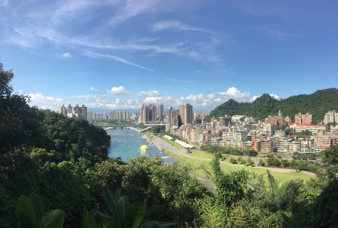
When you’re in the centre of Taipei, you are pretty much surrounded on all sides by hills, and with the city’s exceptional public transportation facilities at your disposal, there is an almost endless wealth of trails to explore. Every single trip featured on this page can be accessed using either YouBikes, buses, the MRT, trains, or some combination of the above. As with all the posts on this site, if you click through to a post, you will find the necessary transportation info at the very bottom.
If you’re not yet feeling up to exploring by bus or train, you can check out this page featuring trails that can be accessed purely by taking the MRT.
MANYUEYUAN WATERFALLS (滿月圓國家森林遊樂區)
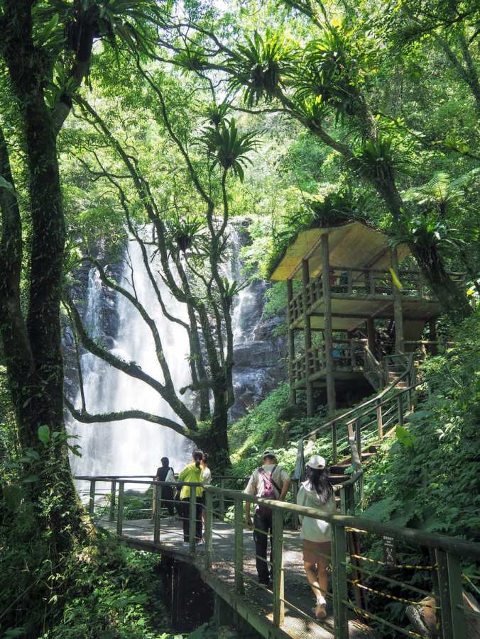 One of two National Forest Recreation areas within the Greater Taipei area, Manyueyuan and its waterfalls is a popular spot for city folk seeking respite from Taipei’s hot summers. The park has abundant greenery, two or three waterfalls, and a handful of easy trails to explore.
XISHAN CANAL TRAIL and PINGJING HISTORIC TRAIL (溪山百年古圳/平菁古道)
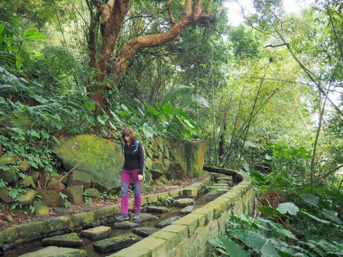 Just up the road from Taipei’s National Palace Museum, Pingjing Historic Trail and Xishan Canal Trail offer walkers a pleasant and shady walk with the promise of coffee and cherry blossom at the top if you visit at the right time of year.
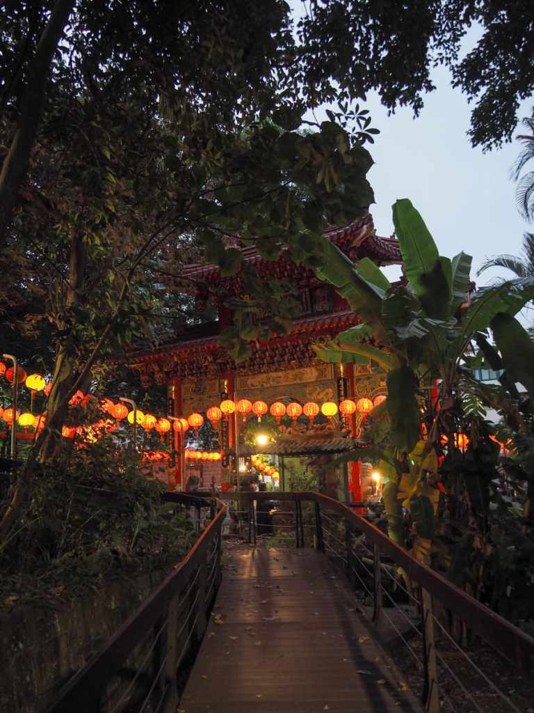
FULONGSHAN TRAIL and GUANYINSHAN TREETOP WALKWAY (福隆山/觀音山林梢步道)
 This trail in New Taipei’s Wugu District is absolutely choc full of cultural interest. It follows a walkway dotted with pretty historic temples before segueing into a wander among the treetops. It’s a perfect little off-the-beaten-track adventure that requires no preparation.
MOUNT DALUNTOU (大崙頭山)
 Mount Daluntou can be found in the green-clad slopes separating downtown Taipei from the more extensive greenery of Yangmingshan National Park. It is an easy Xiao Bai Yue and a simple half-day Taipei hike.
YUANTONG TEMPLE TRAIL (圓通寺步道)
 Yuantong Temple is an (almost) century-old religious establishment built into the hillside of New Taipei’s Zhonghe District. The ridgeline behind it is crisscrossed with a network of trails where you can find all kinds of small shrines, statues and other interesting sights.
GUANYIN MOUNTAIN (觀音山)
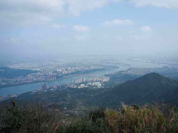
Guanyin Mountain rises from the banks of Tamsui River in New Taipei’s Bali and Wugu Districts. Its nickname is tough guy peak on account of the fact that climbing it was previously used as an entoughenmemt activity for military police officers, and for those unacquainted with Taiwan’s steep, steep steps, it’s clear to see why.
TIGER MOUNTAIN (虎山)
 Tiger Mountain is one of the four beasts that guard the south of Taipei’s Xinyi District and although steep, the climb can be knocked out in under two hours, with plenty of time left for exploring the eateries and shopping opportunities that Xinyi has to offer.
BAT HILL (蝙蝠山)
 The hike to Bat Hill Lookout from Shuangxi is a short and (mostly) easy walk that can be combined with an exploration of this historic riverside town in New Taipei.
CHERRY BLOSSOM in LOHAS PARK (樂活公園櫻花季)
 Every sakura season, the otherwise non-descript Lohas Park becomes a crowded riot of colour as the full blooms of cherry trees attract hoards of sightseers and photographers. More blossom and some easy walking can be found along the banks of Neigou Creek, which straddles the boundary between Taipei and New Taipei.
ELEPHANT MOUNTAIN (象山)
 Hiking Elephant Mountain (or Xiang Shan), is one of the ultimate Taipei travel experiences and while there are many possible routes, this specific one has been voted to be one of the 100 best hiking trails in Taiwan.
NEIHU TWIN HEARTS TRAIL (內湖雙心縱走)
 Normally trails draw me because they offer some specific feature or summit. Maybe a waterfall, a unique temple, or a view that stretches for miles and miles. This walk does indeed have many peaks, some temples, a waterfall, and some views, but the real attraction of this trail is the double heart-shaped route it traces on the map.
EWEISHAN PADDY TERRACE and PINGJING STREET CHERRY BLOSSOM (鵝尾山水田/平菁街櫻花巷)
 There are lots of cherry blossom viewing spots dotted around Taiwan, and taking a walk to enjoy the pretty pink petals is something that many locals like to indulge in at least once a year. This sakura spot in Yangmingshan National Park is an easy and convenient location to enjoy the pink petals.
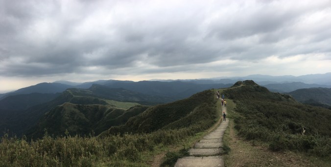
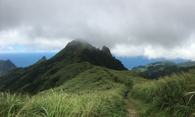
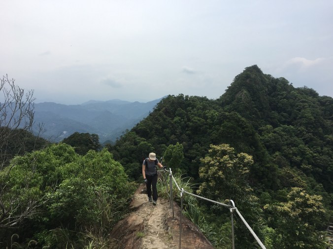
STEGOSAURUS RIDGE (劍龍稜)
 Stegosaurus Ridge has to be one of the most superlative day hikes that you can do in northern Taiwan. It offers spectacular views of grassy slopes and dramatic rocky ridges set against bright blue coastal waters, and is very much a full-body workout kind of hike.
DAHAN RIVER RIDE: XIMEN to DAXI (大漢溪自行車道)
 This easy ride takes you from the heart of downtown Taipei to a Hakka town built around an old street in Taoyuan.
WAYAO CANAL (瓦磘溝)
 Wayao Canal was once a free-flowing river, cutting its way through Yonghe’s alluvial floodplains, providing a useful means of transporting the bricks and tiles that helped the area to prosper. These days, it is channelled under and through the city streets, with few indications of its former life. Following its winding course through the city offers you a unique perspective into one of New Taipei’s most densely-packed districts.
XIZHI LION’S HEAD MOUNTAIN (汐止獅頭山)
 Sometimes you feel like a grand adventure somewhere far from home, but other days call for a backyard adventure. This walk is perfect for one of those days.
TAOYUAN VALLEY via SHIGUANYIN TEMPLE TRAIL (桃源谷步道-石觀音線)
 Taoyuan Valley Trail is one of the classic day hikes in northern Taiwan. It offers free-roaming water buffalo and views for days… just be prepared to earn all the enjoyment with plenty of hard work.
LINGBO TEMPLE WALK (靈菩寺/四股埤步道)
 Lingbo Temple Trail is a tiny little walk in Xizhi that’s probably only visited by a handful of locals. It takes you up to a temple with a view over the area, then heads back down along a fishing pond and past a cute little temple in a cave.
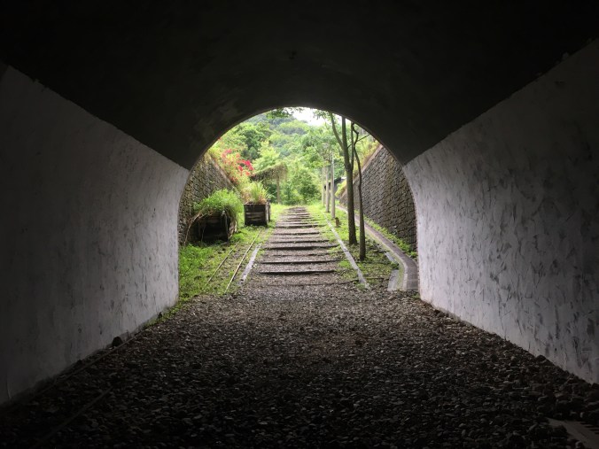
SANDIAOLING TUNNEL BIKEWAY
 Since it reopened in 2022, Sandiaoling Tunnel has become a top spot for people wanting a short half-day adventure from Taipei.
RONGXUAN TRAIL (容軒步道)
 Rongxuan Trail is a short and easy loop walk right next to Taiwan’s northernmost train station.
CROUCHING TIGER HILL (臥虎山)
 A brief loop with an interesting temple and some exploration of a lesser known peak in Keelung.
SHEN’AO RAIL BIKE (深奧鐵道自行車)
 A gentle ride along one of Keelung’s historic mining routes.
MOUNT DONGYAN (東眼山)
 This beautiful trail in Taoyuan’s Fuxing District takes you up to the summit of Mount Dongyan via some incredibly pretty forest footpaths.
KEELUNG ISLET (基隆嶼)
 Keelung Islet is a small rocky mound just a few kilometres off the coast of northern Taiwan. It is also a great choice for a day trip from the city.
CARP HILL NIGHT HIKE (鯉魚山夜爬)
 Carp Hill Trail is a lovely walk whatever time of day you go, but I hope this post emboldens you to pay it an after-dark visit. Not only is it home to a wonderfully diverse range of nocturnal critters, but it also has a prettily sparkling night view to enjoy all by yourself.
WANGYOU VALLEY TRAIL ( 望幽谷步道)
 Located on just south of Keelung, the scenic Wangyou Valley Trail is one of the best-known walks on Taiwan’s northeast coast.
MOUNT GONGZILIAO and GONGZILIAO FORT (槓子寮山/槓子寮砲臺)
 The hills around Keelung are home to numerous old defensive structures left over from various periods in Taiwan’s history. The remains found here at Gongziliao Fort are the most extensive and well preserved out there.
FIREFLY SPOTTING at YUANJUE WATERFALL (圓覺瀑布螢火蟲)
 If you check online for the best places to see fireflies in Taipei, then one of the locations that appears in many of the lists is Dagouxi Waterfront Park. In fact, this is a little misleading since – while the walk does start there – you need to head a little further into the dark to spot any fireflies.
FIREFLIES at JINTONG COAL MEMORIAL PARK (菁桐煤礦紀念公園螢火蟲)
 The ruins of the old Jingtong Coal Mine make for a unique backdrop to Taiwan’s April firefly viewing season.
TAIPEI SKYLINE TRAIL: SECTION 10B
 This section of the Taipei Skyline Trail packs a lot of interesting spots into its not-quite-14km length. There are not one, but two Xiao Bai Yue, and one of Taipei’s most impressive land god temples.
TAIPEI SKYLINE TRAIL: SECTION 10A
 Leading from Sanxia District and on towards Tucheng, this section of the Taipei Skyline Trail was an unexpected pleasure. Gently taxing and quiet ridge line trails offer a wonderful escape from the city.
TAIPEI SKYLINE TRAIL: SECTION 9B
 Much of the Taipei Skyline Trail stitches together popular routes on the edge of the city. Not so this section, which looks like it doesn’t get many visitors.
TAIPEI SKYLINE TRAIL: SECTION 9A

This section of the Taipei Skyline Trail is unique in that it is almost a loop. It covers conjoined ridges that form a horseshoe-esque shape stretching from Sanxia, out towards Daxi, and then back to Sanxia again.
TAIPEI SKYLINE TRAIL: SECTION 8
 This leg of the Taipei Skyline Trail (best done in one concerted push), takes you through along a pleasant and mostly very gentle ridge. As you make your way towards the centre of Taiwan’s ceramic industry, you’ll pass multiple peaks, an ancient banyan tree, and a legendary rock.
TAIPEI SKYLINE TRAIL: SECTION 7B
 This section of the TSLT picks up in Wugu and makes its way through some pleasant edge-of-the-city type trails as it skirts the northwestern edge of Taipei.
TAIPEI SKYLINE TRAIL: SECTION 7A
 Section 7A of the Taipei Skyline Trail sees you scaling Mount Guanyin the hard way, before leading you along a quieter stretch of path to the place where Taiwan’s Robin Hood (allegedly) met his end.
TAIPEI SKYLINE TRAIL: SECTION 6B
 This section of the Taipei Skyline Trail offers grand views over Yangmingshan Park’s western hills, as it takes walkers over the steep (and often) muddy peaks of the Mount Datun range.
TAIPEI SKYLINE TRAIL: SECTION 6A
 Most of the Taipei Skyline Trail’s sixth instalment covers trails within Taipei National Park. This first half takes you along the same route as the Taipei Grand Hike, and also happens to be one of the prettiest easily-accessed walks in the park.
TAIPEI SKYLINE TRAIL: SECTION 5B
 The fifth section of the Taipei Skyline Trail sees you leaving Yangmingshan Park behind and entering Keelung. This section covers a long (muddy) ridge walk between Fengguizi and the very edge of Keelung City.
TAIPEI SKYLINE TRAIL: SECTION 5A
 This section of the Taipei Skyline Trail takes you close to the coast as you explore some of the sights of Keelung.
TAIPEI SKYLINE TRAIL SECTION 4 (Short Version)
 The highlight of this section of the Taipei Skyline Trail is unquestionably the exceedingly cool temple cave close to Mount Hongdan. That aside, it involves some pleasant wandering over less-travelled paths, and passes plenty of historic spots.
TAIPEI SKYLINE TRAIL: SECTION 3

Straddling Xizhi and Ruifang Districts, Section three of the Taipei Skyline Trail offers a good workout, a few views, a historic fort, and one of Taiwan’s Minor 100 Peaks.
TAIPEI SKYLINE TRAIL: SECTION 2B
 This section of the Taipei Skyline Trail was an unexpected delight. It has the twin charms of both a fun ridge walk and a temple-studded historic trail.
TAIPEI SKYLINE TRAIL: SECTION 2A
 This section of the Taipei Skyline Trail covers one of the quintessential Taipei day hikes: the spectacular Huangdidian. Bring a camera and a well-rested body, and come prepared for a very fun walk.
TAIPEI SKYLINE TRAIL: SECTION 1B
 This section of the Taipei Skyline Trail really packs in the views. Taking you from Caonan in the east to Shiding in the west, it offers thrilling climbing and some tantalising views over the famous Huangdidian Ridge.
TAIPEI SKYLINE TRAIL: SECTION 1A
 Climbing from the cerulean waters of Xindian River, this section of the Taipei Skyline Trail takes you up to the ridge line that runs from Bitan over towards Shiding, getting steadily more rugged as it makes its way further east.
MOUNT KAIYANLUN and TEA TERRACE TRAIL (開眼崙山/茶園步道)
 This short loop in New Taipei’s Pinglin District offers a lot of beauty for not much leg work. After a steep (but short) climb to the peak, you are then treated to stunning views of Pinglin’s neat tea plantations as you make your way slowly back to the start.
ELEPHANT MOUNTAIN to LION MOUNTAIN LOOP (象山/獅山O型)
 Lurking in the hills below Mount Nangang and 95 Peak are wild animals. An elephant, a lion, a tiger and a leopard which are collectively known as the Four Beasts. (Ok, so technically they’re hills rather than real beasts.) This loop takes in two of the four, and explores some of the lesser known trails in the area.
THUMB MOUNTAIN SUNRISE (拇指山日出)
 There is something undeniably special about hiking up through the thinning dark to watch the sun cast its first rays over the landscape. This short trail in Taipei’s Xinyi District offers a great vantage point to see the sun come up, and observe the city as it gets ready to start a new day
AUTUMN COLOURS at GONGBEI TEMPLE (拱北殿賞楓行)
 An easy wander in New Taipei’s Xizhi District. Come in November or December to enjoy the bright red leaves.
ZHONGGANG MAIN DRAINAGE TRAIL (中港大排)
 You could be forgiven for thinking that New Taipei’s heavily industrial Xinzhuang District doesn’t have any beauty spots worth investigating. But have you visited Zhonggang Main Drainage Trail yet? Taroko Gorge, it’s not, but for an inner city wander, it’s not too shabby.
YOUKENG TRAIL and WATERFALL (幼坑步道/幼坑瀑布)
 The hills sheltering the Pingxi Line are home to countless exciting trails and waterfalls. Perhaps one of the most spectacular amongst them is the many-leveled Youkeng Waterfall.
MENGHUAN FALLS (夢幻瀑布)
 The hills rising to either side of the picturesque Pingxi Line are dotted with numerous mountain streams and waterfalls. Menghuan Waterfall is perhaps less well known than some of the others, but its secluded nature makes it a great spot to visit.
JIUZHUANG SHAN (舊莊山)
 Jiuzhuang Shan is a small hill in Taipei’s Nangang District, immediately opposite the campus of Academia Sinica. A wander along the trails will introduce you to a number of distinguished academics who were associated with the institution during their lifetimes.
TAIPEI GRAND HIKE 8 – WENSHAN to GUANDU (臺北大縱走8段 – 文山/關渡)
 This is one for the picky completists out there. Back when the Taipei Grand Hike was first announced, I was excited by the idea of a Taiwanese long distance trail, but it always rankled that the trail didn’t encircle the city entirely. Well now it does. (Almost.)
JIANTAN TRAIL NIGHT HIKE (劍潭山步道夜爬)
 There are lots of trails close to the city that offer opportunities for exploring after dark. The ever popular Jiantan Hiking Trail is one such route – although if you visit at night you can expect to have the paths almost entirely to yourselves.
MOUNT WUFEN (五分山)
 Mount Wufen is a rewarding half day hike in northern Taiwan’s Pingxi District. Ideal for Taipei-based day trippers looking for a scenic walk, this trail will take you up through lush forests to an open grassy ridge with expansive views over the many-layered hills of Pingxi.
NUANDONG VALLEY LOOP (暖東峽谷O型)
This short and sweet loop in Keelung’s overlooked Nuannuan District makes a great half day exploration. The trail tracks through quiet woodland and boasts beautiful views of water-sculpted rocks, as well as a couple of stream crossings and a photogenic land god temple thrown in for good measure.
NANGANG TEA MOUNTAIN TRAIL (南港茶山步道 )
 If you picture Nangang District in your mind what do you see? The train station? The exhibition centre? The giant software park? I bet you didn’t envision quiet hillsides cloaked with neat rows of tea. This trail offers an insight into a side of Nangang that not so many people know about.
MOUNT ZHONGZHENG TRAIL (中正山步道)
 Mount Zhongzheng Hiking Trail makes for a quiet and easy wander in the westernmost reaches of Yangmingshan National Park. Starting just a couple of blocks away from Xin Beitou Station, the trail leads you up through farms and bamboo to a peak with commands wide views over the city.
NEIHU’S PATH LESS TRAVELLED
 The hills around Jinmian Shan are crisscrossed with hiking trails of varying degrees of popularity and difficulty. This post details one of the quieter walks that you can do in the area.
JINGUASHI AQUEDUCT TRAIL (山尖路步道)
 This short trail linking the two popular tourist villages of Jiufen and Jinguashi takes you past aqueducts that were used during the area’s industrial past. It’s a great way to stretch your legs after sampling the edible delights of Jiufen Old Street.
NUANSHOU SHAN SINO-FRENCH WAR TRENCHES (暖壽山/清法戰爭古戰壕遺址)
 This short trail in an overlooked corner of Keelung City will take you back in time to 1884 – when French and Qing soldiers fought for control of Taiwan.
FAIRY SHRIMP at XIANGTIAN POOL (向天池的仙女蝦)
 Xiangtian Pool is an ephemeral body of water in an old volcanic crater on the northwestern edge of Yangmingshan National Park. It can be seen after periods of heavy rain, and only then for a brief time. As if this didn’t make the pool intriguing enough, it is also home to a population of fairy shrimp which spawn in great numbers when the conditions are just right.
LINGJIAO and WANGGU WATERFALLS (嶺腳瀑布/望古瀑布)
 The Lingjiao to Wanggu Trail packs an awful lot into its short length. You get not one, but two waterfalls, a dash of history and a trail that’s both pretty and gentle. It’s also short enough that you can combine it with a visit to some of the other sights and trails along the Pingxi Line.
SCISSORS ROCK NIGHT HIKE (剪刀石夜爬)
 Scissors Rock is up there with Elephant Mountain in terms of its popularity among the easily accessible trails of Taipei. But unlike it’s Xinyi District counterpart, this trail in Neihu falls quiet as soon as night settles on the city. Travellers willing to brave the dark will be treated to peaceful city views and maybe even a flying squirrel (or two, or five)
BATTLESHIP ROCK NIGHT HIKE (軍艦岩夜景)
 Close to the city, Battleship Rock Trail is an ever popular walk, and on weekends in particular you are likely to find it pretty crowded. But for those who are feeling brave it offers an easy after dark hike and a stupendous night view of Taipei.
TUCHENG TUNG BLOSSOM TRAIL (土城油桐花步道)
 Every April and May the mountains around Taipei are cloaked with the white blossom of the tung tree. Getting out to observe this May ‘snowfall’ is a popular activity amongst the locals, and this trail in Tucheng is one of many places you can go to join in.
TAMSUI-KAVALAN TRAILS: WANTAN HISTORIC TRAIL and BEISHI RIVER TRAIL (淡蘭古道:灣潭古道/三水潭/北勢溪古道)
 The walk along Wantan Historic Trail and Beishi River Trail is soul-comforting waterside wander between villages in New Taipei’s sorely overlooked Shuangxi District. Bring a picnic and get ready to soak in some gently spectacular scenery.
TAMSUI-KAVALAN TRAILS: WUTUKU to PINGLIN (淡蘭古道:烏塗窟/坪林)
 The stretch of the Tamsui-Kavalan Trails that tracks over the hills between Shiding and Pinglin Districts takes you past relics of the coal industry into the heart of New Taipei City’s tea growing region.
TAMSUI-KAVALAN TRAILS: SHIFEN to NUANNUAN (淡蘭古道中路:十分/暖東峽谷/暖暖)
 Taking the old mining town of Shifen as its starting point this section of the Tamsui-Kavalan Trails takes you up towards Mount Wufen before plunging down into shady valleys on its way to Nuannuan. There are some lovely scenes to enjoy along the way including a bright red trailside temple and a spectacular ravine.
TAMSUI-KAVALAN TRAILS: BEISHI RIVER and ZHONGKENG HISTORIC TRAIL LOOP (淡蘭古道中路:崩山坑古道/北勢溪古道/闊瀨古道/放山坑古道/中坑步道O型)
 The icing on the cake of the Tamsui-Kavalan Trails, this route comprised of five stitched together historic trails shows you some of the most beautiful scenery you can find in northern Taiwan.
TAMSUI-KAVALAN TRAILS: WANHUA to FUYANG ECO PARK (淡蘭古道:萬華/富陽自然生態公園)
 The southern stretch of the Tamsui-Kavalan Trails starts from the historic centre of Wanhua and heads through urban parks and market streets on its way to the edge of the city.
TAMSUI-KAVALAN TRAILS: SHENKENG to WUTUKU (淡蘭古道南路:深坑/石碇/烏塗窟)
 The first stretch of road leading out of Shenkeng isn’t much to write home about, but the rest of the journey soon makes up for it. The sound of water accompanies you for most of the way, as the trail sticks close to first Jingmei Stream, then Wutuku Stream, going against the flow as you head away from Taipei.
TAMSUI-KAVALAN TRAILS: XIZHI to RUIFANG (淡蘭古道:汐止/暖暖/瑞芳)
 The northernmost span of the Tamsui-Kavalan Trails follows the course of the Keelung River upriver from Taipei almost as far as the coast before veering south towards Jiufen. The section between Xizhi and Ruifang jumps from small town to small town, passing lots of temples and traces of history along the way.
TAMSUI-KAVALAN TRAILS: MUDAN LOOP (淡蘭古道北路:牡丹/燦光寮古道/貂山古道)
 This peaceful part of the northern Tamsui-Kavalan Trails traverses the slopes of the valley south of Jinguashi. Along the way you’ll pass deserted mining settlements, a tomb with a tragic tale, (or two, or three, or four), and a now abandoned dam in the middle of the forest.
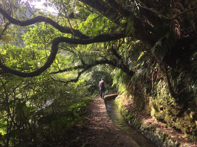
GUIZIKENG TRAIL (貴子坑步道)
 Guizikeng Trail is a short and easy walk in Beitou District. In the spring you can see cherry blossom, in summer you can come to enjoy the irrigation canal, and in winter you can round off the day with a trip to the nearby hot springs.
NEISHUANG CREEK and XIN ZHEN TOU PEAK (內雙溪/新圳頭山)

A short walk in the southeastern corner of Yangmingshan National Park. This trail would make the perfect picnic walk to beat the summer heat.
XINDIAN LION’S HEAD MOUNTAIN HIKING TRAIL (新店獅頭山登山步道)

Lion’s Head Mountain is unassuming peak at the sourthernmost terminus of Taipei’s Songshan-Xindian line which holds unexpected opportunities for adventure. Popular with the local population of retirees, this network of paths is well furnished with shelters, and looping trails around the hillside with changing city-scapes at every turn.
JINGUALIAO FISH AND FERN TRAIL (金瓜寮魚蕨步道)
 Nestled away in the tea-growing hills of Pinglin walkers can find the perfect antidote to summer’s relentless heat: Jingualiao Fish and Fern Trail. This family-friendly trail meanders alongside Jingualiao Creek, and would be a perfect picnic spot.
GUANYIN SHAN NORTHERN CROSS ROUTE (觀音山北橫古道)
 Anyone who has hiked in Yangmingshan National Park and cast their gaze across the Tamsui River towards Bali will have noticed the multiple peaks clustered around Guanyin Shan. This trail covers many of those peaks, and is a much more interesting walk than the stone steps that also climb to the top.
PINGXI CRAGS (平溪小三尖)
 This is one of the all-time classic Taiwan hikes, and for good reason. Pingxi’s crags rise dramatically from the forest and are the perfect adventure playground for visitors from Taipei.
YUE SHAN HU CLIFF LOOP (月扇湖大岩壁)
 Shiding is famous amongst hikers for being the starting point of Huandidian’s dramatic ridge walk, but the area has more to offer than that. Just a ten minute drive from Shiding Old Street you can find the start of Yue Shan Hu Cliff Trail – a fascinating little loop with some spectacular geology and a few traces of the area’s past life as a mining town.
DACUKENG OLD TRAIL (大粗坑古道)
 Now inhabited solely by stray dogs, the abandoned settlement of Dacukeng was once a thriving village supported by the profits of the area’s abundant ‘black gold’ – coal. Climb the stairs to see what’s left of this community, and then continue of to Jiufen for some well-earned snacks.
BIHU TRAIL (碧湖步道)
 This really easy walk in Neihu is suitable for pretty much anyone who can climb a few steps. In the summer remember to bring a towel so you can have a paddle in the stream that runs through Dagouxi Park.
ZHONGYANG PITON and CHOU TOU SHAN (中央尖/臭頭山)
 This moderately challenging walk has exciting climbs, some neat geological features, the odd dramatic view, pretty stream-side walking, and even a touch of Taiwan’s industrial history. What’s more, it can accessed by train from Taipei.
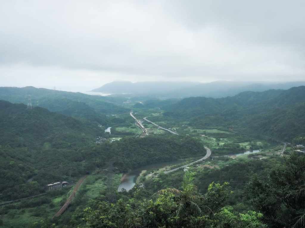
TAOYUAN VALLEY TRAIL (桃源谷步道)
 The Taoyuan Valley Trail is one of those that’s right up there in all of the listicles outlining the ‘top 10 hikes in northern Taiwan’, and whilst that means you’re unlikely to find solitude in the hills here, the popularity is for good reason. For those who prefer to follow well-marked routes and not stray too far from the beaten path, then the views offered by this trail are hard to best.
CARP HILL (鯉魚山)
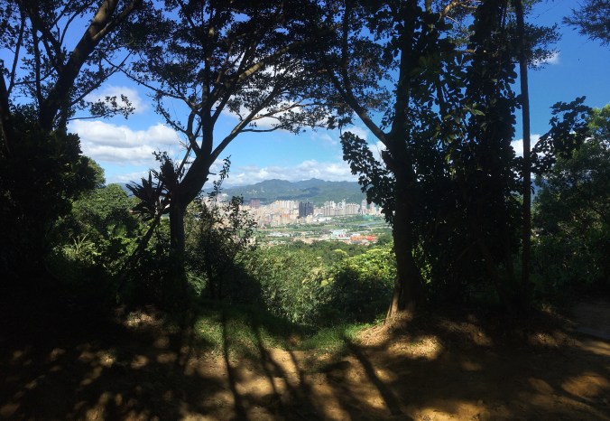
 Carp Hill may not be the highest peak in Neihu District, nor does it have the prettiest scenery or most exciting walk. However it’s a good all-rounder and it can lay claim to being the route that I have walked the most. This is my go-to walk for when I’ve just got a couple of hours free and need to stretch my legs. It’s a great little workout, and it also has plenty to make it interesting time after time. There’s a lookout spot with views over Taipei, Neihu’s oldest Buddhist temple, a waterfall and a…
HUBAOTAN HISTORIC TRAIL (虎豹潭古道)
 A very watery wander along a pretty historic trail in New Taipei’s Shuangxi District.
DENG FENG CANAL TRAIL (登峰圳步道)
A quiet and gentle stroll along some of the irrigation canals in the hills of Shilin District. This would make a great summer walk for those hoping to escape the city heat.
ZHISHANYAN STROLL (芝山岩)
 In this quiet suburb of Taipei sits a hidden gem of a trail. Suitable for people of all ages and abilities, the trails of Zhishanyan have layer upon layer of history to reveal. On these slopes you can encounter a potted version of Taiwan’s past lives, the walk takes in prehistoric bones, the waves of mass immigration from China, a tragedy from the Japanese colonial era and Taiwan’s recent military past.
XIMEN TO XINDIAN RIVER CYCLE PATH (新店溪自行車道)
 As with almost all of Taipei’s large rivers, the Xindian River has well-maintained cycle paths stretching for many kilometres along its banks. This gentle ride upriver towards Bitan is a great way to stretch your legs and enjoy scenery that becomes more and more dramatic the further south you go.
RUYI LAKE and JINMING SHAN (如意湖/金明山)
 A small, but perfectly formed hike tucked away in a corner of New Taipei City’s Xizhi District. Despite being only a couple of kilometres long, this walk manages to pack in some ridge climbing, a small lake and a few views.
BANPING SHAN AND TEAPOT MOUNTAIN LOOP (半屏山/無耳茶壺山O型)
 This is the perfect half-day hike for adventure-seekers who want to explore the many and varied delights of Taiwan’s marvellous northeastern coast.
BIHU PARK AMBLE (碧湖公園)
 A very short and simple stroll around a pretty lake. This walk should be an easy one to do if the weather isn’t being cooperative, or if you want to bring the kids.
YONGHE RIDGE LOOP (國旗嶺/鄧公嶺/烘爐地南山福德宮)
 Whilst Taipei’s northern and eastern hills tend to get most of the attention, this trail to the southwest of the city has plenty to offer the traveller who strays from the well-trodden trails of Yangmingshan Park. Indeed, as the locals know, Yonghe District has well-trodden paths of its own to explore. This route takes in ancient banyans, views to both the north and the south, all manner of trail types and enough temples to satisfy the very keenest of temple aficionados.
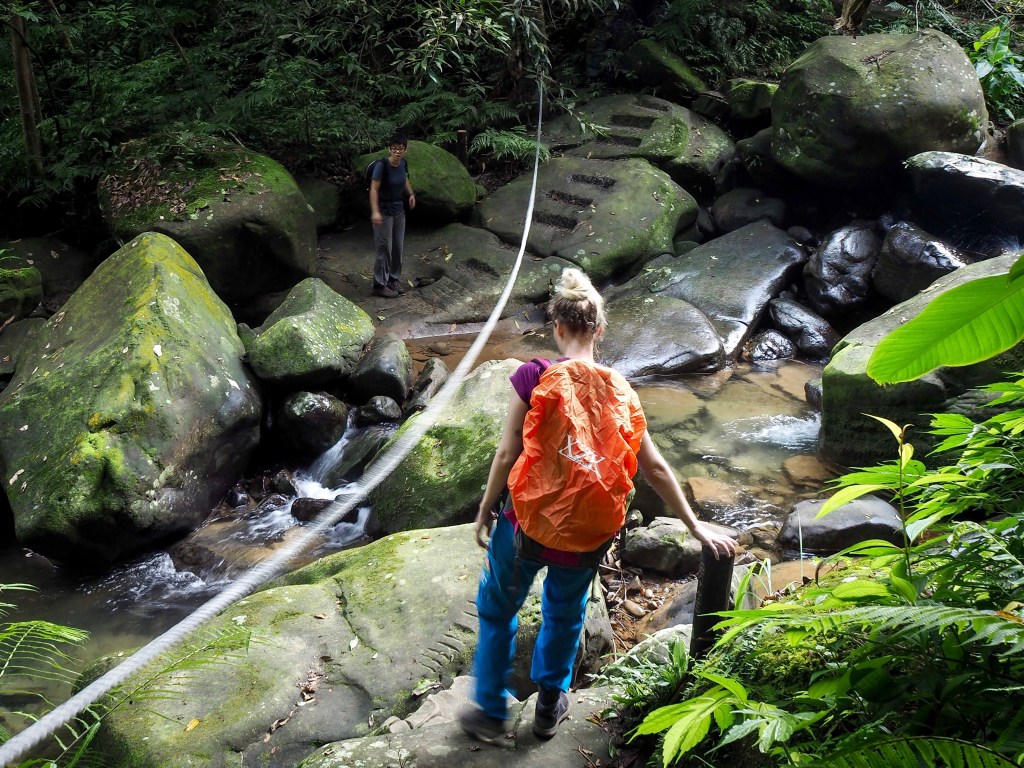
DRAGON BOAT ROCK and YUANJUE WATERFALL (龍船岩/園覺山/園覺瀑布O型)
 This is my newest favourite walk in Neihu. It has a stream, roped sections to tire me out, wonderful views from Dragon Boat Rock, the oldest house in Neihu District, cute little Tudi Gong Temples and a waterfall.
MOUNT HEMEI TRAIL (和美山步道)
 Once a highlight of Taiwan’s domestic tourism industry, Bitan is now a relaxed feeling, end-of-the-line destination, mostly populated by families looking for an easy day out. To see a different side of this weekend hotspot you can cross over the suspension bridge and take a walk up one of the trails up to Hemei Peak. With it’s abandoned amusement park and the return trip on the lone surviving paddle ferry, this really is a wander into Bitan’s past.
HUANGDIDIAN (皇帝殿)
 This is the hike that made me fall in love with the trails and landscape of Taiwan. The first time I walked it was before I lived here, and the impression it made ran deep. This trail pretty much has it all: enthralling mountain views, exhilarating ridge walking, invigorating climbs and, (if you’re feeling bold enough), the opportunity to experience that famous Taiwanese friendliness by trying your hand at hitchhiking rather than walking back along the road.
JINMIAN SHAN – a longer route (金面山)
 A great trail taking in one of Taipei’s most Instagrammable spots. This walk can be done in a morning or afternoon and is easy to get to from the MRT.
Something went wrong. Please refresh the page and/or try again.
