
Distance: 7.5km – it didn’t feel like that far though.
Time: 3½ hours – about an hour of that was spent catching my breath and looking at the view, and I met a couple of (very fit looking) guys who said the loop had taken them about 2½ hours coming from the opposite direction.
Difficulty (regular Taiwan hiker): 4/10 – the majority of this trail is very easy, just steps up and down, but the couple of sections with ropes and rocky paths need a bit of respect.
Difficulty (new Taiwan hiker): 7/10 – the steps alone will be tiring if you’re not used to hiking in Taiwan, and the more exposed rocky sections will require care to navigate. There are one or two places where you are exposed to drops, so it wouldn’t be a good choice of walk if you’re scared of heights. However it’s not hard to find the trail, and the more challenging sections are short so you should be ok as long as you give yourself enough time and wear suitable footwear. (And go with someone.)
Total ascent: about 480m to Mount Banping’s summit which sits at 705 metres above sea level.
Water: I drank about 2.5L on a seriously hot day, (temperatures were in the low-to-mid 30’s).
shade: almost none – I had an umbrella, an aunty hat and sunscreen, and yet I still managed to burn a bit.
Mobile network: mostly clear I think.
Enjoyment: The views over in this corner of Taiwan are spectacular, and the ridge section up to Banping Shan and then down to Teapot Mountain is great fun – I just wish that the fun part was a bit longer.
Other: whilst this isn’t particularly difficult or dangerous if you’ve done similar walks before, it is probably safer to go with company. Also, I felt more comfortable wearing gloves, but you would probably be fine without.
Jump to the bottom of this post for a trail map, GPX file, and transportation information.

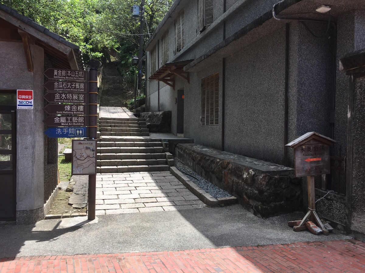
I actually was on the phone when I passed my stop, and missed it, so I had to walk back uphill to arrive at where I was meant to be – the Jinguashi. In doing so, I somehow became swept up with a gaggle of high school students moving between campuses and almost found myself going with them through the school gates. Luckily I just realised at the last minute and went up the other set of steps to arrive at the entrance to the gold museum. From the bus stop you get the first intimidating and/or enthralling look at where the route will take you.
Having got turned around by the wrong bus stop, I paused by the tourist information centre and found myself repeatedly being help-bombed by the multi-lingual assistant manning the door. Initially I brushed off her offers of help, but she actually talked so much and so loudly that I couldn’t concentrate on anything else and I ended up saying that I wanted to go to Banping Shan. She was very averse to the idea and instead told me how to get to Teapot Mountain. I said thanks, but that wasn’t where I was going and she replied with warnings about how dangerous it is, and gave me more directions to Teapot Mountain. In the end, I had to move away from her just to get enough peace and quiet to orientate myself so I could get started. I felt guilty about being irritated by her helpfulness. It’s probably part of her job to warn underprepared walkers away from things that would be dangerous, and she couldn’t have known from looking at me that I wasn’t totally inept.
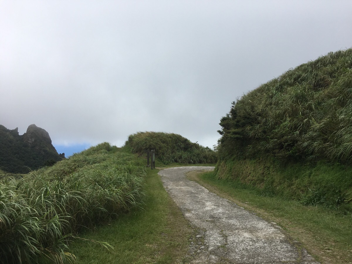
Leaving the information centre behind, I set off up the steps that ran up along the left of the building.

Only a few metres up, I spotted this strange animal corpse on the steps. It was about 10cm long from nose to tail, and completely unlike any living animals I’ve seen in Taiwan. I’m pretty sure it was a dead juvenile Siberian Weasel, but I could be wrong.
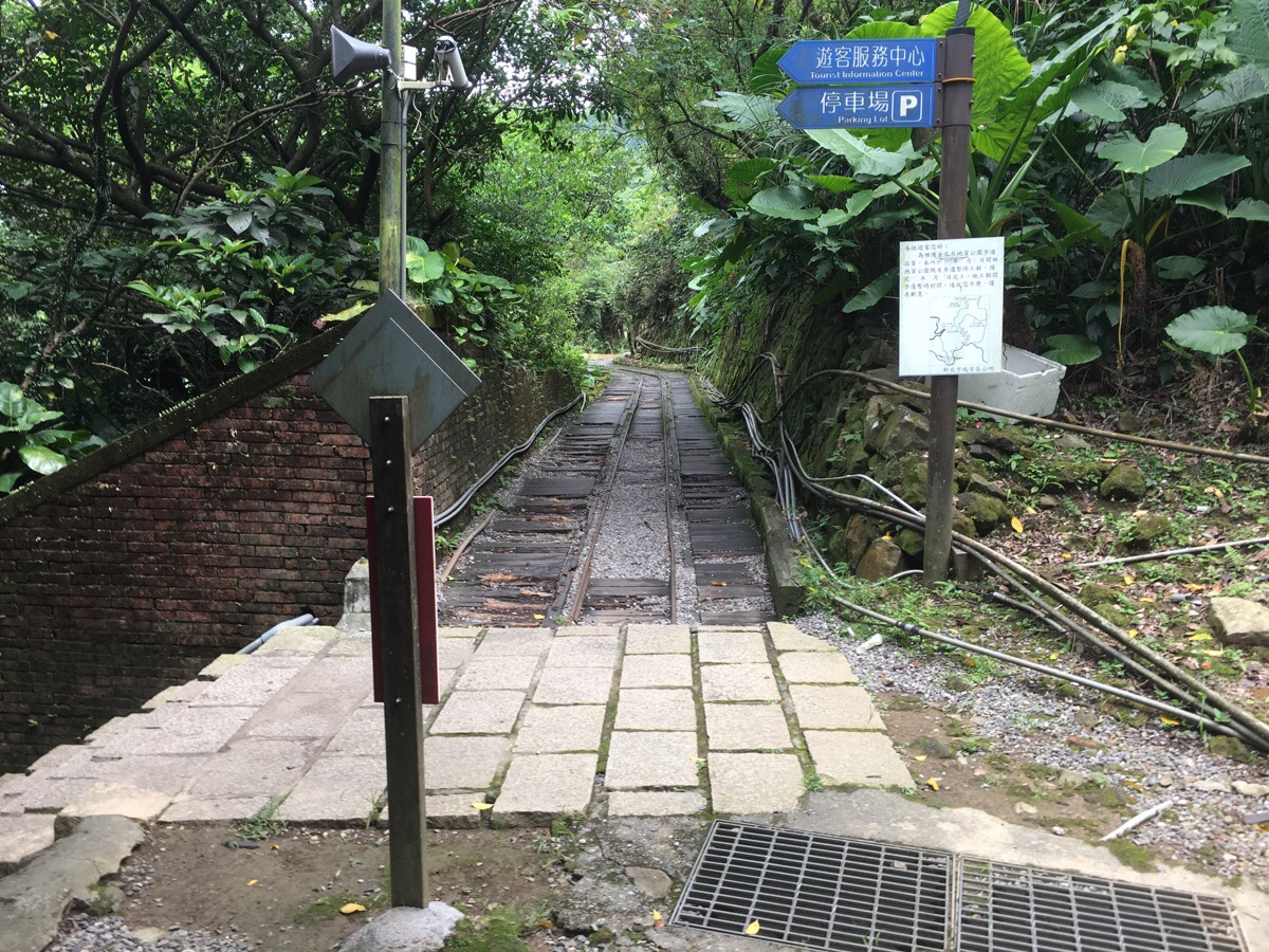
The steps (on the left here) lead up to a section of preserved rail track where I turned left and headed towards Jinguashi Shinto Shrine.
As I was walking along here I encountered a group of university aged people walking towards me. I was perplexed to hear 外國人 coming from one of their phones until I realised that the guy at the front was having a face-time conversation with someone and that it had been a person who wasn’t even there who commented on my foreigner status.
Upon reaching the museum next to the number five coal tunnel, I decided to buy an extra bottle of water, (just in case). And then I took the steps heading up which are sign posted as going towards the old Shinto shrine.
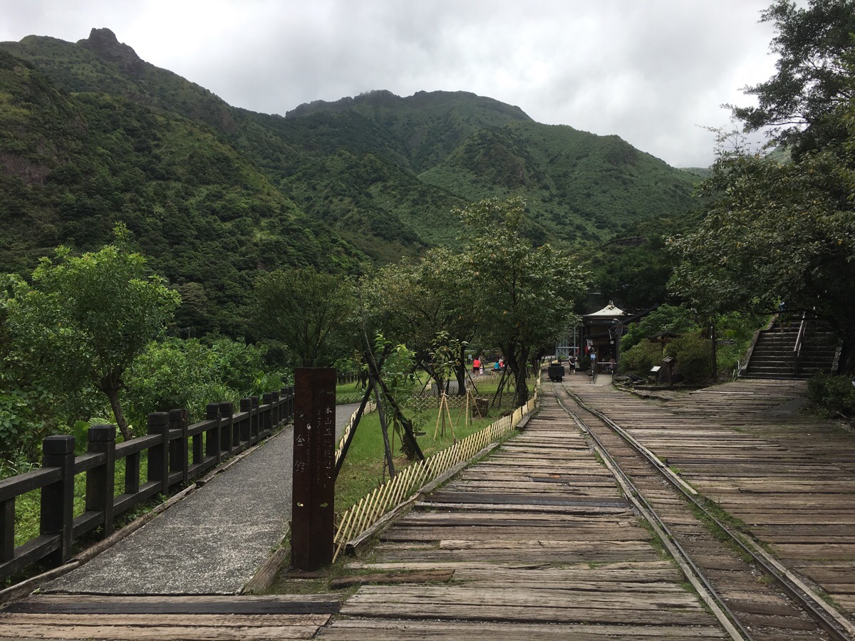
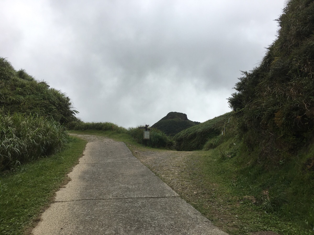
Here you can see the odd knob of Teapot Mountain jutting up from the rest of the landscape, and the jagged edge of the ridge that houses Banping Shan. It looks thrilling and scary at the same time.

As the steps lead up, the path is flanked in two places by stone tōrō lanterns. You see these at the entrances to places where the Japanese came to worship back when they controlled Taiwan. The other place that comes to mind is along the Chinan Temple Trail in Muzha District. There is definitely something very aesthetically pleasing about the way they, (and the steps), have aged into the landscape.

On a stone somewhere between the two sets of lantern pillars, I spotted this incredibly plump (pregnant) skink. On most occasions, these timid creatures will dart away from you at the first indication of your presence, but this one was so slow that I was able to get close enough to take a clear picture.
In fact there were so many of these elegant five-lined skinks that I lost count after twenty minutes or so. The youngsters twisted and wriggled to get away, but many of the larger ones sat there placidly, unwilling to unnecessarily use up energy. I wonder if it is maybe the egg-laying season because a lot of them were really very tubby specimens.

An information board on the left side of the steps sits opposite the easily missed turn of to the shrine. Strangely it doesn’t seem to be signposted at this point, and the group of young people who came up behind me missed the turning and kept powering up the trail. Another set of lanterns and a stone torii mark the entrance to the remains of the shrine.
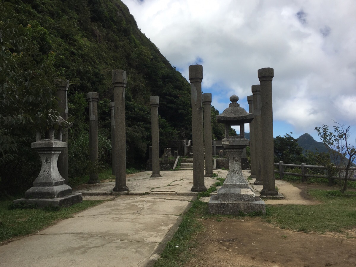
The Ōgon Shrine/黄金神社 was built by the Japanese in 1933 – Jinguashi (or Kinkaseki as it would have been known back then), was the prosperous centre of the gold mining industry in Taiwan. Three kami or spirits were welcomed into the shrine to oversee the continued success of the mines. Okunimushi no Mikoto/大国主命, (a god of nation-building, farming, business and medicine – so basically everything), Sarutahiko no Mikoto/猿田彦命 (the god responsible for roads, crossroads and travellers), and Kanayama hiko no Mikoto/金山彦命, (seemingly responsible for something directly related to metals and metallurgy). Back in the day, there were annual celebrations held here, but these days the temple is only visited by the more curious and athletic amongst the tourists who travel to Jinguashi.
Today only some of the stone supports are still standing, but it remains a remarkably beautiful and atmospheric location. After returning home, I was able to find some photos of the place as it was back then, you can see the same pillars supporting a wooden roof that has long since gone. A photo from below and in front shows how the buildings sat on the site, and another shows the entrance devoid of trees and bedecked with tall flags. It’s fascinating to see the past overlapping with the present in such a tangible manner.
The two guys from the previous photo were sat on the wall and since they’d come downhill I asked them if they’d come from Banping Shan, what the conditions were like and whether it was dangerous (or just difficult) for one person to walk it alone. They reassured me that it was just a little difficult and not dangerous, and that the teapot mountain section was the hardest bit. And since I’d already done that particular part once or twice before, I wasn’t worried about what was in store.
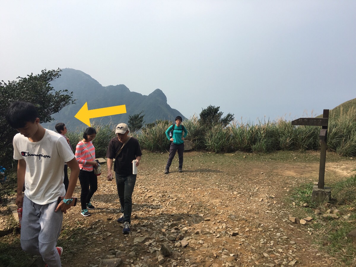
Returning back to the main path and continuing up, I soon passed the young people who’d excitedly, accidentally carried on up the hill. It seemed like a large group and then then two or three separate couples had all made the same mistake and kept walking up until they realised their mistake. An older guy asked me if I was going to the shrine, so I told him they’d definitely passed it already. The path takes a right up some steps (although the straight on seems to be a dead-end), and if you look back you get a good view of the shrine as it sits on the slope.
Part way up, (inthe above picture), the path reaches a junction where a spur to the right will take you towards Benshan Geopark. (You can see the remains of an opencast mine there.) I had my eye on Banping Shan though, and wanted to head up.
The higher you go, the more astounding the views become. Here you can see Mount Keelung rising in the middle between Teapot Mountain to the right and Ben Shan to the left.

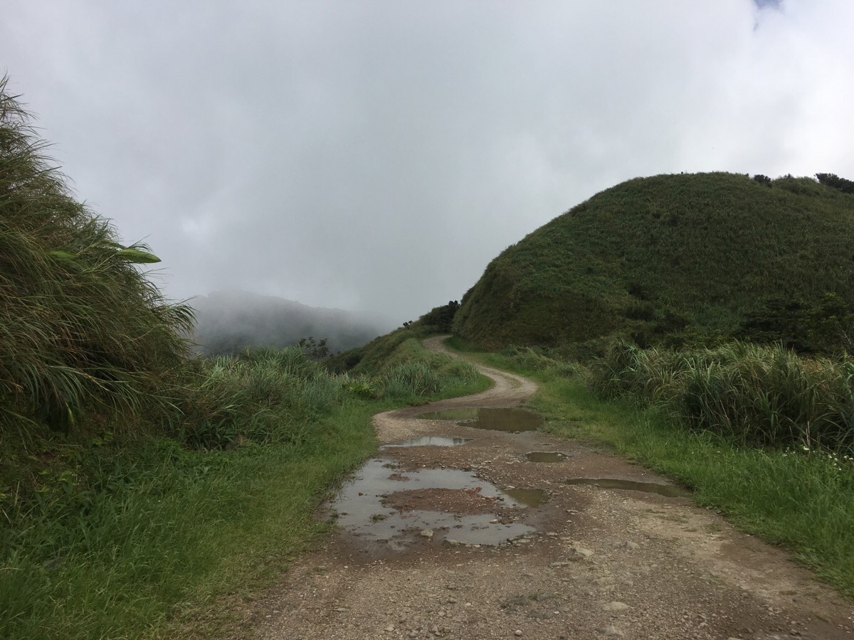
Looking towards where I was headed, the clouds had come down around Banping Shan, but despite looking horribly grey in the picture, they weren’t very threatening in nature.

The steps end at a small industrial road and I turned left following the sign towards the Ganzaidian Ruins. A little way along the road I passed a later hiking group who (almost all) smiled manically at me without saying a word as if they weren’t quite sure how to react to a visiting alien.
After a couple of minutes, the trail splits in two and I took the more defined left track heading towards Banping Shan Trail.
The road has some outstanding views to the left. It feels like you’re looking down over the whole world.
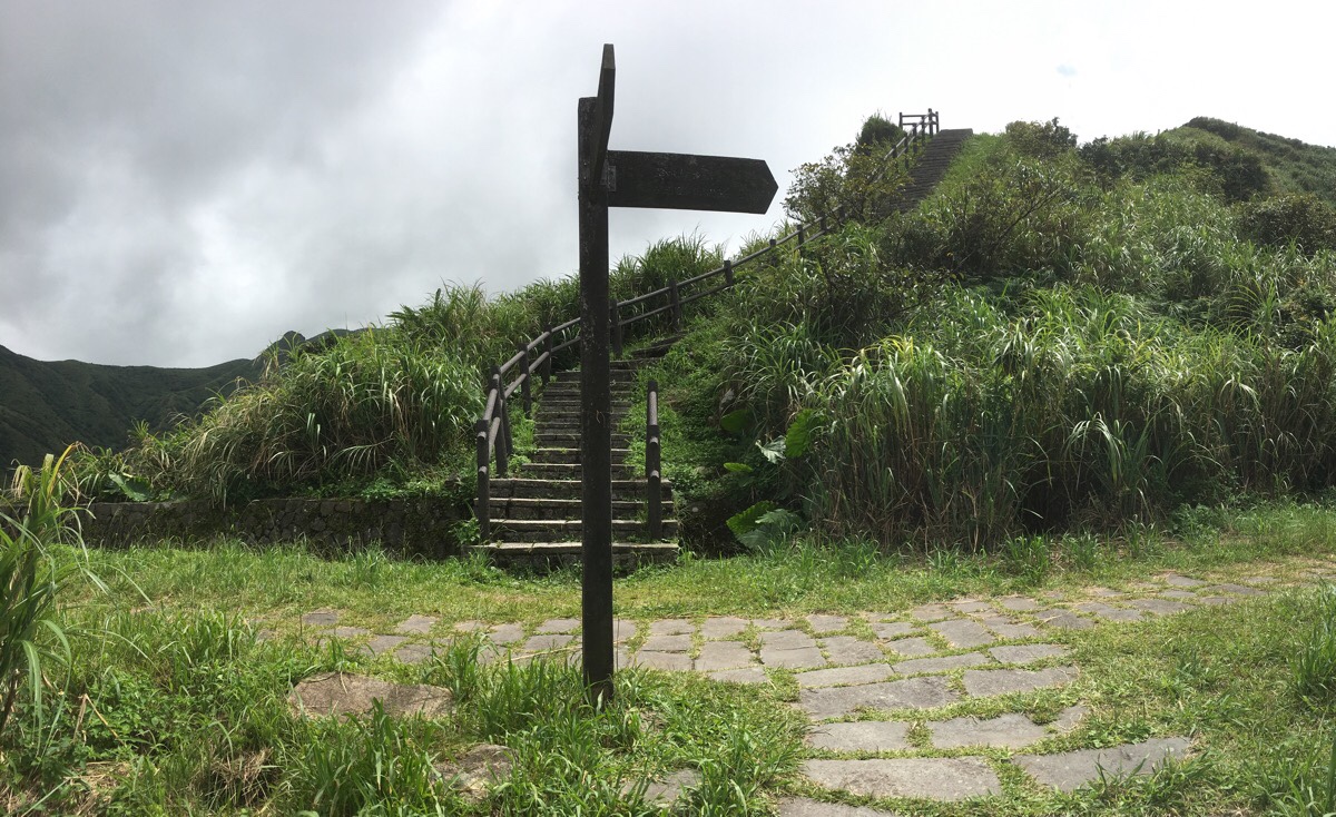
About 10 minutes later I reached the turnoff for Banping mountain. It’s marked by a map on the left of the track.
I sat down on the wooden steps that made up the trail to watch the clouds blowing over the peak whilst I ate a few nuts. it’s a really exciting view all the grasses and exposed rock peaks backdropped by the ocean. A couple of other walkers passed, one I’d watched bobbing his way down the steps, the other had come up behind and I saw him navigate his way towards the peak.

Looking down at the wooden planks that made up the trail I spotted a huge green grasshoppery-type of insect. It wasn’t bothered by my presence, – I guess being that size you don’t need to worry so much about predators. I think it was probably a Taiwan Big Locust/台灣大蝗, although there are many similar creatures it could have been.
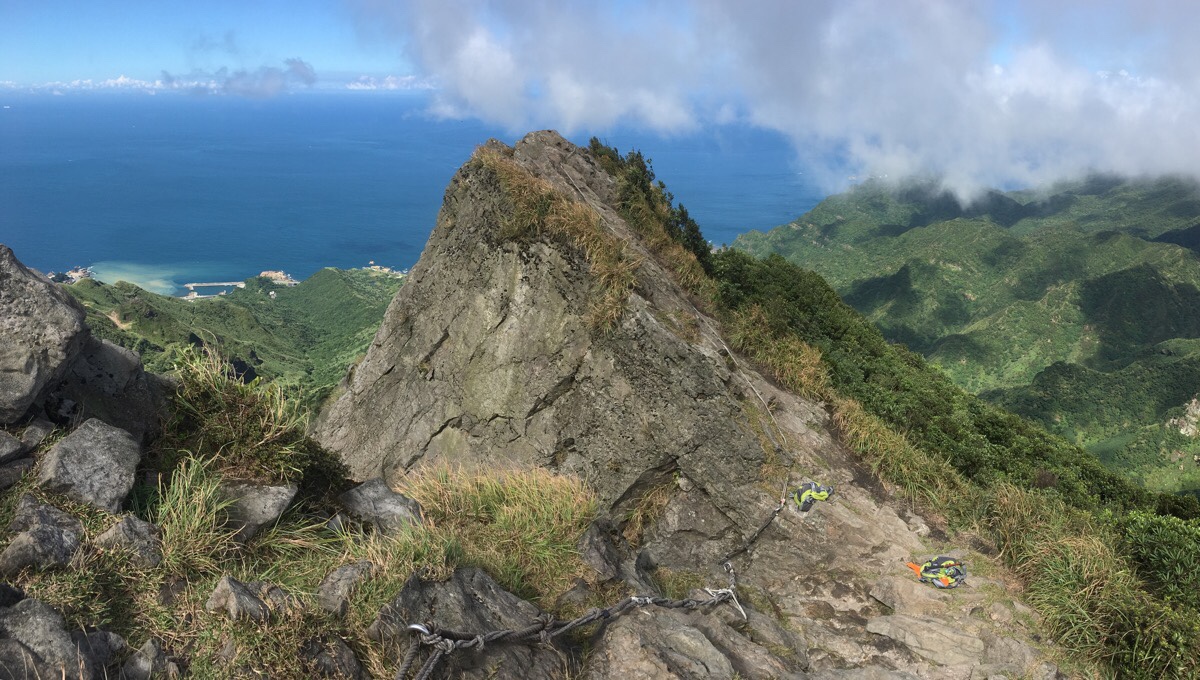
The trail reaches the first of several peaks along the ridge. Myself and the guy who had just started out on the path in front of me stopped to rest and enjoy the view. Looking back where we’d come, the foreground was dominated by the big slab of rock that jutted up like a screen partition, and behind that was the summit of Canguangliao Shan/燦光寮山. A red sign warns hikers of the dangers involved in continuing, but the trail was clear and well trodden. (The sign is a warning rather than an indication of a prohibition.)
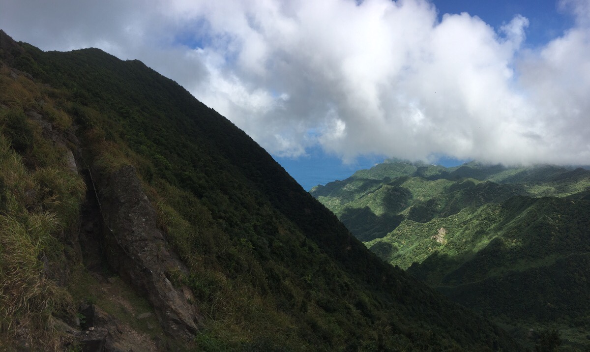
Leaving the first peak behind, the trail treats you to some dramatic views. The path cuts through a narrow rock funnel as the hillside drops away to the right. Bright and fluffy clouds painted the lower hills with ever-changing patterns of light and shade. The walking was a little more mentally challenging in that you needed to pay attention to where you put your feet, but it didn’t feel dangerous.
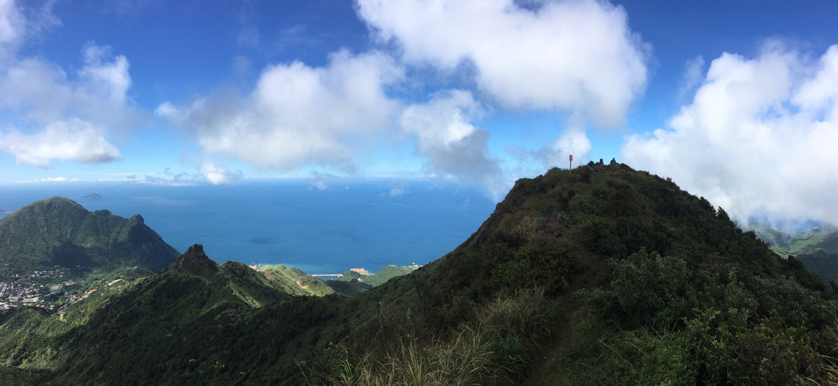
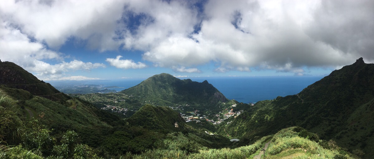
At the top of the next peak, the views were better still. I was very lucky in that the clouds that had been squatting over the ridge earlier on had cleared, leaving me with a clear view in all directions. The summit of Banping Shan was a short stroll away.
When I arrived at the peak there was already one guy there sat down and enjoying the view. He said he’d been over towards Teapot Mountain, taken a look at the way down and decided to return the same way he’d come. It was too scary for him. Very soon the other guy coming the same way as me arrived and the two uncles struck up a conversation.
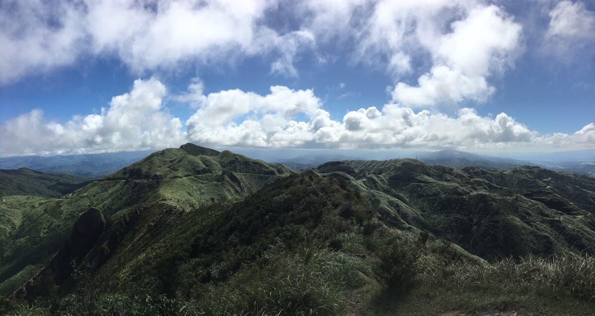
I sat down to eat an apple and watch the clouds unfurl themselves as they blew northwards up from Fulong direction over Cao Shan/草山 (the one with the large passive repeater and other things on top of it). Dragonflies and the occasional bird were the only things moving nearby. Out on the ocean, a white cruise ship seemed to float, suspended in the blue where the water and sky merged.
The two gentlemen told me to be careful when I left, so I assured them that they would. One even checked to make sure I had gloves with me to aid in my journey, and he said that he had some if I didn’t, (I had brought mine with me though). I picked my way over the remaining craggy rocks, and all too soon I arrived at the pass where the trail from Teapot Mountain joins. The views and the walking was just so good that I didn’t feel ready to go down yet. Unsettlingly, two backpacks had been dropped right at the point where I was about to descend and there were no other people in sight. I assumed that they must have left them there to go and explore the view just beyond the rocks – from there you should be able to get a good look down over the spine of Stegosaurus Ridge.
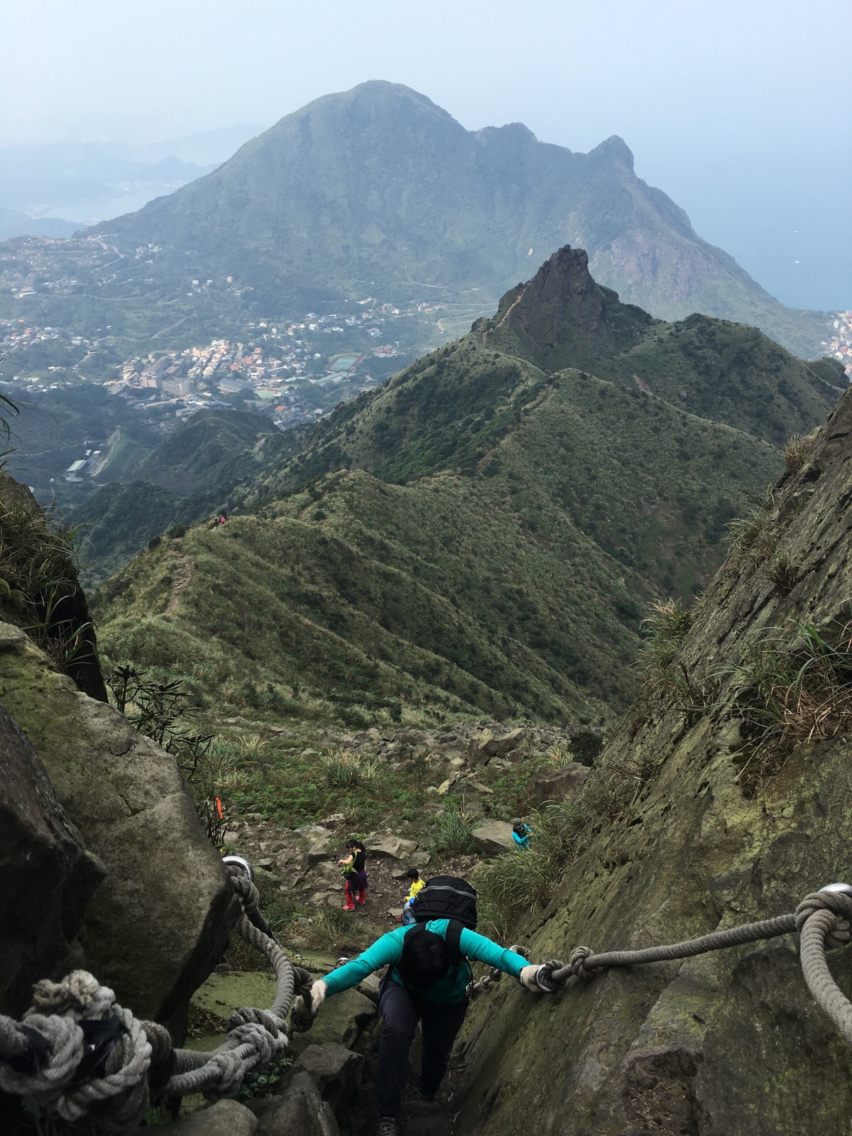
It’s hard to see in pictures from top, but the way down is unmissable once you’re there. There are footholds cut into the rocks and ropes to assist you. (The pictures immediately above and below were from the day that Teresa and I climbed Stegosaurus Ridge. We came down from the same point.)
Between here and Teapot Mountain there is just a single, easy-to-follow path, and except for a final scramble at the far end, it’s all downhill.
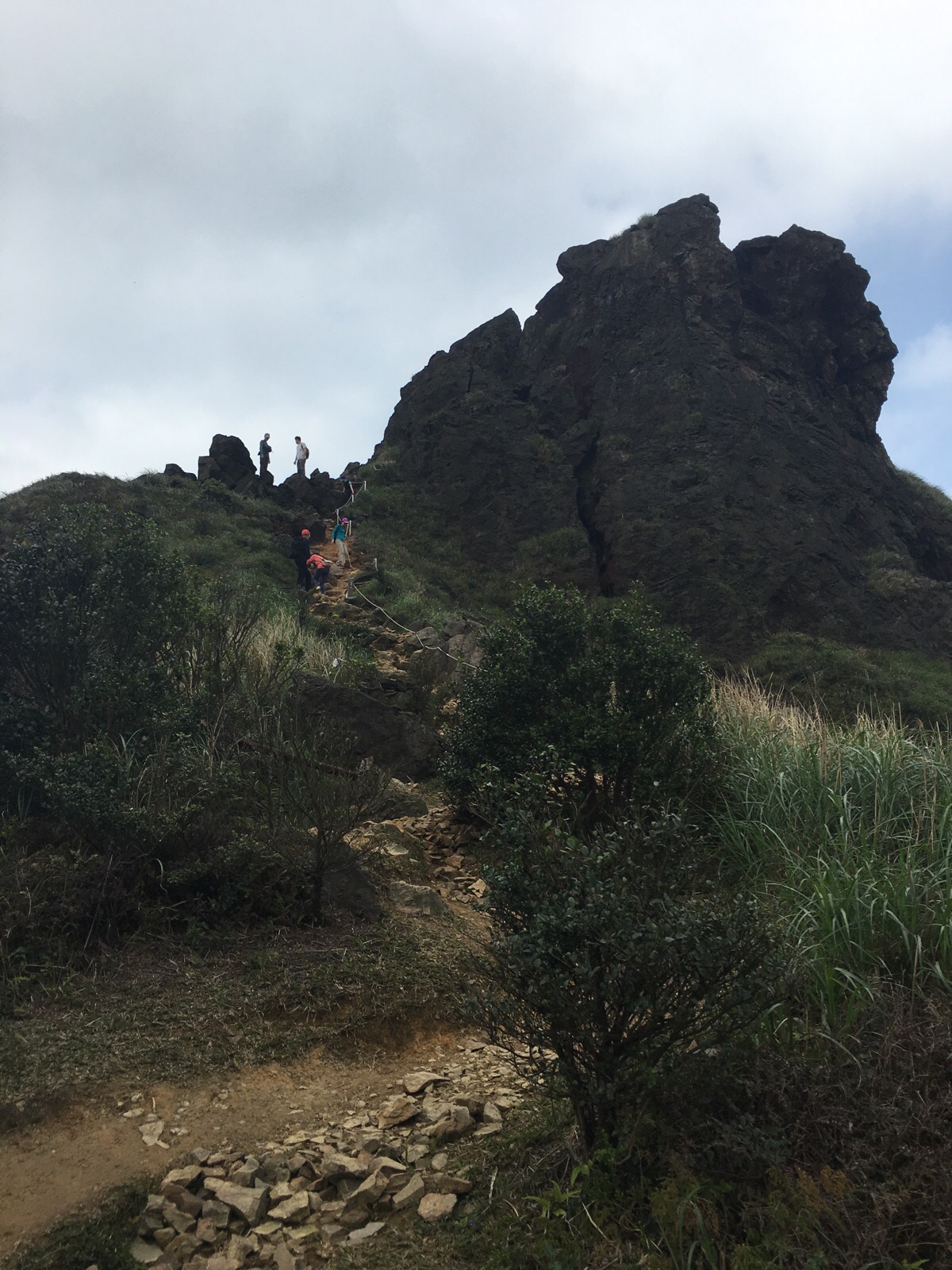
After climbing up to sit on the ledge on this side of the teapot I heard voices coming through the hole. This was lucky as I think I would have tried to go through the wrong hole if I hadn’t seen them first. When you get to the entrance to the teapot hole, you need to climb up a short way using the six or so footholds cut into the rock, (as you can see in this picture), don’t go into the first hole you see, it is harder and more dangerous to get through. Actually there are multiple tunnels with openings around here, and although they’ve almost all been blocked up after accidents or deaths, occasionally tourists or hikers still fall victim to the tricky terrain. The most recent incident occurred in 2015 when a 56-year-old hiker slipped in bad weather conditions, falling 30 metres into one of the holes. Even more alarmingly, the rescue workers who retrieved the body found the remains of a second person who had succumbed to a similar fate. No wonder the woman at the tourist information centre was trying to dissuade me from heading up alone.
With that being said, there is nothing that difficult about the climb so don’t be put off by the warning, just chose a day with good weather (which you should anyway in order to enjoy the views), and take a friend.
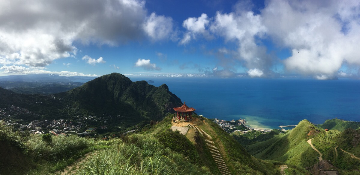
Once through the far side of the teapot you get clear view of Mount Keelung and the runoff-induced light patch of water known as the Yin Yang Sea. I think I posted pictures of a similar view in my Teapot Mountain and Stegosaurus Ridge posts, but the light was just perfect on this occasion. I mean look at those rich greens and blues! Even the textures of the crisp grass and the soft clouds were immensely satisfying.
At the pavilion in the above photo, I met an older couple who were enjoying this most photogenic of picnic spots. They wanted to know how long it takes me to travel back to the UK.
The path down is mostly stone steps until it terminates at a road. Head left down the last few steps.

From here you’ll need to walk along the road for about five minutes. (Ignore the trail on the right next to another pavilion.)
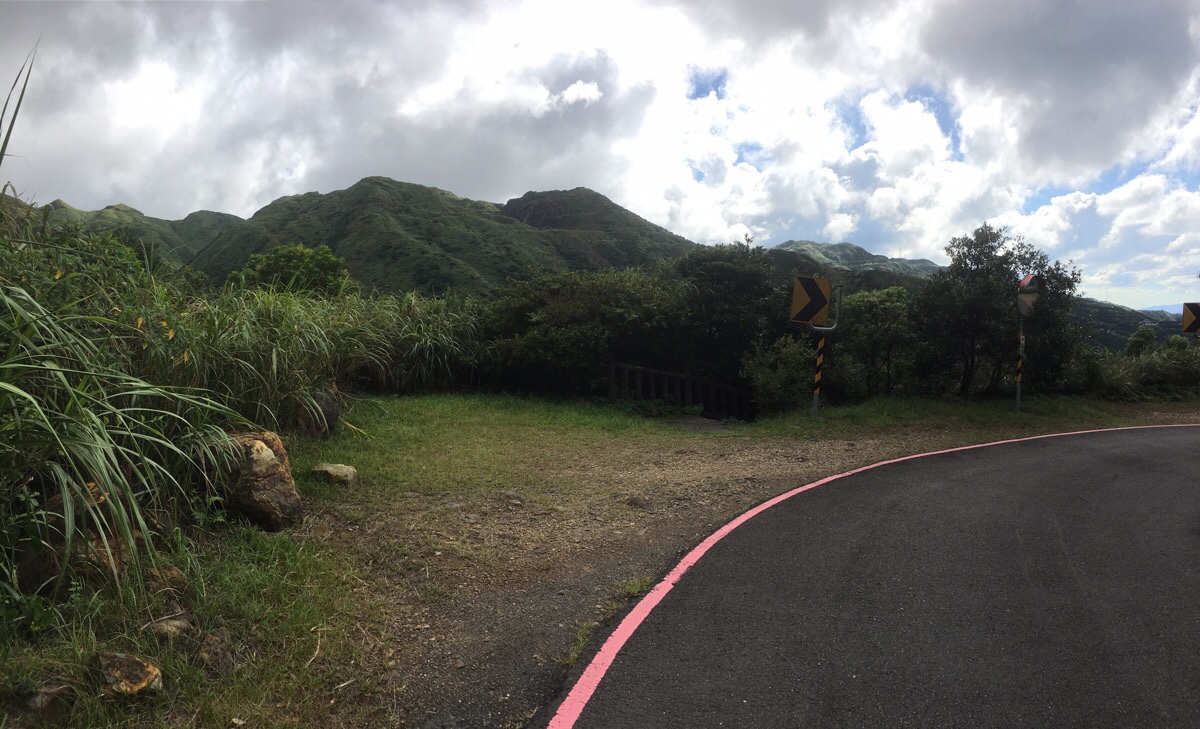
Some easy-to-miss steps lead down from the road at the apex of a hairpin bend. I can’t remember them being signposted, but they lead directly back to the Gold Museum.

The steps lead down to the stream at the back of the Benshan 5th tunnel area, the same place where I’d bought a bottle of water earlier. Then from there, it was just a short walk back to the bus stop near the entrance.
As I passed by the tourist information centre, the annoyingly helpful lady from earlier checked to make sure that I had gone where I planned to, then in a final flourish of helpfulness, she instructed me to fill my water bottle from the water dispenser near the ticket office.
How to get to Mount Banping
Google maps address: the walk starts and ends at the Jinguashi Tourist Information Centre.
GPS location:
- Jinguashi Tourist Information Centre – N25 06.490 E121 51.400
- Ōgon Shinto Shrine trailhead – N25 06.420 E121 51.520FJinguashi Fifth Tunnel trailhead – N25 06.390 E121 51.590
Public transport:
- Train and bus – I took a local train from Nangang Station to Ruifang, from there I transferred to the 788 bus and then got off at the 金瓜石(黃金博物館) / Jinguashi (Gold Ecological Park) stop. I chose this because I prefer travelling by train and wanted to avoid the crowded tourist buses – particularly when I was damp and smelly on the way back.
- Direct bus – the 1062 heads straight from Taipei to Jinguashi. You can catch this from Fuxing South Road, right outside exit 2 of Zhongxiao Fuxing MRT Station. Personally, I hate the tour and taxi company staff who mill around here always hassling tourists to get into their cars, so that was another reason to take the train. The bus does make multiple stops in the city, but it’s a popular route and you may not get a seat if you don’t get on at the start.
Further reading: there’s some more general information about other hills and trails in the area here. And here is a write up from the best known name in Taiwan’s English language hiking world. Finally, this Chinese language blog comes at the hike clockwise – (I did an anti-clockwise loop).
Nearby trails:
- Mount Keelung
- Tamsui-Kavalan Trails – Mudan Loop
- Tamsui-Kavalan Trails – Ruifang to Fulong
- Tamsui-Kavalan Trails – Ruifang to Shuangxi
- Teapot Mountain
- Stegosaurus Ridge
Banping Shan Trail Map
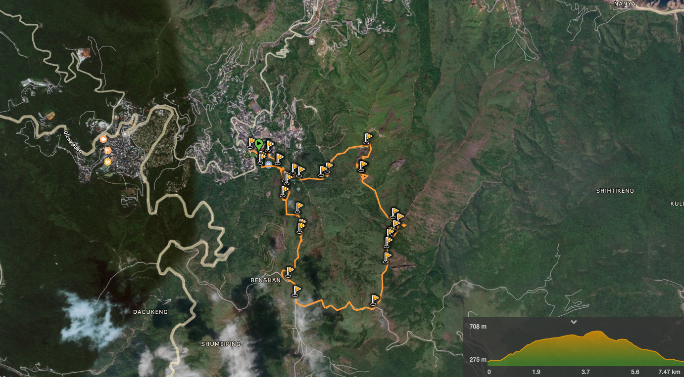
GPX file available here on Outdoor Active. (Account needed, but the free one works just fine.)
My new words learnt on this hike:
- 起霧 / qǐ wù / cloudy or foggy – actually I learnt this three years ago and had forgotten until a fellow hiker described the conditions at the summit to me.
This is the bit where I come to you cap in hand. If you’ve got all the way down this page, then I can only assume that you’re actually interested in the stuff I write about. If this is the case and you feel inclined to chip in a few dollars for transport and time then I would appreciate it immensely. You can find me on either Ko-fi or Buy Me a Coffee.

I attempted to do this route last week. I have a bit of a caution for others that attempt this.
You’ll be on a smooth road and get to the turn-off to Banpingshan. There’s a trail map sign that shows a single trail that leads to “Mt. Banping” then “Mt. Wuerchahu Trail” then “Mt. Wuerchahu (無耳茶壺山)”. Mt. Wuerchahu is Teapot Mountain, although the sign doesn’t say Teapot anywhere. The sign clearly shows only a single out-and-back trail.
I started on the trail and got to the Banpingshan peak marker. I continued on straight because it seemed like there was only one possible way to proceed. As I went along, it got more and more rocky until it was just rock scrambling. Then it changed into hanging-on-a-chain-on-the-side-of-a-cliff. And then ridge climbing. I’m experienced enough that it didn’t phase me too too much, but it was definitely not what I was expecting and even for me there were moments I thought of turning back.
Long story short: I must have missed the turn-off to Teapot mountain because going straight just lead to more ridge climbing and eventually I reached 555 peak and at that point there’s a trail on the left that goes down. At that point Teapot Mountain was far behind me and off to the side. So, if you are hiking from Banpingshan to Teapot Mountain and find yourself doing rock scambles and ridge climbing for an extended period, double check your location because you probably missed the turn-off a while back.
The silver lining was that pretty early on I met an older Taiwanese hiker who was also clearly hiking this route for the first time. He spoke zero English but we grunted-and-pointed and worked together to find the best routes across the rocks. He showed me the path down and then showed me caves and a lookout point and other excellent spots. We ended up hiking for probably 3 hours together and it was one of those magical travel experiences that can only happen through serendipity.
LikeLiked by 1 person
Thanks for this (very sensible) cautionary advice. I had previously walked Stegosaurus Ridge (the harder section you found yourself on), so it was easy for me to spot the turn-off for Teapot Mountain, but if you’re not sure what you’re looking for, it really is easy to walk straight past it. Generally speaking, people climb up Stegosaurus Ridge and then down to Teapot Mountain, it must have been even more challenging doing it in reverse. I’m glad you found a hiking buddy and that you both made it back down safely.
LikeLike