
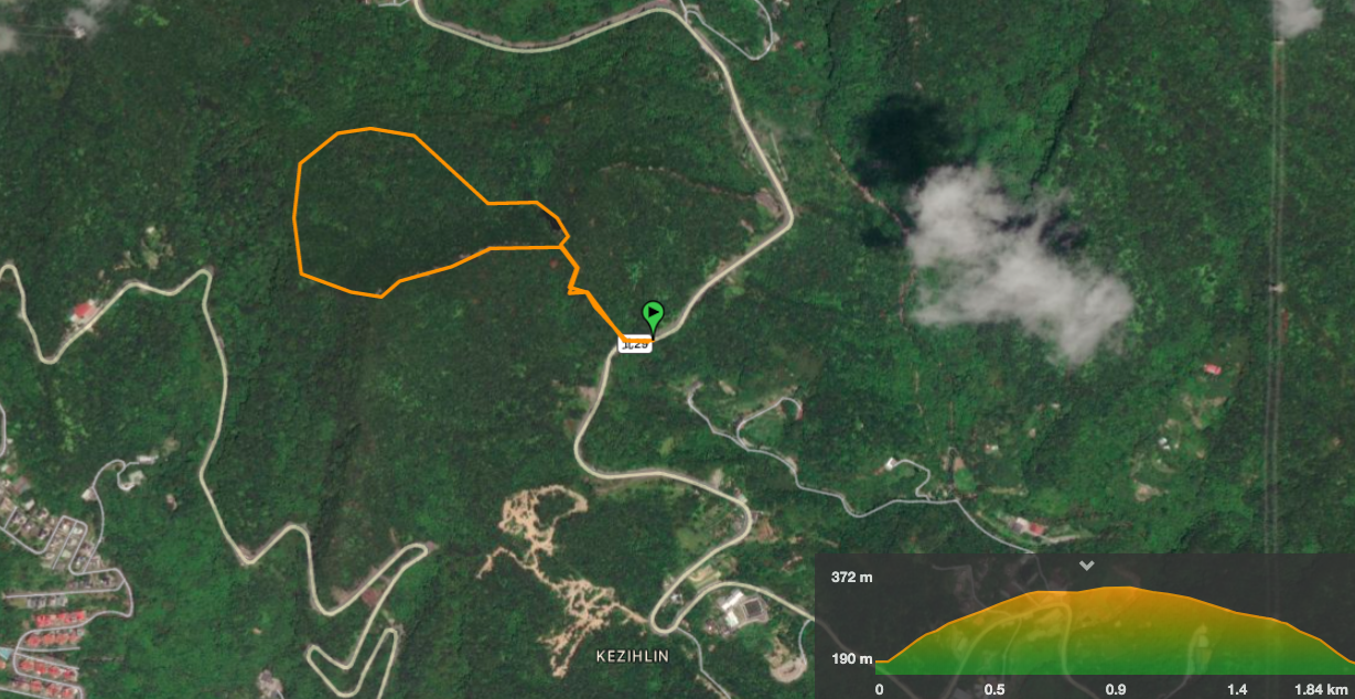
Despite being only a couple of kilometres long, this trail manages to pack in some ridge climbing, a small lake and a few views. The whole time I was there walking it, I found myself wondering how come I hadn’t heard about it or made my way up there before. It really is a hidden gem.
Distance: somewhere between 1.5 and 2km, Teresa and I recorded wildly differing distances, (she 1.6km, me 2.4km – it makes me wonder how often the recorded distance is inaccurate).
Time: 2 hours – this was 30-60 minutes less than we’d expected, we weren’t really hurrying to get anywhere, but I think I would try to slow down and take it at a more relaxed pace if I were to walk it again.
Difficulty (regular Taiwan hiker): 3/10 – this is too short to be difficult. It has steep sections, sure, but it’s so short that it isn’t really tiring. The directions are a bit sparse, but there aren’t a lot of places where you could go wrong. I think that getting to the trailhead without your own transport is probably the hardest thing about this hike!
Difficulty (new Taiwan hiker): 6/10 – there is some steep and rough terrain here, it will be tiring if you’re not used to it. Also, I would have struggled with the lack of English signage when I first started, so make sure you take a map/download a route to follow. Actually, I think because of how short it is, this would make quite a good practise hike for people hoping to start doing slightly tougher walks. But remember to select some good, well-fitting footwear. The very steep slopes (especially downwards), will bugger up your feet if they’re not well protected.
Total ascent: 212m up to a high point of 392 metres above sea level at Jinming Shan.
Water: 1L was more than enough for me on a hot October day.
Shade: some parts are well-shaded, others are completely exposed. I found my aunty hat more useful than an umbrella because it meant I could still use my hands. (Teresa didn’t need anything, but she just browns in the sun, whilst I fry and burn.)
Mobile network: pretty good as far as I was aware.
Enjoyment: This is truly a hidden gem of a walk, I just wish it were a little longer.
Other: we did fine without gloves because the weather was perfect, but they might be a good idea if the conditions are a little wet. Also, if you go in the summer, make sure to take swimming clothes and pay a visit to the nearby Kezilin River Pool.
Jump to the bottom of this post for a trail map, GPX file, and transportation information.
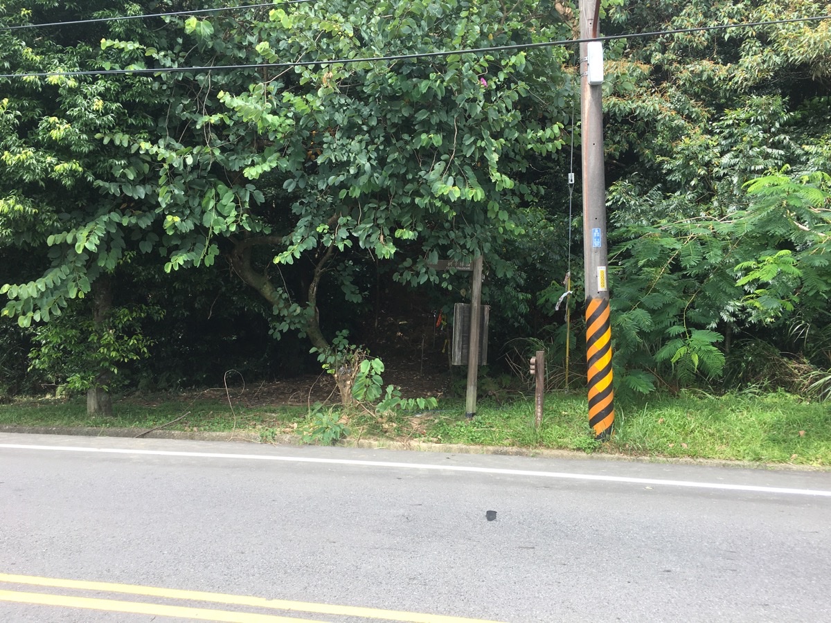
After parking on the opposite side of the road we crossed over to find the trailhead. In fact there are two which run up along either side of a small stream and join together at the lake, but the lefthand one is the one which is marked with a map and signposts, so we took that one.
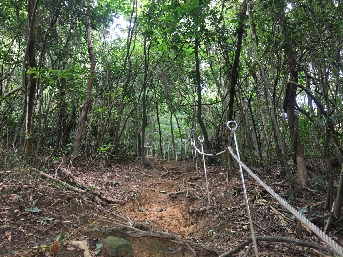
The path is a steep scramble up roots and rocks. We passed quite a lot of people heading down which was a little surprising given that there really weren’t so many cars parked up on the road.
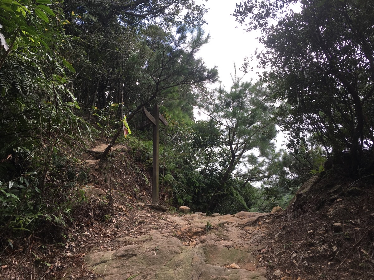
After about ten minutes of climbing we reached the foot of the lake (actually it’s about 40m downhill to the right), and decided to do a clockwise loop. The signpost here indicated that it was another 500-odd metres along the lefthand path to the summit of Kezilin Shan, so we headed on up.
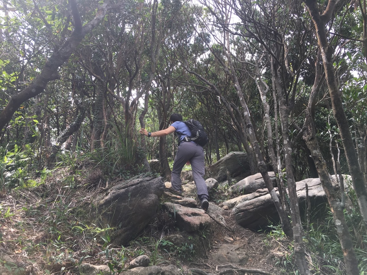
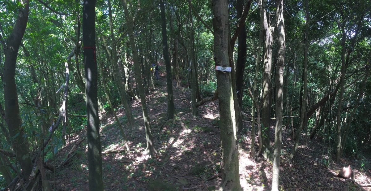
The path is clear and easy to follow as it climbs up over increasingly large slabs of rock and through hardy trees. The large number of acorns on the floor drew my attention to the fact that these slopes are populated with Taiwan Oaks.
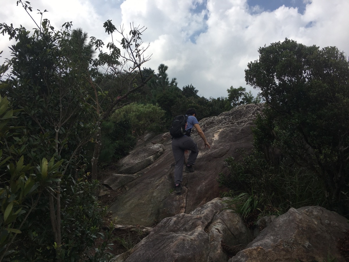
The higher the trail goes, the more exposed sections there are. But I think the photos make it look more daring than it really is – you’d have to be acting really dumb in order to fall off of anything here.
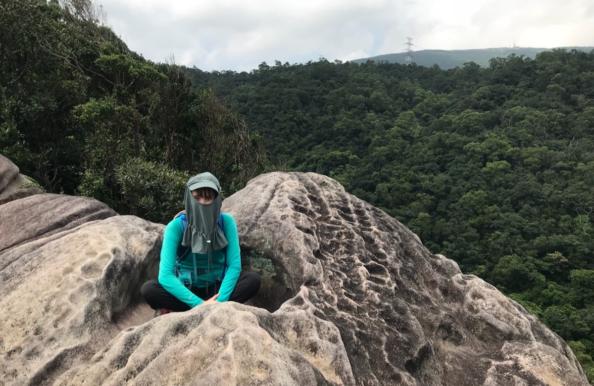
The sandstone rocks here have a beautiful, pockmarked weathering pattern, including a few places where very large holes have been carved out. Teresa noted that it seemed some had been perfectly carved to fit a variety of bottoms.
Teresa also took the geological shaping as an invitation to nap. Behind her, (to the east and slightly north), is the sharp point of Xin Shan – another peak with a lake just below the summit.
To the north we noticed the blue and white temple of the large military cemetery. And in the near-background of this photo (also the one above) you can see the ridge-line that you’ll be following on this trail.
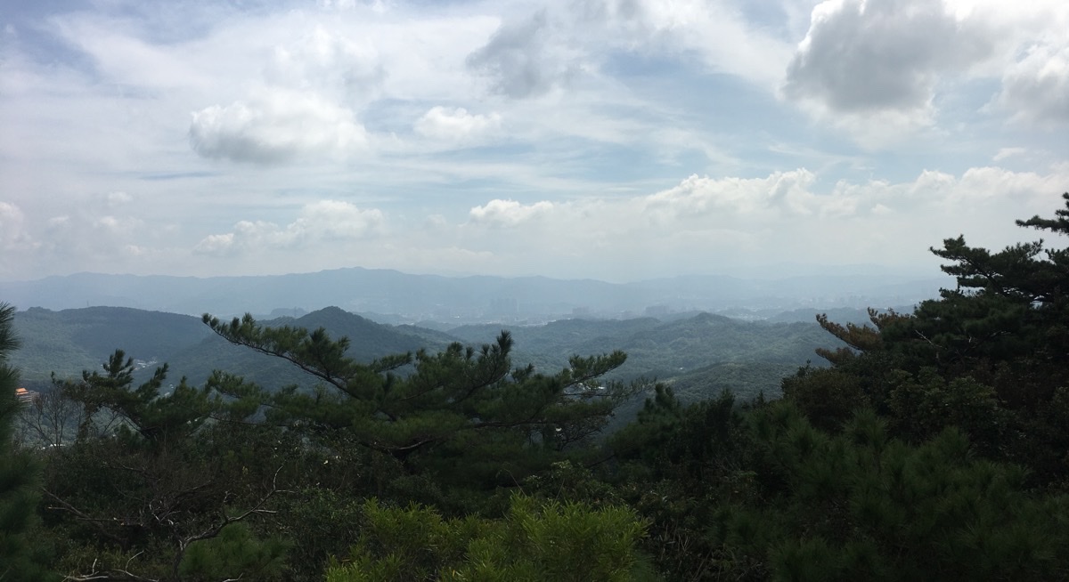
To the south it is possible to see some of Taipei – the arm of Neihu which stretches out along the Keelung River towards Xizhi, but the city seemed distant in the haze.
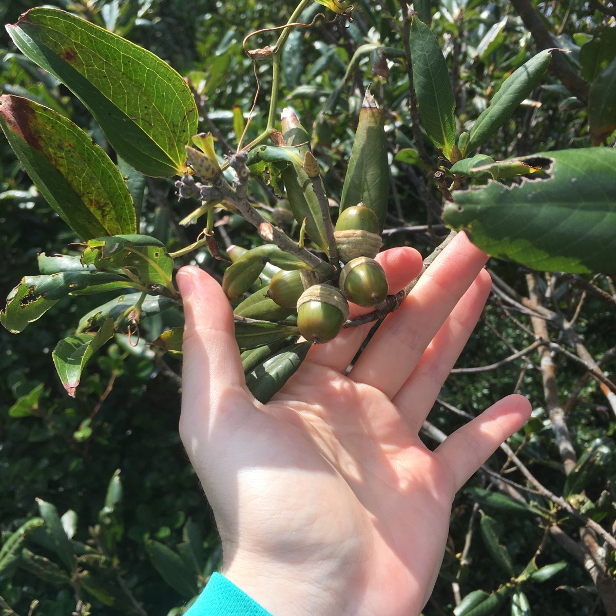
There were oaks all the way up this side of the trail. At first I couldn’t spot the actual trees because I was looking for leaves that were somewhat similar to the lobed leaves back home. But when I finally spotted some acorns on an actual tree, I realised my assumption was far from correct. Taiwan apparently has many trees which belong to the oak family, and many of them have smooth-edged leaves.
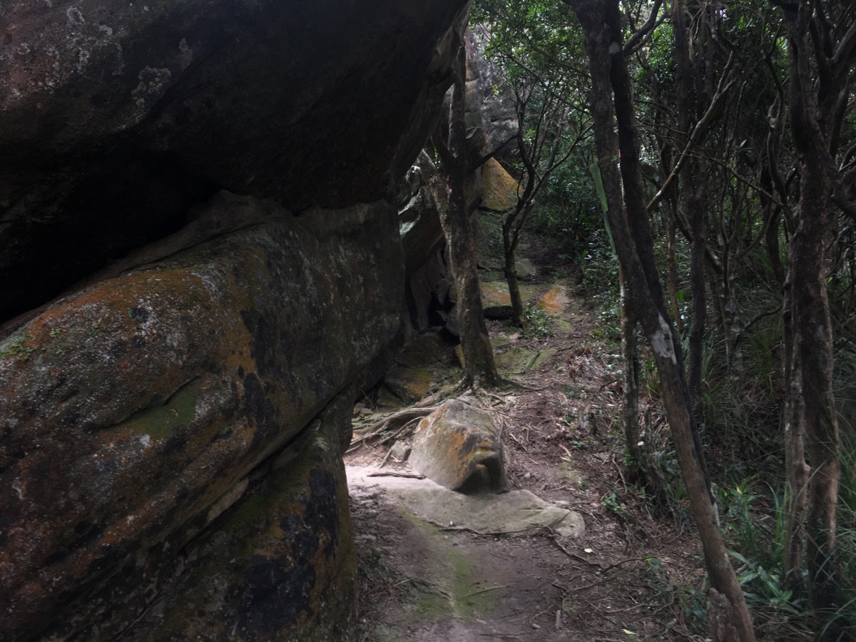
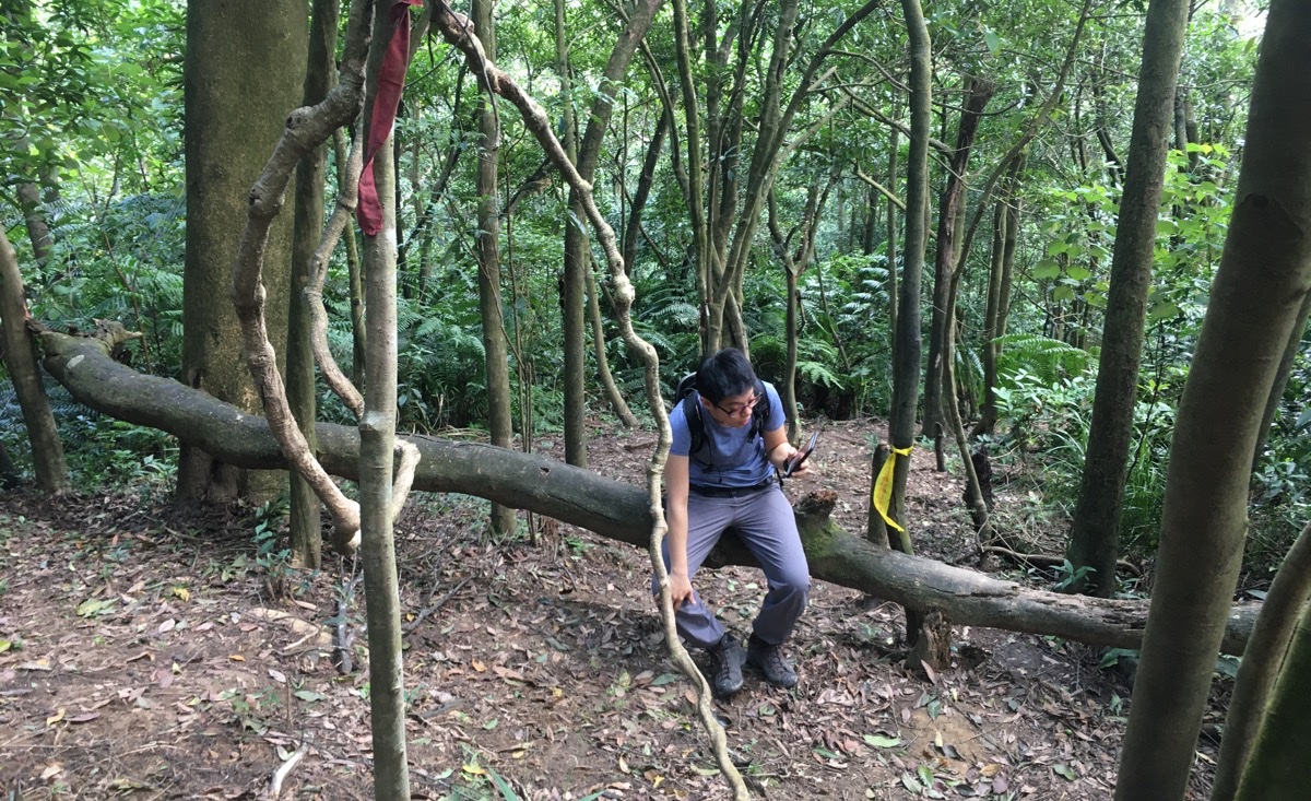
The rock formations here are great, some you go over, some around, some under and some through. At this point, the path makes a brief dart left between two large rocky protuberances. At the far side you hang a right and continue upwards a bit more.
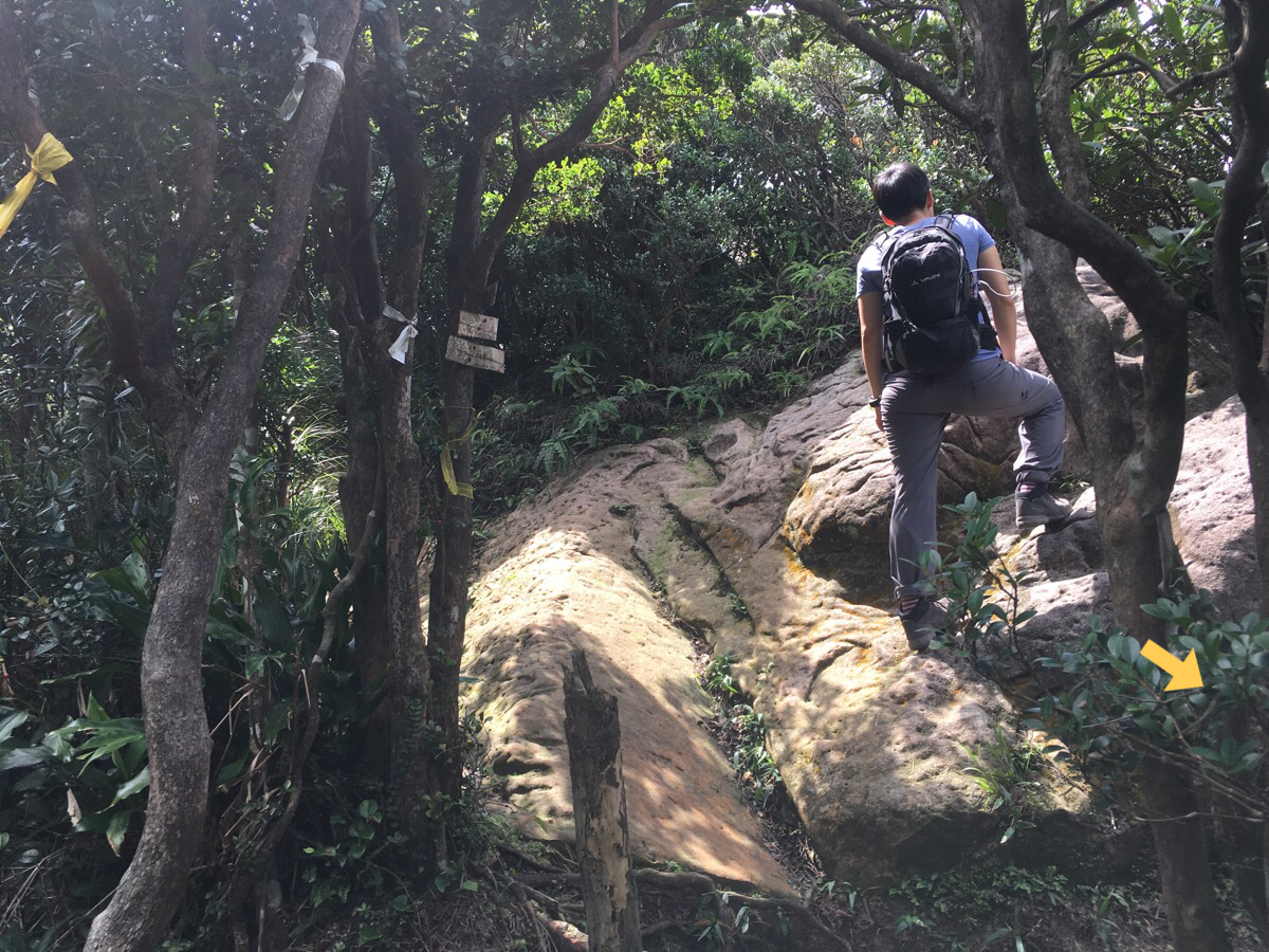
Forty minutes after turning away from the lake, we reached the first of two peaks along the route, Jinming Shan. It’s about five metres up from this picture, so we scrambled up, but didn’t stay long because there were five or six chatty hikers already occupying most of the space.
To continue along the loop you need to head down to the left here.
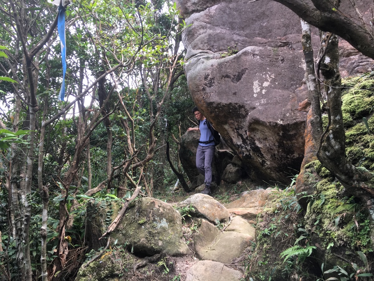
The trail rounds this large boulder at the base of Jinming Shan and then follows a less rocky, more tree-y ridge down and then up again to Kezilin Shan.
Already on the way up I had exclaimed many times to Teresa that I was really enjoying the walk and that I was surprised that it had taken us so long to get out here, but then this section sealed it for me. After the slog of a climb, I absolutely love it when the walk evens out some and lets me enjoy a bit of a ridge. I was enjoying the walk very much.
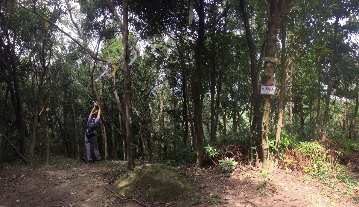
Kezilin Shan is a small peak along the ridge-line, there’s no view beyond the trees, but there is a nice little clearing and the sun filters in through the leaves in the most beautiful way.
Teresa made use of our short break to stretch and commune with a tree.
Heading on from the second and final peak of the trail, we found ourselves walking through really lovely woodland. There are two turn-offs along the way – this first one which is signposted as going towards Ba Lian Road (八連路), and another unsignposted one later on, (also on the left). This second one is easy to miss, or at least it is if your skills of perception are like Teresa’s – she walked straight past it without even realising.
Strangely the straight on and more defined path isn’t signposted at all at either juncture. Despite that, as long as you have basic geographical sense, I think it’s quite clear where you’re meant to be headed.
Not long after the signposted turning, the path starts becoming more consistently downhill. There were many tiny little tree lizards, half tied themselves in knots scrambling to escape, and the other half froze like mini statues. Part way down Teresa found a helpfully fallen tree to use as a bench.
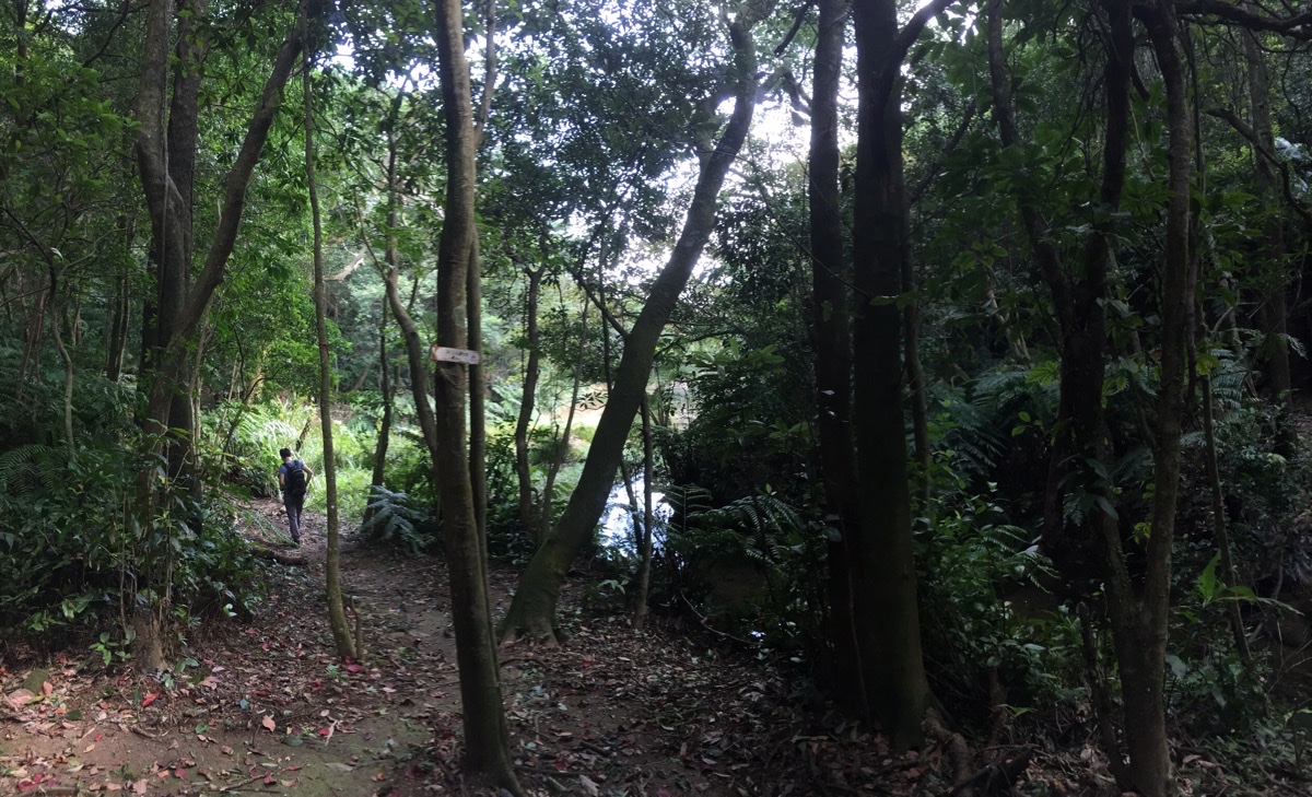
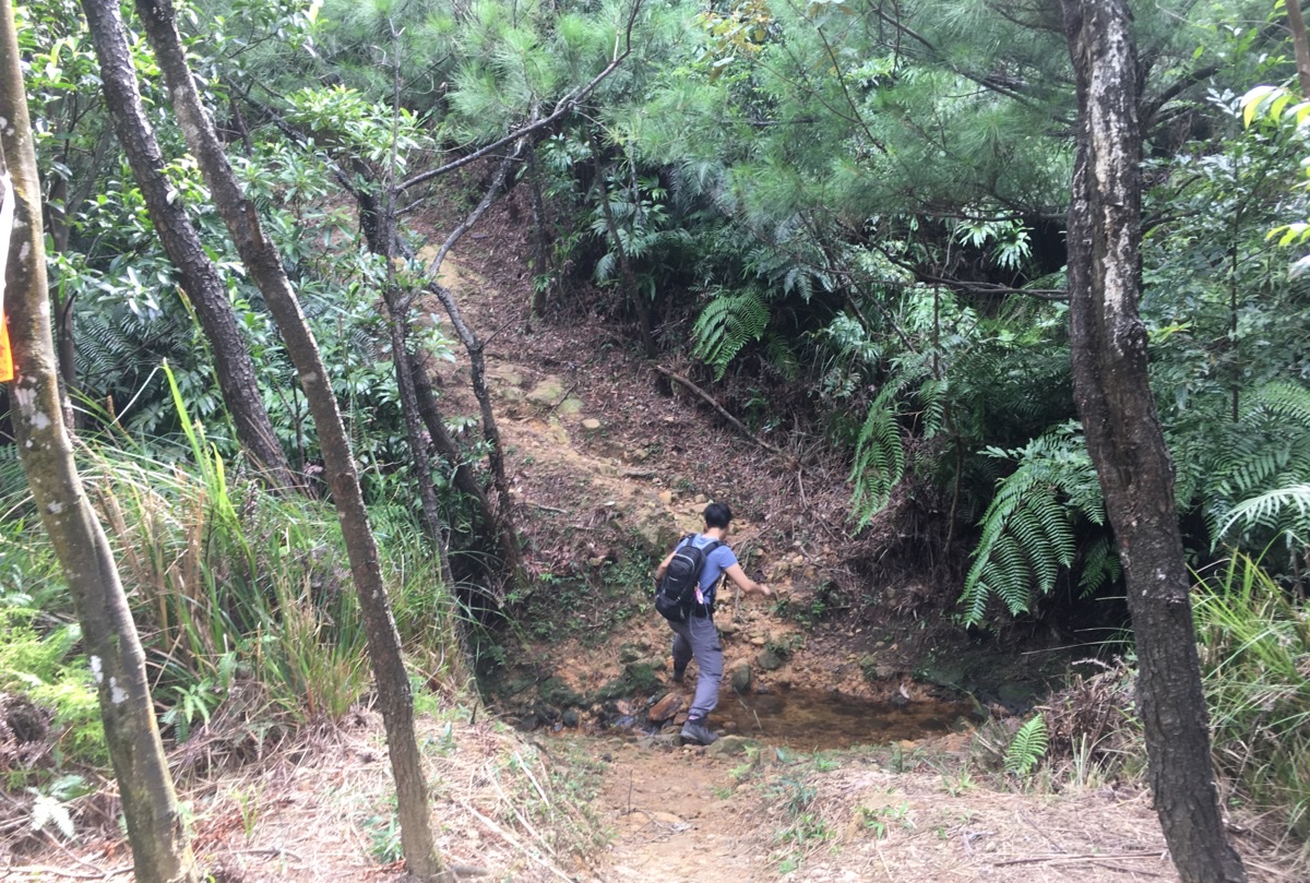
Soon we could hear the sussurant splashing of a small brooke as it tumbled its way down towards Ruyi Lake. Moments after hearing it, we could see it through the foliage on the right of the trail.
The path then arrives at a junction. You can either cross the stream on the right and go round one side of the lake, head straight, (as we did), along the most defined path, or head up to the left, (this seems to be an alternative and less used path up from the road).
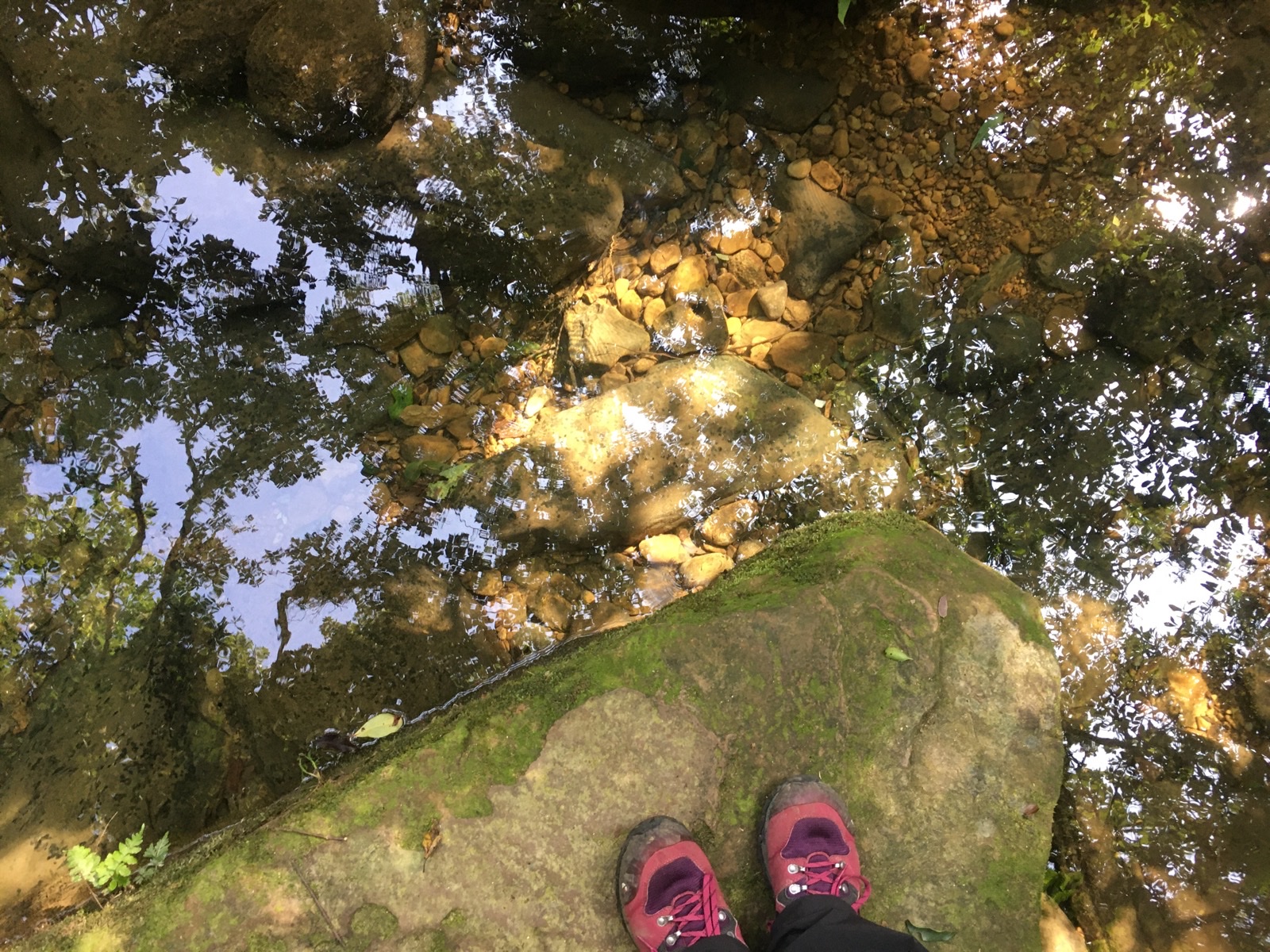
The water in the steam was crystal clear. Waterboatmen skimmed over the surface, and I spotted a mountain shrimp chasing a much larger fish out of its territory.
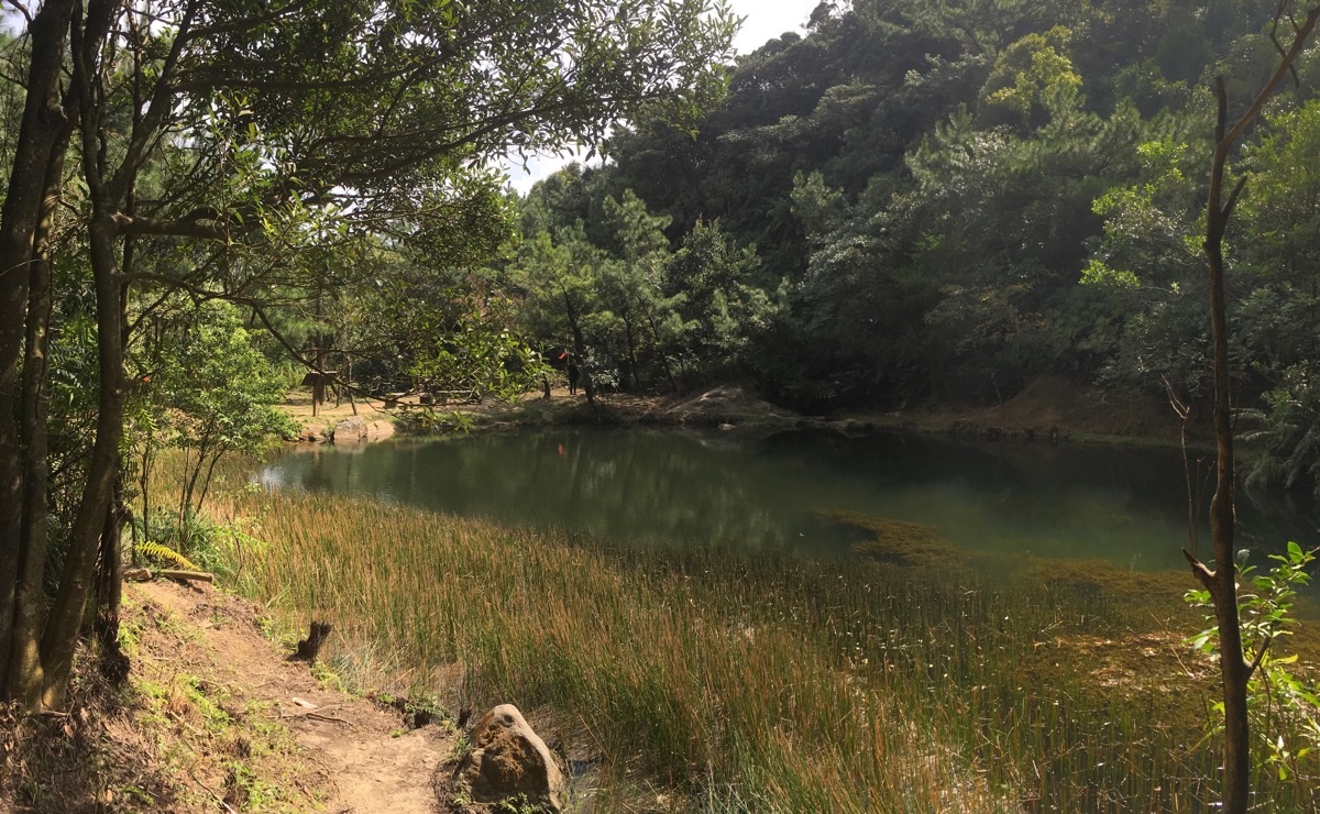
It was obvious from the flattening of surrounding grasses that the recent typhoon had increased the normal water level, but it seemed to have returned back to its regular level again. Just like the stream that fed into it, the water in the lake was clear – we could see many small fish darting between the billowy pond weeds.
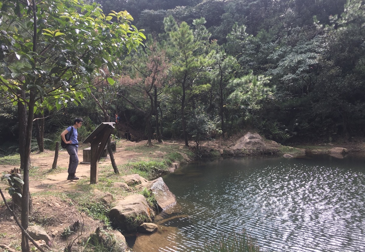
A sign at the water’s edge doesn’t give much information beyond the fact that the lake was named by a hiking club of the same name in Xizhi, and (spuriously) that it doesn’t appear on any maps of the area.
It’s a charming little scene, and I imagine that it must feel magical if you’re able to get up early enough to have the place to yourself. This type of feature isn’t so common in the hills around Taipei – so far I’ve only come across similar pools in the nearby Meng Hu (Dream Lake) and Yangmingshan’s Miantian Pool. Although the first one is bigger and more popular, (it can be accessed with much less effort), and the second is a fleeting landmark – only visible briefly after very heavy rain. This uniqueness makes it well worth the trip up out here.
To return to the car, we took the path over the stream back up to the junction where we’d earlier turned left up towards Jinming Shan. (Or you could take the other path which runs down the far side of the stream and comes out in more or less the same spot.) The walk was over in no time and we drove five minutes down the road to see if the Kezilin river pool was open for swimming. Sadly it wasn’t; typhoon Mitag had silted it up and it was being de-silted by a whole bunch of muscular, middle-aged men in speedos. It looks like we won’t be able to get our dip in there this year.
How to get to Ruyi Lake
Google Maps address: there is some car parking space available on the side of the road right next to the 8.5km marker on Xiwan Road, Section 3, (汐萬路三段).
GPS location: N25 07.200 E121 37.660
Public transport: the F910 bus heads in the right direction. First you’ll need to take a local train to Xizhi Station, then transfer to the F910 bus and get off at Jinming Shan stop. This is doable, but not perfect since there are only 8 buses a day on weekends (or 6 a day on weekdays). The latest bus you could reasonably take would be the 13:00 one, (in order to get back for the last bus returning at 17:20), although personally I would prefer to catch the 11:00 one because I’d always rather factor in extra time just to be on the safe side.
Further reading: there’s this video of the walk, but otherwise there seems to be scant English info out there. If you want Chinese, there are plenty of resources, I started from Tony’s post though.
Nearby trails:
Ruyi Lake Trail Map
GPX file available here on Outdoor Active. (Account needed, but the free one works just fine.)
My new words learnt on this hike:
- 倒霉 / dǎoméi / unlucky
- 錄 / lù / record (v)
- 感情 / gǎnqíng / feeling, emotion
This is the bit where I come to you cap in hand. If you’ve got all the way down this page, then I can only assume that you’re actually interested in the stuff I write about. If this is the case and you feel inclined to chip in a few dollars for transport and time then I would appreciate it immensely. You can find me on either Ko-fi or Buy Me a Coffee.
