Distance: 18.9km
Time: 1½ hours at a pretty good speed and without too much stopping.
Difficulty: 1.5/10 – the only real difficulty is finding the entrances and exits to the park and where to pick-up/drop off the bikes. 18km is a reasonable distance too, but the surfaces are flat and smooth so it goes by easily. On a windy day this might be a lot harder since the wind is quite strong along these riverside parks.
Total ascent: about 98m, but that’s very spread out and not really noticeable.
Water: I think I probably only took 500ml, but there are plenty of places to get out and get more if necessary.
Shade: almost none – you’ll need to cover up if you’re sun shy.
Mobile network: clear throughout.
Enjoyment: the enjoyment gotten from this ride progresses as you go along, the views change from dull city to picturesque mountains and the ending is a really pretty location. One of my friends who has done this particular path said that he enjoyed it so much that it encouraged him to get his own bike and start cycling more.
Other: Bitan is a good place to stop for lunch or dinner and a wander, so give yourself time for that too.
Jump to the bottom of this post for a trail map, GPX file, and transportation information.
.
From the Nishi Honganji Square YouBike stand, take a right onto Section 2, Changsha Street and keep heading straight.
Keep heading straight until you have passed Bangka Fude Temple, after that turn left on Hehuan South Road.
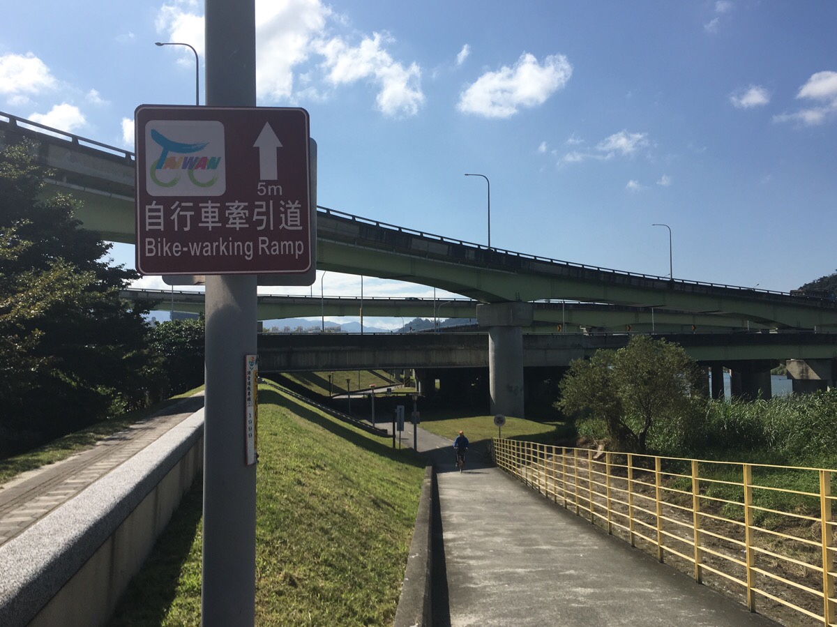
The entrance to the river park is on the right just after you’ve turned onto Hehuan South Road. It’s easy to miss the first time. Just through the gate, you’ll need to cross a scooter-only road, the scooters come really fast, so either press the button to get the traffic lights working, or be very cautious.
After crossing the road, turn left and cycle south until you meet the main cycle path.
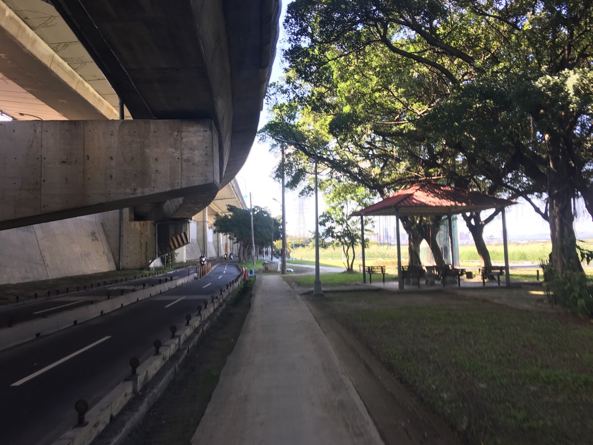
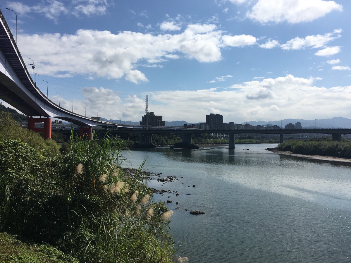
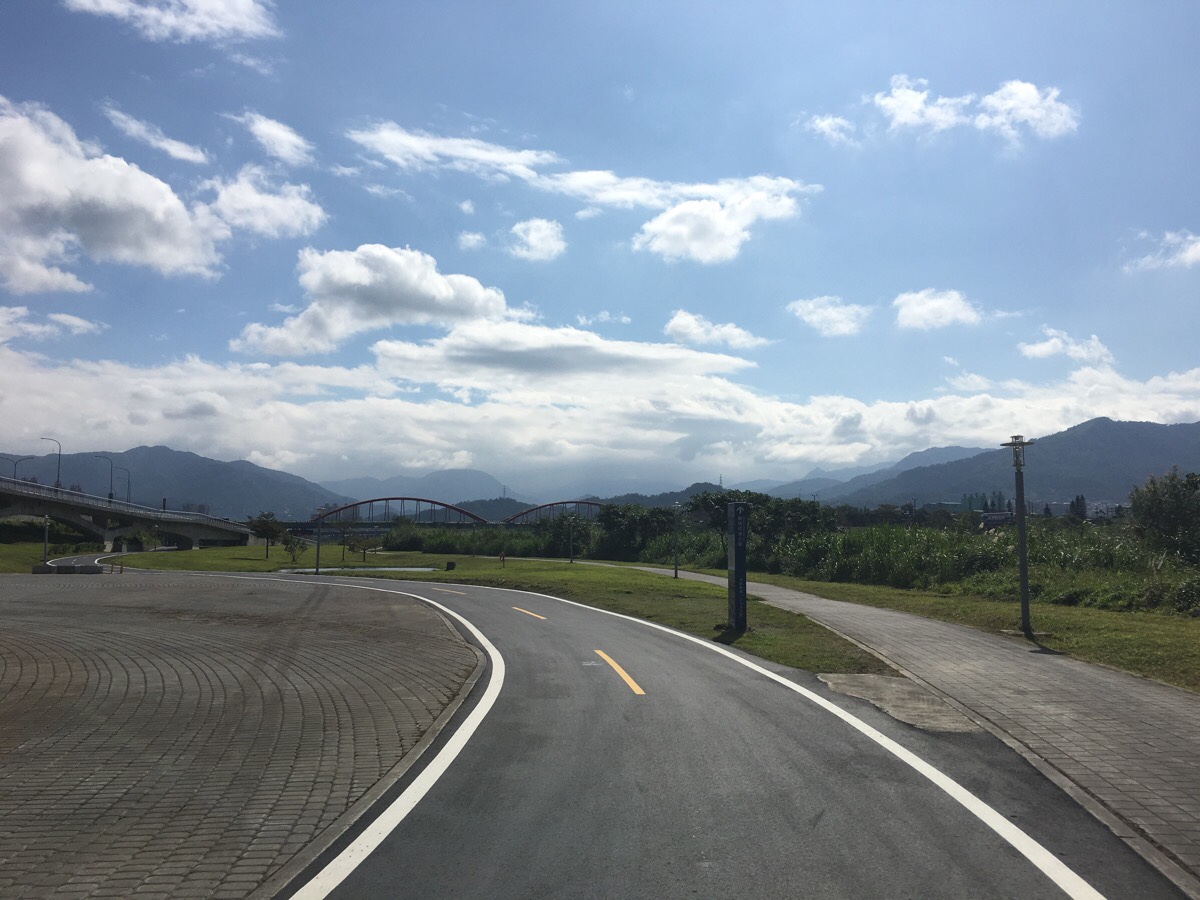
Pretty much from here until the end, the path is flat and easy. At the junction in the picture, keep towards the right. The grassland and mudflats along the river just beyond the junction is a favourite for local bird watchers. It’s designated as being Taipei’s city waterbird refuge (臺北市野雁保護區), I think the two websites relate to the same place, but the English is poor. The area here is special because the waters flowing from the river mix with the tidal waters of the sea to make the river very slow moving. Additionally, the nutrient rich sediment coming from the rivers forms sandbars which make for a perfect foraging ground for migratory birds as they pass through. Originally the protected area was smaller, but these days it stretches quite a long way up the Xindian river all the way to Yongfu bridge.
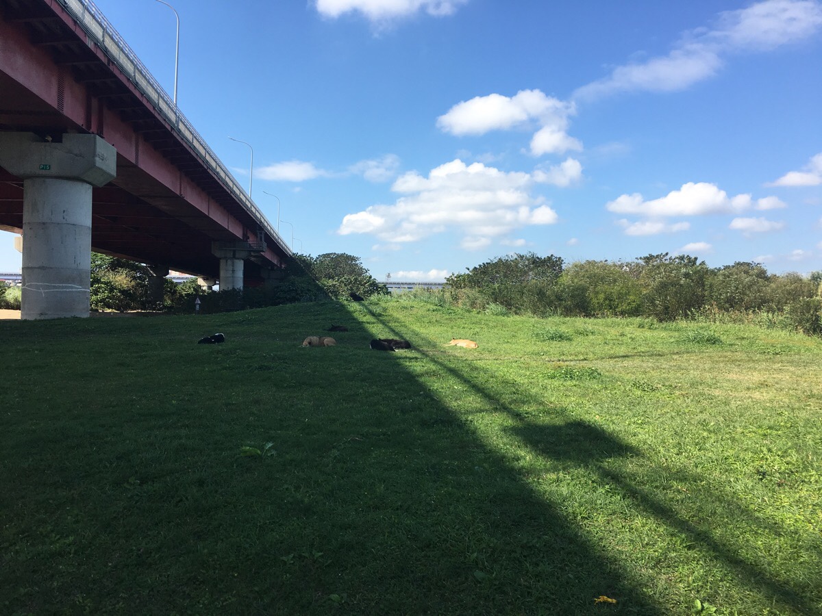
The cycle path curves left to pass under Huajiang Bridge. Every time I’ve passed this way there have been a lot of stray dogs sat around here. It looks like someone takes scraps to feed them under the bridge. I don’t know what they would be like with other dogs, but they seem to be completely oblivious to all the people passing through.
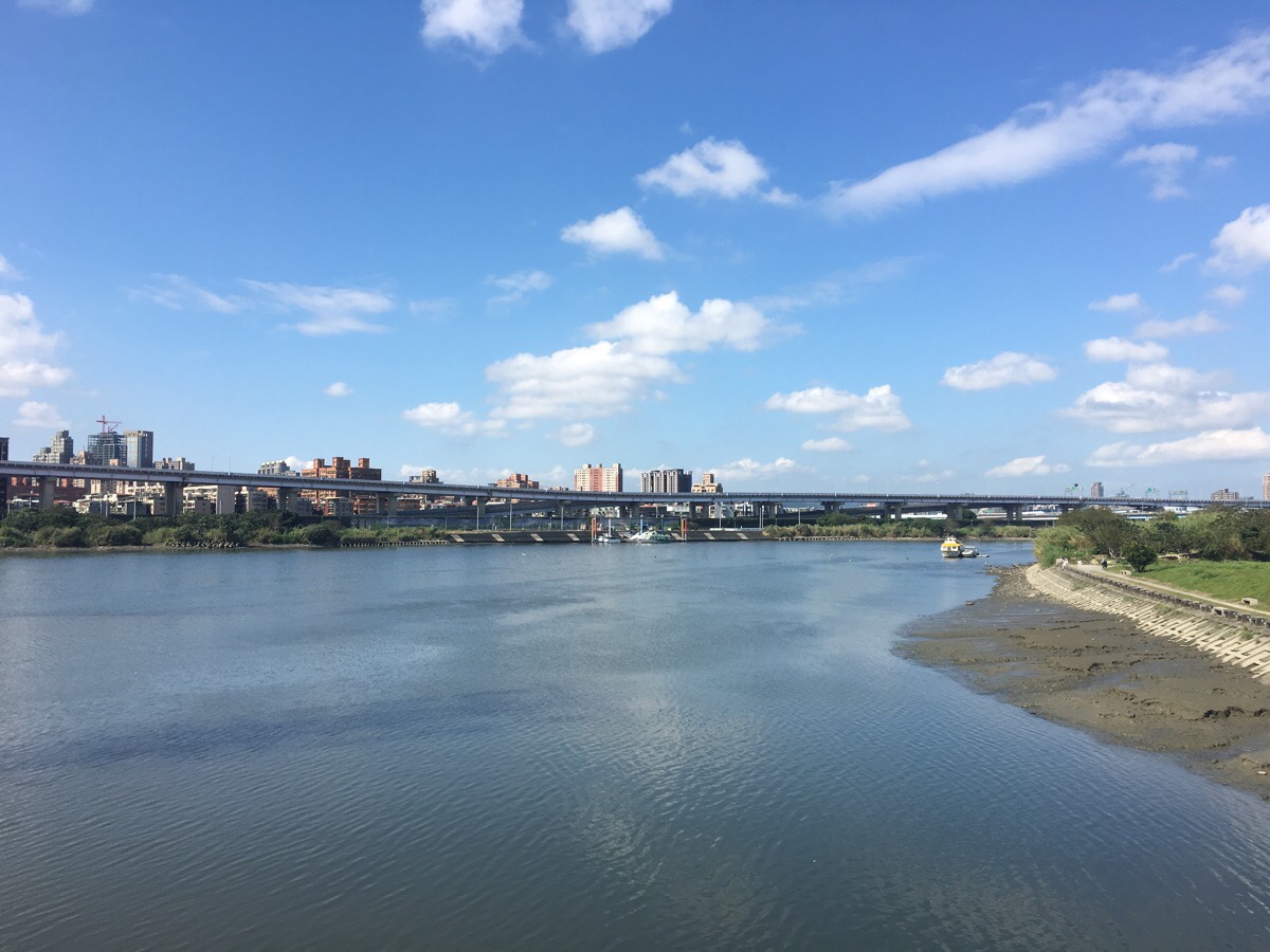
Looking out from a small bridge over an inlet you can see where Huajiang bridge arrives into Banqiao District. Raised above the land, the Taipei expressway skirts close to the edge of the water, and several boats moored to the far bank give away the location of Huajiang dock.
As you cycle along the banks of the river, the cycle path passes through many different areas of park.
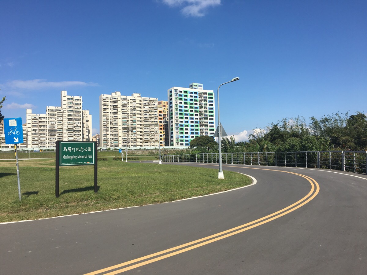
From the point of entry to here, you will have passed through Longshan Riverside Park, Huajiang Park, Shuangyuan Riverside Park and Huazhong Riverside Park, (which apparently has a campground). The next park you’ll pass is Machangting Memorial Park.
This parcel of land has a somewhat unsavoury past. During the White Terror era (Taiwan’s years under martial law), this stretch of riverbank was commonly used as the execution spot for political dissidents. There are some photos online of people being led to their deaths here. After the lifting of martial law in the 1980s, the park was used for horse racing and training, and then in 1998, the (then) mayor of Taipei, Chen Shui-bian revealing a plan to turn it into a park which would memorialise those who died during the White Terror period. Now a simple mound and a small plaque stand to commemorate the horrors of the past.
Cycling through there on a beautiful and sunny afternoon, it is easy to miss the traces of the past, and even harder to reconcile what the place was like back then with the place of relaxation and recreation that it is now.
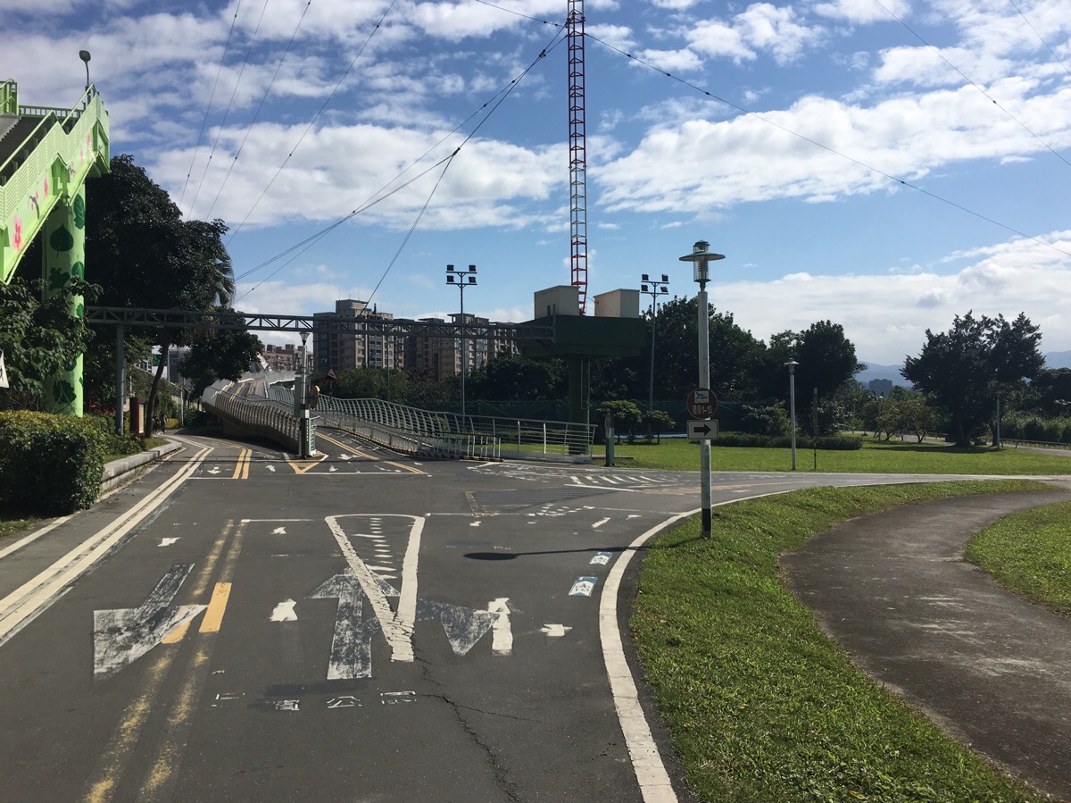
The path towards Xindian veers to the right here. There is pretty good signage along the whole route.
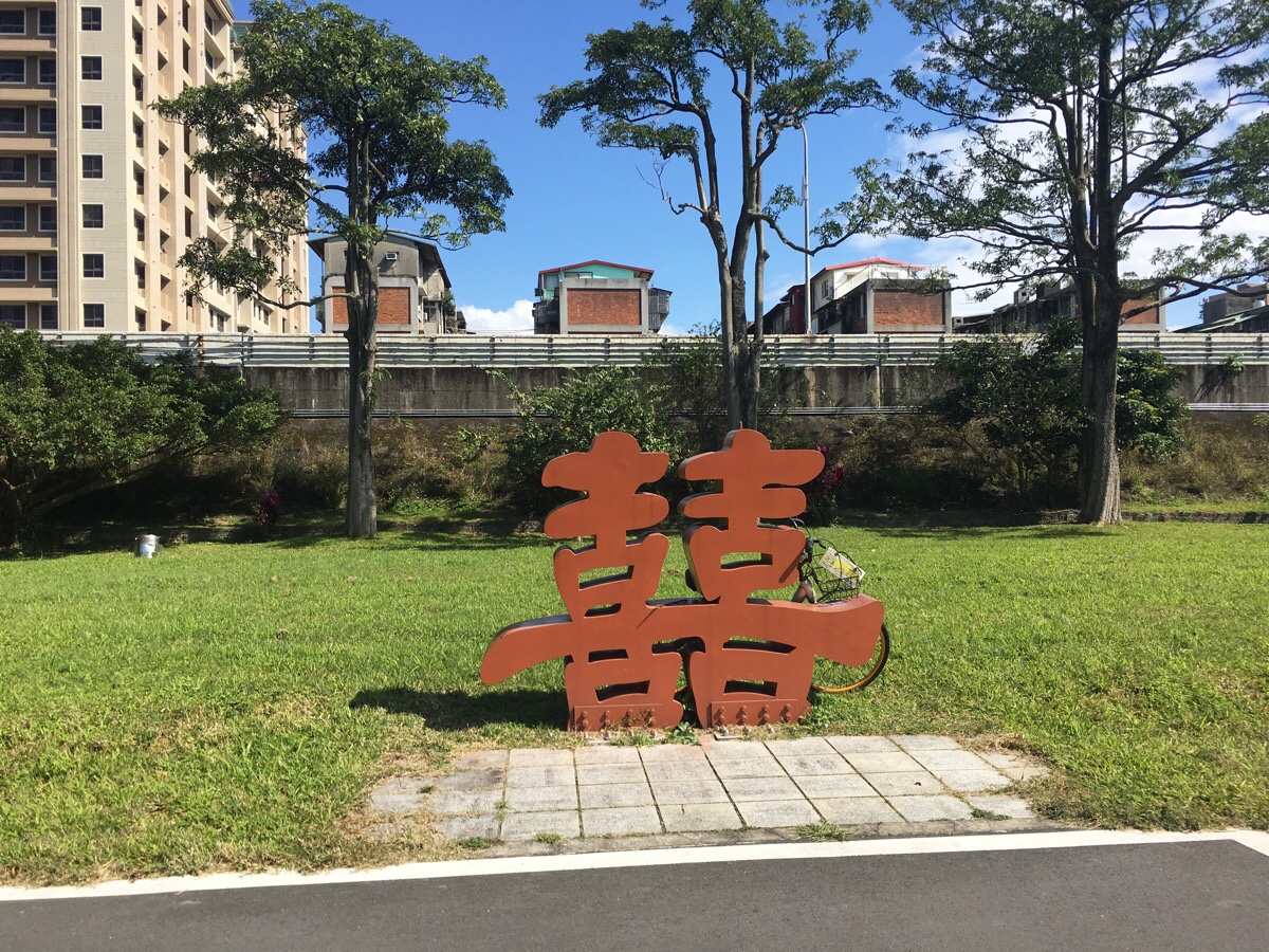
An oBike lurks behind a double happiness sculpture.
As the cycle lane enters Guting riverside park, you can choose between a wobbly path or a straighter path nearer the river. Both rejoin after a short distance, so either is ok. This park is maybe the cutest of all the ones you pass through on this route, with lots of Taiwan-style sculptures in one area.
Just after passing under Yongfu bridge (which has some large water pipes running alongside it and a sheltered playground built into the slope), you get this dramatic view of Shuiyuan Expressway curving next to the river.
Just a little further on from here, you will pass the live music venue, Pipe, and a little further still you can see the ramshackle-seeming buildings of Treasure Hill Artist Village to your left.
Following the expressway, keep straight and head over the small bridge. This is where the Jingmei river joins the Xindian river.
(The cycle path to the left will take you towards Muzha.)
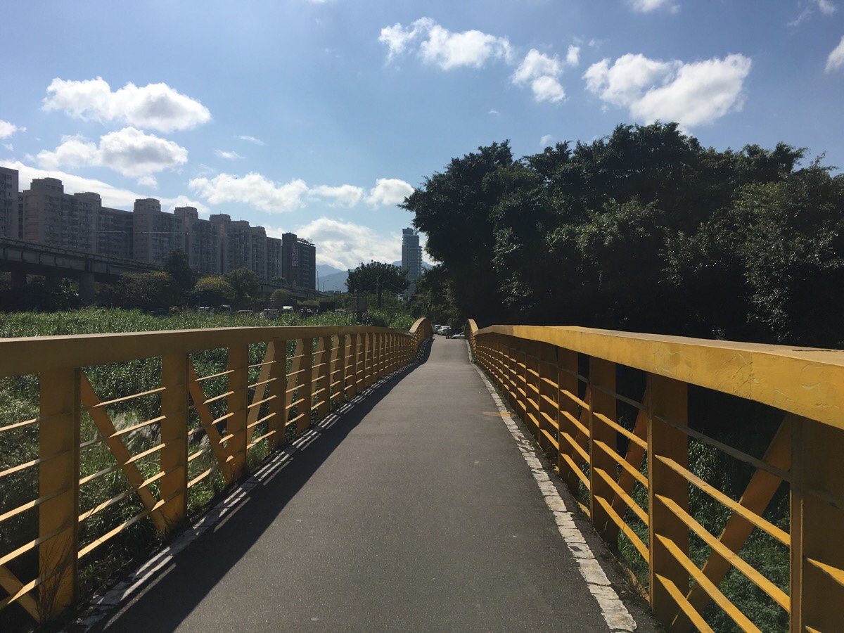
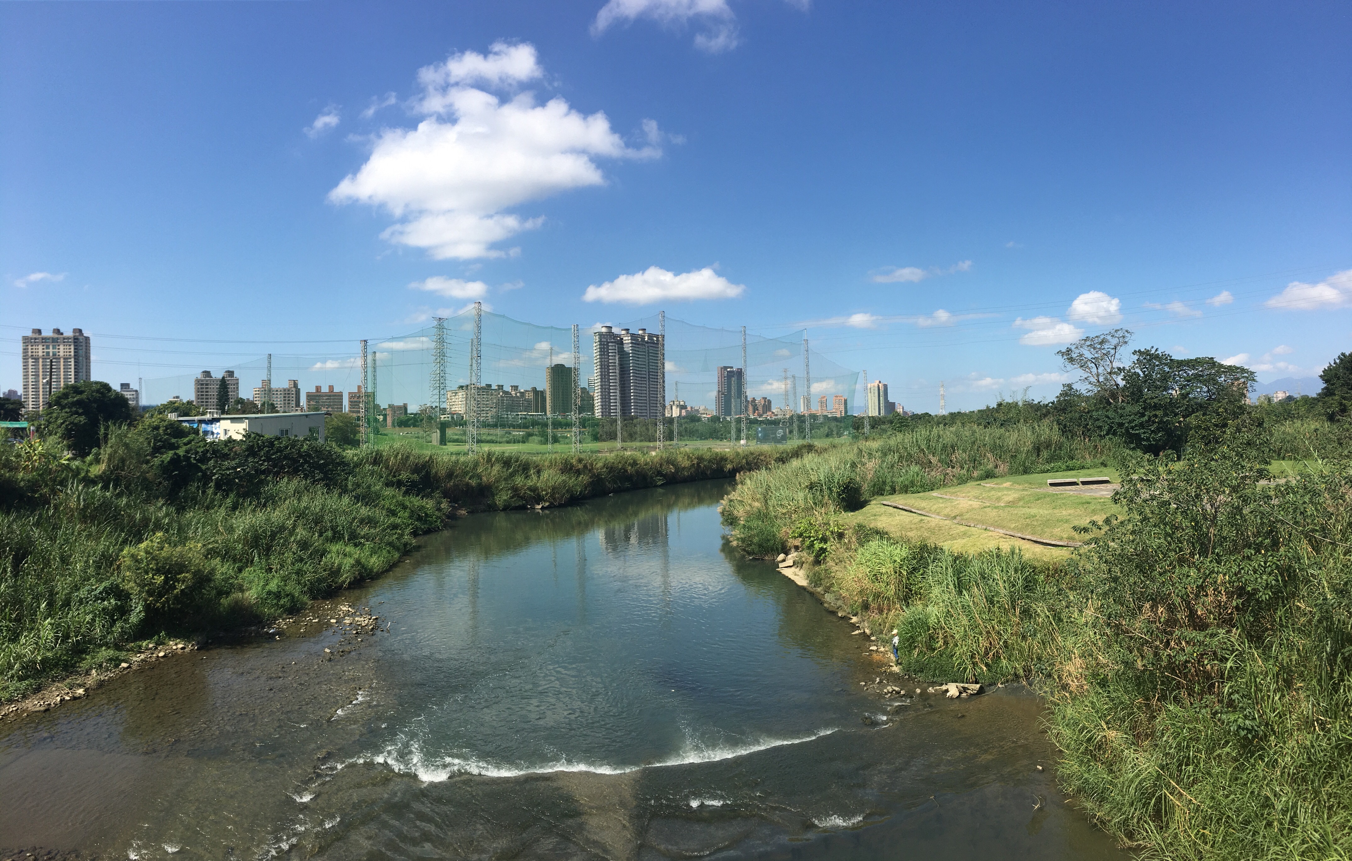
The bridge is a slightly humped, yellow-railed thing with a good view of the nearby golf practise range.
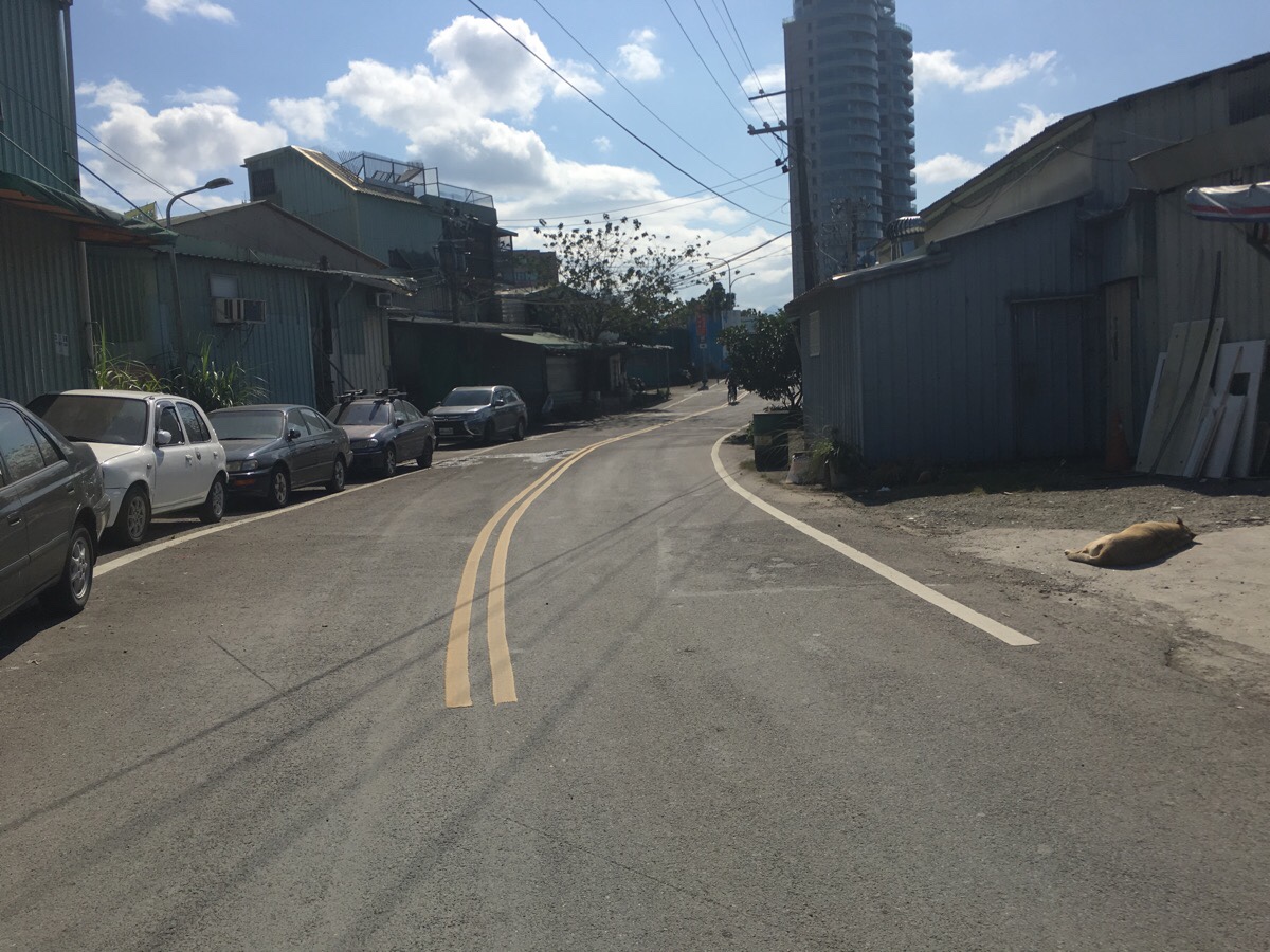
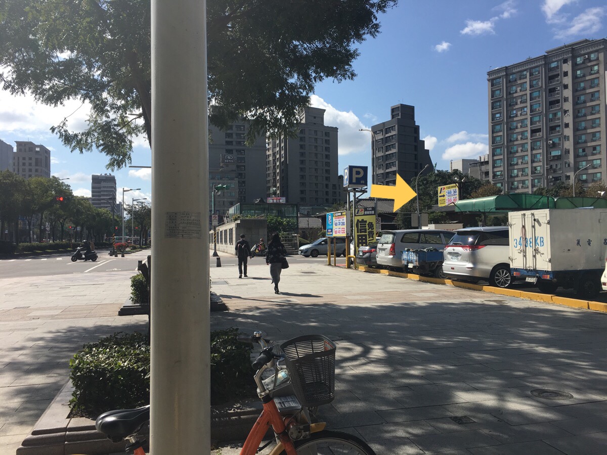
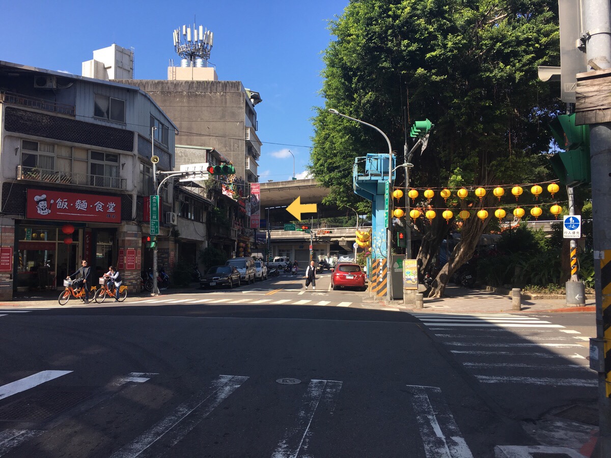
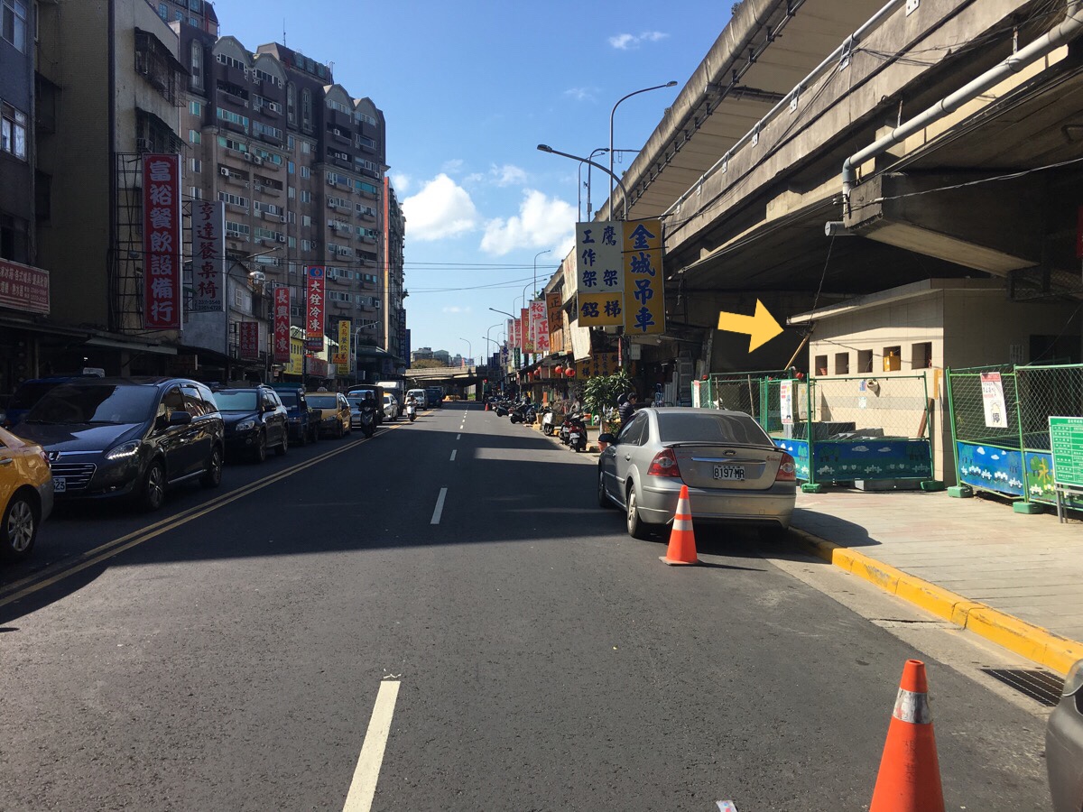
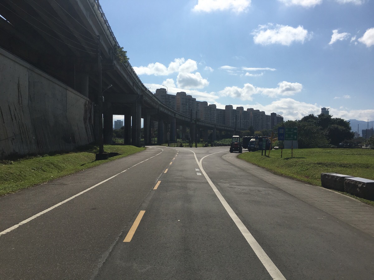
Somewhat jarringly, the bike path disappears at the other side of the bridge and you find yourself cycling through a small industrial area. This section is pretty short though, and where the small road joins a bigger one, the bike trail heads to the right.
Near the place where the road becomes bike path again, you can find this sign. The phonetically correct, (but actually wrong), spelling of the work ‘walk’ is even stranger because these types of signs are normally pretty well done.
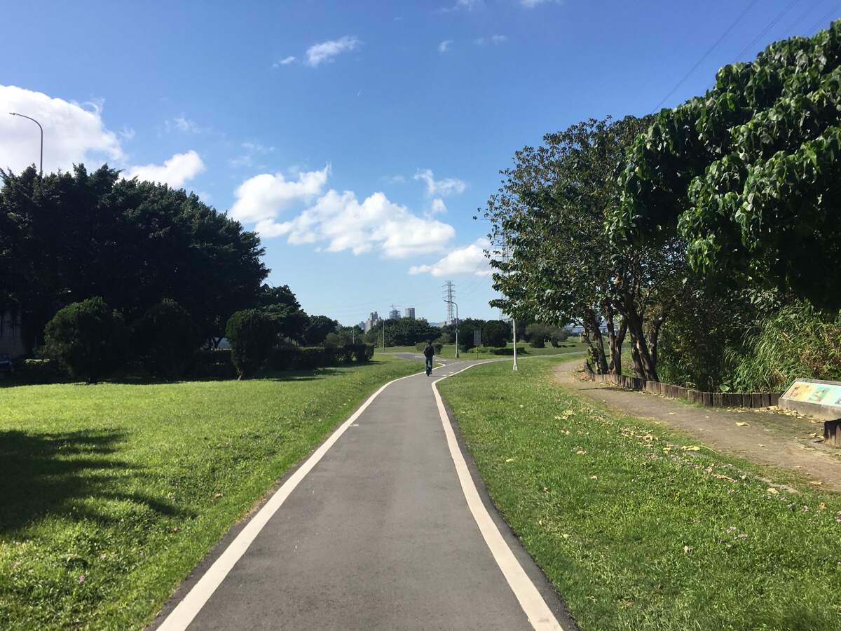
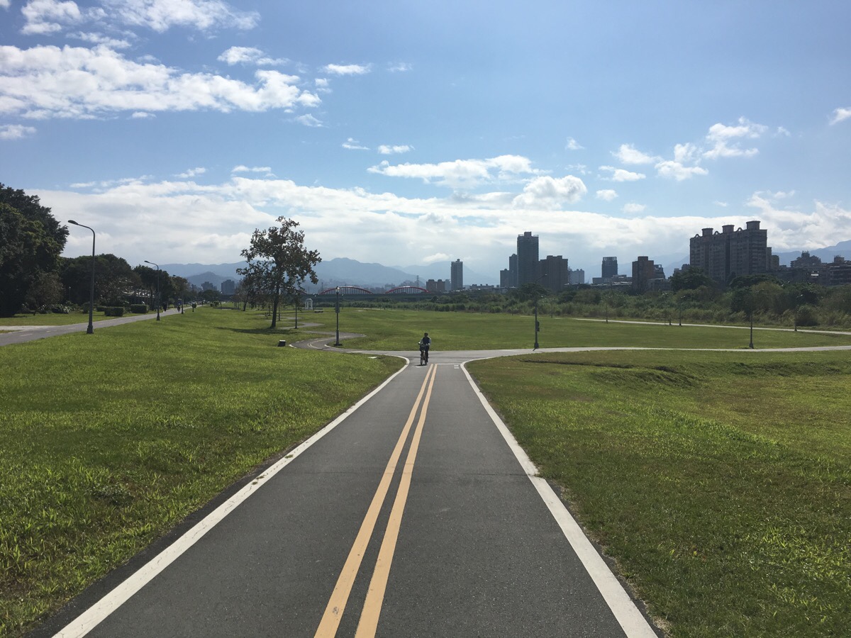
After passing under the bridges, the real beauty of this cycle way starts to show itself. The further you get from the city, the more mountainous the backdrop becomes.
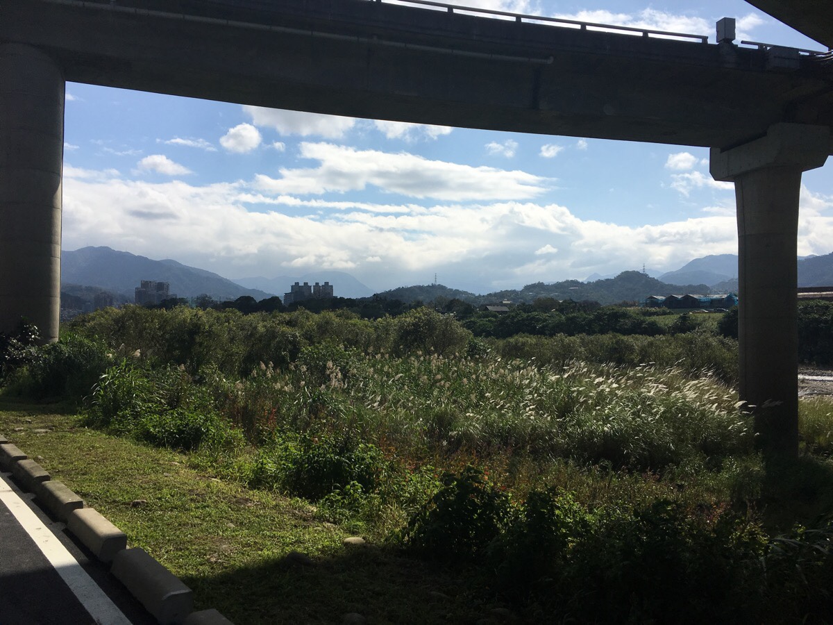
I found the frame supplied by this bridge to be especially aesthetically pleasing. The hard grey concrete lines surrounding the swaying silver grass and mountains beyond.
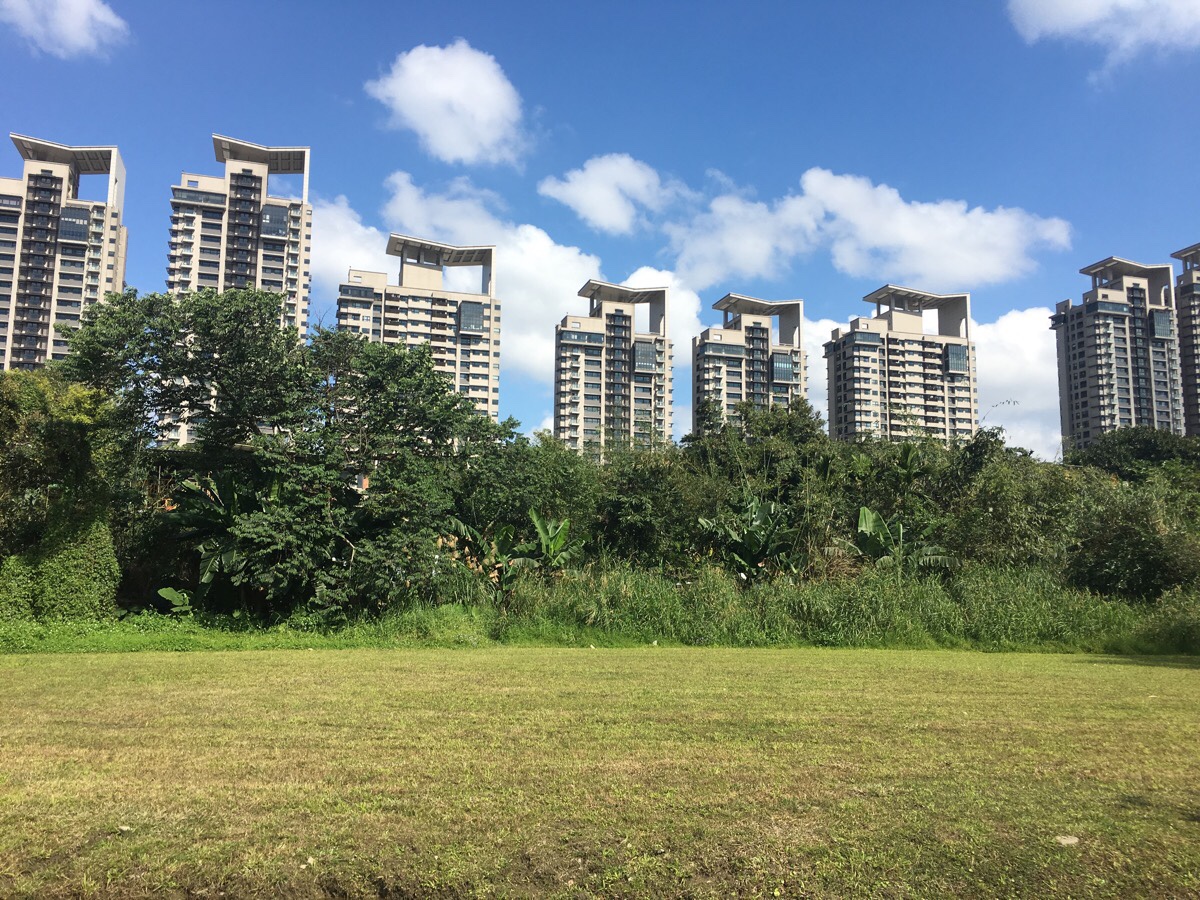
Even something about the weird uniformity of these apartment blocks was visually pleasing.
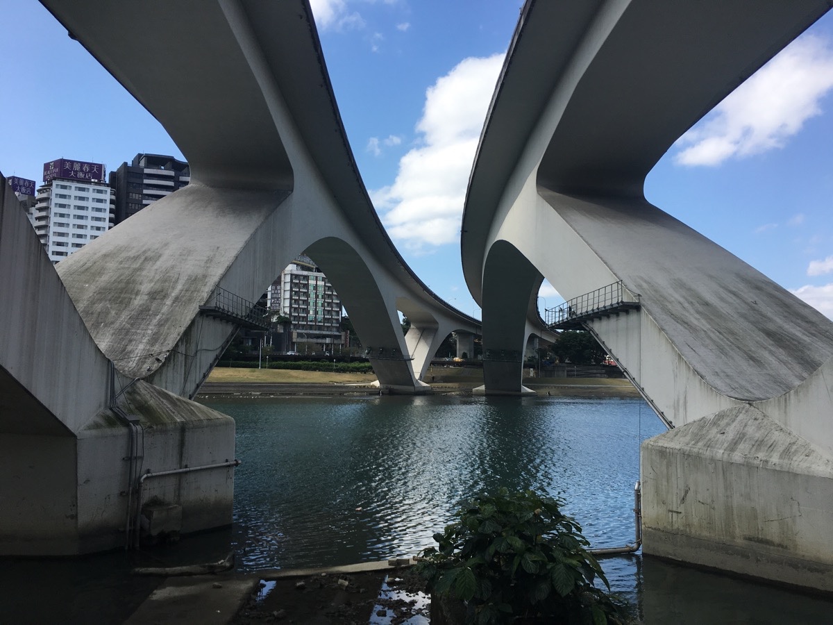
As you near the end of the cycle path, you pass under the twin stretches of Highway 2 Bitan bridge. This impressive structure was built to try and compliment the beauty of Bitan’s natural surroundings, and it somehow achieves that despite essentially being just a huge amount of concrete. At the time, it was the only bridge in Taiwan to use this particular method of construction (known as prestressed concrete), and when it opened in 1997, it became one of Bitan’s tourist attractions. Although I suspect most people who visit now are more interested in the suspension bridge, you can still enjoy the pleasing curves of the road bridge.
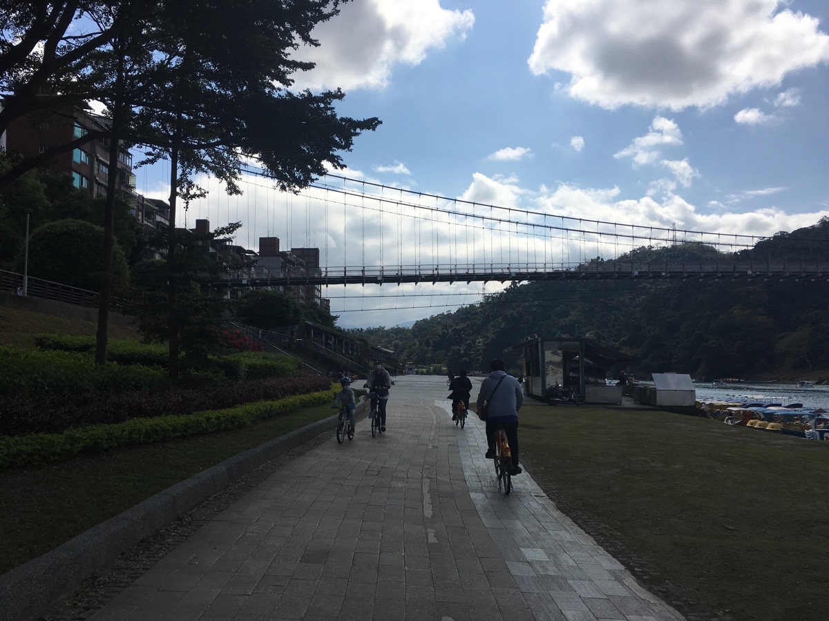
100 metres or so upriver of the highway bridge is the suspension bridge. Crossing over this will lead you to a network of small trails up the hill beyond.
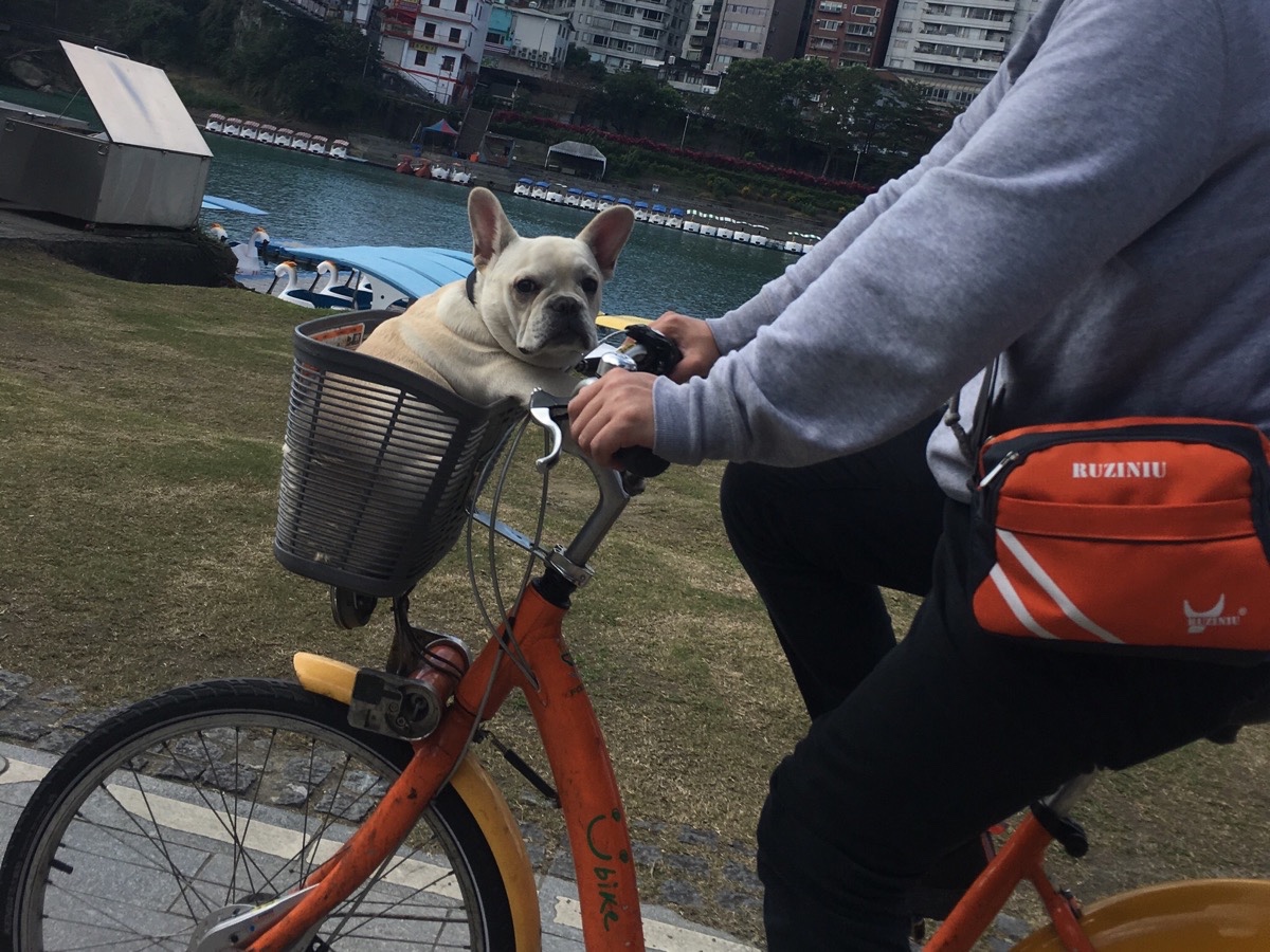
The pictures here are from a Tuesday morning cycle, so there weren’t a huge number of people on the trail. At least one canine and his keeper were put having fin though.
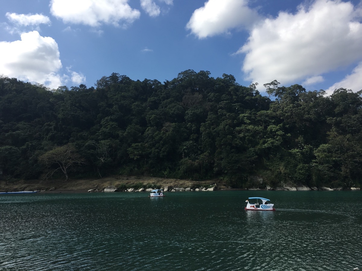
The area here really doesn’t feel like Taipei, it is a lot quieter and more laidback-feeling. People pedal around on the still water of the Xindian river in pedalos, and other people watch them from up on the suspension bridge.
I followed the bike path past a row of restaurants until it curved left and ended in a car park. A ramp just beyond the toilet block takes you up, and then there are steps down the other side where you can dock your YouBike. (The steps even have a channel in the centre for walking your bike down.)
How to get there
Google maps address: I started from the Nishi Honganji Square YouBike stand and entered the river park through Guiyang Evacuation Gate. Then I returned the bike to the Bitan Ferry YouBike Stand.
GPS location:
- Nishi Honganji Square YouBike Stand – N25 02.440 E121 30.460
- Guiyang Evacuation Gate – N25 02.455 E121 29.910
- Bitan Ferry Carpark Exit – N24 57.120 E121 32.280
- Bitan Ferry YouBike Stand – N24 57.185 E121 32.250
Public transport: to get to the first YouBike stand turn left out of exit on from Ximen MRT Station then walk south on Zhonghua Road. Then at the far end, walk north up Xindian Road until you arrive at Xindian MRT Station.
Further reading: the government has some basic information about the path (in Chinese). Here you can find some more basic info about all the various parks that the trail passes through. And this page goes into a bit more detail about a couple of the places you’ll pass through.
Nearby trails:
Xindian River Cycle Map
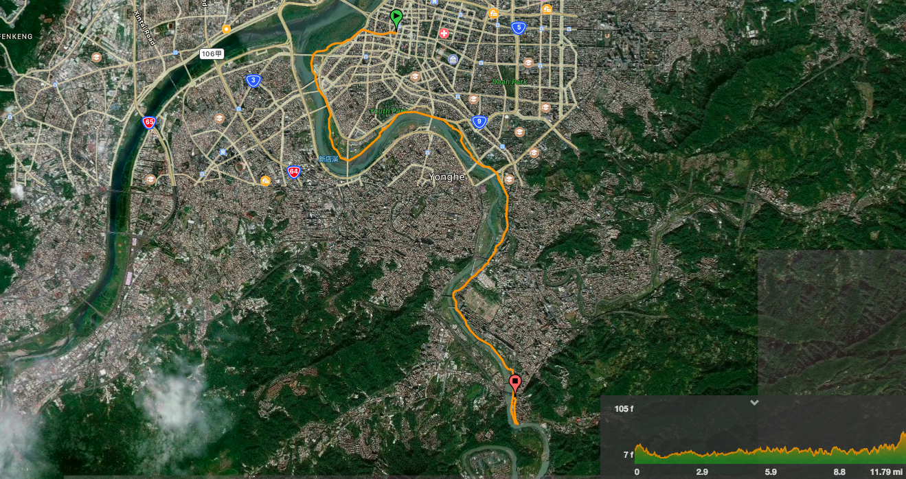
GPX file available here on Outdoor Active. (Account needed, but the free one works just fine.)
This is the bit where I come to you cap in hand. If you’ve got all the way down this page, then I can only assume that you’re actually interested in the stuff I write about. If this is the case and you feel inclined to chip in a few dollars for transport and time then I would appreciate it immensely. You can find me on either Ko-fi or Buy Me a Coffee.

Oh yes! This was my standard running and cycling route until last week. A very good description you are giving.
LikeLike
Ah! I see you’re both here and on Twitter. I assume you’ve moved on elsewhere now then?
LikeLike
Yes – a little bit everywhere.
I lived four weeks in Guting while taking Mandarin classes. The photo you took near Hakka Park was where I started my runs and cycling.
Now back in Germany.
LikeLiked by 1 person
I miss this bike route – Ronnie
LikeLiked by 1 person
Is this *the* Ronnie?
LikeLike