Distance: 7-8km or there about. Two of us recorded it and had wildly different distances, but most other walkers have recorded somewhere between 7 and 8km.
Time: 8½ hours – it took us about 4 hours to get up and about 3 hours to get down, so the total also includes rest time. Many local teams seem to do it in around six hours.
Difficulty (regular Taiwan hiker): 6.5/10 – the path is steep and tiring, but not actually technically difficult, and there are plenty of ropes to assist in the trickier sections. There aren’t that many hiking tags or trail markers compared to other similar trails, but the path is reasonably well defined and I didn’t have too much trouble finding the way.
Difficulty (new Taiwan hiker): 8.5/10 – we took a relatively fresh hiked with us and she said rated it as a 8/10 for difficultly. I think she did very well, and she was able to get up there because she already has a pretty good level of fitness. If you’re new to hiking, or this type of hiking in Taiwan, it is essential that you give yourself enough time, (wherever you are at about 1:30pm, you should probably start to head back in order to avoid getting stuck up there overnight). I’d also recommend that you have a map/GPX route to follow and take plenty of water.
Total ascent: about 800m to a high point of 1852m at the top of Jian Shan.
Water: we took 7L between three of us, a little under 1L was used for cooking and making coffee and we each drank around 2L. This was pretty much all finished by the time we got back to the car, so it’s worth leaving a spare bottle in your car/scooter for when you get down.
Shade: most of the walk was well-shaded, but I suffered in the sun at the summit. If you’re particularly affected by sun, you might want to take a hat or towel to protect your neck.
Mobile network: remarkably pretty good most of the way. I only noticed black spots in a couple of locations.
Enjoyment: honestly, this one is hard to define. There were portions of the walk where I felt like I never wanted to leave the mountains, and others when I cursed Teresa for choosing this route. I think part of the stress was knowing that we were responsible for having another person with us and I wanted her to enjoy herself, so all of the challenges felt slightly more stressful than they would have if it were just the two of us. However, the trees, the forests, the greens, the wide mountain views, even the hellish mud (in hindsight), were great. Put it this way, if there hadn’t been a lovely view at the top, I would have felt a lot less inclined to recommend this. But there is, so it’s worth it.
Other: you’ll need gloves and good, waterproof shoes. The trail conditions are muddy even in good weather, so footwear is particularly important. If you have hiking poles, they would definitely help too, but we did fine without. Also, make sure you take enough food and salt candy to keep your muscles running well. Finally, we brought our basic hiking first aid kit with us – this hike is really remote, there’s no short-cut to get back and you’re not likely to run into many other people, better safe than sorry.
Permit: none necessary.
Jump to the bottom of this post for a trail map, GPX file, and transportation information.
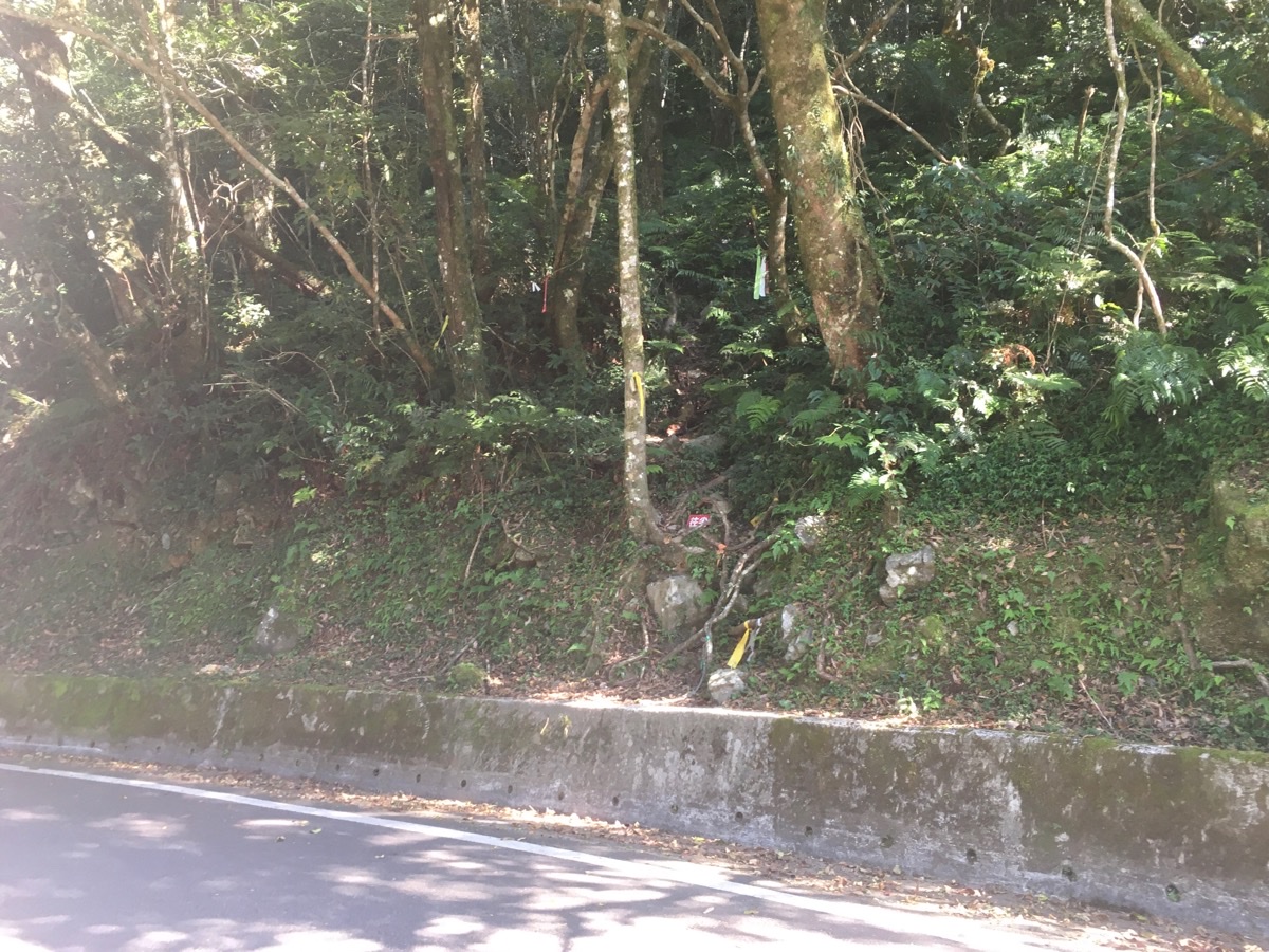
00:00 – We left our house at around 5:45, grabbed some breakfast and after a rather long drive we parked up next to the 58.6 mile marker. There were already a couple of cars and a scooter parked in the spaces next to the road, and if there had been one more car we would have had to find a slightly further-away spot.
Following a bit of faffing around with shoes and bags and bits, we set off and found the trailhead. By the time we were at the entrance and ready to go, it was 8:50. There used to be a marker attached to the tree, but it’s fallen down and now there are just a few trail tags and the tell-tale wearing of many boots to indicate where the path starts. I imagine that many people drive straight past without realising there’s anything there at all. It’s actually right next to the entrance to the more popular Sileng hot spring trail, and in fact that was how we first learned of this route, (but it took us almost three years to get back here). That previous time we headed downhill, this time the walk was up, up and more up right from the very start.
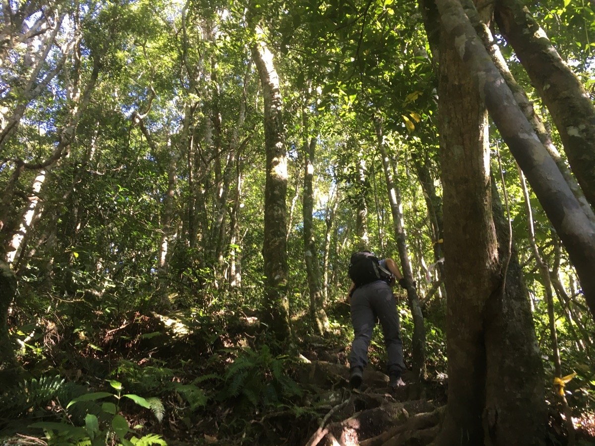
00:13 – You will quite quickly know whether or not you’re up to the task. The trail starts of with a steep climb over tree roots and the occasional boulder. This was our first ‘proper’ hike since we visited Yunsen Waterfall, and so I went bounding up, all over-excited to be out in the wild places.
After about 35 minutes of climbing I smelled the unmistakably fragrant scent of Taiwanese cypress in the air, and we noticed the chainsaw-cut stump of a tree just off trail to the right. There is a sign nailed to the stump which dated as being left earlier this year. Thankfully this was the only evidence of illegal logging that we spotted.

00:47 – By the next sign urging you onwards and upwards towards Jian Shan a tree has fallen across the path, and so a new path has been beaten around to the right. For almost all of this hike, the trail was pretty straight forward. There weren’t a huge number of hiking tags, but somehow the path was always just defined enough that it was easy to follow.
Not far beyond this point the trail crests a small peak and then dips down a little. The sound of rushing water drifted up from the valley to the left of us, and even though the map I was reading suggested otherwise, I was worried that the trail would take us deep down the slope before making us climb up once more. Thankfully, the map was accurate, and the descent registers as barely more than a blip on the altitude profile of the walk, (despite this, it certainly registered as more than a blip when we were returning with tired muscles).
As the trail started to climb again, we were all startled by the decidedly unbirdlike grunts-squawks of something off-trail to the left. It wasn’t so close, but close enough that we could hear it crashing about a bit, and it had a very bizarre cry, and until the more squawky sound started, I wondered if we hadn’t perhaps disturbed some wild boar. I think there may actually have been a pair of them, but we never caught sight of anything.
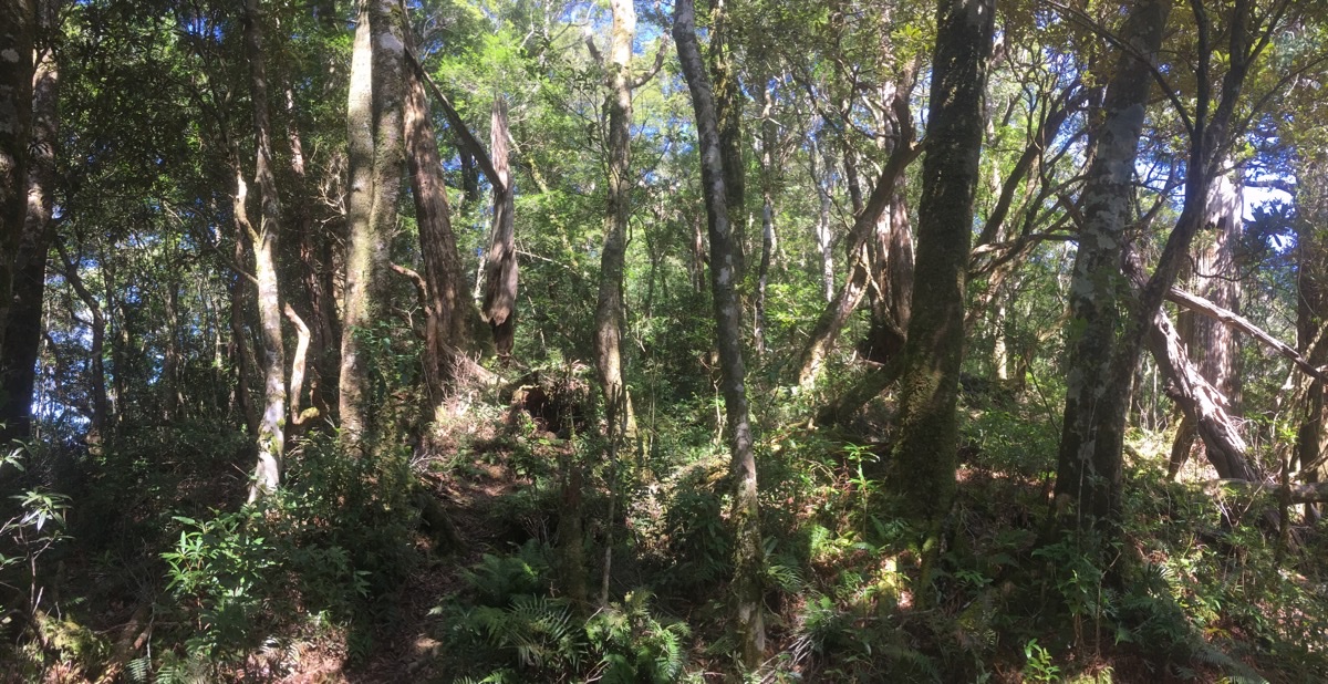
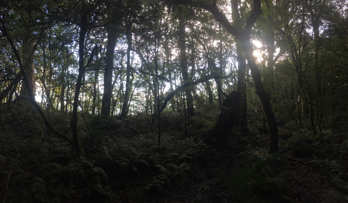
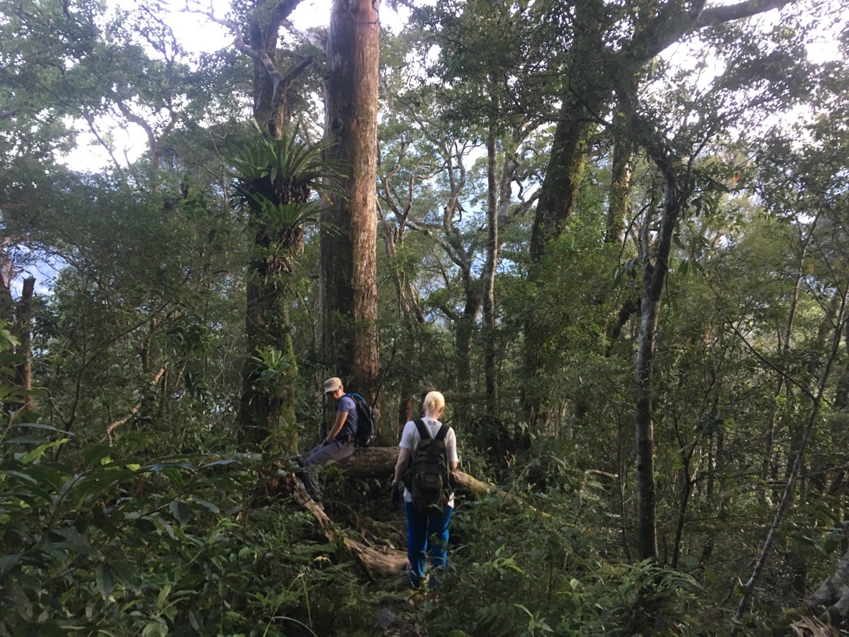
01:31 – The trail continued to climb reasonably steeply, but despite that it felt pretty good, not too tiring, not too hard. There were several places where felled trees presented obstacles, (or to Teresa’s mind ‘thoughtfully placed benches’). I think we didn’t even spend that long stopped to catch our breath. As the trail heads up, it passes a couple of groves of humongous trees. Some had fallen down, and even their dead stumps towered above us. But the many living ones stretched up far beyond our heads and providing enough shade to let all the fungi and ferns grow abundantly.

01:52 – Nearly two hours after we started we reached the first and only real junction. There’s a small clearing with a fallen tree that provides a perfect bench. The remains of a couple of small fire circles suggested that people have probably used this as a camping location. We stopped for about twenty minutes here to rest up a bit and have some snacks. K had brought some Wang Wang crackers (a great snack choice), and the packet had swollen up to the point where it appeared as if it might pop. We figured it must be due to changes in altitude, but this was the first time we’d had something swell up in this way so it was a little strange.
Once we were rested up, we took the path heading downhill (to the right as you enter the clearing), which is signposted as heading towards Jian Shan (往尖山).

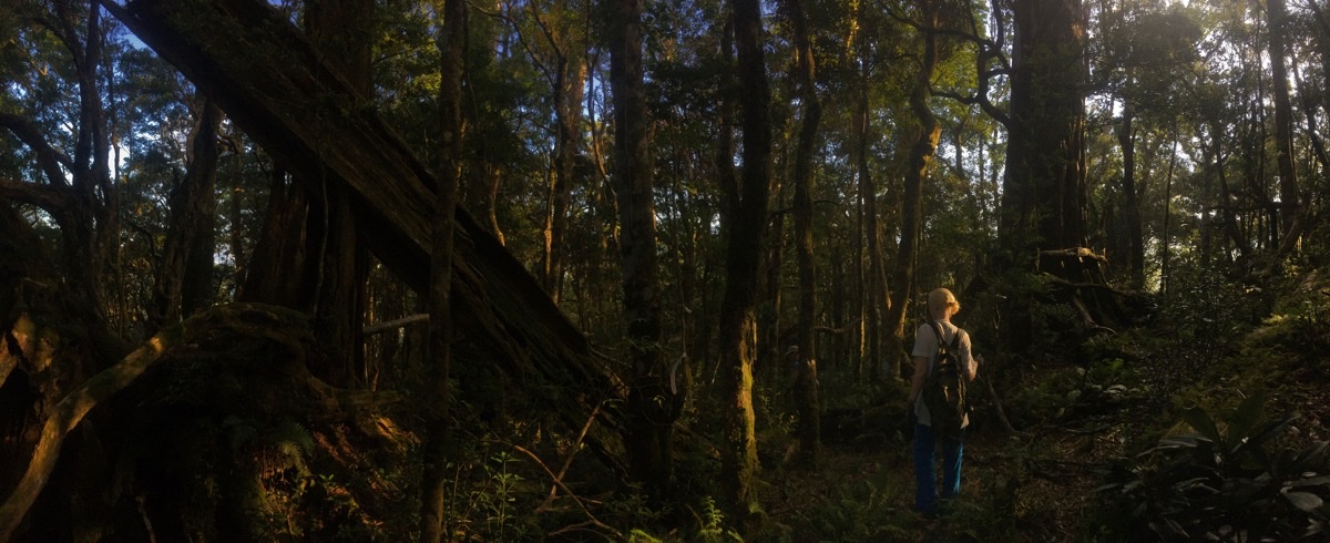
I thought I knew what to expect from reading the map prior to setting off. It looked like we were going to do a steep climb, followed by a much easier section of ridge walking before a final steep push to the summit. Generally speaking ridges are a lot easier to walk along than the slopes leading up to them, and broadly speaking that initial expectation was correct. However, ridges of these high mountains are far wider than their lower counterparts, and as a result the conditions are very different.
At first it was pretty much as expected, the path snaked forward though beautiful old forest, and we were making good progress. But then the first of several challenges presented itself: mud. The combination of broad, flat ridge and cloud-catching foliage had resulted in the path becoming a series of squelchy puddles. Progress slowed as we were forced to step carefully through and around the mud. More enjoyably, there were also many huge trees to appreciate and the old forest was majestically pretty.

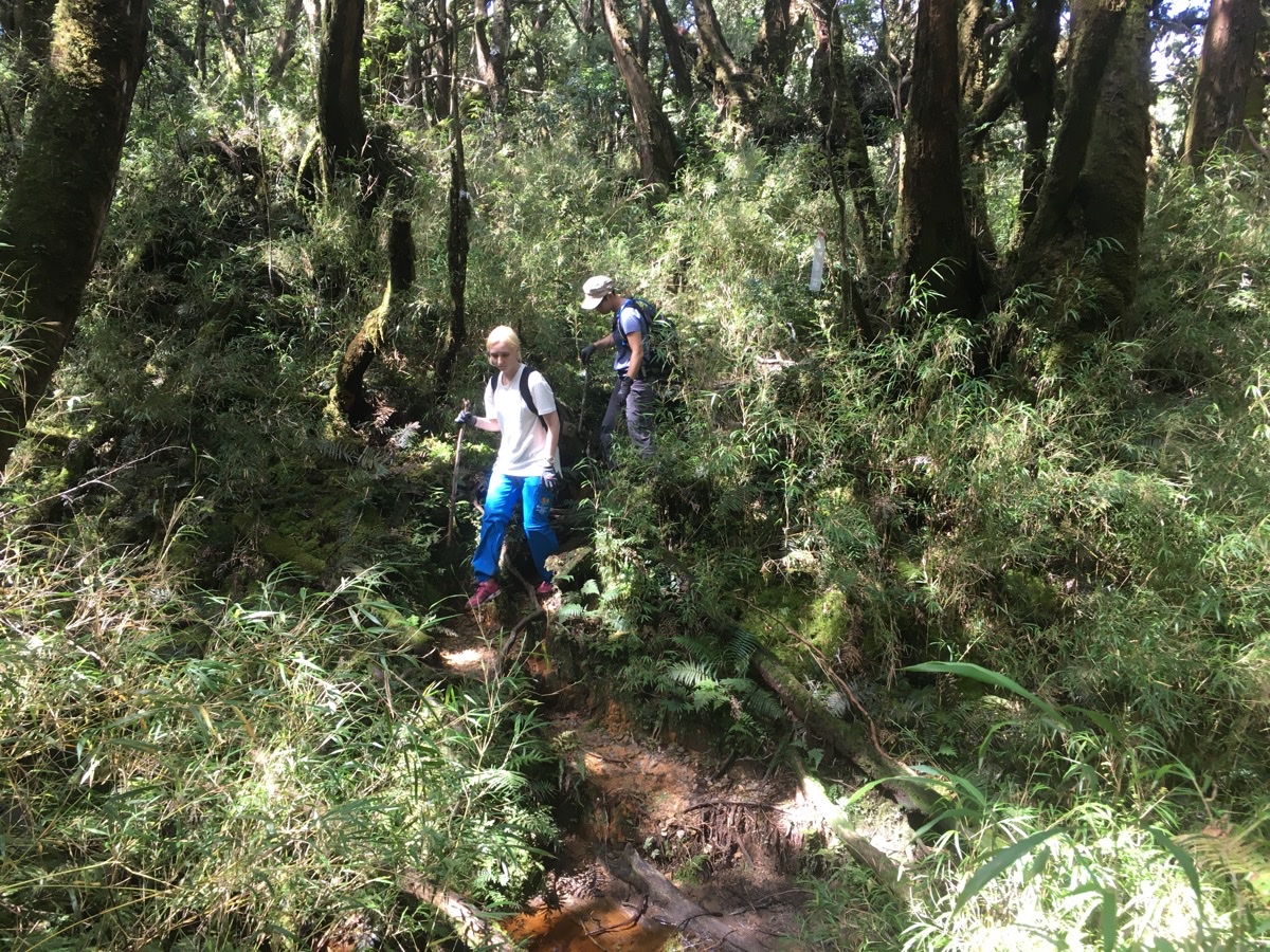
02:45 – The next challenge that the trail has to offer is a section of path-obscuring arrow bamboo. I was the front walker, so I had the less than enviable job of waving away all the spider webs. I really don’t like these types of trail conditions, so although it was probably less than 100m, it felt a lot longer.
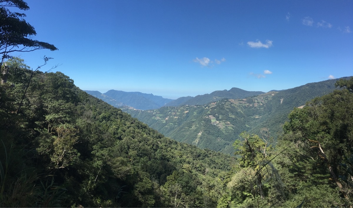
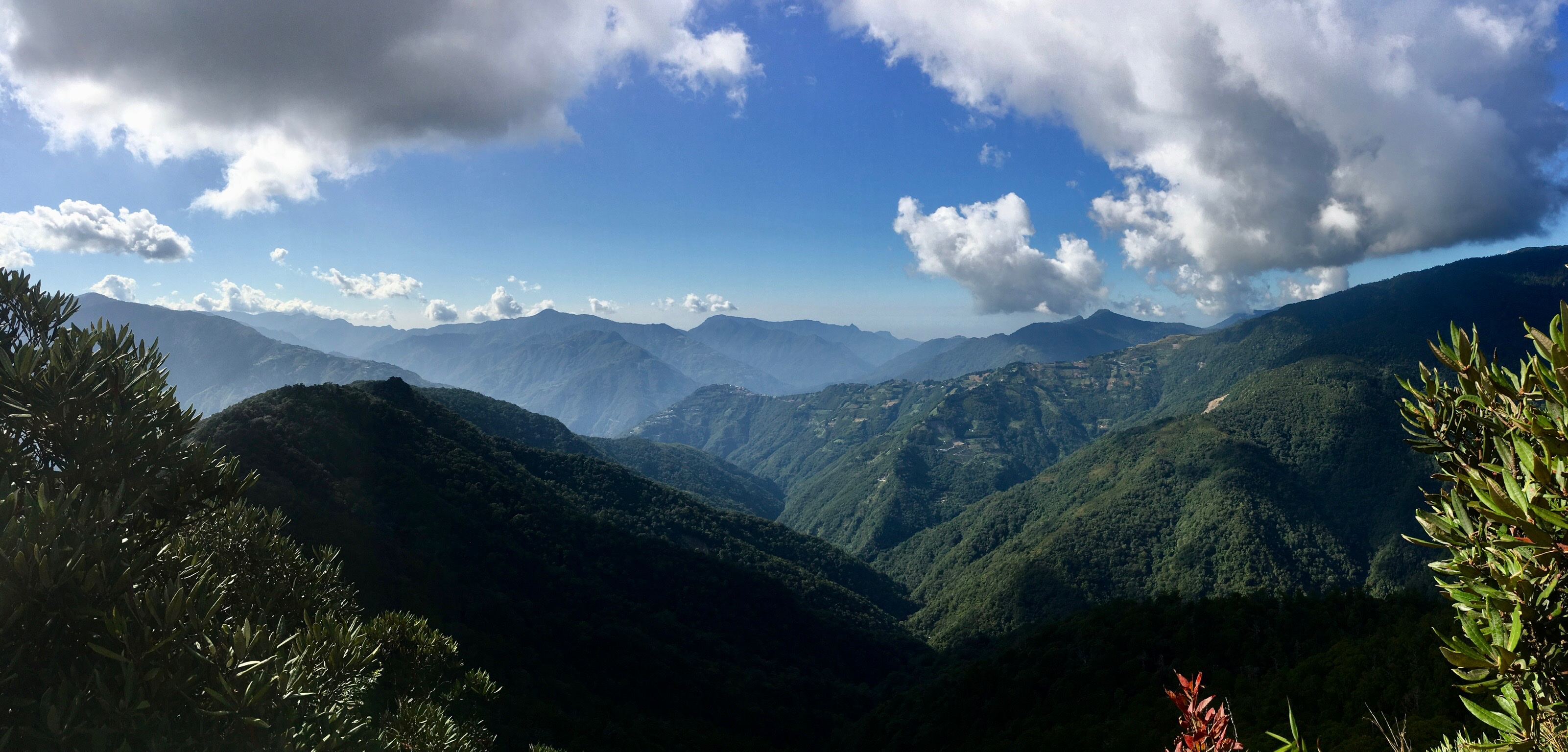
02:47 – When the short slog through bamboo is mostly over, the trail breaks out into a small clearing with views over the valley. This is the first view of the walk, you have a clear line of sight over to a little mountain community (many campgrounds and peach farms) near the start of the Tamanshan trailhead. (One day we hope to do this one.)
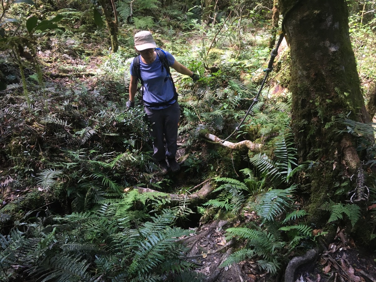
02:54 – Walking away from the view point, the bamboo continued for a short way, and then after a brief respite the muddy floor returned. A little further on there was this point where you have to use tree roots to step across a narrow 1.5m deep g ko ully cutting through the forest floor. It looks like it must become a proper stream on rainy days, but when we passed through it was just damp.
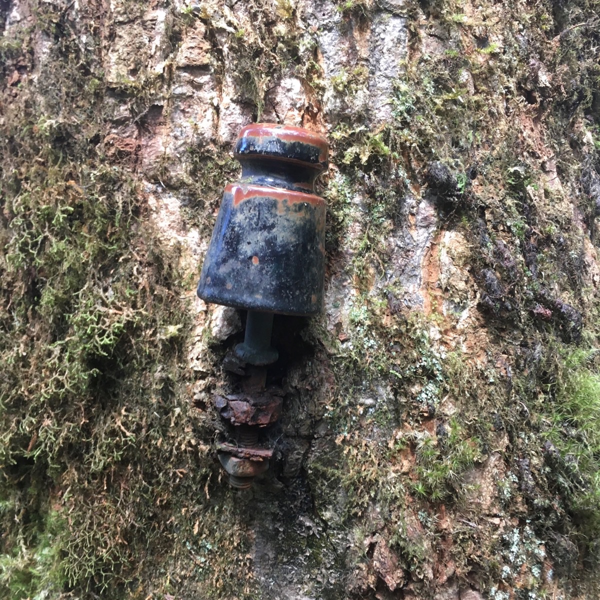
03:09 – As I was waiting for Teresa and K to round a large tree, I spotted several of these ceramic insulators growing into the trees. This isn’t the first time we’ve seen them, I definitely remember spotting quite a lot when we walked Batang Zong Zou, and I think at Jiali Shan too. They’re normally a good indicator that the Japanese were active in the area, although unlike those two places, it doesn’t look like they were doing much logging up here, (no whole mountains covered in Japanese cedars), so I’m not sure what they would have been used for. Maybe it was used for telecommunications during their efforts to control the country from up high.
03:12 – The path continues in a very boggy, muddy, gloopy, swampy, soggy, sludgy, squelchy fashion. We had to skirt around the edges of the trail and tread carefully on the roots or fallen branches to avoid sinking in up to our ankles. Personally, this didn’t bother me as much as the bamboo, but K did not enjoy it at all.
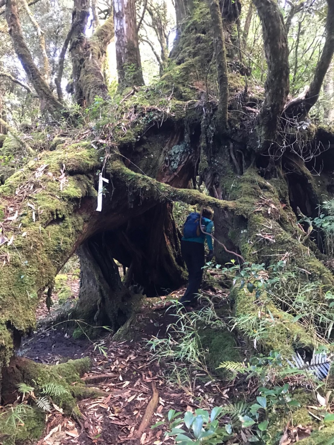
03:18 – Despite the mud, the forest remained utterly enchanting. There are so many large trees, (Taiwanese and Hinoki Cypress I think). One such tree was this moss-clad beauty whose roots formed a tunnel/magic portal through which we all had to walk.
Eventually, we started to climb out of the bog, and just as the path began to get steeper I was started by a flash of movement on the trail ahead of me. I hesitated to let my eyes pick out the moving object better and was surprised to see a human coming towards us. Two humans actually. They were already on their way down. I asked if they’d come up the same way and they said that they had. They also asked if we’d brought headlamps (we had, we always do these days if we’re doing a remote walk we haven’t done before), and warned us to make sure we started the descent as early as possible in order to avoid being caught in the thick fog that sometimes comes down around the mountains here.
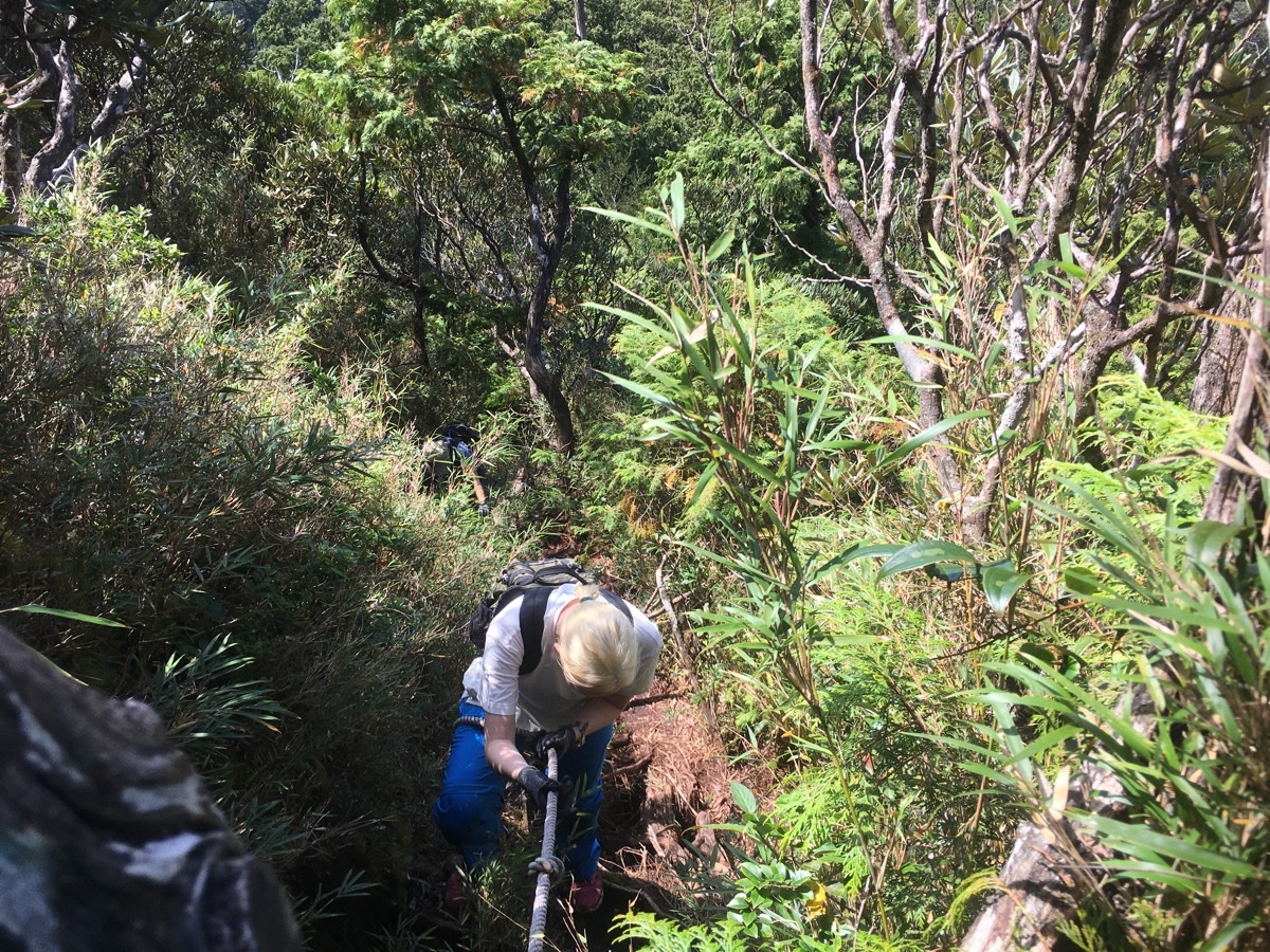
03:45 – There is another red sign which says “加油哦! 尖山基點快到了!” (Keep going! You’re nearly at the top!) And then the final ascent to the summit starts. As well as the walking shifting up a gear, the surrounding trees change. Gone are the giant trees, and in their place is a lot of tough arrow bamboo and the rhododendron bushes that invariably grace slopes at this elevation.

There were plenty of ropes and roots to make climbing pretty straight forward. And there was only this one location where I had to work through a couple of possibilities in order to keep heading up.

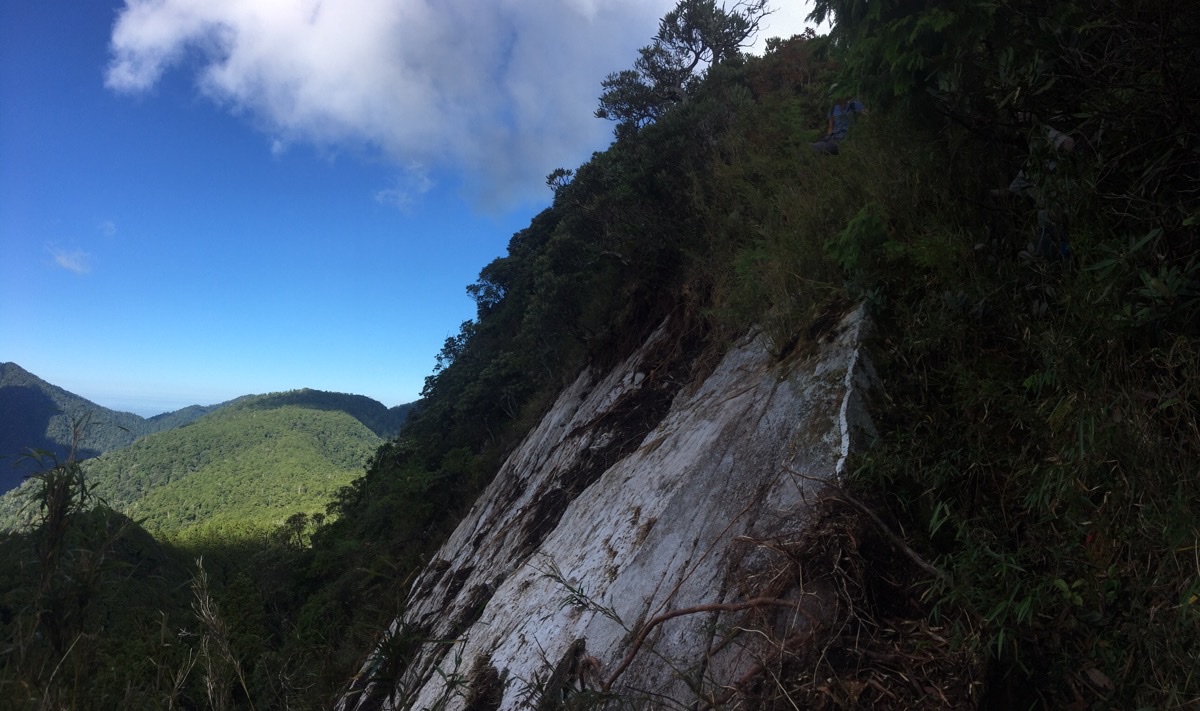
03:51 – The higher we climbed, the better the views became. When the trail re-entered the tree line again, there was an almost 90-degree drop off to the right and a bizarre landscape of trees growing horizontally away from the mountain. (Despite my efforts, no photographs could do this justice, they just looked like I’d rotated the image weirdly.)

03:58 – This is the view west southwest of the trail, and I am pretty certain that the closest, darkest ridge is the one we walked up. The trail is an L shape, so here we would have been looking back at the foot of the L.
04:03 – Right before the summit we encountered the hairiest section of the whole hike. The path seemed to terminate at a bald rock face, and initially I thought I must have come the wrong way, but a less defined trail trodden into the grass to the right became visible. It didn’t look anywhere near as defined as the rest of the route, so I went ahead cautiously to see if it was passable. It was, but it was right at the limit of my comfort zone. In order to rejoin the more established path, there was a point where you have to step out over the rock face with nothing below you. (If you zoom into the picture above you can see the blur of Teresa’s T-shirt just beyond this point.)
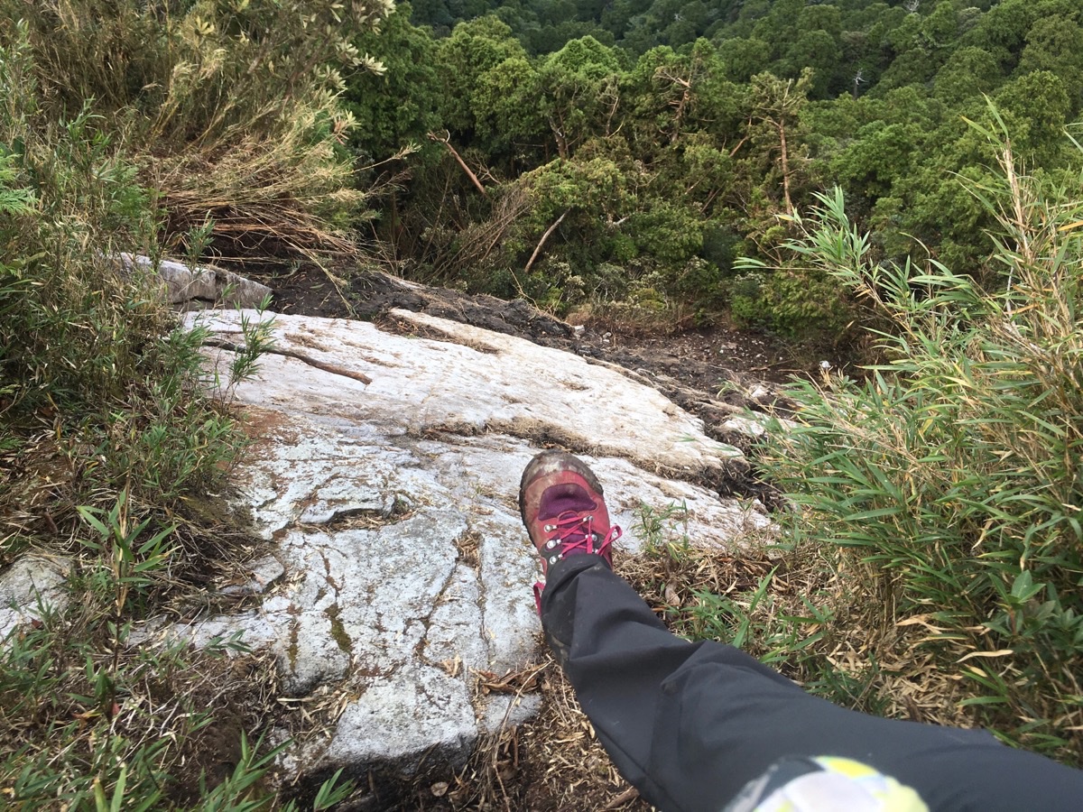
I manoeuvred myself over by hugging tight to the rope and the plants making sure that my centre of gravity was angled forwards into the rock rather than back and away from it. It wasn’t so much that it was difficult, but it was scary, and I was might relived to plant my feet firmly on the trail beyond. K seemed to share my (sensible) fears, but Teresa just breezed on over as if it were nothing more than climbing up a step.
Actually, after getting home and studying plenty of Chinese blogs outlining the route, I’m pretty sure that this section of path has collapsed within the past couple of months since there are no pictures or mention of this part (and most local hiking blogs tend towards documenting every single tree, so that seems strange that they’d leave such a risky feature out). Even the trail looks pretty recently beaten.
Right before the peak the walk offers up its grandest view. (The peak itself is somewhat surrounded by bushes, you can see, but the view is partially obscured.) Suddenly all the mud and bamboo seemed worth it.
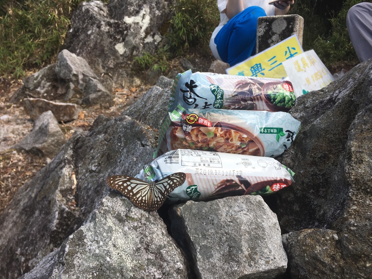
04:07 – We didn’t waste much time in getting the stove set up and soon we had cups of coffee to drink whilst we prepared lunch. We’d brought our standard fare of instant noodles, vegetables and some tofu. But before I could get the noodles going, this butterfly decided that our lunch looked mighty tasty. It spent a good ten minutes fluttering around the peak.

We spent an hour and minutes preparing, eating and then cleaning up after lunch, so by the time we were ready to set off again it was about 2:15.

Heading back down the same way as we’d come, the views were in front of us this time and I felt reluctant to dip back down into the tree line.

The return walk was an interesting psychological experiment which neatly demonstrated the concept of time being relative. All of the less pleasant portions of the trail, the parts that involved hard climbs, mud or bamboo were far shorter than they had been in my memory, whilst the other sections felt much longer this way round.
From the summit, it took us 1 hour and 8 minutes to get back to the clearing with the view.
To get back to the junction with the fallen tree where we’d had snacks earlier it took 1 hour and 40 minutes from the summit.
The forested ridge seemed like a more alive place than it had been when we first walked through, birds sang and the sun cast everything in a delicate glow.
As we descended the spine of the ridge back down to the road we walked into the magic hour. Both K and I have a passing interest in photography and so we were enthralled by the golden light. It’s the perfect accent to bring to life all those greens and browns, and when combined with the varied textures of mosses, ferns and bark it becomes like a feast for your eyes.
Where the path reached the slight dip and climb (the part where we could hear running water), we heard something crashing and squawking to the left of the trail. It seemed as if we had disturbed it and it was trying to get away. We didn’t see anything, but if I had to bet, I would guess that it was a mikado’s pheasant. We’ve seen them in similar habitats before, and they make quite a bit fuss whilst trying to get away from you if startled.
The sound of cars and scooters travelling along the road below us was a welcome noise. We all had tired legs and personally I couldn’t wait to get out of my rather gross hiking clothes. It had taken us 3 hours to get all the way back, and we made it with about forty-five minutes worth of daylight to spare.
We got changed out of our dirty clothes on the side of road, and just as we were decent again, a large group of youngsters climbed over the guard rail where the path leads down to Sileng hot spring. It would have been perfect if we’d had enough time and energy to have a soak in the hot spring after the walk, but I guess we’ll have to leave that for another day.
How to get to Fuxing Jian Shan
Google Maps address: marker 58.5 1 號, Datong Township, Taoyuan City, 267
GPS address: N24 38.721 E121 26.116
Public transport: not so easy, there’s almost no public transport up here.
Further reading: this post written in Chinese documents all of the fungi they saw (a lot), as well as how muddy it can get. I couldn’t see any more English info on it.
Nearby trails: the Sileng hot spring trail starts from exactly the same place.
Fuxing Jian Shan Trail Map
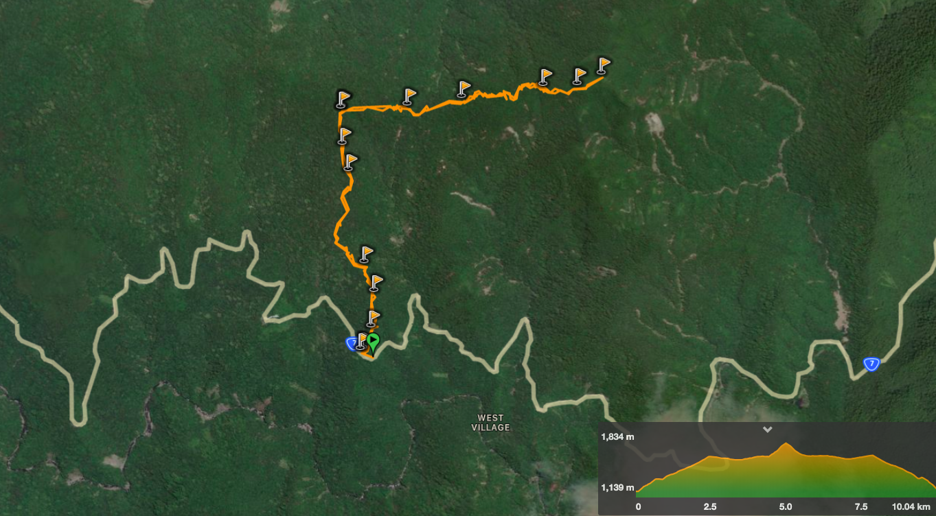
GPX file available here on Outdoor Active. (Account needed, but the free one works just fine.)
My new words learnt on this hike:
- 自給自足 / zìjǐ zìzú – self-sufficient, we were talking about the farmers who live in these small mountain villages
- 土石流 / tǔshíliú – landslide
- 開心果 / kāixīn guǒ – pistachio nut, this was taught to me by K, (I’d brought some as a snack).
- 煩惱 / fánnǎo / upset or annoying situation – I know hear this a lot, but it’s still been hard to pinpoint the correct usage for some reason
This is the bit where I come to you cap in hand. If you’ve got all the way down this page, then I can only assume that you’re actually interested in the stuff I write about. If this is the case and you feel inclined to chip in a few dollars for transport and time then I would appreciate it immensely. You can find me on either Ko-fi or Buy Me a Coffee.
