
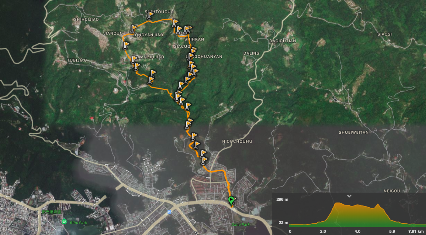
Distance: 7.9km
Time: 2½ hours at a reasonable pace.
Difficulty (regular Taiwan hiker): 4/10 – the climb up to Dragon Boat Rock is steep and has some slightly tougher ropes sections, but it is short. Directions aren’t in English for portions.
Difficulty (new Taiwan hiker): 6/10 – the climb will be quite physically taxing, a couple of sections require upper body strength, (although I am puny and still managed it). The climb from the river up to the peak is unpaved and has fixed ropes, it’s not too difficult, but it will be different if you’ve only done steps before. Also, if you’re worried about directions, make sure to download and follow the GPX file and/or take a friend who knows where they are going.
Total ascent: about 360m – around 300m of which is done in one 700m section, (check out the elevation chart).
Water: I took about 1.5L on a warm day, there are water dispensers at the entrance to the Liyu Shan trail (N25 05.755 E121 35.350), and at the entrance to Bihu trail (N25 05.455 E121 35.770) where you can fill your water bottles up if necessary.
Shade: the climb from the river is shaded, but the road section is completely exposed.
Mobile network: the section from the waterfall down to the park is pretty consistently black, but this is a very popular and safe trail so it’s no worry.
Enjoyment: It’s a great walk with plenty of variety, ropes, views, a reasonable distance covered, waterfall, and the option of nearby temples if that’s your thing.
Other: I appreciated having gloves on for the climb.
Jump to the bottom of this post for a trail map, GPX file, and transportation information.

Leaving Dahu Station via exit 1, follow signs pointing up Dahushanzhuang Street towards Liyu Shan and Zhongyong Shan Hiking trails.

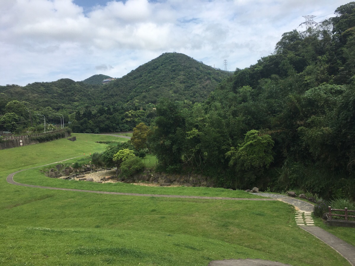
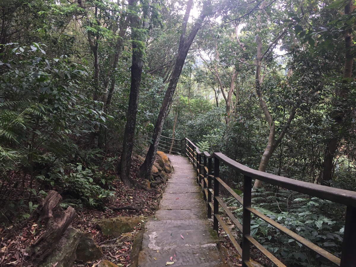
The road curves around to the right and eventually terminates at Daxigou Waterfront Park. You can head through the park either via the road to the left or up the steps in front. I think the route up the steps is a lot prettier since it takes you right alongside the stream.
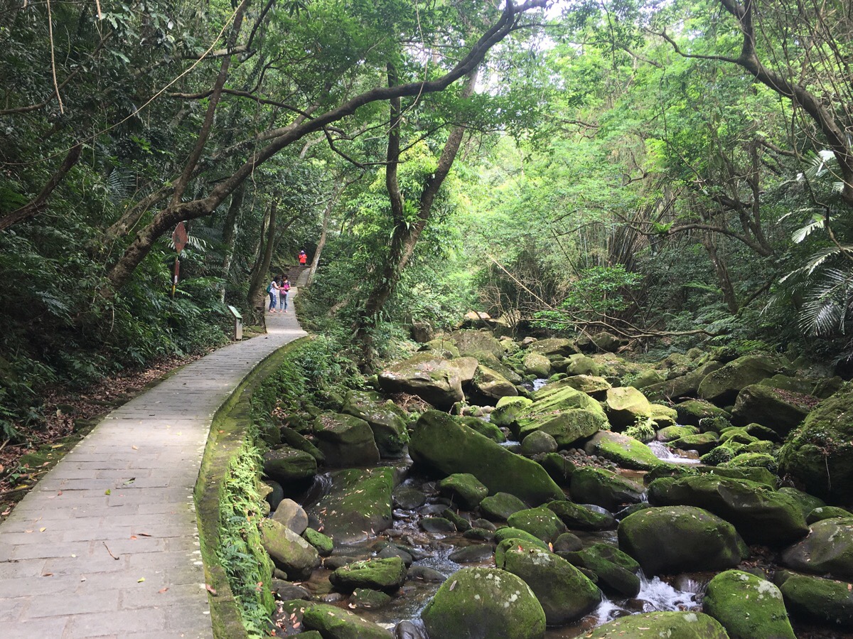
Follow to path down to the water and cross over to continue walking up the stream. The water is clear and filled with lots of fish. I noticed maybe three or four different species, but I am no fish expert. Keep following this path at water level until you have no choice but to climb the steps next to a shelter. At this point, the plants growing in the stream were alive with butterflies – there were hundreds and hundreds of them. I’m not sure what species they were, the top surface of their wings was a dark and dusky blue, whilst the underside was brown.

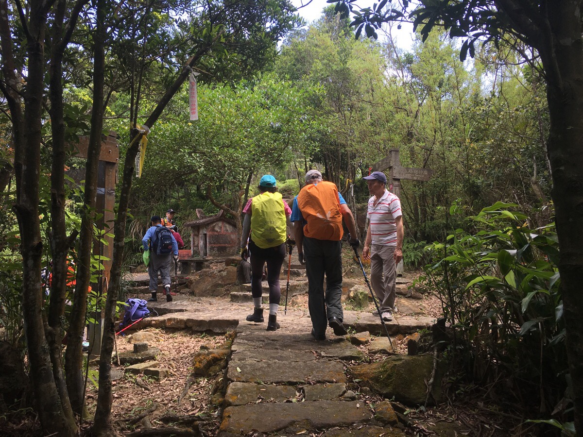
As the trail reaches the far end of the park, I had to cross over two arched bridges. (The second one is where the brightly coloured group of hikers is in the picture.) Over the second bridge, turn left and keep following the water upstream.
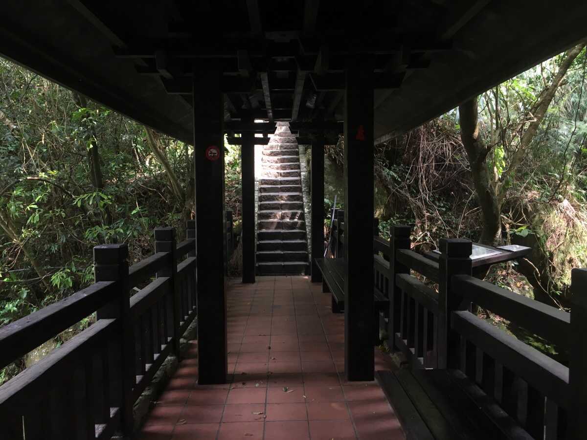
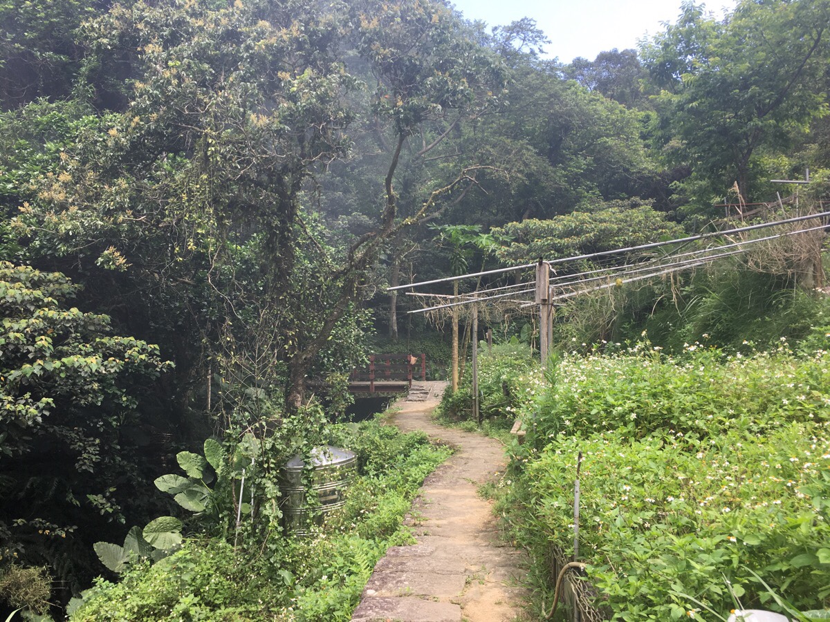
A wooden, roofed bridge crossed back over the water once more. From the near end of this structure you can get a glimpse of a small waterfall tipping down into a small pool. Bizarrely, on the downstream side of the bridge there is a camera and large light set up. It looks like a regular CCTV camera, but I don’t believe that there would be any need for that in this location.
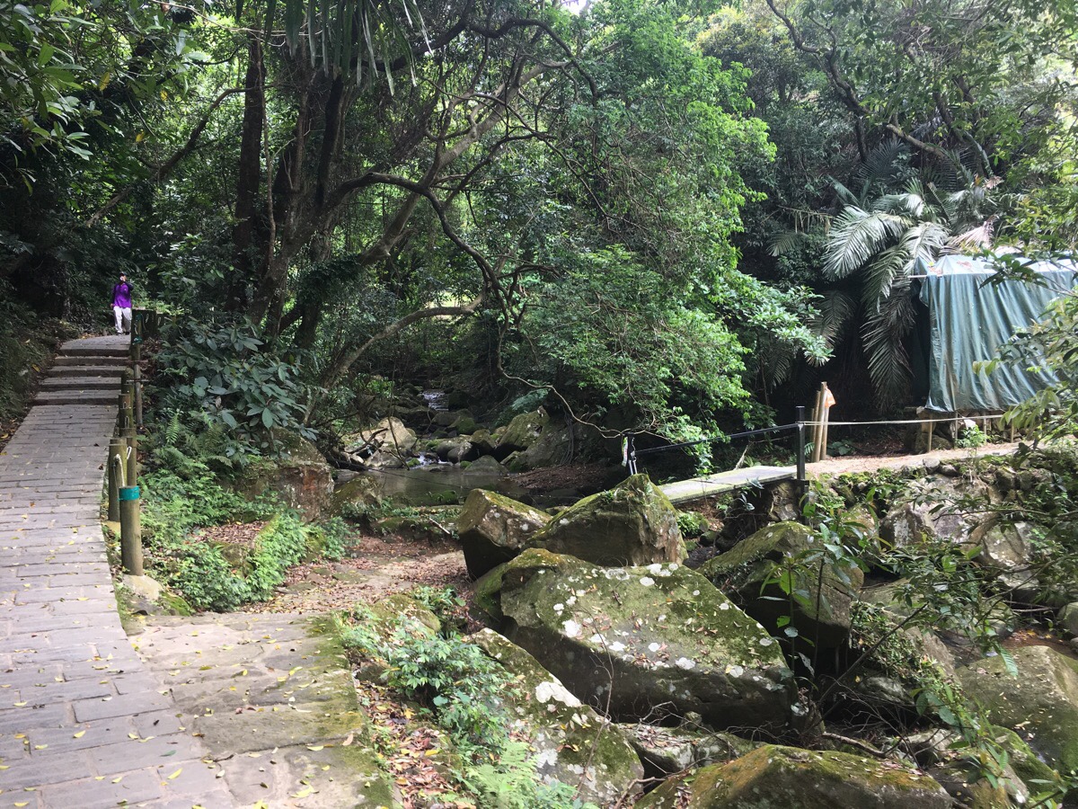
The path running up along the river is the perfect gentle warm up. Smoothly, comfortable, and just slightly uphill in order to get your muscles working. You’ll notice a trail on the left heading up to Liyu Shan, and if you keep your eyes open, you might spot a tiny temple up on the opposite bank, overseeing the flow of the river.
A couple of hiking tags attached to the posts of an unassuming metal bridge mark the start of the trail up to Dragon Boat Rock. I stopped here to get my gloves out and have a drink before starting the ascent. The brightly coloured hiking group (which I’d passed whilst they were admiring some things which looked like catkins), reached me and did exactly the same. It turned out that I was going to have company.
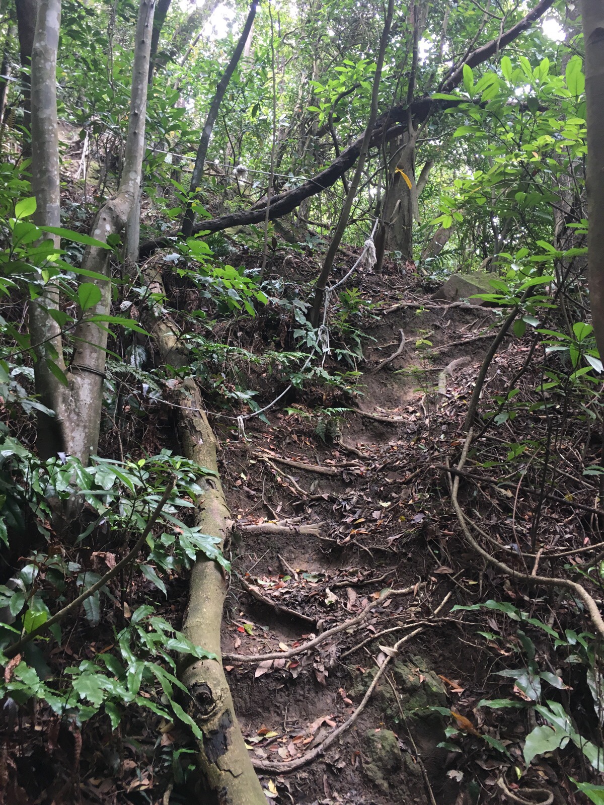
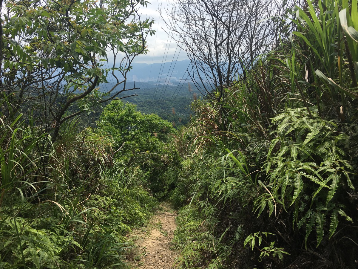
The trail goes through a couple of distinct phases as it climbs higher. The first couple of hundred metres is mostly farmland. Hiking tags guide you through the junctions until the trail arrives at the end of the trees. From here, the path starts to ascend steeply through a dense covering of trees and plants. The trail is well maintained and has fixed ropes in a few sections. The guy heading up the hiking team behind me had brought along a small saw with which he swiftly cut away deadened branches and roots that were intruding on the path.
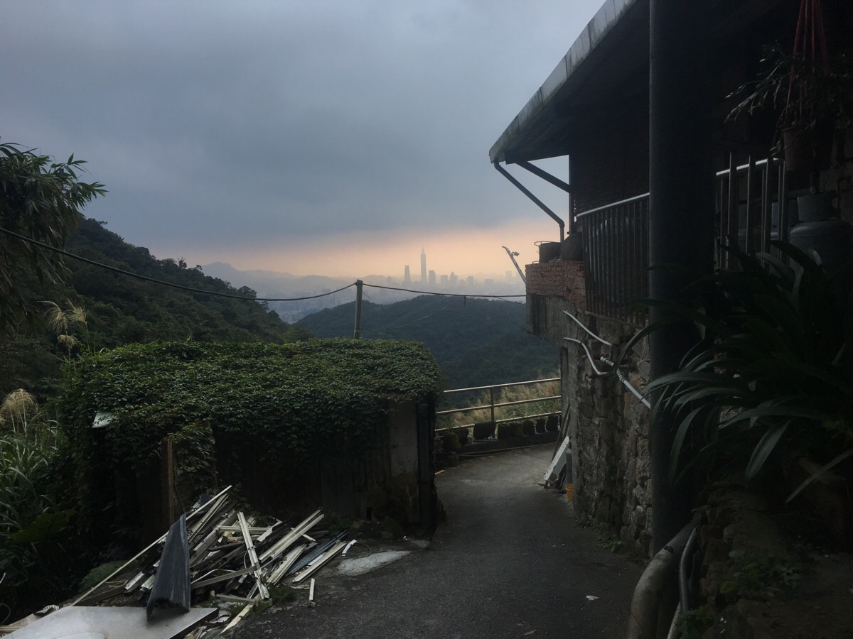
After 15-20 minutes of climbing, a spur on the right leads to a pretty view over the eastern, upper portion of the Keelung River, (which is where the stream I’d passed earlier eventually ends up). I paused here to let the breeze cool me down, and set off again after about 3 minutes when the hiking group caught up.
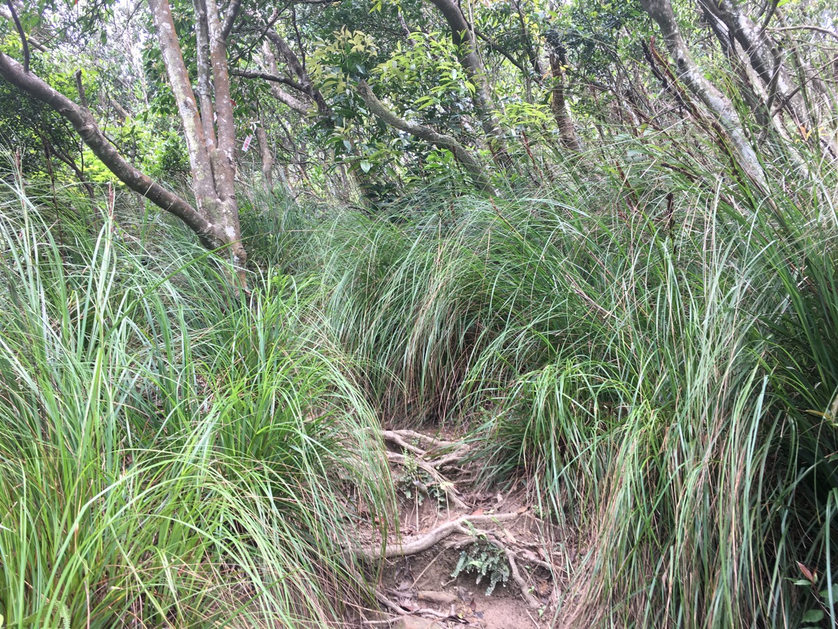
The next short phase of the climb was marked by lots of grasses bordering the path. And when the trail levelled out at the top of the ridge, the grass was replaced by short, scrubby trees.
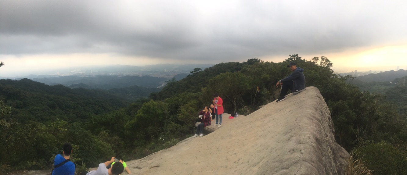
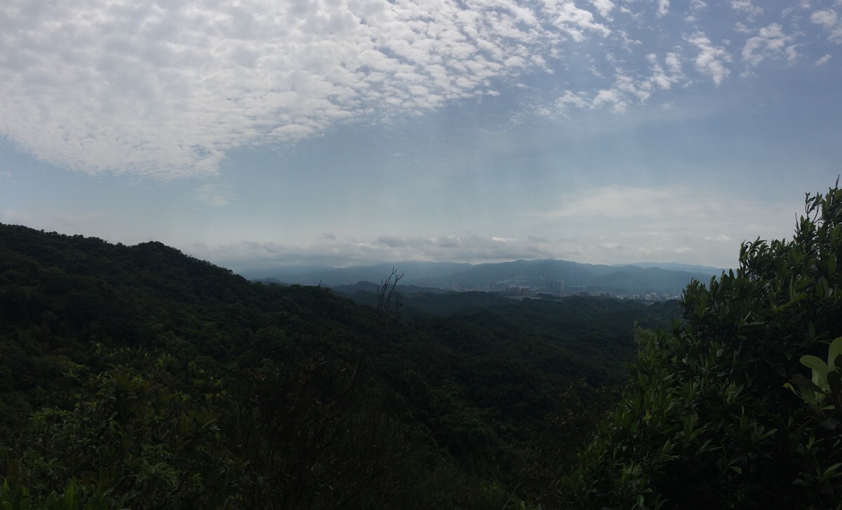
Despite being a Friday morning, the famous rock was full of adventurers. A whole group sat atop the rock and posed for a photo – except for one aunty who was afraid of climbing up there. I paused to enjoy the view (which was a lot clearer than in the above photo – this was taken on another walk in the area).
I kept pace with the hiking team who’d travelled up with me as we continued away from Dragon Boat Rock.
At the crossroads, some members of the other group stopped to pay their respects at the small land god temple. Although we hadn’t really talked beyond saying where we were heading, I got the impression that they had been keeping me ahead of them just to make sure that I was ok, so they nodded goodbye as I head off on the left hand path downhill towards Bishan Road.
The steps arrive down in farmland around the edge of a village. Someone had been burning off dead crops, and the air was thick with smoke as I headed over the little bridge.
The path heads left around the front of a small row of houses until it joins Bishan Road. If you keep your eye out for it, you may notice the oldest house in Neihu tucked away in this little community.
Walk to the end of the houses and then past the bus stop onto Bishan Road. From here it is just a case of following this road for quite a way. At the first junction bear left.
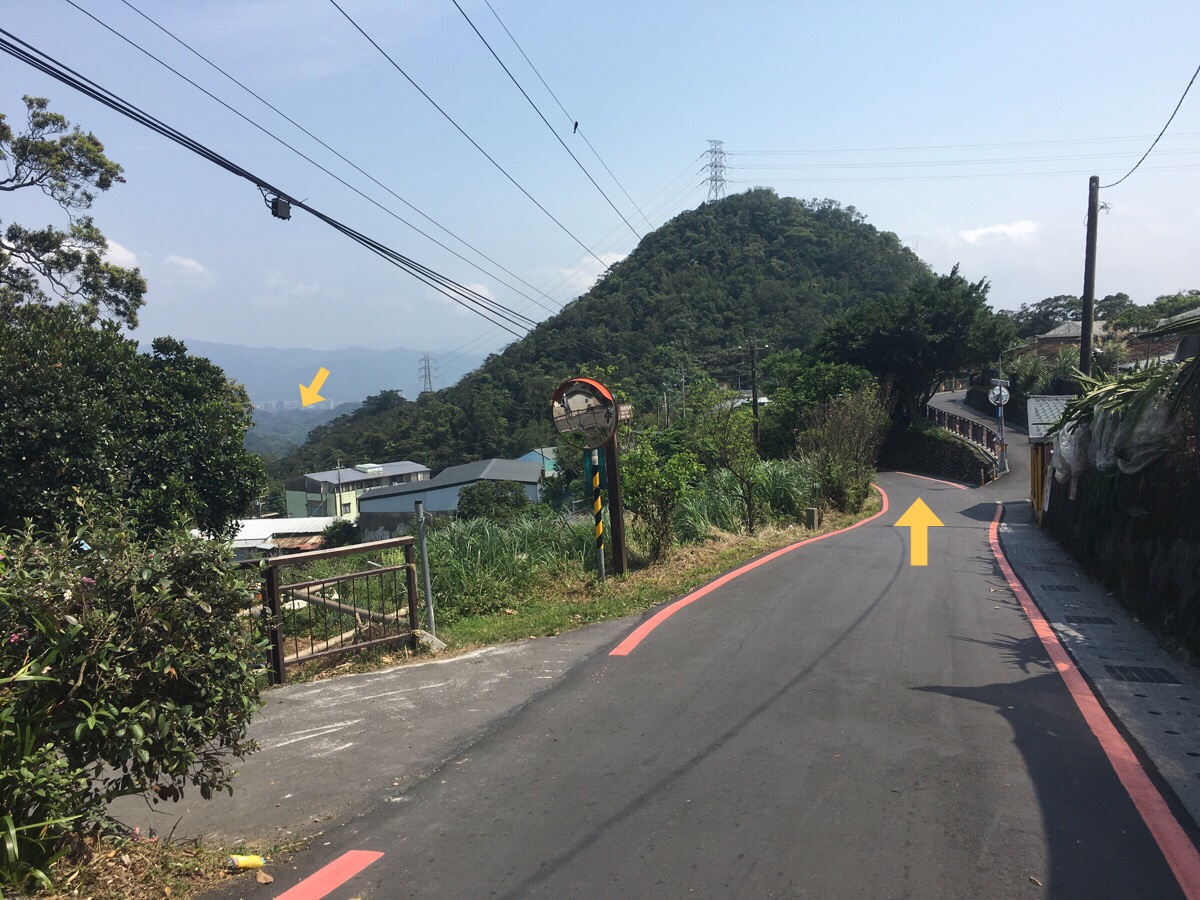
A little further on you’ll get a view out over all of the farm buildings towards Yuanjue Shan, (the one with the pylon on it).
Staying on the same road, you’ll pass the mother and son tree (indicated by the smaller arrow on the left here – I stole this picture from my post on the Feng Gui Zui to Dahu MRT Station section of the Taipei Grand Hike), and then the lovers lakes of Honhu wetlands on the right a little further. Once you’ve checked them out, return to the road and keep walking towards Yuanjue Shan.
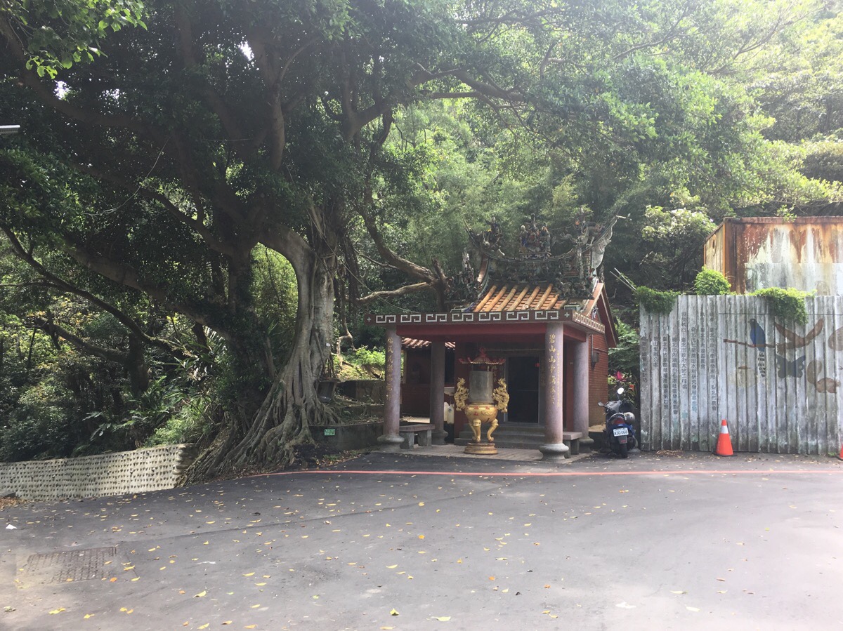
The next stage of the journey is marked by a small land god temple which is tucked into a bend in the road and shaded by a banyan tree. Just to the left of the temple you can spot the hiking tags which indicate the start of a trail. After you climb up, the trail quickly leaves the road behind.
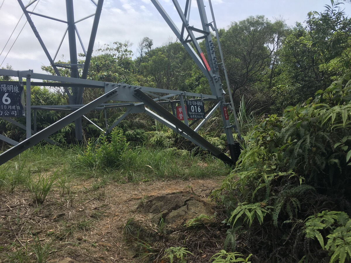
By a pylon, the path goes two ways. To the right is an offshoot which goes to the peak of Yuanjue Shan, but since I was a little tight for time I just went straight over to and down the far side.
The path down down this side or the hill is steeper than the path up from the temple – the odd cobweb strung across the path ready to catch me unawares.

Before long, I found myself coming out at the steps right next to Yuanjue Temple – a tall guy looked curiously at me and we both took the steps heading downhill.
The man introduced himself as Jeff, a fellow foreigner who has made Taiwan his home – although he is a veteran with many more years under his belt than me. He said that he often walks the Liyu Shan to Yuanju Falls route for exercise, (sometimes with his dog), and we talked about the highs and lows of working in Taiwan’s buxibans – a subject that I think the vast majority of English-speaking foreigners in Taiwan could hold forth on for a considerable amount of time. The fact that he’d been in his job for many years would tend to suggest that he managed to score himself one of the less terrible deals.
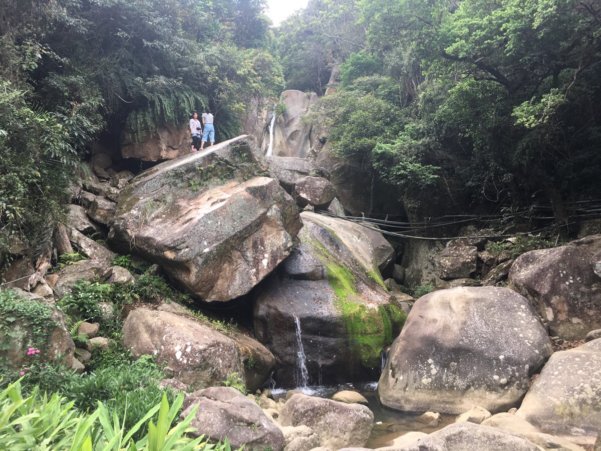
Since both of us had work to attend to in the afternoon, we passed by the waterfall and its gatherings of assorted retired folk.

Following the path back down to Daxigou park, we passed the little metal bridge up to where I’d just hiked, (on the left), and the steep steps up to Liyu Shan (on the right). We parted ways at the main entrance to the park and I made my way home to shower before work.
How to get to Dragonboat Rock Trail
Google maps address: the proper walk starts from the pretty Dagouxi Waterfront Park.
GPS location:
- Dagouxi Waterfront Park trail head – N25 05.320 E121 35.915
Public transport: it’s a short walk from Dahu Park MRT Station to the start of the walk.
Futher reading: there’s not much more in English about this particular route, and I can’t seem to find anything in Chinese except for links to GPX files, but this post covers most of the same points in a different order, plus some extra.
Nearby trails: this part of Taipei is riddled with trails.
- Bihu Trail
- Egret Hill
- Carp Hill (AKA Liyu Shan)
- Kangle Shan
- Mount Kaiyan Loop Trail
- Taipei Grand Hike – Bishanyan to Jiantan
- Taipei Grand Hike – Feng Gui Zui to Dagouxi Waterfront Park
Dragonboat Rock Trail Map
GPX file available here on Outdoor Active. (Account needed, but the free one works just fine.)
This is the bit where I come to you cap in hand. If you’ve got all the way down this page, then I can only assume that you’re actually interested in the stuff I write about. If this is the case and you feel inclined to chip in a few dollars for transport and time then I would appreciate it immensely. You can find me on either Ko-fi or Buy Me a Coffee.
