Carp Hill, otherwise known as Liyu Shan or Mount Liyu, may not be the highest peak in Neihu District, (that is Daluntou Shan at 475m), nor does it have the prettiest scenery or the most exciting walk. However it can lay claim to being the route that I have walked the most. This is my go-to walk for when I’ve just got a couple of hours free and need to stretch my legs, and I have walked it at least three times a month since relocating to this part of Taipei. It’s a great little workout with many steps which, whilst often unpopular, help me to work on my stamina for more adventurous walks. Additionally, it has plenty to make it interesting time after time. There’s a lookout spot with views from Xizhi in the east to Songshan airport and beyond in the west, you’ll pass Neihu’s oldest Buddhist temple, a waterfall and there is also a curious series of hand-crafted miniature landmarks.
Since I’ve walked this route so, so, so many times, there are photos from three or four days here and you might notice changes in the weather.
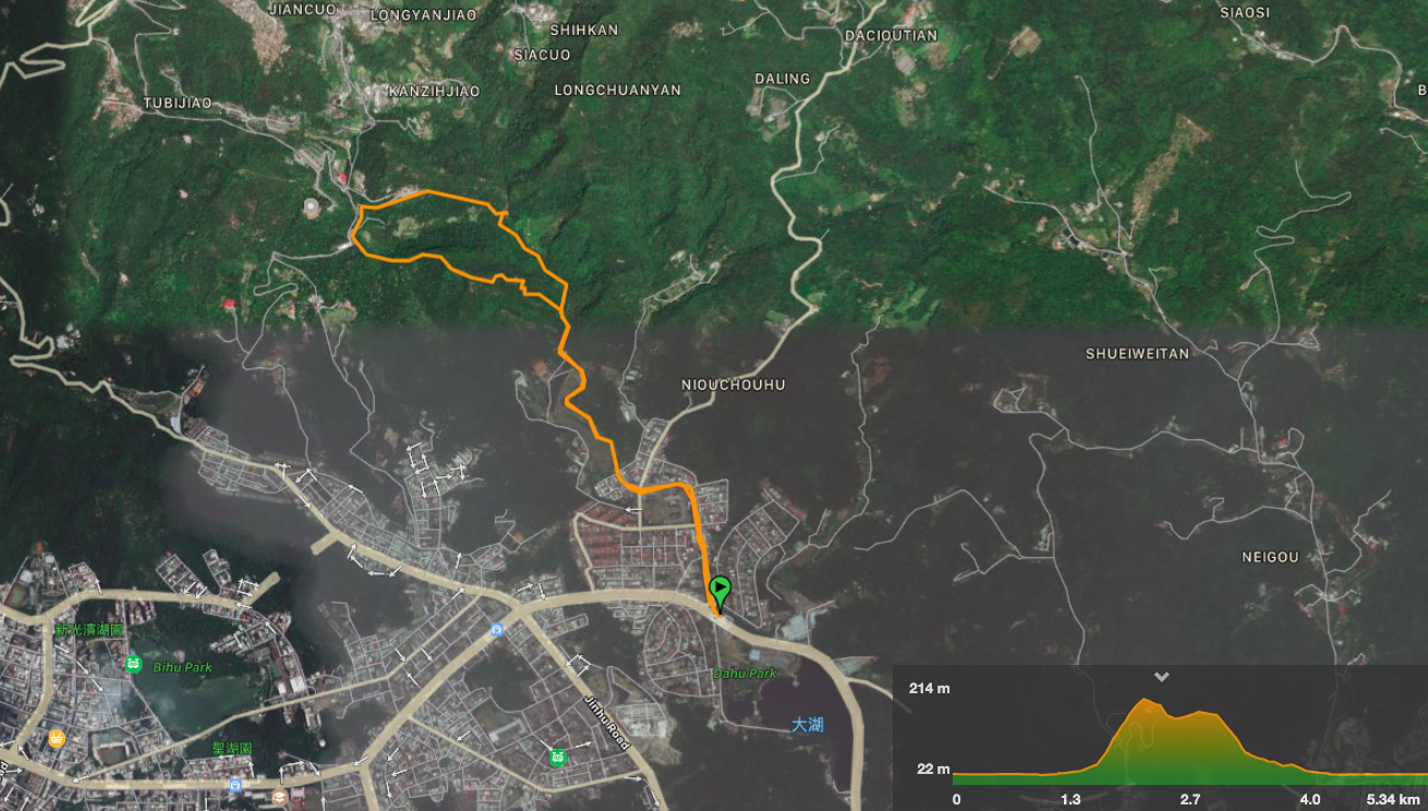
Distance: 5.6km
Time: 1½ hours at a fast pace, 2½ hours if you plan to stop and enjoy the scenery along the way.
Difficulty (regular Taiwan hiker): 2/10 – some steep steps, but that’s about it.
Difficulty (new Taiwan hiker): 4-5/10 – the route is a little steep, but the paths are all paved and it’s quite easy to know where you’re going.
Total ascent: about 230m, the majority of which is done over quite a short distance.
Water: I take a 0.5L reusable bottle, on cool days that’s enough, on hot days I refill it at the road end of Liyu Shan trail.
Shade: on and off, I always take an umbrella in sunny weather.
Mobile network: the stretch of path between Yuanjue Temple and Dagouxi Park has very poor signal, but it’s also quite an easy-to-navigate and popular trail, so you’re unlikely to get lost.
Enjoyment: 8/10 – despite this being paved all the way, I really enjoy this walk, there are always plenty of little things to draw my attention.
Jump to the bottom of this post for a trail map, GPX file, and transportation information.

Starting from Dahu Park MRT Station, follow Dahu Shan Zhuang Street up towards Dagouxi Waterfront Park. There are a couple of convenience stores and breakfast shops along the way, so if you forgot your reusable bottle you can still pick up some water. (Oddly there are also two or three arts and craft studios up here, I guess the people of Neihu have more time to be creative than most of Taipei’s citizens.)

At the entrance to the park I prefer to take the steps up the grassy bank, but it’s also possible to take the track on the left and follow it as it curves around the edge of the park. In fact on my two most recent visits to this trail I’ve had to take the road because the trail next to the stream had flooded after heavy rain.
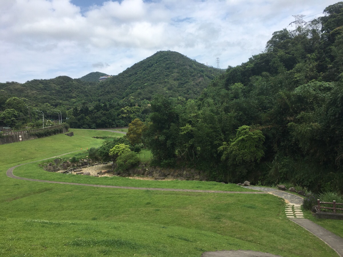
At the top of the grassy bank you can see the steps dropping down to meet the water. Head down there, cross over the water and follow it upstream.
Except for after heavy rain, the water is pretty clear and full of fish, and if you visit in the summer you’ll find the park populated by families who have been drawn to escape the heat in the cool water.

If you follow the water, keeping it on your left you’ll arrive at a shelter next to some steps. Head up the steps and keep next to the water until you get to this bridge. Here you need to cross this bridge and the bridge beyond it (in the centre of the photo).
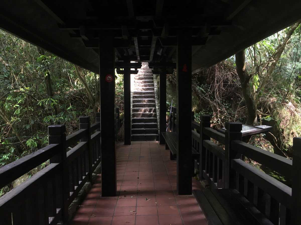
Before you’ll end up at the next bridge. This one is an elegant, covered wooden construction which is just downstream of a small waterfall. This is a popular resting spot and there’s nearly always someone here resting, doing tai-chi or chatting.
Once over the bridge turn right and keep going up against the flow of the water.
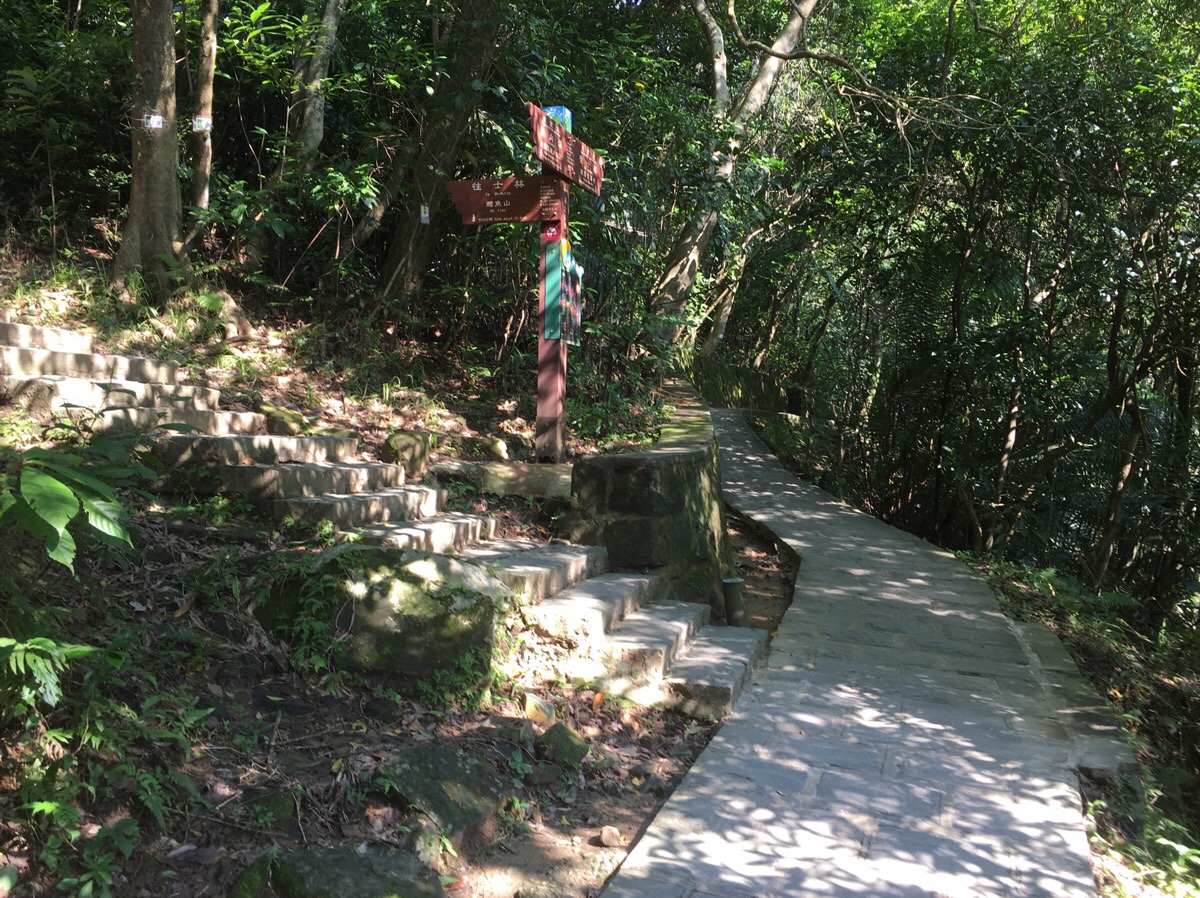
Before long you’ll arrive at the turn-off to the Mt. Liyu/Carp Hill trail. The sign says it’s a ten minute walk, but don’t believe it for a second! It’s a straight upwards route, and even though I can do it without stopping at a reasonable pace, it still takes me nearly 20 minutes. Also, although I’m no trail-runner, I’d say I was pretty fit, so I imagine that it would take most people a little longer than that. Honestly, I think 10 minutes would be a bit of a push even if you were heading downhill.
Erroneous signage aside, the next section climbs steadily and steeply up stone steps for a bit, then there’s a wooden bridge across a small gully and then the steps resume their climb once more until it reaches an electricity pylon. Here there are are signs saying 小人國家步道, (Miniature Country Trail), each character has its own fish shaped post. Indeed, in keeping with the mountain’s name, fish shapes are incorporated into the design of many features along the trail. They appear carved into the steps in places, the benches are fish shaped, (except for the two which are shoe shaped), and there are decorative fishes worked into the metalwork of the railings along one part. It is a bit of a Taiwanese phenomenon I think, sometimes the local people responsible for an area really, really go to town on the themed elements of the environment.

Where the more structured steps give way to well-worn sandstone you should keep a look out for an unmarked trail to the left of the main path. If you turn up here and walk for just one minute, you will come across the best view of this whole hike. (There are views later on, but they’re all partially obscured.)
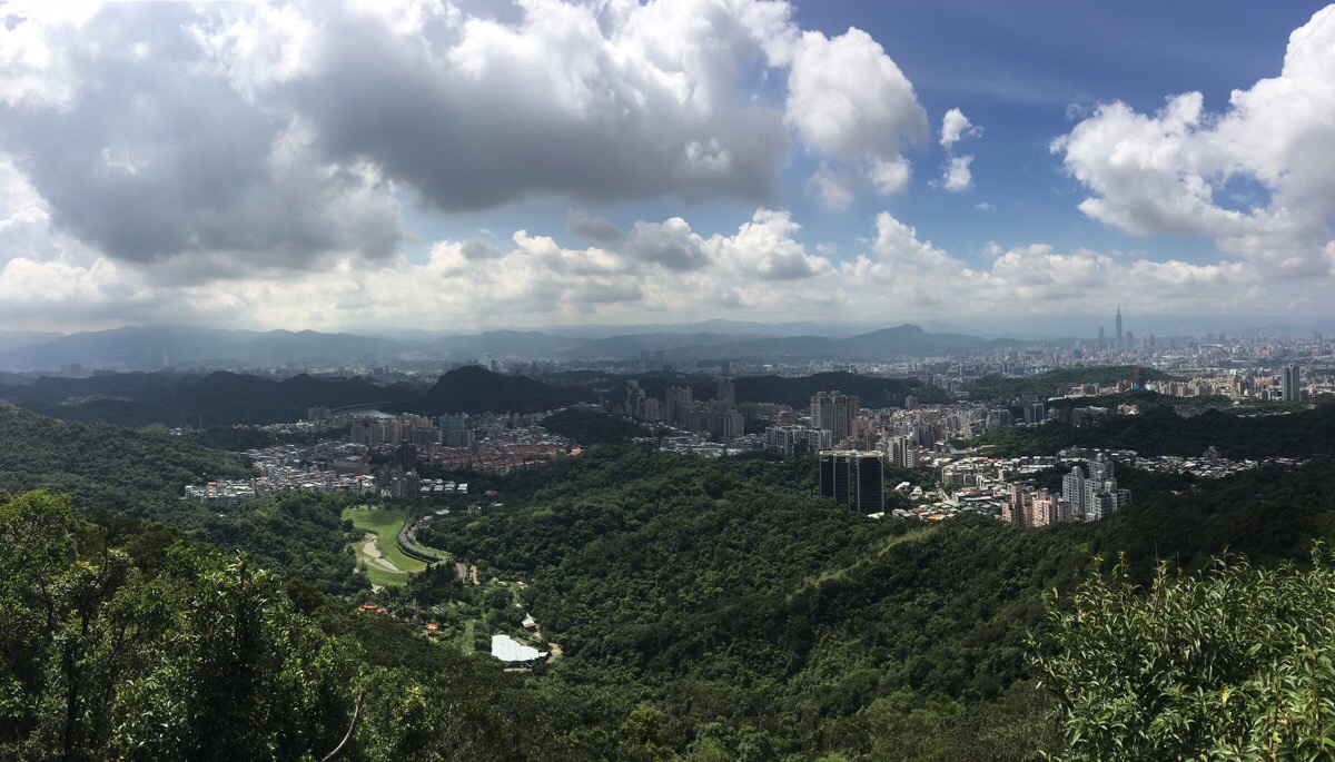
A shelter with a couple of chairs marks the end point of the spur trail, (almost every time I’ve been there has been an old guy sitting in the chair, or even multiple old guys playing chess). Here you can see back down to the park where this walk starts, and you can see the small hump of Egret Hill rising from behind Dahu Station. Actually, you can see a long way in every direction except for north.
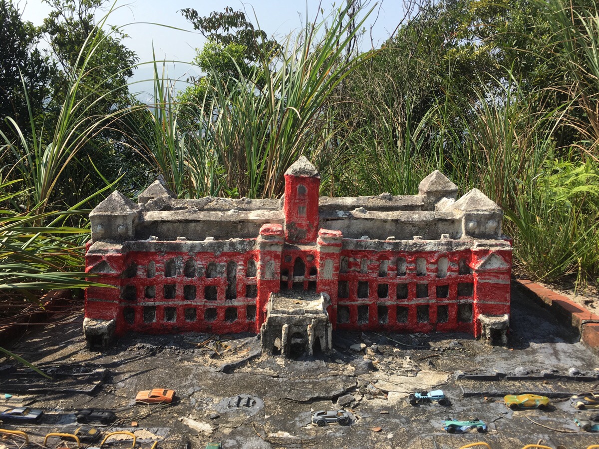
If you walk back to rejoin the main trail, you’ll soon pass more of the little landmarks that make this trail unique. This one here is a scaled-down version of the Presidential Office Building. There are miniature versions of Beyi Road, Taroko Gorge, of the old Provincial Highway No.1 toll booths that were used before the e-tag technology made them obsolete, and there are several famous temples.

A little further up is a pagoda which feels like it is the actual peak, and then beyond that the path starts to climb down again.
About half way down, you’ll come across the trail’s largest model, a not-so-accurate recreation of the Great Wall of China which stretches down the along the trail for several metres.

The trail emerges onto the road next to a water fountain and a couple of benches where you might meet the resident cat. If you come at the weekend, you’ll find a vendor selling sweetcorn out of a truck.
The steps straight ahead lead up to Bishanyan Kaizhang Sheng Wang Temple – well worth a visit if you’ve never been before – but since I often do this trail just for the workout, I tend to head back from here by turning right through the paifang for Yuanjue Temple. These two temples are both important religious sites, the former for its significance to Fujian settlers, (I wrote about the story of this religious site in some detail in an earlier post), and the latter by dint of it being the oldest Buddhist temple in Neihu.
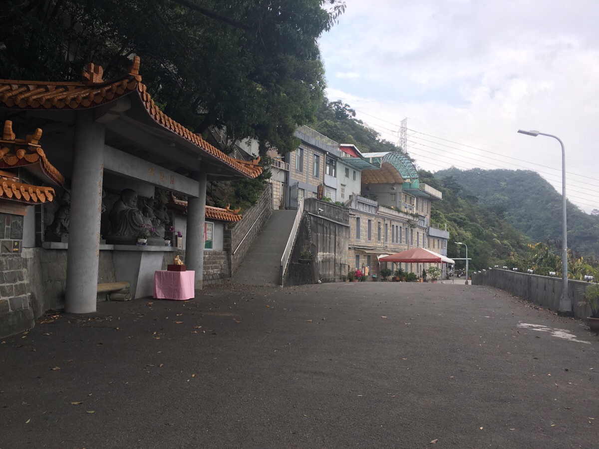
The road climbs a little to a small land god shrine next to a stream, (a great spot for seeking Formosan blue magpies), and then climbs further to arrive in front of Yuanjue Temple. You’re almost certain to hear chants being played through the loud speakers which are positioned all along the outer fence here, and there is often a nun sweeping the forecourt. Head straight in front of the temple and then down the steps on the far side.
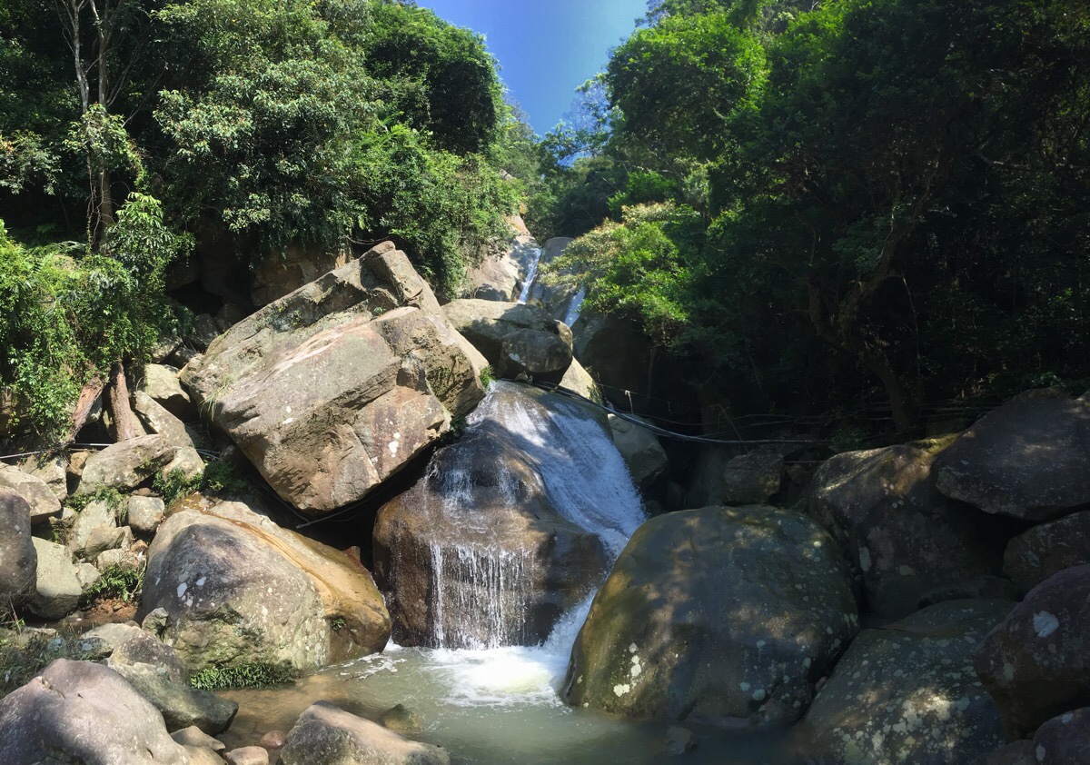
In sunny weather and at dusk, keep an eye out for snakes, I’ve spotted greater green snakes on the steps between the temple and the waterfall a number of times. Yuanjue Waterfall is a little off the main path, but it’s hard to miss on account of all the shelters built around it. Generally quite tame, it can swell to a thunderous torrent after heavy rain. For the more adventurous, it is possible to scramble up a rocky trail to the left of the stream and climb to one of the higher rocks to get a better view of the upper portion of the falls.
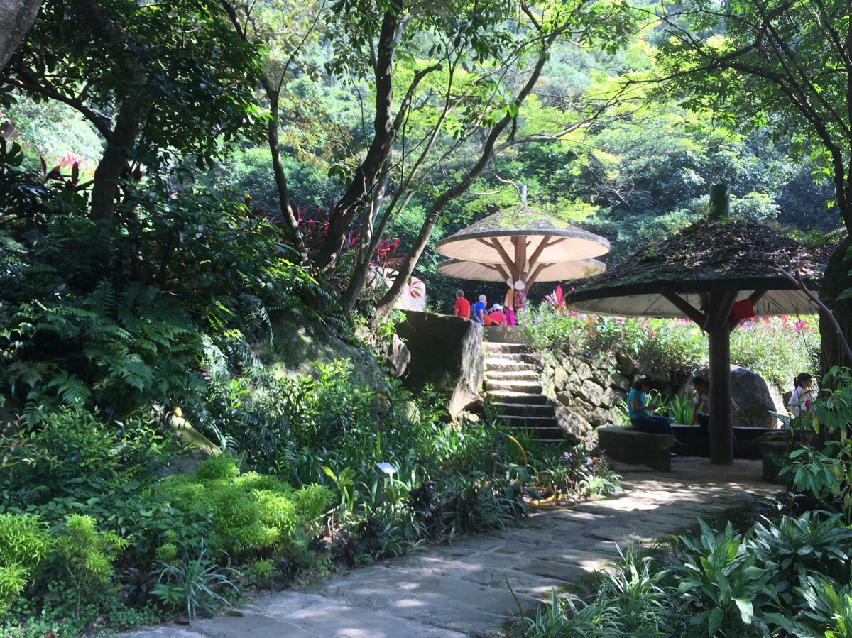
This area seems to be highly maintained by a local group, and since taking this photo, the patch of greenery to the left has been replaced with a small pond complete with miniature waterfall and many tiny fish. In fact this whole stretch of trail between here and Dagouxi is regularly maintained by a team of retired volunteers – if you go in the morning, you’re very likely to bump into some of them sweeping the path free of leaves and picking up rubbish.

Walking along the river here, I quite often spot (or hear) a Taiwan whistling thrush dipping and bouncing its away over the rocks next to the water. These birds may just look like a blackbird if you see them in the shade, but a closer inspection will reveal plumage in delightful shades of midnight blue. Once or twice, I have even caught an electric-blue shock of colour as a kingfisher darted from its perch.
Not far beyond where this photo was taken, you’ll find yourself back at the point where the path turns uphill to go to Liyu Shan, and from there just retrace your steps back to the MRT Station.
How to get there
Google Maps address: the proper walk starts from the pretty Dagouxi Waterfront Park.
GPS location: N25 05.320 E121 35.915
Public transport: it’s a short walk from Dahu Park MRT Station to the start of the walk.
Futher reading: there’s not much more in English about this particular route, and I can’t seem to find anything in Chinese except for links to GPX files, but this post covers most of the same points in a different order, plus some extra.
Nearby trails: there are a whole host of trails nearby
- Bihu Trail
- Egret Hill
- Dragon Boat Rock
- Kangle Shan
- Mount Kaiyan Loop Trail
- Taipei Grand Hike – Bishanyan to Jiantan
- Taipei Grand Hike – Feng Gui Zui to Dagouxi Waterfront Park
Carp Hill Trail Map
GPX file available here on Outdoor Active. (Account needed, but the free one works just fine.)
This is the bit where I come to you cap in hand. If you’ve got all the way down this page, then I can only assume that you’re actually interested in the stuff I write about. If this is the case and you feel inclined to chip in a few dollars for transport and time then I would appreciate it immensely. You can find me on either Ko-fi or Buy Me a Coffee.
