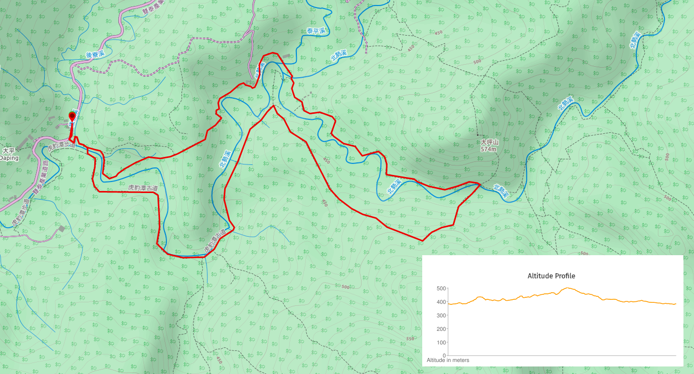
Distance: about 8km
Time: a little over 3½ hours without really taking any significant breaks (we stopped frequently for short period though).
Difficulty (regular Taiwan hiker): for the whole loop 4.5/10 – uneven and slippery surfaces, a stream crossing, and there’s the mental taxation that comes from parts of the path being overgrown. If you only do the short loop, then it’s probably a 2.5 or 3/10.
Difficulty (new Taiwan hiker): the longer route is probably about an 8-8.5/10 because of the poor trail conditions in parts and the river crossing – I wouldn’t have felt at all confident crossing knee-depth water
Total ascent: about 200m to a high point of 511 metres above sea level.
Water: on a warm late-autumn day I drank a little less than 1L. I would have probably needed 2L to be comfortable in the summer though.
Shade: pretty well shaded for most of the way. I still had a hat and suncream on though, because I can burn in the winter on a cloudy day. Unless you’re very fair-skinned you probably only need to worry about sun protection from May to September.
Mobile network: the signal dropped out for quite a few stretches, particularly on the return half of the loop.
Enjoyment: 8.5/10 – this is a great walk that’s worth making the effort to travel to. It’s a charming old trail through forest and farmland along streams and rivers. And the shorter route should be doable for any able-bodied people. In fact, I don’t think I’ve yet come across another similarly easy and yet still natural trail following a stream in Taiwan, so it’s really quite special. The only thing which impacted on my enjoyment was the unexpected bushwhacking, (I hadn’t gone mentally prepared for that type of walk, so I found it harder than it really was).
Other: it’s better to take gloves if you plan on doing the longer version, it’ll make the bushwhacking part less unpleasant. Also, this would be a lovely picnic walk in the summer. You’d probably be walking more slowly, but you’d also be able to cool off in the water.
Jump to the bottom of this post for a trail map, GPX file, and transportation information.
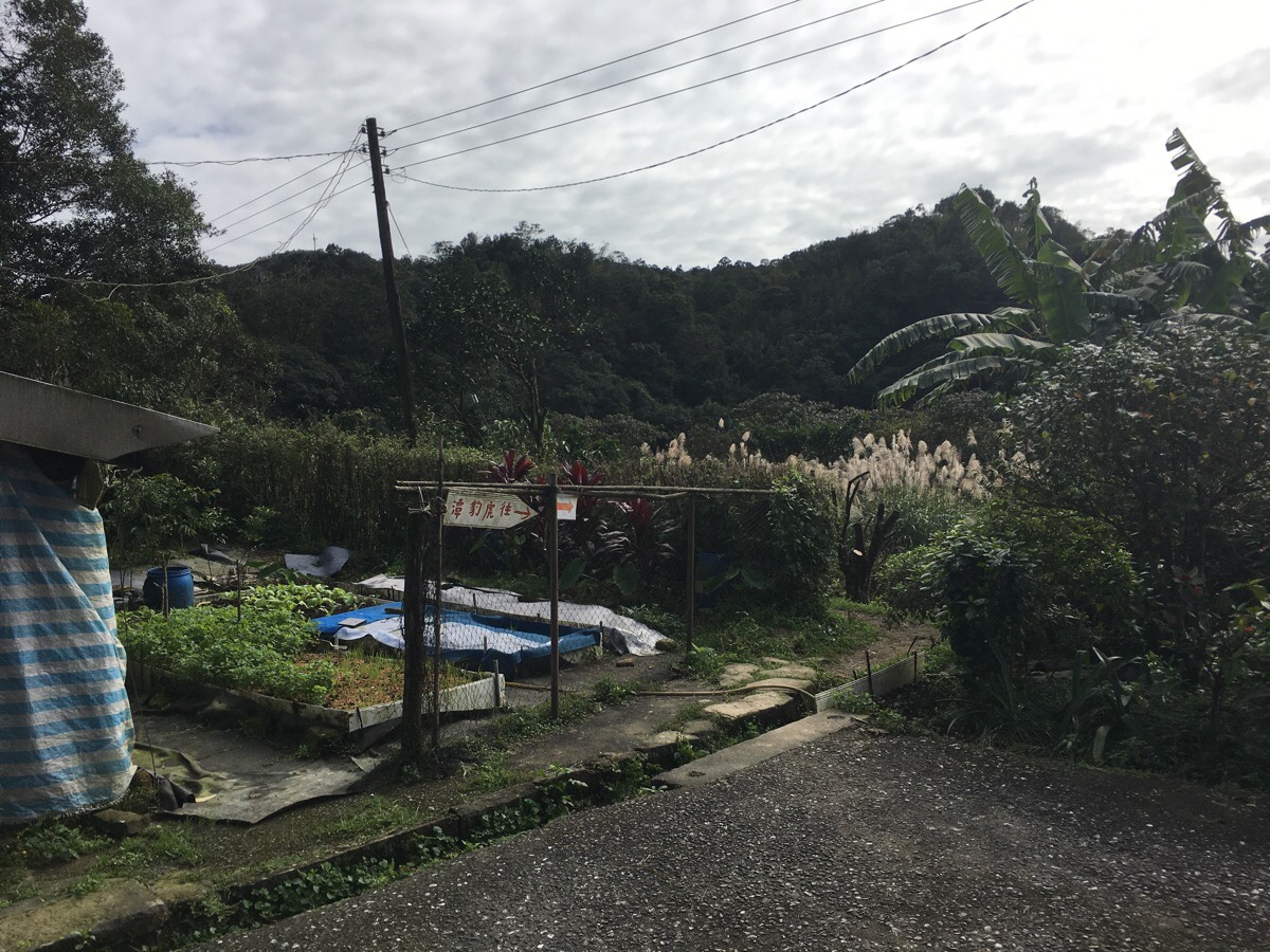
It was an interesting drive to get here, the Ignis’s first go on windy roads, (which weren’t strictly necessary, but it’s where the phone took us, so we blindly followed), and we passed a small temple filled with large Buddha head, (hilariously, google maps have blurred this out). And then all along the slightly bigger small road just before the trailhead there were lots of little honesty-box type stands selling cabbages, ginger, eggs and other homegrown produce.
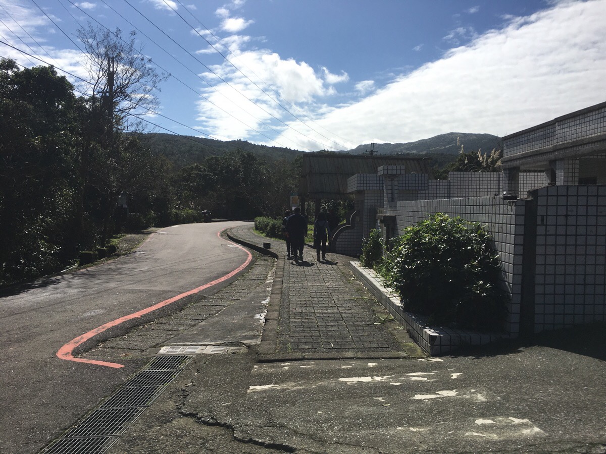
We parked in the large carpark alongside about 12 other cars, and headed back towards the entrance and the bus stop. Right next to the bus stop there was another table with eggs for sale, bus this one also had an ‘honesty-fridge’ full of water, coke and other canned drinks. A short way beyond the bus stop there is a Land God shrine, and just across the road from the god is the start of the trail. There’s a map there, and the sound of water to draw you down the steps, so it’s hard to miss.
There are also some public toilets here, (but make sure you take your own tissue).
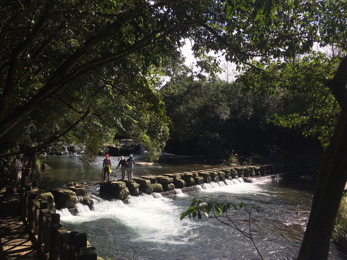
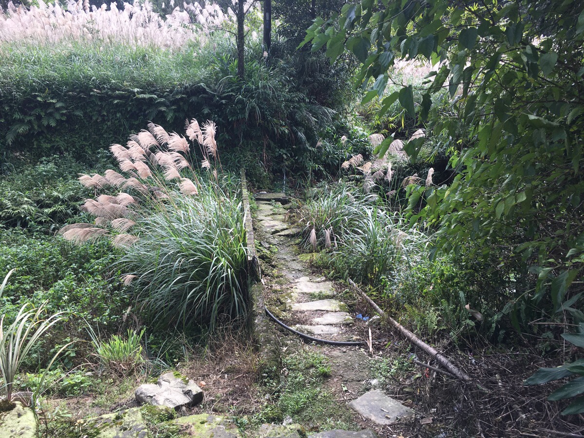
After our toilet and suncream needs were met, we set off along the walk. It’s a funny-shaped loop, and since we decided to do a clockwise route, these stepping stones were the way that we rejoined our original path.
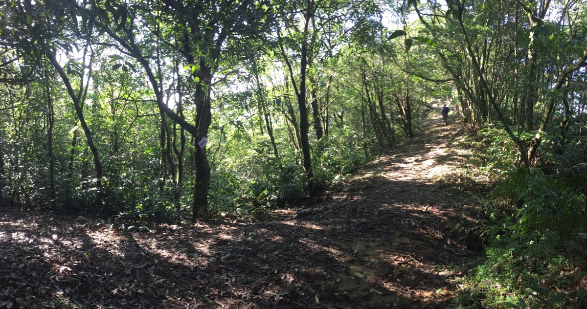
We took the trail heading straight, with the river close to us on the right.
The first time the trail splits, both routes end up back together again after a couple of hundred metres, but we wanted to stay closer to the water so it made sense to follow the lower trail on the right.
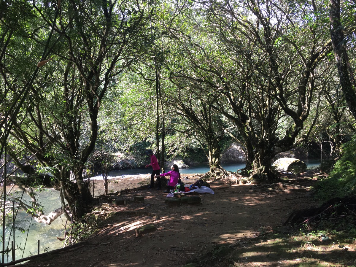
This section is really pretty. The path is almost at the same level as the water, and the trees open up to show clear water filled with many fish. I have to believe that this is a wildly popular spot in the summer.
The trail starts to climb, (we were behind a middle-aged husband and wife couple, the former of which seemed to be helping the latter up by joining her arm up). A little further along, the path darts just to the right of a rather opulent grave.
About 10-15 minutes after they split, the two paths merge again, (the one on the left is the rejoining trail). After you take the righthand trail, there, there is a short but steep climb up to a ridge, after which you have to dip down again.
The whole while we could hear, and catch glimpses of the river below, but then just as the path breaks out onto a patch of farmland, we encountered the first of this trail’s many, many stream crossings.

The farm had lotus ponds amid the other assorted vegetable patches, and the scene looked very pretty in the sun, (as long as you ignore the plastic sheeting).

Small deer prints tracked all through the soft mud of the farm trails, and the upper pond was teeming with tadpoles of various sizes and developmental stages. Astonishingly, this was Teresa’s first ever time seeing tadpoles that had started growing legs – it seems the life experience of a Taiwanese city kid and a British village child are vastly different.
The steps lead up to several farm houses, and we followed the trail across the bottom of the courtyard and out the far corner. There are big red arrows at many places along the trail to make it clear which way to go.
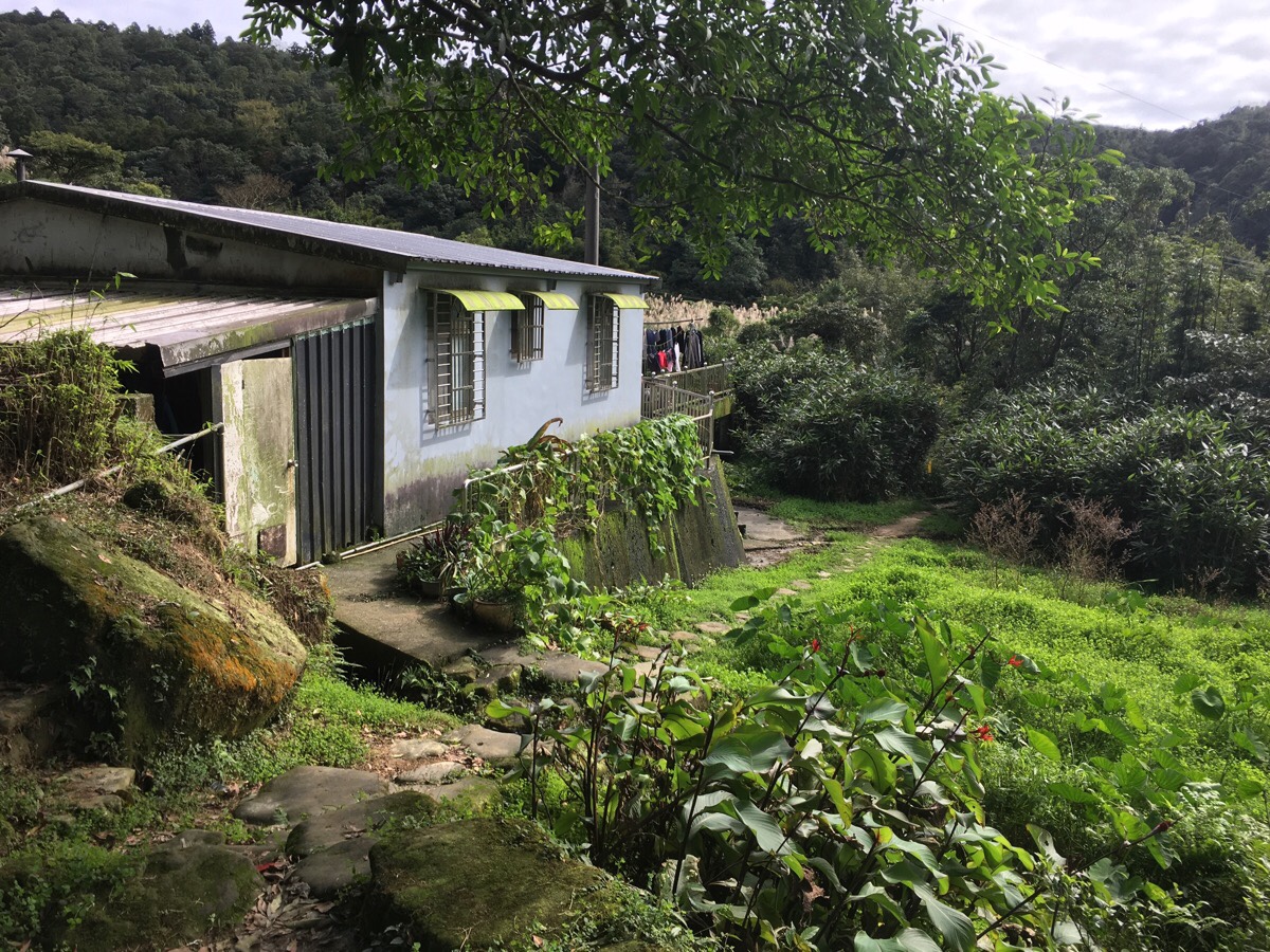
At a second collection of houses, and we soon heard the barks of multiple dogs from within the closest building. A split second after this photo was taken, a trio of dogs came spilling and barking out of the dirty white door – one tan, one black and one beautiful skinny little black-brown tiger-patterned one. I was in front and was surprised to find that at some point over the past year, my initial reaction towards such dogs has morphed from backing away to standing my ground and telling them how noisy they are. I’ve watched Teresa do it so many times (without fail until now), that I now feel able to deal with it calmly. As it turned out, this was the correct approach, the loudest one, (the tan dog), was just noisy and cowardly, barking at us from a safe distance, the black one seemed to just be along for the fun because it wagged it’s tail whilst letting out the occasional excited bark, whilst the third seemed more surprised that it had gotten caught up in all the fuss and went to stand further along the trail watching and giving the odd mournful yap. In the end, shy tiger-dog (who turned out to be called Hua-Hua), got scolded by the owner and was told to get back inside, (the other two having smartly buggered off when they heard him shouting “爸爸回來了”).
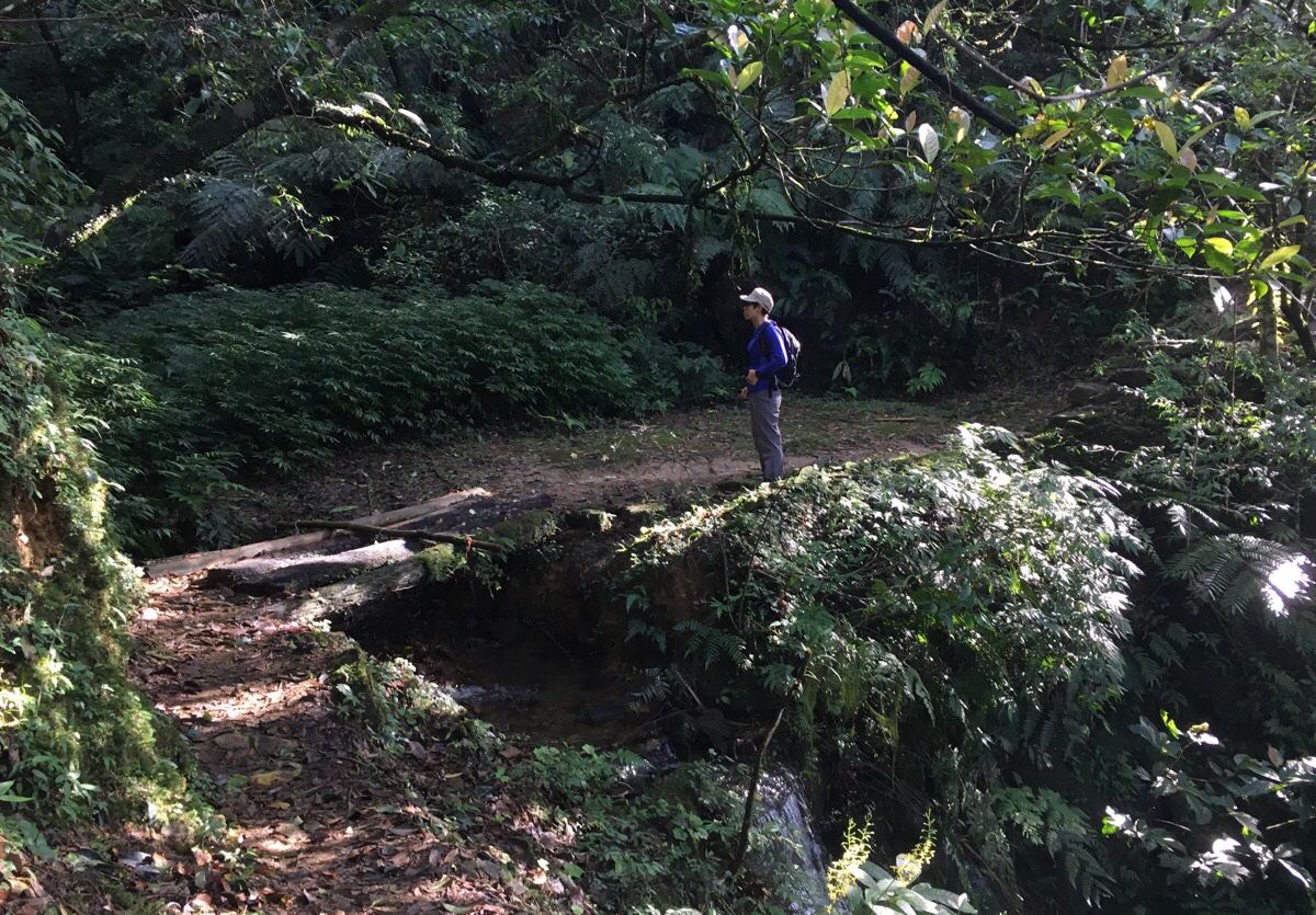
A small bridge leads away from the houses, over Taiping Stream (泰平溪). This section along with a few other points had a particularly ‘historic trail feeling’ to it – old stone steps rather than concrete, a path that winds around obstacles rather than powering straight over them.
As we crossed a larger bridge over one tributary of the Beishi River we met a man who warned us that there was a dog further along the path. (Although he didn’t actually give us any more details than that, just that there was a dog.)
Originally we had only planned to do the shorter popular route and turn right here, following the river back down to the start, but it had taken us less than an hour to walk this far and it was still early, so we decided to take the path heading up on the left along another tributary of Beishi River.
(*If you turn right here, you will arrive very quickly at the point where we rejoined the trail one hour and fifty minutes later.)
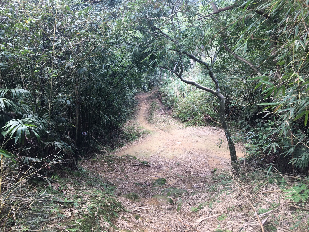
The trail passes through one final farming area. This time, the path stays just below the buildings and you have to take this little bridge, then at the far side of the bridge head straight, (the path on the right goes down to farmland).
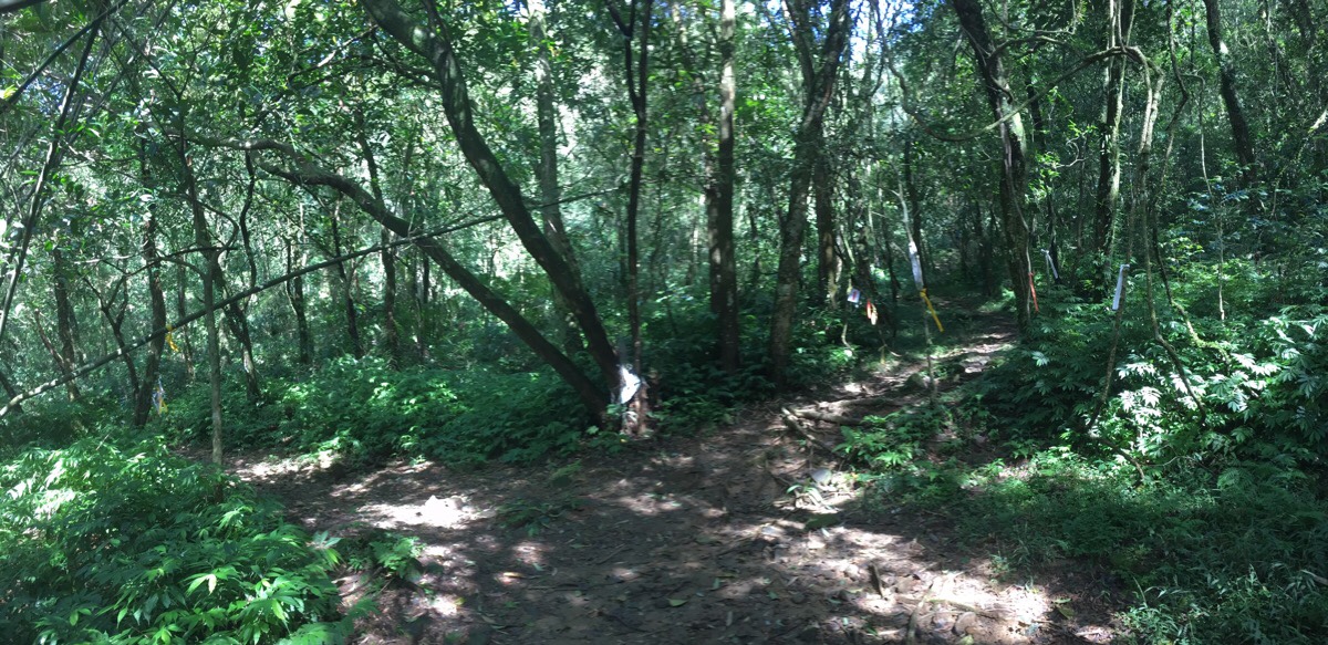
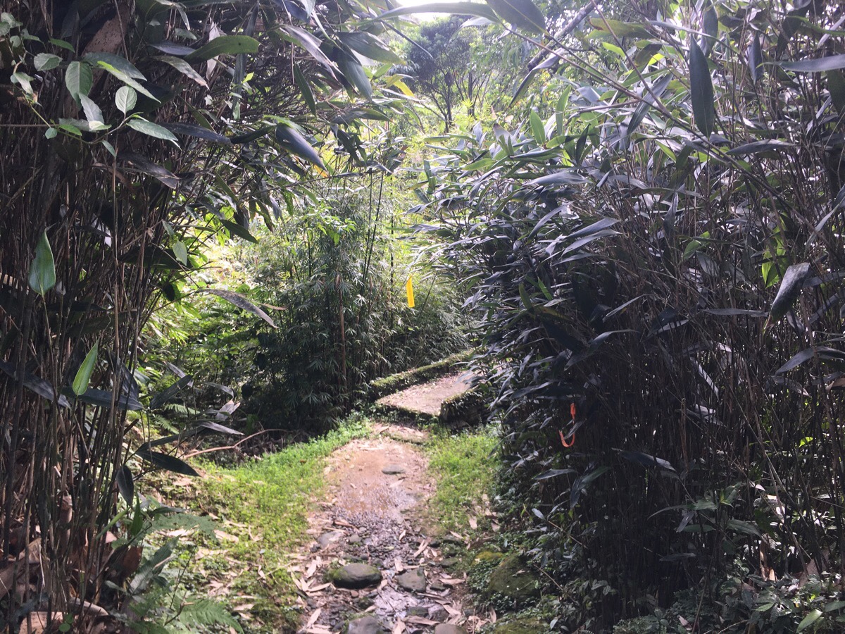
The trail very quickly becomes somewhat rougher, and it’s evident that most people stay on the shorter, more popular route. Still, it’s clearly marked with hiking tags, and not overgrown at this point.
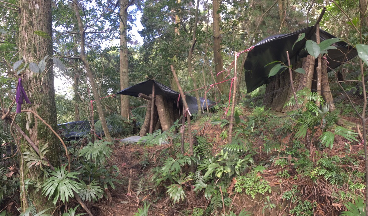
It was not far up from this farm that we came across the first of two mysteries on the trail. Dotted around in the forest we found many of these structures – plastic sheeting or sometimes tarp tented over logs that had been leant at an angle against a central pole. At first glance, I thought the wood was that kind of fern-y tree which has a spot pattern on it, but a closer look suggested that wasn’t the case. Later on, after getting home I posted a couple of pictures on Twitter, and within 12 hours the mystery had been satisfyingly solved by several smart people.
Found these structures which seemed to be drying wood, anyone know what for? It was all the same kind of wood, not a variety. Also, I’m curious as to whether these prints were just a very small domestic cat straying away from home, or something else? #Taiwan #hiking #爬山 #台灣 pic.twitter.com/Jcondc30Lx
— 🇹🇼Taiwan Trails and Tales🇬🇧 (@Taiwan_trails) December 1, 2019
They are almost definitely being used to grow mushrooms.
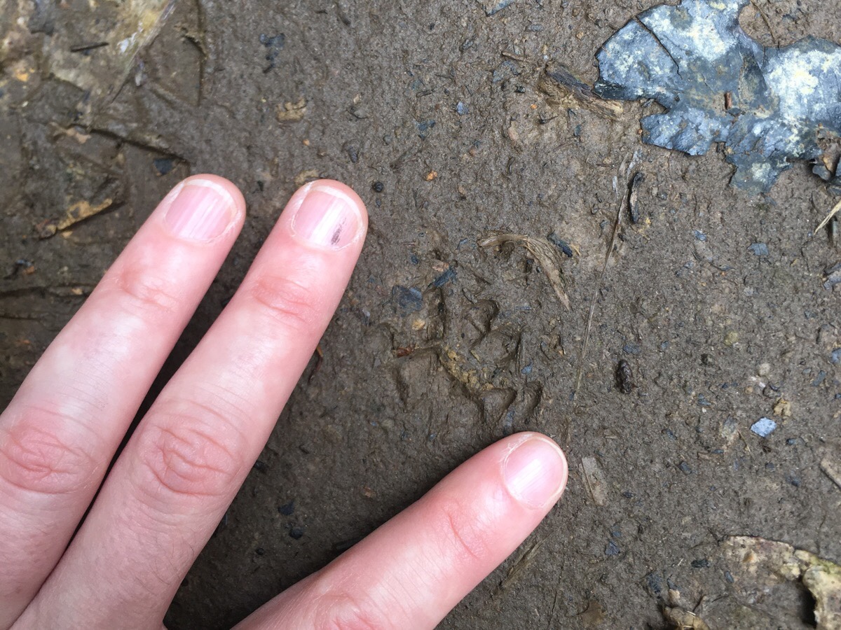
The second mystery came at about the same time. We started noticing these cat-like animal prints in the mud along the path. They were pretty small, between 2-3cm long and across, and it was hard to get a clear picture as it looked like the back prints seemed to fall on top of the front ones. So far I haven’t been able to come up with a good guess as to what might have left them.

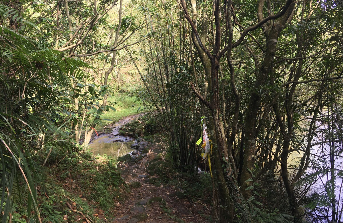
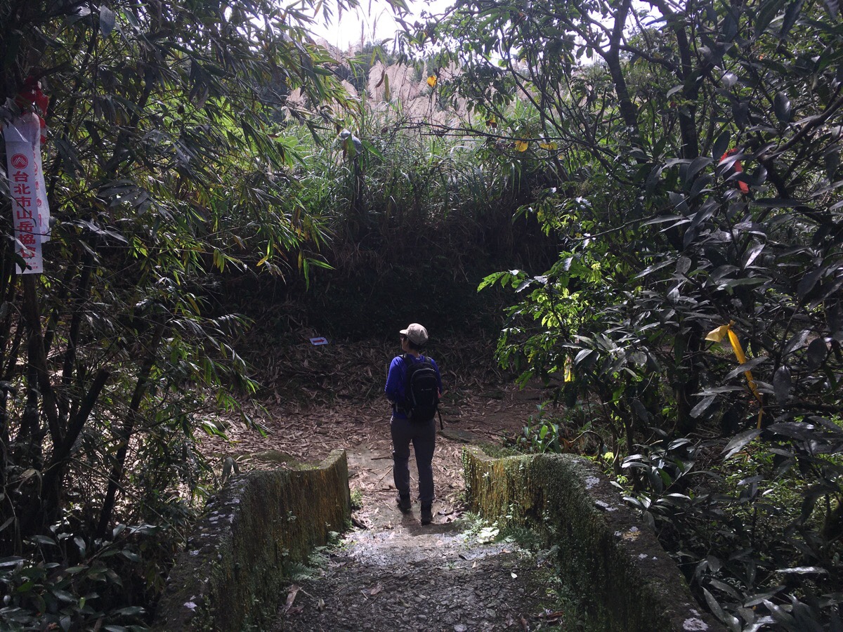
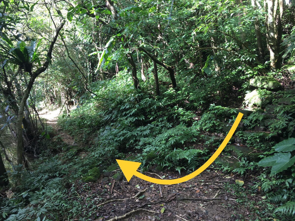
There is a fork in the trail, where it crosses a stream right next to a little waterfall. At first we didn’t go down to the stream since there wasn’t any water shown here on the map I was following – but the lefthand path soon terminates, and the arrows continue down over the water, so we backtracked to head down and across the stream and it quickly proved to be the correct route.
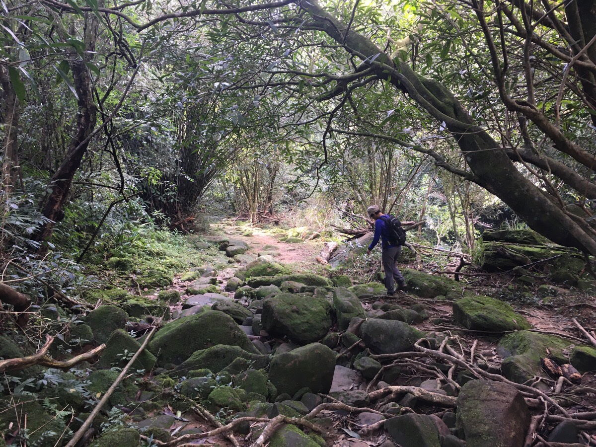
From this point on, the vegetation ratchets up a notch and the path becomes overgrown with ferns up to about knee height. It also gets a bit soggy, and we walked slowly to avoid sinking into thick mud.
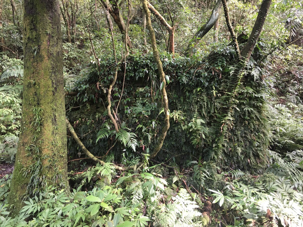
Five minutes beyond the little crossing there were more mushroom-growing structures, and a further five minutes walk from the mushroom logs were the remains of an old settlement. There were only a few remaining walls, and they were so covered in ferns and creeping plants that it would be easy enough to walk straight past them.

Immediately beyond the old dwellings, the path starts to climb. It also kind of becomes a stream – water from a spring somewhere uphill trickles down and over the stones. Thankfully it wasn’t especially deep or muddy, so it was easy enough to step around the deeper puddles.
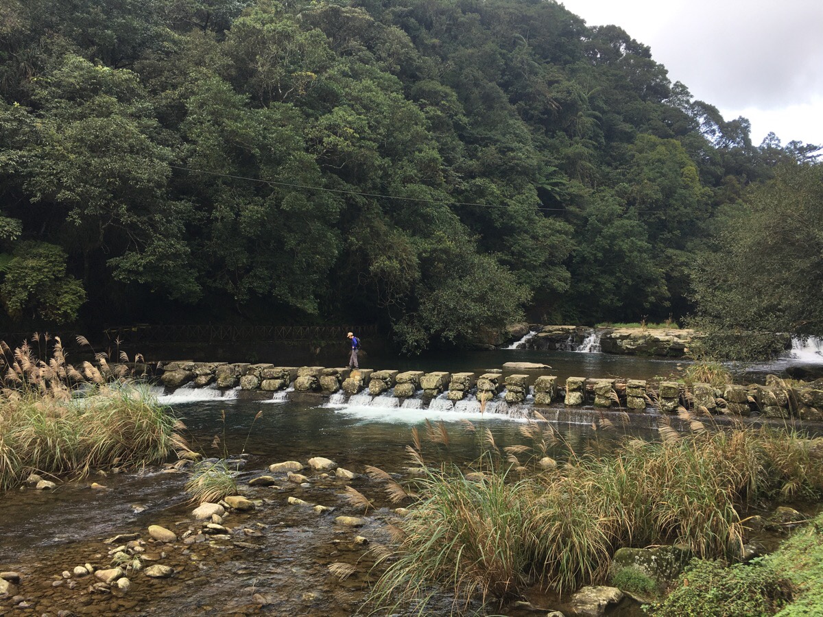
The trail takes a right turn down some steps right onto the bank of the stream. We knew that we had to cross the water here, because the map we were following showed the path climbing up from the far side, but it wasn’t immediately clear where to go. After checking the map against our surroundings again, it seemed clear that we had to turn right along the edge of the water. (The trail that continued upstream went in two directions, the first was up to Da Ping Shan, the second was tracing the stream all the way up to its source.) It wasn’t clear from the map what type of crossing this would be, but we soon realised that we had to walk through the water to the far side of the stream.
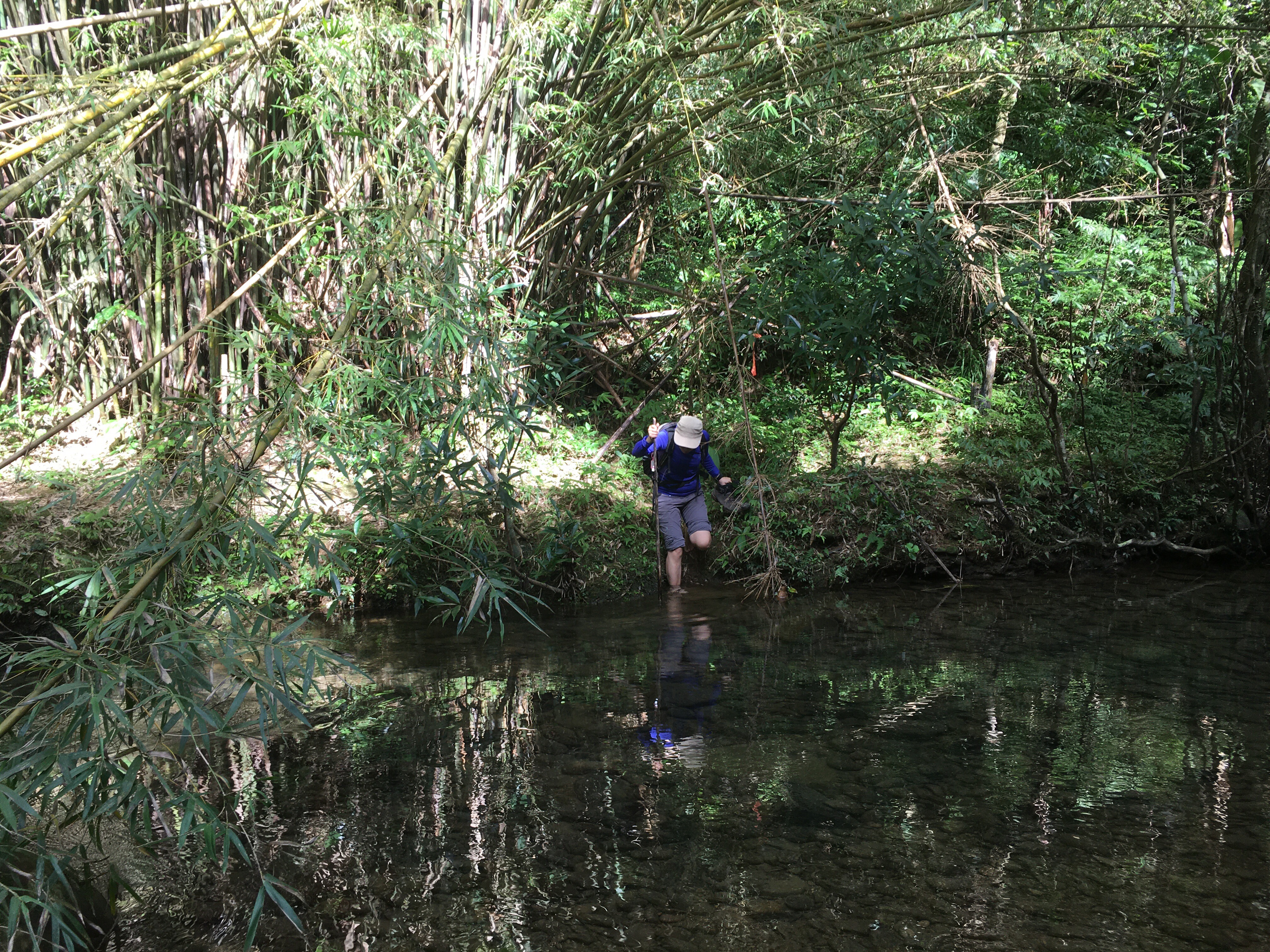
The path hugged the bank for about 20 metres, and then just stopped. Soil erosion in one or two places showed that they had clearly been used for entry into the water, and so we weighed up our options. The one further along the bank was a shallower crossing, the water reaching maybe just to lower calf height, however the water was fast there, and it was hard to see the bottom. The first entry point we came to was deeper – the water was about knee-height, but it was slow moving and clear right down to the bottom, so it would be easier to work out where to step. With the rocks looking very slippery, it seemed more sensible to opt for the second choice, so we rolled up our trousers, tucked our socks into our shoes and went for it.
I went first, scattering the many fish who had previously had the water all to themselves. I had a little wobble at first when the bamboo pole I’d picked up to steady myself split, but after a couple of steps I got the hang of it, and made my way to the large rock that was half way across where I stopped and waited for Teresa.
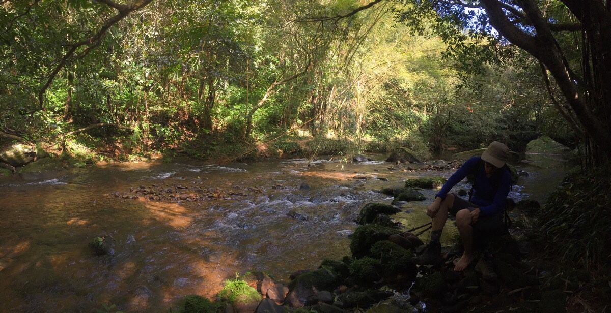
The second half of the crossing was considerably shallower – the water not coming much higher than our ankles, and before long we were at the far side and putting our shoes and socks back on. Considering that I’m actually really quite a squeamish person, it wasn’t too bad.
Once we were ready to set off again, we followed the path as it climbed up to the left, (it seems like there is a path to the right too, but I think this may have been made by people wrongly heading that way).
The trail conditions for the next 20-25 minutes or so were the least pleasant of the whole walk; thigh-high ferns and shrubs crowded over the path and it made me wish I’d been carrying a machete. Despite this, the trail was still clear and easy to follow.
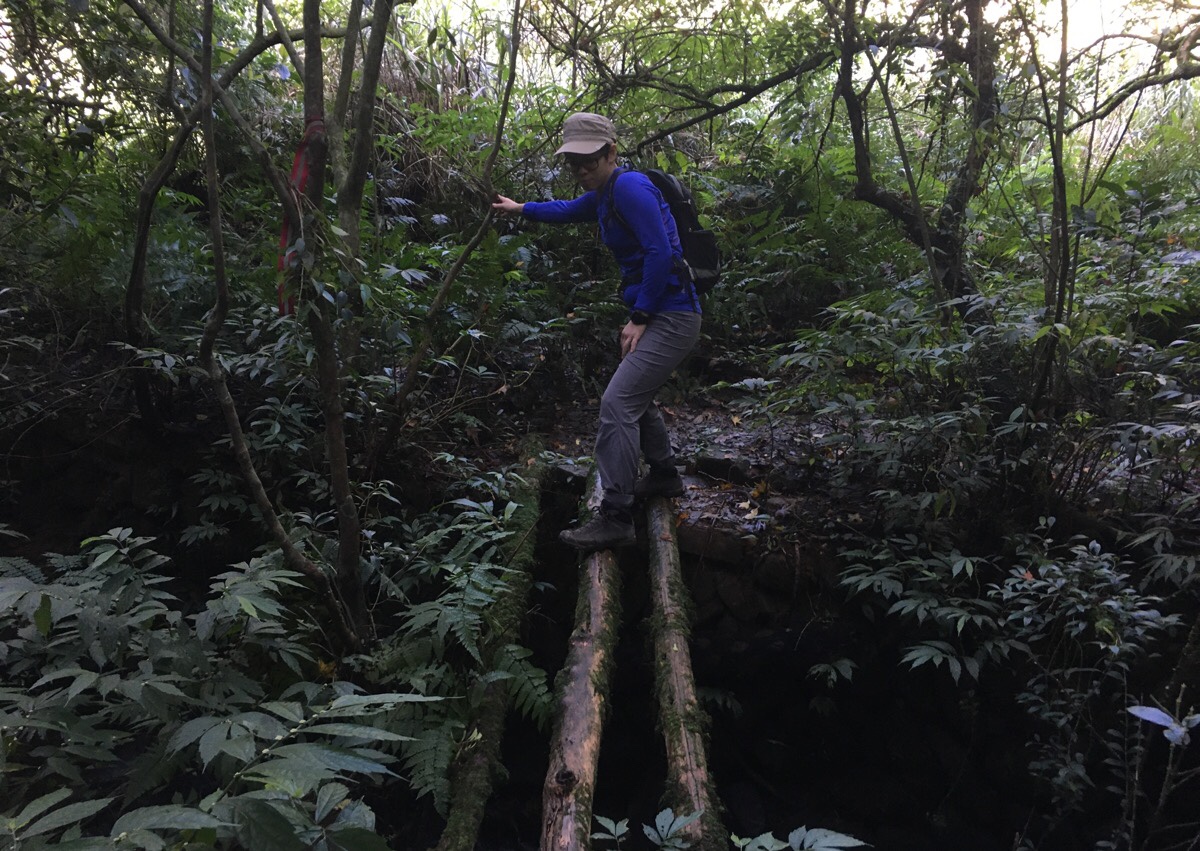
In several places the path crosses small streams and passes walls or similar forgotten structures. There was also a very dodgy three-tree bridge which I pretty much crawled over, and which Teresa tackled slightly more elegantly.
About 30 minutes of battling through dense undergrowth, the path came out on a much more established track. I’m not sure where it goes if you turn left as there is nothing indicated on the map, however, if you turn right it will take you back down to the water.
The trail first climbs up a little way, and then after cresting a rise, it’s downhill all the way. The exposed mud was extremely slippery, and despite going slowly, we both found our feet sliding away from us more than once.
After about ten minutes of walking down, the path reaches a junction. Red arrows indicate that to continue following Hu Bao Tan trail we needed to turn left.
*This is where we would have arrived if we had turned right over the big bridge instead of heading left. If you come directly from that bridge, you would need to turn right here.
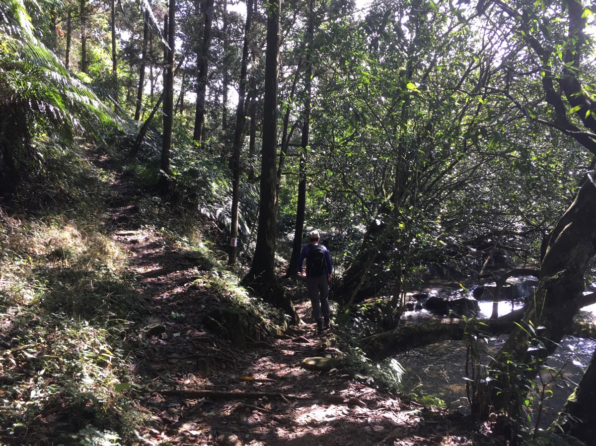
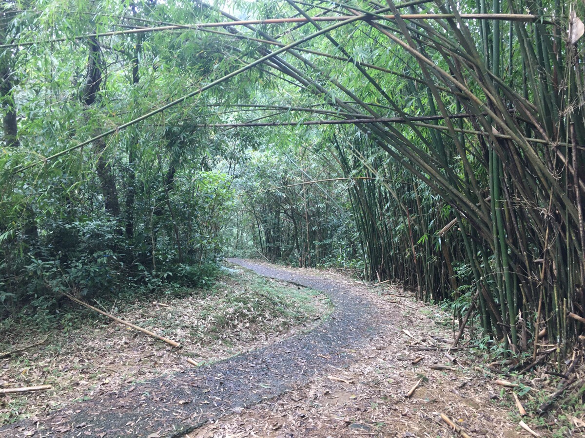
From here, the path has a delightful historic-trail feel to it. The rocky path hugs close to the side of the hill crossing various small streams as they flow down to join Bei Shi River.
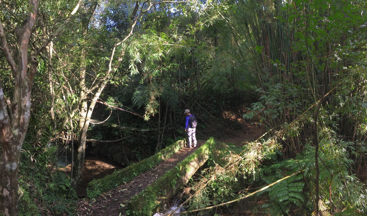
There are bamboo groves and mossy bridges, and the sound of water is all-pervading. There are also a couple of promising-looking trails leading up on the left that I would love to come back and have a go at another time.
Most of the way, the trail stays above the water, but towards the end, it dips right down to the same level as the river. And we stood on huge weather-smoothed slabs of rock to watch the fish darting around in the enticingly turquoise water. There were several spots that would definitely make for good swimming in the warmer months.
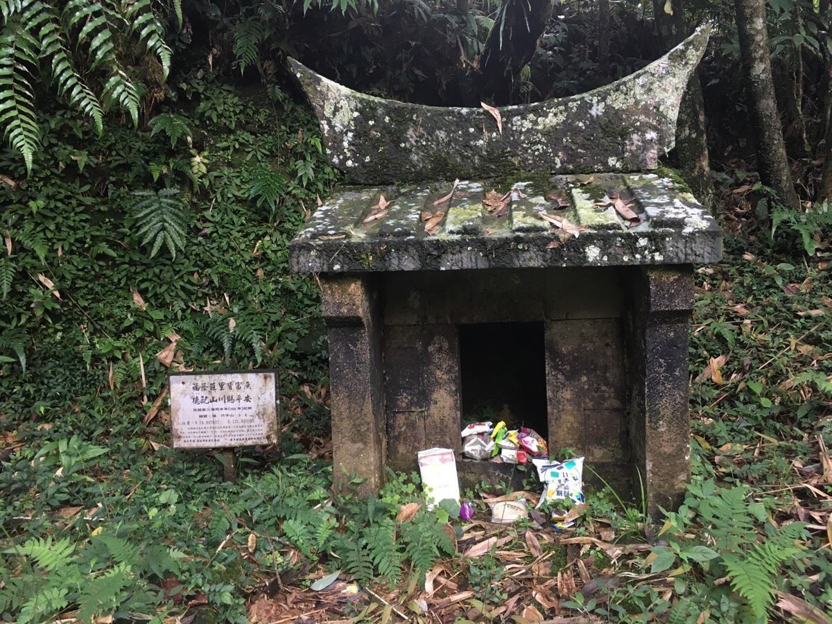
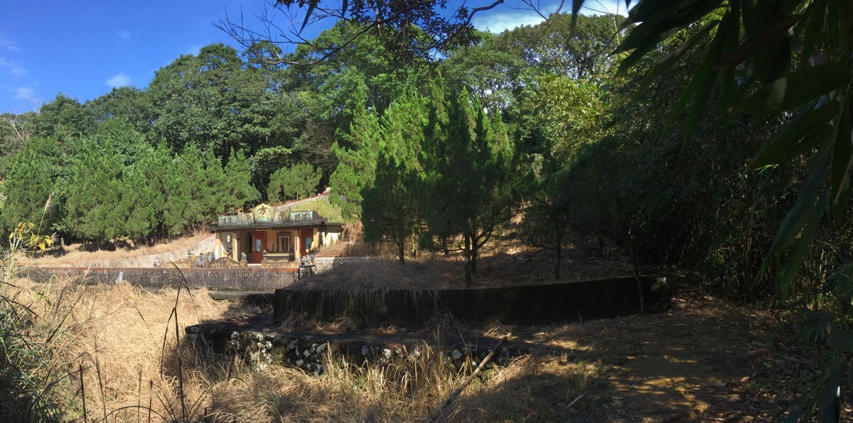
To the left of the path there is a small land god shrine, the third of three that we saw on this trail, (the first being right by the entrance and the second being a very easily missed four-stone structure between two trees). This one has been rebuilt in recent years, but it was first established in 1904. The locals who used these historic trails long before they became historic needed to make sure they were protected on their journeys, and so it’s very common to find multiple small shrines on such paths. The resident god was a small figurine, just 10cm tall, but he had been well-fed by people passing through.
After climbing again for a short distance, the trail joins a concrete path and we had to head right downhill to rejoin to river.
Soon we were back at the concrete stepping stones, and crossed over them back to the side that we’d originally started from. From there it was a short stroll back past the toilet block and to the car.
NOTE: Since October 2021 you may find that you have to keep walking down this side of the river for another 800m or so until you reach a bridge. Once at the bridge you can cross over and turn right onto the road then follow it back towards the start of the trail.
How to get to Hubaotan Historic Trail
Google Maps address: we parked in the public car park here: 虎豹潭步道停車, Shuangtai Industry Road, Shuangxi District, New Taipei City, 227
GPS location:
- Carpark – N24 58.365 E121 49.669
- Bridge which marks the point at which you need to choose to do a short loop of a long loop – N24 58.477 E121 50.220
Public transport: there is a bus, the F815 from Shuangxi train station which arrives at the trailhead four times a day. It leaves the station at 6:20, 9:40, 13:00 and 15:50. The four return times are 07:54, 11:14, 14:34 and 17:24. The second one is probably your best choice, but the third one should also be possible if you cut off the harder section that we did. Shuangxi Station is an hour or so’s train ride from Taipei main station, so to arrive in time for the 9:40 bus you would have to catch the 8:14 train.
Further reading: there are lots of posts written in Chinese about this trail. This one does a shorter anti-clockwise loop (cutting out the river crossing section). I can’t seem to find any that followed the exact same route that we did though. Also, there doesn’t seem to be any English language info out there already – unless perhaps it uses an alternative name.
Nearby trails:
Hubaotan Historic Trail Map
GPX file available here on Outdoor Active. (Account needed, but the free one works just fine.)
My new words learnt on this hike:
- 有屁快放 / yǒu pì kuài fàng / if you have something (silly) to say, say it quickly/right away – this colourful phrase is literally something like ‘have fart, fart quick’, and since learning it I’ve heard it being used a couple of times. In one instance the speaker was busy and wanted the other person to just come out and say whatever they wanted to say so that they could continue working. In another, a colleague was being gently mocked for gossiping or saying unnecessary things.
- 有話快說 / yǒu huà kuài shuō / this is the more ‘proper’ version of the above phrase.
- 碎碎念 / suì suì niàn / whitter, or keep prattling on.
- 速度 / sùdù / speed
- 轉變 / zhuǎnbiàn / transform, change
This is the bit where I come to you cap in hand. If you’ve got all the way down this page, then I can only assume that you’re actually interested in the stuff I write about. If this is the case and you feel inclined to chip in a few dollars for transport and time then I would appreciate it immensely. You can find me on either Ko-fi or Buy Me a Coffee.
