
Distance: about 5km
Time: 2 hours at a gentle speed.
Difficulty (regular Taiwan hiker): 1.5/10 – it’s really easy if you’re used to hiking here, just uneven surfaces and the occasional slippery patch to keep an eye out for. The stream crossing is simple too.
Difficulty (new Taiwan hiker): 3/10 for the canal trail only, there isn’t really any elevation gain or anywhere to get lost, so it’s a good place to start. To do the same little partial loop that we did would be a little harder since you have to cross a stream, and scramble a little for around 100m, but as long as it hasn’t rained too much recently and you go carefully it should still only be a 4/10.
Total ascent: a mere 30m or so – these canal trails are very flat.
Water: I don’t think I even drank more than 200ml, but it was an autumn day, you’d need 0.5L or so on a warmer day.
Shade: pretty well-shaded the whole way. This, combined with the water means that it is a great walk for hotter days.
Mobile network: patchy throughout, but it didn’t seem to drop away for long.
Enjoyment: This is a really lovely canal walk, with a couple of interesting features, but it’s definitely more of a relaxing walk than an exciting hike.
Jump to the bottom of this post for a trail map, GPX file, and transportation information.
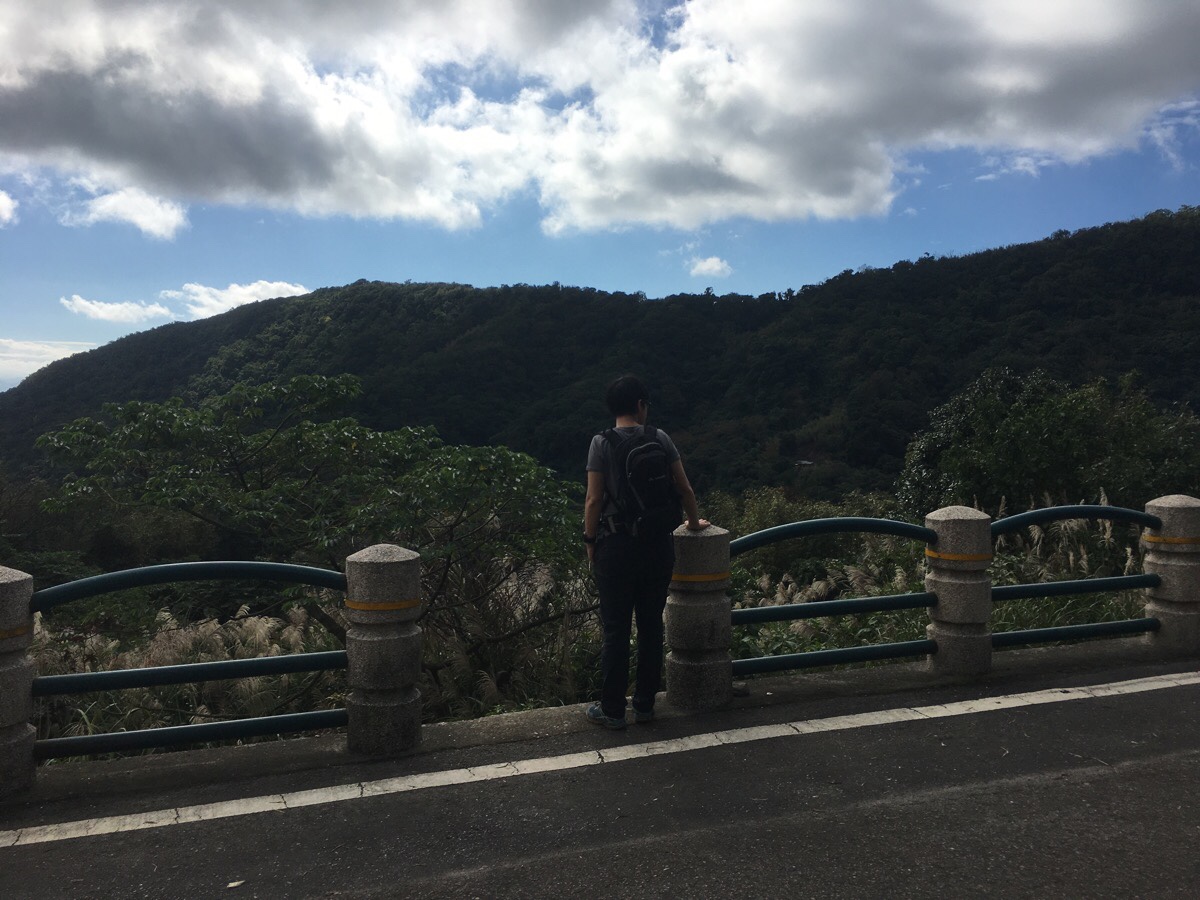
Steps leading off the road will take up down to the canal – actually there is a more established flight of steps a little further along, (next to a coffee shop), but I am not one to take the road when there is a motor er interesting choice, so we headed straight down and to the right.

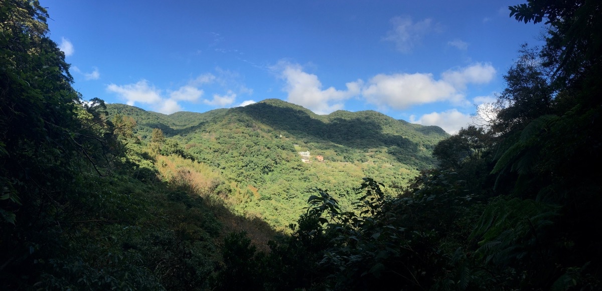
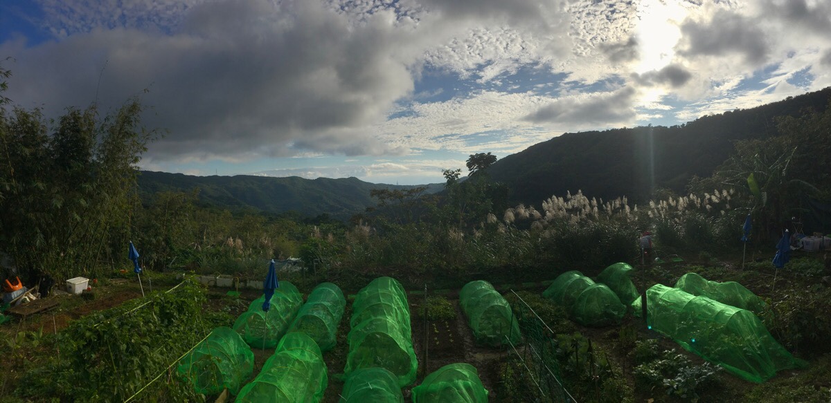
The canal flows through farmland and parallel to the road until a little beyond the house in the above picture, and there were a lot of people around enjoying the silver grass.
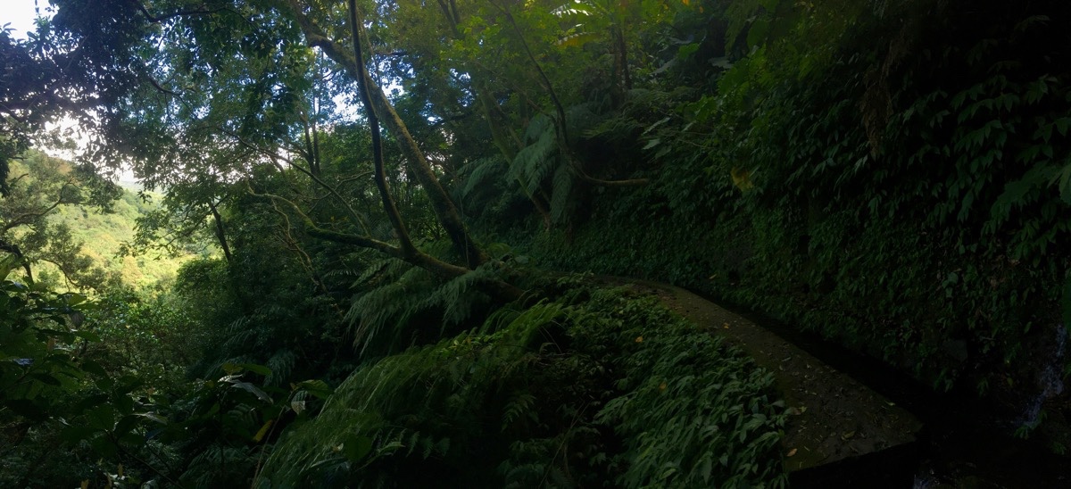
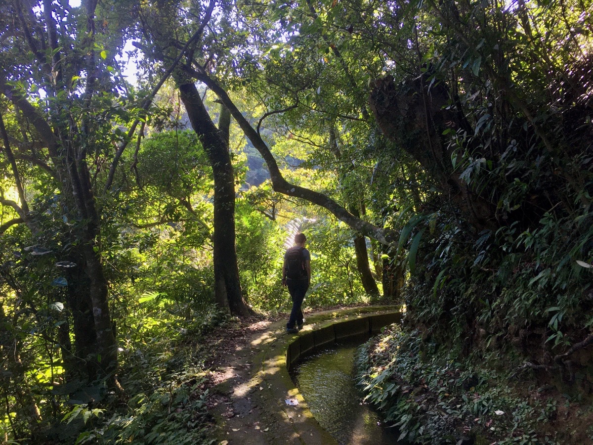
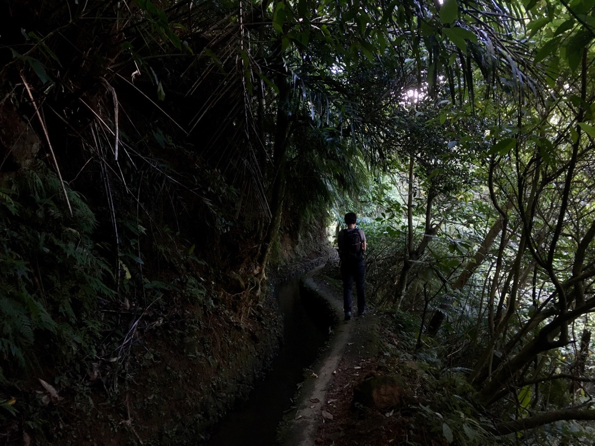
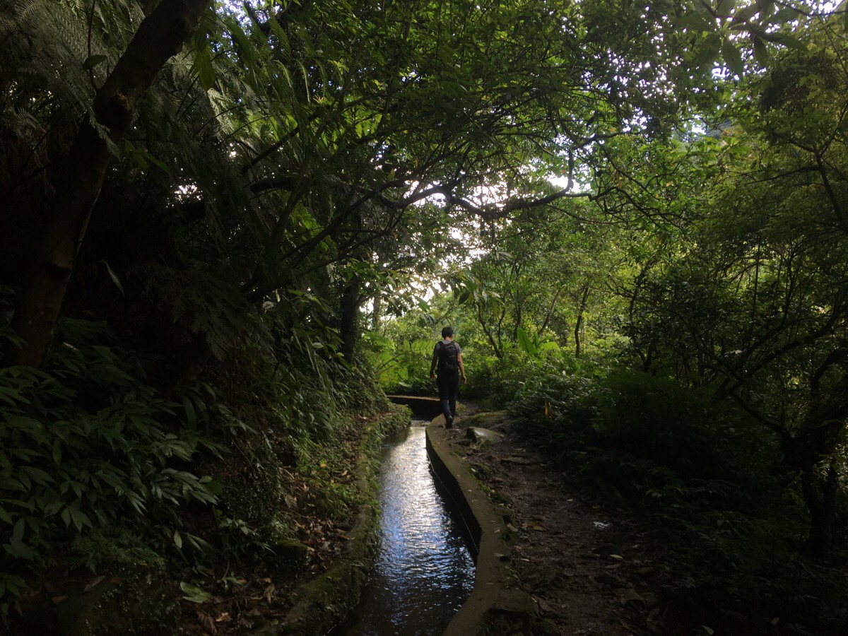
As soon as the canal left the road behind, it became exactly the sort of trail that I was hoping for – a gentle waterside walk under a tunnel of leaves.
There is a path leading down on the left at one point, and a couple of other leading up on the right, but we ignored them and just followed the water.
Walking in this direction, the right side of the trail is uphill whilst the left is downhill. Every now and then there were streams and waterfalls of varying sizes feeding down from the right into the canal and down again into larger river below. Here is where Dingshan Stream (頂山溪) flows down on its way to join the larger Nei Shuang Creek (內雙溪).

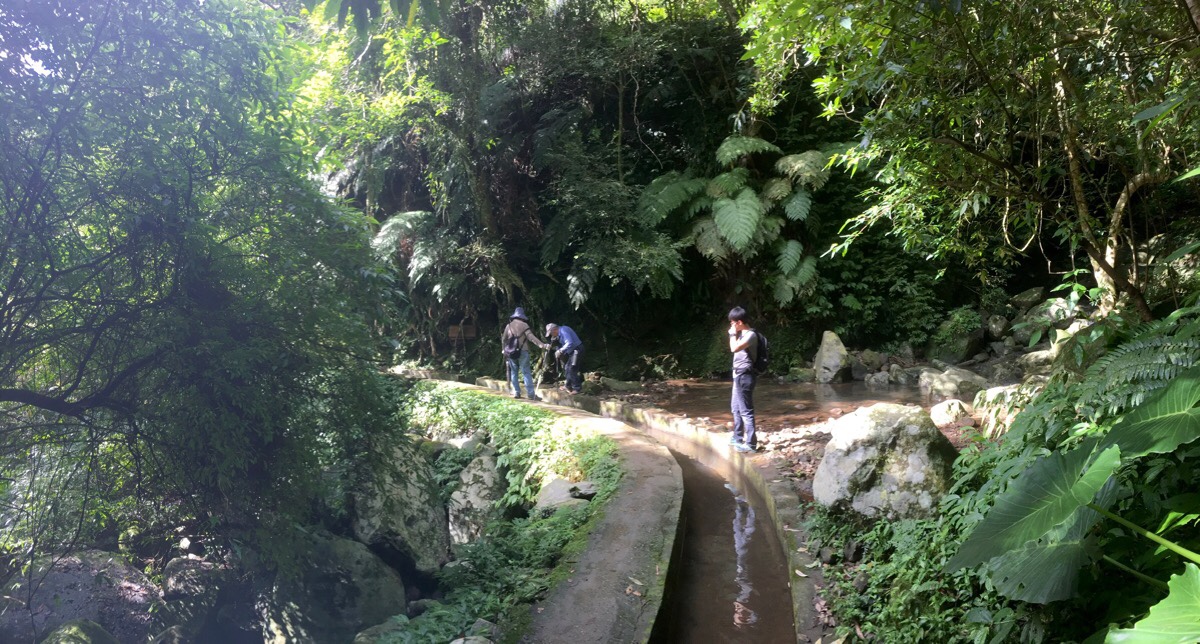
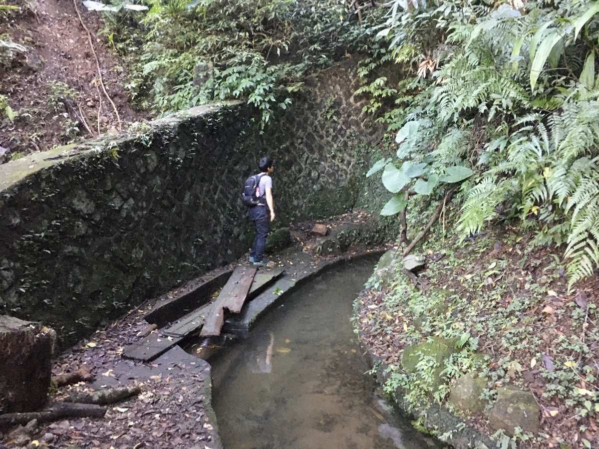
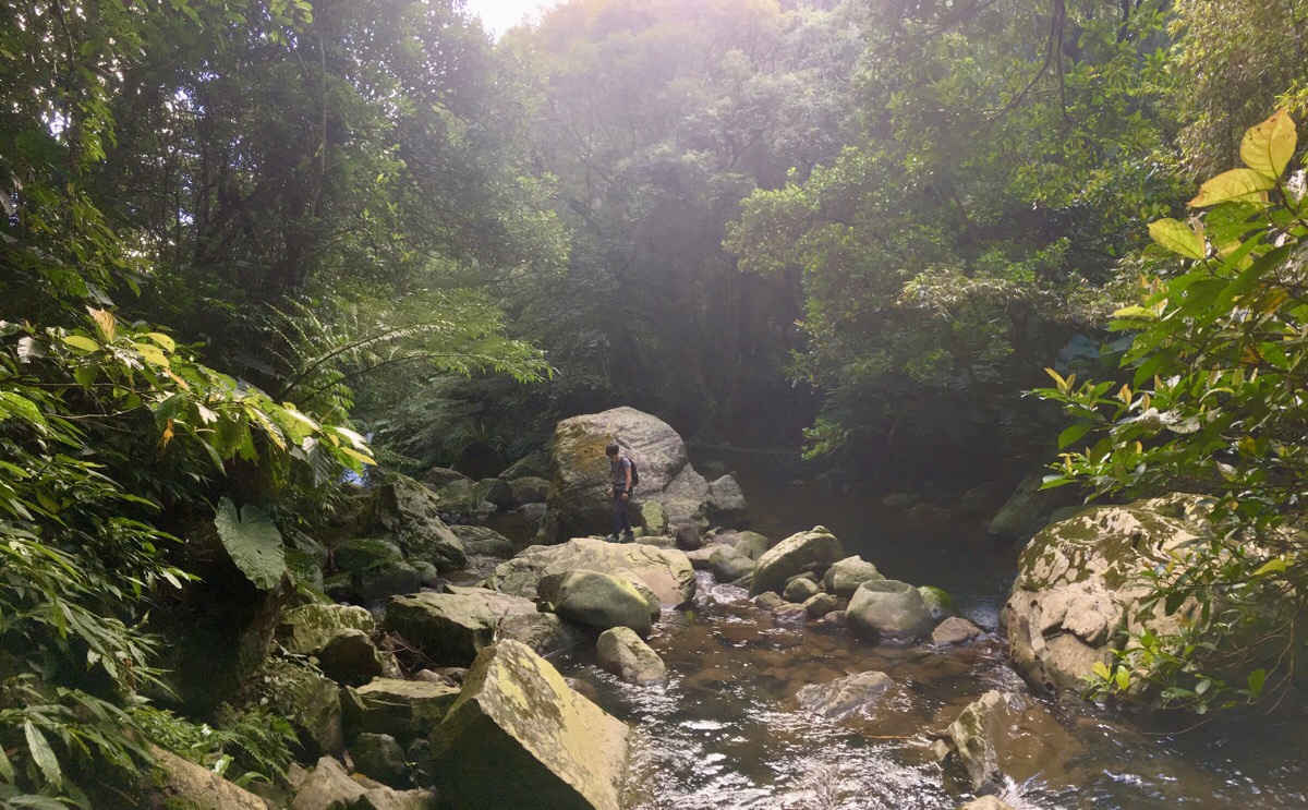
A short while later, we crossed Nei Shuang Creek – it was the largest of all the streams we came across, and was full enough to be rushing over the sides of the canal. This forced us to choose between getting wet feet or taking our shoes and socks off.
Both of us and the couple just ahead of us opted to take the bare-foot option. Actually I wished I stopped to do this more often – it is such an enjoyable sensation to feel the earth (well, concrete really here, but earth is better), through the soles of your feet.
The view looking back over the semi-flooded section is rather lovely – not entirely unlike a smaller, manmade Shifen. I imagine this is a very popular rest spot during the summer.
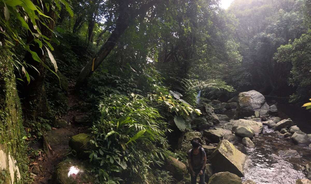
Continuing onwards, the path drops away more steeply to the left and climbs more steeply to the right as the water winds around the curves of the slope.

About 50 minutes after leaving the road behind we arrived at the steps which lead up to Pingding Village. (We passed through here – from uphill to downhill – when we walked up the Gouyinqin Canal to Pingding.)
Although eventually, to head back to the car, we had to head up to the right, first I wanted to walk to the end of this particular canal trail, so we chose to cross straight over and continue to follow the water.
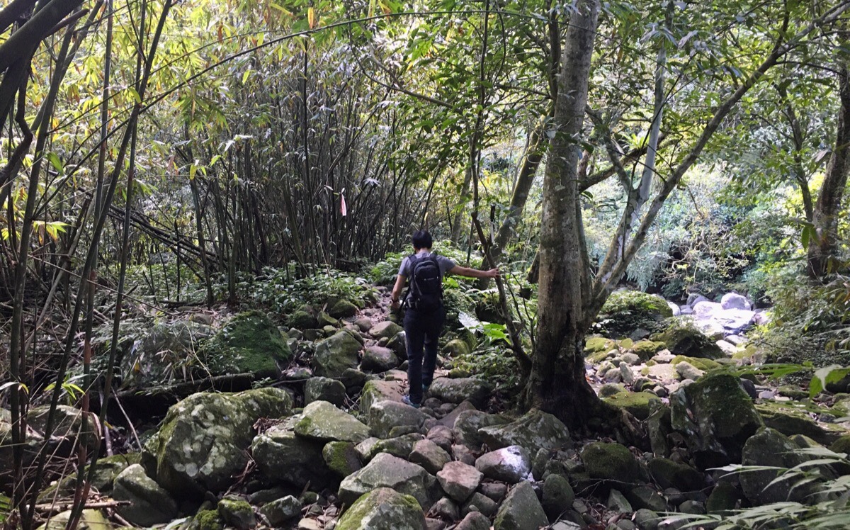
It was a further 800m-or-so to the end of the path, and this section had pretty much the only views out of the foliage tunnel of the whole walk.
The trail itself was as well-walked the whole way, so it seems reasonably popular despite not being a through-route. Also, we got treated to some absolutely beautiful mid-afternoon sunlight filtering through the leaves and casting everything in a yellow-green glow.
10 minutes or so after crossing the path, we reached the end of the line. The footpath terminates at a tunnel into the side of the hill. The flow of water slows around here as the channel widens just before disappearing into the the dark for about 400m.
We stared into the black for a while and then turned around and retraced our steps back to the junction.
Back at the steps we decided to turn left up the steps and then almost immediately right along the course of the slightly higher New Pingding Canal. This time we were walking against the flow of the water, heading upstream.
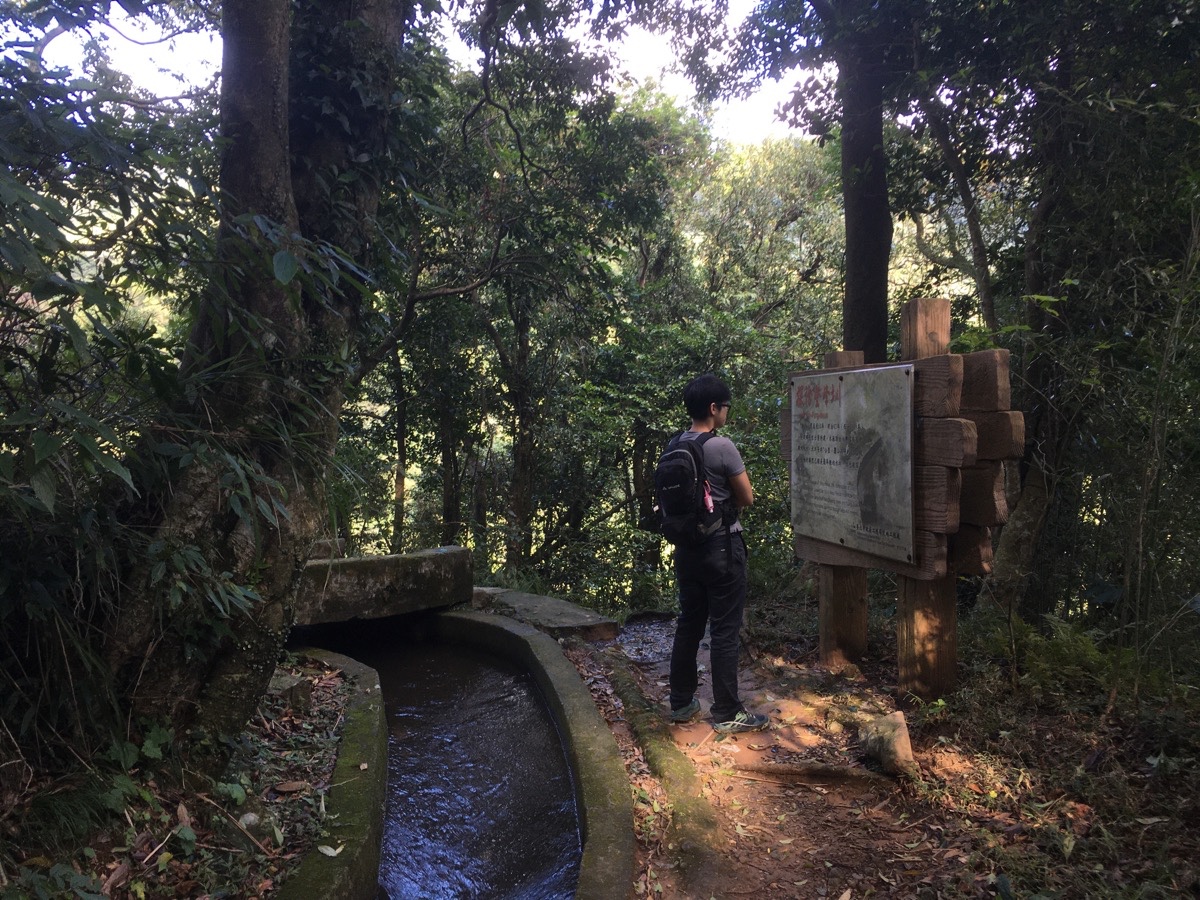
There are actually three waterways supplying water to the farms around Pingding. The one that we started this walk on (Deng Feng Canal) was built in 1909 and is the lowest and most recent of the three. The one that we returned on, (New Pingding Canal), is the one in the middle – both in terms of date and elevation. It was built in 1849, a mere 15 years after the original Pingding Canal was constructed. The two older ones are slightly more traditional in construction, with most sections being comprised of stonework, (the most recent one is made of concrete).
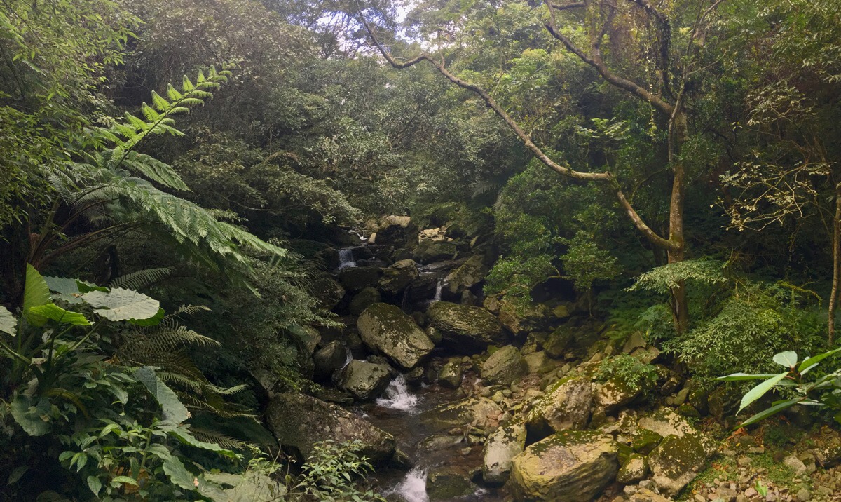
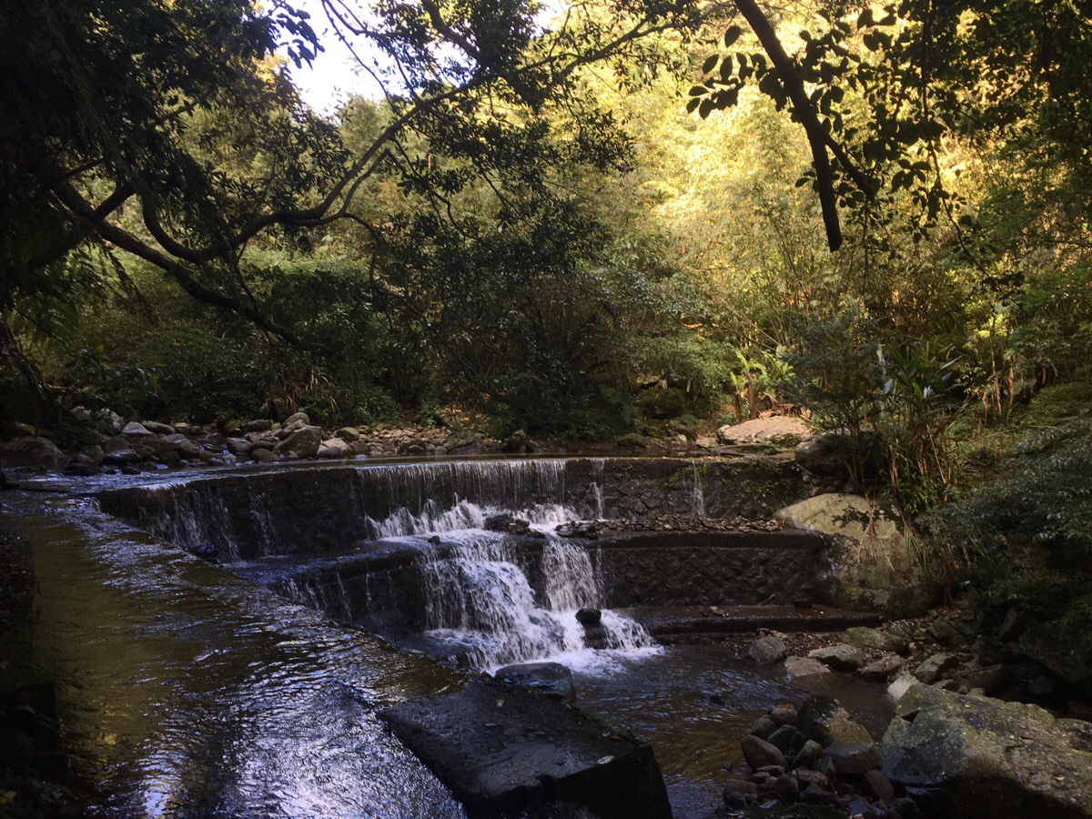
After about 15 minutes of very relaxed walking, we reached the point where New Pingding Canal diverts from it’s source – Nei Liao Creek.
The view was quite delightful. Trees shade the shallow valley cut by the stream as water spills forth over large boulders. In fact it makes me think I really do need to come back and walk the whole of the Nei Liao Creek Old Trail at some point.
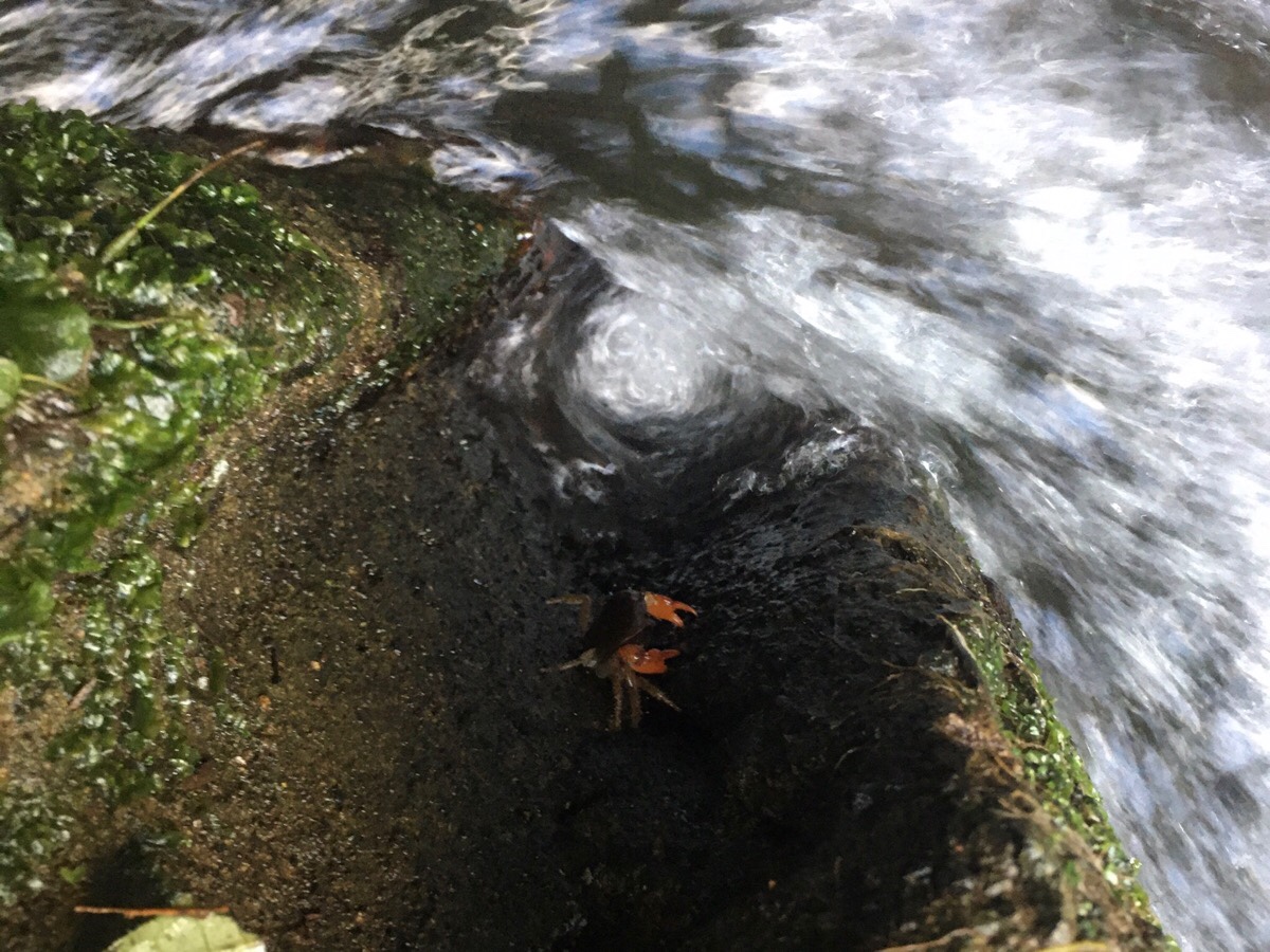
As we went to cross a manmade channel in the path, I noticed this little crab braced against the rushing water.
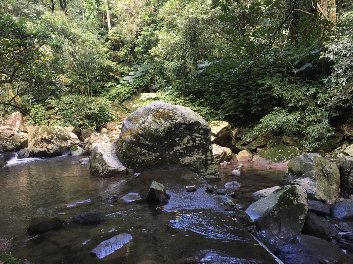
The path was not immediately clear, but I knew that it was meant to cross the river at this point, and so after a closer look I noticed that hiking tags lead up from the opposite bank, (just up from and slightly to the left of the largest rock in the picture above). The water between the near shore and the rock in the middle of the stream was only about an inch or two deep, (it looks deeper than it was), so since we knew we were not far off finishing, we decided against removing our shoes for a second time and just went for it. (There is a path leading up to the left, but that goes up to the end walkable section of Pingding Canal – beyond that it disappears into private land.)
Teresa’s smaller legs made it a little harder for her to navigate around the boulder, but she did fine, and once we got past the large rock in the middle it was a lot easier to walk the rest of the way to the far bank.
Once on the other side of the water, hiking tags indicate that the path splits in both directions. We took the trail on the left leading back down to Deng Feng Canal.
It was only a short five-minute (or less) walk down to the lower waterway. The path seemed well-trodden and there were tags here and there, so it was pretty easy to follow.
The trail breaks out onto the canal path at the point where we had earlier stopped to take our shoes off. We startled a group of hikers by suddenly appearing from the bushes and then turned left, back towards where we started.
As we made our way back towards the little village, I wasn’t quite ready for the walk to be over, (I could have happily done double the distance in these conditions).
By the time we arrived back at the farms, the light had dipped low enough to be beautifully backlighting the silver grass and vegetable patches. There was also an aunty selling freshly-baked pumpkin steamed buns out of a garage next to the road, so we stopped to buy some to snack on (and take home for breakfast the next day).
How to get to Dengfeng Canal Trail
Google maps address: the trail starts and ends right next to the Hill Top Courtyard Cafe at No. 41, Lane 370, Section 3, Zhishan Road, Shilin District, Taipei City, 111
GPS location:
- Trail head at Dingshan – N25 08.250 E121 35.280
- Pingding bus stop – N25 07.890 E121 34.590
- Shengren Waterfall bus stop – N25 07.690 E121 35.220
Public transport: the M1 minibus from Jiantan Station (first stop) or Shilin (fifth stop) will take you almost directly to the trailhead. It is not a frequent service though, so you’ll need to plan to arrive on time. The route runs five times a day, with the village of Dingshan (where this trail starts) being the final stop. In my opinion, the best way to make this work would be to do a one-way walk starting from Dingshan and ending either at Pingding or the Shengren Waterfall bus stop; both of these places have more regular bus routes. To head to Pingding, turn uphill when you get to the junction with the signpost explaining about the canal, and to head to Shengren Waterfall stop turn left downhill at the same place.
Further reading: for some information written in Chinese you can check out Tony Huang’s post on the trail – as always he gives a bit of background information. The only English language reference I can find online is this brief (and useless) mention in a highly inaccurate press release recommending trails for losing weight which carries on the weird Taiwanese trend of measuring trails by how many calories they burn and the equivalent in slices of bread. (According to the website, 1.3km of gentle canal trail walking will apparently burn a staggering 1,460 calories, which is equal to 10 slices of bread.)
Nearby trails:
- Jiaokeng Trail
- Pingding Canal Trail
- Gouyinqin Old Trail and Weilun Canal
- Taipei Grand Hike – Feng Gui Zui to Daxigou Riverside Park
- Taipei Grand Hike – Feng Gui Zui to Xiaoyoukeng
Dengfeng Canal Trail Map
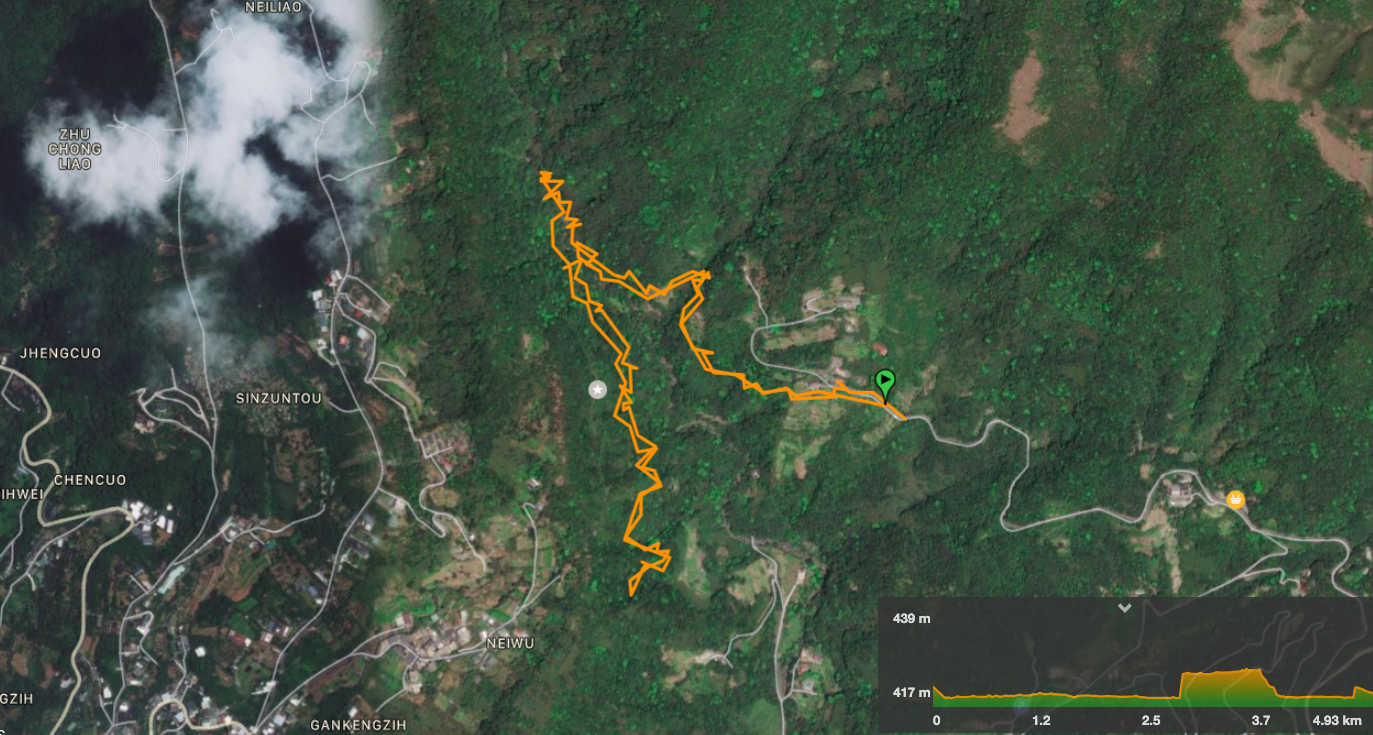
GPX file available here on Outdoor Active. (Account needed, but the free one works just fine.)
My new words learnt on this hike:
- 預測 / yùcè / predict or prediction
- 各走各的 / gè zǒu gè de / go our own ways
- 人家 / rén jiā / generally speaking this just means ‘people’, but the secondary meaning I accidentally learned is that it can be used as a kind of affected way to refer to yourself in the third person. In English if we wanted to affect being posh, we might say “one would rather not do that”, (obviously no one actually speaks like that unless it’s for comic affect); in more modern English you’re more likely to hear “man” being used in a similar way, certainly amongst speakers of MLE. In Chinese it is equally colourful, it is a way of speaking that is usually adopted by a specific type of woman, particularly one who seriously or ironically employs sa jiao in her communications with her significant other, (and because I don’t like the sweeping generalisations and lack of a woman’s perspective in the first article, please make sure to give yourself a more nuanced understanding by taking a look at this great discussion of the article linked to above). Anyway, descriptions of sa jiao are not really the point, my point is that 人家 can be used as a way to say I. For example “人家不喜歡!” or “人家好累喔!“ Anyway, it makes Teresa cringe when I use it and that’s enough to make it something I learnt very quickly!
- 不好連 / bù hǎo lián / not easy to connect (like a wifi network)
- 我連好久了 / wǒ lián hǎo jiǔ le / I’ve been trying to connect for ages.
This is the bit where I come to you cap in hand. If you’ve got all the way down this page, then I can only assume that you’re actually interested in the stuff I write about. If this is the case and you feel inclined to chip in a few dollars for transport and time then I would appreciate it immensely. You can find me on either Ko-fi or Buy Me a Coffee.
