Distance: the route that we took was 18km – this could be shortened in a number of ways, (there’s an 8km version, a 15km version, and one that’s just a smidge shorter than the one we did). I will include notes throughout the description to indicate where the shorter routes differ. Since I’ve not hiked those, I can’t vouch for the trail conditions, but there are plenty of Chinese language posts about them where you can check the photos.
Time: 9 hours and 20 minutes – we spent a good 3 hours of that resting or stopped though.
Difficulty (regular Taiwan hiker): 5/10 – almost all of the difficulty here is in the distance and mental endurance is required. The terrain is steep in some places, but not too bad, and if you’re familiar enough with Chinese characters to recognise mountain names, then the trail is pretty well signposted.
Difficulty (new Taiwan hiker): 10/10 for the full loop – this would have finished me off when I was starting out! If you only do the first section up to Baishi Shan and then loop back it should be a doable 7/10 for any reasonably fit people as long as you give yourself enough time. The difficulty will be the uneven trail surface, some steep climbs, some slightly exposed ridge walking, and following signposts that are pretty much exclusively in Chinese. Make sure to download a GPX route to follow, and/or take a map and/or a local friend who has some experience of hiking.
Total ascent: nearly 900m – most of the ascent was done prior to arriving at Baishi Shan, with some up and downs as we continued along the ridge to the highest point at Jinmian Shan (679m).
Water: the two of us took a combined 5L on a pretty cool day (the temperature was around 15 degrees). I finished most of the 3L in my water bladder, around 500ml of which was used for cooking, but Teresa came back with just over 1L left. (She never drinks enough!)
Shade: mostly pretty well shaded, I didn’t need to worry in winter – I may have struggled in the summer though.
Mobile network: super patchy – most of the Datieliao section was totally blank, the ridge along to Baishi Shan and Shi San Fen Shan was mostly ok, but beyond that point there were more areas without signal than with. Because of this, it’s particularly important that you download a map or take a paper one with you.
Enjoyment: this was a really enjoyable hike with a couple of noteworthy highlights – the old trail following a stream, the cute old bridge and the ridge section up to Baishi Shan. I think both Teresa and myself would give that part a solid 9/10, from that point on, I think I enjoyed the walk more than Teresa (the difference being that I am a much more challenge-orientated kind of person, whilst she doesn’t entirely understand that part of my psychological makeup). If you’re not sure, then I’d say it is 100% worth doing the loop up to Baishi Shan and back.
Other: you’ll want gloves and snacks whether you only go as far as Baishi Shan, or continue on as we did. Make sure you’ve got enough food and water to keep you going.
Jump to the bottom of this post for a trail map, GPX file, and transportation information.
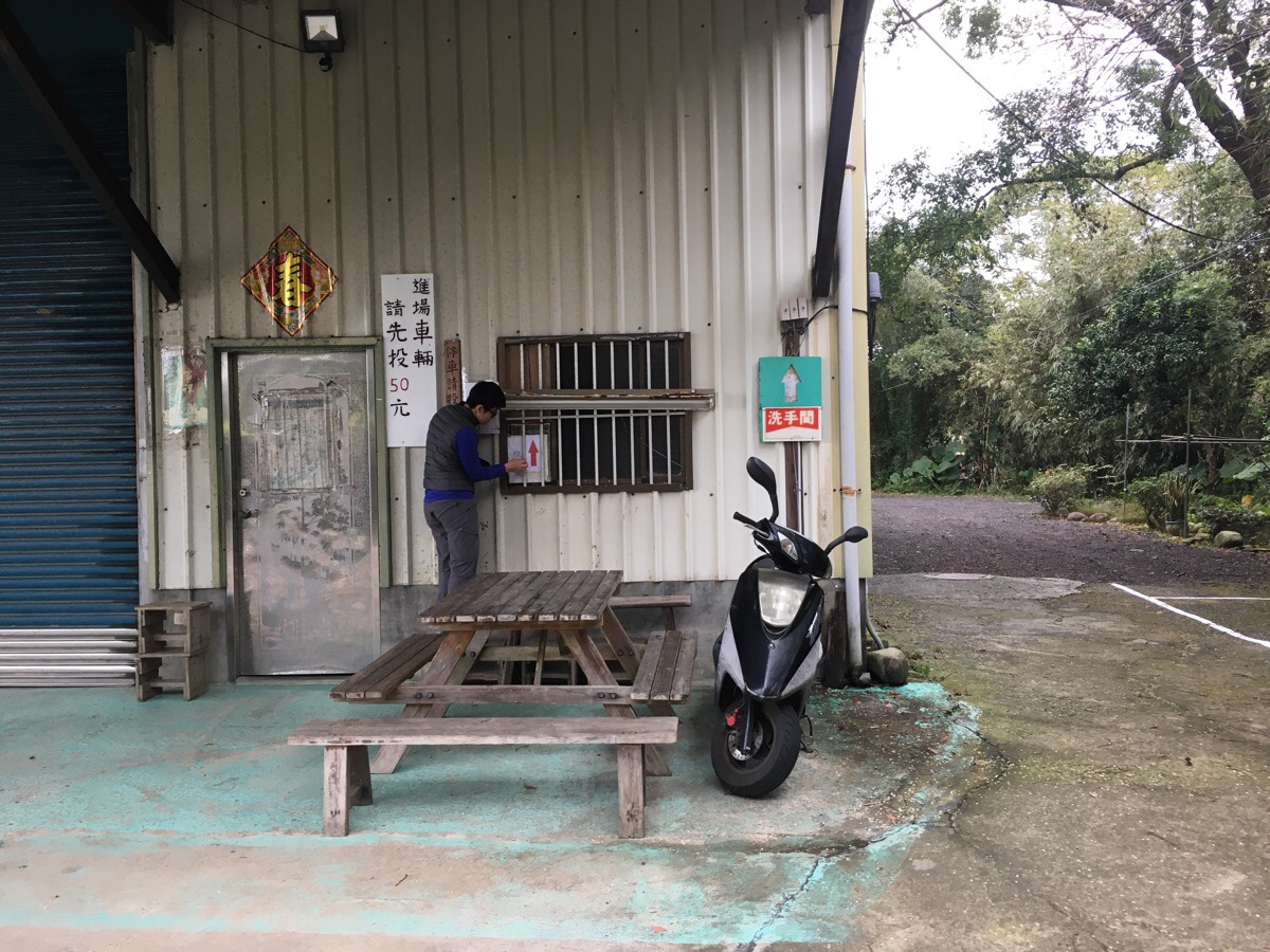
We arrived at the trailhead carpark shortly before 8:30 in the morning and were the only car there. Someone else had parked a scooter, but they’d already set off before we started. There is an honesty box for paying the fee, ($50 for cars, a little less for scooters), although according to other write-ups online there is sometimes a car park grandpa there to take your money.
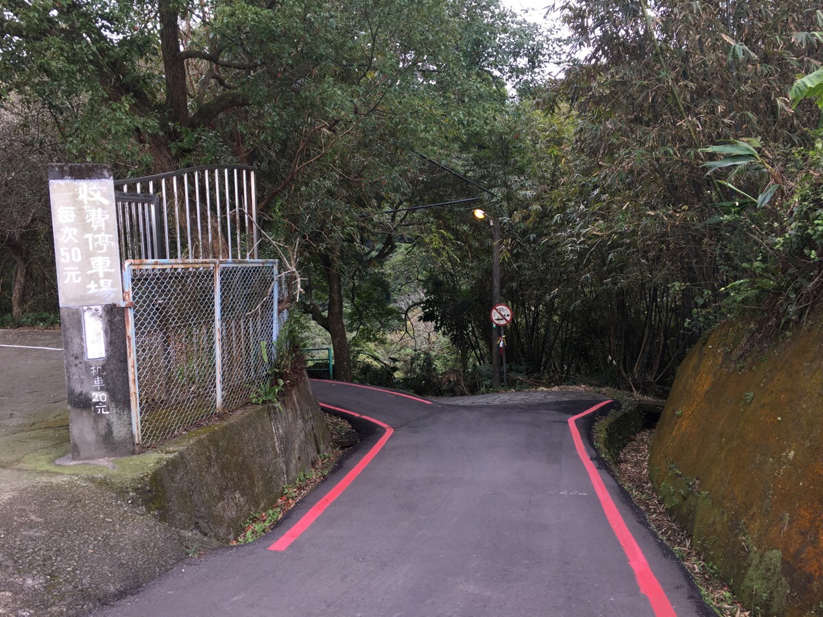
08:48 – Leaving the car park, the road heads left and immediately there is a little paved road which continues downhill. Hiking tags show you that this is the correct way to go.
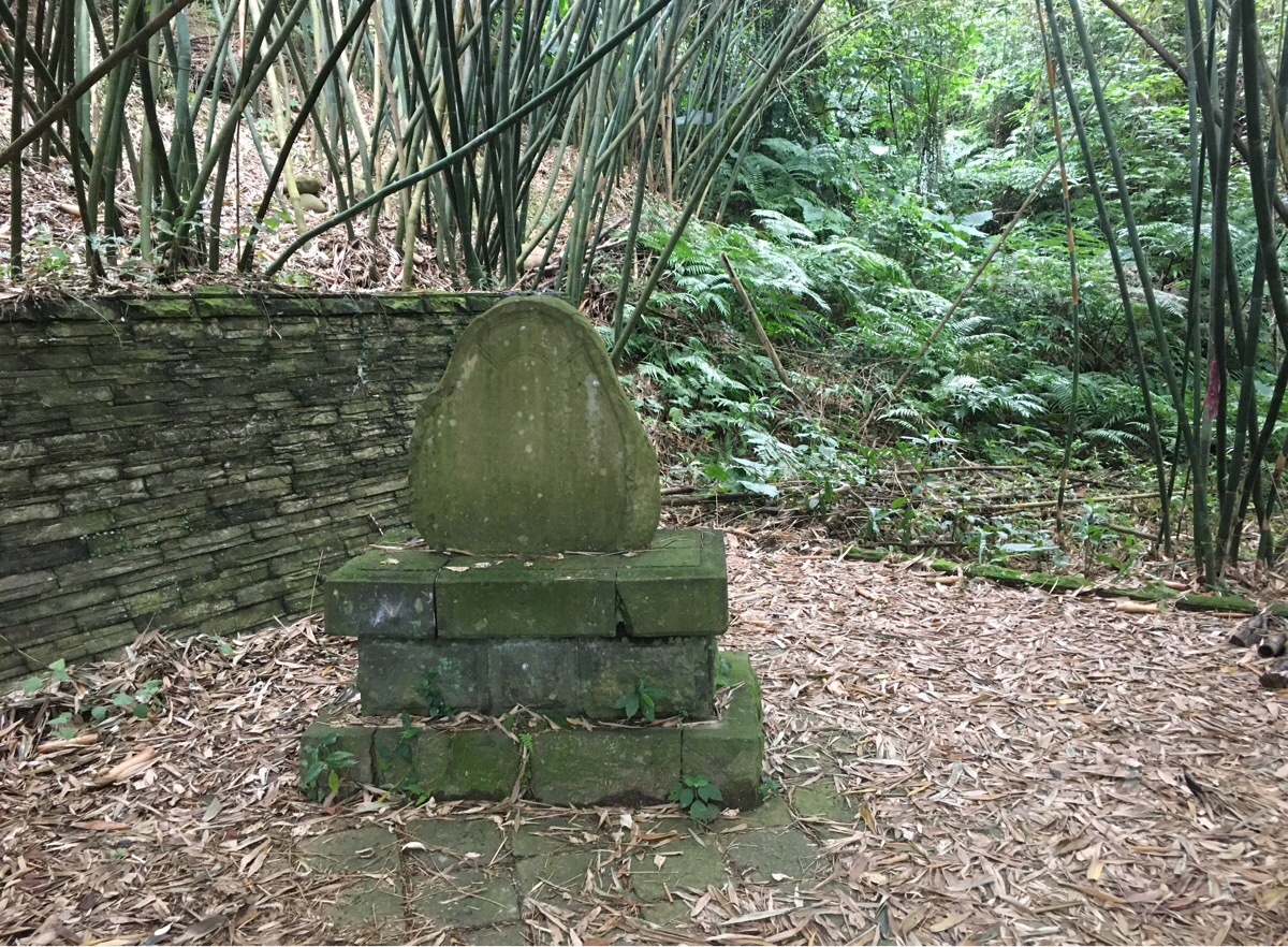
08:51 – A short way down you can spot this stone tablet. It was put here to commemorate all of those who donated to the construction of the two bridges that you cross at the start of the trail—Taiping and Ji’an bridges.
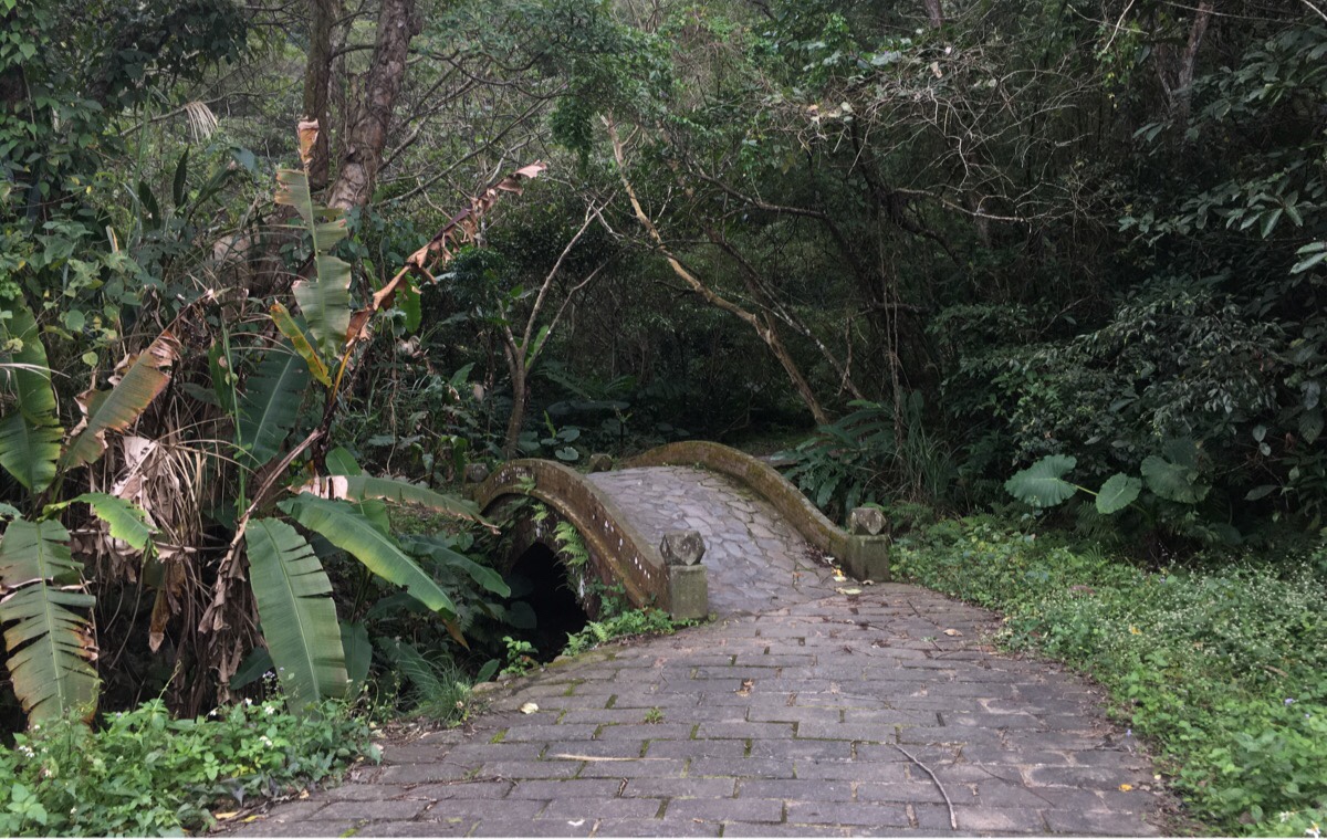
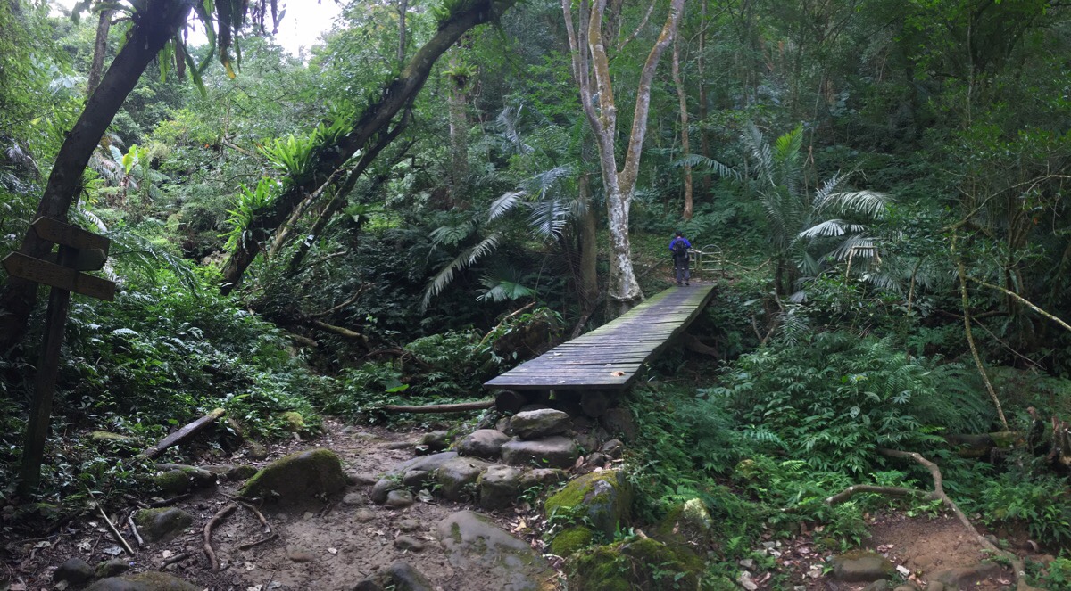
08:55 – The first bridge, (Taiping), crosses Caoling Stream (草嶺溪), I don’t remember there being much water flowing under the humped Ji’an Bridge, but I may be wrong there. Also, make sure to look out for the curious warning sign about slippery ladders and snakes to the right of the trail.
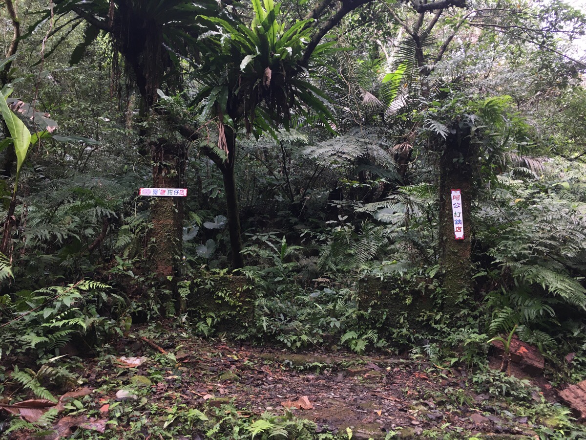
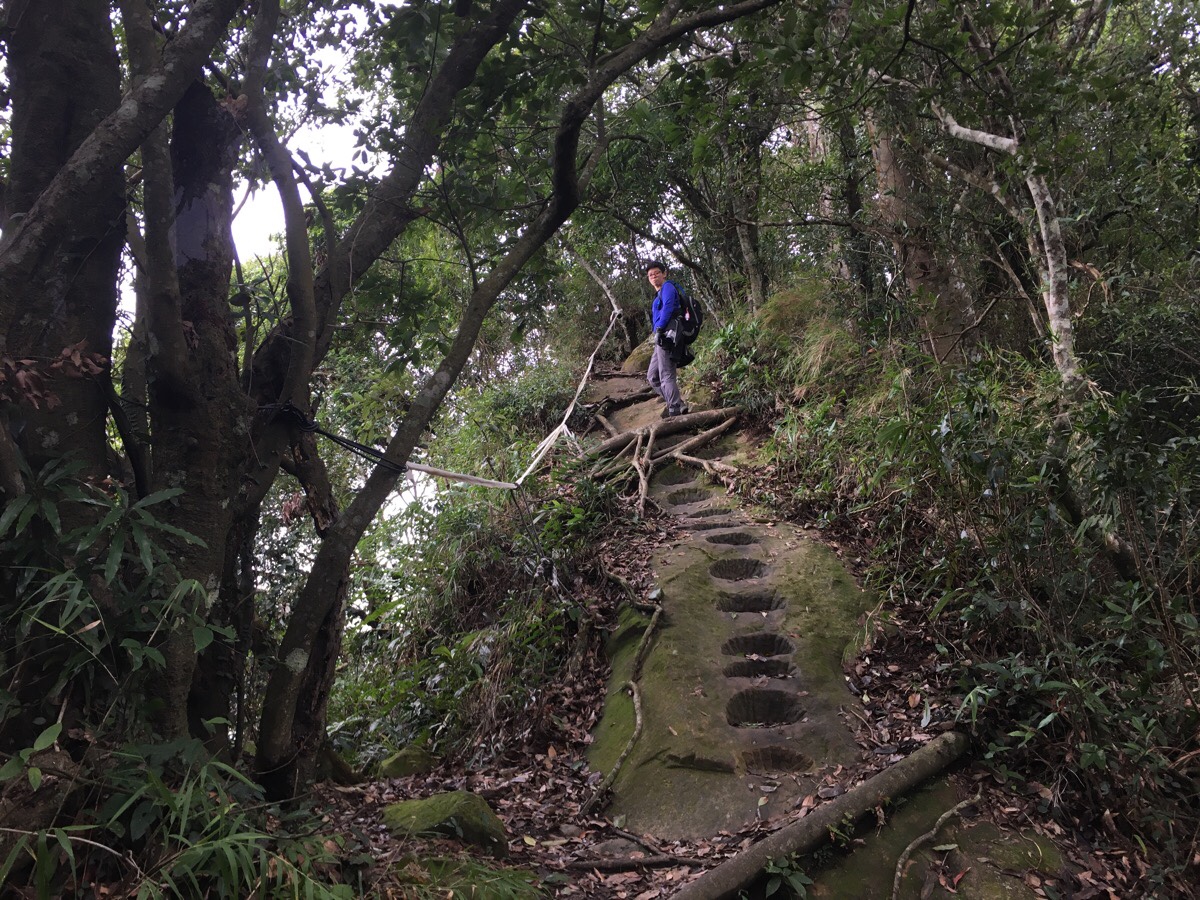
09:15 – Almost immediately after crossing the bridge, the recently laid stonework gives way to more rustic-feeling stones. Some parts have reverted back to dirt a dirt trail. Just before the trail starts climbing in earnest, there are two greenery-decorated brick pillars to the left of the path – signs affixed to each say that the left is “Grandma’s Grocery Store” and the right is “Grandpa’s Blacksmiths Shop”. More brickwork shrouded in ferns gives you a better idea of how the buildings would have sat in the landscape.
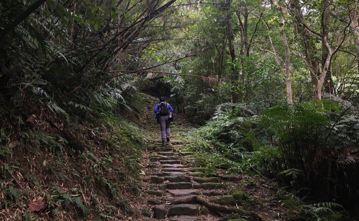
Some places seems to have withstood the passing of time better than others, and in those spots, the larger central stones are clear and worn by frequent use, whilst the smaller stones on the edge are slippery, cloaked in a slick covering of moss and algae.
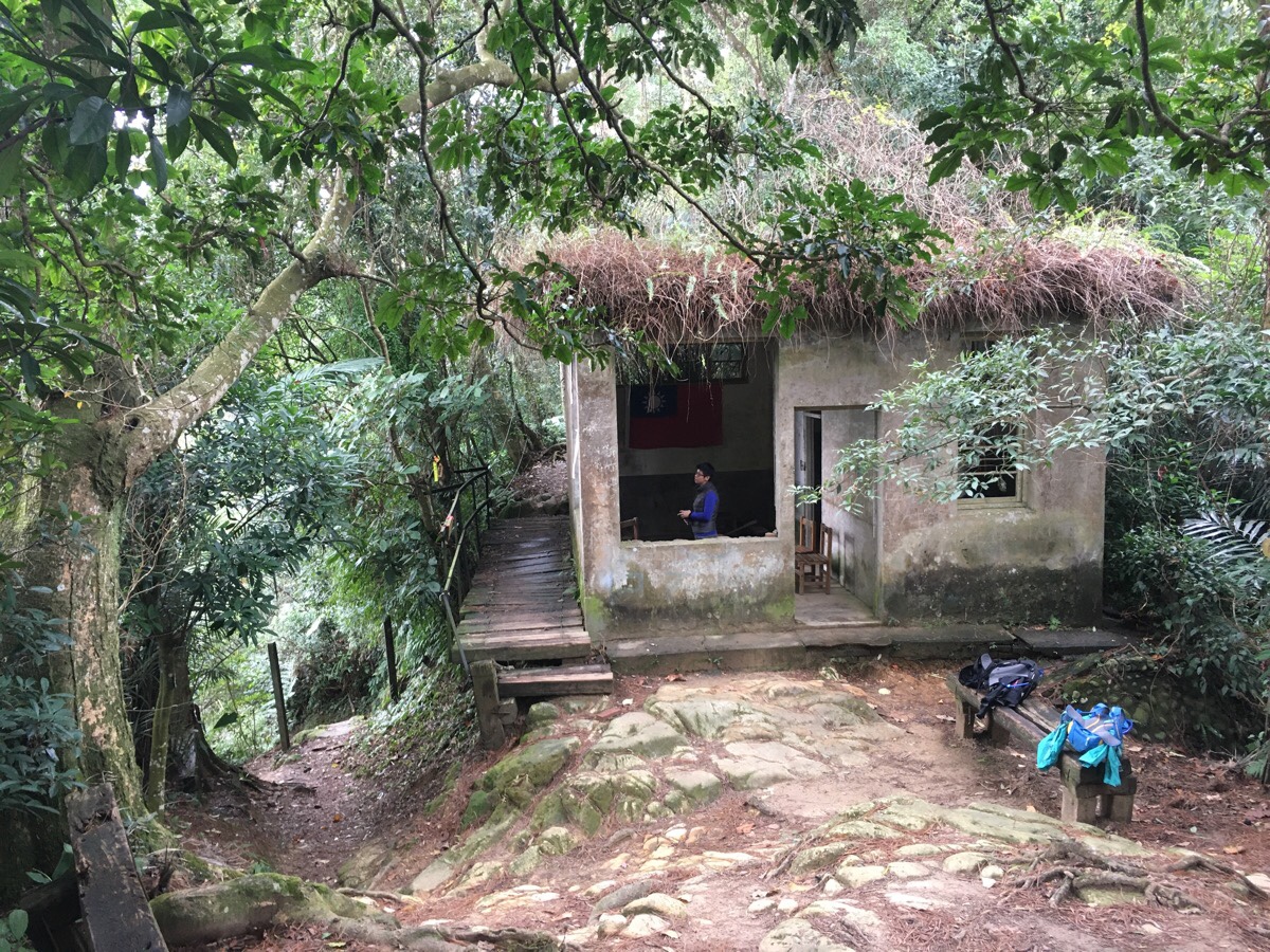
09:24 – After climbing to a saddle in the trail, we reached an old sentry post. These days it looks like it is used as a camp spot or just a rest point on the trail, but in the past it was one of the defence posts set up to watch over Chiang Kai-shek’s Daxi residence: Cihu Villa. Inside there are a few wooden chairs, a shovel and a Taiwan flag pinned to the wall.
When we were ready we followed the wooden path as it heads just to the left of the building and kept going. Not much further on from here someone had sharpied 高雄發大財 (Prosperity for Kaohsiung) on a post. This was one of Han Kuo-yu’s election slogans when he was campaigning to be Kaohsiung’s mayor, and it continues to be a frequently used phrase in his lexicon.
(NOTE: the place where I was standing to take this photo is where the trail splits to head towards Caoling Shan (草嶺山), we didn’t go to take a look, but many walkers start by heading up this way.)
09:37 – At the next junction, we followed the path to the right. Very shortly after this point, the trees to the left of the trail clear and you get a view of Hou Ci Hu (後慈湖/Rear Ci Lake) and the mountains beyond. When we visited, the lake was completely drained of water, (with water it should look like this).
IF YOU DO THE SECOND SHORTEST LOOP WHICH HEADS BACK ABOUT 150-200M AFTER BAISHI SHAN THEN YOU WILL RETURN TO THIS SPOT VIA THE ROUGH TRAIL ON THE LEFT.
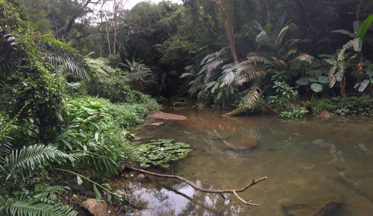
09:47 – After briefly climbing down, we heard water and the path took a left to arrive at a wide pool in the stream which flows into Hou Ci Hu. It was a magical moment – the water is channelled through a shallow valley giving you the sense that you are discovering a secret location that has existed completely unchanged for hundred of years. (However this is an illusion; I’ve seen one write up of the walk where this area looked like it had been more or less levelled and turned to bare earth by a landslide less than four years before our visit.)
09:57 – The trail cuts a lush green tunnel up the valley, tracing alongside the stream. Moss, ferns and all types of greenery are abundant, even some of the stones in the stream are bedecked with gifts of grass. These stones entertained us for a while – looked at from the right angle, they look like the balding pates of little mountain trolls crouching in the water.
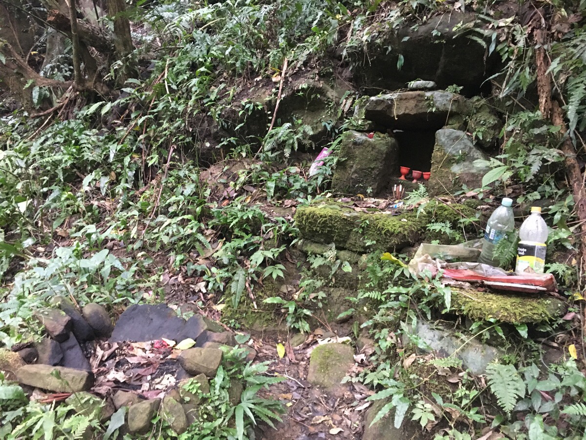
There is another stone tablet here, and someone had recently cut up a fallen tree into 30cm-high rounds and arranged them like chairs around a table, as well as a very basic land god shrine where the incense burner is a bowl fashioned out of rocks. (I think it may be the only one of this type that I’ve seen.)
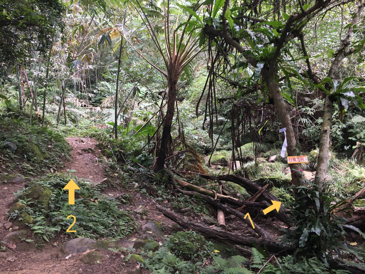
10:02 – A side trail on the right is signposted 行進方向, something like ‘continue this way’, and another Walker has sharpied in 東興橋 (Dongxing Bridge) above it. We decided that it would be worth the detour and stepped across the river to begin climbing again.

10:08 – After about five minutes of climbing the trail arrived at Dongxing Bridge. The bridge – also known as the glutinous rice bridge after the substance which was originally used to bind the stones together – sits just upstream from a small series of cascades which tumble over potholed rock, and just downstream of a pool that would serve nicely as a place to cool off should you come this way in the summer. While we were milling around in the area, a noisy husband and wife couple passed through and said hello.
After about ten minutes or so, we decided to get going and headed back down the same way that we’d come.
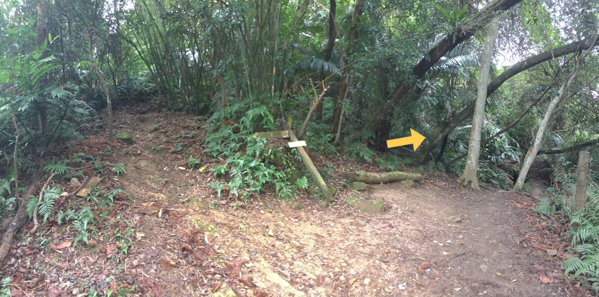
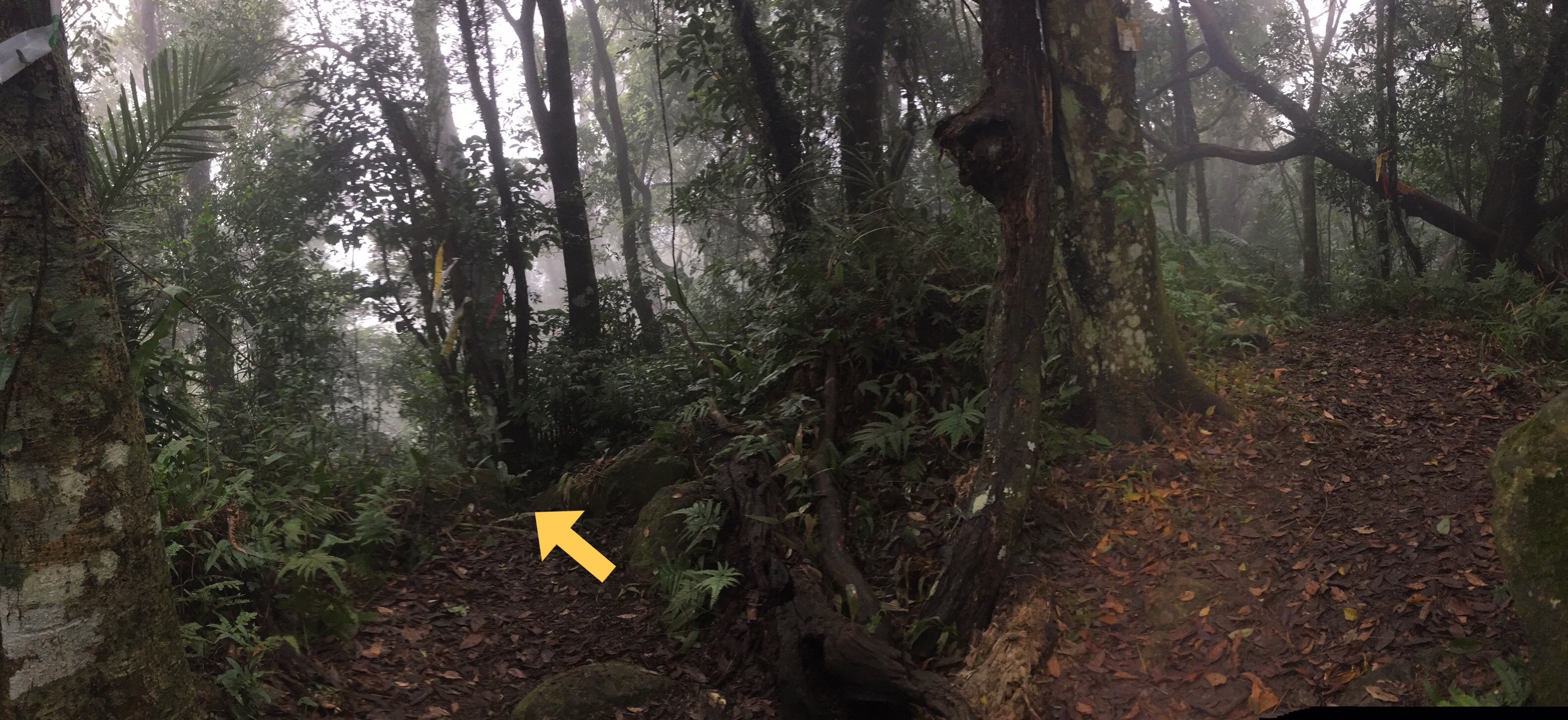
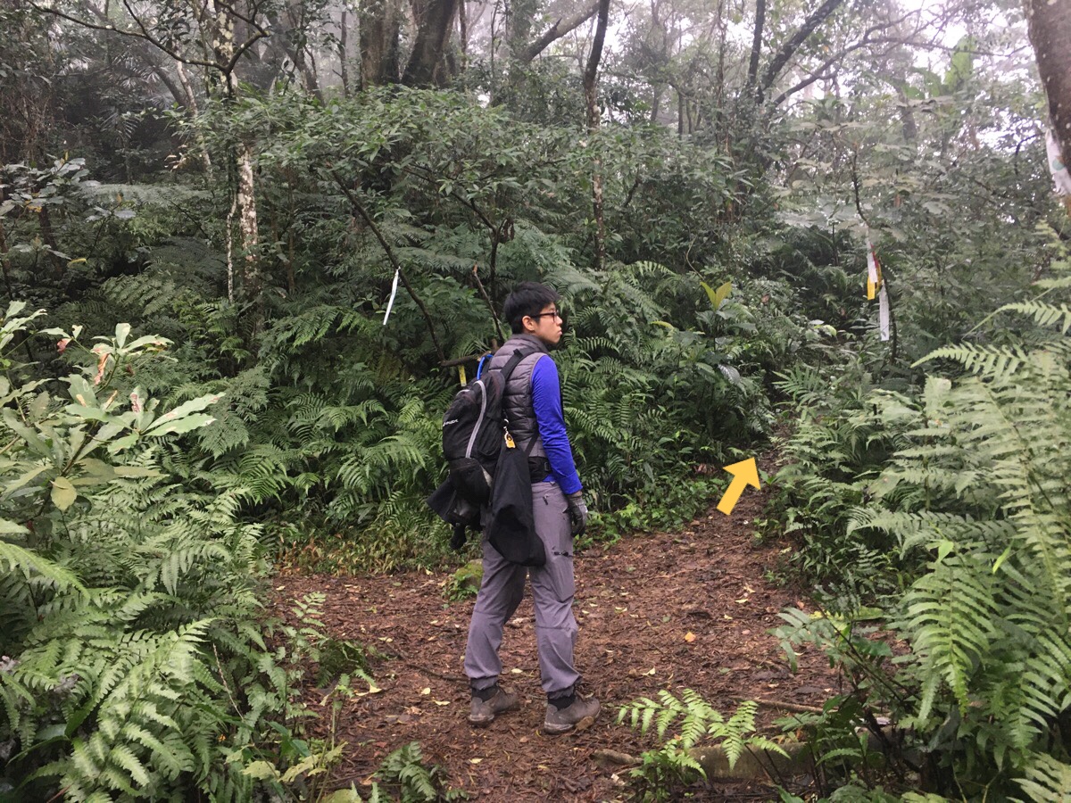
10:22 – The trip back down was short, and we arrived back at the stream crossing within a couple of minutes and then turned right. (Arrow two in the earlier photo.)
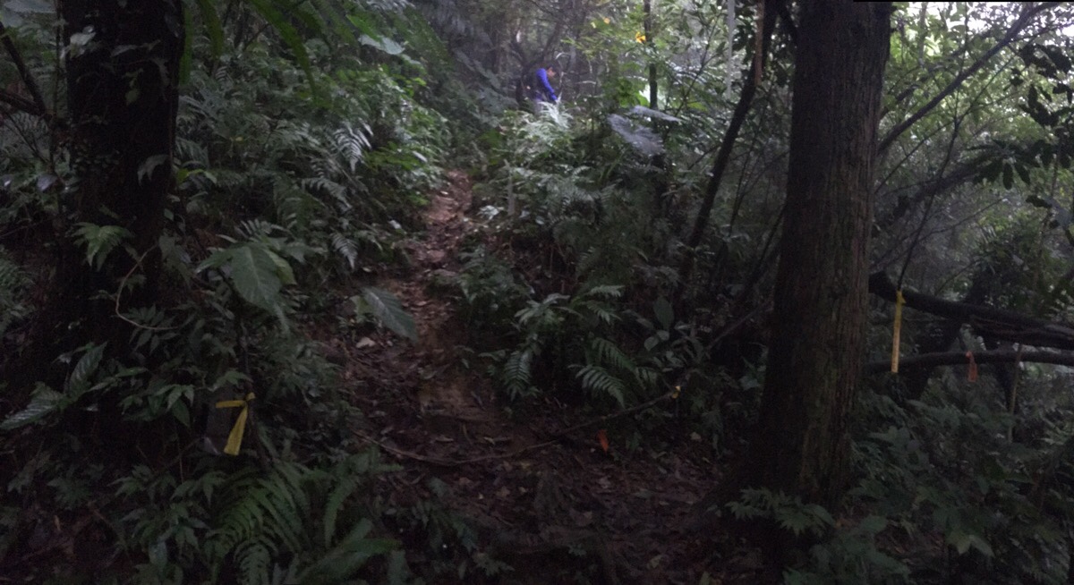
10:30 – At a junction, we followed more signs to Baishi Shan over a wooden bridge. (The other trail heads left to connect with the ridge that rises to Shi Cuo Keng Shan/石厝坑山.) From this point on, the trail starts to climb away from the stream and head up towards the more exposed portion of the trail.
10:32 – Immediately after crossing the bridge we encountered two trails joining from the right. They’re both pretty much the same trail and are an alternative route down from Dongxing Bridge (If you continue straight after reaching the bridge and then take the first left you can come down this way instead.) A few minutes before we saw them, we heard the noisy couple from earlier chattering their way down from this direction. They seemed confused to encounter us somehow in front of them for a second time.
They seemed even further perplexed when, after a mere couple of minutes, we all arrived at the start of another large climb. The route they’d taken had just come down to go up again – the route that Teresa and I had taken was much the same, but since our downwards section had been completed a little earlier, it didn’t seem quite as frustrating as it obviously did for the noisy couple. After a brief flat section, the path doubles back on itself as it starts to climb steeply, and they spent a while searching for a way to continue straight along the flat before admitting defeat and following us up the steps.
10:56 – The path climbed without any breaks or distraction for a further twenty minutes. On this section we passed another couple – one of whom was clearly struggling with the walk. We offered her a few words of encouragement as we passed.
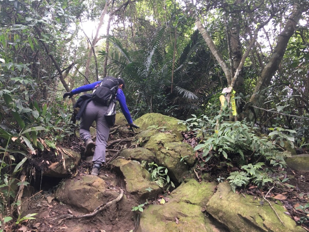
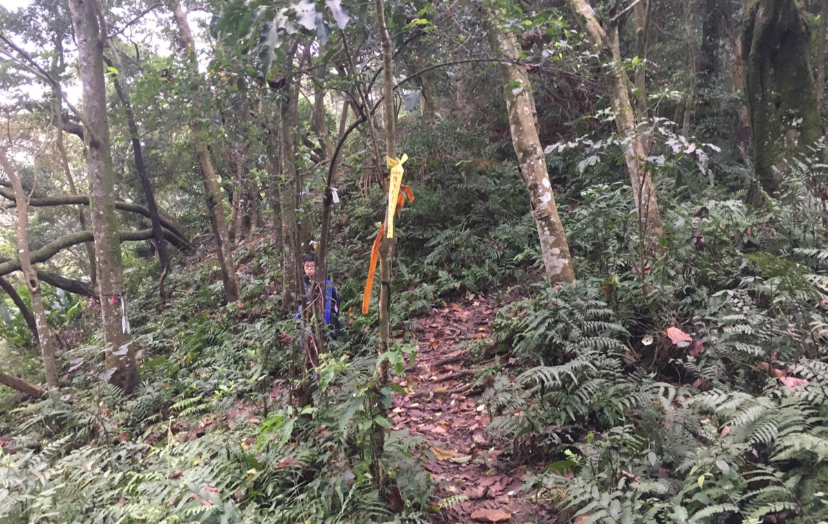
At the junction, we took the path on the right, and it was just a few metres beyond here that we decided that it was time to put on the gloves.
IF YOU DO THE VERY SHORTEST LOOP WHICH HEADS BACK ABOUT IMMEDIATELY AFTER BAISHI SHAN THEN YOU WILL RETURN TO THIS SPOT VIA THE TRAIL ON THE LEFT.
11:01 – After five minutes of scrambling, the path arrives at another junction. Left to continue up to Baishi Shan and right down to Baishi Pool. We were heading for the ridge, so of course we turned left.
11:06 – Not long after making the left turn, we found ourselves walking along the ridge line. At first their were trees on either side, but before long they dropped away on one side or the other to offer impressive views to the north, west and south.
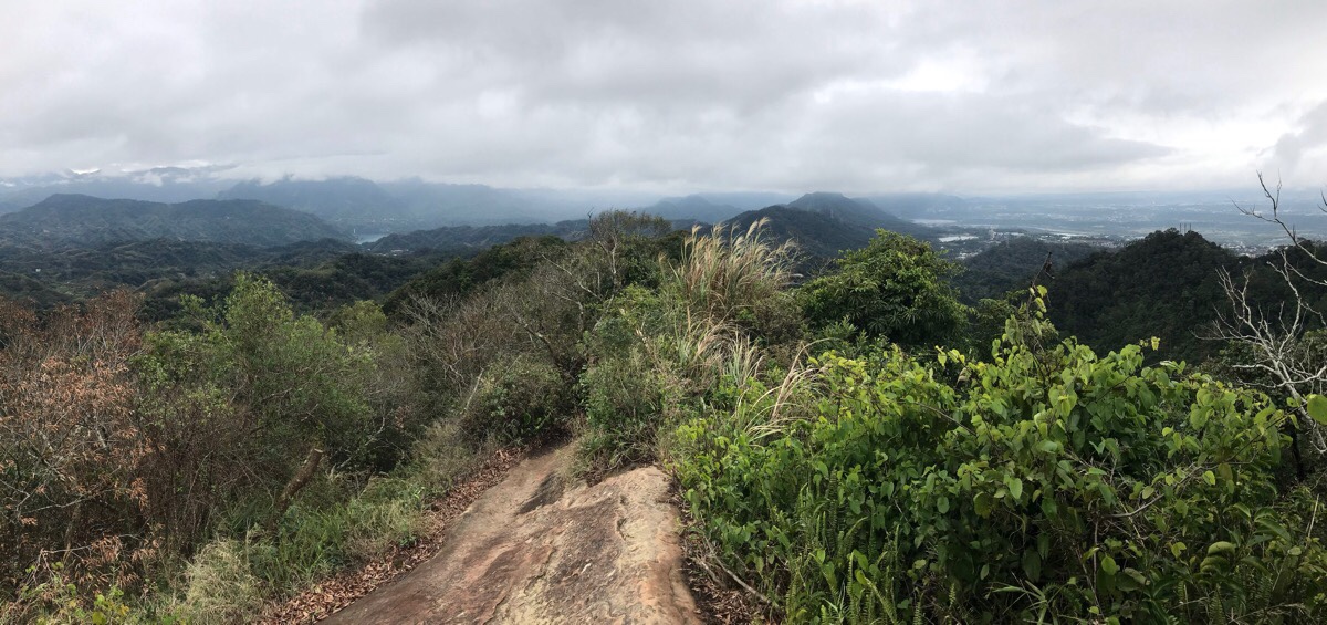
11:18 – In this picture looking south west down the tail of the ridge you can just about make out the glassy turquoise of Shimen Reservoir. To the right is the more built up area of Taoyuan District, with Daxi in the front and the airport right at the edge of the land. Then to the left is Fuxing District, probably my favourite part of Taoyuan (on account of all the giant trees, hot springs and generally great mountains).
A couple of spots had been turned into rest areas, the most developed of which had a large gas canister set up for making tea.
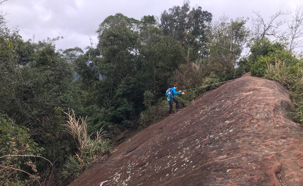
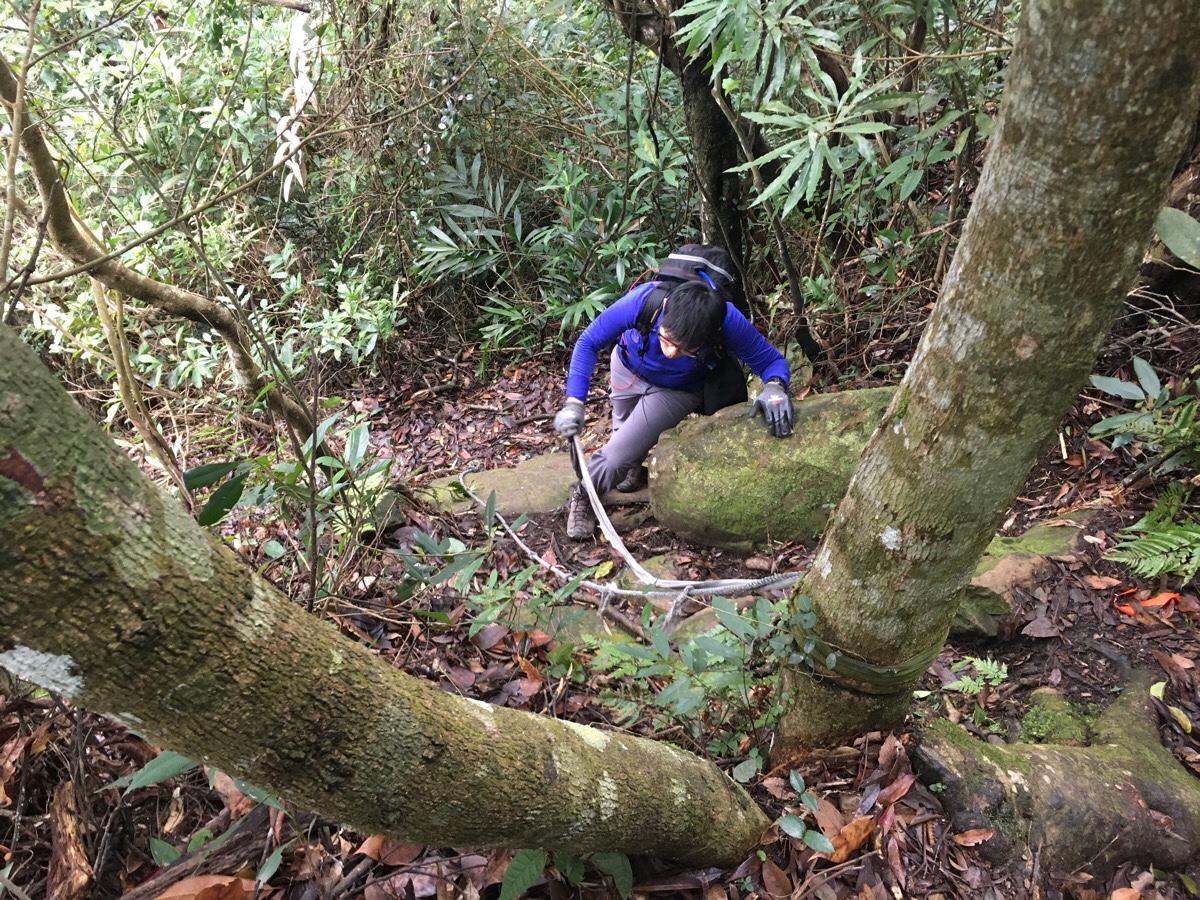
11:40 – Baishi Shan is a slab of rock which juts up a little higher than the surrounding ridge. We sat up there and had some fruit whilst admiring the view and wondering at the Taiwan-shaped puddle in the rock.
To continue on from Baishi Shan, you can either take the easy path straight down from the rock at the peak, or walk a little further along a ridge and use the ropes to climb down, (there are two places with such ropes). Obviously we chose the rope option because that is a lot more fun.
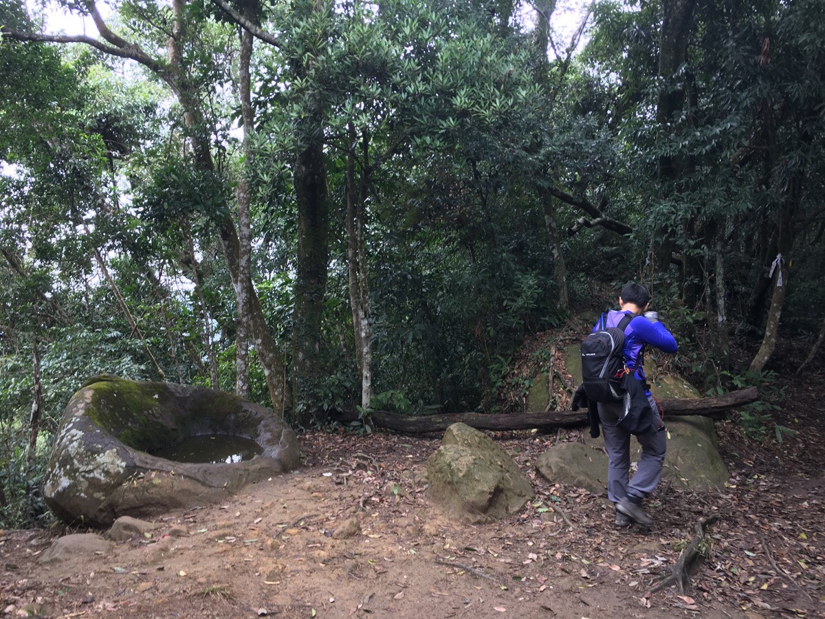
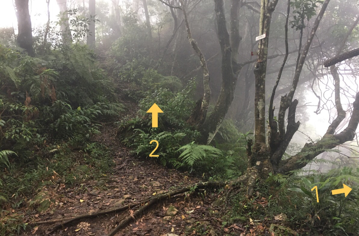
11:44 – After descending from Baishi Shan, the path flattens out at a clearing with a stone basin. There are actually two along the trail, (I can’t remember where the second one was, but I definitely remember seeing it). We took the path heading straight on towards Shi San Fen Shan/十三分山.
TURNING LEFT HERE WILL TAKE YOU BACK VIA THE SHORTEST ROUTE. YOU CAN TRACE BACK ALONG THE BOTTOM OF THE CLIFF AND REJOIN THE ORIGINAL PARH AT THE 白石山/白石碑 JUNCTION AND RETRACE YOUR STEPS FROM THERE.
11:49 – Not much further on from the previous junction, there is a second one. Again we took the trail heading straight on (right in this picture) towards Shi San Fen Shan/十三分山.
TAKING THE JUNCTION ON THE LEFT IS THE SECOND SHORTEST LOOP OPTION, IT WILL TAKE YOU DOWN INTO THE VALLEY THEN UP AGAIN TO 石厝坑山 AND EVENTUALLY BACK TO THE JUNCTION CLOSE TO THE ABANDONED GUARD HUT.
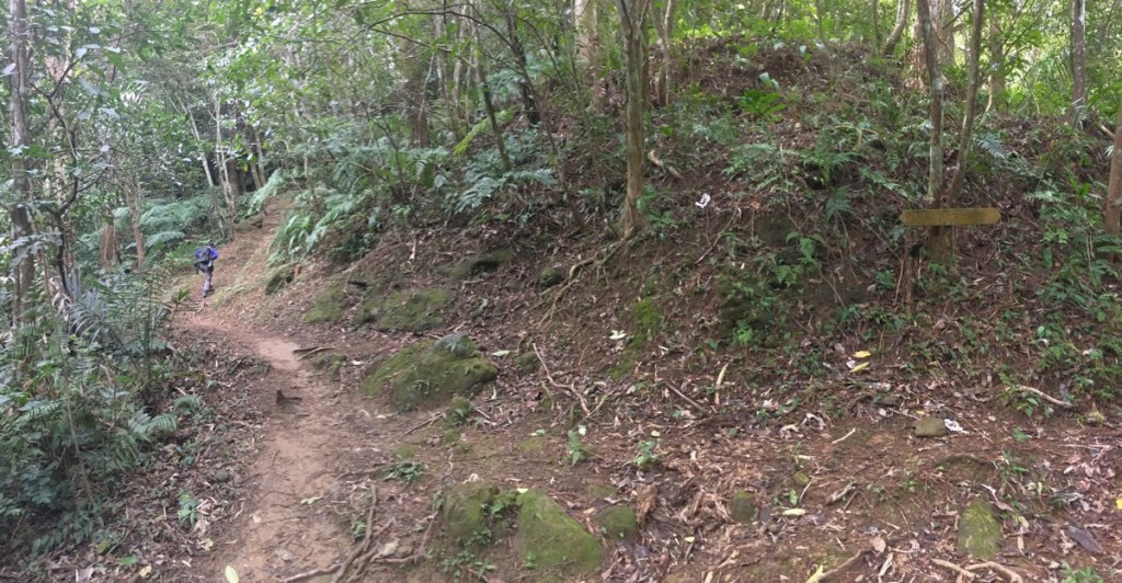
It quickly became clear that we had finished the more popular part of the hike. It wasn’t that the path became especially harder to follow, but it was obvious that it didn’t see as many visitors as the part that we’d just finished. The walking got a little harder going too, and we found ourselves doing a bit more scrambling over roots.
The less trodden path also meant that we encountered more flower and fungi life along the trail – including this intriguingly gelatinous specimen.
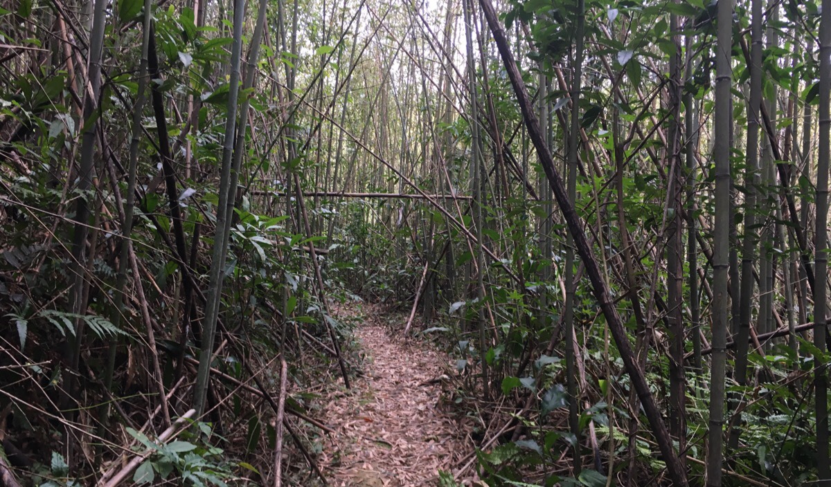
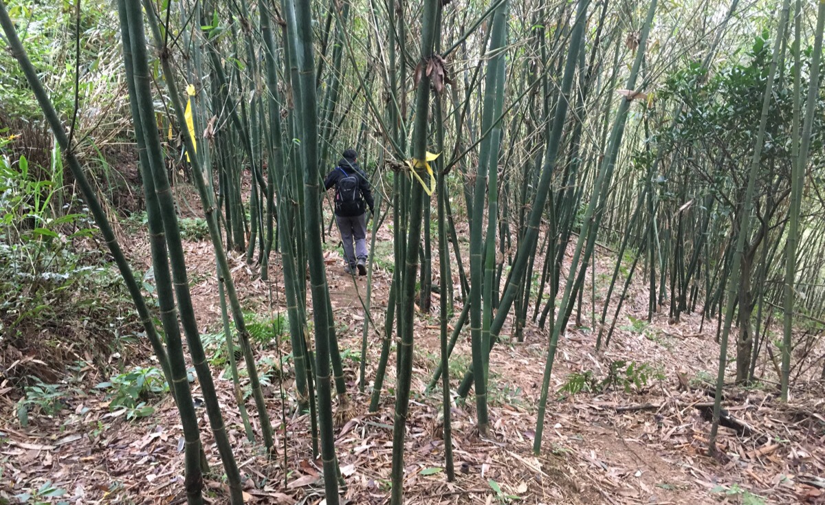
12:21 – As the trail rises and dips along the ridge, it weaves in and out of towering forests of bamboo – some areas appeared to be maintained by farmers, but others were very much wild. Around here we started catching snatches of something that sounded like a traditional play blaring out of an old radio somewhere over the valley, it wasn’t close enough to be able to pick out words, but we could hear a melody of sorts.
12:23 – The trail through the bamboo arrived out into a flatter section which looked like it must be used as an agricultural access road. There was a small trail on the left which looked to double back to 石厝坑山, it seemed pretty well kept, but it didn’t appear on my map, and anyway we were headed towards Shi San Fen Shan. We turned right to follow the track for 15 metres or so, and then took an abrupt left up through a farmed area of bamboo. There were hiking tags to follow, but initially at least they were not so numerous. The signs suggested that it would take us a further 30 minutes to reach the peak.
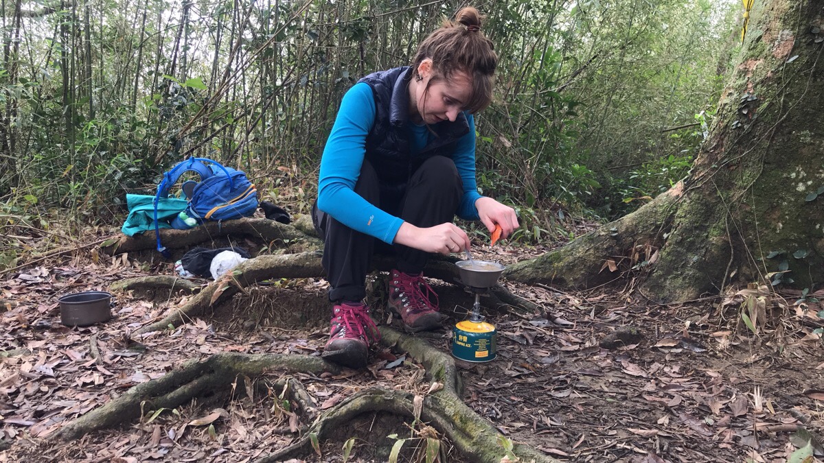
12:36 – Less than 15 minutes later, we were at Shi San Fen Shan. It wasn’t as dramatic a location as Baishi Shan, there were no views to speak of, but there was a clearing and tree roots placed in a way which made them suitable to function as seats. There were also clouds swirling around the tree tops – at over 600m high, we had walked up to the clouds. I got the coffee done first so that we could drink it whilst the lunch was cooking, and I layered up in order to avoid getting cold. (We did a lot of adding and removing layers on this walk – I had a gilet and a jacket, and I think I wore them in all possible combinations.)
We were eating after about 20 minutes or so, and had the peak to ourselves until we’d almost finished. When we were just finishing off our food, a couple of men turned up and then about five minutes after them, the quicker female members of a hiking group turned up. They were the first people we’d seen since leaving Baishi Shan. (And their group would be the last people we’d see before arriving back on the road a couple of hours later.) We started packing up, and by the time we were ready to set off, the peak was jam-packed and you couldn’t stand upright without holding on to the trees at the edge for support. One guy shoved me with his backpack so that he could get a spot in the group photo – he turned back upon becoming aware that something was there, and then after seeing me he just resumed pushing.
13:40 – Aside from the path we’d walked up on, two further trails led away from the peak. One led down to the same road that we would eventually find ourselves walking back on, and the other continued on to Jinmian Shan. Since the sign pointing towards the latter indicated that Jinmian Shan was just 60 minutes away, we made a quick decision that we would continue the hike in that direction and retreated from the noisy and overcrowded Shi San Fen Shan as quick as we could.
14:03 – The path between the two peaks is much of the same. Some ridge following, some bamboo, some climbing, some descents. According to my map, at this patch of bamboo, there was a path heading down to the valley on the right, but I never saw, instead we kept left along the top edge of the farmed area.
14:23 – The path wasn’t really difficult, but it required concentration to avoid a misplaced foot from getting trapped in a roots or slipping on algae and mud. My mental makeup means that I love this type of walking – it necessitates the absence of any other worries or thoughts from my mind so that full attention can be given to moving forward, but Teresa likes to think about other things while walking, so she was getting irritated by all the focusing on where to put each foot. At one point we passed an interesting giant slab of rock with a pine growing out from it. I imagine the view would have been spectacular in clear weather, but we just had the mystery of the fog.
14:38 – We made slow progress, and about an hour after leaving Shi San Fen Shan we arrived at a junction. The lefthand path was the one we needed to take towards Jinmian Shan, and the path on the right continued onto the massively popular Wuliaojian. I think most of the hiking team who had overrun our lunch spot had hiked straight through from Wuliaojian – distance-wise it’s probably similar to what we did, but since it’s all on tough mountain trails, I’d imagine it is a seriously tiring all-day walk.
(NOTE: I looked into this route, apparently it is called 五溪縱走/Wu Xi Zong Zou, or Wuliaojian to Daxi continuous route, it extends all the way along the ridge from Wuliaojian down to Shimen Reservoir, and it can be done in 14½ hours by some of the insanely tough local hiking machines.)
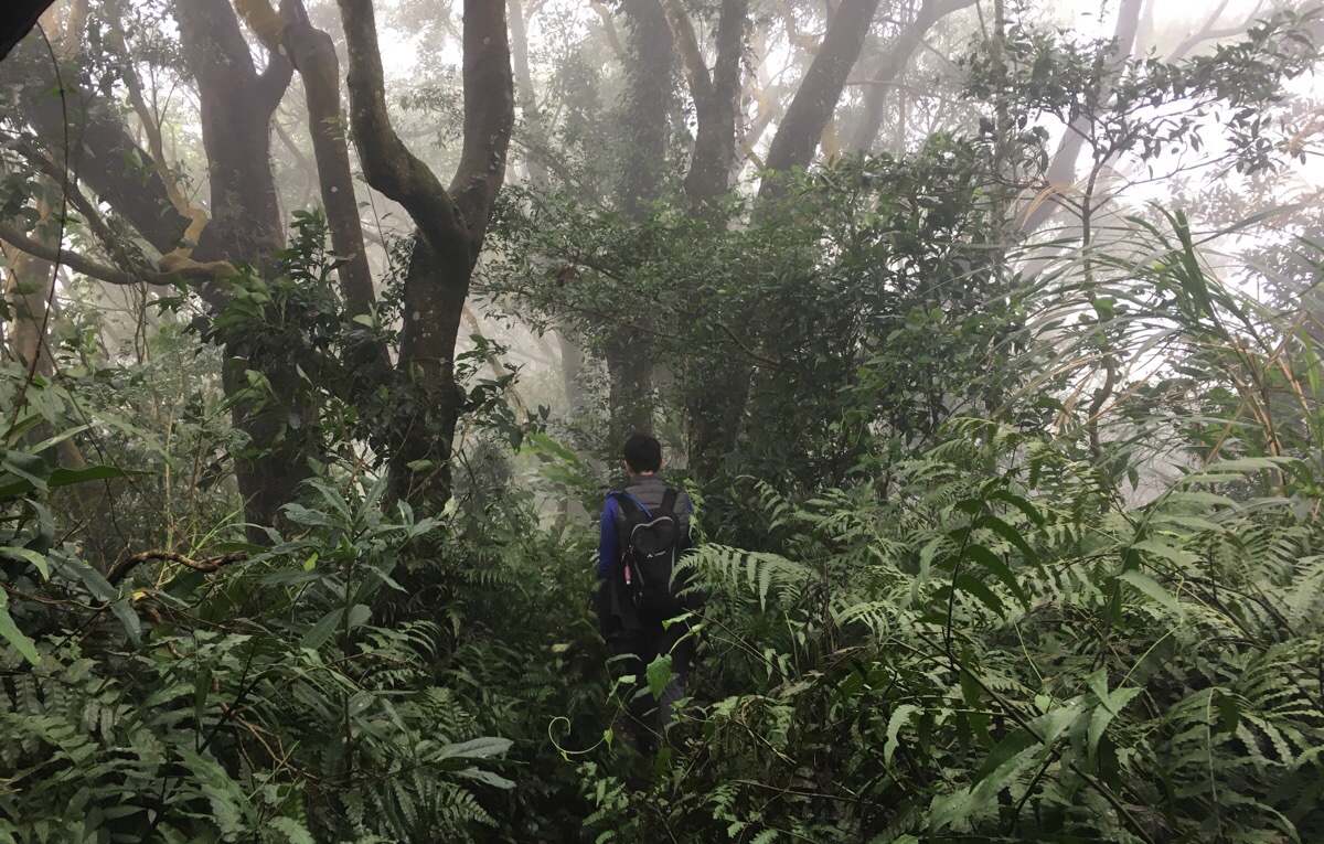
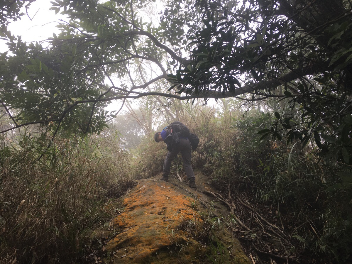
Around this point we found ourselves very much enveloped in cloud, and judging by the quality of the trail we were on, I’d say that this path is regularly in the clouds. In the afternoon light it was beautiful, but the path was muddy and the shade-loving plant life had exploded. The route was still very clear and easy to follow, but our gloves and trousers fast became wet through. Thankfully though, we had both passed the threshold of caring about physical comfort or discomfort, and paid little attention to the sogginess.
14:48 – We met a junction which didn’t quite correlate to the map I was following. I think the left path joins the path coming down from Shi San Fen Shan, but we headed almost straight over towards Jinmian Shan.
14:50 – A short way up there was another junction on the right. This one loops around to the back of Jinmian Shan, but we were getting tired and took the more direct route straight up.
14:55 – We arrived at a saddle along the ridge which led up to Jinmian Shan, and given how tired and ready to go home Teresa was, I suggested skipping it and just heading straight down. But Teresa said that since the signs said it was just another five minutes, we may as well head up. So we made the brief scramble up to the peak (arrow one in the picture). It took us about an hour and twenty minutes from Shi San Fen Shan – we are clearly not as tough as the hikers who left the signs. There was no real view, and I imagine that even on a clear day most of the view would be obscured by trees.
15:14 – After returning down the same way from the peak, we walked in the direction of arrow two, and after a short climb, we found ourselves heading pretty much down all the way from here to the road.
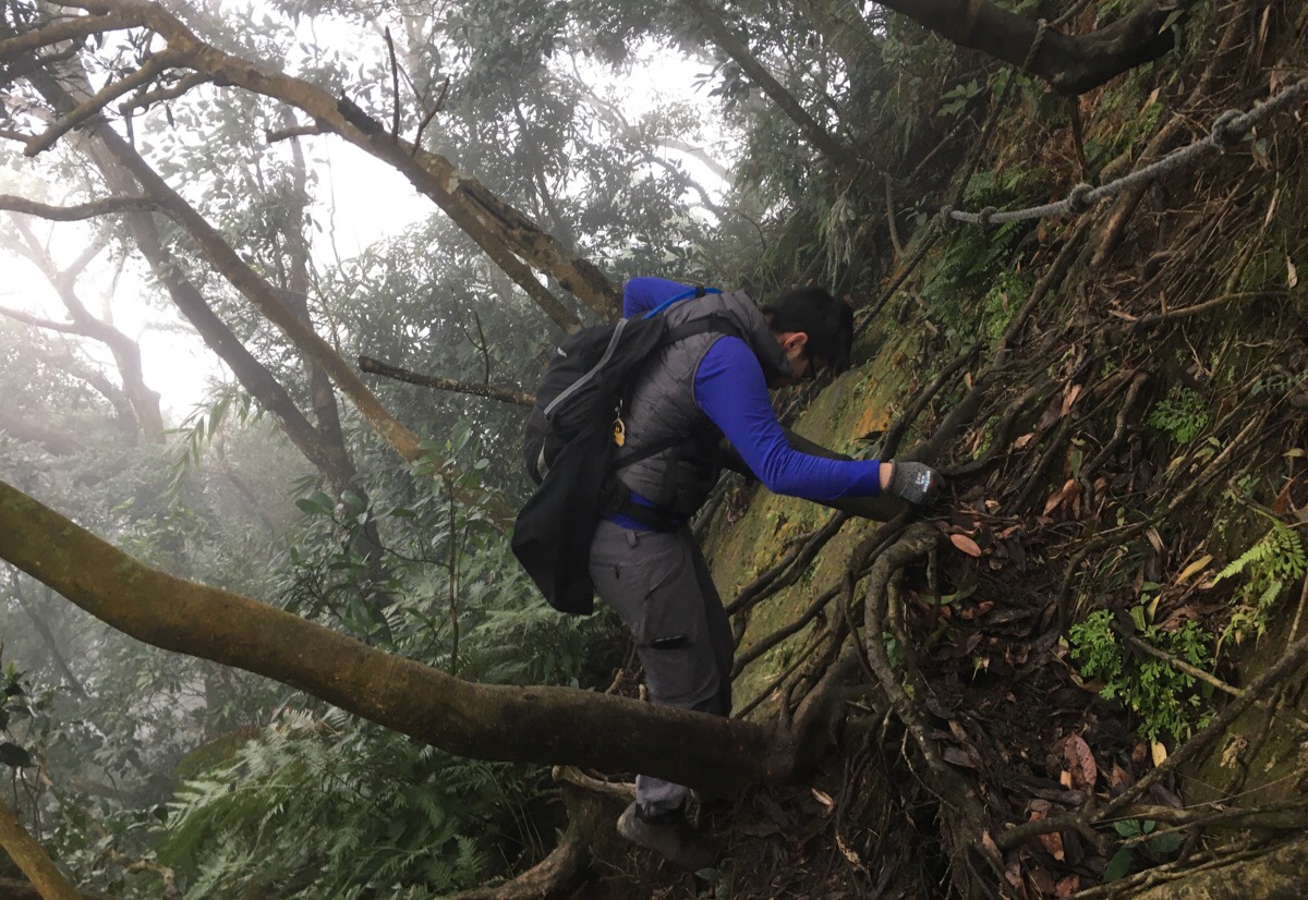
15:42 – Much of the walk was easy, if quite steep, but this one section was particularly fun. It involved scrambling sideways along a rock face for a couple of metres before heading almost vertically down for another couple of metres.
Around this point I turned my music on to try and keep up Teresa’s morale – it worked, but more out of humour than musical enjoyment, since the spotty signal left us getting odd words and phrases before silence returned.
Most of the way down was uneventful – we didn’t really stop, just kept up a steady pace. At one point the path levelled out around a large rock and a clearing before dipping down again – here we disturbed a pack of wild mountain dogs. They sprang up from their rest and darted away down the trail in front of us and then completely melted into the surrounding forest.
A little further on we passed some kind of relay station on the hillside just before the path dipped into the trees again and came out near what looked to be an abandoned toilet block, (although we stayed on the path above it, and never went to explore whatever it was, so it could have been something else completely).
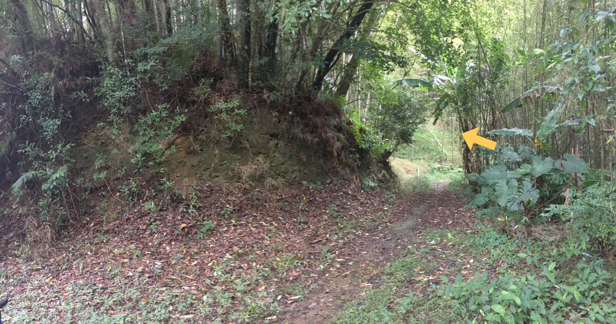
16:14 – The path reached a junction where we turned left downhill. Initially we wanted to go straight on over 金山面山, but after heading down that way a short distance we couldn’t find any clear path down that easy and decided to head back to this spot and head down.
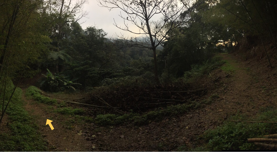
16:21 – The trail headed down through a bamboo grove and then joined a farming track. At the track we headed left and it wasn’t long before we found ourselves back in civilisation.
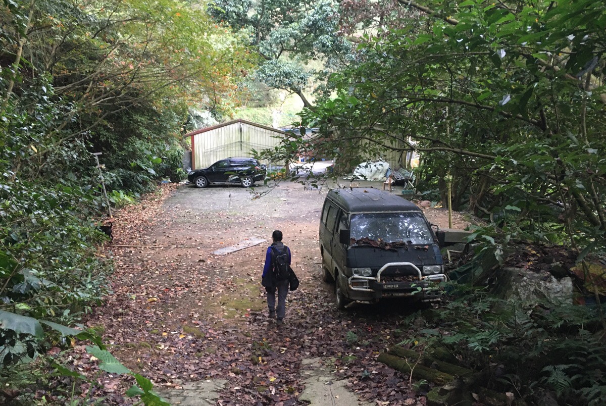
16:24 – The trail joins the very end of a rural road. Here there is a small collection of buildings and restaurants, and Teresa immediately made friends with the dogs. A woman watched us emerge from the track, gave us a knowing nod and said 不好走 – wisdom that may well have been useful a couple of hours ago!
From here we had a long and winding route back to the car. The light was failing by the time we got back, and our feet were tired from all the tarmac, so I didn’t take so many photos along this section. We passed a few territorial dogs, but none which were genuinely threatening, and although we both had our head-torches with us, we didn’t need to use them until we arrived back at the car shortly after 6pm.
How to get to Datieliao Old Trail
Google maps address:
- the trail head we went from starts here: 335, Taoyuan City, Daxi District
- an alternative trail head starts from the curious Chiang Kai-shek Statue Park and from there heads up to Caoling Shan and joins our trail at the old guard post: 慈湖停車場, 335, Taoyuan City, Daxi District
- we came down from the hill to this collection of restaurants: 335, Taoyuan City, Daxi District, 金山路392巷268號
GPS location:
- Car park near Taiping and Ji’an Bridges trail head – N24 51.005 E121 17.400
- Car park near Chiang Kai-shek Statue Park trail head – N24 50.410 E121 17.600
- Trail head that we exited the trail from – N24 52.115 E121 19.630
- Trail head that you would exit from if you headed downhill directly from Shi San Fen Shan – N24 51.920 E121 19.365
Public transport: there isn’t public transport to the trail head that we started from, however there is a tourist bus which gets you close to the Chiang Kai-shek Statue Park trail head. The 501 (a tourist shuttle I think) will drop you here from Taoyuan HSR Station. Similarly, there are a couple of buses which travel here from near Taoyuan Train Station (which is very different to the HSR station), but check first, because some require you to change buses and some don’t.
Further reading: there’s an old Off The Beaten Track article about the first section of this trail which was what first put it on my radar.
Nearby trails:
My new words learnt on this hike:
- 接近 / jiējìn / close, nearby – 我不知道這是在台北怎麼接近的地方。
- 只要照著口訣做就沒問題 / zhǐyào zhàozhe kǒujué zuò jiù méi wèntí / As long as you follow what I say, then you won’t have any problems. – I can’t remember why this phrase came up.
- 打鐵 / dǎ tiě / blacksmith (Teresa also informs me that is Taiwanese slang for ‘party’)
Datieliao Old Trail Map
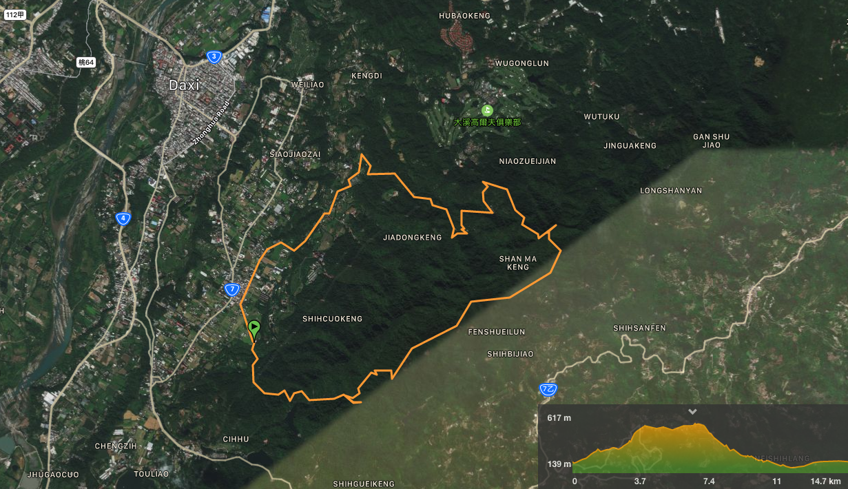
GPX file available here on Outdoor Active. (Account needed, but the free one works just fine.)
Datieliao Old Trail → Baishi Shan → return (8.2km)
Datieliao Old Trail → Baishi Shan → Shi Cuo Keng Shan → return (15.2km) – this one starts from a different location to where we started from, but only the first couple of kilometres.
This is the bit where I come to you cap in hand. If you’ve got all the way down this page, then I can only assume that you’re actually interested in the stuff I write about. If this is the case and you feel inclined to chip in a few dollars for transport and time then I would appreciate it immensely. You can find me on either Ko-fi or Buy Me a Coffee.
