Huangdidian may well have been the hike that made me fall in love with the trails and landscape of Taiwan. The first time I walked it was before I lived here, and the impression it made ran deep. This trail pretty much has it all: enthralling mountain views, exhilarating ridge walking, invigorating climbs and, (if you’re feeling bold enough), the opportunity to experience that famous Taiwanese friendliness by trying your hand at hitchhiking rather than walking back along the road. I had been wanting to revisit it for a while and finally, we managed to get around to hiking this a second time, (with so many new places to explore, finding time to get back to old favourites can be tough). It was every bit as fun as I’d remembered it to be, and there’s no doubt that I’ll be back again sometime soon.
Distance: 6.3km, with the road walk it would have been nearer 10km I think.
Time: we spent 5 hours and ten minutes on the trail, but actually only about half of that time was spent moving.
Difficulty (regular Taiwan hiker): 4/10 – there are climbs, but most are on ladders, nothing technical, and the path is pretty straightforward.
Difficulty (new Taiwan hiker): 7/10 – it is doable but you’ll ache the next day. Also, I remember being nervous getting on the ladders and walking along the ridges on my first visit, (this was mostly because I hadn’t really had much experience though, not that it was too hard or dangerous). There are generally a lot of people on the trail, so you’re unlikely to get lost, but it’s worth making sure you know where to go beforehand and checking the maps online/at the trailheads.
Total ascent: about 550m to a high point of 664 metres above sea level.
Water: I got through about 2.5L on a hot day.
Shade: if your skin is sensitive to the sun then you’ll need a good form of hands-free protection. We went on an overcast spring day, so I was just able to get away with using sunscreen lotion and long sleeves, but if the sun had been out I would have needed my sunshade hat too.
Mobile network: not too bad I think, although I was too busy looking at the view.
Enjoyment: This is a real fun walk, especially if your cardio fitness level is enough that the steps don’t drain you – this second time was a lot easier for me and I was able to spend more time just enjoying it. Much of the walk was spent with a huge smile on my face just from the sheer love of the hike. I’ve heard other people complain that this hike gets congested, and it certainly is a bit busier than many lesser-known walks, but it is popular for a reason, and besides, I didn’t find it unpleasantly busy (despite going on a Sunday with perfect hiking weather). If you want to avoid the crowds, though, maybe go early on a weekday.
Other: gloves are a good idea, as is food. Also, you might want to skip this one if you’re not good with heights. To stand a reasonable chance of doing this walk on a quiet day you will have to go midweek – with it being so popular, close to Taipei, and public-transport accessible, this route is often quite busy. (Having said that, it wasn’t unbearably so, even on a dry May Sunday.)
Jump to the bottom of this post for a trail map, GPX file, and transportation information.
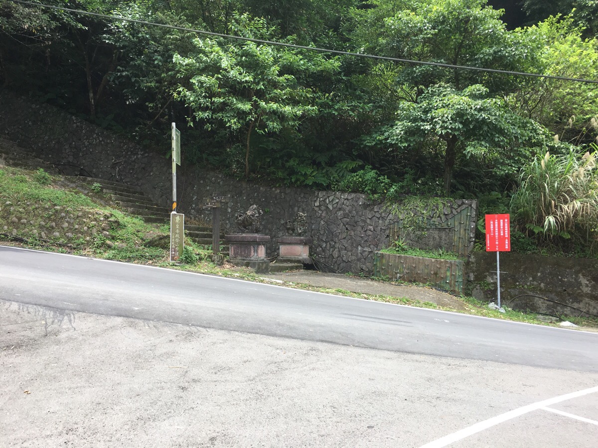
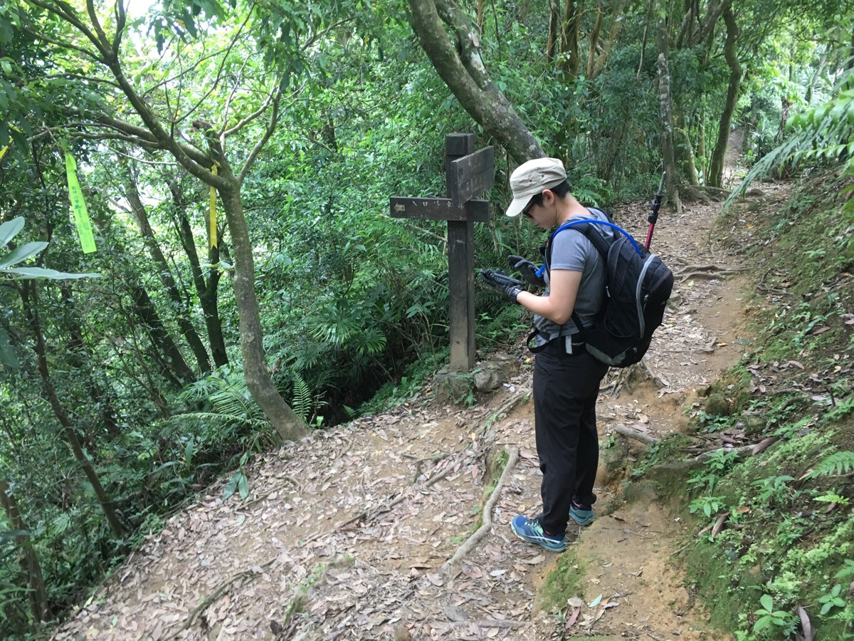
We parked up at the car park around 11am, (a late start for us, but then we’d already knew what we were in for). I was planning on using the portaloos, but both had been colonised by oversized mosquitos and I didn’t much fancy baring my behind to them. Just across the road from the carpark is a flight of stairs leading up and left. A nearby map notes this as being Shihding Nankan Mountain Hiking Trail. About five or ten minutes before we started, a couple with a big scooter had just set off up the steps, and we soon encountered them coming down again. I passed them ahead of Teresa and overhead them saying “Why does she look like she’s going to climb Yushan?!” (Believe me, I didn’t, I had a small day pack with a hydration bladder and a hiking pole – not quite Yushan levels of preparedness.) After Teresa passed them, I noticed that they had turned around again and were now following us back up the hill. I can only assume that they had been questioning if they were heading in the right direction. We quickly lost sight of them.
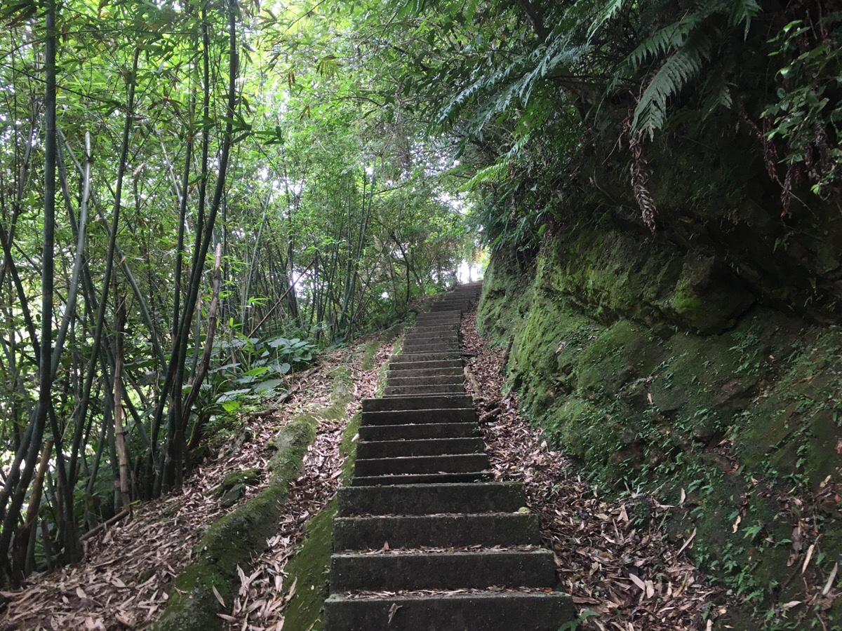
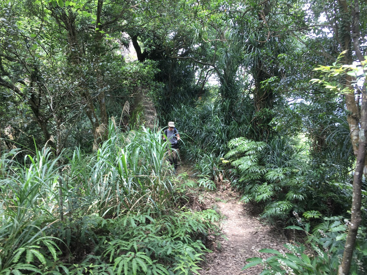
The first fifty minutes of the hike was just steps. Despite doing this before, I had completely forgotten just how many steps there were, (presumably this part was cut from my memory because it is exceedingly boring compared to what follows). I also found that my memory of just how many steps there were faded quite quickly this time. I had to check the timestamps on the photos to see that it had taken so long.
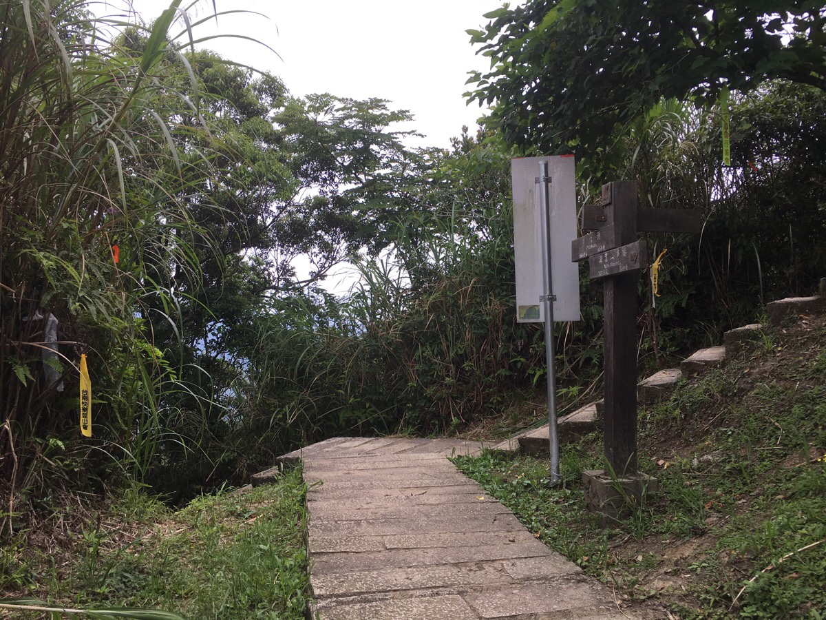
After fifty minutes of walking, we arrived at the start of ‘the proper hike’. We stopped here to sort out gloves, sun-screen and make sure everything was packed properly again before setting off.
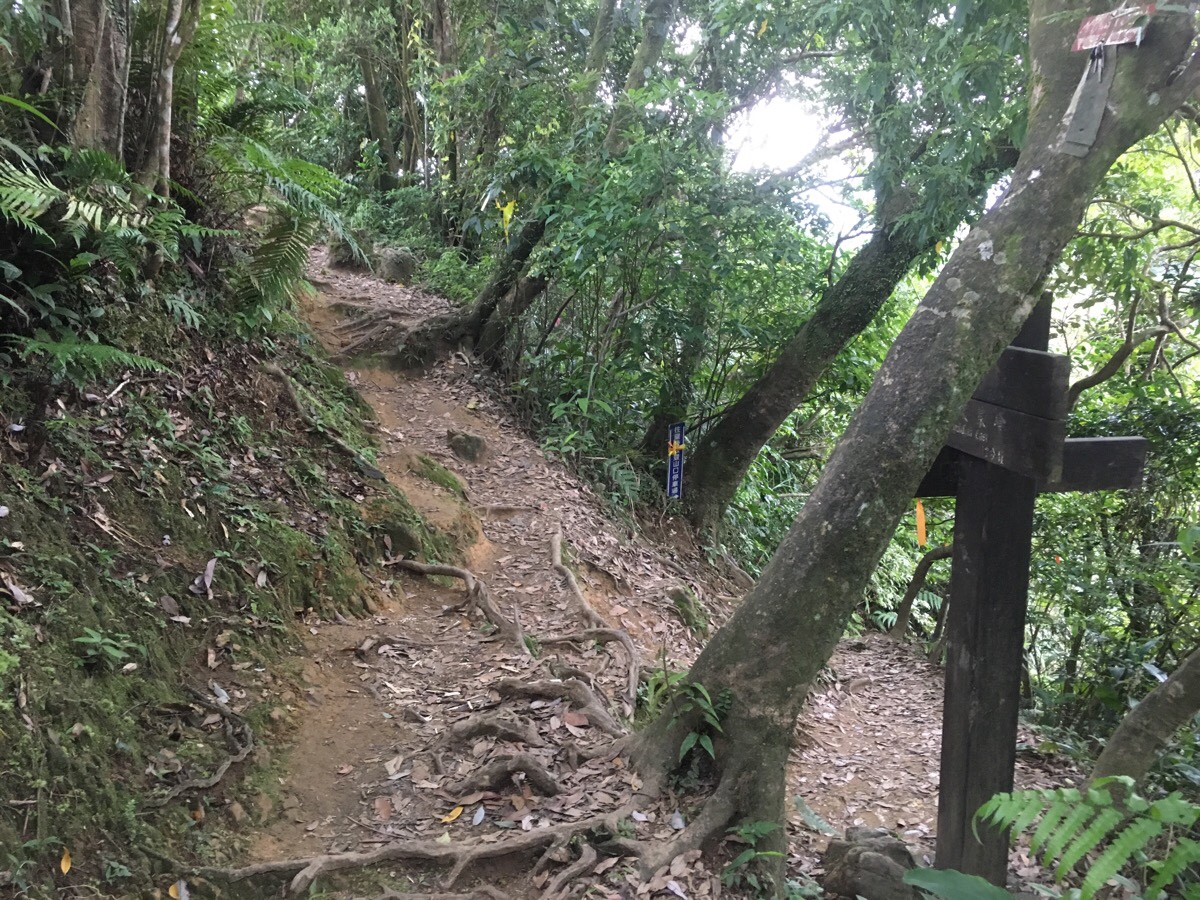
From this point on, the trail is a mixture of dirt path, rocks, roots and ropes.
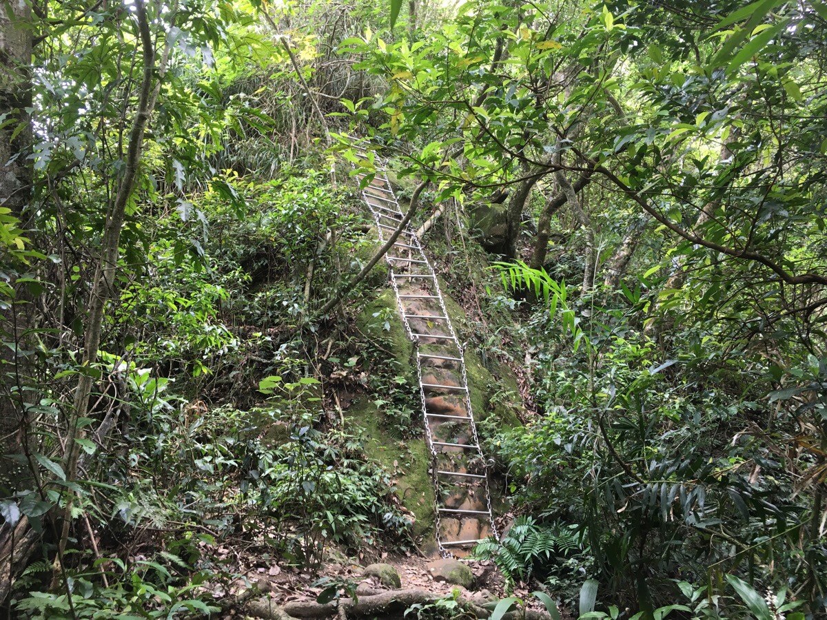
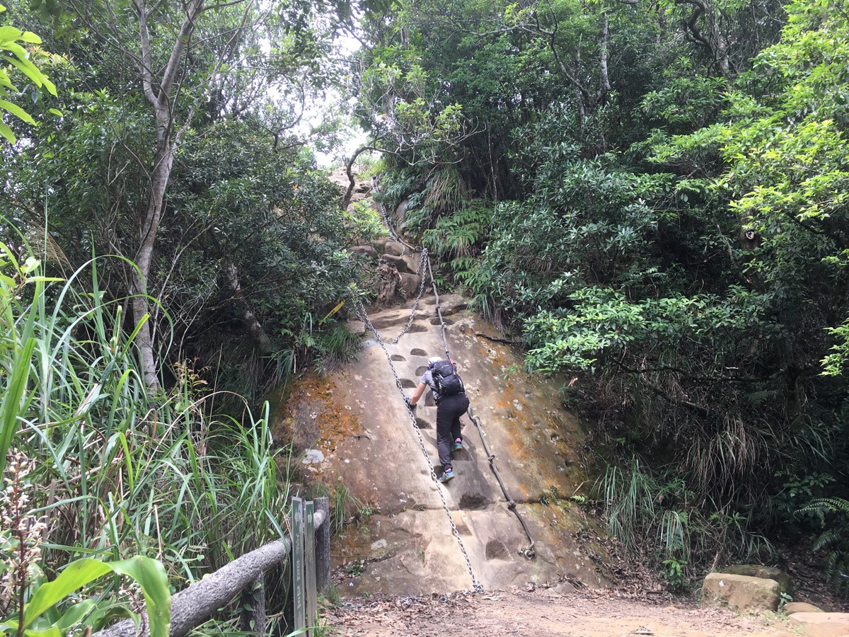
And ladders.
The first ladder is a climb, but in this direction, most of them are descents.
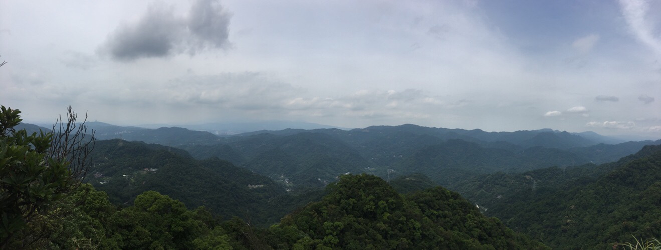
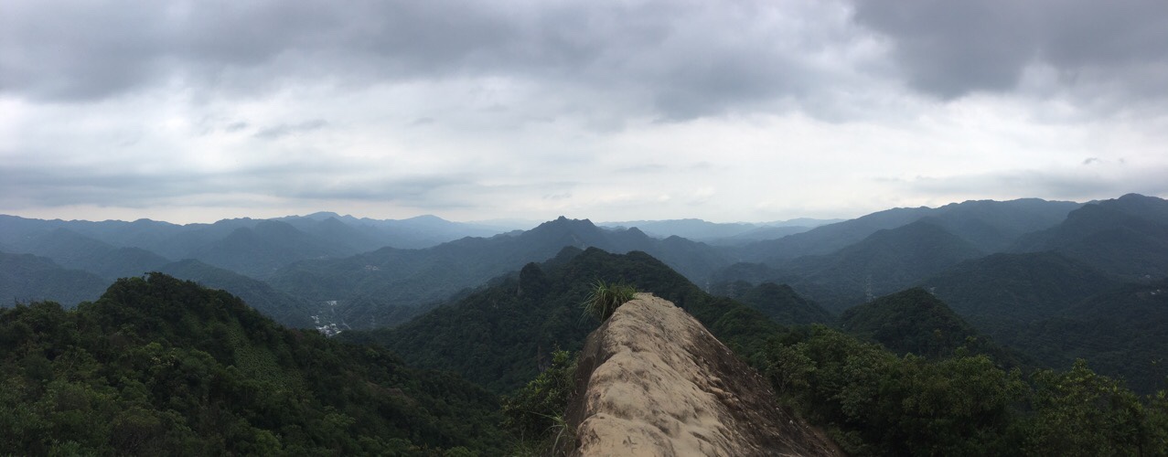
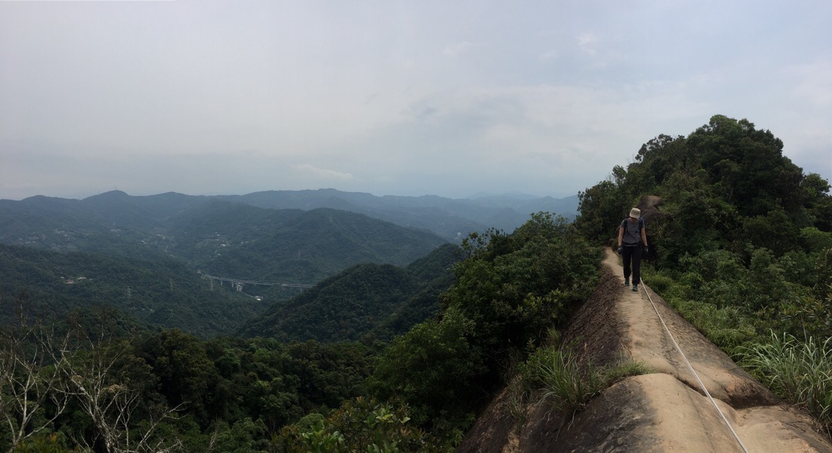
About an hour and a quarter after setting off, we arrived at the west peak. Setting the tone for the walk, the peak offers beautiful views of mountains layered upon mountains. You can also see the very tip of Taipei 101 peaking over the crest of a hill to the northwest.
The path is really very easy to follow. There are few turn offs, and those that do exist are well signposted, so all we had to do was enjoy the walk.
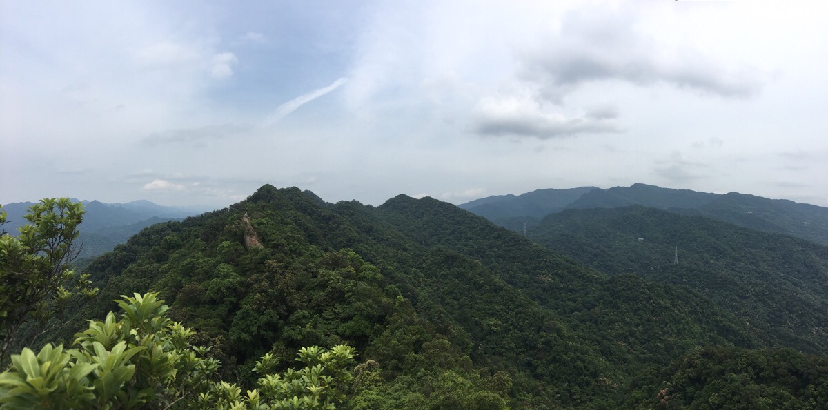
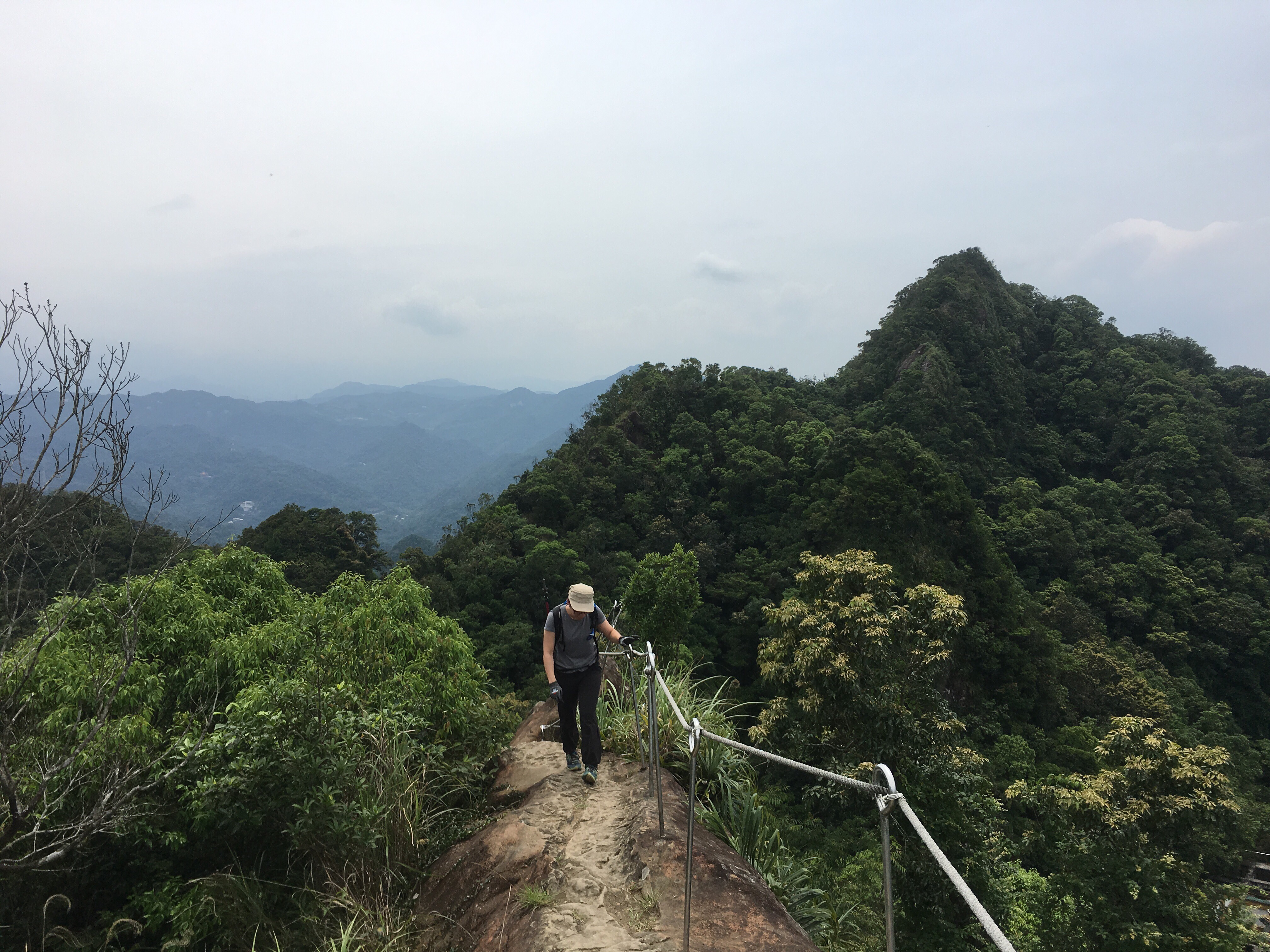
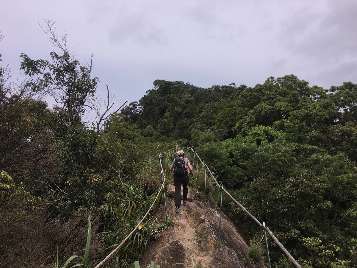
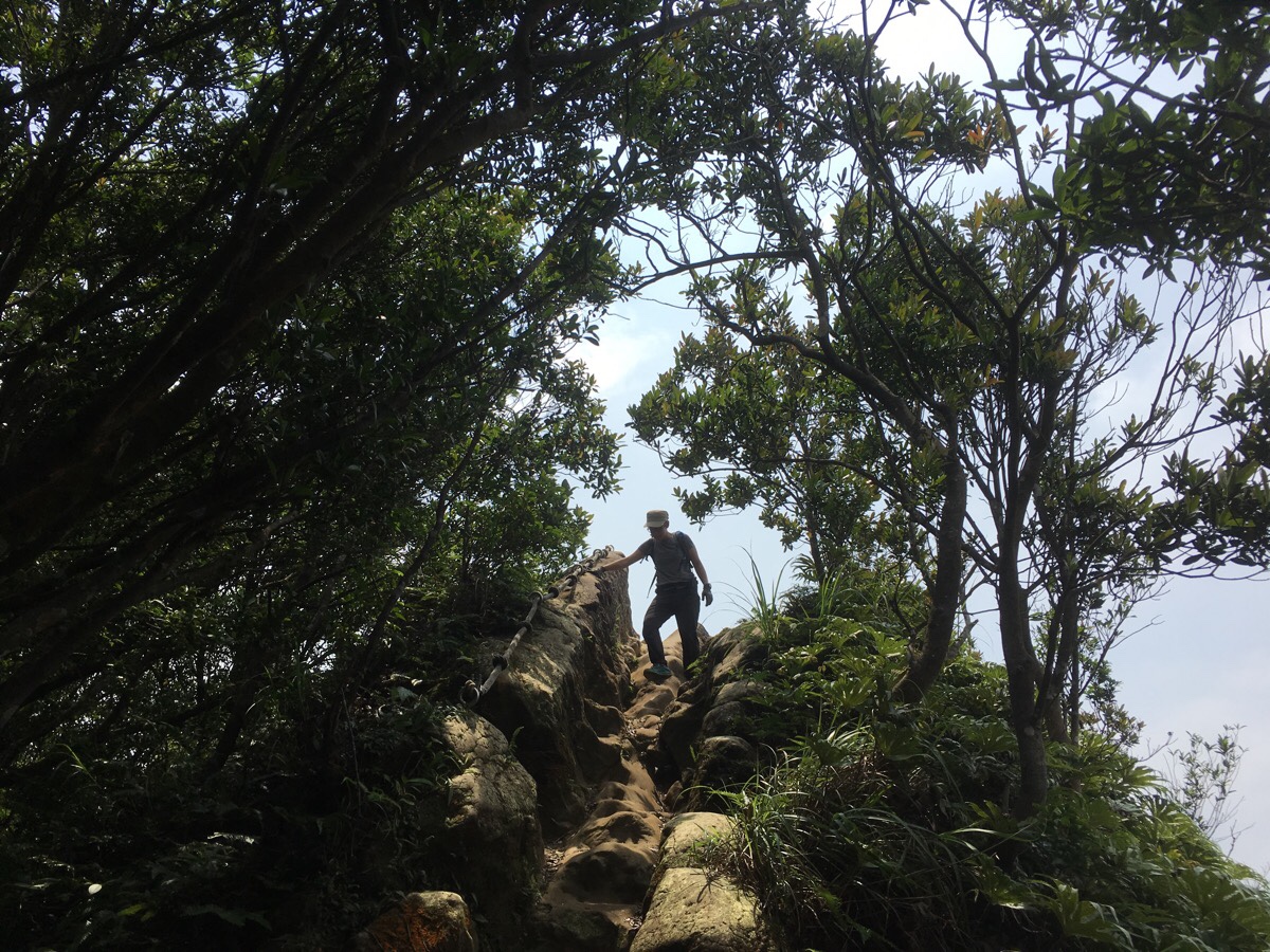
Occasionally you can catch glimpses of walkers making their way along the exposed portions of the ridge. (As in the above picture.) And seeing the remainder of the ridge left to climb is very exciting.
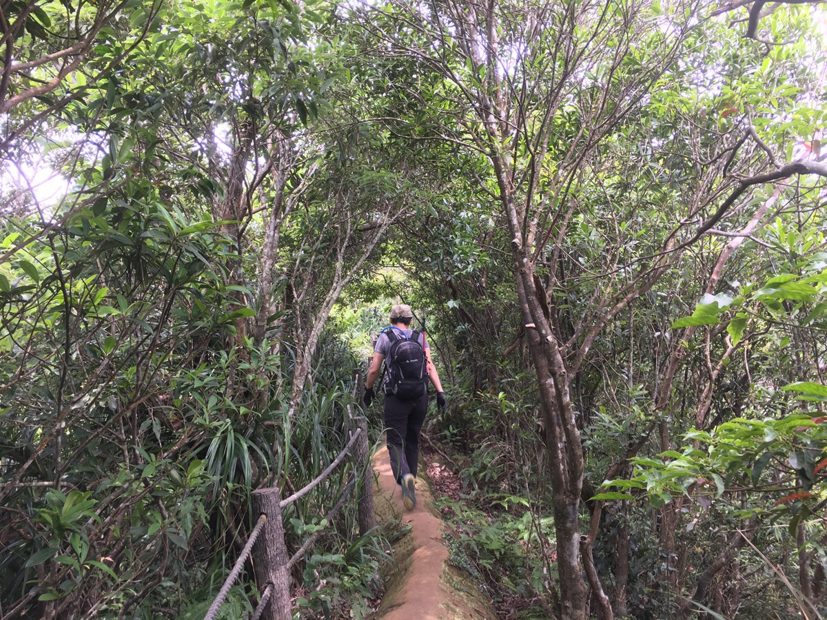
Even through sections where the walk is covered by trees, it’s still fun. Indeed the ridge is maybe even more of a proper ridge here as it hasn’t been cut away to make a wider, safer walking surface.
Here a path goes down on the right. It is a more direct route down to where we would eventually rejoin the road – but don’t take it! The fun is just getting started.

After scrambling up footholds cut into the rock in the previous photo, the view to the rear and left opens up. That jagged peak there just to the left of the frame is where we’d climbed from. And the building is an abandoned looking temple. Teresa mused upon the benefits of turning it into a swimming pool – she argued that it would be popular with hikers who wish to cool down and she suggested they could set up a long waterslide. I foolishly imagined she meant from the trail into the pool and she reprimanded me for dreaming up the image of a death trap.
Actually the walk itself is really quite straightforward, I don’t need to post so many photos to indicate the way to go, (and besides, there are already a plethora of posts out there detailing how to do this walk). But it’s just so fun and pretty that it makes me want to go overboard with the photos.
Most Taiwan lifers attest the the fact that it (much like Sandiaoling) was much more beautiful back in the day before the government got all health-and-safety-crazy, (as if Taiwan could ever be accused of that…), and that all of the safety measures like fixed ladders and poles ruin the whole thing. I can sympathise. I have no doubts that the land would look even prettier without the metal piercings and shaved off ridge peaks, but perhaps it’s the price that has to be paid. This is a popular trail due to its accessibility, moderate difficulty and ‘Instagram Appeal’, so without these safety precautions it is likely that many (more?) would have been injured or killed by their inquisitiveness. And that would almost certainly lead to it getting the Stegosaurus Ridge treatment – and it being made off limits.
There is one section where you can get a taste of what it would have been like back in the day. Here there are no guard rails, only a low rope to provide comfort to the scared-of-heights, or to trip up the over-confident. Apparently it is a lot wider than it used to be, and I certainly didn’t feel anxious as I walked over it. I have vague memories of having to crawl some sections as a result of my fear the first time I walked this, (but I may be confusing that with Wuliaojian), anyway, this time I had no such qualms. Taiwan has definitely toughened me up.
The second turn-off on the right also heads down to the road that we would eventually end up on. Again, don’t take it, there is more fun ahead. Sitting in a clearing just up from the junction caught up with a guy that we’d been leapfrogging with right from the start, and an older couple who were busy preparing their lunch on a small stove. (I think this is where I turned down the first time we hiked this.)

Not far beyond the clearing is the third right turning. This one joins the path that we walked back on before that path reaches the road.
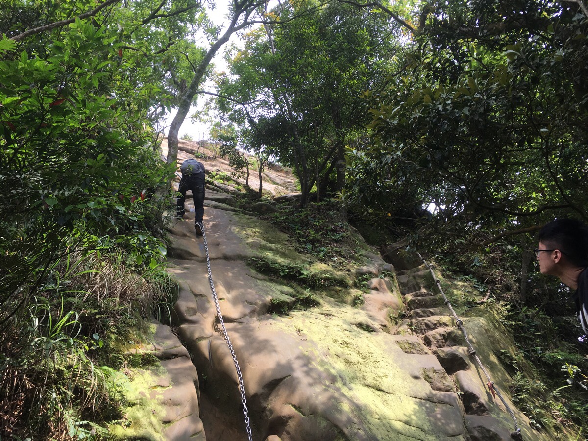
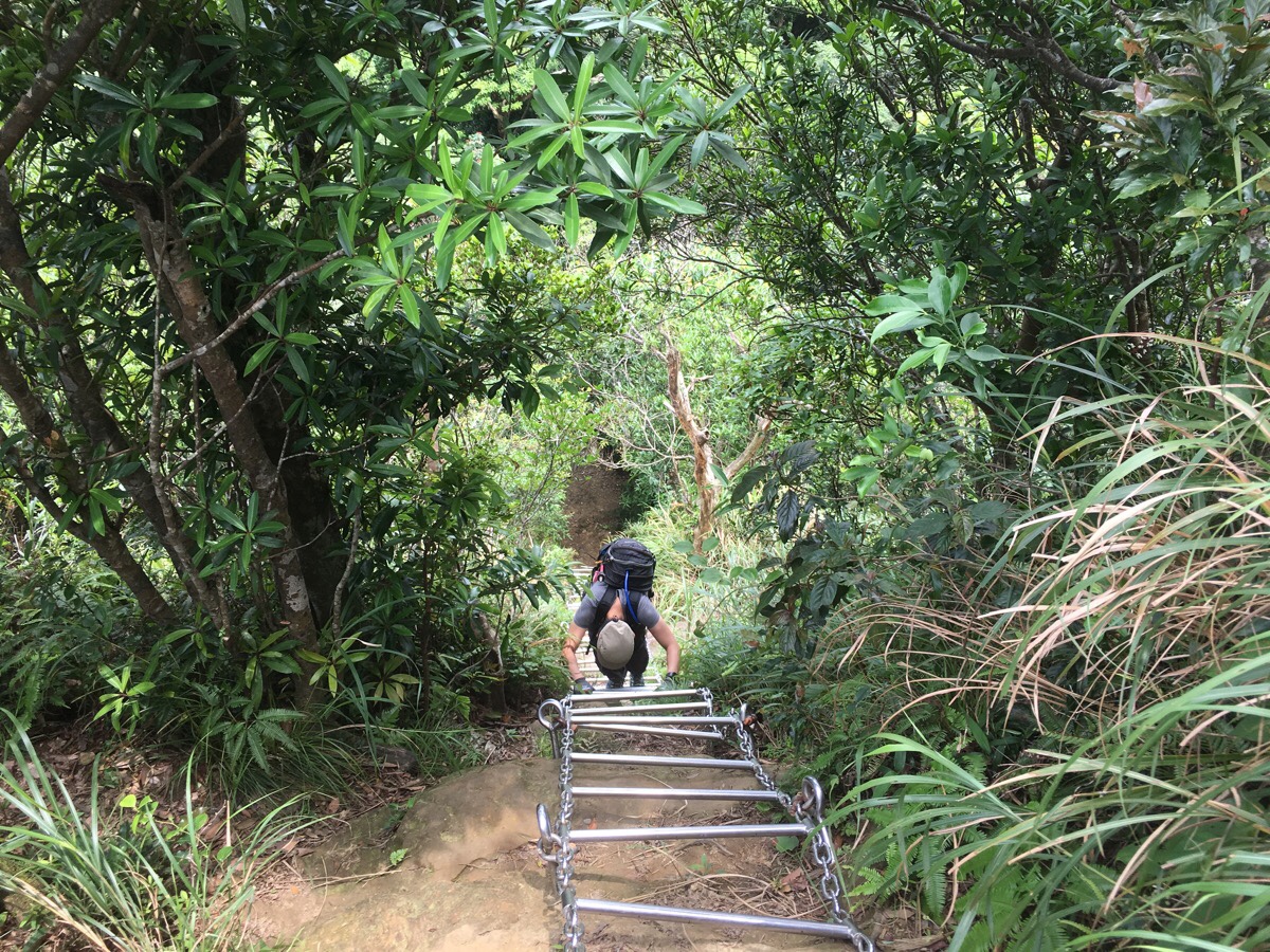
Walking straight on from the junction, we came to the biggest climb of the walk. It looks like there are two options for heading down, either climbing or abseiling, but it is much easier to go up the route on the right rather than the one that the guy is coming down on in the picture. It looked like so much fun that I was half tempted to climb up, abseiling down, and then climb up again. But I didn’t. (Next time, for sure.)

Looking back you can see the ridge line stretching away enticingly. (If you’ve ever looked at this area in satellite images, you’ll know just how fun it looks from every angle.)
I retreated a little into the shade to wait for Teresa to finish her ascent and observing of the view.
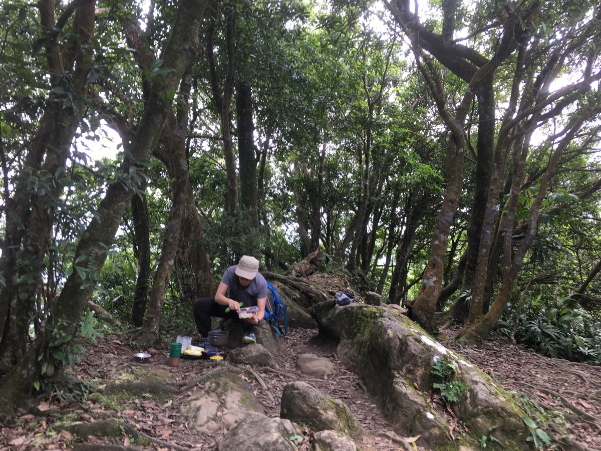
A little further on we decided to set up camp for lunch. We got over taken by a couple of the people that we’d passed earlier, and some people walking back offered us extra vegetables, (they’d not been able to finish everything that they’d brought with them). It was a great spot to have our bak kut teh instant noodles with a cup of coffee, and I enjoyed the happiness that can only be found in eating food cooked somewhere up a hill or in a forest or in a beach.
After lunch we set off feeling energised and ready for the rest of it.
The trail continued much the same as before, lots of slight up and downs over roots and rocks. Another path headed down to the right, but again we ignored it for now and kept going straight uphill. (Later we returned to this spot and came down this way.*) At this point we met a father with two young girls – the dad was ready to give up, but his kids told him it was silly to come so far and then not make it to the good views.
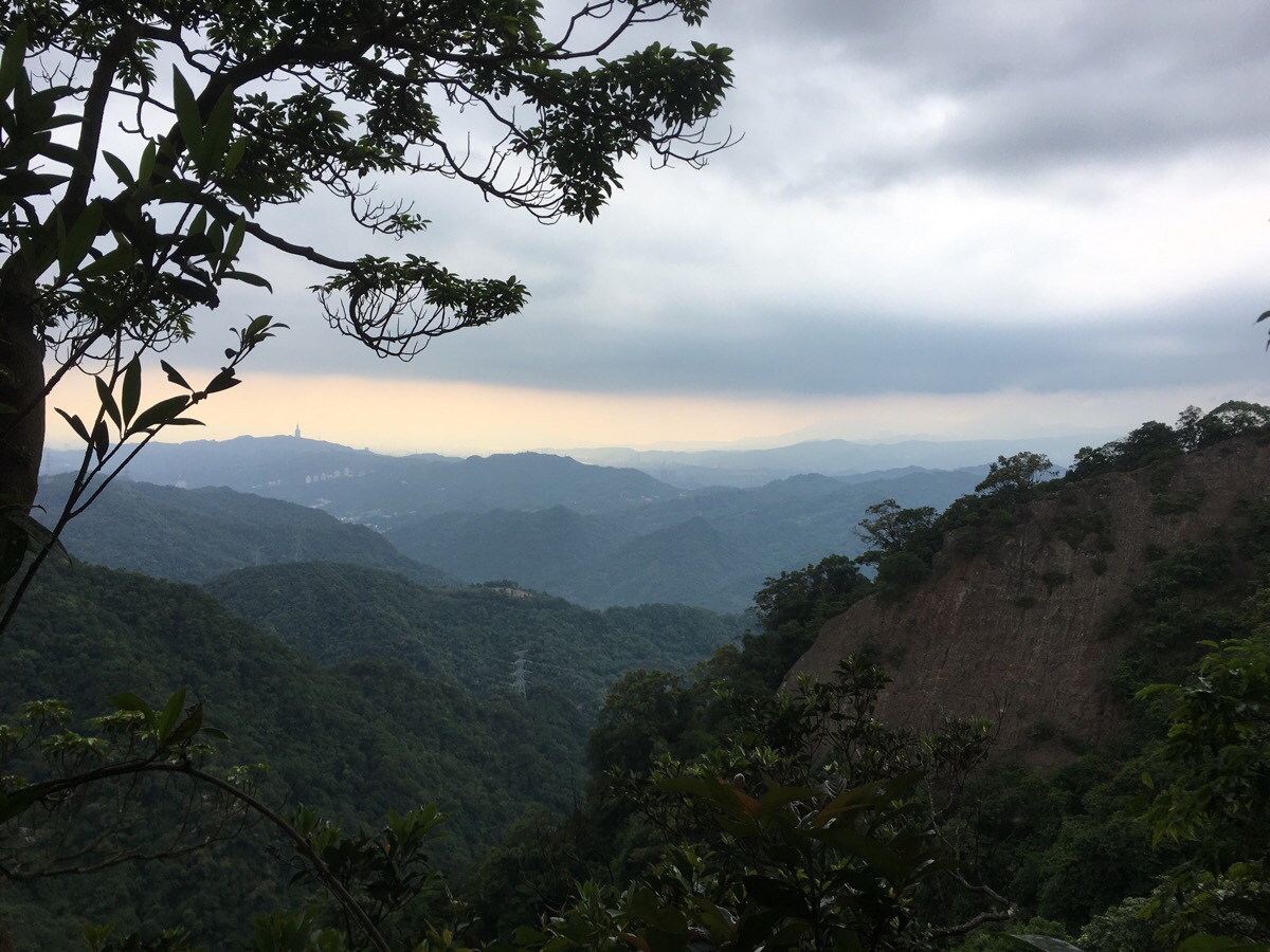
Where the trees clear to the left there are occasional majestic glimpses of rock faces and layered hills – the distant ridge lines hazy as if through layers of tissue paper.
The final 10 minute push up to the east peak rewards weary travellers with outstanding 360° views. I really don’t think the photos can give you a true idea of how it feels to be up here. It’s truly spectacular.
We debated continuing on, (some local blogs indicate that there is further fun to be had – see notes below), but were dissuaded by some older hikers. I think next time maybe we should start earlier if we want to go exploring further. So after spending a while sitting astride the ridge, we returned back the previous 300m or so to the last junction we’d passed.
*This second time, we took the junction (now on the left), downhill. The first 20-30 metres are still an earth track, but it very quickly becomes steps.

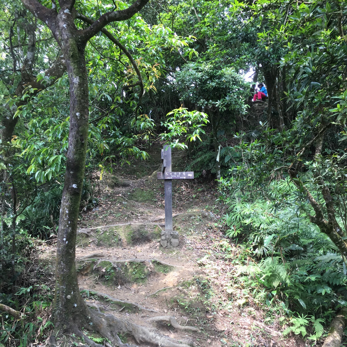
About the same time that the trail becomes steps, there is an interesting looking diversion to the left. Teresa had a little look at it, as did another couple who starting hiking down the same time as us. I’ve forgotten where it said it went to, but looking at the map it seems to split after 200m with one branch looping back to the east peak and the other heading down to a different road.
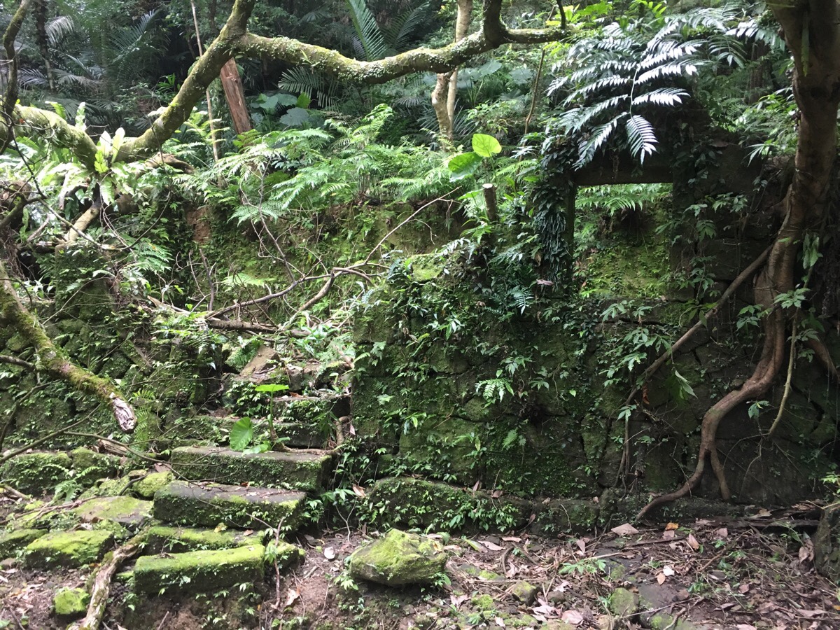
Further down, an abandoned dwelling is slowly being reclaimed by the forest.
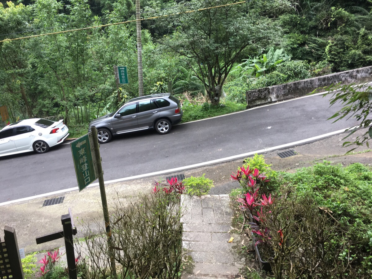
Before too long, we popped out onto a small road, (in fact the same one we’d finished on the first time we did the walk, only further down it). There’s a little toilet block right next to it and a noticed taped up offering a dial-a-taxi service to finishing hikers. We’d walked back the first time though, so we turned right and started the long walk down.
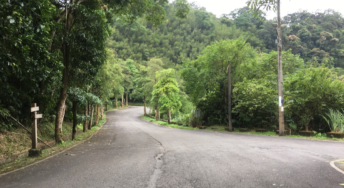
At one point, the road splits in two and we took the left fork, but actually both end up at the same place. However, it turned out to be a serendipitous choice, because a couple of gents who had passed us coming down the mountain passed us again in their car and offered us a lift back to the start. I think this must be a very common occurrence given the popularity of this trail and the fact that it is possible to do it as an A-B walk – is that just the lingo in Taiwan, or is that used everywhere? Teresa got a lift on another previous occasion doing the same hike. I can’t remember what we talked about, but the drive was quick, (less than ten minutes I think), but it certainly saved us from a long road walk. It also ended up being by first ever accidental hitchhike.
How to get to Huangdidian Trail
Google Maps address:
- The trailhead carpark where we started at the west end of the route is here: 皇帝殿西峰登山口, No. 35, Nanku Road, Shiding District, New Taipei City, 223
- The trailhead carpark at the east end is here: Huangdidian Trailhead Parking, 223, New Taipei City, Shiding District
GPS location:
There is parking at both ends of the trail, which makes it very popular with small groups doing A-B hikes where some car shuffling is done before starting the walk so that no one has to walk back at the end.
- Western trailhead is at N24 59.552 E121 39.825
- Eastern trailhead is at N24 59.338 E121 40.746
Public transport: you can take the 666 bus from Muzha Station. Make sure to get on either the one that says it’s heading towards Huafan University (往華梵大學) or the one that says it’s going towards Huangdidian (往皇帝殿). If you want to do the hike the same way around that we did you’ll need to alight at Jiezaitou/街仔頭 bus stop then walk 10 minutes up to the western trailhead. Alternatively, to do the walk in reverse, get off at Huangdi Temple bus stop, then walk about 20 minute up to the eastern trailhead.
Further reading: This is a massively popular walk, so there is a lot written about it. Just a sample of what is available: the Bike Hike Taipei people did the walk in reverse. Richard Saunders has some advice for anyone who thinks this walk isn’t adventurous enough. People have vlogged it. And Josh Ellis has photos of the walk up on his site.
Nearby trails:
- Bijia Ridge
- Taipei Skyline Trail – Section 1B
- Taipei Skyline Trail – Section 2A
- Tamsui-Kavalan Trails – Shenkeng to Wutuku
- Tamsui-Kavalan Trails – Wutuku to Pinglin
- Yueshan Hu Cliff
Huangdidian Trail Map
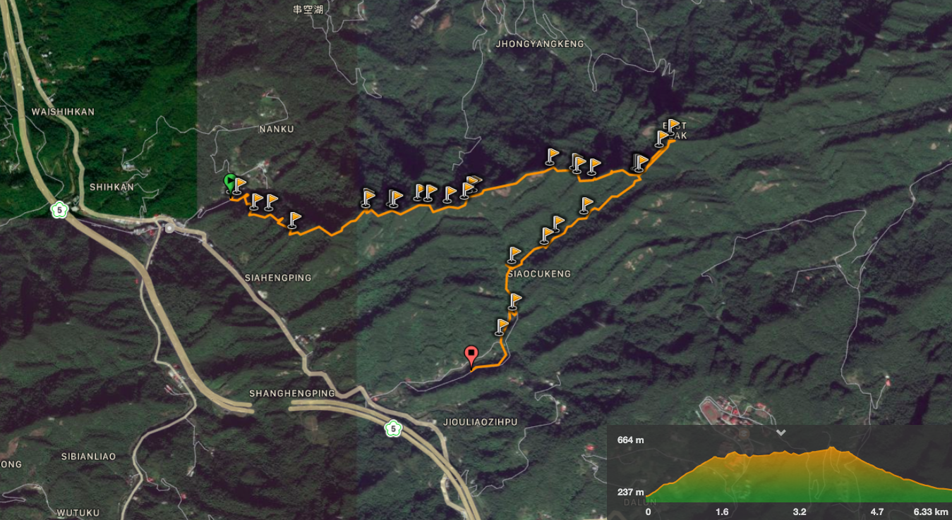
GPX file available here on Outdoor Active. (Account needed, but the free one works just fine.) The route in the picture is what we actually walked, the GPX file is the complete loop.
My new words learnt on this hike:
- 單點 / dān diǎn / used to express that you want to order a single item rather than a set. We got breakfast from a fast food establishment and Teresa told them 這個單點就好, as in just this by itself is ok. I’m surprised that I hadn’t picked up on this before given how useful it is.
- 暴雨 / bàoyǔ / rainstorm – we overhead staff at the convenience store discussing the likelihood of their store being flooded by the heavy rain predicted in the following week.
This is the bit where I come to you cap in hand. If you’ve got all the way down this page, then I can only assume that you’re actually interested in the stuff I write about. If this is the case and you feel inclined to chip in a few dollars for transport and time then I would appreciate it immensely. You can find me on either Ko-fi or Buy Me a Coffee.
