Having already climbed the three famous spires of Pingxi Crags a number of times, we decided to explore beyond the frequently trodden trails near the village of Pingxi and see what the hills beyond had to offer. As it happens, there is plenty more fun walking to be had around here, including this fun loop up to the intriguingly named Chou Tou Shan. The most literal translation of the name would be Stinky Head Mountain, (a name which makes me think that the land is comprised of sleeping giants whose smelly heads form the peaks), but all I can see online as to the provenance of this unfortunate title is that perhaps there was once a big fire here many, many years ago which caused the hill to smell bad, this would have been so long ago that it is now impossible to know for sure. Name aside, this is a great trail with moderately challenging walking, some cracking geology and some pretty scenery too.
Distance: About 10km
Time: 5.5-6 hours (including a lunch break)
Difficulty (regular Taiwan hiker): 5/5 – For some climbing, steep ascents and descents and trail conditions.
Difficulty (new Taiwan hiker): 7.5-8/10 – Most of this trail, whilst strenuous wouldn’t be too difficult for a fit person without hiking experience, however, there’s one section which could prove both difficult and dangerous. Also, the signage is sometimes bilingual, sometimes only Chinese, so you’ll definitely want to follow a GPX track.
Total ascent: about 570m to a high point of 583m.
Water: I drank 2 of my 3 litres, but my body later told me that I should have drunk more.
Shade: Patchy, if you’ve got sun-shy skin make sure you’ve got hands-free protection.
Mobile network: Pretty good for the first half, pretty crap thereafter.
Enjoyment: Lots! If you enjoyed the Pingxi crags, but thought the walk was too short, then this is a good choice. It’s not exactly the same, but the landscape is similar, just less managed.
Other: Not a great choice if you’re scared of heights.
Permit: None needed.
Jump to the bottom of this post for a trail map, GPX file, and transportation information.

The first section of this trail follows the route of the shorter Pingxi crags loop. If you’re coming from the train station, you’ll need to walk down towards the river, then turn left after crossing the bridge. After a couple of minutes you’ll spot a map and a toilet block on your right (left in this photo, as we were coming from the opposite direction). The group gathered around the base of the steps was a team of mostly deaf hikers, and I was unsurprised to note that they seemed every bit as chatty as their more commonly encountered hearing counterparts. People were signing all over each other, with multiple conversations being directed at each individual.
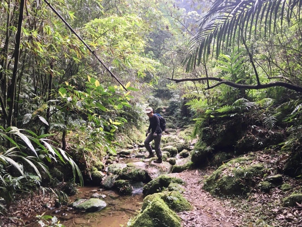
We set off up the trail ahead of them, and followed a stream up past what looked like an old mill and through bamboo to a house.

Turn right at the house to join the road, then immediately left towards a carpark and the start of the proper trail.
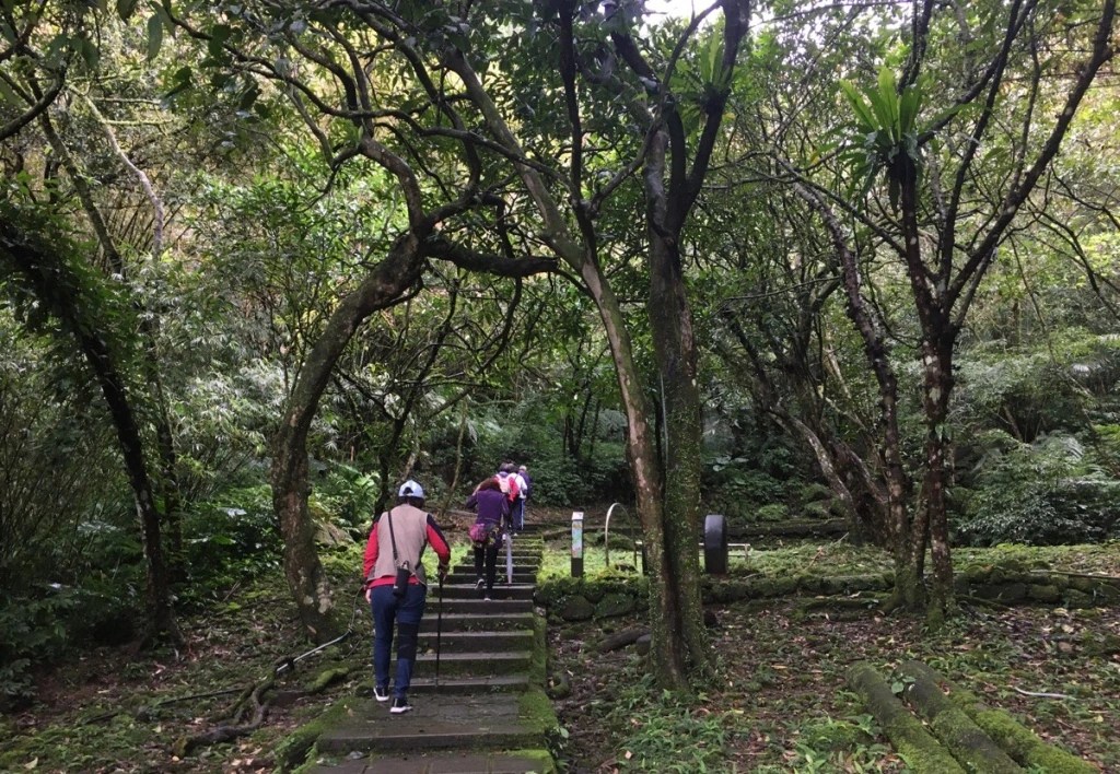
The path starts off by climbing up concrete steps, but those soon give way to more pleasant sandstone. The group of retirees ahead of us in this picture stopped to let us pass and the alpha male commented loudly in Taiwanese to his team mates that the foreigner (me) had brought her son (Teresa) to go hiking. To my knowledge, this is the first time that we’ve been misread as mother and son, and I’m hoping that the guy just had poor eyesight – I mean he either didn’t realise that Teresa is quite clearly not a white foreigner, or he did some mental gymnastics which involved assuming that I’d adopted him/her. Anyway, this led to Teresa enjoying calling me mum for these whole walk in a whiny tone that sounded like a bleating lamb.

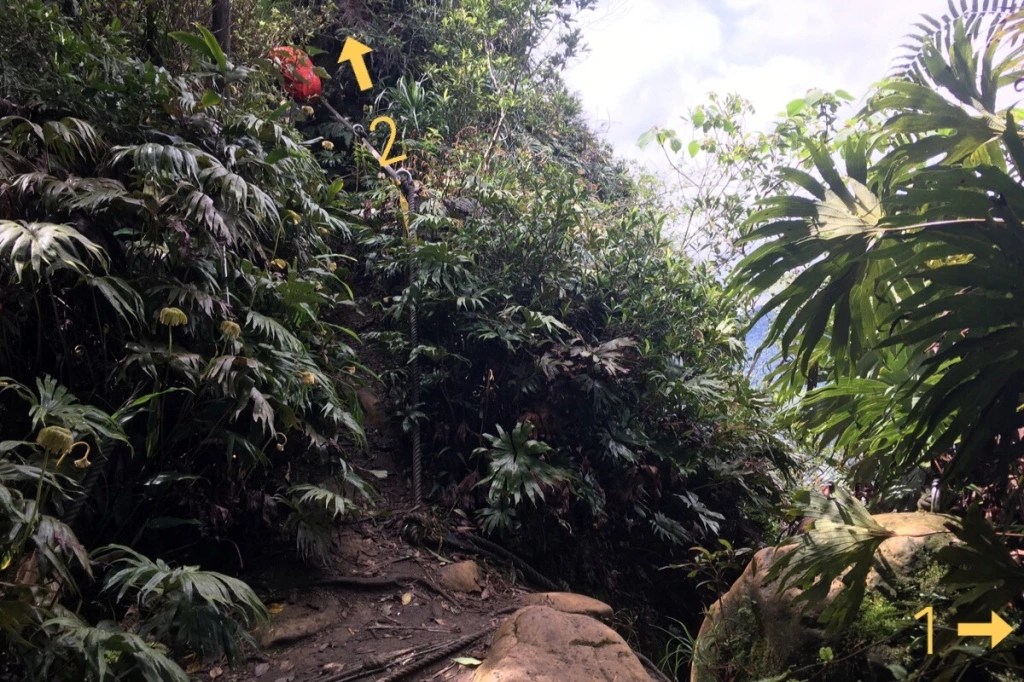
At the top of the steps, the path splits into three short trails leading to the three popular peaks of the Pingxi crags. To the left (arrow one) is the steep spire Xiaozi Shan/孝子山, otherwise known as Filial Son Mountain. Straight over (arrow two) is Cimu Shan/慈母山, this is the Loving Mother Mountain overlooking the son. Then the third trail to the right heads towards Putuo Mountain/普陀 – a short spur trail here leads you to a shrine set up in a shallow cave.
It’s worth spending a little time to explore the area, if only to make sure you’re up to the task of what you’ll find on the trail ahead. If you find these scary or difficult, then you probably shouldn’t attempt to reach Zhongyang Piton and Chou Tou Shan. Once you’re ready to crack on, head up the trail marked by arrow three, (it can also be reached by climbing up and over Cimu Shan as indicated by the second arrow). Stay on the path made of concrete steps – there’s only one, so you can’t get lost.
After passing the trail up to Putuo Shan on the right, and the trail coming down from Cimu Shan on the left, the steps descend to a junction. To get started on the walk to Chou Tou Shan and Zhongyang Piton turn left here.
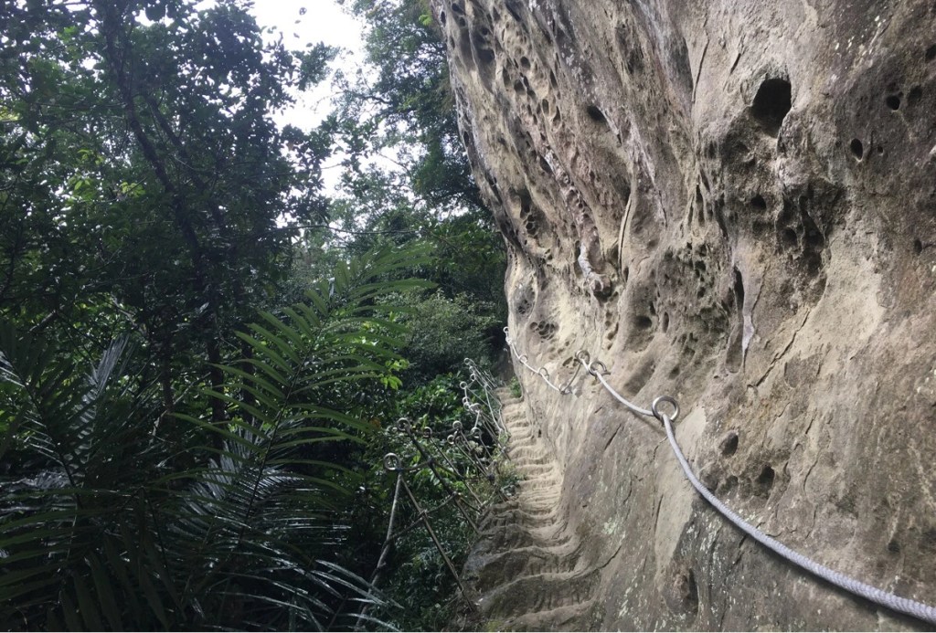
After turning left, the path heads up on paved steps for a few minutes before the trail becomes a scramble. Two paths run parallel, the left one appears to be an occasional stream bed, but the one on the right is much more dramatic, cutting up along the base of a sheer rock face. The cliff rises honeycombed many metres above above the trail, and the steps themselves are narrow, there are places where it would be hard for two people to pass.
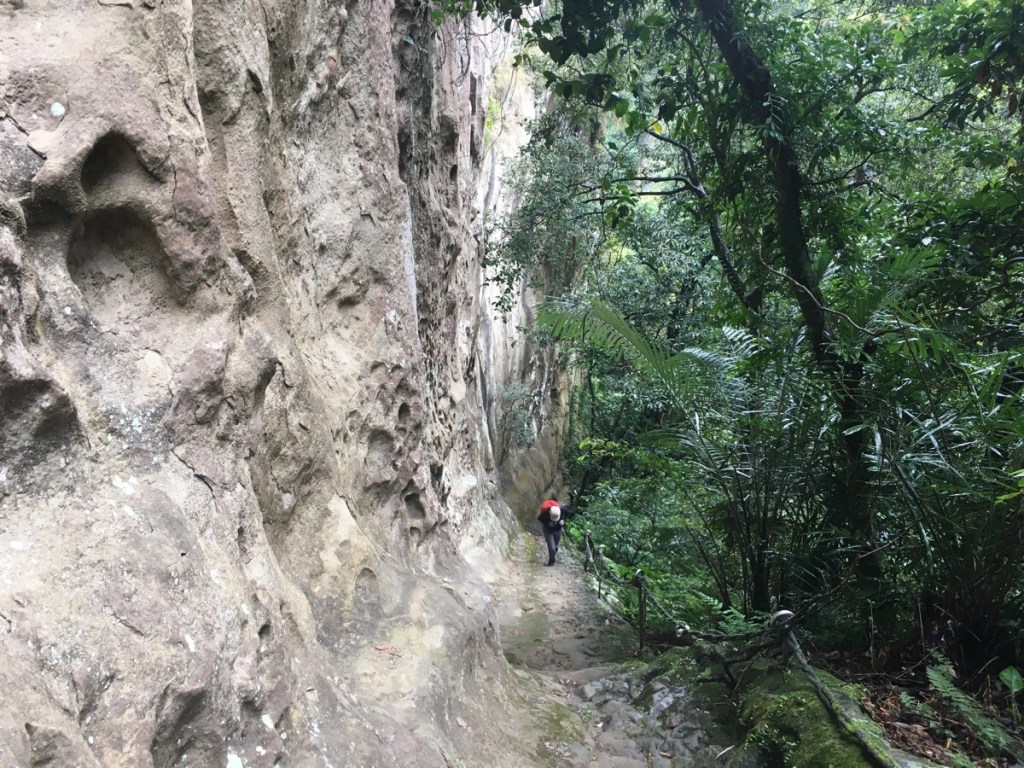
The scale of it as you look back down is really something special. We had decided upon this walk as a kind of last minute choice the night before, and although we had a pretty good general idea of the level of difficult, time, distance, etc., I hadn’t looked closely at blogs of the trail. This meant that the it held many unexpected delights along the way – this marvellous rock face being one of them.
After almost reaching the upper edge of the cliff, the path splits left and right. The right trail heads over Ci’en Shan (慈恩山), or Mercy Mountain according to Google), which might be a better short option if you’re not feeling up for the whole route. We took the left trail though, heading towards Zhongyang Piton and Chou Tou Shan.
Abruptly there is a second junction, although again it’s just a case of following the signposts.
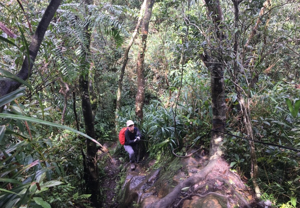
For a while, the path levels out a little and it’s a pleasant scramble along a verdant ridge cloaked in scraggly screw pines. A little way in there is brief scramble up to the left which gives you views back over towards Pingxi. In the distance we could hear the harsh bark of a muntjac, and a little closer we heard the startled squarks of a pair of squirrels that we’d disturbed.
At an indistinct junction we took the righthand trail towards 中央山. The path dips down a bit. We walked through a thicket of lower-growing trees, and the path to either side bristled with the call of grey-cheeked fulvettas – peering into the undergrowth revealed one of the constantly-moving sprites to me – small with beautiful tan-grey feathers and a white ring around the eyes, (thanks to the vastly knowledgeable @TaiwanBirding for the identification).
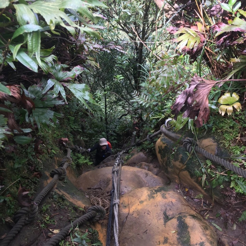
And then it climbed a bit more, and then dipped again. This last downwards portion deposited us at the bottom of what seemed to be a cliff. The top of the cliff looked to be pretty much where I thought Zhongyang Piton ought to be, so I pulled out the route we were following and yes, it was indeed the peak. That meant that the next section was going to be a steep climb. Closer inspection of the way ahead revealed that what I’d initially taken to be vines hanging vertically down were actually the ropes we were going to have to use.
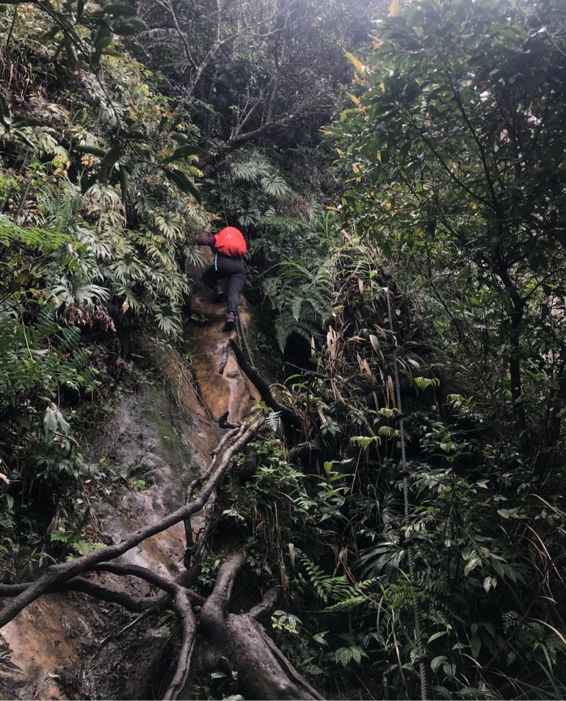
Teresa took this photo of me just as I was starting the climb. It’s around 90m vertically up from here to the peak, and all but the last few metres are this steep. The climb had a couple of points where you could stop and rest a bit, so I’d go first, then let Teresa climb up a bit, then she’d wait as I went up. The climbing isn’t too tough, there are plenty of handholds and footholds, but you’re going to want to test each of those before putting your weight on them, and never trust a single rope or root with all your weight, make sure you’ve always got multiple points of contact. There were a couple of spots where I needed to stop and think where to put my feet, and one part where there wasn’t anywhere for feet to go and I found myself sitting on a knobbly piece of rock sticking out from the slope. The part that got my heart rate going the most was about halfway up when you need to move your body out from the rocks a bit in order to get over and round a protuberance. If you’ve done walks like Wuliaojian or the Nangang rope trails, then you should be fine, but still be sensible.
Teresa, of course, made it look like a walk in the park as she gracefully scaled the ropes. I have to believe she was a monkey, or perhaps a mountain goat or a gecko in a past life – that would go someway to explaining her natural affinity for the terrain
The trail emerges here, (that drop off on the right), and it’s another five metres in the direction of arrow one to the top of Zhongyang Piton. We went up to the top, (580m), but it was full of a group of five or six who had stopped to have lunch, so we pressed on in the direction of arrow two.

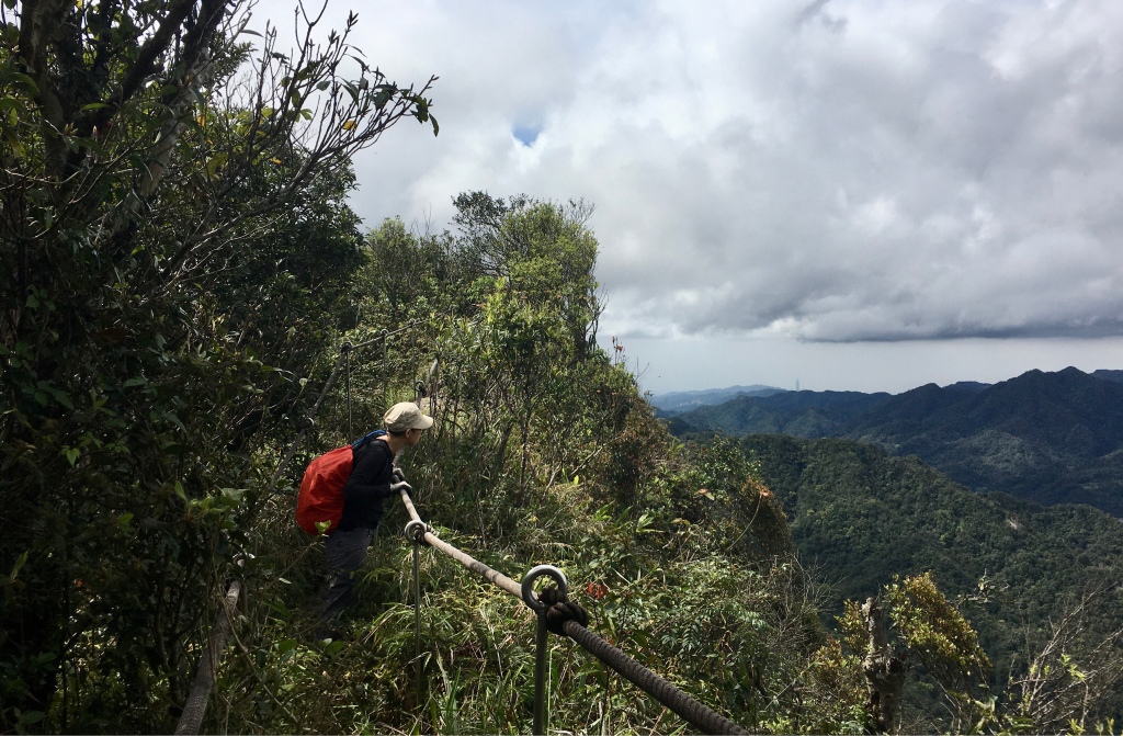
The trail bridges the spine for a way and when the trees to either side drop back, the views here are magnificent. If you look closely at the above picture you can even spot Taipei 101 in the distance.
The views lasted only briefly, and we were soon scrambling along a narrow trail down a steep slope. About five minutes into the descent we encountered what I took to be an extended family group making their way up. They asked how much further it was and said we must be very tough to find this route. I was shocked to meet a small 9-10-year-old child in the middle of their party, I am not sure I’d feel comfortable bringing a child to do this trail, (specifically the vertical section which they would have to go down).
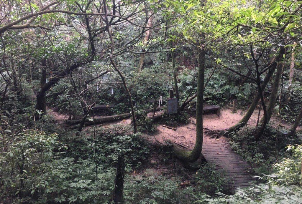
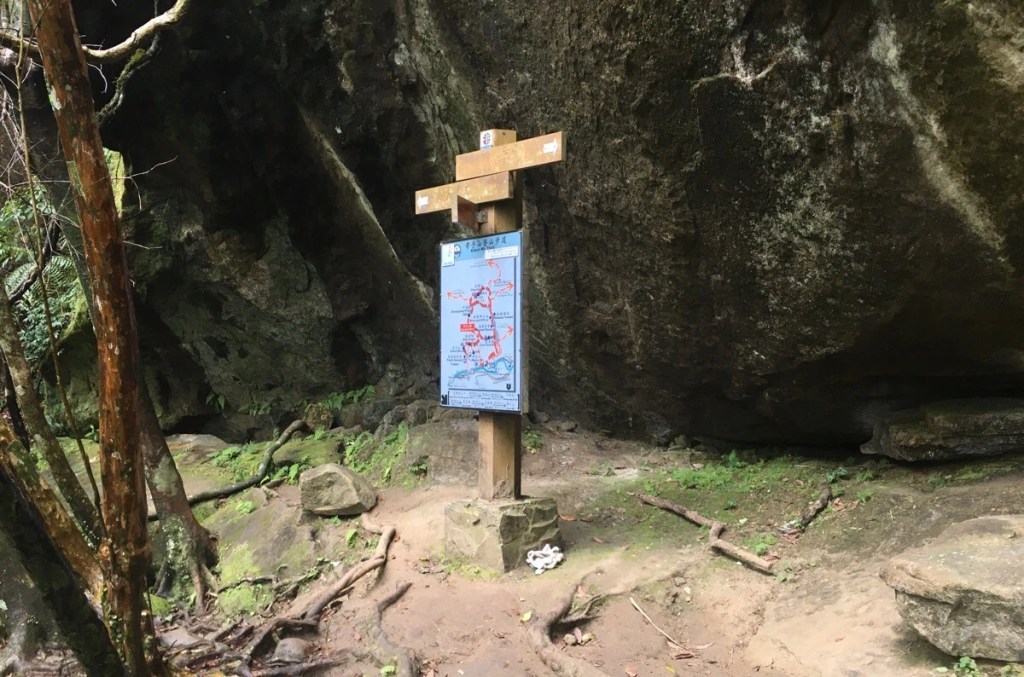
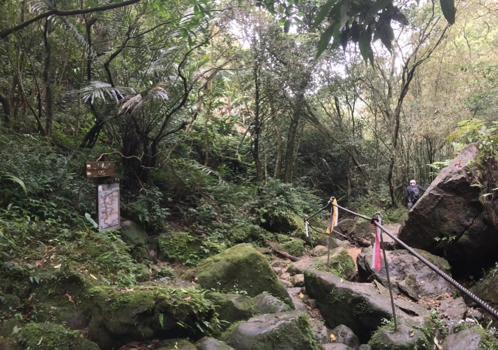
The descent ends at a pleasant little clearing with a few benches and a map. We debated having lunch here, but decided to just keep going on to Chou Tou Shan (the signpost said it was another 20 minutes further), in the hopes that it would be a prettier lunch spot. As it happened, we would probably have been better off eating here, but we only knew that with hindsight. The trail up to Chou Tou Shan is the one leading kind of straight over and a little to the left, (the righthand trail cuts out the peak and joins the path we would come down on later, so perhaps this is a better option if you’re running out of daylight hours).
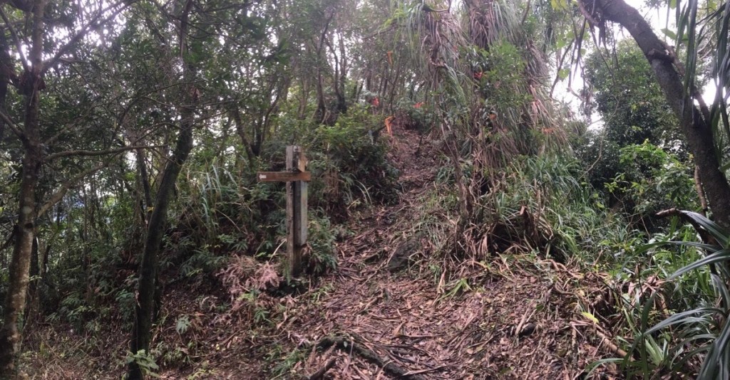
Much to our horror, the next sign we passed said that it was a further 30 minutes to the peak, but that turned out to be a cruel joke as the second one (in this picture) informed us that we were a mere 10 minutes away. (In the end it transpired that the original sign’s 20 minute estimate was pretty accurate, as we made it up in about 18 minutes).
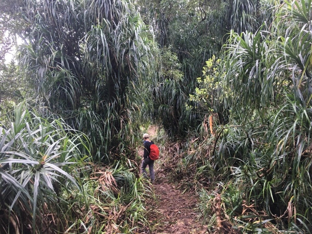
The final section of ridge before the peak was a resplendent, explosive mess of screw pines. It’s a common enough plant on ridge trails around here, I’ve seen it on the Huangdidian and Bijia Shan trails, but I had never seen it being the dominant foliage in an area before. The overall effect is visually striking, the way the glossy upper sides of the leaves reflect light whilst they droop over to create pockets of deep shade makes it look like someone has taken a photo and increased the contrast just beyond what is comfortable.

We reached Chou Tou Shan (476m) and more or less breezed straight over. There is no view to speak of and with nowhere to sit, we made the choice to keep on walking.
There was a dramatic change of greenery almost as soon as we started heading downhill again. The screw pines were replaced by a stand of cypress trees which seemed somewhat foreign in the landscape, and then they gave way to bamboo trees as the trail traced the channel of an ephemeral stream.
Just over 10 minutes after leaving the peak, the trail arrives at a junction by a stream where we turned right downhill. From here onwards, I immediately got the sense that path was one of the many historic trails that criss-cross the land of Taiwan, often tracking alongside routes already opened by streams. Sure enough, a little research after getting home showed that this portion of the route follows a historic trail connecting the settlements of Dongshige and Pingxi. It was recorded on the Japanese Colonial Period Map of Taiwan, (when it was then known as Gua Liao Keng Historic Trail/瓜寮坑古道) and has since been officially named Dongshige Yueling Historic Trail (東勢格越嶺古道) by the New Taipei City government. Perhaps one day I’ll come back to walk the whole of this – I imagine it would be a great summer walk given it’s proximity to water.
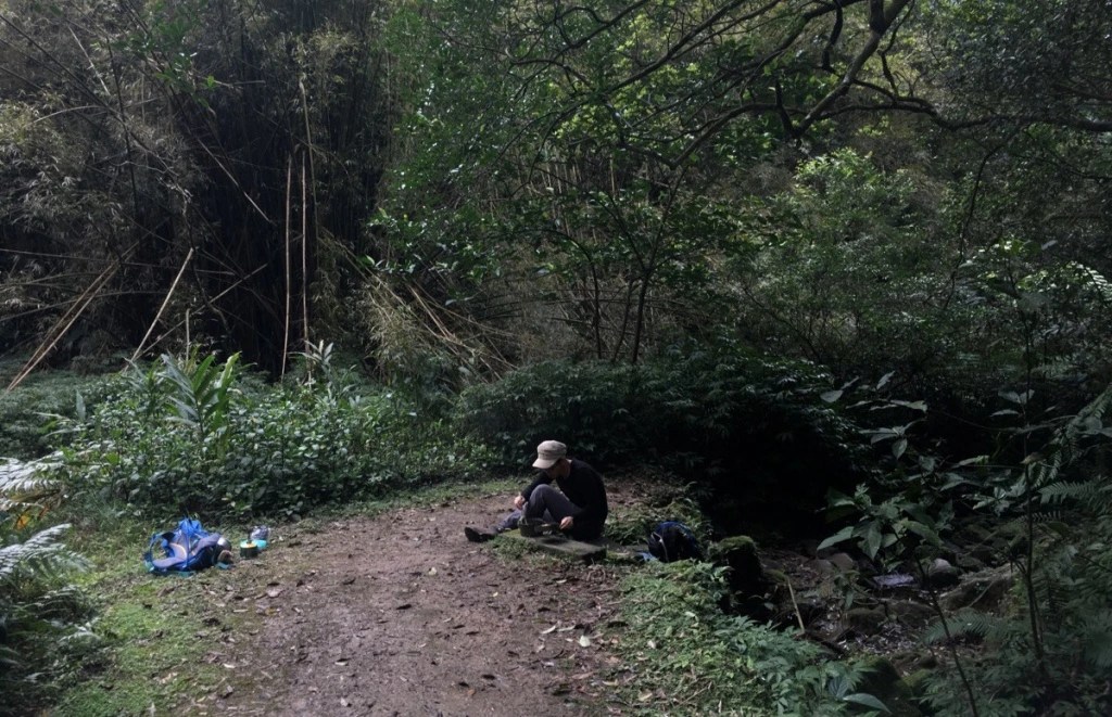
We continued a little further until we found a clearing where we could downpack and have lunch. As we were cooking our noodles the team that we’d met having their lunch atop Zhongyang Piton, they seemed to be delighted by the fish in the stream a little beyond where we’d stopped.
Somehow we managed to get the whole process done in record time (under 45 minutes I think), and had soon packed up and were on our way again.
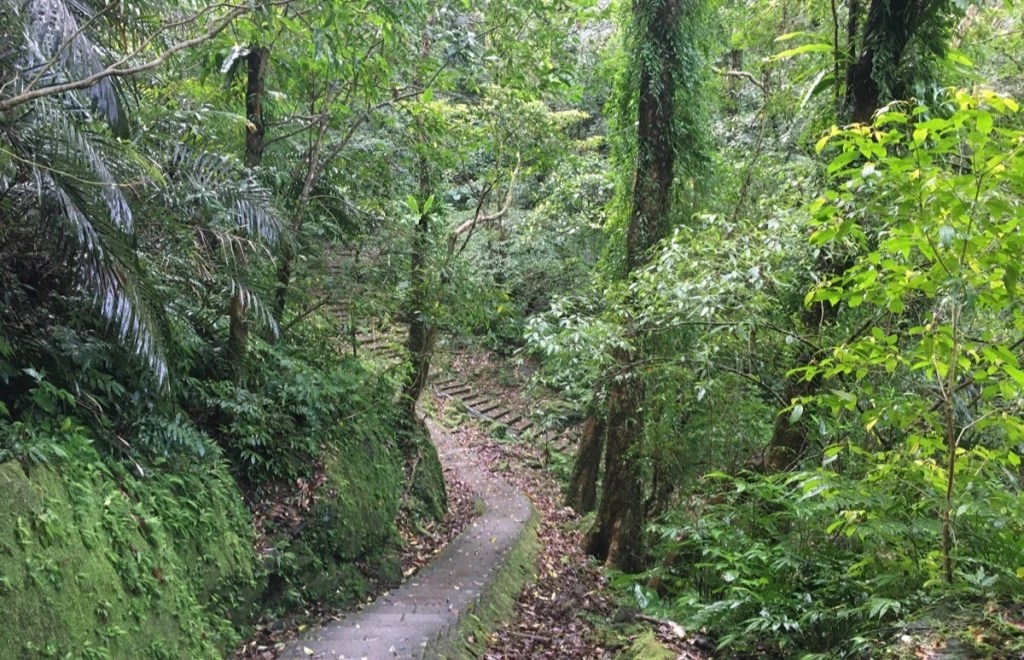
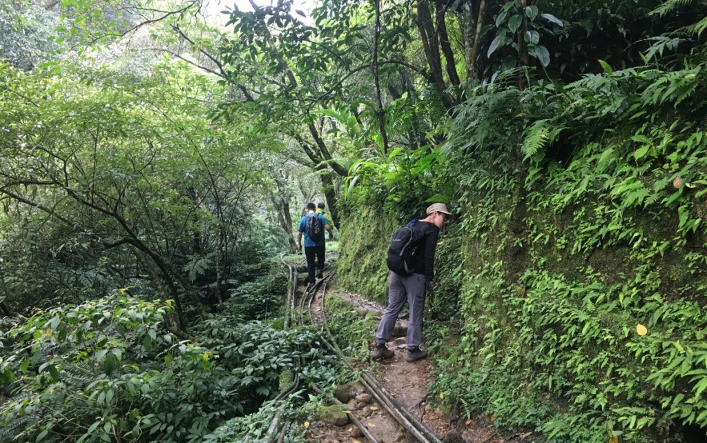
The remainder of the trail skips over and around the stony stream channel, and it has that utterly timeless charm of so many of the old trails in Taiwan – without the reference points of clothing, (and photographic technology), the above picture could come from pretty much any point over the past century – I sometimes find myself quietly pondering about the people who have walked these ways before me, and the things that the trees could tell me if we shared a mutually intelligible language.
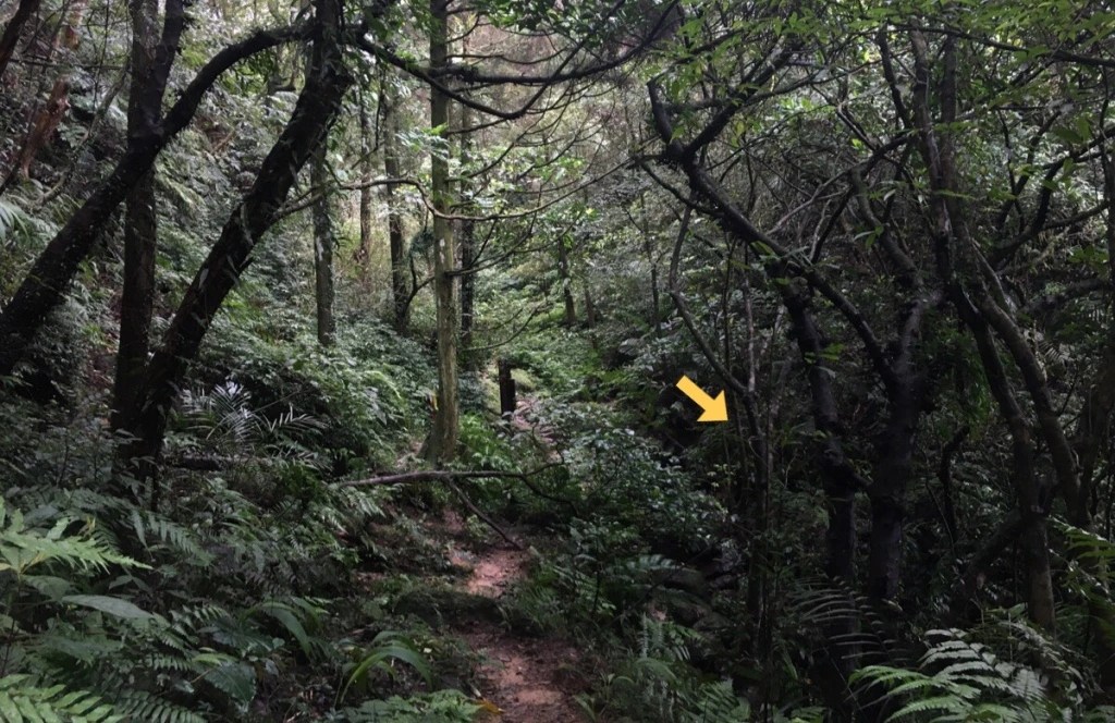
The first junction you pass is a trail on the left leading to an extended loop over 峰頭尖東峰, 九龍山 and 石燭尖 (link in Chinese), which definitely looks like worth a return trip at some point in the future. The path back towards PIngxi heads straight following the stream.
Soon after that the trail meets up with the path that we could have taken instead of heading up to Chou Tou Shan. (It’s the trail to the right in the above image.) We kept heading straight down along the water.
A further indication it’s this is a historic trail comes in the form of not one, but two separate small shrines, one built on either bank of the brook. Each stone shrine had its own two-sided corrugated iron shelter to protect the residents from the worst of the elements, and both were obviously old, but well maintained. The one on the far side of the water was dedicated to Tudi Gong (土地公), but the one on the same side of water as the trail is dedicated to You Ying Gong (有應公), a type of spirit or ghost, (not actually a named god). This type of shrine tended to be established where there was the need to soothe the spirits of improperly venerated dead, and this particular one had a burner made out of rocks, just like the one we saw earlier this year on Datieliao Old Trail – at the time I commented that I hadn’t seen any of this construction type before, but now I wonder if perhaps I just hadn’t noticed them. (Likewise, maybe I have misnamed many other You Ying Gong shrines as being dedicated to Tudi Gong – I will have to pay more careful attention in the future.) Strangely, it also had just a single moon block placed at the entrance, (as opposed to the normal pair).
Beyond the two temples, the trail had its final steep descent as the trickle of a thin waterfall fell to the left of us and water from the stream on our right was sucked down through a filter. At the bottom of the steps, the water disappeared under a bridge, and form that point on, the trail ran above the stream rather than alongside it. An old wooden bridge straddles the channel, landing right next to what looked like a fire-pit in an alcove carved into a rock, but it looked too rotten to be trusted with my weight.
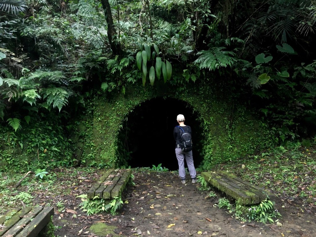
Close to the rickety plank bridge we came across the first of several traces left by the area’s mining past – an abandoned mine shaft to the left of the trail. Although in the photo it looks like it goes on forever, actually there is very little left to see – turquoise-grey water has filled up the shaft to about 20cm below the level of the path, and since the roof slopes down at a 30-35 degree angle, it doesn’t go too far back before the top wall hits the water.
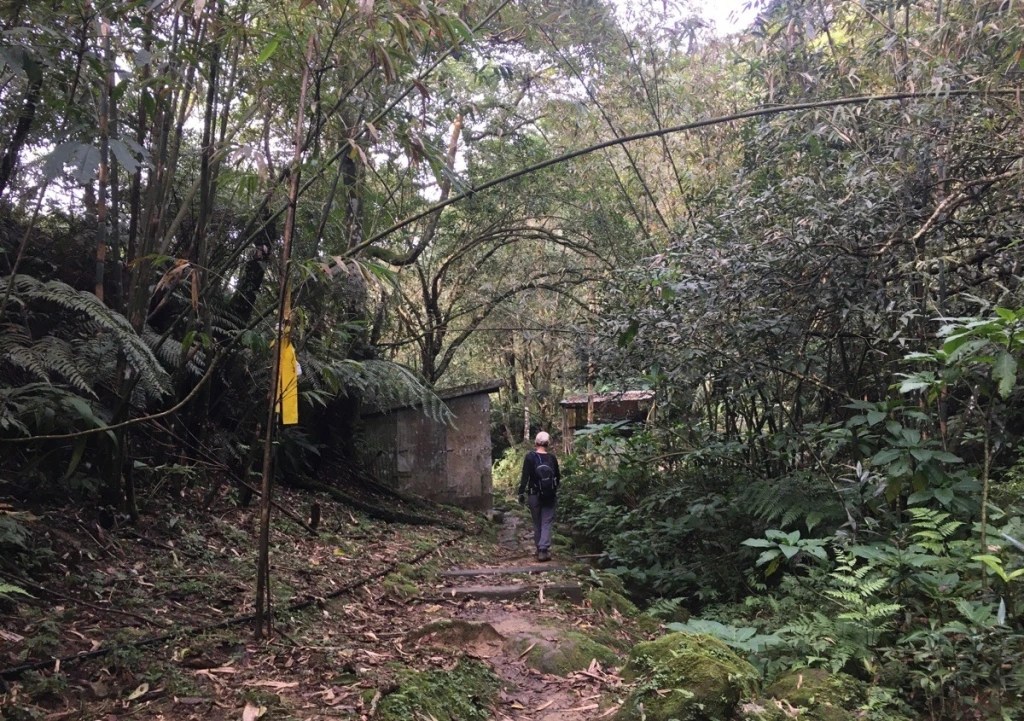
As we were passing the mine shaft on our left, there was also an obvious collection of structures over the stream to our right. This includes an old mining office, now nothing more than the walls remain.
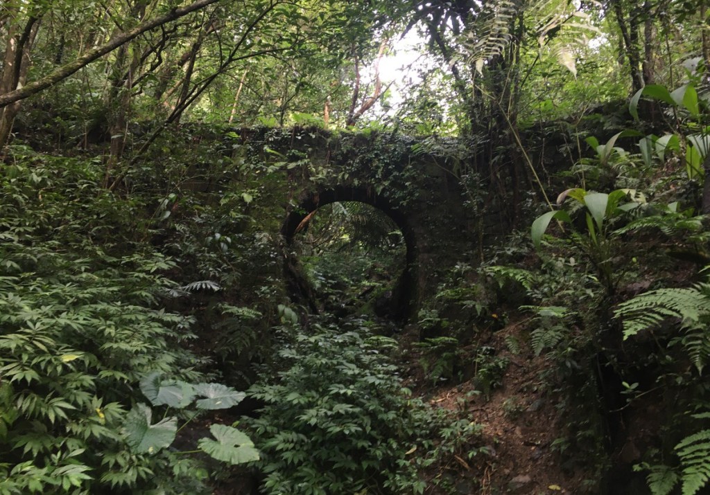
From this point pretty much to the road, the path follows the track that the mining carts would have taken, so the slope is gentle and the path curves around the folds of the hill rather than taking a more direct route. If you pay attention to the forest on the right you can spot more hints of the area’s previous industry, like this beautifully constructed arched bridge that’s gradually being reclaimed by greenery.
Whilst we were looking at the bridge, we encountered a pair of men walking towards us. They seemed unsure about where they were headed and asked us if they were going in the right direction for Zhongyang Piton, we said that they were, but advised that given the late hour, (it was about 3:30, they probably shouldn’t attempt to climb that way). Thankfully, they seemed totally ready to take the advice, and set off back the same way they’d come. They may well have been able to get up there, and return safely, but if it were me there’s no way I would want to start such a walk so late in the day.
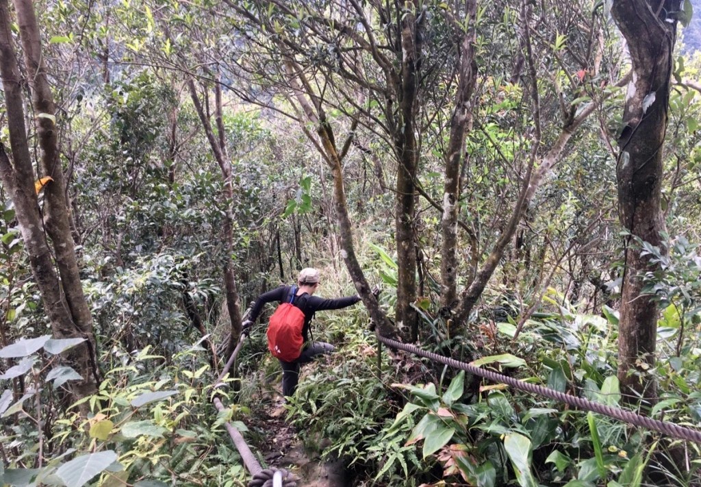
There are also a great many walled-off sections of building (one of which Teresa is peering into in the above photo). I have to imagine they’re either storage spaces for the mining works, or perhaps even bunk houses for the people who used to work here.
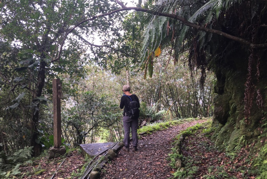
The water was, by now, way below us in the gulley to the left, and occasionally trails would cut through the trees down towards the water. There even looked to be a few pools that would make possible swimming holes in the summer months. Along the way we passed the turn-off for Ci’en Shan (慈恩山) on the right.
As the trail approached the road, we decided to stick with the cart track rather than head down the steps, so we followed the curve of the path right.
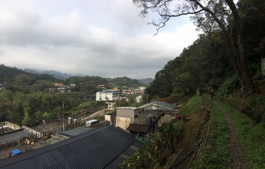
Before too long we we walking parallel to the road, and soon the path spat us out next to a house and we made our way down to the river then back towards the train station.
How to get to Choutou Shan Trail
Google maps address: the trail starts in front of Pingxi Waterfall, there is roadside parking near here but it fills up quickly on weekends so get an early start.
GPS location:
- Waterfall trail head – N25 01.460 E121 44.355
- Farm trail head – N25 01.410 E121 44.150
Public transport: take a train to Ruifang, switch to the Pingxi Line (make sure to go out and pay for the Pingxi Line again) and then alight at Pingxi. Return back the same way.
Further reading: a long time ago I’d found this post on a walk in the area, but hadn’t actually been able to work out where it was until walking the route. For information written in Chinese you can check out this post.
Nearby trails:
- Fireflies at Jintong Coal Memorial Park
- Sandiaoling Waterfall
- Dacukeng Old Trail
- Lingjiao and Wanggu Waterfall
- Mount Wufen Trail
- Pingxi Crags
My new words learnt on this hike:
- Li si teh – Taiwanese for ‘Uh, hello?! What are you thinking/doing?’ – what you say when someone clearly hasn’t thought through what they’ve just said or done.
- 白馬王子 / báimǎ wáng / Prince Charming
- 言語騷擾 / yányǔ sāorǎo / verbally harass
Choutou Shan Trail Map

GPX file available here on Outdoor Active. (Account needed, but the free one works just fine.)
This is the bit where I come to you cap in hand. If you’ve got all the way down this page, then I can only assume that you’re actually interested in the stuff I write about. If this is the case and you feel inclined to chip in a few dollars for transport and time then I would appreciate it immensely. You can find me on either Ko-fi or Buy Me a Coffee.
