This is one of the all-time classic Taiwan hikes, and for good reason. The photogenic Pingxi Crags rise dramatically from the surrounding forest, and their easy accessibility makes them the perfect adventure playground for visitors from Taipei.
Distance: 2.5km
Time: 1-2 hours – depending on if you prefer to rush around them or take your time.
Difficulty (regular Taiwan hiker): 2/10 – steep steps where some care is required, otherwise nothing challenging.
Difficulty (new Taiwan hiker): 4/10 – very steep, but quite short, care is needed when climbing the more exposed sections, but there are steps and handrails provided to make it easier.
Total ascent: about 200m with the highest peak at 450 metres above sea level.
Water: one 0.5L bottle should suffice as long as you don’t go any further.
Shade: not much – I would need more protection on a sunny day.
Mobile network: mostly ok, just dark in a few spots.
Enjoyment: loads of enjoyment, it is a very special feature of the hills in northern Taiwan.
Other: head here on a weekday to avoid the crowds, (weekends and holidays are extremely busy), also its sensible to go on a dry day. After the walk you could pop into Pingxi for snacks – just make sure you don’t release one of those forest-littering lanterns>, (as far as I know the more environmentally friendly ones are still not on general sale).
Permit: none required
Jump to the bottom of this post for a trail map, GPX file, and all of the transportation details.
And for information about more hikes near Pingxi, you can hop over to this page dedicated to collecting all of the hikes on this site that can be accessed via the Pingxi Line.
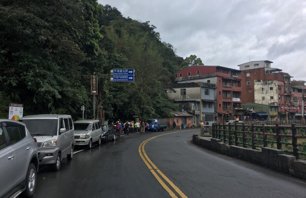
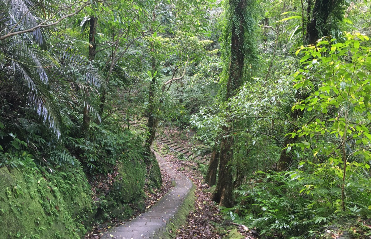
The trail head is just a short walk away from Pingxi Train Station, and is marked by a map and a small toilet block. (Note the gathering of brightly clothed walkers.) Head up the steps here and follow the stream uphill.

After about a five-minute climb you’ll arrive at a house, turn right in front of it and then turn left onto the road. You’ll find yourself at the main entrance to the trail, (also marked by a map and a portaloo. If you’re coming with your own transport you can park here.
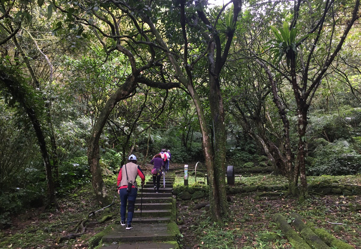
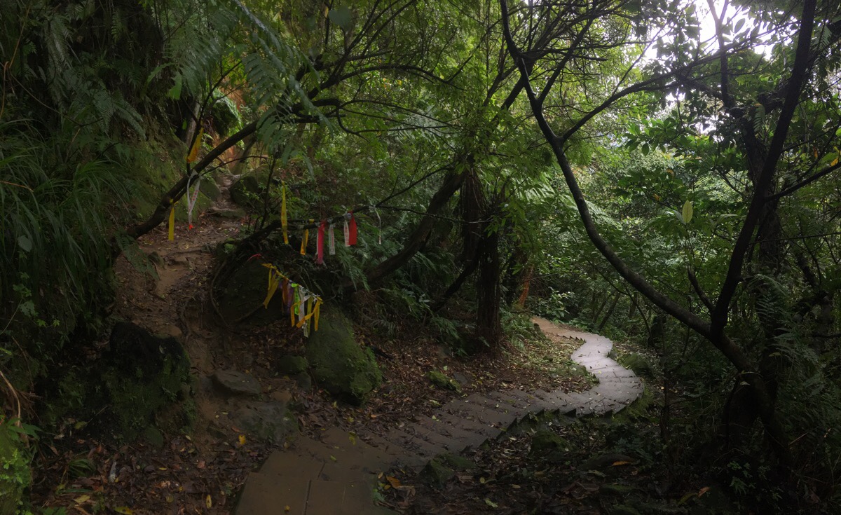
From here there is a steep, but easy climb up steps to where the real fun starts. On the way you’ll pass a very impressive tree hulkingly draping itself all over a boulder, and a couple of shrines that have been set up in alcoves in the sandstone rock-face.
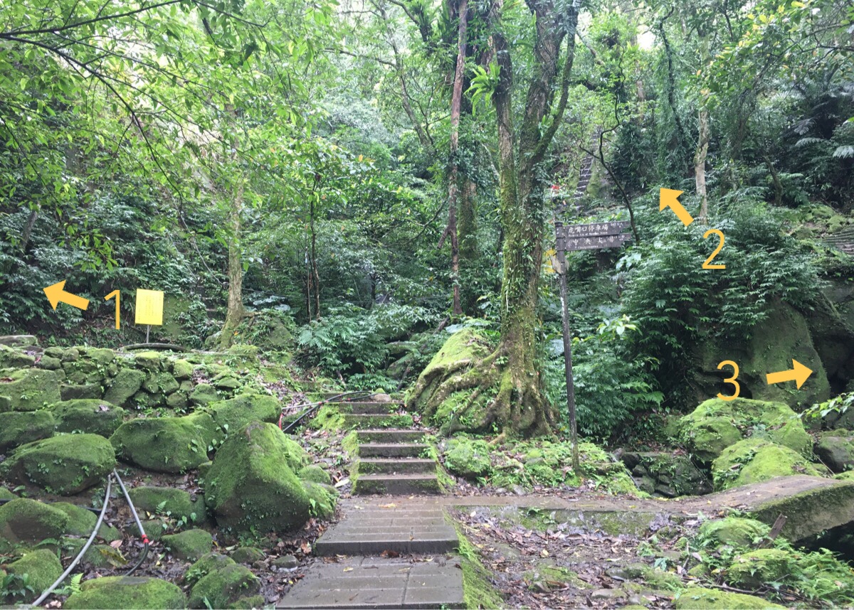
Unlike most trails, this one isn’t a straight line from A to B, and neither is it a simple loop, instead it is a series of loops and spurs around a central area. After the initial climb, you’ll arrive at this spot with another Guanyin statue just off frame to the right. Different write-ups include three, four or six peaks in the Pingxi Crags, but I’ve decided them into two separate posts, this one covering the three smaller peaks (as referenced by the Chinese title) closest to the train station, and one which details the walk to Choutou Shan since I feel there is a significant difference in difficulty level between the two. The three arrows here take you towards the three main:
- Filial Son Mountain (孝子山/Xiaozi Shan) – 360m, this is the most dramatic of the three, a knobbly spike of rock protruding above the tree line.
- Loving Mother Mountain (慈母山/Cimu Shan) – 410m, this is the second highest of the trio, and the only one without a resident deity.
- Mount Putuo (普陀山) – 450m, this one has the most comfortable peak to spend a bit of time on.
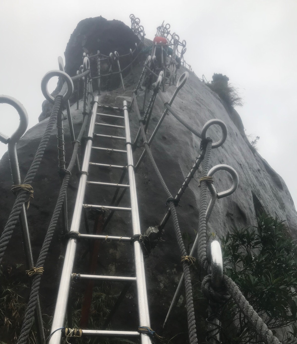
The trail to the top of Xiaozi Shan curves around the side of the crag first and then through a small archway. It is the only one with an actual ladder affixed to the rock – personally I’m not a big fan of the ladder, I prefer to get a solid footing on the rock. Also worth noting is that this is probably the most popular of the three, and so if you visit on a weekend or national holiday you can expect to spend a good deal of time queuing. The first two times we visited were either on weekdays or weekends with poor weather, so we were the only ones up there, but this time it was so crowded that we didn’t even bother. From the distant vantage point of Putuo Shan it was possible to see at three dozen people queuing all the way up the slope.
Once up there you can get some cracking views of people climbing Cimu Shan – views which make it look way more badass than it actually feels to climb. As well as the trig point and marker telling you that you’re 360m up in the air, you’ll also find more statues lining the railings.
After climbing down from the top, return back the the junction with the Guanyin statue. It doesn’t really matter which peak you tackle next since it’s easy to get from one to the other, but we decided to do Cimu Shan .
A little before you reach the half way point, turning round with reward you with the most dramatic view of Xiaozi Shan, standing tall amongst the surrounding greenery. Even on a dreary, grey day the landscape is excitingly beautiful, so I would imagine that it must be even more picturesque with blue skies or yellow-syrupy evening lighting.
The climb up to Cimu Shan is pretty much straight up all the way to its summit. At 410 metres above sea level, it feels considerably higher than Xiaozi Shan, but by some strange illusionary process it seemed pretty much equal to the 450m Putuo Shan. The peak itself is a narrow strip of flatter land with steep drops down to either side, and since it was quickly inundated with other people, we passed on through.
There are a total of four trails leading up to this peak. The one we came up on, one heading down to the left just before we got to the peak, one which continues straight ahead, and one which heads down to the right towards Putuo Shan. The left and straight over ones meet up after a short way, but we took the trail on the right (the steps shown in the above photo) because we were planning to head to Putuo Shan next.

The steps head down to a paved trail. To do a loop walk, first head down towards Putuo Shan and then return in the direction of the second arrow. (If you keep walking down in the direction of the first arrow you will soon arrive back at the original junction with the three trails leading to the three peaks.)
The path on the left for Putuo Shan is generously decked out with hiking tags so it’s impossible to miss. The trail first skirts around the bottom of the rock face for a way, and then starts to climb.
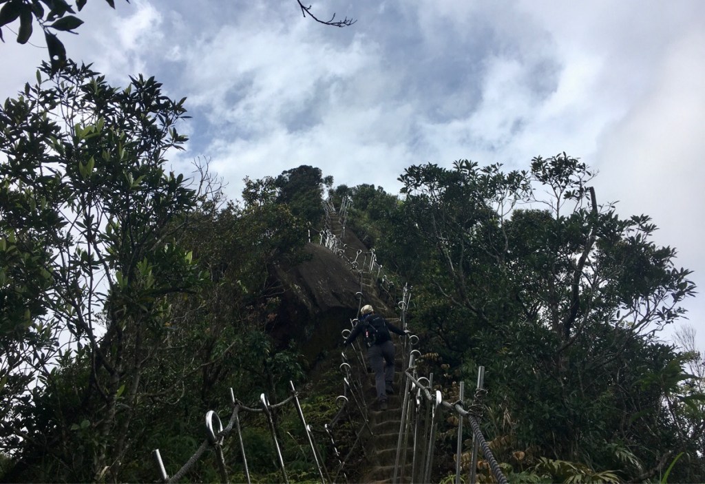
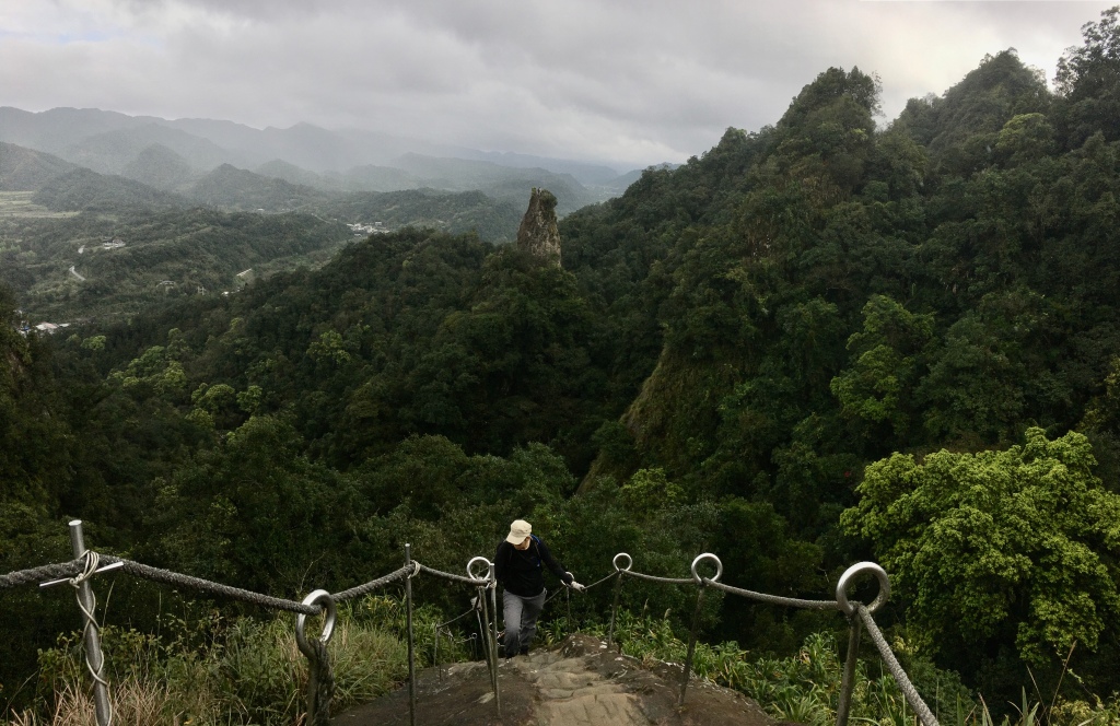
This peak offers you the longest continuously visible section of roped steps, and it really does look pretty dramatic. I’m sure that back in the day when it was unprotected by these metal barriers it would have been even more thrilling.
As we were nearing the top, we passed a group of walkers heading down “this one is much less popular with internet beauties eh?” said one of them, “yeah, this peak is not as popular as the other two” replied her friend. The popularity of the location with ‘internet beauties’ is undoubtably one of the reasons that it is always packed, but sure enough, we had the peak to ourself for a good five minutes before anyone else showed up.

This peak is the biggest and most comfortable of the three, there are two little clearings, each with their deities, and both of which have donation pots filled with coins of small denominations.

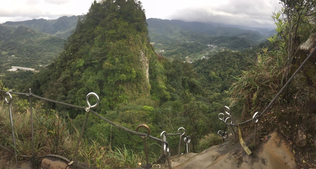
From the second clearing you can get a good view over towards Cimu Shan, which definitely looks lower when you’re above it. As we watched, we spotted several of the aforementioned ‘internet beauties’ making their way up in clothing that I wouldn’t really call suitable for the weather, and at that point the weather got a bit worse. We spent a while sheltering under the trees before deciding to head down again.

The view of the steps carved into the spine of the hill as you climb down is rather striking.

And the view over the valley towards Pingxi and Shifen isn’t bad either. It would be better in clear weather, and with a few less of the notorious sky lanterns caught up in the trees.
After climbing down from Putuo Shan, we turned right and headed back up the few metres to where we’d got down from Cimu Shan. From there we followed the steps as they descended from the back of the hill away from Pingxi. After a couple of minutes, the steps arrive at a junction. To finish the walk, head right downhill and you’ll soon arrive at a farming lane which you just need to follow down to the main road and the river. Turn right at the river to get back to Pingxi Station. However if you feel up for another 4-5 hours of walking you can follow the trail to Chou Tou Shan, (or Mount Stinky Head).
How to get to Pingxi Crags
Google maps address: the trail starts in front of Pingxi Waterfall, for those who plan to drive you can find roadside parking near here but it fills up quickly on weekends so get an early start.
GPS location:
- Waterfall trail head – N25 01.460 E121 44.355
- Farm trail head – N25 01.410 E121 44.150
Public transport: take a train to Ruifang, switch to the Pingxi Line (make sure to go out and pay for the Pingxi Line again) and then alight at Pingxi. Return back the same way.
Further reading: there is a wealth of information on these trails available online – the no-longer-updated Pashan blog has some good photos, as does Josh Ellis’s site. The Pingxi Crags are also quite popular with YouTubers if you’d like to see footage of what to expect.
Nearby trails:
- Sandiaoling Waterfall
- Dacukeng Old Trail
- Zhongyang Piton and Choutou Shan
- Mount Wufen Trail
- Tamsui Kavalan Trails: Ruifang to Shuangxi
- Tamsui Kavalan Trails: Neiganjiao to Shifen
- Tamsui Kavalan Trails: Shifen to Nuannuan
Pingxi Crags Trail Map
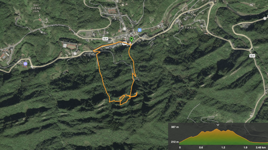
GPX file available here on Outdoor Active. (Account needed, but the free one works just fine.)
This is the bit where I come to you cap in hand. If you’ve got all the way down this page, then I can only assume that you’re actually interested in the stuff I write about. If this is the case and you feel inclined to chip in a few dollars for transport and time then I would appreciate it immensely. You can find me on either Ko-fi or Buy Me a Coffee.
