
Grand Views and Great Winds on the Taoyuan Valley Trail
It was never my intention to return to Taoyuan Valley Trail. In fact, as I think I mentioned the first time I wrote about this walk, it’s a once-and-done kind of walk. But when a friend of a friend visited, this was the walk she picked, and so that’s how I found myself heading back here. Originally, I’d intended for this post to replace the old post, but since they cover slightly different routes and show the trail in markedly different weathers, I’ve decided to let the old one live on. To read that write-up of a slightly longer trail, you can check here.
DISTANCE: 14.6 km
TIME: 5½ hours at a comfortable pace.
TOTAL ASCENT: About 700 metres.
DIFFICULTY (REGULAR TAIWAN HIKERS): 3/10 – This walk is very easy by most standards, the path is clear and well-made, the directions are simple to follow, but the steps are really quite tiring.
DIFFICULTY (NEW HIKERS): 5-6/10 – The rating here is purely a reflection of how tiring the walk is. If you’re fit enough to climb endless steps, you’ll be fine.
SIGNAGE: Very clear signage.
FOOD AND WATER: On a cool day I drank about a litre.
SHADE: The ridge section of this walk is very exposed, but you’ll need to be strategic about how you protect yourself from the sun on account of the really strong winds.
MOBILE NETWORK: My mobile reception was pretty weak for most of the way down the Shiguanyin Temple Trail.
ENJOYMENT: This is a hard one to rate. The views are stupendous and I loved visiting the temple on the way down, but… the steps! There are so many steps!
SOLO HIKE-ABILITY: This is a good choice for a solo walk (just don’t expect to be alone).
OTHER: This trail is infamous for being exceedingly windy in autumn and winter. We saw at least one person be parted from their hat. Also, the steps on the descent are ice-rink slippery. Each of us came close to losing our footing, so walk carefully, and maybe take a stick (or if you want to go full Taiwan, wear wellies since they’re the best defence against slippery rocks).
SEASONAL: Visit from October to January to enjoy silvergrass at its best.
TAIWAN 100 MINOR PEAKS: Number 82 – Mount Wangkengtou.
ROUTE TYPE: There and back.
PERMIT: None needed.
Jump to the bottom of this post for a trail map, GPX file and transportation information.
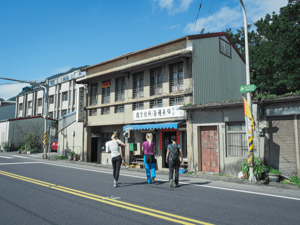
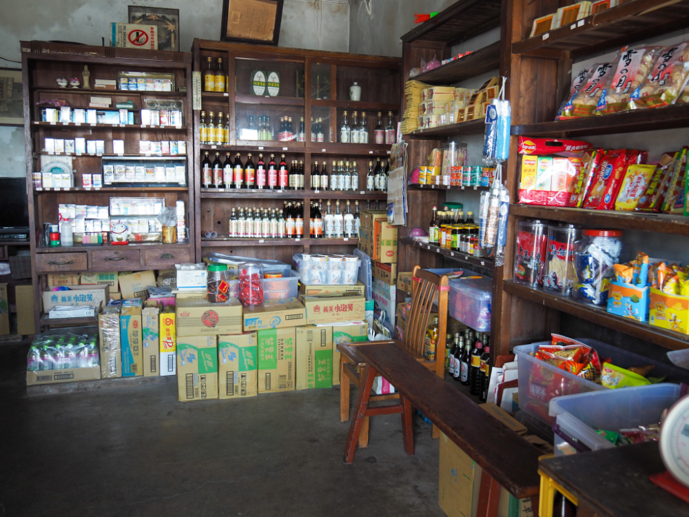
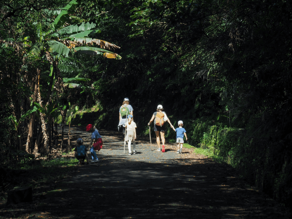
Our walk started with a trip to use the toilets at Dali Station, followed by a brief diversion to pick up water from the mom-and-pop store across the way from the station. The last time we came, we met an old man. This time, it was a 92-year-old grandma–Teresa had to help her get up and fetch the change.
Water needs taken care of, we headed up the road (right as you leave the station), following signs pointing towards Caoling Historic Trail.
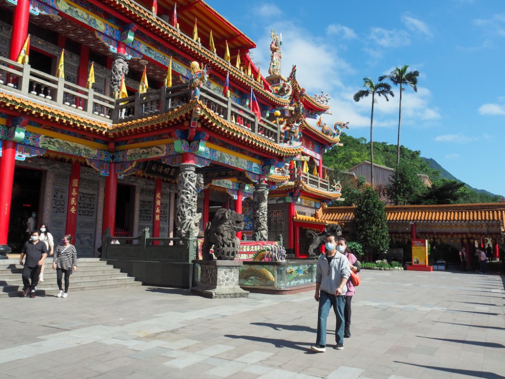
The trail leaves the main road when it head up through the Caoling Qingyun Temple (草嶺慶雲宮) complex. This grand temple also goes by the name of Dali Tiangong Temple (大里天公廟), and it’s huge. Closer to the road, there’s a darker, squatter hall, and further up you’ll find this massive multi-level building. The temple’s main god is the Jade Emperor, but inside you’ll find numerous altars dedicated to different deities. On weekends, the area is a hive of activity. The food court sells all sorts of snacks, and seaweed vendors line the steps. If you’ve got a water bottle that needs filling, you’ll find a water dispenser somewhere here. There’s also a visitor centre, where you can find bilingual information about some of the sights and points of historic significance of the area.

To the upper right corner of the temple complex, look out for some steps which will take you through this “forest” of ancient stone steles. Then at the far end, join the track and head left as you begin your climb.

For the next fifty minutes, we followed the gravel track as it sloped onwards and upwards. You can trim this section a little by taking the shortcuts up steps leading between switchbacks, but unless you truly love steps, I would advise you to stick to the track. By the end of this walk, you will have climbed enough steps to make you never want to set foot on a hill ever again.
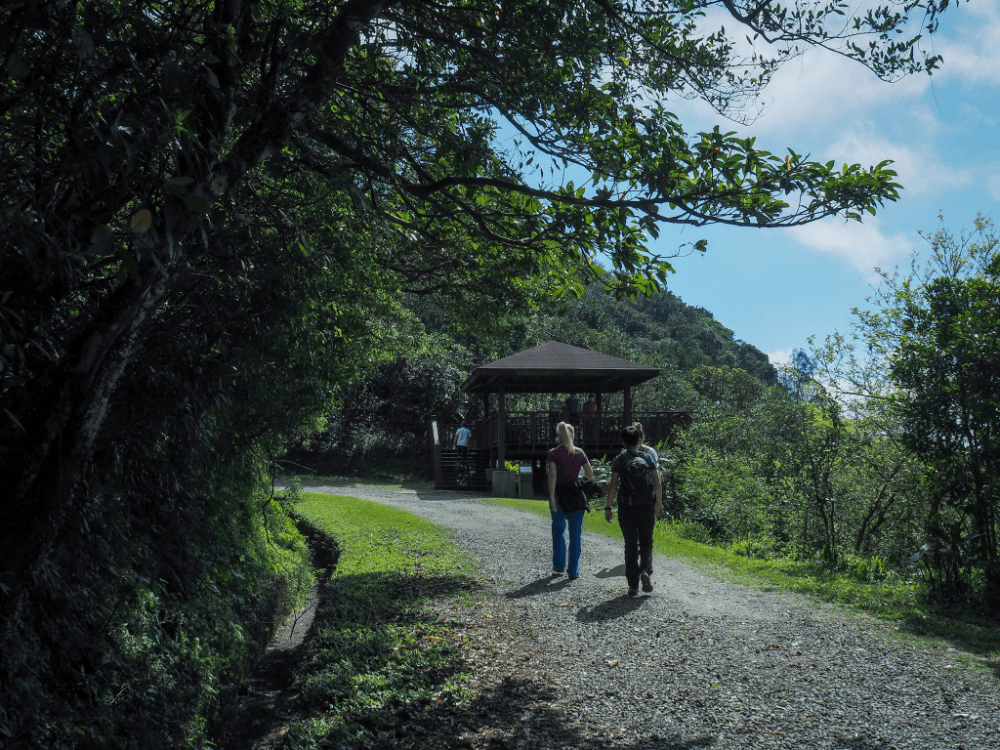
About two-thirds of the way up, you’ll reach a pavilion where you can pause to catch your breath, but if you can, just keep going. This is still the easy part!

At the top of the track, you’ll find Caoling Historic Trail’s Tudigong Temple.

It’s here that the Taoyuan Valley Trail finally diverges from Caoling Historic Trail. Hikers taking the latter route have finished the hardest part of the day, but for those of you planning on completing the rest of the journey detailed on this page, the hard part has not yet started. From the saddle, the trail climbs up to the left towards twin pavilions.
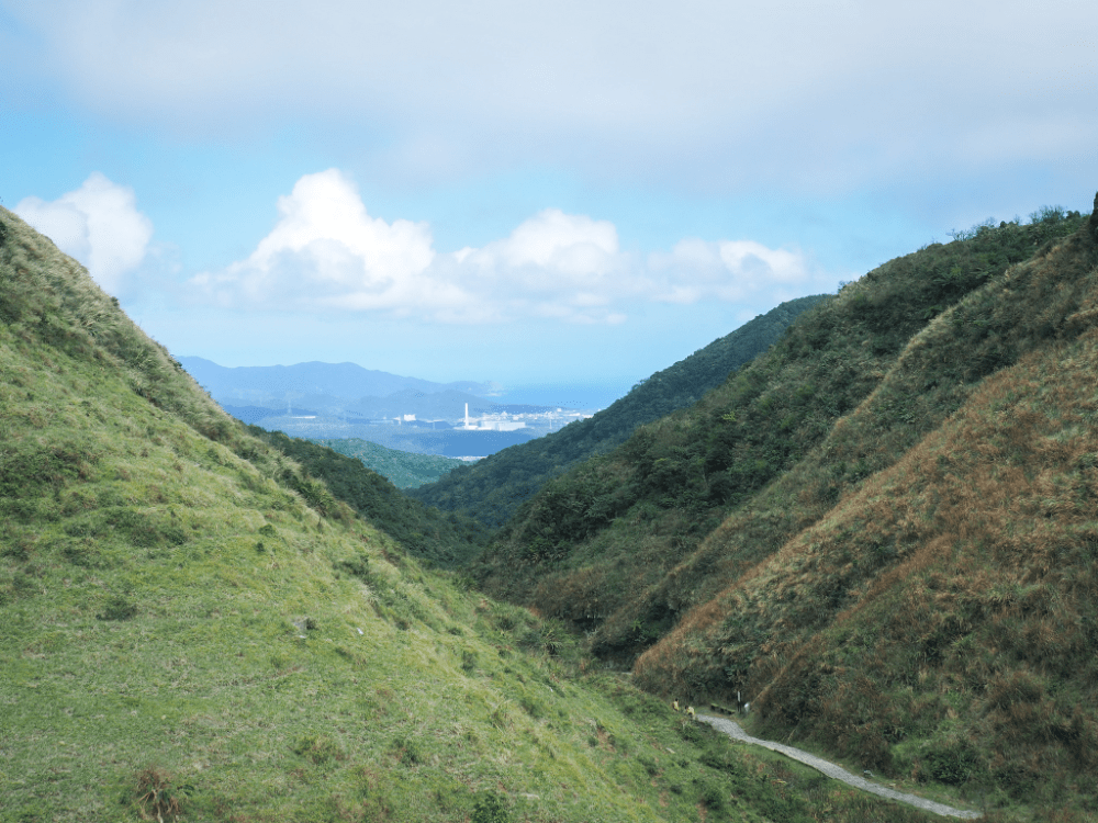
From the pavilions, you can look in two directions. Looking northwest you can see Caoling Historic Trail and Longmen Nuclear Power Plant close to the beach at Fulong.
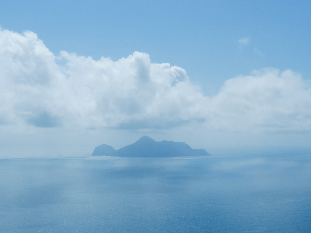
And to the southeast, Turtle Island swims far out to sea.
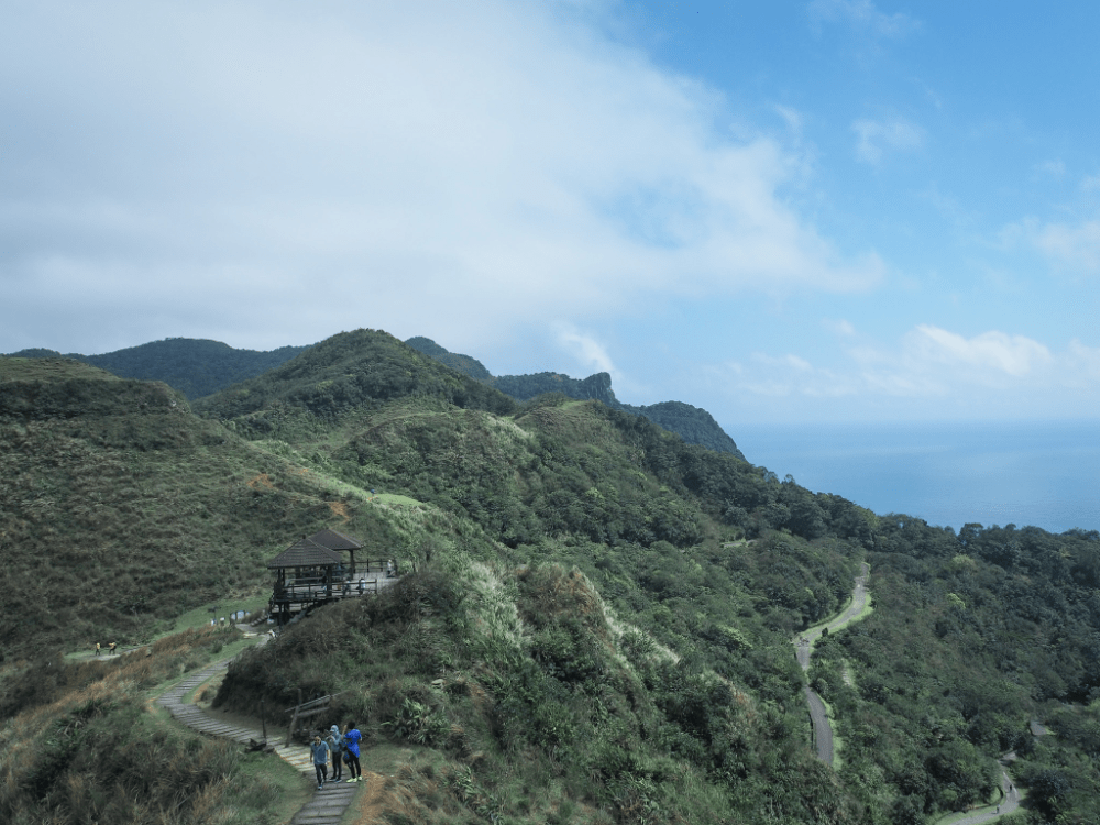
As you leave the pavilion behind, get ready to get well acquainted with endless stone steps.

Thankfully, there are a reasonable number of places to stop and rest, and an even greater number of places where the scenery compels you to stop and observe.

The wind had been pretty noticeable by the time we made it to the double pavilion, but up here on the ridge, it was something else entirely. Cloud whipped past us as if ramped up to triple speed and we passed a poodle that was being carried, clamped tightly under her human’s arm because a gust had already knocked her off her paws and sent her tumbling. The cloud cover dimmed the views somewhat, but this area doesn’t need clear blue skies to be beautiful.

Close to the highest point along the trail, we ran into a herd of water buffalo–a common sight on the Taoyuan Valley Trail. There must have been around twenty of them all in all, including several youngsters. You don’t need to worry about the water buffalo. Yes, they’re wild animals (the ones which roam the grassland here almost certainly are the descendants of those kept by local farmers), but as long as you leave them alone, they won’t bother you. If they’re on the path, just walk around them.

The exposed summit of Mount Wangkengtou was too blustery to stay long, and with white walls all around, we weren’t missing out by moving along quickly.


The next stretch, while no less ferocious on the wind front, is probably the prettiest section of the whole walk. Even with the clouds pressing down on us, the landscape was stunning.

The lower we descended, the more the weather improved. There was a little less chill in the wind, and the clouds lifted again.

At the junction, we encountered a lot of people who had driven up to access the viewing point before heading back. From here, we turned left downhill towards Shiguanyin Temple (石觀音寺). I’ve seen it rendered as Stone Guanyin Temple elsewhere, and on the signage by the trail, it was erroneously labelled Shihuanyin.

Although it was a relief of sorts to no longer be climbing, the steps down are treacherously slippery, so in a way, it was just as tiring as the ascent.

The scale of the buildings around Shiguanyin Temple (which is also sometimes called Longshanyan or 龍山巖), provides a false sense of having arrived somewhere. At this point in the walk, you’re still very much in the middle of nowhere, but this is Taiwan, so of course the middle of nowhere has a temple with numerous outbuildings.

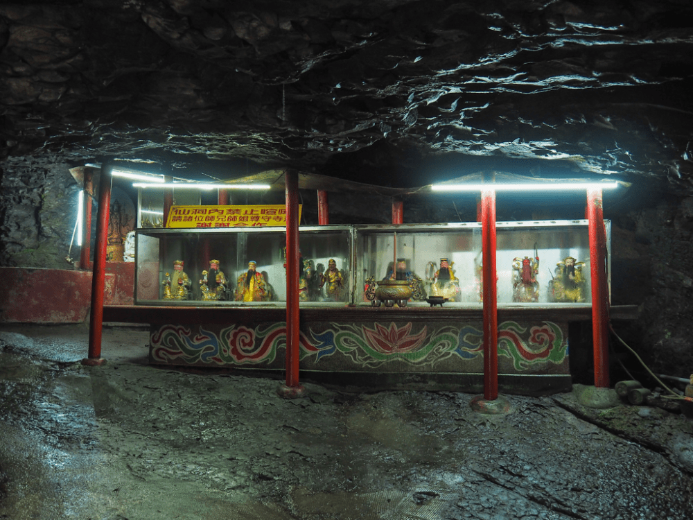
There has been a religious site here for a very long time. It’s hard to find anywhere which can give a definitive answer to the question of precisely how long, but some places say the earliest version, which made use of natural cave to house the goddess Guanyin, began welcoming worshippers in the 1820s. Over the years, multiple renovations have expanded the temple’s altar space, and now you’ll find a huge number of figures from the overlapping Buddhist and Taoist belief systems.

I have a thing for cave temples in general, but I think my overall favourite element at Shiguanyin Temple was this alcove housing both Huye (the tiger god), and Tudigong. Not only was it strange (and somehow intensely cute) to see them sharing the space, but this particular Huye has the most charmingly worried expression.

We rested up a bit before hitting the path again. The trail takes a right in the direction of the big red arrow, and cruelly, it starts to climb again.
This last section is what really wore my legs out. It’s one type of tiring to go up and up and up. It’s another type of tiring to go down and down and down. But to go up and down and up and down on already tired legs. That’s a special kind of torture?
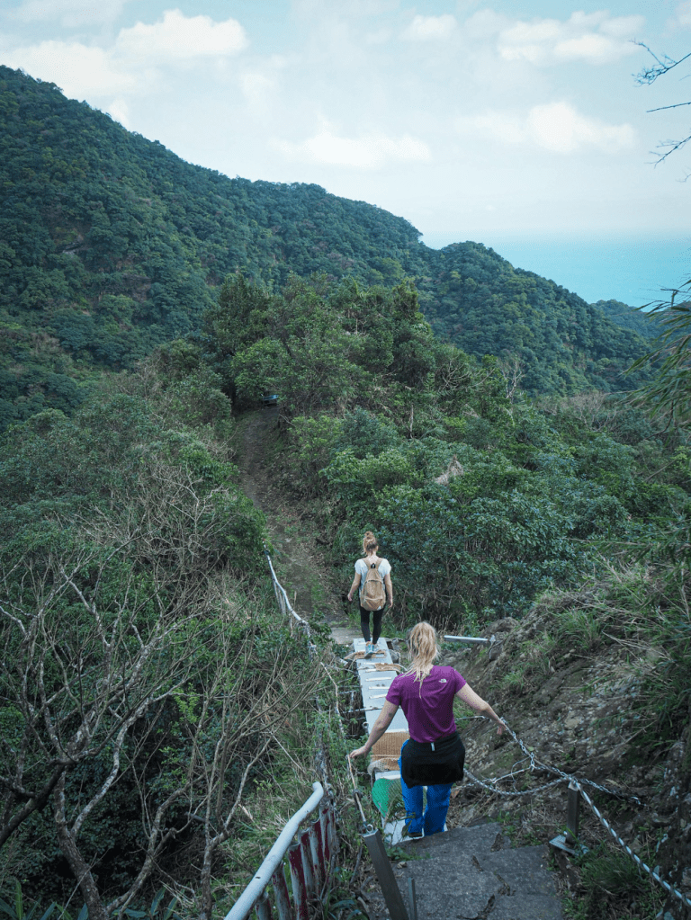
The steps are horrendously slippery in places, and we had to constantly focus on staying upright. As if that wasn’t enough jeopardy, there was also this rather sketchy metal bridge to contend with. It felt infinitely less secure than it looks.
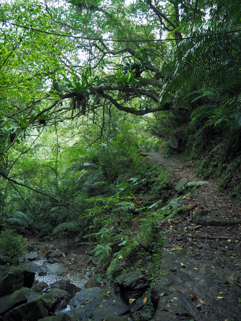
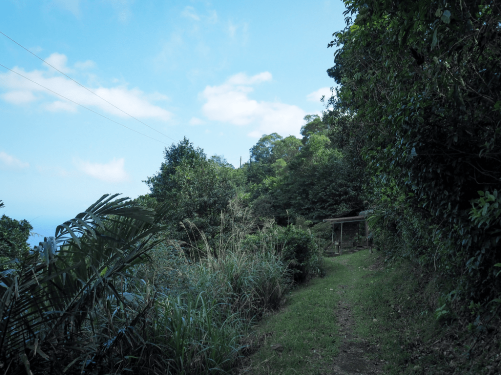
The further down we walked, the more warm and humid it became. You’d think there wouldn’t be much appreciable difference between sea level and 600 metres, but there really is. On the flipside, the lower down we got, the more shady it was, and the more small streams we passed.
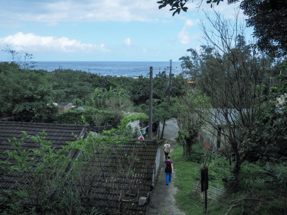
About fifty minutes after leaving the temple, we found ourselves emerging from out of the treeline beside a small hamlet.


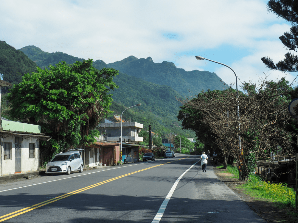
From here, we followed the track under the railway line and turned right onto Provincial Highway No. 2.

From here, it’s another forty minutes along the road to Dali Station. (Or similar to Daxi if you’d rather go that way, we had originally planned to walk a little further on the ridge, so we’d left our vehicle at Daxi.) Along the way, we paused at the 7-Eleven to get refreshments. For fish eaters, there are some good restaurants along the way, but our hearts were set on picking up THE BEST scallion pancakes from a little further up the road in Toucheng.
How to get to Taoyuan Valley Trail
Google maps address: There is roadside parking available at both ends of this trail, although on a weekend it might get busy. Since there were four of us, we drove. We parked at Daxi, timing our arrival so that we could hop on the train to Dali and start our walk from there. That way, we didn’t need to wait for transport at the end of our walk.
- The trail starts behind Caoling Qingyun Temple, just five minutes away from the Dali train station.
- The Shiguanyin Trail ends half-way between Dali and Daxi. From there, you’ll need to walk back to either Dali or Daxi Station (Daxi is a better choice if you want to get food and drink).
GPS location:
- Dali trailhead – N24 58.220 E121 55.540
- Stone Guanyin Trail trailhead – N24 57.100 E121 54.550
Public transport: This walk is perfectly suited to being done using public transportation. Dali Train Station is at one end, and Daxi Train Station is close to the other.
Nearby trails:
- Caoling Historic Trail
- Fumao Old Trail
- Tamsui-Kavalan Trails – Shuangxi to Dali
- Tamsui-Kavalan Trails – Dali to Yilan
- Taoyuan Valley Trail (extended version)
- Turtle Island
Taoyuan Valley Trail Map
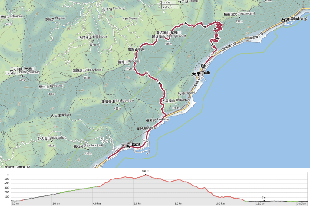
GPX file available here on Outdoor Active. (Account needed, but the free one works just fine.)
If you enjoy what I write and would like to help me pay for the cost of running this site or train tickets to the next trailhead, then feel free to throw a few dollars my way. You can find me on either PayPal or Buy Me a Coffee.
