Distance: 11.1km – there are options to make this longer and possibly shorter too.
Time: 9¾ – With almost an hour’s break for lunch and a fifteen-minute coffee break.
Difficulty: 8.5/10 – Actually it would have been 7.5/10 (for distance and repeated ups and downs), if we had chosen to continue towards the head of Caoling Historic Trail and to Dali train station instead of going down a little earlier to Shicheng station. The final portion down from the ridge to the sea was harder than the rest.
Total ascent: 849m – Rising from sea level to a maximum elevation of 469m.
Water: 2.5-3L – I took 3L and drank 3L by the time I arrived at Shicheng station. Teresa took 2L and didn’t drink the whole amount but probably should have. We walked on a warm February day, the temperature was about 24 degree which was just on the hot side of comfortable, in summer it would have been a lot sweatier.
Shade: Either dappled shade or no shade – the large part of this walk alternates between scrubby forest and exposed grassland. I would have burnt if I didn’t cover-up.
Mobile network: Not great, especially the final portion, the reception was totally cut off by the slope of the hill.
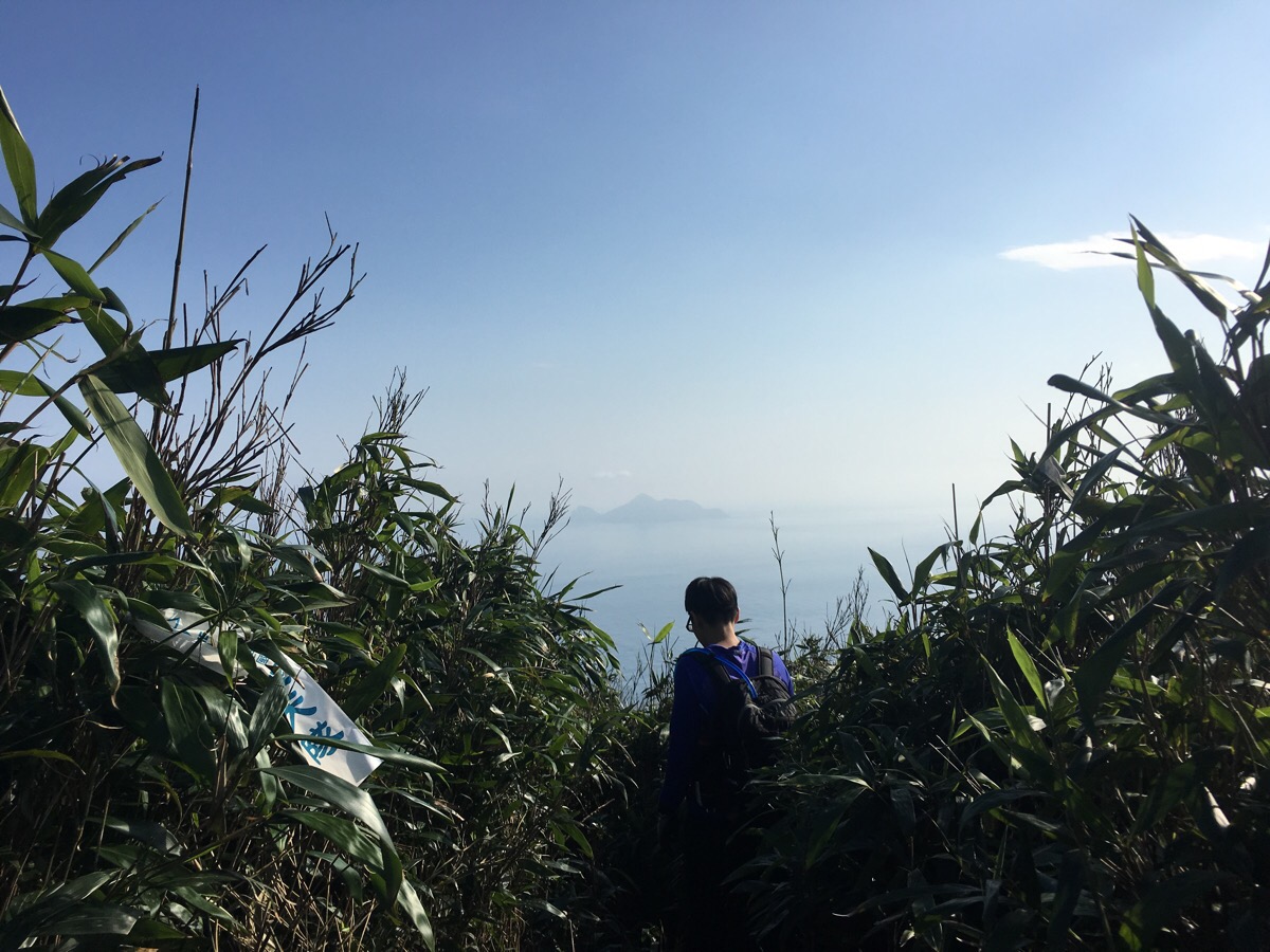
Enjoyment: A conditional 8.5/10 (the condition being that we took an alternative route down from the ridge). Although this walk doesn’t have the same excitement as very high mountain scenery, the views over the headland with sea to both sides are rather special, and the grasslands are not like any scenery I’ve encountered in Taiwan so far. It’s also pretty fun to be able to do a walk that exceeds 10km, since often the steepness of higher mountain trails makes getting the miles behind you quite hard work. Likewise, the roped sections here were really fun. The downside to this walk for me was primarily the presence of many ticks in the shrubbery – we were well-covered and vigilant, but I really hate those little buggers.
Other: As just mentioned, there are ticks on the trail so full skin coverage is important if you want to protect yourself from some of the diseases they can carry. You should also take gloves to help down the roped sections and because we encountered quite a few thorny plants. We took a hiking pole each which I felt was more help than hindrance for this kind of trail, but not everyone we passed had them. You’ll also need to make sure you take enough food to keep yourself going. And one more thing – you do not want to be doing this on a windy day, the weather was perfectly still when we went, but even so, there was one section which had high, gusty winds, and if there was a strong wind, the exposed cliff-top sections would be terrifying.
Jump to the bottom of this post for a trail map, GPX file, and transportation information.
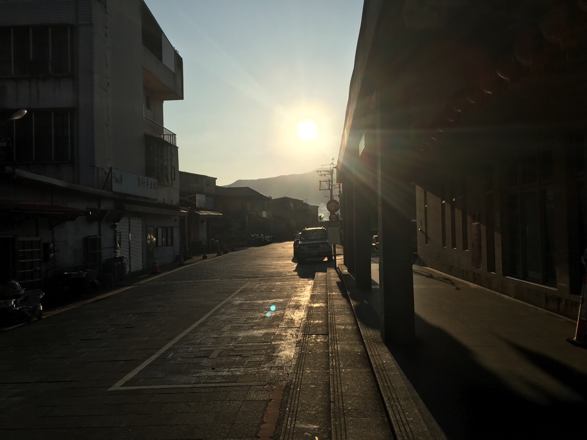
07:18 – Starting from Fulong station we headed towards the sun along Lane 2, Fulong Street and continued in the same direction after it became Guishougu Street. We passed a $100-a-day car park just a couple of hundred metres from the station, but there are places to park for free around Fulong if you arrive early in the day.
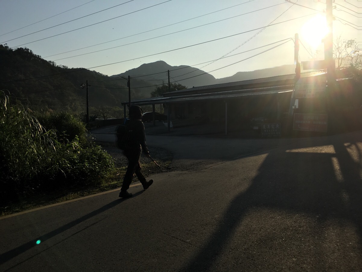
07:28 – At the junction with Laoliao Street, take a left over a stream. This place is a busy bicycle rental area during tourist hours, but there was only one guy around when we passed through.
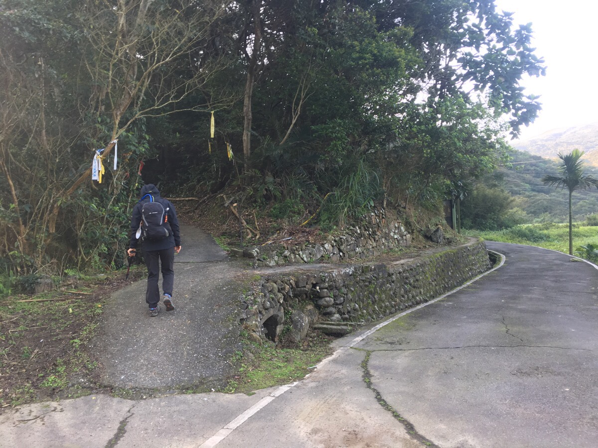
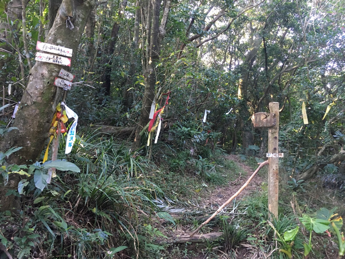
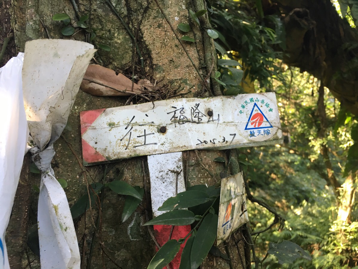
07:36 – The first section of the trail is along Fumao Old Trail, but there is nothing to show that at the start of the path except for some tags and one small trail sign saying 福卯古道: 往隆隆山.
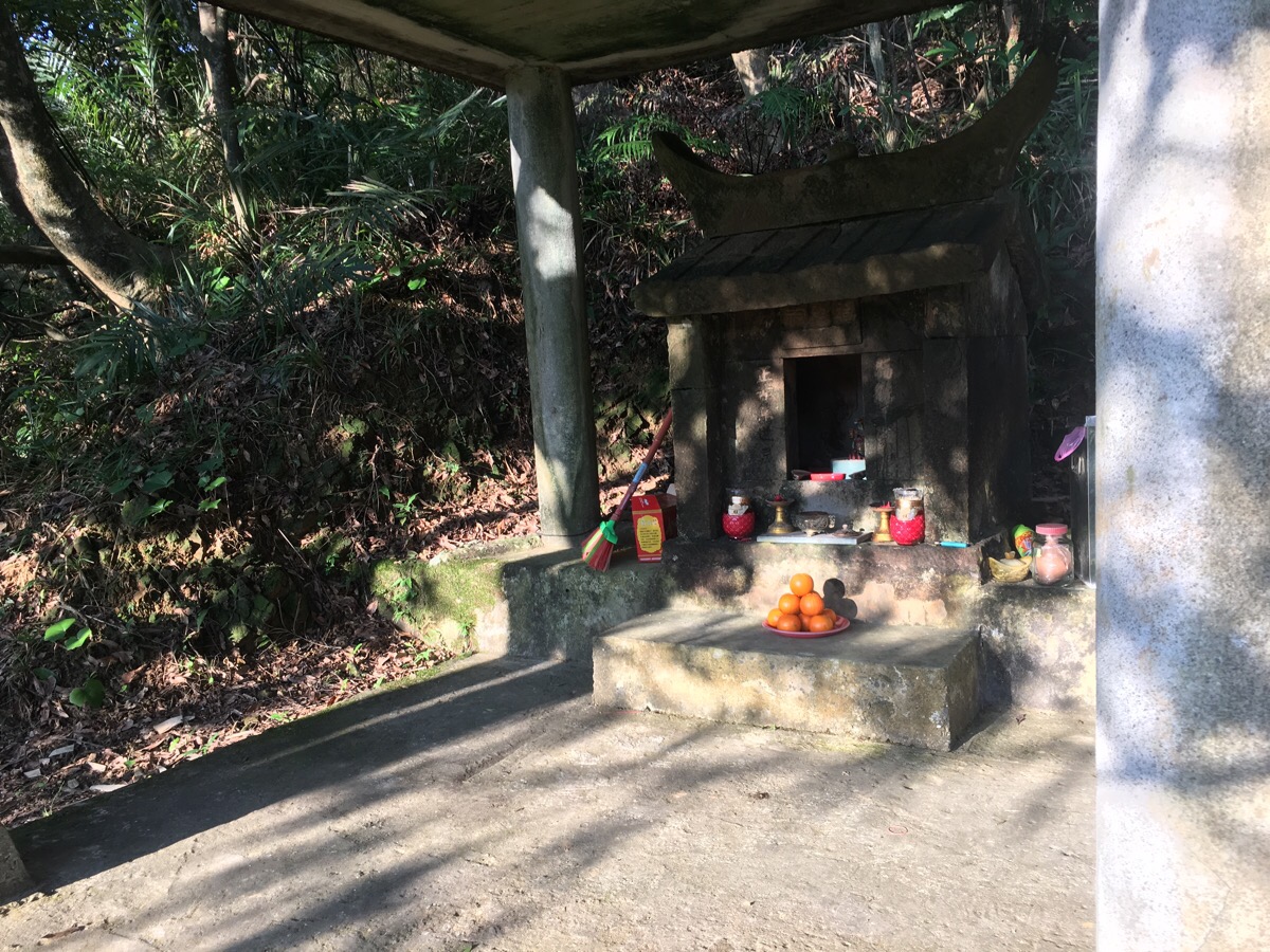
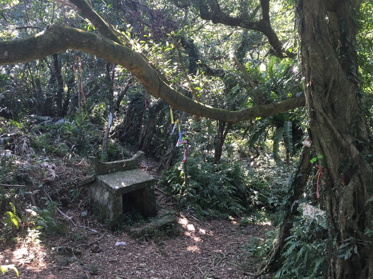
There is a land god shrine with a resident deity just beyond the start of the path.
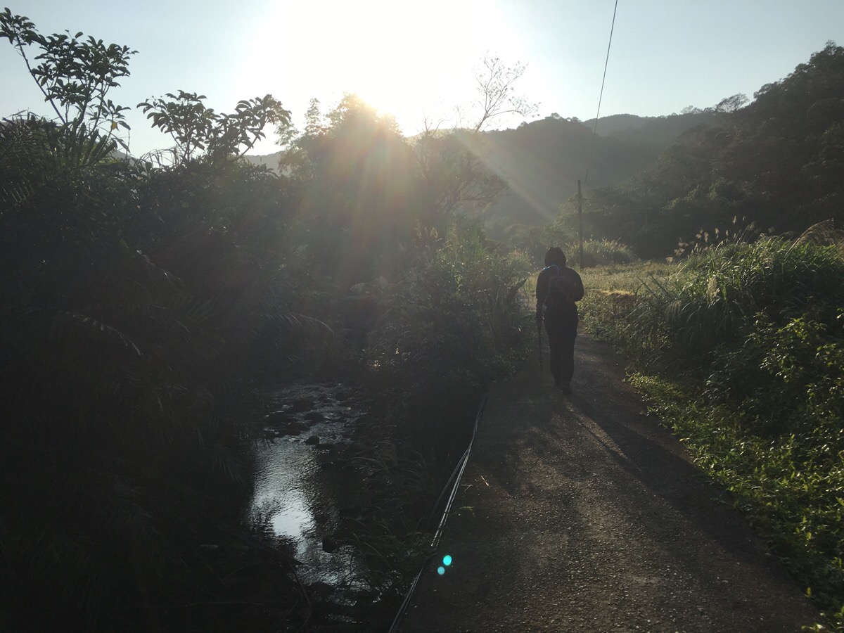
For a while, a concreted path winds through farmland along a stream – a gentle way to get the legs working and woken up.
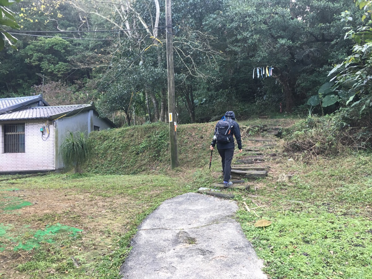
07:48 – The concrete path ends at a building and the trail tags you can see hanging from a branch above the path were the last group of tags. From this point until we reached the next junction, all grouped collections of trail markers had been ripped down (and left on the ground). I found this slightly disconcerting since I couldn’t really think of any positive reason why someone might do this (except for possibly to maintain the natural look and feel of the trail – but then surely they’d take the pulled-down ones away), so I wound up imagining angry locals who resented the hikers who passed by their property.
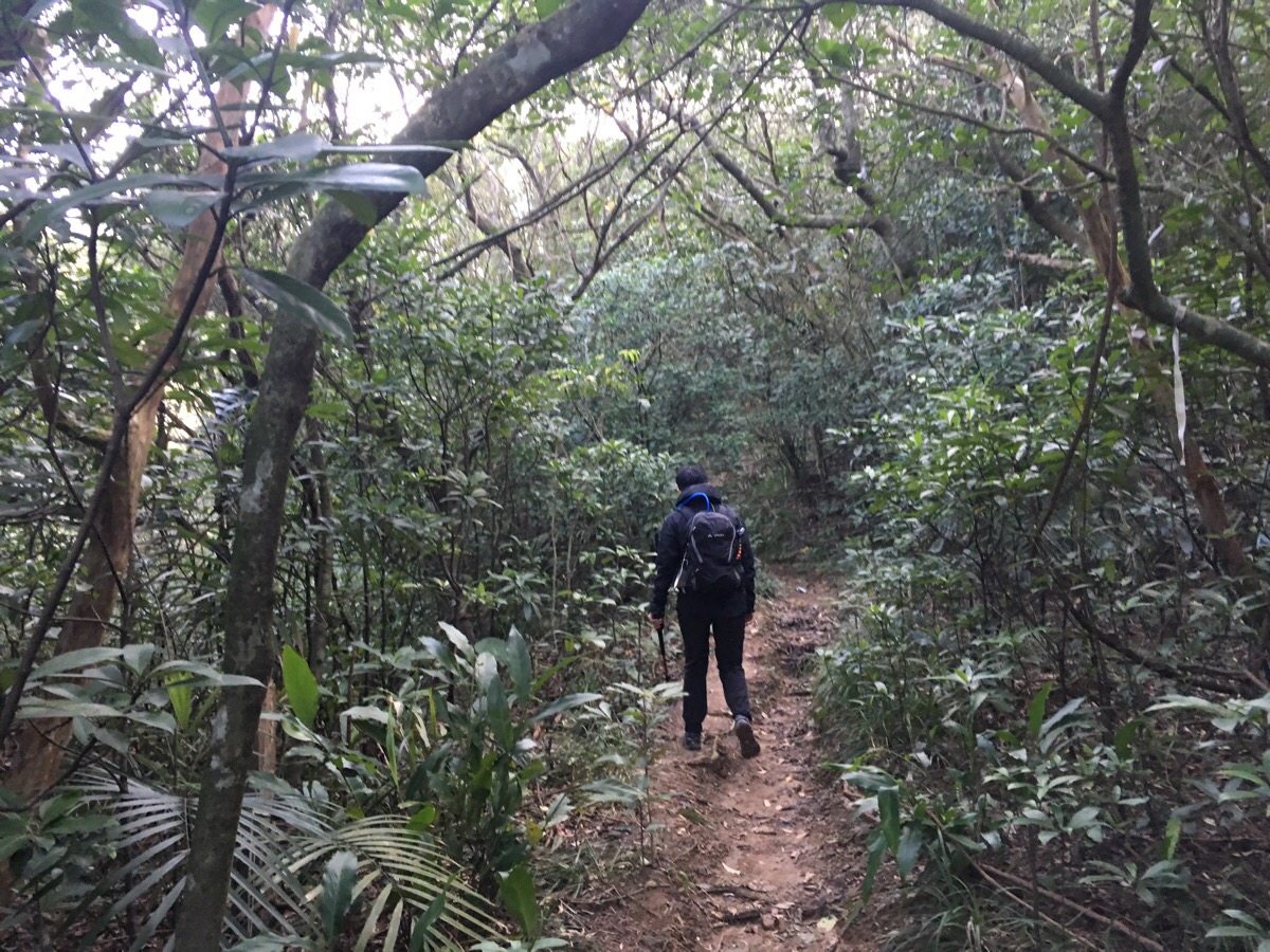
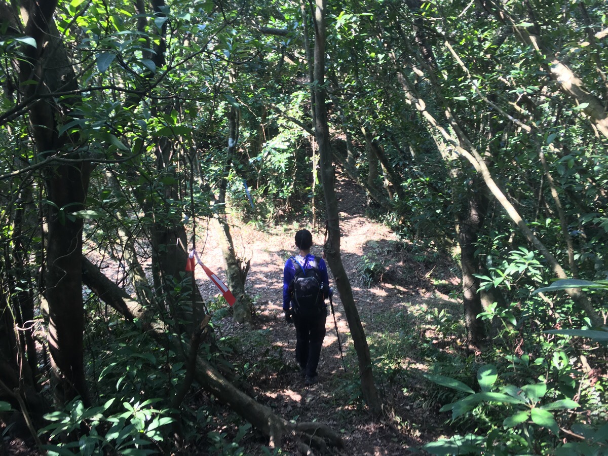
But there were no angry locals in sight, so we continued on. The path up this section was occasionally built with stone steps, but most of the time it was just dirt.
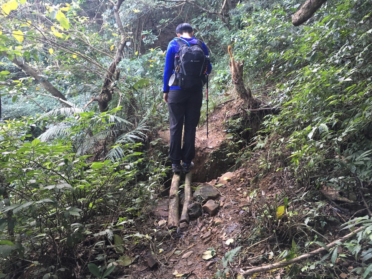
08:14 – Given that this is an old trail, it wasn’t surprising to see signs that the path had shifted over the years as the land it travels over has been weathered and transformed by time. In some parts, this meant a slight diversion from an older route, and at others, previous hikers had fashioned solutions like the ‘bridge’ above.
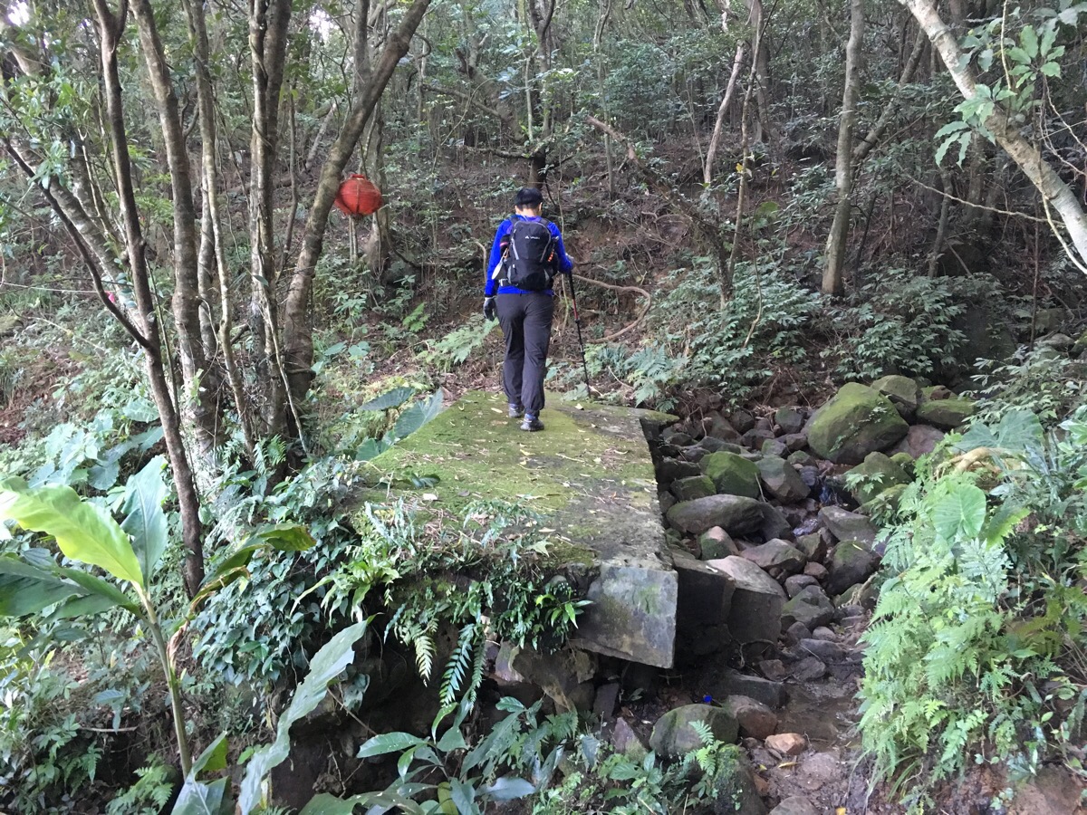
08:18 – It wasn’t only the natural environment which bore the marks of time – an hour into the walk we came across the first sign of previous habitation, a partially functional concrete bridge.
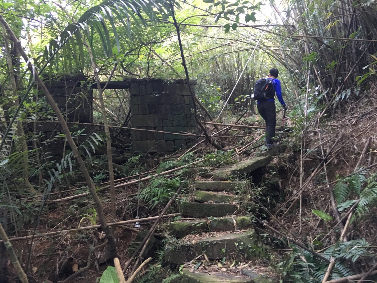
08:26 – Just beyond the bridge are the remains of a small settlement. As we passed the first of these abandoned structures, a little shit of a squirrel broke the silence, momentarily scaring me. (Part of me believes that squirrels are some kind of trickster spirit – I mean, why wait until we are passing the creepiest point on the trail to make yourself known?) This was to be the first of several wildlife-based scares on this walk.
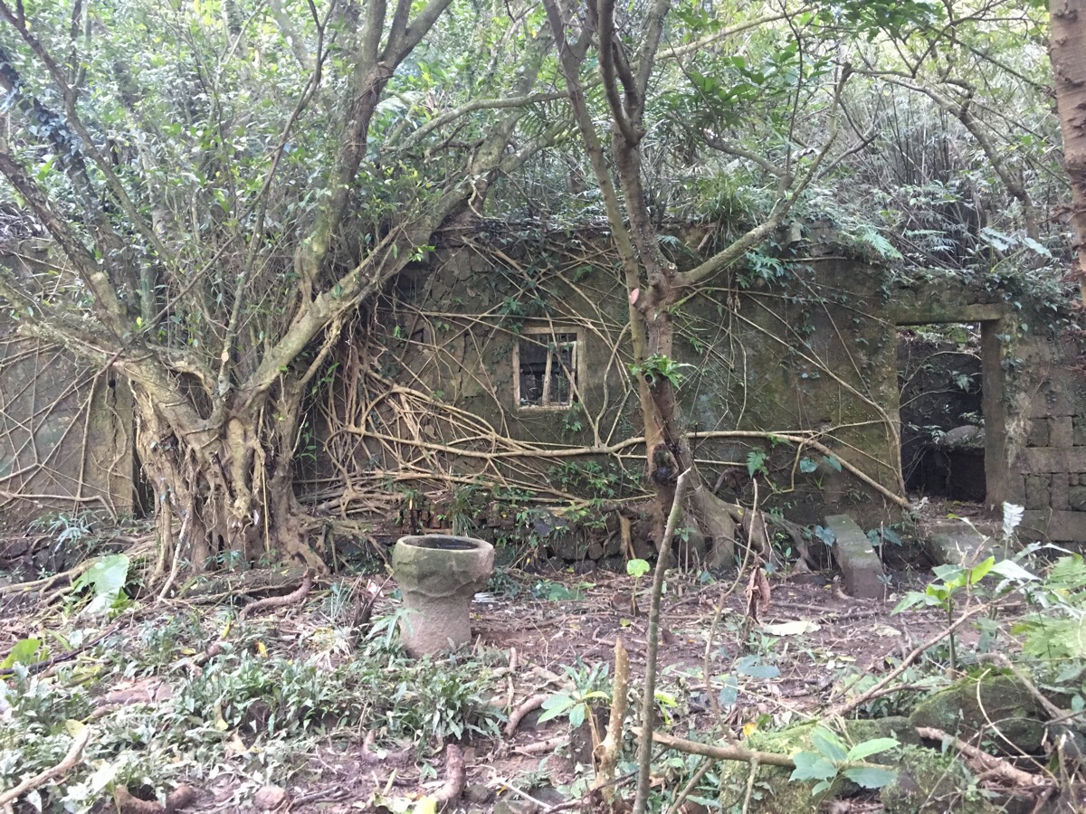
Just up from the squirrel house, was a long structure which had a couple of doors and a magnificent banyan tree busily reclaiming the space for nature. The ground appeared to have been recently tended to, so perhaps the descendants of the people who lived here are still in the area.
08:44 – The path arrives at a junction with four possible routes, one heads up to a road which leads to a temple complex, one crosses over a style and then splits into two paths, both of which ultimately end at Mao’ao/卯澳. We took the one on the right which takes off at a nearly 90° angle to the path we’d come in on.
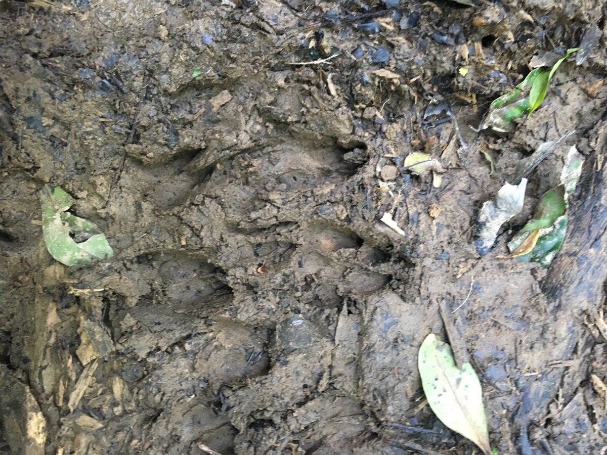
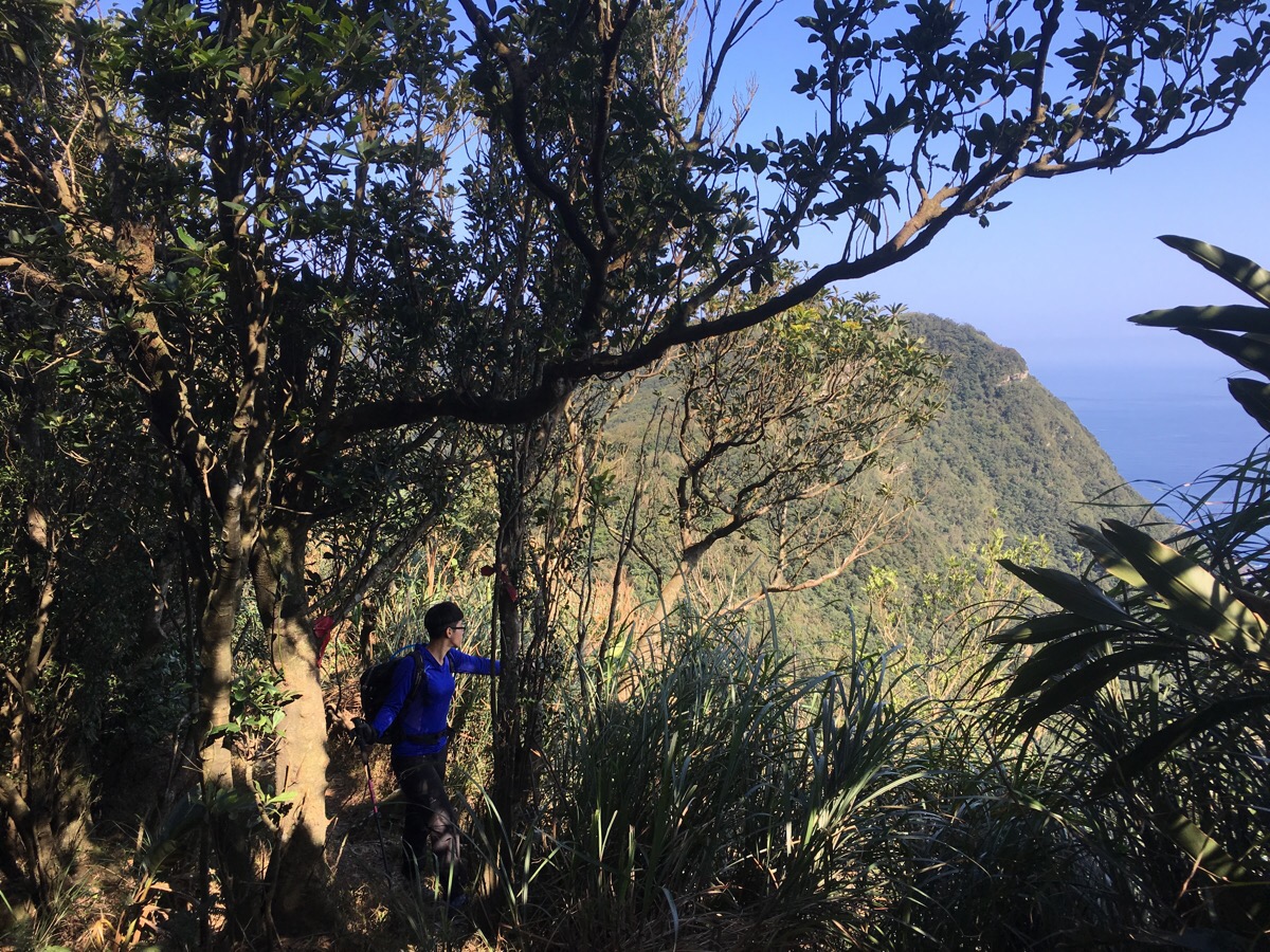
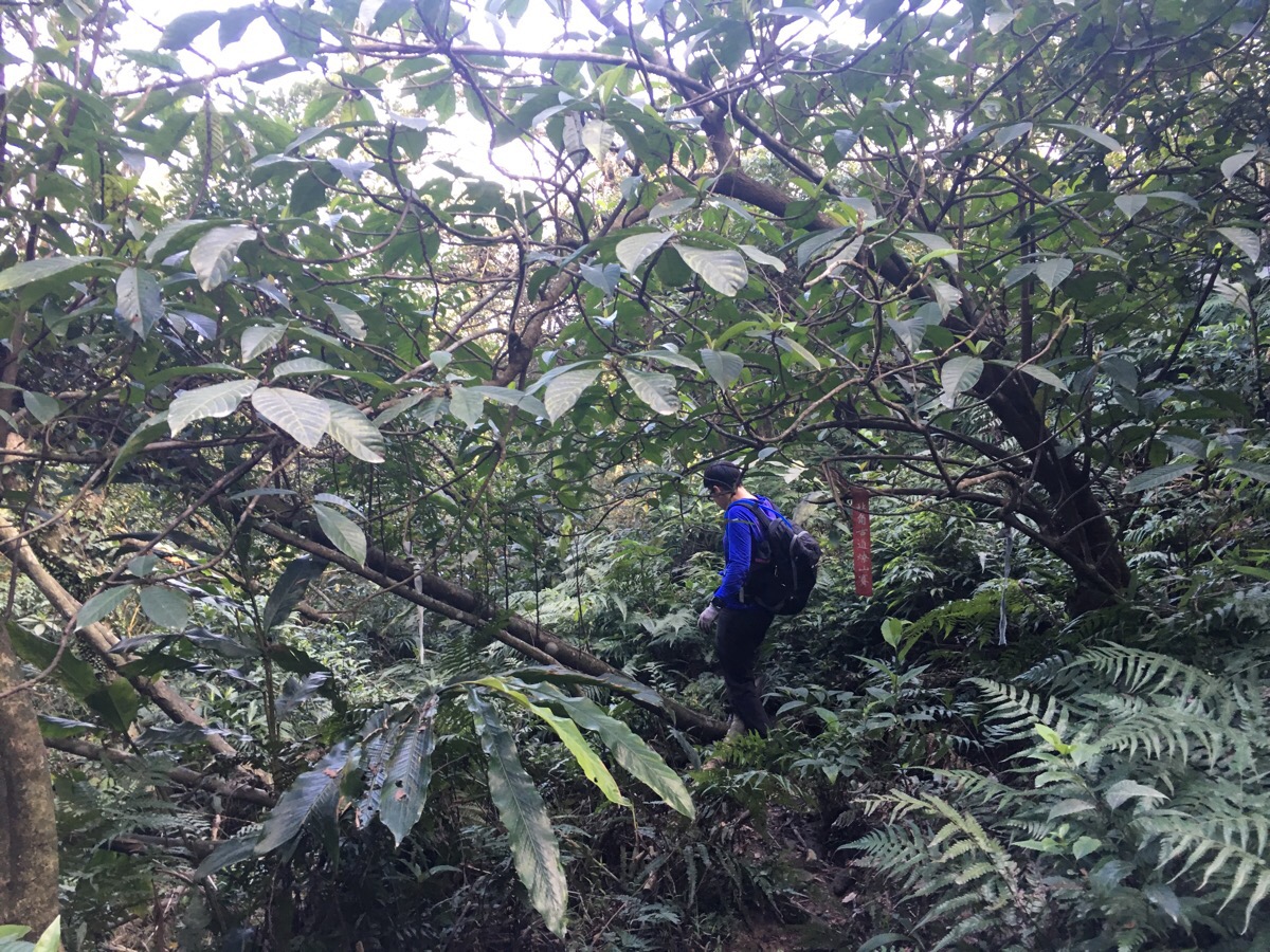
For a while, the path climbed gently through and on the edge of scrubby, low-lying rhododendron forests. At a small, shaded hollow we found our first evidence of the area’s (presumably) large deer population.
09:33 – As we climbed out of the hollow, we were startled by some very close by barking – it seemed that our presence had just been detected by the maker of the hoof prints and s/he wasn’t all too keen on our being there. The barking of muntjac deer would become like a background soundtrack to this walk – they must have been literally everywhere. At the top of this first roped climb, there was a sign indicating that there was an impressive view 45 minutes away to the left. We checked it out on Google to see if it was worth visiting but decided against it. As we were dithering over making a decision, a group of hikers turned up. An older, lean guy wearing wellies with shorts and no gloves was in the lead, followed by a group of eight or so women in their 40s, and then another, younger guy bringing up the rear. We got a few slightly passive-aggressive remarks from the older guy about how brave we two ladies were to be doing the walk alone without a guide like him. The ‘guided aunty group’ is a bizarre phenomenon that I’ve witnessed numerous times in Taiwan – to be honest, most of them looked better equipped than him to do this kind of trail (doing steep roped sections and overgrown paths without gloves or trousers just seems a little silly).
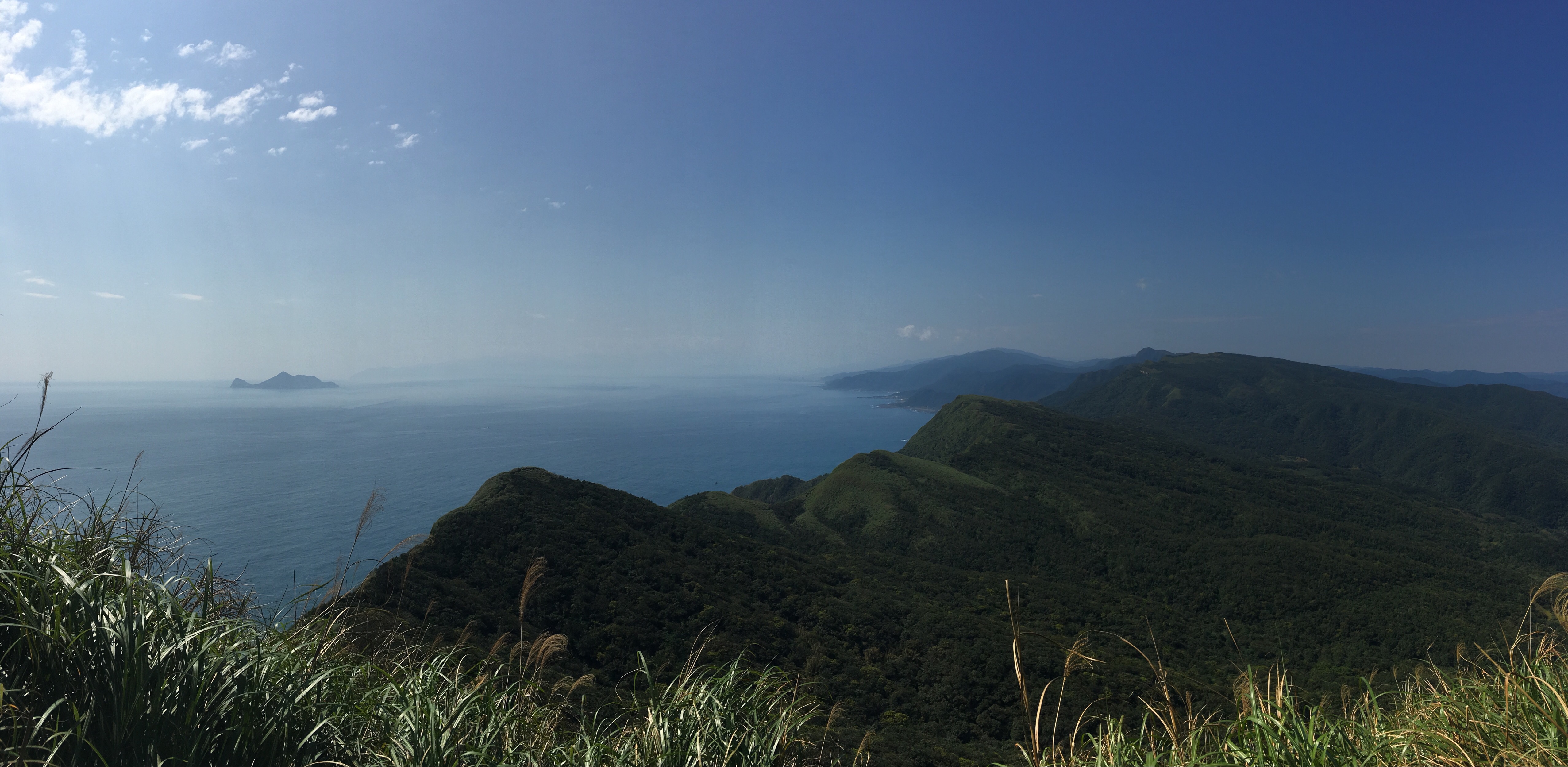
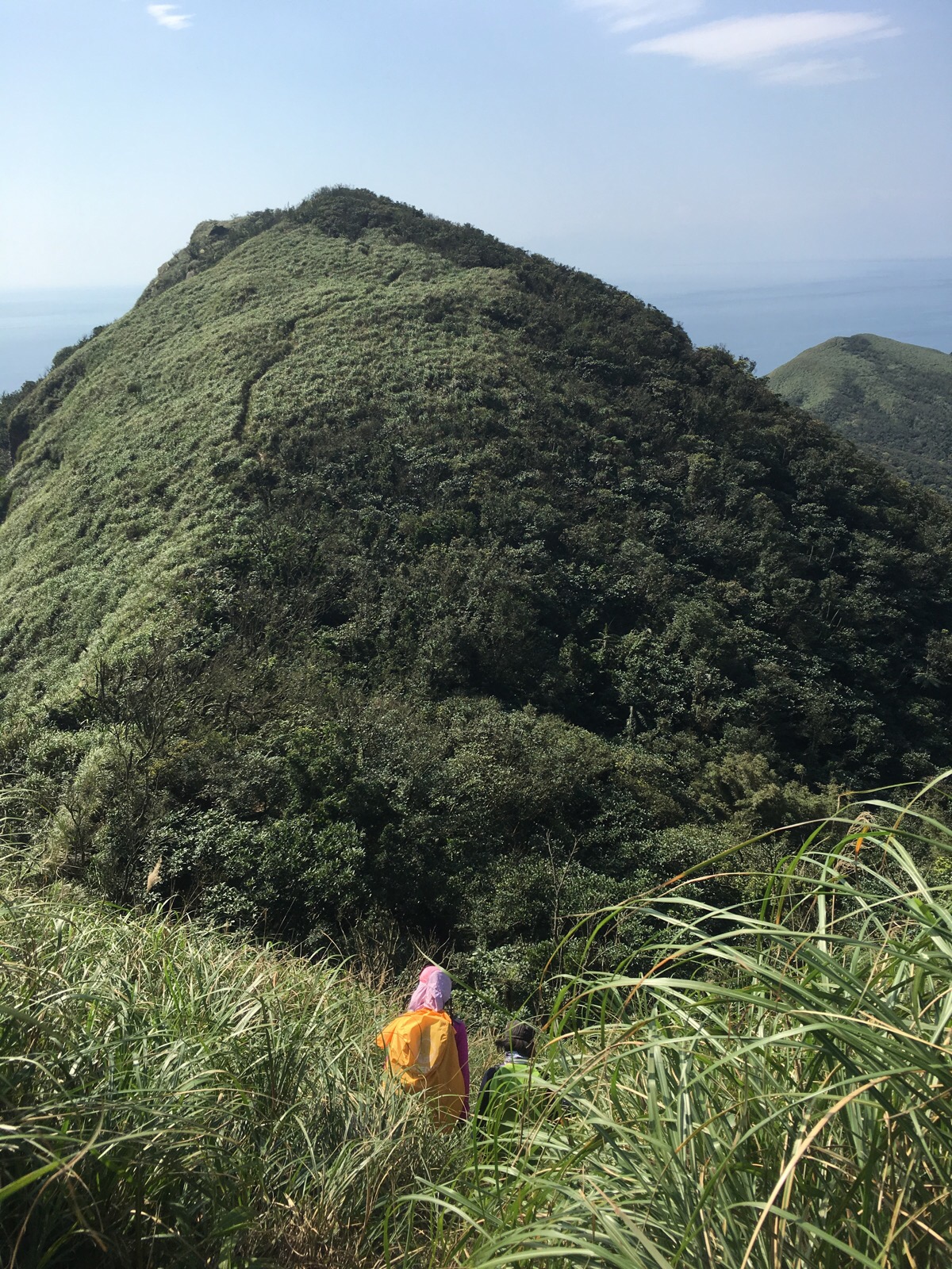
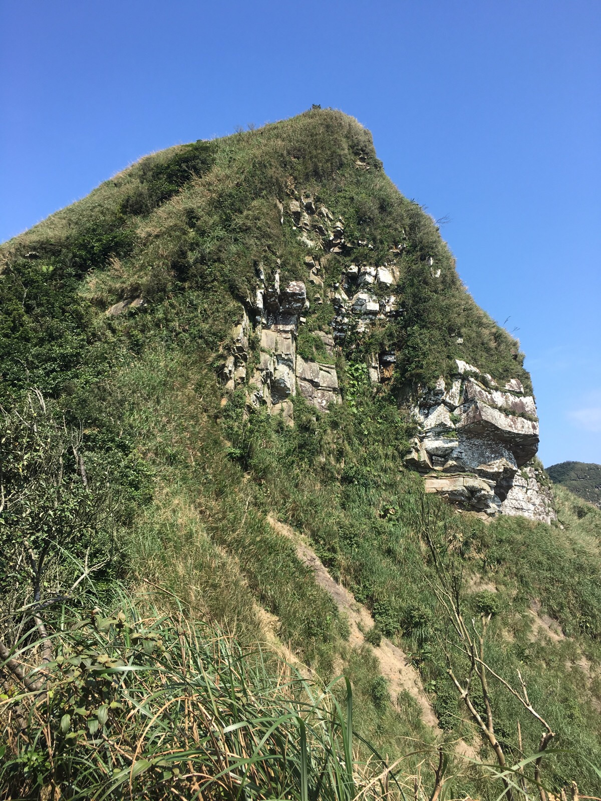
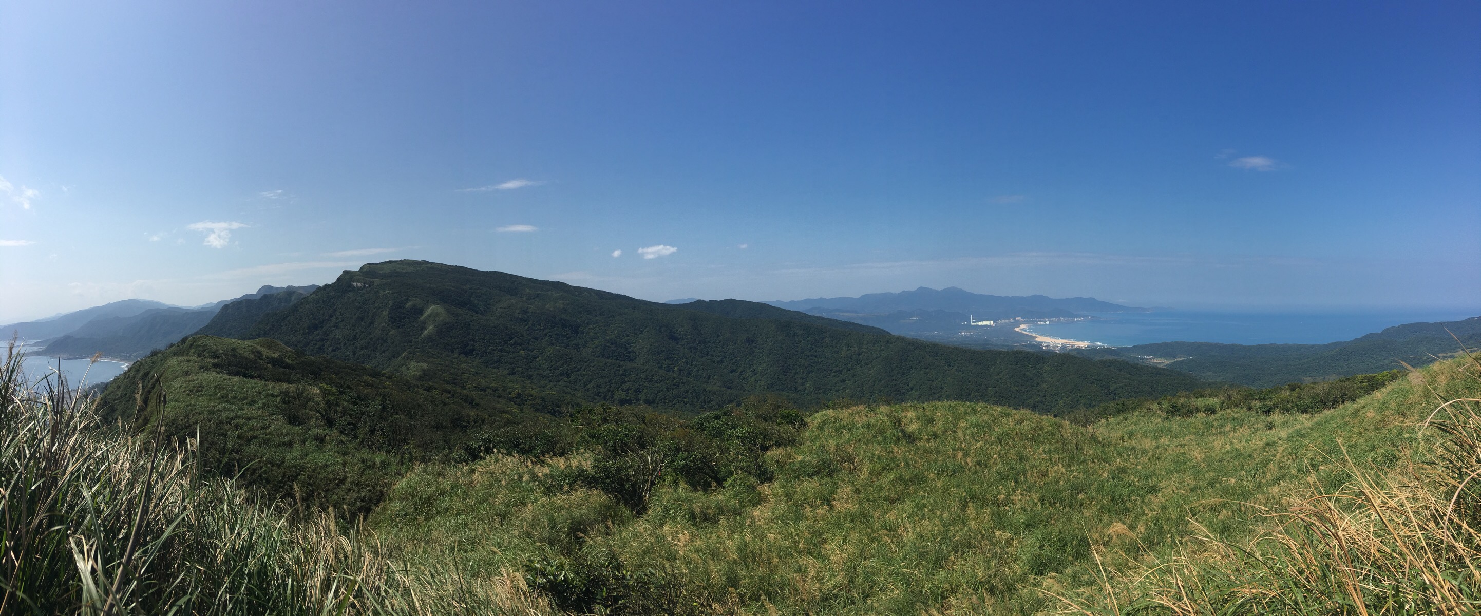
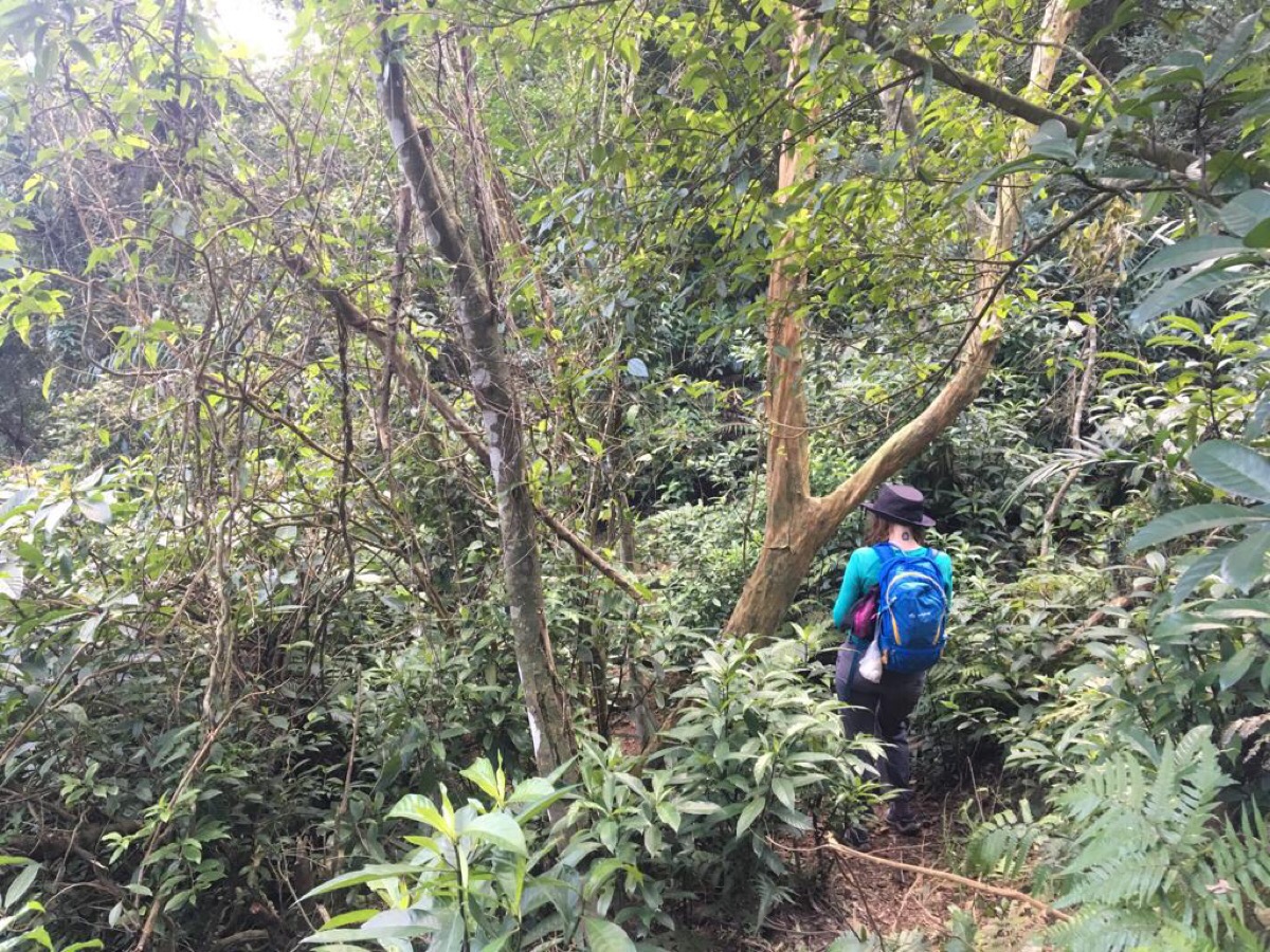
It is at the top of this first roped climb that the path gets into its stride. From here until pretty much the end, the path is a series of dips below the tree line into the fringes of the rhododendron forest which cloaks the lower reaches of the peninsular and climbs above the tree line to the grasses ridges and exposed peaks that the route follows.
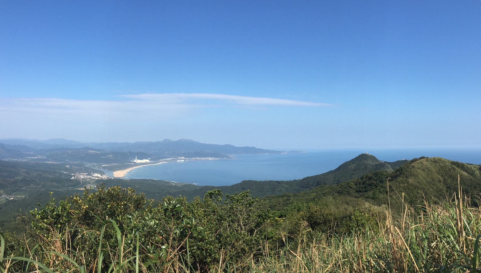
Just before reaching the first peak, there is a vantage point which gave us our first views back over to Fulong Beach and the Bitoujiao headland beyond.
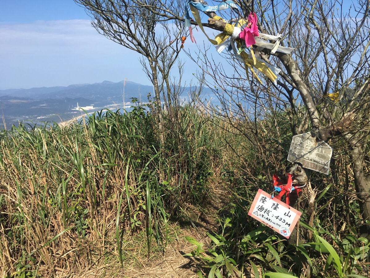
09:56 – The peak we reached was Longlong Shan (隆隆山). It was basically just a grassy clearing with a trig point and a tree. We’d overtaken half of the aunty group, and by the time the rest of them arrived, the peak was both crowded and noisy. We got forced into having our photo with the peak sign taken by one of them and another seemed intent on demonstrating her English in a way which made me feel uncomfortable. This prompted us to get off and moving again to see if we could outpace them.
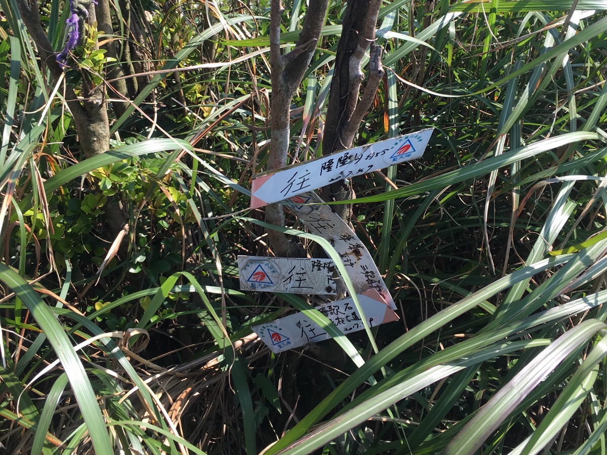
10:03 – Just a short distance from Longlong Shan is a three-way junction. The left path goes along the south edge of the headland to arrive at Sandiaojiao Lighthouse/三貂角燈塔, but we took the right path towards Yingge Shi shan/鶯歌石山.
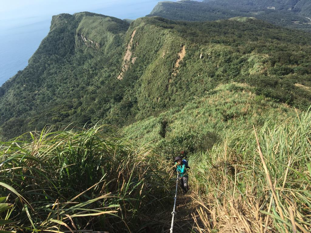
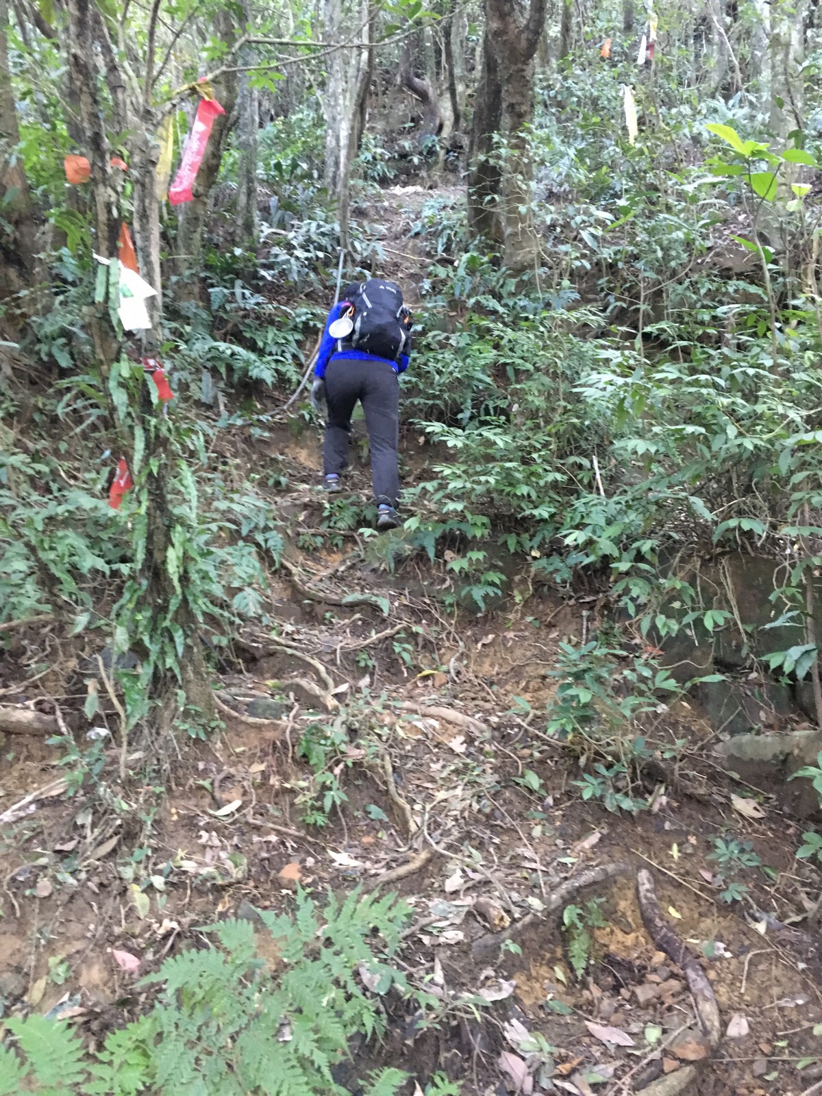
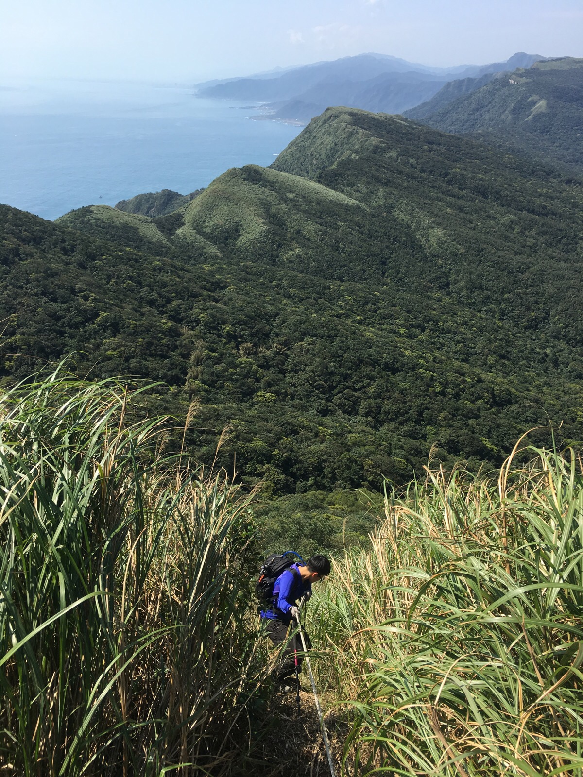
Immediately after the junction, the path descends steeply through the grass for quite some way.

At this point, our hiking sticks weren’t especially useful, but the gloves were essential – I would not have wanted to be doing this without gloves.
As we were descending the steepest section, the advance party of the chaperoned aunties caught up with us and, much to my consternation, failed to follow proper hiking etiquette. Instead of waiting for the first person to clear one section of rope before following, they all barrelled down together, sending bits of mud and grass down onto us and pulling the rope in different directions. We decided to let them pass and go first. It was at this point that I noticed the first of several ticks on me. Thankfully, each time I spotted them as they were making my way up my trousers and before they could come into contact with my skin. They were hideous little buggers: 2-3mm, flat body with legs which took them up to a total span of 4-5mm, a light greyish-brown in colour and really fucking creepy. I have hated ticks ever since my first experiences with them during Scottish holidays as a child, and after finding one on me, I became somewhat obsessed with checking both myself and Teresa for them every rest stop. Perhaps in their effort to creep me out further, they ignored Teresa and only found their way on to my clothing.
10:46 – At the first available place, we decided to stop for a coffee and fruit break and to let the rest of the aunties get ahead of us, and to help give Teresa a little more energy. We didn’t stop long, maybe only 15-20 minutes before getting back on with the walk.
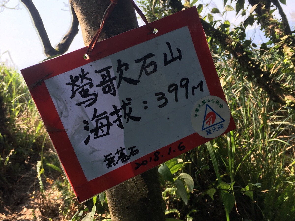
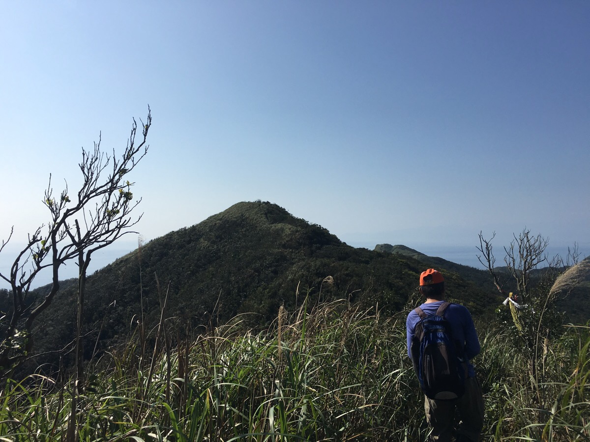
11:06 – The next peak we arrived at was Yingge Shi Shan. The peak itself was a little shaded with a few stones for sitting on.
But just out of the shaded area was the most stunning view along the coast. Standing here, we could see the ridge line that we’d be walking along later and the appearance of Turtle Island was a clear sign that we were close to Yilan.
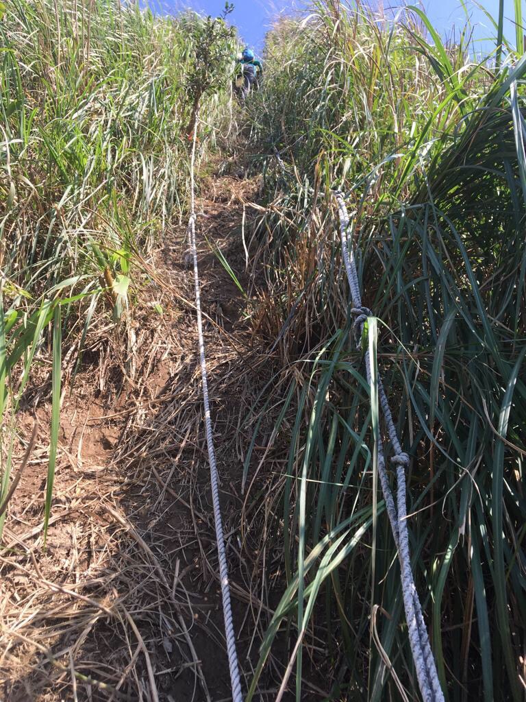
The descent from Yingge Shi Shan was another near-vertical roped section which would have been an absolute bugger to do in the reverse direction.
To be honest, I didn’t know what to enjoy more, the tactical challenge of the climb down or the views of the scenery as I took turns waiting for Teresa to climb a way first. Looking down to the left, it was possible to see waves crashing against the dark grey rocks along the shore.
11:24 – This is looking back at Yingge Shi shan just after having completed the descent – here the path runs alarmingly close to some steep drops, so we had to pay attention to our feet.
11:43 – Reaching a junction, we discussed whether or not to call it quits and head home – I was doing fine but Teresa was suffering from her bad sleep still and her mood was slightly angsty.
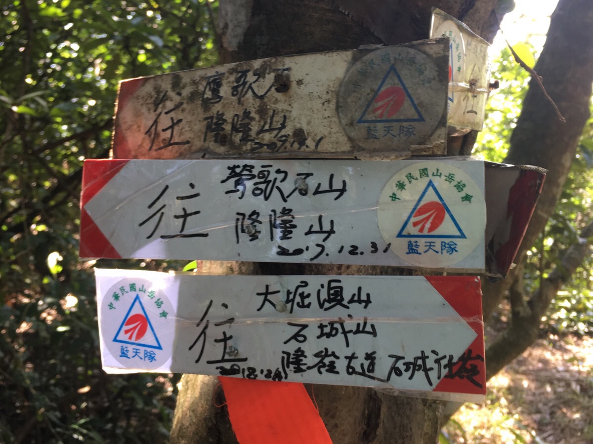
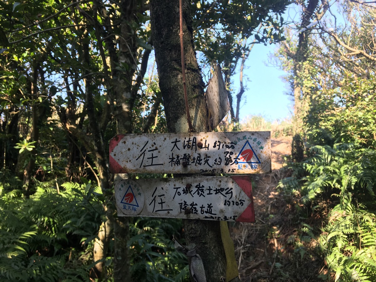
Looking at the signs, the left is back to where we came from (鶯歌石山 and 隆隆山), right is where we ended up going (Da Ku’ao shan/大堀澳山). If we had chosen to go downhill here, we would have reached the road and could have walked back to Fulong from there. Instead, we decided to keep going straight towards 大堀澳山. We kept going despite a few reservations.
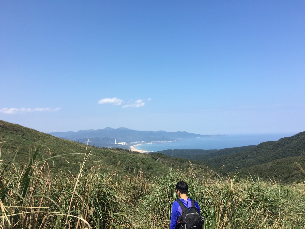
After passing through a few more trees, the view opens out to the right and it was possible to see how far we’d walked around the peninsular in relation to the beach.
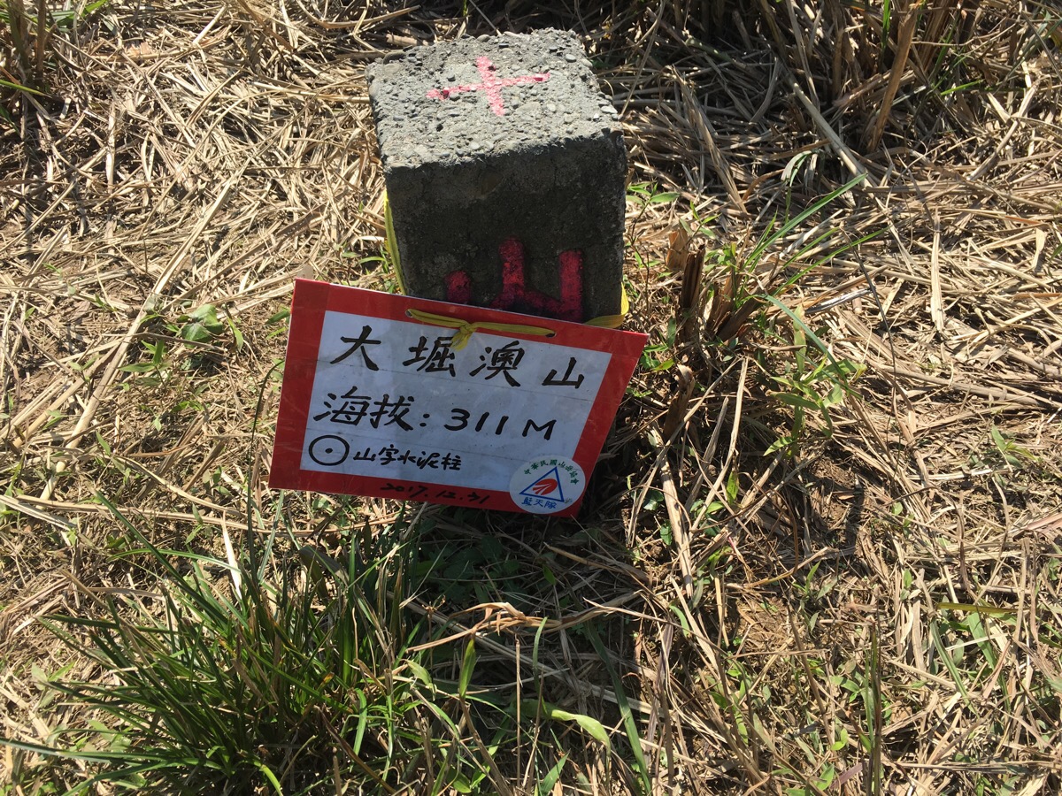
11:58 – Da Ku’ao shan wasn’t an especially exciting peak, again it was pretty much just a small, grassy clearing with a trig point. Here we crossed paths with two guys who were doing the path in the opposite direction to us. No words were exchanged, they just both took photos with the peak sign and then got off on their way again. They must have had a tough time going up some of those steep roped sections.
About half an hour after passing Da Ku’ao Shan, we were getting hungry and ready for some lunch. We were getting ready to down packs and cook in a sheltered clearing when we suddenly noticed that more-or-less the whole floor was carpeted with droppings. Not a great lunch spot then.
Pressing on, we were rewarded with some amazingly expansive views – looking southwest it was possible to see the ocean on both sides. Teresa was pining for the beach and beer.
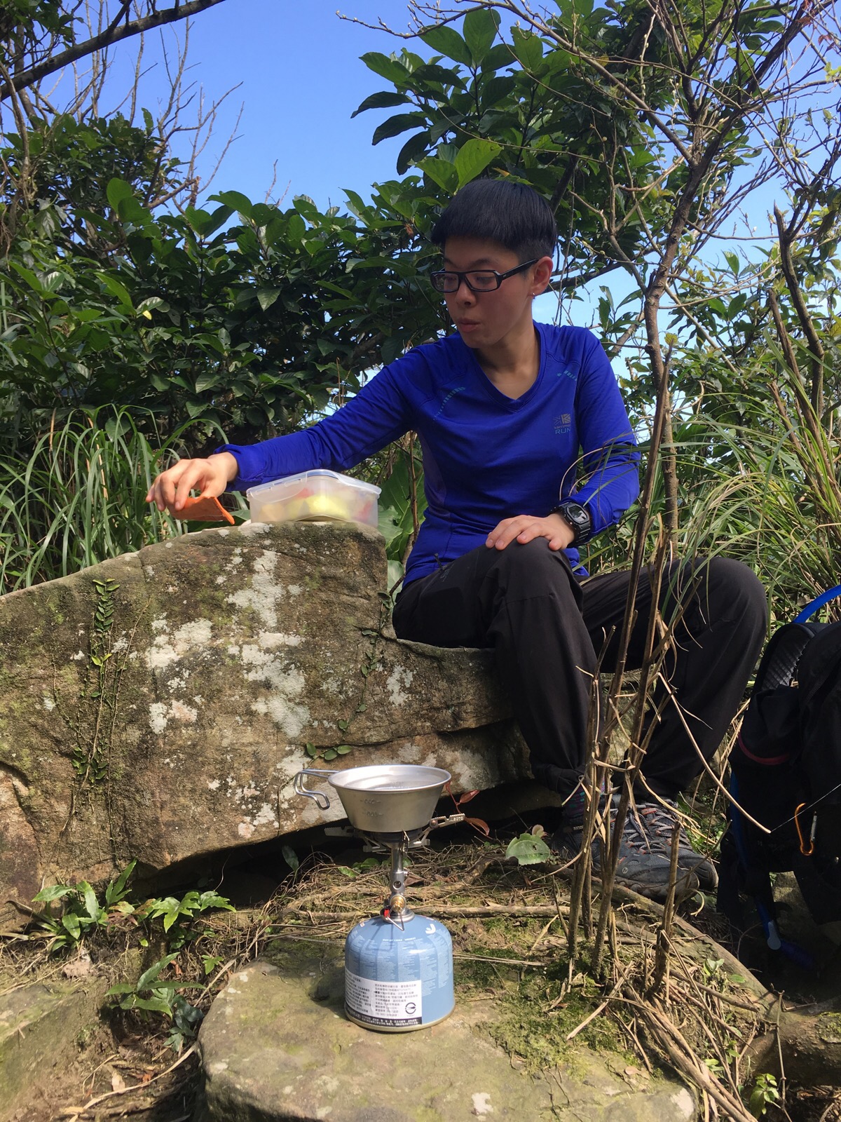
13:16 – Finally, maybe an hour after we should have eaten, we reached a suitable resting place. The ridge line trail that we were on intersected with Longling old trail/嶐嶺古道, and the crossing was marked with a small shrine. At the crest of the Longling trail, there was a stone slab which was just wide enough for both of us to sit on and cook. I did the vegetable bit and then left Teresa in charge of the noodles whilst I went to have a look at the shrine – there was no resident god inside, and no stone tablet with a name either. Perhaps whoever had resided there has been moved to somewhere with a higher traffic flow. It also seemed that there were two names for it, one was Shui Tou Tudi Gong/水頭土地公 and the other was Shicheng Zi Ling Tudi Gong/石城仔嶺土地公. Given that the literal translation of the first is ‘Water Head Land God Shrine‘, I think I like that one better.
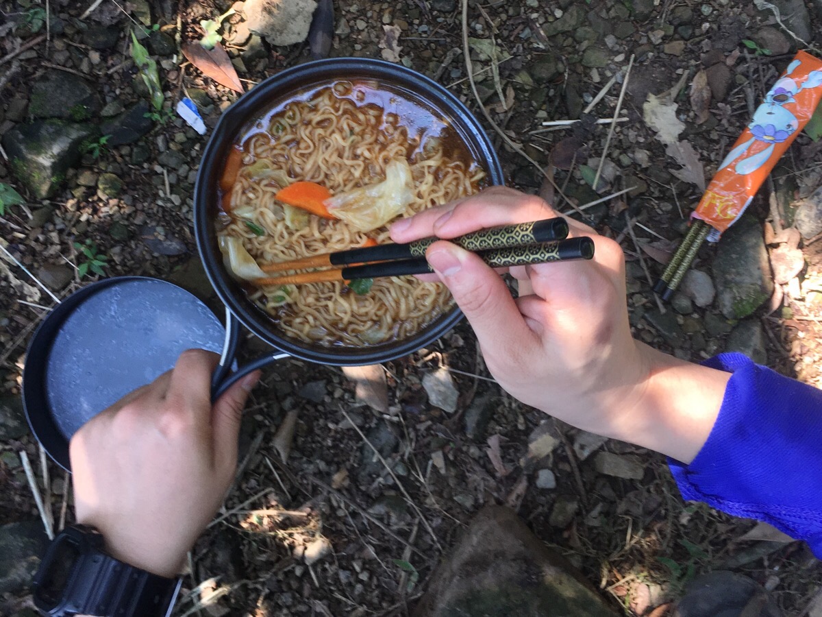
We dined on instant noodles and a surplus of vegetables and had another coffee before getting back down to the hiking.
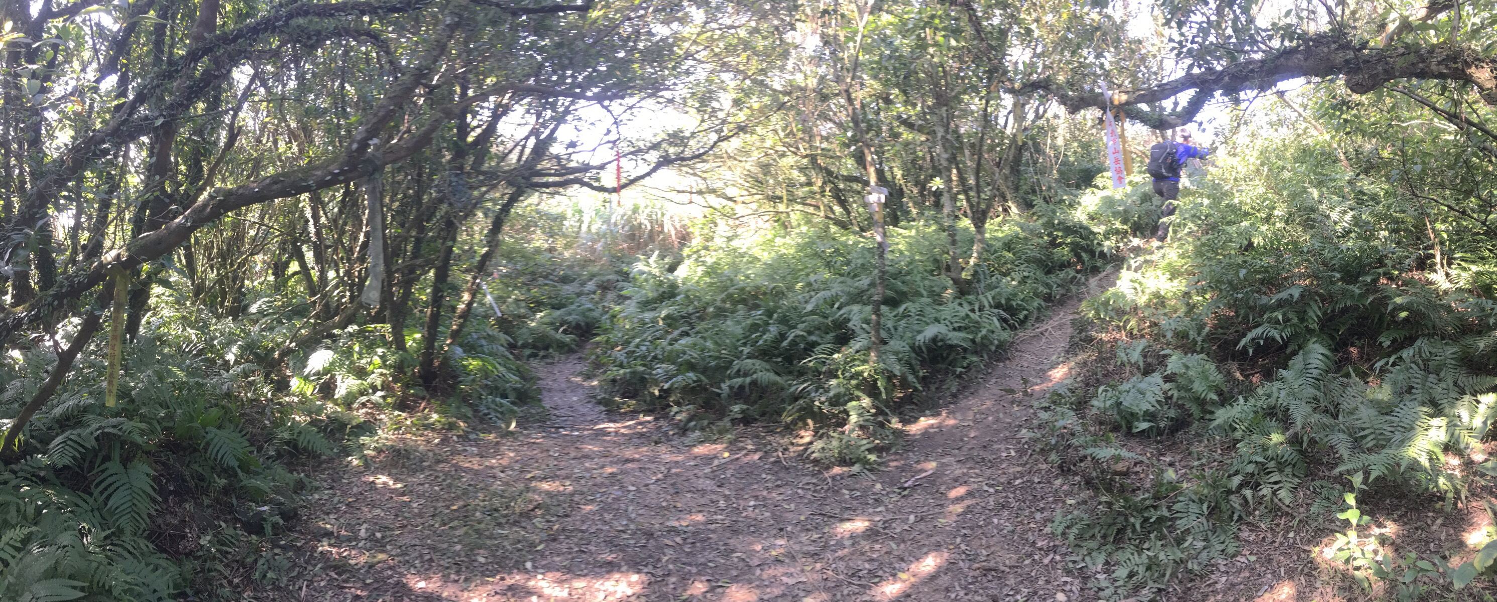
We left the clearing by heading straight, passing some impressive tree structures as we went. Just as we went, what sounded like a huge group rocked up behind us and a loud voice repeatedly declared that it was time for “大休息” (big rest). We were mere seconds out of the clearing, but they were so loud that they must have been totally unaware of our presence.
The path away from the shrine is signposted towards Fulong shan/福隆山 – according to what Teresa had read online, this was meant to be the toughest climb of the whole route.
Perhaps the refuelling had helped because it didn’t really feel especially difficult.
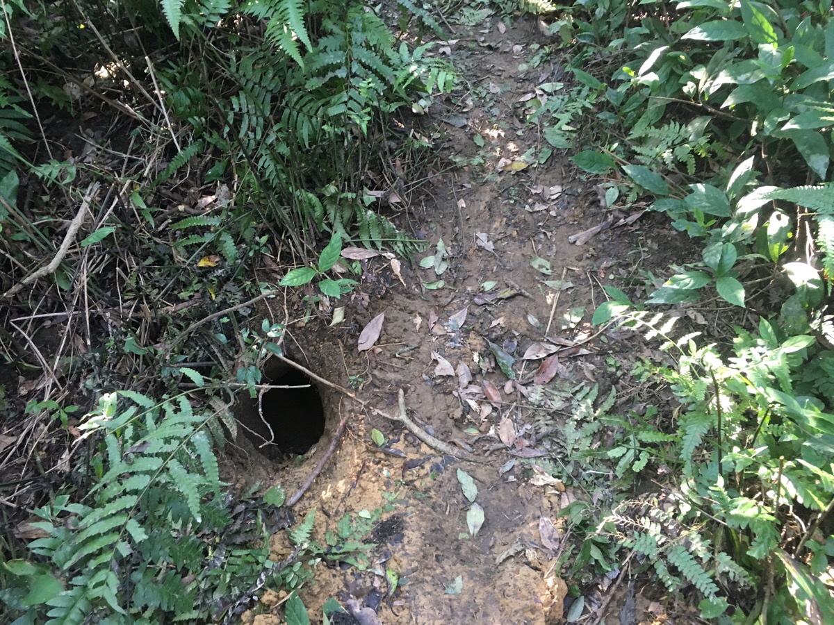
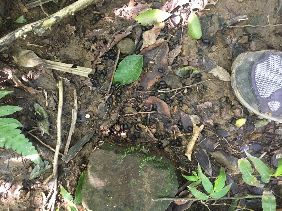
All the way along the trail, we had seen huge, huge numbers of these burrows – some with still-fresh mounds of orangey earth piled up around them. I’ve seen them in various places around Taiwan but have never really worked out what makes them. Since completing this walk, I spent a frustrating stretch of time trying to discover what is likely to be making these, and my best guess is that they are likely to be the work of pangolins. Just like finding out who made the holes, it is frustratingly difficult to find out just how widespread these animals are in Taiwan and if indeed, they are likely to exist in large enough numbers as to have covered the whole of this place with burrows.
The climb to Fulong shan ended without ever having become as difficult as I’d been led to believe it would be – the peak itself is on a small spur off to the right.
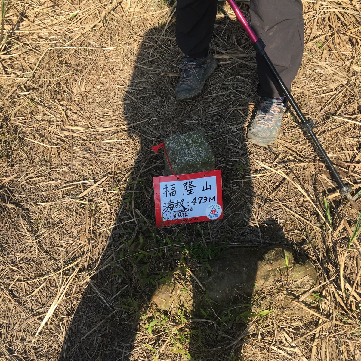
14:50 – We went and found the clearing and when we saw that this peak was once again, just a small grassy space without much of a view, we got back on our way.
The signpost onwards said that we were heading towards Dahu shan/大湖山.
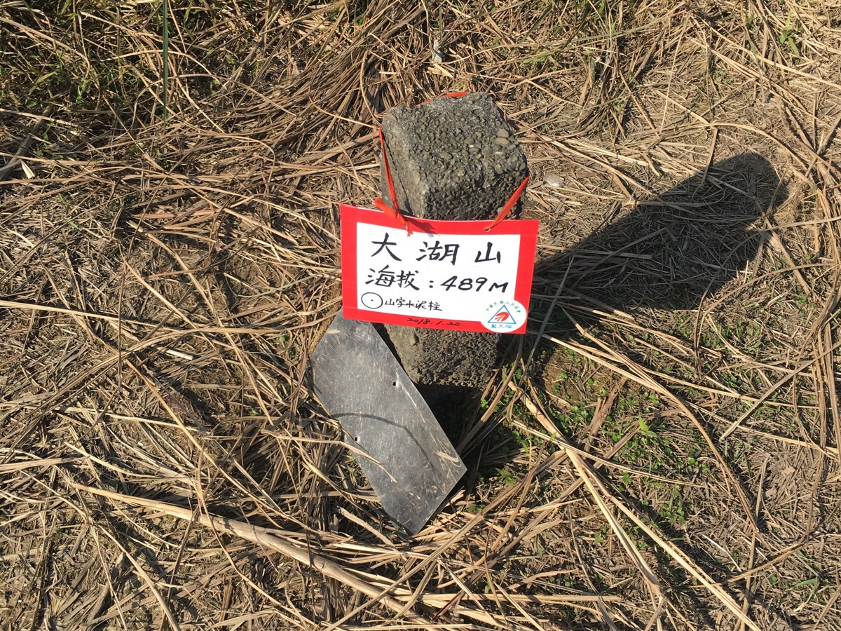
15:00 – Indeed, we very soon arrived at the next peak, but I’ve no idea where the name came from – Dahu shan translates to ‘big lake hill‘ and there wasn’t a lake in sight.
The path leading away from Dahu Shan was a little unclear due to the abundance of deer trails in the area – we had to pay attention to make sure that we stayed on the correct path.
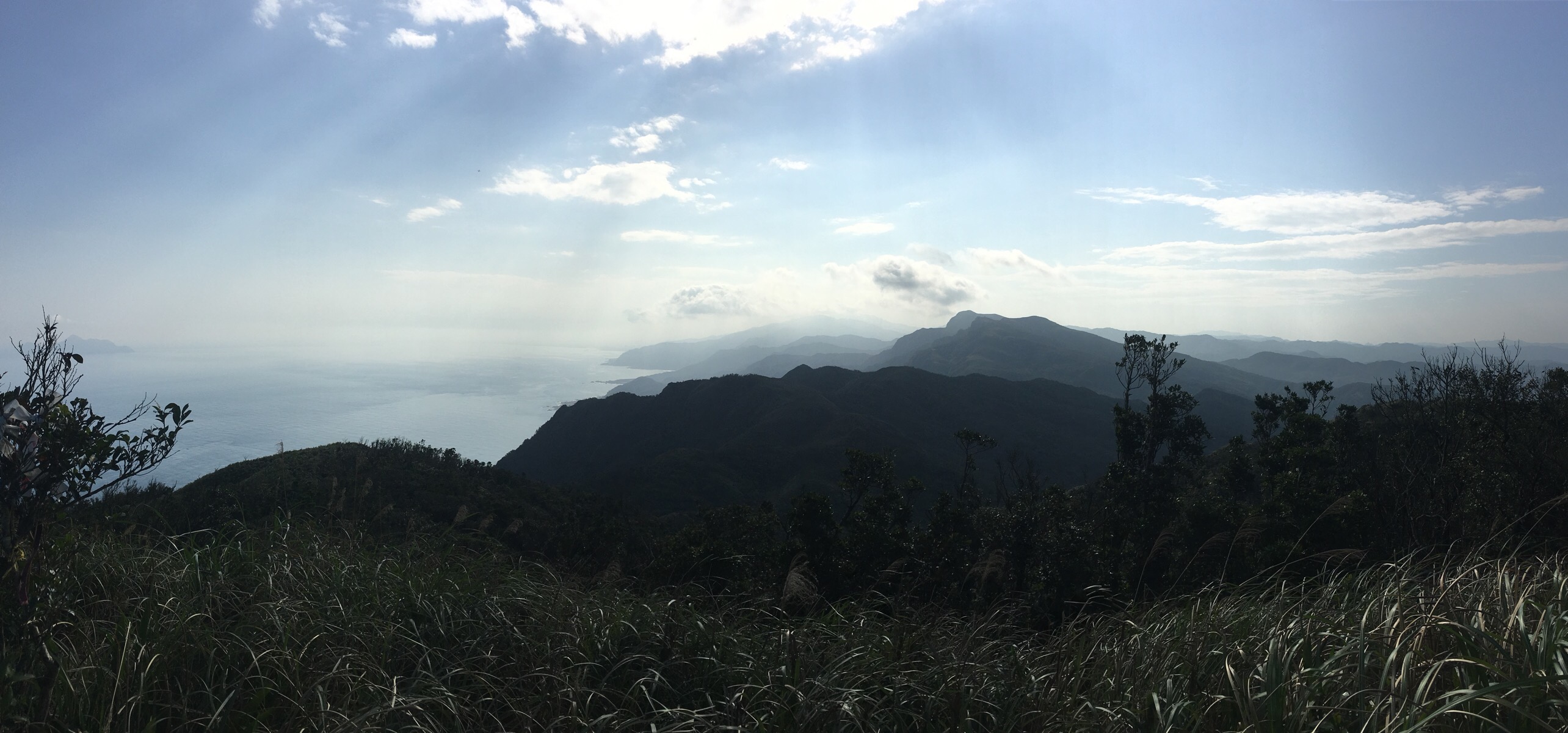
Coming off the top, we were once again given some magnificent views southwest towards Wai’ao and presumably Yilan – photos never really capture the feeling you get from seeing layer-upon-layer of mountains.
It was at this point that the greenery became a little different, tall grasses were replaced with scrubby bamboo. Given that we had to traverse another steep descent, the extra hand-holds provided by the slightly sturdier bamboo were welcomed.
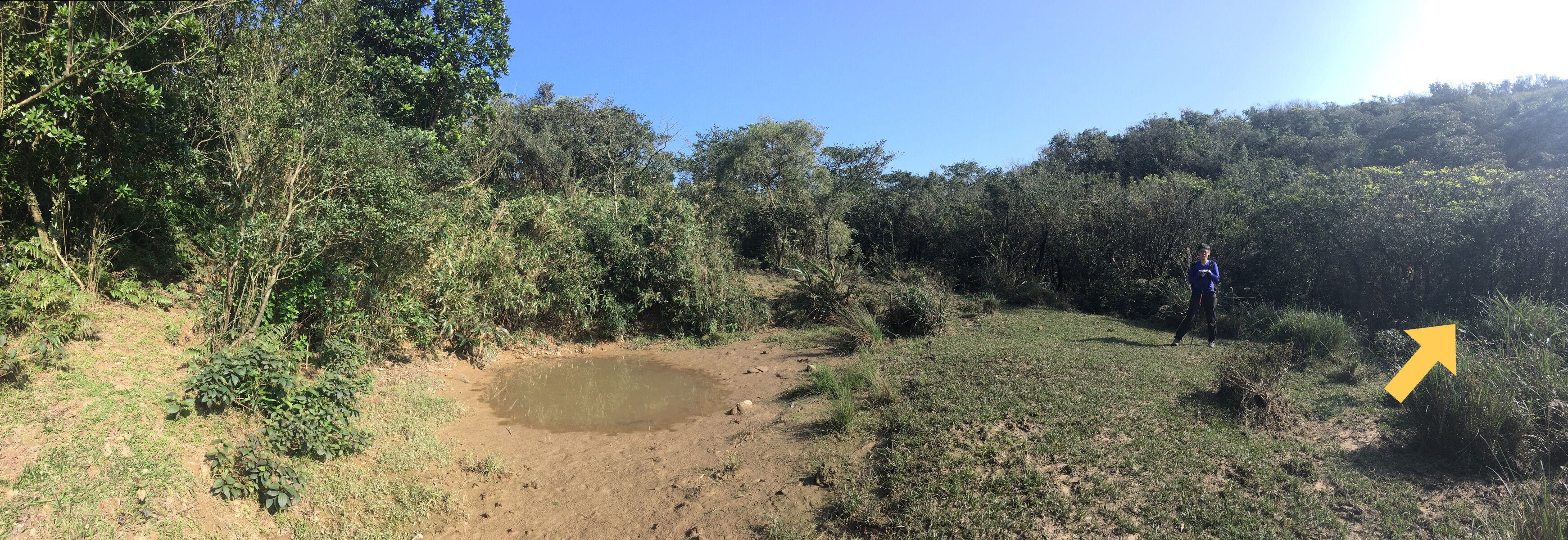
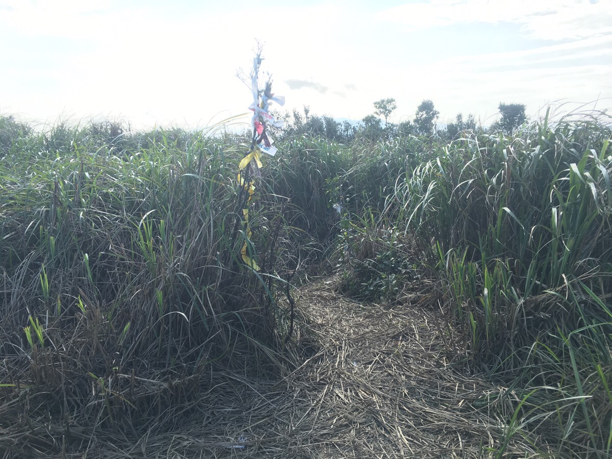
15:22 – The descent flattens out at a small mountain pool, (surely this can out be the big lake…). A closer look at the muddy water revealed huge numbers of tadpoles massed together in the shallows – there was also evidence in the soft mud around the edges that an egret or heron had visited to enjoy the easy pickings. The path leaves the clearing and dips into a small hollow where there is a crossroads.
This is where we made the wrong choice. If you plan on following this route, please ignore my directions from here and I stress, GO STRAIGHT OVER AT THE CROSSROADS. Going straight over will take you on a slightly longer, but much easier route with will join up Taipei the high point of Caoling old trail, from where you can just walk down the road to Dali. (This is the route marked in dotted green on the map at the top of this page.)
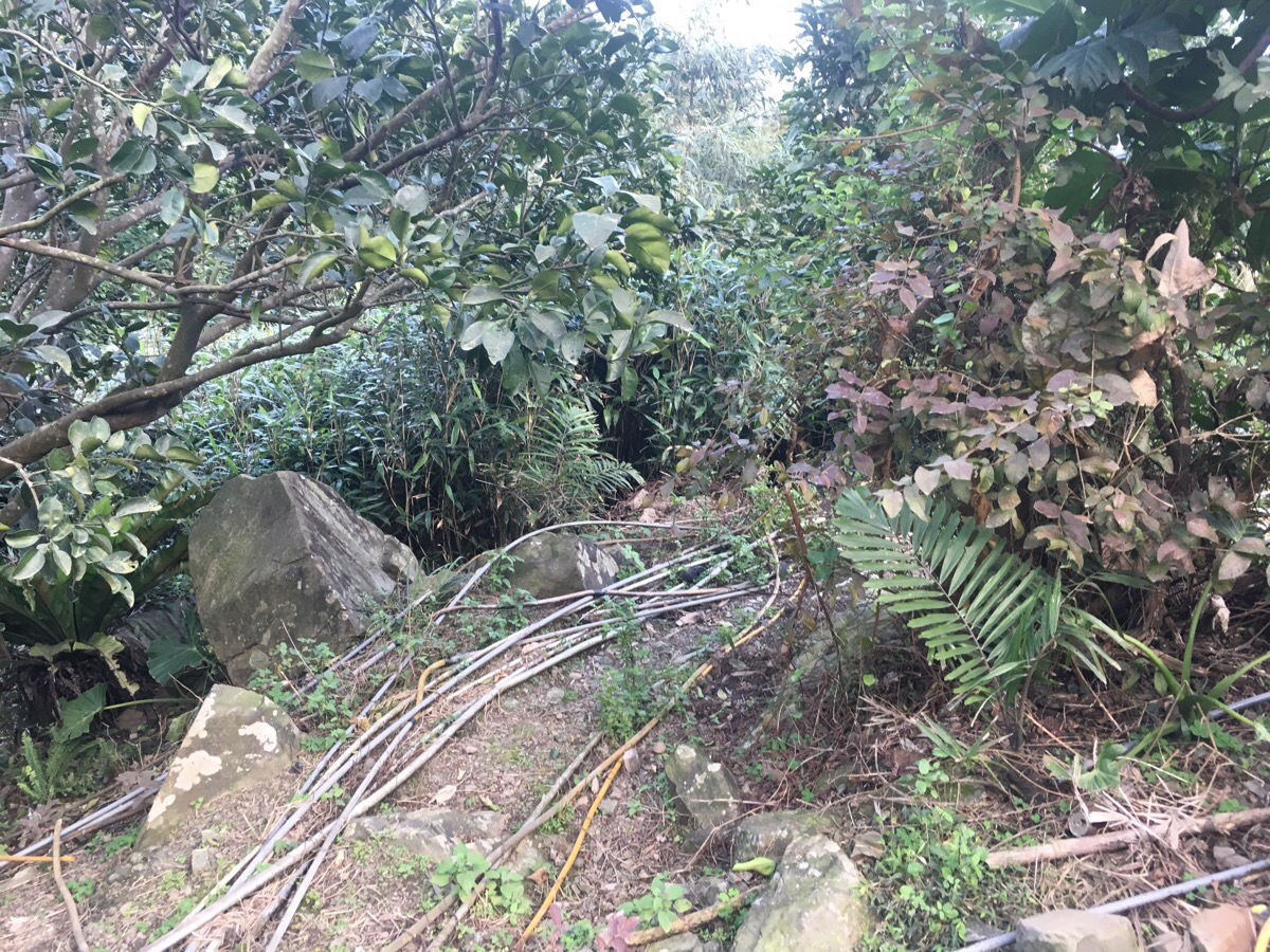
Instead of going straight, we decided to take the path going left out of the hollow which would arrive at Shicheng station. In fact, in hindsight, we were given a warning right from the start, as the first path we took out of the hollow turned out to be a water buffalo path, and we had to backtrack before we’d even started.
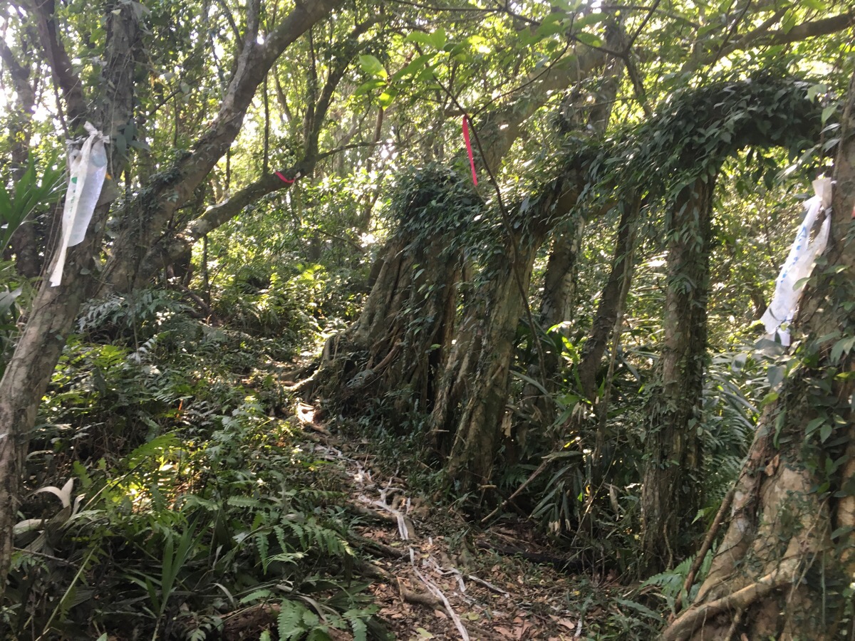
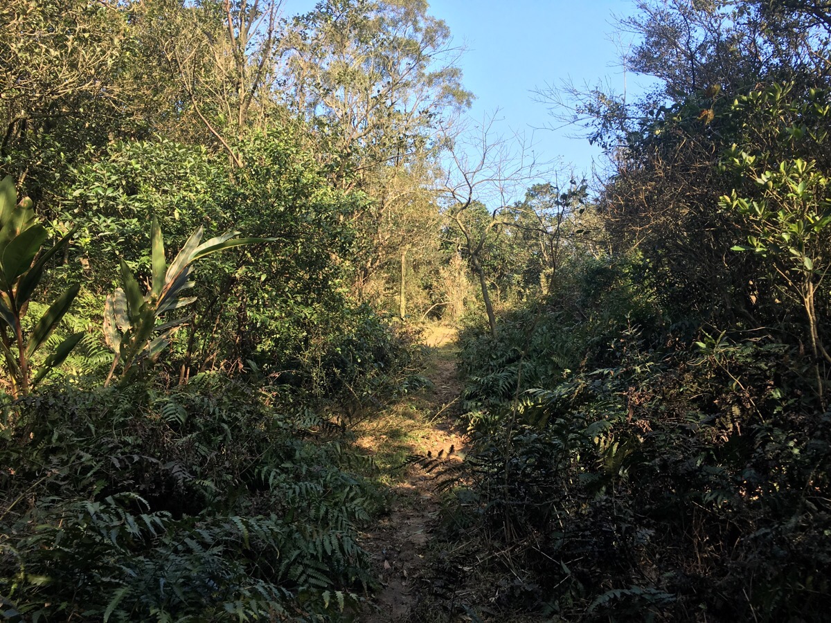
There was more evidence of the waterbuffalo having stomped around in the area, as well as some deer-like prints and bigger droppings than we’d seen so far on the walk, maybe 7-8cm patties formed of several soft pieces. What there was less evidence of was human activity. We were following a GPX route and by going slowly, we were able to match it up to the very old-looking trail tags, but it soon became clear that this was not a well-traversed path.
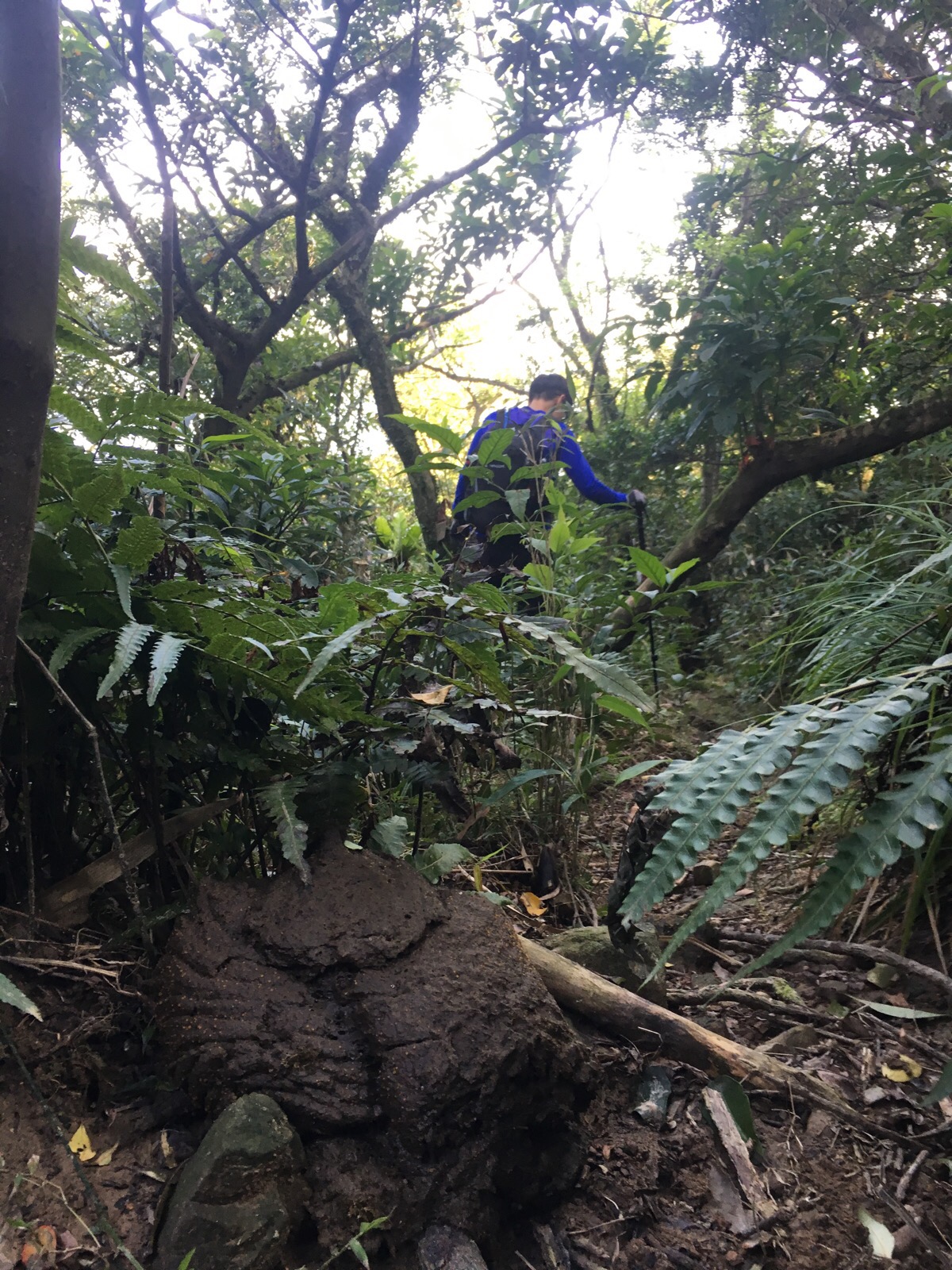
In one or two sections we needed to bushwhack our way around downed trees, and the challenge of keeping on the path was mentally taxing. A little while back, we’d walked a newer route up to Zhi Shen Mao Tai Shan, and at the time I’d thought it was a challenge for my map-reading and trail-following abilities. I now know that it was simply practise for this. To step up our difficulties to the next level, as we were contemplating the best way to pass a fallen tree, a series of sharp grunt-barks and squeals erupted from the dense shrubbery, maybe 50-30m away. We hadn’t heard anything like it on our travels before, but suddenly the larger ‘deer’ prints and mystery poo made sense: wild boar. Now, logically I know that wild boar are skittish and elusive beasts, as unlikely to come looking for us as I am to eat a bacon sandwich (I’m a vegetarian), but that knowledge was not at the forefront of my mind at the time. My immediate reaction was a flight response, but with nowhere to go, that wasn’t going to work. Listening quietly to the sounds of the forest wasn’t especially comforting, the animals seemed to be neither retreating not coming closer, but they were definitely close enough for us to hear both a range of communicative noises and the rustling of trees and plants as they moved. After the previous time that we’d strayed into wild boar territory, I’d researched what to do in the event of a boar encounter, and thankfully the information had stayed in my memory. If they’re far enough away that you can’t see them, they’ll probably want to stay away, making noises to alert them to your presence will make that easier for them. They are unlikely to attack unless cornered, threatened, or unless you accidentally disturb a mother and piglets – in the event of an attack, climbing a tree is your best bet. Basically, despite my intense fear, it was extremely unlikely that we would be savaged by a gang of blood-thirsty boars, and actually, they would most likely be having the same fear reaction to our presence. We made noises by banging our metal cup and occasionally shouting. Given that the path was still near-invisible, we had to keep the pace slow, stopping to check that we were on track and that we weren’t about to ambush our boar friends.
At a small grove of bamboos, we heard sounds of running water, and a quick check of the route indicated that we should be tracing the river down to the road. But then, just audible above the sounds of the water and closer than before, pig sounds. This time it wasn’t the same mixture of mature grunts and barks, but instead a lone adult bark-grunt and a whole lot of young squeaks and squeals – piglet noises. And coming from the direction that we needed to go in. As mentioned above, wild boar are generally not aggressive, except for in a few specific circumstances, like, for example, a mother boar protecting her piglets. I was so ready to go home at that point.
We retreated a short way to work out what to do. For a short time, the sounds seemed to move in our direction and (perhaps prematurely) we found ourselves trees to climb. We sat there for a while, doing the noise thing to see if we could encourage mama pig to take her babies elsewhere, but time was definitely ticking on and I did not want the added challenge of failing light to make the journey any harder – of course, we had head torches with us, but those were precautionary rather than because we’d planned on using them. So we got out of our trees and continued down, (actually, we couldn’t find the path at first and had to double back). There was nothing else to be done, we had to walk towards the source of the noise, luckily for us, it seemed that they had moved a little further upstream, and rather than making harsh shouts, I switched to keeping up a steady stream of bargains and reassurances with the mother pig that we just wanted to pass through, not harm her or her babies and then be on our way and out of theirs’. As the river came into sight, I started to feel a bit better, we were surely almost out of the woods.
16:59 – Finally the pipes leading away from the river led us to a small patch of farmland and I can honestly say that I’ve never been so happy to see signs of human habitation. We followed them until they took us down to the road.
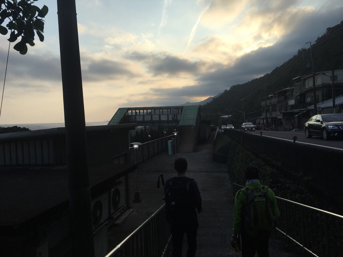
At the road we crossed over and turned right towards the train station.
I am sure that some people reading this must think that I’m a bit of a muppet for getting so worked up over wild boar – they exist in many countries and rarely attack people. Hell, people hiking elsewhere have much bigger dangers to worry about like mountain lions and bears. But I am not a brave hiker, I am scared of many things, including (but not limited to) snakes, sunburn, earthquakes, crazy rogue deer, getting lost, having no water, falling, lightening and sudden weather changes, not having enough food, insects inside my clothing, and flash floods. I feel that it would be unfair of me to write as if I wasn’t afraid of these things, I am afraid, but I still go out there. That’s one of the reasons why I keep this blog, so that I can provide more information or those who deal with fear the same way I do, by trying to face it with over-preparation. On this day, I faced three fears, ticks, wild animals, and just as I was drifting off to sleep, a 5.0 magnitude earthquake which violently rocked the building we were staying in – being faced with this kind of makes me think that it would be more foolish not to have a healthy fear of nature. None of it is going to stop me getting out there though.
How to get to Fumao Old Trail
Google Maps address: the trailhead isn’t yet marked on the map, a bicycle rental shop can be found here: 228, New Taipei City, Gongliao District, 荖寮街, and you just need to walk up the road a little further to reach the start of the trail. You can park your car for $100 a day at this car park in Fulong, (although if you go early enough, there are a few free spaces to be found dotted around the village.
GPS location: N25 00.835 E121 57.355 – this is the trailhead rather than where we actually stopped walking.
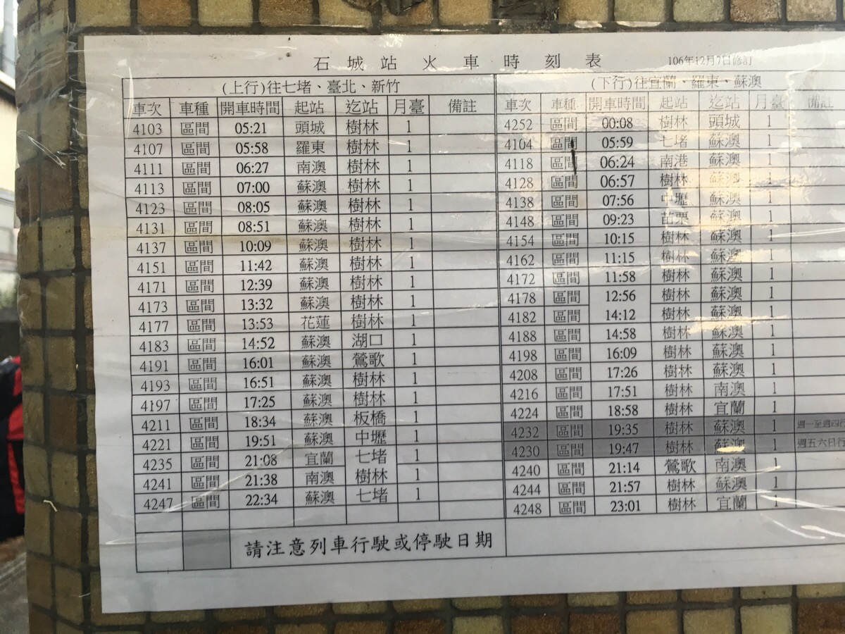
Public transport: this is easily accessible by train, you can check out the timetable here, (when you select Fulong as the destination, it can be found in the Taipei/Keelung area/subline). The photo below is the timetable at Shicheng station, the left side has the northbound trains.
Further reading: Some more stuff on Pangolins here, (and their poo). And the Pashan blog has a post on the Hapen trail containing information about Scrub Typhus, a tick-borne disease in Taiwan, (I’d read this prior to going on this hike and it didn’t make me feel any happier about encountering the horrible things). Unfortunately, the links are broken every time I try to link back to this site, so you’ll have to google it.
Nearby trails:
- Caoling Historic Trail
- Tamsui-Kavalan Trails – Dali to Yilan
- Tamsui-Kavalan Trails – Fulong to Dali
- Tamsui-Kavalan Trails – Ruifang to Fulong
- Tamsui-Kavalan Trails – Shuangxi to Dali
- Taoyuan Valley Trail
My new words learnt on this hike:
- gou dzwi / (Taiwanese) 可愛 / cute
- oh beh mbeh / (Taiwanese) 亂買 / buy whatever – I can’t quite express the oh beh/亂 concept in English, it’s a bit like whatever or random or careless, and it’s very useful in Mandarin.
- 以防萬一 / yǐ fáng wàn yī / in case
- 改裝 / gǎizhuāng /modify
- 鰻魚 / mányú / eel – this was learnt in the hours after the earthquake as we strolled along the beach in the dark. tens of people were spread out along the shoreline with torches and strange net contraptions. After staring in confusing for a while, Teresa pulled her classic ‘can you explain to me so that I can explain to the laowai’ trick, and we learnt that there is an annual window during which the eel arrive at Fulong beach to spawn. They swim upstream a little and their eggs and young get dispersed along the beach. Individual eels can be sold for pretty good prices, but catching a pregnant eel is like hitting the jackpot.
- 孤單 / gūdān / alone, or maybe lonely?
Fumao Old Trail Map
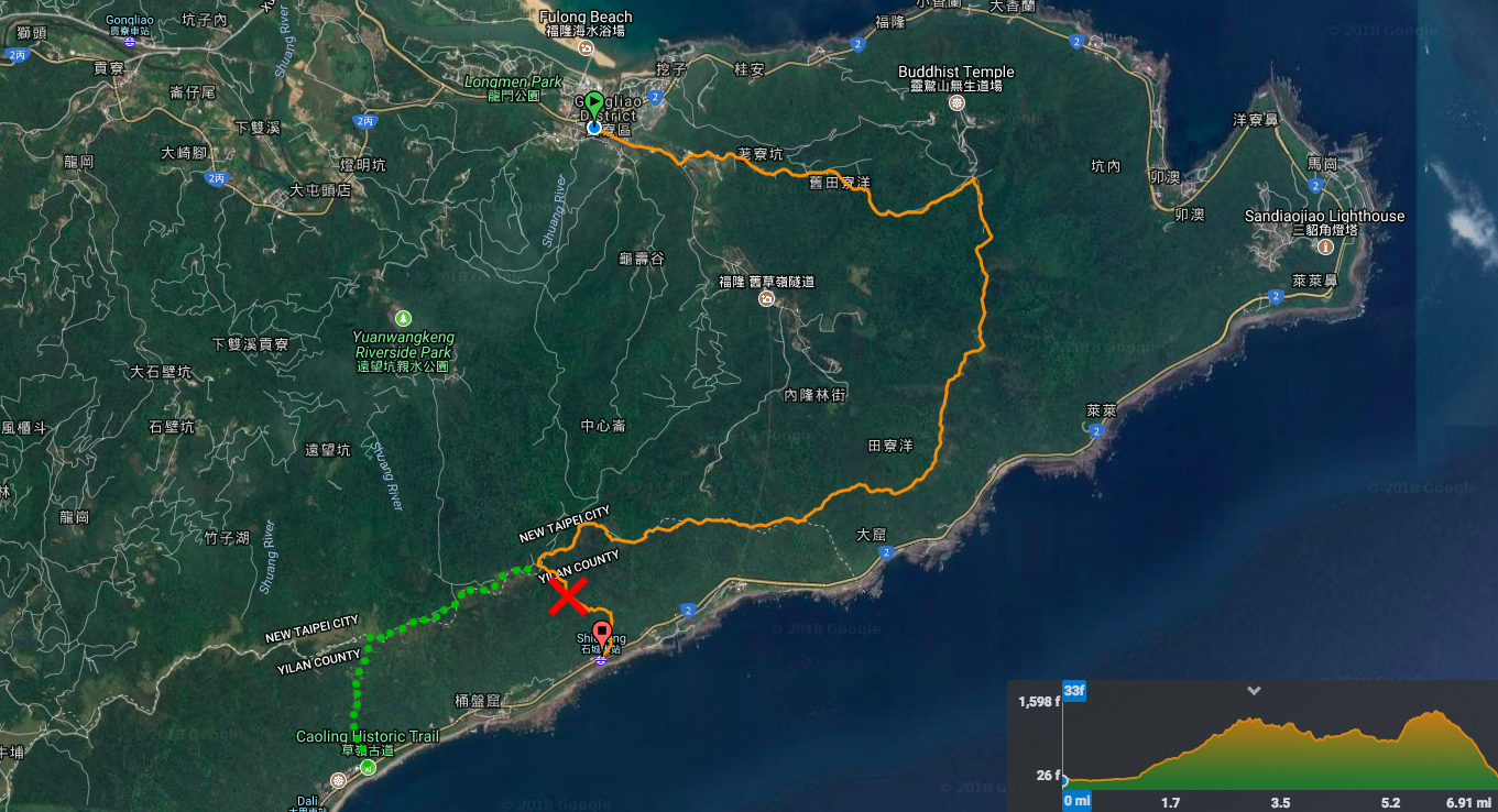
GPX file available here on Outdoor Active. (Account needed, but the free one works just fine.) The file linked here takes you a slightly longer (and safer) route than the one I walked.

Seams to be a great hike. I like the counter right 🙂
LikeLike
It was great, (except for the ticks). And different to a lot that I’ve done over here.
LikeLiked by 1 person
I love how you wrote down this entry. I had a similar experience with wild boars when traversing Suhua Old Trail, and I was alone back then. That time, I really had to think quick and face my fears on my own. Had I learned some warnings from an article like this, I could have came more prepared. So thanks for bloggers like you! Anyway, I hope I can travel this trail soon.
LikeLiked by 1 person
Gosh, that must have been terrifying! Was it a large group? How did you react?
I’m glad you enjoyed the post, and I’d love to hear about your experience walking it as and when you get round to it. If I could summarise the most important advice, I would say wear long trousers and sleeves (ticks aren’t fun), and take the more popular route down.
LikeLike
Pingback: TAIWAN | Severní Taiwan - část I - S rancem na zádech