Distance: 3.4km
Time: 3 hours
Difficulty (regular Taiwan hiker): 3.5/10 – a little steep and scrambly, no English signage, a little hard to get to.
Difficulty (new Taiwan hiker): 6/10 – the way up has a few steep and tricky sections but it’s short, and easy to follow the path. I’d say this would be a pretty good warm up for some tougher hikes because it gives you a taster of what to expect without being crazy-difficult.
Total ascent: 371m to a maximum elevation of 626m.
Water: 1.5L – I didn’t quite drink 1L but would have needed more on a hot day.
Shade: mostly well-shaded, except for the peak.
Mobile network: mostly ok but not strong
Enjoyment: As a short but sweet adventure, this hits all the spots, a tough climb, a little bit of a ridge, great views on a clear day and an easier downwards portion.
Other: you’ll be better off taking gloves to help with the scrambling on the way up. Also, because of the several stream crossings, I would advise you not to do this if it’s recently rained a lot.
Jump to the bottom of this post for a trail map and GPX file.
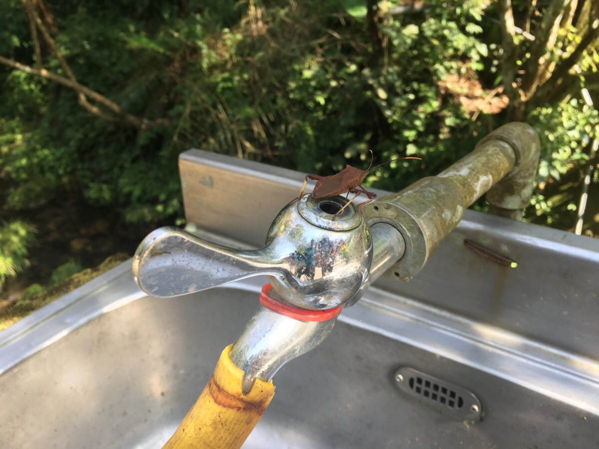
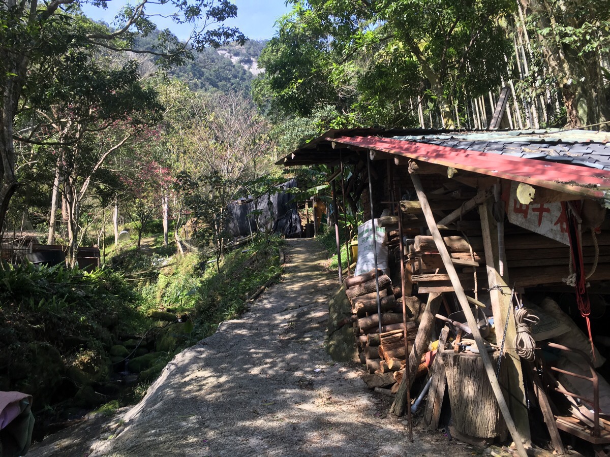
We parked the car in a small parking lot next to a temple. According to information that Teresa had seen on Chinese language blogs, there is normally a guy who asks for a NT$100 fee to park in this area, but he must have gone home for the holiday as we didn’t see anyone except for this imposing bug. There was actually a sign which indicated free parking further up the road, but after we walked beyond that there was also another sign indicating that hikers should bring their cars any further up.
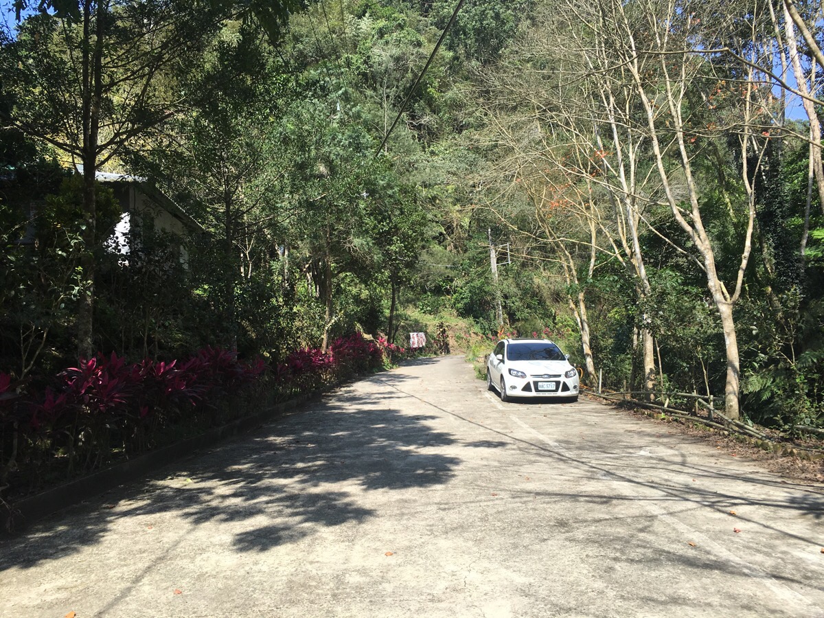
We left the car at 13:09 and walked up the road leading out of the back of the carpark.

As with the road leading up to where we parked, there was a shit ton of betel nut trees to both sides. We also passed an orchard of kumquat trees which seemed to be just about ripened.
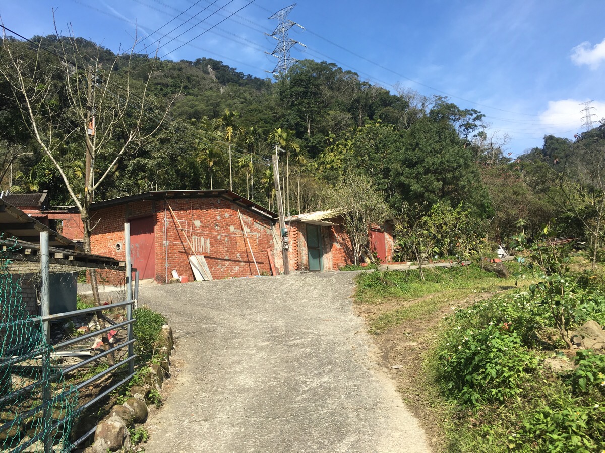
The road comes to an end at a small collections of houses and farm buildings. We passed them on our left, and a few residents sitting out in the courtyard yelled out a hello and then something else that neither of us really understood.
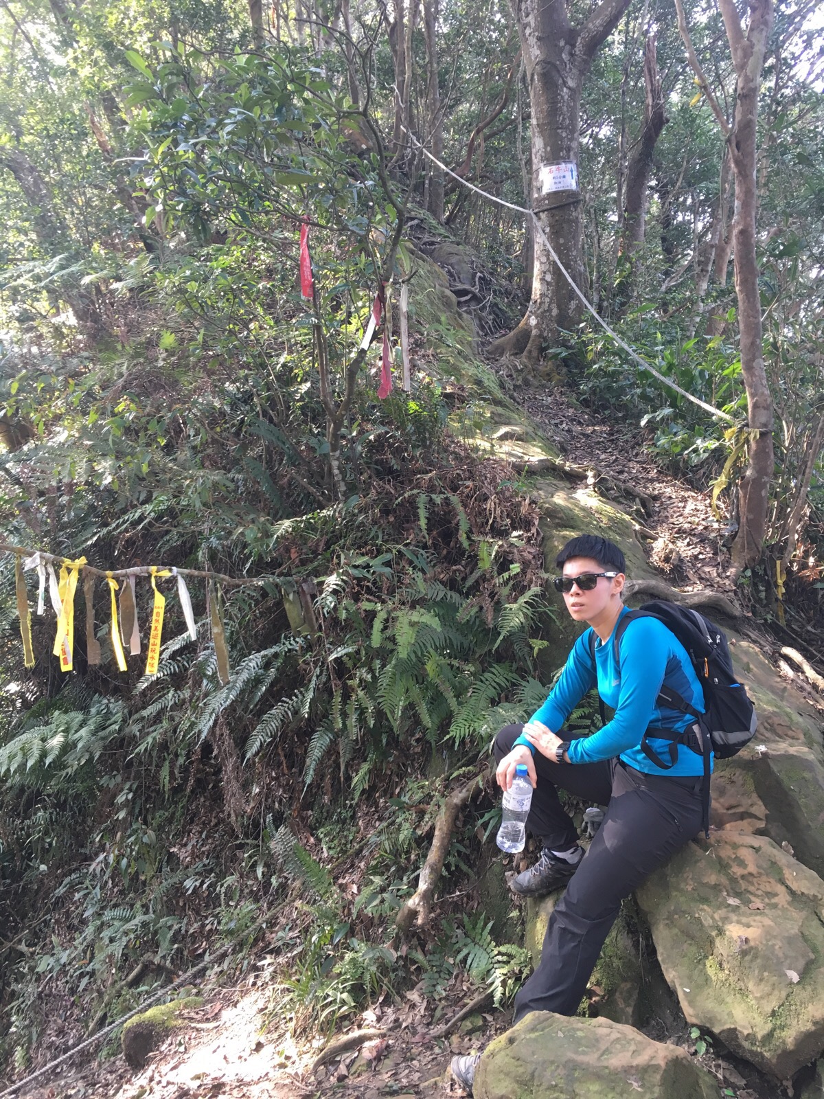
13:22 – A tree at a junction points uphill towards 石牛山, here we encountered another local who just stared after us in a slightly ominous way – I wasn’t sure if it was because we were starting quite late, or because our group of two women is too small for most locals liking or because one of us is clearly foreign – either way, it was a little disconcerting.
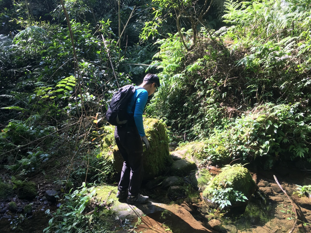
Not five minutes into the walk, we encountered the first of several stream crossings. After a couple of rain free days, they were all manageable without having to get our feet wet, but I would imagine that a couple of hours of rain in the area might change that.
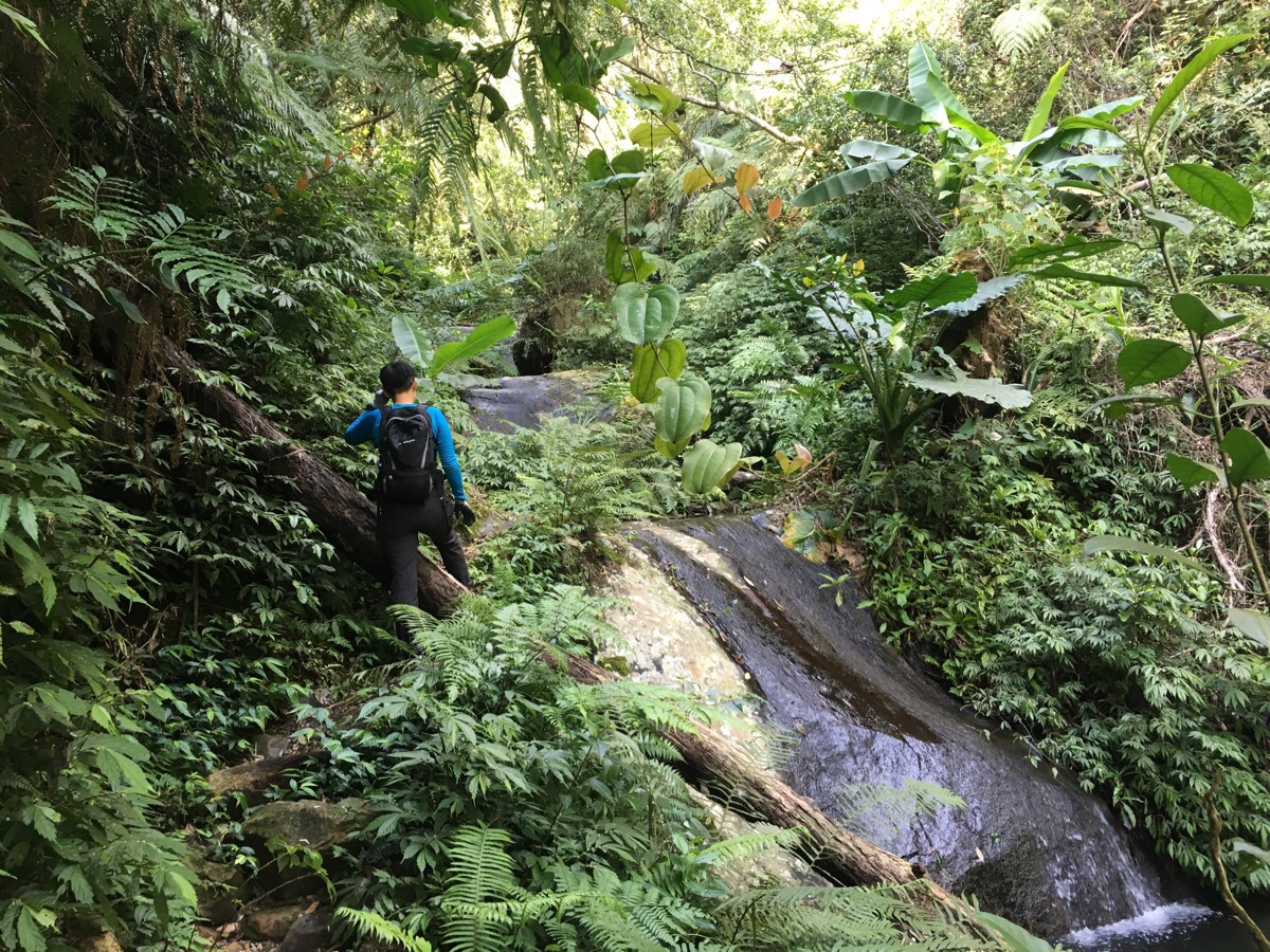
Just above the first crossing, there was a series of drops over flat slabs of rocks into deeper pools which looked like it would be an awesome water ride for 10cm-tall people.
The toughest crossing was over the top of one of these flat drops, and required a double crossing, first to one side and then back to the other over slippery rocks. The first part had a rope, but the second required a first step to secure yourself on the other side and then a little leap (or rather push) of faith to land the other one over too.
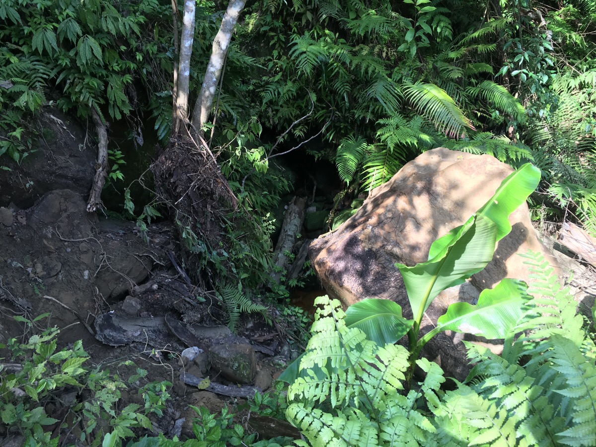
13:38 – not far from the trailhead we encountered what looked to be a pretty recently fallen boulder. Perhaps it had been dislodged by last week’s combination of earthquake and heavy rain, or maybe not. Either way, it had destroyed a small section of the trail, and there were no signs that anyone had walked this way since it had happened. We took our time to assess the stability of the path with some prodding and testing for weight bearing whilst we were still in a position to hold something if the ground gave way.
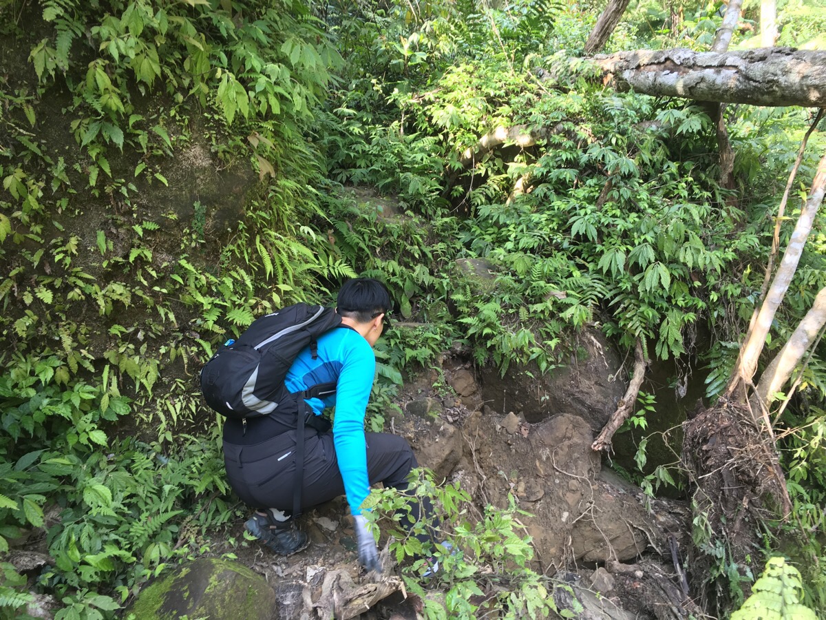
It seemed that there were a couple of stable sections where we could step on some roots so Teresa went first, quickly and carefully and once she was safely across, I followed her. I was happy to get over it without any issue.
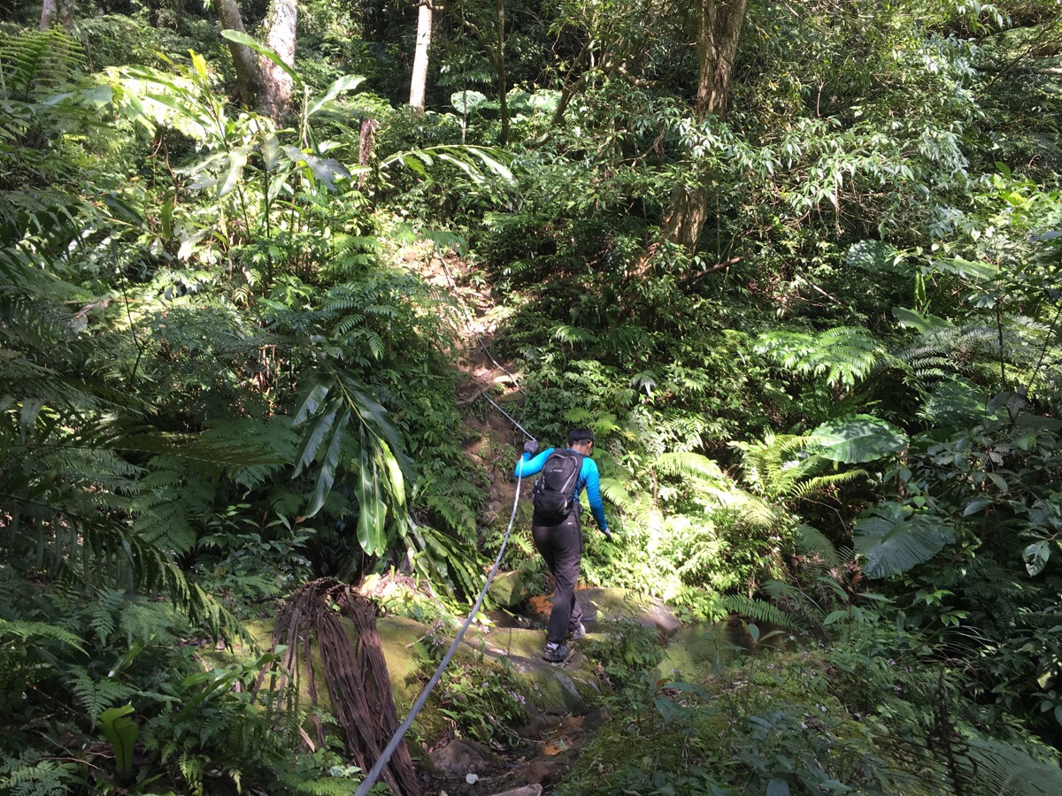
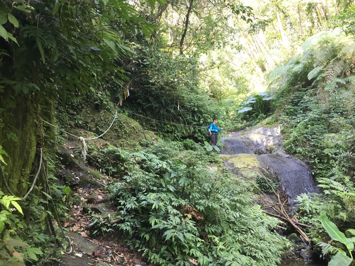
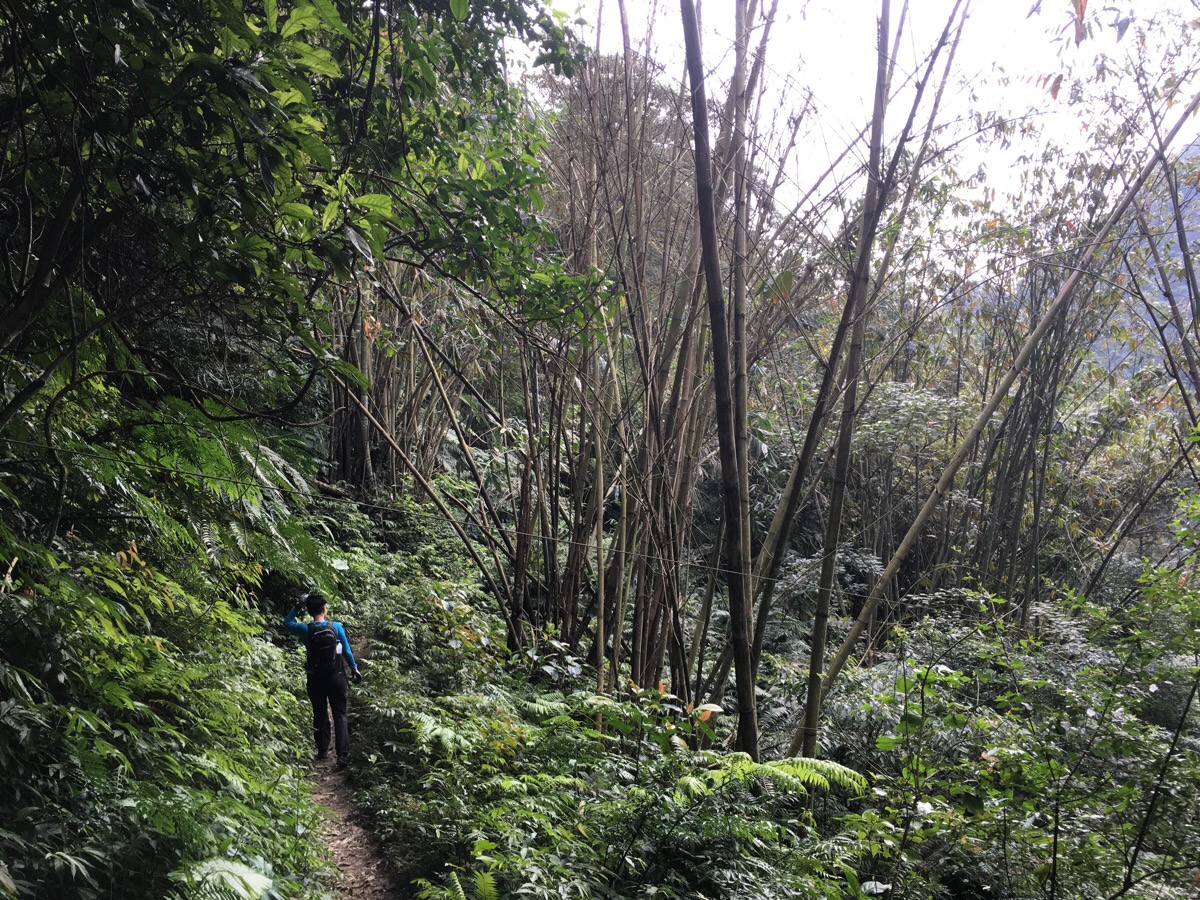
There are a lot of roped sections, including some rally quite steep places, but nothing overly challenging or technical.
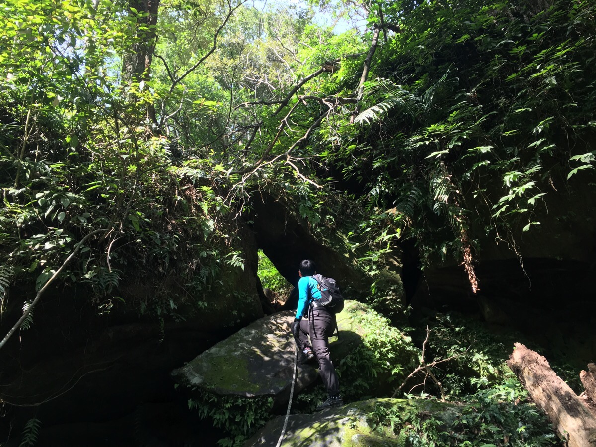
13:46 – My least favourite section was where the path goes through a couple of narrow crevices between huge boulders – especially since this trail showed many obvious signs of how shifting and unfixed Taiwan’s natural landscape can be, places where trees and earth and boulders had fallen down or given way in the not too distant past.
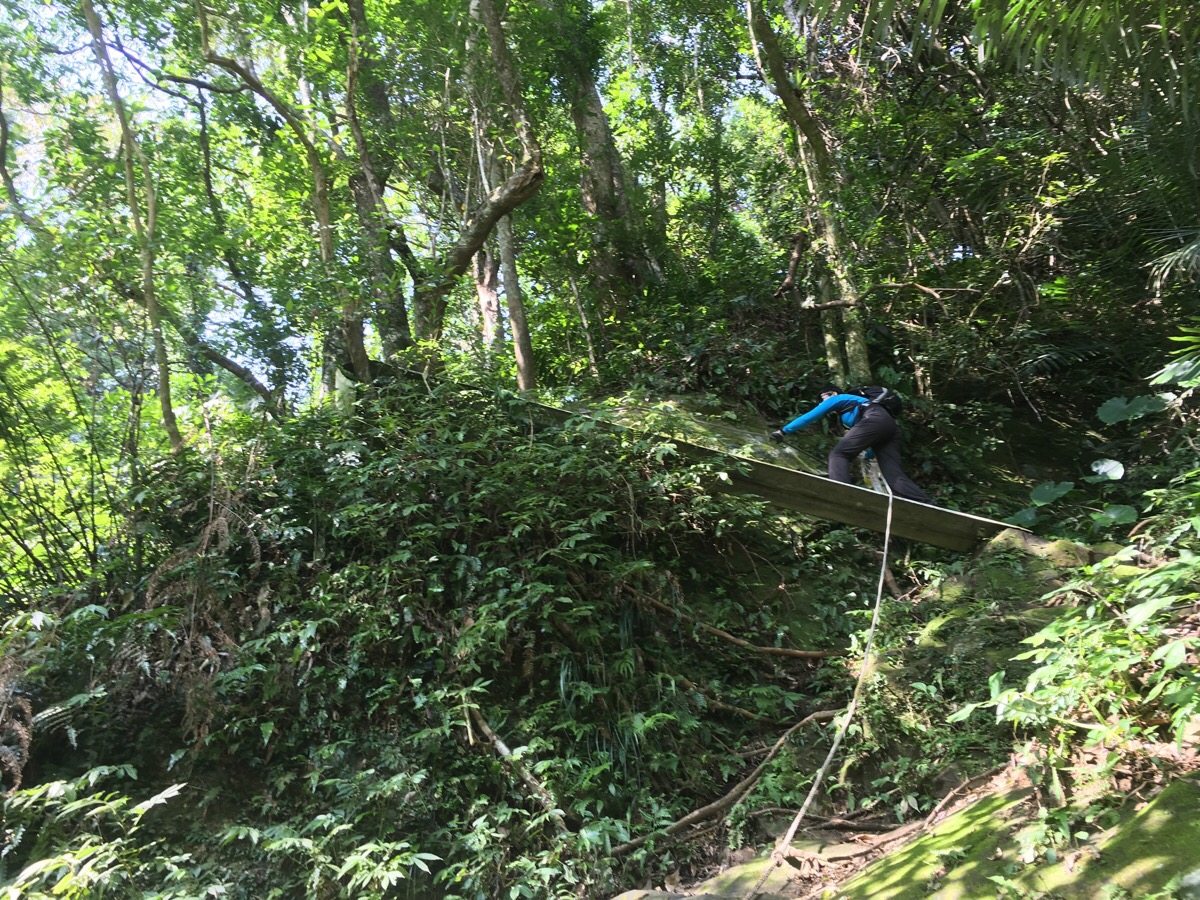
13:50 – Puzzlingly, there is a length of crash barrier spanning a difficult to cross section. I would not have enjoyed being part of the team which was tasked with lugging this up to here. I also didn’t particularly like climbing over it, since it didn’t seem to be especially sturdy, however I clung tightly to the ropes and braved it.
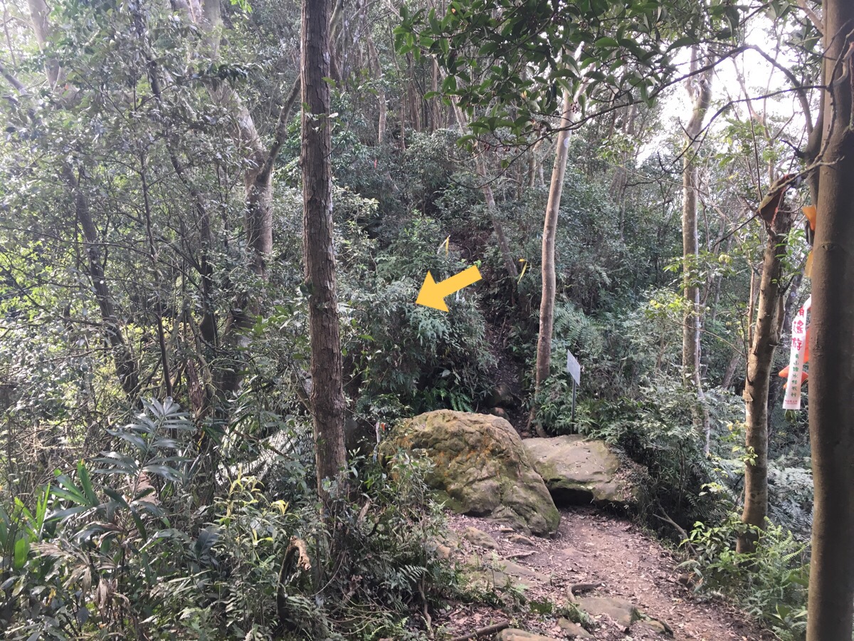
After crossing the water again for a final time on the ascent, we arrived at a short section of rock fall – again without any obvious signs that it had been traversed since falling – although it also looks like this section might be in a more permanent state of shifting.. We scaled it quickly since it seemed unwise to stand down slope of where the debris must have come from.
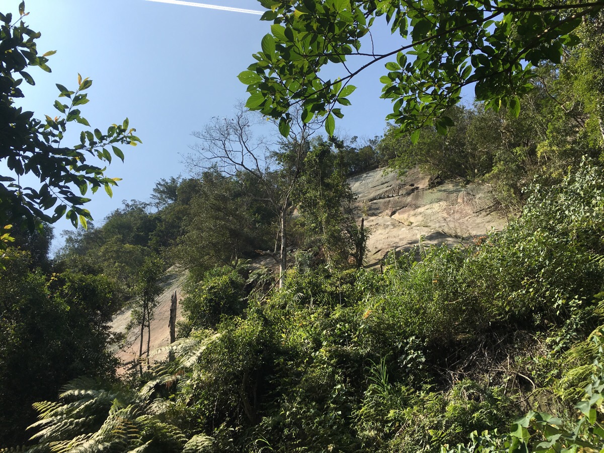
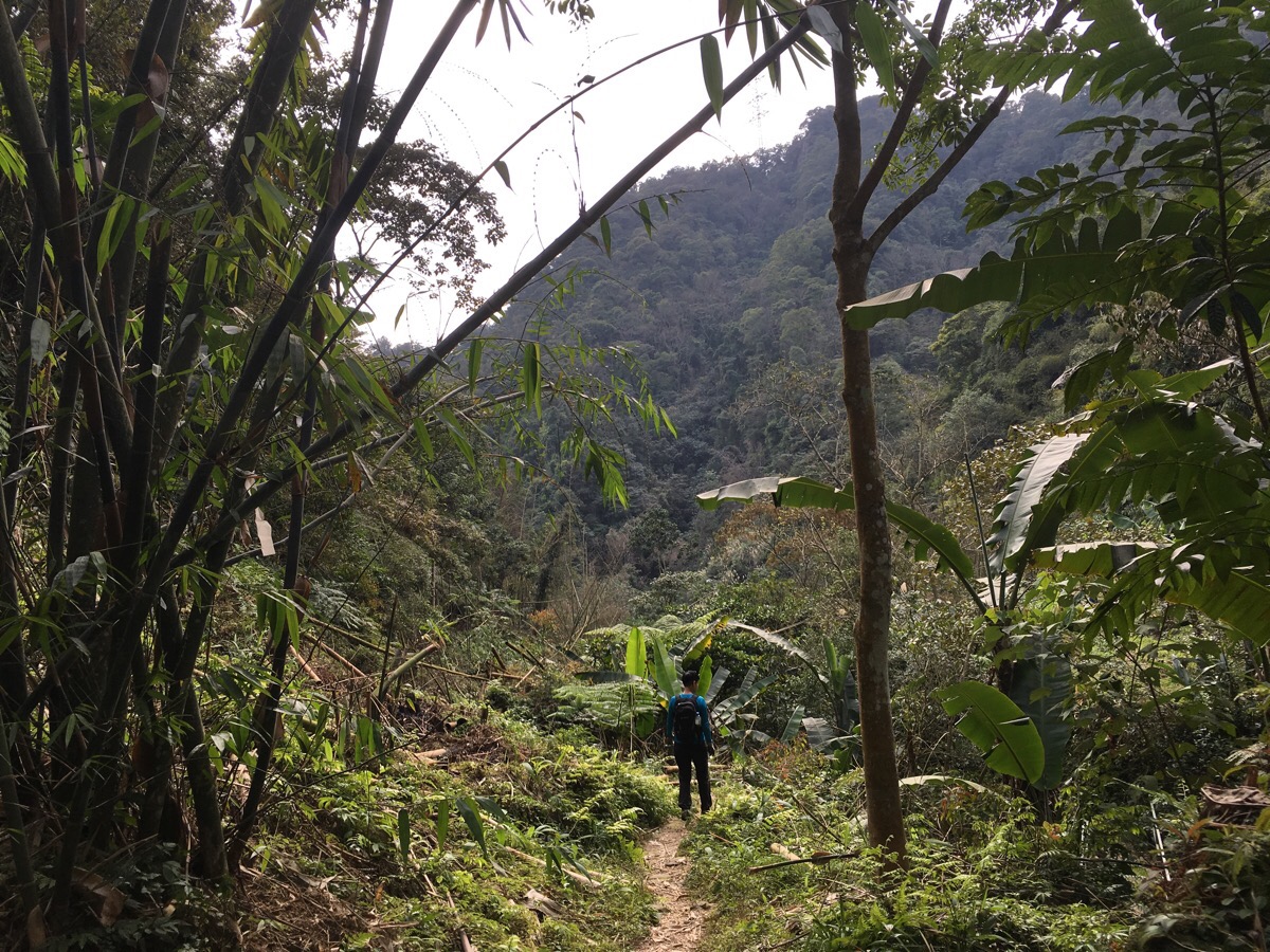
14:15 – Breaking out of the tree coverage for a short time we caught a glimpse of where we were headed, a spine of trees clinging to the top of a ridge over a steep cliff.
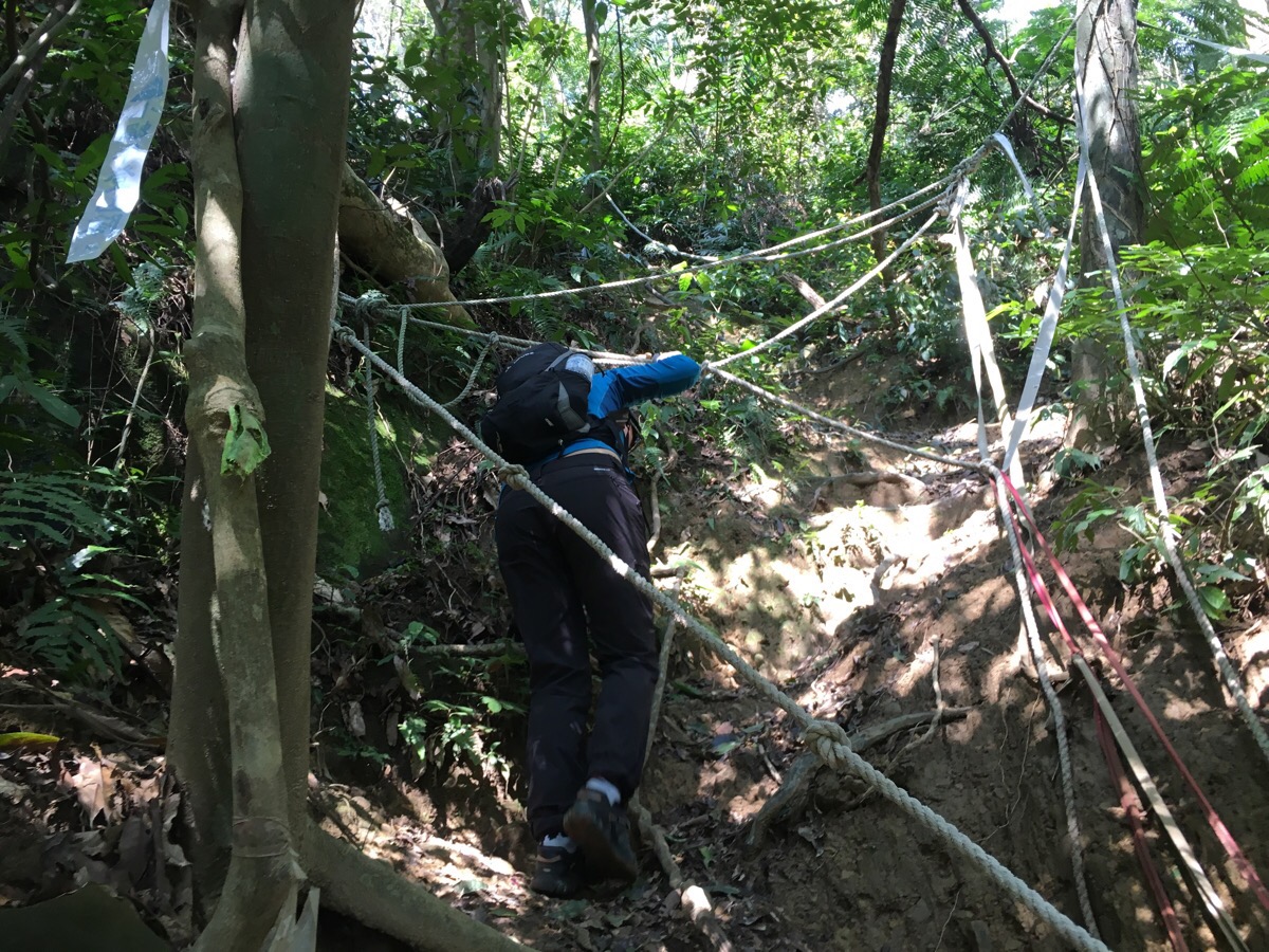
This section seemed excessively roped – especially since it transpired that there was another, easier detour available.
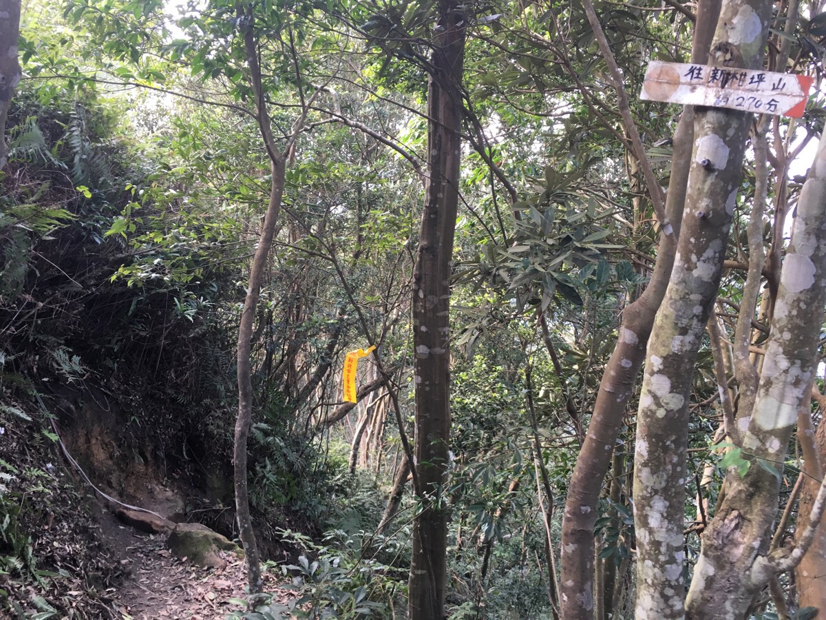
14:22 – We arrived at the ridgeline where the path joins with the route heading east-west just south of Shimen reservoir. We rested a while before taking the left turn up towards 石牛山. (The other direction goes towards 新柑坪山/ Xin Gan Ping Shan. Teresa had seen news on a hiking post from 2016 that there was a large and active beehive in the area and that a guy had died after being stung – presumably it’s not still there after two years, but it’s worth remembering the lifeforms that we share these landscapes with.)
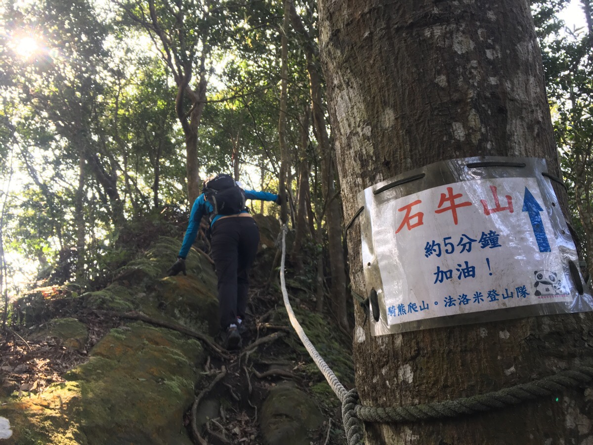
A helpful sign just beyond the junction advises us to keep going for another five minutes.
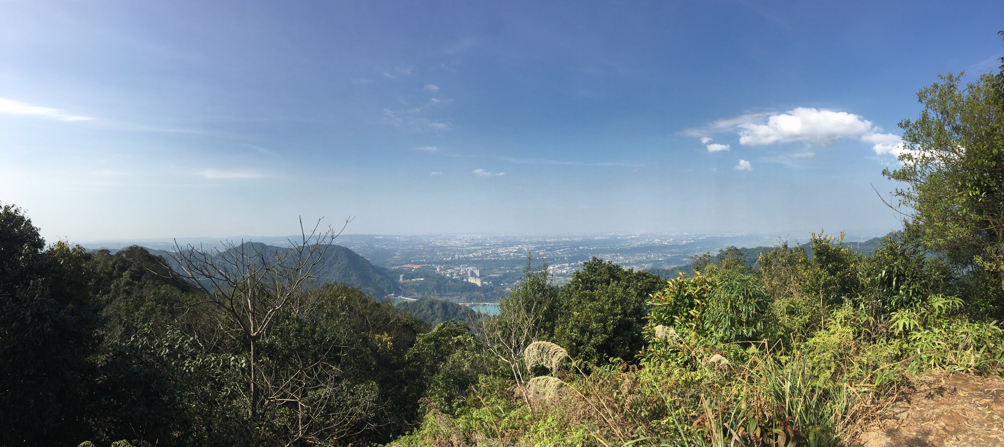
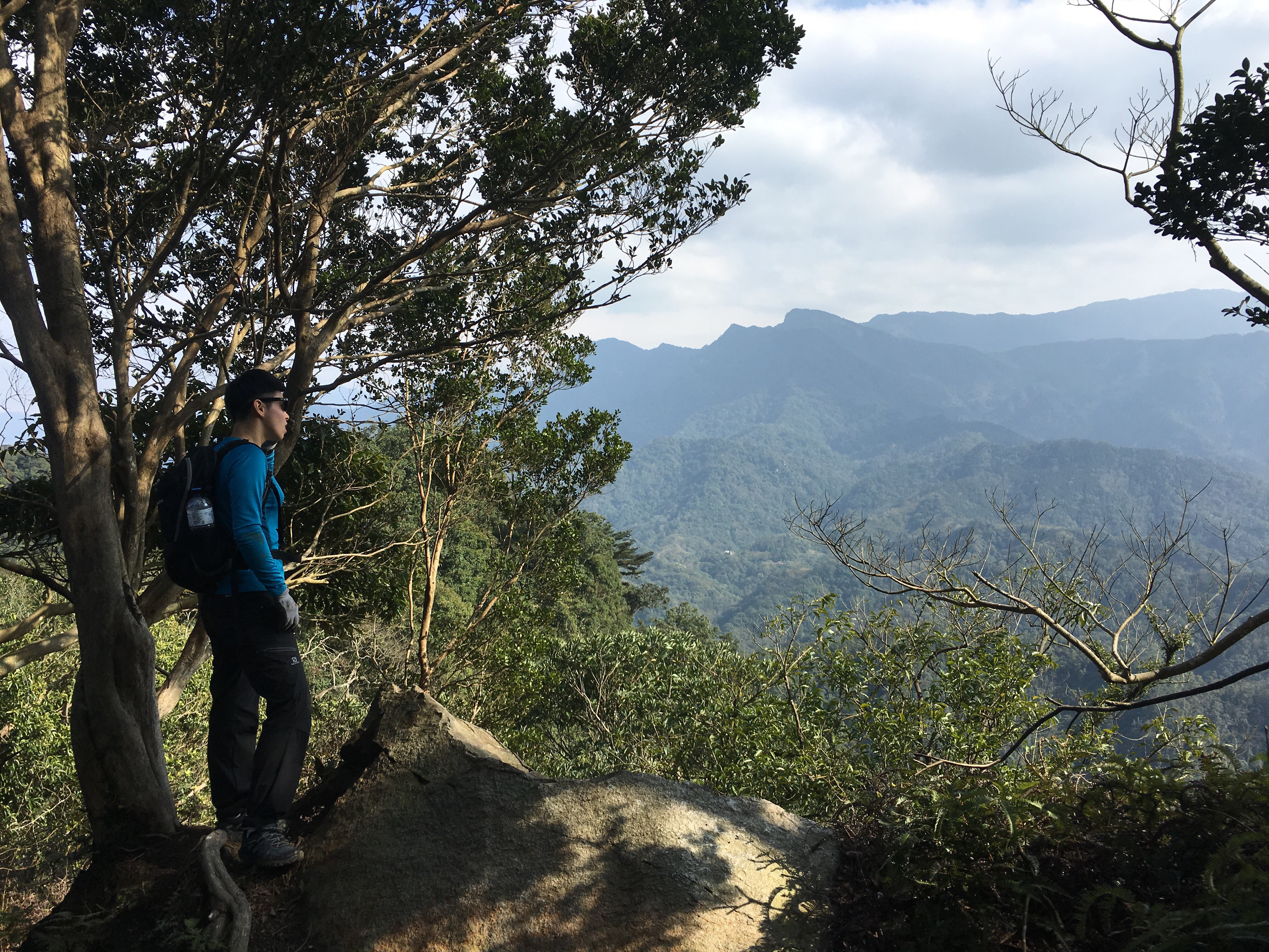
14:36 – The top of Shi Niu Shan is a very comfortable, small rocky plateau with plenty of space to throw down your bag and sit around to take in the views. The largest of the rocks has the peak name carved into it and is possibly the ‘stone cow’ that the mountain is named after. Looking north, you can make out the western end of Shimen reservoir, and beyond that a flat area with three large hangars which appears to be a mysteriously unnamed airport in the Longtan District of Taoyuan.
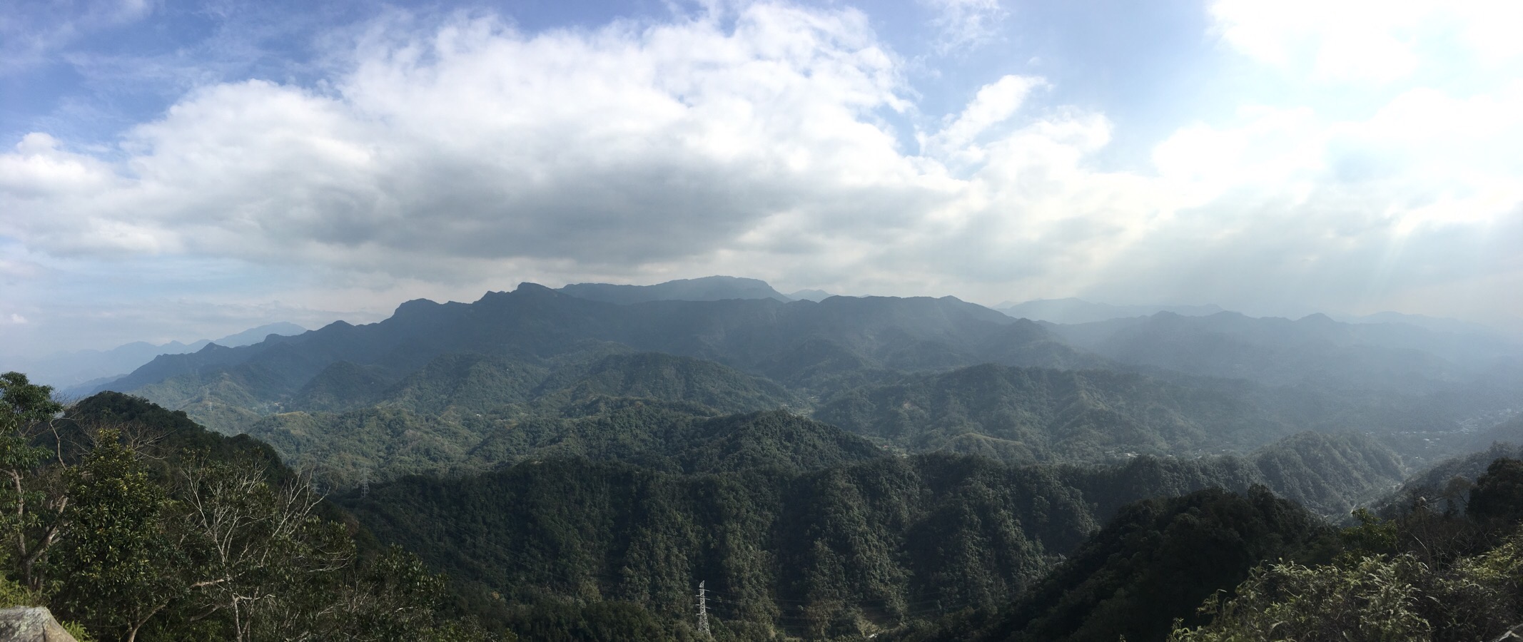
The view south is a stunning, multi-layered and endless sea of mountains – this sort of sight makes you realise that you’ll never be able to do more than scratch the surface of what Taiwan has to offer.
Whilst we were having a little rest on the top, a husband and wife in their fifties showed up, coming from the other direction – they must have parked after us because they asked if the car in the parking lot was ours. They were a funny pair, and we helped them take a picture together before we headed off to let them enjoy the view by themselves.
15:10 – We left the peak by the same entrance we’d came in, but then turned immediately left (we’d come up from the right side).
15:12 – The ridge path continues straight here, but we headed left down the slope.
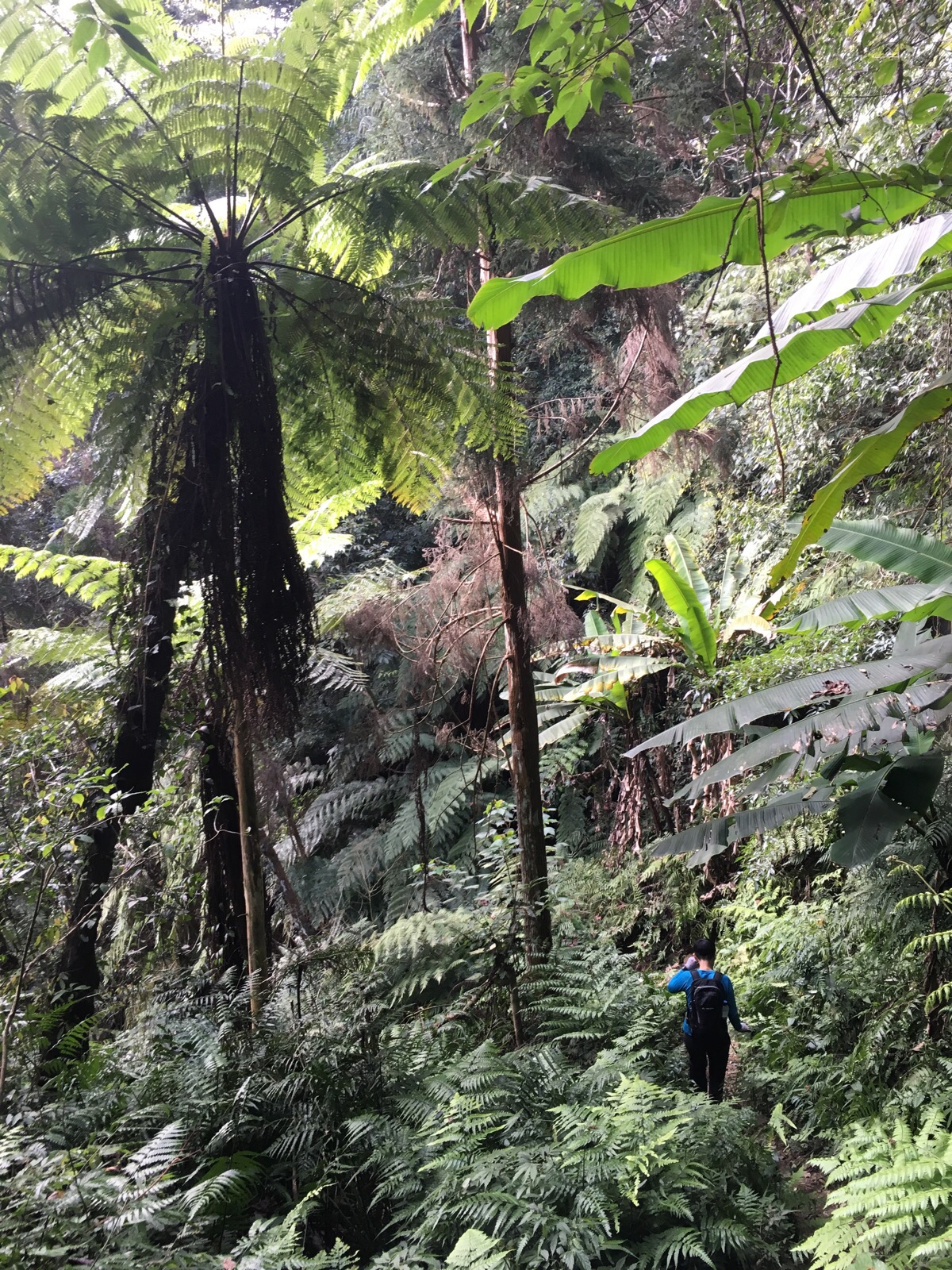
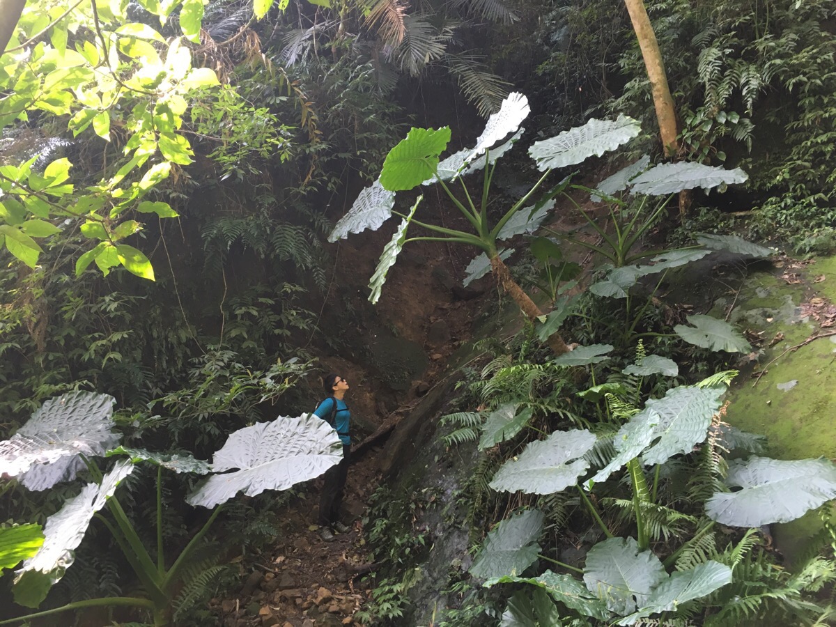
This path was a whole lot easier than the way we came up which meant I was able to enjoy this crazy prehistoric-looking jungle. So many different kinds of ferns everywhere.
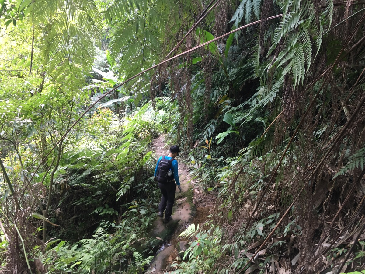
15:30 – There were a couple of minor stream crossing on the way down, but nothing difficult.
As the forest starts to open up into a farmed valley, there is a cable strung high from down to up – presumably used to pulley things up at some point but not obviously recently.
15:45 – A little over 30 minutes after leaving the top, we arrived at a small farm where a newish bridge crosses a stream surrounded by banana trees.
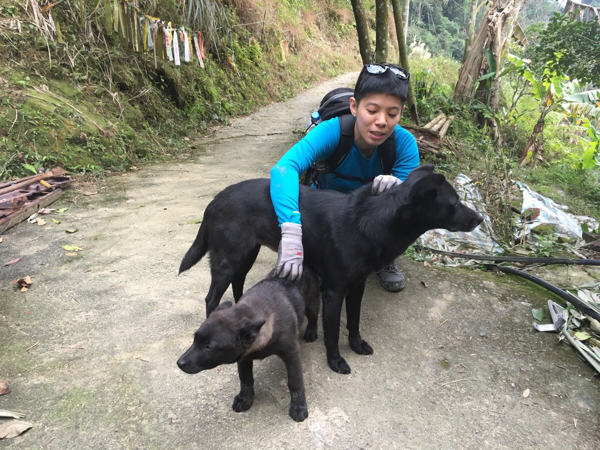
The farm has two ferocious noisy but friendly guard dogs who barked and made a big clamour until scratches and belly-rubs were offered.
15:50 – After they had been petted and stroked enough, we were allowed to pass through, they live in a traditional sanheyuan style building with an extra exterior covered lounge area tacked on to one end. Actually, I was allowed through, Teresa was hassled the whole way for more attention – especially from the rather uniquely coloured pup, (I thought he looked like a pine marten). In fact, we spent so long fussing the two dogs that the other couple who we’d left up on the peak managed to catch up with us at this point.
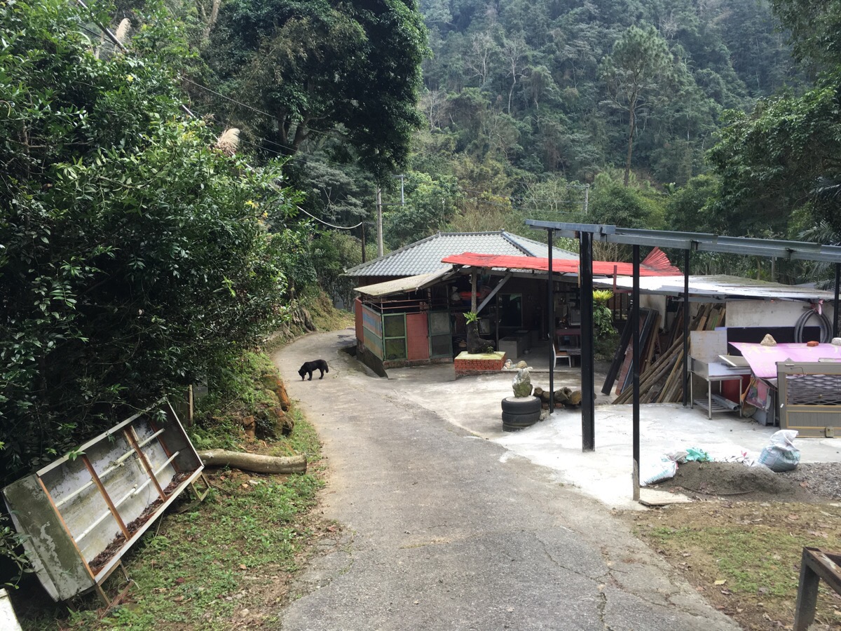
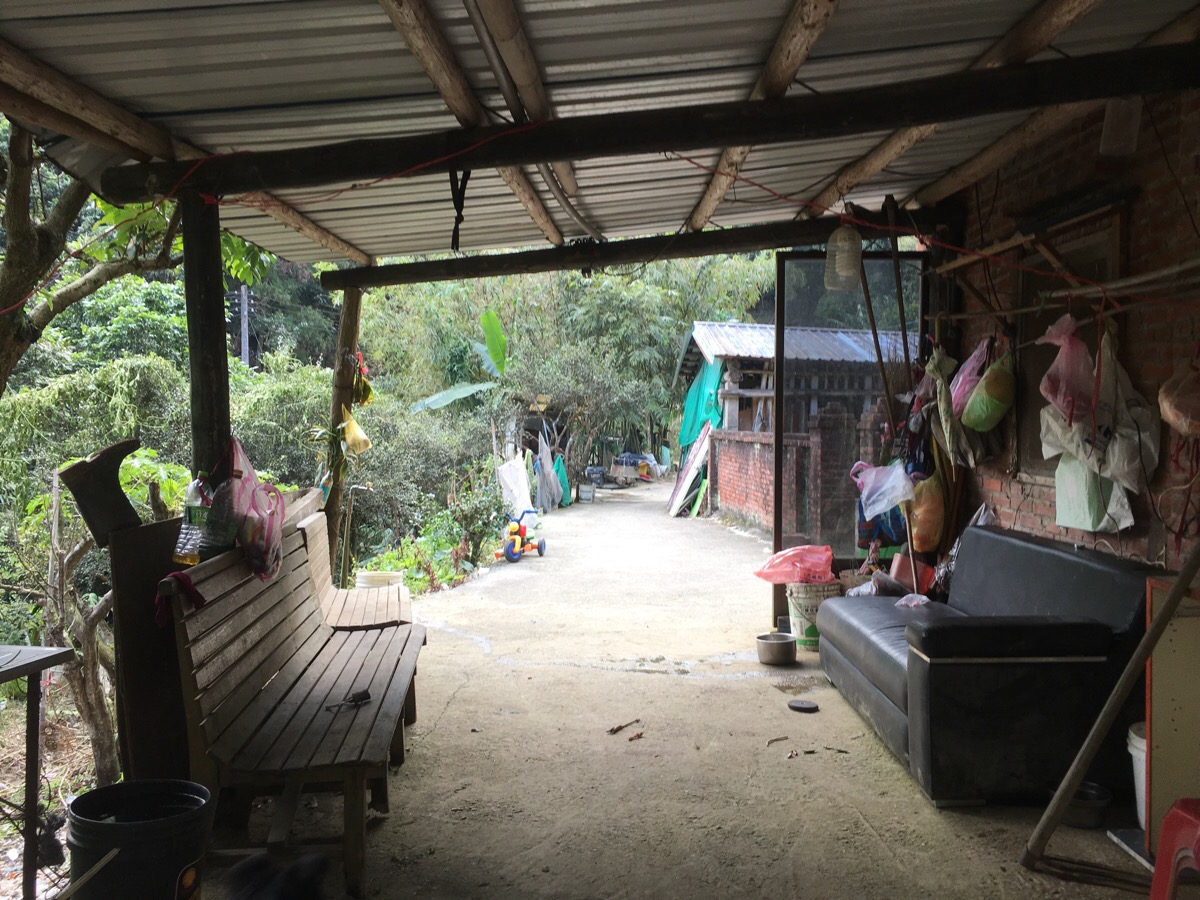
16:06 – The houses and temple where we parked also have a guard dog, but again, he only looks scary, in reality he just wanted to eat his food in peace. We passed him and washed our hands in the temple washroom before climbing into the car to head home.
How to get to Shiniu Shan Trail
Google maps address: 306, Hsinchu County, Guanxi Township, 石牛山登山口 – this is the address of a small temple with a parking lot that hikers can use. According to information that we heard in Chinese, there is normally a $100 fee for parking, but it seems that when we went, there was no one to collect the payments so we parked for free.
GPS location: N24 47.100 E121 14.950
Public transport: it seems that there are a few buses which run near here with Zhongli Station being the nearest largish transport hub – however it looks like it would be incredibly time consuming to do this and would turn quite a short hike into a two-day thing.
Further reading: There doesn’t seem to be anything in English out there, but this Chinese-language blog follows the same route that we took – it looks like one of the bridges near the end has been rebuilt in the years since they did this. This one gives a little more of a general overview, but again it’s written in Chinese.
Mount Shiniu Trail Map
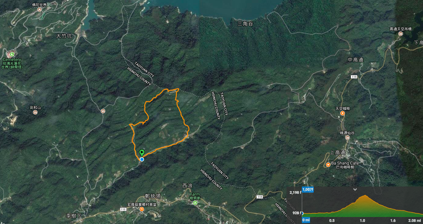
GPX file available here on Outdoor Active. (Account needed but a free one works just fine.)
My new words learnt on this hike:
- 你很易怒 / nǐ hěn yì nù / you are irritable or easy to anger
- 變形 / biànxíng / deformed or out of shape
- 明膠 / míngjiāo / gelatin – we were talking about making marmalade and mango jam, the former sets without the need for gelatin or pectin, but the latter needs some assistance.
- 太小看妳了 / tài xiǎo kàn nǐle / underestimate you
- mbo ginh / (Taiwanese) 沒問題 / no problem

Wow beautiful place
LikeLike
It really is. I would highly recommend Taiwan to anyone who likes mountainous scenery.
LikeLike
It’s in my wishlist now. 😊
LikeLike