Walks listed with the most recent at the top. There might be some overlap between moderate and challenging hikes.
FISHERMAN’S TRAIL: SOUTHERN SECTION (魚路古道南段)
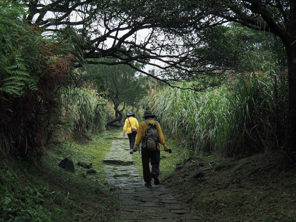 The Fisherman’s Trail is a historic 30-kilometre trading route connecting Jinshan on Taiwan’s northeastern coast with Shilin. This post covers the southern section connecting Qingtiangang with Shilin.
FISHERMAN’S TRAIL: NORTHERN SECTION (魚路古道北段)
 The Fisherman’s Trail is a historic 30-kilometre trading route connecting Jinshan on Taiwan’s northeastern coast with Shilin. This post covers the northern section connecting Qingtiangang with Jinshan.
JINMIAN SHAN SUNRISE HIKE (金面山日出)
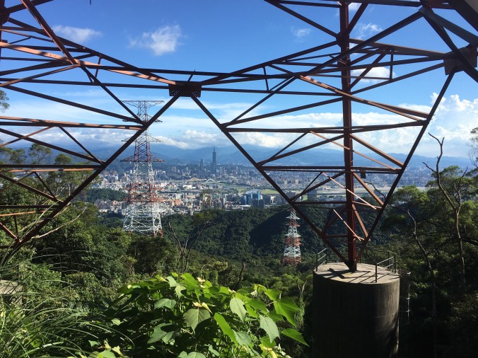
 Mount Jinmian — or more accurately, Scissors Rock —offers one of the best spots from which to catch the sunrise over Taipei and watch the city waking up.
LUJIAOKENG ECOLOGICAL PROTECTED AREA and FENGLIN WATERFALL TRAIL (鹿角坑生態保護區/楓林瀑布)
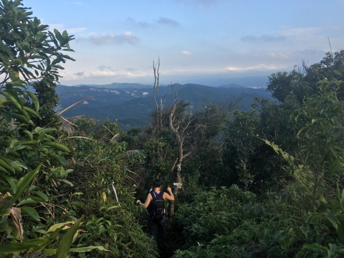
 Tucked into the northern folds of Yangmingshan National Park, Lujiaokeng Ecological Protection Area and Fenglin Waterfall can only be accessed by those who have applied for a permit. Don’t let that put you off though, this pretty trail involves lots of stream crossings and the remoteness means you’re all but guaranteed a quiet walk.
SUNRISE on MOUNT QIXING (七星山日出)
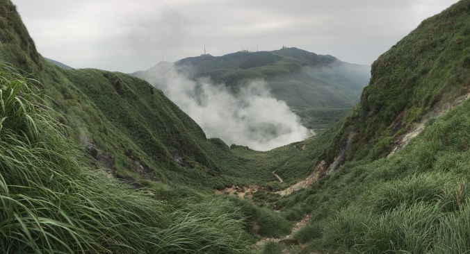
 Watching the sun rise on a new day is always a memorable experience, but a sunrise seen from the city’s highest summit is doubly so. The changeable weather up on Mount Qixing makes it challenging for sunrise seekers, but if you do manage to beat the odds, and get good weather it feels like you’ve won the jackpot.
NEIHU TWIN HEARTS TRAIL (內湖雙心縱走)
 Normally trails draw me because they offer some specific feature or summit. Maybe a waterfall, a unique temple, or a view that stretches for miles and miles. This walk does indeed have many peaks, some temples, a waterfall, and some views, but the real attraction of this trail is the double heart-shaped route it traces on the map.
TAIPEI SKYLINE TRAIL: SECTION 7A
 Section 7A of the Taipei Skyline Trail sees you scaling Mount Guanyin the hard way, before leading you along a quieter stretch of path to the place where Taiwan’s Robin Hood (allegedly) met his end.
TAIPEI SKYLINE TRAIL: SECTION 6B
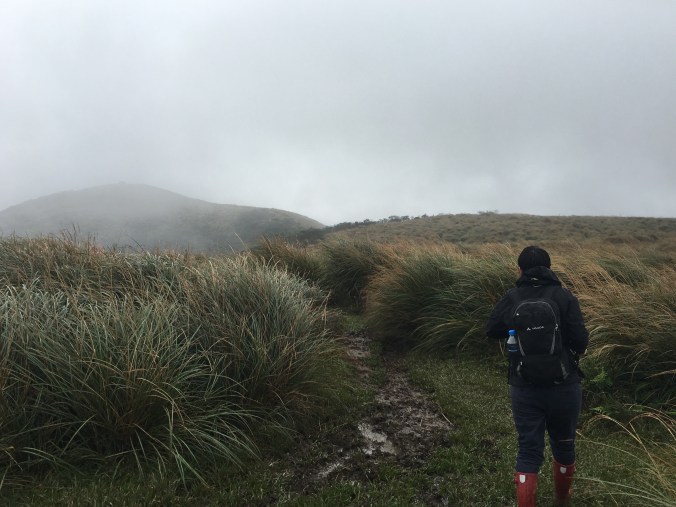
 This section of the Taipei Skyline Trail offers grand views over Yangmingshan Park’s western hills, as it takes walkers over the steep (and often) muddy peaks of the Mount Datun range.
TAIPEI SKYLINE TRAIL: SECTION 3

Straddling Xizhi and Ruifang Districts, Section three of the Taipei Skyline Trail offers a good workout, a few views, a historic fort, and one of Taiwan’s Minor 100 Peaks.
TAIPEI SKYLINE TRAIL: SECTION 1B
 This section of the Taipei Skyline Trail really packs in the views. Taking you from Caonan in the east to Shiding in the west, it offers thrilling climbing and some tantalising views over the famous Huangdidian Ridge.
TAIPEI SKYLINE TRAIL: SECTION 1A
 Climbing from the cerulean waters of Xindian River, this section of the Taipei Skyline Trail takes you up to the ridge line that runs from Bitan over towards Shiding, getting steadily more rugged as it makes its way further east.
ELEPHANT MOUNTAIN to LION MOUNTAIN LOOP (象山/獅山O型)
 Lurking in the hills below Mount Nangang and 95 Peak are wild animals. An elephant, a lion, a tiger and a leopard which are collectively known as the Four Beasts. (Ok, so technically they’re hills rather than real beasts.) This loop takes in two of the four, and explores some of the lesser known trails in the area.
THUMB MOUNTAIN SUNRISE (拇指山日出)
 There is something undeniably special about hiking up through the thinning dark to watch the sun cast its first rays over the landscape. This short trail in Taipei’s Xinyi District offers a great vantage point to see the sun come up, and observe the city as it gets ready to start a new day
TAMSUI-KAVALAN TRAILS: FUYANG ECO PARK to SHENKENG (淡蘭古道南路:富陽自然生態公園/深坑)
 The first step on the southern span of the Tamsui-Kavalan Trails, this walk takes you from Da’an District over the hills to the popular sightseeing spot of Shenkeng Old Street. Depending on you view of the town’s famous stinky tofu this is either a perfect reward for a day of hard walking, or sore punishment.
DRAGON BOAT ROCK and YUANJUE WATERFALL (龍船岩/園覺山/園覺瀑布O型)
 This is my newest favourite walk in Neihu. It has a stream, roped sections to tire me out, wonderful views from Dragon Boat Rock, the oldest house in Neihu District, cute little Tudi Gong Temples and a waterfall.
JINMIAN SHAN – a longer route (金面山)
 A great trail taking in one of Taipei’s most Instagrammable spots. This walk can be done in a morning or afternoon and is easy to get to from the MRT.
TAIPEI GRAND HIKE – NANGANG MOUNTAIN RANGE AND FUYANG BRANCH LINE (南區茶鄉大縱走 – 南港山系/富陽支線)
 The Taipei Grand Hike’s southern arm stretches over the peaks of the Nangang mountain range and up to the huge temples and tea plantations of Muzha. In this section, you will experience wonderful views over Taipei, some of the most popular trails in the city as well as some much quieter, less frequented routes. Take in 360 degree views, historic trails, a mountain-side cemetery and a whole load of temples. This walk is a great way to start your Taipei Grand Hike adventure.
TAIPEI GRAND HIKE – BISHANYAN TO JIANTAN (北區稜線大縱走 – 碧山巖/老地方/劍潭捷運站)
 Bisecting the northern and southern portions of the hike, day five takes you along the hills which separate Shilin and Songshan Districts. Here you’ll pass a supposedly haunted temple, the best spot for overlooking Songshan airport, and remnants of Taipei’s military past.
TAIPEI GRAND HIKE – FENG GUI ZUI TO DAGOUXI RIVERSIDE PARK (北區稜線大縱走 – 風櫃嘴/大溝溪生態治水園)
 The fourth installment of the Taipei Grand Hike takes you to some beautiful and quiet corners of Yangmingshan National Park, as well as some of the more popular scenic spots in Neihu. The best thing about this portion is that it has an abundance of water, from the natural and charming stream running alongside Shuangxigou Old Trail, to the manmade Sweet Water Lake, and the easily accessible Yuanjue waterfall.
TAIPEI GRAND HIKE – FENG GUI ZUI TO XIAOYOUKENG (北區稜線大縱走 – 風櫃嘴/頂山/石梯嶺山/小油坑)
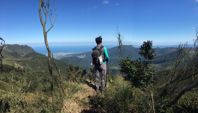
 The third installment of the TGH has you climbing to the highest peak inside Taipei City. Go on a clear day and your effort will be handsomely rewarded with 360-degree views of the surrounding area. As well as big views, this route also takes in some really pleasant forest and ridge scenery on the Mount Ding – Mount Shiti Trail.
TAIPEI GRAND HIKE – ERZIPING TO XIAOYOUKENG VIA DATUN SHAN (北區稜線大縱走 – 二子坪/大屯山/小油坑)
 The second leg of the Taipei Grand Hike climbs some of the wilder peaks in the west of Yangmingshan National Park. This section starts from Erziping and takes in three peaks on the Datun Multi-Peak Trail before dipping down into the picturesque scenery of Dinghu. Then finishes by climbing along a stream to the steaming crater of Xioayoukeng.
TAIPEI GRAND TRAIL – SECTION 1 (臺北大縱走-第一段)
 The first part of the the Taipei Grand Hike has you putting in some serious legwork to make it all the way from the flat land of Guandu right up into Yangmingshan National Park. This section takes in art, grand tombs, an irrigation canal, and many, many steps.
MOUNT DATUN MULTI PEAK TRAIL (大屯主峰連峰步道)

Right on the western edge of Yangmingshan National Park you can find a quieter alternative to some of the park’s busier walks. The Mount Datun trail takes in three peaks. Short but strenuous roped sections lead you over the west and south peaks followed by some serious steps up to the main peak, and then a gentle coasting down to finish at Erziping.
DRAGON BOAT ROCK AND MOUNT KAIYAN TRAIL (開眼山/白石湖山/大邱田山/龍船岩O型路線)
A slightly scrappy scramble across several of Neihu’s peaks. This walk has the added bonus of passing some cute little land god shrines and a scenic spot popular with social media fans.
MIANTIAN SHAN AND XIANG TIAN CRATER POOL (面天山/向天池)
 Miantian shan trail offers an easy to follow path over some of Yangmingshan National Park’s western peaks. Go immediately after heavy rain in order to catch sight of the elusive xiang tian crater lake.
95 PEAK AND NANGANG SHAN THE SCARY WAY (南港山步道2號峭壁)
 NOTE: DUE TO A NUMBER OF ACCIDENTS IN THE AREA THE ROPE TRAILS ARE NOW CLOSED. Think the Nangang mountain range has nothing challenging to offer? Think elephant mountain is the height of excitement? Think again. Hidden between the ridge path of the Nangang trail and the network of small paths around the lower reaches, there are a series of more difficult climbs to tackle. This route incorporates the hardest of them all.
XIAOGUANYIN SHAN LOOP WALK (小觀音山O型縱走)
 A moderately difficult and very fun loop hike with absolutely stunning views over Yangmingshan Park’s bamboo cloaked northern hills. This is one of my favourite walks in this area and a must for anyone seeking to get away from the crowds at Qixing peak.
QIXING SHAN ROUND MOUNTAIN TRAIL (環七星山人車分道)
 This circular route is an excellent way to experience some of Yangmingshan Park’s top attractions. Start early and make a day of it to get the most out of this varied walk.
ERGE SHAN VIA NANBANGLIAO LOOP (二格山,南邦寮山)

This short loop at the edge of civilisation offers a quick getaway from the city.
JIAOKENG HIKING TRAIL TO QINGTIANGANG (礁坑古道)
Forested ridges, wide open grasslands, cows – this short hike has lots to offer.
