
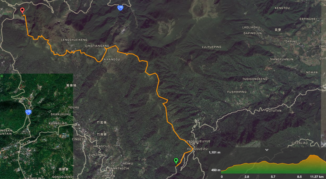
The third installment of the TGH has you climbing to the highest peak inside Taipei City. Go on a clear day and your effort will be handsomely rewarded with 360-degree views of the surrounding area. As well as big views, this route also takes in some really pleasant forest and ridge scenery on the Mount Ding – Mount Shiti Trail.
DISTANCE: The official materials state that this section is about 14km long, but my device measure it as being just over 13km.
TIME: The guide suggests this is a 7-8 hour walk. Doing this by myself, it took me just over five hours, but I think I would be closer to the seven hour mark if I did it with company, I probably would have taken more time to enjoy observing the scenery.
DIFFICULTY (REGULAR TAIWAN HIKERS): 5/10 – This section involves a lot of climbing, and more importantly there is a significant climb in the final portion of the hike when you’re already tired, so it’s difficult from an energy-usage point of view, but otherwise a piece of cake. There are also a lot of uneven stone steps which can be hard on the feet, but just wear good shoes and pay attention. Navigation-wise it should be easy, the signs aren’t great, but just keep aiming for Qixing shan and you’ll get there.
DIFFICULTY (NEW HIKERS): 8/10 – I would recommend that new hikers split this section up in order to be able to enjoy it. Otherwise it’d be too long and tiring. The Taipei Grand Hike (TGH) signage is a little lacking, but as long as you know where you’re meant to be heading next it should be easy enough to follow the signs, the difficulty comes only from length and elevation gain.
TOTAL ASCENT: My device tracked the greatest elevation gain of the whole TGH on this section – 1023m. This isn’t too surprising since it takes in the highest peak in Taipei. Qixing Shan main peak stands at 1120 metres above sea level. However, since the bus stop that you start from is at 450m, that means there is quite a bit of going up and down.
SIGNAGE: The TGH signage here isn’t clear – there seem to be very few stickers compared to other sections. However, the first section from Fengguizui to Qingtiangang is very straightforward and there aren’t really any alternative trails. Then once you arrive at Qingtiangang it’s just a case of following signs towards Lengshuikeng, and from there it’s impossible to miss Qixing Shan (at least on a clear day).
WATER: I took 3L and consumed a little over 2.5 on a warm day (city temperatures 25-30 degrees). If you wish to pack light, it would be possible to stock up again at Qingtiangang and Lengshuikeng as both have visitor centres. I would recommend having at least a litre on you when you start out from Fengguizui and the same again at Lengshuikeng.
SHADE: On and off. I kept having to open up my umbrella when the sun started to burn through the clouds.
MOBILE NETWORK: There are quite long stretches without any reception. I didn’t have any from starting at the bus stop to a little way along the ridge. Beyond that there are black spots every now and again.
ENJOYMENT: 10/10 – I think this may be the section I enjoyed the most. The views are splendid the whole way, from the charming stream portion along Shiti Ridge to the magnificent 360-degree vista that greets you at the top of Mount Qixing. Although the whole path is paved rather than natural, I understand that this is to protect the ground from the affects of so many feet, and it doesn’t detract from the scenery.
SOLO HIKE-ABILITY: The first section of the trail is a little quiet on weekdays, but probably busy on weekends, and the section from Qingtiangang onwards is always busy, regardless of when you go. So you’re unlikely to be on your own for too long if you run into difficulty. The one concern I had prior to starting this trail was that I might encounter the water buffalo, but it seems they’re all enclosed for the time being.
OTHER: It’s worth bringing snacks in case you get hungry along the way, but you can buy basic food supplies at both Qingtiangang and Lengshuikeng visitor centres. The climbs are steep and you’ll sweat a lot, so make sure you take something to replace your salts. Also, it’s quite a bit cooler on the top of Qixing Shan than it is in the city, so you might want to pack a light extra layer. (Given how quickly the weather up in Yangmingshan park can change, that might be a good idea anyway.)
TAIPEI GRAND HIKE PHOTO POSTS: Three – one of the two ‘běi’ characters is at Feng Gui Zui. Then ‘dōng’ can be found at Qixing Shan east peak, and ‘xī’ is on Qixing Shan main peak.
TAIPEI GRAND HIKE OFFICIAL ROUTE:
- Feng Gui Zui / 風櫃口
- Ding Shan / 頂山
- Shiti Ridge / 石梯嶺
- Ding Shan to Shiti Ridge Trail / 頂山-石梯嶺步道
- Qing Tian Gang Grasslands / 擎天崗
- Leng Shui Keng Visitor Centre / 冷水坑遊客服務站
- Qixing Shan East Peak / 七星山東峰
- Qixing Shan Main Peak / 七星山主峰
- Qixing Shan Main Peak to East Peak Trail / 七星主峰-東峰步道
- Xiao You Keng Visitor Centre / 小油坑遊客服務站
OPTIONS FOR SPLITTING THIS SECTION: there are two choices for splitting this section, either at Qingtiangang or Lengshuikeng. Both places are served by a bus. I think Lengshuikeng is maybe a slightly better place to stop since that just leaves the final climb.
MAP:
GPX file available here on Outdoor Active. (Account needed, but a free one works just fine.)
DIRECTIONS:
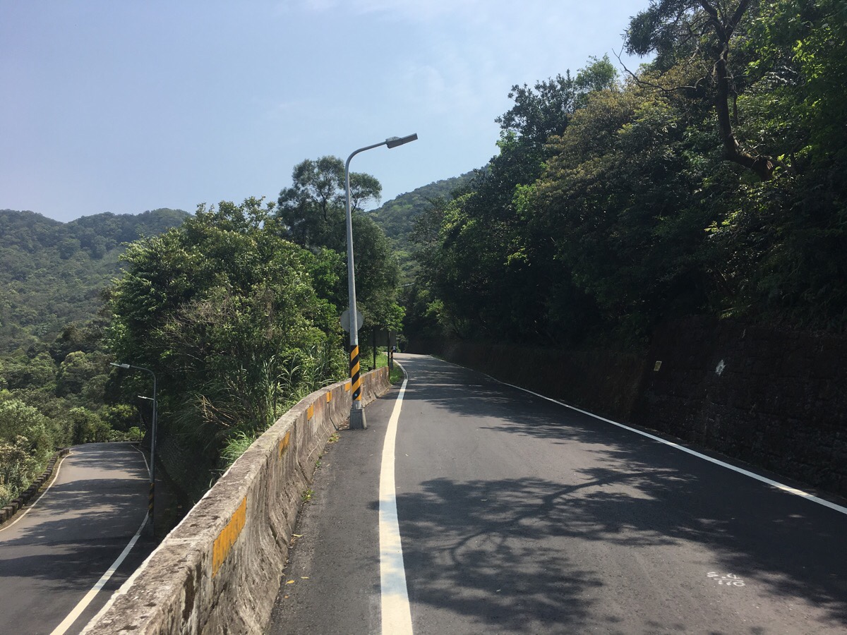
00:00 – I got off the bus at Feng Gui Zui with three other people. One gentleman who’d come on his own and a pair of guys who were walking together. We all set off uphill, the three men chatting together about their plans for the day. A little way up, a couple of cars and scooters were gathered to collect water where the stream runs under the road. One guy was loading his scooter so full of water that I wondered how he was going to stay balanced. Cyclists zoomed past downhill and others edged their way upwards. I was glad to be walking rather than pedalling.
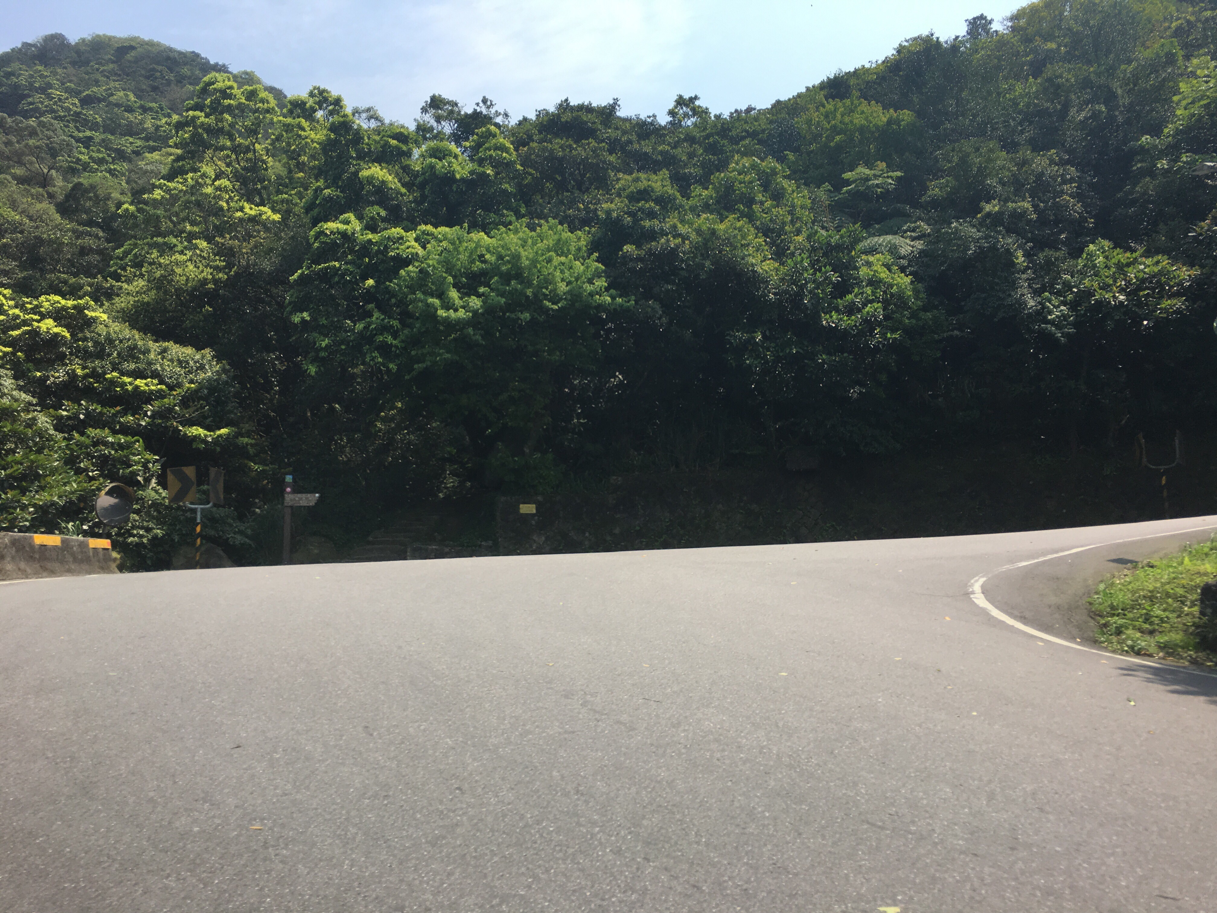
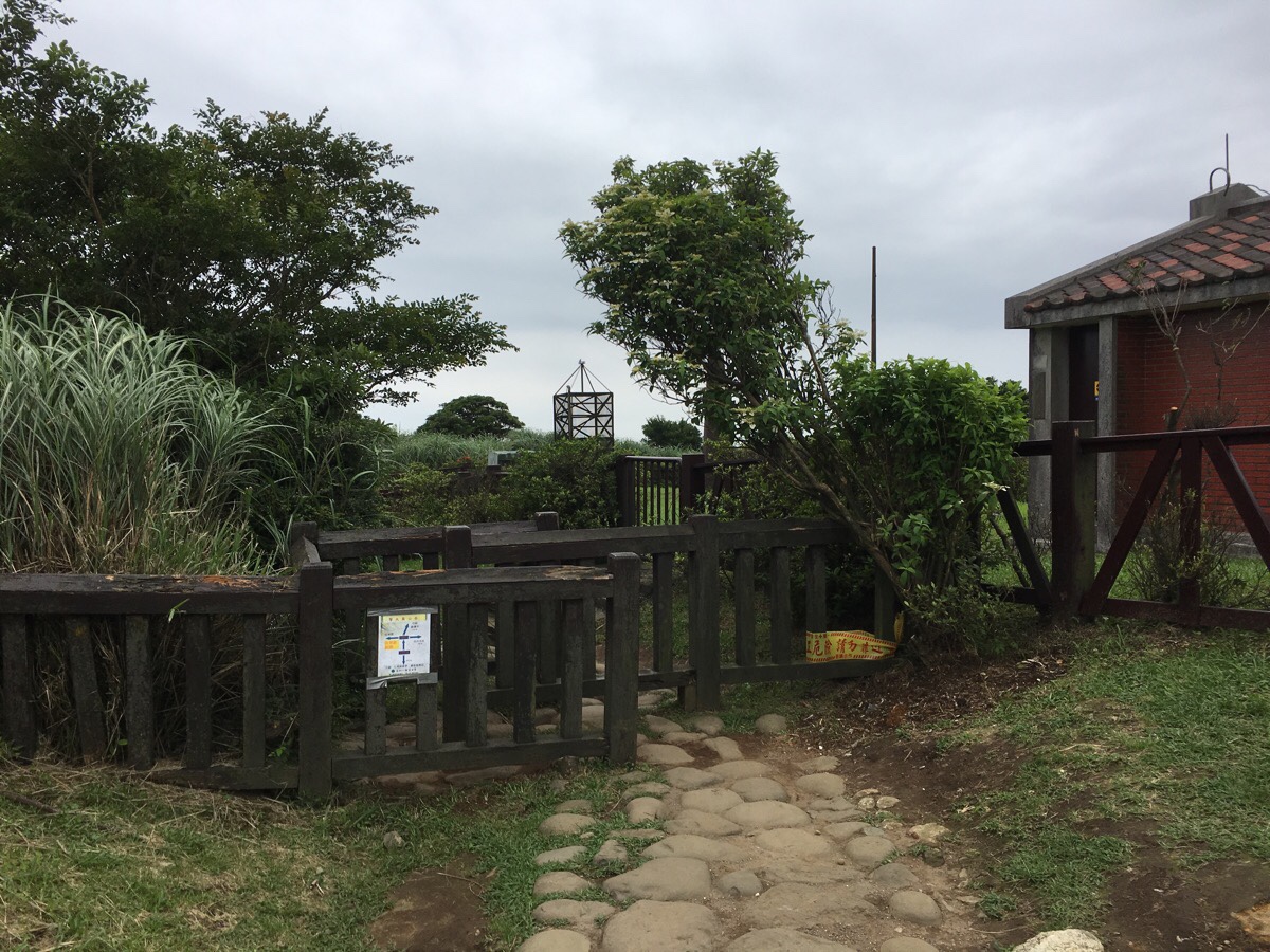
00:07 – At the first big bend in the road I took the steps leading up towards Feng Gui Zui.
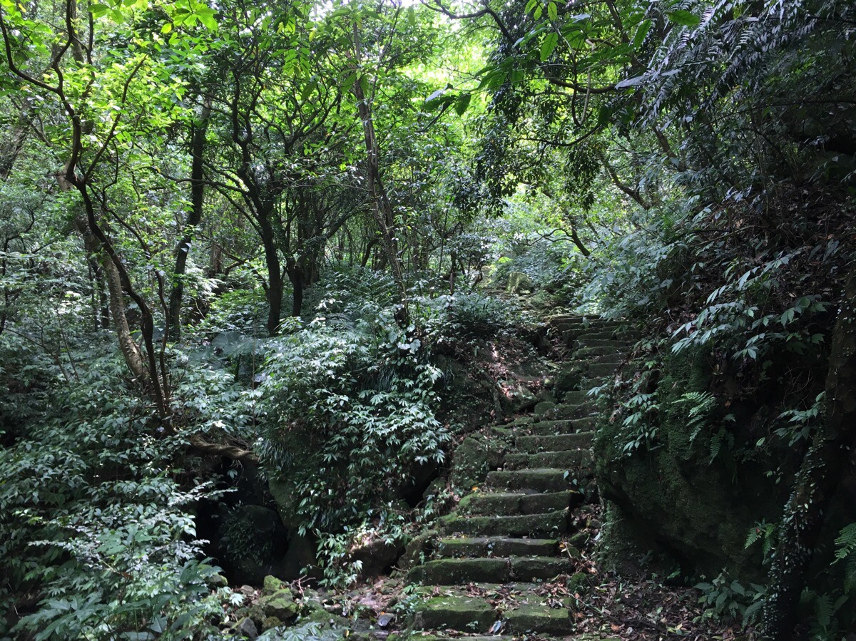
I’d walked down this path once before and I’d forgotten that it follows a little stream. The climb set the tone for much of the day’s walking. I just planted one foot down after the other and got into a rhythm.
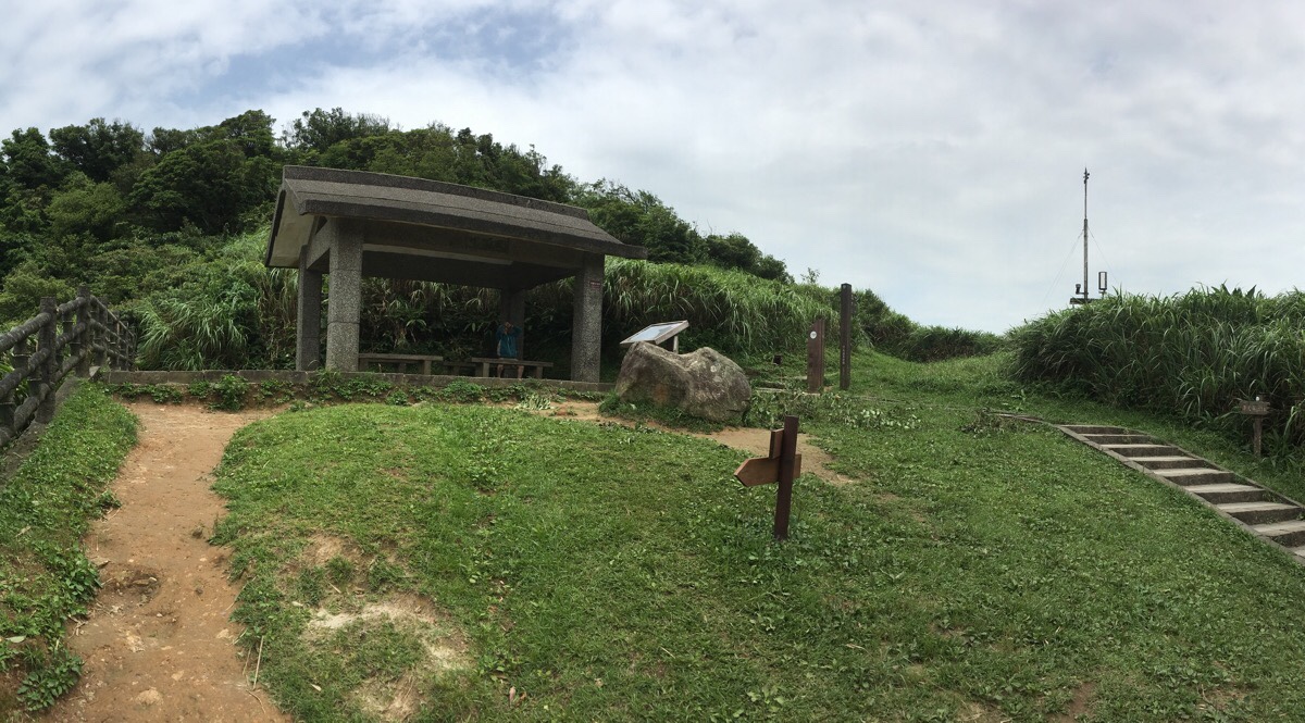
00:15 – A disgusting sight greeted me at the top of the trail. It seems that this spot just down trail from the viewing pavilion has been used as a toilet by cyclists or runners with bouts of sudden, exercise-induced diarrhoea. Some attempt had been made to cover the multiple deposits with tissue paper, but it didn’t really help. What’s more, this must have been done within the last day or two, since prior to that there had been some really heavy rain which would have flushed everything away.
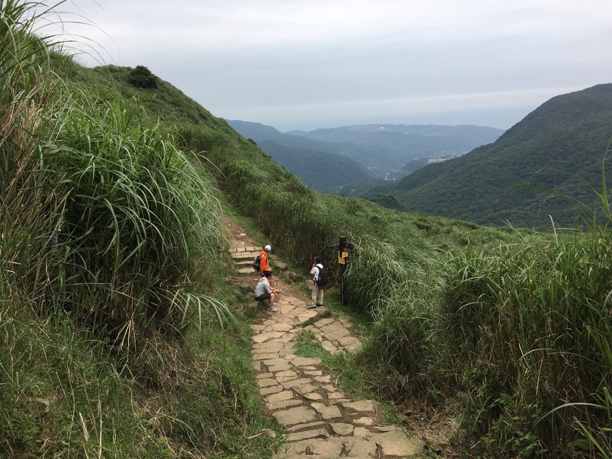
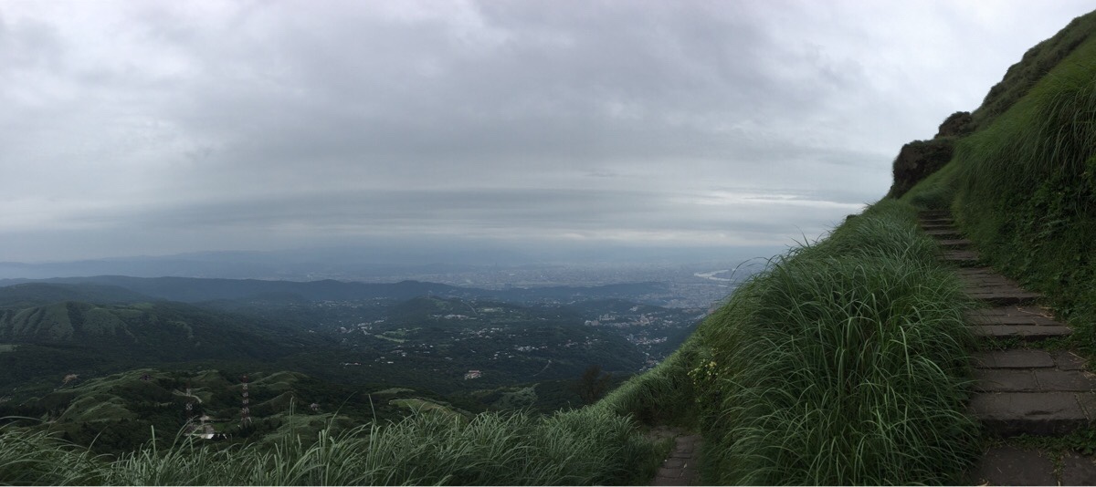
Toilet unpleasantries aside, the view back towards the city from here was nice, and the views just got better and better from here on. I found the ‘北’ post and took a photo, got out a salt candy and got started on the trail leading away from the shelter towards Qingtiangang.
The lone gentleman had started straight up the trail ahead of me, whilst the pair had elected to rest a little before setting off, (that was the last I saw of them). A sign maybe 100m up warns of cattle in the area, but although I saw and smelled signs of cattle, I didn’t encounter any until the enclosed area up at Qingtiangang.
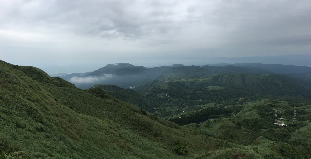
00:29 – The trail climbed and climbed, I overtook the gentleman in front of me and we had the first of many brief exchanges between there and Lengshuikeng. Looking back I could see the ridge that Teresa and I had once walked all the way from Keelung. Just off the coast it was possible to make out Keelung Islet, and between here and there, the mountain road snaking down towards Wanli.
On a level section, I encountered a pair of Taiwan bamboo partridges (not my video, but the behaviour is similar), who had been mud/dust-bathing on the trail. They seemed reluctant to get up at first, but shuffled along once I got a bit closer.
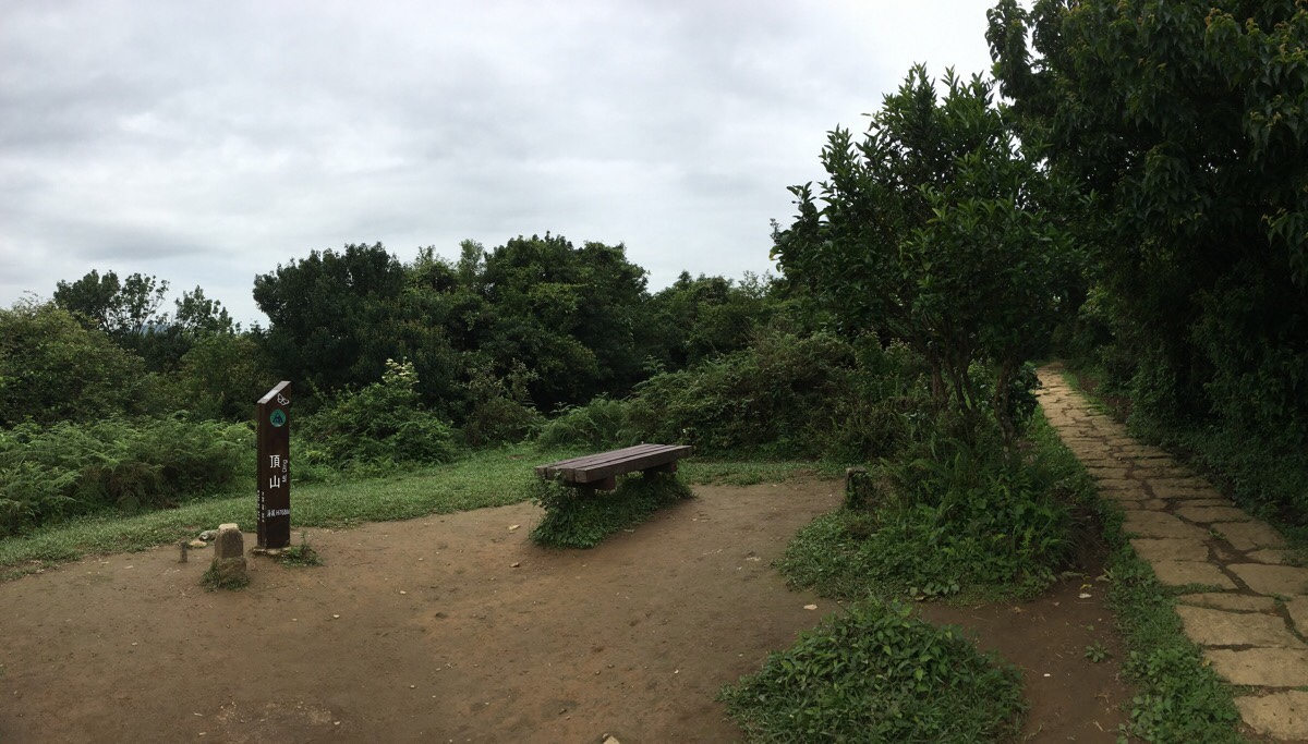
00:53 – After reaching at Ding Shan, the path runs along the ridge for a way, only dropping any climbing a little. It feels good to get up a good pace after all the climbing I’ve been doing of late.
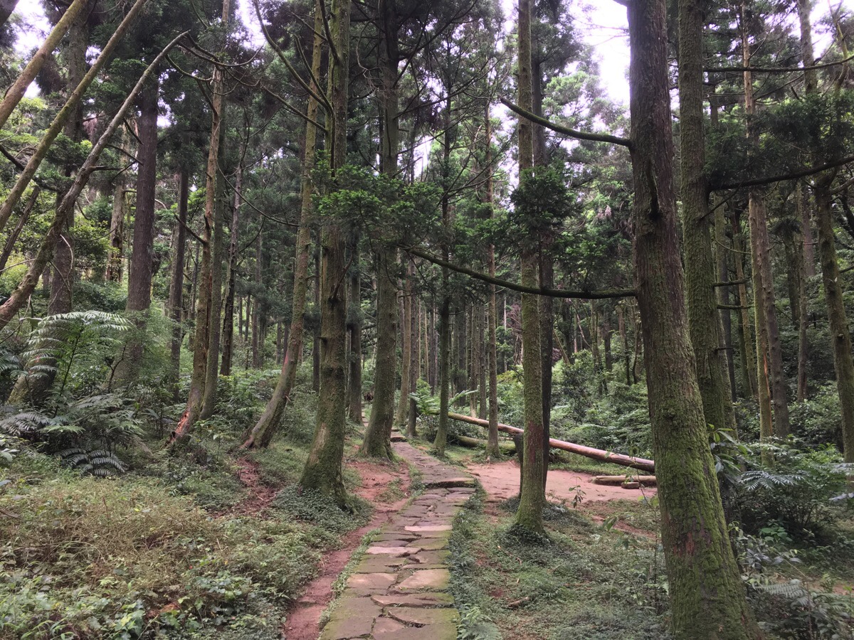
01:02 – My favourite section of the Shiti Ridge Trail comes when the path starts to drop down into a forested area. This is the result of a second drive to carry out reforestation within Yangmingshan National Park. This was carried out by the Yangmingshan Management Bureau in the 1950s-70s, (the first reforestation efforts were made by the Japanese in the 1920s). There was great need for some kind of land management and protection, since the whole landscape had been stripped of trees. But due to the geography of the area, (volcanic soil and seasonally somewhat inhospitable conditions), most attempts to replant the area with lush forest were thwarted when the trees failed to thrive.
Perhaps because it is slightly sheltered in a valley, this stand of Japanese cedars has endured. As the path follows the crease of the valley uphill again, it runs next to a lovely little stream. If it weren’t so early in the walk, I would have stopped for a break here to bathe in the pleasantness of the surroundings.
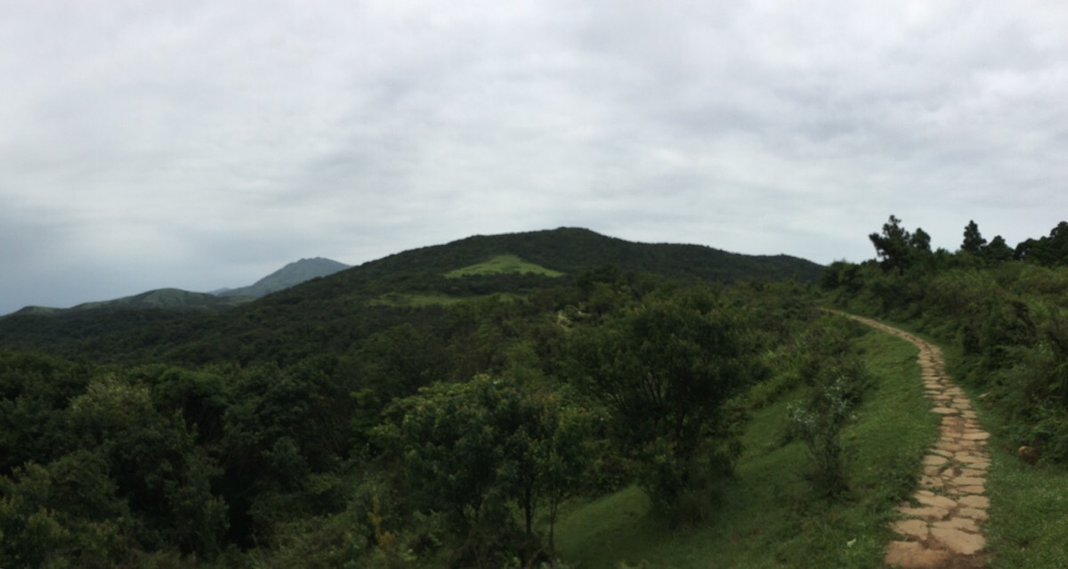
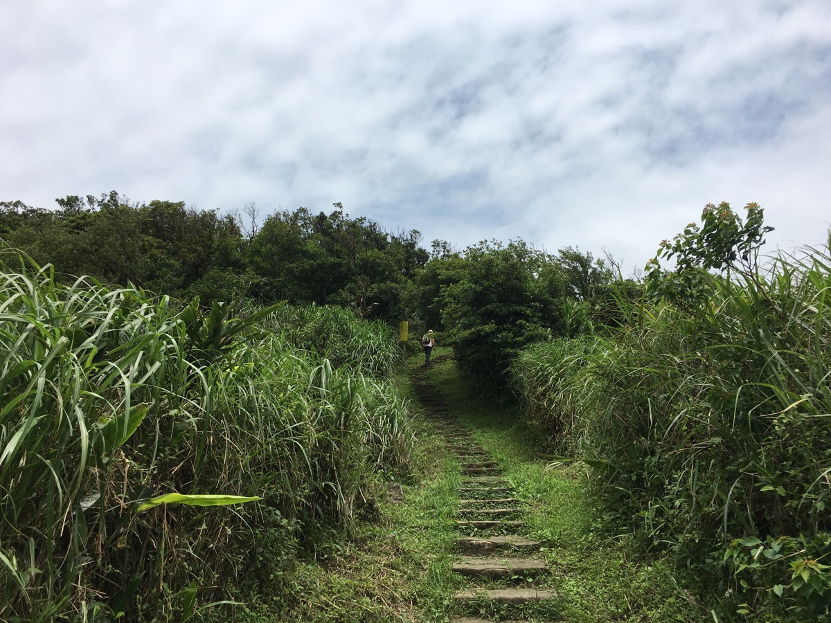
01:14 – Upon emerging from the trees, I caught sight of my destination for the day peaking up from beyond the nearer hills. It seemed both impossibly far away and also not that big a deal. I took out my dried fruit and nuts to keep my legs fuelled as I made my way along the ridge towards Qingtiangang.
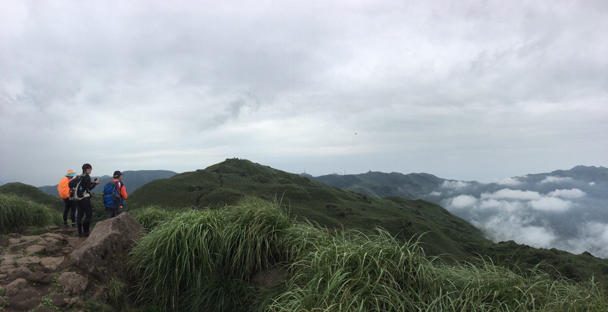
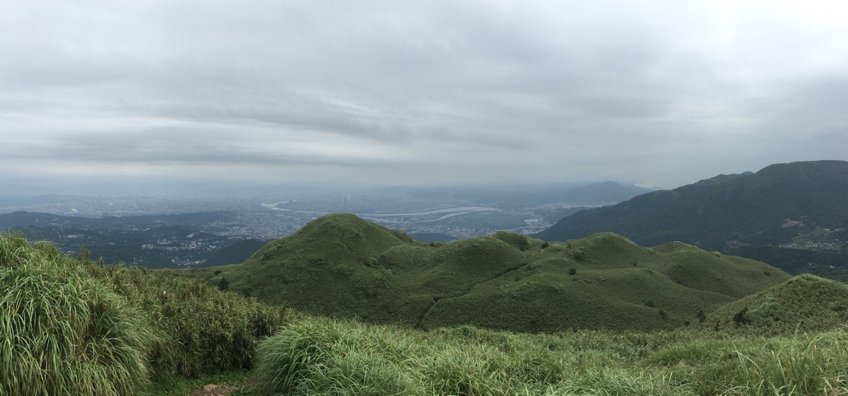
The near high point is Mount Shiti, it took a little over 15 minutes to make my way there. In the triangle-shaped patch of grass halfway up the hill I encountered two wild dogs. They eyed me suspiciously, but didn’t move, and as I was just about reaching the crest of the hill, the number of people around suddenly increased from just me and the guy to many. The ridge running down from mount Shiti to Qingtiangang has some outstanding views in all directions, I felt like my eyes were constantly drinking in the beauty of it.
As the path starts to dip, I encountered a pair of beetles trying to roll dung to somewhere. And a little further along, I passed the padlocked gate which marks the entrance to Mount Huangzui – one of two restricted areas in Yangmingshan National Park.
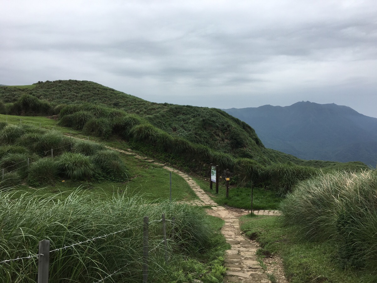
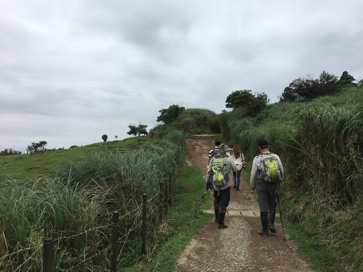
01:56 – Where the path dips down to join the southeastern edge of the Qingtiangang loop, I noticed more wire and signage than there had been before. Bamboo funnel gates had been constructed to allow cows to amble in, (but not out), and signs indicated that the path was no longer passable. I headed straight over at the first junction here just to see if the next bit was walkable.
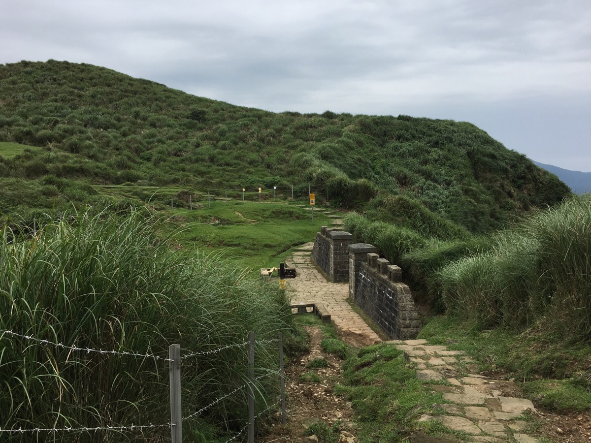
01:59 – But it wasn’t. I had to turn right down through the Jinbaoli Gate. All these new measures were put in place some time last year after a number of attacks during August 2018. It seems that on more than one occasion the water buffalo charged visitors to the site, and now they have been corralled in order to keep them apart from members of the general public. I hope that they manage to work out some way to keep the cows roaming and people out of harm, since it seems like their current area is really quite restricted compared to what they were able to access before.
02:01 – A few steps downhill later, and there was another junction where I headed left towards Qingtiangang Visitor Centre. (The right is the Jinbaoli Trail I think – or maybe the Japanese Trail, they run side by side for a way.)
As I approached the far edge of the grasslands, there were a few water buffalo grazing and a greater number of people observing them. “Don’t stare at its face! You’ll make it angry!” the guy in front of my admonished his friend. “No I won’t, he’s too far away,” responded the starer.
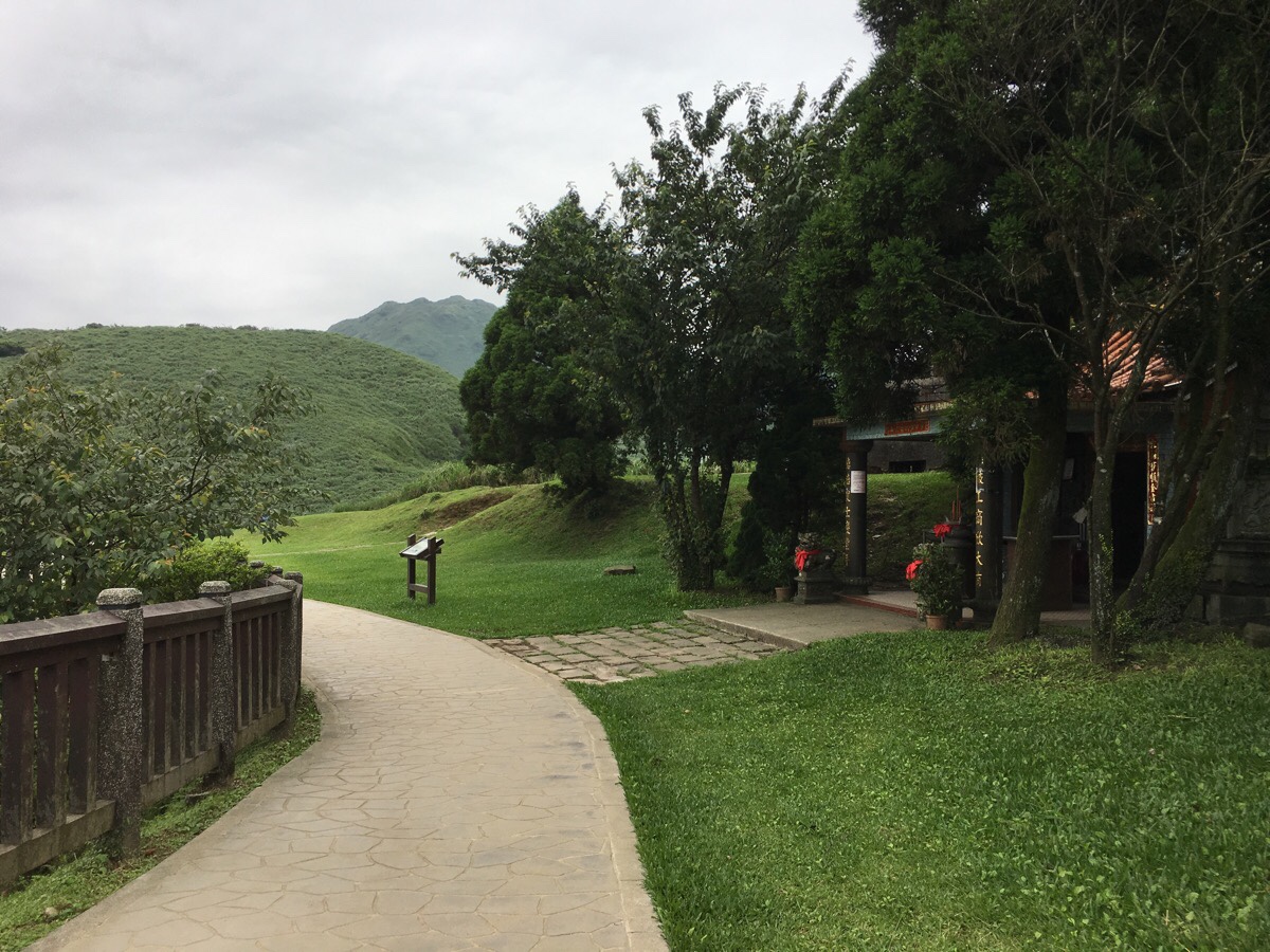
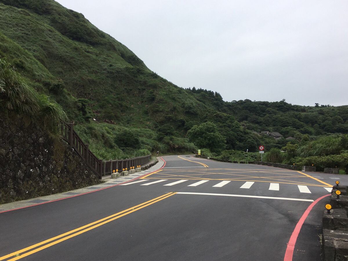
02:08 – The double temple (look closely and you’ll spot a smaller, older one behind and up from the main one), mark your arrival at the Qingtiangang Visitor Centre. The TGH signs here are non-existent, (maybe the trail went through the grasslands before the closures), but you need to veer abruptly left away from the car park.
Before heading this way I made use of the toilet facilities, as did the man in the white t-shirt that I’d been with since Feng Gui Zui. We left at the same time and ended up back on the path together again.
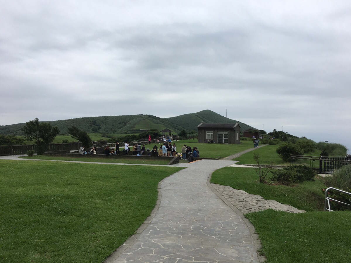
02:14 – This is the view after you have turned left from the previous picture. There was some class taking place and the speaker had just finished.
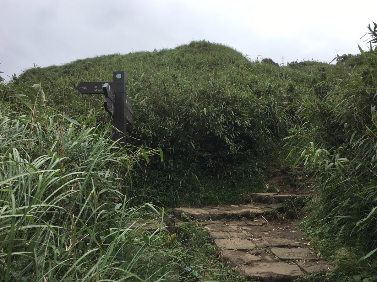
02:16 – Beyond the buildings a cattle gate brings you back to the start of the trail proper. This section is marked as Lengqing Trail in the TGH materials – I am not sure if this is an actual name, or just the result of it being the trail being Lengshuikeng and Qingtiangang.
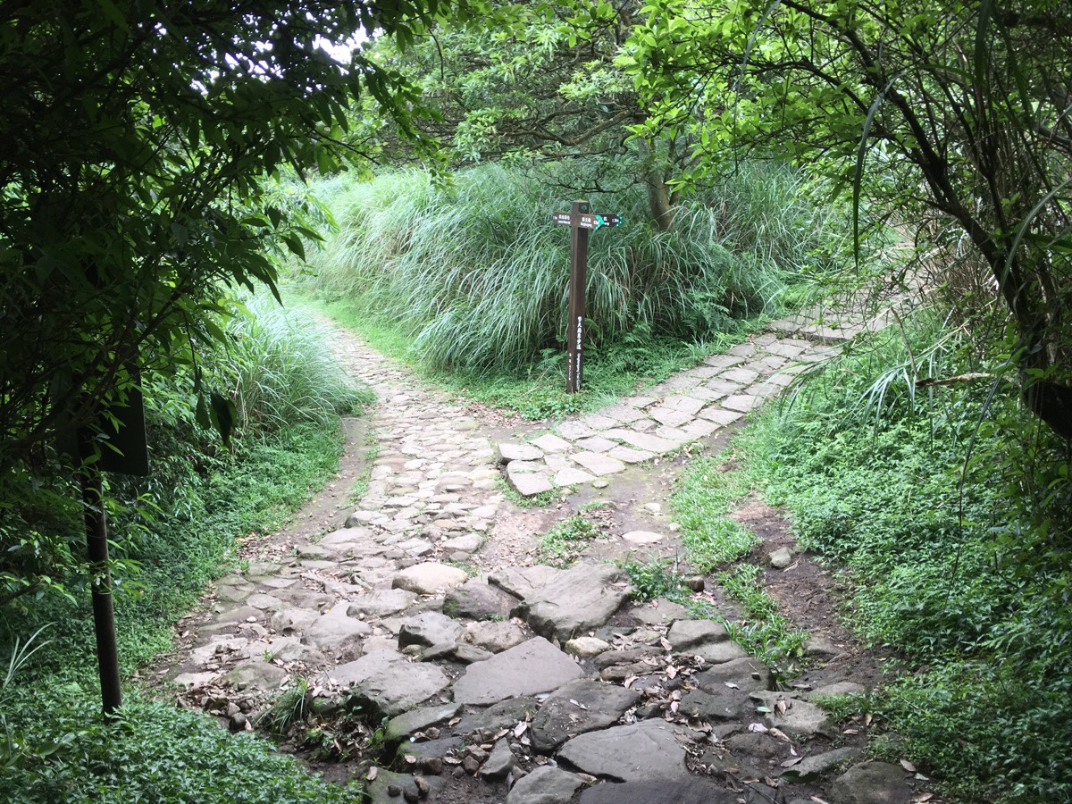
02:20 – A little further down and I felt like I was retracing past steps. From here you just follow signs towards Lengshuikeng, so it was right at the junction.
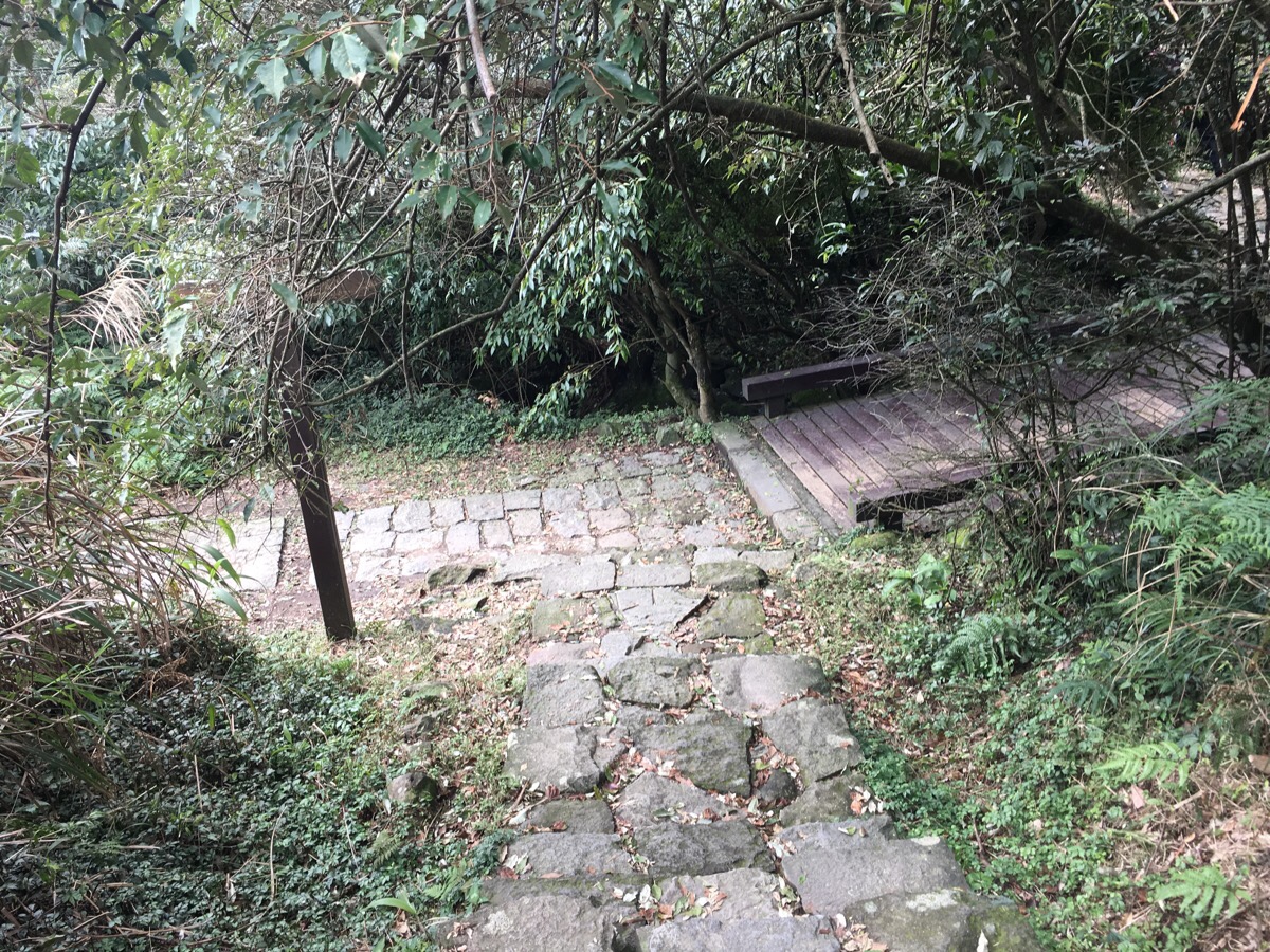
02:22 – Arriving at a wooden bridge, I knew I’d been here before. Twice in fact. Once when I did the Juansi Waterfall Trail, and the second when Teresa and I walked the (now closed) Qingtiangang circular loop.

(Photos between here and Lengshuikeng are taken from the Juansi Waterfall walk since the next several hundred metres cover the same ground and it saves space on the blog.) After crossing the bridge, head left, again following signs to Lengshuikeng. The path climbs up next to a stream for a while and passes the remains of an old dwelling.
Along this stretch, white t-shirt guy had got ahead of me again and I noticed his bag was open, so I offered to zip it up for him, then over-took him again as he chatted to another lady.

02:30 – After reaching the highest point between Qingtiangang and Lengshuikeng, the trail arrives at Jixinlun viewing platform. The first time I went it was really foggy, (as seen here), but this time it was very clear and Qixing Shan was both very visible and rather imposing, not anything like it looked from way back in the hike when I first caught sight of it. There is another path cutting across here, but the TGH heads straight over.

The path heads down through a stand of Japanese cedar trees that have been planted flanking the steps.

02:33 – And at the bottom you can go either way since they both arrive at the same place. The left hand route takes you around the side of Lengshuikeng Ecological Pond, the right just leads through the trees.

02:35 – The two paths reconnect and soon I found myself at Jingshan Suspension Bridge. As I went to cross it, it became clear that the bridge was being used for a photo-shoot. A woman in a white bridal dress was laying on the floor whilst a photographer directed her, telling her to move her head one way but look the other. I thought he had finished photographing her when the white T-shirt guy from Feng Gui Zui arrived and asked what was happening. But I was wrong. At the point, the photographer clambered up – one foot on each railing – and got the groom to lay down next to the woman. The groom had a lot more trouble following the photographer’s instructions. “Move your foot towards the edge!” “No, not that foot, the other foot.” “Yes, that way, but not that foot on top, put the other foot on top.” “No, that’s how it was before! Husband, you are so dumb!” “Hey, how come you want to marry this husband?! He can’t even work out which foot is his right foot!” In the end, the photographer’s assistant had to duck between his legs to go and sort out the groom’s feet, then when the photograph was set up he had to run to my side of the bridge to avoid being in frame, then run back to sort out another misplaced body-part. By the time they had got their shot, queues had formed on both sides of the bridge.

After crossing over, I took a very short detour to take a look at the milk pond – a small body of water which is white due to the presence of sulphur.
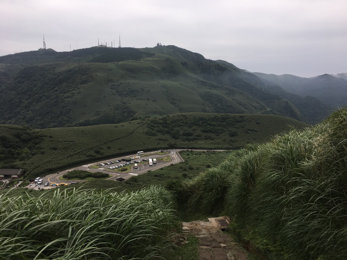
02:46 – At Lengshuikeng Visitor Centre white T-shirt guy disappeared round the back of the building to maybe use the toilets or get more water, and that was the last I saw of him. I didn’t need anything, so I pressed on and headed to the road where I turned right to find the entrance to the Qixing Shan Trail.
02:47 – The trail starts up some steps to the left of the road. It starts with steps and continues with more steps. There are a lot of steps in this portion. This was only the second time I’ve climbed Qixing Shan, the first time was shortly after moving to Taiwan, and that time I did the path in reverse and I missed out on the views due to it being exceedingly foggy. (Incidentally, that time it took us 4½ to just walk up Qixing Shan and then back along the road to where we’d parked – this shows me how much my legs must have toughened up in my time here.)
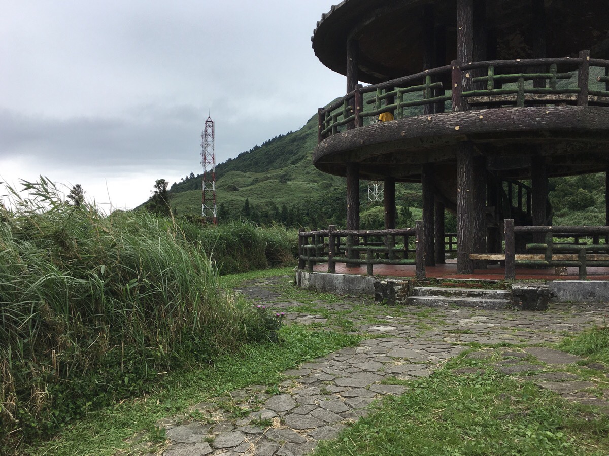
03:07 – Part way up the trail arrives at double-level pavilion. I stopped here for another salt candy, hoping the sugar would help power me up the steps to come.
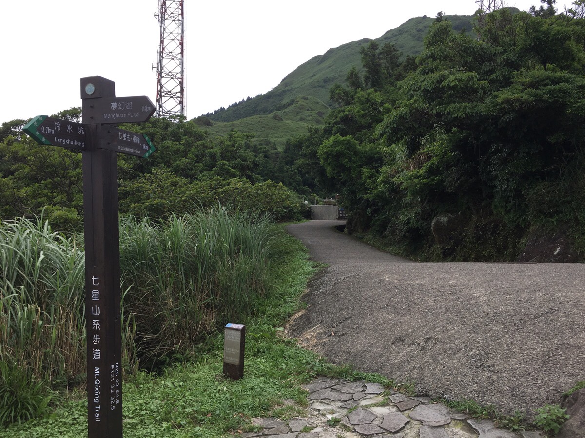
03:09 – Heading on from the pavilion I went straight through a collection of picnic tables and then headed left along the road towards the National Education Radio buildings. A man was strolling around inside the compound with an elderly looking dog.
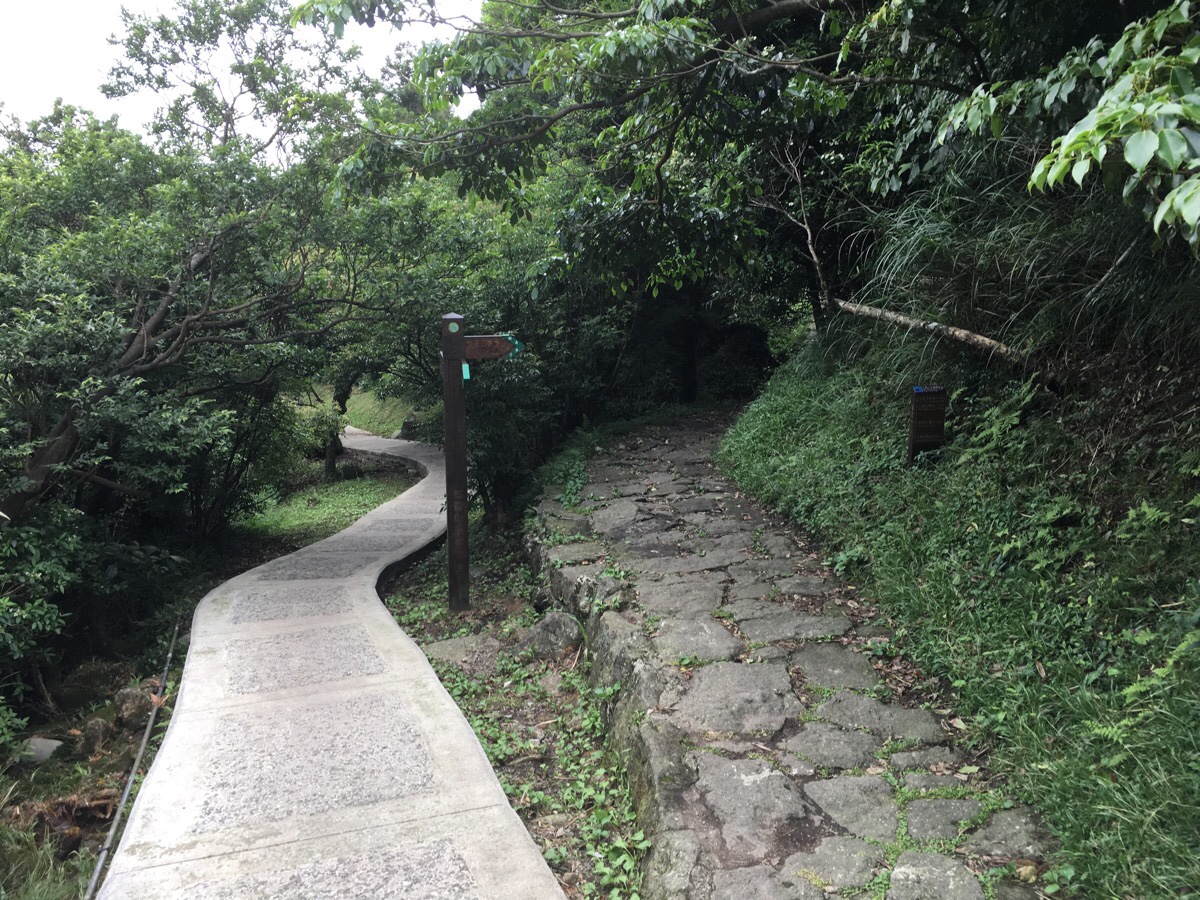
03:10 – The trail curves left around the side of the building, and shortly after that splits in two. The TGH takes the right route uphill on the stony path. (The left turning heads towards Qixingshan Park.)
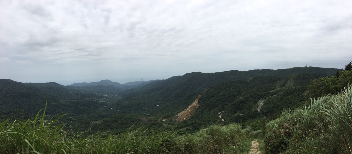
03:33 – Every time I paused for water or to ease the tiredness in my calves, the views behind me were better than before. Looking southeast I could see Taipei basin stretching out beyond the edges of the park.
Looking northeast was even more spectacular. The dark waters of Menghuan Pond sit at the foot of Qixing Shan, (just left of the National Education Radio building and the double level pavilion). And far off in the distance is Jinshan Harbour, (just visible to the left of the image). The high, flat-topped mountain in the distance just right of Jinshan Harbour is Huangzui Shan, (the protected area that the trail passes just before reaching Qingtiangang), and the slightly lower, but also flat-topped and a little bald mountain is Da Jian Hou Shan. The protected ecological area walk is one that’s been on my list for a while. But it involves a little bit of forward planning, so I haven’t gotten there yet.
03:43 – After nearly an hour of climbing I arrived at Qixing Shan East Peak. There were a fair few people already there, some sitting, some admiring the view, and one group of four who were taking increasingly odd photos of themselves with the ‘東’ post. One woman tried to rest a leg on it – her foot level with her head. Another tried to do a little jump and get her photographer to capture her in mid-flight. I think it took them over five minutes to get what they wanted.
From the east peak, it’s possible to make out the main peak just 250m away as the crow flies, and about 10m higher.
03:50 – In a dip between the two highest peaks of Qixing Shan, the path meets another junction, the TGH head right up to the main peak, (left goes back down towards Qixingshan Park).
03:54 – After a short final push uphill, I arrived at the main peak. It was really busy with walkers taking photos, eating and just generally milling around, so I took myself to the edge and had a drink, (not sure why I was feeling antisocial, maybe just because of the large number of people). The views here were amazing, despite the weather being overcast, and I was really glad that I’d made it up here on a clear day, (now I also want to come up on a sunny winter day too – I think it would look extra amazing in sunlight). Looking southwest towards where the path heads down I could see the ridge that Mount Datun sits on, and the arrow of water where the Tamsui and Keelung Rivers meet with the tip of the arrow pointing at Guanyin Shan. This was actually the final section of the TGH that I completed and I feel it has really helped solidify my geographical grounding in this place. Pretty much wherever I am within the city, if I can look up and see mountains, then I know that I have walked there, it is an interesting feeling.
04:50 – After recuperating a little, I started the descent towards Xiaoyoukeng, stopping at the viewing platform part way down and to watch the clouds and steam stream across the landscape. It was hypnotic. A little further down and the path descends through an area of open fumeroles – small vents surrounded by yellow sulphur and ash-grey rocks emit wisps of steam – and in the dip of the valley, the great opening of Xiaoyoukeng kicks up enough sulphuric gases to completely cloak that side of the trail in steam clouds. I’ve seen this many times now, but even so it retains a magical quality – just imagine how people viewed it before we had science to rationalise and explain, it really would have been pure witchery – awesome in the truest sense of the word.
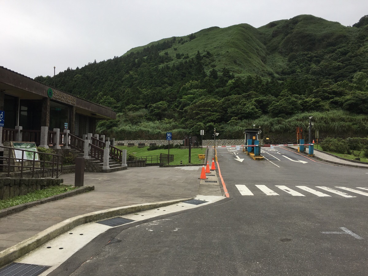
05:03 – After making it through the pungent smoke, the end of the hike (and the end of my TGH journey – maybe), hove into view, and five minutes later I was back at the visitor centre.
HOW TO GET THERE
google maps address: The Feng Gui Zui bus stop is here – you have to walk up the road to the trail head, and it ends at Xiaoyoukeng Visitor Centre. If you plan to split the walk in two, then you can either stop at Qingtiangang Visitor Center or Lengshuikeng Visitor Centre, both of which are served by a bus.
GPS location:
- Fengguizui – N25 07.920 E121 35.830
- Qingtiangang Visitor Centre – N25 10.020 E121 34.470
- Lengshuikeng Visitor Centre – N25 9.965 E121 33.835
- Xiaoyoukeng Visitor Centre – N25 10.610 E121 32.845
public transport:
- The M1 (市民小巴1) service will get you to Feng Gui Zui, it is a scheduled bus service, and it leaves from Jiantan MRT Station. There are just a handful of buses each day, and on weekends you have to arrive at the first stop a good 2-30 minutes early to be sure of a seat. Because this part of Yangmingshan is so poorly served by public transport, it makes sense to start your walk from here.
- If you plan to split the trail at Qingtiangang, you can take either the 108 back to Yangmingshan Park bus stop, or the S15 to Jiantan MRT Station.
- If you plan to split the trail at Lengshuikeng, you can take the S15 to Jiantan MRT Station.
- From Xiaoyoukeng you can either catch the 1717, (this heads back to Taipei Main Train Station via Jiantan), or the 108 back to Yangmingshan Park bus stop from where you can catch buses to wherever.
further reading:
Tony Huang and his wife walked from Fengguizui to Lengshuikeng and it took them about 6 hours including rest time.
These are the beetles I saw rolling dung around.
This is the bit where I come to you cap in hand. If you’ve got all the way down this page, then I can only assume that you’re actually interested in the stuff I write about. If this is the case and you feel inclined to chip in a few dollars for transport and time then I would appreciate it immensely. You can find me on either Ko-fi or Buy Me a Coffee.
