The second leg of the Taipei Grand Hike climbs some of the wilder peaks in the west of Yangmingshan National Park. This section starts from Erziping and takes in three peaks on the Datun Multi-Peak Trail before dipping down into the picturesque scenery of Dinghu. Then finishes by climbing along a stream to the steaming crater of Xioayoukeng.
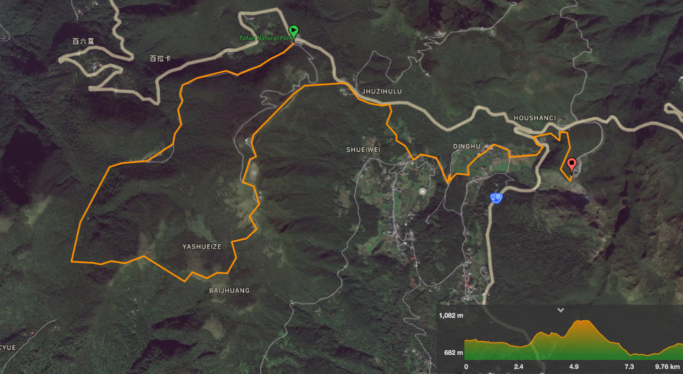
DISTANCE: The official distance is noted as being 13km. My route-tracker recorded 11.3km.
TIME: The TGH’s guidelines are 6-7 hours. It took me 4¼ hours to cover the distance with almost an hour spent resting. If it’s your first visit, I’d recommend that you take your time to enjoy it.
DIFFICULTY (REGULAR TAIWAN HIKERS): 5/10 – for length, altitude gain, steepness and a little confusion as to where the path actually goes. There are ropes and the path gets muddy in places, but it’s fun rather than difficult. This has been one of two sections that have left me sore the next day, (the other was the one which went over the Nangang range – but that only affected my legs).
DIFFICULTY (NEW HIKERS): 9/10 – If you’re new to hiking and want to complete the Taipei Grand Hike, I would save this section to last as a kind of graduation challenge to yourself. Once you’ve completed the other sections, you can be confident that you’ll be able to complete this section too.
TOTAL ASCENT: I recorded a climb of about 690m to a high point of 1086m.
SIGNAGE: The signage is ok for the first section, and if you know which landmarks you’re meant to be passing, but a little lacking in one or two places. I went the wrong way twice, but it wasn’t too hard since I was already pretty familiar with most of the route.
WATER: I got through a little over 2.5L of the 3L that I took with me – the wind may wick away the moisture, but a climb this strenuous is sweaty business.
SHADE: There are large stretches of unshaded walking. I got very lucky with the weather, in that I completed the harder sections (where I wouldn’t be able to carry an umbrella), whilst the sky was still clear, but the sun wasn’t yet too hot. Either way, you ought to take sun protection with you.
MOBILE NETWORK: The network coverage is somewhat patchy out here – I maybe wrong, but it seemed like the west-facing slopes didn’t have coverage, but the east facing slopes did.
ENJOYMENT: 10/10 – this is a very enjoyable walk in a pretty part of Yangmingshan National Park.
SOLO HIKE-ABILITY: If you go on the weekends, you’d find it almost impossible to have much time alone, but I imagine weekdays are a bit quieter. If you’re new to hiking, I would suggest that you find a friend to accompany you, but if you’ve got a few similar walks under your belt, you shouldn’t find it too treacherous. You just need to be careful not to slip on the steep, rocky and muddy sections. And of course, if you plan to go it alone, make sure you have a good map and plan out the route.
OTHER: You ought to take gloves and/or hiking poles for this, and be aware that the temperature will be really quite different to what it is in the city. The peaks of the Datun range are exposed, often windy, and are around (or just over) 1000m in elevation, so it is worth taking a light outer layer that you can use if you need to take a break. As for sustenance, take enough to keep you going for several hours, and I’d recommend taking salt candy too.
TAIPEI GRAND HIKE PHOTO POSTS: There are three characters to be found on this leg. ‘走’ is on Datun Shan West Peak, ‘縱’ is on the southern peak and ‘大’ is on Datun Shan Main Peak. I believe these all came from an older route covering the main peaks of Yangmingshan National Park.
TAIPEI GRAND HIKE OFFICIAL ROUTE:
- Erziping Visitor Centre / 二子坪遊客服務站
- Erziping Trail / 二子坪步道
- Miantian Ping / 面天坪
- Datun Shan Multi-peak Trail/ 大屯主峰連峰步道
- Datun Shan West Peak / 大屯西峰
- Datun Shan South Peak / 大屯南峰
- Datun Shan Civil Aviation Authority Lookout / 大屯山觀測站平台
- Datun Saddle Car Park / 鞍部停車場
- Balaka Highway Pedestrian Trail / 巴拉卡公路人車分道
- Dinghu Calla Lily Trail / 頂湖海芋步道
- Yangming Creekside Trail / 陽明溪畔步道
- Arrow Bamboo Trail / 箭竹林步道
- Xiao You Keng Visitor Centre / 小油坑遊客服務站
OPTIONS FOR SPLITTING THIS SECTION: The only logical way to split this would be to return to Erziping after heading down the Anbu Trail. The first part would be considerably harder than the second part.
MAP:
GPX file available here on Outdoor Active. (Account needed, but a free one works just fine.)
DIRECTIONS:
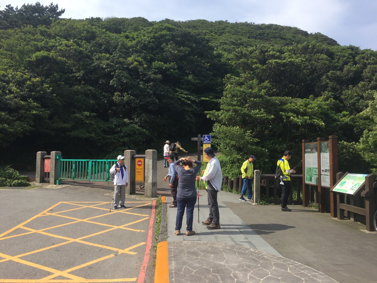
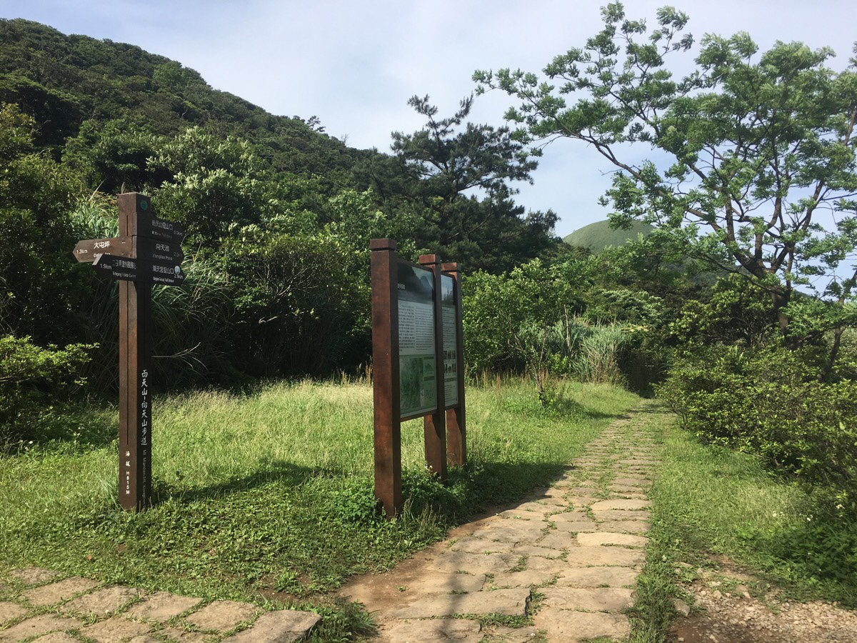
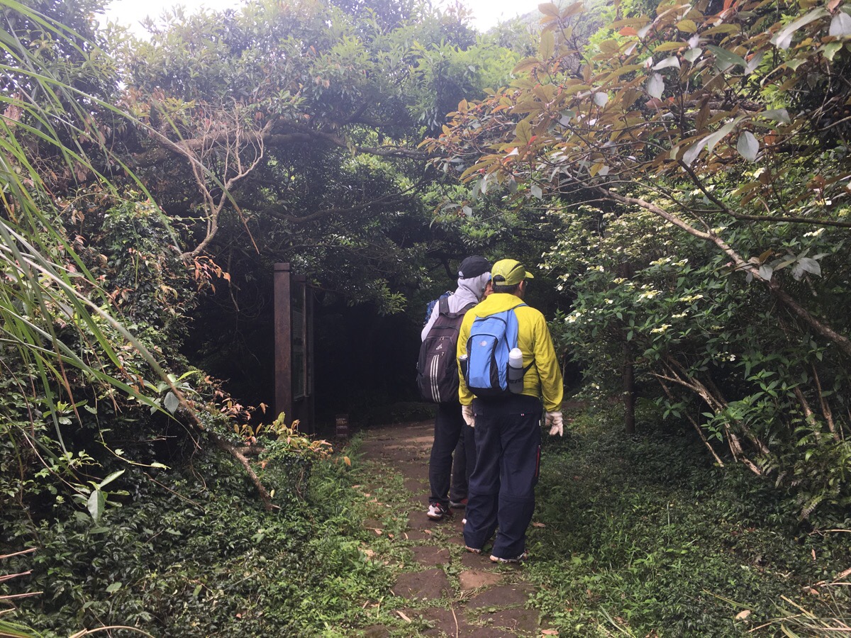
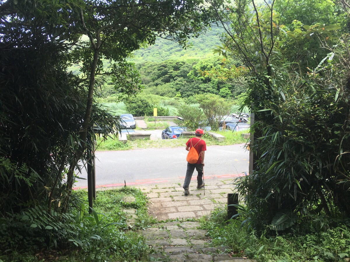
00:00 – After a failed first attempt at this section the Sunday before, I found myself heading back up into the hills of Yangmingshan early on a Sunday morning. The previous week I’d arrived at the trail head around 9:20, but this week I’d managed to get up a little earlier, and I’d arrived by 8:30am. Since it’s the final stop on the route, the S108 minibus empties its whole load of variously-prepared hikers at Erziping. There are toilets here, and a small store selling a few types of food and drink, but it doesn’t open until around 9am. I’d been surprised the week before that the area was already busy, but even at 8:30 it had a very 熱鬧 and lively atmosphere. Large numbers of cyclists were stopping to wash their faces and prepare for the final climb up to Datun Main Peak, sprightly retiree-hikers were out looking far more enlivened than I felt, a few families were already out strolling, and there was even a steady stream of folk walking back towards the carpark – presumably having already made it to the ponds and wanting to head back home for a second breakfast.
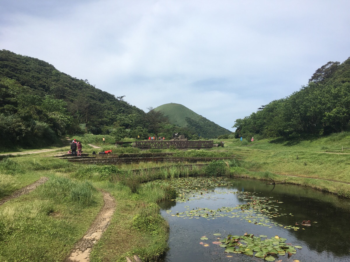
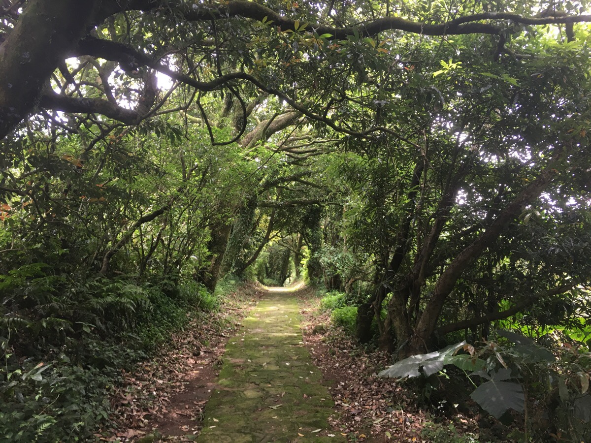
00:18 – The 1.8km Erziping trail is cool and gentle. It is the only barrier-free trail in Yangmingshan National Park, and it appeared to be much appreciated for this reason. I passed a good number of parents with push chairs and families wheeling their elderly relatives in wheelchairs. Signs along the edge of the trail illustrate why Taiwan is so loved by many: “Let those with physical impairments have right of way. Beware of poisonous bees and snakes. Speak softly so that you can enjoy nature.” There’s no guarantee that anyone follows those rules of course, but the thought is there at least.
When the trail opens up at the ponds you can catch a glimpse of Miantian Shan in the distance – easily identifiable by the two passive repeaters atop it.
00:19 – From the far end there is a trail leading away in the direction of Miantian Shan. A map details some of the trails in the area and gives some information about the cultural history of the routes around Erziping. One thing I didn’t know previously is that the remnants of stone walls that you catch glimpses of on the way between here and Beitou were left by Qing Dynasty Han settlers. I often assume (wrongly it seems) that stone remains found in Yangmingshan National Park are most likely the result of the extensive expansion into area during the Japanese occupation.
00:25 – The steps join a rough dirt road, (which actually also runs all the way from Erziping), and continues down to the left. Here you have a choice of keeping on the road, or crossing over and taking a stone path. I stuck with the road because they both merge again after a few hundred metres, and the stones here are hellish slippery.
About midway between where the steps meet the road and where the path heads off you’ll pass the turn off (on the right) for the Miantian Shan trail. A little beyond that, there is a small pond partially hidden in the bushes to the left of the trail.
00:43 – After arriving at Miantianping Pavilion I stopped for a bit of a rest and snack. I’d brought sandwiches, fruit and salt candy. As I was eating some fruit, a couple of women and a guy had a chat with me about walking in the area. They’d come from Taoyuan to walk this trail and asked if I’d heard of Hutoushan, they said that was their normal Sunday walk.
I figured that getting moving was as good a way as any to get my energy levels up, so after about five or ten minutes I set off. I started the climb right behind a couple, and this ended up being a great decision since their pace was perfect for me. It prevented me from going too quickly and tiring myself out. I think this is maybe the most fun section walking-wise. It is uneven underfoot and uphill, so it requires focus and energy. I think I like this style of walking so much because it really forces you to focus your thoughts. You can’t even grumble to yourself about the difficulty of the climb when you’re watching your feet.
The couple and I chatted a bit about walking in Taiwan, where I am from, that kind of thing.
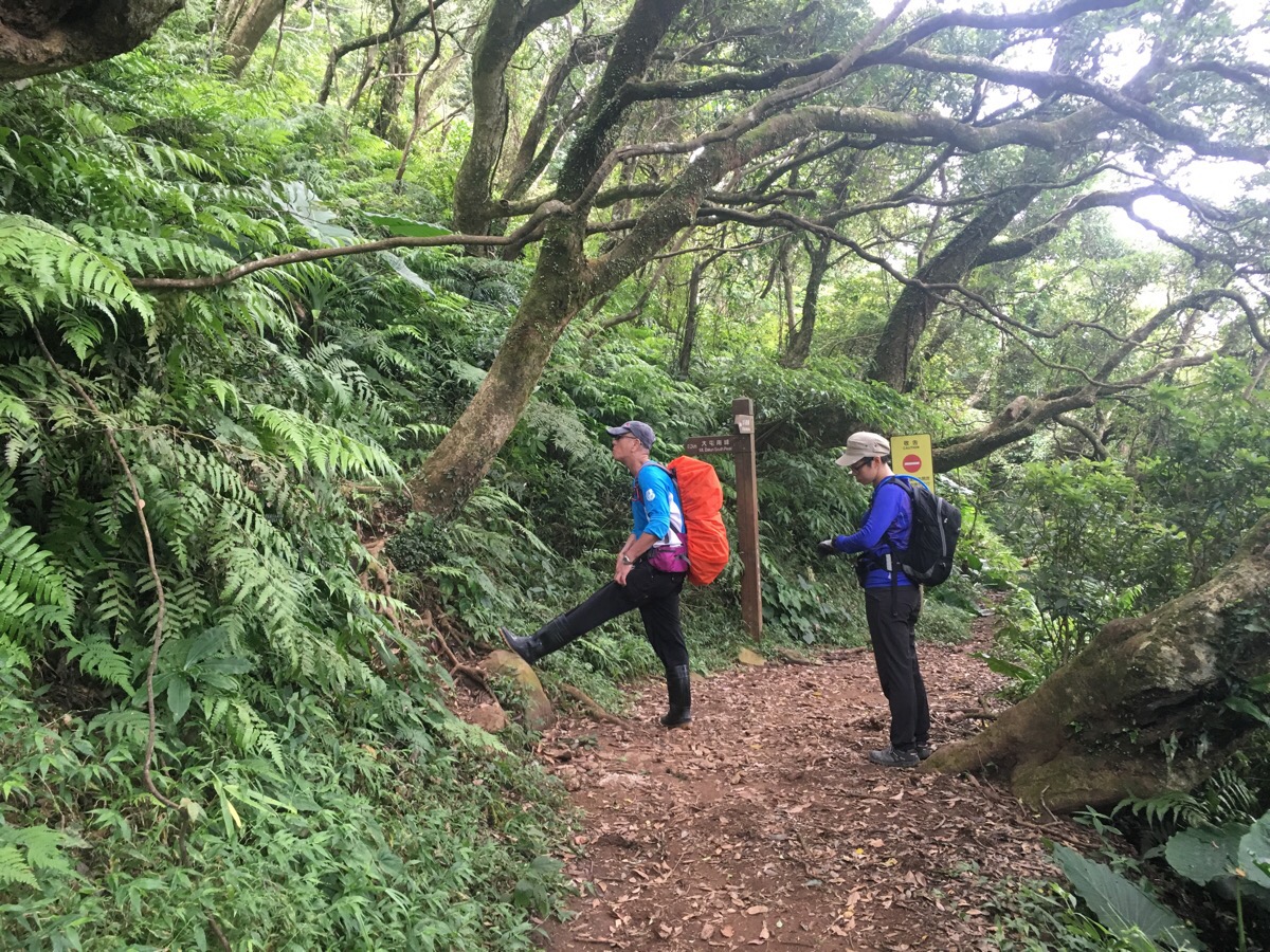
(A number of photos have been borrowed from an earlier walk, so although my regular hiking companion appears here, I actually walked this alone.)
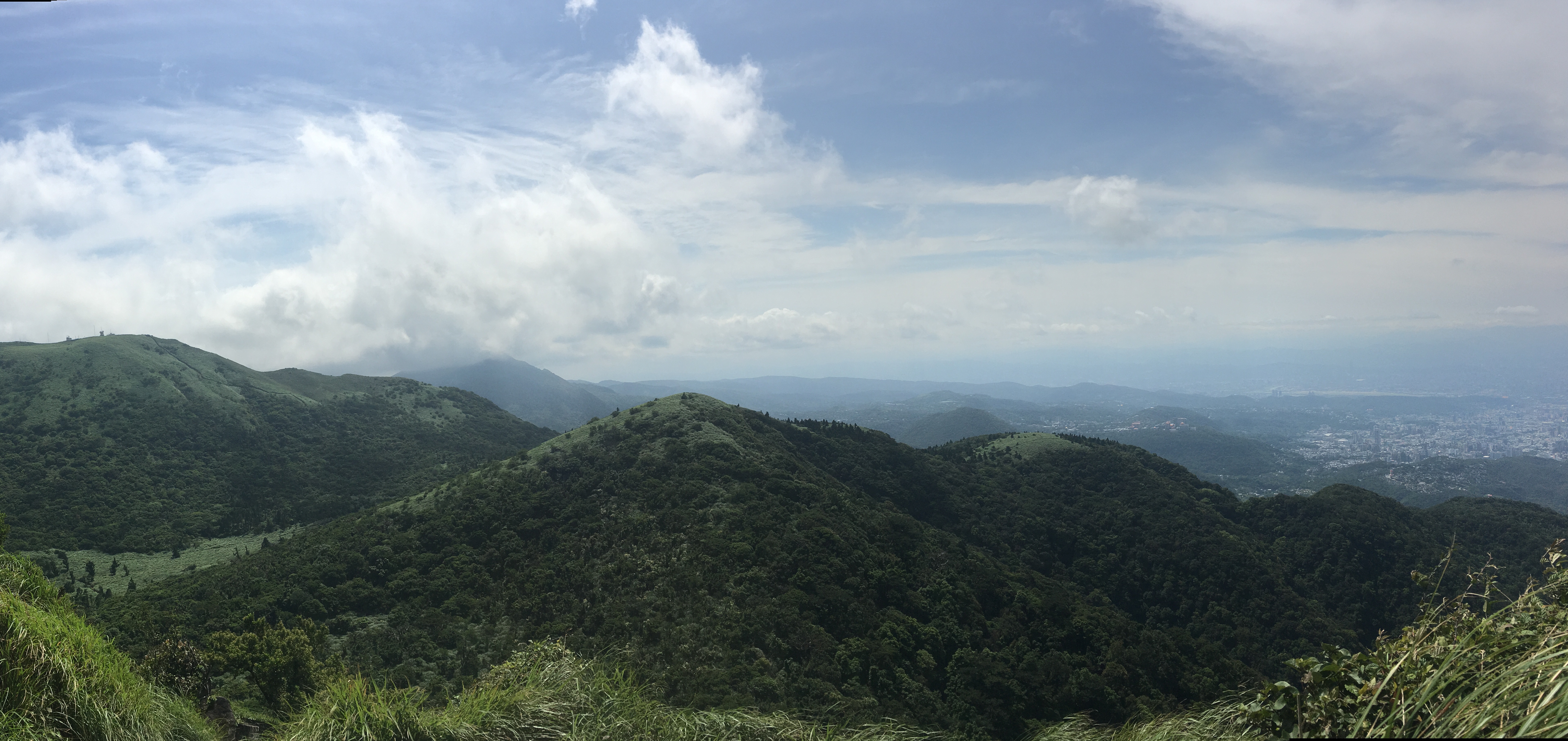
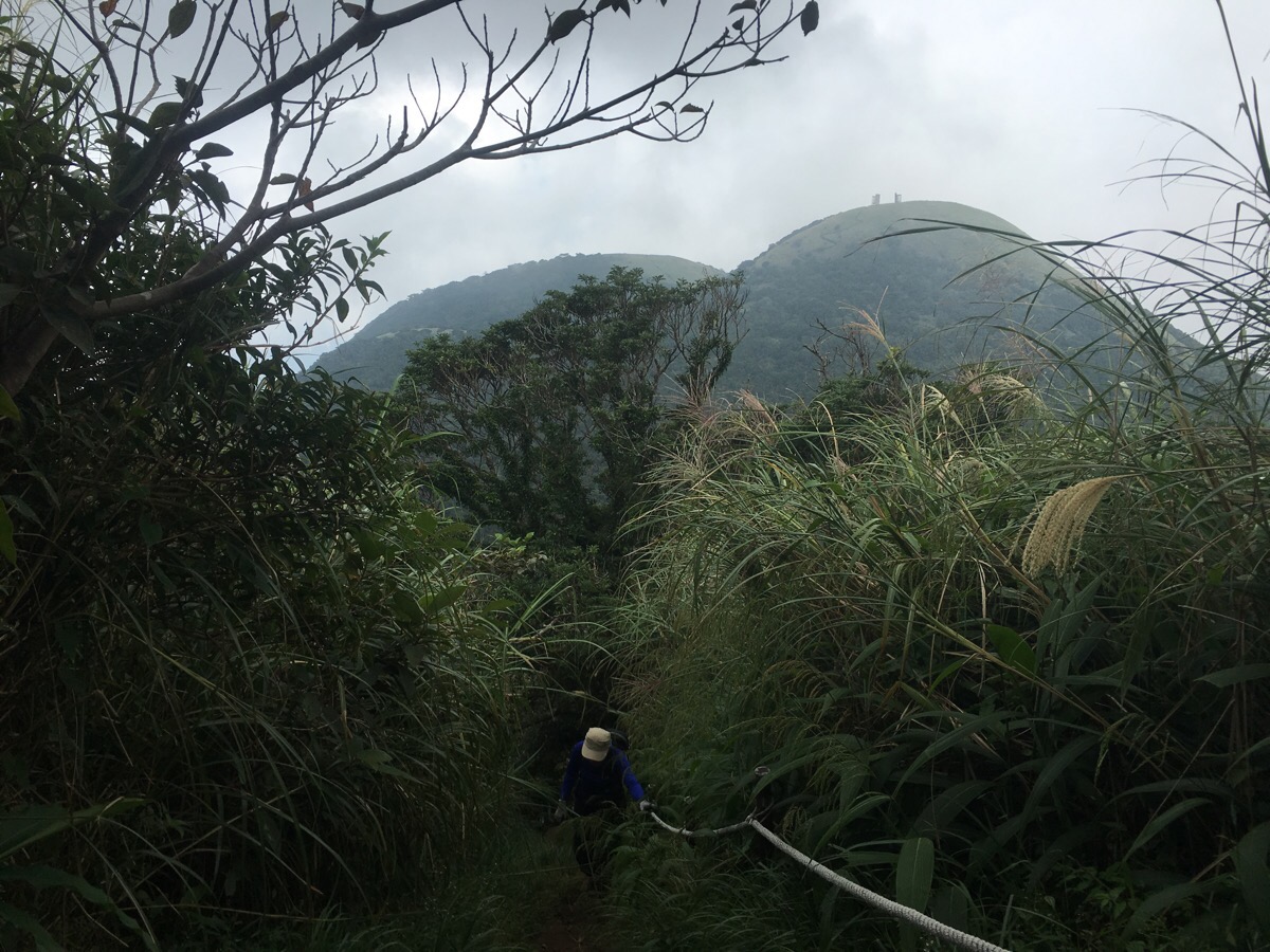
As the path changes from being tree-line to being flanked by grasses and bamboo, the climb starts to be rewarded with some views. The twin domes of Xiangtian Shan and Miantian Shan are to the west, and further away south of them you can see over Tamshui to Bali, the jaggedy spine of Guanyin Shan rising up on the far bank of the Tamshui River looks remarkably insignificant from this high up. An additional bonus on this occasion was that I could even see as far as the coast beyond Taoyuan.
01:11 – Arriving at Datun West Peak, (983m), the views really are stupendous, particularly as you head down from the far side. Here in the centre of the picture you can see Datun South Peak and the ridge the path follows down to it. The highest peak of the Datun range must be just off camera to the left.
At the top, I took a picture with the sign (走) and chatted with the couple I’d walked up with. Some guys who looked like trail runners came after us, and I left at the same time as them.
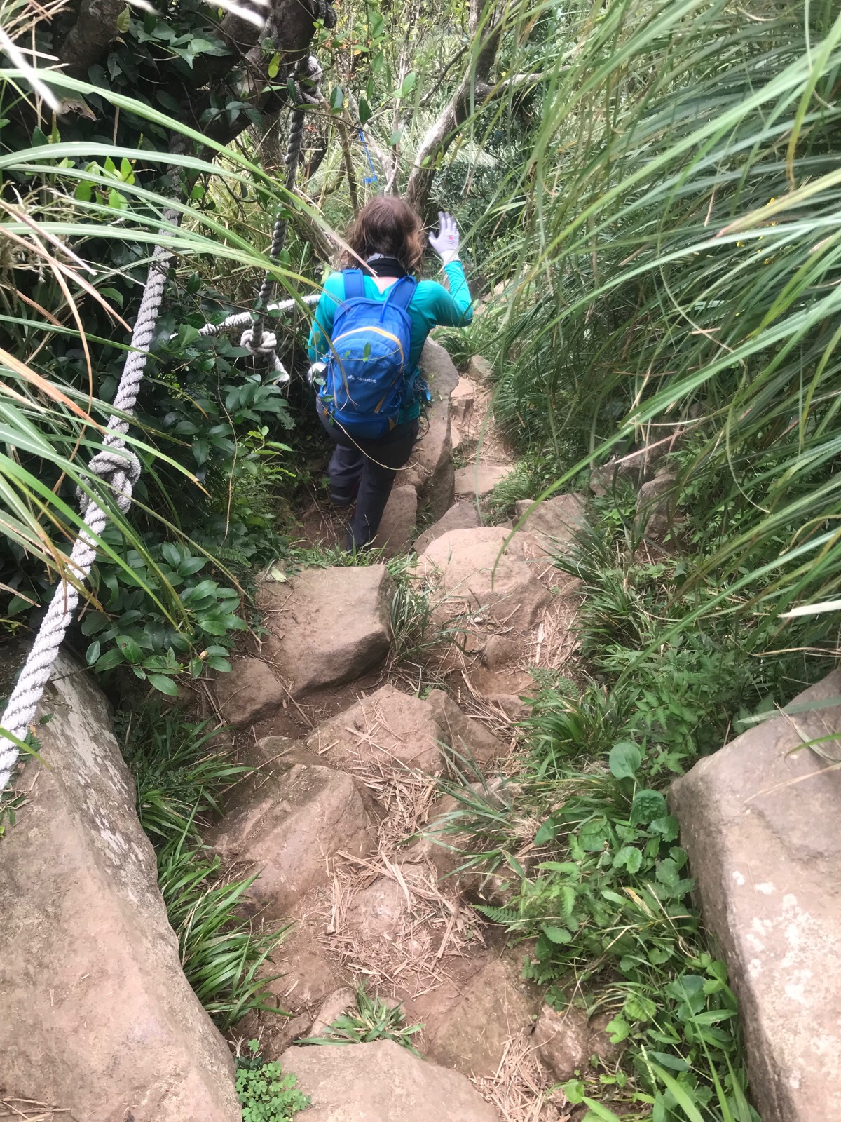
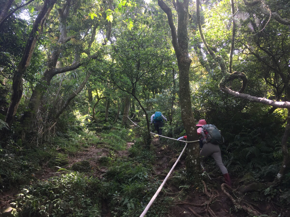
The down hill section seems steeper to me than the uphill if you do it in this direction. Many parts of it are roped, but the large rocks on the floor mean you have to be cautious in order to avoid turning your ankle. Looking up amor down the path gives you the impression of being in the middle of a green chimney.I passed quite a lot of people coming up along this section, it seems that many people do the loop starting from the main peak and heading back via Miantian Shan.
01:19 – At the next junction I met a group of hikers around my age. They were calling ahead for one member of their group, so I told them that I hadn’t seen anyone for a while and that he was almost definitely out of shouting range. In exchange, they warned me that the upcoming section was very muddy and that I needed to be careful where I was putting my feet.
What looks dry here, (this was from my first walk here), was more like a bog. Ankle-height mud covered the whole width of the path, and I had to pick my way around the less deep sections. It would have helped quite a bit to have hiking poles here, but since I’m not accustomed to using them, I was perfectly ok with a bit of caution and a slower pace.
01:28 – At the turning heading up to the south peak I encountered a husband and wife who seemed particularly ill equipped to deal with the terrain. The husband was busily fussing over the wife – telling her what to do and where to go. I worried about them a little on the way up. This section is steep and a little physically demanding even in good weather, but with the ground having been turned into something resembling a mudslide with added rocks, it was even harder. Particularly the part which requires upper body strength and a bit of welly to get you up a large and muddy boulder.
Despite the mud, I was in my element. Going up is always more enjoyable for me than going down, and despite having felt exhausted for most of the week, I felt strong and capable when confronted with rocks and roots and ropes.
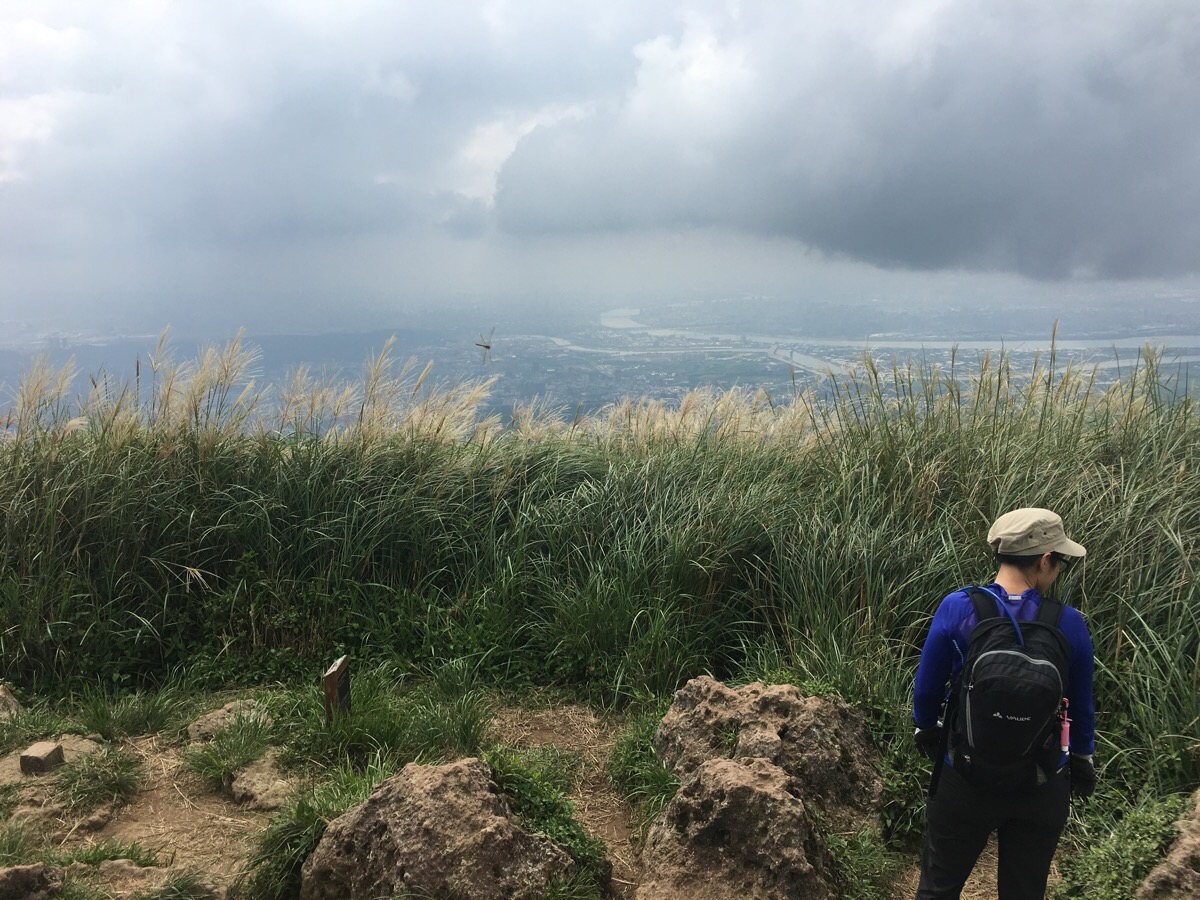
01:40 – The south peak, (957m), is another bald area with a few rocks and the ‘縱’ character post. Here I stopped for a little fruit and one of my sandwiches whilst I took in the views. It really is amazingly pretty. Looking back to where I’d come, I could see the west peak and Miantian Shan. Looking south, the whole of Taipei stretched out in front of me, the bends and curves of both the Keelung and Tamshui Rivers cutting brightly through the city. Also from here you can make out many of the hills traversed by the TGH. At the very far side of the city you can see the Nangang mountain range behind 101, but what surprised me the most is how the ridge running along from Jiantan station towards Neihu (covered in the Bishanyan to Jiantan section), seems little more than a raised bump from up here. It feels a lot higher when you are actually down there.
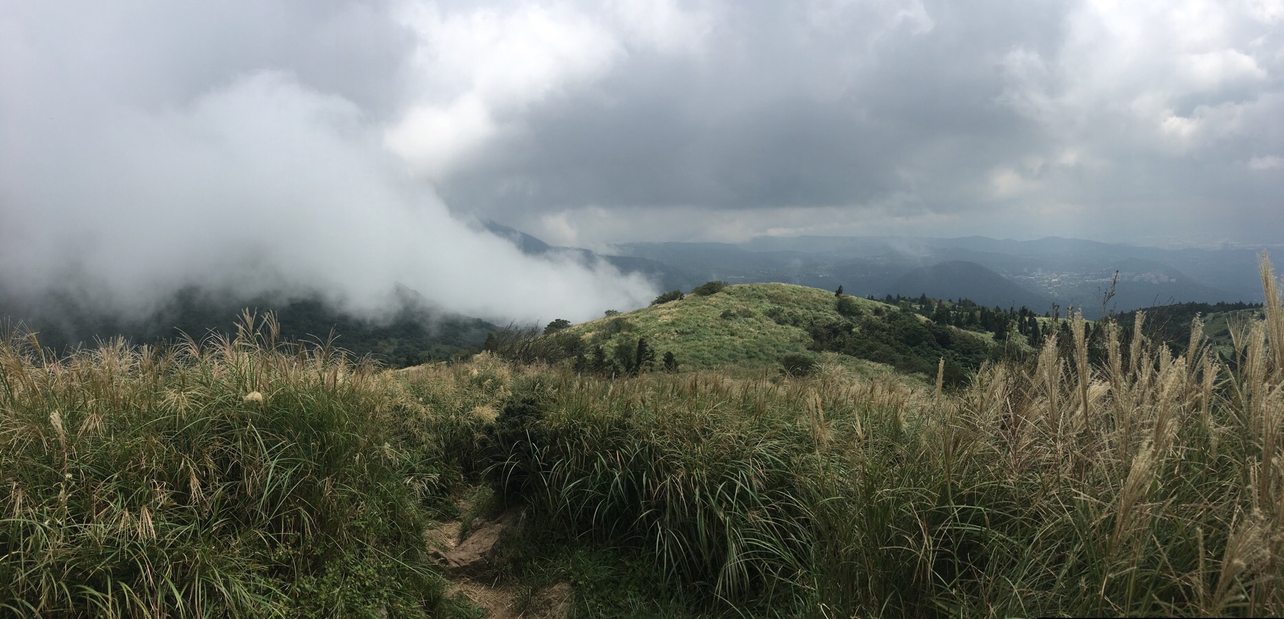
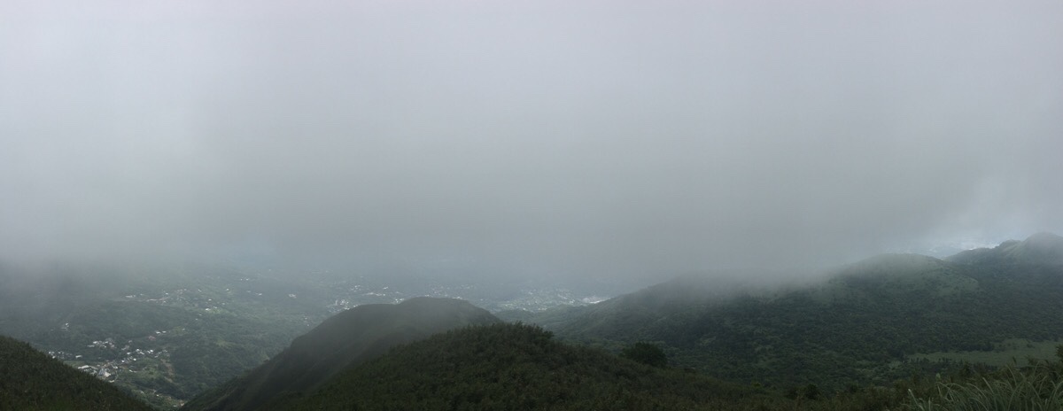
Although this photo looking towards the main peak was taken on my previous visit, the scene is not far from the truth. In the thirty minutes since arriving to the west peak with blue skies and fluffy clouds, the more customary cloud covering had started to descend upon the higher peaks. Looking back towards the west, I could see a blanket of grey clouds ready to cover Miantian Shan and Xiangtian Shan. Likewise to the east, Qixing Shan was already surrounded.There were four other men on the peak, at first I thought they were all together, but later I found out that actually only three of them were. They chatted about their eating strategies (邊吃邊走 being the favourite, something I understood thanks to what my Chinese teacher had covered with me a couple of months earlier), and one guy passed around McDonalds potato wedges which he’d stuffed into a wide flask. Before they left, they asked if they should wait for me, but I said it was ok, I was enjoying my food. They were replaced by a pair of aunties, who were also collecting photos of themselves with all the TGH character posts, but apparently they weren’t doing the whole walk, only the bits which would take them to the posts.
The path levelled out and I caught up with the fourth guy in the group. He asked me if I was with the group ahead of us, and then I realised he’d made the same assumption about me as I had about him. We passed a wild dog chilling out here, it felt odd to see one in the mountains.
01:53 – At the junction, I caught up with the others who I’d first met on the south peak. We all turned right and headed uphill. Initially they let me go first, but two of them quite quickly ended up over-taking. I’ve had quite a bit of practise at doing steep steps recently, so I got into a slow, steady rhythm and just kept heading up. The fact that it was a little cool, and that the sun had decided to duck out for a bit made it a whole lot easier, and I was able to keep heading up, only stopping once to enjoy to views whilst getting another salt candy.
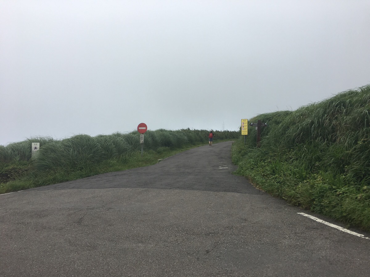
02:11 – Datun Shan main peak is 1092 metres above sea level, and as such is quite a bit cooler than the surrounding areas – especially when combined with the cool breeze that was blowing through. I found the character post (大), and took a photo. The view was slightly obscured by clouds, but still beautiful. It was doing that magical-looking trick thing where the land and sky that is lower seems brighter than the stuff above it because you’re partly in the clouds. The observation platform at the top was busy with cyclists and walkers, there is a road here which is only open to bikes and service vehicles, so it’s a very popular walk up.
Before leaving I asked the guys I’d met on the south peak how long they thought it’d take to reach Xiaoyoukeng, and they said that with my pace it wouldn’t take long, maybe an hour and a half. I set off shortly before they did.
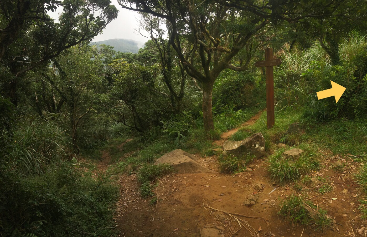
02:17 – After passing the air navigation station on my right, I turned right up a smaller road. Here, the sign post is a little confusing, there are TGH stickers in all three directions, but luckily I had been careful to check the route clearly beforehand so I knew that I wanted to head down the Anbu trail. The group from the south peak were worried that I’d gone the wrong way and shouted after me, but in the end they decided to go the same way.
After a couple of hundred metres, the road ends and the trail heads into the bushes.
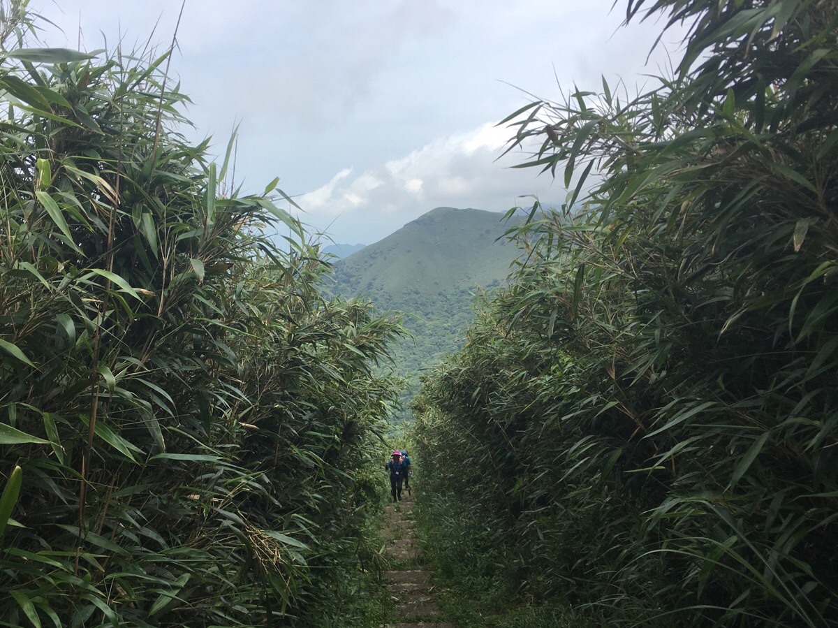
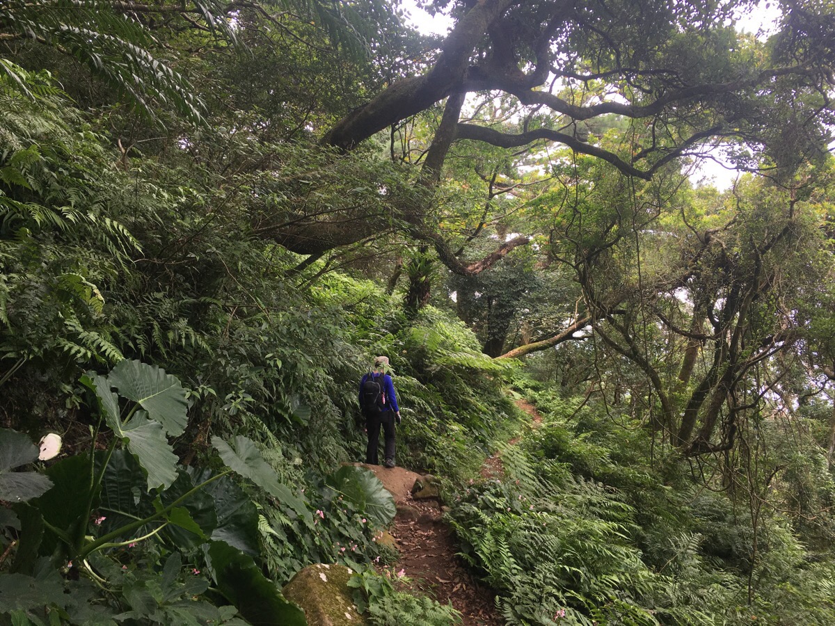
The bamboo-lined Anbu Trail offers some stunning views over the park. An opening on one side reveals the metal towers near the summit of Xiao Guanyin Shan, and even the narrow glimpse you get over (what I think is) the northern or northwestern peak is perfectly framed.
The gentleman at the front of the group I’d met back on Datun South Peak walked with me down this section and we chatted about walking in Taiwan. He said that he’d already done all of Taiwan’s Bai Yue (the country’s top 100 most beautiful peaks over 3,000m high), and asked if I’d climbed any yet. When I admitted that I hadn’t, he said that I really ought to since I had the strength and stamina to…but alas, having split days off makes it rather hard to get anywhere. Halfway down we passed a huge hiking group from Taichung. “歡迎光臨台北” my new hiking companion said to them as what appeared to be at least half the population of Taichung streamed past us in blue T-shirts – “welcome to Taipei!”
IF YOU’RE PLANNING TO SPLIT THE TRAIL INTO TWO SECTIONS, HEAD LEFT BACK ALONG THE ROAD TO ERZIPING HERE.
02:43 – As we neared the road, my new companions (the guy who had been walking just behind us had joined the conversation by bathos point) asked if I’d like to walk with them and combine the next stage of the TGH with what I’d already done. I told them that I had plans later, so I needed to be finished before a certain time (and in my head I thought about the fact that whilst meeting and talking to people along the way is fun, so is walking by yourself).
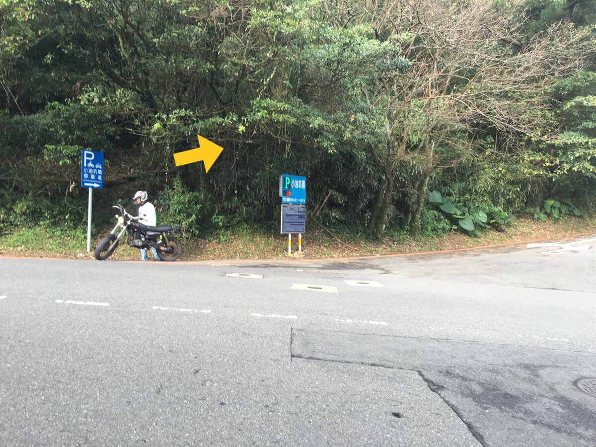
At the road where it meets the Anbu carpark, (the starting point for the lovely Xiao Guanyin Shan trail), we all headed right.
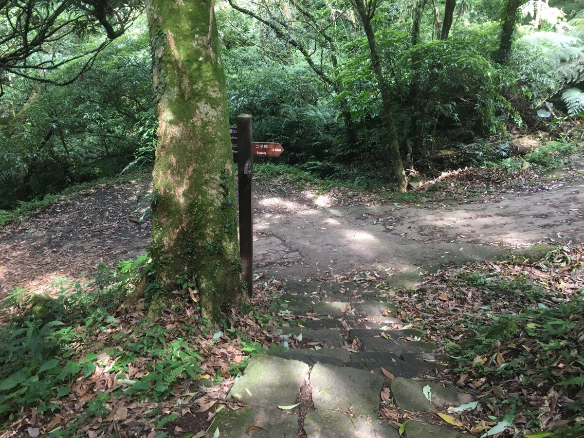
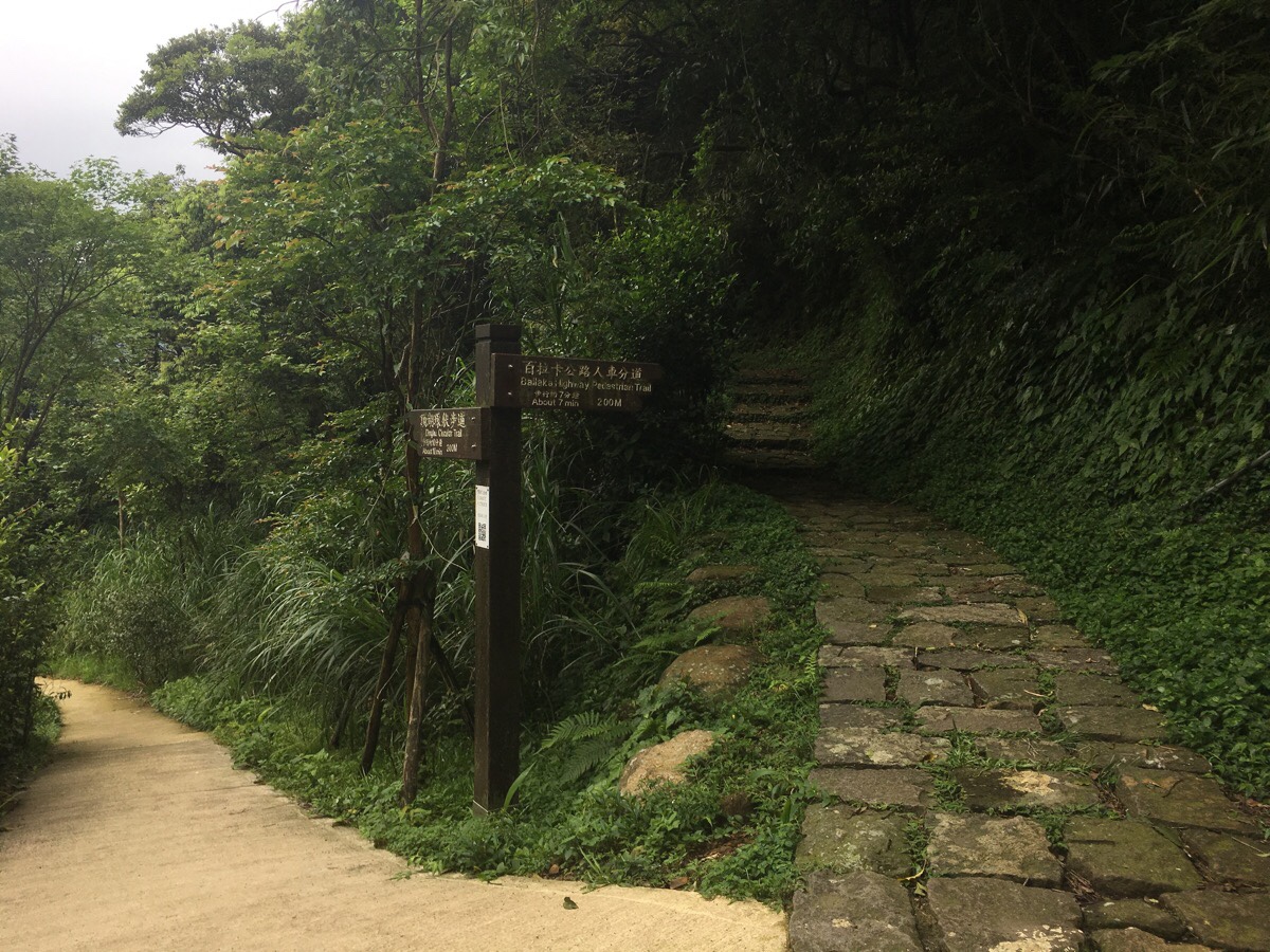
02:45 – Just a very short distance from the carpark, my new friends and I parted ways. Since they were trying to complete the walk in a short time, they wanted to walk the road, but since my goal was to experience as much of the nature surrounding Taipei as possible, I took the small path which is marked by a (hard to spot) signpost in the above picture. This is the entrance to the Balaka Highway Pedestrian Trail, and its signposted as heading towards Zhuzi Hu
02:57 – The stones on the trail are slippery because they get little light, and I had to slow my pace a little. At the crossroads, the TGH heads downhill to the right.
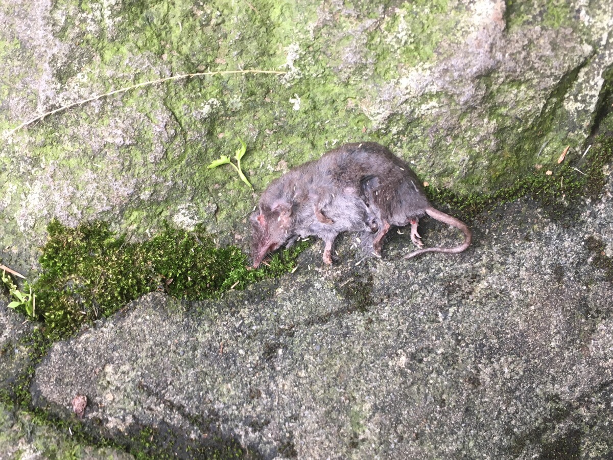
Drying out on the steps of the trail, I encountered this unfortunate creature. It looks a little shrew-like, but I don’t really know what it was.
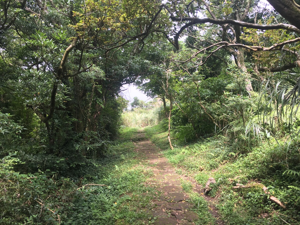
The path here is unexpectedly pretty, and so much quieter than path I’d been on earlier. I saw just a single person in the 25 minutes it took for me to get from one road to the next road.
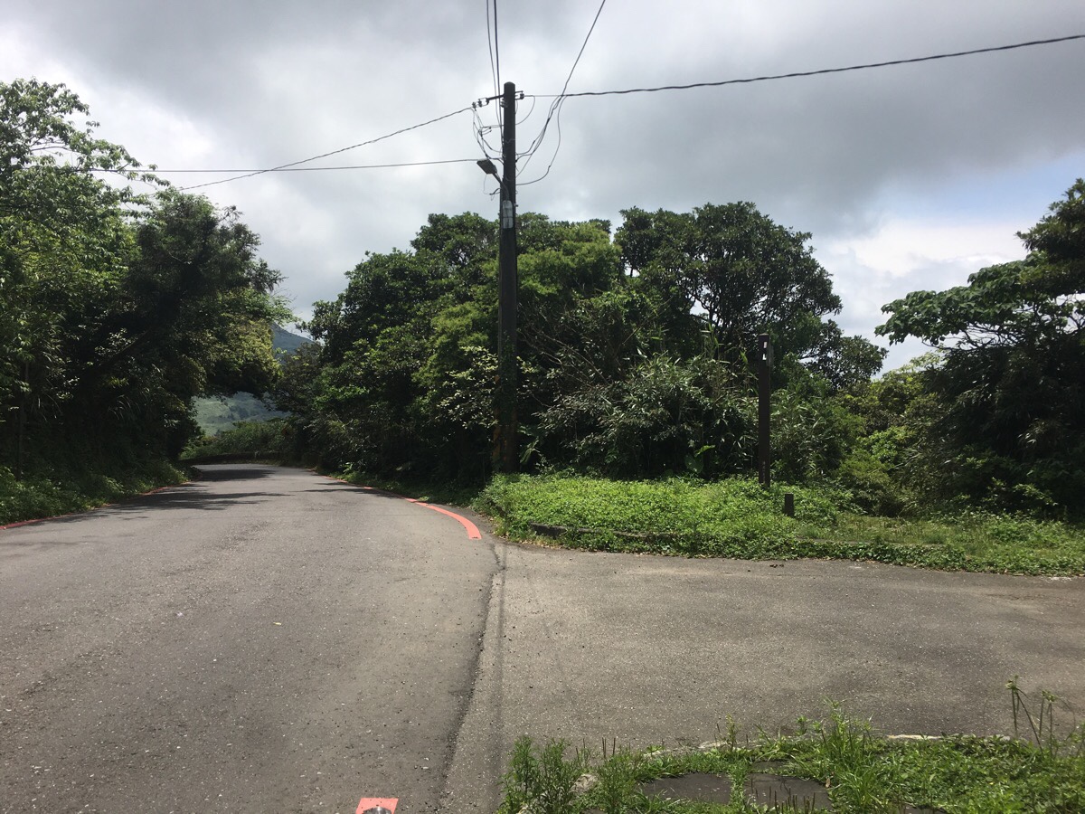
03:08 – At the road it is unclear which way you’re meant to go. There are no signposts and the official map seems to indicate that you go straight over, but as I found out when I walked that way, that isn’t quite right.
Actually you need to turn left here and head slightly uphill between a couple of bars and restaurants. Part way up next to a long hedge of angel’s trumpets shrubs, there is a sign indicating that you’re on the right path. Why there, (where there is no junction), and not next to an actual junction I have no idea.
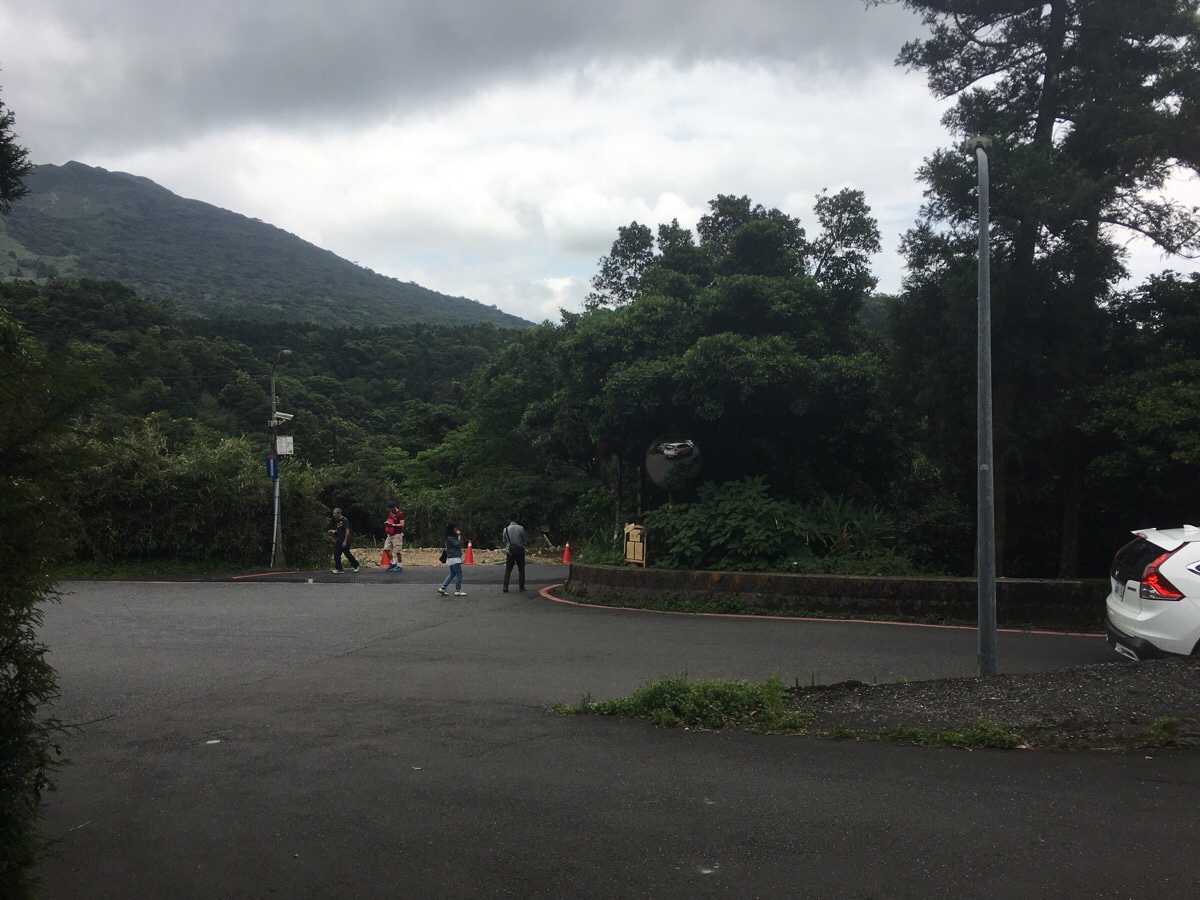
03:20 – At this junction with a shop selling flowers, the TGH veers left away from the main road. There is a signpost at the junction with a sticker on it.
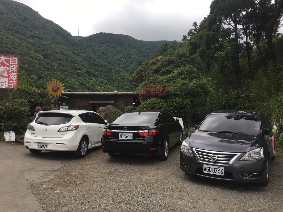
03:22 – Initially I went the wrong way by heading up the road, (which is left of the white car), but actually the path is hidden between the two black cars at the back of a carpark/lay-by next to a cafe-type place. (This is only about 50-100m up from the junction.)
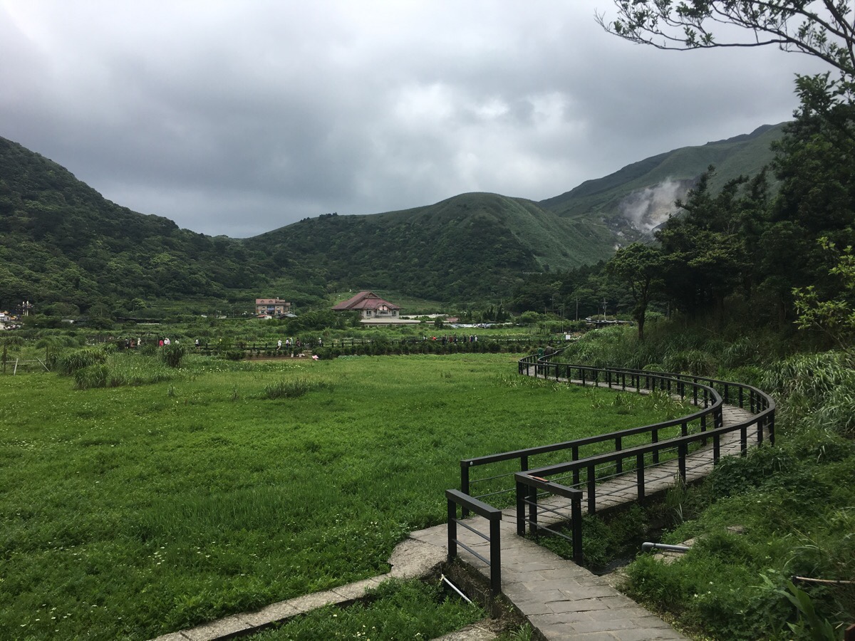
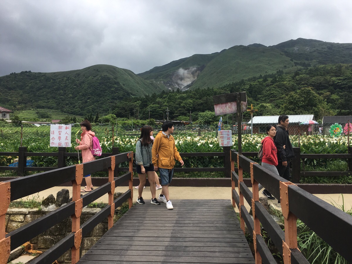
03:23 – After emerging from behind the cafe, the path arrives at Dinghu. The area here is famous for its elegant, white calla lillies – there is even an annual festival dedicated to them. This was actually the first time I’d walked along the Calla Lilly Trail, despite having walked near it on a number of occasions.
03:25 – At the bridge, head left up towards where the cars are parked. Where the path ends, keep heading up, following the road as it bends right. Again, the signs disappear at the junction, and reappear just to confirm that you’re headed the right way later on.
03:33 – After a several minutes of road-walking, the path dives off on the left following a stream uphill. This is marked on the sign as being another part of the Balaka Highway Pedestrian Route, but I’ve also seen it called Yangming Creekside Trail. The water is clear, but I didn’t spot any aquatic life except for snails, I wonder if this is maybe because it is still too acidic – just upstream of here is Xiaoyoukeng.
03:42 – The creekside path climbs to meet the Qixing Shan Round Mountain Trail, and where that path crosses the river I stopped to make myself a coffee. I contemplated taking my boots off to dip my feet in the water, but decided not to in the end. I don’t think that I stopped for long – 15 minutes maybe, long enough to heat the water and let the stove cool down again. For these walks where I know there will be significant easy paved sections I have gotten into the habit of taking my reusable coffee cup with me and just setting off with coffee in hand.
To get back on my way I turned left up the stone steps, and followed the path with the road just above me to the right.
03:55 – Keeping with the Qixingshan Round Mountain Trail a little longer, the path crosses the road and heads up along the left edge of a carpark. (Actually, this is a slight shortcut, I think the main purpose of not routing the path directly across here is to avoid people having to cross on a blind bend.) There is a toilet block in the carpark. I think this was the first toilet that I’d noticed since the Erziping ponds – although I imagine there must be some around Dinghu.
04:02 – The path climbs for about five minutes to another carpark, and then climbs into the bamboo at the rear of the carpark.
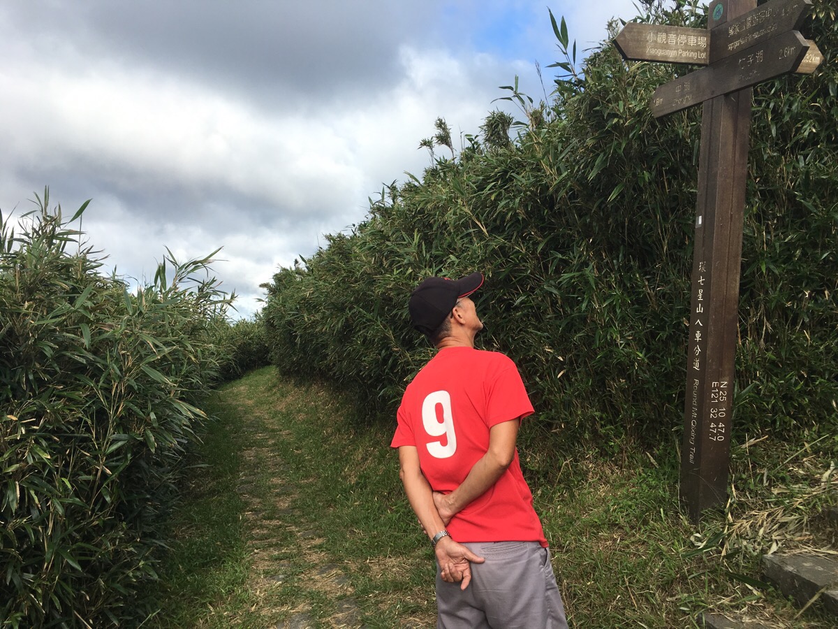
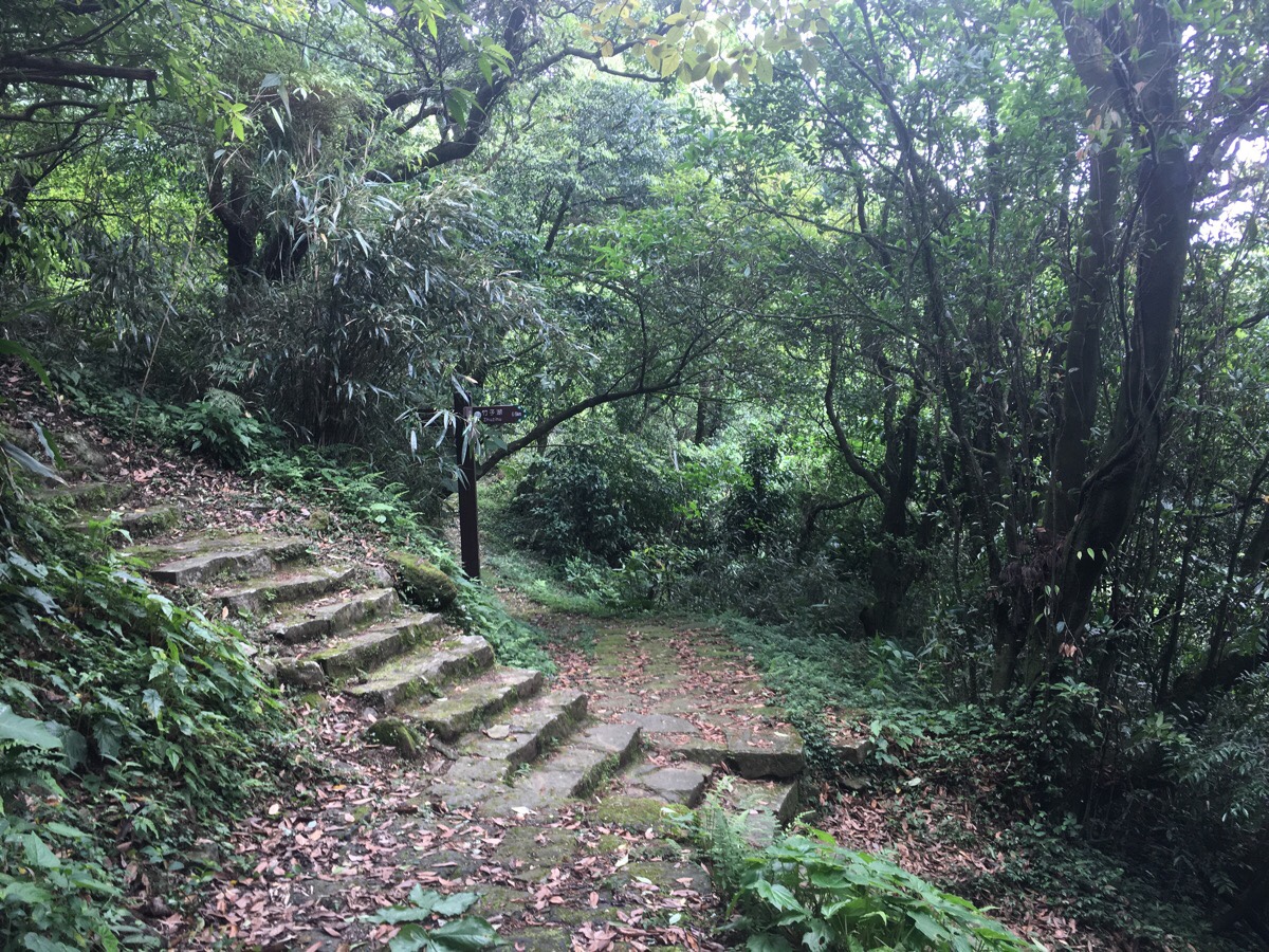
04:03 – The next junction marks the point where the TGH leaves the Qixingshan Round Mountain Trail – here, you arrive at the final climb of this section. Turn right up towards Xiaoyoukeng.
A couple of minutes up, the trail splits in two. Both arrive at the visitor centre in a similar length of time. I chose to turn right through the bamboo trail.

04:11 – After climbing a viewing platform which shows you Qixingshan (where I’ll be heading in the next section), and Datun Shan (where I’d just come from), the path dips a little as it heads down towards Xiaoyoukeng. The view from here is really impressive, (and slightly scary – that path winding up behind the crater looks somewhat perilous).
The visitor centre here was doing good business, selling ice creams and coffees, but since I’d already enjoyed my coffee, I just nipped to the toilets briefly to change my T-shirt before heading to the bus stop. There was a whole lot of people in front of me in the queue, and so I missed the first 108 minibus and ended up having to get on the 1717 bus all the way back to Jiantan Station. To my dismay, not only did my easy card not have enough credit, (this bus isn’t covered by the monthly pass), but I also didn’t have enough change. However, Taiwan being the kind of place it is, a solution promptly presented itself – the bus driver said that if I went and helped the two lost foreigners on the back of the bus, then I only needed to pay the $25 dollars that I had on me. Initially I picked the wrong foreigners and bothered a couple of French guys who looked baffled about my concern. However a glance to the very back of the bus revealed a pair of Australian tourists who seemed more in need of help. It turned out that they’d wanted to get off somewhere that they could catch a taxi to Beitou, and just wanted to know whether it would be better to get off near the Cultural University or at Yangmingshan Park. I thought it was very sweet that the bus driver had obviously been waiting to find someone who could help them out.
HOW TO GET THERE
google maps address: the trail starts from Erziping Visitor Centre, and ends at Xiaoyoukeng Visitor Centre. If you plan to split the walk in two, then the first section starts and ends at Erziping and the second section is from Erziping to Xiaoyoukeng.
GPS location:
- Erziping Visitor Centre – N25 11.165 E121 34.377
- Xiaoyoukeng Visitor Centre – N25 10.610 E121 32.845
public transport:
- The 108 bus is the only bus that serves Erziping. You can catch it from the Yangmingshan Park bus stop. The 108 has its own little sheltered stop just to the side of the building in the bus station (Many buses from all over Taipei head up here.)
- From Xiaoyoukeng you can either catch the 1717, (this heads back to Taipei Main Train Station via Jiantan), or the 108 back to Yangmingshan Park bus stop from where you can catch buses to wherever.
further reading:
Tony Huang didn’t do this walk in quite the same way as I did. He walked Xiaoyoukeng to Erziping (without climbing the Datun peaks) in one section.
And then did Erziping all the way down to Guandu via the Dutun peaks.
There is also a Chinese write-up of the walk which just takes a slightly different route from Dinghu up to the road.
This is the bit where I come to you cap in hand. If you’ve got all the way down this page, then I can only assume that you’re actually interested in the stuff I write about. If this is the case and you feel inclined to chip in a few dollars for transport and time then I would appreciate it immensely. You can find me on either Ko-fi or Buy Me a Coffee.
