Distance: 5.8km – This could be increased a little by taking in 小觀音山西北峰, or decreased by skipping 菜頭崙.
Time: 6½ hours – This includes a 15-minute snack stop and an hour for lunch. It would have been a lot quicker if the views weren’t so good too – there were so many times we stopped to allow the beauty to wash through us.
Difficulty (new Taiwan hiker): 5-6/10 – Steep, but overall not too challenging in good weather.
Difficulty (new Taiwan hiker): 7-9/10 – As mentioned above, this is a very steep trail with rope-assisted ascents and descents. Another difficulty for foreigners doing this hike would be the lack of English signage, (although if you read Chinese there’s no problem), so it is necessary to take some form of map to follow. Also, except for the road portion, this is all done on dirt trails, so it’s not quite like some of Yangmingshan’s more well-known hikes.
Total ascent: Almost 600m from a minimum of 773m to a high point of 1045m.
Water: 2.5L – I consumed almost all of this on a cool day, but it was also used for cooking and making coffee.
Shade: There are some shaded areas, but lots of this is totally exposed to the sun (and the wind and the rain), I had a hat and sun cream on and was ok, but Teresa got a bit of a pink nose.
Mobile network: Mostly ok but with a few black-out areas.
Enjoyment: We saw Xueshan from Taipei—that was awesome! Beyond the excitement of seeing such a distant peak, this has to be one of the most beautiful and fun walks within Yangmingshan National Park. Bamboo cloaks the hills like sandy-green velvet and the walking itself is challenging enough to keep your mind satisfyingly occupied with the task of finding the next foothold without being dangerous or feeling like too much.
Permit: From October 2020, it’s necessary to apply for a permit to walk this trail and any others that sit within Yangmingshan National Park’s extended protected area (press release in Chinese on the subject). To do this, you will need to create a profile on the Yangmingshan National Park website and log in to confirm your route. You can follow the steps on this page to apply.
Other: I would strongly recommend that you save this one for a day with good weather – this was the second time we’d attempted it, the first was in foggy and windy weather and I am so happy that we gave up and went back on a clear day. You ought to take gloves to make the roped sections more comfortable. Also, for me, long sleeves and trousers make this type of walk a lot more comfortable, but perhaps long sleeves aren’t as important as they are on some hikes I’ve done.
Jump to the bottom of this post for a trail map, GPX file, and transportation information.
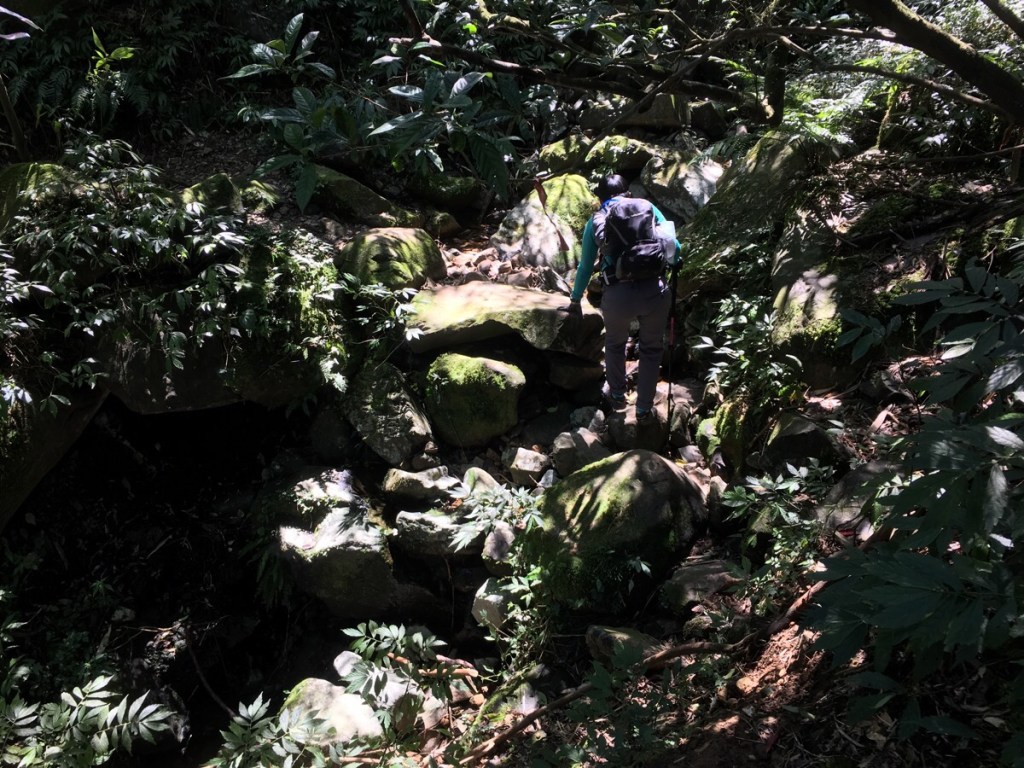
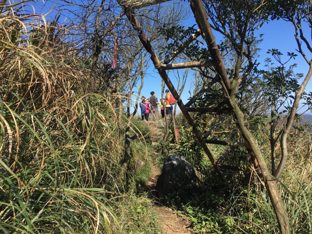
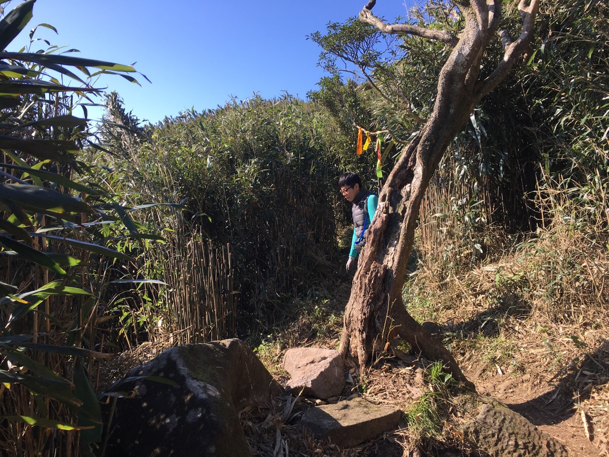
09:20 – We arrived a little too late to get any of the free road parking spaces near the trailhead so we parked up in the car park and took the trail leading out of the northeastern corner, next to the entrance barrier.

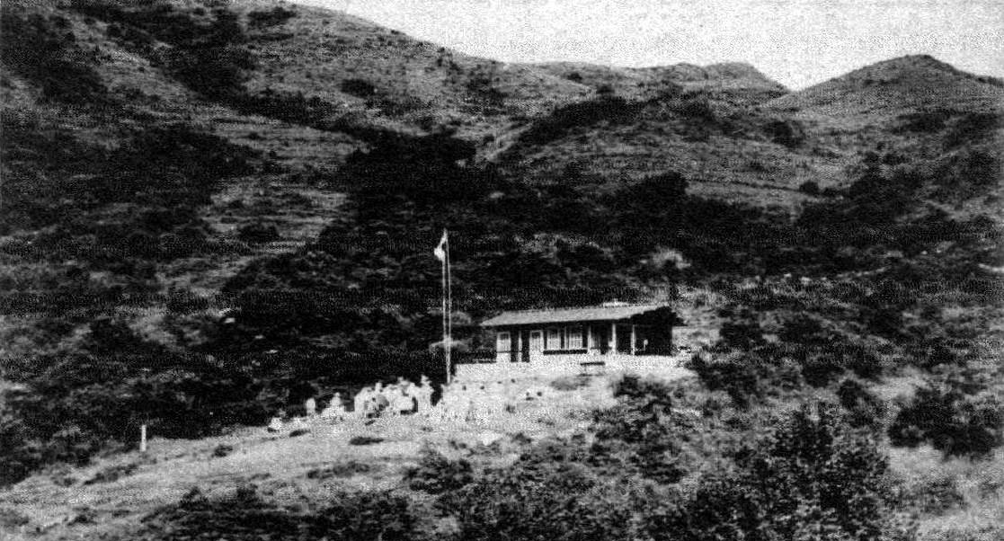
09:26 – Shortly after setting off, the path passes ‘Mountain House’ or ‘山之家’. These days, only the chimney-bearing wall and the outline of the other walls remain. There isn’t much English language information out there about this, but Tony Huang has written about it in Chinese so I will attempt to relay the information contained there. The structure was built as a leisure facility in 1938 as part of the ruling Japanese government’s plans to turn the area into Datun National Park. At the time, the area in which the house was built was a lot more open and had beautiful views, looking at this old photograph from the time, you’d hardly believe that it’s the same place. But, although the mountain house was ready to go, the timing was rather unfortunate – war arrived in Taiwan in the years after its completion, the plans to create Datun National Park were abandoned, and so was the mountain house.
The mountain house sits at a junction of three paths, we took the right fork towards Xiaoguanyin shan – the left path follows Caigongkeng old trail/菜公坑古道.
09:28 – The next junction we passed was actually where we ended up coming back down at the end of the loop – the right path will take you up to join the road, but keeping on the straight/left side path starts the climb to Xiaoguanyin shan’s east peak.
09:39 – Another junction, although this time the trail was so small that Teresa breezed right past it without even noticing. The sign indicates that the right path leads towards the weather station and the road, (looking at the map it seems that the path we took off the road later could have connected to here).
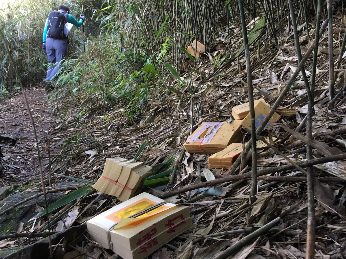
The stretch between here and the next junction was strewn with piles of ghost money. The first time we’d walked this way, the whole place was foggy, we could barely see 20m ahead, so to find piles of money left behind to keep the ghosts happy was slightly unsettling. From what I previously knew of the practise, ghost money is left in places where something bad has happened, or else places where someone has had an unpleasant encounter. The sight was still a little shiver-inducing even on a sunny day (and despite the fact that I don’t subscribe to the same beliefs). Afterwards, I searched to see if I could find out any explanation for the proliferation of spirit money in this area, and it turns out that there is a reason, and it’s not nearly as terrible as it could be. People have been collecting bamboo in this area for many years, (actually we encountered an old lady further up the hill harvesting bamboo, and later a group of young women doing the same). Bamboo forests are quite a difficult landscape to navigate, and would have been even more difficult to navigate in the past before leisure hikers’ feet maintained a well trodden and easily visible trail. For this reason, the bamboo harvesters would mark their path with ghost paper to appease the spirits of the mountain and in order to be able to retrace their steps home. Anyone who has seen the 2015 Taiwanese horror film ‘The Tag-along‘ will have encountered the ‘魔神仔’ from Taiwanese mythology, for those who haven’t, this description from the fascinating Island Folklore blog gives a good description:
The Taiwanese mô-sîn-á (móshenzǎi in Mandarin) translates roughly as “little devils.” These devious beings are spirits or mythical creatures often featured in Taiwanese folklore.
Taiwan’s mô-sîn-á—like the fairies, elves and pixies of British and Icelandic folklore—are believed to be spirits that dwell in the island’s mountains, forests and the countryside. Like the genies of the Arabian Nights, mô-sîn-á are mischievous and, according to the tales, interactions with them often do not end well for mortals. Like the yāoguài or yōkai of China and Japan, the term mô-sîn-á is a catch-all term applied loosely in Taiwanese tradition to horrifying backcountry-dwelling mythical creatures of various shapes and sizes.
The Taiwanese have their own rituals for dealing with their mô-sîn-á, the same way that the Danish will go out of their way not to disturb the home of an elf, or folks from my county would avoid stepping in a fairy ring, or perhaps leave a dish of cream out for the fairies. Seriously, go and give the blog a visit if you’re at all interested in Taiwan, Asian culture or mythology.
It was clear that a lot of new spirit paper had been lain down in the two months since we’d made our first attempt at the walk, and it according to the source I read, that is because the harvesting window for bamboo shoots falls between February 15th to April 15th and August 1st to September 30th each year. During this time, a greater number of people will walk through, laying offerings for the mô-sîn-á.
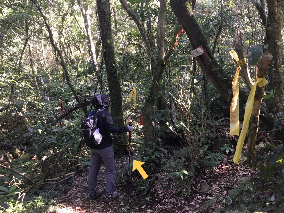
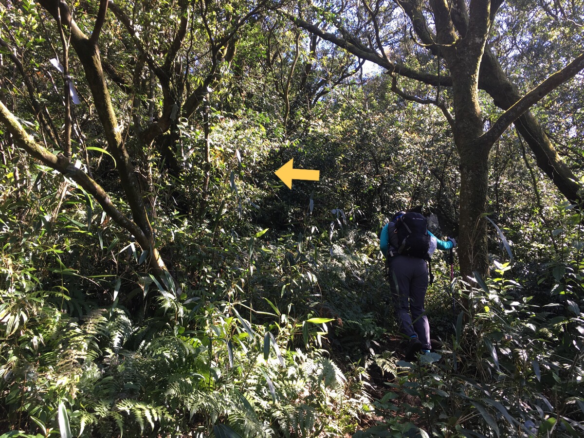
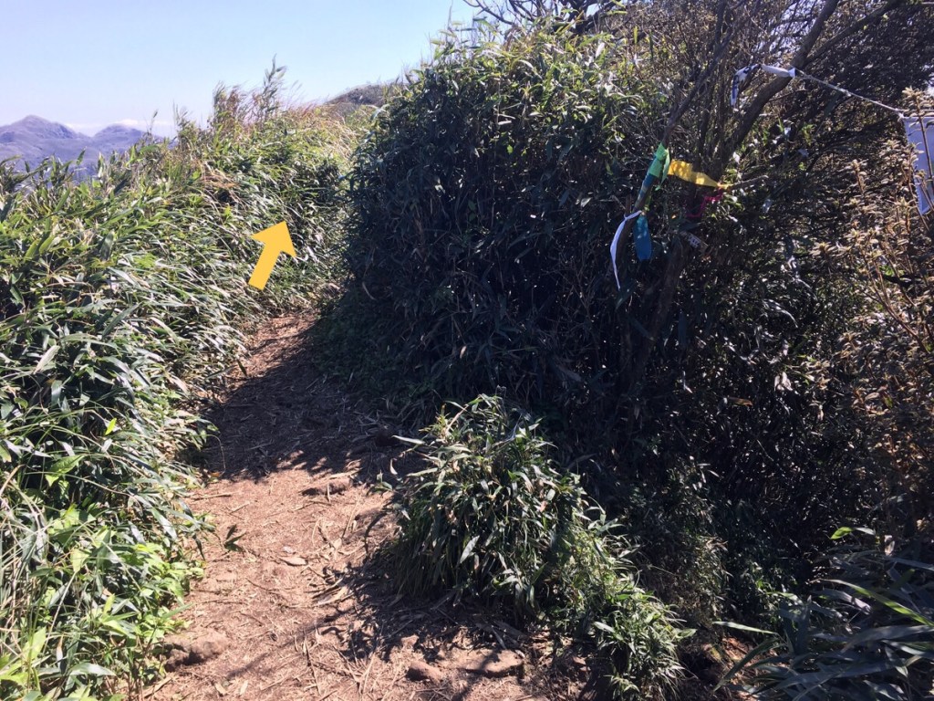
09:48 – At the last junction before the views get better, a track on the left goes… somewhere. Actually, I didn’t notice a sign, and the route doesn’t appear on my map either… perhaps this is the mô-sîn-á at work. We weren’t foolish enough to be misled by their fake path, and instead kept going onwards and upwards.
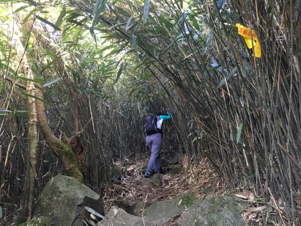
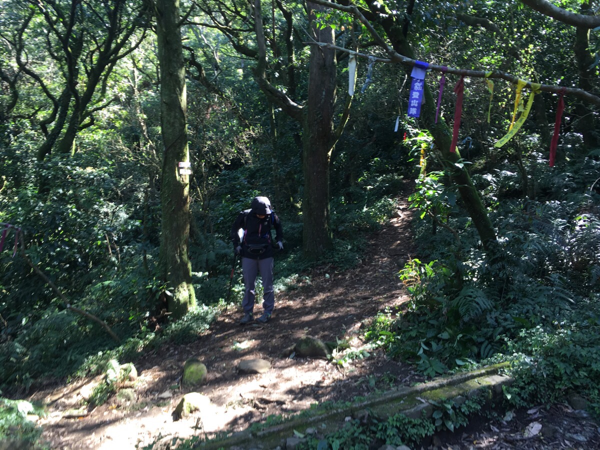
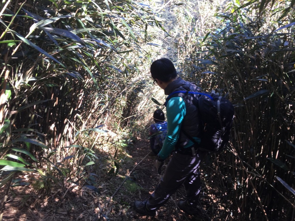
The bamboo corridor was really rather charming in pleasant weather (I hadn’t felt that way about it when the weather was bad though). However, some caution was required since the fallen leaves were covering a rocky surface.
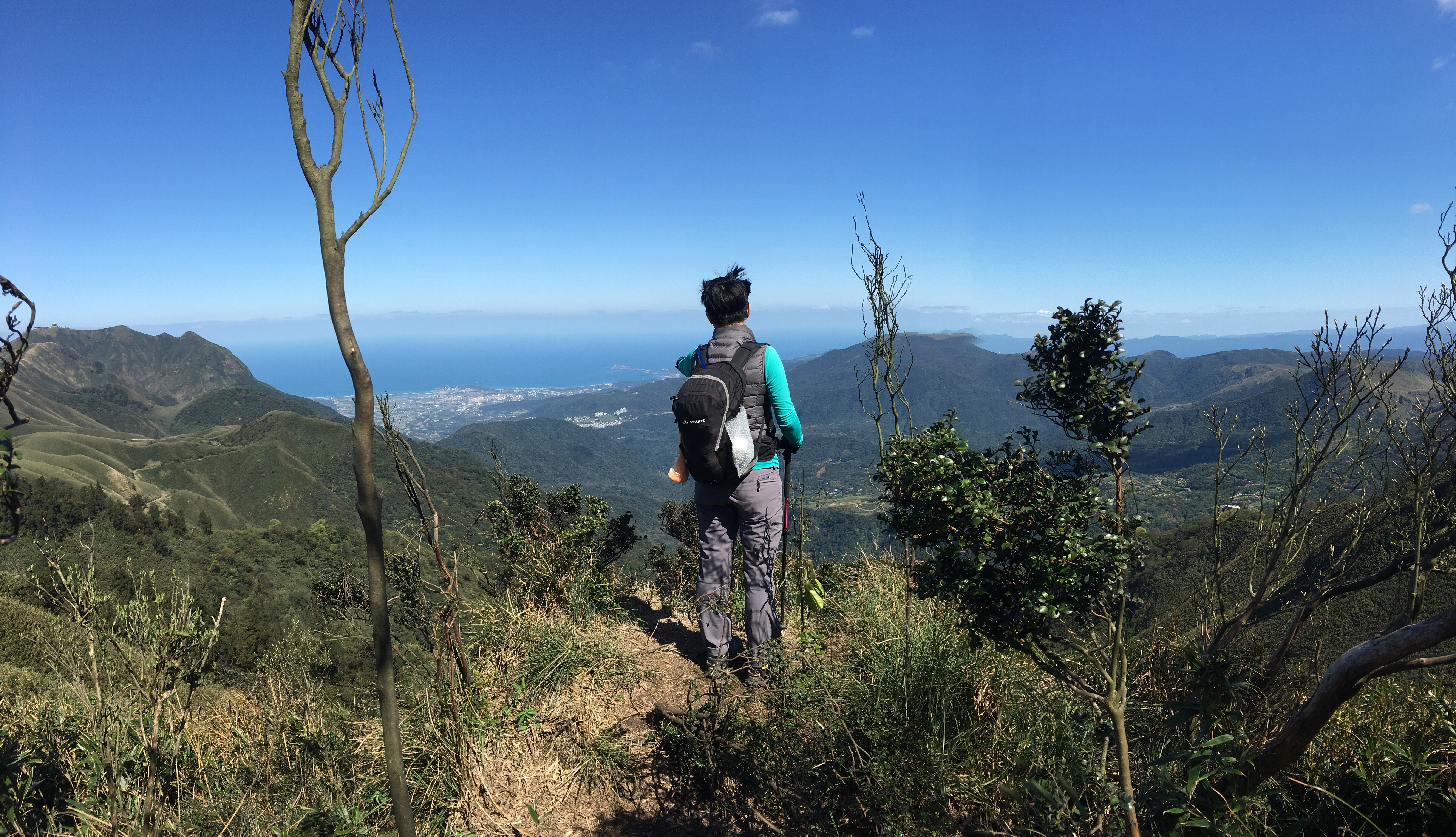
09:58 – After forty minutes of walking, we arrived at 山海觀, translated this is something like ‘mountain sea view’ or ‘lookout’. For the first view of the day, it was pretty promising. Looking west we could see walkers in brightly coloured jackets climbing the Mount Datun trail. To the right of the peak it is just possible to make out parts of Tamshui on this side of the river and Bali way off on the far bank.
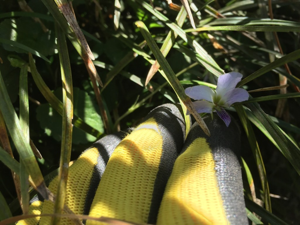
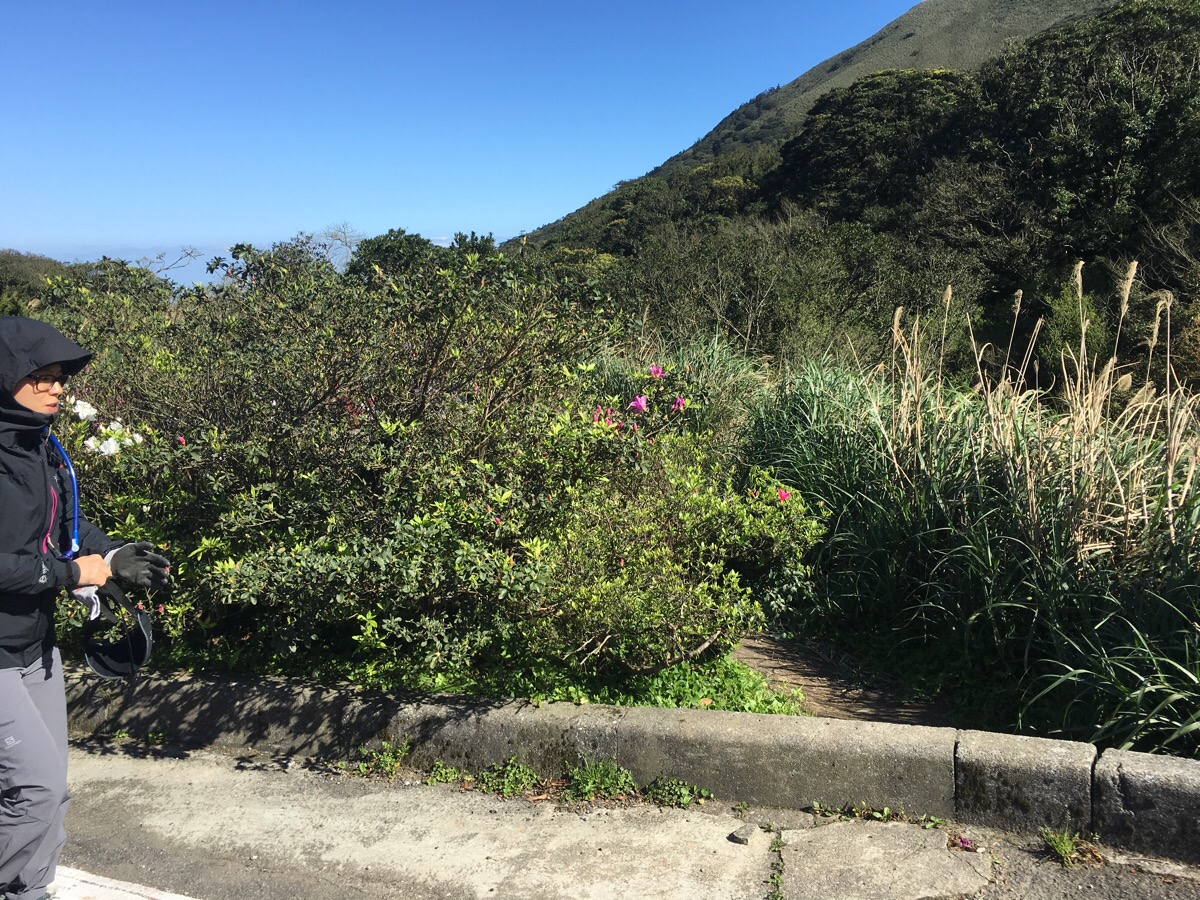
Climbing up through the bamboo we passed many of these beautiful and delicate-looking violets. Looking down from above, they look like lilac-coloured butterflies, the four larger petals fan out and sit a little higher up than the smaller fifth petal which is striped with deep purple veins. Once home, I did a little googling to see if I could establish what they were and it seems that they are Taipei Violets (台北菫菜) – a variety of violet which is commonly found in low elevations in northern Taiwan. As a side-note, my googlings also informed me that violets have been and still are widely used in both food and medicine.
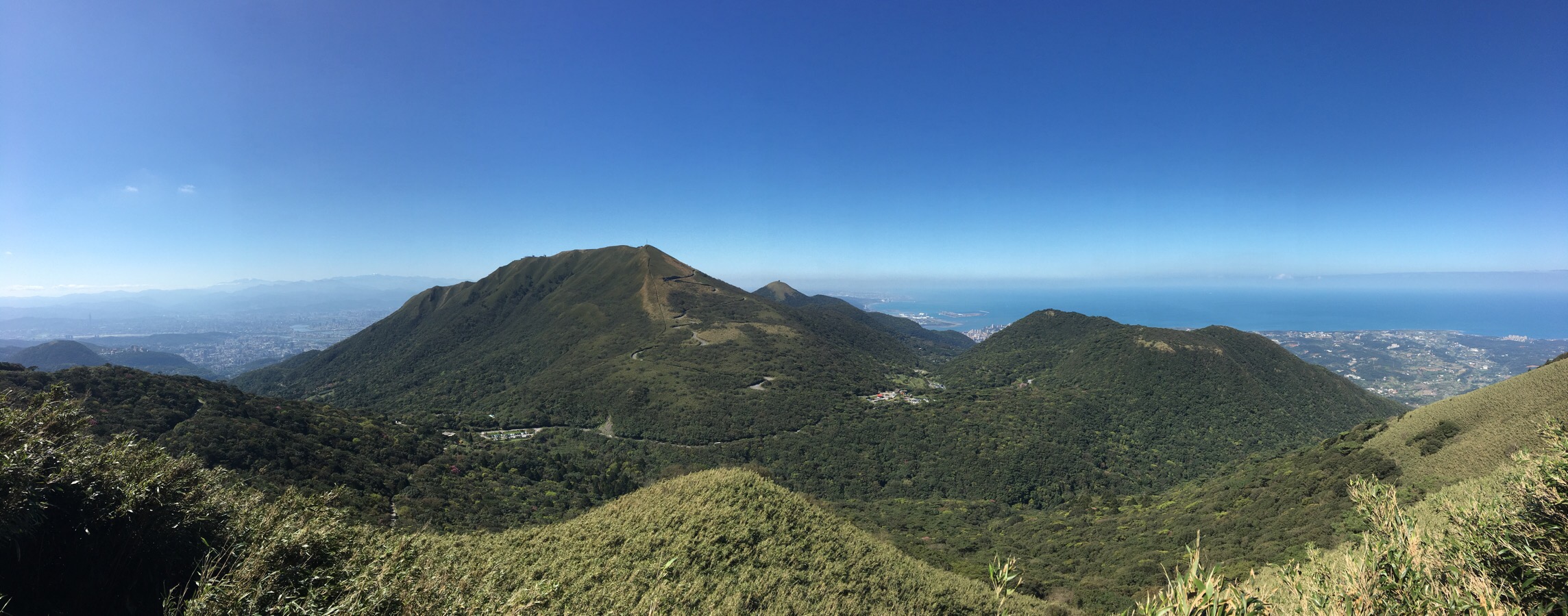
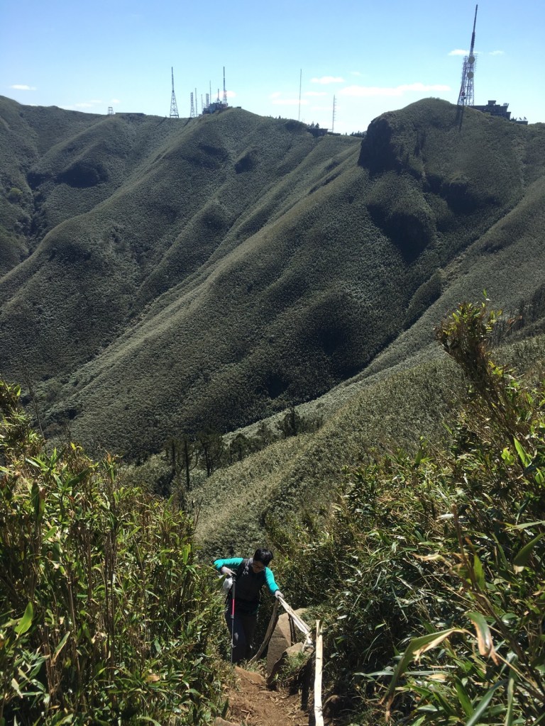
10:14 – Upon reaching a junction we turned left to do the clockwise loop, (right goes straight to the radio towers). At this point, the path is basically on the ridge line of the crater so there are some magnificent views already.
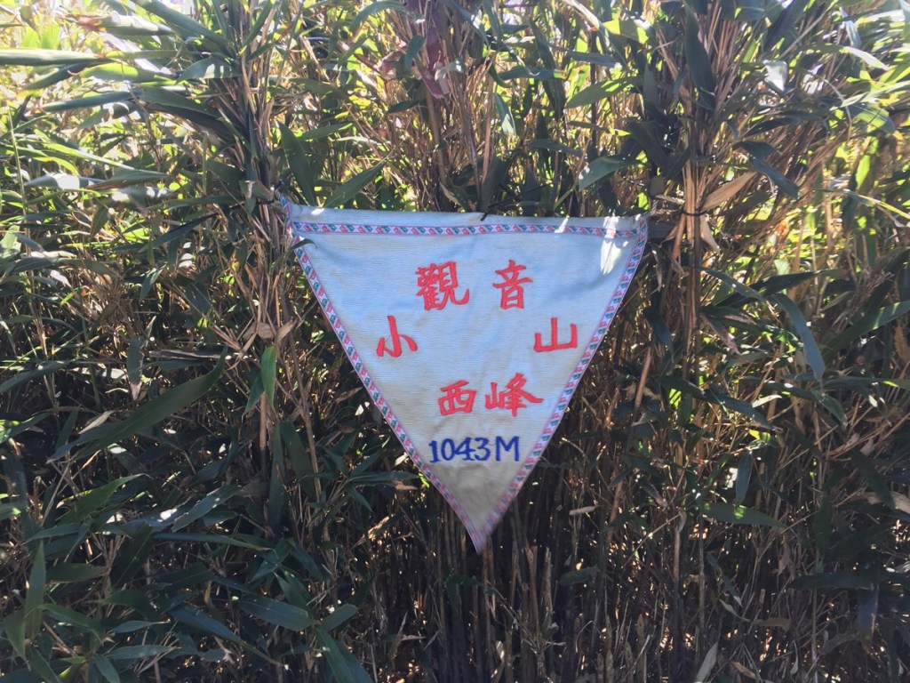
In the ten weeks since we last passed this way, someone has been through and added a whole load of triangular flags to all the peaks and noteworthy locations in the area. The first peak we reached was Xiao Guanyin shan west peak/小觀音山西峰.
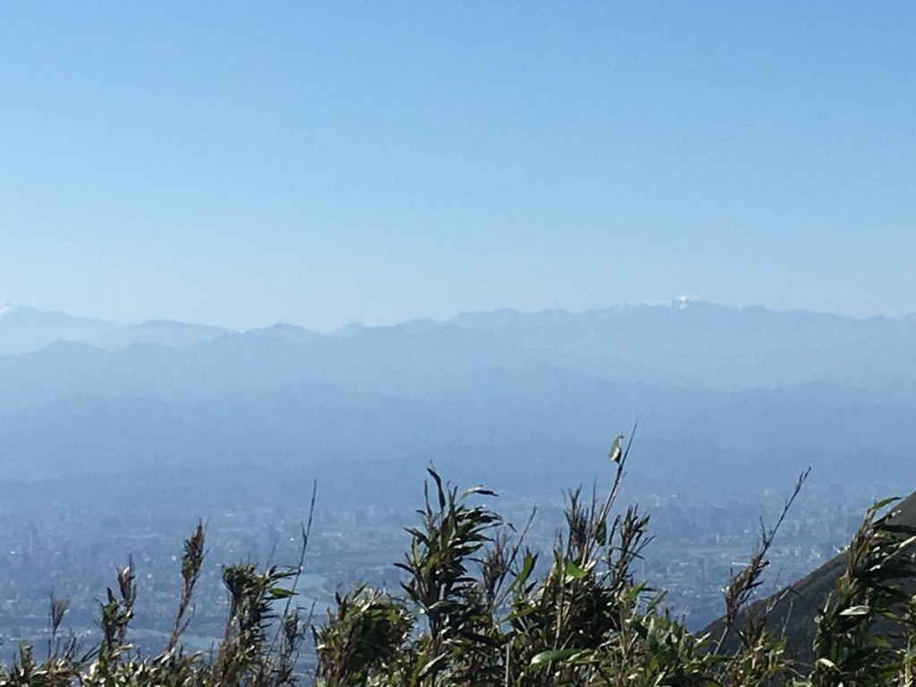
Whilst standing in the small grassy clearing of the first peak I cast my eyes south and had a huge shock – in the distance were two snow-capped mountains. I wondered if at least one of them was the peak of Snow Mountain – Taiwan’s second tallest mountain, to still have snow on them in March they must have been big mountains, but it seemed unlikely. Later, after the air had become too hazy to see them anymore, I asked an older gentleman what he thought they would be and he said that yes, Snow Mountain is the first high mountain in that direction. That’s over 90km away! We must have had the best air quality that Taipei had seen for a while in order to be able to see that far. The photo has been cropped which has resulted in a poor quality image, but that blurry white peak is a mountain with snow on it.
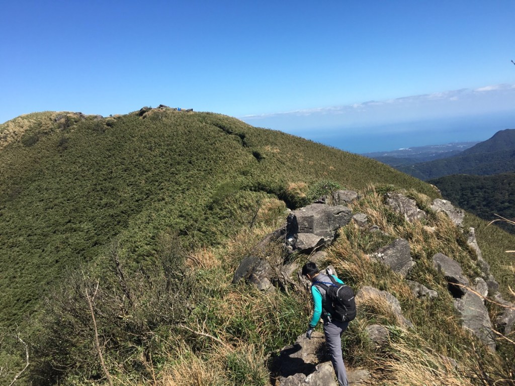
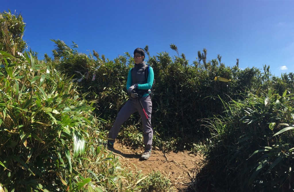
The ridge line stretches from the west peak to the ‘west west’ peak and passes a small knot of rocks which need to be clambered over or around. It was at this point that we encountered a hardy Taiwanese grandma foraging for bamboo shoots. She was walking along the trail at a pretty impressive speed and then suddenly darted into the bamboo to the side of the trail and by the time we caught up with her, she had dissolved into the surroundings.
From the rocky outcrop there is a good view of the whole Xiao Guanyin shan range in clear weather. Chinese language articles which have written about this hike often describe this as being Taiwan’s largest caldera. (The Mandarin name for caldera is a wonderful example of how the language functions by combining ideas to make new ideas – when you put the characters for fire, mountain and mouth together, you get 火山口, the written Chinese for caldera. I suppose that to those who are inclined to notice these things, the etemology of the English word might tell a similar story of conceptual leaps as it passed through Spanish from Latin and shares much with the boiling cauldron). Largest or not, it really is beautiful – I’m sure that I’ve said this about previous hikes (and I will definitely say it again), but I had to keep stopping to allow my eyes time to soak up/absorb/delight in the exquisite prettiness of it all. I am a visual person, I don’t miss the foods or smells or familiar sounds of my home country, I miss the specific delicate, promise-filled light of a perfect English summer morning seen from the mouth of a tent, and the crystal-clear, cool light of a British winter afternoon filtering through my windows. I miss the heavy, petulant grey of a storm that has been defeated by early evening sun. These are the things I pine for. Perhaps it is no wonder then, that this land which was once know as the Beautiful Island has found a way to insinuate itself into my affections.
10:30 – Continuing along the ridge, the path arrives at a second collection of large rocks. Here the path actually heads down to the right just as you reach the rocks, but we wanted to go a little further to find the ‘west west’ peak, (1056m).
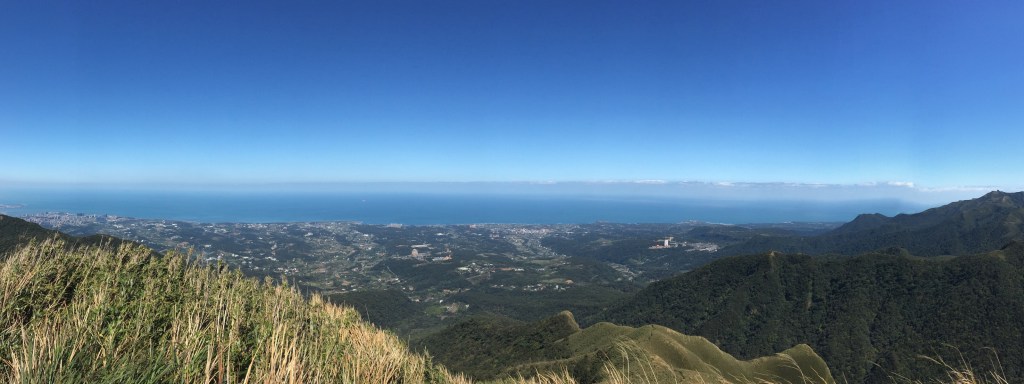
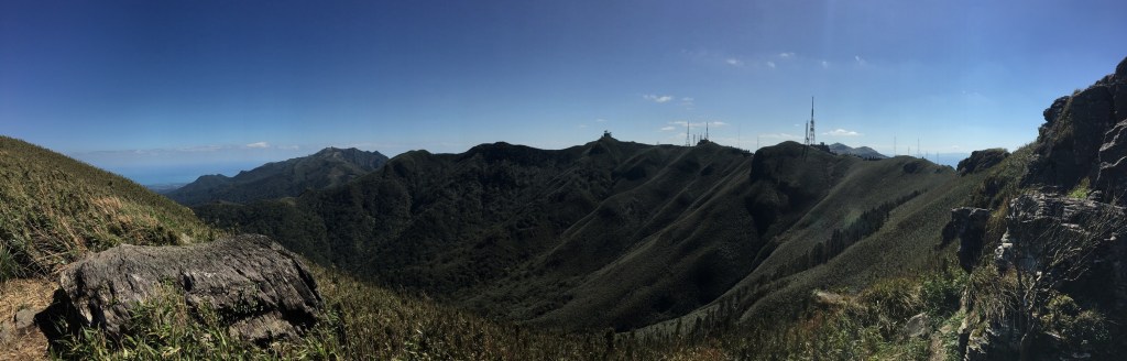
Just beyond the peak, there is a place where you can see out over Sanzhi and Shimen Districts and beyond to the ocean. Perhaps the most impressive man-made feature in this landscape is the light grey ‘True Dragon Tower‘, a 103.5m tall columbarium slightly to the right of centre in the picture, (individual halls within this structure are given prosperous-sounding names that your granny would approve of such as Starry Sky Hall, Treasure Hall and Abundant Earth Hall). A brief glance at the website gives you an idea of just how big a business it is to find a place to shelve the relatives once they’ve passed – with care being taken to ensure that the chi of the location and the architecture is going to bring wealth and success to the descendants of those resting within. This particular company seem to focus on providing top of the range death services, they have several cemeteries around Taiwan, and the Baisha Bay complex that you can see from the hill even includes a pet columbarium. (This isn’t as strange as it might initially sound to some western ears since the Buddhist belief system followed by many here allows them to think that an animal may be reincarnated as a human, and that by looking after Fido’s earthly remains, they can ensure that any future interactions with Fido stay positive.) There is another, squatter pagoda slightly to the left too. This one is Beihai Fuzuo – another luxurious resting place for the remains of your dearly departed.
(There is a path leading down from here but we left that one for another day.)
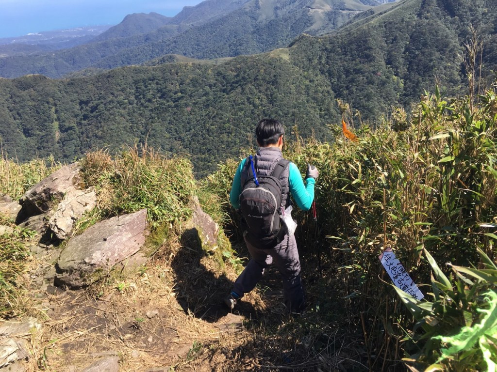
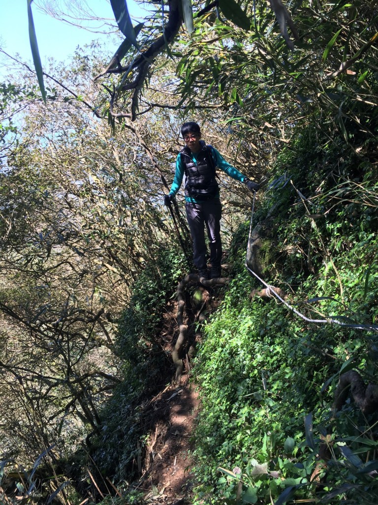
After taking in the view we retraced our steps a short way to the junction and headed down hill. There are ropes involved with the descent and this is the point at which we gave up last time. Luckily the weather was on our side on our second attempt and we were able to make our way down with only minor slips.
Once again, the views fought with the task of climbing for my attention. How can you not stop to enjoy the ripple of wind through bamboo? Part way down the exposed section, a sign claimed that this is 英雄坡 or Heroes’ Slope. I can imagine that successfully climbing it in reverse might make one feel rather heroic.
Just as we reached a really steep chute going down through bamboo, we caught up to a couple that we’d seen at an earlier point in the trail. This section was only doable one at a time, so there was a bit of waiting around. As I reached the bottom, I realised that there was a group of women around our age waiting so that they could climb up. It’s not usual to met hiking parties of women the same age as us, these three seemed to be out gathering both photographs and bamboo.
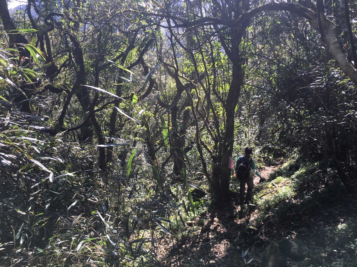
11:23 – As the path levelled out a bit, the bamboo was replaced by more diverse low mountain forest, and there were a few small creeks to cross.
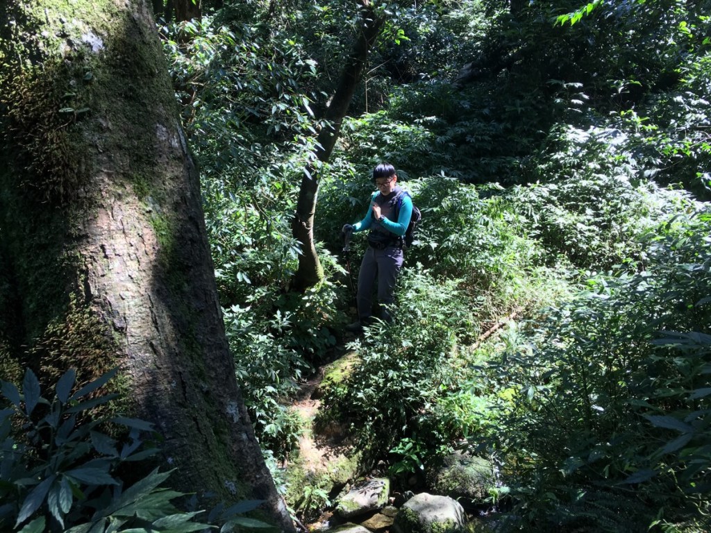
The creeks were all running into the fold of the valley and the sound of water gradually increased until we were walking alongside and above a larger stream.
The shaded valley had a totally different, gentler kind of beauty to the exposed mountain vista and I would have been happy to trace the river for longer.
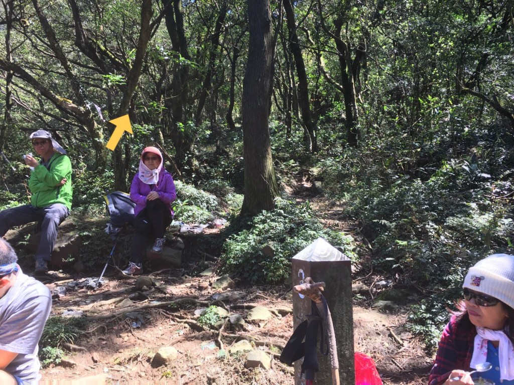
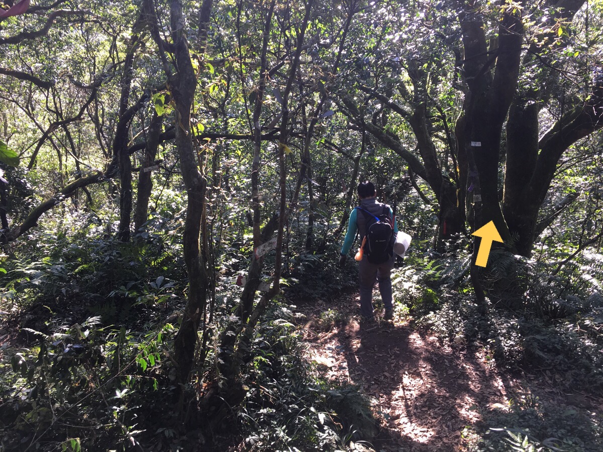
11:42 – At the next junction, there was a choice to go up or to continue straight a little before going up. We decided to go straight up. Actually I would have like to have a rest and eat some fruit first, but it seemed that a large assortment of middle-aged Taiwanese hikers were cheerfully (and loudly) occupying the clearing. I don’t mind chatting with people I meet in the hills, but their large group size and excitable chatter had us marching on up the path without stopping – it can be overwhelming to be thrown into a loud group after a couple of hours of almost solitude.
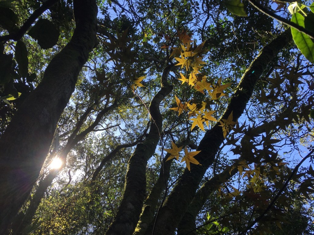
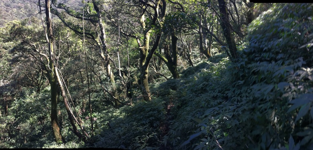
We really should have stopped and gotten ready for the ascent. This slope may have been covered by trees, but it was nearly as steep as the climb down into the valley, and I could feel that the muscles in my legs were in need of a resupply. Through the gaps in the canopy we were offered glimpses of the spring colours, wild cherry trees stood out as vivid splashes of pink in a landscape dominated by fresh greens. On the path, I was enthralled by the yellow illuminated on these leaves by a stray sun beam. They look maple-like in shape, but since March isn’t really the season for yellow maple leaves, they are probably some variety of sweet gun.
Nearing the top of the climb, there’s one section where the ground is in the process of gradually slipping down the mountain, so care must be taken to walk on the inside of the path.
12:43 – Emerging at a junction, we turned left to go and pay a visit to Caitou Lun (菜頭崙). Later on we would pass back this way.
The path passes another trig point on the way – signs mark this as being the ‘north north’ peak of Xiao Guanyin shan. We passed straight through, ignoring the path on the left, (this is where we could have come up if we’d taken the longer route up).
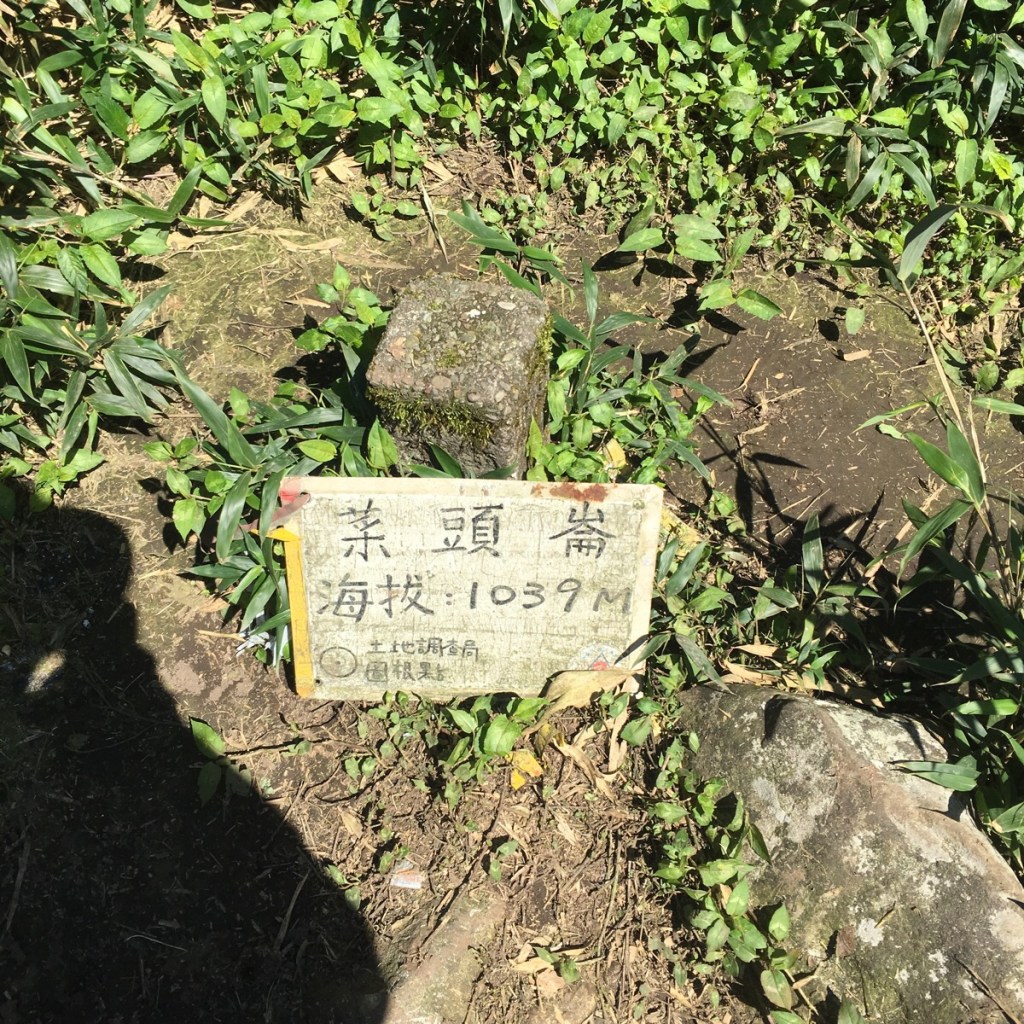
12:56 – We reached Caitou Lun at just about lunch time – there wasn’t any view, but there were a couple of rocks to perch on and so we decided that it would be a suitable place to eat. We did debate a little about heading downhill five minutes where a sign assured us that there was a beautiful view, but decided that food was the priority.
14:13 – We spent just over an hour eating and resting our legs before returning along the same path that we’d come from. When we passed the junction with the path we’d climbed up from the stream, we kept walking straight along the ridge.
14:17 – This section of path had some more spots of heart-stopping beauty – especially here on the Xiao Guanyin shan north peak. There is a small bluff which overlooks a few tiny villages clustered together around another hot spring hot spot – there are several hotels and resorts here, surrounded by flower farms. (Actually there is another wild hot spring located in this valley, but bathing here is prohibited.)
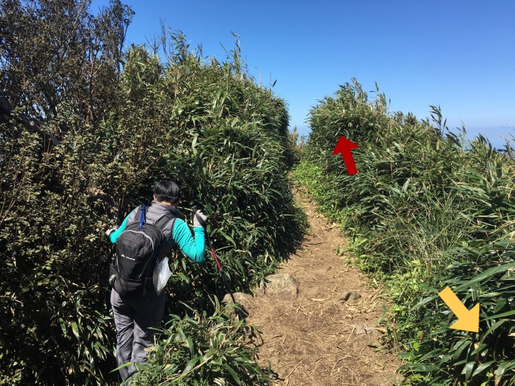
Leaving the north peak, the path gently dips and rises through chest-high bamboo as it approaches the main peak. For a while we had a small brown bird bobbing and skipping in front of us, as if it were anxious that we wouldn’t be able to find our way.
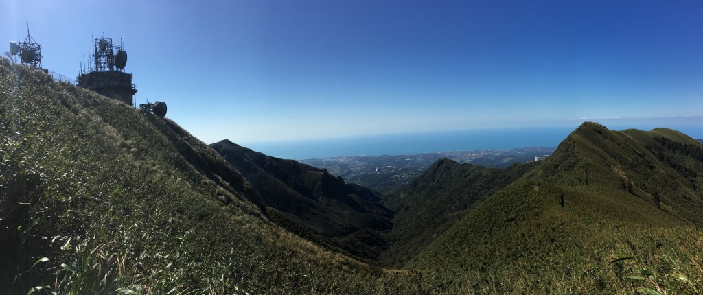
From here it’s possible to look down the barrel of the valley towards the coast. The paths that we’d walked on both sides were visible cutting through the bamboo. Standing here made me really wish that we’d walked the longer route so that we would have covered all the peaks (because that’s how my mind works).
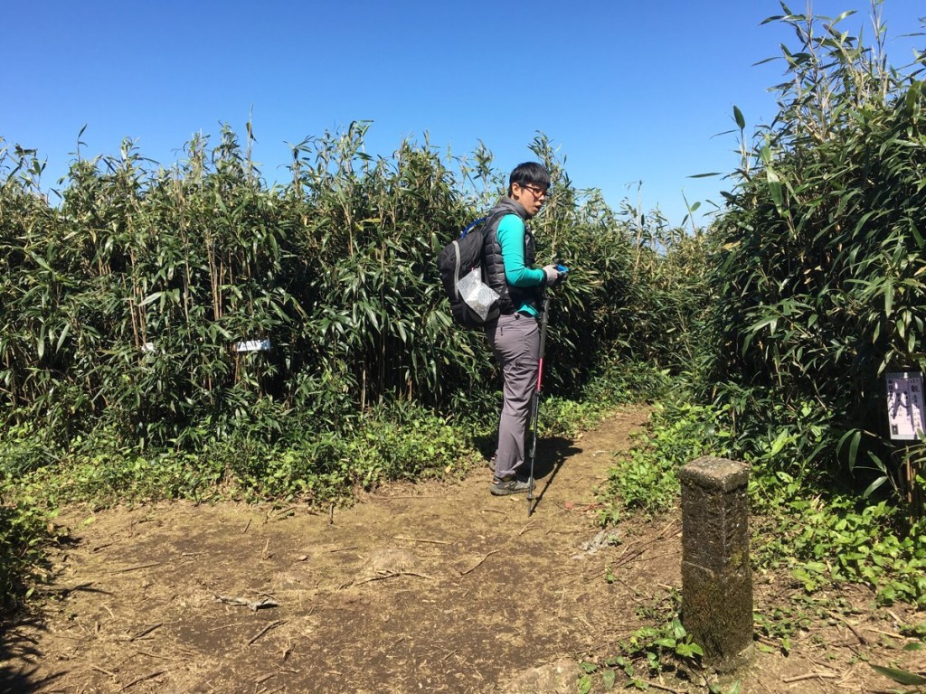
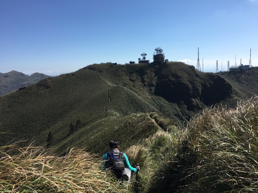
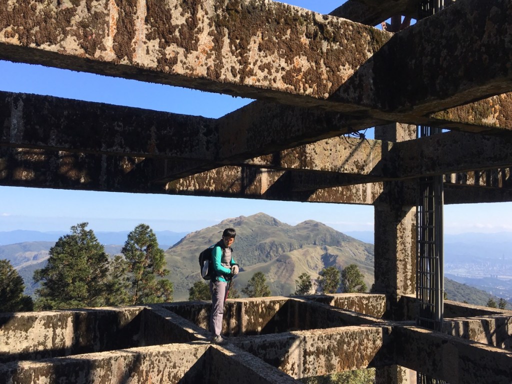
14:41 – Arriving at Xiao Guanyin shan main peak, the path skirts just left of an old building before passing under a collapsed mast. On the sunmit, there were yet more older people with Opinions. This time, a gathering of three older people shared Opinions and Advice with a younger couple who were newish to hiking and evidently not going about gaining experience in the correct way. We ignored them and enjoys the scenery instead.
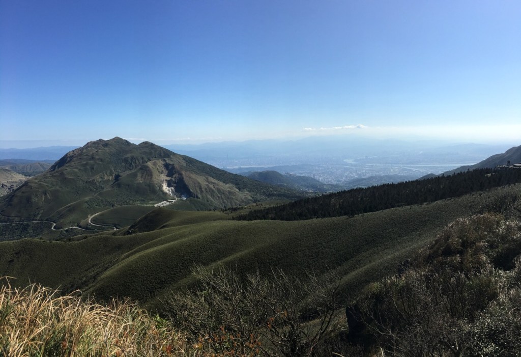
It seems that I have an endless capacity for enjoying the mountain scenery of Taiwan, each new vista is able to hold me transfixed with its beauty. From this peak, the view takes in Xiaoyoukeng and Qixing shan with the sprawl of Taipei in the background – the rivers winding through the mass of buidings with pleasant curves, and the mountains to the south of the city framing everything. By this point, the snow-capped distant peaks had been erased from the horizon by dust or water vapour in the air. I felt excited again by the fact that I’d been able to see them earlier.
As we were standing and enjoying the view, a couple in their forties arrived and set up camp chairs facing Qixing shan then sat down to enjoy it. They seemed ever so content – I would have been too if it were me.
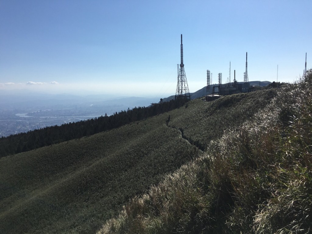
The path leaves the main peak in the direction of the radio towers.
15:04 – The artificial stand of trees visible in the previous photograph is a welcome, but strange feeling change of scenery. We hit it at a wonderful low-sun time which meant the place was saturated with lovely warm light.
The first sign that you’ve reached the radio towers is the massive concrete base of one of the towers. Teresa, being Teresa, couldn’t resist a little walk over some of the cross beams.
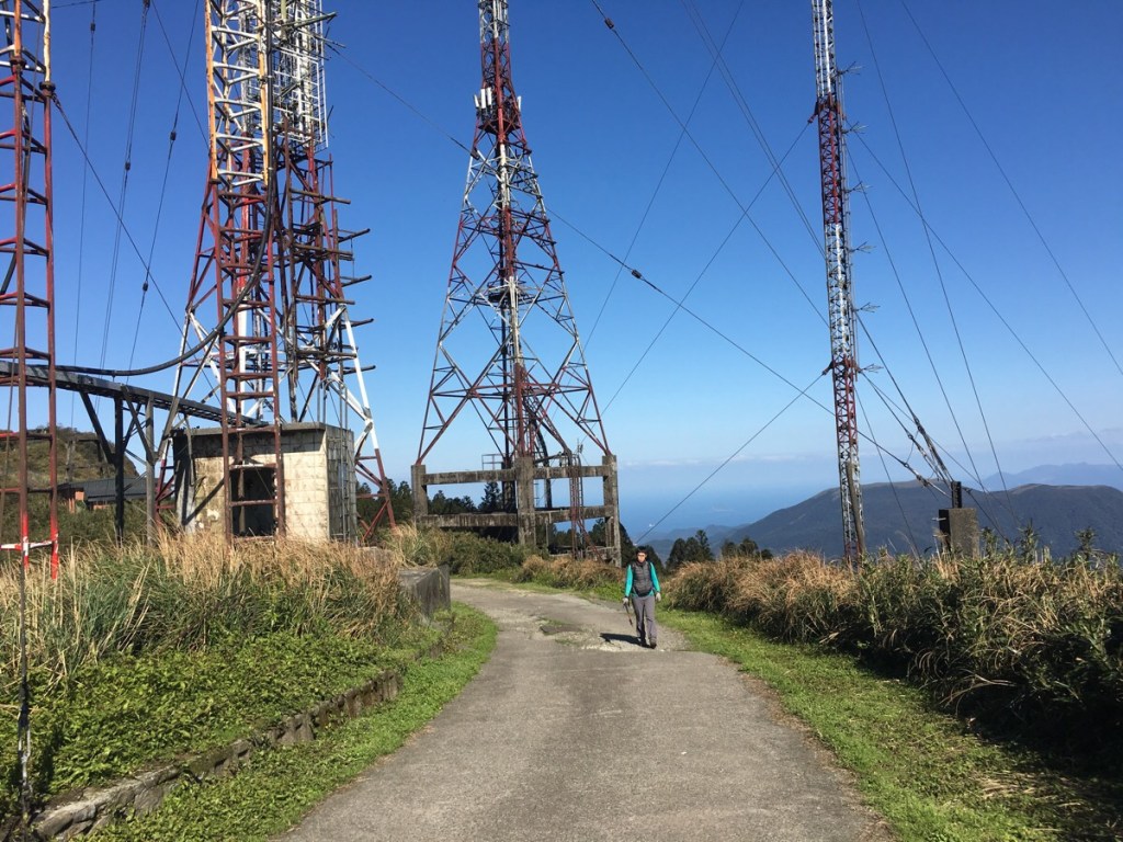
There are a few buildings along the road, one of which has a few noisy guard dogs sat outside. Actually, one of the things that worried me about doing this hike is that Taiwanese walkers who’d completed it warned of very fierce dogs at some point along the trail, but if these were the fierce dogs they mentioned, then it was a case of overexaggeration – the barked at us fiercely from a distance but nothing more.
We kept heading straight down the road as people in cars drove up – it seemed that many people were coming here just to enjoy the view and then head home again.
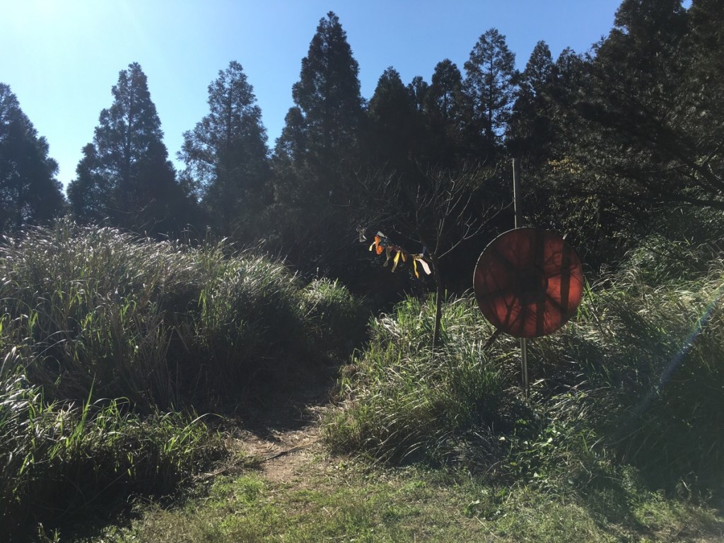
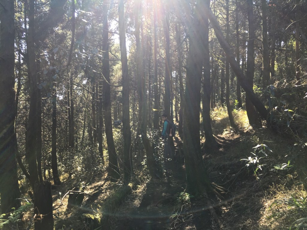
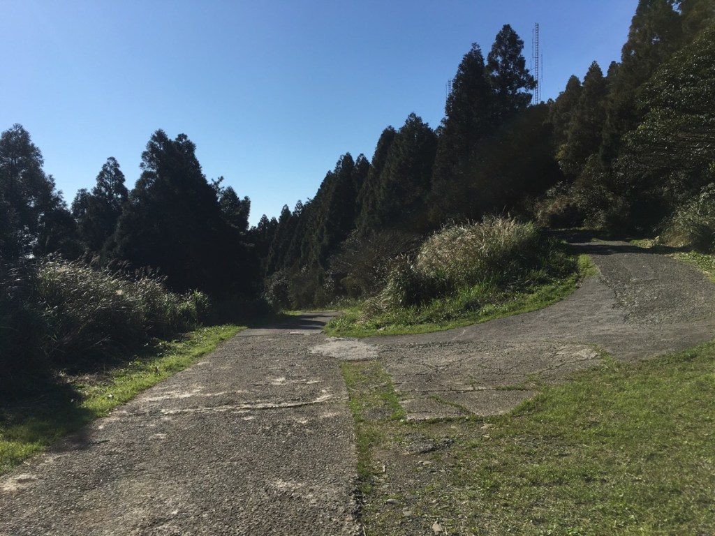
15:20 – At this point we had to make a decision about whether we wanted to just walk back down the road, or take the footpath. We opted for the footpath and turned right into the trees by a broken mirror. There is a junction on the left very soon after leaving the road, but that just joins the road at another point.
15:26 – After leaving the shelter of some trees, the path took us back to bamboo-covered slopes. Another of the fabric triangular flags told us that we were passing though 美滿幸福大道, or Happiness Avenue – I have no idea what led to it getting that name. At this junction with a leaning tree, we headed left. The sign indicated that from here it would take us another 30-40 minutes to arrive back at the mountain house/山之家.
Teresa was apparently on a mission to get back to the car and she powered ahead of me as we drew below the bamboo line and back into the trees.
15:38 – There is one more small path joining from the left. Again this comes from the road so we ignored it and kept going.
15:45 – When the path reached a T-junction, we headed left and were soon at the mountain house. From there it wasn’t long before we arrived back at the car park. We were pleasantly surprised to find that we had a spare sachet of coffee in the car and rested a while without shoes off to enjoy a hot coffee before getting on our way. In general, I think I am quite an easily satisfied person, but I finished this day feeling really happy.
How to get to Xiao Guanyin Shan
Google Maps address: 252, TaipeIi City, Beitou District, 三芝區示範公墓 – this will take you to the car park by the trailhead. It’s free for scooters but charges by the half-hour for cars so it’s not cheap. If you can go early, there are a few possible roadside spaces.
GPS location: N25 11.000 E121 31.750
Public transport: it is possible to take a bus to a bus stop near the trailhead, but it looks like it’ll take a good couple of hours.
Xiao Guanyin Shan Trail Map

GPX file available here on Outdoor Active. (Account needed, but the free one works just fine.)
My new words learnt on this hike:
- 胃脹氣 / wèi zhàngqì / bloated
- 故意的 / gùyì de / on purpose
- 各種問題 / gèzhǒng wèntí / various problems – said of a person, this is a little rude, as in ‘you have a variety of problems’
- 沒有什麼屁用 / méiyǒu shé me pì yòng / what is the use of X, or that’s useless – very rude
- 你嘟嘟嘴做什麼?/ nǐ dū dū zuǐ zuò shénme? / What are you pouting for? – 嘟嘟嘴/dū dū zuǐ is like saying ‘pouty face’ I think.
- 玩電動 / wán diàndòng or 打電動 / dǎ diàndòng / play computer games
- 粗魯 / cūlǔ / rude
- 隔天 / gé tiān / the next day – I can’t believe that I didn’t know this word until now. I know 後天/the day after tomorrow, how could I not have heard this before too?

Great write up Amy! We did the hike today not the best weather for it so no views but this was the third time I’ve had permits but the last two times we had to cancel due to injuries or really bad weather so we went for it. Update re permits – you no longer need the leader to be Taiwanese and it was really easy to do as there is an English version of the website.
LikeLiked by 1 person
Glad to hear you had a good time! I keep meaning to return to this one, but you know how these things are, there’s always something else! Actually, I should thank you for giving me a push. I recently visited Lujiaokeng (another permit hike in Yangmingshan), and went through the process of applying myself. I’m working on an explainer and I’ve been meaning to update this page to better reflect the current situation. I was really pleasantly surprised by just how easy the process is. After years of it being such a faff that it wasn’t really worth it, it’s suddenly super straightforward.
LikeLike
Pingback: Hiking Group Hikes/Day Trips/Activities from Taipei – Rafaels Reisen
Xiao Guangyin was a gorgeous hike, but I would definitely rate it more difficult than 4/10. I would give it a 7 or 8 for regular hikers and would not recommend it for new hikers. We just hiked Phoenix Mountain on your recommendation and found that much easier than this. But yes it was spectacular! Thank you!
LikeLike
On balance, I think you’re probably correct there. This rating malarkey is so hard. Especially when you take into account all the different kinds of walks Taiwan has. On the one hand, you’ve got people saying that Elephant Mountain is an “extremely challenging climb” and others saying Stegosaurus Ridge is “pretty easy.”
LikeLike