I have given much shoe rubber to the hills of New Taipei’s Ruifang District and I’m still not even close to running out of tracks to walk. This particular mini adventure is a brief but enjoyable walk that connects two of the area’s popular sight-seeing spots: the Golden Waterfall and Shibaoshan Lookout. If you’re feeling energetic, you could use it as a warm-up for climbing Teapot Mountain, or if — like me — your in more of a leisurely mood, you can end the walk with a pleasant sit down in one of Jinguashi’s coffee shops.
Distance: About 2.5 kilometres with options to extend.
Time: 1½-2 hours (more if you extend the walk or stop for coffee).
Total ascent: About 250 metres.
Difficulty (regular Taiwan hiker): 3-4/10 – This walk has challenging sections that are steep and/or slippery, as well as some sections that require the use of a rope, but it’s short. For these reasons, a seasoned Taiwan hiker would likely consider it to be on the tougher end of what they find easy.
Difficulty (new Taiwan hiker): 6-7/10 – Judging by all the Google Maps reviews calling the slopeway difficult and dangerous, I think it’s safe to say that most people who aren’t familiar with Taiwan’s hiking trails will find this either moderately challenging or quite challenging.
Risks and dangers: Slippery trail, one or two area with a drop-off beside the path (but nothing too serious or scary). The route is only signposted with hiking tags and hand-written signage, so you need to know where you’re going.
Water: I took 0.5L and drank very little on a cool day. There are several coffee shops or small restaurants once you reach Qitang Old Street, and you can top up your water bottles at Quanji Temple or the gold museum.
Shade: Tree coverage is patchy at best. If it’s sunny and your skin is sensitive to the sun, make sure to cover up.
Mobile network: Clear throughout.
Enjoyment: It is only a short walk, but I really enjoyed linking two of the area’s popular tourist spots via a totally off-the-beaten-track trail.
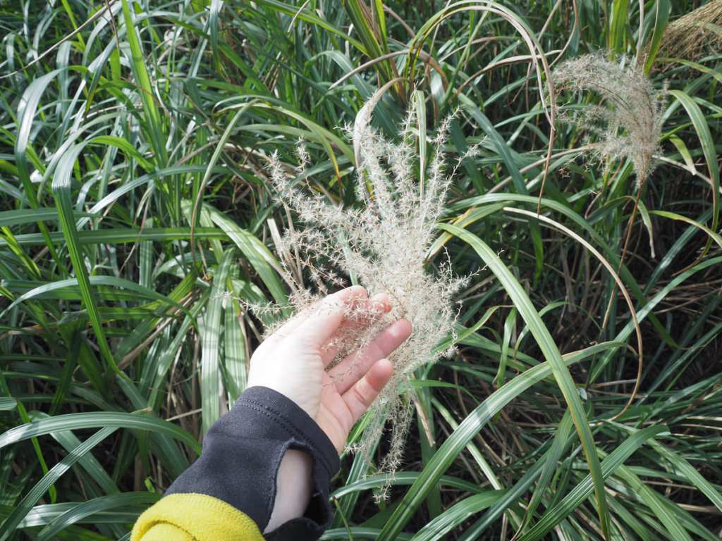
Silvergass Season: Silvergrass season varies from year to year. Sometimes it’s late October, sometimes it’s early January. Your best bet is to look at the recent Instagram posts for the area — the internet beauties will be the first to know.
Bathroom facilities: There are no toilets near the start of the walk, but you can find bathroom facilities beside Quanji Temple and at the Jinguashi Gold Museum.
Route type: Point to point.
Permit: None needed.
Jump to the bottom of this post for a trail map and GPX file.
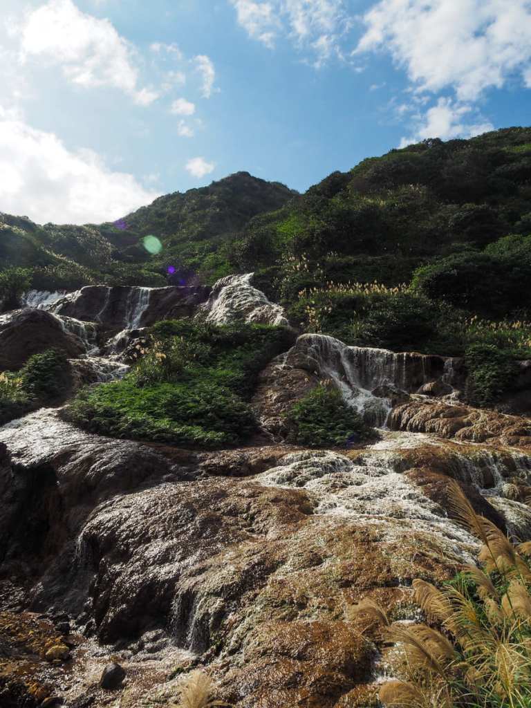
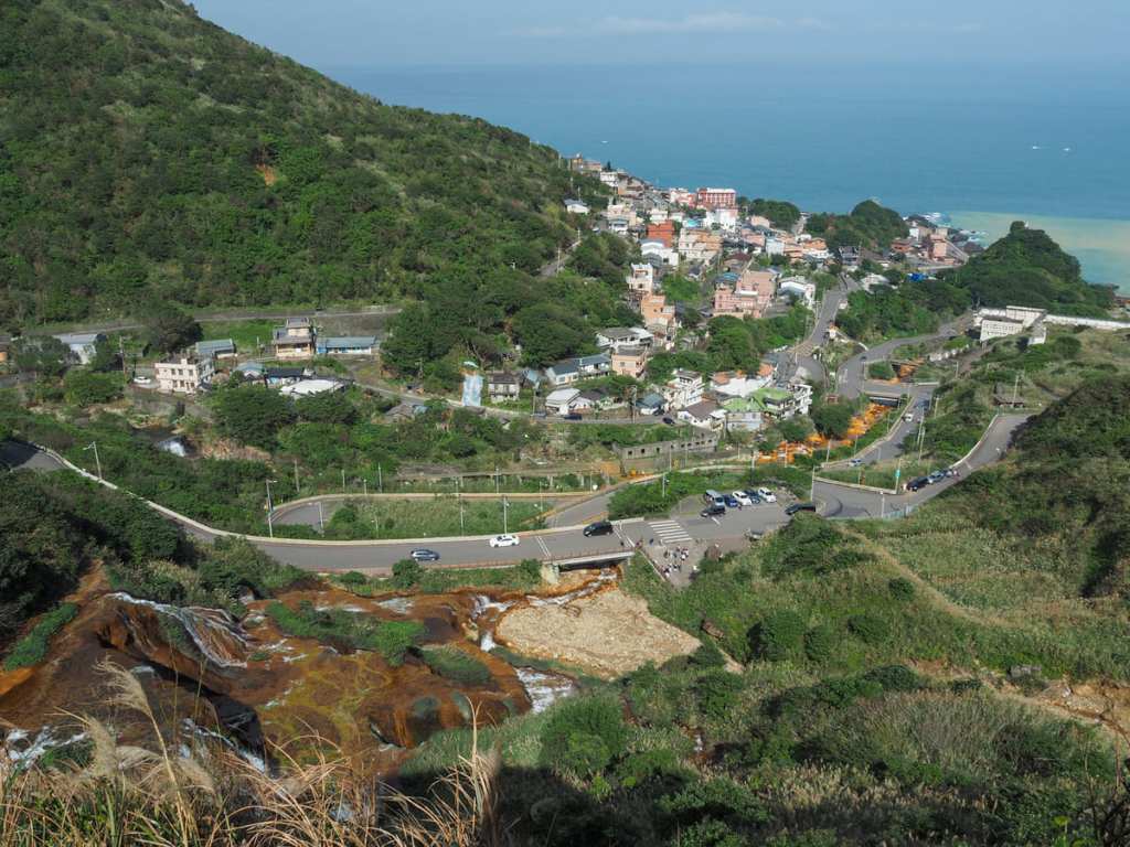
I have passed by Jinguashi’s Golden Waterfall countless times, but I’m not sure that I’ve ever stopped here before. Despite its less-than-beautiful roadside location, the falls are indeed impressive. A broad wall of small cascades was picked out in high contrast by the early morning sun, thin curtains of water gleaming white against the yellow-stained rocks that give the waterfall its name.
I began my walk at about 10:30am on a Monday morning, and already, the dark-coloured people carriers operated by private tour companies were lining the curb, hazard lights flashing, passenger loads milling about and taking photos.
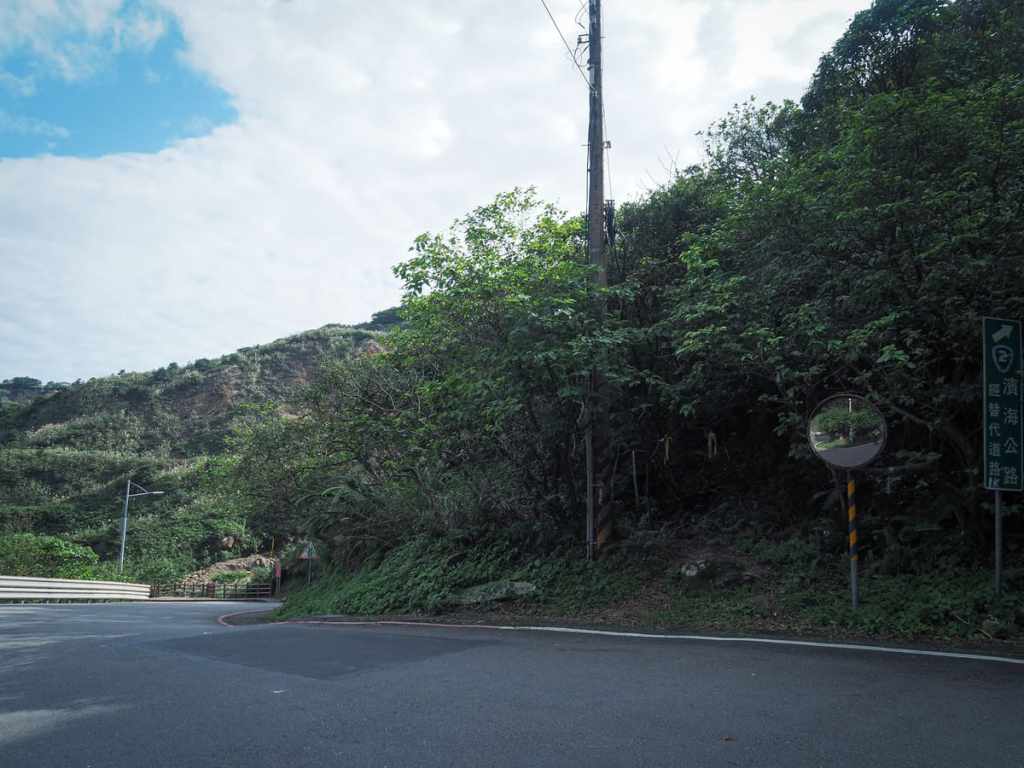
Turning away from the waterfall and headed uphill to the next junction (the waterfall is down that road to the left hand side of this photo). The entrance to the trail can be found at this junction. It’s on your left and right next to a traffic mirror.
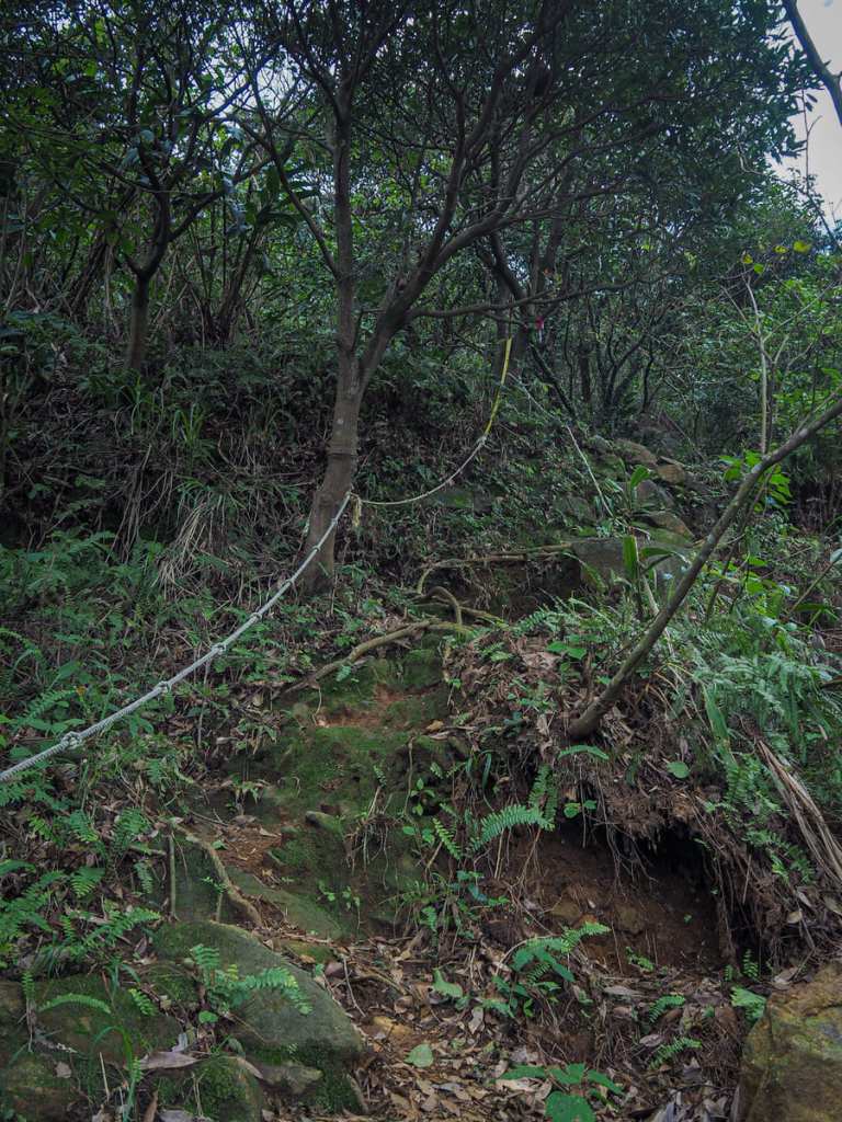
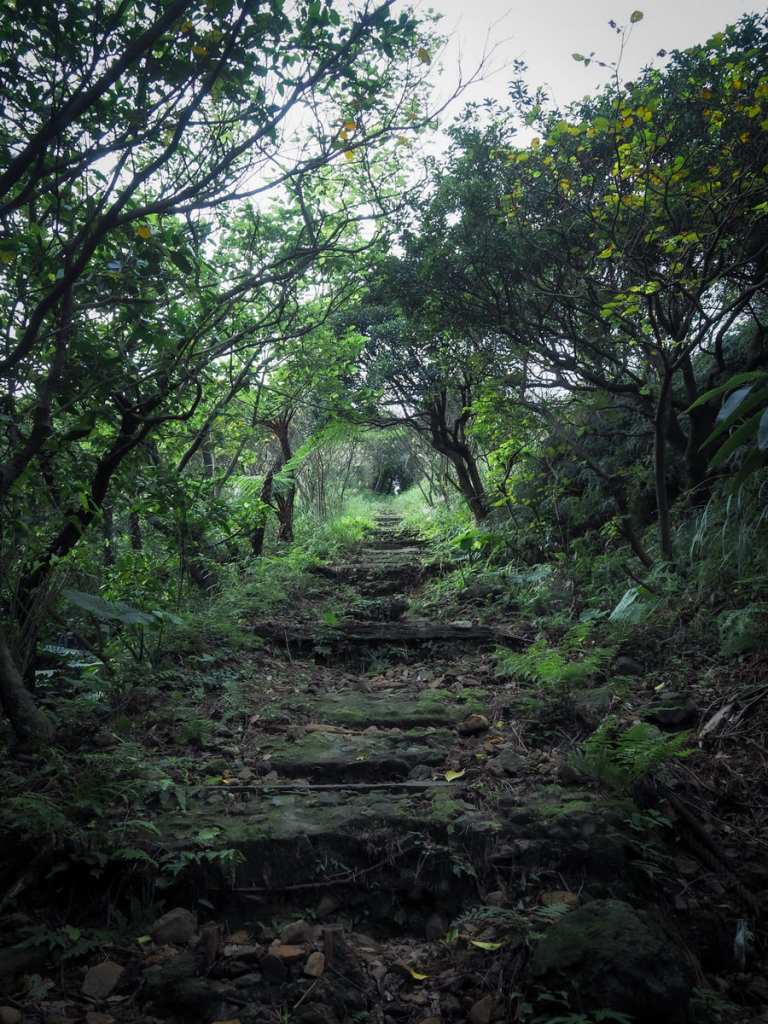
The initial scramble from the road to the top of the waterfall is the steepest part of the journey and hikers are assisted by a few fixed ropes.
At the trail nears and then passes over the top of the waterfall, you can look down over the people looking up. It felt like a weirdly powerful situation to be in, even more so since most of the observers seemed entirely oblivious to the fact I was up there.
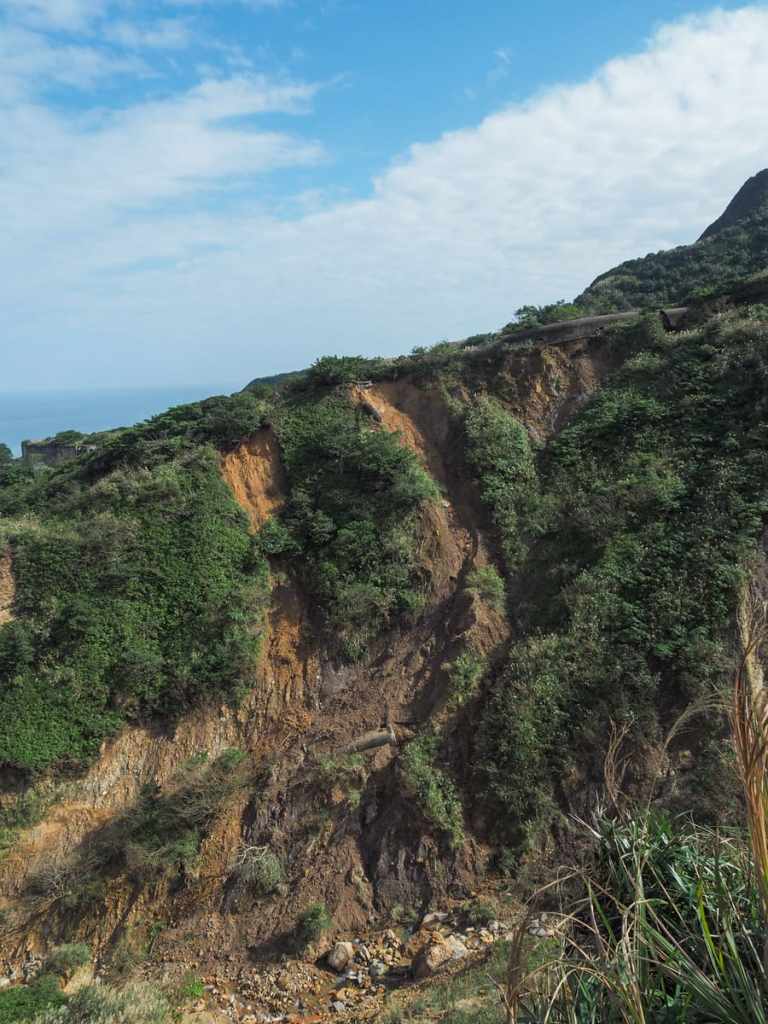
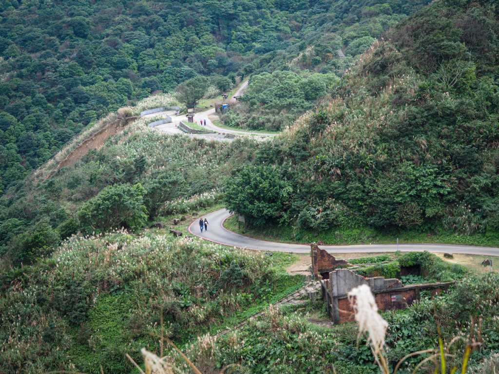
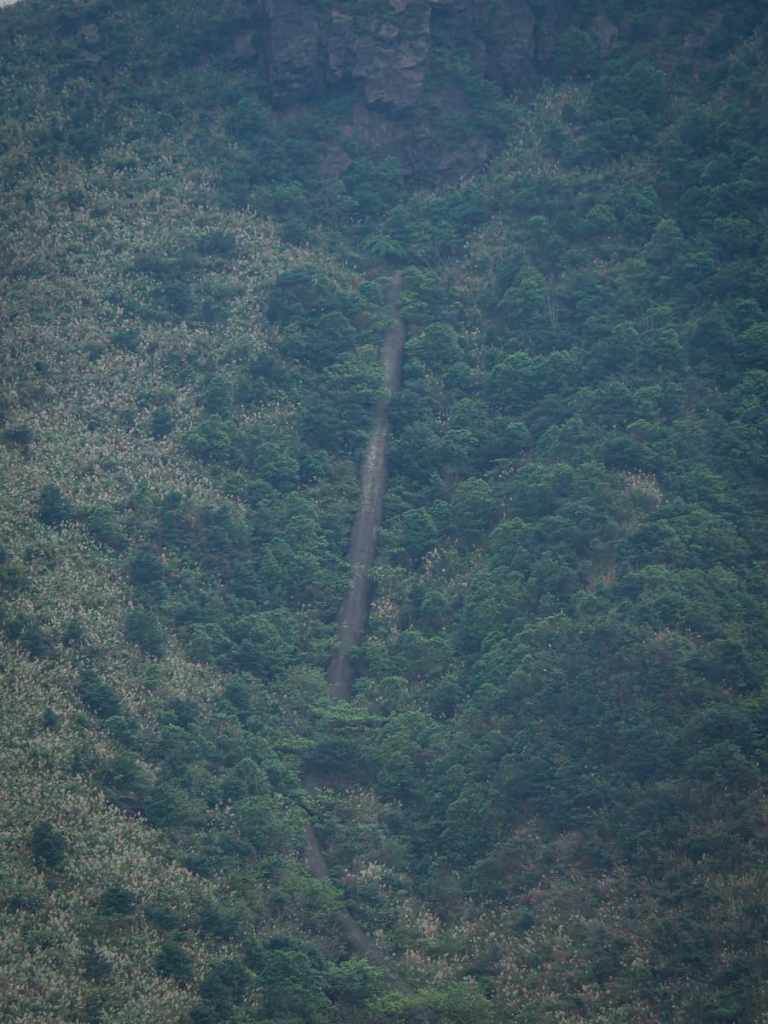
After a brief but steep climb, the trail crests a rise and from up here, you can see across a valley to where one of the old flues teeters on the verge of collapsing — indeed, part of it has already collapsed. These giant concrete snakes (there are at least three of them) are huge. Tall enough to walk through, they run from the old Shuinandong copper smelting plant (now known as the remains of the thirteen levels), all the way up towards the spine of Stegosaurus Ridge (although I’ve never looked into precisely where it is that they terminate). They were built to carry the toxic fumes from the smelter up onto the hills and away from the workers, and even though they’ve been defunct for decades, the concrete still contains high levels of toxic substances (at least that’s one of the reasons the authorities give to explain why they’re off-limits).
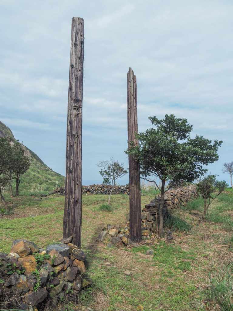
The trail climbs to a parcel of flat land bounded by stone walls. Trees have begun encroaching on the clear ground and on one edge, two wooden posts form a doorway of sorts. This location was featured in the 1992 Taiwanese drama, Hill of No Return (無言的山丘).

The film follows the lives of two brothers who suffer hardships working as miners under Japanese rule. One of them falls in love with a sex worker (the town’s two main industries being mining and the oldest profession), but the film is not a romance, its bleak and in the end, she dies from tuberculosis while sat against these walls.
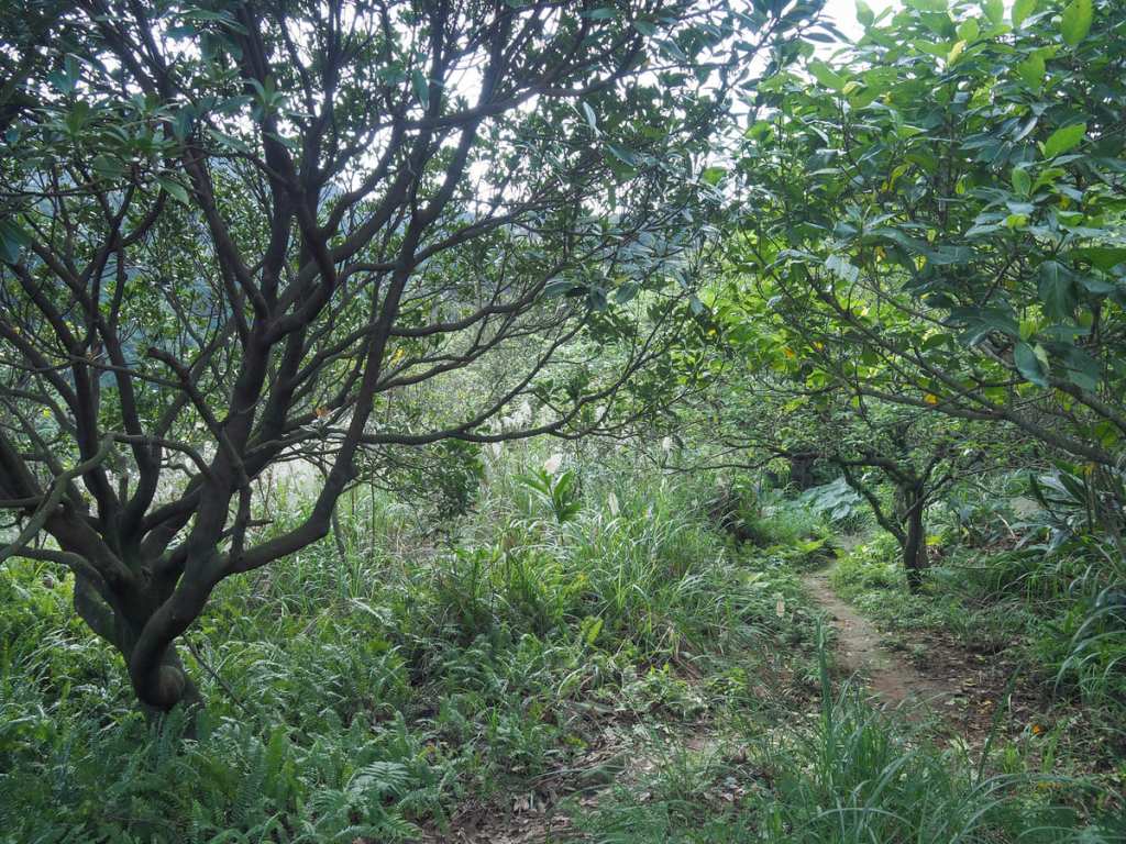
Heading diagonally through the site, a trail leads under the tree cover.
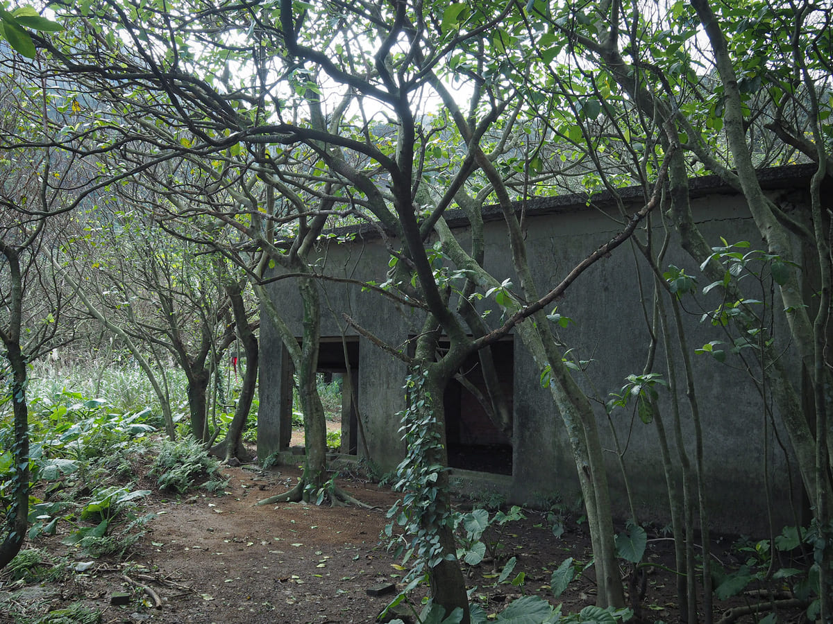
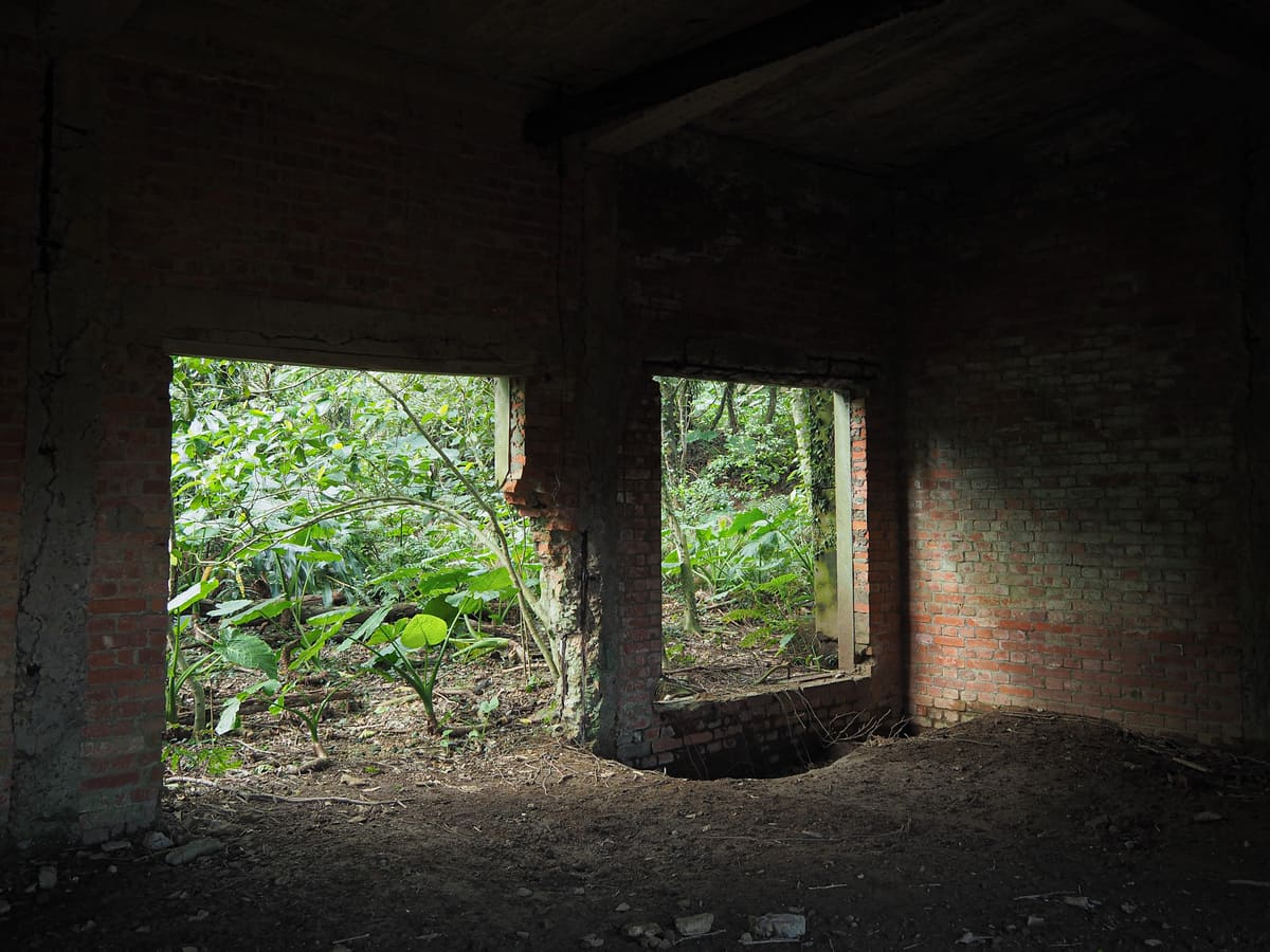
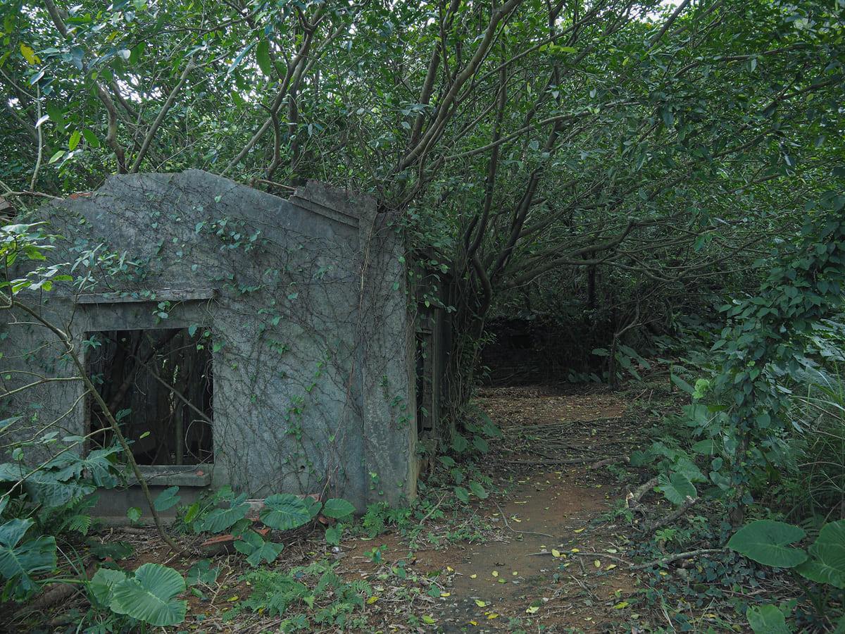
A short distance into the trees, the trail passes through a cluster of abandoned buildings. I haven’t been able to find any resources that state definitively what they are, but their proximity to mines and their placement at the lower end of Liukeng Slope Ropeway suggest that they were likely part of the mine’s retinue of administrative facilities.
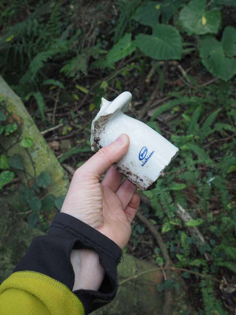
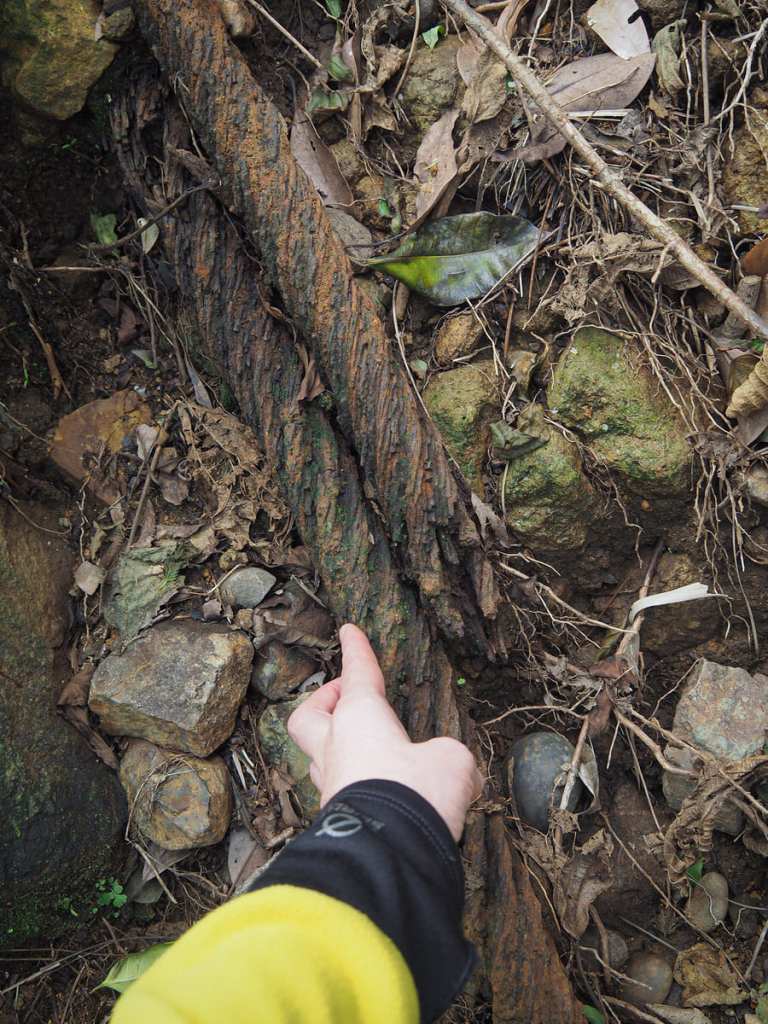
Historic detritus (or junk, depending on your outlook) can be seen lying beside the trail. As well as lots of old glass bottles, I saw several of these ceramic fixtures that might have had something to do with holding wires or ropes, as well as some giant chunks of metal cable.
There are a couple of trails fanning off from the spot by all the abandoned buildings. One goes left to explore a few more mining ruins and one goes right along the course of an old irrigation canal to rejoin the road, but it’s impossible to miss the cableway.
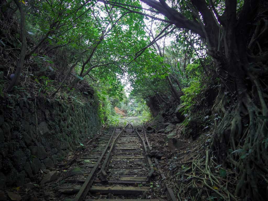
Built in 1932, for transporting ore, equipment and personnel, the track extends for a little over 300 meters at a 45-degree angle and it is somewhat challenging to walk up. About two thirds of the way up, a section of the old rails remains in situ, but for the most part, the old line has crumbled.
You can see photos of the ropeway working into the 1970s.
https://tcmb.culture.tw/zh-tw/detail?indexCode=Culture_Object&id=569766
https://ntpc.culture.tw/ntpc/zh-tw/localruifangJinguashispace/281560
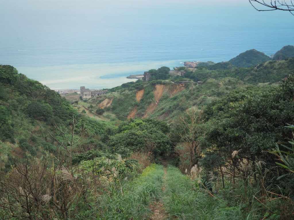
As you near the top, it’s worth turning round to look at the view. Far below, it’s possible to make out some of the remaining buildings of the old smelting plant, and beyond that, the strange colouration of the Ying Yang Sea (a phenomenon caused by all the minerals that are washed out from Jinshan’s streams).
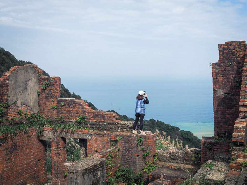
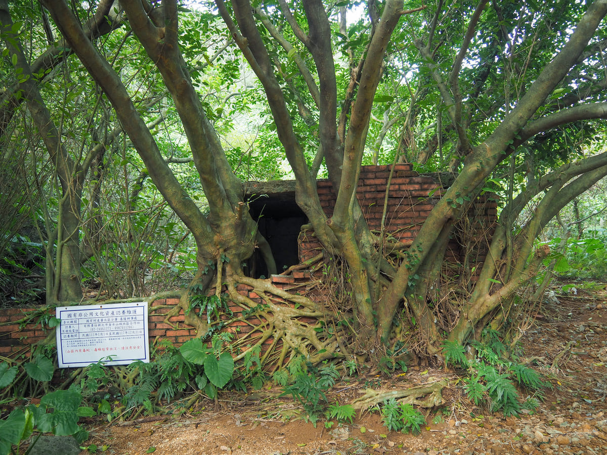
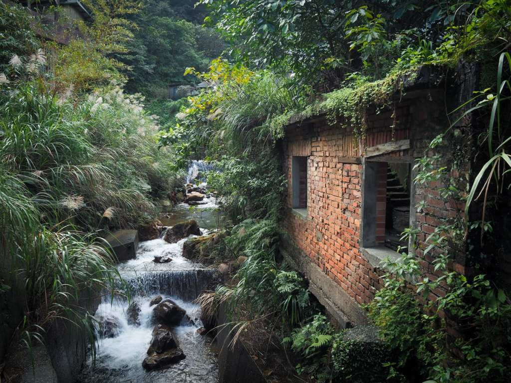
The old tracks terminate at a crumbling red brick structure which used to house the old ropeway mechanisms. It’s now become a popular Instagram check in location thanks to the picturesque dilapidation and scenery.
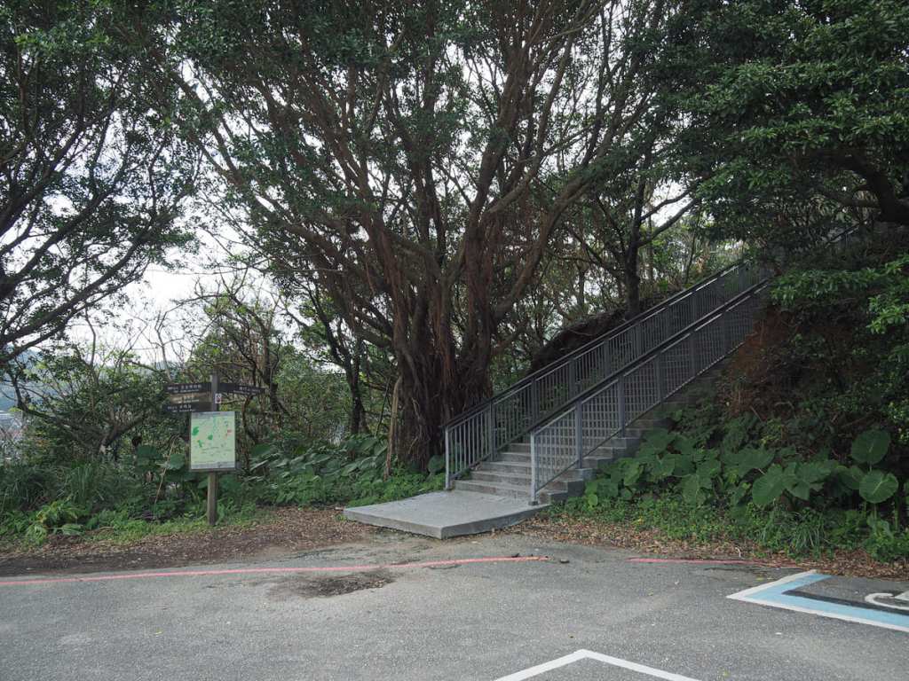
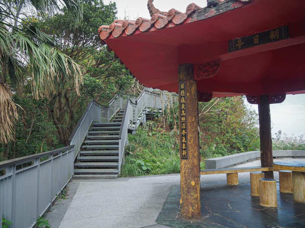
While you’re here, it’s worth taking a brief 10-minute diversion to visit the Shibaoshan Boardwalk and Lookout. The entrance can be found to the right of the carpark as you reach the top.
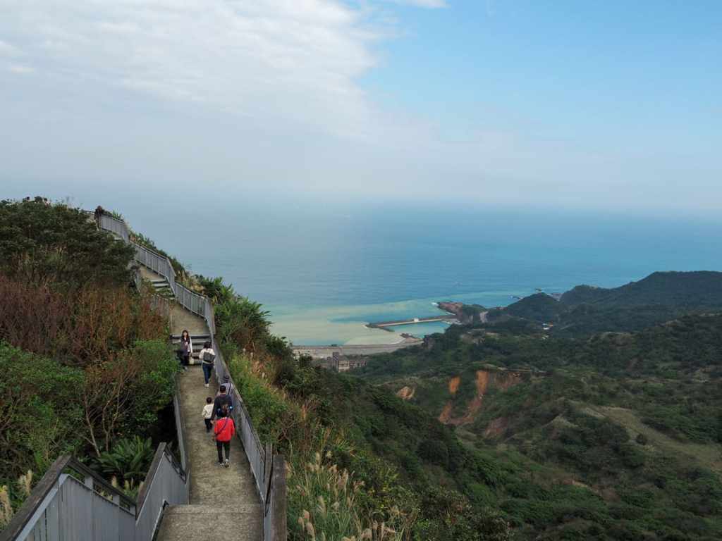
A fenced trail takes you along the spine of a hill to reach the lookout.
From up here, you can see the red brick cable house at the top of the ropeway.
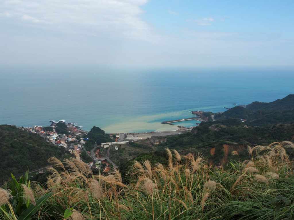
Looking down towards to coast from the lookout platform, the yellow-tinged mineral-rich flow from Jiufen Creek spreads out, mixing with the waters of Liandong Bay (濂洞灣).
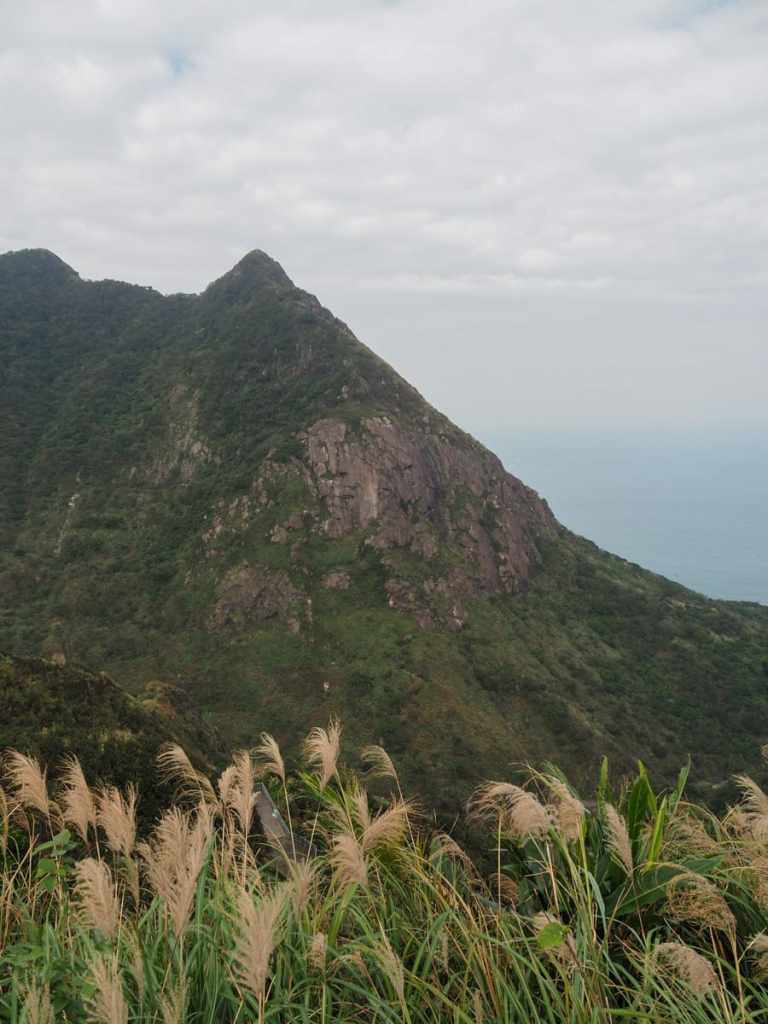
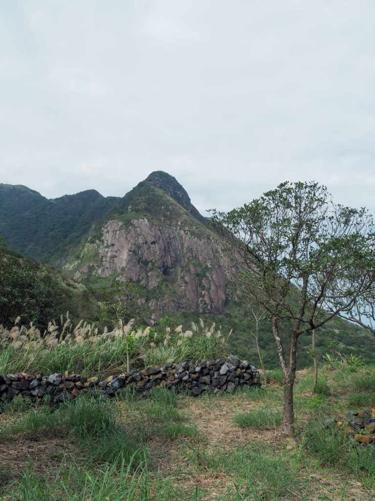
To the left, the dramatic eastern peak of Mount Keelung surges up to join the more rounded hump of the main peak, while to the right, you get a glimpse of some of the higher up sections of the old smelter flues and a tall, thin waterfall.
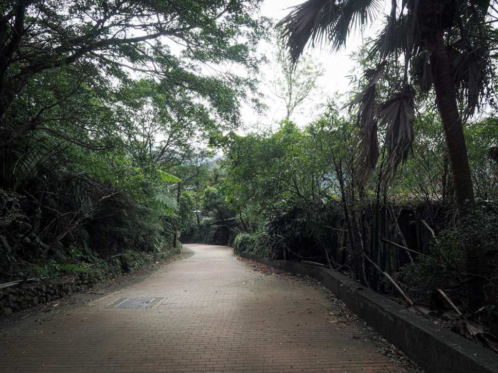
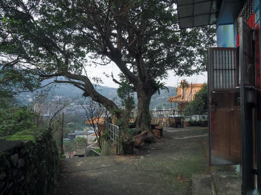
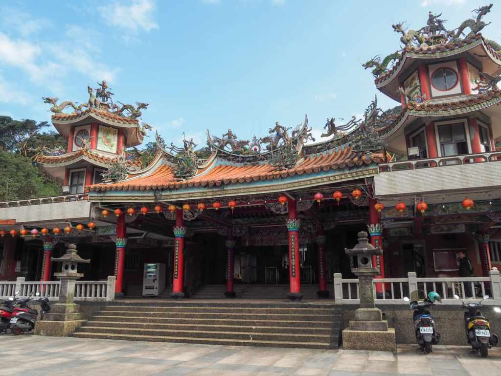
Returning back along the boardwalk, I decided it was time to go in search of coffee, so I headed for the path at the far end of the carpark then took a right down some steps to reach Quanji Temple (勸濟堂).
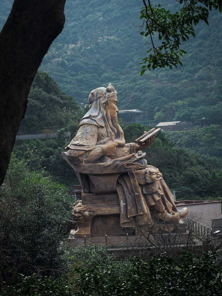
The temple’s main claim to fame is the ginormous Guan Gong statue perched above it — said to be the largest of this particular deity in Taiwan.
I didn’t pop in to the temple on this occasion, just passed straight through the courtyard and down the steps leading towards the narrow cluster of lanes fanning out from Qitang Old Street.
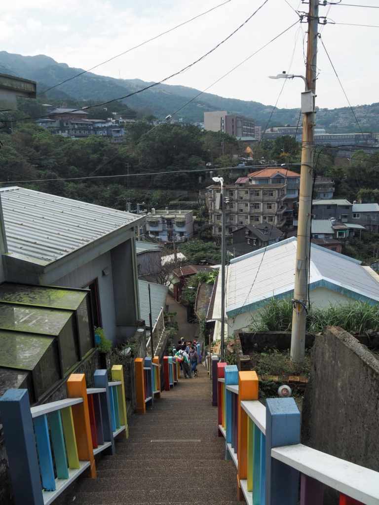
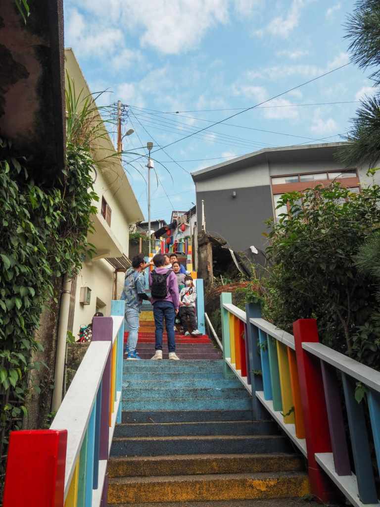
This area isn’t nearly as popular as nearby Jiufen, so touristy flourishes — like these rainbow steps — seem all the stranger.
The old street is an odd mix of low-key trendy cafés and abandoned buildings, like this one perched over the creek that runs below the street in the direction of the Prisoner of War Memorial Park.
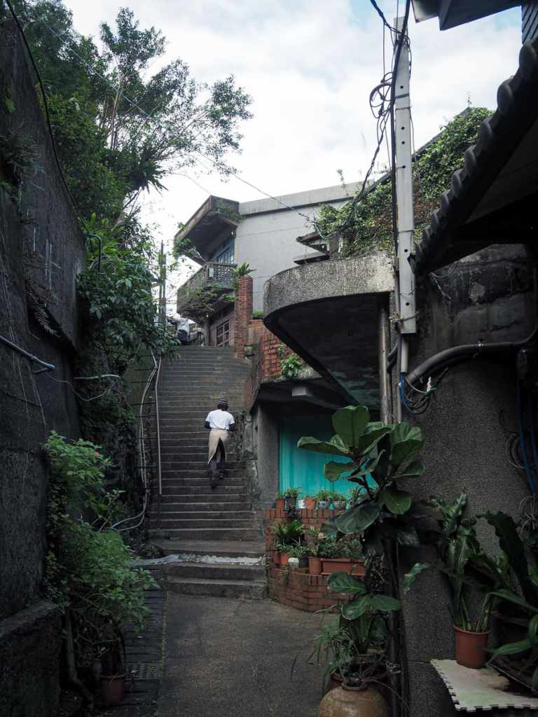
An employee of one of Qitang Old Street’s coffee shops climbing the steps.
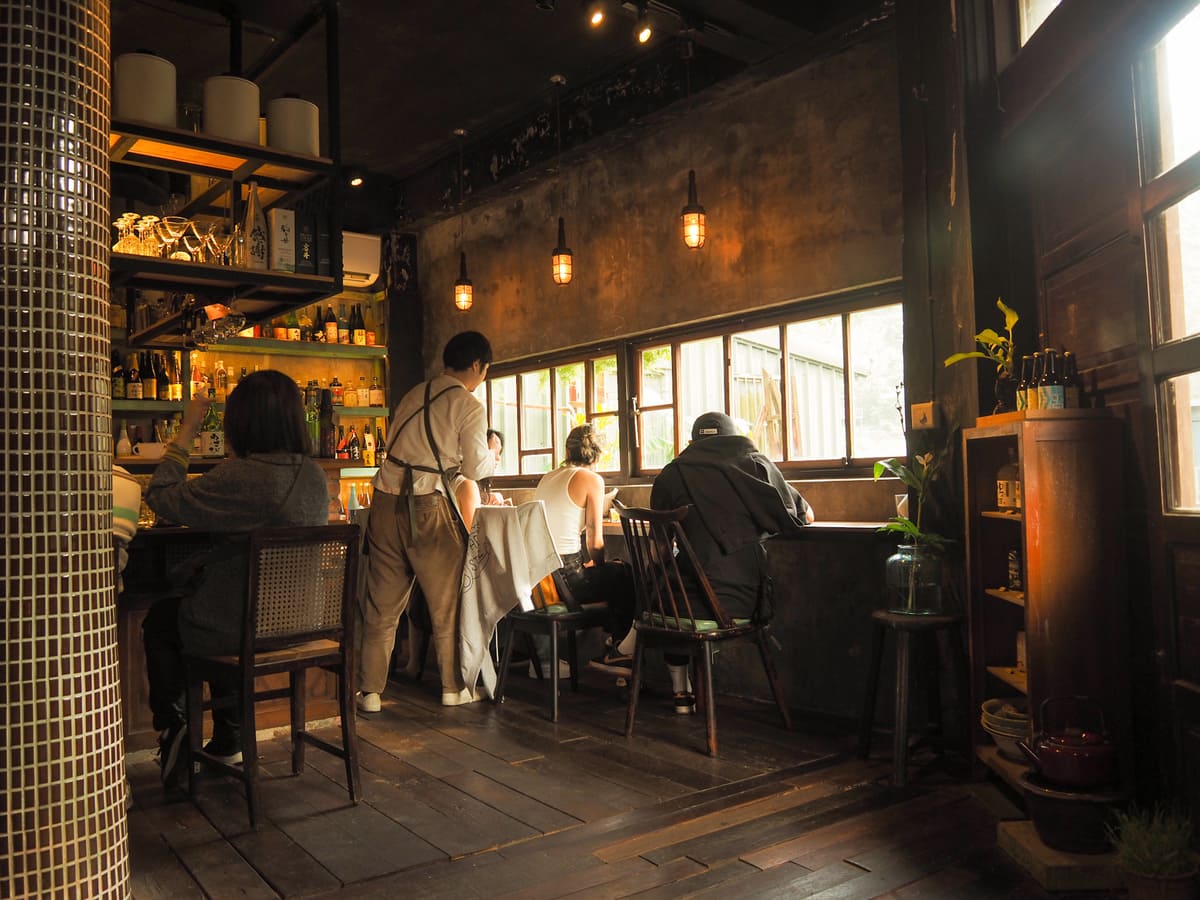
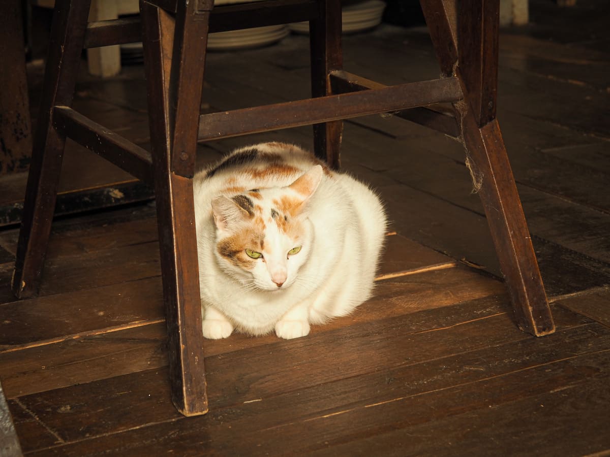
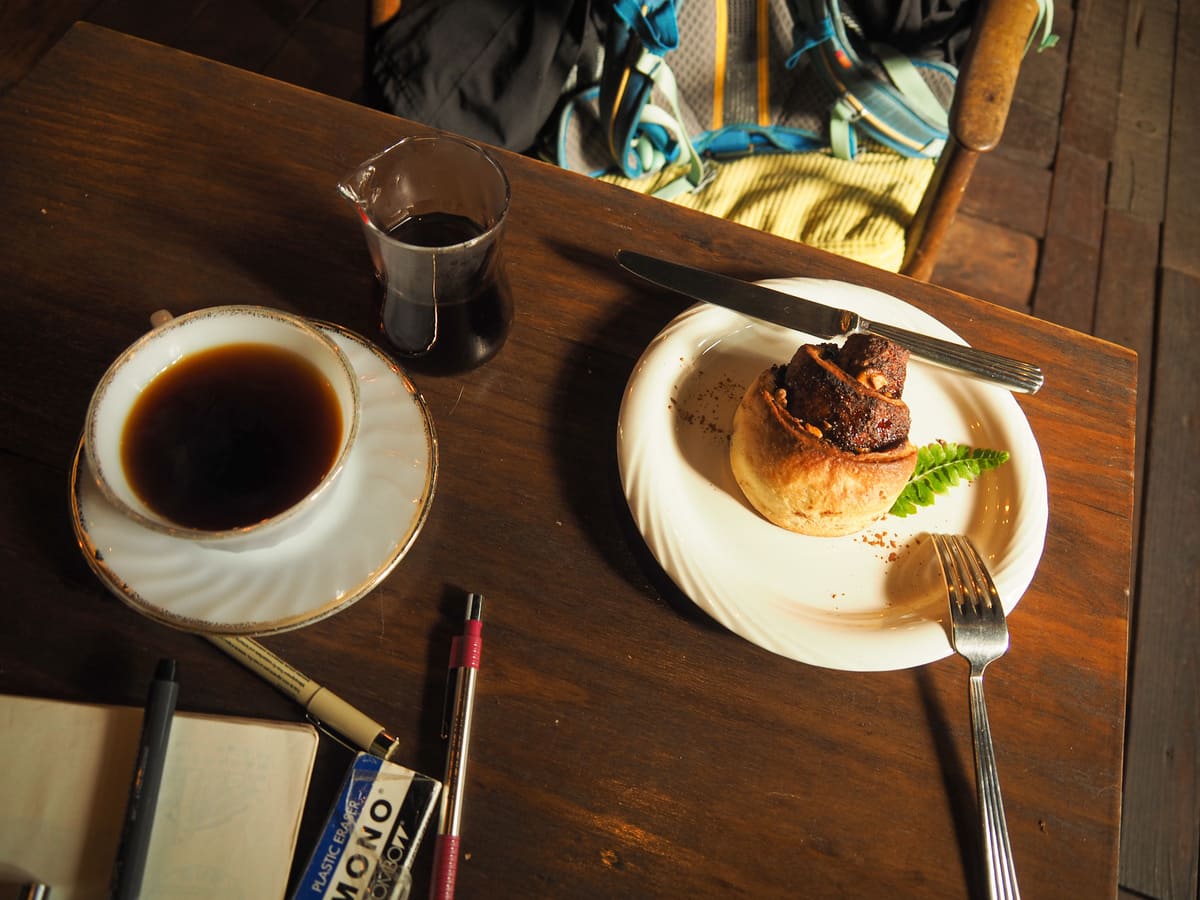
I decided to duck into Take a Walk for a coffee and some cake before heading home and enjoyed a pleasant hour sketching and befriending the shy cat.
How to get to the Golden Waterfall
Google Maps address: The walk begins close to the Golden Waterfall and concludes either at Jingushi’s Quanji Temple or by Jinguashi Gold Ecological Park.
GPS location: N25 07.045 E121 51.630
Public transport: There are a couple of buses that will take you right to the Golden Waterfall (788 Extended Shuinandong and 856 Taiwan Tourist Shuttle — both of which pick up passengers close to Ruifang Station), but these only have a handful of services a day, so unless you want to time your departure carefully to coincide with one of them, you’re probably better off getting the 1062 and walking the last little bit. The 1062 shuttles between Taipei and Jinguashi Gold Eco Park a couple of times an hour. You can catch the bus from Zhongxiao Fuxing MRT station and Songshan Station and alight at Gua Shan Elementary School then walk down the road to the start.
Nearby trails:
- Jinguashi Aqueduct Trail
- Mount Banping
- Mount Keelung
- Stegosaurus Ridge
- Tamsui Kavalan Trails — Mudan Loop
- Tamsui Kavalan Trails — Ruifang to Fulong
- Teapot Mountain
Golden Waterfall to Jingushi Trail Map
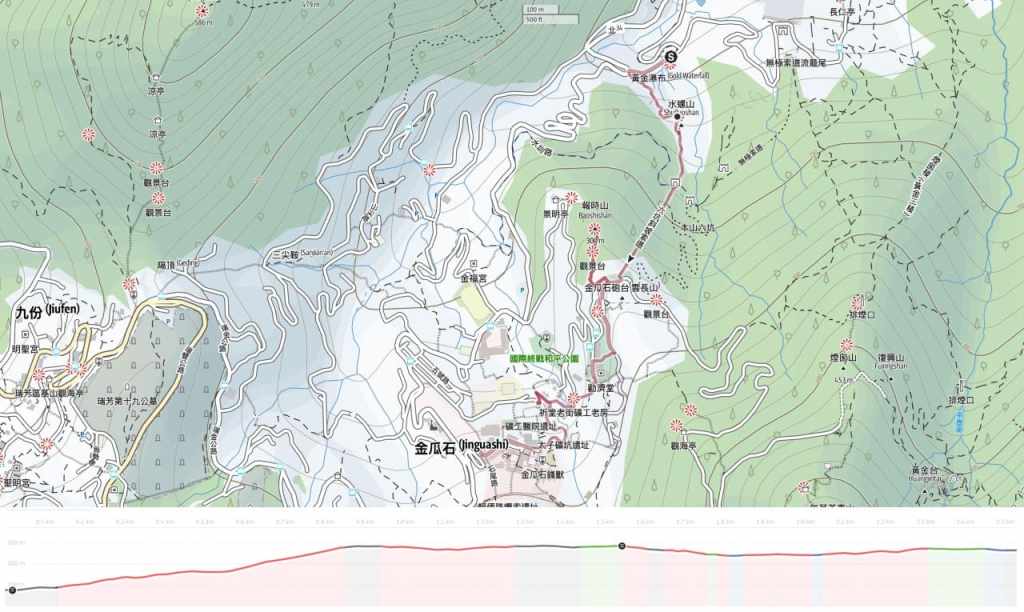
GPX file available here on Outdoor Active. (Account needed, but the free one works just fine.)
