This loop trail takes you to a wilder edge of Yangmingshan Park that many visitors never see. The first section is a tough climb through quiet, dense forest. The mid-section takes you scrambling from peak to peak through a maze of bamboo. And during the final section all your hard work is rewarded as you experience the sheer pleasure of following a delightful stream carving its way down through a luscious valley.
Distance: 7.3km
Time: 6 hours and 20 minutes – This included a couple of stops to refuel. I would have liked to have had more time to walk slowly and enjoy the river section without having to worry about losing the light.
Difficulty (regular Taiwan hiker): 6/10 – Tiring but not difficult.
Difficulty (new Taiwan hiker): 8/10 – The hardest part was keeping up morale whilst navigating through overgrown bamboo over uneven and steep terrain. I would highly recommend that you either have someone experienced with Taiwanese mountains, or do another, more established walk over similar terrain first – Xiao Guanyin Shan for example.
Total ascent: A climb of 780m to a max elevation of 1020m.
Water: I got through about 2L out of the 2.5L that I brought with me on a cool autumn day. But I probably should have drunk more on the climb because I could feel I was either dehydrated, mildly salt-depleted towards the end of the hike.
Shade: Plenty, in fact, I may even say too much! However, had I rested on the exposed peaks for too long, I still would have burnt even in December.
Mobile network: Patchy, some areas in the valley are not so well covered.
Enjoyment: This trail is split into two parts, the uphill section was a 7.5/10 for me, I loved the challenge of navigating, and the manageable (but still tough) physical exertion. However I seriously disliked fighting through spidery, thick bamboo and not being able to see where I put my feet. The section of the walk which ran alongside Datun stream was a 10/10 hike, moderately challenging walking, and extremely pleasant surroundings.
Permit: As of October 2020, it’s necessary to apply for a permit to walk this trail and any others that sit within Yangmingshan National Park’s extended protected area (press release in Chinese on the subject). Currently it seems that the means to apply for a permit is to create a profile on the Yangmingshan National Park website and log in to confirm your route.
Other: Don’t attempt this if the weather is bad or if there has been a lot of rain recently – I can’t attest to what the stream is like in full flow, but waterways here can increase quite dramatically in volume in a very short time. As for what you should take, good sturdy shoes are a must – the terrain is rough and steep, so you’ll suffer if your shoes aren’t up to it. I’d also highly recommend taking gloves (or poles if you prefer) and long trousers at a minimum, I wouldn’t have wanted to do this in short sleeves, so I suggest long sleeves too. If you go in warmer weather, make sure to take a towel or dry clothes to change into because you’re certain to want to get in the water. Finally, this is a reasonably long walk timewise, so take enough food to keep you going.
Jump to the bottom of this post for a trail map, GPX file, and transportation information.
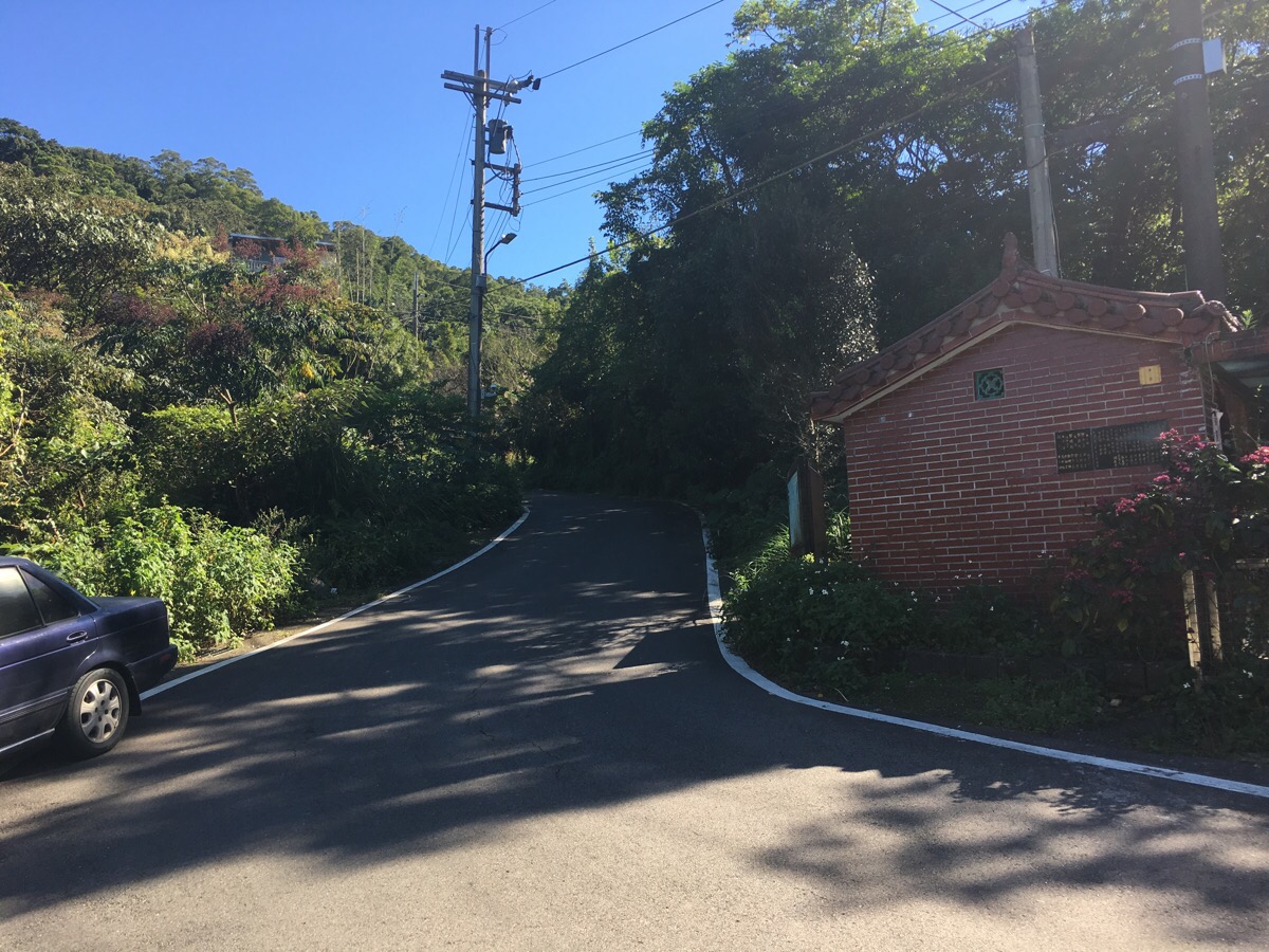
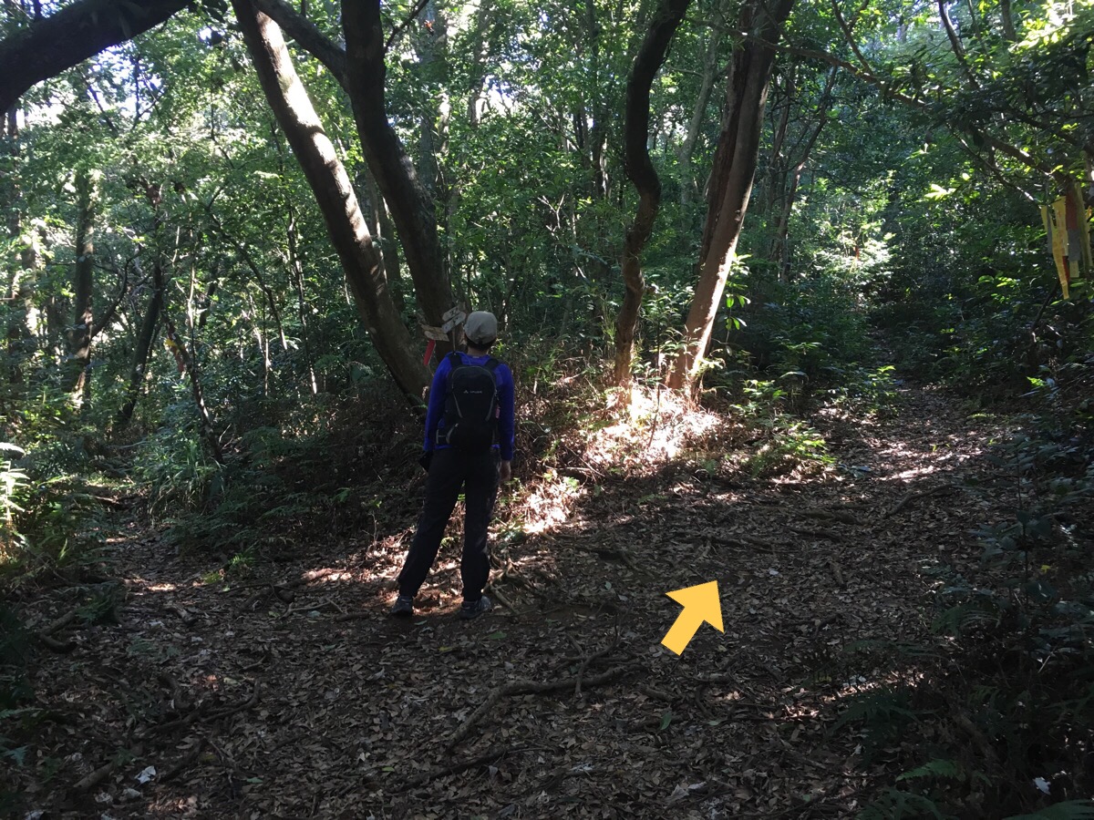
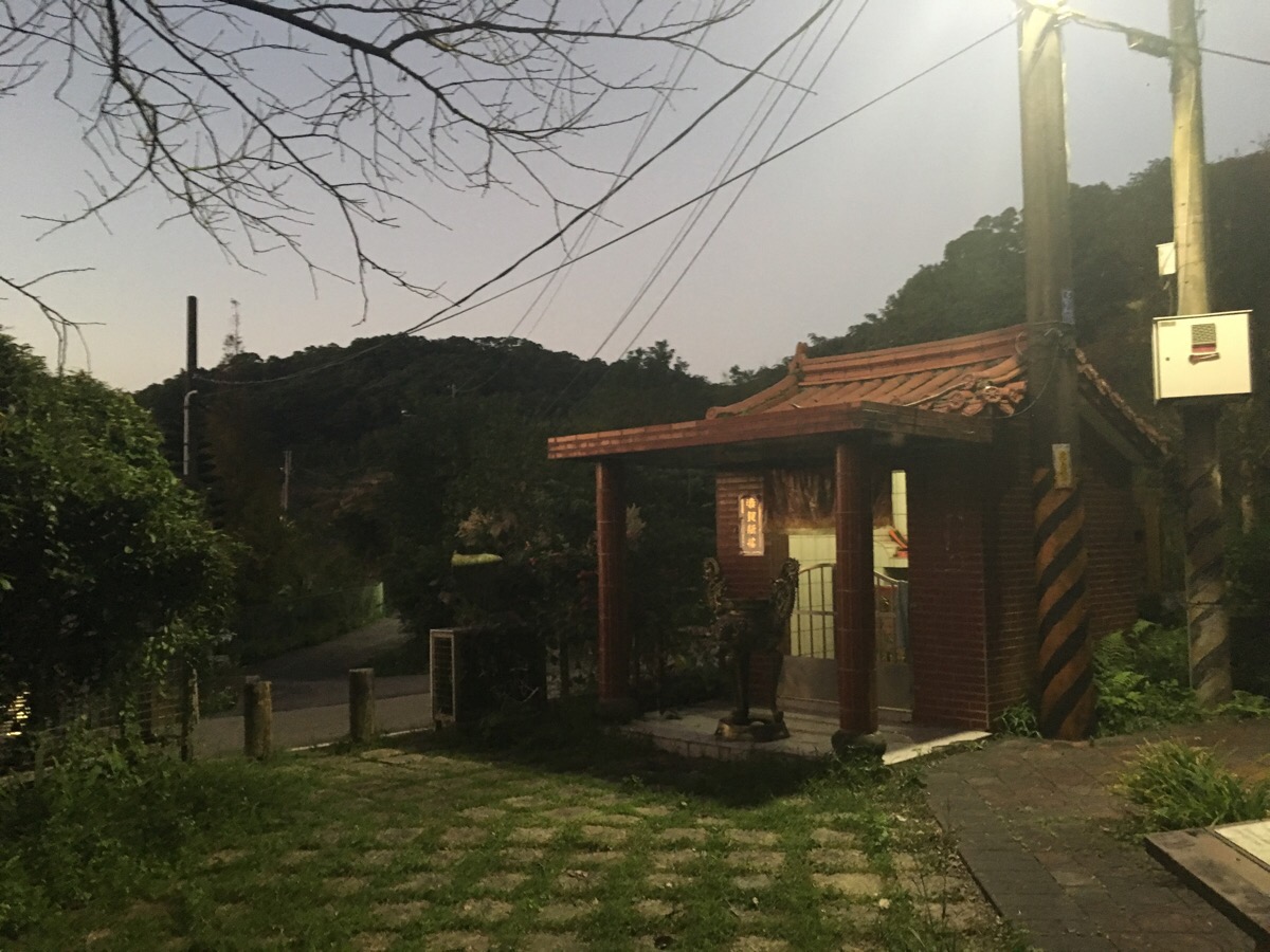
10:54 – A pleasant scooter ride through farmland led us (a little later than I would have liked) to Sanban Bridge, the starting point for today’s walk. Actually we could have parked a little further up the road where the trail disappears into the tree line, but we didn’t know that at the time. There is a very clean public restroom here as well as a little Tudi Gong temple.
At around 11am we set off uphill and away from the direction we’d travelled in on. We chose to follow the road as it did a big loop around to the right instead of taking the shortcut on the left which would have taken us directly past a house where a dog was already letting us know with vigorous barking that we weren’t welcome.
At a junction, there are some trail tags, but they’re the way we came back down, so we ignored them.
(If you plan to do just the Datun Stream trail you should turn right here.)
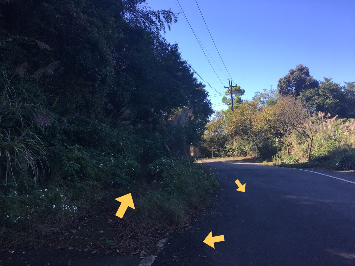
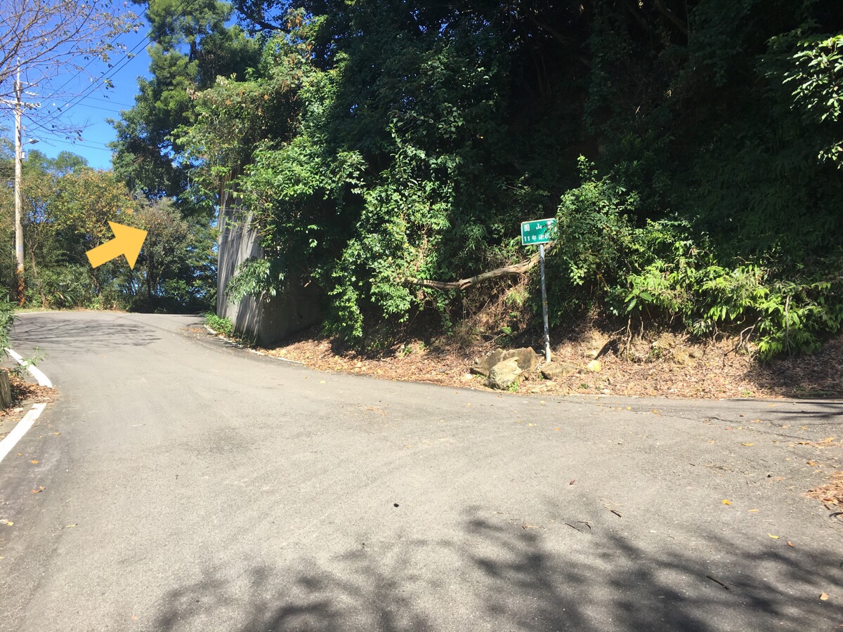
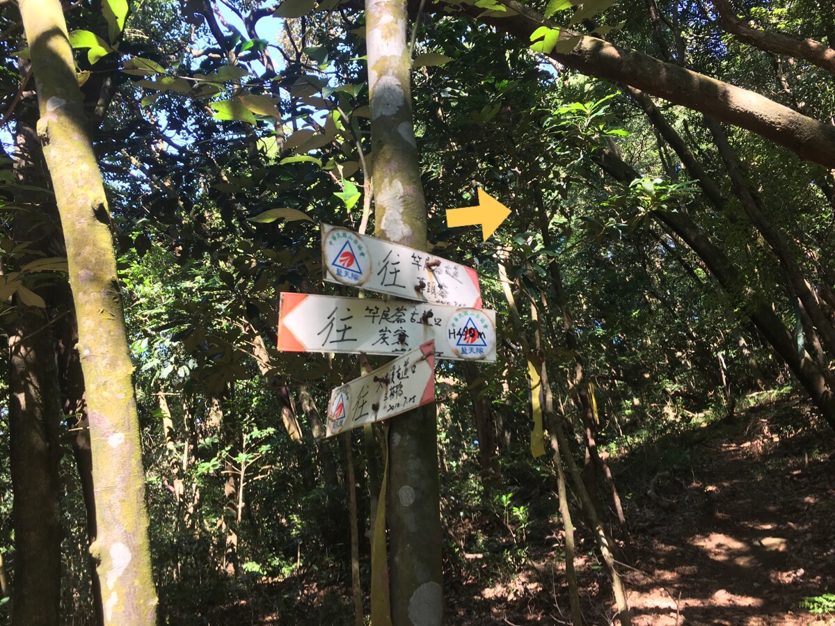
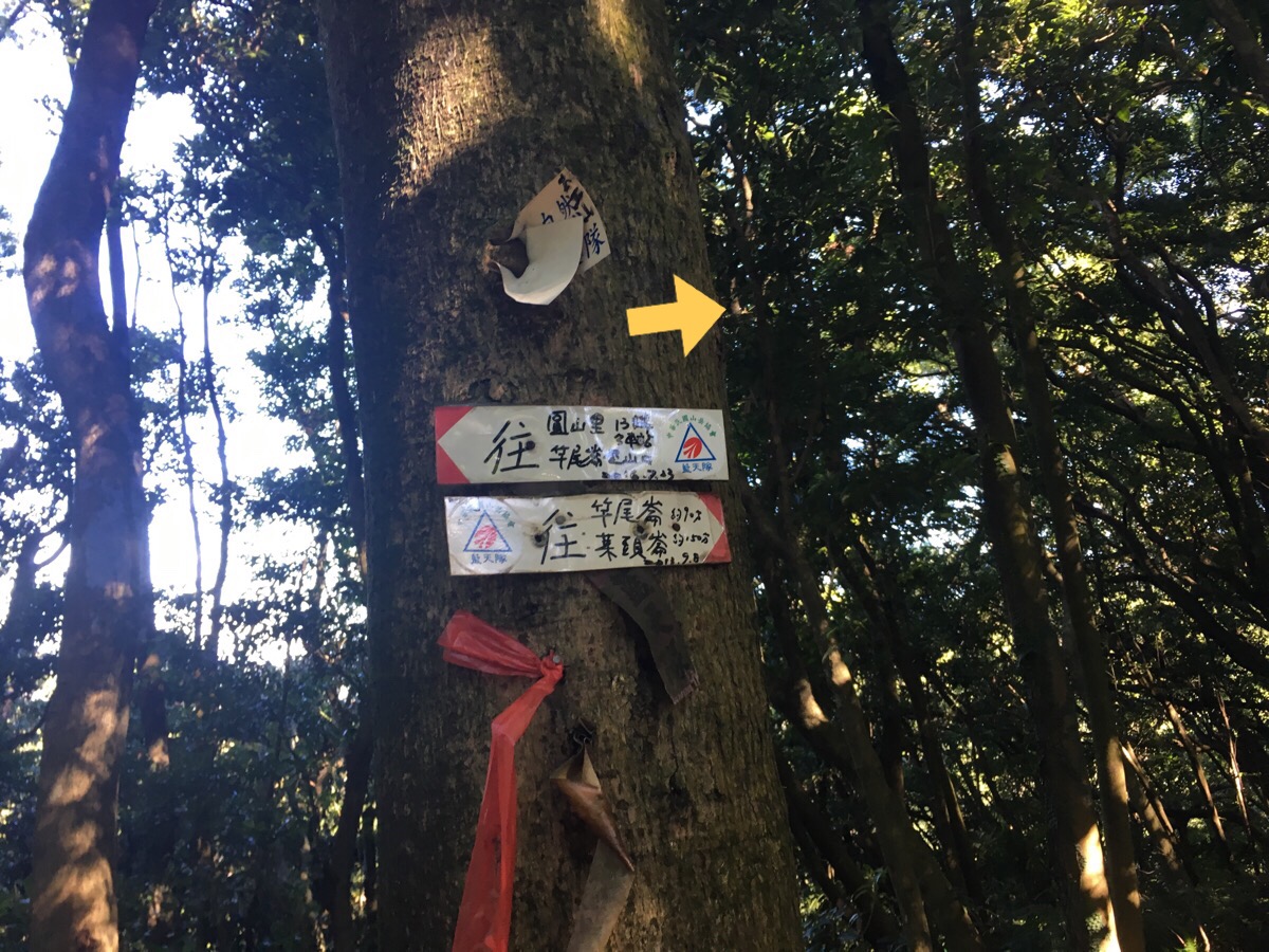
11:03 – Coming around the corner we noticed a parked scooter and some trail tags going up a ramp to our right. There’s a red and white trail sign here which says 往竿尾崙山古道 (Gan Wei Lun Shan Old Trail).
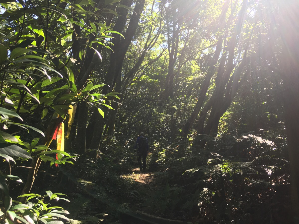
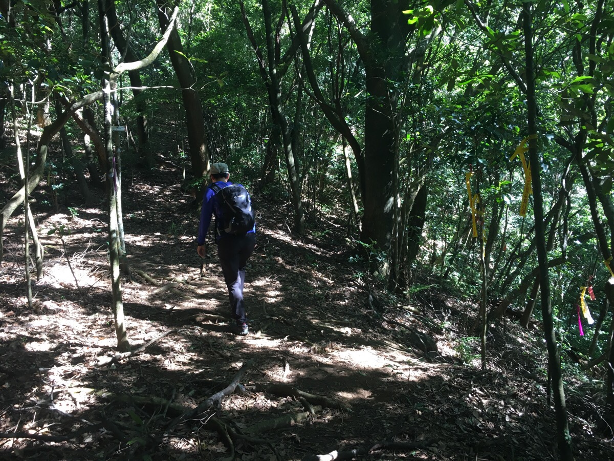
The path starts off on a slight incline, up but not too difficult. In fact it made a really pleasant change from some of the tougher hiking in Taiwan where travelling 50m in distance leaves you panting with all the elavation gain. We were making good time, and the surroundings were lovely; no trash, clear path and a healthy looking forest.
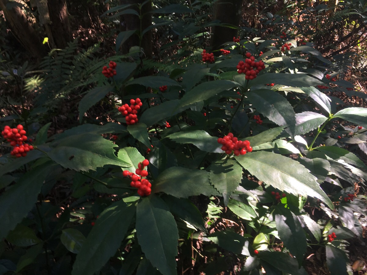
The sun did a great job of picking out berries in both red and blue.
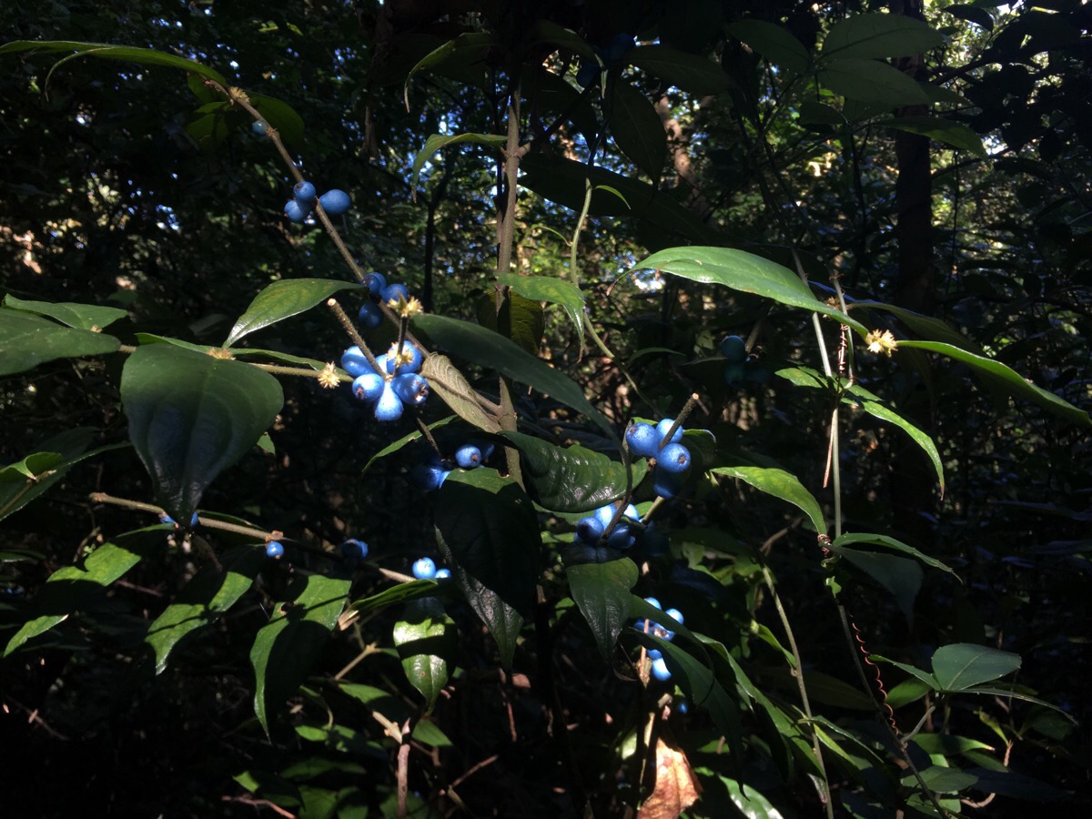
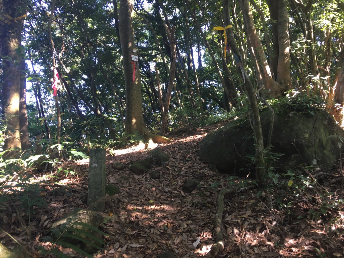
I’m not sure what this blue one was, but these plants were present in abundance all the way through the lower reaches of the forest. To the right of the trail about ten minutes in we passed a small door to an old dwelling of some sort. It’s marked with trail tags, but you could easily miss it if you weren’t paying attention (as Teresa did).
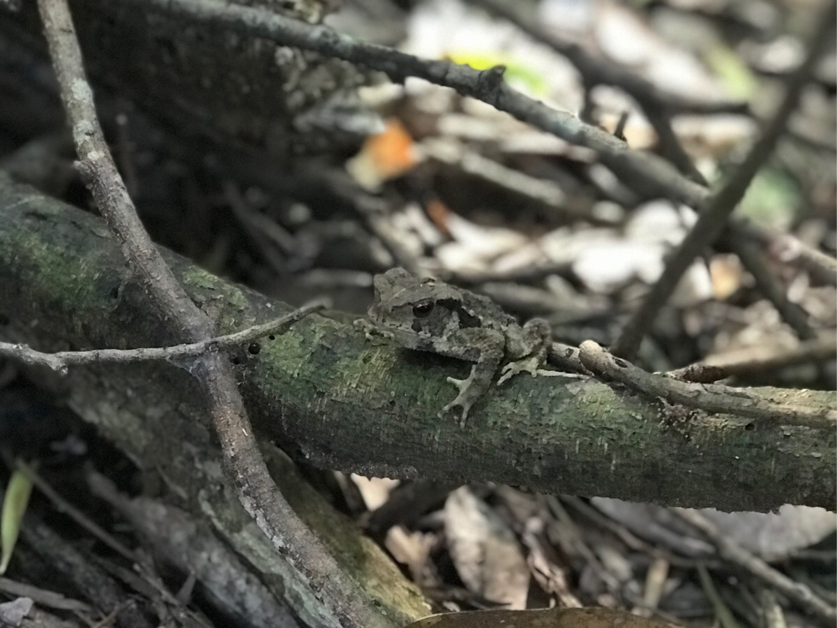
Also, from the trailhead until just before we reached ganwei lunshan (竿尾崙山), there was an array of toad and frog life. We stumbled over at least seven. The largest toad was a great lump of a thing, maybe a 10cm diameter body and not in the least bit threatened by us.
11:16 – At the first fork in the road, we headed right following the signs to 竿尾崙山. Actually, from looking at the map, (and from what we saw of the trail later on), it looks like both forks can reach the same point further on*. But we decided to stick to the one signposted as going where we were planning to go.
11:28 – The trail soon reaches another fork. This time the right hand path runs down towards Datun stream and the left hand one continues uphill. We header straight and up.
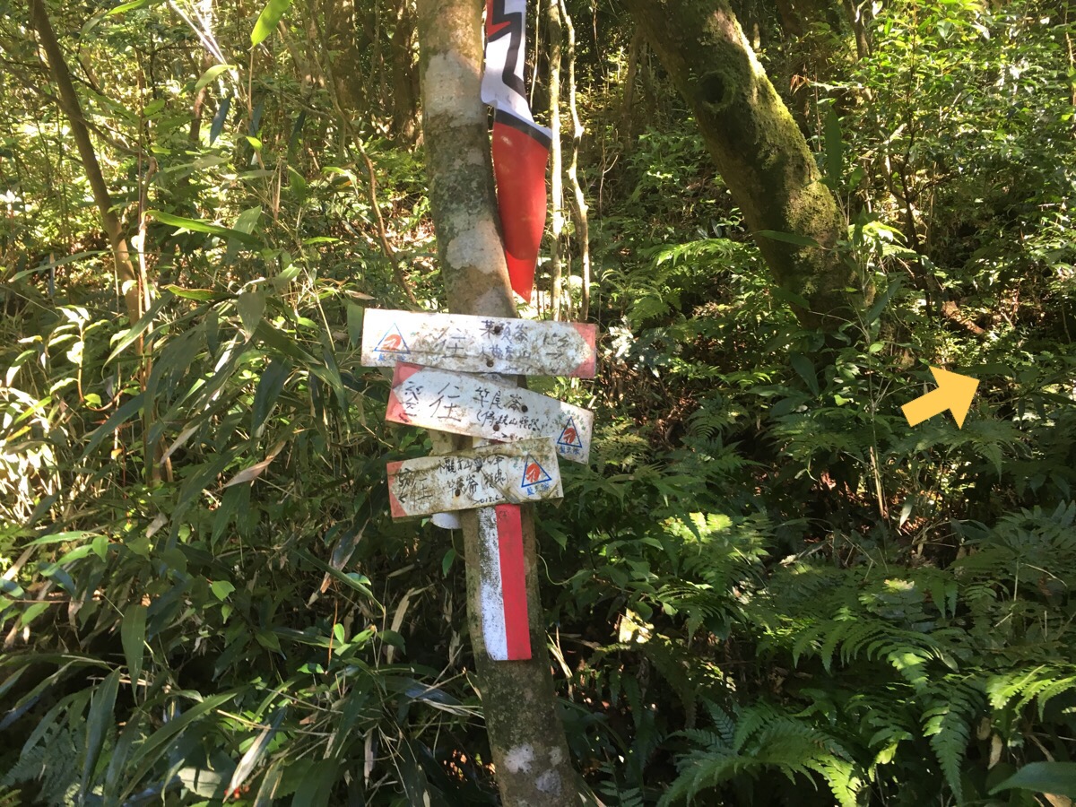
These signs are at the junction, again, keep following the arrows leading to 竿尾崙山.
A short 20m or so later there is another junction. This one goes uphill to 竿尾崙山 or downhill to 竿尾崙.
*This is where the earlier fork in the road should rejoin the pat according to my map.
The signposts at this junction are clear, except for the one which looks like it has slowly been eaten by its host tree.
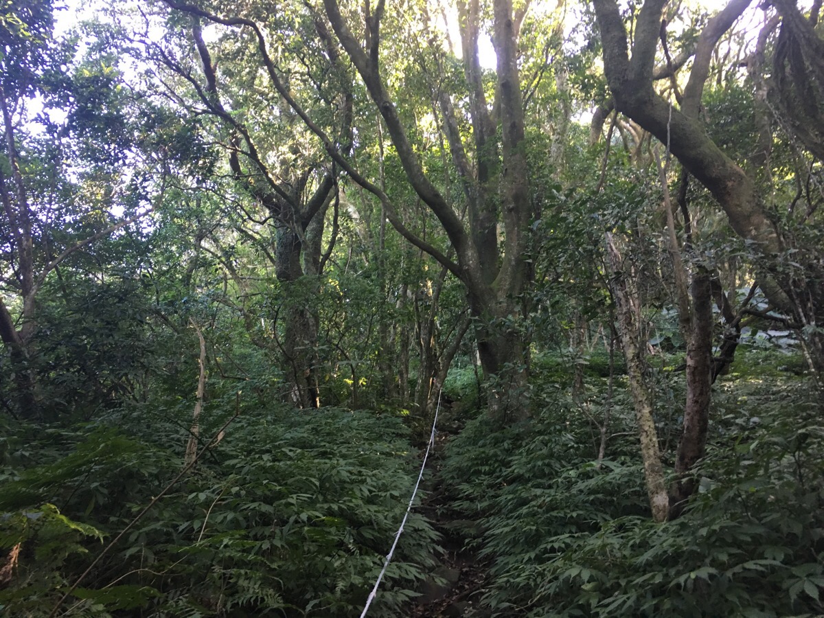
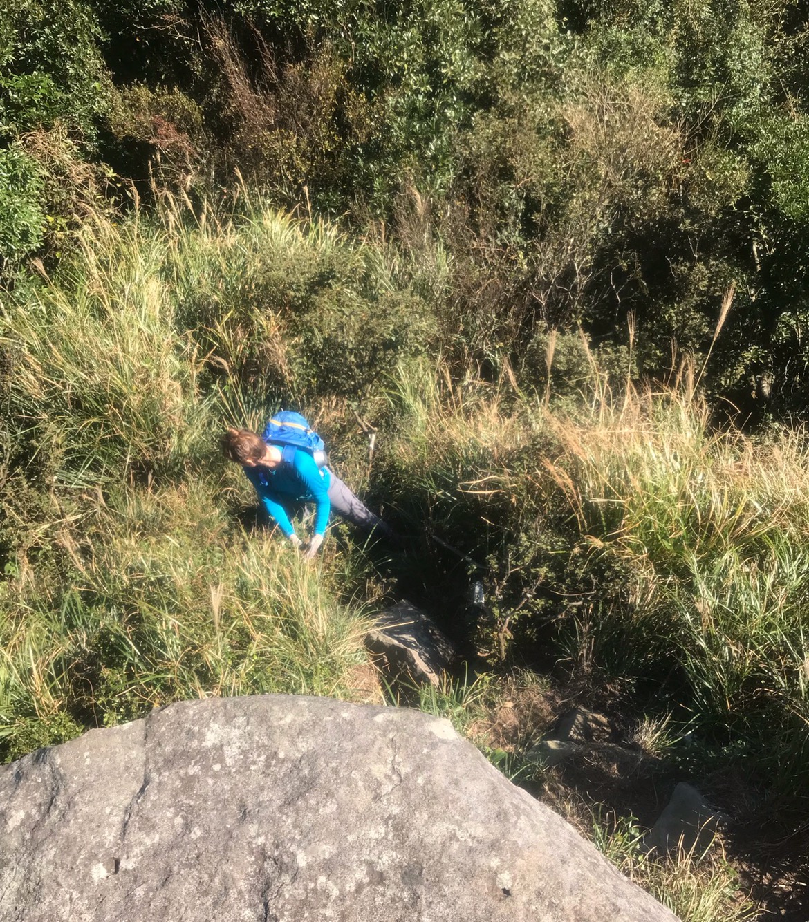
Whilst at these two junctions, I’d looked at the map and seen the how contour lines go from being reasonably far apart to being all pinched up tightly together and I’d said to Teresa something along the lines of “it’s going to get a bit steeper from here on.” That was definitely true. Our pace slowed considerably as uphill walking turned into something more like climbing. The trail surface wasn’t the easiest either; muddy in parts, covered with loose leaves and twigs elsewhere, or otherwise made up of large boulders. I was in front most of the way because Teresa had become frustrated by all the spiders webs she was walking into (luckily these ones were all small spiders, not any of those giant orb weavers).
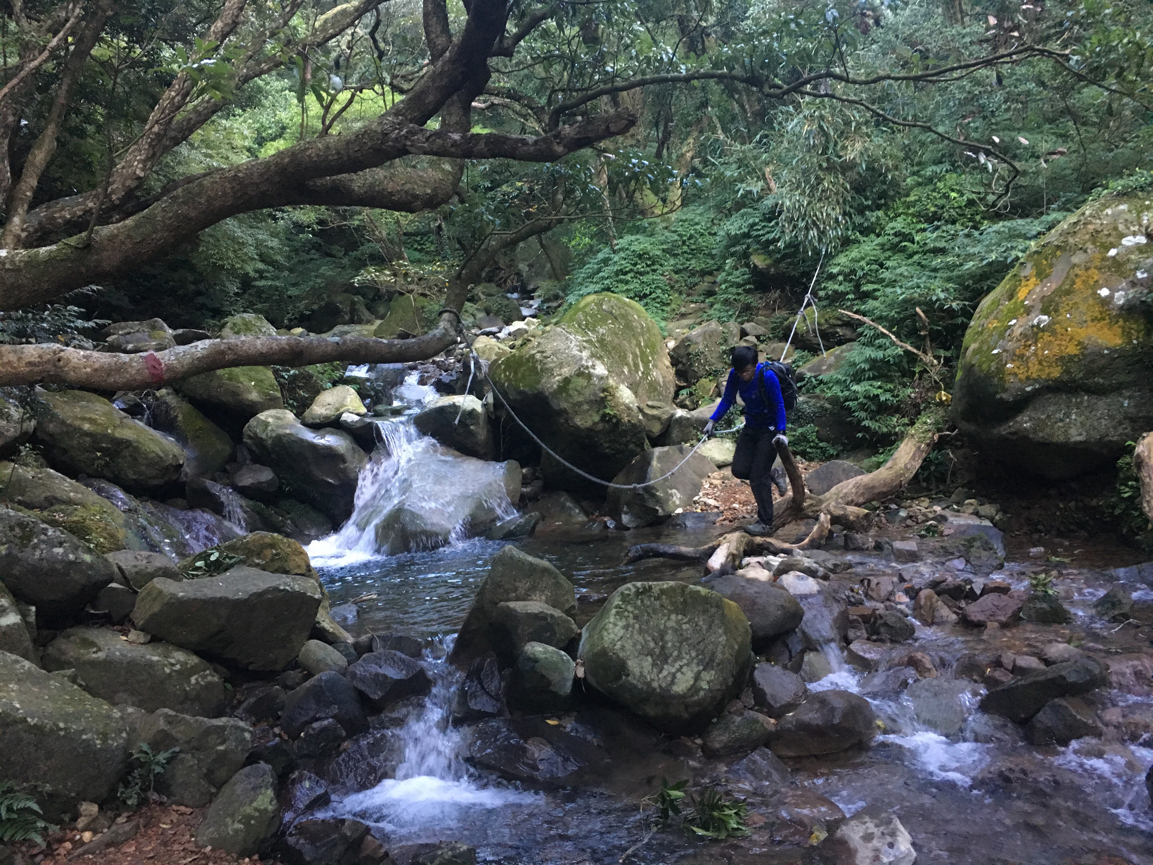
Shortly after climbing the roped section in the photo above I heard something crashing about in the underbrush and froze. I couldn’t see it, but I’m pretty sure that I can eliminate almost all of the animal species that I’ve come into contact with so far. It couldn’t have been a bird, since even the larger birds here fly off a short distance when threatened, and there were no flapping sounds. And I doubt it was a deer or a monkey because every time I’ve startled those in the past they have let off some bark or call of warning. Likewise, I think a boar would have made more easily identifiable noises, not to mention we would have seen more signs of their presence as we did the last time we came across wild boar. Whatever it was was too larger and ground-based to be a squirrel. So it’s a bit of a mystery. The only other clue as to what it may be is the poo that we saw liberally distributed on rocks in the middle of the path, much like a fox might back home, only bigger, kind of the size that you might expect to be made by a small-medium sized dog. I wish I’d photographed some of them now so that I could compare. What seems closest is something like the poo left by a crab-eating mongoose. They are known to defacate on rocks as a way of marking territory, and some sources suggest that they are present in Yangmingshan National Park. Additionally, the presence of so many frogs on the trail and the fact that it looks like there are crabs found in Datun stream, would make it an ideal hunting ground for a crab-eating mongoose.
We never saw whatever it was, and after about two minutes it had heard us and decided to move further away or hide whilst we passed. I have no way to know for sure, but I would be happy to believe that I nearly met a mongoose.
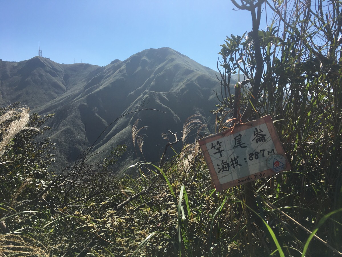
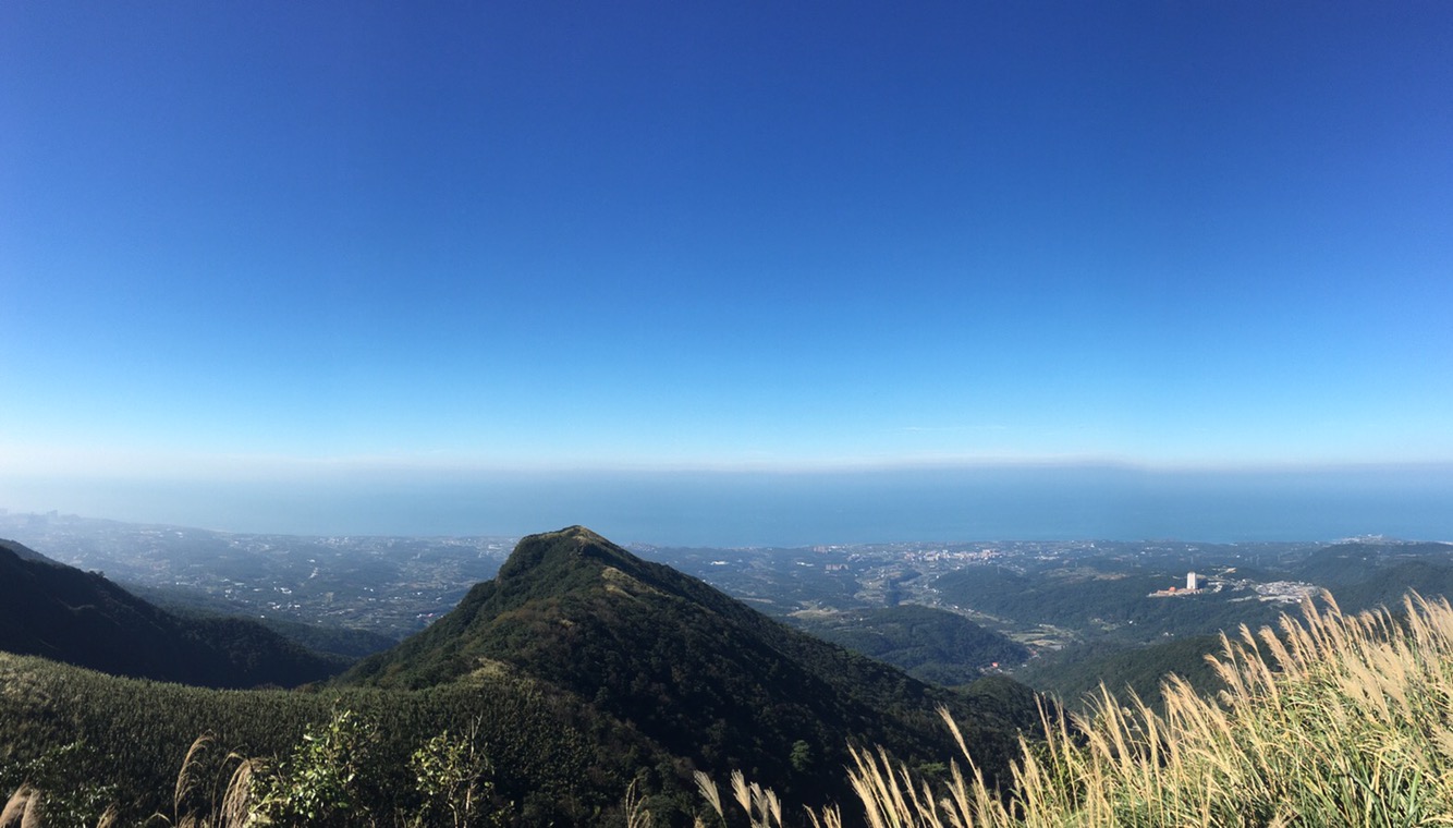
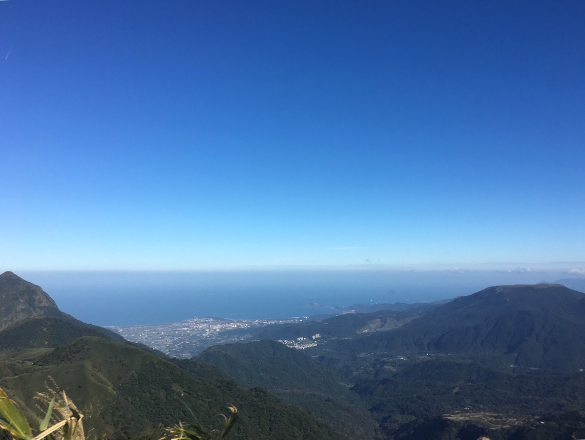
12:36 – After a solid hour and a half of climbing, (the last hour of which was pretty strenuous), the path unexpectedly breaks out onto the peak of 竿尾崙山. The sudden view made a pleasant change from being surrounded by forest.
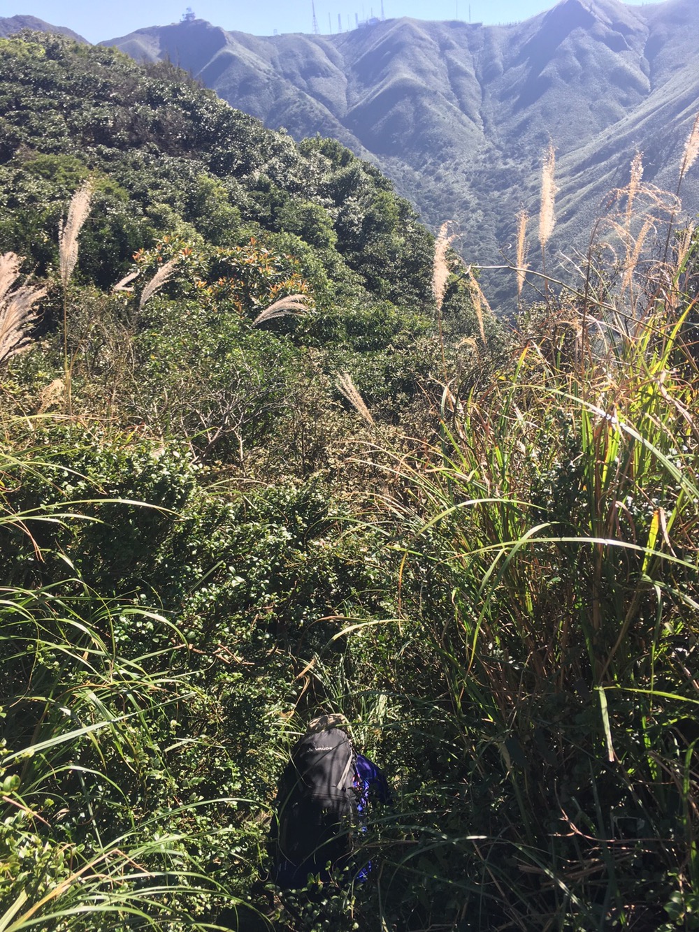
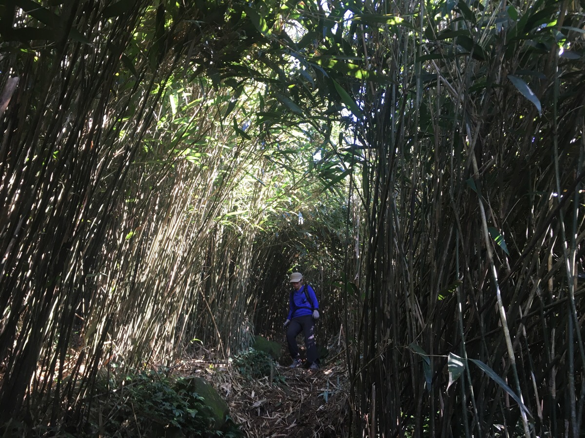
Since the peak was little more than a small clearing, we didn’t spend long there before heading on. From here until the start of the proper descent, grasses and bamboo are the main form of foliage, and since both are quick growing, the path here is rather overgrown.
A couple of minutes after leaving the peak, a sign indicated that it was a further three minutes to Da Xiong Peak (大雄峰) and five minutes to Fo Yan Rock (佛眼石).
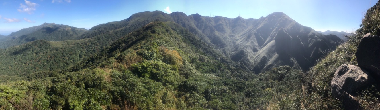
The view from the peak is marvellous, the ridgline stretches out towards the northwest peak of Xiaoguanyin Shan and then you can see it curve towards the main peak and the weather station. With the silver grass and bamboo cloaking the slopes, it truely is a magnificent sight. I know that I am apt to go on about the delights of Yangmingshan National Park whenever I get the chance, but it’s not without reason. Less than an hour’s ride from the capital city is this fantastic natural playground. The people of Taipei are so lucky to be able to come here so easily! And yet despite the trail’s closeness to civilisation, Teresa and I didn’t see a single person until almost six hours into the hike, (by which point we were already back on the road).
I don’t recall Fo Yan rock bring indicated by a sign, but I am pretty sure that it was the massive hunk of stone which was jutting out like it was auditioning for the role of the rock in the Lion King.
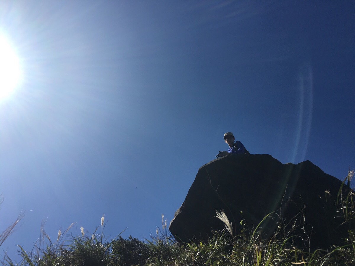
12:50 – I would have loved to have chilled out on the rock for a bit, but as with many of the prominent rocks of peaks that we encountered up in the higher reaches, it had been claimed by a pair of amorous hornets, (or wasps or bees, I’m not sure). Not being a big fan of flying insects which can sting you, I quickly made my way down and let Teresa be the one to photograph the view.
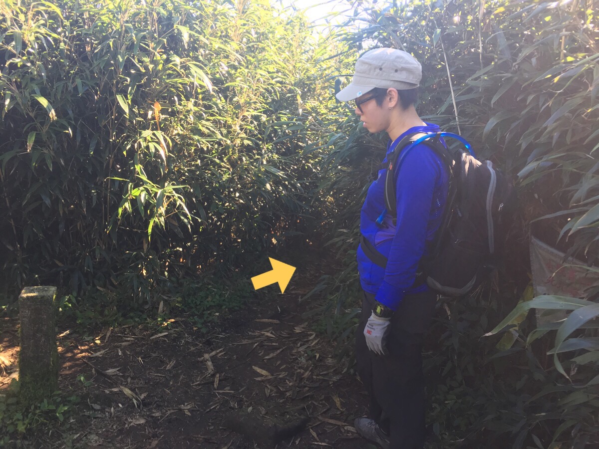
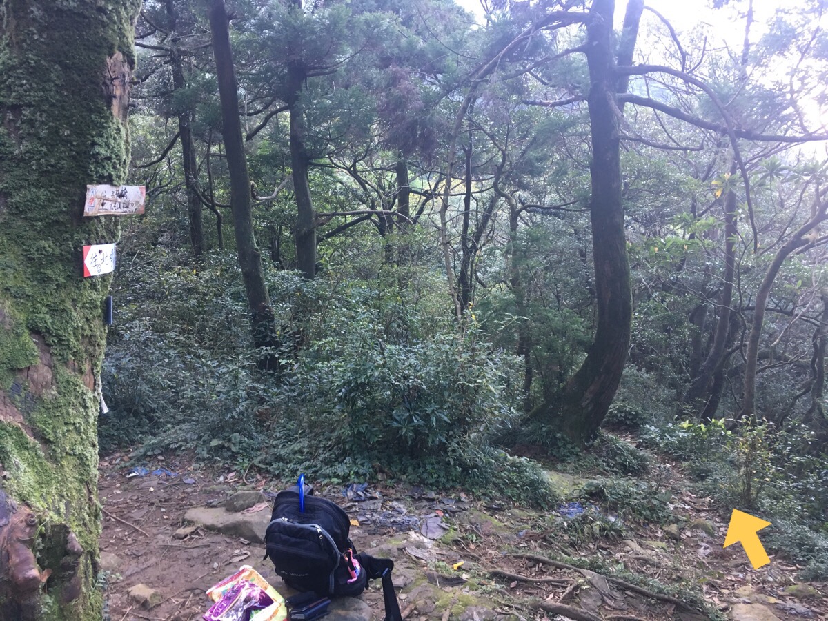
13:08 – We came to a junction where we had to decide whether to continue on straight towards 小觀音山西北峰 and eventually reach the main ridgeline (as the people whose blog I had seen had done), or go right downhill to join the second section of Datun Stream trail. We decided to go straight as the other people had done because at least we knew that the ridge trail, (which was about 500m further on), was passable because we’d walked it earlier in the year.
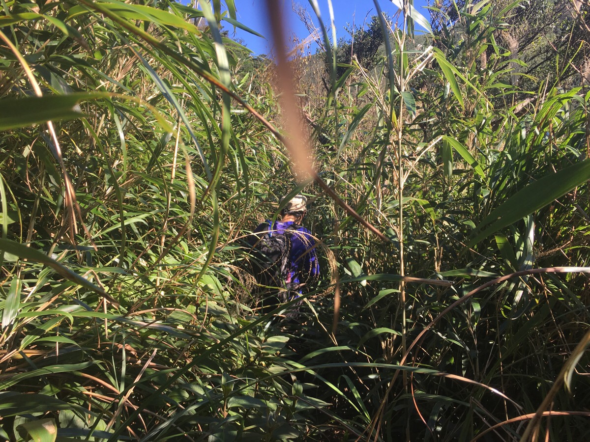
I can tell you that those 500 metres were not my favourite metres of this walk. It was about 200m from the junction to the west peak of Xiaoguanyin shan, and that was 200m of pushing through very over grown bamboo. It wasn’t really hard to follow the trail, since it was always visible at ground level, and there were regular enough hiking tags, but I would have found it harder if I hadn’t already experienced this type of trail in Taiwan before.
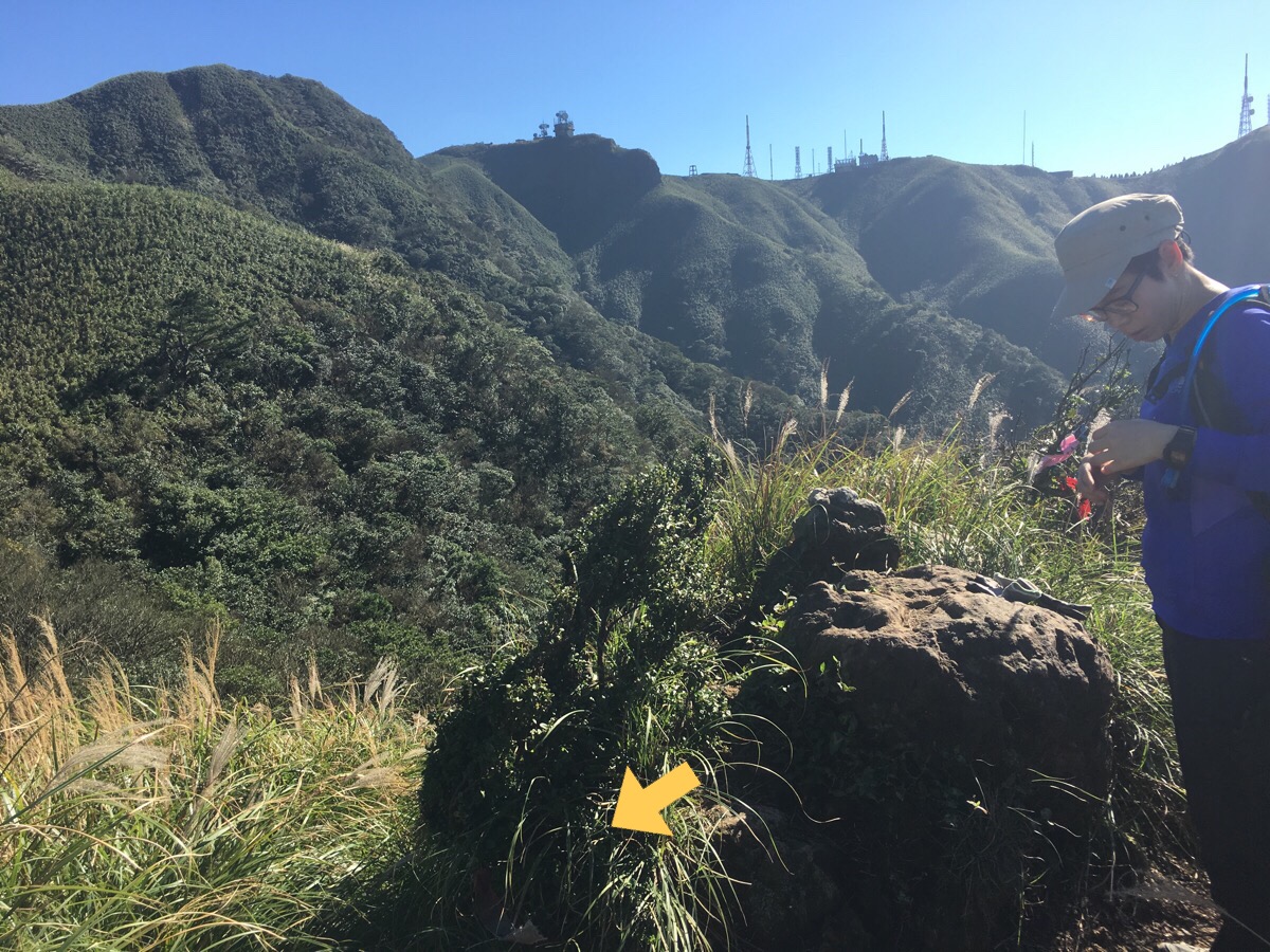
12:23 – Just before arriving at Xiaoguanyin shan west peak there is a fork in the road. The signposting is vague, but going straight just cuts off the top of the peak itself. Instead we climbed up left for another couple of metres and had clear views back to 竿尾崙山 and Fo Yan rock. I think we were both feeling kind of drained by this point, since the hike had become not only strenuous, but also overgrown and not exactly pleasant.
We sat down to have a few snacks and just enjoy being surrounded by green. From here it was possible to hear people somewhere off in the distance, maybe in the valley or on the ridge, we never saw them. We also got visited by a large ladybird and another couple of peak-hogging hornets, (although I was tired enough to just ignore them by this point).
After about 10 minutes we packed up and set off again. The path down the backside of the northwest peak reconnected with the main path after a couple of metres.
13:36 – Very shortly we met the last trail junction before Xiaoguanyin Shan’s ‘north north’ peak (小觀音山北北峰). This one indicates that there are a couple of paths trailing down towards Datun stream, but they looked even more overgrown than the path we were already fighting our way through.
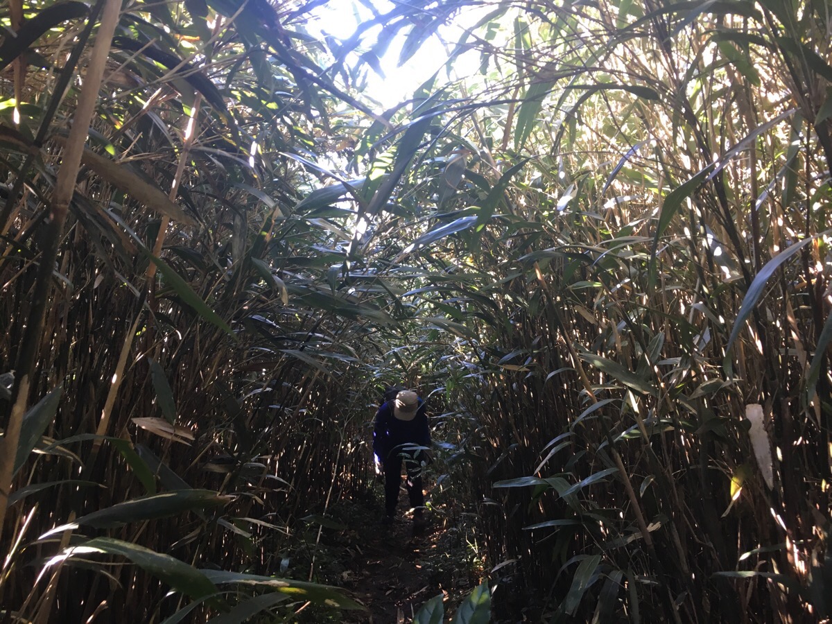
What followed was a 20 minute, steep uphill slog through very overgrown bamboo. At least going uphill meant that it was somewhat easier to stay within the tunnel of the leaves, rather than constantly getting your face slapped with it (as happened on downhill and flatter sections). I spotted a snake as we rounded a corner here on this section. I’m not sure what it was; it was kind of non-descript, tan-beige in colour, light diamond hatch markings, but not that defined, maybe about 120cm long – I didn’t notice it’s head shape and I couldn’t really pick it out of the line up over on snakes of Taiwan. It moved out of the way pretty quickly, but it managed to disconcertingly disappear into a place where there looked like there was nowhere to hide. If I’m honest, I was already somewhat fearful of encountering a snake or two since it felt like their territory (and I’d almost stepped on a young Chinese cobra the last time I’d been out on the trails), but for Teresa it was an unexpected and unpleasant intrusion. Apparently she had been walking free of snake-related worries up until that point, (you are never free of snake related worries here, I’ve encountered snakes on the last three walks I’ve done).
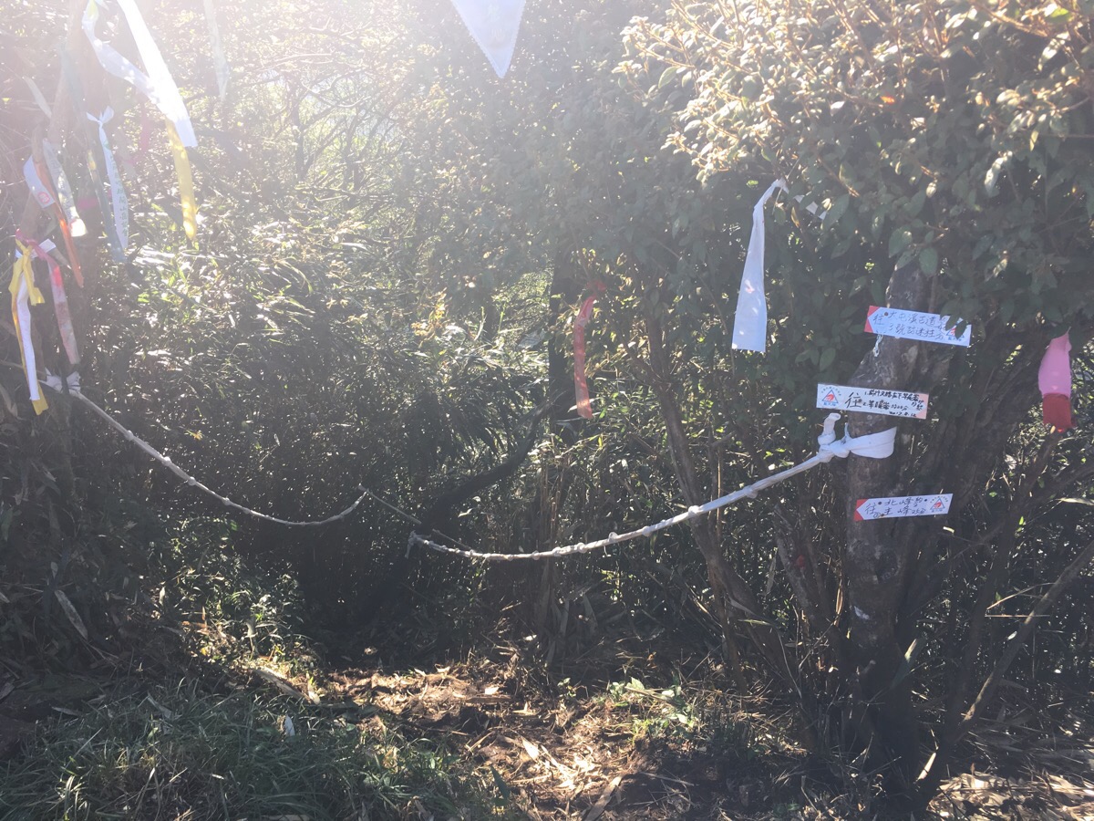
13:59 – After a three-hour climb, Teresa was unimpressed find herself at this location since in her mind, we had walked all the way from out of Yangmingshan park into the park, and would therefore have to walk back out again. (Actually I think that where we started was just within the park limits.) I’m not entirely sure why she was surprised to find herself there since I had said we would and pointed out both in the landscape and on the map, but it seems that she never quite connected that with the previous time we’d visited. Anyway, we turned right out of the clearing and continued fighting our way through the bamboo along the ridgeline.
It was considerably more overgrown than the previous time we’d walked it, and I nearly got tricked off the path at one point, the route suddenly darts right and upwards, but it seems like an animal tunnel continues straight. The only view we got to the south came just as we were about to start the descent.
14:07 – I was hugely relieved to finally be able to get cracking on the return leg of the loop. We’d walked this section in reverse before, so I knew it would be steep, but I didn’t care because at least it wasn’t horrendously overgrown.
A short way down we stopped at a small clearing on the right for a quick cup of coffee because we were both flagging. Teresa in particular was struggling with the down, the metal rod in her leg was giving her a bit of gip. Whilst we were stopped we could hear people nearby, and it even seemed for a while that they were walking up to where we were, but no one ever appeared.
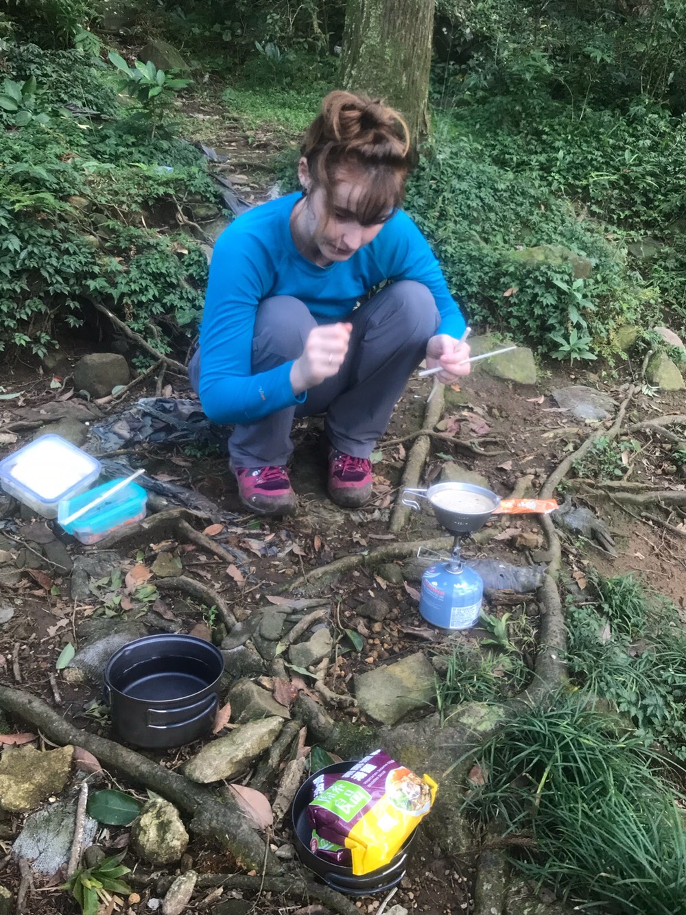
15:10 – A short while further we decided that actually we needed proper refuelling, and so got out the stove for a second time to cook noodles and finish the sachet of coffee that we’d just started. By this time we had just dropped low enough into the valley that the sun didn’t reach us, and the temperature was definitely noticeably cool after our heart rates had returned to resting. I checked how long it had taken the people whose route we were following to get back to the road from this point and saw that it was a little over two hours. This worried me somewhat since we normally have to increase the times given by local groups a bit to estimate our own times, and with the sun already pushed out of the valley, I was anxious about having enough light.
Sitting still to eat, we heard nothing but the sounds of the stream and birdlife. A giant spider, black with an almost pea-sized body and a legspan as big as my outstretched hand ambled over a nearby rock. Another with colouring which helped camouflage it against the tree had a thorny spike protruding from it’s back.
15:47 – After cooking and eating we packed up and got going again. I was working on the assumption that we would finish the walk around 6ish and that we’d probably just make it without having to dig out our headlights.
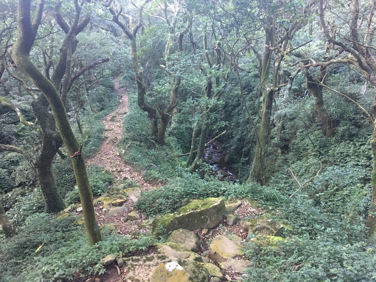
The trail leading away from the junction ran along a ridge with the stream crashing through its channel below us to the right. From here to the road, the scenery is enchanting.
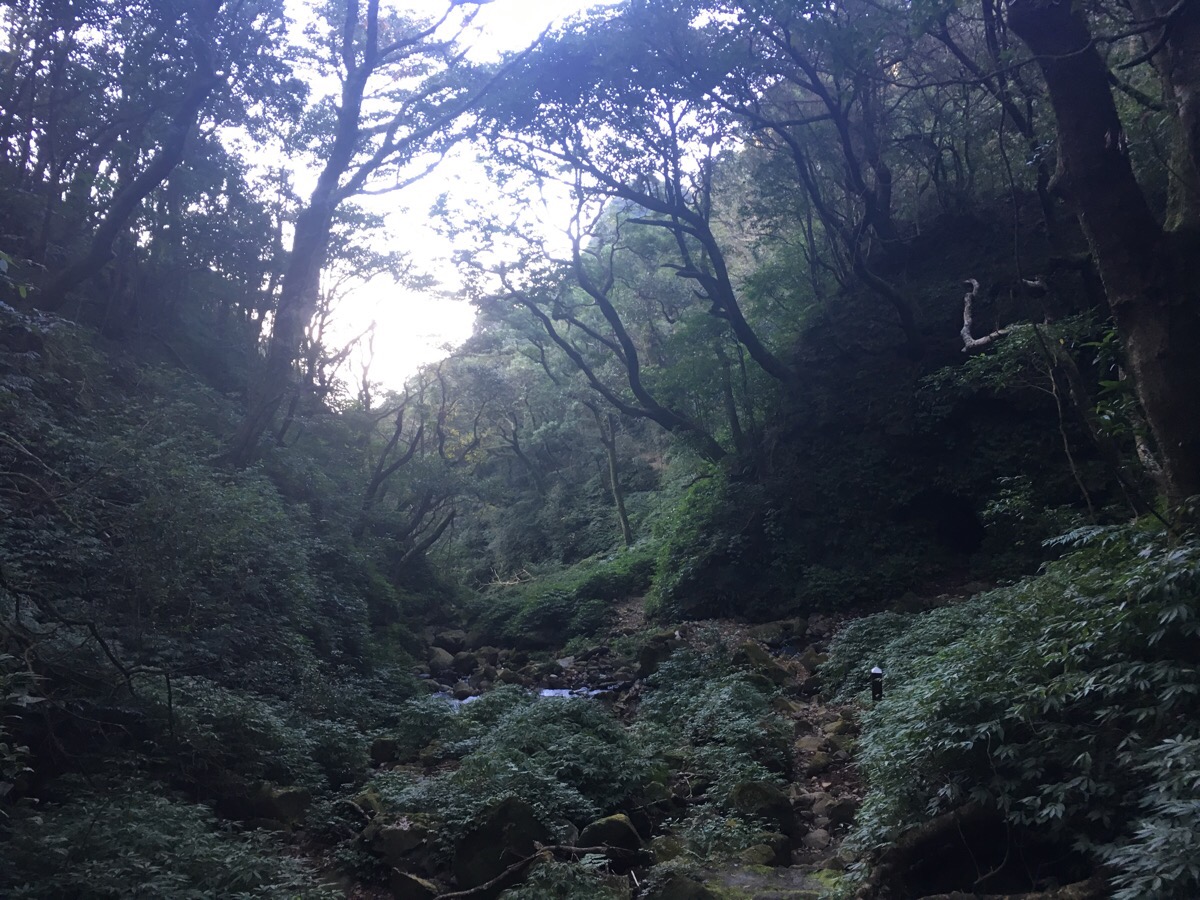
15:50 – Rounding a bend, the path dips down to the first of maybe seven or eight stream crossings. I’d been worried that Teresa’s shoes would get wet, but the level of the water was pretty low. On the opposite bank, a dark cave sat on the edge of the river. I felt creeped out by it because the shade of the valley completely hid everything more than a metre deep into its mouth and so I just didn’t look at it – I’ve no idea what I thought could be lurking in there, but I guess I’d rather remain ignorant. (I am such a cowardly walker!)
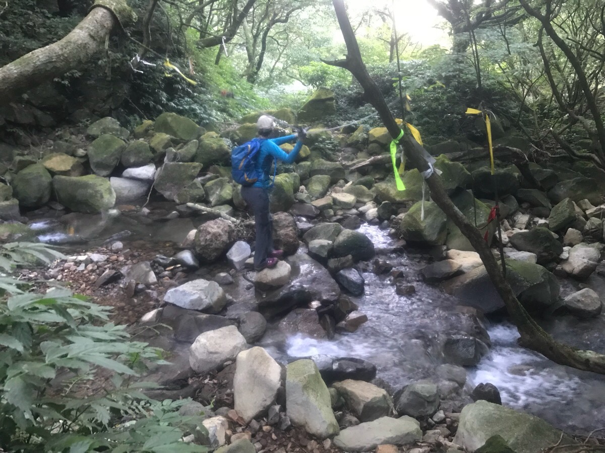
16:01 – The second crossing (I think). Several crossing had rope strung across from one side to the other to help you keep your balance.
16:04 – A couple of crossings came in quick succession. There always seemed to be just enough rocks above water to get across with dry feet.
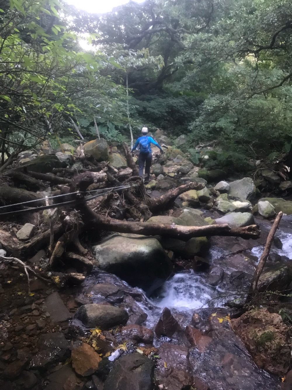
16:07 – After this crossing, there were a couple of much smaller steams to go over, but only one more reasonable-sized crossing about 10 minutes later.
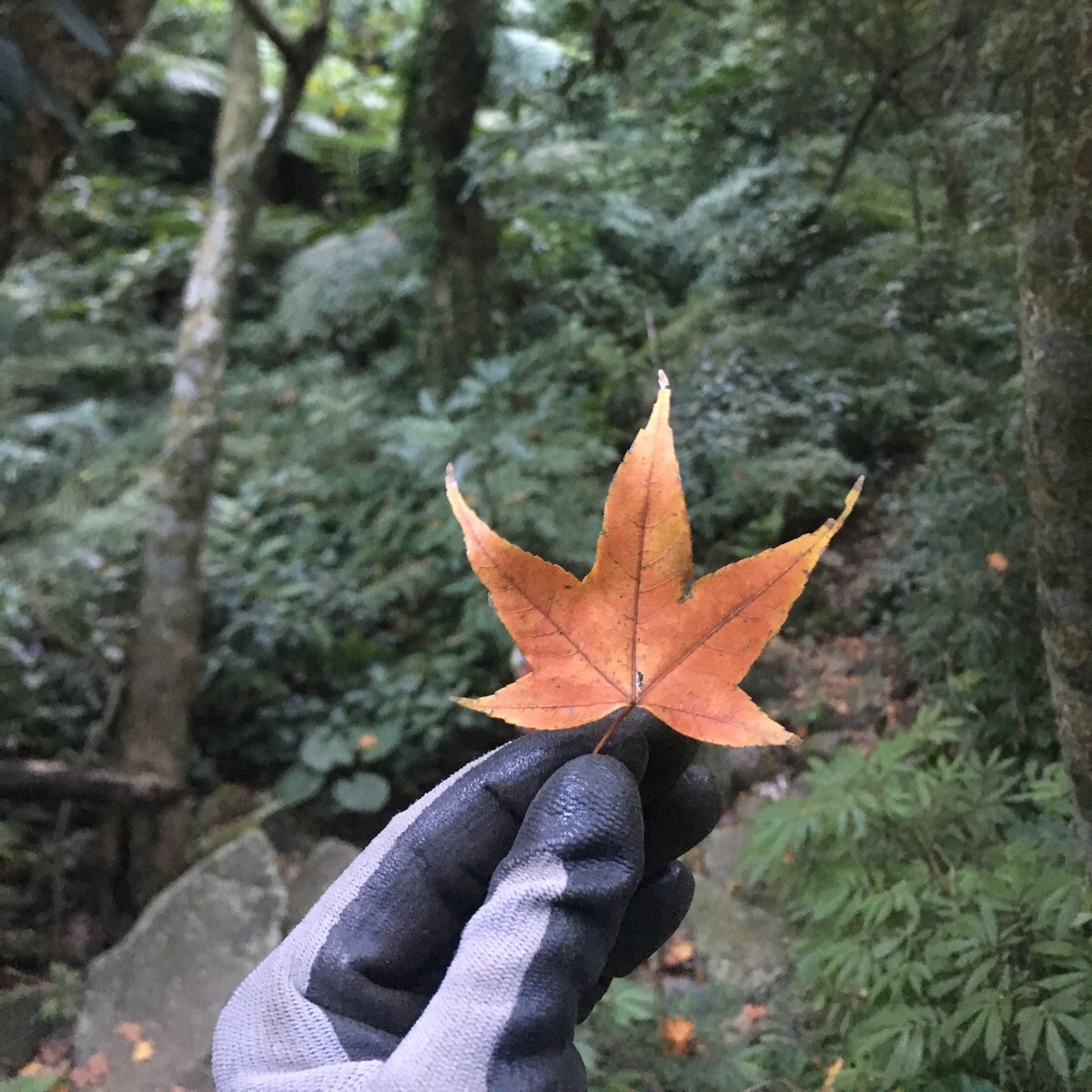
In a couple of places, the path was dotted with beautifully coloured Taiwan maple leaves.
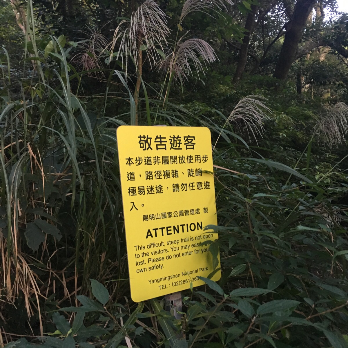
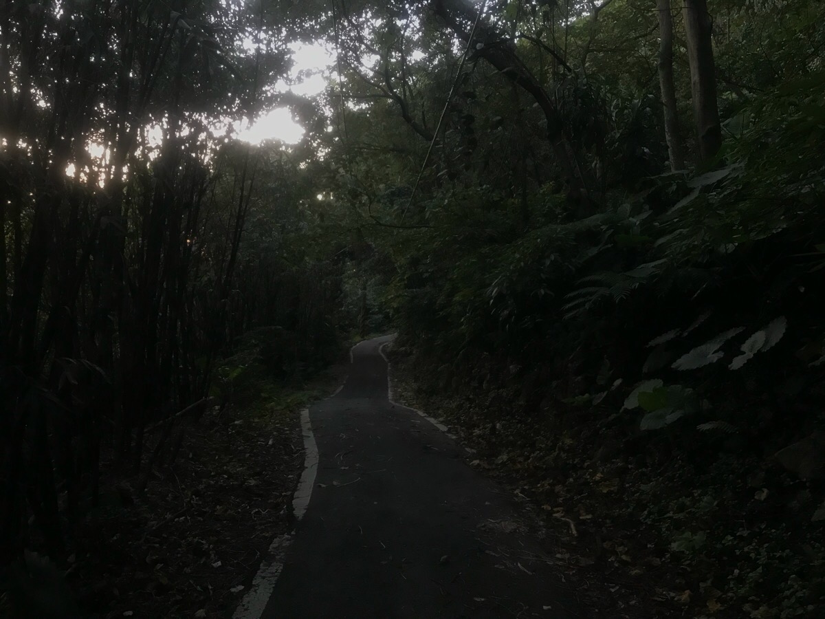
16:45 – The dirt trail transformed under our feet into an old and unmaintained tarmac road. By this point the light was getting pretty gloomy so we were both somewhat relieved to realise that we’d made it out of the woods (literally) before dusk fell. Where the old tarmac became a properly maintained road there was this sign, Teresa was not impressed! But in all honesty, I found the stream section much easier than the section through the higher reaches of the woods and the bamboo peaks – perhaps that was because we went after a dry spell so the path wasn’t too wet and the stream wasn’t too full.
16:54 – Walking down this little road we saw the first people since we’d been on the road at 11am, it is amazing that just an hour outside of Taipei it is possible to find a little patch of remoteness to enjoy.
Further down the road there was a rope swing strung up over a deeper pool. I imagine plenty of people come here in the summer to ignore the signs which say “no swimming”. And closer to the junction with the road we’d come in on, we passed a couple of farmhouses. Several dogs ran out barking aggressively, but it was just for show and they did nothing more than bark.
17:15 – We got back to the scooter just before dark and went into the toilets to change into some less unpleasant clothing. By the time we came out, dusk had already fallen around us and we rode back down through the lanes in the gathering evening.
How to get to Datun Stream Trail
Google Maps address: We started out from the temple and toilet block by the bridge at 252, New Taipei City, Sanzhi District. We were able to tuck the scooter away off the road here, however if you’re planning to come by car you might want to head up to closer to where the trail leaves the road, (actually we could have parked there too, but it was convenient to be able to use the toilets before setting off).
GPS location: The trailhead is at N25 12.496 E121 31.188
Public transport: There is a bus stop right by where we parked, (I think it may be served by the New Taipei City F131), however I am really struggling to find information about how to actually arrive there by bus. However, the 876 leaves from Tamsui MRT station and will take you as far as Guizishan Bridge bus stop. From there it is another 15-20 minute walk to the trail head.
Further reading: I can’t find any other English information covering the same route, but Off the Beaten Track, (which is always worth a read), has a post on the stream trail, (I can’t quite tell exactly which way he went, as most of the details about this hike are in his book on Yangmingshan park). The route taken by Bike Hike Taipei‘s writer is a slightly easier version than the one we did. I think their route may actually be better if you’re hoping to do the whole thing on public transport since it will take you to finish somewhere near Erziping (which is better served by buses than the starting point). The downside to doing it this way is that you’ll have done the pretty stream bit first, and will have a hard climb ahead of you after that, however, the peaks above the stream are pretty in their own right. If you want to look at a Chinese language write-up of the same route we took, then you can find that here. And finally, a video of some people river tracing up this stream.
Nearby trails:
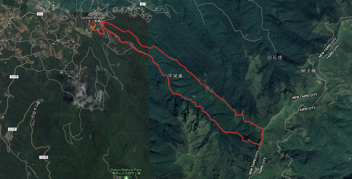
Datun Stream Trail Map
GPX file available here on Outdoor Active. (Account needed, but the free one works just fine.)
My new words learnt on this hike:
- 放鴿子 / fàng gēzi / stand someone up – as in 你怎可以/會放我鴿子? I found this very funny when I first heard it because the literal translation is ‘put the pigeon’.
- 八婆 / bā pó / gossip aunt, or rather someone who likes to do a lot of gossiping.
- 得意 / dé yì / gloat, brag
- 後果 / hòuguǒ / consequence, as a result of
- 教學相長 / jiào xué xiāng zhǎng / literally “teach, learn, mutually grow” – a saying or phrase which has a meaning something along the lines of ‘learning and growing together’, or like ‘a teacher learns from their students’.
- 描述 / miáo shù / describe, description
- 娘娘腔 / niáng niáng qiāng / sissy voice – I have absolutely no recollection of why this came up in conversation, but unfortunately this (and 放鴿子) are the two things that I remembered easily, despite being a lot less useful than 後果 or 描述.

Great hike!
LikeLike
Thank you very much. It was a really rewarding walk despite the toughness of the highest section.
LikeLike
Rugged scenery!
LikeLike
It really is. I still find it hard to believe that this place is under an hour outside of Taipei proper.
LikeLike