
Distance: 7.5km
Time: 2 hours 20 minutes – we were going at an extremely slow pace because we had Teresa’s mum with us.
Difficulty: 2/10 – This is a very straightforward walk, but at over 7km, our 60-year-old hiking companion found it slightly tiring (mind you, she’s not used to exercise, so that might be why). The floor isn’t smooth enough to bring a pushchair, but it’s not far off, and there’s no way you can get lost here – the route is very clear.
Total ascent: 398m – I’m kind of surprised by this. It didn’t feel like we were ever really climbing.
Water: I finished my 0.5L and would have liked more, but Teresa and her mum barely drank anything. We went in winter, so on a summer’s day, I would at least double my water intake.
Shade: In places – I would have needed an umbrella if it were sunny. We ended up needing umbrellas because of the rain.
Mobile network: The first half had reasonable signal, but it disappeared after that.
Enjoyment: This trail has a decent waterfall, pleasant stream walk and some cute bridges. The first section was a bit off-putting because it felt like we were walking along the road, but I’m glad we stuck with it.
Jump to the bottom of this post for a trail map, GPX file, and transportation information.
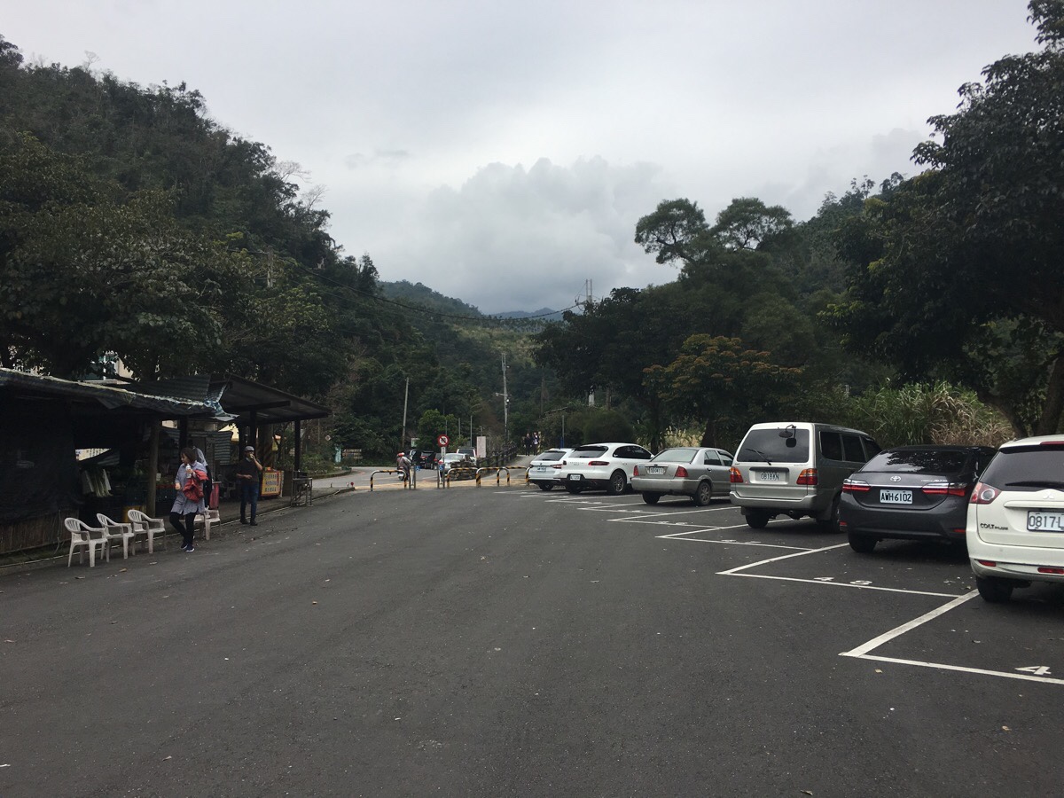
The car park at the entrance to the trail was pretty full when we arrived, so we parked up about halfway down and made use of the toilets before setting off. Worryingly, Teresa’s mum made some mention of just how far away the toilets were (maybe 100m), which didn’t bode well for the walk ahead, but we started walking anyway.
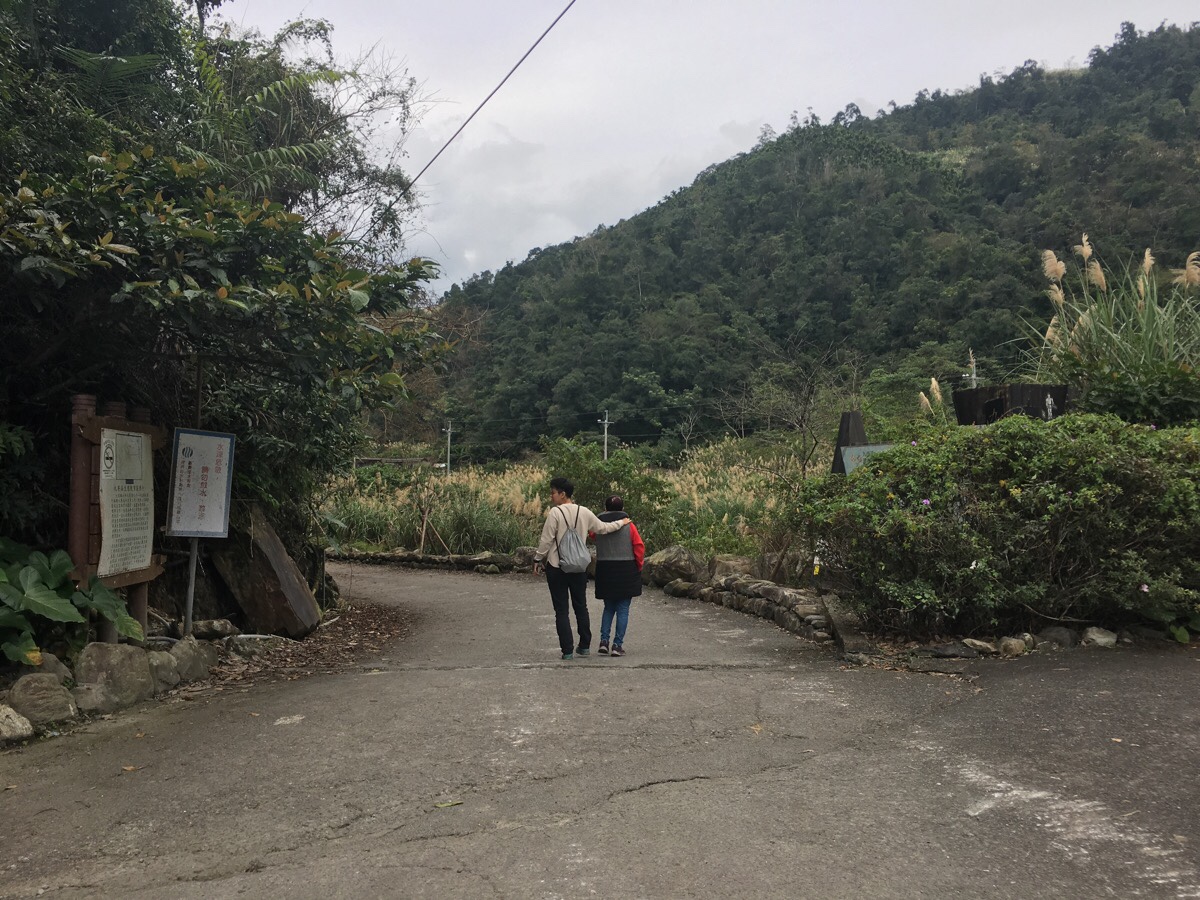
Walking to the head of the car park, the road becomes a track. For pretty much the whole way there is a footpath which runs alongside the road, but we, (like all of the other people on the walk that day), stuck to the road because according to Teresa’s mum it was 比較好走.
An information board here give a little background of the area. Over the years its natural resources have been exploited by both the indigenous Atayals and the Japanese. Fittingly, both groups have left their mark in the language of the place by way of names. The Atayal’s original name for the creek was the Gaba river, (this name lives on in the waterfall). One story of how it came to be called this is that during one hunting expedition, a group of Atayal hunters spotted a sambar deer and pursued it through the forest. They chased the deer along the stream and finally cornered it at the top of the second waterfall, but the sambar, not wanting to become lunch, leapt into the spray churned up by the water and disappeared. As they stood contemplating their defeat and their hungry bellies, all the Atayal could hear was the mocking sound of the water as it crashed onto the rocks ‘gaba-gaba’.
For a while, the next wave of people to inhabit the area, the Han Chinese settlers took to calling the stream Po-dang Stream – a reference to the power of the water as it rushed downhill. However, the name that is mostly used today comes from the period of Japanese rule. During that time, there was a busy camphor industry in and around Yilan. Many people came to the area attracted by the prospect of wealth, and in order to simplify things, all the camphor stations were numbered started from number one as the northernmost station. The station next to this river was the ninth station, (Jiu Niao Liao) and so the river became known as Jiu Liao stream. Personally, I think that the story of the disappearing dear is the coolest naming story of the three, but then hearing how all three names came about is also pretty fascinating.
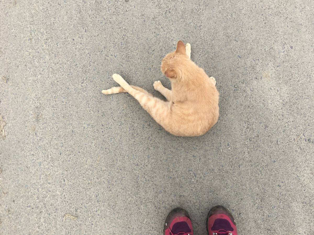
About 500m into the walk we reached a small pavilion, apparently this is as far as Teresa’s mum got the last time she walked here (it was summer, they were too hot). A little further beyond that were a couple of houses with dogs and cats outside. This one just wanted to hang out in the middle of the road cleaning himself.
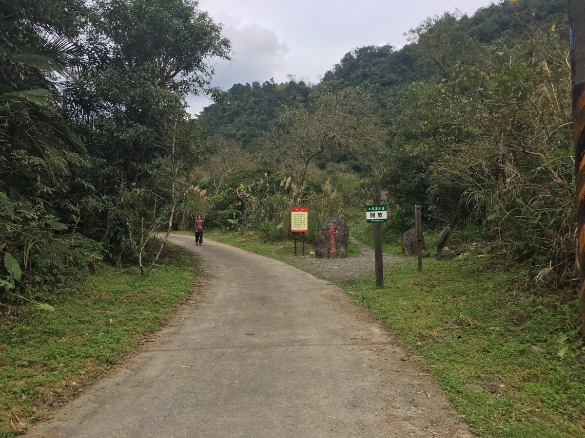
There is a stone trail marker at the point where the ‘proper’ trail starts, the road and the trail run side by side, so it doesn’t really matter which one you take.
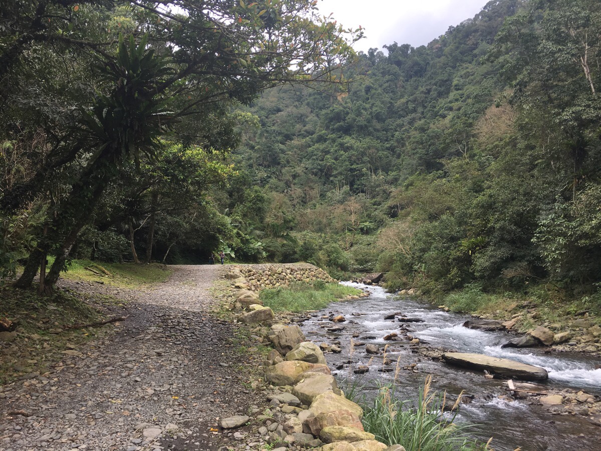
After a while, the road becomes a gravel track, and about 1.2km into the walk, the track finally gives way to a proper footpath. At the this point, there was a blue truck parked and the truck’s driver was sat on a step contemplating an artificial waterfall that was spewing forth from a series of pipes which had been strung up over the water. I wondered if he had been sent to fix it, but when we returned on our way back, both he and his truck had vanished and the water was still falling.
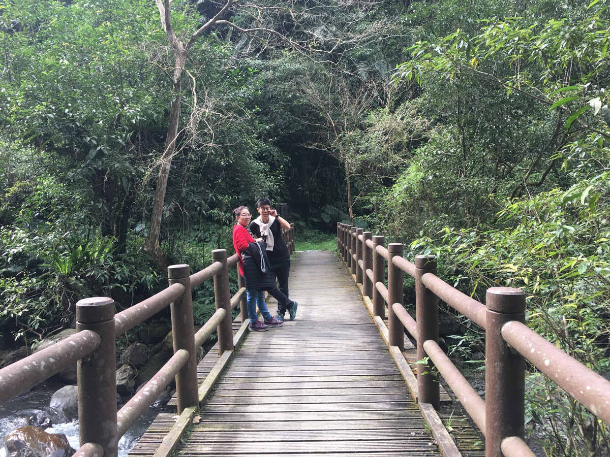
The path can’t make up its mind about which side of the river it prefers, so there are a series of names bridges as it crosses several times. Another sign somewhere along the trail says that the Atayal build a few temporary bridges across the river every year, but I don’t think we passed any on this visit. The sign describing why the bridges are so frequently remade was the one that I think the writers must have had the most trouble translating into English, (the rest were of a really high standard compared to some I have seen….beware of bee stink if you visit Pingding canal trail). I have to assume that the original text was just too poetically written to translate comfortably:
Rain drop from the sky in every season from dark clouds; the river is a one-way traffic lane flowing toward the east. And when it passes the lonely wooden bridge, it always remembers to take it on a journey; yet the wooden bridge, which never had the chance to get old, always loses its way back home in the corner of the Lanyang River.
The closer it gets to the waterfall, the more shaded and leafy the path gets. After a clearing with a few benches, the path comes to the most recent iteration of Ho Nghu-Pa Gah bridge, just upstream an earlier version made of ropes still straddles the channel, but it is fenced off with signs saying not to cross it.
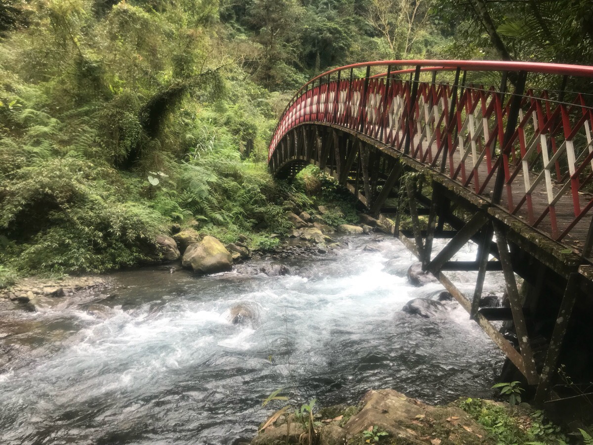
Each bridge is different in style and design. Some arch upwards.
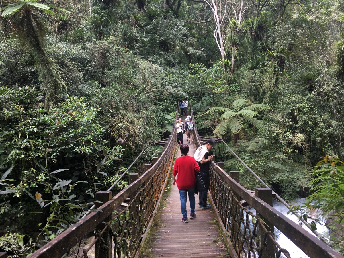
Others curve downwards. Some are rigid, others are wobbly.
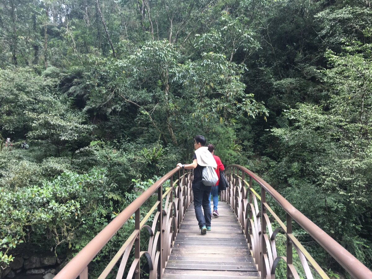
From the back of the final bridge, you can hear the roar of the water and see the mist kicked up by the falls, but it’s not until you round the corner that you can see the water.
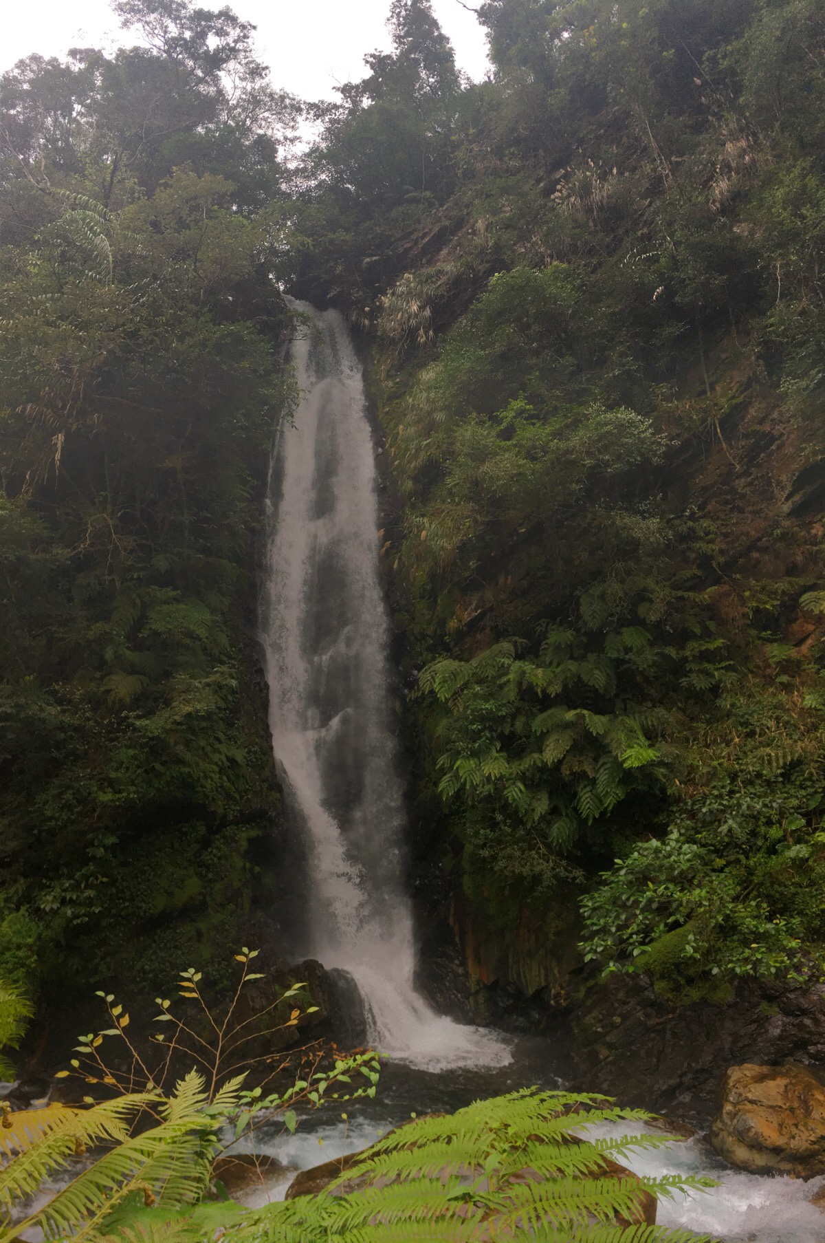
The waterfall is secreted away in the folds of the rocks and so surrounded by foliage that it feels hard to imagine that there is a stream continuing up there. It is neither the widest nor the tallest waterfall I’ve seen in Taiwan, but it is rather charming. If there hadn’t been a gaggle of aunties and uncles stretching their limbs on the viewing platform it would have felt very close to the enchanted misty curtain the the deer disappeared into in the story.
We sat awhile, ate a couple of snacks which Teresa had accidentally brought along and then made our way back. As we neared the point where the path turned back into a road, the grey clouds that had been skulking over the hills decided that they’d been hanging around for too long and were ready to lighten their load. What started as very light, occasional spots shortly turned into a persistent drizzle that managed to deep through clothing despite looking like nothing in the air. I marched ahead slightly quicker and retrieved umbrellas, but Teresa and her mum we’re pretty damp by the time I got back to them. Luckily for me, I had an easily accessible change of clothes in the boot of the car, so I could change out of the wet ones before we went to find lunch.
How to get there
Google Maps address: Jiuliao Creek Trail, 267, Yilan County, Datong Township
GPS location: N24 40.420 E121 36.000
Public transport: The 1744 bus leaves from Yilan station heading towards Nanshan village. Get out at Jian Cha Shao bus stop and walk up the lane towards the big car park and toilet block.
Further reading: The Yilan Government website has a page for this trail.
Jiuliao Creek Trail Map
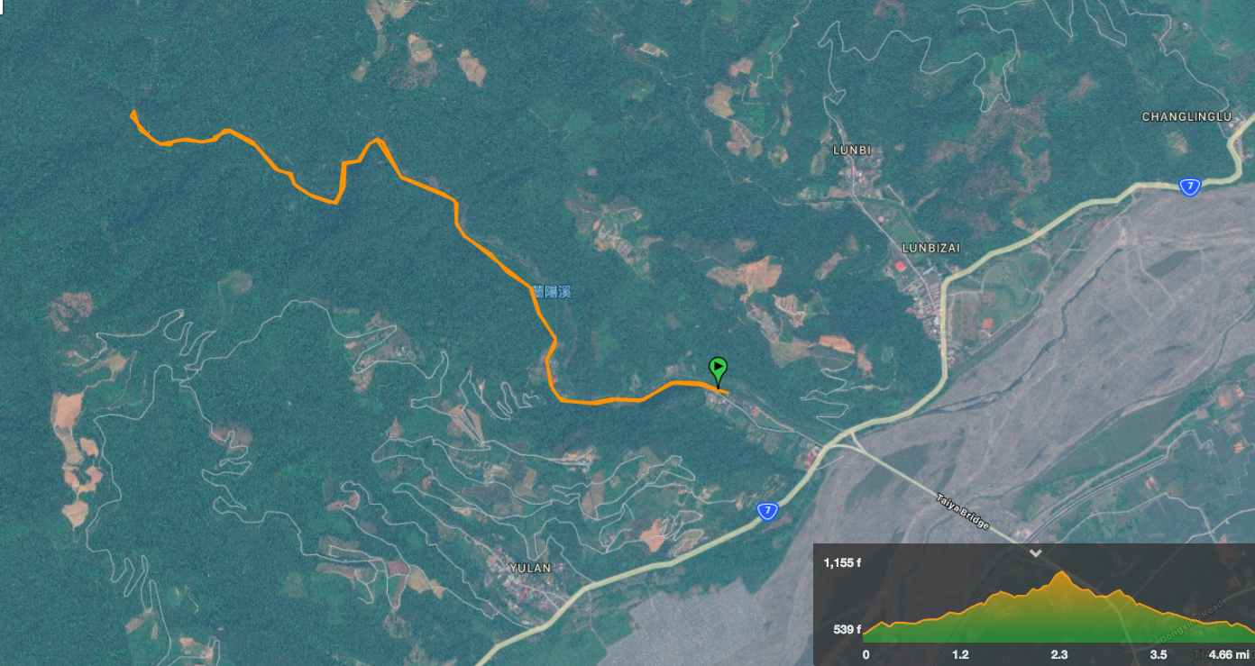
GPX file available here on Outdoor Active. (Account needed, but the free one works just fine.)
My new words learnt on this hike:
- 消息 / xiāoxī / news – Teresa says that the bopomofo tones are xiāoxī
- 監獄 / jiānyù / prison
- 貴族 / guìzú / noble
- 競爭的 / jìngzhēng de / competitive
- 團購 / tuángòu / group buy – this is a pretty big thing here, people group together to buy things, (either online or in shops), in order to benefit from the discounts and efficiency which come from buying things in bulk. I’m sure this must happen at home too, but I was never around people who participated in it.

Might try this one on my visit towards the end of this year. Thanks
LikeLiked by 1 person
When you’re planning you trip, feel free to ask me about walls in the areas you plan to go to. There are so many lovely places to visit.
LikeLiked by 1 person
Thanks!
LikeLike
We did this hike this morning and it was absolutely beautiful, the while ginger lily was in full flower and smelt amazing. We even managed to get our friend from the car park to the coffee shop in his wheelchair (he chilled there while the rest of did the hike). Also encountered a snake!
LikeLiked by 1 person
Lucky you! A snake sighting is guaranteed way to improve almost any hike. I’ve been seeing more later in the year this year. I guess the heat is keeping them active.
LikeLike