Sandiaoling trail is one of the most popular day hikes in northern Taiwan, and for good reason. You’ll enjoy waterfalls, a shaded walk by a stream and a dash of adventure… and all easily accessible using public transport.
Distance: 7.1km
Time: 3¾ hours – Faster people could probably shave a little time off of this, but make sure you give yourself enough time to enjoy the waterfalls
Difficulty (regular Taiwan hiker): 3/10 – A little slippery and steep in places.
Difficulty (new Taiwan hiker): 5/10 – Mostly a straightforward walk but with a few more challenging sections. It would be very simple to do an easier version of this walk though by just walking up to the falls and back down again.
Total ascent: 478m – Regardless, it didn’t feel like too much of a climb.
Water: 1L – We went on a warm winter day. It was cool enough that we started and finished the walk wearing jackets, and it wasn’t a strenuous or sweaty hike in these conditions. However, I carried about double the water and I am sure that I would have needed it in the summer.
Shade: Either well-shaded or not at all shaded – even in winter I wore a hat to avoid sunburn on my neck.
Mobile network: patchy – the area around the waterfalls there was no signal.
Enjoyment: Some lovely waterfalls and very fun walking to be had here, and the fact that you can travel back via train is good too. I was just a little sad that we were unable to do the loop that we’d planned to do.
Other: If you’re planning to eat after walking, you could head directly to Shifen instead of going to Dahua, there are a couple of paths that’ll take you there.
Jump to the bottom of this post for a trail map, GPX file, and transportation information.
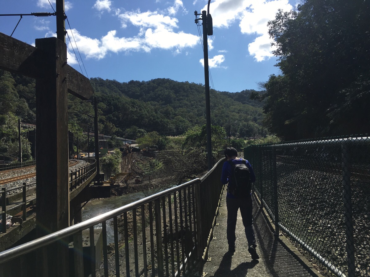
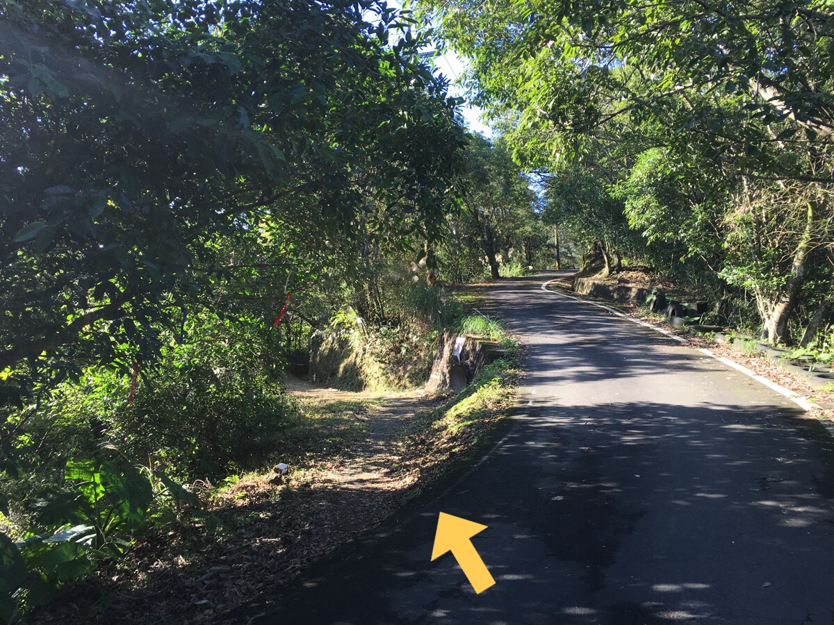
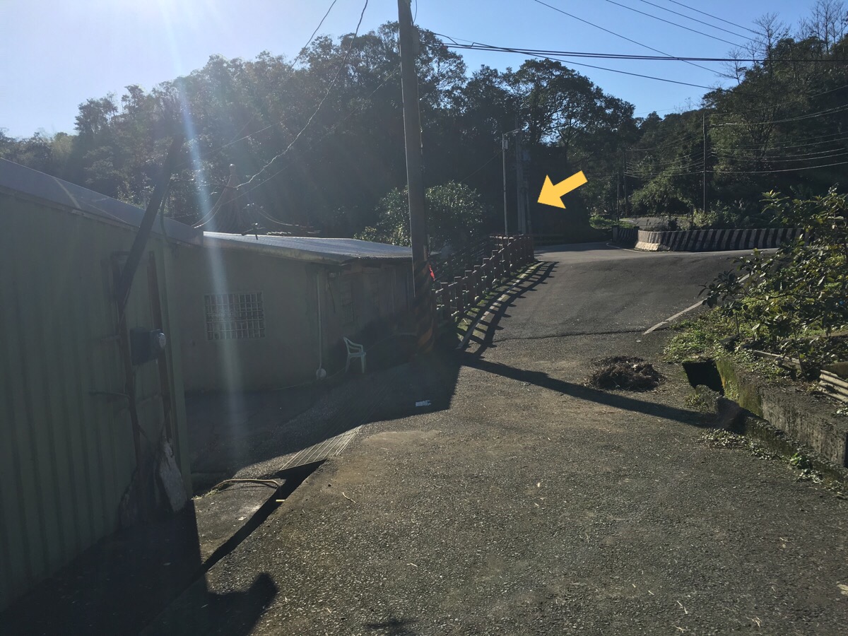
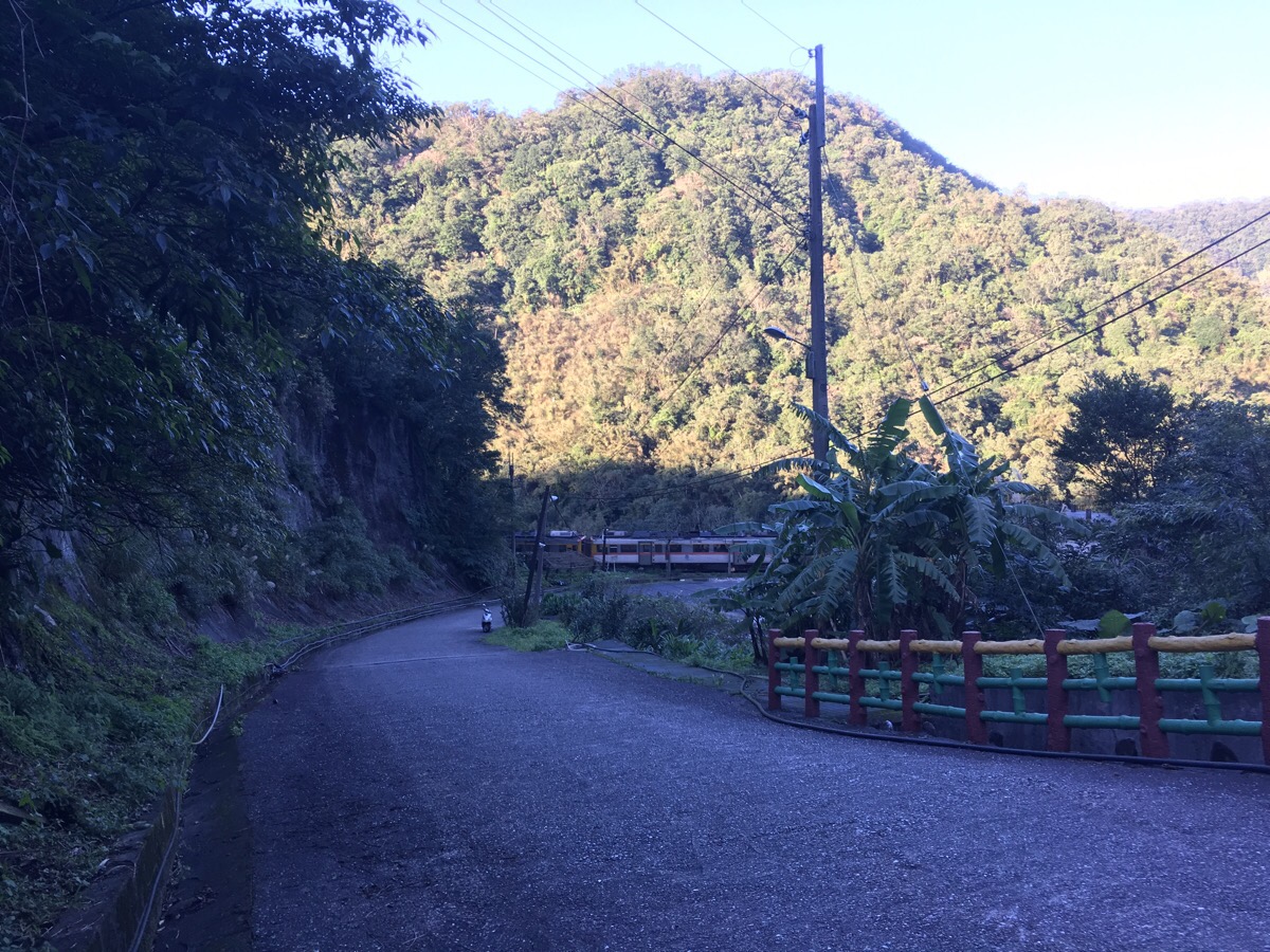
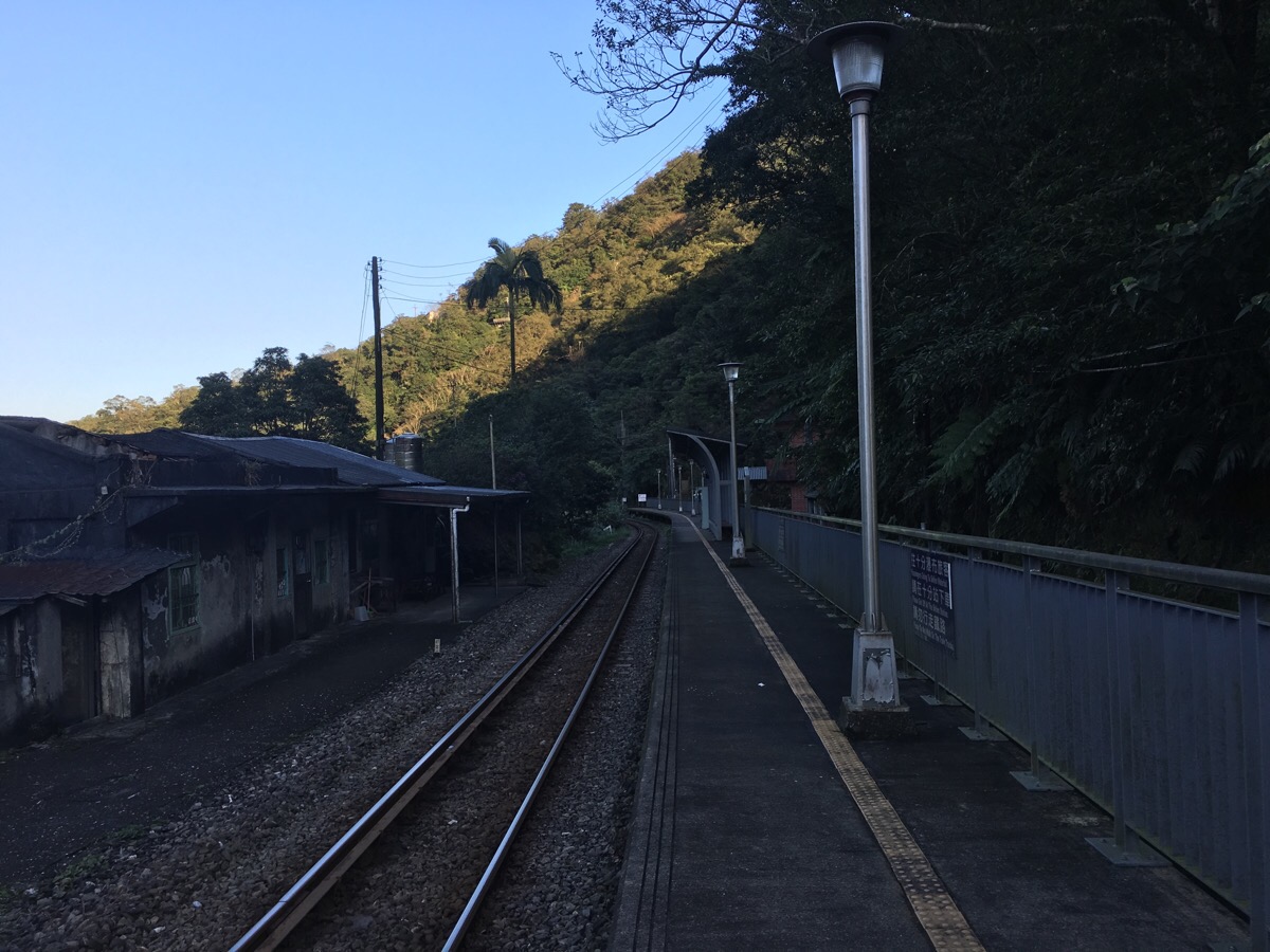
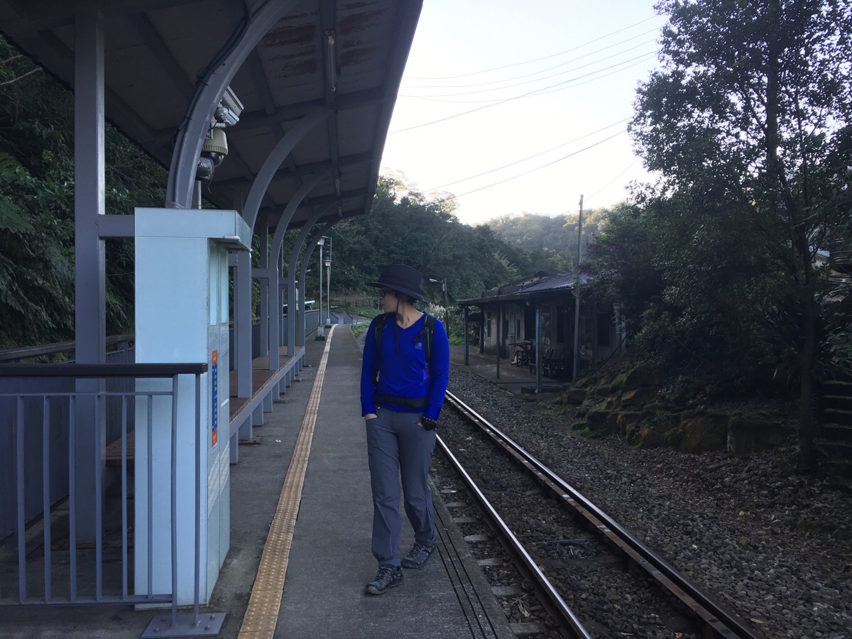
Starting from the train station, go through the little ticket office and turn right following a narrow path beside the tracks. The path ducks under the rails and comes up the other side. (Actually, since we arrived by car instead of by train we had to cross the rails at an unauthorised point, but I wouldn’t recommend that, the trains come out of the tunnel mighty fast.)
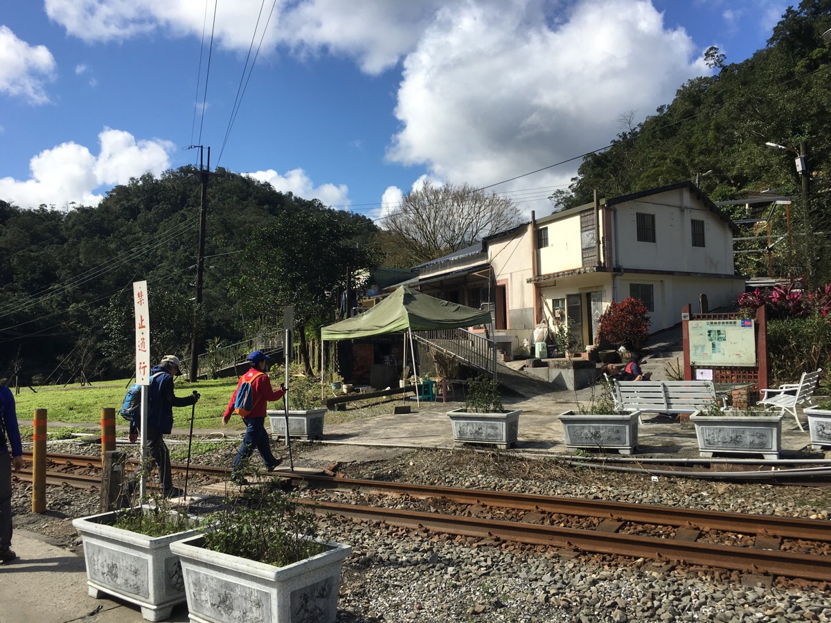
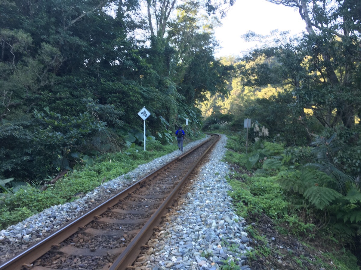
Keep following the rails until you get to the small village of 碩仁里/Shuò Rén Lǐ.
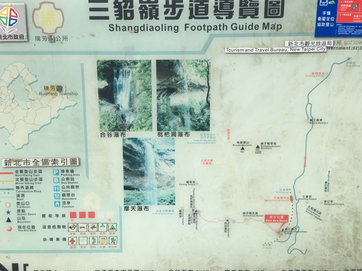
After crossing the rails, there is a map which gives a general sense of where you’re headed – getting to the falls is extremely straight forward, there’s only one place where the path splits off.
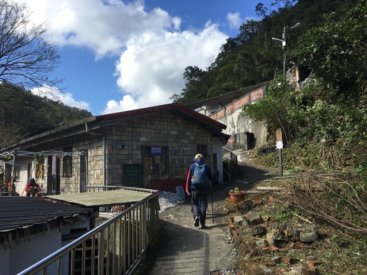
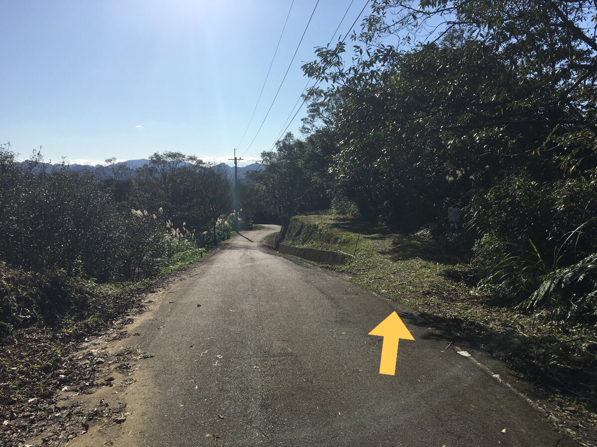
Follow the path through the village, and as soon as you leave the houses behind, you’ll start to climb some stone steps.
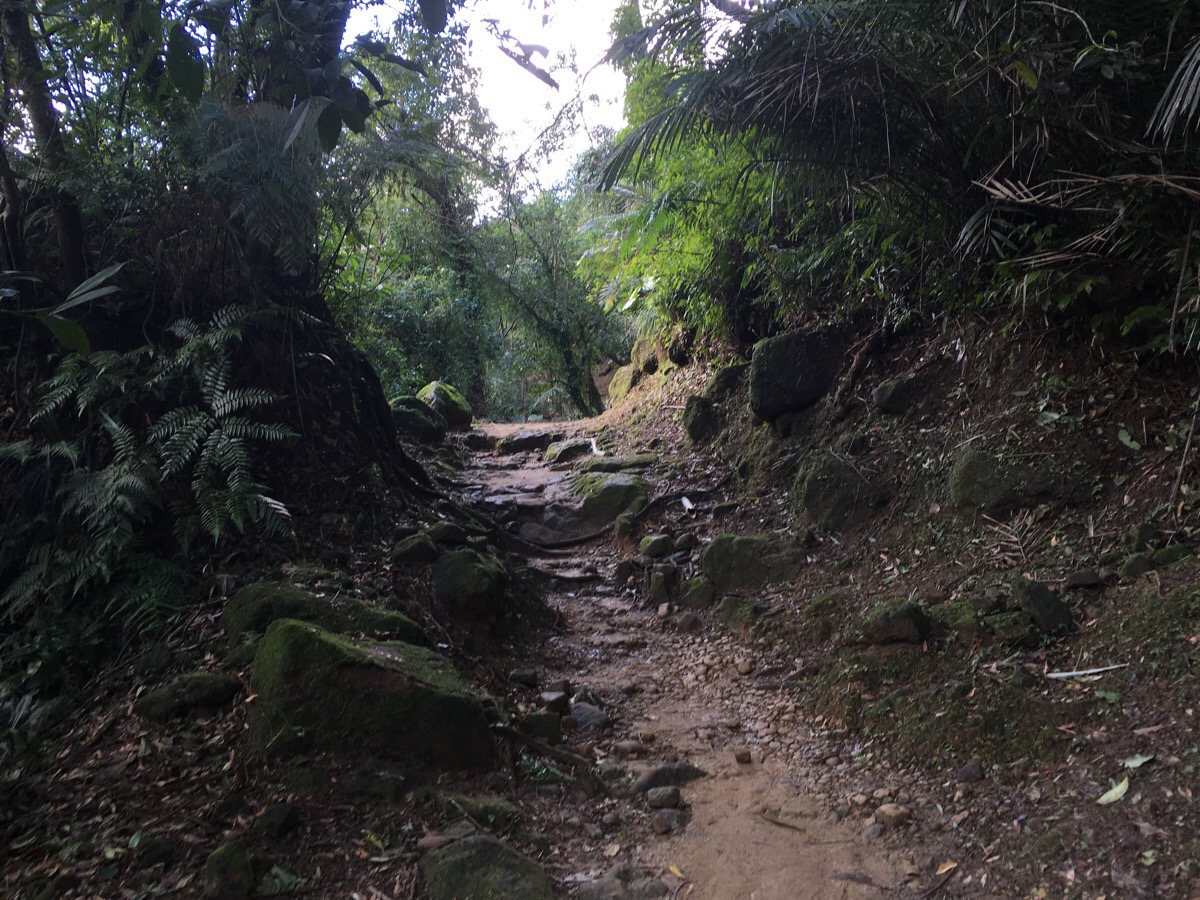
After a short climb, the path levels out a little.
Most of the way it’s just a dirt path, although there are a few places where it gets rockier.
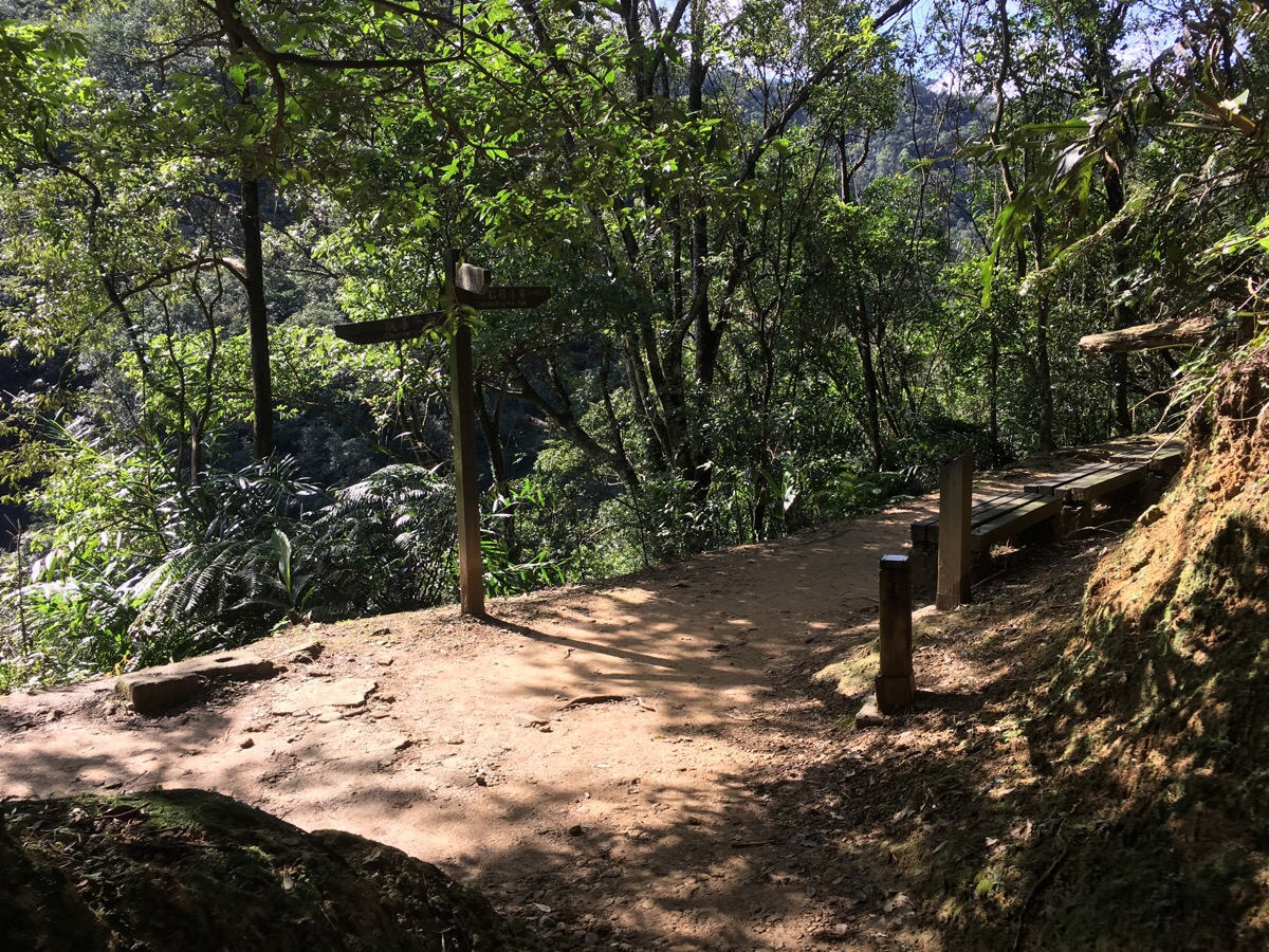
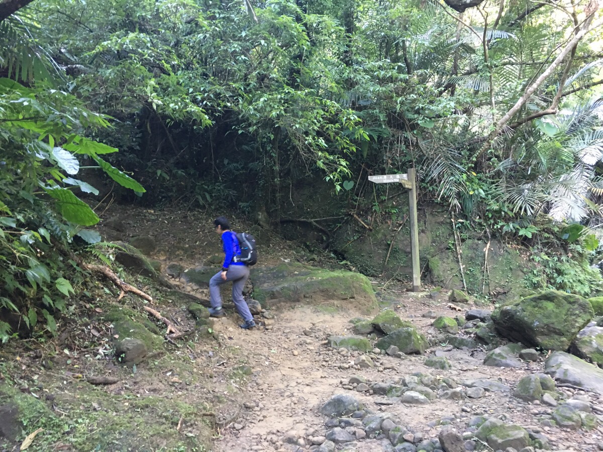
About fifteen minutes after leaving the village, we passed the only noticeable junction before the waterfalls. There was a map, but the signpost had fallen down a little further along the path. We kept going straight. (The path on the right is where we would have looped back down if we’d been able to do the walk I wanted to do.)
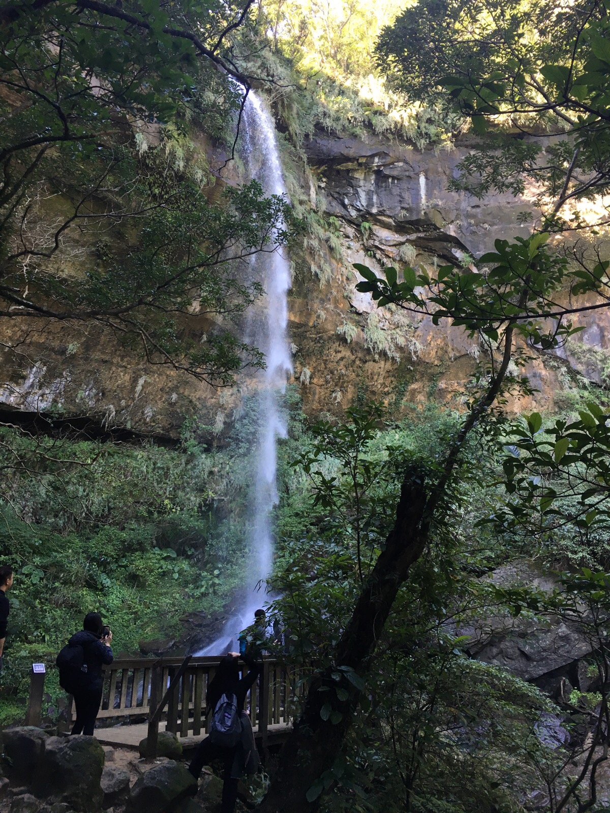
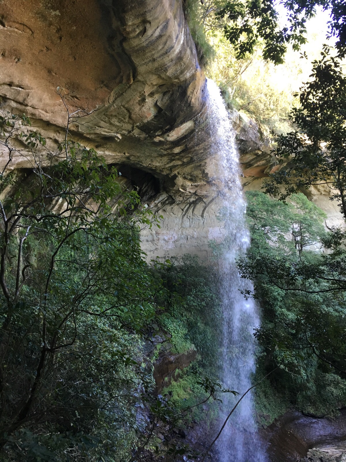
At a bend, there is a spur on the left where we encountered both a small shrine (聖媽廟) and a viewing platform for Hegu Qaterfall (合谷瀑布).
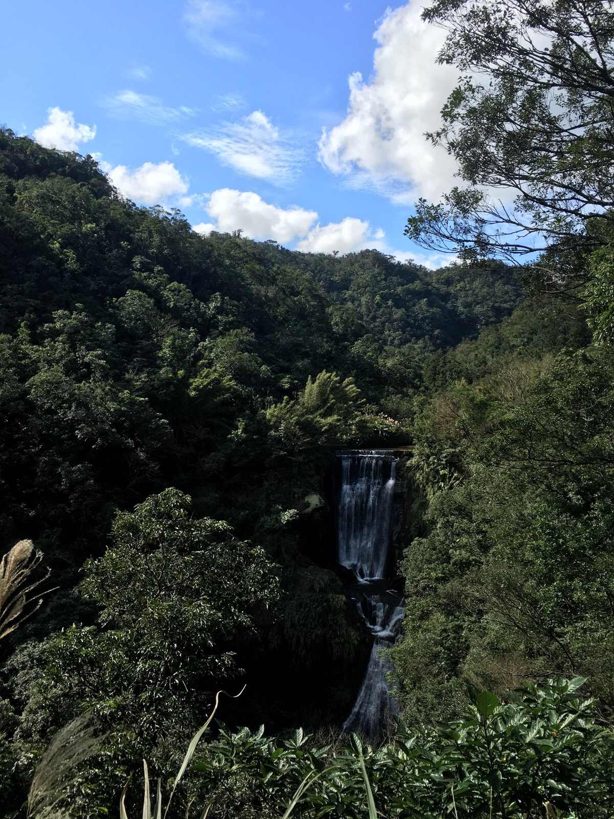
Hegu is 40m high – split into two staggered cascades of 25m and 15m – and it is the tallest of the three falls we passed.
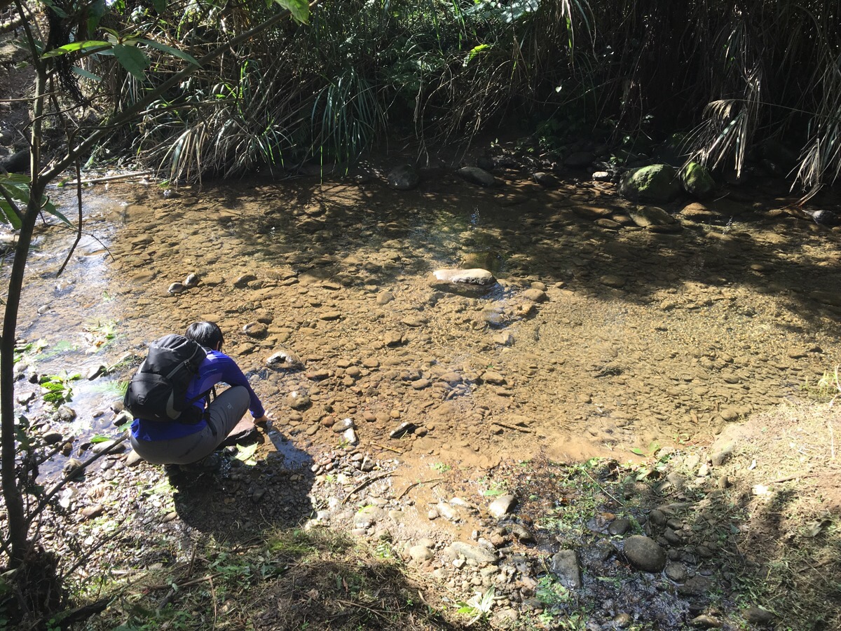
Not far beyond the viewing platform, we encountered one of the tributaries which feeds Hegu, and Teresa had a little bit of a paddle whilst we waited for a group of aunties to stagger across the rope bridge.

This is the first of two such bridges in quick succession, and somehow seems a lot bigger without people on it.
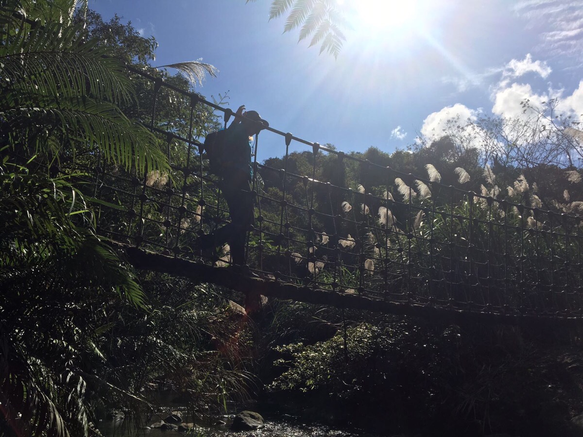
After watching the aunties struggling to cross, I had anticipated that it might be deceptively hard to cross. However, that wasn’t the case—it had a pleasing springiness.

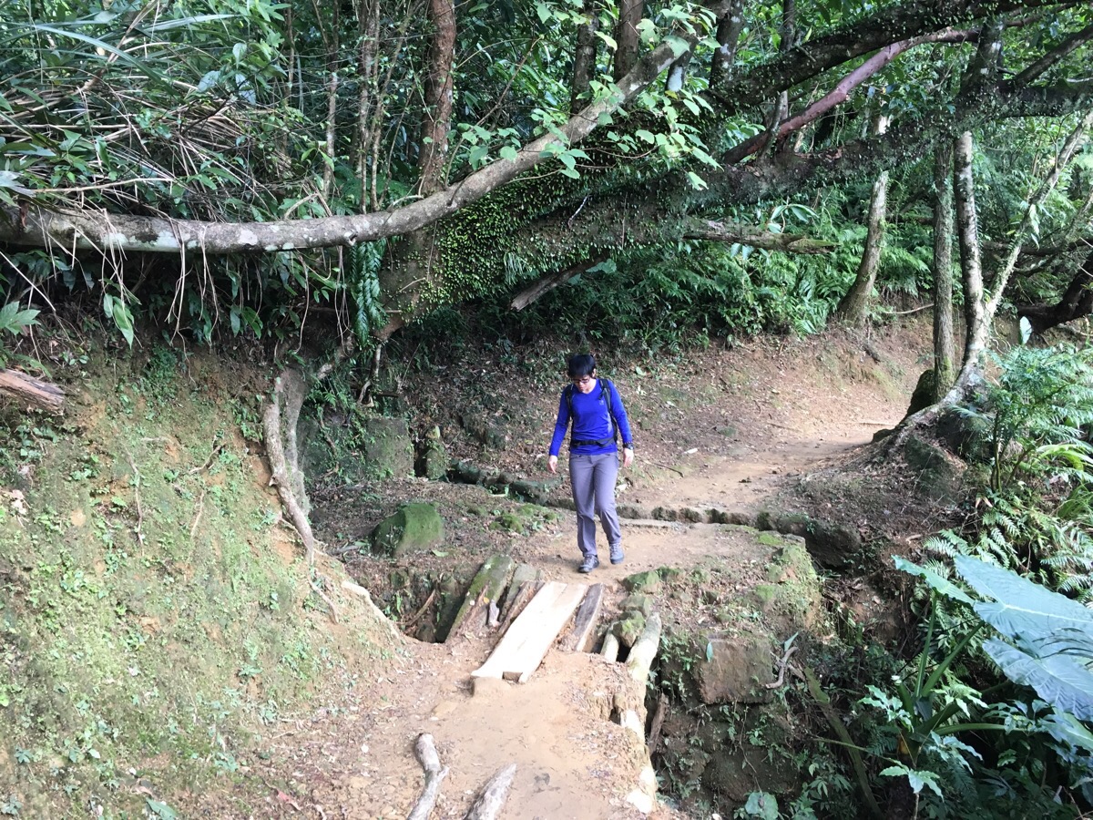
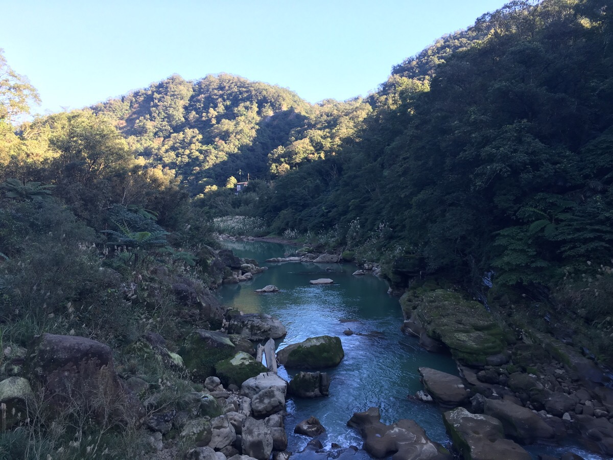
Beyond the second bridge, the path runs alongside some water for a way.
Then, it diverts up and left away from the water.
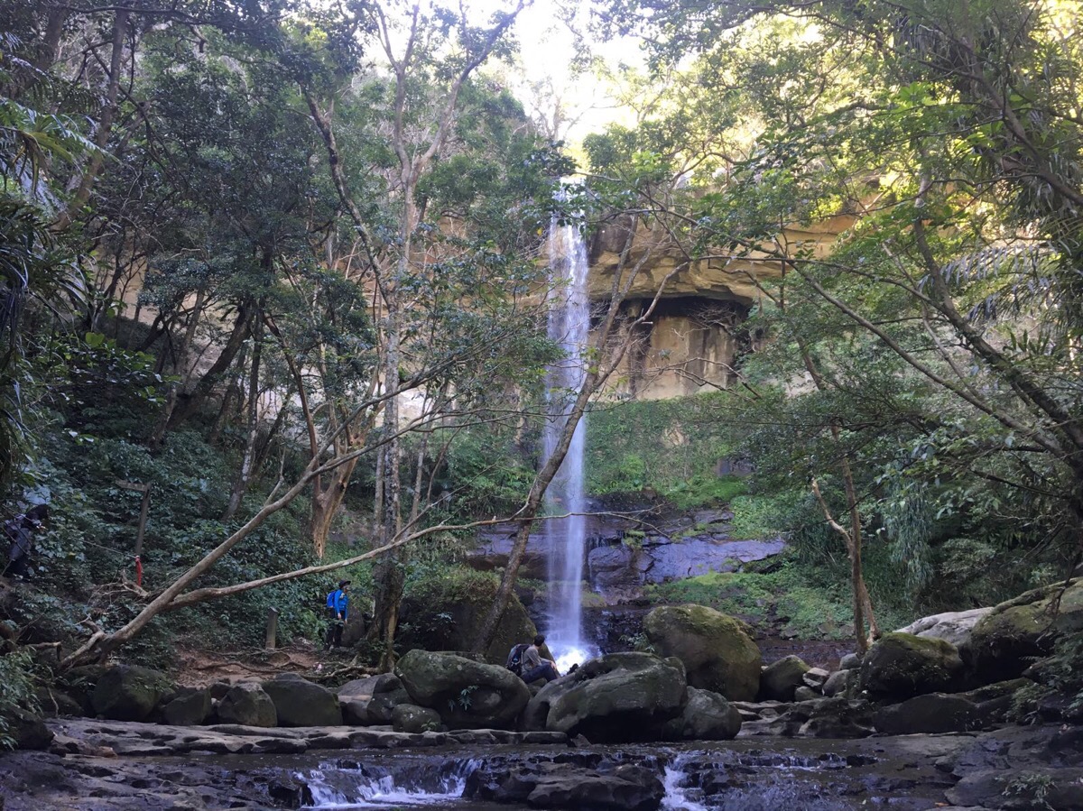
Roughly an hour after leaving the village, we arrived at Motian waterfall (摩天瀑布). The viewing platform, which juts out over the river, was occupied by waterfall-mist selfie-takers. Like almost all of the people we encountered, they seemed to be tourists. The few other Taiwan residents that we encountered walking came in two distinct groups: over-prepared avid hikers (this lot were decked out in expensive hiking gear, with wellies, bandanas, knee-straps and hiking poles), and cavalier weekend wanderers (these were mostly families all wearing hoodies and the kind of slippers that the Taiwanese feel are appropriate for any and all situation).
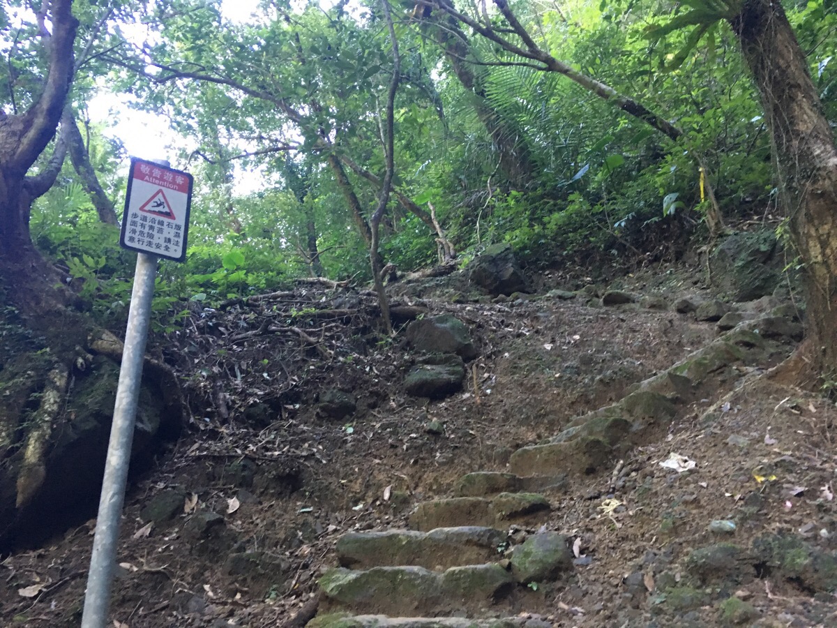
A path leads up and away from the river with a rather unnecessary sign warning that the rocks are slippery.
Looking back down at the waterfall gives a better sense of perspective than it’s possible to get from the site itself.
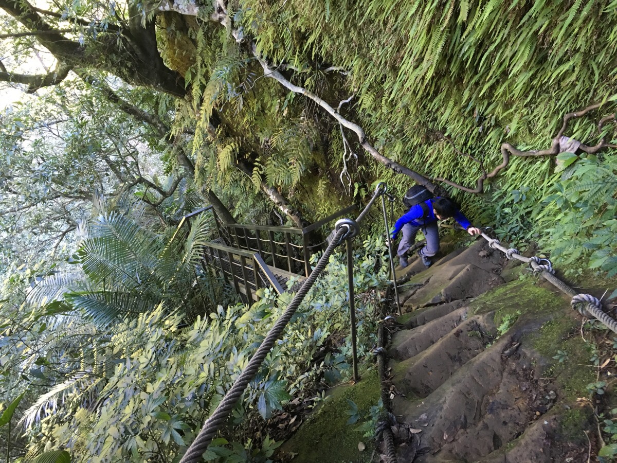
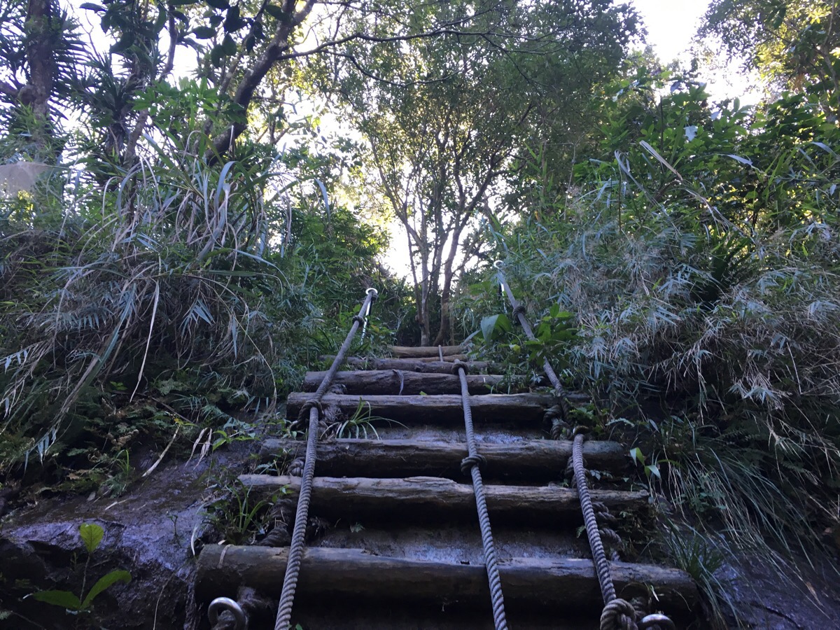
I think this is the section that the old-timers lament about in the blogs I’ve included as further reading. A rather ugly metal ladder leads up to a roped and fenced section with steps cut into the rock. From what I can glean, it seems that this part used to be a lot more challenging than it is now. As it is, almost any able-bodied individual would be able to do this easily enough.
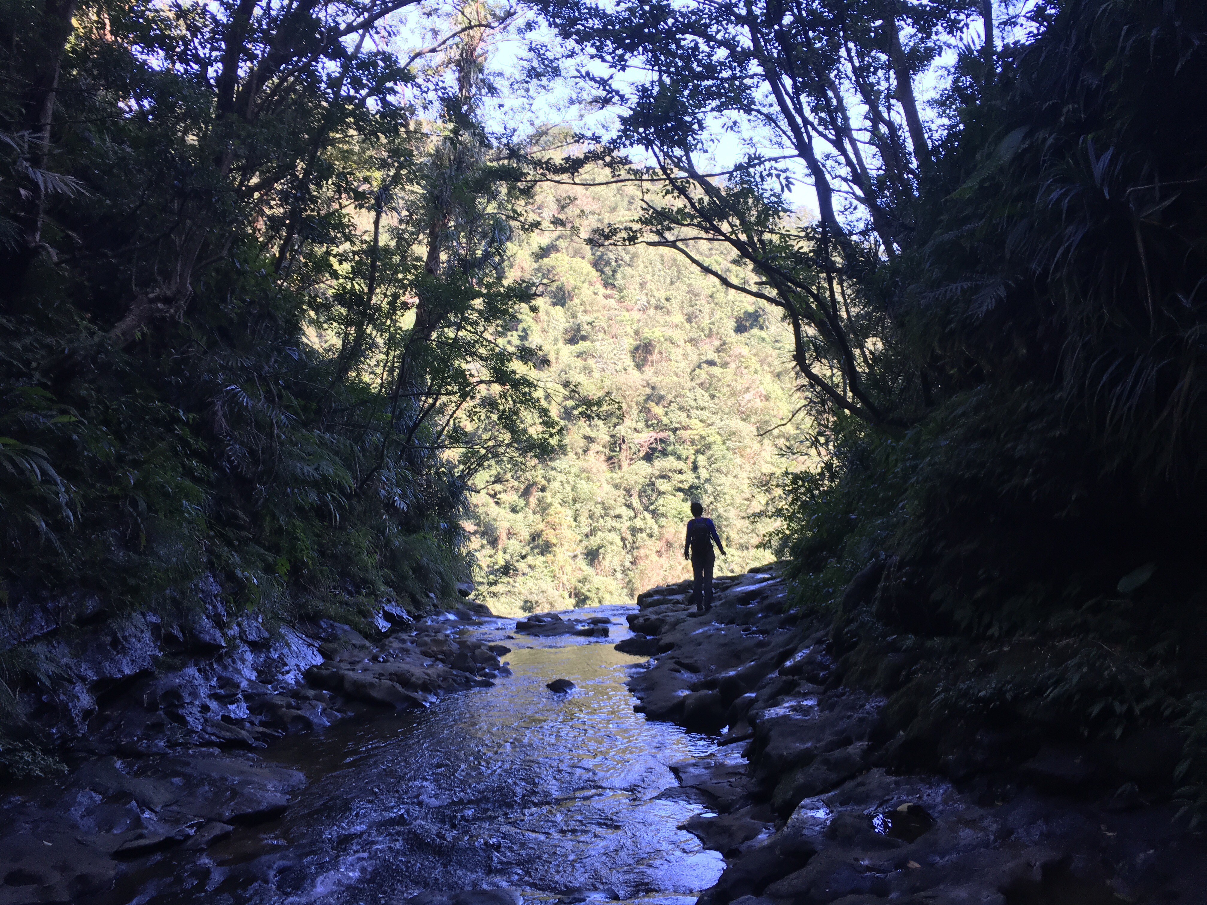
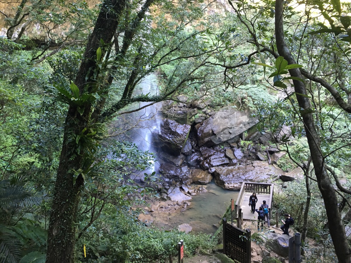
Only a little further up, the path arrives at Pipadong waterfall (枇杷洞瀑布). We took a little bit of a break here to wander around and enjoy the water. The photo at the top of this post is also from here – you can walk up to the lip of Motian.
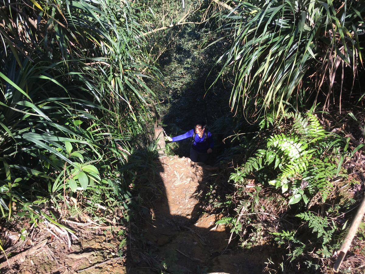
When we were ready to get going again, we took the path leading up from Pipadong.
The views as you climb up the water are rather dramatic.
There is one place where the original wooden ladder-style climb is still possible, but it seems that even here, people have found an alternative way up since there seemed to be a small path that curved up and around.
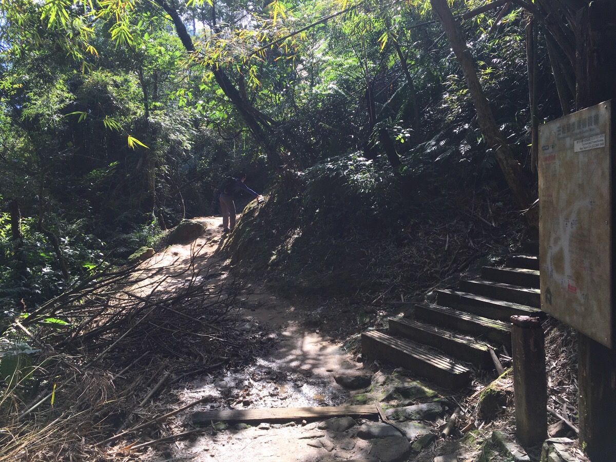
Just beyond the ladder, the trail emerges onto a more established-looking path with a map.
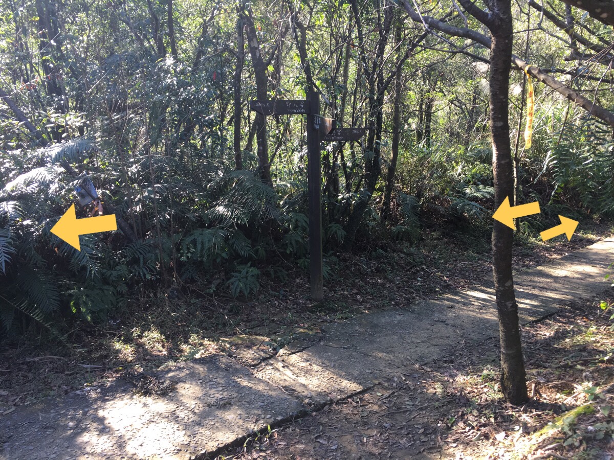
We were planning to go right in order to loop back. But in the end, that turned out to be a brief diversion. *
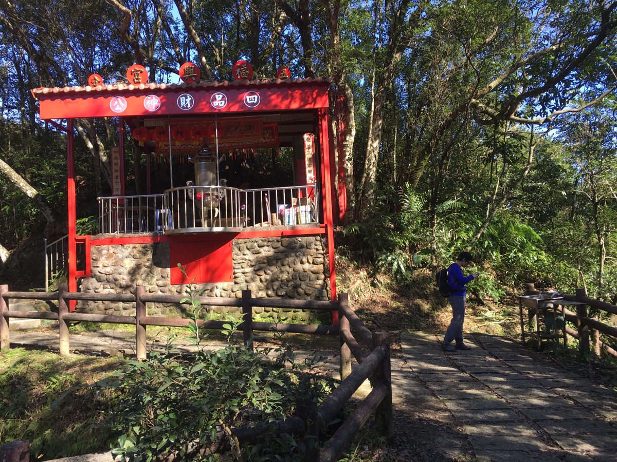
After crossing a little stream and walking for a few minutes, we arrived at some portaloos and a small temple.
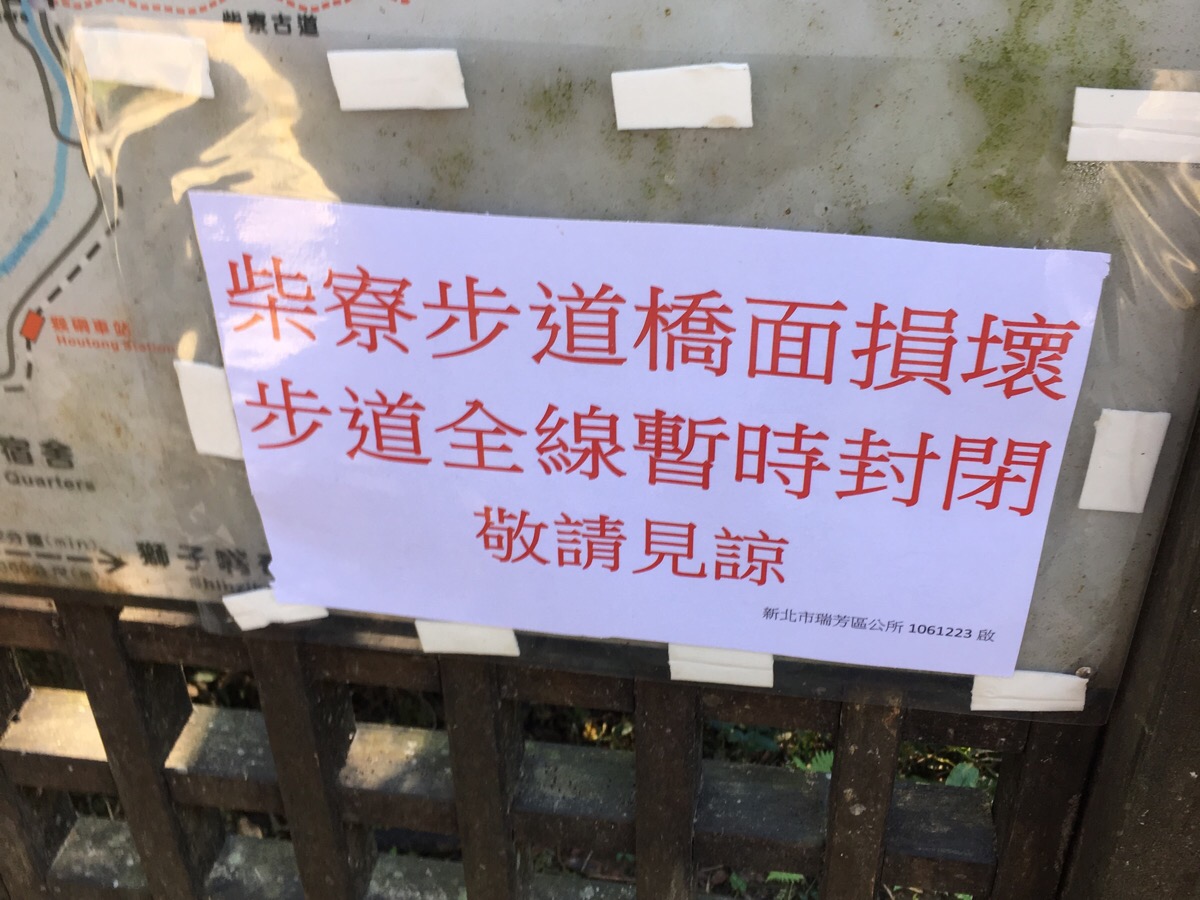
We also encountered this sign warning hikers that the route that we’d planned to take was closed. So, we turned back to where we’d come from and…
*…ended up going left towards Dahua (大華) instead.
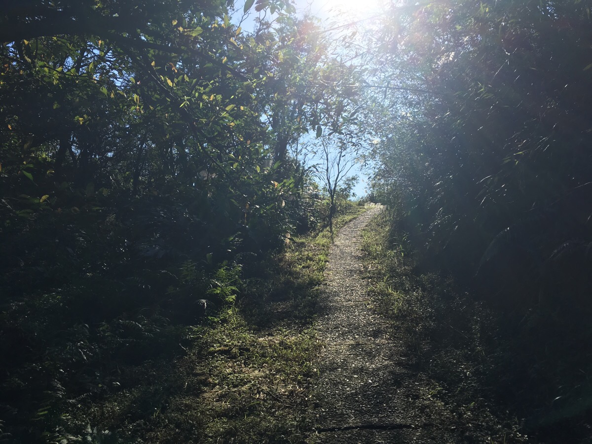
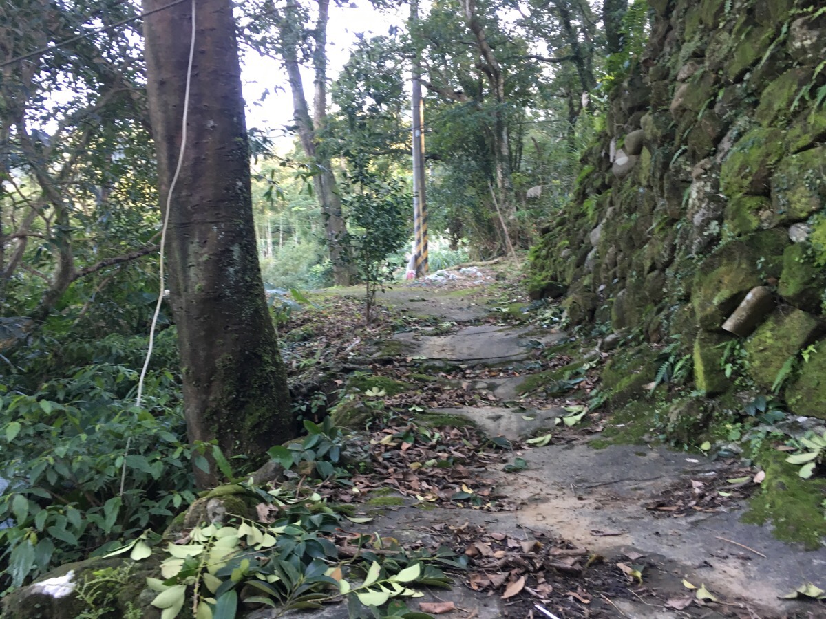
This section of path is a little strange. It seems like it might have been a little more frequently used in years past. At the bend in the middle of this picture, we spotted another, smaller path heading off to the left, but since we hadn’t brought our gloves with us, we decided to just stick to the easy routes.
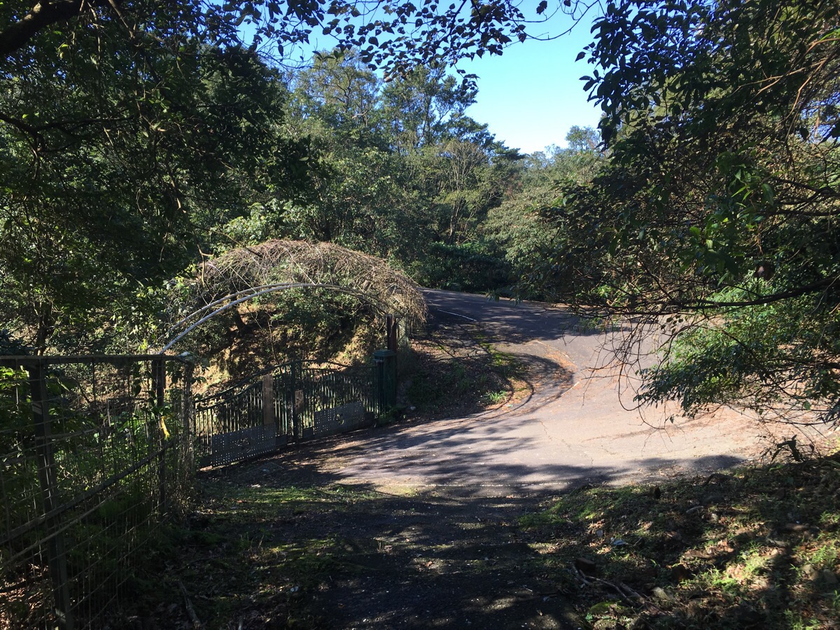
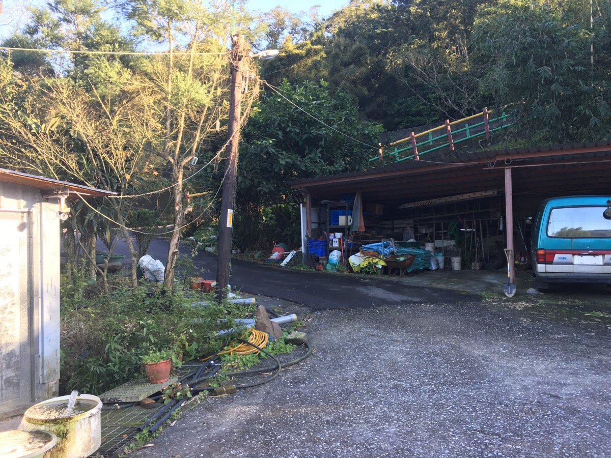
About ten minutes after the junction with the waterfall trail, we came out onto a road. There’s a gate to a semi-abandoned-looking private property, the sign on the gate says “Please close the gate to prevent wild dogs getting in”—not a promising message.
We followed the road until a small footpath veered away to the left. It is signposted as going towards Dahua and marked with a couple of trail tags.
About five minutes later, the path recrosses the road and continues on the right. Again, it’s signposted towards Dahua with some rather half-hearted signage.
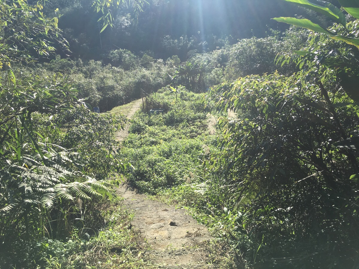
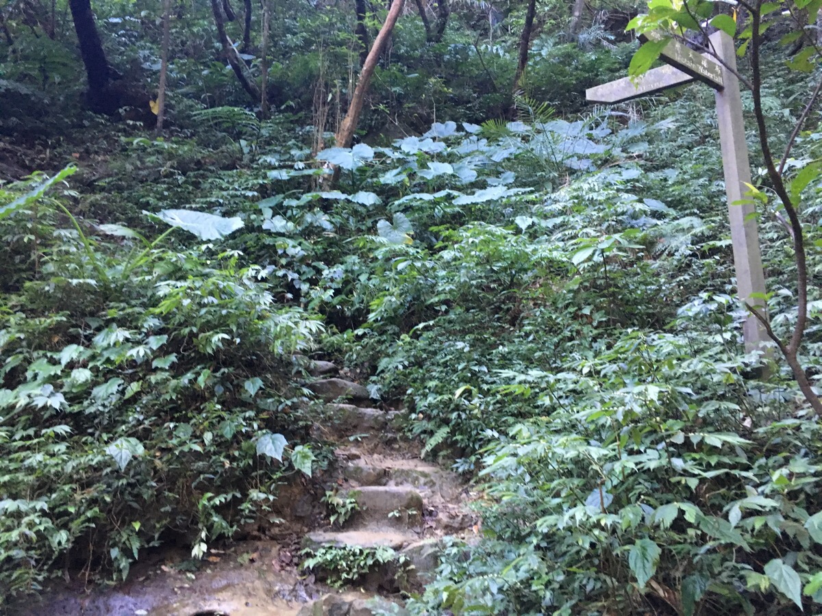
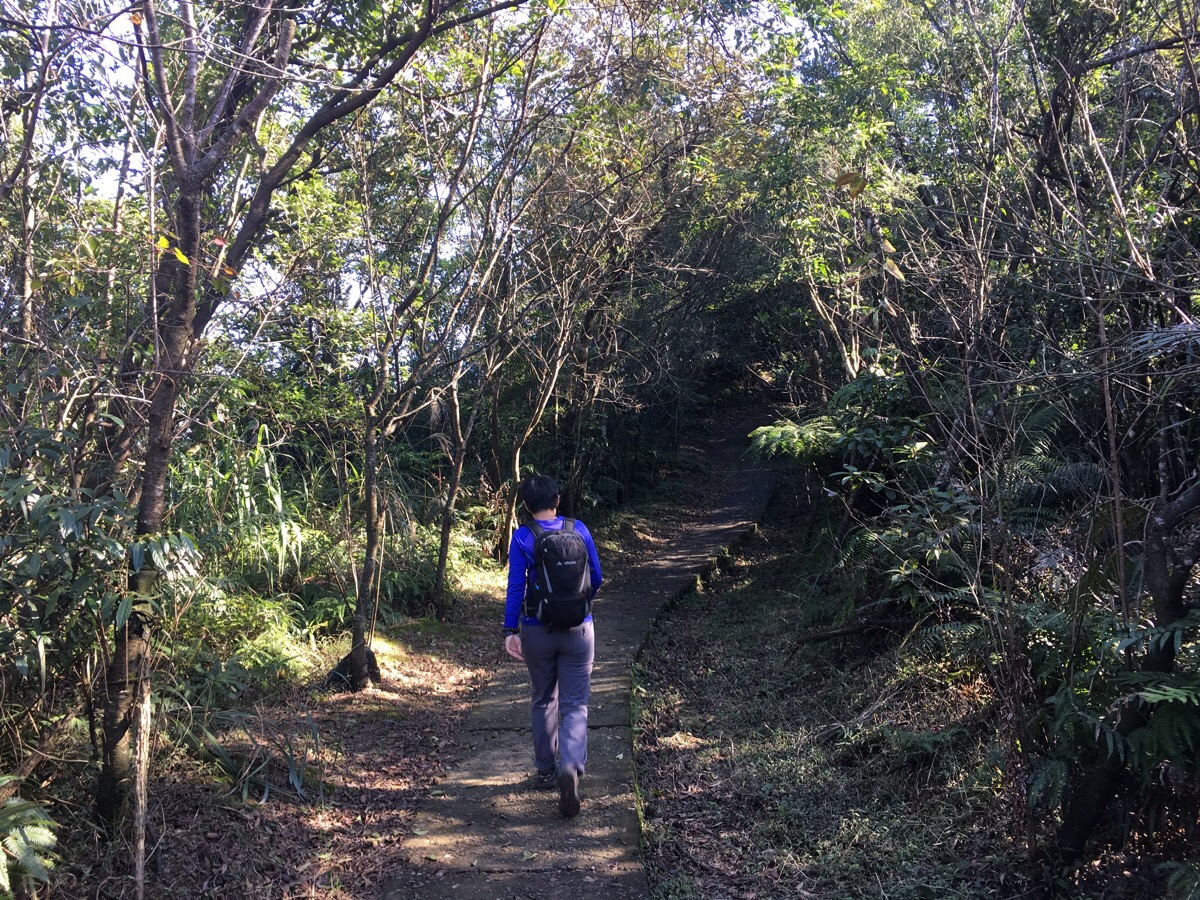
After a short downhill section, the path starts to wander through farmland – first bamboo groves and then more general farmland.
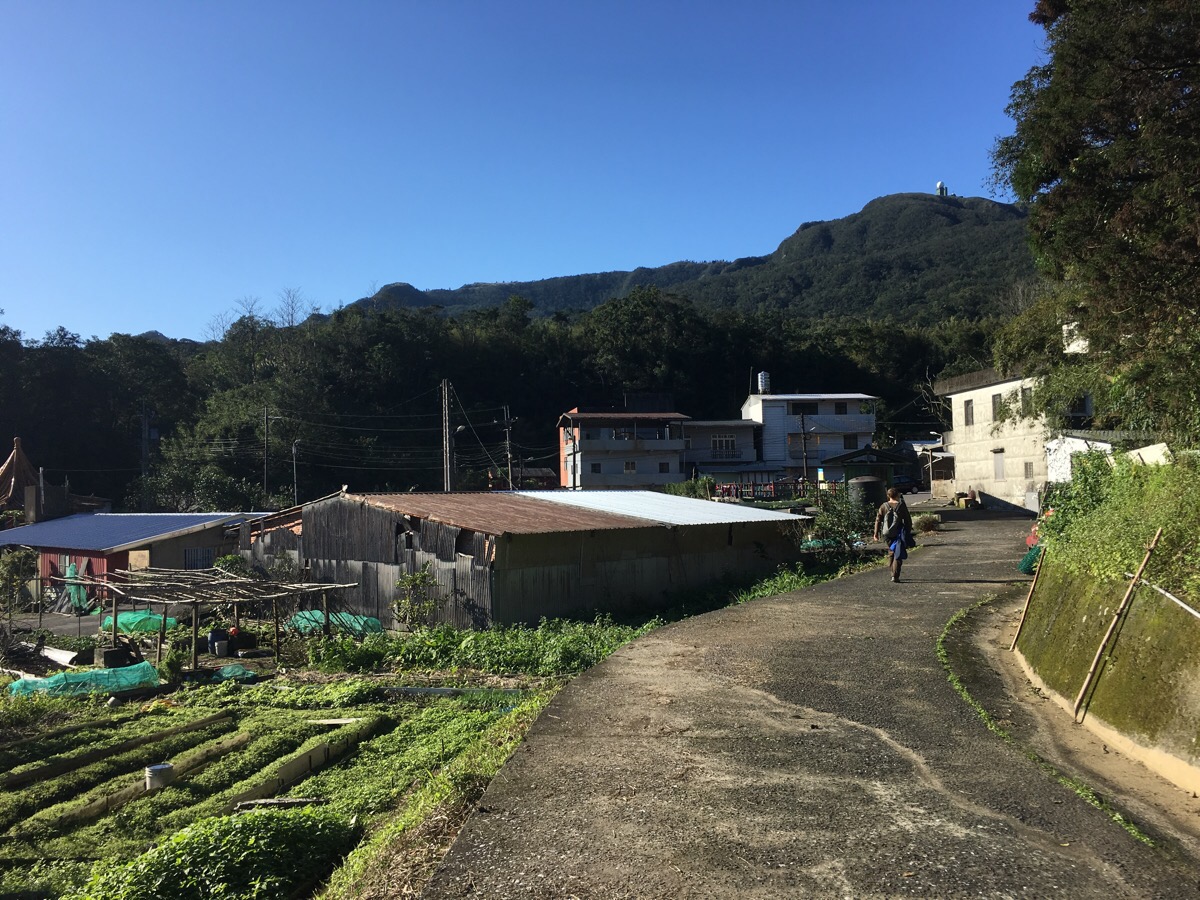
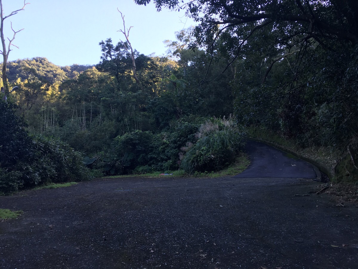
At the edge of a village, the path becomes a road.
Apart from one other walker, (who seemed a little lost), we didn’t see anyone in the village. There’s a small pavilion, (新寮亭) just beyond where the arrow points – we turned left again at the pavilion and started walking downhill.

After walking down the road for about five minutes, we walked through this elaborate gateway for an abandoned car park. The sign across the top of it says 野人谷. This is kind of interesting to translate – Teresa translated it on the spot as meaning ‘savage garden’ which I think she thought was a little funny. When we got to Dahua train station, there was a map which called it Wildman Valley, this is possibly more accurate, since 野人 is the name for the Chinese equivalent of the yeti.
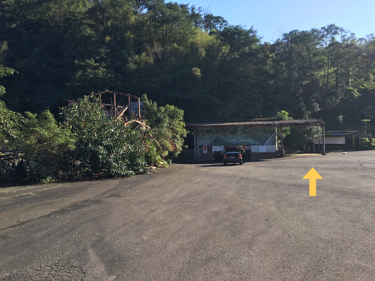
Walking into the car park, it’s possible to get a sense of what has happened to the place. The ticketing office remains standing (with a detailed map of the gardens so that you can have a look at what it used to be like). But the only other obvious building was in very poor repair. When we got home later in the day, we asked Teresa’s mum if she’d ever been to the park before. She hadn’t, but we found out that it was basically just a park with several waterfalls inside and that it was destroyed in 2000 when a typhoon swept much of it away.
The path leads just to the right of the ticket office and climbs up some steps.
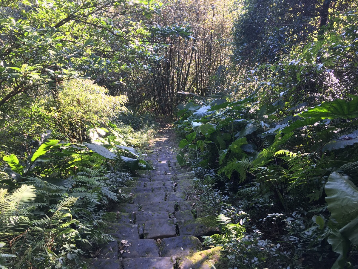
After a very brief climb through a small bamboo farm, the steps start heading down again and they are SLIPPERY. We had to slow right down here and I even resorted to using my hands at one point because the steps were just impossible to walk on safely.
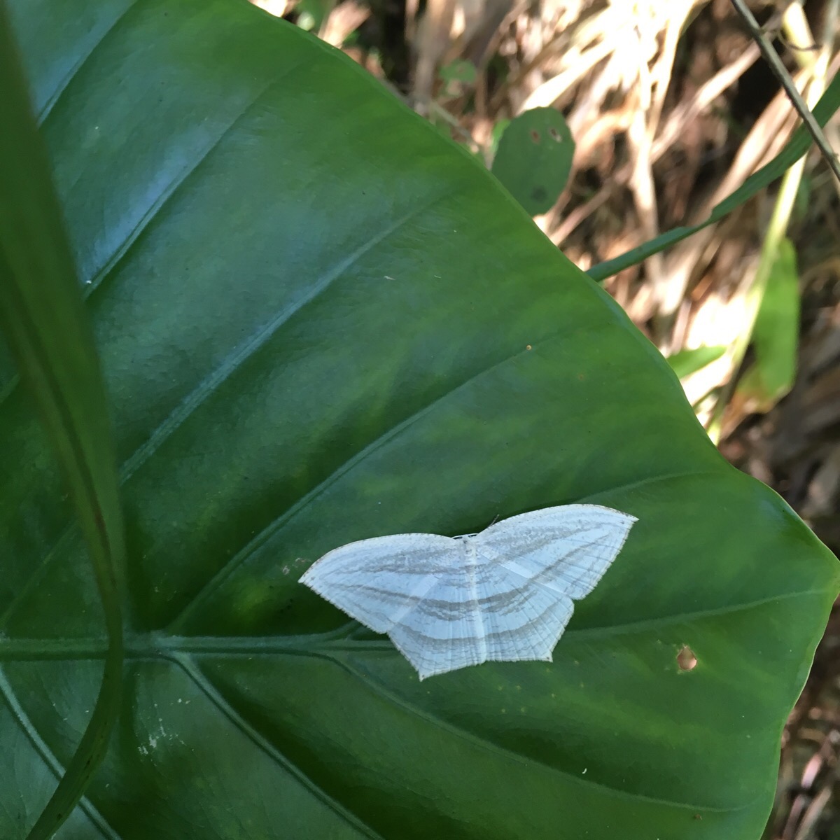
As we were nearing the bottom, the steps got a little safer and I was able to take a little more time to observe the things around me – including this rather beautiful pale thing which I think might be a moth, but I haven’t been able to identify it, so please let me know if you’re a butterfly/moth expert.
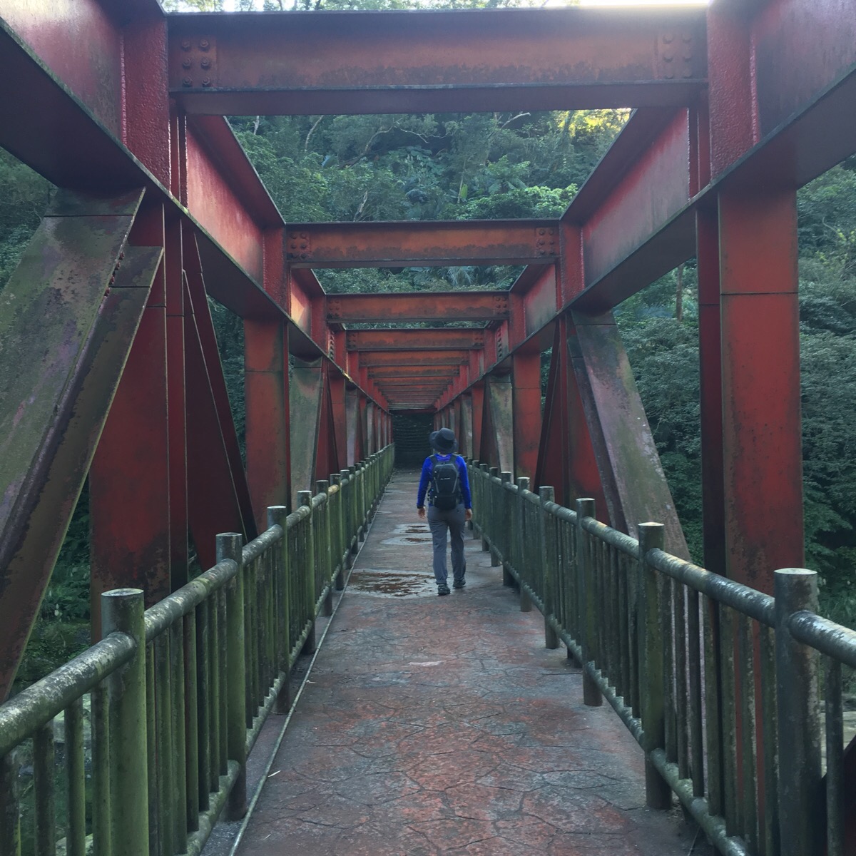
The path exited onto a red metal bridge crossing the river.
The views in both direction were rather pleasant and we stopped to enjoy them for a while before climbing up the steps.
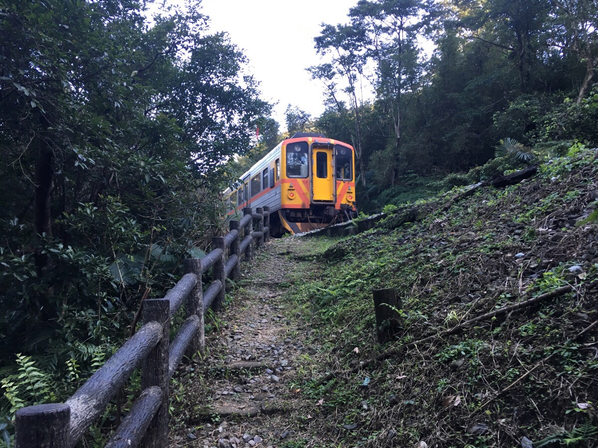
Just as we neared the top of the steps, we realised that we’d walked back to the train tracks when a train suddenly cut across the path in front of us.
At this point, we decided to cross the tracks and follow them for a short way to the apparent path which went up just to the right of where we’d emerged. Some people decide to walk along the tracks back to Dahua, but I’m not going to advise that anyone does that. (Or if you do, make sure you check the timetables carefully first.)
At the top of a short flight of steps, we turned left just in front of some old houses.
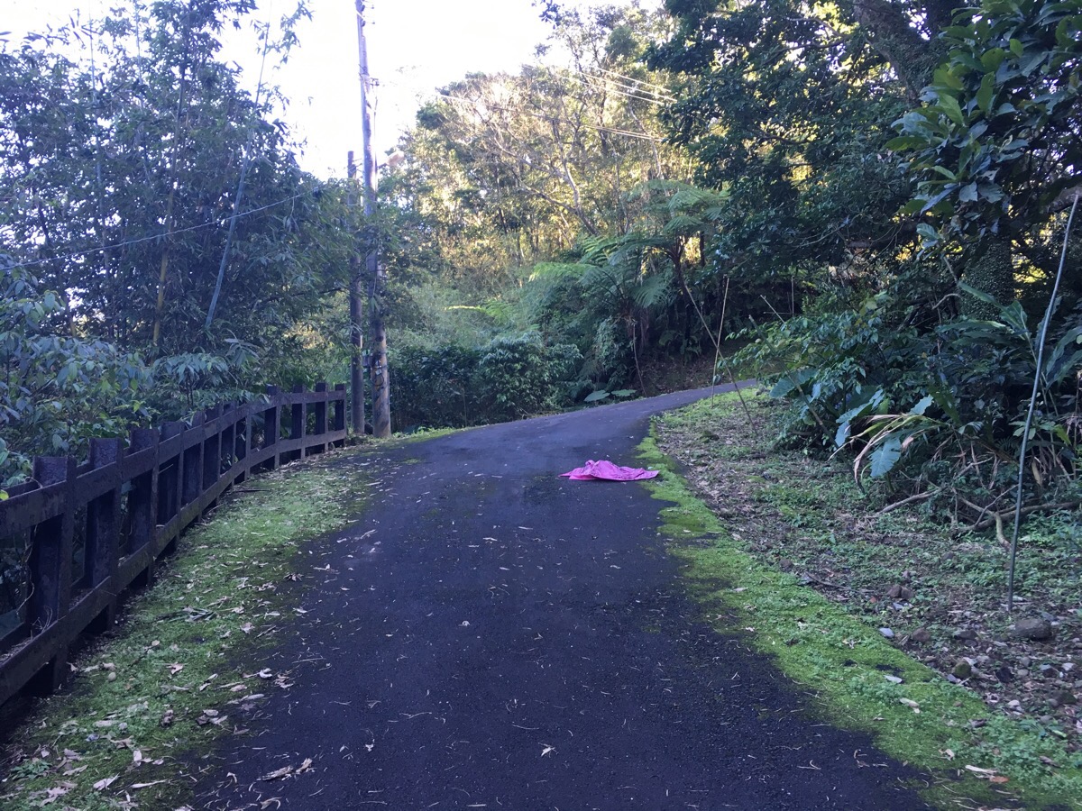
Here we came out onto a road which we followed uphill.
This is why I get really frustrated by the many for-tourists articles that promote releasing lanterns at Shifen. Any time you walk in this area, you come across the carcasses of sky-lanterns littering the scenery. This one had wishes scrawled in Korean along the side. I wonder if people would still want to release them if they saw where they ended up.
By this point on our walk, the light was starting to be tinged with that wonderful over-saturated later afternoon warmth. We passed a small duck farm on the right and this is where we started to hear dogs.
Walking a little more forward, the barking got more intense, and had I not been with Teresa, this is where I would have been looking for alternative routes. But Teresa is not scared of Taiwanese dogs and so she led us on. As we rounded a bend, we were greeted by the sight of four black dogs racing towards us at top speed barking territorially. Again, had I been alone, I would not have stood my ground. But Teresa was not afraid – even though the largest of the four was running towards us with the remains of a broken chain.
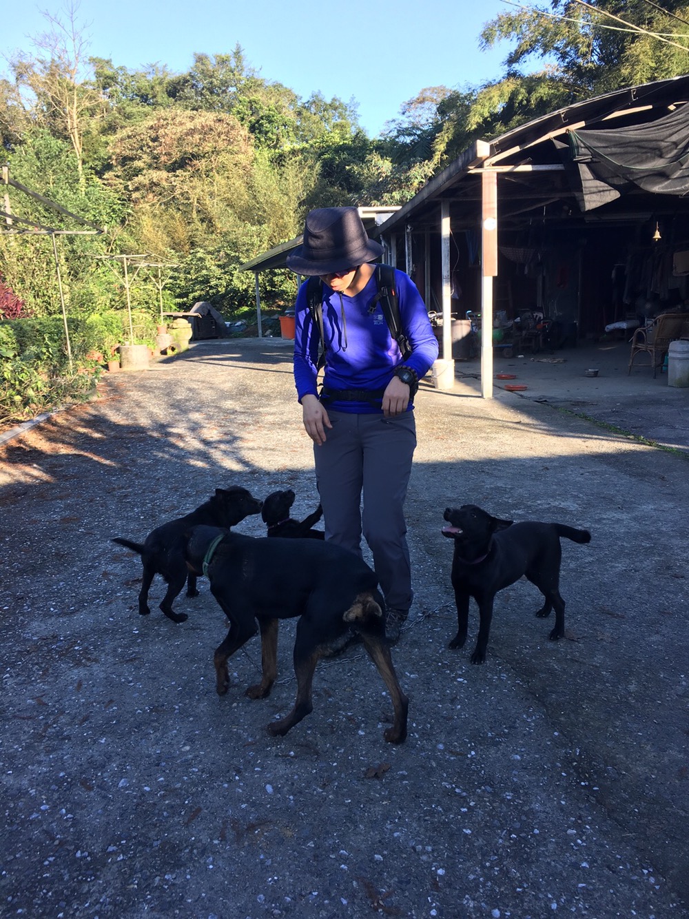
Thankfully, she made the right call, and a little bit of assertive politeness reassured them that we weren’t up to no good, and before long, Teresa had them all rolling over for belly rubs and some fussing. We spent at least ten minutes there with them, since each time we tried to move, they kept following to get a little more affection. We never saw the landowners.
Walking past the house, the road heads up to the left.
We joined a slightly bigger road and turned left to walk downhill.
Three of the dogs followed us for a way, at the next road junction, the largest dog went up into the trees on the side of the road whilst we were followed downhill by two of the smaller ones.
Heading down a little further, we were just in time to see a train pass the station.
Dahua station little more than an elevated walkway next to the rails.
There’s a timetable and an easycard beeper but that’s it. Luckily we only had to wait another 20 minutes for the next train to pass by and take us back to Sandiaoling. Less fortunately, Teresa put her wallet down on the bench and forgot to pick it up when we left. We noticed its absence when we got back to the car, and after a little dithering, we decided to split, she decided to drive the 45 minutes back to Dahua and I headed back to Sandiaoling to try and ask the station guard if there was anyone he could contact back at Dahua. Once I’d managed to communicate the problem, he retreated to the office to see if he could get hold of anyone, but Dahua is an unmanned station so there wasn’t really anything he could do. I waited at Sandiaoling for Teresa to arrive and see if she’d been lucky; since there weren’t any trains scheduled for a while, it was just me, the guard and a group of boy-band cute Korean tourists milling around the station. The guard good-naturedly let them cross the platform to take photos and prevented them from getting their legs chopped off by a speeding through-train. Teresa got back to Dahua in a little under 45 minutes, and right after she’d stopped her car, she got a call from her bank to tell her that her wallet had been handed into Ruifang police station. So she called me to tell me, and I decided to catch a train on towards Ruifang and meet her there. The guard told me that I should wait for the second train because it would be a lot quieter than the first, and he was right. I had a seat to myself for the short journey. I arrived in Ruifang before Teresa and was consequently able to enjoy visiting both of Ruifang’s police stations. I was able to take her wallet from the second station after some suspicious questioning from the police about my relationship to the wallet owner and why I was there when she wasn’t, but eventually after one of them talked to Teresa on the phone, I was able to walk away with her wallet – but not before one of the police officers asked to have his photo taken with me. It was quite a stressful end to a pleasant walk. However, since her wallet was retrieved with everything still in it (including $2,000 in cash), our faith in humanity was reaffirmed.
How to get to Sandiaoling Waterfall Hike
Google Maps address: Sandiaoling trailhead, No., No. 154, Yuliao Road, Ruifang District, New Taipei City, 224
GPS location: N25 03.530 E121 49.235
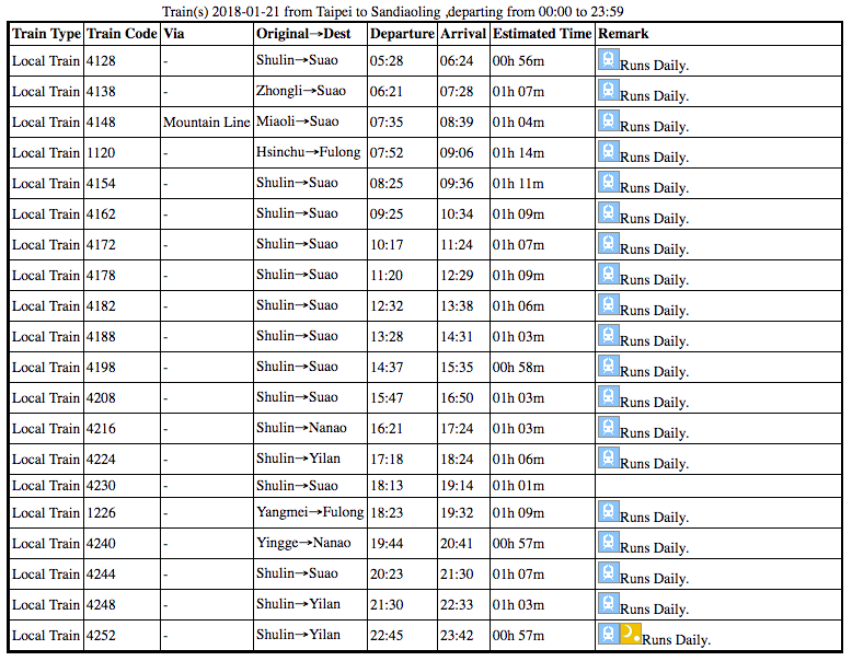
Public transport: trains go from Taipei Main Station, (as well as other stations along the line like Songshan or Nangang), get on one going towards Su’Ao and get off at Sandiaoling. It should take around an hour and twenty minutes and cost around NT$60 one way and can be bought at the station, or you can just use your EasyCard. (Although if you’re planning to explore the surrounding area by train as well, then you might want to think about getting a day pass). Below are timetables for trains from Taipei Main Station to Sandiaoling and the return trip, (accurate as of January 2018).
Further reading: there is LOADS written in English on walks in this area since it’s really easily accessible using public transportation. There is an older description of the walk here, some of the ladders seem to have changed since 2012. A slightly depressed-sounding account of those changes can be found here – they also give really clear directions, including to both the alternative loop that I’d wanted to do as well as the way we ended up going.
Nearby Trails:
- Dacukeng Old Trail
- Menghuan Falls
- Mount Wufen
- Lingjiao and Wanggu Waterfalls
- Savage Valley
- Tamsui-Kavalan Trails: Mudan Loop
- Tamsui-Kavalan Trails: Neiganjiao to Shifen
- Tamsui-Kavalan Trails: Shifen to Nuannuan
- Youkeng Waterfall
My new words learnt on this hike:
- 打嗝 or 打飽嗝 / dǎ gé or dǎ bǎo gé / burp or belch
- 王八蛋 / wángbā dàn / jerk or son of a bitch
- 發抖 / fādǒu / shiver
- 雲在天上 / yún zài tiānshàng / (the) clouds are in the sky – phrases with prepositions are interesting in translation, I was wondering if Chinese uses ‘in’ the same as English does to describe the positional relationship between clouds and sky, but it seems that Mandarin speakers perceive the clouds to be on the sky. However, apparently it is unecessry to specify where the clouds are since they are normally in the sky – much in the same way that I normally wouldn’t say it in English.
- 上天 / shàngtiān / God – although apparently this is weird and 上帝 is more commonly used.
- 火雞 / huǒ jī / turkey – charmingly, the two characters that make up this word are ‘fire’ and ‘chicken’.
- 鳳凰 / fènghuáng / phoenix – I thought that ‘fire chicken’ sounded like it should mean ‘phoenix’, so I asked. Turns out, there’s another word for phoenix.
- o beh kunn / put (sth.) anywhere – this is the Taiwanese of the phrase 亂放 .
- 體力 / tǐlì / physical power or strength – it was explained to me as being energy.
- 不好的話 / bù hǎo de huà / bad words – I’ve also heard teachers tell kids off for saying 髒話 which is more like dirty words – “誰在說髒話?“
- 我會中風 / wǒ huì zhòngfēng / I will have a stroke
- 一直到現在 / yīzhí dào xiànzài / until now – this explains why I hear people say keep until now whenever they mean to say until now
- 廚師 / chúshī / chef
- 社會 / shèhuì / society
- 猥褻 / wěixiè / molest
- diu gao / throw a monkey – Taiwanese for what (the hell) are you doing when you can see that someone is doing something stupid or especially strange.
* I’m not very sure of my Taiwanese transcription abilities, so apologies if it doesn’t seem right.
Sandiaoling Waterfall Trail Map
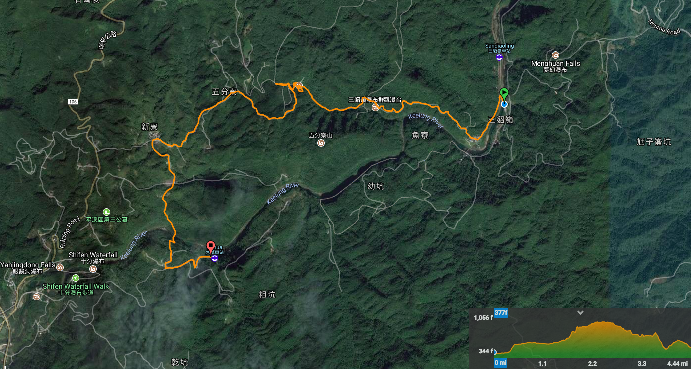
GPX file available here on Outdoor Active. (Account needed, but the free one works just fine.)

I found this really helpful, and heartwarming with the friendly dogs and found wallet.
LikeLiked by 1 person
I’m glad you enjoyed the read! Yeah, the wallet thing was so lovely. It’s not the only time either. I lost my wallet a year or two later and I didn’t even realise until the police phoned me to say someone had handed it in.
LikeLike
Pingback: Classic Canyoning Routes in Taiwan (Day Trips) - Canyons Taiwan
Pingback: Travel to Northern Taiwan - Episode 973 - Amateur Traveler
Note to anyone wanting to hike this: The red bridge toward the end of the hike is now closed off, and the whole section from the abandoned car park to the red bridge is overgrown and hazardous.
LikeLiked by 1 person
Thanks for the update. It’s really helpful to have more up-to-date info. Sandiaoling is one I’ve been hoping to get back to for a while now. It seems like the whole thing could do with a rewrite.
LikeLike
I believe there was a sign about the closure earlier on the trail, but I cannot read Chinese, so I didn’t understand. I also do not recommend the trail from the car park and the red bridge. The trail is very slippery and overgrown. It’s better to either turn around from the last waterfall or to go to Shifen from the village.
LikeLike