Distance: 5.2km for all of the actual trail walking, but 8.7km including the road walking sections of the loop.
Time: 7 hours and 50 minutes (including the road walking)
Difficulty (regular Taiwan hiker): 4/10 – steep and scamble-y in places, but not really difficult.
Difficulty (new Taiwan hiker): 8.5/10 – there weren’t really any places where I struggled like I did with some parts of the Wuliaojian hike, but it is still a strenuous and challenging route. It was made even more challenging by the hoards of ill-equipped and unfit hikers along the way. Added to that, it is also pretty dangerous—slipping at any of the toughest sections really would have serious repercussions. I would advise you not to do this if you’re alone, a first-time or inexperienced hiker and definitely get some slightly less dangerous climbs under your belt before attempting this. Also, if you are scared of heights do not do this. There were a few scared and novice hikers on the trail which really slowed things down and made it riskier for the rest of us, (not helped by the fact that some of the Taiwanese old-timers are rather cavalier about things like steep drops and narrow ridges and are quite happy to leap past you in an alarming manner).
Total ascent: 650m – I can tell you that it felt like a lot more.
Water: I drank 1.5L (although I carried about 2.5L) on a cool day when I was barely sweating. Teresa drank considerably less but I don’t necessarily think that was a good thing.
Shade: large sections are well-shaded, but the exposed sections are completely exposed. I didn’t take any extra sun protection in November, but I would have needed a hat and sun cream in the warmer months.
Mobile network: On and off—I didn’t check too often but I did notice that I didn’t have signal at some points, especially during the Shao Lai Shan part of the hike.
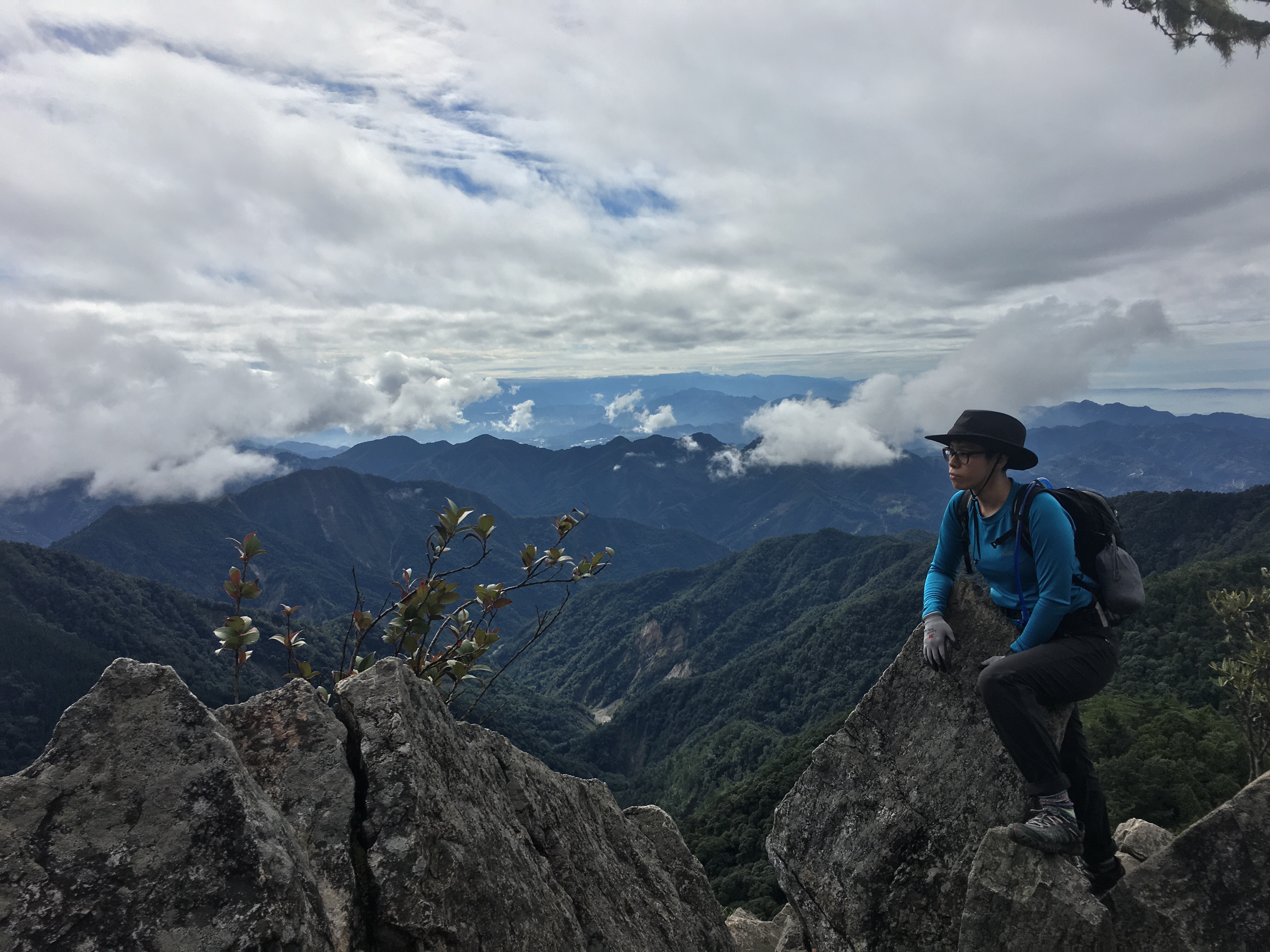
Enjoyment: If we had only done Yuan Zui Shan I would have to say only 6/10 because my enjoyment of the beautiful views was somewhat dampened by the huge number of other hikers on the trail, I am not a ‘me and the wilderness’ kind of walker, but the sheer volume of people here on a Sunday with good weather is just crazy. However, since we decided to continue on, the trail redeemed itself and earned a 9/10. The views are stunning, the forests are beautiful and the hiking itself was enjoyably strenuous.
Other: plan this and go well prepared. At a minimum, you’ll need shoes with a good grip, gloves, long sleeves and trousers, snacks and plenty of water to keep you going. If you’re going in warmer months, you might want to take salt candy, suncream and/or a hat. I saw plenty of idiots doing this in old trainers, skateboarding shoes and shorts but they were struggling—any exposed skin was covered in scrapes and scratches, and those wearing footwear without any tread struggled to get purchase on the rocks (at some points footholds are minimal or non-existent). Don’t bother attempting this if the weather is bad. Finally, it would be a good idea to take a head torch if you want to do both peaks – by the time we were back on the road it was dusk and by the time we reached the car it was already dark.
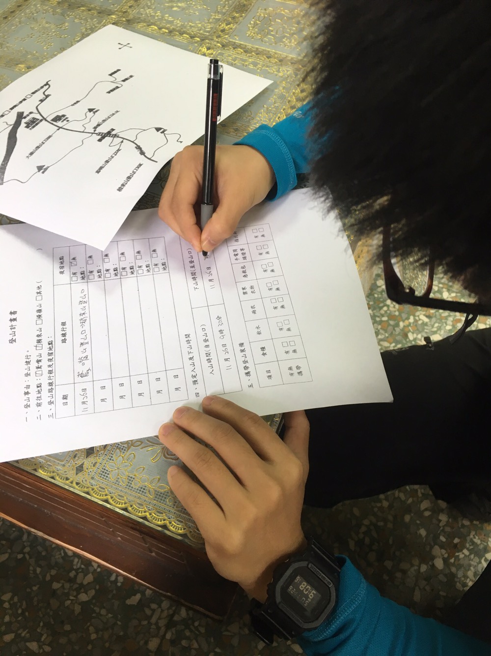
Permit: Technically this hike requires a permit to do, but I very much doubt that half the hikers up there had one. You can apply for one in the police station a little further down the road (it’s just after 15km as you’re coming up). There’s no checkpoint preventing people from climbing without a permit, but given that we went in a group of two, it was definitely a good idea to get one, (also it’s free so there’s no reason not to). You also need to pop in on the way back to let them know you’ve made it down again, (although to be honest they seemed surprised that we bothered getting the permit in the first place and even more surprised that we’d returned to inform them of our safe return so I think we must have been in the minority).
Jump to the bottom of this post for a trail map, GPX file, and transportation information.
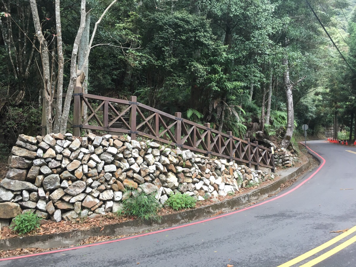
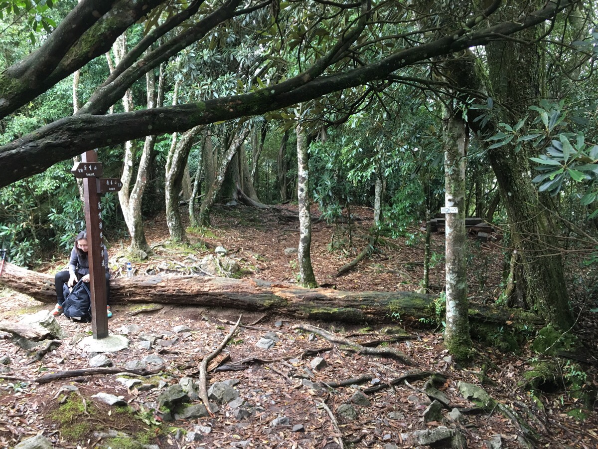
There are a couple of entrances near the main roadside parking area. We went up the one which was just opposite the toilets. The toilet building is constructed on stilts over a sizeable drop to the forest below – which was quite visible through the gaps of the wooden flooring. If you feel uncomfortable with this then you probably shouldn’t even start the hike!
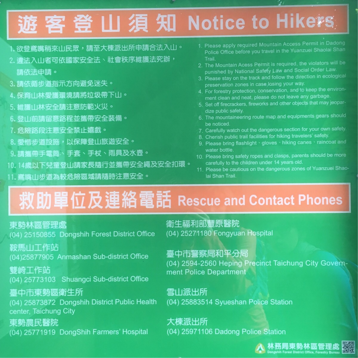
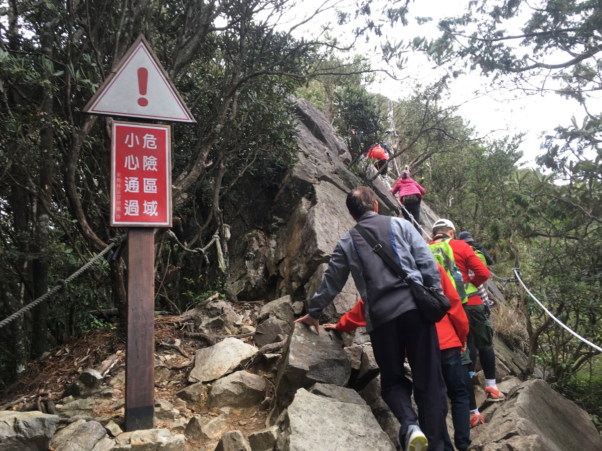
This is a walk which shouldn’t be done if you’re not well equipped. Signs at the trailhead advise on what is necessary. Also, it might be worth taking note of the emergency contact information just in case.
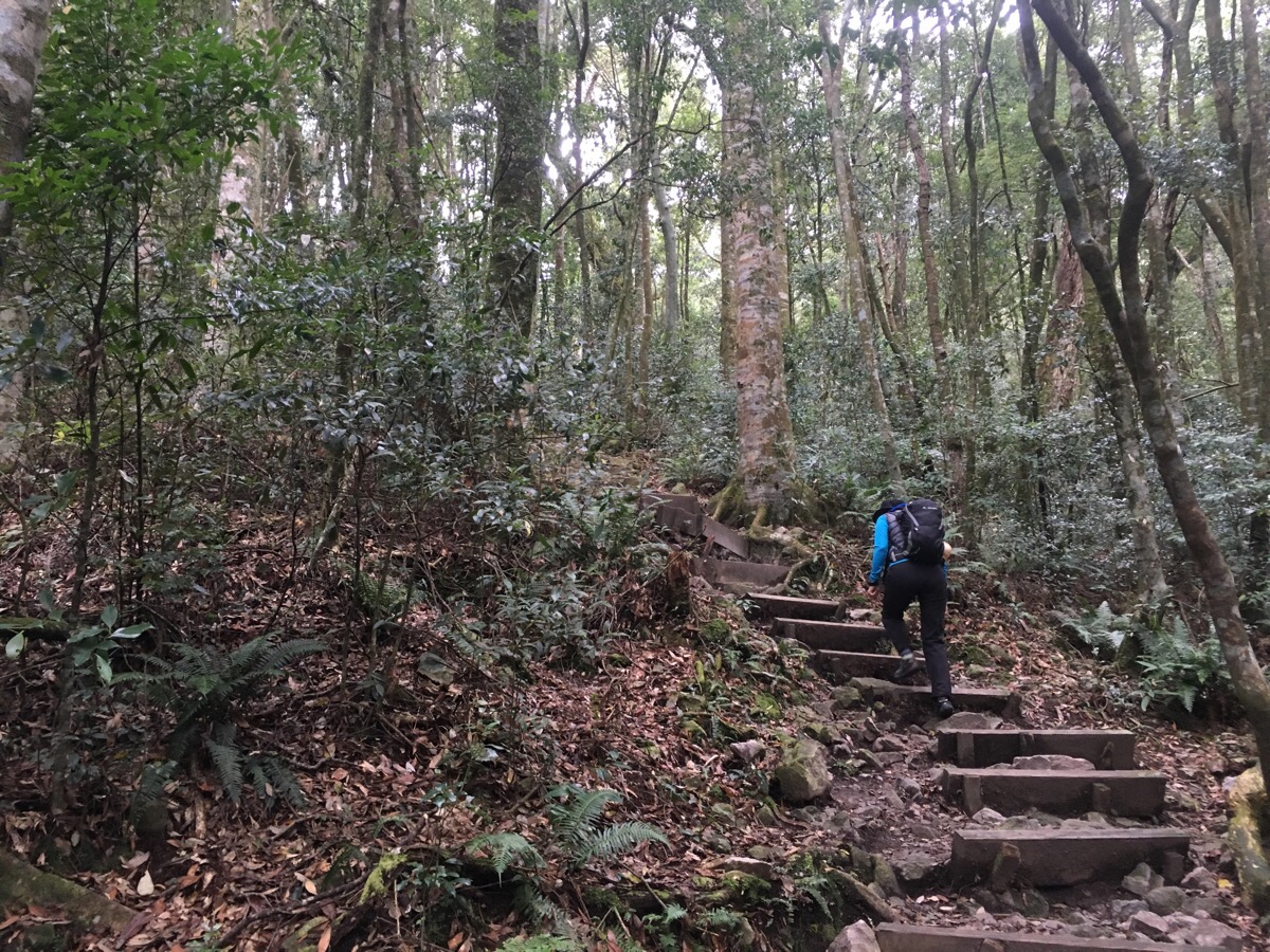
The trail starts off with a good legs and lungs workout to get you in the mood. As is customary, Teresa began complaining at this point and we stopped for her to take off a layer almost as soon as we’d started.
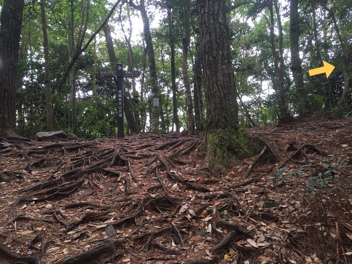
Fifteen minutes in we met an alternative route which joined from the left. We kept going uphill towards the right.
I can’t emphasise just how much I love mountain forests in Taiwan – I don’t mind which kind, scraggly rhododendrons, towering old redwoods, elegant cypresses, grumbling bamboo groves, they’re all fantastic. We passed through mostly the first two on this walk, starting with the rhododendrons. As we started to climb in earnest, we got caught by what seemed to be a tour bus-load of very loud, very slow, very unprepared older people (and a couple of children even – DO NOT bring small children on this hike).
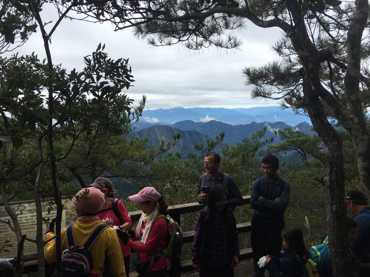
Fifteen minutes on from the junction was a small lookout platform where you could get a feel for the views that were to come. We decided to use this as an opportunity to push on past the loud group and kept heading up.
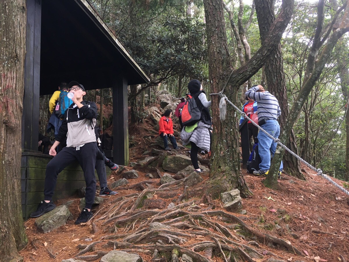
Likewise, five minutes later we paused at the shelter just for a drink in order to try and evade the crowds but our efforts were in vain.
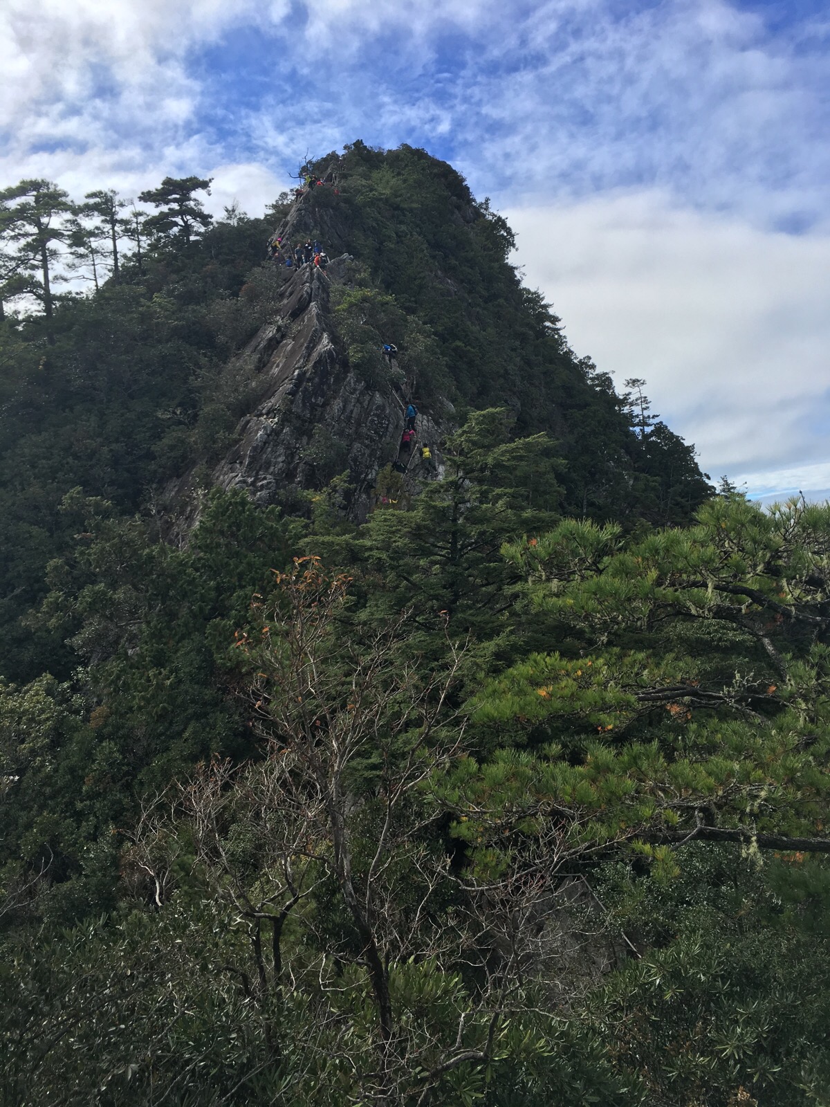
Ten minutes after passing the shelter we reached the exposed climb up to the main peak. From here we joined a steady stream of people heading up.
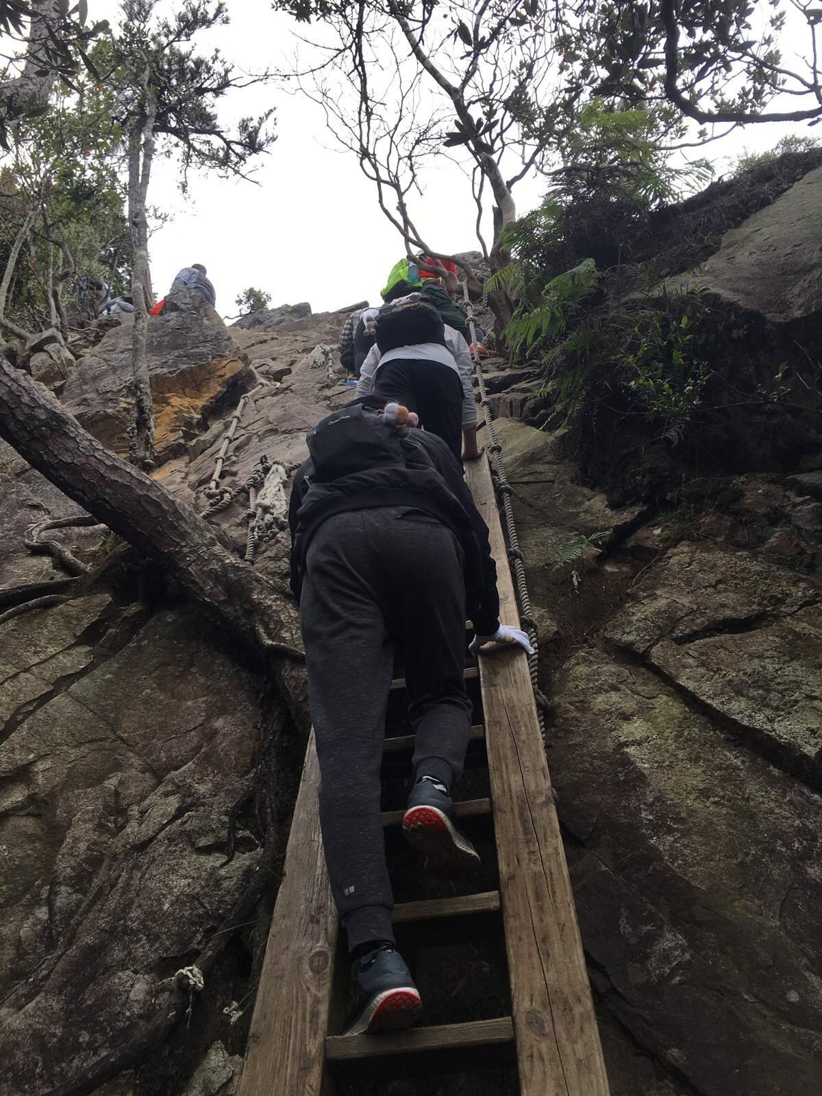
It was basically just up, up and more up. I really enjoy this type of climbing—I wouldn’t want it to be the whole hike, but sections like this are awesome!
And every time I had to wait for the person in front to climb a bit further I could turn around to see the amazing views.
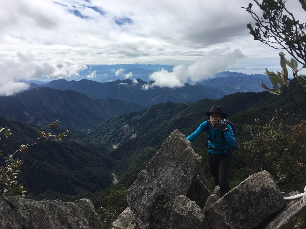
There were people definitely struggling with this section. For us it was a good workout but not too tough and therefore extremely enjoyable. But even so, I think Teresa was even happy to have to wait a bit because it meant she never got out of breath.
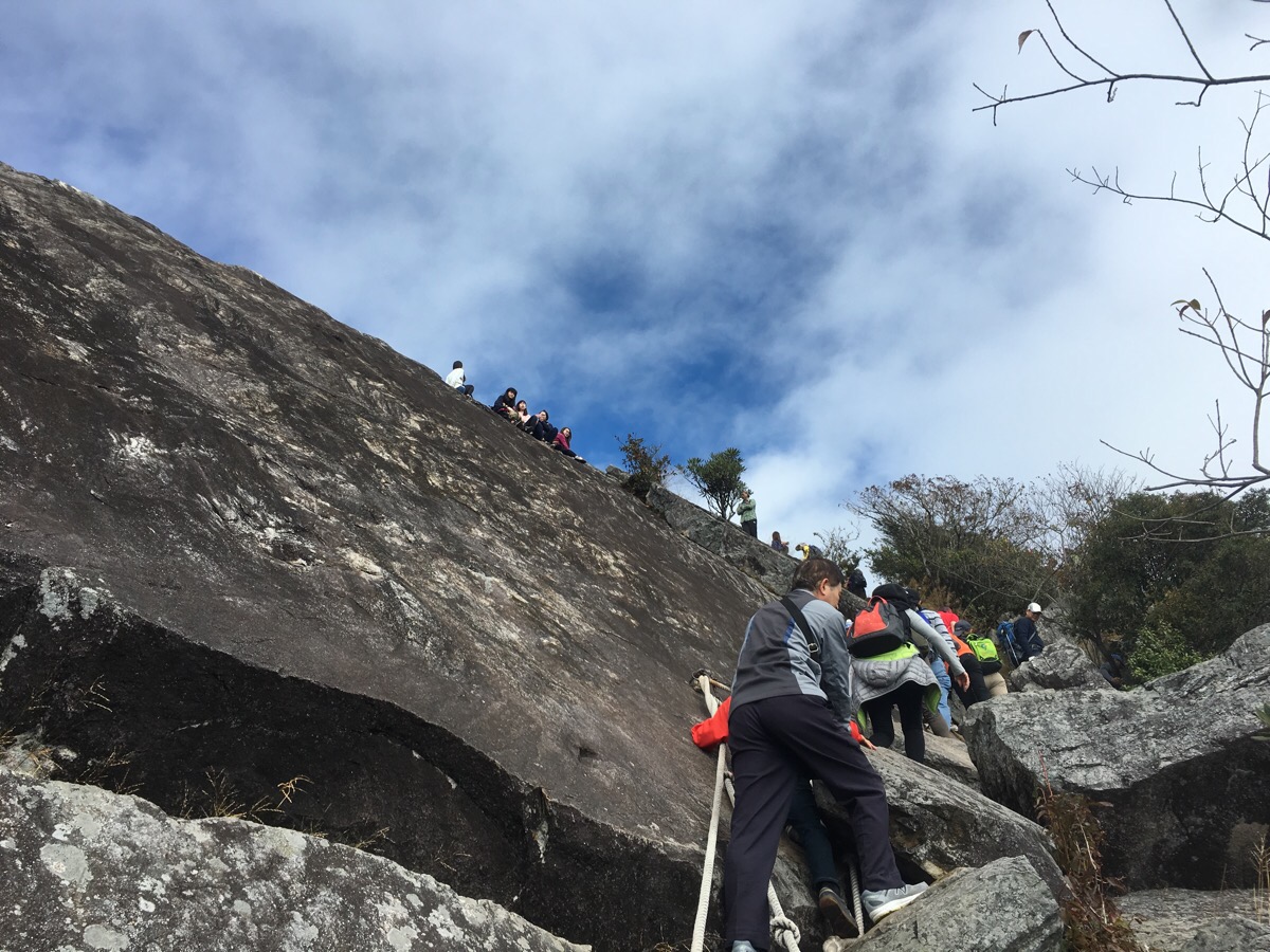
As the top came into sight, we got well and truly stuck in a backlog of people. It took us nearly 15 minutes to get up from here.
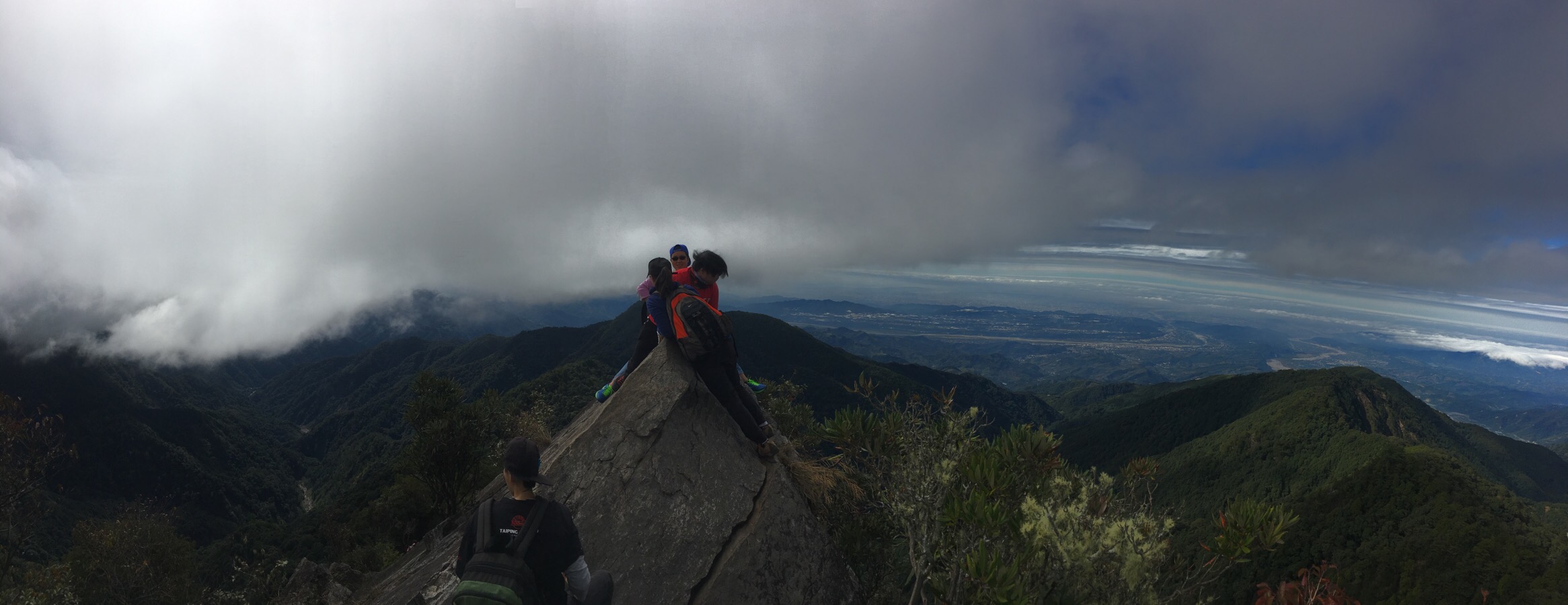
Yuan Zui Peak itself is a narrow ridge with almost 360° views. You can make out the twin Dajia and Da’an rivers as they wind their ways through the northern reaches of Taichung towards the coast, (and to Gaomei Wetlands in the case of Dajia River). Everyone wanted their photo on the peak including a group of students who had come with their graduation gowns and mortar boards (clearly they weren’t renting them by the hour at extortionate rates like we had to back home). Had it been more relaxing, I would have liked to spend a little more time resting on the peak, but it was packed so we stayed for about 10-15 minutes before continuing on and joining the queue heading down.
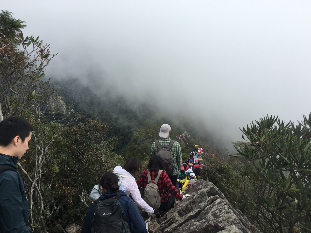
The queue.
I’m not joking about the queue. It was seriously jam-packed. We spent more time sitting down, waiting, and bum-shuffling 30cm at a time than we did making any sort of progress.
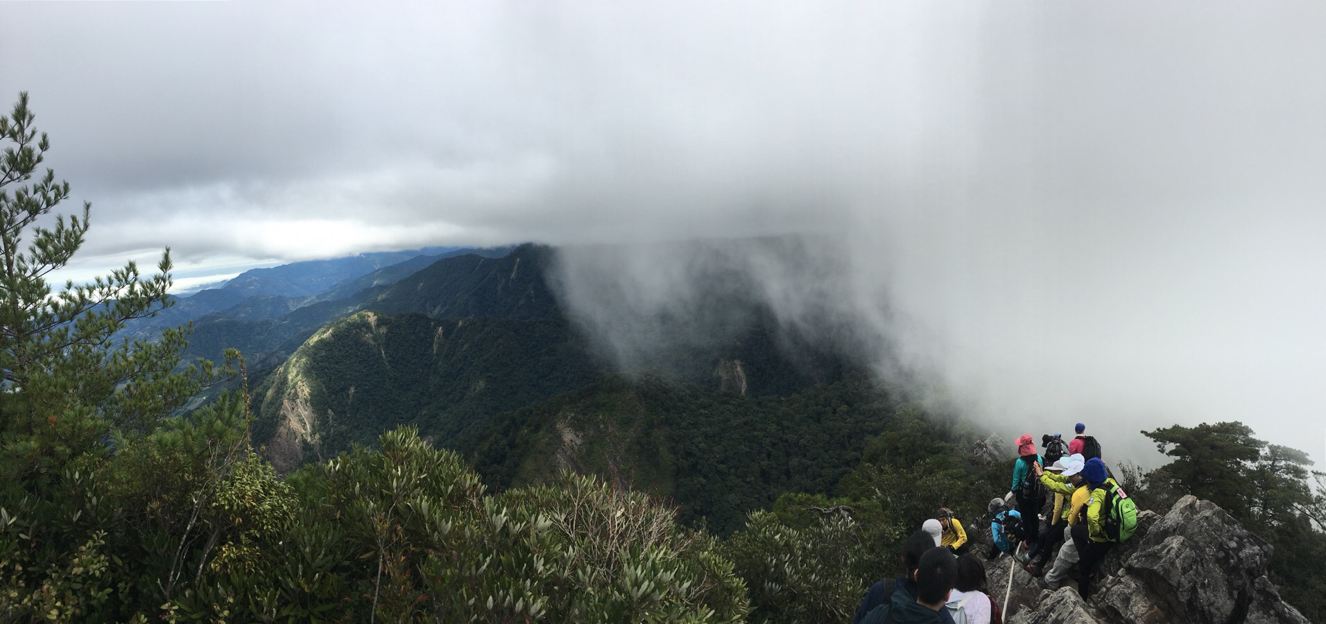
Just as the path drops down from the peak, there is a kind of wind funnel effect created by the geography of the area. This meant that we could see the clouds racing towards the hill below where we were, but when they reached the mountainside, they were channeled up above us.
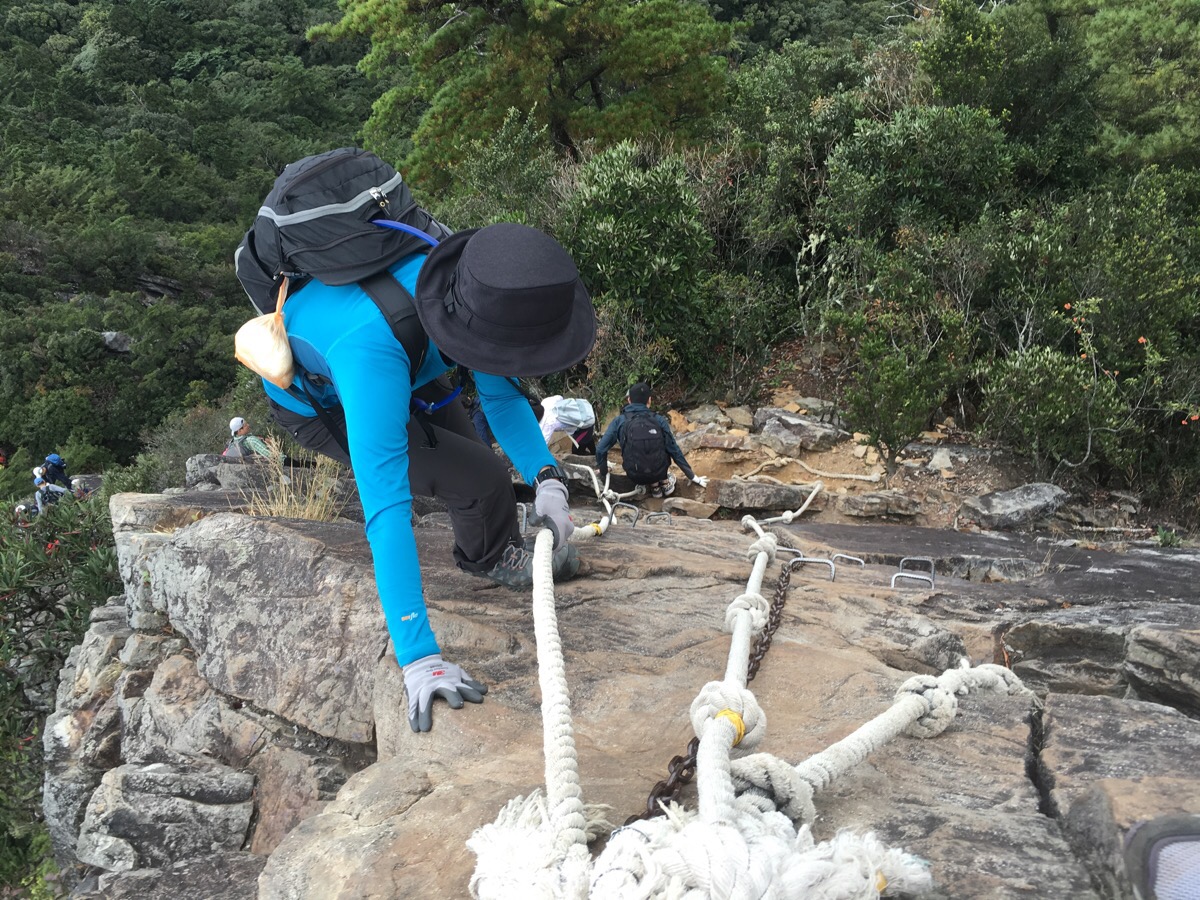
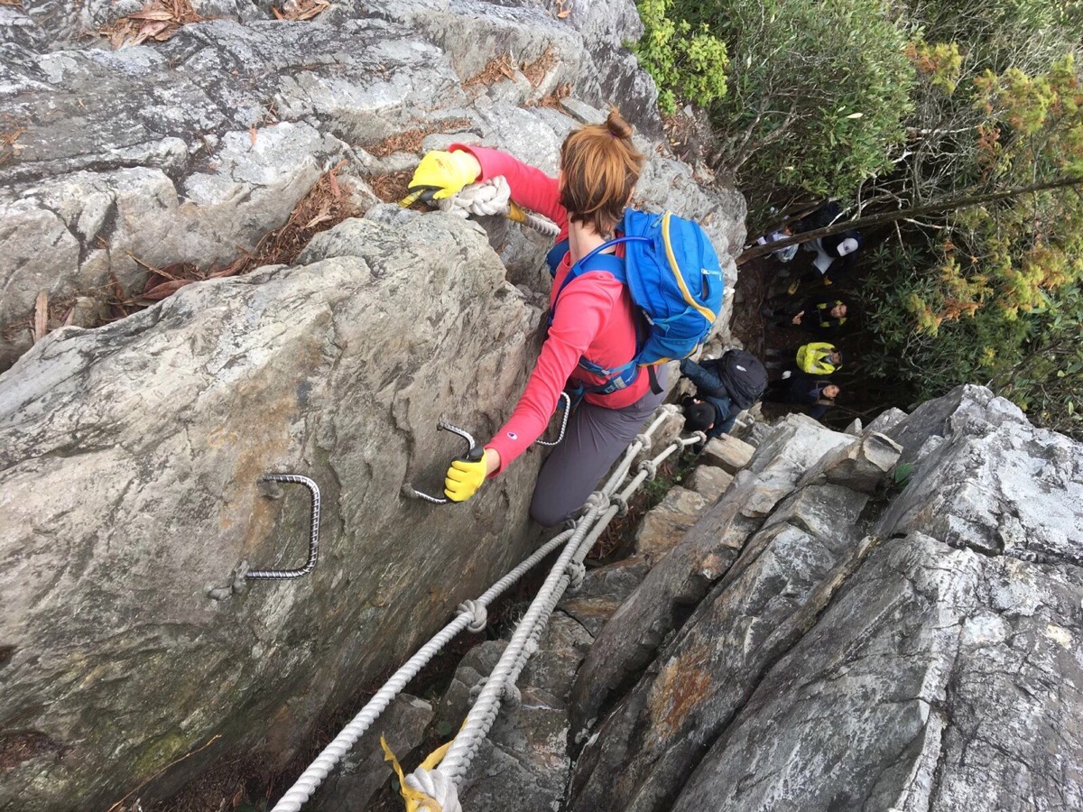
The reason for the queue was several tricky roped sections that had to be tackled by one person at a time. However, as we drew closer, it became increasingly evident that the reason for the hold-up wasn’t so much that it was difficult but more that the people doing it had little to no experience of how to attempt it. Some people were going down near-vertical slopes facing outward. Others were starting and then stopping because they were afraid. Of course, I was a patient and courteous hiker, but I’d be lying if I said I didn’t find it annoying – just because it is a short climb, it doesn’t mean that it’s safe or easy.
As the time frittered away we started to wonder if we’d have to cut short our walk and head back after finishing the Yuanzui Shan section of the trail.
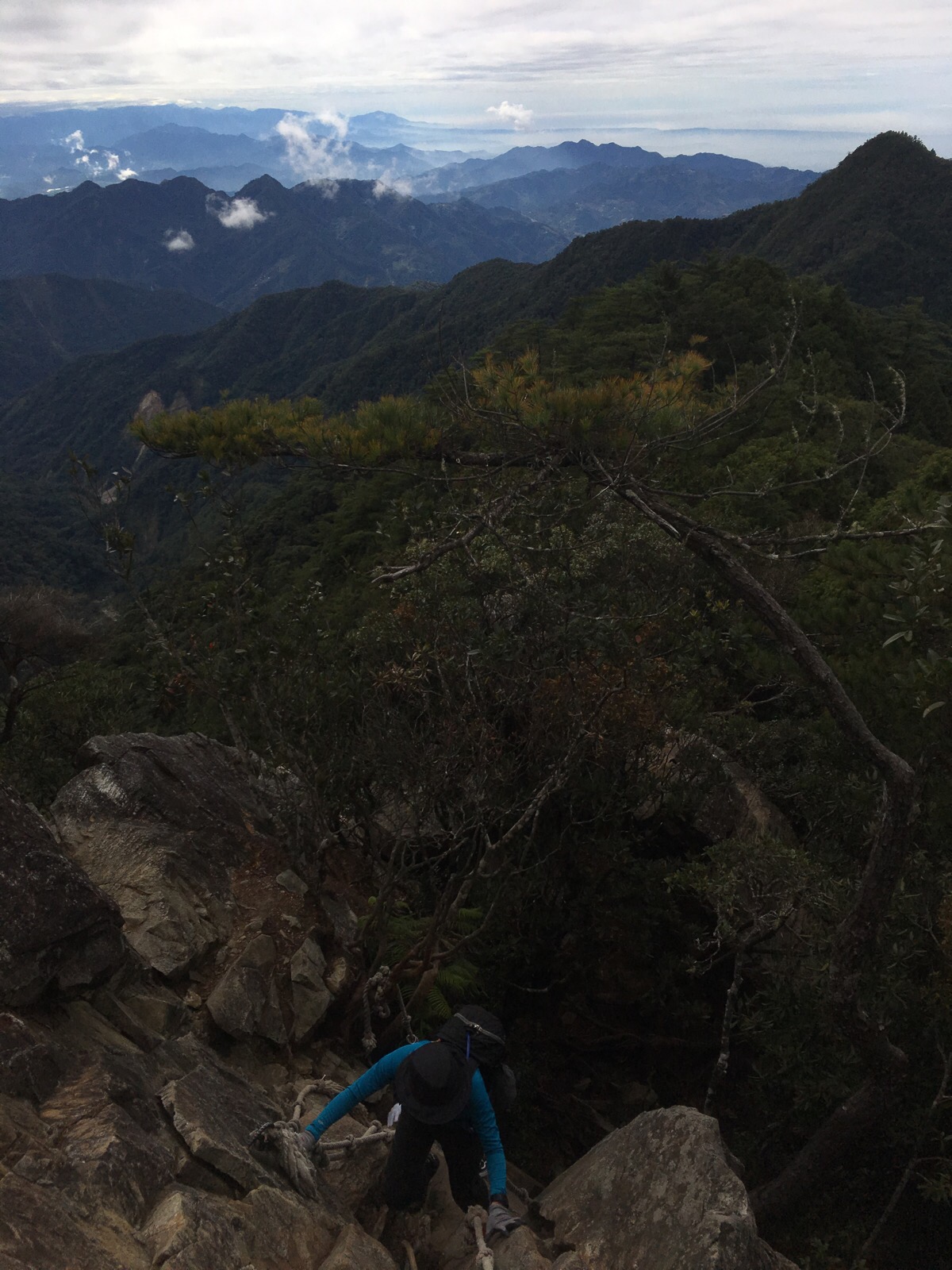
Thankfully, every time I got frustrated at the waiting around for people who had come without any preparation or idea of what they were doing, I could just turn around and look out at the beautiful landscape.
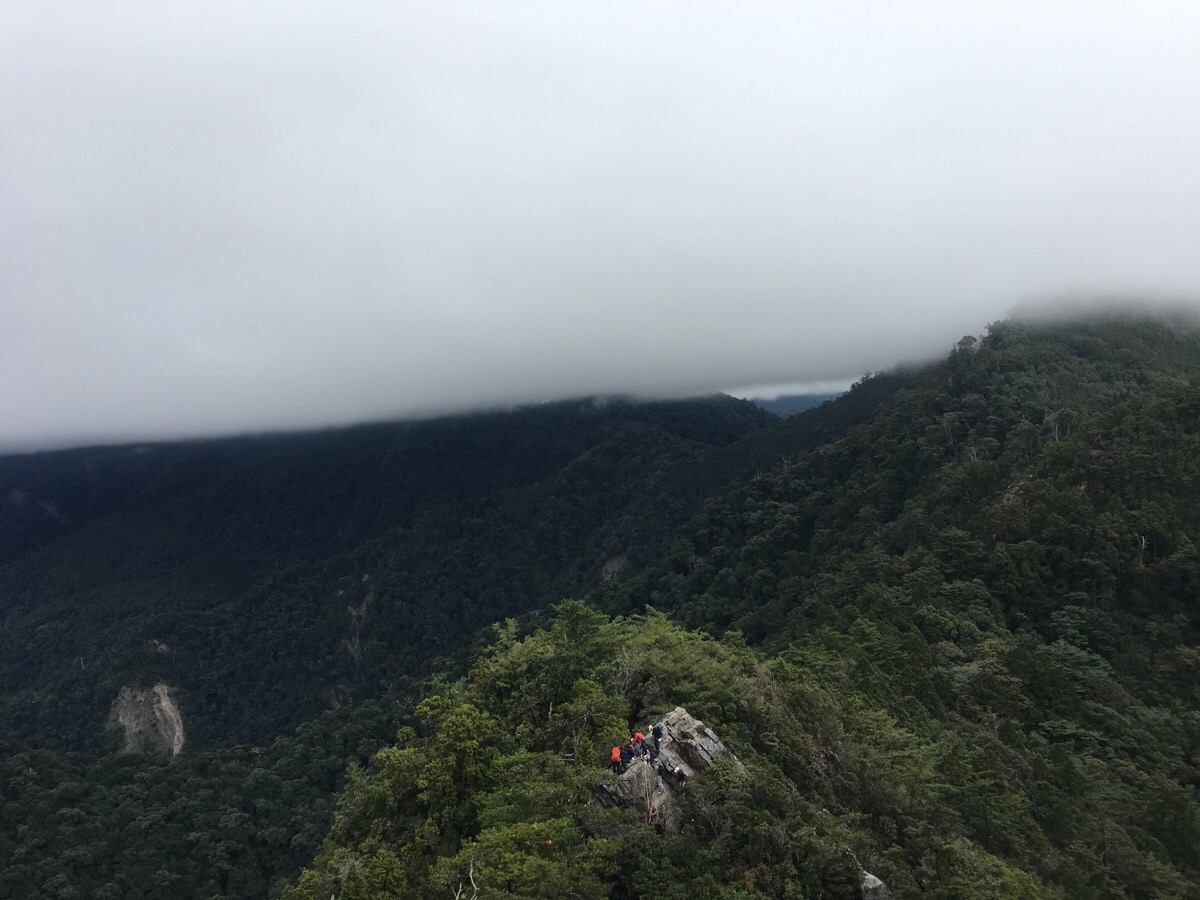
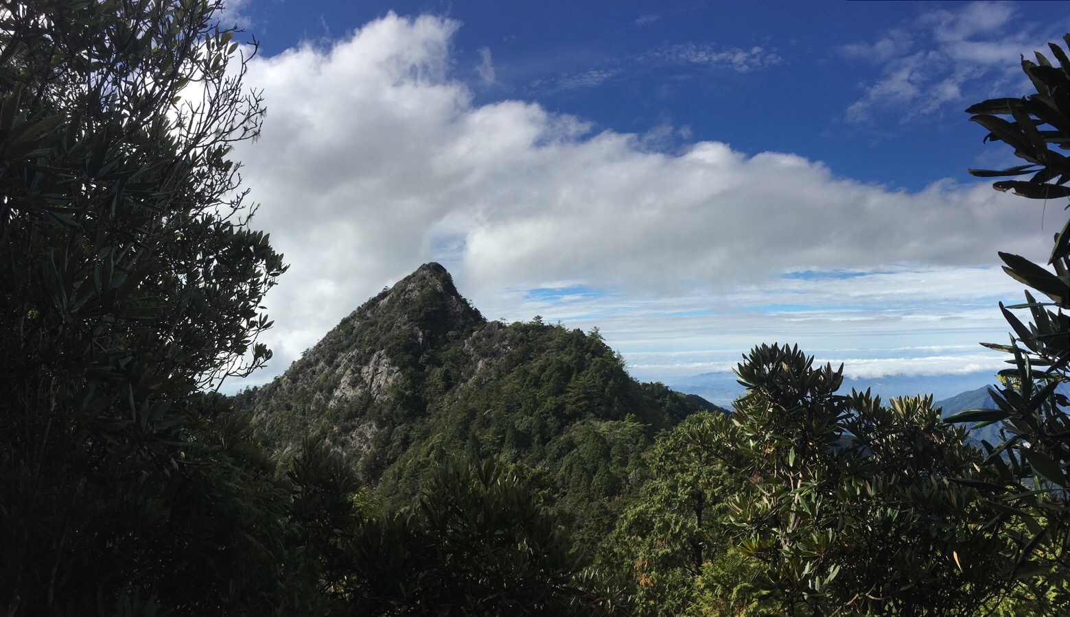
After a little dip, the path comes back out onto a small rocky protuberance which afforded us a view back to where we had been climbing. It really didn’t seem like far, but it had taken an age to get down.
The final roped section of the down was in a slight crevice which dropped down into the tree line. Once there the path flattened out and we had to make a decision about whether to press on or head down.
After a quick reassessment of the route we decided to press on since there would be at least on further opportunity to take the path down to the road before reaching Shaolai Shan.
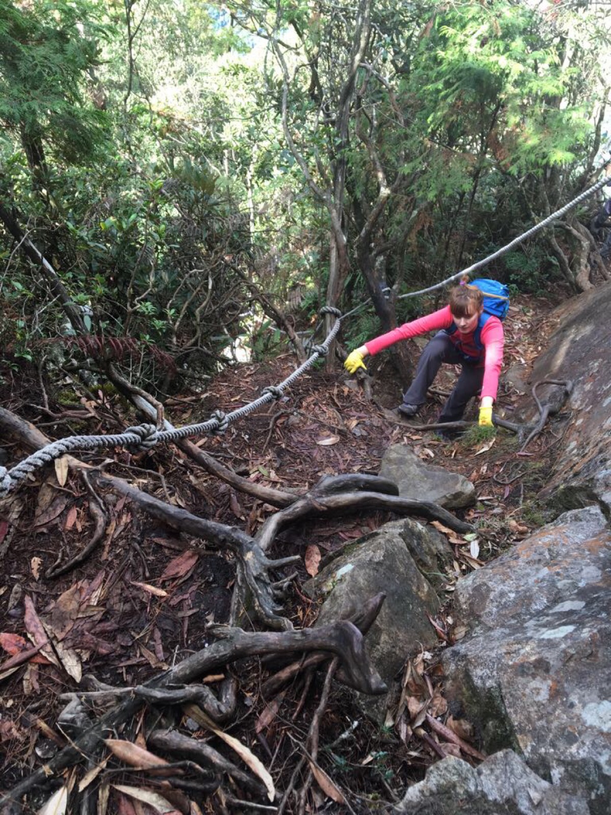
Much of the path here was comprised of my favourite type of climbing so I had a great time doing the upwards parts.
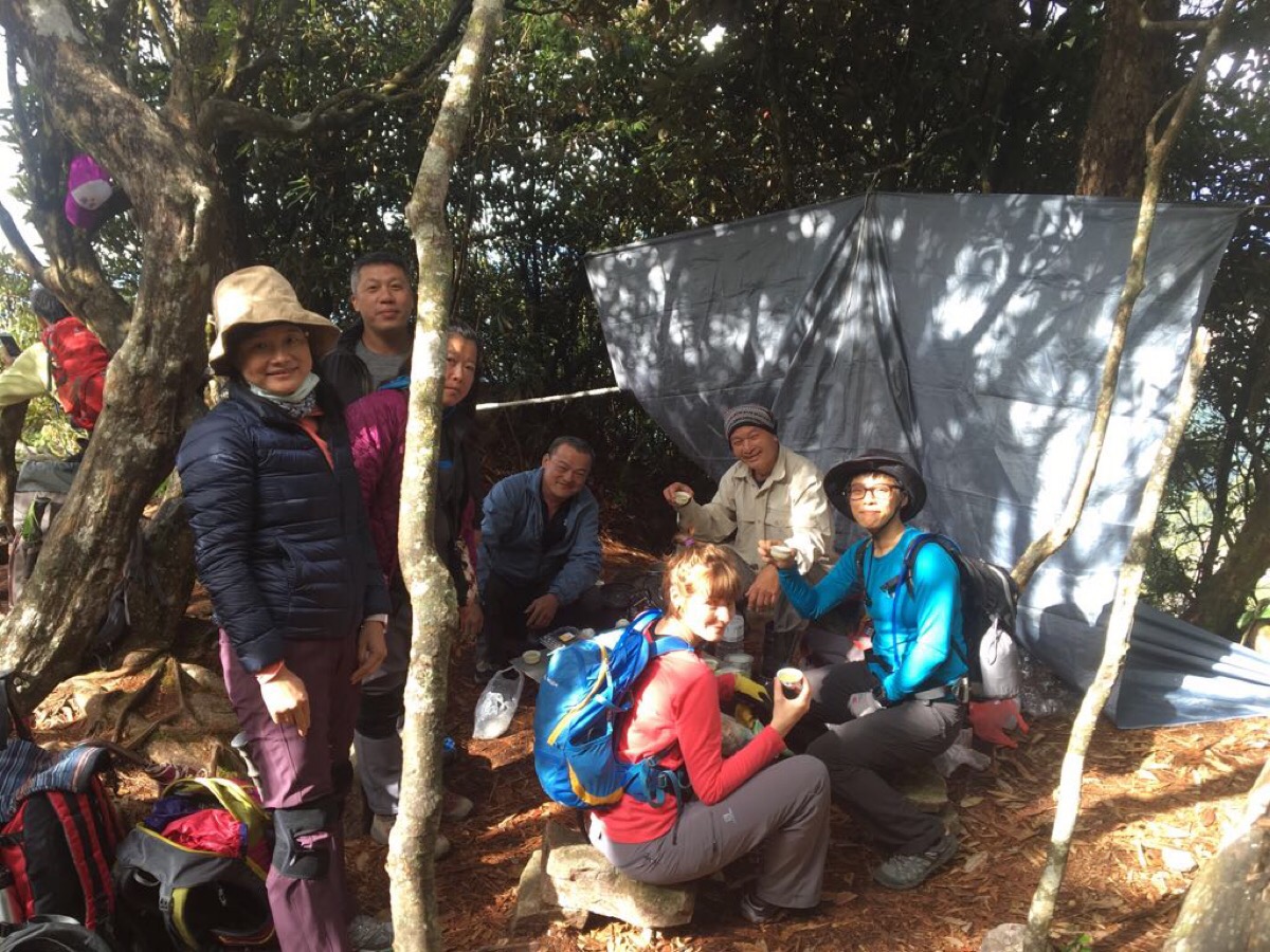
Not far up from the crowds that had gathered near the base of the Yuanzui climb we encountered an extremely well-prepared group of older people. I was highly impressed by their setup, (windbreaker, stove, table and a whole tea set), but Teresa was even more impressed. She used my foreignness as an excuse to talk to them (“Oh, sorry to bother you, laowai here hasn’t seen people drinking tea in the mountains before, would you mind if she photographs you?”), I was very red-faced by her tactics, especially since it was her who had wanted to photograph them… However, it was worth the small embarrassment since we were promptly invited to join their tea drinking. The alpha male of the group was a loquacious gentleman (who, I suspect had been made even chattier by the rice wine he was offering around – “it’ll make you climb quicker if you drink it”), and he had a good few jokes to make at my expense but it was all in good humour. We also solicited their advice about continuing the walk and were informed that it should be doable if we set off quickly since a lot of the way was flat.
From their tea-drinking oasis they were able to watch and laugh at the log-jam of brightly coloured hikers making their way up and down the peak.
Very shortly after leaving the tea drinkers, we realised that they must have either, A – been talking about a further along section of the walk, B – had a totally different idea of what ‘mostly flat’ means, or C – been lying to us. ‘Flat’ was definitely not the first word I would have chosen to describe the terrain between Yuanzui and Shaolai peaks.
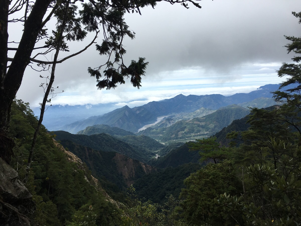
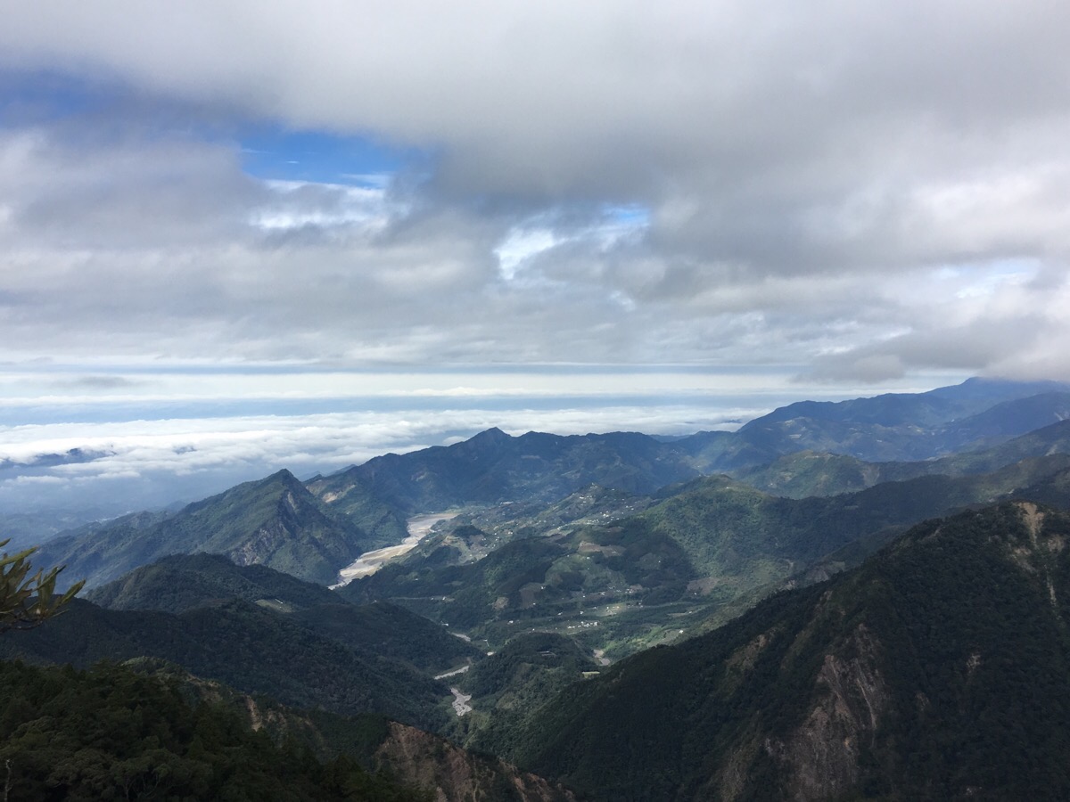
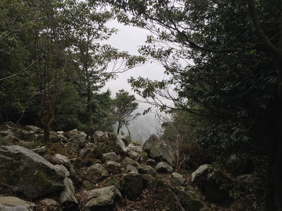
Along the way, there are several gaps in the trees which offer views, mostly over to the Northwest. Although both Yuanzui Shan (2180m) and Shaolai Shan (2307m), are pretty small for Taiwanese mountains, I am still constantly overwhelmed by the scale of the scenery here. The peaks we could see were peaks upon already-elevated mountain ranges, it’s a landscape that I doubt I can ever tire of.
We soon reached the last possible point at which we would have been able to return to the road before Shaolai Shan and had another chat with the lady sitting on the log about whether or not she thought it was possible to continue on. She seemed quite relaxed about it and said that we should be able to make it to the road before the sun went down and so, on we went.
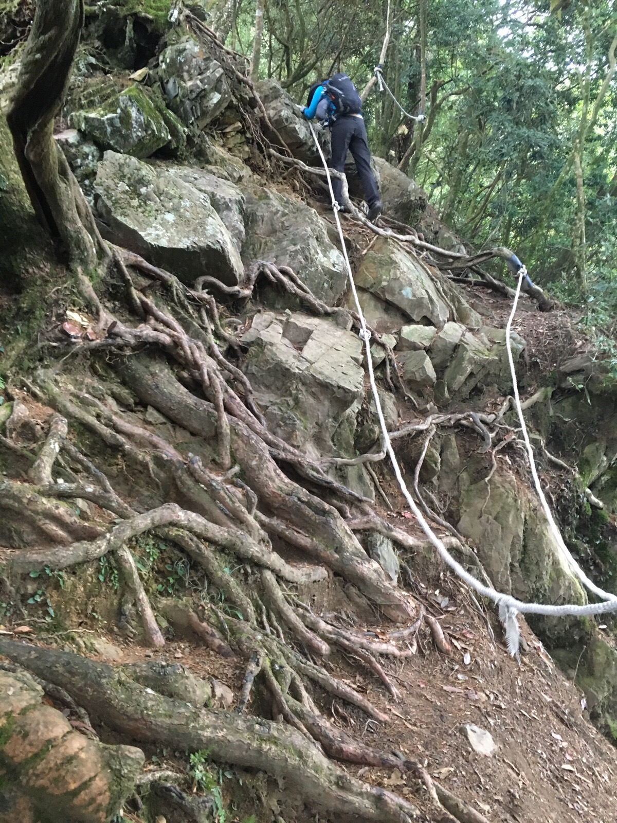
Evidence of a rockslide made for some interesting scrambling just beyond the last turn-off.
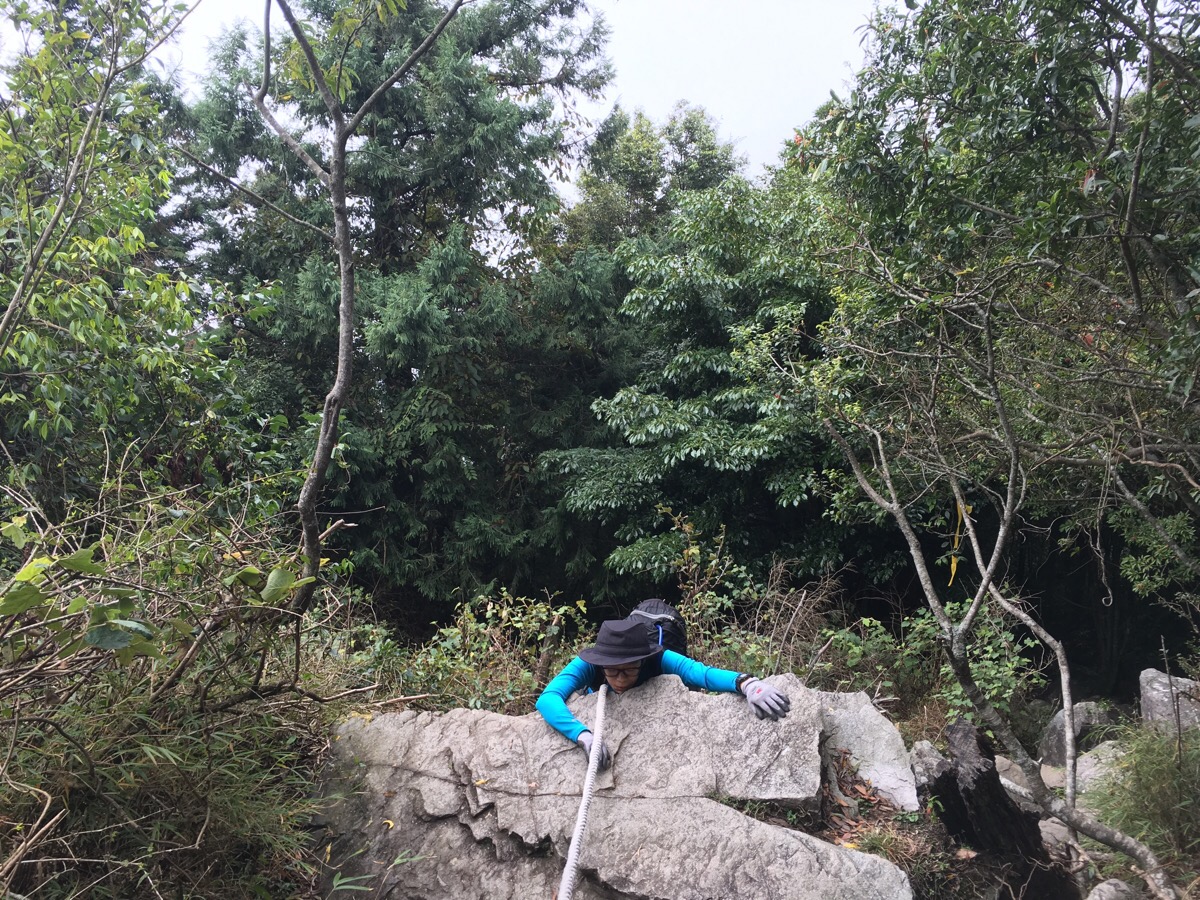
And Teresa contemplated whether or not she’d made the right choice to continue.
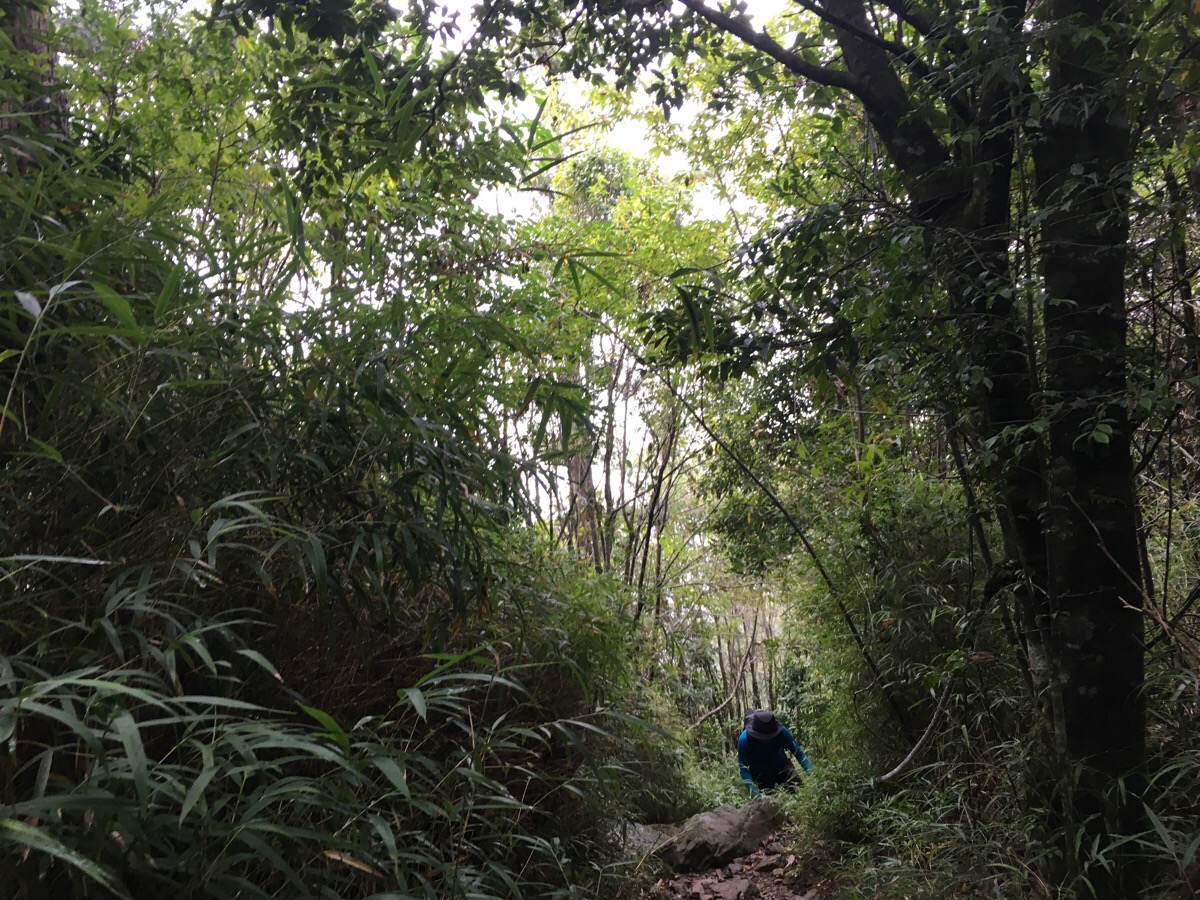
We got a slight change of landscape as we continued upwards passing through some skinny bamboo.
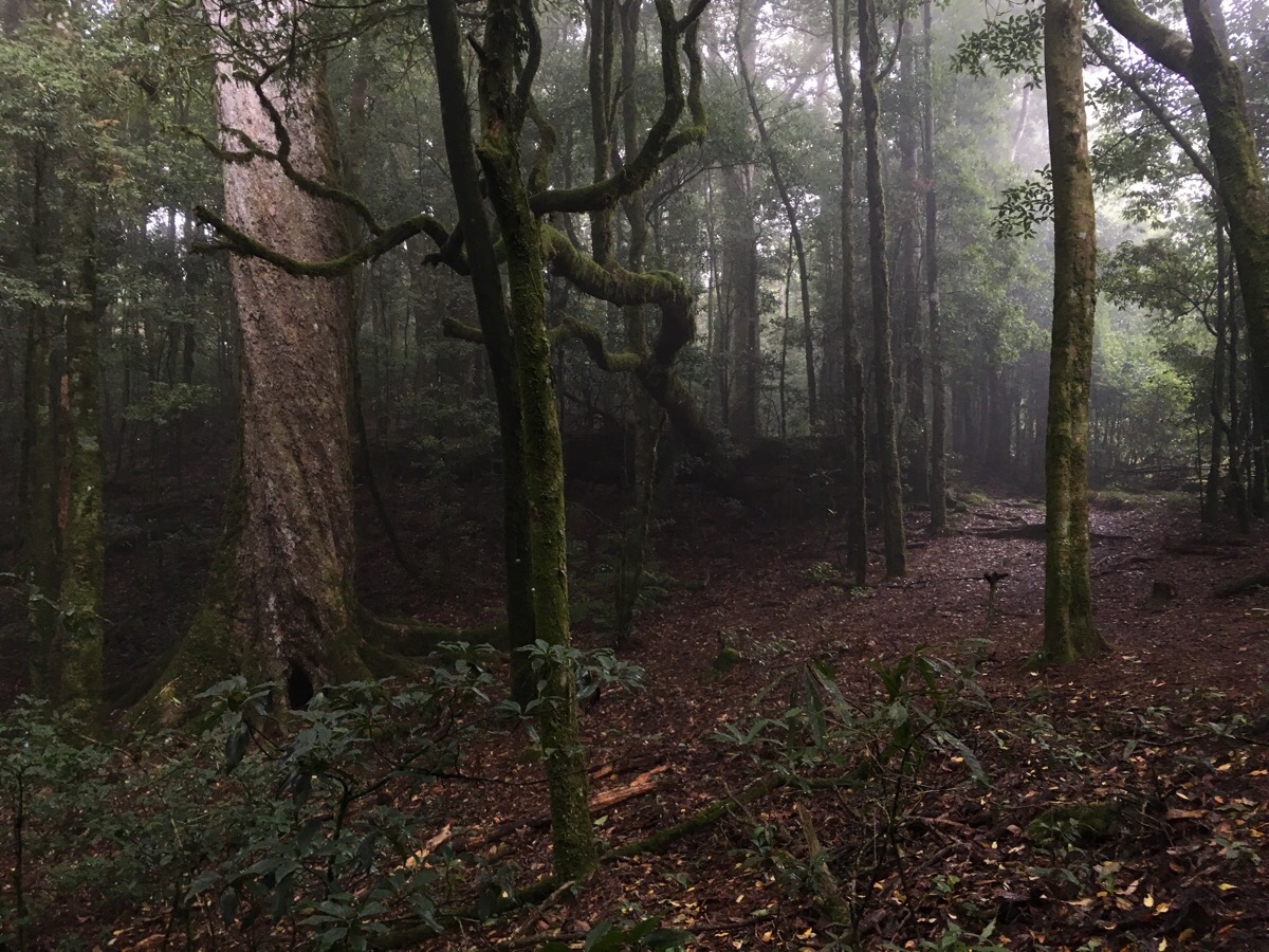
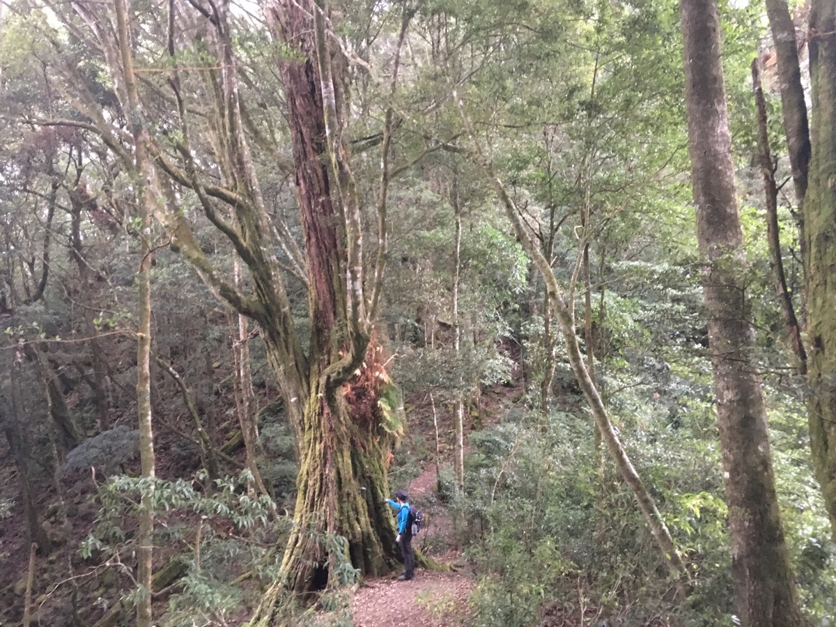
And then beyond the bamboo we encountered the older, bigger trees. As always, the photo does nothing to show you the scale, but that one on the left was a solid giant.
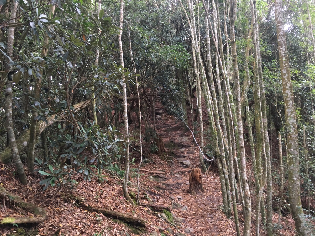
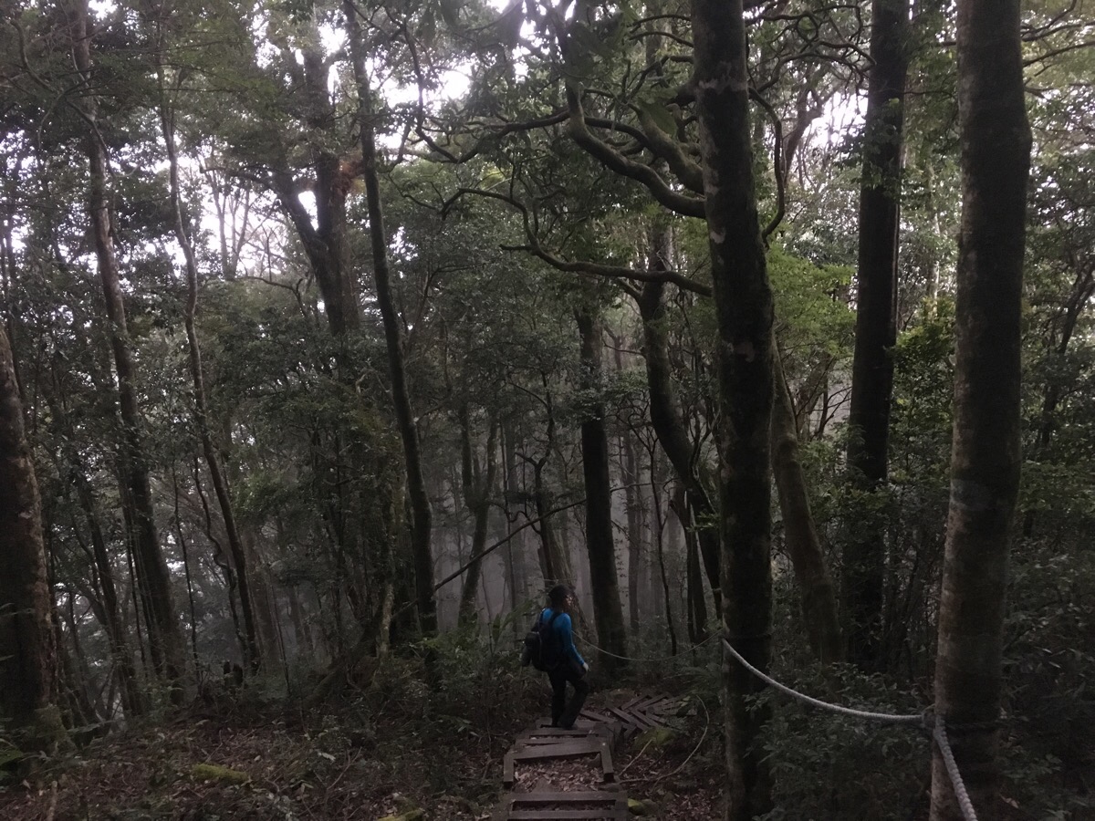
It was along this section of the walk that I really started to feel a bit more relaxed, the sounds of other hikers had faded to be replaced by the sounds of the forest, insects, bird song, and the wind stirring the upper and outer leaves of the canopy, and our feet landing on the leaves and roots carpeting the floor. Even the increasing springiness of the trail seemed to be adding to the overall feeling of relaxation.
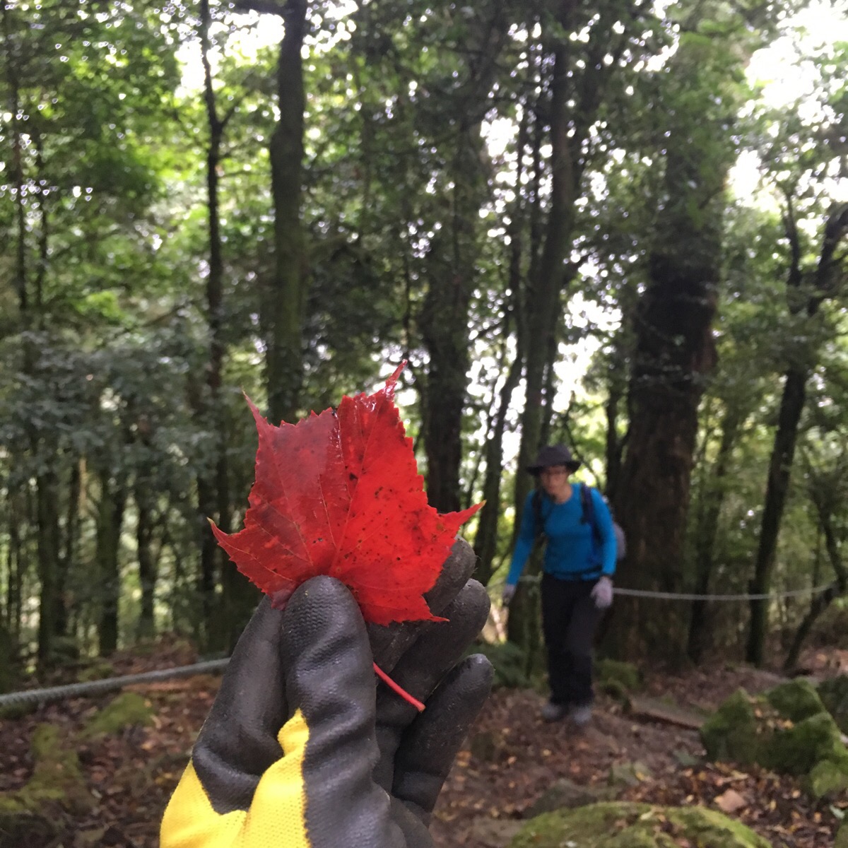
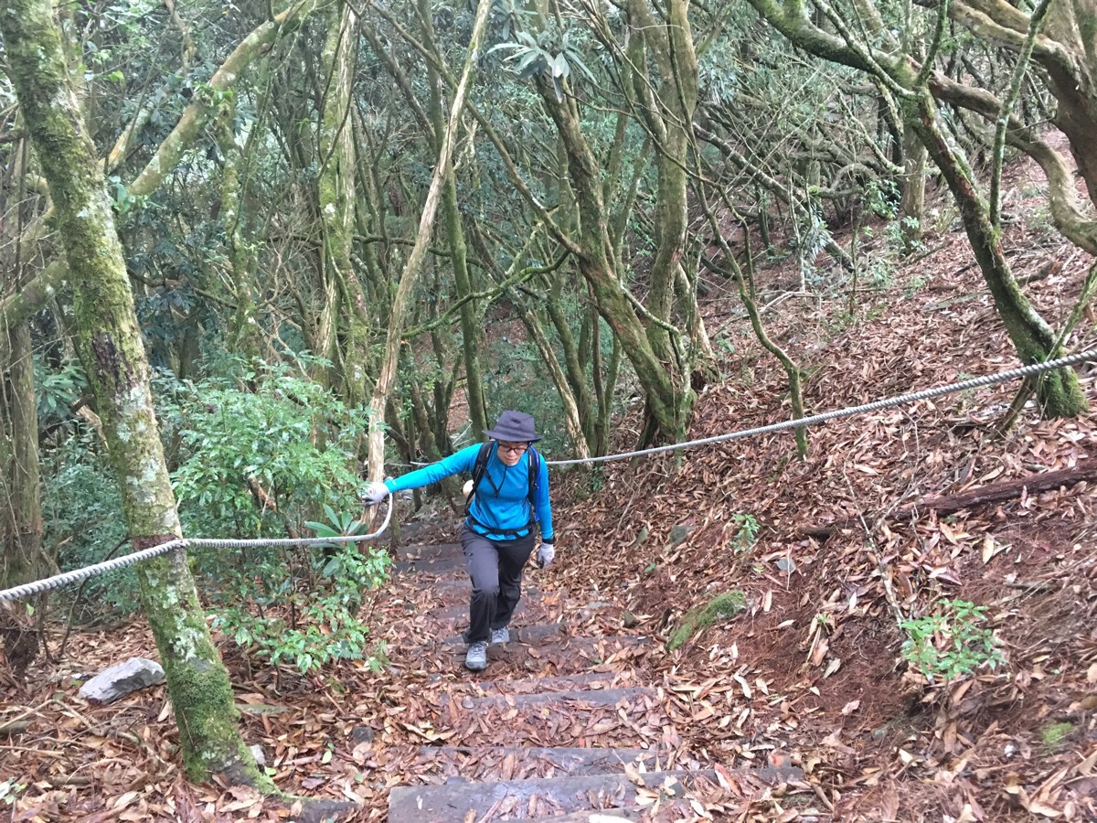
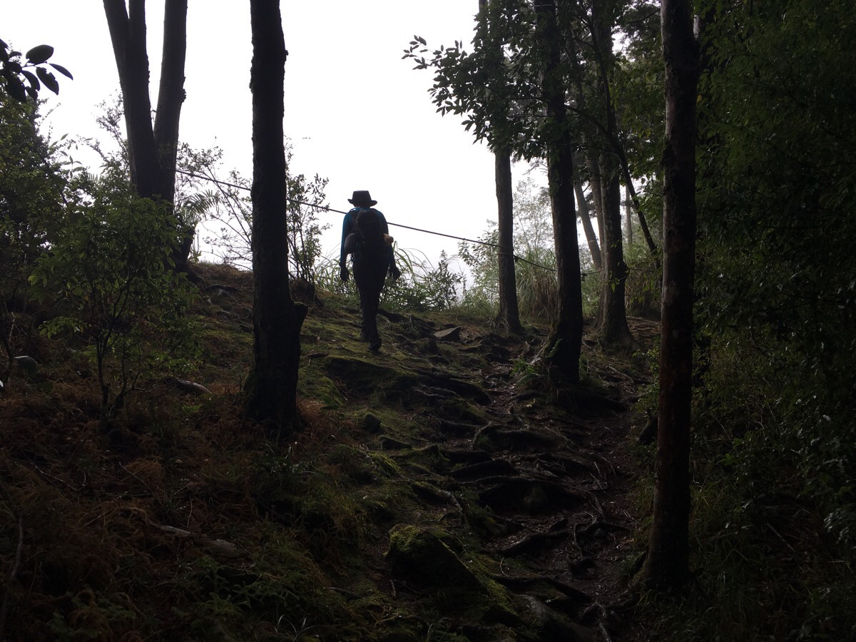
The steps on the slope up to Shaolai shan were littered with more bright red leaves than I think I’ve ever seen in Taiwan. Back home Autumn is much more of a noticeable thing, but here in Taiwan, the transition between summer and winter isn’t so clearly marked by changing leaves. The shedder of all these leaves was a stand of maple trees (Acer morrisonense according to my googlings). As we got within about five minutes’ walk of the peak, we started to hear the chatter of people who’d arrived before us.
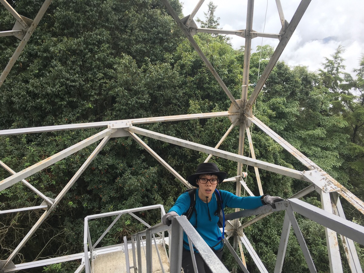
Upon arriving at the peak, the first thing we noticed was the weird, rickety construction which looked like the component parts of an electricity pylon had been rewelded to form a lookout tower. The flimsiness of it wasn’t enticing, but why go all the way up to the top of the mountain and then not climb the last 10m or so?
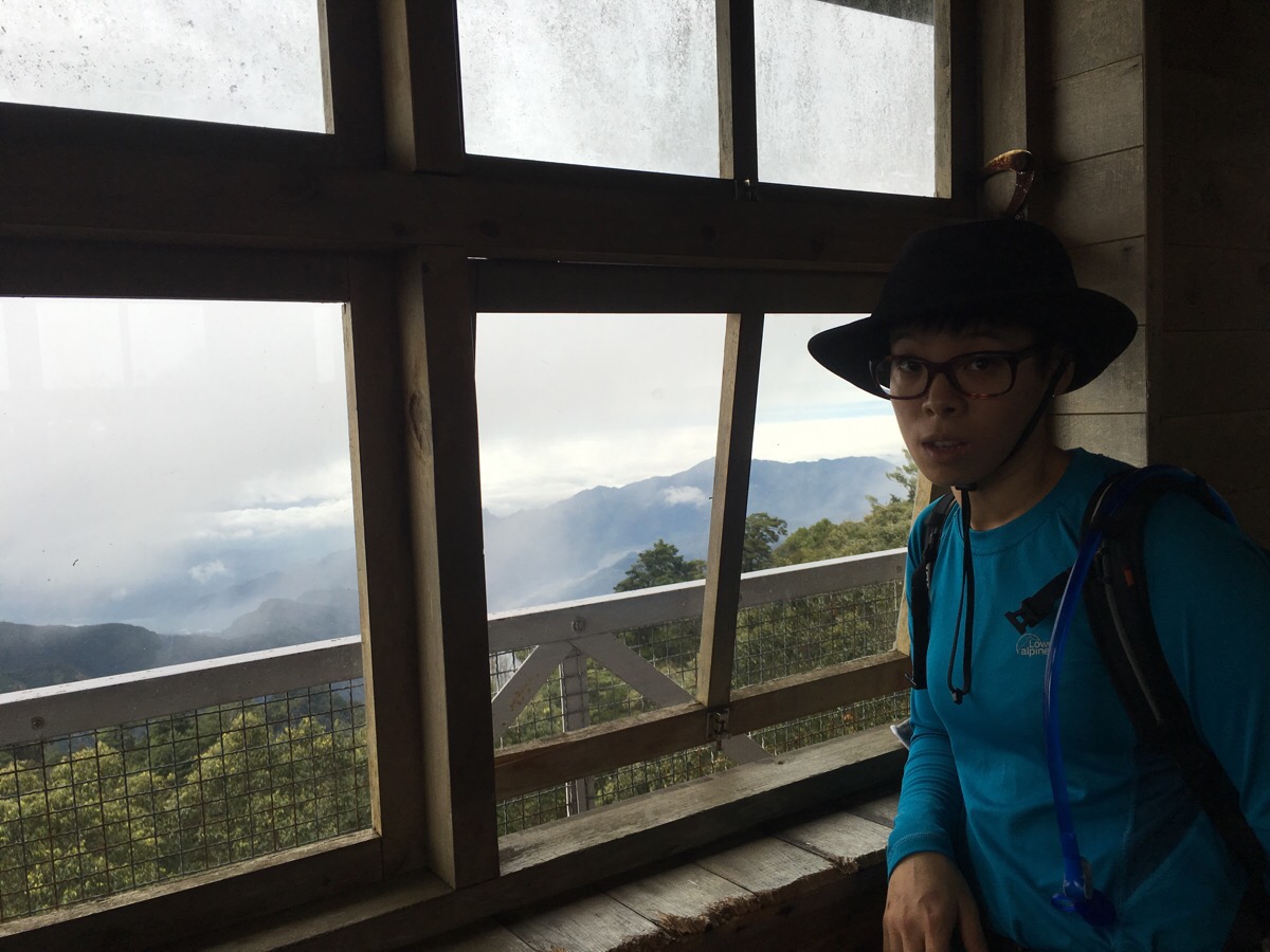
At the top, there is a wooden hut with big windows and a narrow, fenced-in ledge which you can walk around. This time we could see more towards the northeast.
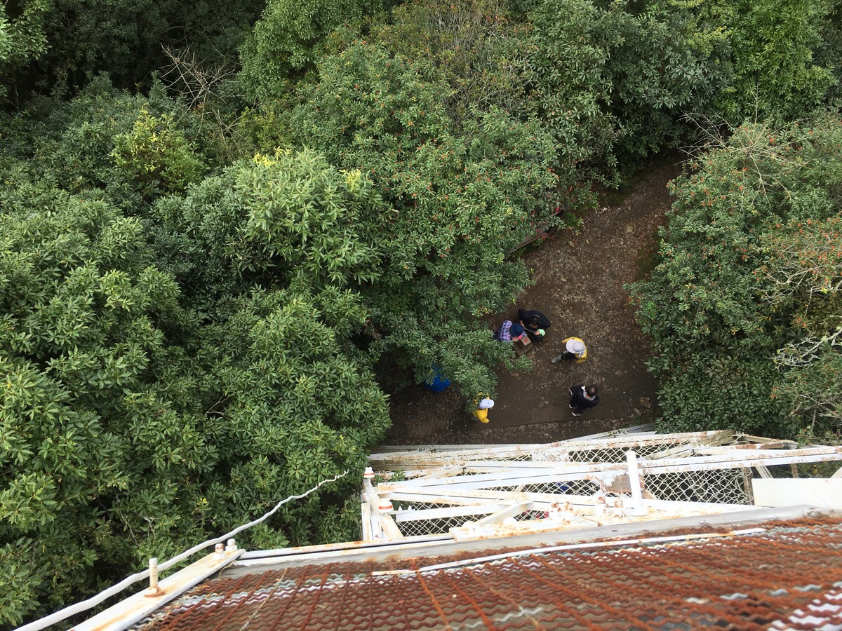
The view down doesn’t really give you any sense of just how precarious it felt!
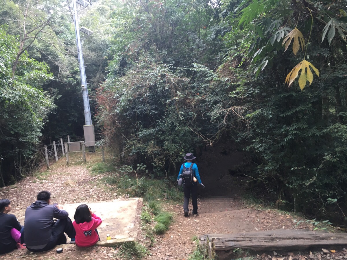
As seems to be our habit, we didn’t feel like sticking around too long in the more populated area and got back on with the walk.
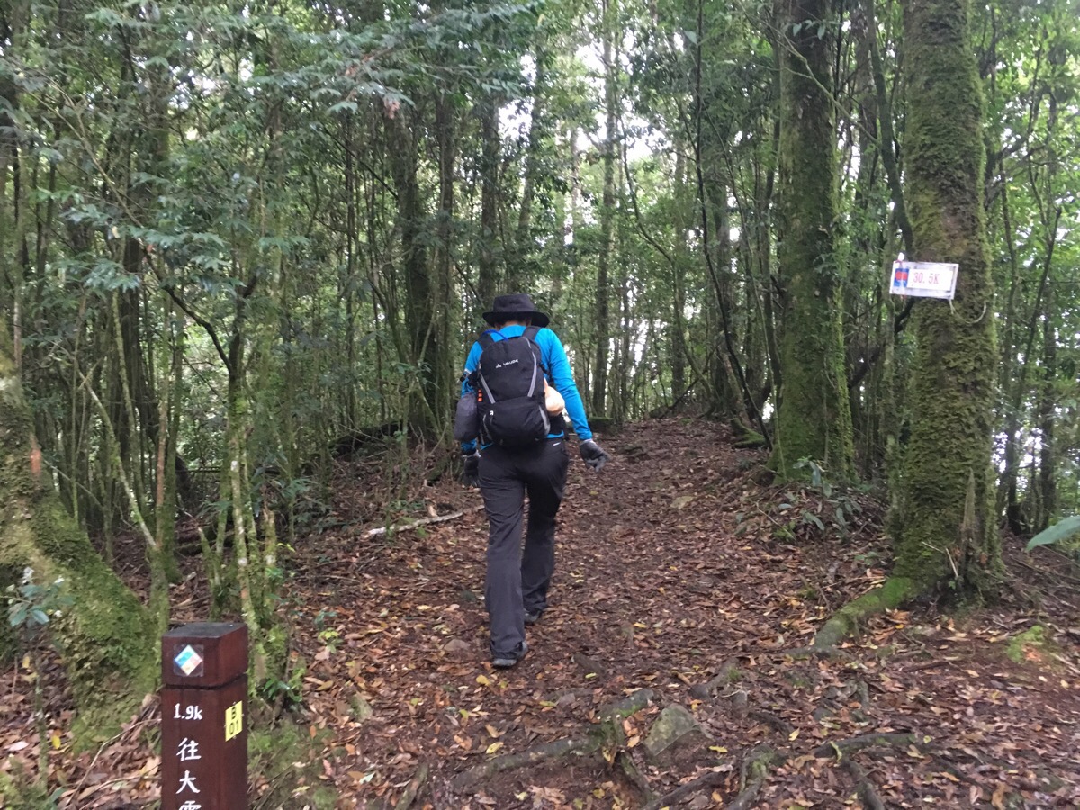
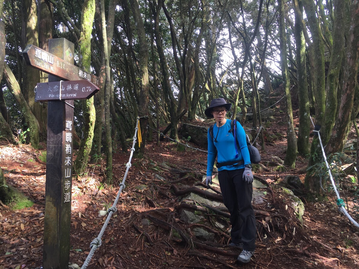
At what I think was the only junction after Shaolai Shan, we took the right-hand trail towards 稍來山南峰/Shaolai Shan South Peak and the 30.5km road marker.
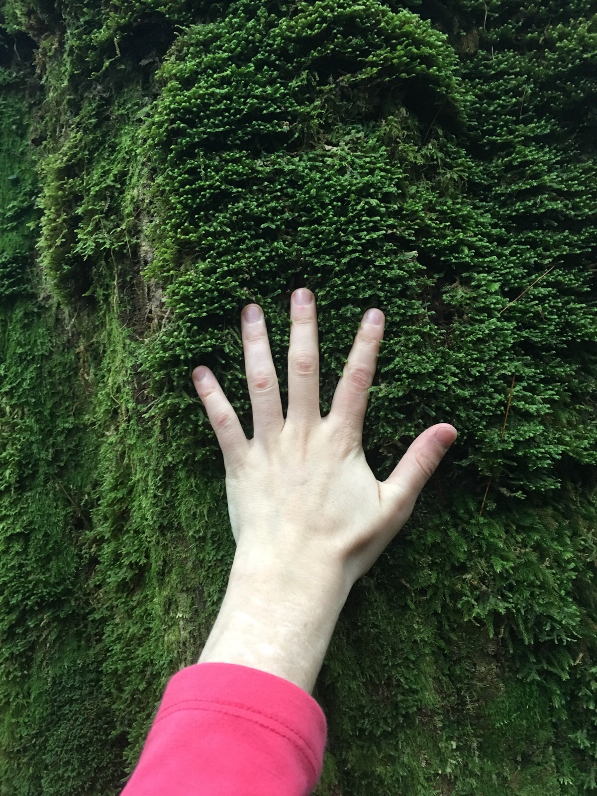
This section of the trail had some stupendous mossy carpets and coats for the trees.
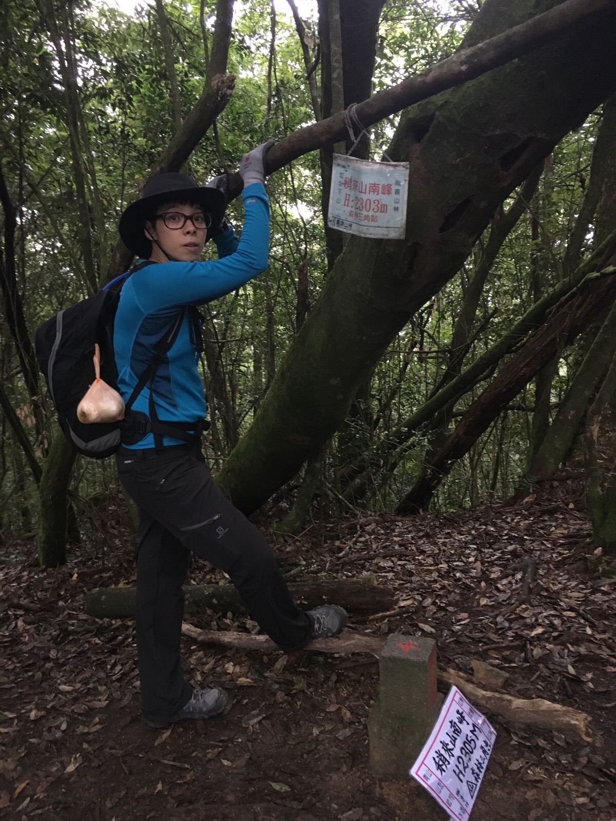
Upon reaching our third peak of the day we allowed ourselves to finally eat the rest of the fantuan that we’d bought for snacks. In fact, after having got caught up in human traffic for so long, I felt we didn’t have nearly as much food as I would have liked for the amount of time we spent on the walk, but knowing that we were getting close to our destination boosted my energy.
From the south peak, it was pretty much all downhill through some beautiful old forests. At one point we were treated to a glimpse of a woodpecker. It was hammering away at a tree right over the trail, sending little showers of debris pattering down through the foliage but we never saw more than flashes of movement.
I will never get bored of running into life forms like this knarled but still growing old thing.
For the last twenty minutes to half an hour of the walk, we could feel the light fading. We weren’t too worried since there were headlights in our packs and from the information given by the chatty, tea-drinking group, we had anticipated that we’d reach the road at around 5pm or just before the dark came down around us and it seemed that we were pretty much right on track for that. Bizarrely, as we were making brisk progress towards the exit, we passed a young family (mother, father, a preschooler and a baby strapped into a chest harness) heading up. We stopped and talked to them briefly to make sure that they knew where they were going and that it was about to get dark. They asked if we’d passed a small picnic area made up of cut-down trees ranged in a circle around a clearing – we had, only about five minutes earlier and they said that was where they were headed. It was slightly reassuring to know that they weren’t heading far, but still, they didn’t seem to have a torch and I would have been a little reluctant to be carrying a baby down over all those uneven steps in the dark and I worried if they would be able to get down before nightfall.
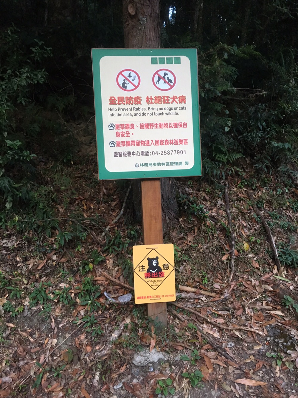
Breaking out onto the road, the absence of trees above us suddenly made everything seem brighter again. We were about to turn right onto the road when I noticed this sign. It’s the first time I’ve seen any indications that there are bears in the area where we’ve been hiking.
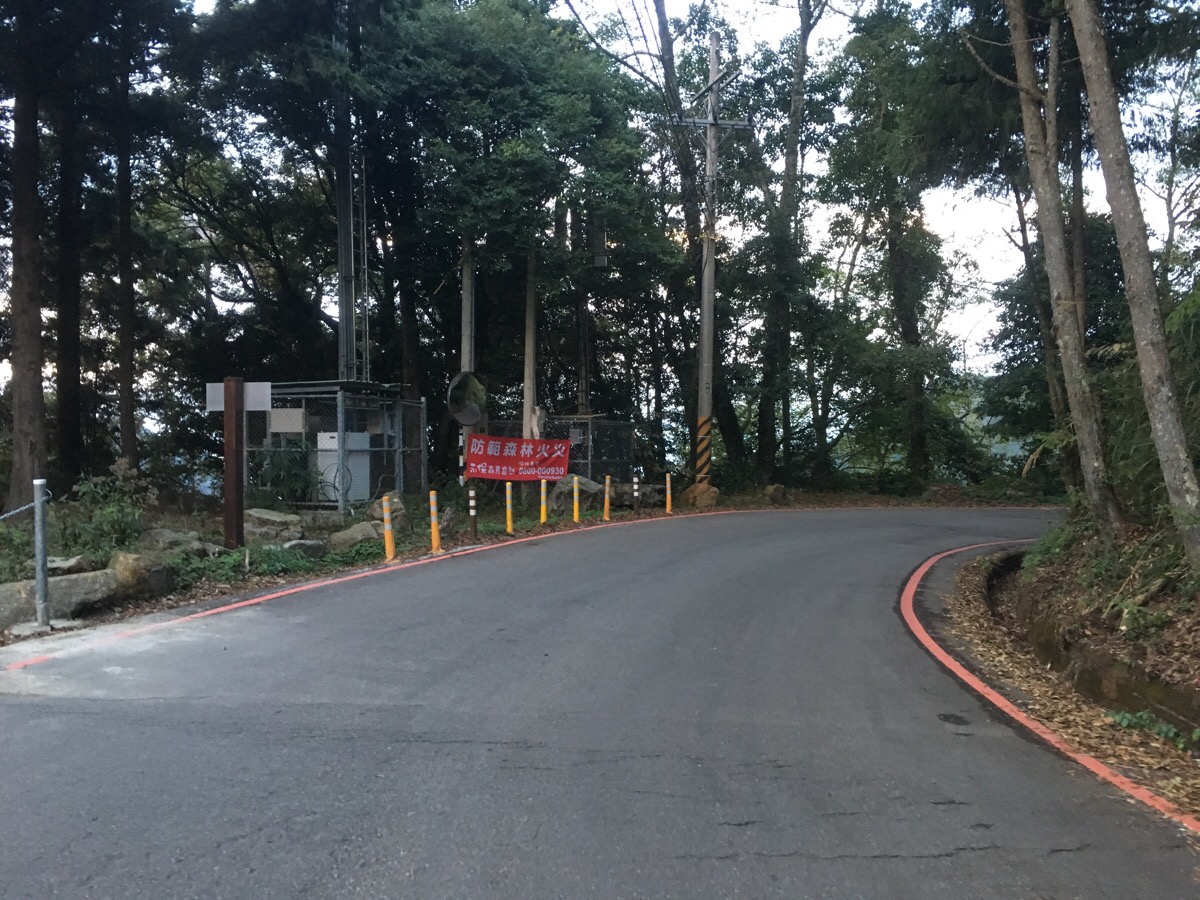
We started the road walk back with reasonable light, but by the time we’d gone about half a kilometre, it was necessary to crack out the headlamps. One of us wore a front-facing lamp and the other rear-facing in order to make ourselves more visible to the alarmingly fast cars which occasionally whizzed by. Around the 29km mark, we ran into another couple who had parked a little beyond us and were also walking back. They walked with us (and we overheard them remarking upon our strange use of headlights) until we reached our car and declined the offer of a ride onto theirs since they said they’d only parked a little further on. By the time we made it back, it was pretty much proper night-time dark and we were definitely ready for a sit-down and some food.
How to get there
Google Maps address: 鳶嘴山步道涼亭 27K登山口, 424, Taichung City, Heping District, 大雪山林道
GPS location: N24 14.083 E120 57.247
Public transport: you won’t be able to get here using public transport.
Nearby trails:
My new words learnt on this hike:
- 飛吻 / fēiwěn / blow a kiss (or air kiss?) – actually the first character on its own means ‘fly’ and the second means ‘kiss’, so that kind of makes it a flying kiss, right?
- 倉鼠 / cāngshǔ / hamster
- 保護 / bǎohù / protect or protection
- 文青 / wén qīng / hipster
- 圍起來 / wéi qǐlái / roped off, fenced off, surrounded
- 猶豫 / yóuyù / hesitant or indecisive maybe
- 你耳朵長包皮嗎?/ nǐ ěrduǒ zhǎng bāopí ma? / literally it means ‘have your ears grown a foreskin?’ but a more accurate translation would be close to the English meaning of saying that somebody is ‘cloth-eared’ or unable to hear accurately or clearly (when there isn’t really any medical reason for having difficulty).
- 摩天輪 / mótiān lún / ferris wheel – there’s a big one visible from the freeway near Miaoli.
- hwee wei / (Taiwanese, exclamation) nonsense, rubbish, (British) bollocks – the equivalent of 放屁 in Mandarin
- gei / fake (Taiwanese) – I think I learnt this before as part of a phrase
- 對牛彈琴 / duìniútánqín / play the piano to a cow, basically to waste your efforts trying to communicate something to someone who is too lazy, stupid or otherwise unable to understand – a better explanation with a visual aid can be found here.
- 露你的大腿 / lù nǐ de dàtuǐ / show your thigh – probably closer in sense to the slight risqué ‘show a bit of leg’. This was what the old guy with the tea suggested we should do if we got down to the road too far away from our car and wanted a lift back.
- 啄木鳥 / zhuó mù niǎo / woodpecker
- 我不排斥 / wǒ bù páichì / I won’t reject – at first I thought this might be the equivalent of ‘I wouldn’t say no’, but it has none of the implied ‘but I would say yes’ that the English phrase has. It is much more literal, ‘if pushed, I wouldn’t oppose it’ with the implication being ‘but it’s not really what I want/agree with’.
Further reading: some information written in Chinese here. You can also read Richard Saunder’s write up for the Taipei Times here.
Mount Yuanzui Trail Map
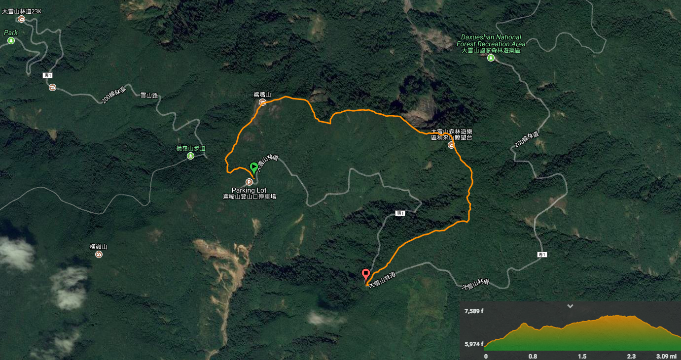
GPX file available here on Outdoor Active. (Account needed, but the free one works just fine.)

WOW! The views on this hike are amazing. I feel as though inexperienced hikers would be danger to not only themselves, but to those prepared and experienced. That is a wild amount of people for such a skinny ridge!
LikeLike
Tell me about it! I have no idea why so many people ignore the (very detailed) signs at the bottom of the trail and just hope it’ll be ok. People have died here over the years, (when that happens in Taiwan, the authorities have been known to close the route even if the cause was inexperience). I totally understand why people would want to do this type of walk, but it’s SO important to know your ability and limits. That’s one of the reasons why I am so over-specific about things like water needs, difficulty and other required equipment on here. I would hate for people to not know what they’re signing up for.
LikeLiked by 1 person
I like the amount of detail you add, I think it gives a more realistic expectation of the experience along the trail. Knowing your limits is one of the most important aspects of being outdoors. Keeping yourself and others out of dangerous situations.
LikeLike