Yuantong Temple is an (almost) century-old religious establishment built into the hillside of New Taipei’s Zhonghe District. The ridgeline behind it is crisscrossed with a network of trails where you can find all kinds of small shrines, statues and other interesting sights. The trail that starts from this particular temple is also famed for its “thread of sky” feature — a path that cuts straight through a narrow gap between rocks. It is thrilling and panic-inducing in equal measures!
Distance: A little under 5 kilometres.
Time: 1½ – 2 hours. I walked this in about an hour and 40 minutes, but I did keep stopping to take photos.
Total ascent: 150 metres.
Difficulty (regular Taiwan hiker): 2/10 – A solidly easy walk in comfortable weather.
Difficulty (new Taiwan hiker): 3/10 – There are some steps, but since the trail is well-maintained and the walk is short, this should be easy even if you’re new to hiking in Taiwan.
Risks and dangers: The steps can be slippery in places but no more than normal. The path also heads through a narrow gap between rocks, which — while neither a danger nor a risk — might be uncomfortably tight for some. If you don’t like the sound of this, there is a slightly longer alternative route that skips this section.
Water: I took a little over 0.5L and drank only a small amount of it on a cool day.
Shade: Shade is patchy, with the road sections exposed and most of the trail sections were covered.
Mobile network: Pretty good throughout.
Enjoyment: If you like slightly unexpected, this is a good walk. There’s an interesting geological feature, temples and their strange statues, and you’ll get to experience some of Taiwan’s mountaintop exercise/social culture.
Bathroom facilities: There are toilets at the start and possibly at one or two of the other temples along the route, but make sure you have your own toilet paper.
Route type: Point to point
Permit: None needed
Jump to the bottom of this post for a trail map and GPX file.
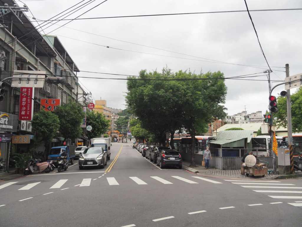
Depending on how you arrive at the trail, you may or may not find yourself starting at Zhonghe Station, but since that’s where my bus dropped me, that’s where this post begins. Head south on Yuantong Road, past the bus depot, then take a left onto Lane 367, passing FamilyMart on your right.
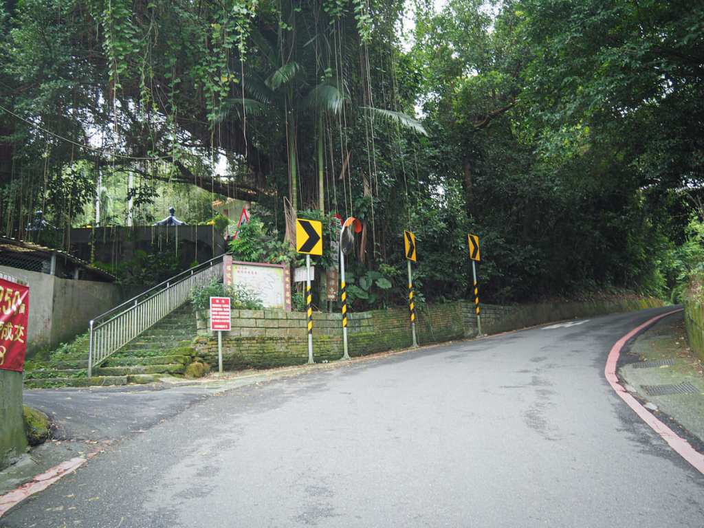
Very quickly, the lane leaves the built up are behind and begins to climb. On the left, I passed a military cemetery, and a little beyond that, steps veer off from the road and up towards a pavilion. Both the steps and the road head up to Yuantong Temple, so you can choose either the longer, winding road or the shorter, slippery steps. I chose the latter.

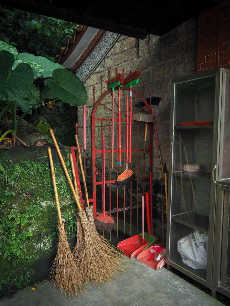
Along the way, there were a couple of interesting Taiwan sights. The first was this homemade poo bag dispenser, and the next was this casually photogenic assortment of brooms found outside a small wayside temple.
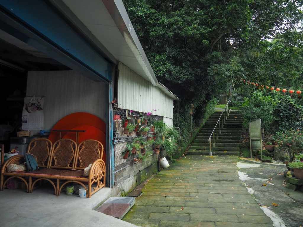
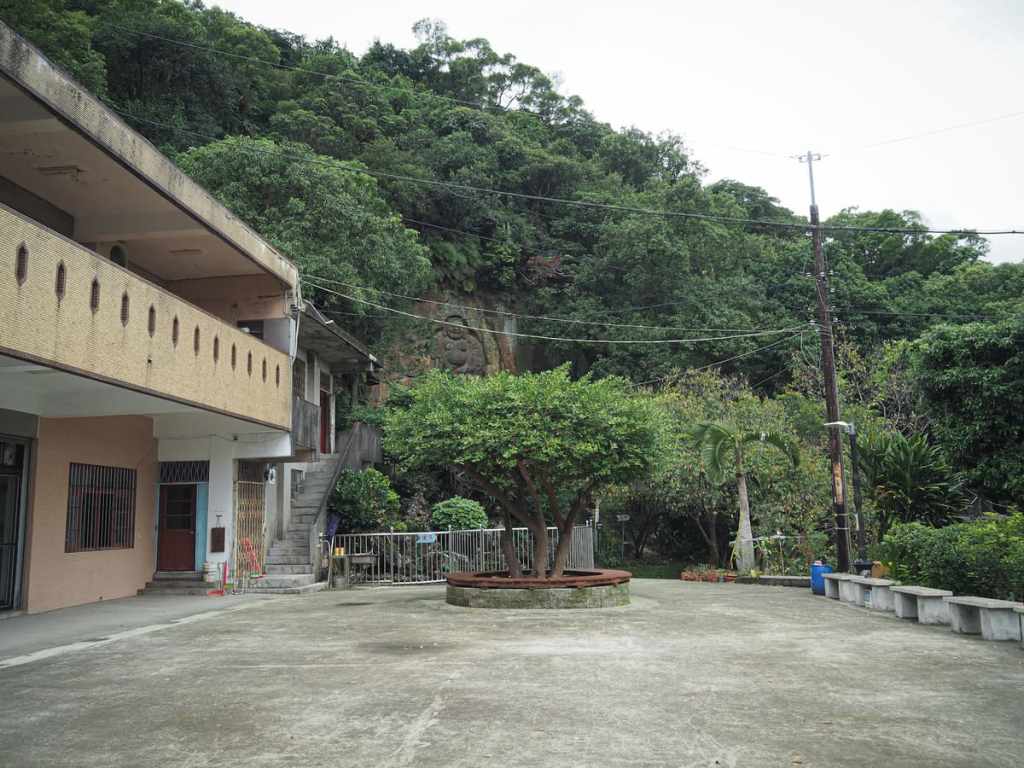
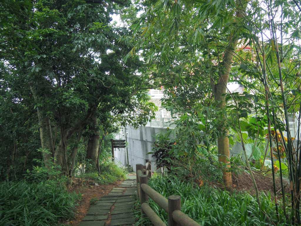
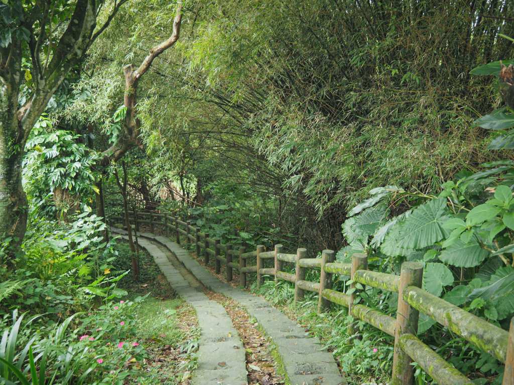
Just beyond the temple, the path dips to join the road again, but once more, I stuck to the steps. If you peer into the bushes at this point, you can spot several interesting old houses, some of which are still lived in, but others appear to be slowly returning to nature. At the top of the steps, a lane leads past a mountainside community of red-roofed villas, then at the end of the lane, turn right to meet the main entrance of Yuantong Temple.
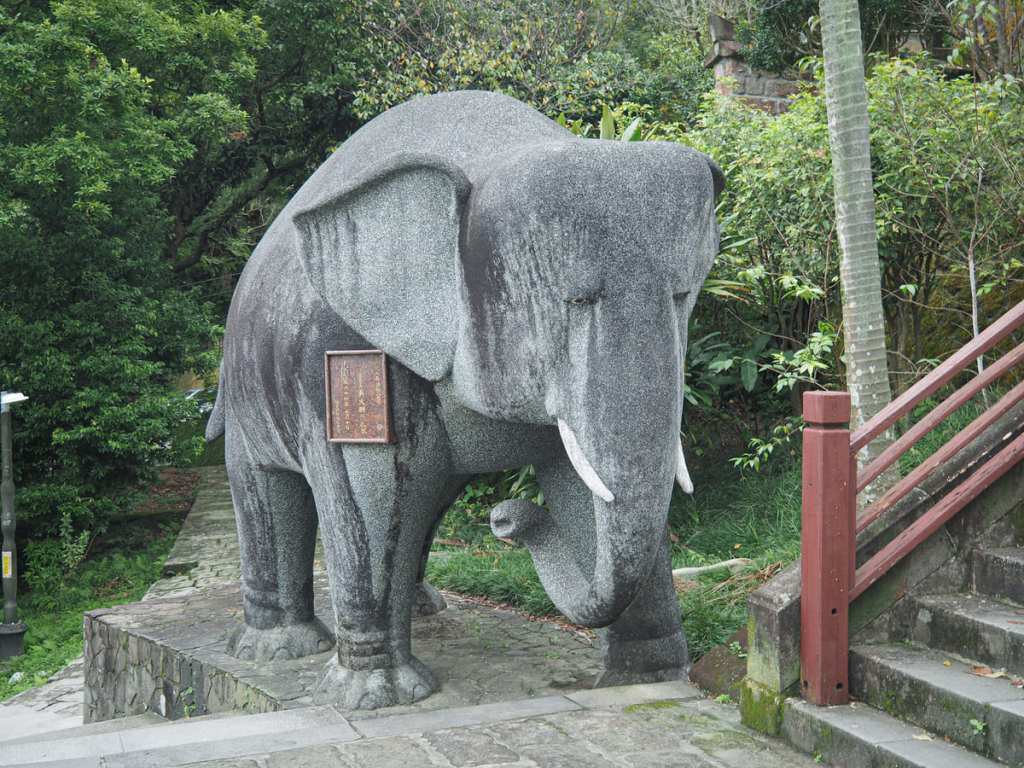
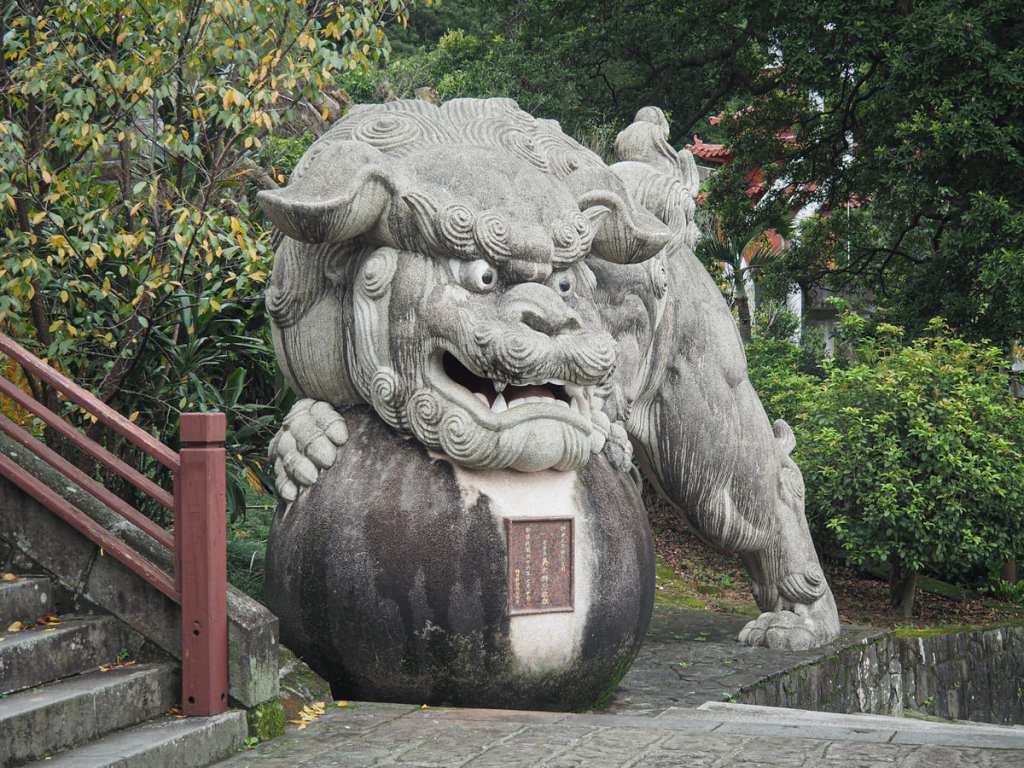
Built in 1926, the temple adheres to the Mahayana school of Buddhism and was one of the earliest temples in Taiwan to open to nuns. An elephant and a lion guard the steps — solemn and fierce.
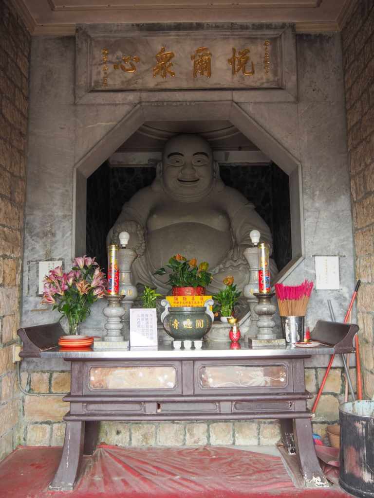
At the top of the first flight, you’re greeted by the Maitreya Buddha, a beatific smile gracing his features. If you’re not interested in temple stuff, you can head right and through the gate towards the trailhead here, but the temple-curious amongst you might want to step through the opening and head up the inner stairs on the statue’s left or right.
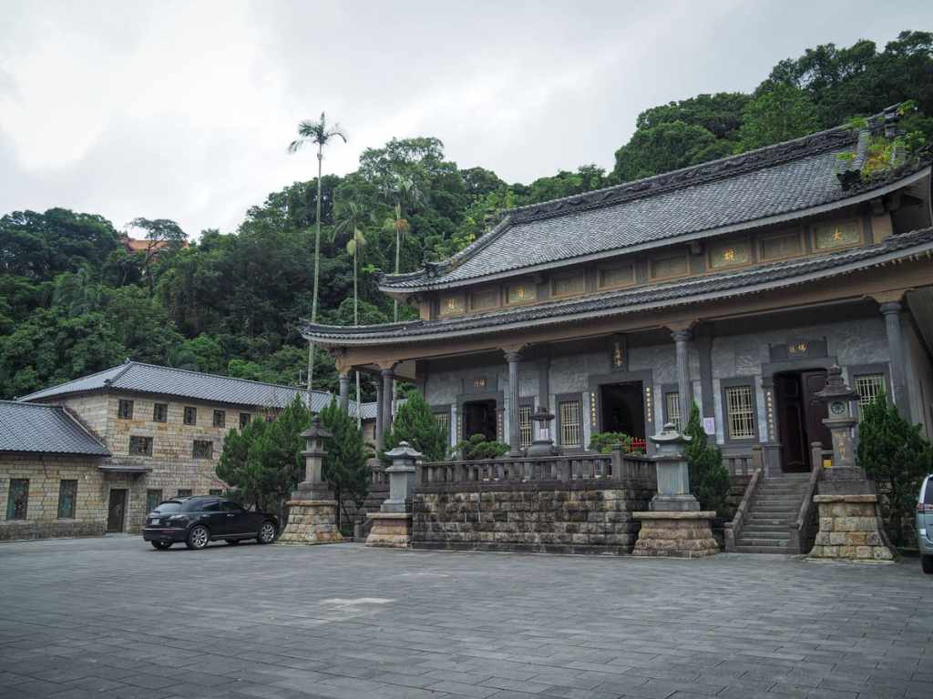
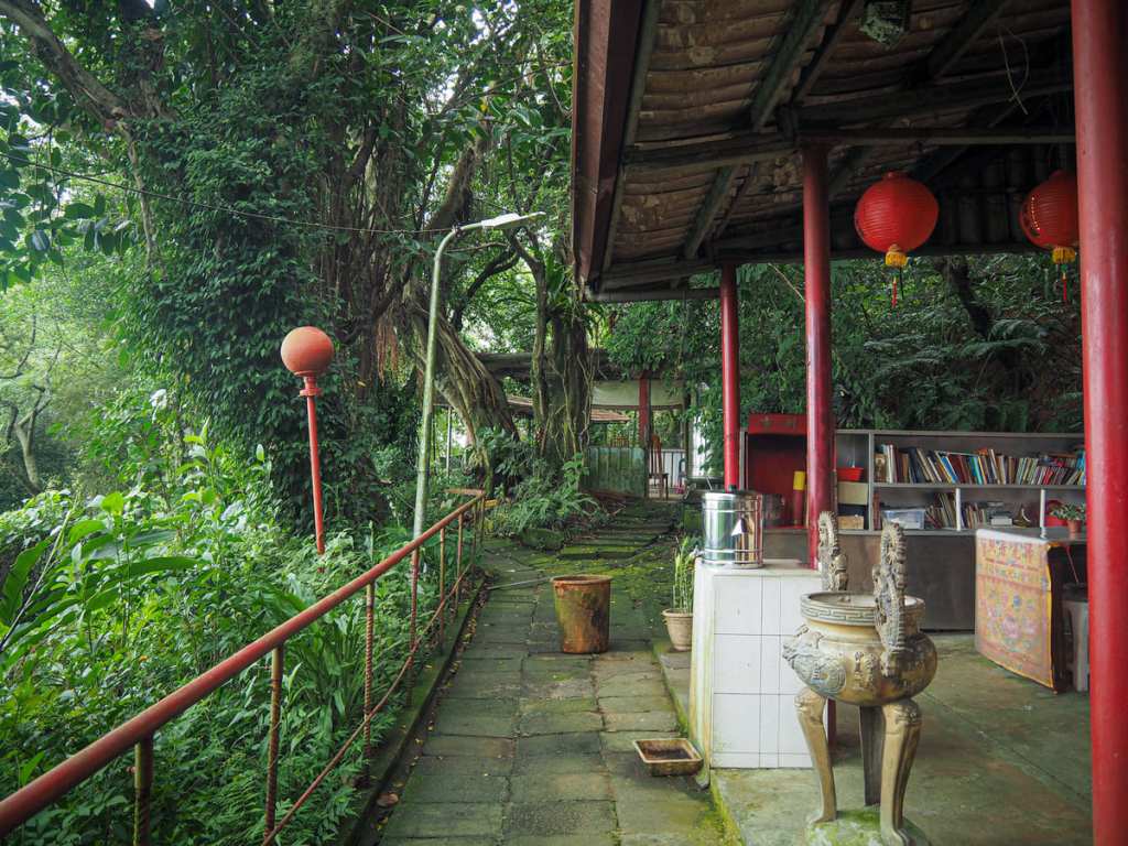
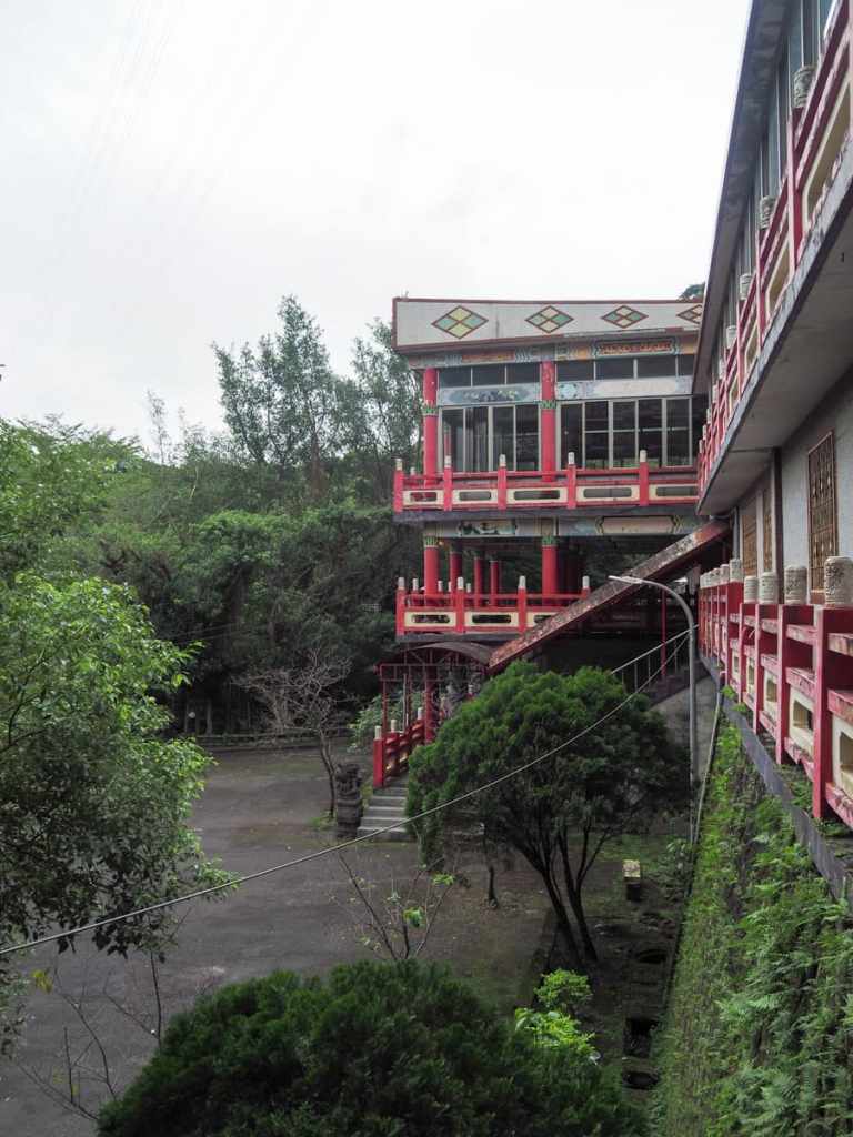
Whichever way you go, you’ll find yourself standing in front of Yuantong Temple’s main hall. Unlike its Taoist or Taoist/Buddhist peers, Yuantong Temple is a sombre affair. The colour palette is limited to natural stone tones and inside, a vast golden Buddha presides over the space.
Generally, this kind of temple is a little more reserved about letting visitors wander in and out, and judging by the absence of interior photographs on Google Maps, photography isn’t allowed, so make sure to be aware of that if you visit.
The peaceful atmosphere was somewhat diminished by the fact that Buddha was having his belly buffed to a polish, but I suppose he has to have it done some time or other.
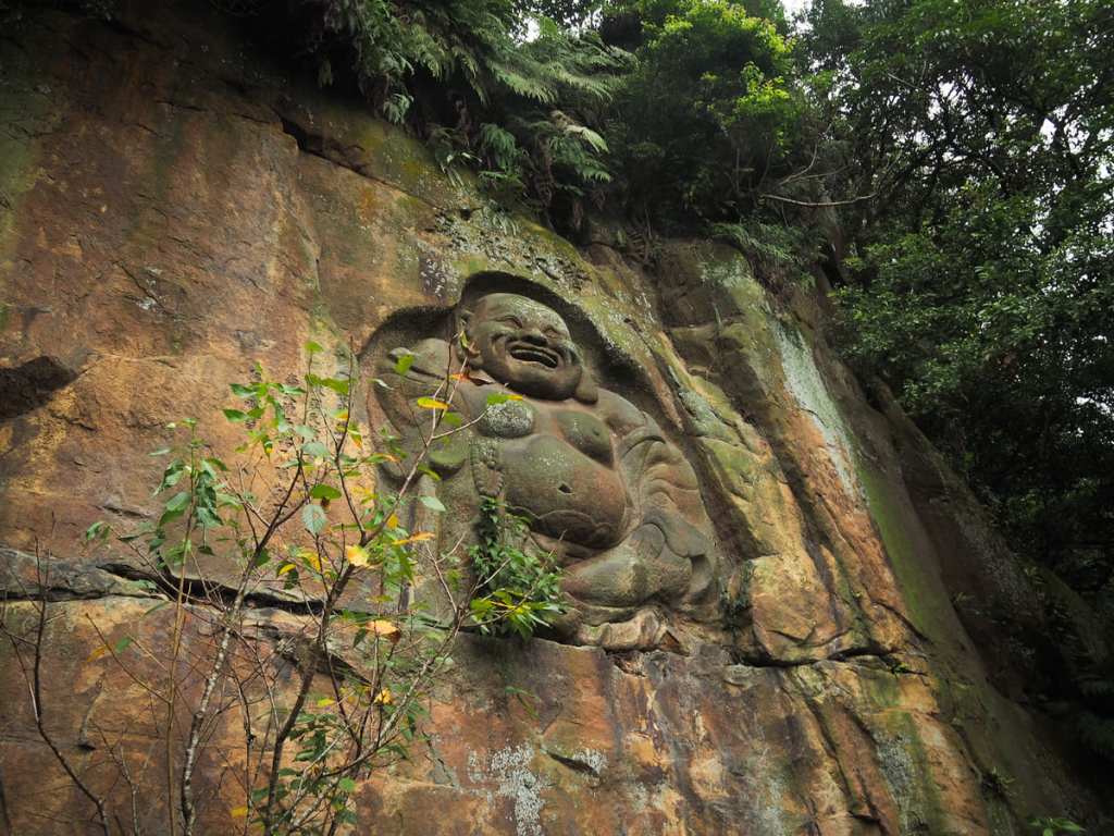
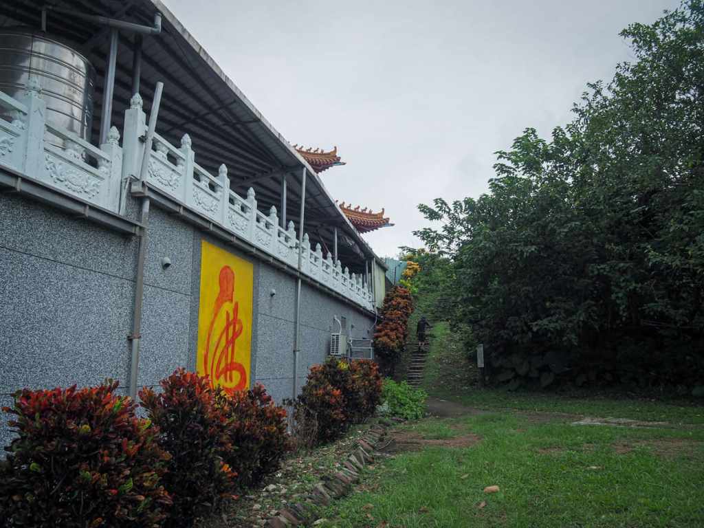
Facing the temple, turn right and walk past a paper burner following signage directing you towards the toilets and the Stone Buddha Rock Wall Passage. If you look up, you should be able to spot said Buddha carved into a rock face.
The carving is tall and impressive, and it’s one of the features that has made Yuantong Temple a popular place to visit.
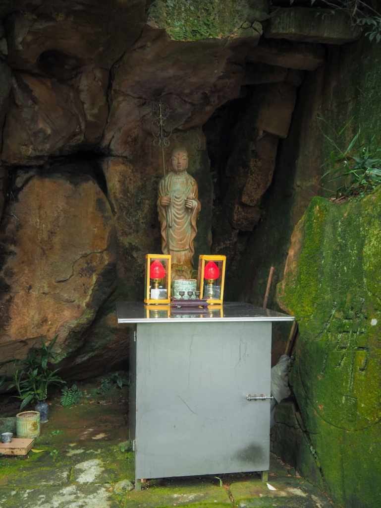
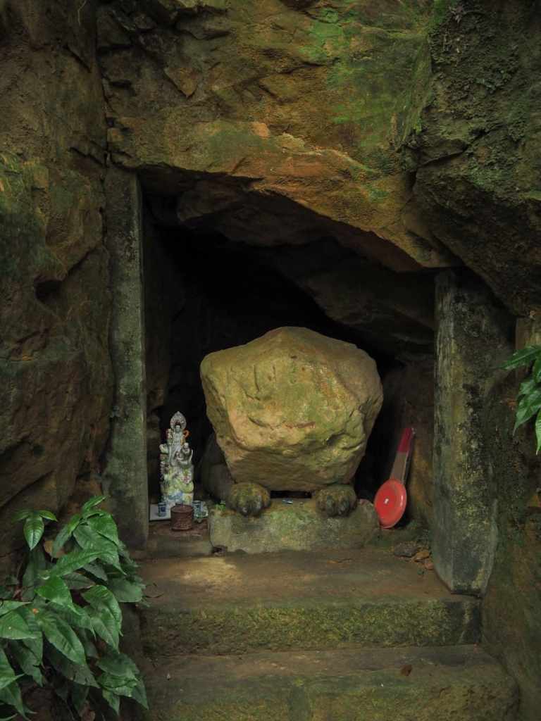
Nearby, you can also spot a whole host of other figures and carvings (or half carvings) like this tiger/lion that seems to have been finished save for its head. The spot kind of reminds me of some of the weird and wonderful discoveries on this trail I walked near Elephant Mountain. I haven’t photographed all of the interesting characters that appear here, so be sure to take your time and see what you can find.
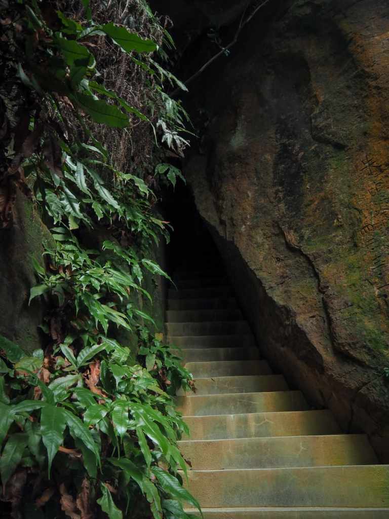
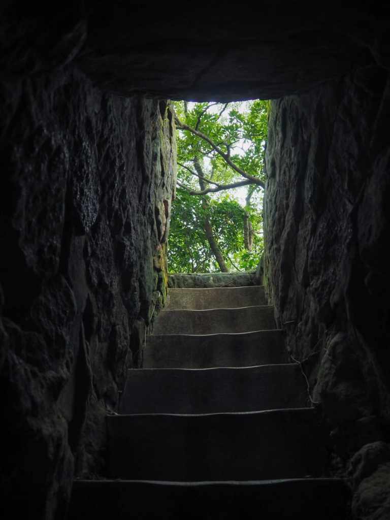
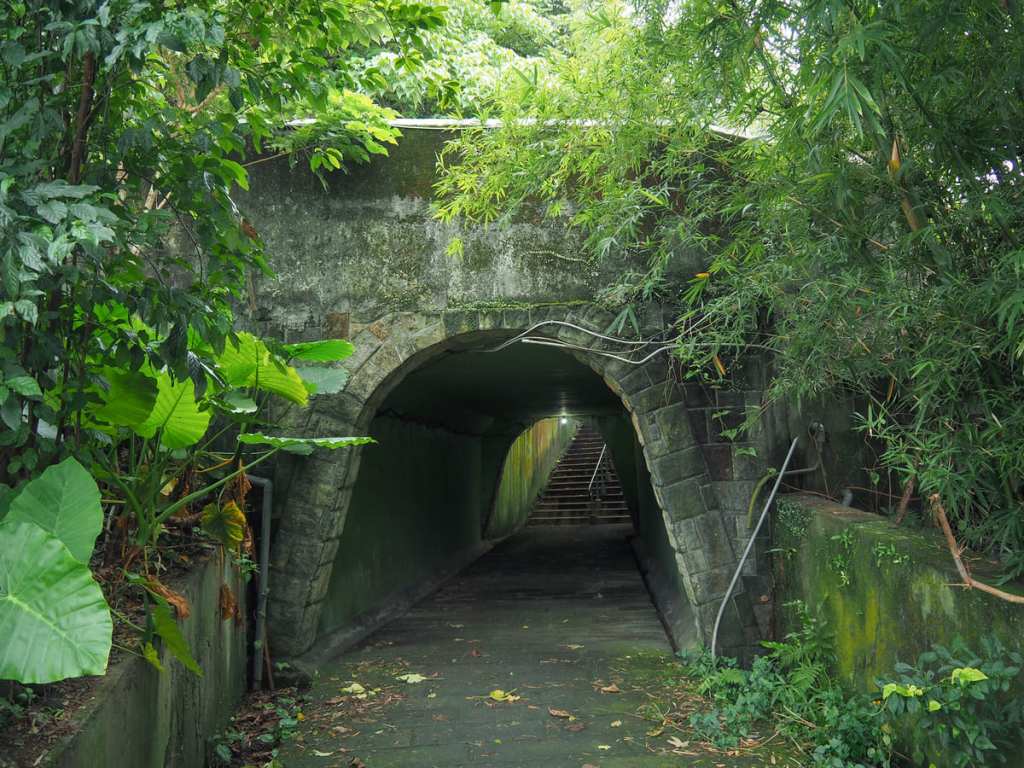
Another fascinating feature of this hike is the section of trail that leads up from the base of the rock face to the top via a thin chink of a path that cuts straight through the rock. I had seen plenty of pictures of this before embarking upon the walk, but none of them accurately convey how it feels to actually walk through this. The feature — nicknamed “A Thread of Sky” or “一線天” in Mandarin — is maybe ten metres long, and at its narrowest point, it’s perhaps around 50 centimetres across. What’s more, the path twists, so when you first step inside, you can’t see the exit. I suffer from mild claustrophobia, so I would have hated walking through this on a busy day, but luckily for me, I was the only one there.
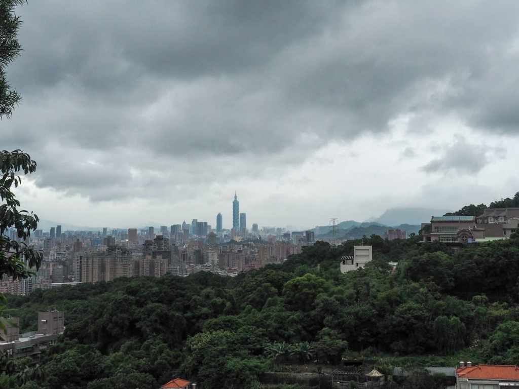
At the top of the steps, I got my first proper view of the city.
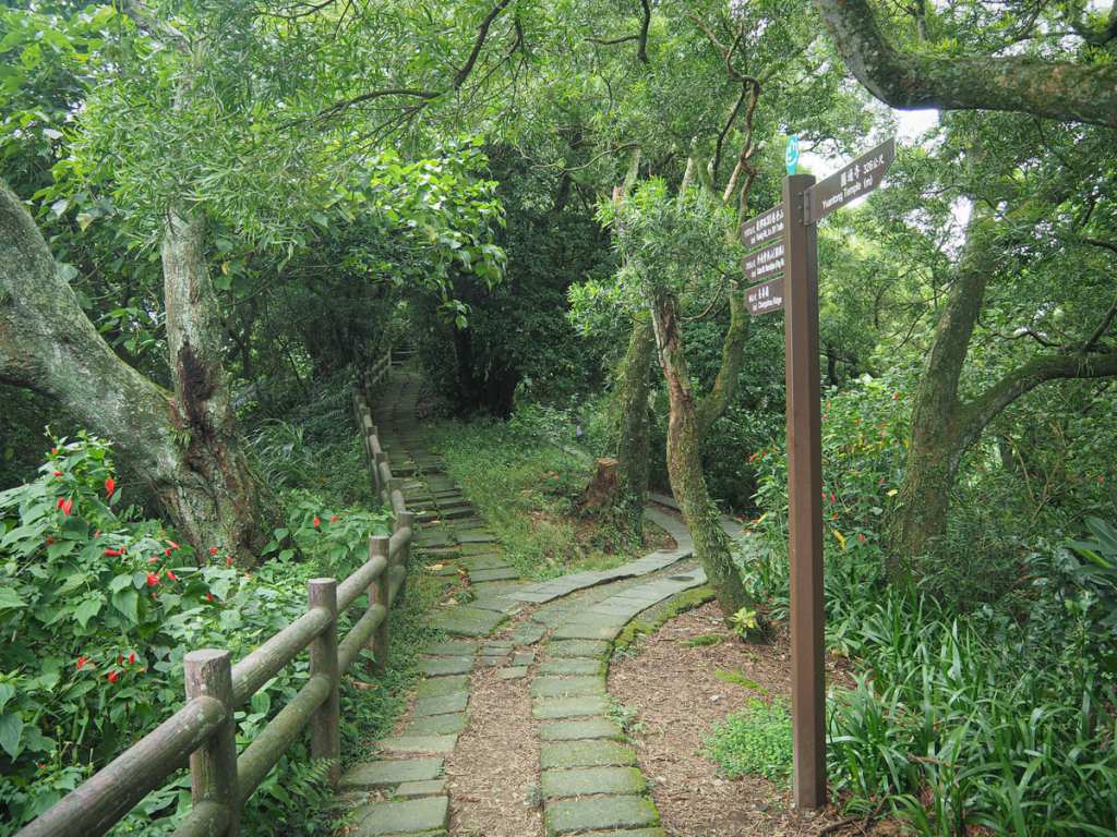
There seem to be two or three trails leading away from this point. I took the leftmost one as you exit the steps. The trail led up along a sloping ridge towards a junction with a red pavilion. Head straightish here and take the trail leading towards Shang Baoshang Temple (上寶禪寺).
Just a short distance beyond the temple, I passed a shoddy-looking mountain shelter filled with retiree hikers — most of them were engaged either in playing or watching a mahjong game played on a rickety table with mismatched chairs.
After a few minutes, the trail leads down to join a road, and here, the trail takes a right to skirt up and around the rear of another temple. (I popped in for a quick look, but this one didn’t grab my interest.)
A pigeon coop in the shrubs behind the temple.
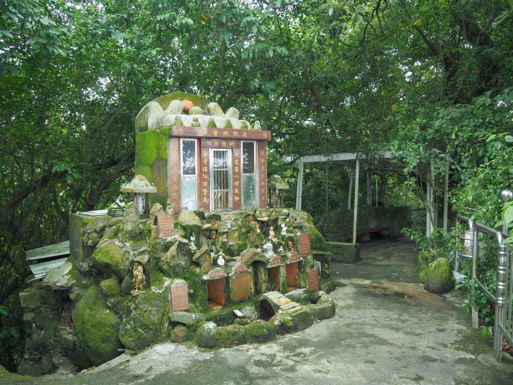
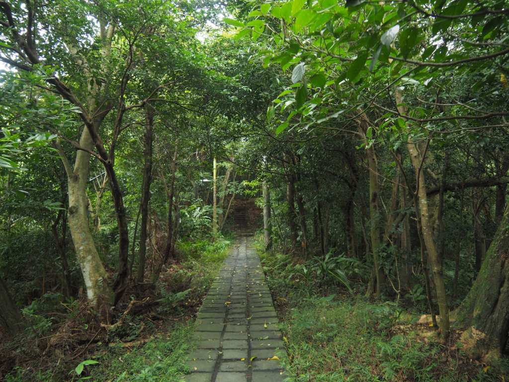
Continuing onwards, the trail dips and climbs, passing some an odd shrine or two along the way. The one in this photo was dedicated to Guanyin and the outside had been decorated with all sorts of figurines.
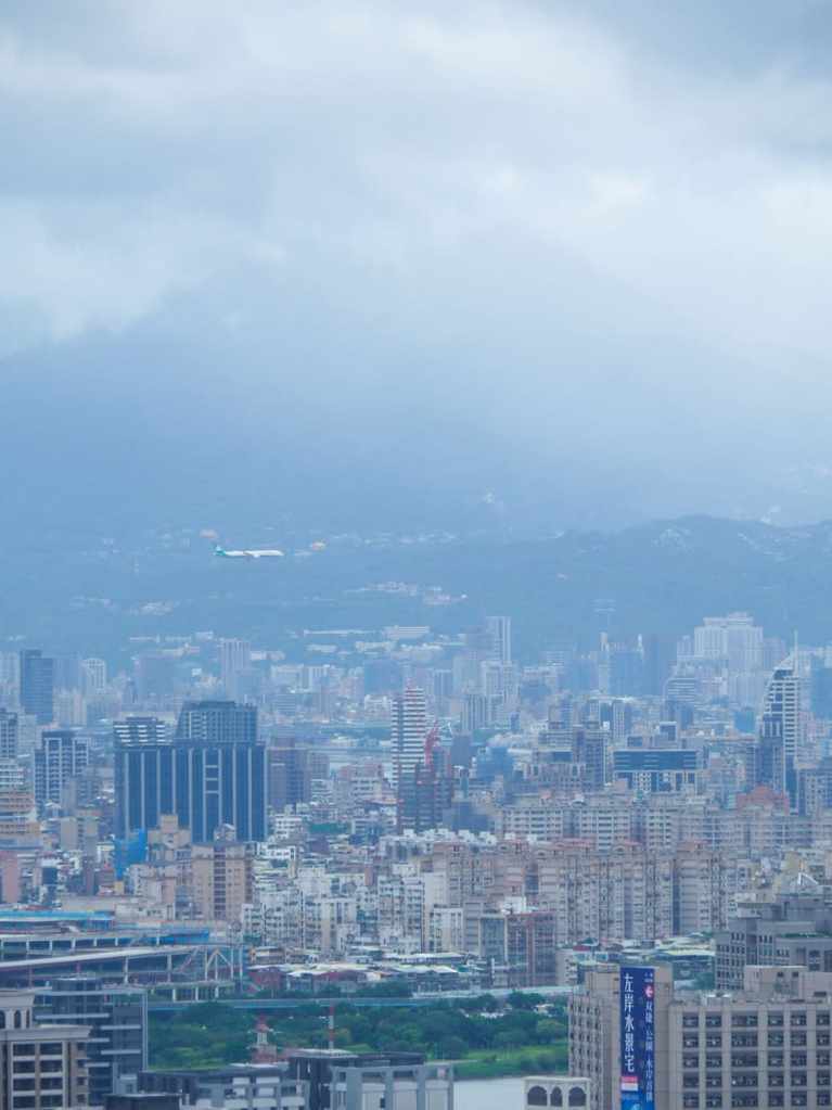
At an observation platform to the left of the path, I enjoyed a clear view over Taipei with the hills of Yangmingshan rising in the background. As I watched, an EVA Air plane came in to land at Songshan Airport.
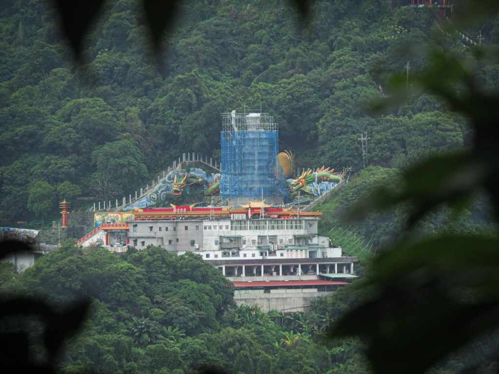
A little further down the path, a gap in the trees on the right gave me a view over to Hongludi’s huge Tudi Gong statue. At the time of writing, the statue was undergoing maintenance, so it was entirely surrounded by scaffolding.
This fork in the trail is actually more of a false fork. The left hand trail is lower and the right hand trail heads up to a peak with a (seemingly now disused) flagpole, but the two soon connect together again.
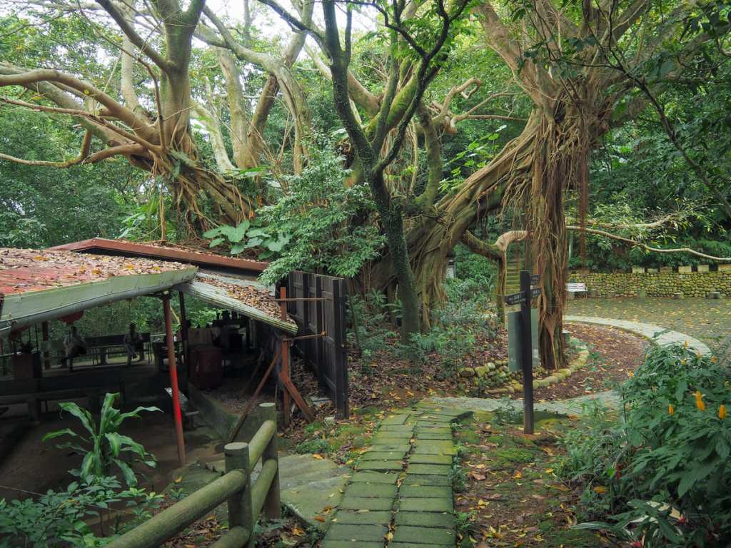
After the two paths merge, the trail dips down to a clearing with a tiny land god temple and a huge banyan tree. Multiple paths split off from here and if you visit earlier in the day, you’ll likely find it populated with a large number of exercising and chattering retirees.
There are two paths that head more or less straight over (both hidden behind the banyan tree in this picture). I took the left hand one of this pair, which was signposted as heading to Letian Temple (樂天宮).
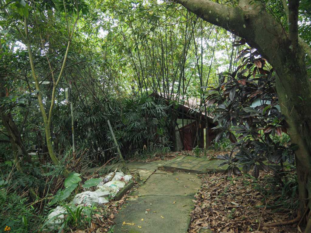
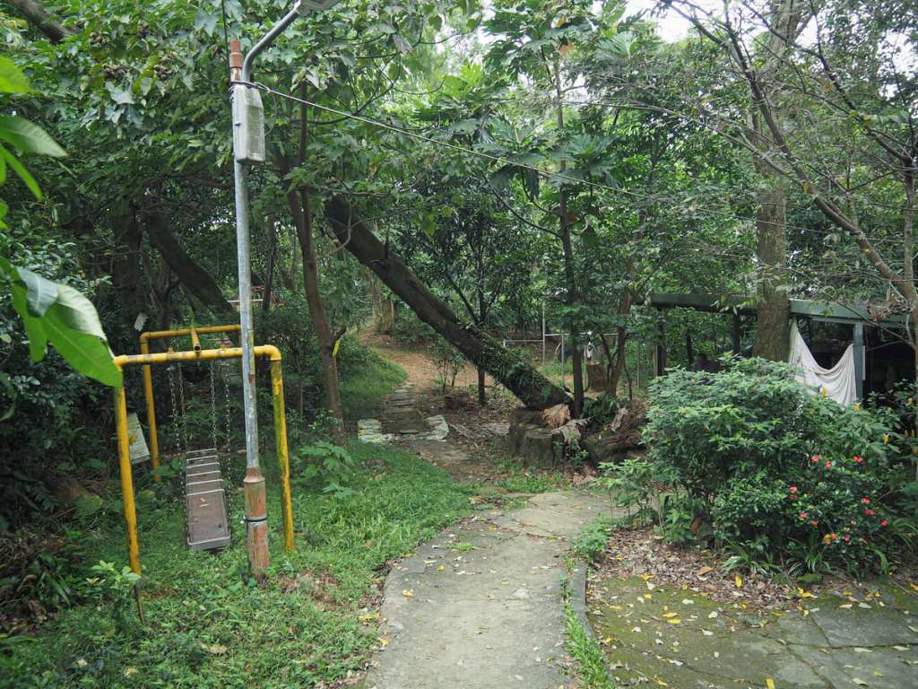
The trail skirts past a strange-looking temple with several separate altars under a low roof and an extensive library of religious texts. Beyond the temple, I found myself passing through an old-school playground made of the kind of shiny metal that would almost certainly burn bare skin in the summer, then at the next junction, take the trail on the left heading down to Letian Temple.
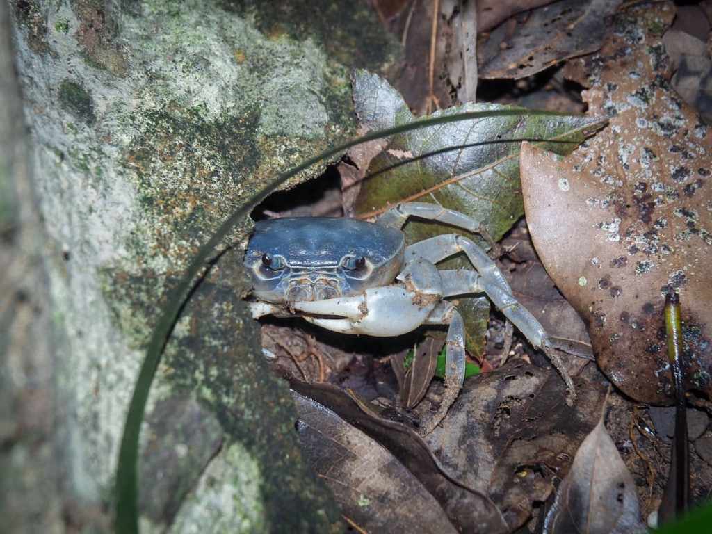
A cheeky little stream crab (likely Geothelphusa olea). I spotted it scurrying across the steps and then watched as it ducked into a small crevice beneath the concrete.
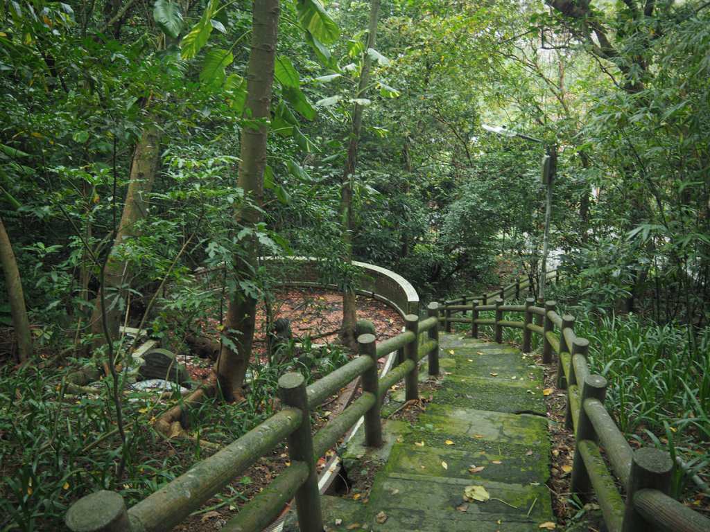
At a shelter, the main path curves sharply to the right and then leads down through an incredibly overgrown graveyard.
The trail ends at Letian Temple, and from here, it’s an easy downhill walk back to the built up area. I followed the lane I was on, turned right onto Fuxing Road, then left onto Jingan Road and was soon back at Jingan MRT station.
How to get to Yuantong Trail
Google Maps address: The trail starts by this military cemetery.
GPS location:
- Yuantong Temple trailhead – N24 58.980 E121 29.555
- Letian Temple trailhead – N24 59.225 E121 29.970
Public transport: Take the MRT to Jingan Station, then hop on either the 241, F513, or O2. All these services take slightly different routes to arrive at Zhonghe Station bus stop. If it’s not too hot, you could easily walk the 30 minutes from the MRT station to the trailhead. At the end of the trail, it’s easy to walk to Jingan Station.
Nearby trails:
Yuantong Trail Map
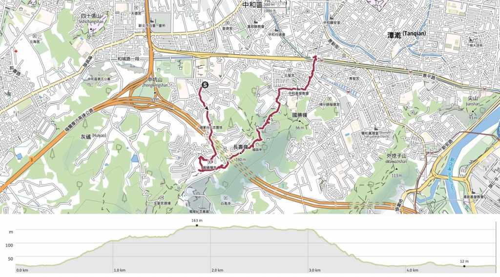
GPX file available here on Outdoor Active. (Account needed, but the free one works just fine.)

Thanks once again for an awesome guide! We really enjoyed the trail this weekend.
LikeLiked by 1 person
Happy to hear you had fun!
LikeLike