Distance: 10km including the road section, about 6km of that is road walking.
Time: The whole thing took us a very unrushed 7 hours (we took about an hour’s lunch break and another 30 minute nap break for Teresa).
Difficulty: 6.5/10 – This is likely to be very challenging for new hikers, but it is just moderately tough for regular walkers. It’s a steep climb, but nothing technical or difficult.
Total ascent: 990m
Water: I got through about 2.5L on a cool day.
Shade: Mostly shaded, I made do with some sun cream.
Mobile network: Pretty good for this type of walking, but there are still a few black spots.
Enjoyment: A thoroughly enjoyable walk. Big trees, waterfall, a scenic place for lunch and a couple of beautiful views.
Other: Gloves and hiking poles helped with some sections. You’ll also need to take enough food to keep you going, and I really benefitted from salt candy on this hike.
Permit: None required! This is a rare hike which will get you up close to some of Taiwan’s giant trees without having to fill out any permit forms.
Jump to the bottom of this post for a trail map, GPX file, and transportation information.
We had a super early start on this one. We woke up at about 3:45am and were out of the house by about 4:20 – too early for any breakfast establishments to be open which meant that we ended up relying on 7-Eleven as our source of pre-hike sustenance. The main positive though was that we ended up arriving at the start of the walk just before seven.
We stopped at the very first patch of space after the end of the properly surfaced road. This was maybe 20 metres downhill of the little green 0km road sign. The road continues on until 3.5km, and the trailhead proper is somewhere between 3km and 3.5km, but since Teresa’s car is quite a low sitting one, it seemed smarter to walk up rather than risk damaging the bumpers or getting rocks flung up underneath.
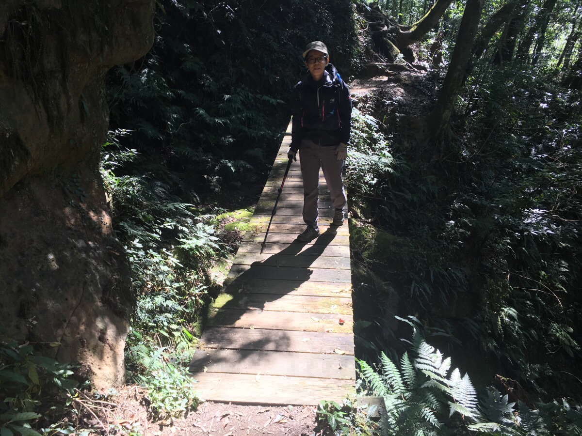
6:59am – We set off up the track at about 7am, accompanied only by the sound of the birds singing their morning chorus. There were a couple of other spots we noticed that it would have been ok to take the car to, but at the time it didn’t seem like a good gamble to just drive up and see. The first quarter of the trail is all like this, mountain road, and whilst it never gets too steep, it is a pretty constant uphill, (from looking at the chart, it seems like maybe the first 300m in altitude gain were done in this part).
7:18 – After nearly 20 minutes of walking, we arrived at the end of the mostly concreted section of road, this is marked by a campground with a faux Tudor house. There were tempting smells of breakfast being cooked outside carried to us on the breeze – the appeal of bacon cooked on a camp stove in the morning is something that doesn’t seem to diminish no matter how many years of vegetarianism I am away from actually consuming it.
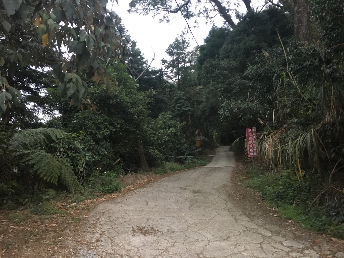
Leaving the happy campers to enjoy their breakfast, we pressed on up the track. From here on, the road really is a track – short sections are made of concrete, but equal amounts are gravel or dirt. The trees lining the road range from tall bamboo in the lower reaches through to Japanese cypress and a more varied mix the further up we walked. At a hairpin bend we encountered a small family of Taiwan bamboo partridges strutting through the dew and foraging in the grass. Although eminently unperturbed by our presence, they slowly ambled off into the longer grass and we continued our uphill amble.
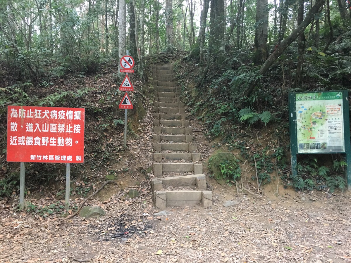
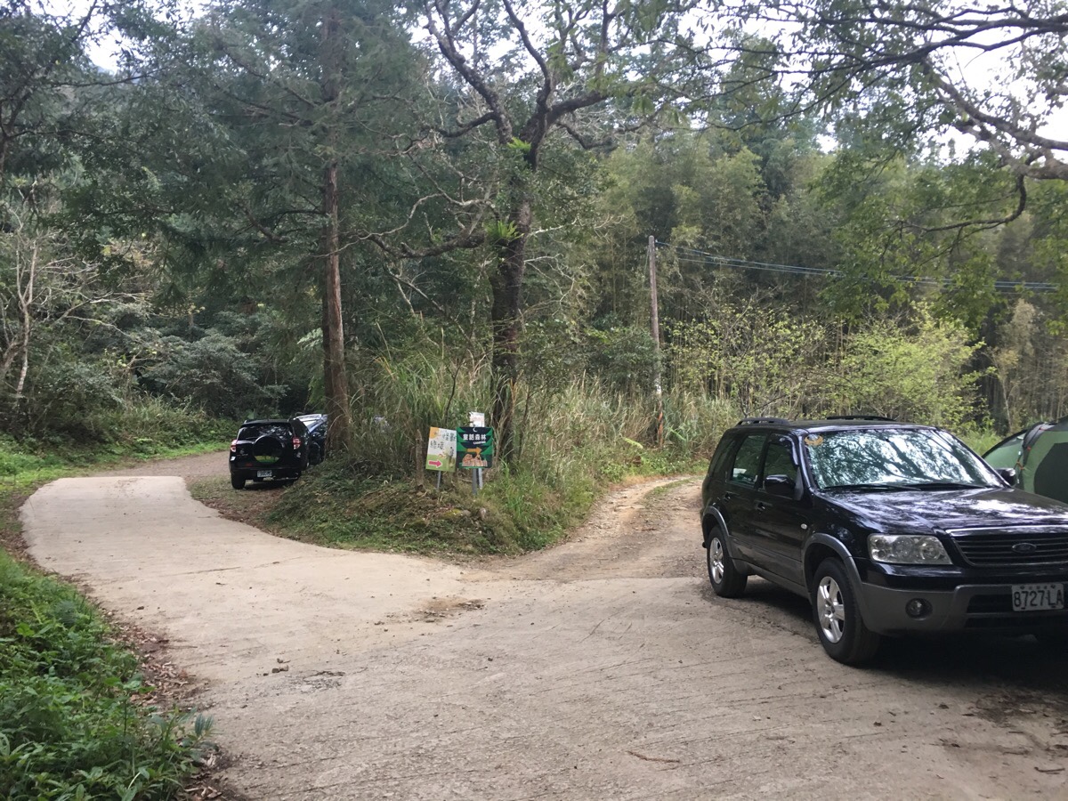
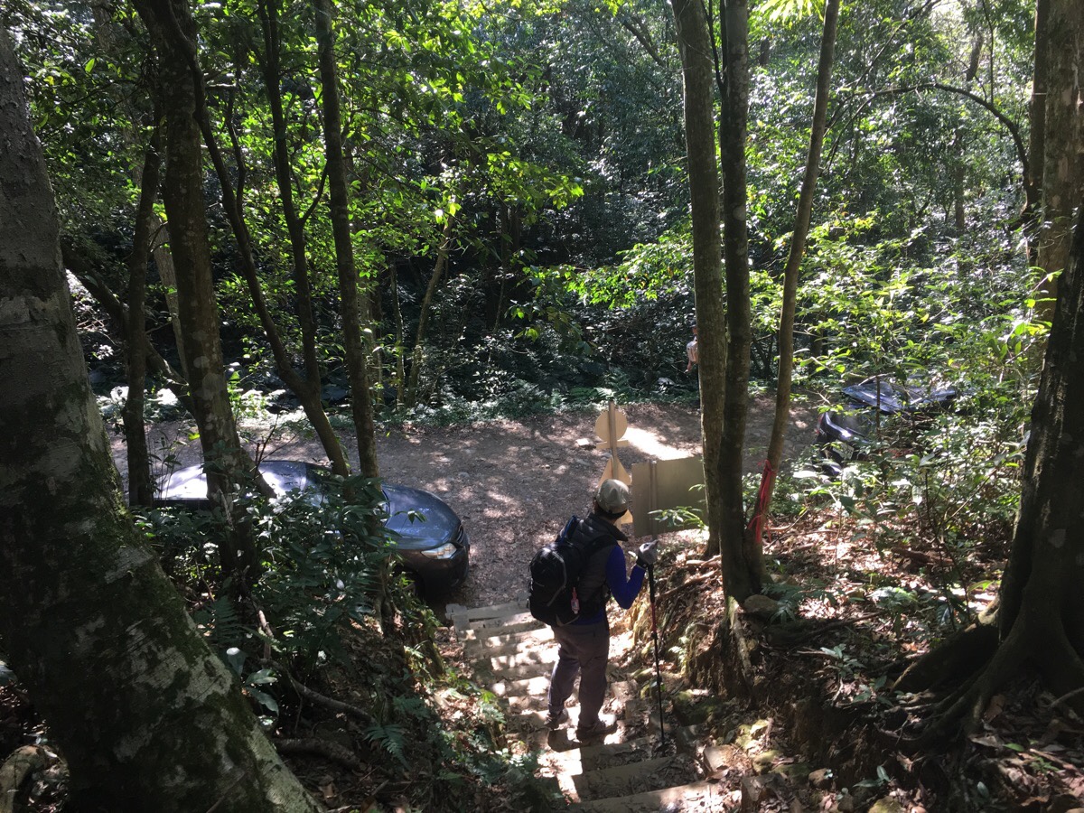
7:56 – About an hour after we started walking, we reached the trailhead proper. There was one car already parked up here, and space for many cars, so clearly many people do manage to drive up. Actually, I don’t think it was necessarily a bad thing that we’d walked to this point since it meant that our muscles were nicely warmed up by some gentle uphill walking before we had to tackle the harder portion of the climb, (although on the way back I wouldn’t have minded skipping the downhill road section).
We stopped for a small snack, Teresa finished the remainder of her breakfast fan tuan and I had some crackers. Suitably refuelled we set about the main slog of the hike. This is where the second quarter of the hike starts, and it is without doubt the most tiring part.
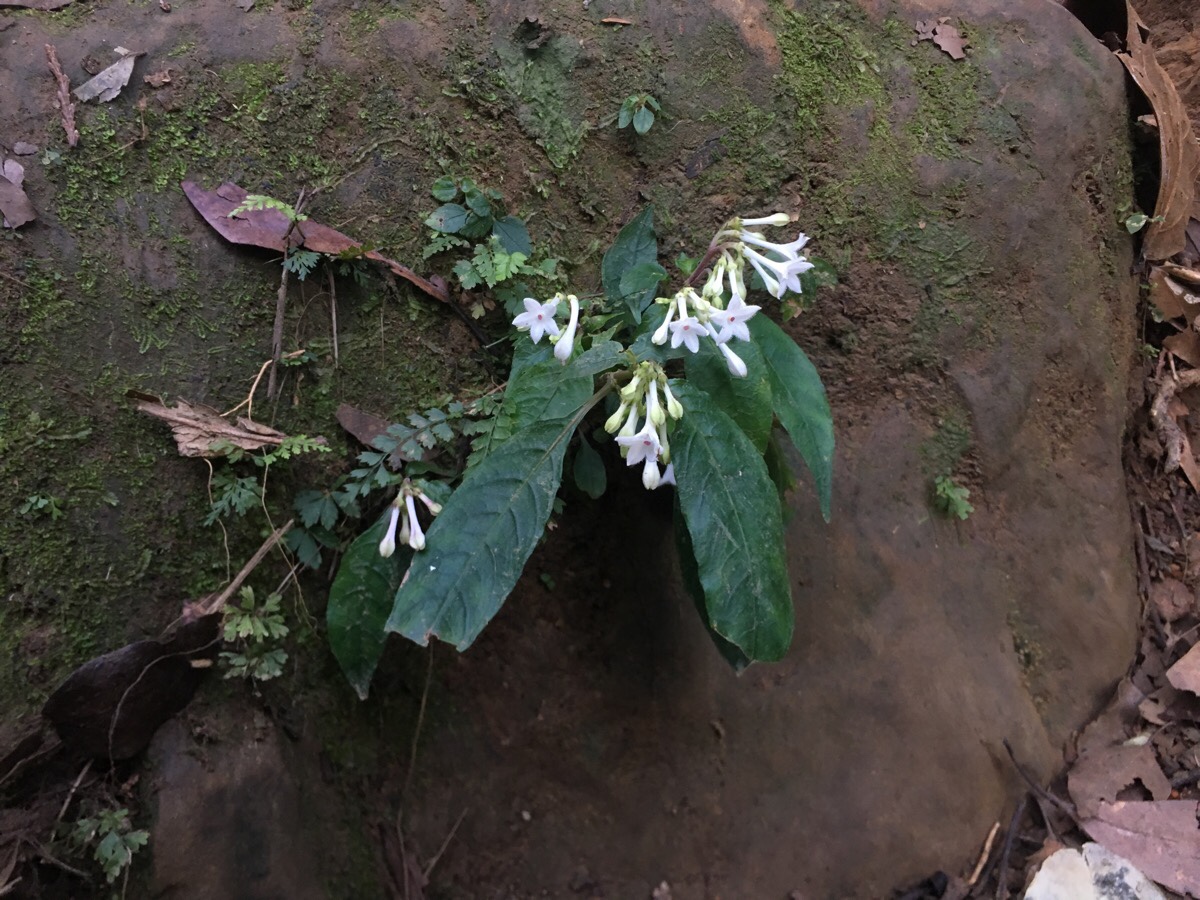
Not long after setting off we started to see many of these small white flowers dotting the rocks and roots around the trail. I’m not sure what they are, but they had a pleasant, sweet fragrance. Further along I saw several 胡麻花 and some delicate looking violets.
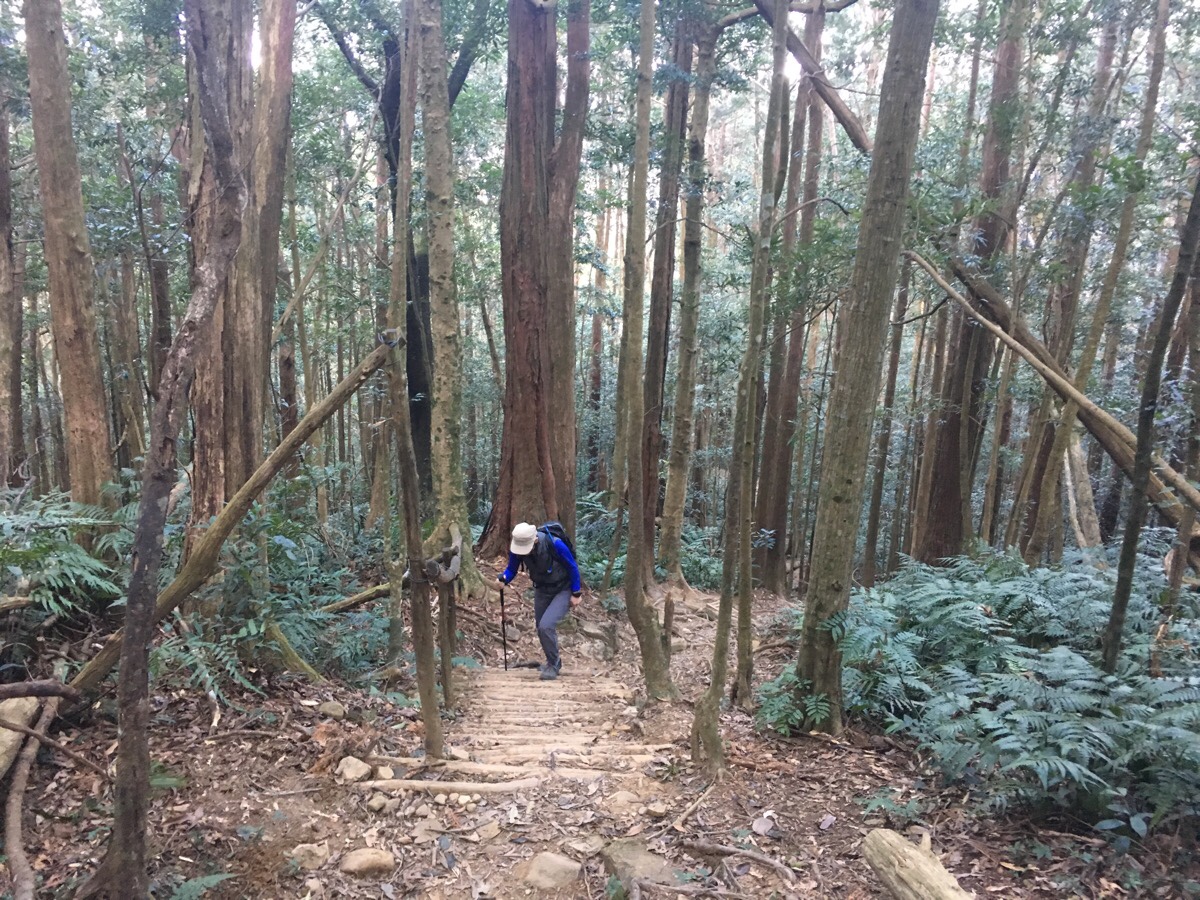
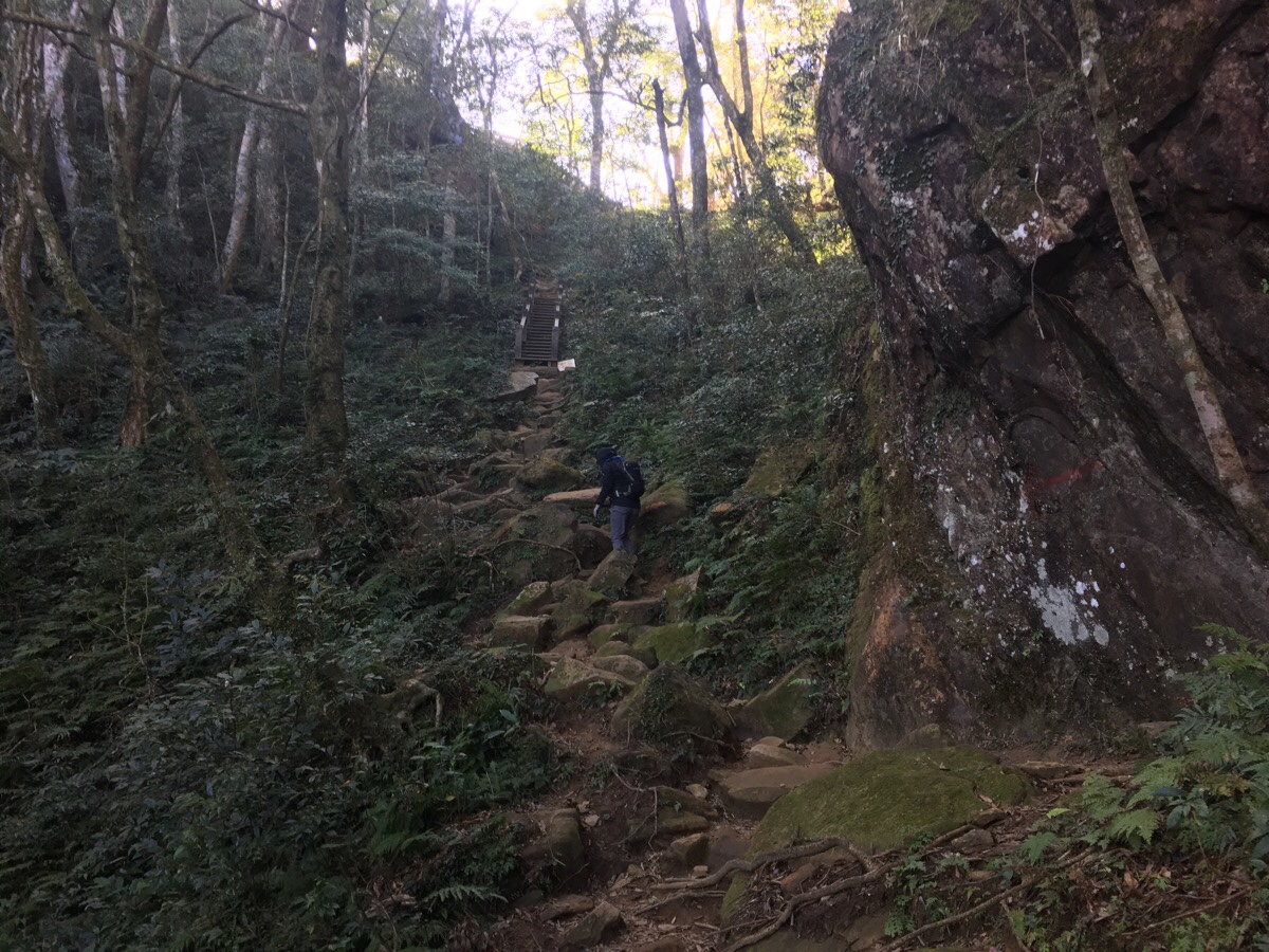
This section of the path is a constant climb. I felt we made pretty good progress given that it was kind of steep. Perhaps it was the cooler weather, or maybe the warm up, but it really didn’t feel too tough. The floor is mostly roots, small rocks and earth, but there is the occasional flight of stairs made of wood.
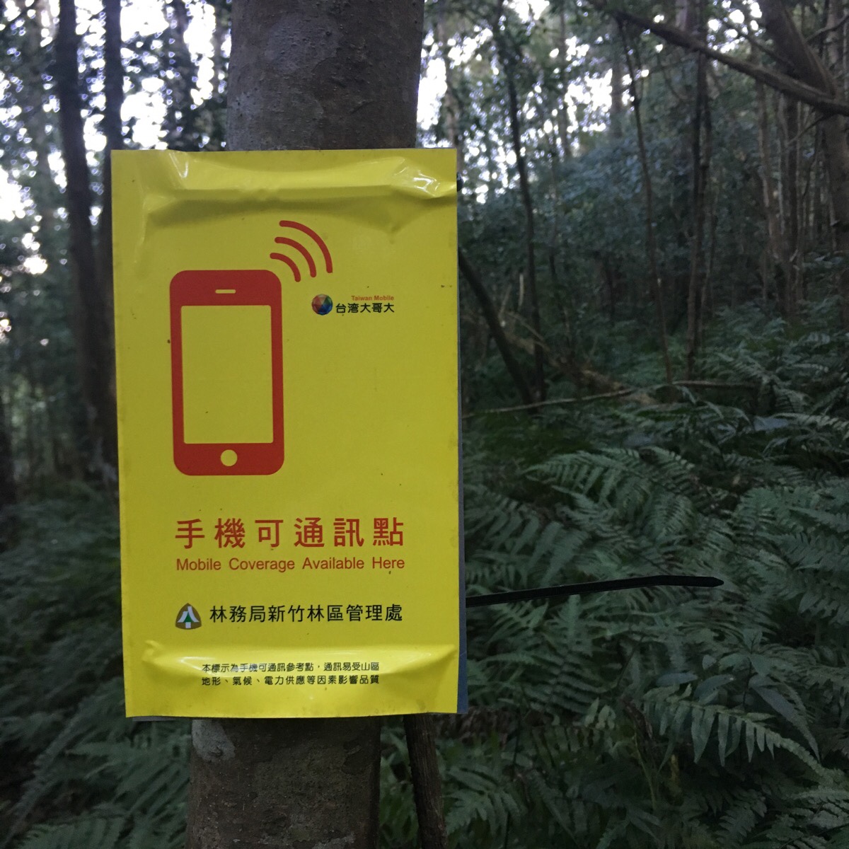
One thing that we saw on this hike that I’ve never seen anywhere else were these signs advising that the area has mobile network coverage. I am guessing that the local organisation managing trail maintenance put these in because it is a relatively accessible, relatively straightforward climb and is therefor likely to draw in a greater number of casual hikers or people who aren’t so accustomed to this kind of trail. There are a couple of media stories of people having to be helped back down, so perhaps it is anticipation of such kind of incidents.
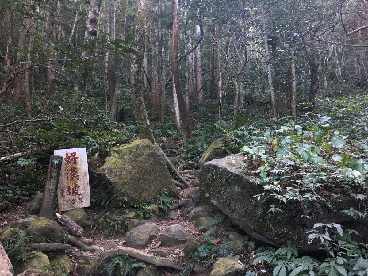
08:32 – 600 metres into the climb since the trailhead we arrived at 好漢坡. This means something like heroes slope, tough guy slope, or the slope of real men – basically it equates to if you can make your way up here, then you’re a badass, or in other words, the next bit is steep. For me, it wasn’t the steepness so much as the constant switchbacking that got tiring. It is clear that I am not the only one who felt this way, because the trail workers have had to erect signs encouraging people not to damage plant life by taking shortcuts.
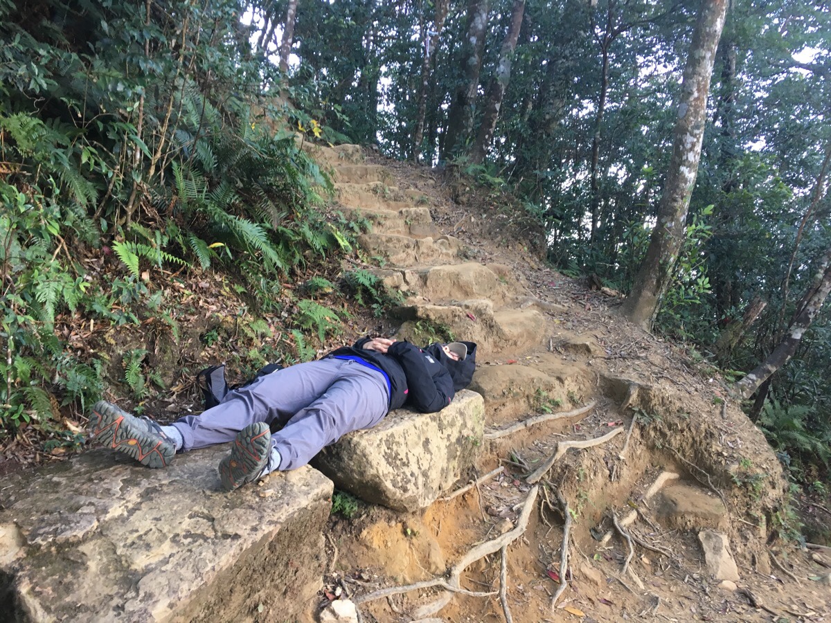
08:51 – I wasn’t sure if the heroes slope had ended or not, but there was a slightly flatter area with wooden benches to rest on. We stopped awhile, but either there was a short and quick change in the weather, or this particular section catches a lot of wind, because it was a little too cool and blowy to sit around for long. Besides, just a short push further there is a much better place to rest.
9:10 – We arrived at another small, flat clearing where three large, flat rocks form a series of natural benches. Almost before looking at the view, Teresa saw an opportunity for a nap and seized her chance. (This was already the second nap of the day, the first occurred in the car outside a 7-Eleven in Wulong.
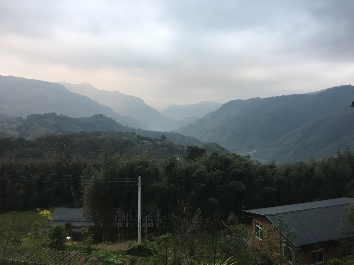
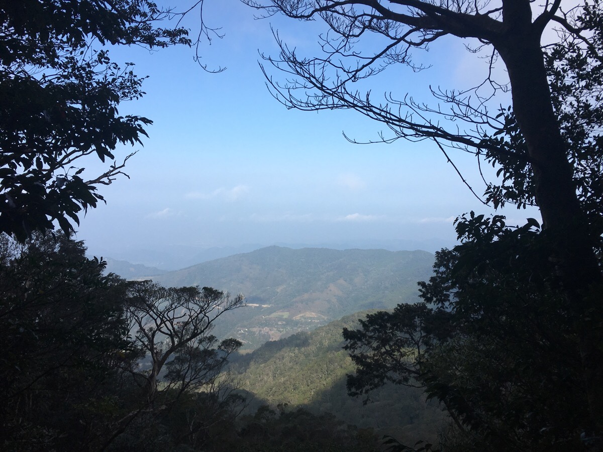
While she made the most of a comfy flat surface and her cat-like ability to catch forty winks in almost any situation, I saw an opportunity for coffee. I’d managed to make the coffee, put away the stove and sit to warm my hands and watch the clouds casting drifting shadows over the trees in the valley below before her allotted wake-up call time arrived.
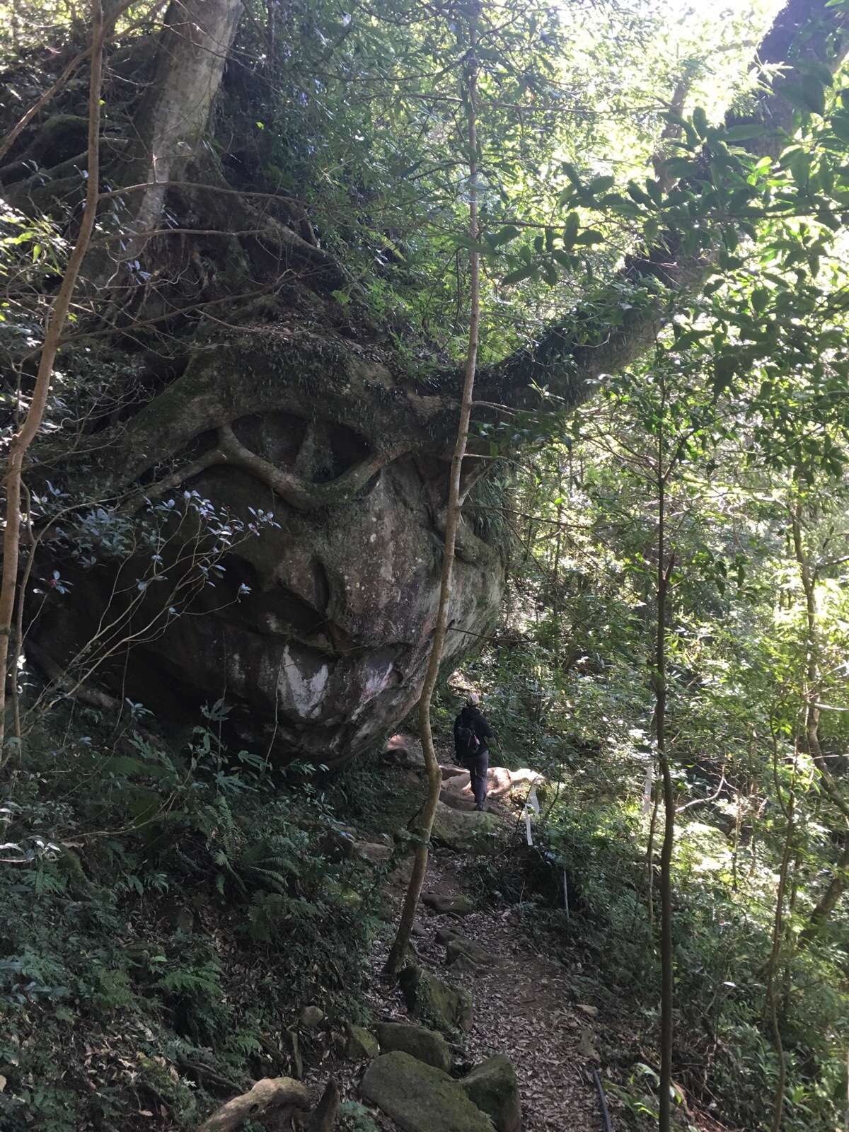
09:39 – The path scales a boulder and skirts around a larger rock face. Here the angle of the hill seems to shelter the trail from the wind, because it was almost as if we entered a different world. The breeze died back completing, and after one final set of stairs we were approaching the ridge.
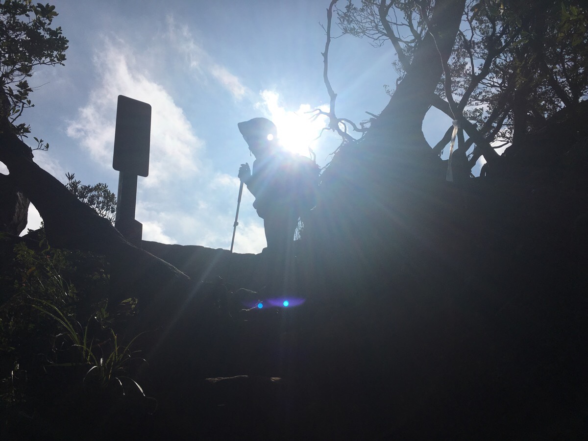
Not only did the wind die back, but the sun broke through. It was magnificent.
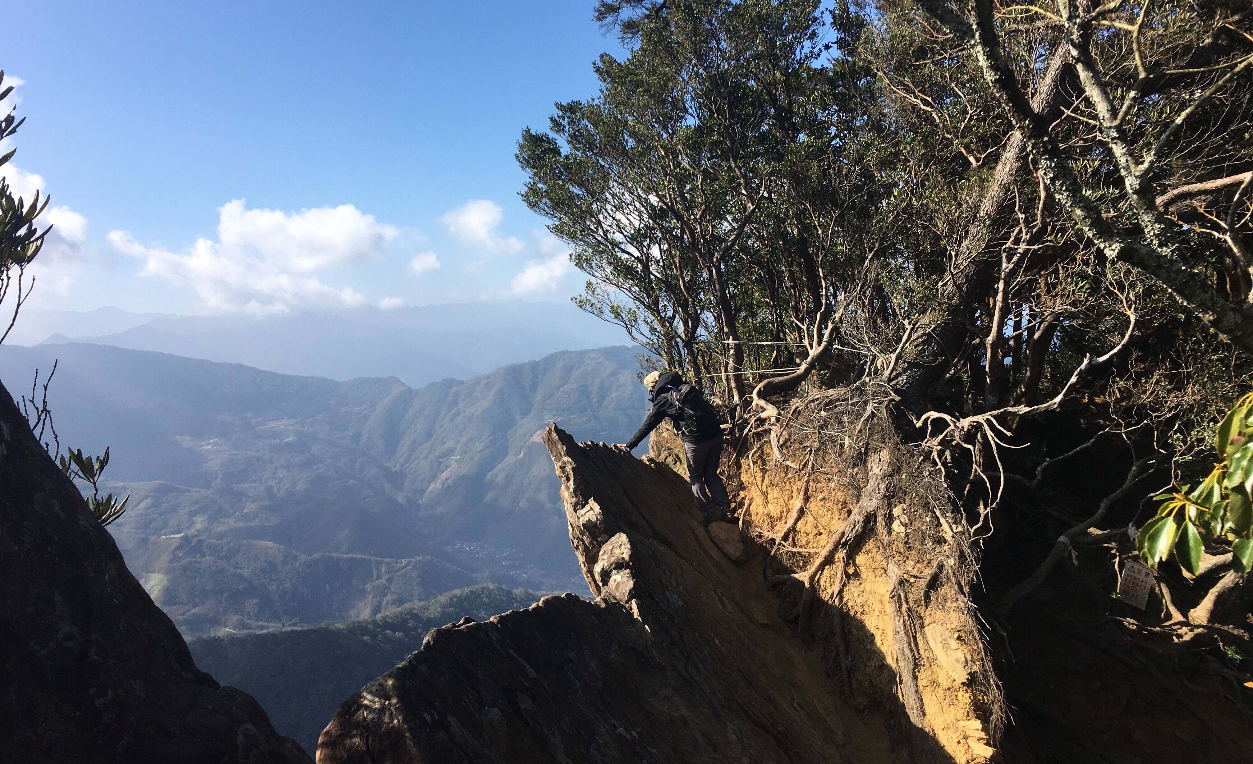
This is the most exposed section of the hike. It looks like at some point in the not too distant past, a tree has pulled away from a slightly overhanging jut of rock.
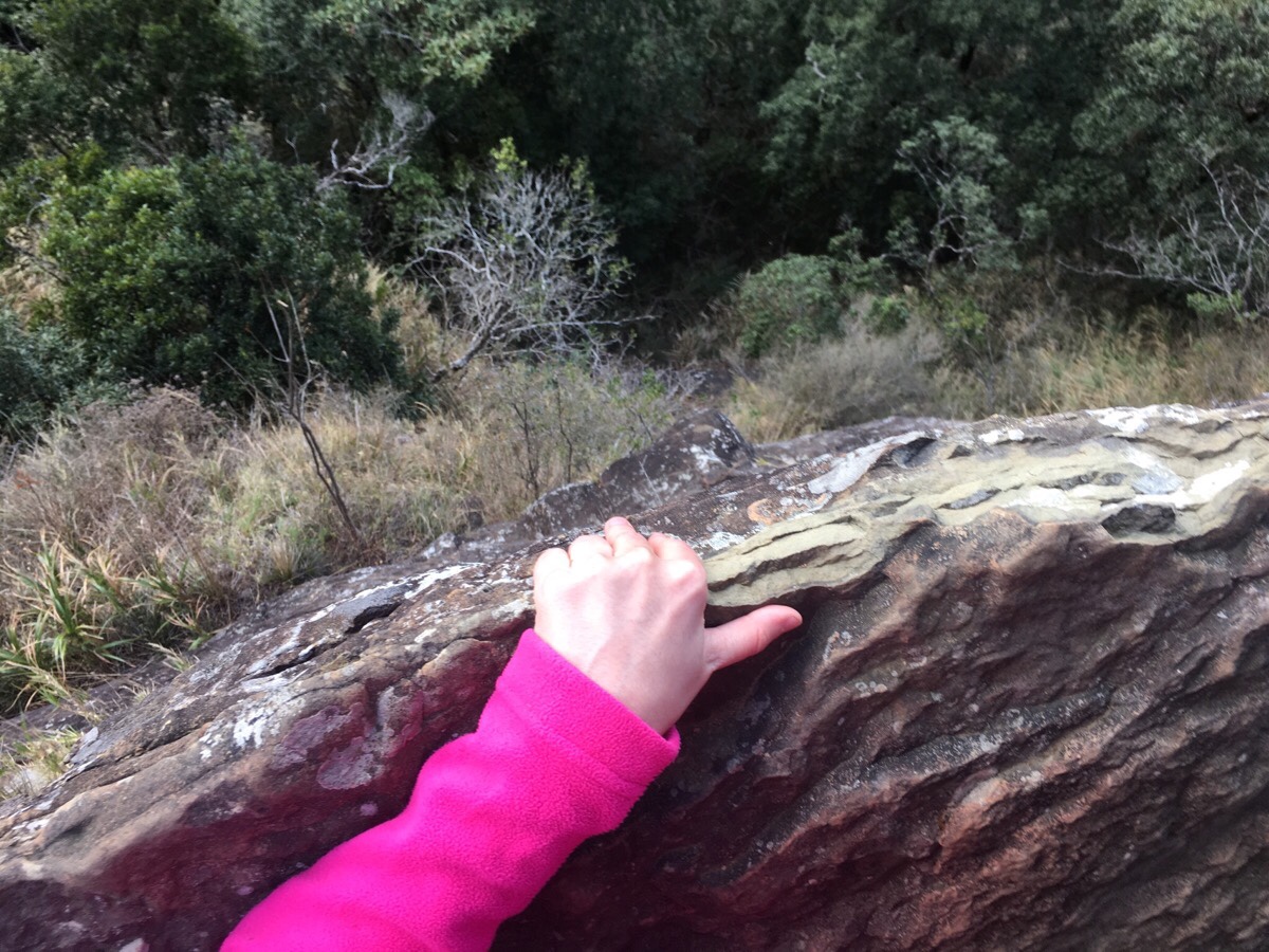
If you lay with your belly flat to the rock there are great views to be had, almost as if you are flying over the valley. When we arrived at about 9:45, the slope of the mountain easing up to the left was still in shadow, but the sun had spread itself across the land to the right of us and it was beautiful – that kind of sharp, cutting light that you get when you’re slightly higher up and away from all the city smog. Despite not liking heights all that much, I felt safe laying against the cool stone and wanted to see what was below me – it wasn’t as terrifying as I’d imagined.
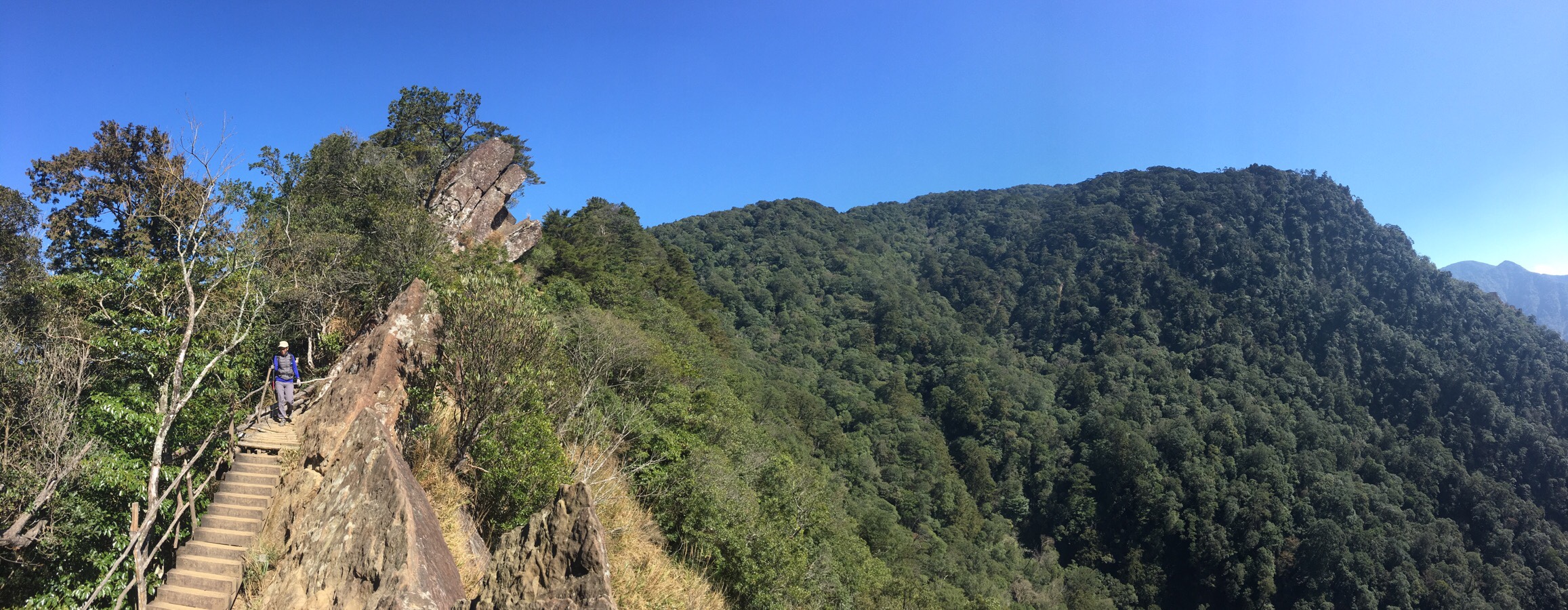
09:52 – We’d been completely alone up until this point, but whilst we were looking at the view we started to hear voices approaching, so we left to let them enjoy the lookout spot by themselves. From here we entered the third quarter of the hike – the ridge line. Anyone who has read a few of these may well have heard this before, but ridge walking is probably my favourite kind of walking; the hard part is mostly done, there are (often) views to both sides, and the vestigial part of me which has some animal instincts is happy with being the one at the highest vantage point. This hike was no exception, it was a great bit of ridgeway – not quite long enough!
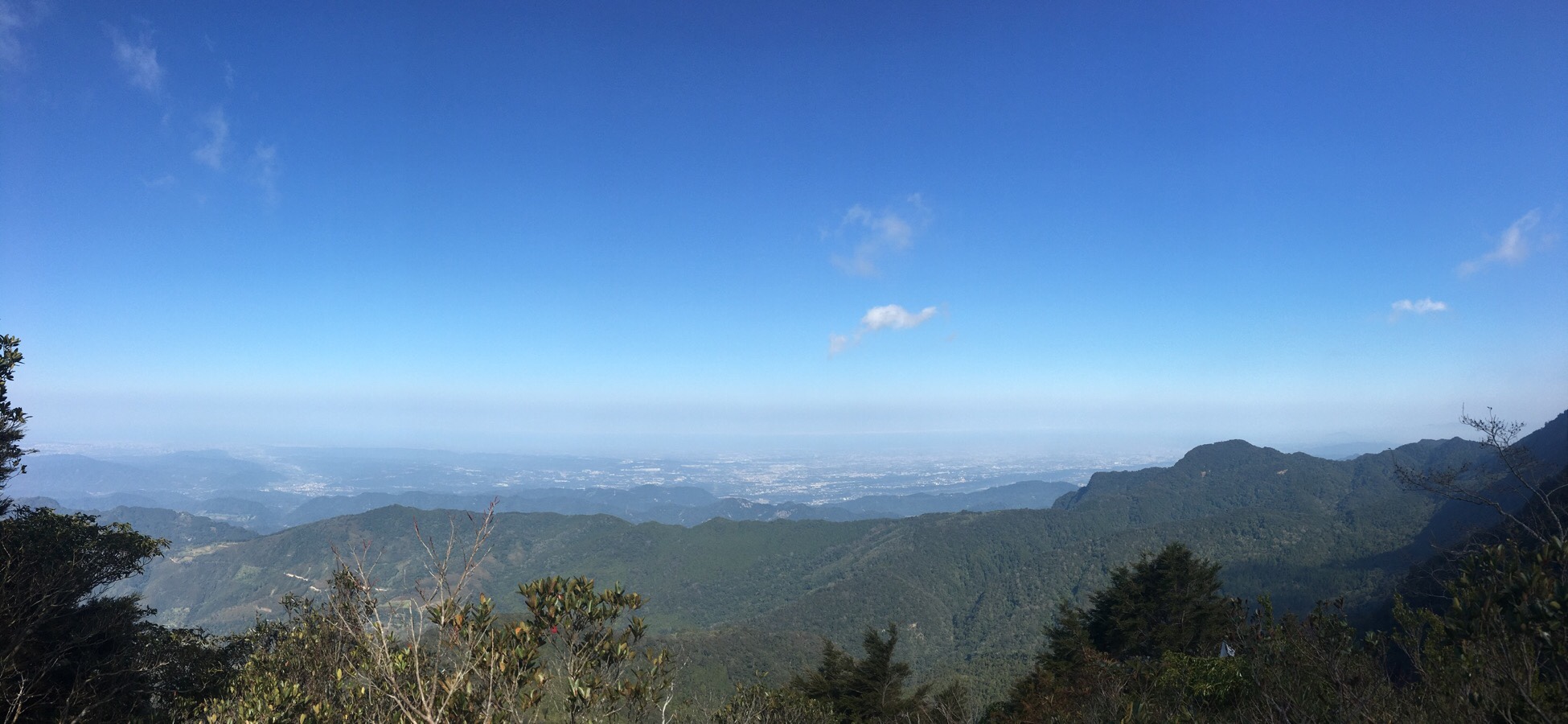
10:00 – A subtle fork in the path either sends you around the side of a small peak on the ridge, or else up it. We went up, because up always holds the promise of better views, and indeed we weren’t disappointed. By this point we had climbed high enough to see over the nearest other ridge to the north and to my surprise we were able to see all the way back to Taoyuan, where we’d started our journey that morning. Whilst were busy trying to work out what we could see, the people who were walking behind us caught up and overtook via the lower path.

Just beyond the peak, a short portion of the trail runs through beautifully weather warped trees. Here the sunlight picks out dramatic shadows through the branches and over the roots, and the floor is all springy. From this point, the path drops down a short way to arrive at a rest area and junction.
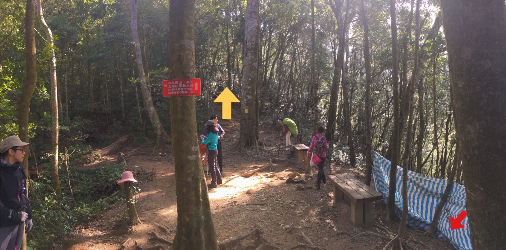
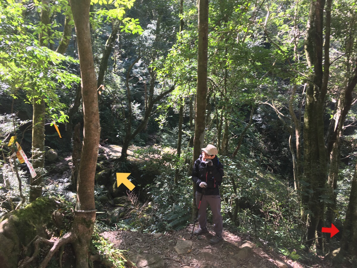
10:14 – We arrived at the rest area seemingly at exactly the same time as everyone else, (despite having had the head start). Everyone else was busy having a short sit down and snack, so we did likewise. However, one of the groups was comprised of precisely the kind of people who are want to set Teresa’s teeth on edge. A group of (probably) recently or nearly retired hiking veterans with particularly loud men started asking the other family group where they planned to go. The family group stated that they just planned to do the loop around to see the giant trees and then head home, but this caused the older hikers to scoff and say they were too soft. Actually, this irritates me too, people can choose to enjoy the outdoors how they want, (so long as they look after it), there is no right or wrong length of difficulty of hike, and it is generally a smart idea to slightly under aim, that way you don’t end up requiring anyone to go and rescue you. In order to avoid having our choices questioned, (and to prevent Teresa from becoming angry), we didn’t hang around long before setting off again. As we were getting ready to set off, one of the annoying hikers started loudly proclaiming to all that he had brought a huge number of bananas with him (I forgot if he said eight or nine) as sustenance for the walk. That number of bananas isn’t dangerous as some sources claim, however the thought of eating my way through nine bananas that have been bashed around in a backpack makes me want to gag.
We left via the almost straight on path and returned later via the one on the right (red arrow indicating the direction we walked the second time we passed by here).
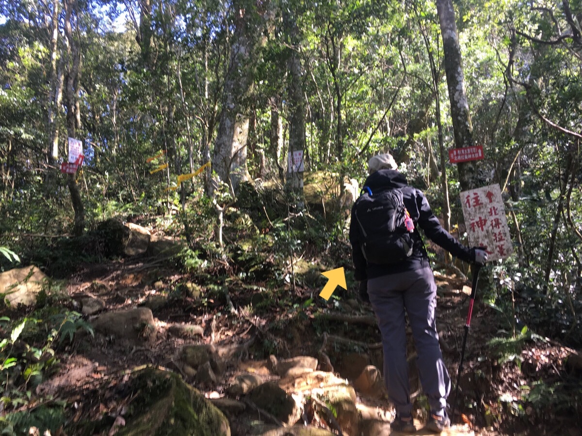
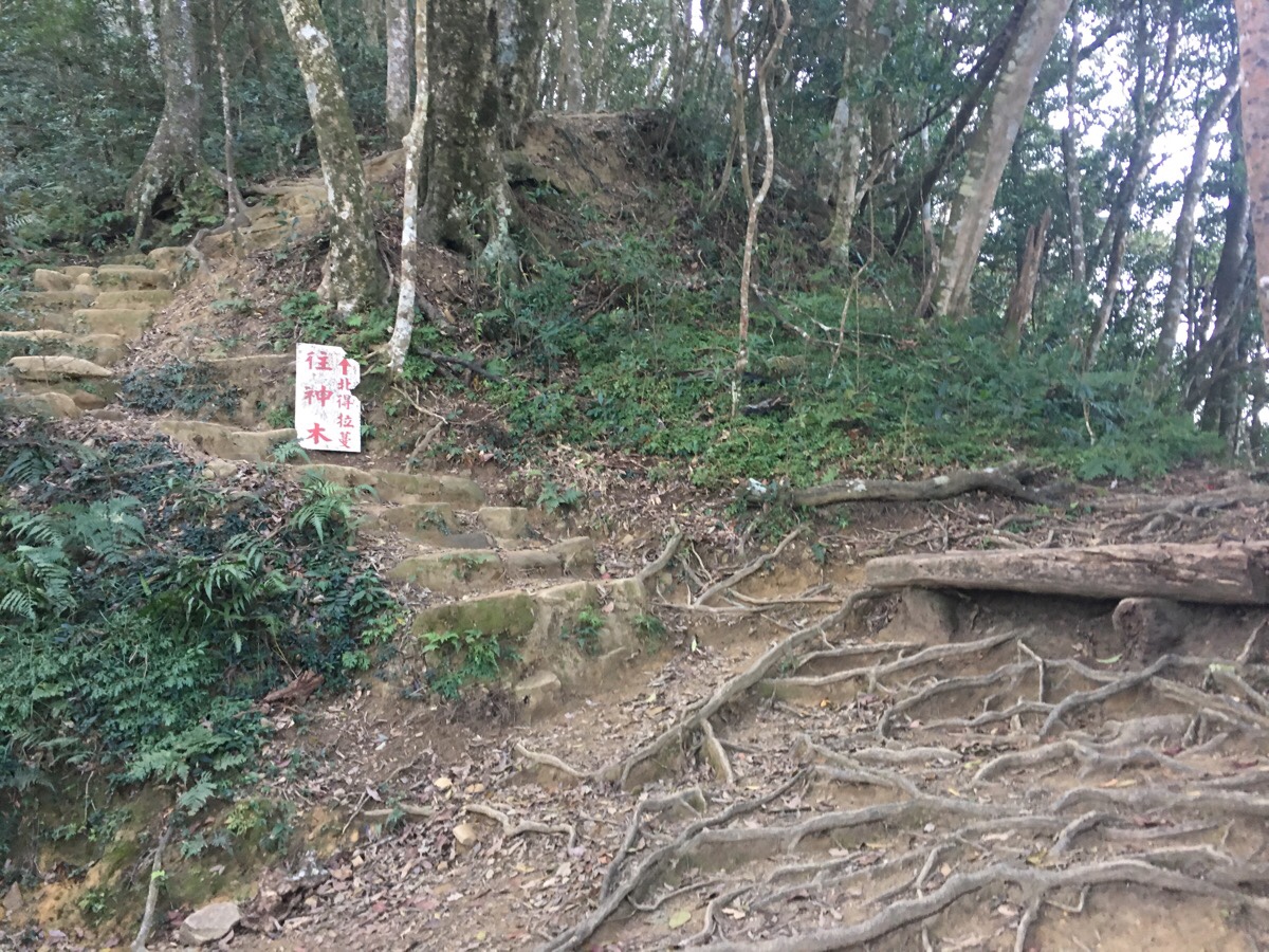
10:30 – Very shortly after settling off, we reached another junction. The route on the left goes up to Neiniaozui Shan (內鳥嘴山), and given how early it was in the day, we totally could have done it. However, for once we opted for the shorter route. Actually, I opted for the shorter route, I didn’t really tell Teresa it was a choice. I made this choice partly because I am still working out what my foot is capable of doing now, and partly because I felt like having a stress-free walk. By heading right, I knew we’d have know trouble getting down with plenty of time to spare. (I am a huge worrier, so even though we are equipped to finish the walk at night, I never plan to do that if it’s avoidable.)
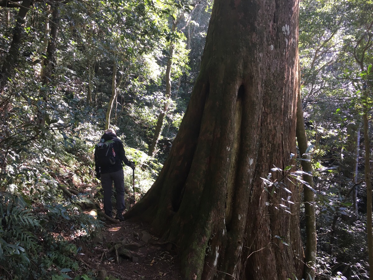
This loop section constitutes the final quarter of the walk – for the whole of it it feels like you have shrunk and are scrambling around in a much bigger, older world than you’re used to.
The trees are big. Huge, in fact. And the stones are big too – almost the size of small houses. Every time I am able to cross over into this world I feel the closest I ever feel to a spiritual experience. This type of forest at this elevation even has its own special acoustics, similar to those of a cathedral. Even if you close your eyes, you can still hear the vastness of the space.
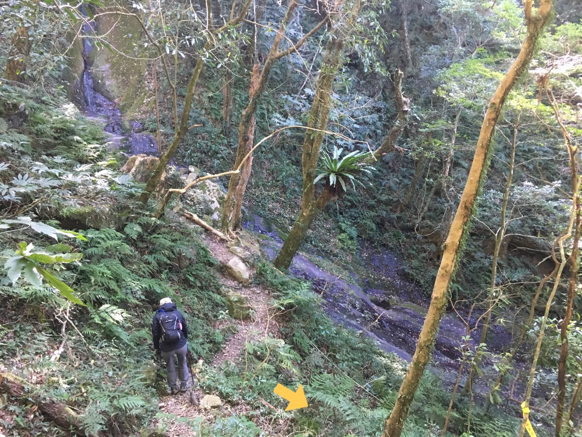
10:46 – We arrived at the waterfall, actually the path here goes both left and right. Left is the return leg of the longer loop going to 內鳥嘴山, so we ignored that and headed right.
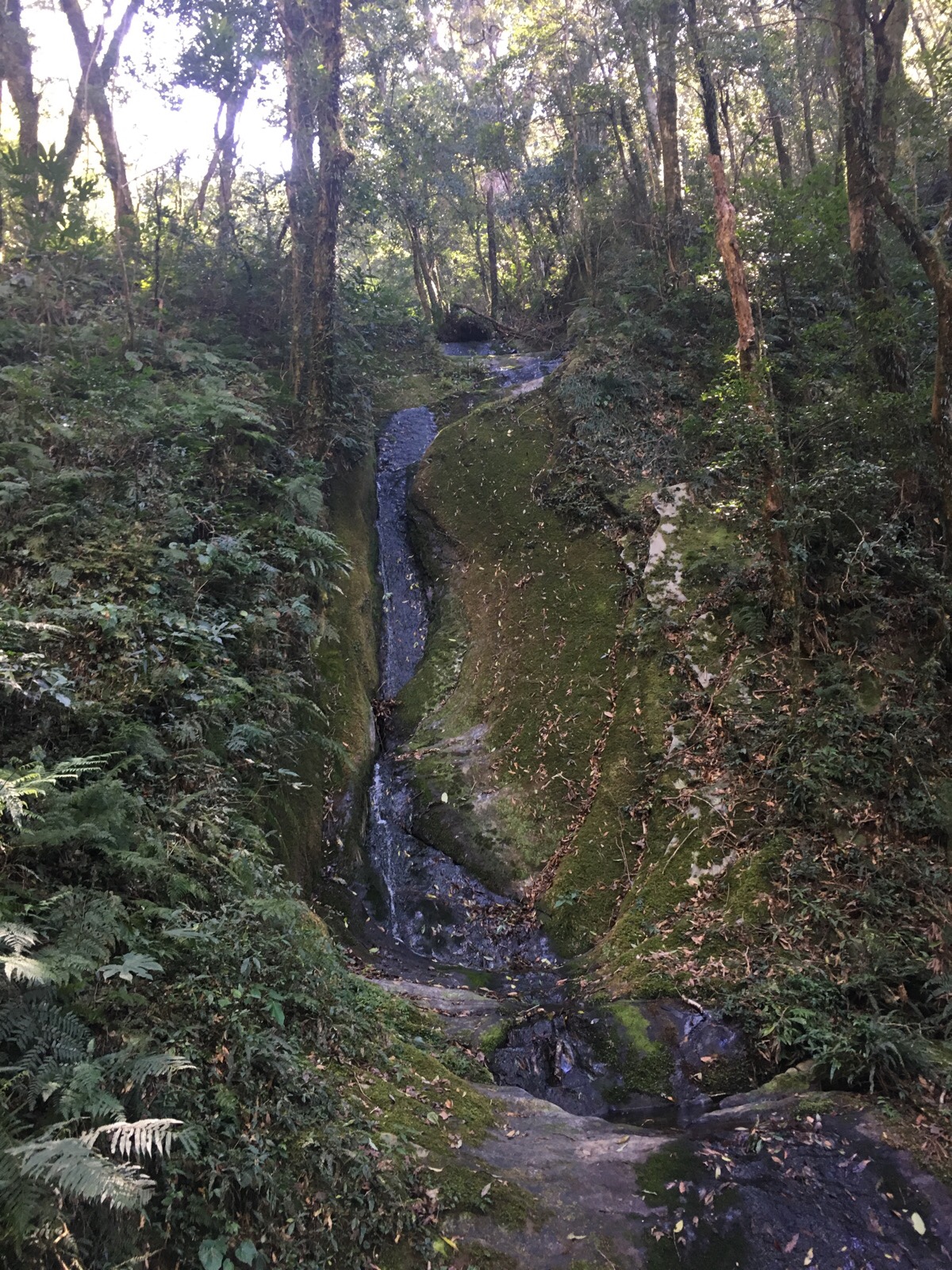
But not before pausing to take in the waterfall. Since we’ve not had much rain recently, there wasn’t a huge volume of water passing through.
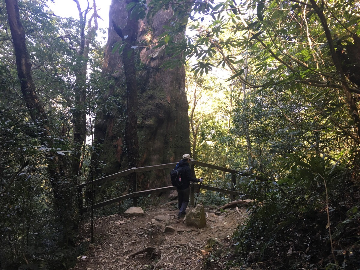
10:56 – The first giant tree you meet rises up from the forest floor protected by a fence. Approaching it from this side, you can’t see that it is hollow in the middle, but as soon as you go round the front you will notice. We didn’t take our photographs standing so close to the tree because I didn’t want to add to any damage that might caused by people trampling on its roots – the fence is there to protect them. However, the fact that the fence is broken suggests that most people aren’t too concerned about this.
11:21 – A brief walk down from the first tree, the main path turns right abruptly. There is a spur path heading left here, and we spotted what looks like a dry creek bed where big, flat rocks beckoned us with their lunch-suitable surfaces. There are also two (maybe three, according to the maps) more giant trees in a small loop here, but the trees have been waiting an awfully long time for us to visit, so we figured they wouldn’t mind if we made them wait a little longer while we ate.
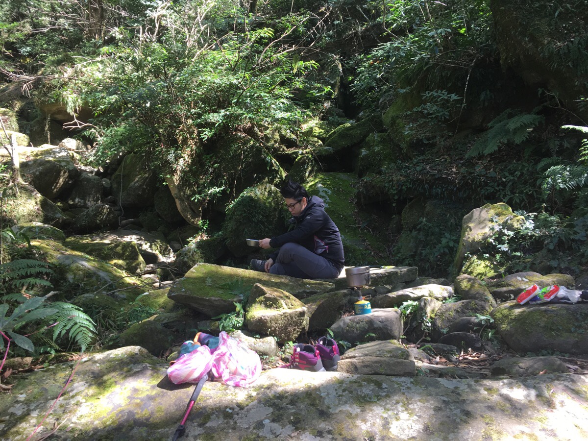
I normally don’t take my shoes off while walking, even when we stop, but there was just something so inviting about the cool rock that I felt the need to feel more directly rooted to nature, so the shoes and socks came off immediately.
The other reason for choosing this location is that it was the biggest, flattest space away from all trees, and therefore the safest, (signs along the trail said no campfires, and whilst we weren’t cooking on a fire, it still seemed better to do it in an open space).
While we were eating our food, an aboriginal family cafe walking by, the guy was carrying a huge machete and waved it around happily and expressively as he asked if I was Spanish. We ended up walking behind them and seeing them at several points along the trail, apparently, they live in the area and had just come out for a family walk to pass the holidays. Notably, despite the fact that many mountainous areas are known for being aboriginal hunting grounds, this is only the second time I’ve met and talked to any walking on the trail for recreational purposes, (and I have talked to many people in the hills of Taiwan).
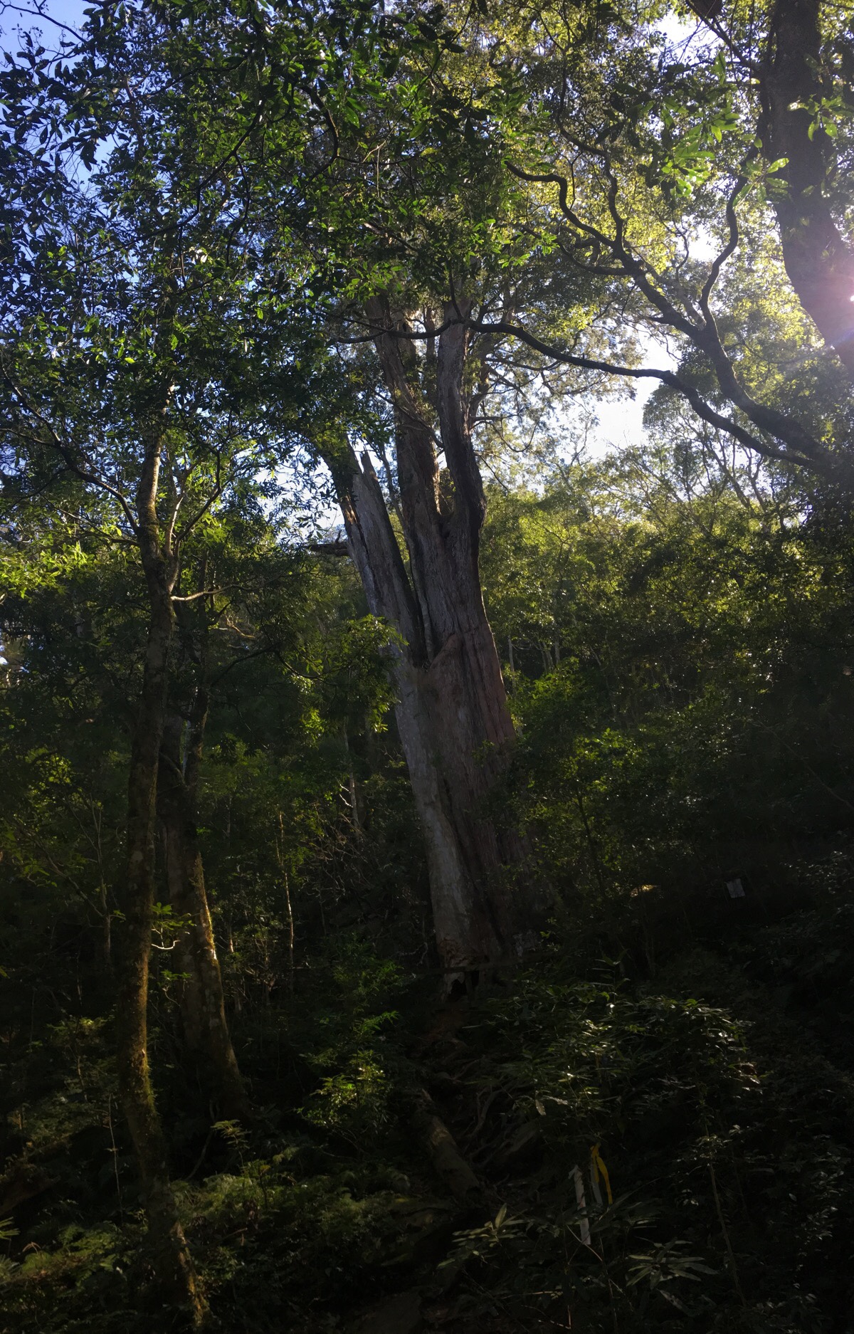
After finishing and packing up, we made the short loop to visit the two (maybe three…) giant trees where they have been calmly presiding over the forest for many years. One slants out slightly wonkily away from the slope. The other just stands quiet and queen-like in its clearing – receiving visitors and admiration.
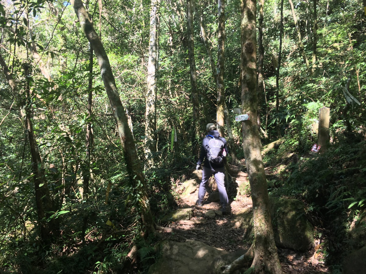
12:42 – Back on the trail again, we carried on back towards the clearing that we’d passed through at quarter past ten. The forest continued to be charming. More importantly, our recent refuelling and the smaller, gentler up-and-down-ness of the path meant that I was fully able to enjoy being in such lovely surroundings.
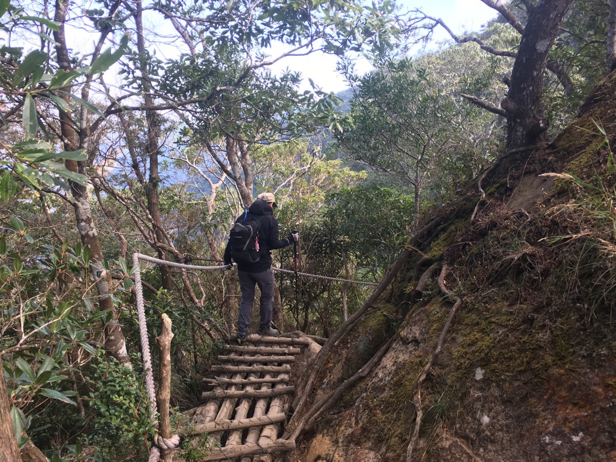
12:53 – Shortly before returning to the clearing with the benches, the trail crosses a wooden bridge and then climbs steeply. By 12:59, we had already completed the loop and were just embarking on the return journey of the hike.
By the time we reached this open portion for the second time, the sky had well and truly cleared, and was showing us the brightest, most happy shade of blue that it possibly could, and the sun had burned away the last of the clouds.
Heading down, we were more clearly able to appreciate just how much switchbacking the trail involves. I also personally found it harder than the upwards journey. My toe injury/defect means that I have to be really careful about how I tread. I have to recheck to make sure that my shoes are tightly laced and that I don’t angle my foot so that it is pressing against the toe in the shoe. The hiking poles helped quite a bit and this walk gave me some confidence that with the right management and some extra care on my part, it doesn’t have to be as restrictive as the doctor suggested.
We made it back to the trailhead at 14:07, and back down the road to the car about an hour after that. It really was a pleasant experience to finish with plenty of time left before it got dark. We were planning to pull over in a lay-by the Beidelaman side of Neiwan for a nap, but insane holiday traffic put that on hold and we ended up stopped just past Hesing Station instead. I must have been knackered, because I managed to get some very rare sleep in the back of the car within a few minutes of laying down in the back.
How to get to Beidalaman Trail
Google maps address: The trail head proper is at: 北得拉曼巨木步道, 313 Hsinchu County, Jianshi Township, 新樂村. There is space here for quite a large number of cars, however the road surface leading up to here is kind of poor, so if your car has not so great suspension, you’re might want to either switch to a scooter (which will be bumpy), or park further down the road.
GPS location: we parked at N24 44.599 E121 16.109 which is right at the start of the smaller road. Between there and N24 44.659 E121 16.420 we saw a few more possible places for parking up on the side of the road, but it wouldn’t have been good for the car to go beyond that. The trail head proper is at N24 44.325 E121 16.788.
Public transport: if you want to try and do this by public transport, it’s going to be a two or three-day thing. You can get as far as Neiwan by train and from there, you might be able to find a taxi driver to take you to N24 44.599 E121 16.109, (and maybe some local hotels in the area would be able to arrange a taxi service). On the way back, it might be harder, but if you make friends with the right people on the trail, you should be able to get a lift back down to the main road. We were offered a lift by the Aboriginal family that we’d talked to, but by the time they drove past us, we were only about 300m away from the car.
Further reading: the grandfather of all English language Taiwan hiking information has done a post on this walk, (which has since gone offline, so it can only be accessed through the Wayback Machine), and usually that means that several other people will have done it and written about it, however in this case the information is pretty scant. There is, however, loads of information written on the subject in Chinese.
Beidalaman Trail Map
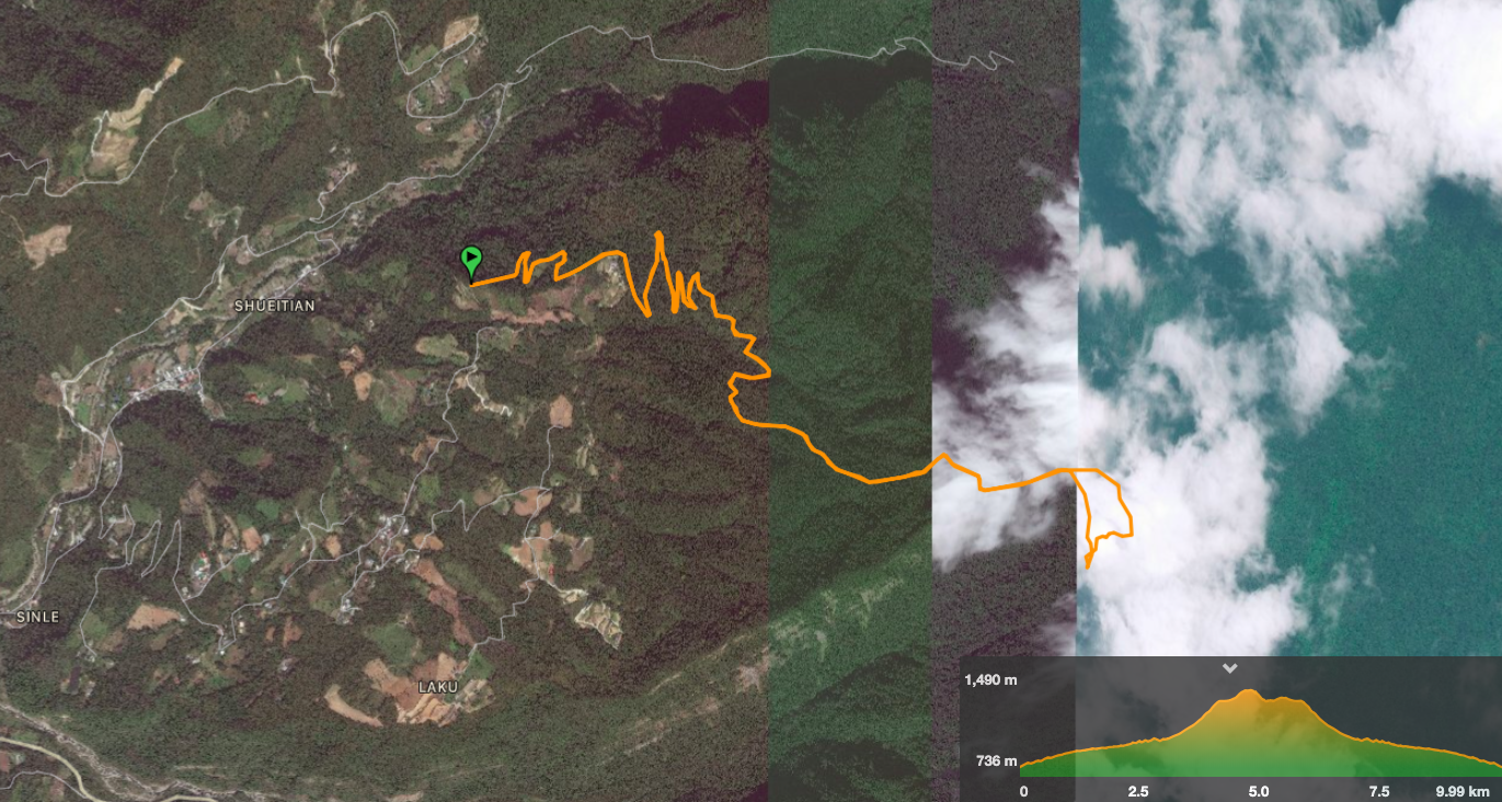
GPX file available here on Outdoor Active. (Account needed, but the free one works just fine.)
My new words learnt on this hike:
- 有捨才有得 / yǒu shě cái yǒu dé / something like you have to sacrifice to gain, something bad may come of something good, or no pain no gain
- 搖 / yáo / shake – actually I knew this from the phrase 搖尾巴 (wag the tail), but I hadn’t realised that it meant shake.
- 藉口 / jíkǒu / excuse
- 你(到底)會不會聊(天)/講(話) / nǐ (dào dǐ) huì bù huì liáo (tiān)/jiǎng (huà) / do you even know to have a conversation, or you have no conversational skill. Recently I’ve been more aware of a few similar uses of this sentence pattern “你煩不煩?” and “你行不行?” They’re used to imply that the person being spoken to is the negative option, ie 不會聊天, 很煩 and 不行.
- 騙吃騙喝 / piàn chī piàn hē / the literal translation is something like trick eat, trick drink, but Teresa used it to describe her English ability. Someone said to her “your English ability must be pretty good”, she replied with “
- 栽培 / zāipéi / cultivate, grow (can be used for children).
- 嫁雞隨雞,嫁狗隨狗 / jià jī suí jī, jià gǒu suí gǒu / literally ‘marry a chicken, follow a chicken, marry a dog, follow a dog’ – it is an idiom which means something like ‘you must go with who you marry’.

Looks really great but not easy, I like the network mobile coverage, never see that before! and the nap!
LikeLike
It really was great. As for difficulty, I would say that it is more tiring than actually difficult. Unlike a lot of mountains like this, there weren’t really any dangerous parts, so I guess that’s why there were more teenagers doing this walk. And like yourself, I’d never seen those signs before, but I guess it kind of makes sense in places like this (or Yuanzui Shan), which are likely to attract those who haven’t got so much experience.
LikeLike
Your blog is amazing! Horizons broadened. Thanks. and nice meeting you the other day!
LikeLike
Hi Jeff, thanks for stopping by to check it out! Likewise, it was a pleasure to meet and chat the other day.
LikeLike
Pingback: August 13, 2021 – CloudBridgeTaiwan