Youluo Mountain is one that had been on our radar for many years. Just a little too far away for a roll-out-of-bed, impromptu weekend walk, and a little too close and too short for a pre-planned destination hike, there always seemed to be some more suitable proposition. Then, the stars aligned on Dragon Boat Festival. We’d both had work and other things to attend to on the first day, and needed a relaxing, nearby adventure to ensure we still felt like we’d got away somehow — Youluo Mountain fit the bill perfectly. Even better, the mist-cloaked trails and tall, quiet trees were exactly what we needed.
Distance: About 6.7 kilometres. 4.5 kilometres is along dirt trail, the rest is on a forestry track.
Time: 4-5 hours. The signs at the trailhead suggest that 4½ hours is an average walking time. We stopped for a lunch break and the whole journey took us about 4¾, and there were definitely a few people who were walking at a quicker pace.
Total ascent: Just shy of 700 metres to a high of 1,762 on top of Youluo Mountain.
Difficulty (regular Taiwan hiker): 4-5/10 — This is a moderately difficult walk. For those familiar with Taiwan’s trails, it is on the easier end of the moderate spectrum. There are steep ascents and descents, rough trails, and the trailhead is up a narrow, winding, single-lane track.
Difficulty (new Taiwan hiker): 6-7/10 — For those newer to hiking in Taiwan, this belongs on the harder end of the moderate scale. In addition to the steep trails and difficulty accessing the trailhead, the signage at the junctions is all in Chinese and the paths are a slippery collection of rocks and tree routes — it takes a while to figure out how to avoid slipping on them.
Risks and dangers: The trails are steep and slippery and the area is often shrouded in cloud, meaning you need to pay close attention to the trail tags to avoid wandering off-course. Additionally, the single-lane track that takes you to the trailhead is littered with evidence of rock falls, so I wouldn’t advise going there immediately after storms or heavy rain.
Water: We took lunch and about 2.5L between the two of us and drank almost 2L in June (35°C in Taipei, around 27°C up where we were). There are no stores near the trailhead, so it’s necessary to bring whatever you need up from Zhudong.
Shade: The trail itself is very shady, but the forestry track on the way back is a little exposed.
Camping potential: There are a couple of spots along this route where it would be possible to wild camp. Some people car-camp at the trailhead. There’s space just off-trail around trail marker 12, and space near the summit of Youluo Mountain. None of these places have water sources nearby.
Mobile network: There is almost no network coverage on this trail. From the start, all the way until we rejoined the forestry track at the far end, neither of us had signal (we’re with Chunghwa and Taiwan Mobile).
Enjoyment: If you have a hankering for gorgeous forests, this is a great choice. It’s also the perfect length for a relatively casual weekend trip from Taipei.
Other: Hiking sticks are a good idea (especially for the descent), and you might also want to take gloves if you’re not keen on touching muddy roots/grabbing tree trunks.
Bathroom facilities: There are no bathroom facilities at any point along this route.
Route type: Loop
Permit: None needed
Jump to the bottom of this post for a trail map and GPX file.
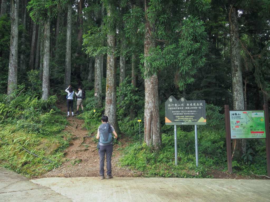
We arrived at the trailhead at about 10:00 and found it so full that the cars had spilled out to park on the verge for a couple of hundred metres. I’m an early start, early home hiker by nature, so I found this a little disconcerting (Were we too late? Would we find ourselves among hoards of other hikers?) but as it transpired, I needn’t have worried — we’d accidentally timed it just right.
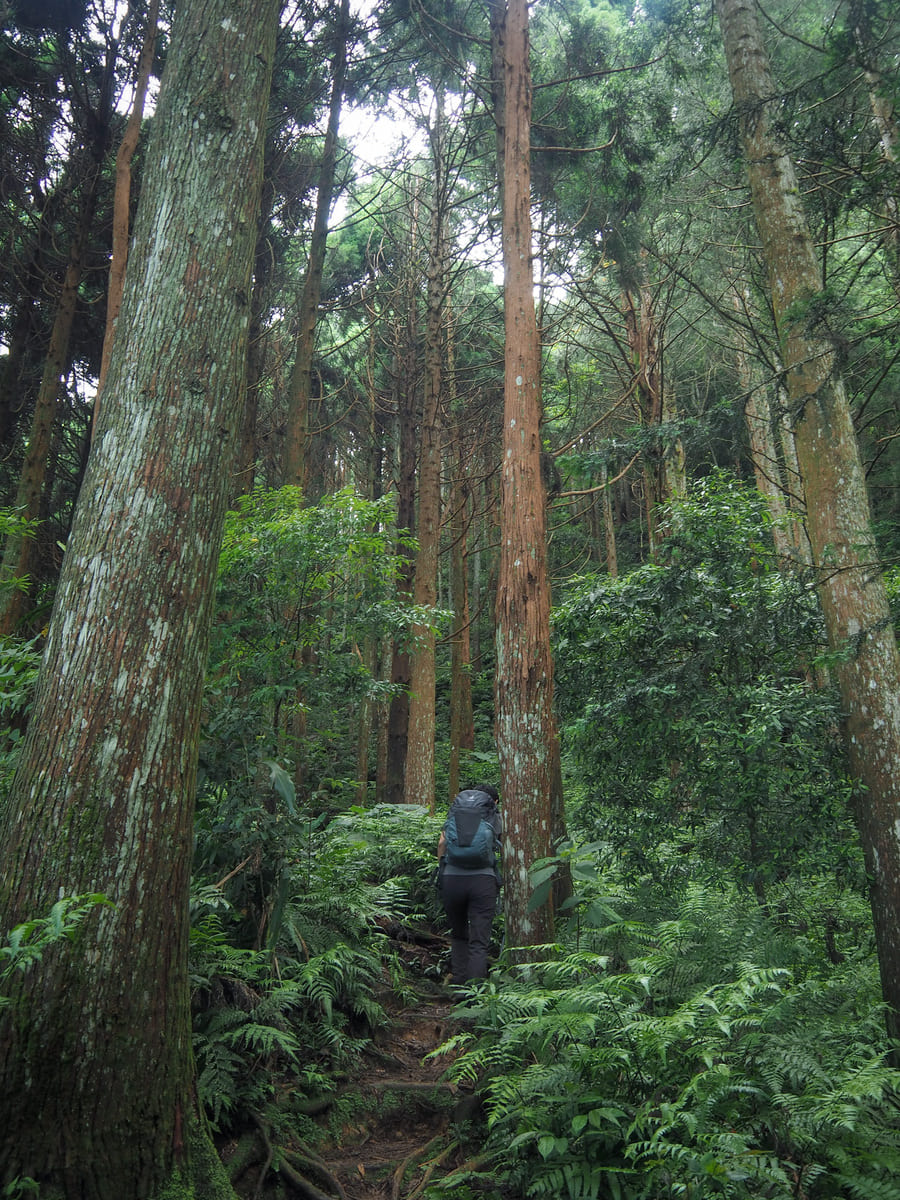
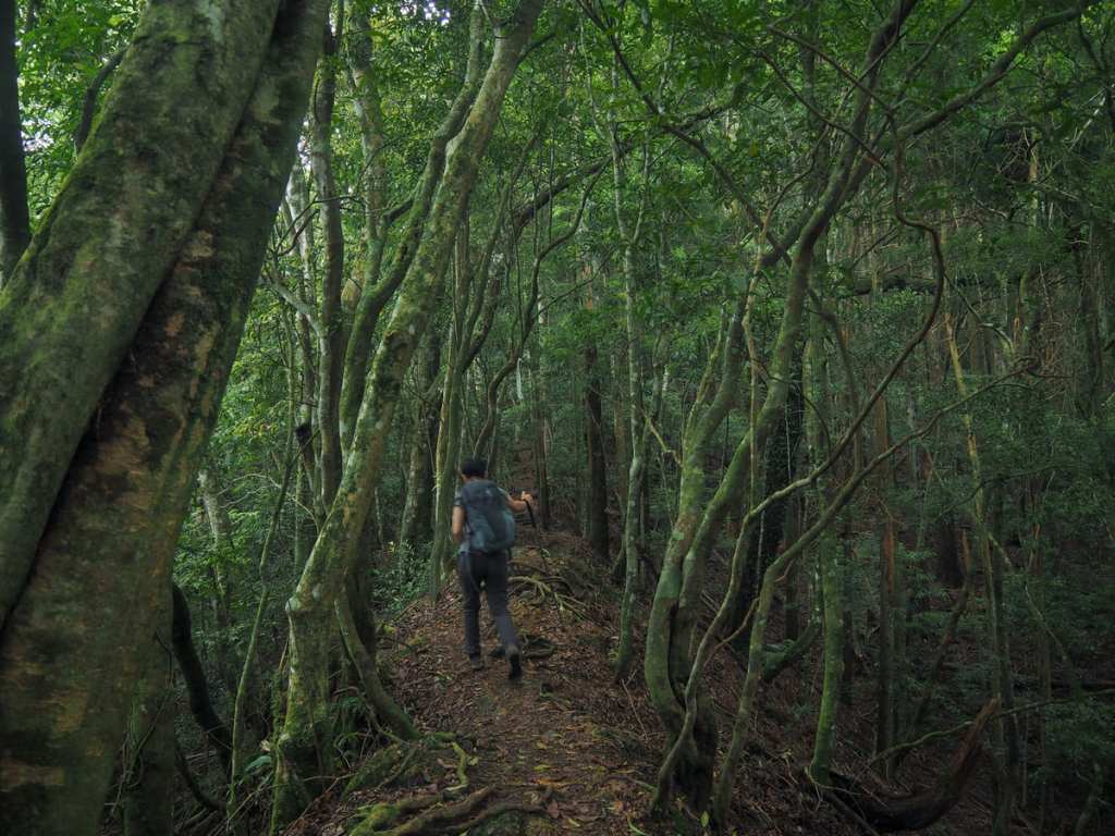
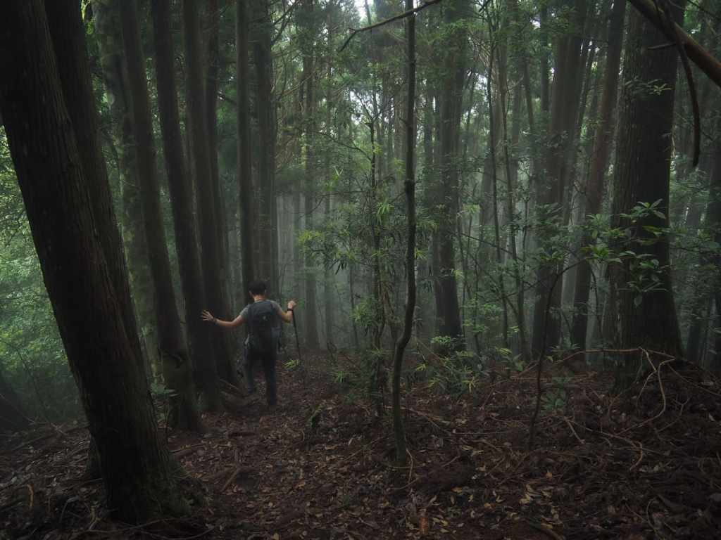
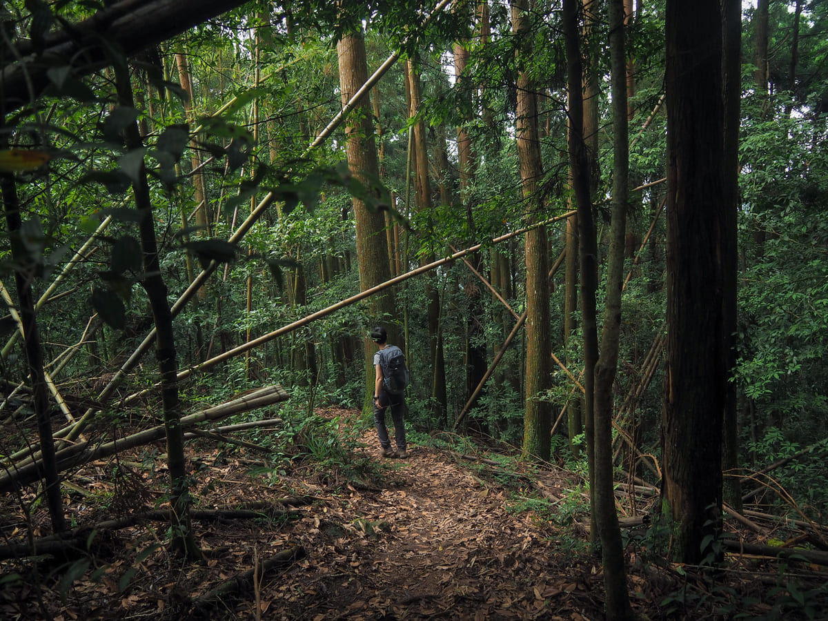
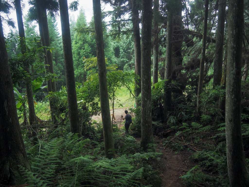
Right from the get go, the trail reveals its true nature — a steep path cuts its way ever upwards through a forest dominated by Japanese cedar trees.
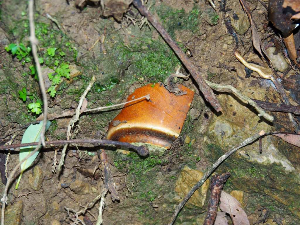
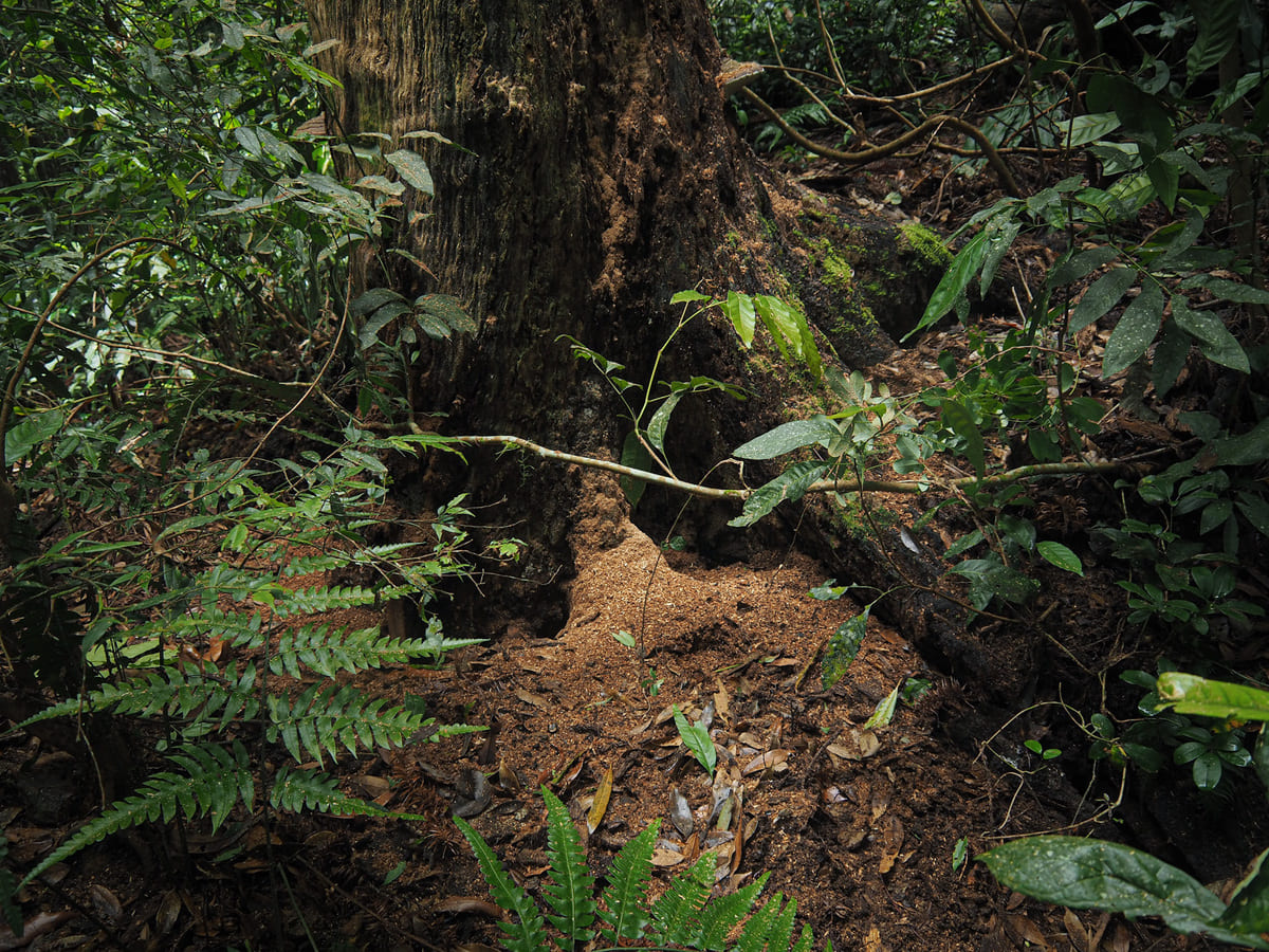
In addition to the obvious monocultural impacts of later afforestation, there is ample evidence of past forestry endeavours, mostly in the form of these ceramic telegraph pole insulators. Elsewhere, I also spotted old stone work and a few antique glass bottles.
Several huge boulders break up the scenery and dark grey shale make the trail somewhat slippery underfoot.
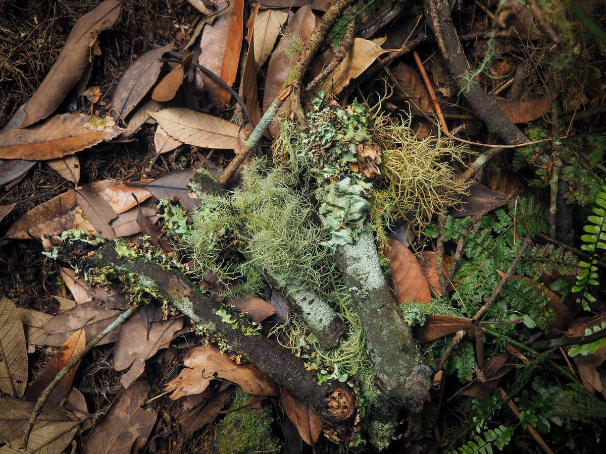

One of the perks of plodding slowly up steep slopes is that it provides you with ample opportunity to pause and notice details like this fallen shard of lichen-garbed branch, this tree that is being gradually deconstructed by bugs from the inside out (we could actually hear them at work), and these spindly black-stemmed mushrooms.
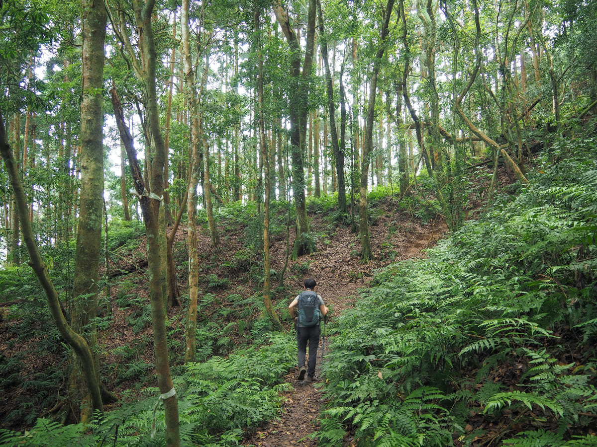
Every now and then, the incline eased off a little and we found ourselves walking through these enchanting green cathedral spaces.
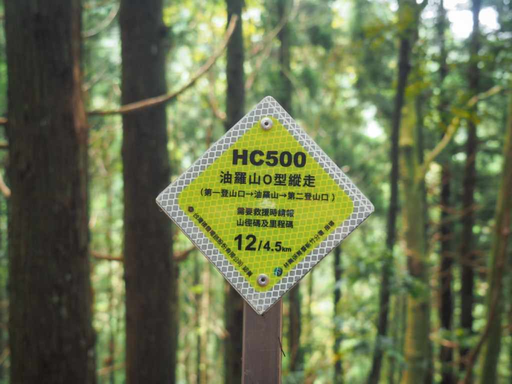
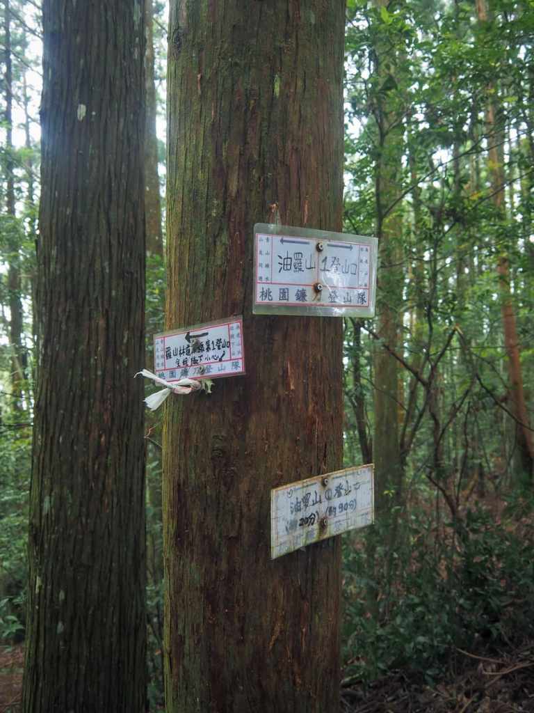
The whole trail is clearly marked with these (very shiny and new-looking) trail markers. The trail (excluding the forestry track portion) is 4.5km, and these markers are placed every 100 metres to let hikers know how far they’ve come. (The left-hand number reading “12” here actually means 1.2 kilometres. I’m not entirely sure why the decimal was eliminated.)
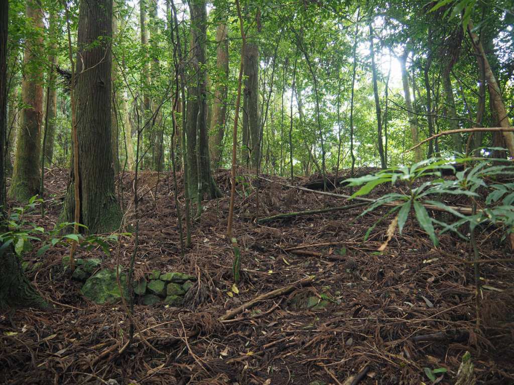
Around the 1.2-kilometre marker, there’s a flat section of ground that looks like it might once have been home to some sort of forestry workers’ encampment. There are odd dips that might have been water tanks and a few sections of stonework that look like old walls. (It might also be a semi-decent place to camp if you’re looking for an off-grid adventure.)
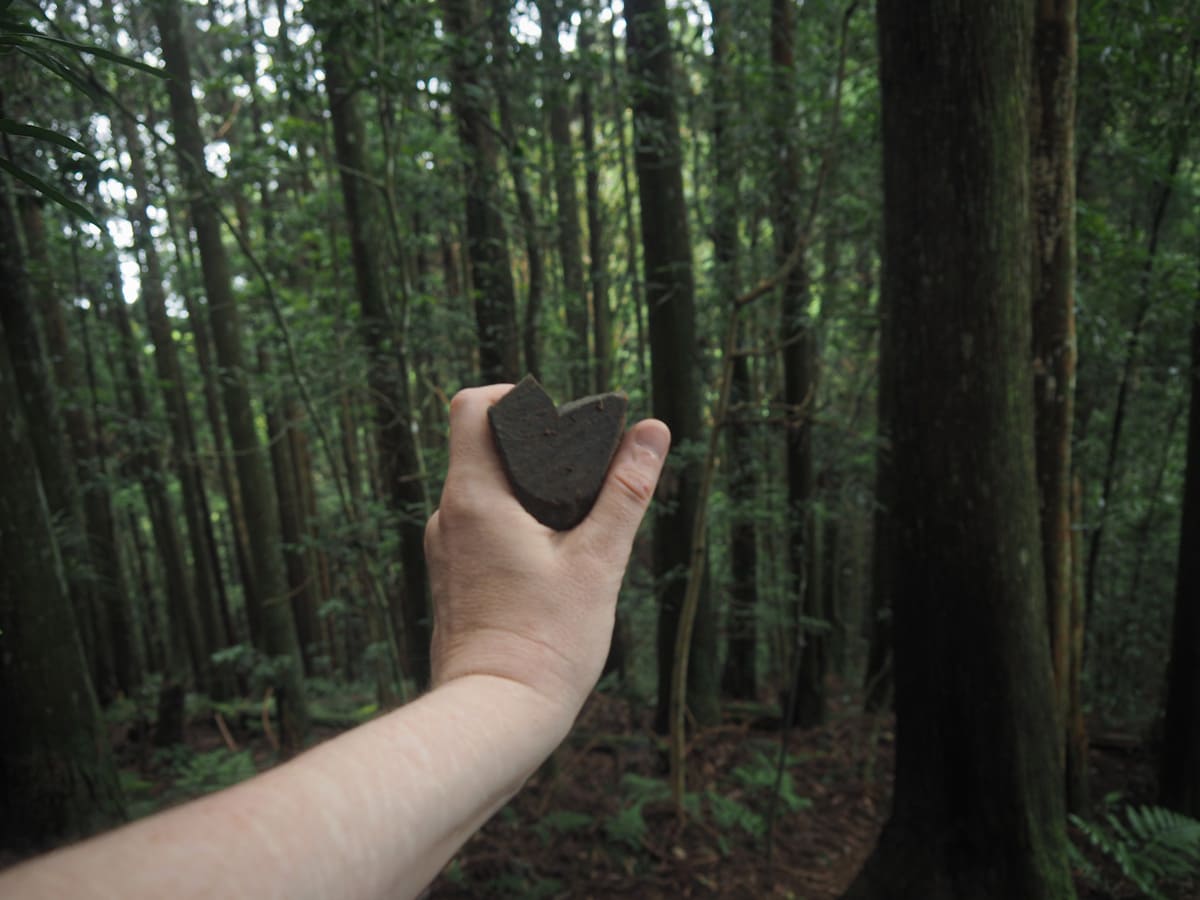
A heart-shaped piece of rock and one of the many small scrambles on the way to the summit.
After climbing for about an hour and a half, we passed the first junction. The trail to Youluo Mountain continues straight ahead, while the path on the right descends steeply to join the track a little further down from where we parked.
Some of my favourite parts of the ascent were like the section show above, where we found ourselves walking along a forested ridge with deep, quiet hollows to either side. I’m not sure I can explain exactly why I like it, but the feeling is somewhat special.
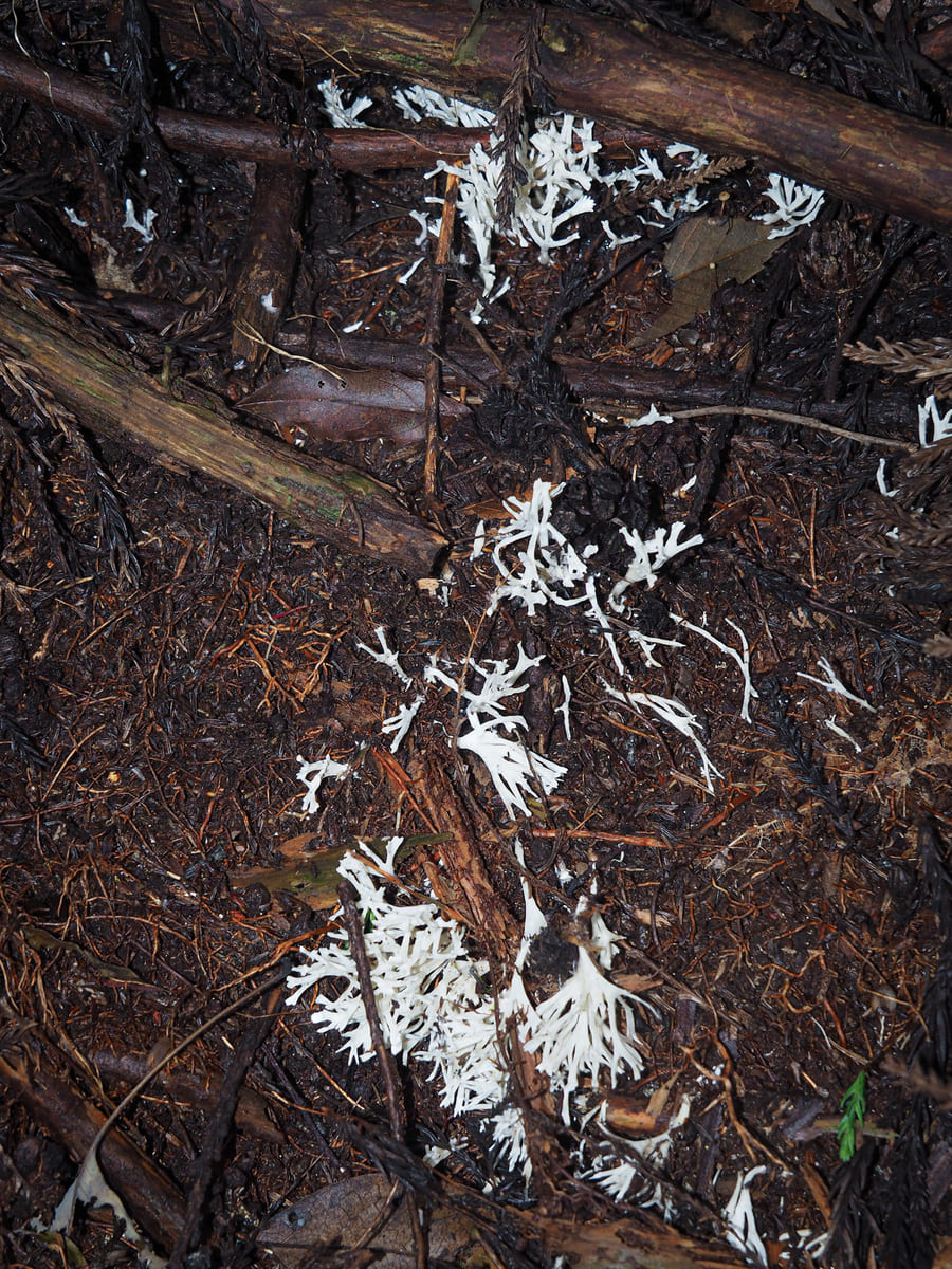
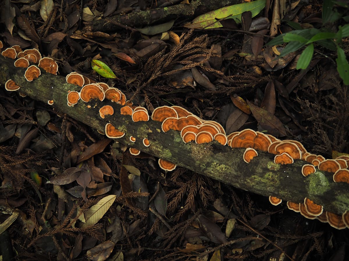
Some of the fungi and mushrooms spotted along the trail. Woods like this are great for fungi fans.
As we were nearing the top, we ran into a huge group of about 30 hikers, as is often the case with Taiwan hiking groups, the vast majority of them looked old enough to have a discounted bus pass!
After a lot of hellos and expressions of shock and awe at seeing a foreigner so deep in the mountains, we managed to overtake the whole group. As the trail nears the peak, we passed the second junction. The loop trail goes left from here, but first, we headed right and continued for another 100 metres to visit the summit.
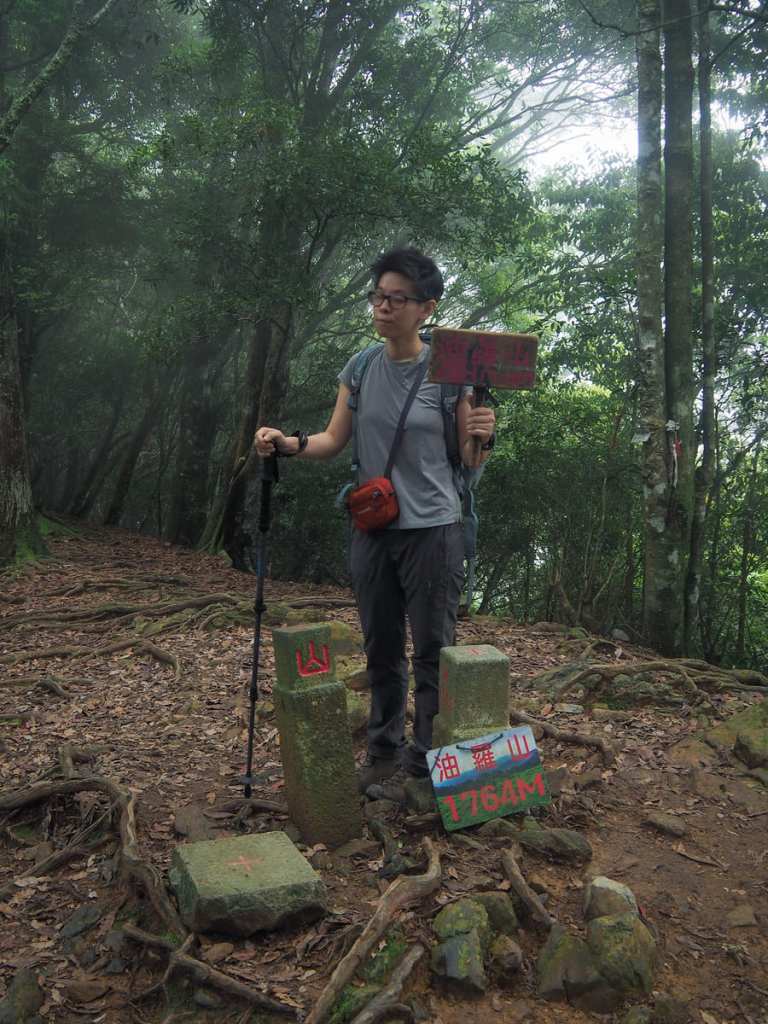
Sitting at an elevation of 1,764 metres above sea level, the top of Youluo Mountain is entirely surrounded by trees. There’s little to see except for three generations of stone summit marker and a couple of signs left by hiking groups for people to pose with for their peak-bagging photos. (This was the only photo of Teresa in which she was not pulling some type of ridiculous face — instead I caught her considering which face to pull next.)
Originally, we had planned to have our lunch break at the top, but since the giant hiking group of chatty elders was hot on our heels, we turned around straight after taking a photo.
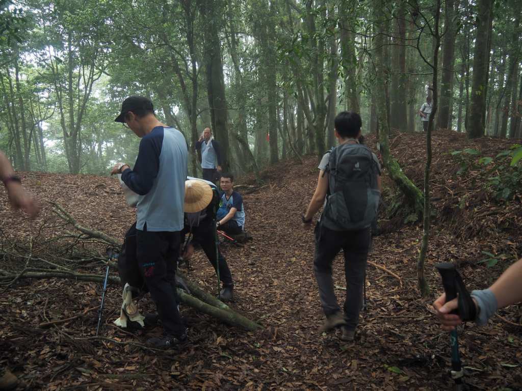
By the time we made it back to the junction and took the right turn down to the second trailhead, the vanguard of their group had already arrived and was beginning to spread out in preparation for a convivial lunch. We nodded solemnly at their professed admiration of our speed and the fact that we didn’t need to stop, all the while looking forward to finding the next suitable clearing to pause in and quiet our hungry bellies.
As we began our descent, a thin veil of cloud began to filter through the trees, adding to the magic of the forest atmosphere.
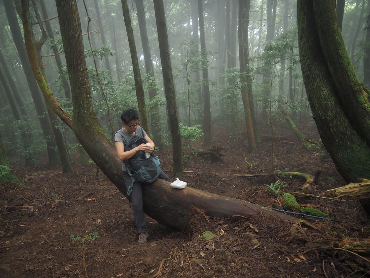
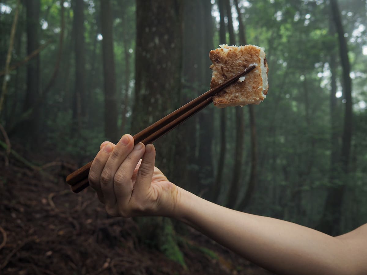
The trail seemed intent on reprimanding us for our unsociableness because while there had been numerous spacious clearings to stop in on the way, there were next to none on the way down. In the end, we found a curved bough on which to sit and have a light lunch (radish cake, lychees and crap FamilyMart bread).
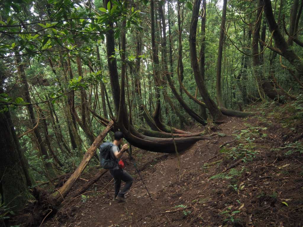
Continuing our descent, we spotted a whole load of trees that were growing at an odd angle, just like our lunch tree. This is a product of soil creep. As the earth slowly, slowly slides downhill over time, the trunk tilts downwards, but as the tree continues growing, it will reach up towards the light. The result is a slope full of bendy trees.
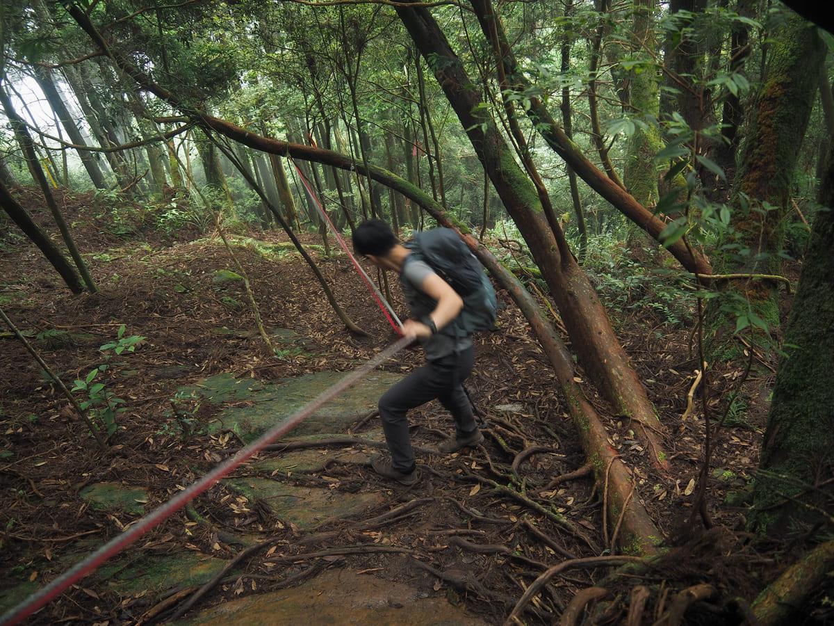
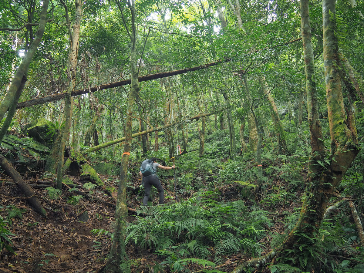
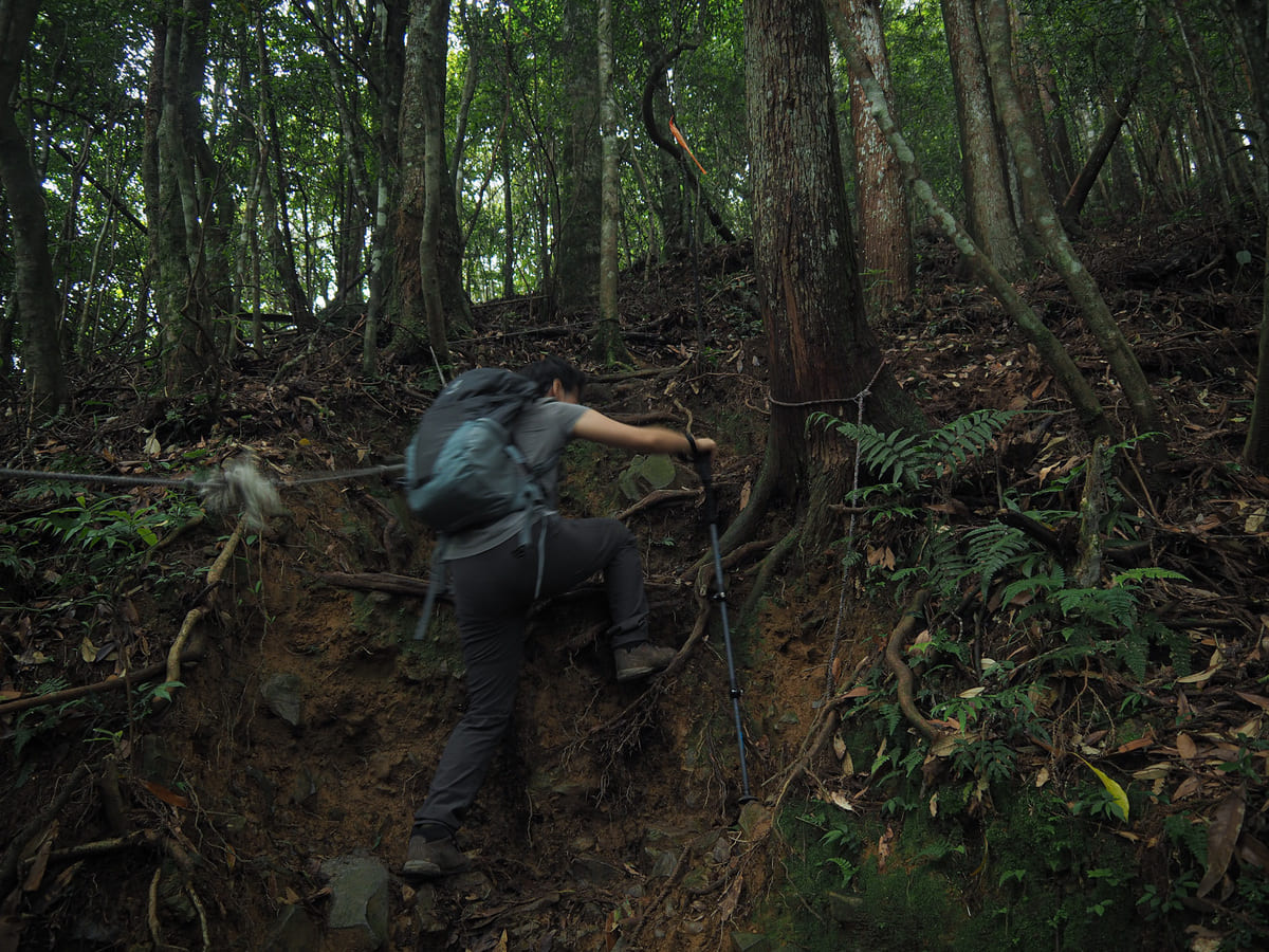
Interestingly, I found the descent every bit as challenging as the climb. There were many more steep, rope-assisted portions than there had been on the way up and the trail was a mix of damp, slippery roots and damp, slippery rocks.
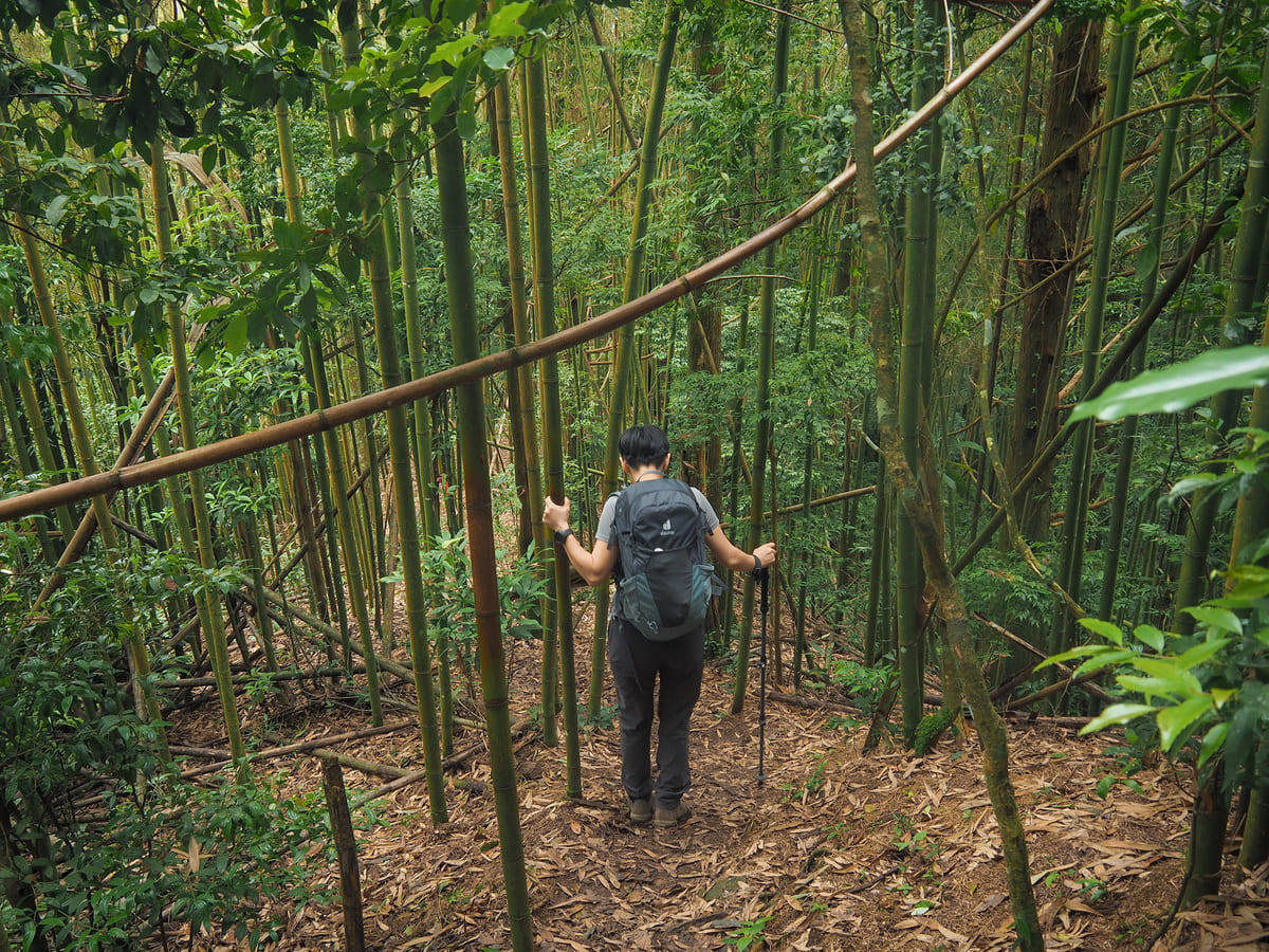
At least twice on the way down, I noticed the temperature creep up a degree or two, and by the time we were walking through bamboo forest, I was sweating as much as I had been at any point on the way up.
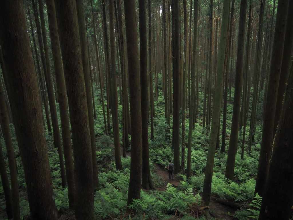
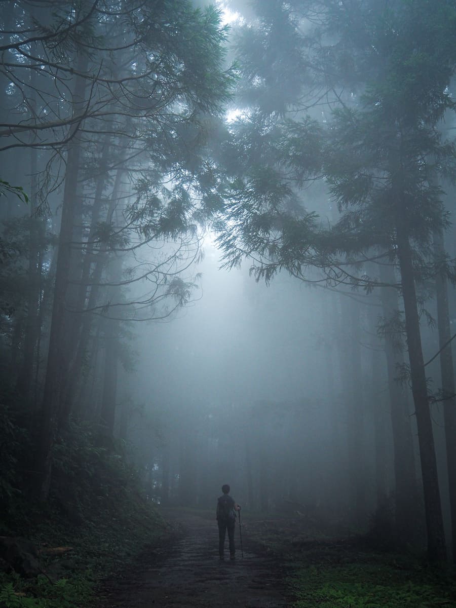
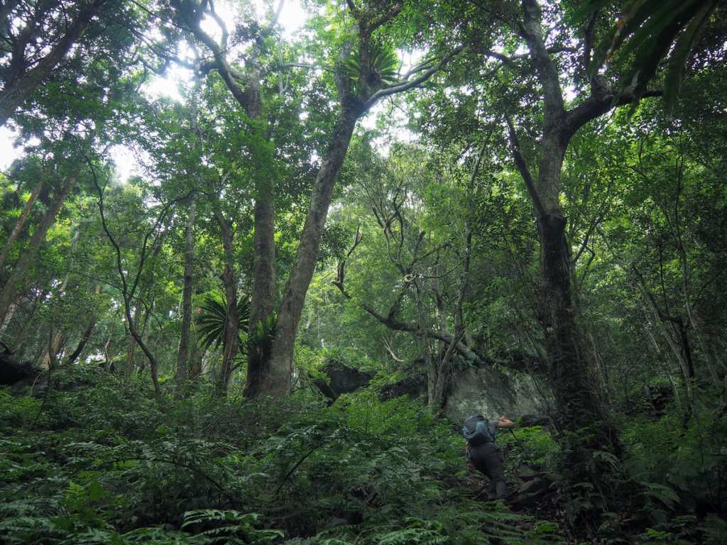
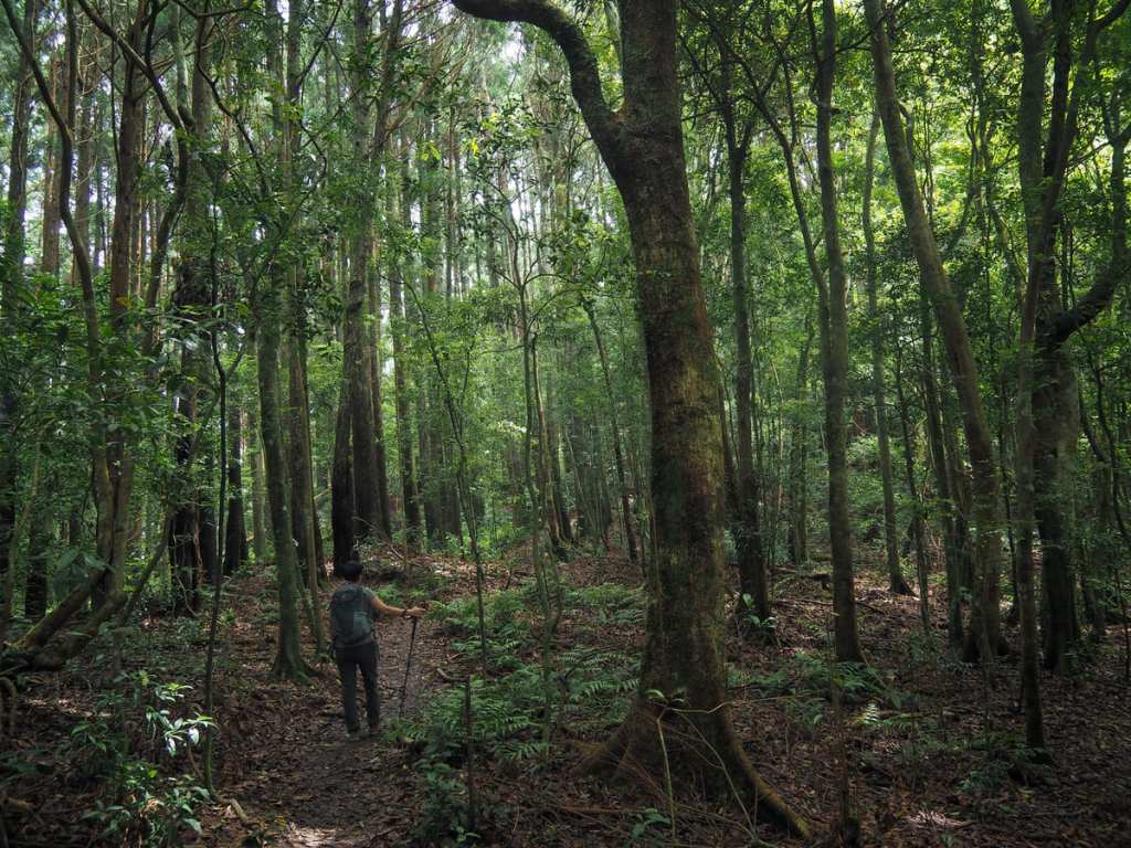
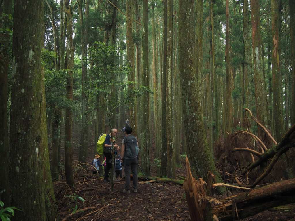
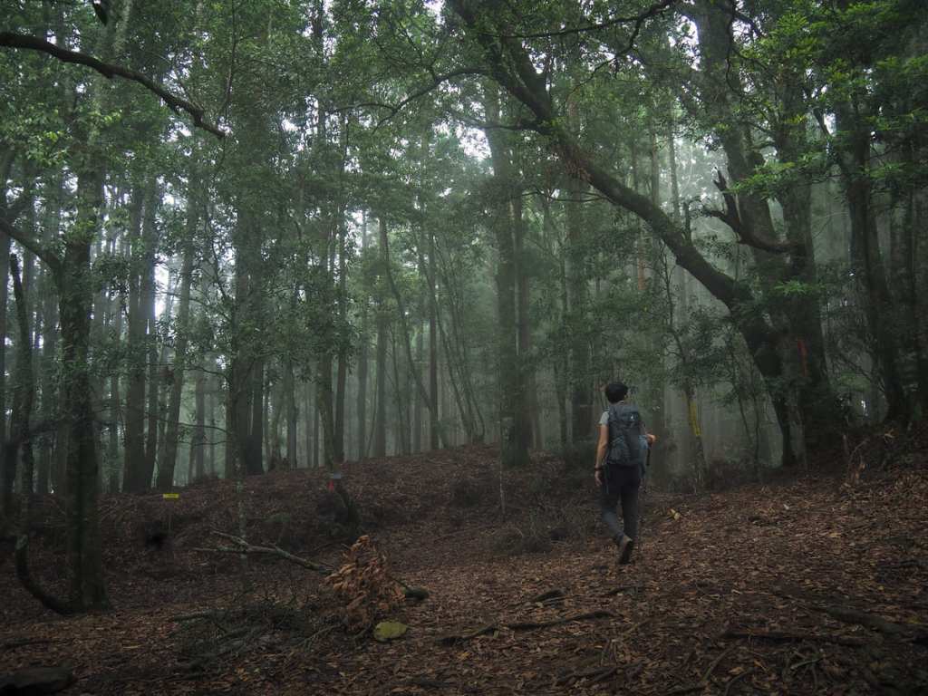
The one unequivocal benefit of such steep scenery is that when it finally starts to level out, you get to enjoy wonderful views like this. There’s something awe-inspiring about seeing such a tiny human in such a huge forest.
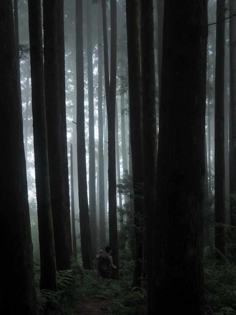
The clouds were also doing their bit to lend an air of intrigue to the proceedings.
About 55 minutes after leaving the summit, we found ourselves turning left onto the forestry track that would carry us back to the car.
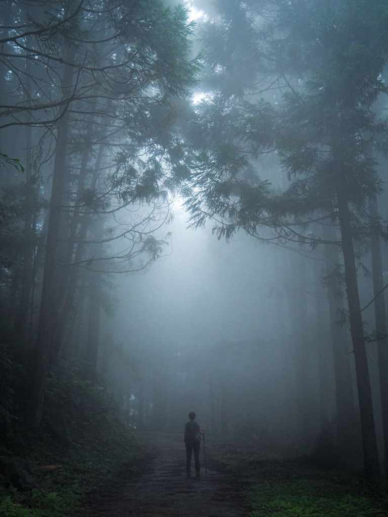
We spent the whole length of the track embraced in thick, grey fog.
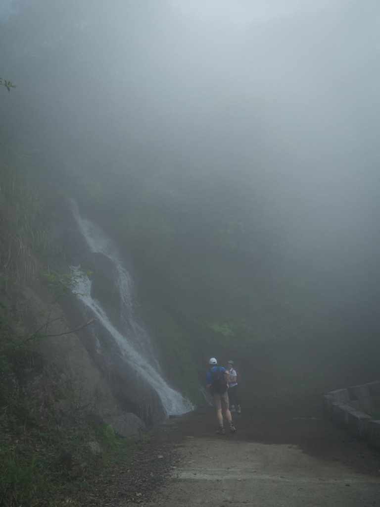
The half-way point on the track is marked by a couple of roadside waterfalls, the second of which would make an excellent place to stop for a paddle.
A sign by the second trailhead indicated that it should take us about an hour to reach the first trailhead, but we made good time and were back where we’d started in about 40 minutes. Even better, the time that we finished meant that when we made our way back down the maintain roads into Zhudong, it was almost time for dinner at one of my favourite vegetarian restaurants.
How to get to Youluo Mountain
Google Maps address: The walk starts from Youluo Mountain First Car Park. The track leading up here is just wide enough for one car with passing places every now and again. If you’re not comfortable driving such routes, I’d suggest arriving by scooter instead.
GPS location: N24 37.955 E121 09.790
Public transport: There’s no public transport to this trail.
Further reading: There aren’t currently any other detailed English resources related to this trail, but there are plenty of blogs written in Chinese, such as this one. There is a longer version of this trail called Xia-You-Mai Connecting Trail Loop (油霞麥縱走), but that’s a bit more than we’re up for on a casual holiday walk.
Nearby trails:
Youluo Mountain Trail Map
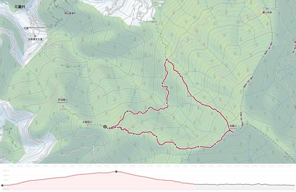
GPX file available here on Outdoor Active. (Account needed, but the free one works just fine.)

Stunning photos!
LikeLiked by 1 person
I wish I was back here right now. I’m craving precisely this kind of visually relaxing environment.
LikeLike