

Towering waterfalls, precarious suspension bridges, hot spring baths, bamboo forests, plentiful bird life, and an Indigenous village — this varied trail in Taoyuan’s Fuxing District has a lot to offer.
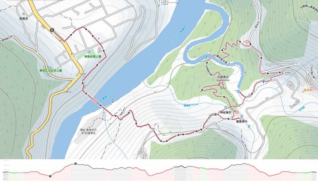
Distance: About 6 kilometres.
Time: 3-4 hours.
Total ascent: Around 370 metres.
Difficulty (regular Taiwan hiker): 3-4/10 — The public transport logistics and the number of steps mean this fits at the upper end of the easy spectrum. If you try to do it in the summer, it’ll be even more of a challenge.
Difficulty (new Taiwan hiker): 5/6 — For the same reasons as above, this is a moderately difficult walk for people new to hiking in Taiwan.
Risks and dangers: Mis-timing your buses and getting stuck on the mountain for a couple of extra hours is probably the biggest risk here. Oh, and don’t head up this way if it has been raining heavy or if there has been big earthquakes in the past week or so. The mountain roads are more prone to rockslides.
Water: I took 1L and drank most of it on a cool February day. There’s a 7-Eleven near the trail head and water dispensers near the start of the suspension bridge trail and up in Xiaowulai. There are also coffee shops and restaurants both near the trailhead and at Xiaowulai, but a fair few only open on weekends.
Shade: There is on and off shade for most of this trail, so if you’re sun-shy, take some type of cover.
Mobile network: My phone signal was OK throughout.
Enjoyment:
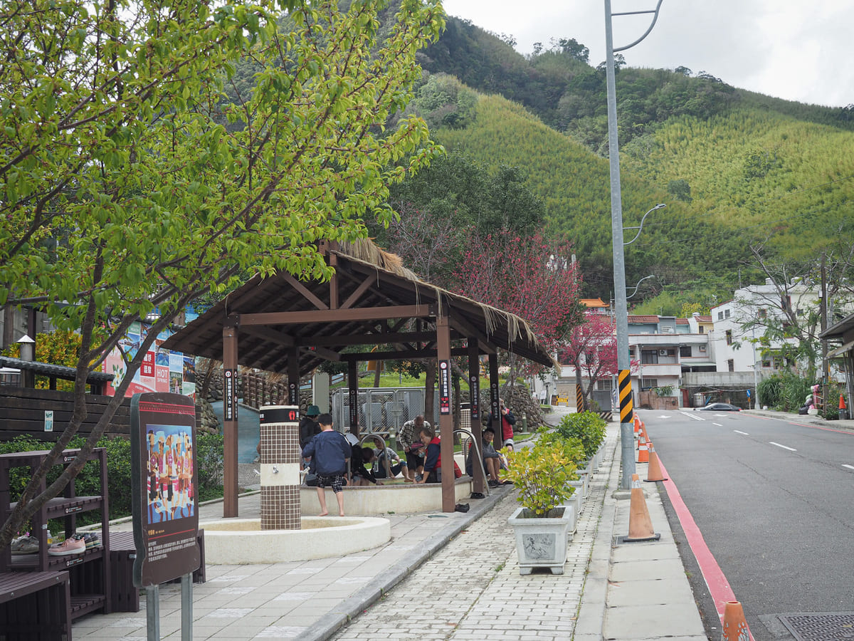
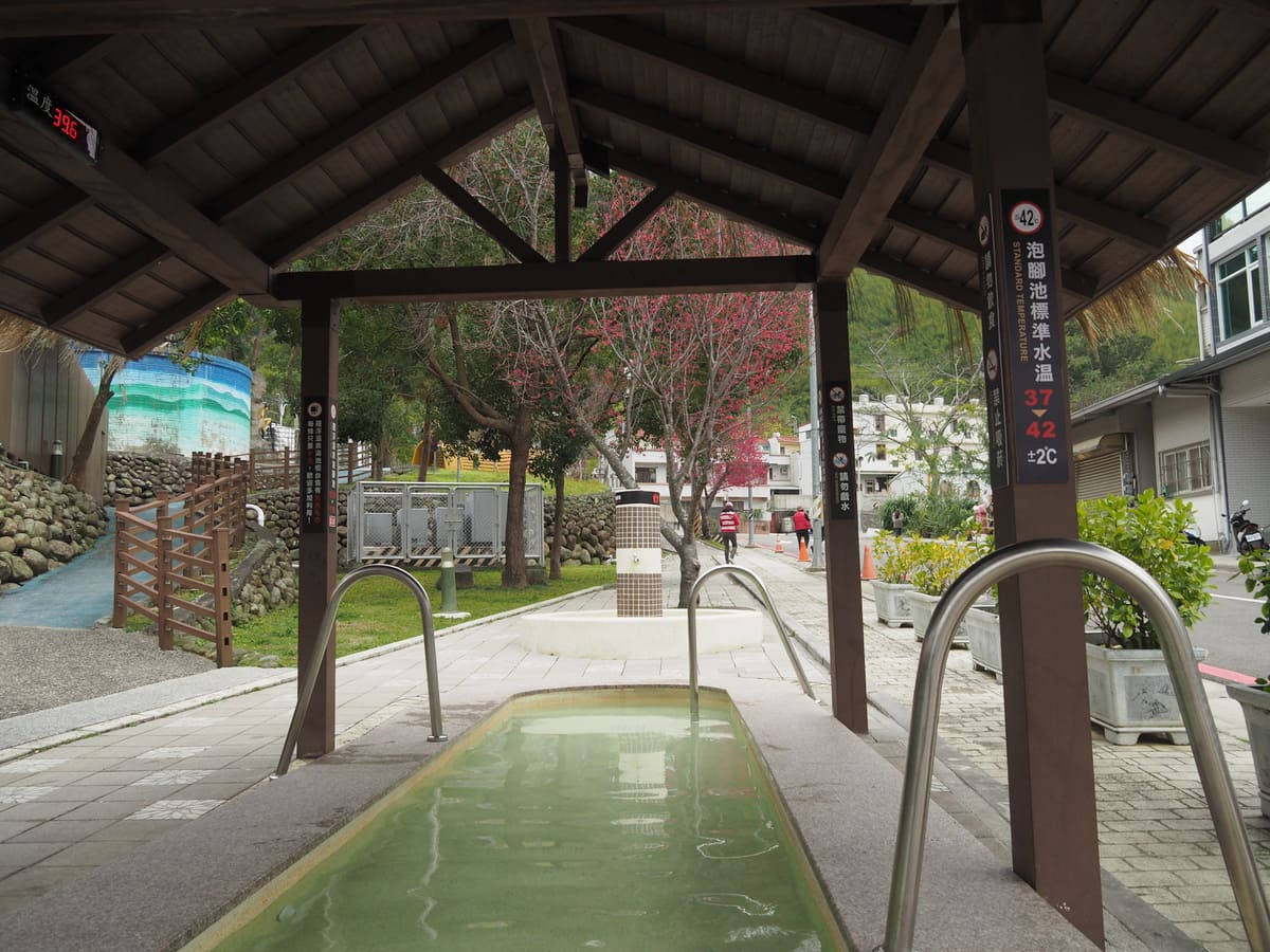
Other: Bring a swimming costume and towel to enjoy the hot springs.
Bathroom facilities: There are toilets near the hot spring at the start of the hotel and a couple within Xiaowulai Scenic Area.
Route type: Lollipop loop (or maybe point to point).
Permit: None needed.
Jump to the bottom of this post for a trail map and GPX file.
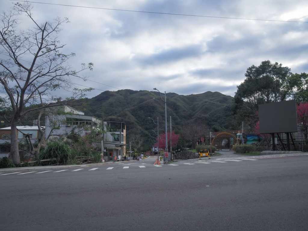
I hopped off the bus at Luofu Village and made a quick diversion to the 7-Eleven to grab coffee and some provisions for the day. I knew their were some cafes in Xiaowulai Scenic Area, but I wasn’t sure how of them would be open on a Monday, and it’s a good job I did because it transpired that none of the vendors were open.
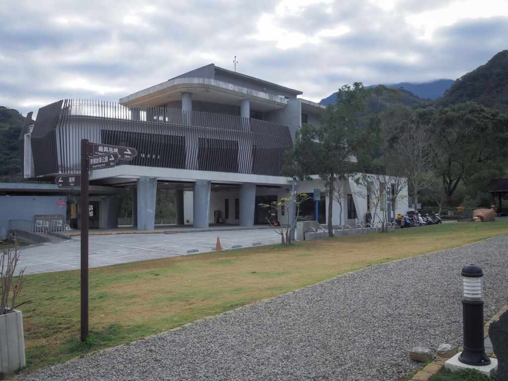
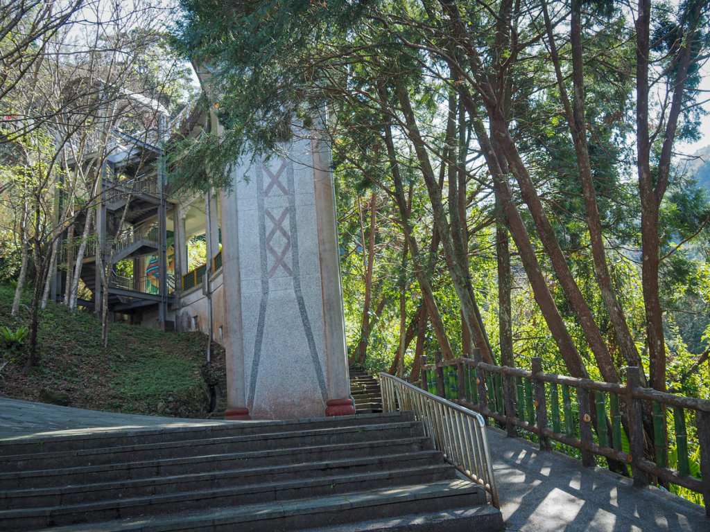
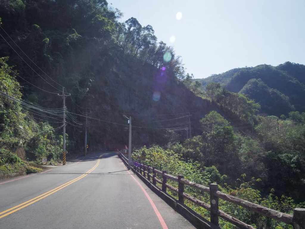
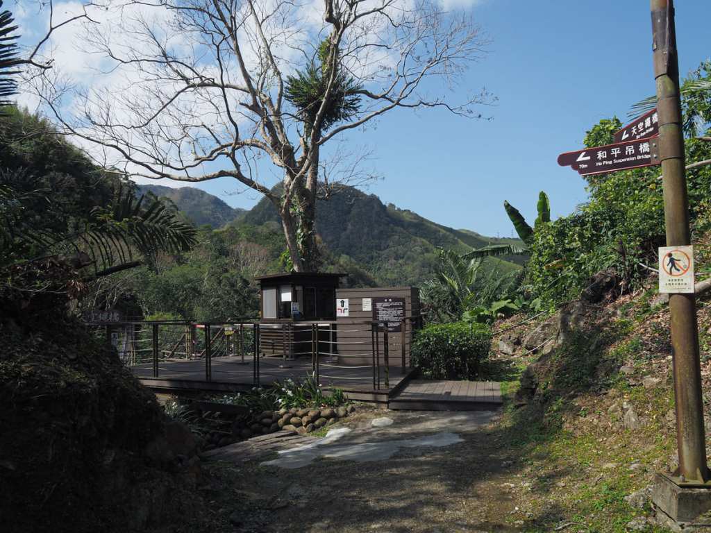
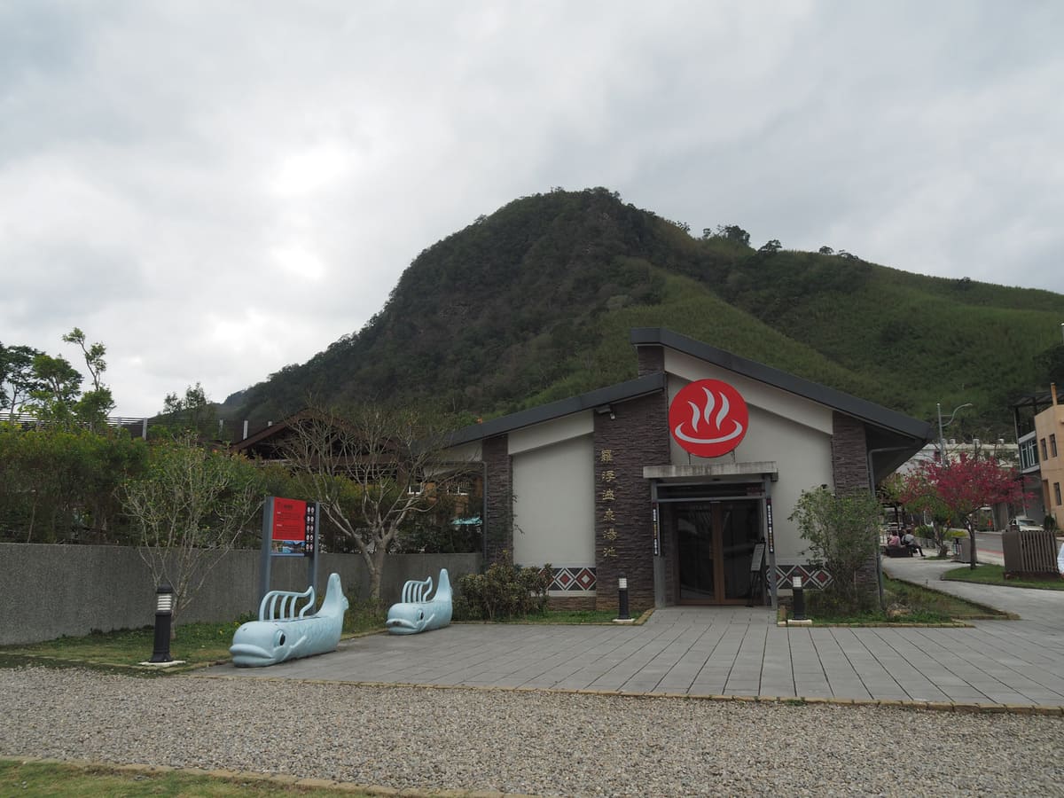
From the 7-Eleven, I made my way up the road to the next junction and followed the dowel directions on the finger post pointing towards the hot spring pool and visitor centre.
Just beyond the entrance to the hot spring baths, the trail turns right onto a gravel path leading towards Yixing Suspension Bridge.

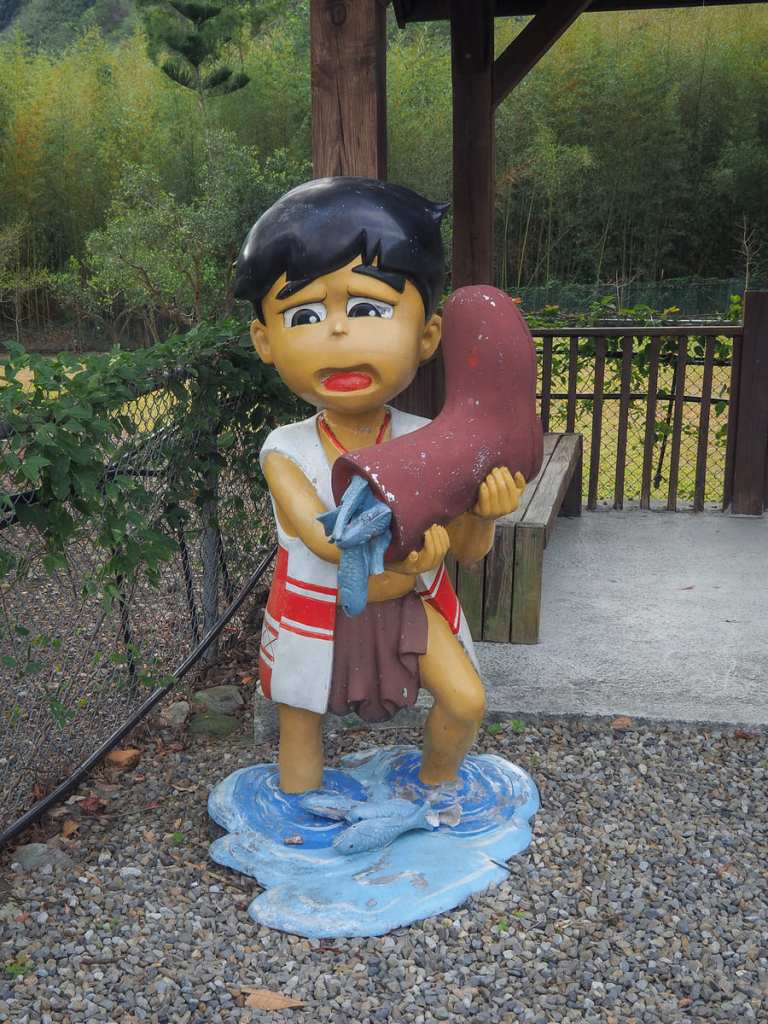
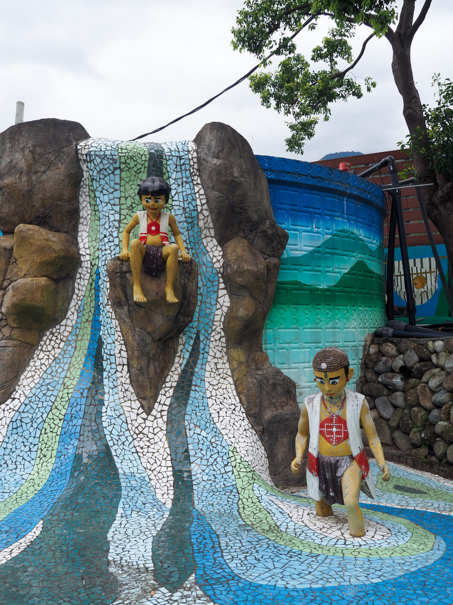
There are a couple of cute statues depicting Tayal boys catching fish in their boots, as well as another stranger statue depicting… I’m not quite sure what.

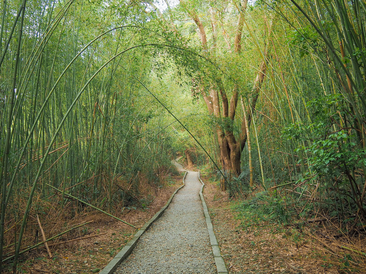
A green and leafy trail lined with bamboo leads around the side of the hot spring area before joining steps heading down to the river.
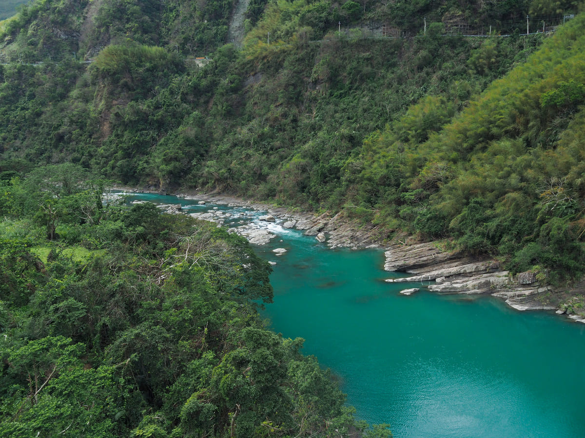
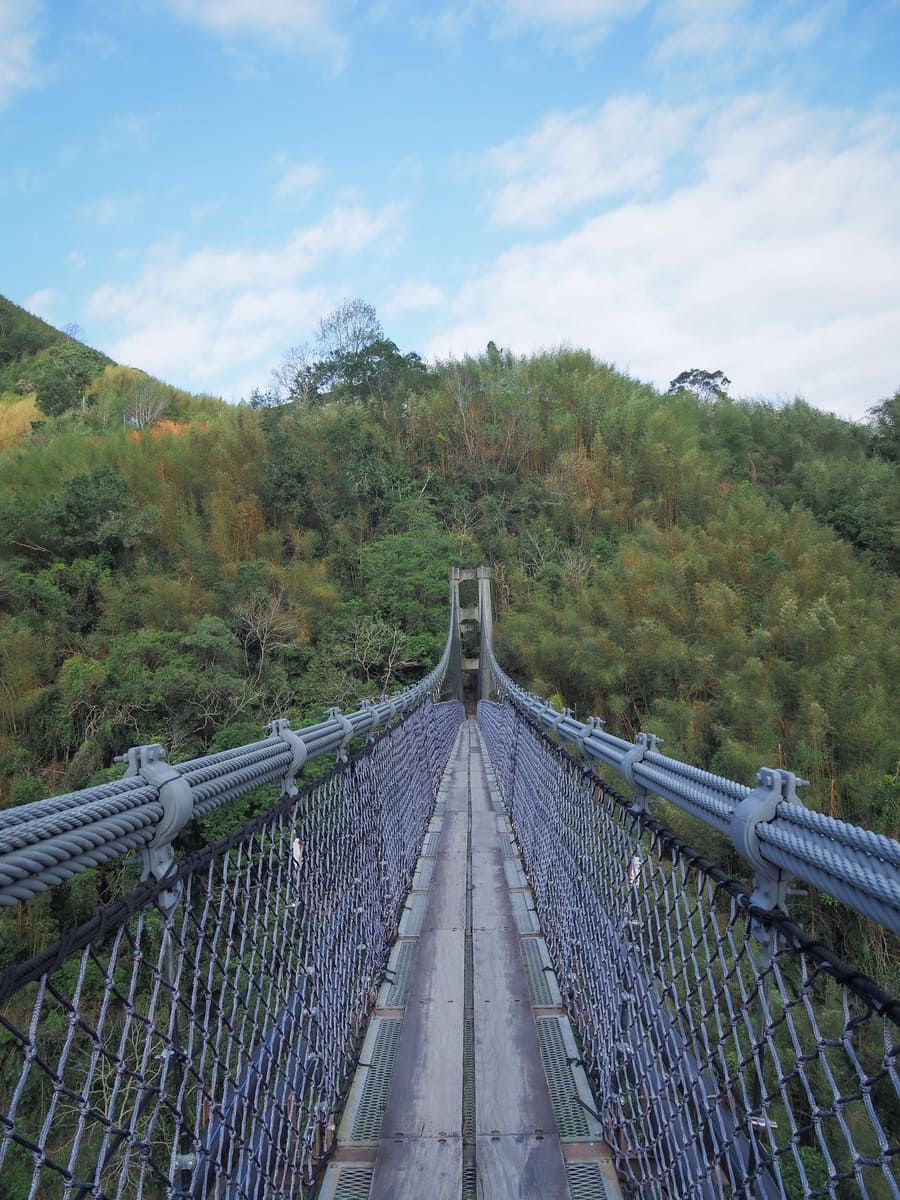
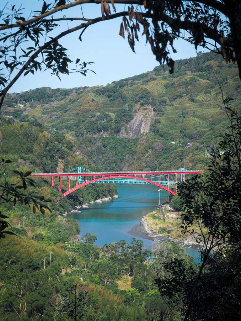
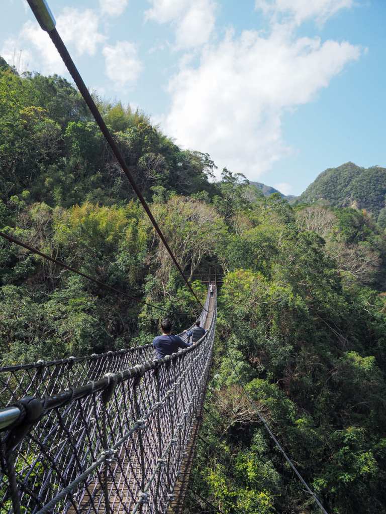
The 200-merte span of Yixing Suspension Bridge (義興吊橋) sits a vertiginous 70 metres above Dahan River (大漢溪). Its predecessor was built in 1966 to connect the settlement on the far bank of the river with Luofu Village, but the current structure is much younger, having been built in 2013.
I’m not sure if it’s something to do with the mineral composition of the waters in Dahan River, or perhaps I just got lucky with the weather, the water beneath the bridge is a super, vivid blue.
It might be worth pointing out that if you’re not good with heights, walking across this bridge will be a fear-provoking experience. The walking surface is comprised of wooden planks on top of an alarmingly fine-looking mesh, which gives the impression that it is terribly flimsy. If this sounds like a nightmare, the only advice I have is to try and keep your eyes on the far bank.
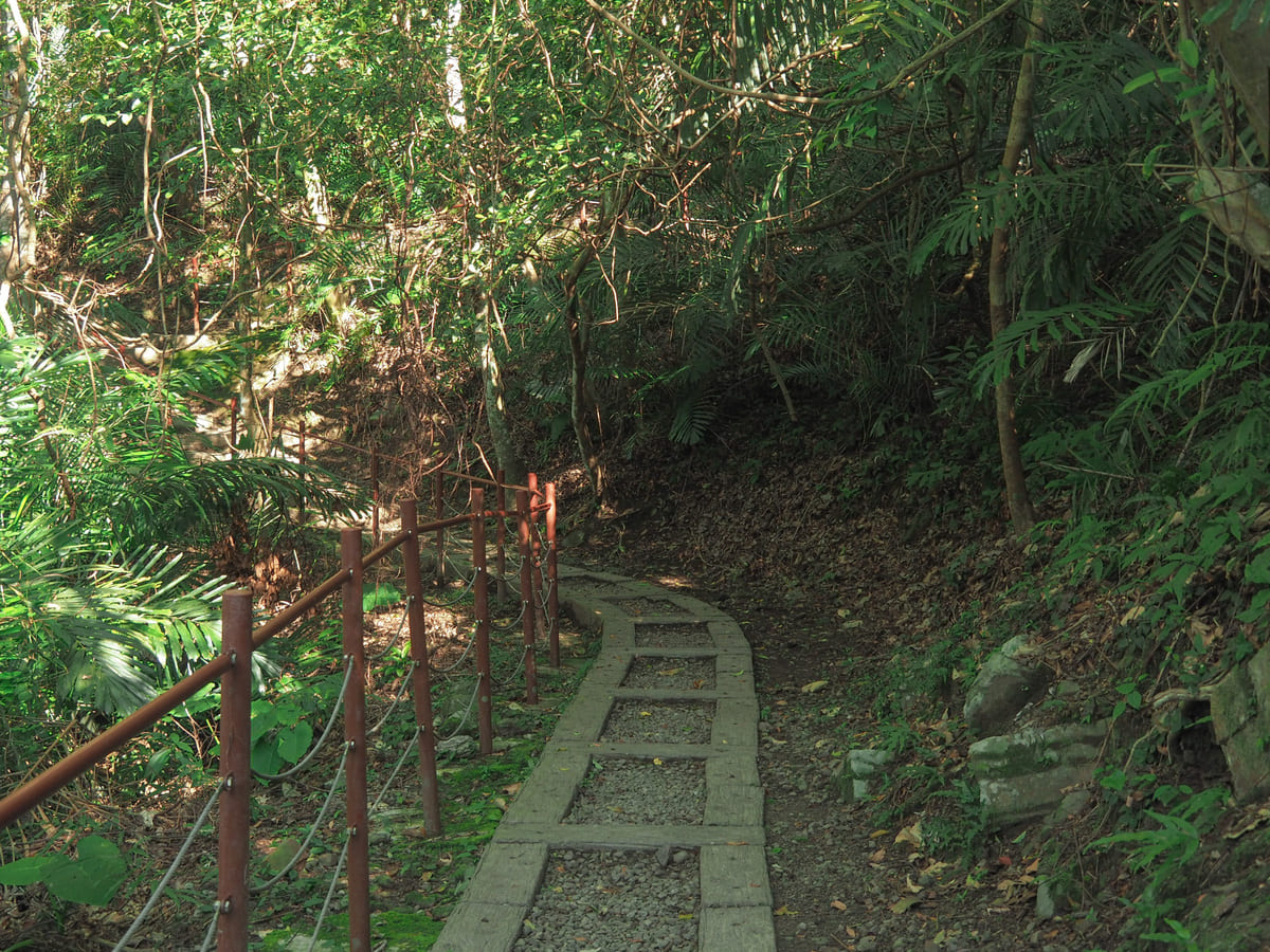
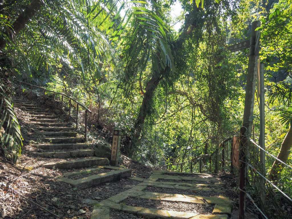
Once I’d reached the safety of the far bank, the steps leading up into the bamboo were easy to spot. This section is known as the Old Irrigation Canal Trail (舊水圳古道) on account of the fact that there was previously a water channel dug here to irrigate the fields belonging to the Indigenous villagers. These days, the old canal has been replaced with bog-standard water pipes that cut across the trail in several places.

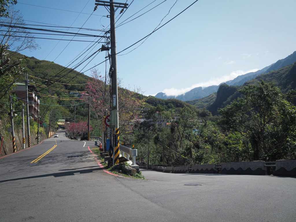
At the top of the steps, a walkway follows the road to the left.
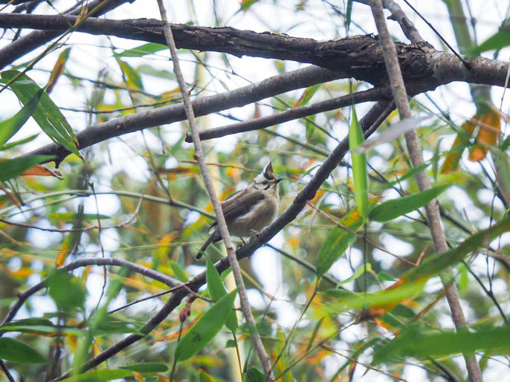

When I visited, it was mid-February Singapore the mountain cherry trees were still in bloom. One tree beside the road had attracted a large flock of Taiwan yuhinas and several white-eared sibias.

After about ten minutes, the path veers away from the road by diverting left down a flight of steps.
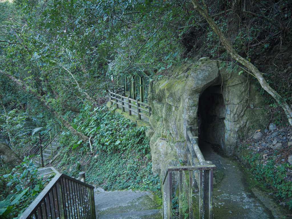
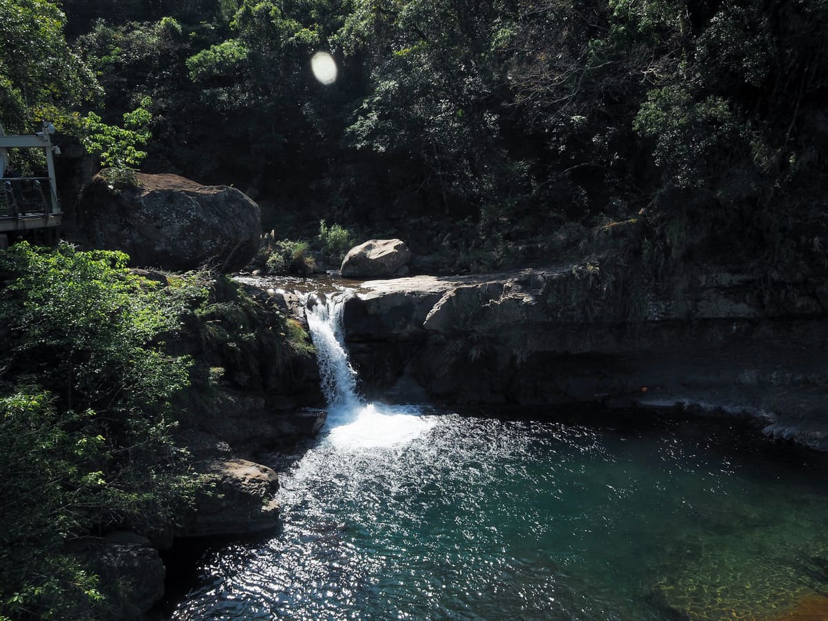
I soon found myself in the rear section of Xiaowulai Scenic Area. I passed the exit gates for the rope bridge on my left, and then arrived at this junction. The loop continues by heading down the steps to the left, but before you do that, it’s worth visiting the waterfalls accessible through the little fake tunnel on the right.
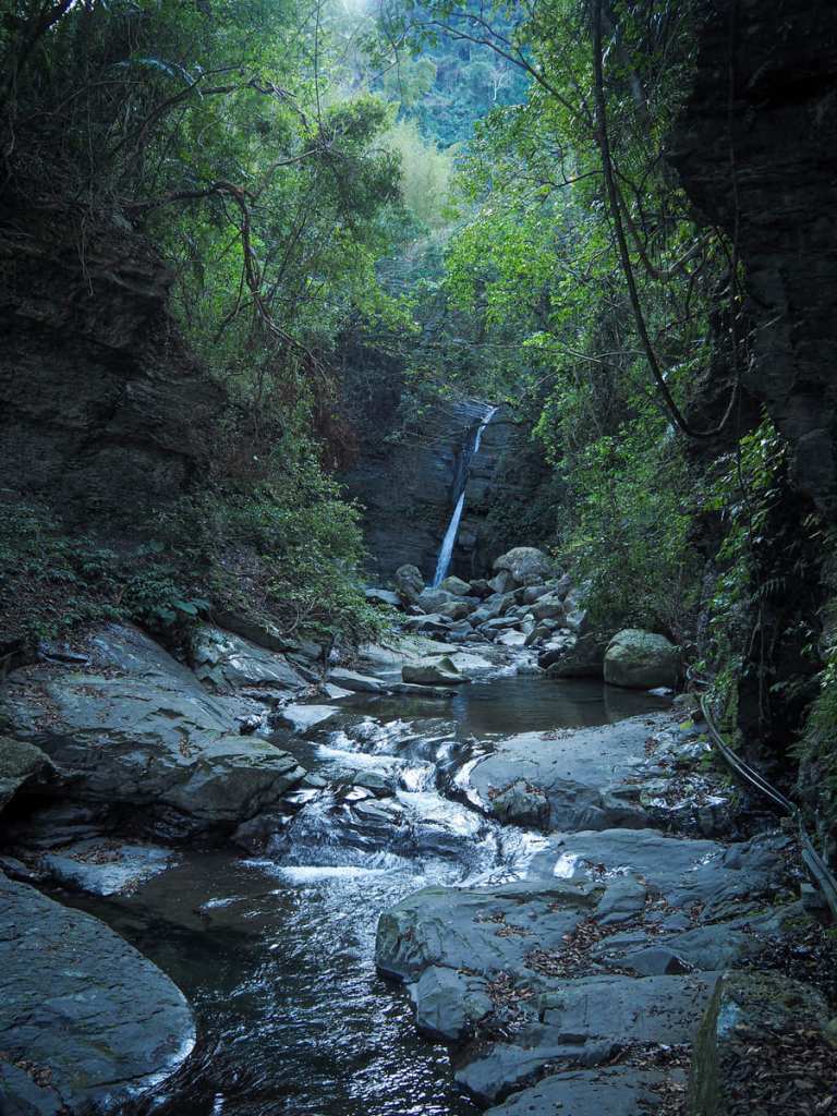
The trail dead-ends at a viewing platform that sits directly above one of the two waterfalls and with a clear view of the other. Fortuitously, I had managed to time my arrival perfectly to coincide with the arrival of the sun, and as I was stood soaking in the morning forest scent, I watched the light creep over the lip of the hill and begin chasing the shadows out of the valley.
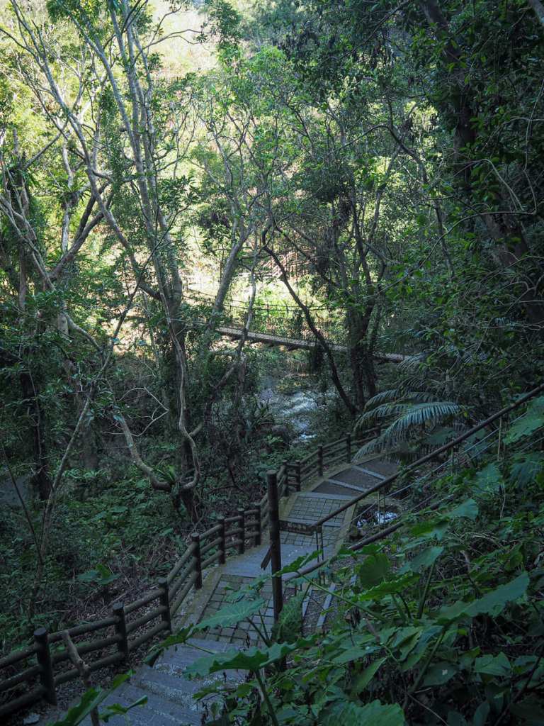
Returning back to the previous junction, I headed down the steps and over the less spectacular of the two bridges in the area. The path splits in two at the far side of this bridge — both trails take you to the same spot, but the right hand one will first take you to a viewing platform overlooking Dragon and Phoenix Falls (the two waterfalls mentioned above).

When you reach the next junction, pass under the rope bridge and follow the sign directing you along the forest trail. This is the start of the loop portion and (if you pay for a ticket), you’ll leave Xiaowulai Scenic Area via this bridge.
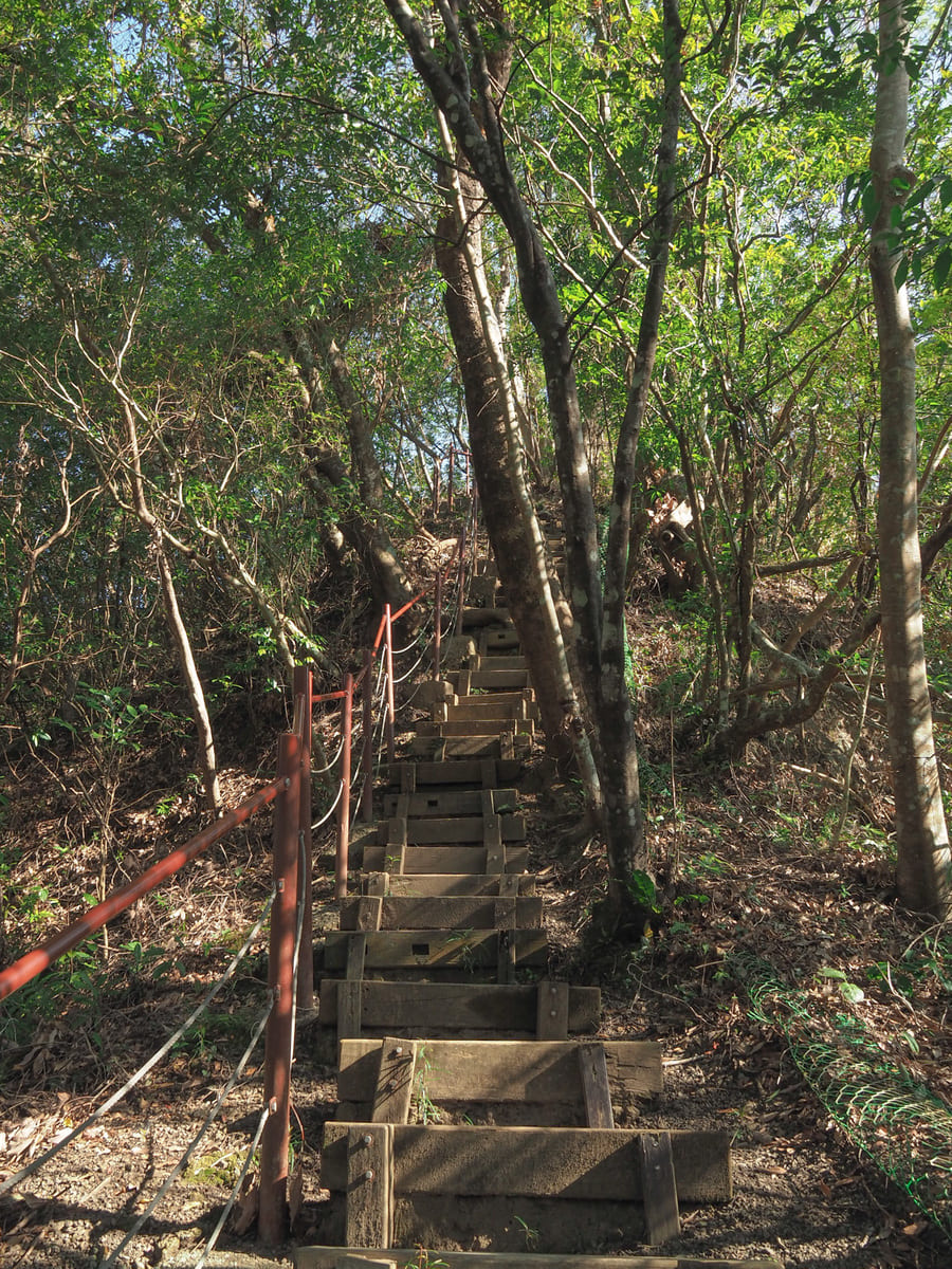
The trail climbs gently at first, then later steeply and it made imagine what this must have been like to climb the ridge before it was “improved”. I’ve walked a few wilder trails in this area and they’re delightful.
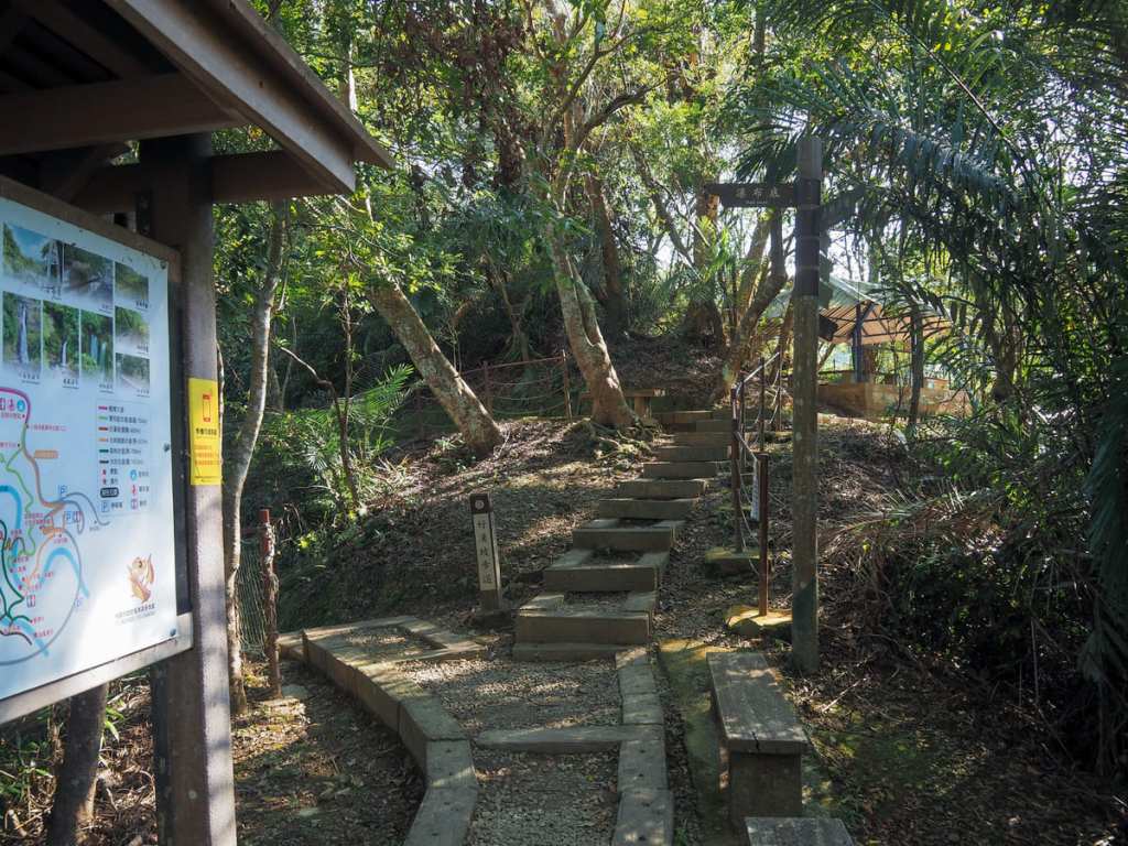
The high point of the climb is marked by a four-way junction, a pavilion, and a map.
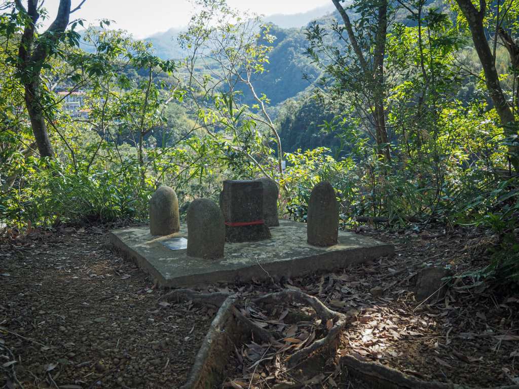
I took the path heading straight over and down (signposted as going to the waterfall base), but before I did, I detoured to visit the summit of Xiaowulai Mountain. The summit marker sits beside the trail just above the pavilion. There’s almost a view of distant cloud-capped mountains, but they’re partially obscured by the trees.
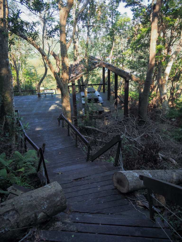
Just before the trail descends to meet a wooden viewing deck, a tree has fallen across the path. It has been cut through do that hikers can still pass, but the fence hasn’t been repaired. I feel this is kind of generally representative of how the area has been maintained — the bare minimum has been done to keep it walkable. I get the sense that Xiaowulai used to be a much more popular tourist destination in the past and now it’s just kind of a slightly forgotten backwater.
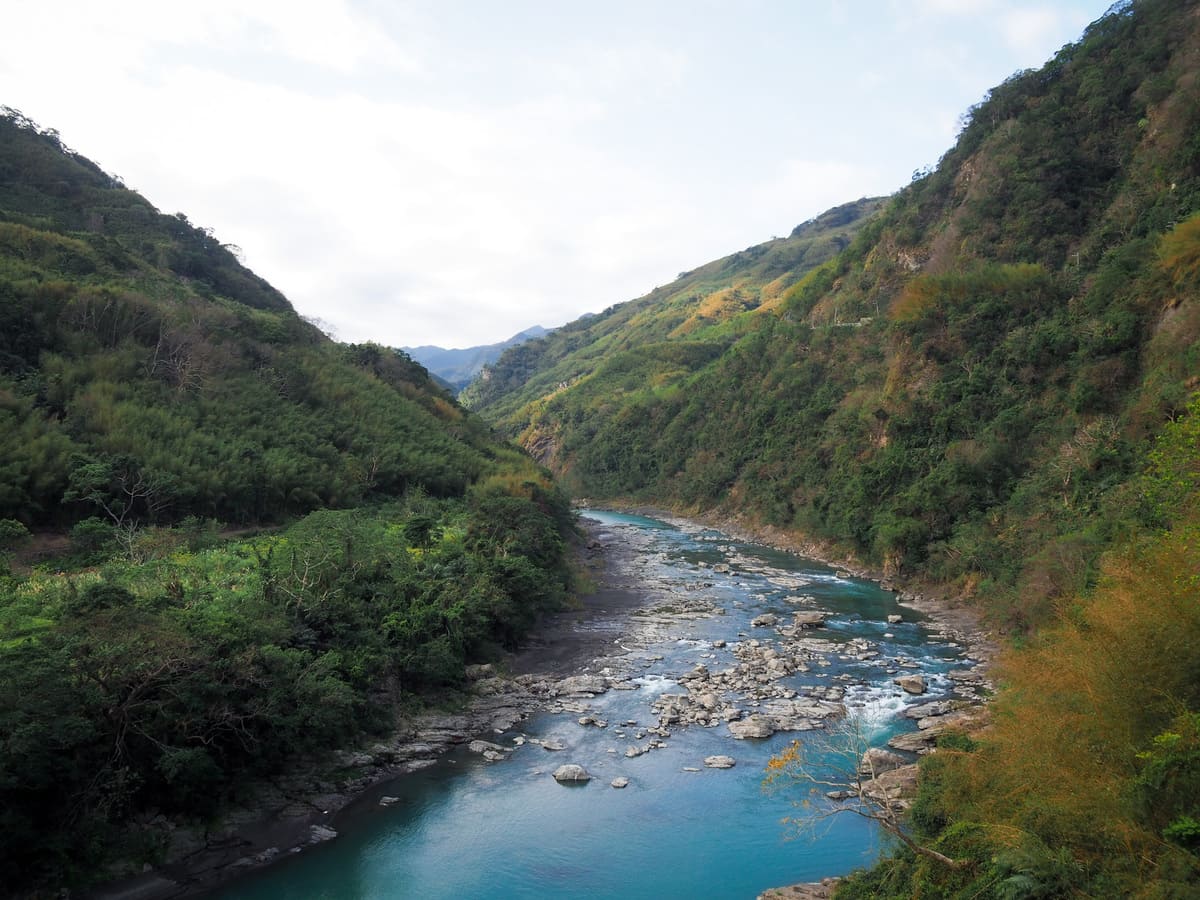
The viewing deck overlooks a bend in Dahan River where two parallel bridges cross the water. The bright red span of Luofu Bridge is a more modern appendage, and is what cars plying the Northern Cross-Island Highway traverse, while the smaller blue Fuxing Bridge is now only used by pedestrians (and bungee jumpers).
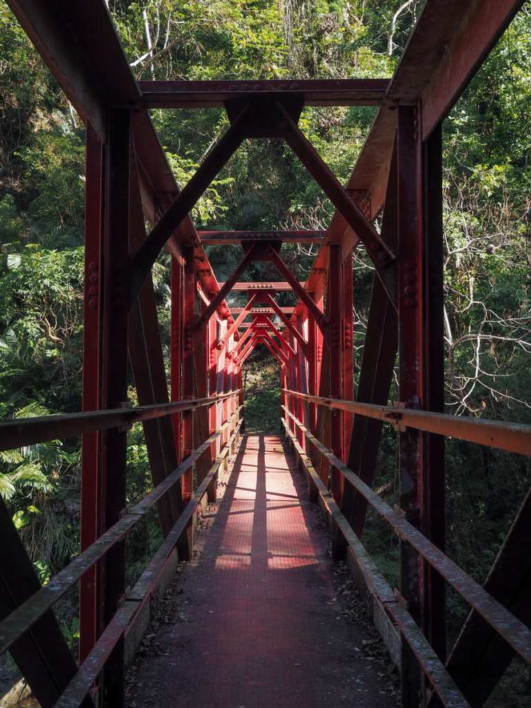
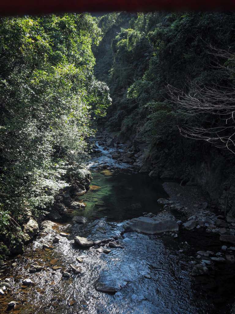
After a very steep descent, the path reaches Yunei Creek and crosses it via a red metal bridge. Glancing down, the waters are perfectly clear and full of lithe silver fish. But, what goes down…
…must go up, and from the bridge, the path begins a steep, steady climb up to the road. Part-way up, there’s a fork in the trail where one path branches off to visit the base of the waterfall, but after taking a few steps onto it, I soon found that it has been all-but abandoned.
As I climbed, I encountered several large mixed flocks. I saw grey-chinned minivets, dusky fulvettas, white-eared sibias, Taiwan yuhinas, Japanese white-eyes, and likely others that didn’t stop long enough for me to get a good look.
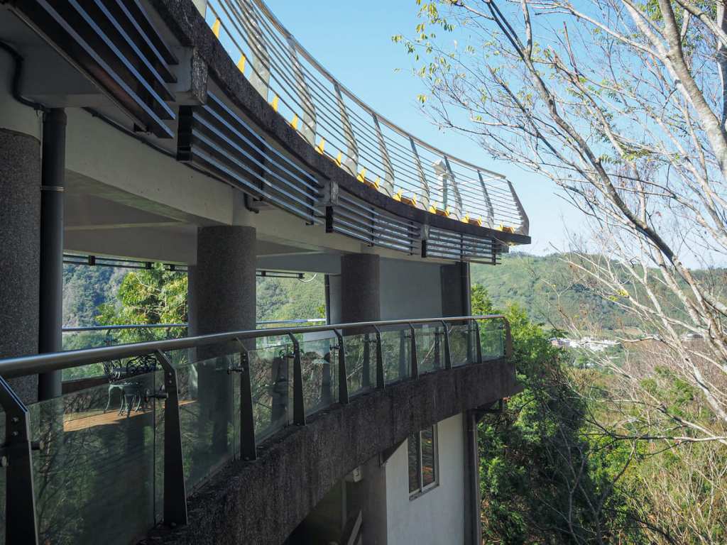
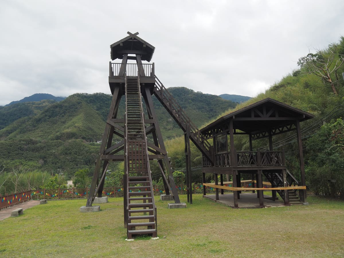
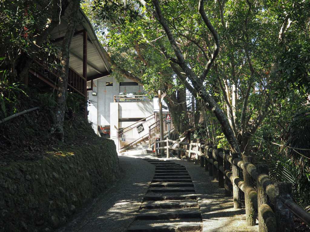
The steps lead up to a courtyard of sorts beside a toilet block and a towering viewing platform. You can either walk up a lane to join the road or climb the steps leading to the viewing deck – both bring you to the same place.
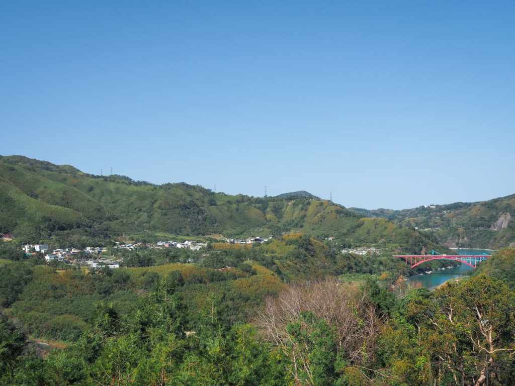
From the viewing deck, you can see the twin Fuxing and Luofu Bridges, as well as spot Luofu Village (where this walk starts) In on the far side of the valley.
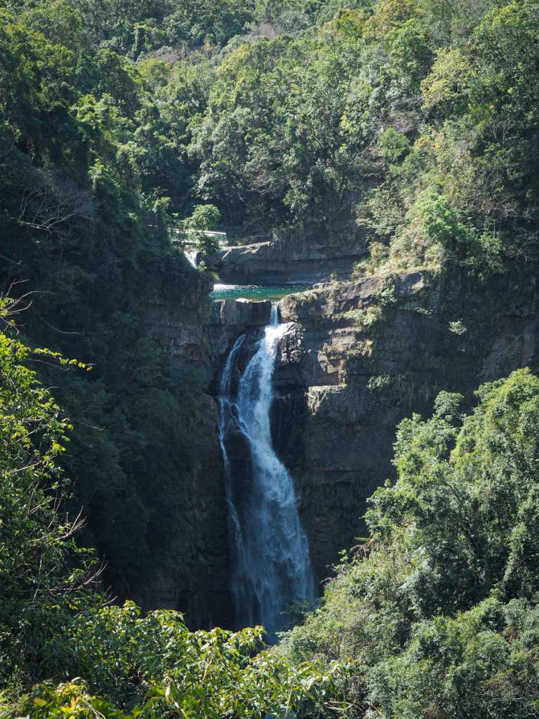
This spot also offers the most impressive vantage point for viewing Xiaowulai Waterfall.
From the viewing deck, turn right onto the road, then take the righthand fork when the road later splits in two.
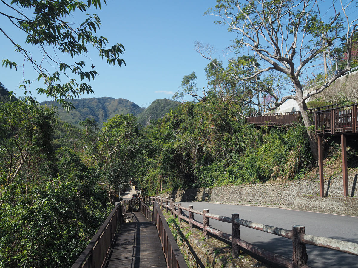
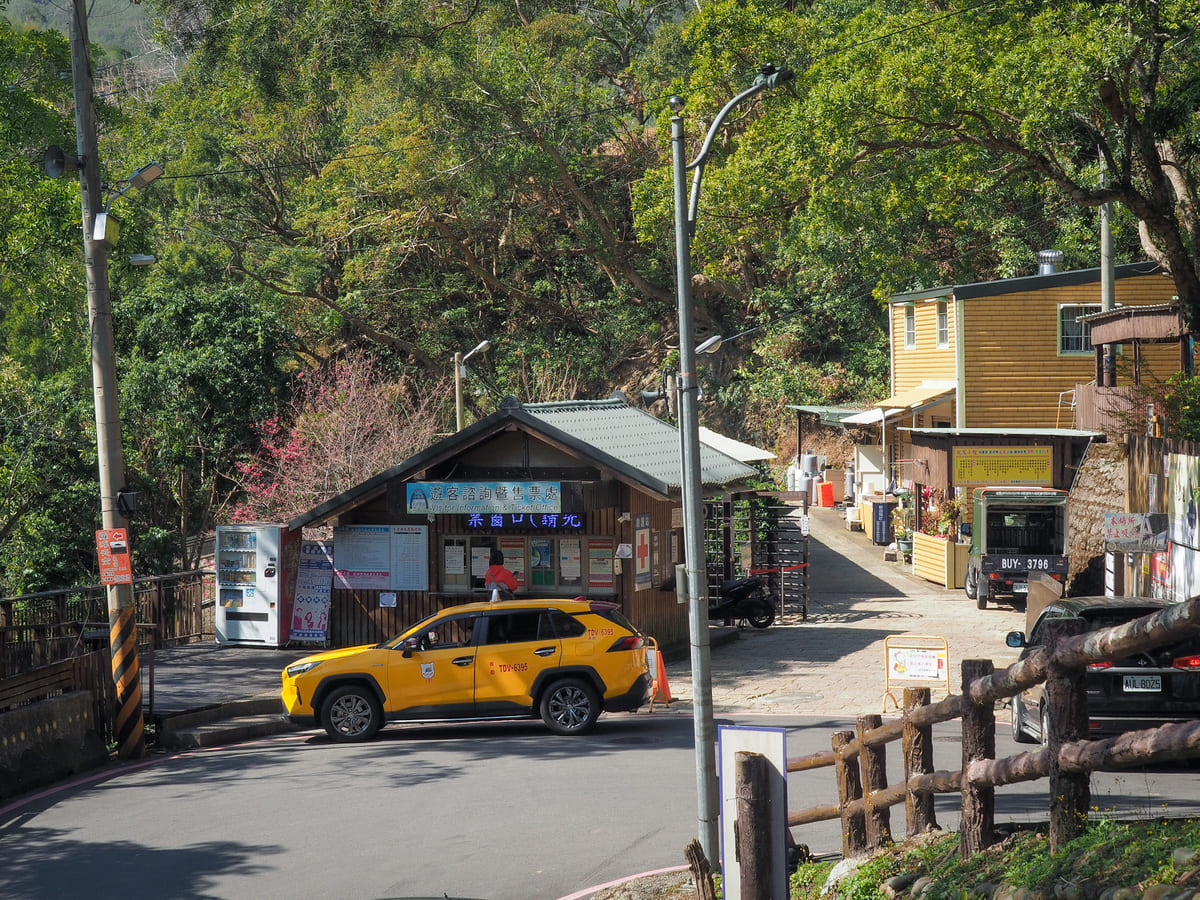
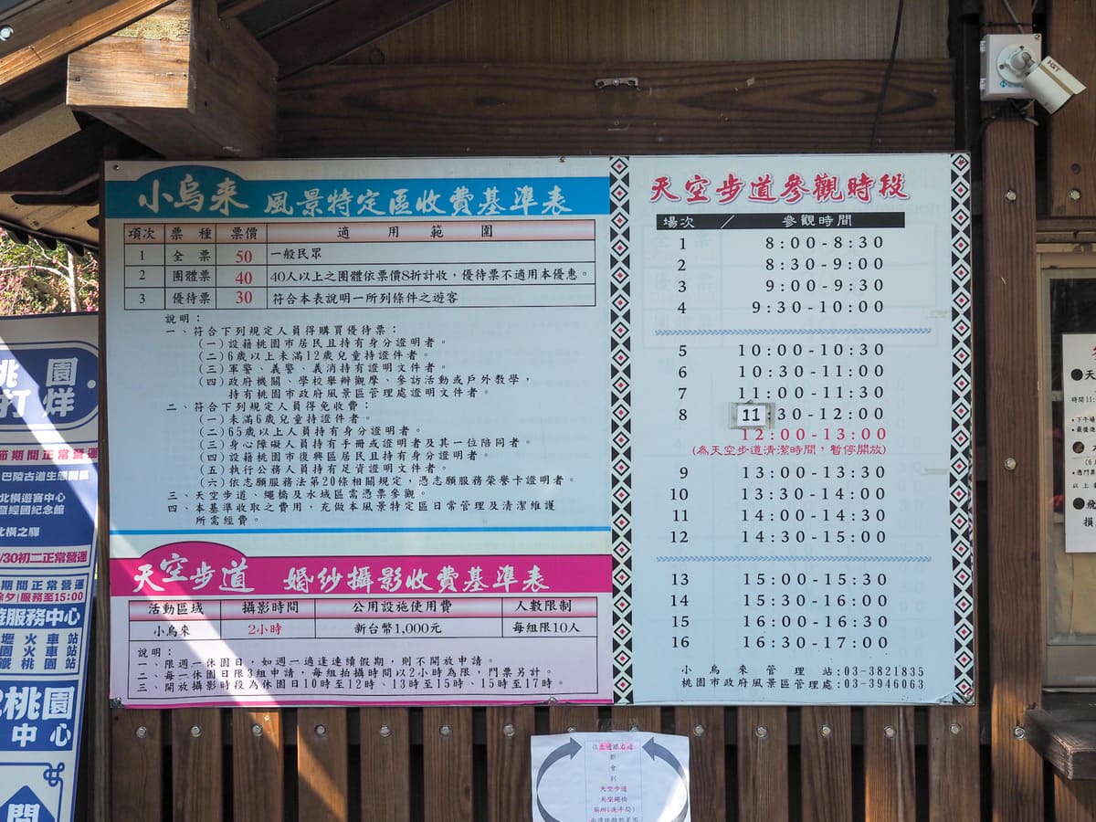
A walkway directs you down to the Xiaowulai ticket booth. If you want to walk on the waterfall skywalk or cross the rope bridge, you’ll need to purchase tickets (NT$50 for a full-price adult ticket), but in actuality, you can complete this walk until without having to buy a ticket.
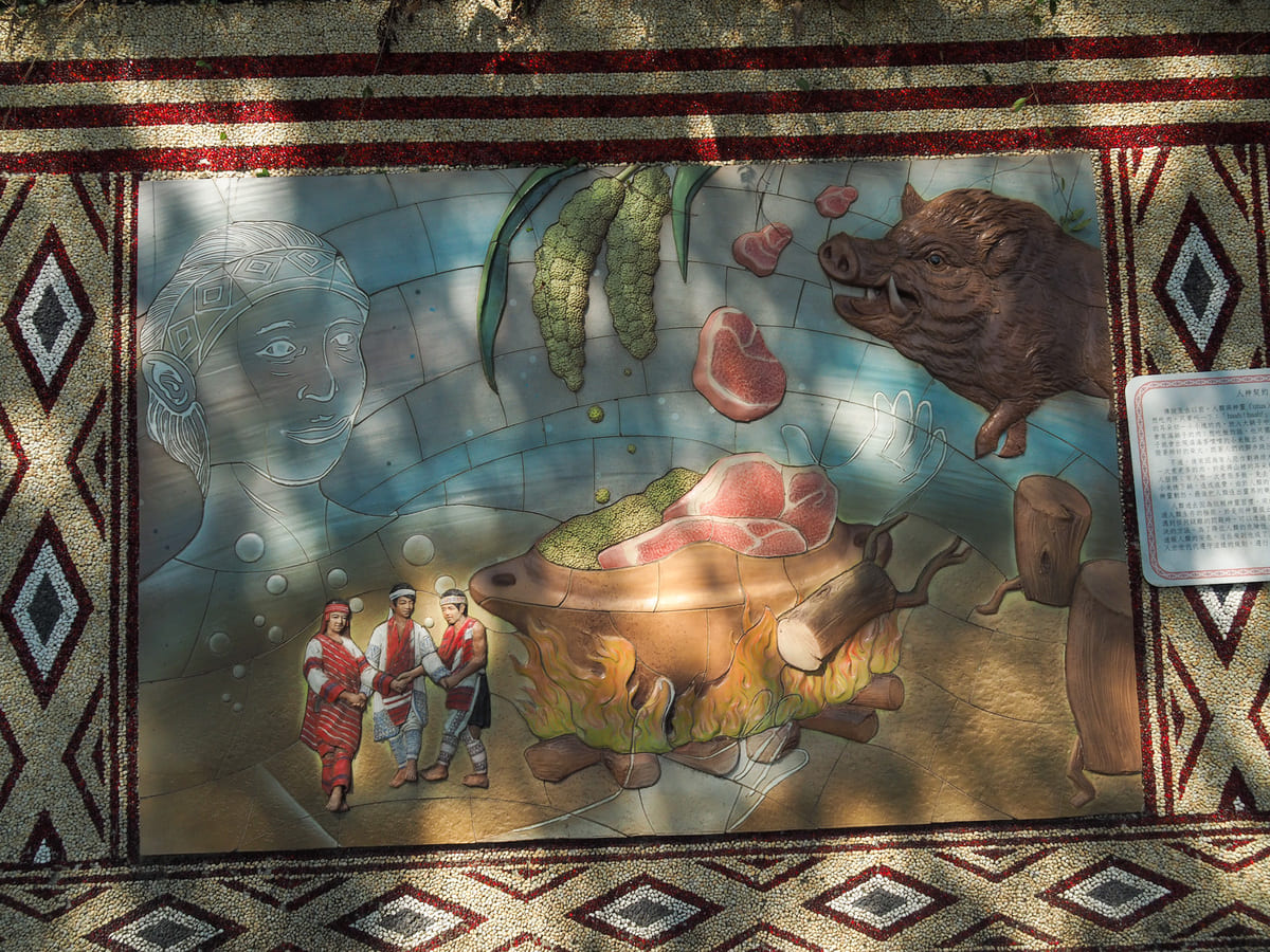
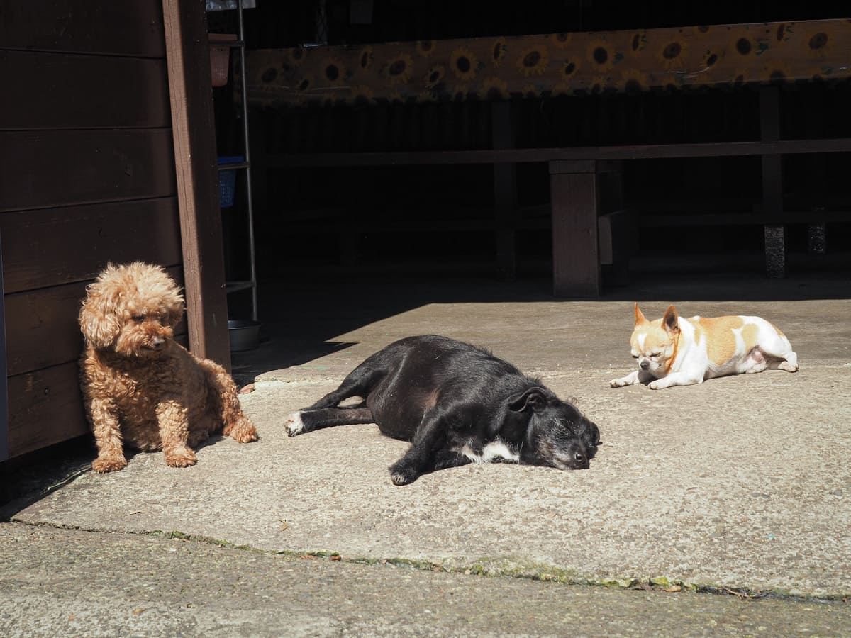
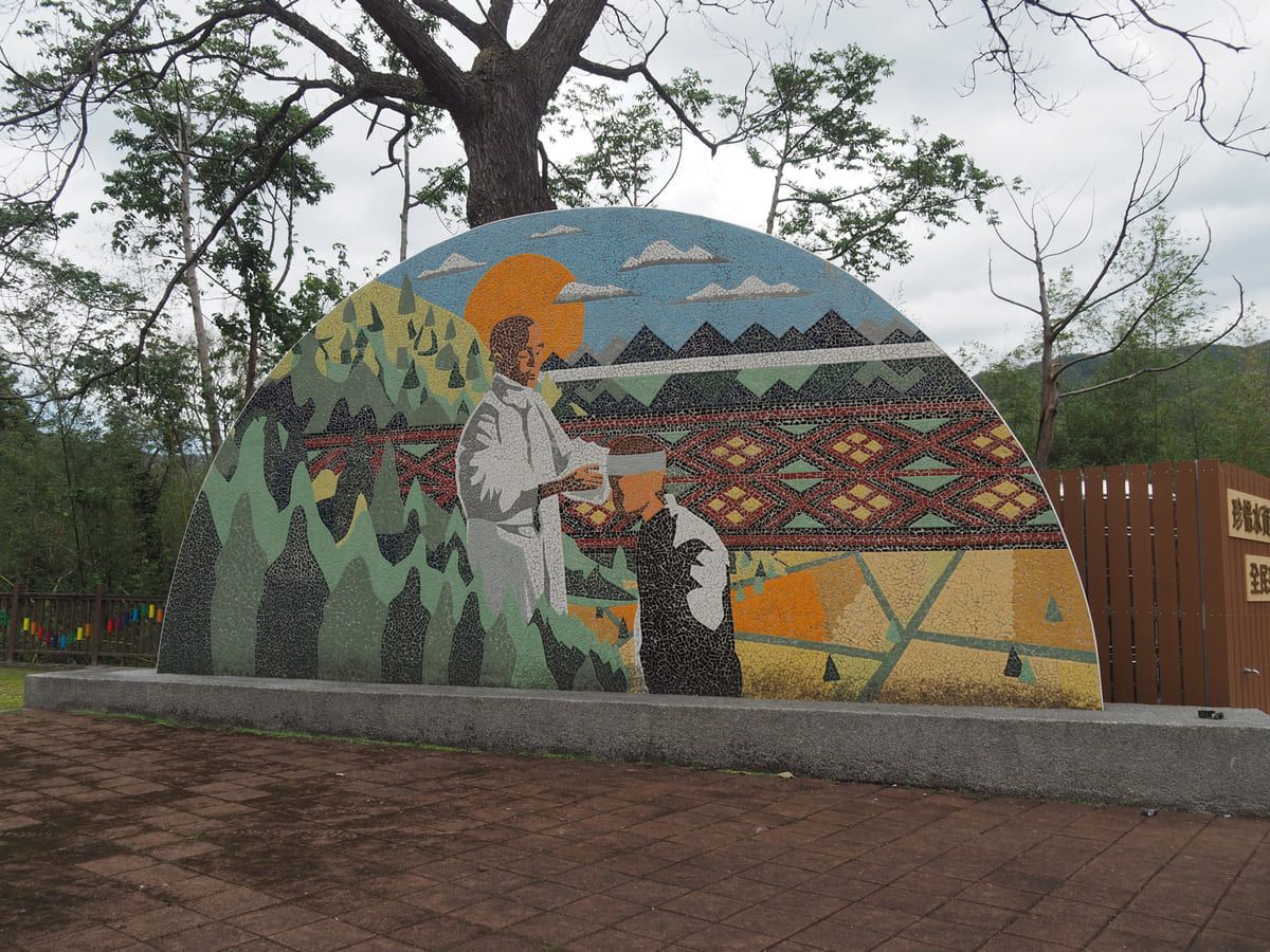
The path heads past a couple of small restaurants with a contingent of cute but overloaded pups and along a wall decorated with artwork depicting Tayal stories, including the tale of how Tayal tribespeople were born from a rock and learnt how to reproduce after they saw a giant fly (which they took to be tribal spirits) flying back and forth across the woman’s crotch.

If you bought tickets to enter the skywalk area, you can show them to the people staffing the ticket booth on the right here. (If you didn’t, you can just head straight over the bridge.)
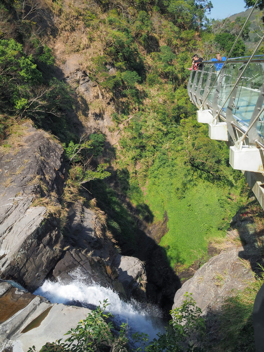
A short path leads from the ticket booth to the skywalk. On the way, you’ll pass a rock that has been christened the Balancing Stone. This five-metre tall stone used to be perched perilously on the river bank, resting on a narrow wedge. It withstood many earthquakes and typhoons balanced in that fashion and it became entwined with the local tribespeople’s folklore. They hold that the rock was put there by a fortune telling bird to protect the tribe’s crops from being washed away during heavy rains — a job it apparently did rather well more many years. However, in 2013, Typhoon Soulik spat out so much rain in such a short time that this huge rock was swept from its perch into the water.
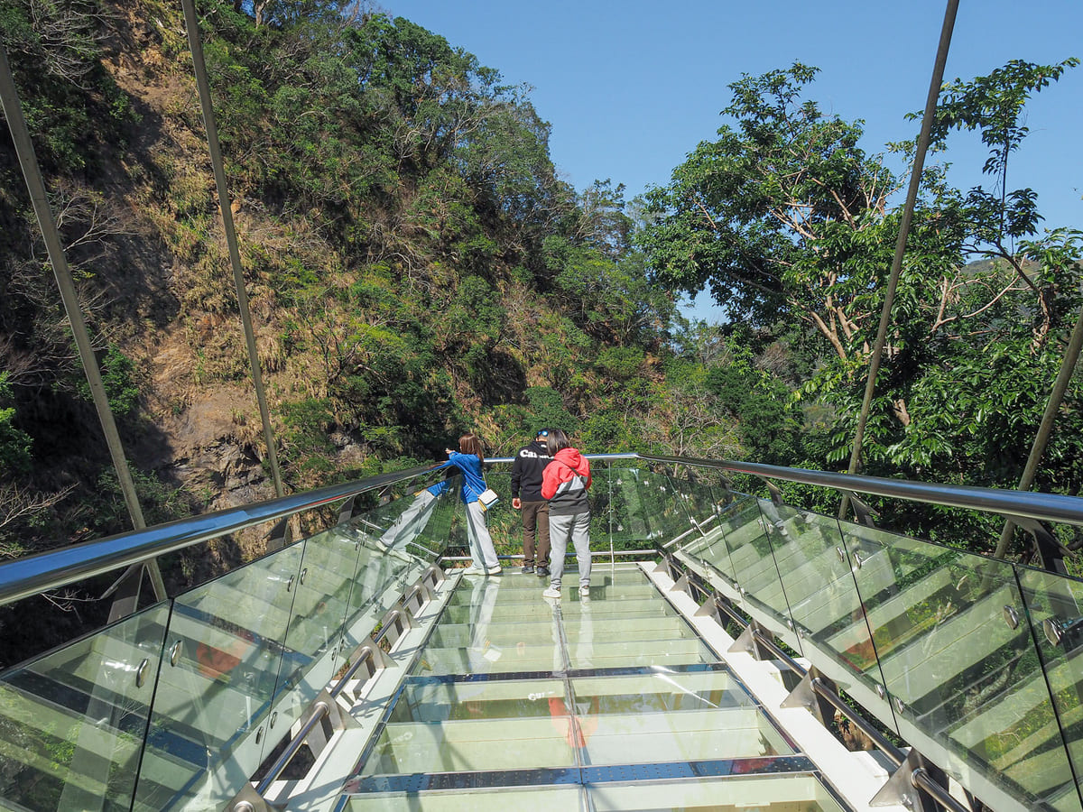
Past the balancing stone, I soon found myself walking out over the glass-bottomed skywalk. The walkway gives you a good view of a small waterfall that tumbles into a pool just upstream of the much more dramatic main falls. If you have the stomach for it, you can peer through the reinforced glass floor to see the water tumbling over the precipice to fall roughly 50 metres and kicking up an almighty white spray.
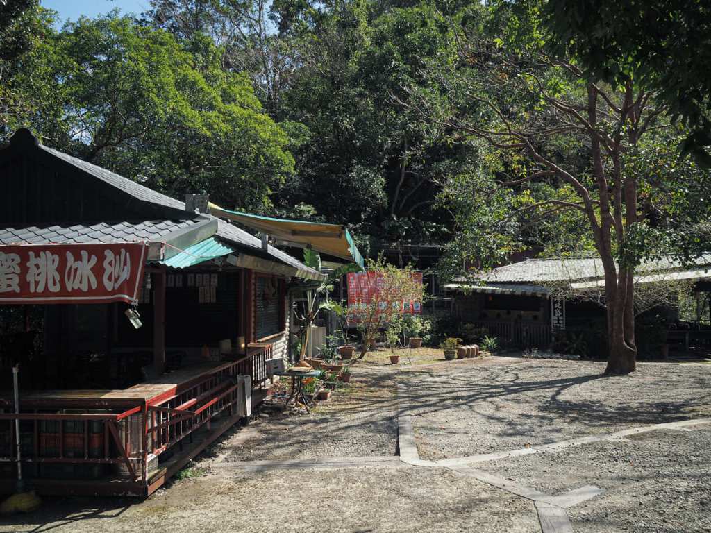
Heading back through the ticket checking area, I turned right and followed the steps uphill towards the toilet block and an area that has several small eateries (all closed on a Monday, but I think a couple still open on weekends).
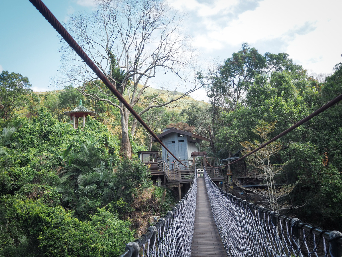
Nearby, you’ll find the entrance to the rope bridge. If you didn’t buy a ticket, you can just take the lower and smaller bridge to head over the water and back towards Luofu, but if you bought a ticket, just wade it at the person staffing the bridge and you can walk over.
This much shorter than Yixing Suspension Bridge, but judging by the anxiety of the group in front of me, it’s still plenty high enough to be challenging if you don’t like heights. If you’re brave enough to look down, you might spot the secluded Mysterious Waterfall far beneath you.
On the far side of the bridge, I turned right Nd retraced my steps back over Yixing Bridge and up to Luofu. I had about an hour to kill before the next bus, but I hadn’t brought my swimming costume and the café I wanted to visit has closed, so I just kind of mooched around for a bit.
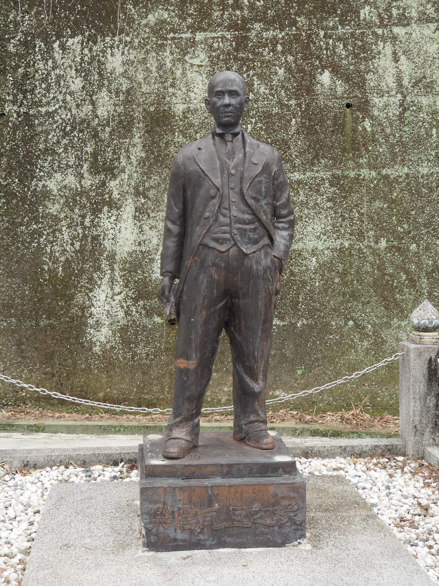
As well as the hot springs, you can wander up to Losin Watan Memorial Park (樂信瓦旦紀念公園). In February, the hills were full of bright pink cherry blossom. Losin Watan is an important historical Tayal figure.
A note on names: English name translations are always somewhat flexible in a country that has had multiple romanisation systems, and doubly so when the people in question existed in a time and space where using three tongues was common. In Losin Watan’s case, his name filtered into English from his native Tayal language via Japanese, Mandarin, and Taiwanese, so elsewhere, his name is Lixin, Lexing, Losing, or Loxin, Wadam or Wadan or other combinations of similar sounds. For now, I’m going to stick with Losin Watan.
Losin Watan was born into the Dabao tribal community (大豹社) near Takoham (大嵙崁) in 1899, just a few years after Japan invaded Taiwan. Takoham was located a little further down towards the planes than Luofu is, in Taoyuan’s Sanxia District, and thanks to its abundant camphor resources, it was one of the earliest places to suffer incursions by first Qing, then later Japanese forces.
Losin Watan’s father, Watan Syat (the Tayal naming convention is for the child to take the father’s given name as the second element of their name, with no surnames), was the head of the Dabao community and he played a key role in the Dabao Uprising — a protracted and bloody rebellion against the theft of their land and ill treatment of their people. By the time it ended, the Tayal had suffered numerous casualties and they were forcibly relocated to villages higher up (in present-day Fuxing District).
Despite his father having fought against the Japanese regime, Losin Watan ended up being something of a poster-child for the authorities’ efforts to educated and assimilate Taiwan’s indigenous population. He was selected as a candidate for a trial “governance by natives” policy that involved training the sons of high-ranking tribal chiefs so that they could be sent back to form a bridge between their tribes and the colonial authorities. He studied medicine at the Governor-General’s Medical School, later returning to promote modern medical practises among his community. He even married into a respected Japanese family.
When the Japanese left Taiwan, Losin Watan continued to be a representative for his community. Initially, the KMT forces seemed to view him as a positive force, but he later fell out of favour for his work advocating for Indigenous land rights. He was executed by the government in 1954 on charges of conspiracy — a victim of the White Terror Era.
I wasn’t planning to write so much about Losin Watan on an otherwise pretty light post about a scenic walk, but I’d never heard of him and it is almost impossible to find all but the barest of details about his life in English and I wanted to do what I could to change that.
How to get to Xiaowulai
Google Maps address: The walk starts and ends at Luofu Village, where you’ll find ample parking near the information centre.
GPS location: N24 47.550 E121 22.020
Public transport: Transportation requires a little planning and takes time, but it’s not impossible.
For early, early risers, take the 5:25 9005 bus from Taipei City Hall and ride it to Minzu Rd. in Taoyuan. From there, walk about a 100 metres to Zhonghua Minzu Rd. Intersection and then wait for the 5301. This services departs nearby Taoyuan TRA station at 6:30, so you can expect it to arrive around 6:32. Ride this service all the way to Luofu bus stop.
For those that prefer a more leisurely start, you would be better off staying the night in Daxi the night before. Then you could take the 5
Nearby trails:
Xiaowulai Trail Map
GPX file available here on Outdoor Active. (Account needed, but the free one works just fine.)
