Climbing Mount Keelung is part and parcel of the Jiufen experience. Most visitors take a break from sampling the town’s many and varied treats to climb the thigh-testing, lung-burning steps. Far fewer people know that there is a secret back-route that reaches the summit via a series of thrilling scrambles. What’s more, with coffee shops at the bottom and the promise of food at the top, climbing the peak this way just makes sense.
Distance: 3.2 kilometres as a point-to-point wal or 6.3 kilometres as a loop.
Time: About 3 hours as a point-to-point hike or 4 hours as a loop.
Total ascent: About 590 metres.
Difficulty (regular Taiwan hiker): 6-7/10 — For frequent Taiwan hikers who are experienced with this kind of terrain, this is on the higher end of moderate or lower end of challenging. It requires upper body strength and a lot of scrambling.
Difficulty (new Taiwan hiker): 9-10/10 — For people new to hiking in Taiwan, this would be quite a challenging trail. At times, it feels more like rock climbing.
Risks and dangers: There is a real risk of falling here. In a couple of places, there is very little between the trail and a steep drop, and in more places, the path itself is a 60-70° slope with a significant way to fall below you.
Water: I took 1L on a warm March and drank about 0.8L. There are no convenience stores at the bottom, but there are a few coffee shops, and once you finish the walk, you’re in Jiufen, so there are lots of places to stock up. We stopped for a drink at 正好Cafe, a tiny hillside house with a plant-filled terrace and a charmingly ramshackle interior.
Shade: Much of this walk is quite exposed. If you’re sensitive to the sun, I would advise long sleeves and a hat that can cover the back of your neck as a minimum.
Mobile network: My network was clear throughout.
Enjoyment: I absolutely loved this walk. It was challenging but not too long. There are some superb coastal views and it finishes at a place where you can get refreshments. I would very much recommend this walk to anyone who has adequately prepared themselves for the challenge.
Other: It was about 24°C on the day of our walk, and I really would not advise doing this if the conditions are any hotter. It would be miserable.
Bathroom facilities: There is a toilet block near the start and you can find toilets in Jiufen too.
Route type: This can be either a point-to-point or loop walk depending on how you choose to arrive at the trailhead. I imagine most people will do a point-to-point walk.
Permit: None needed.
Jump to the bottom of this post for a trail map and GPX file.
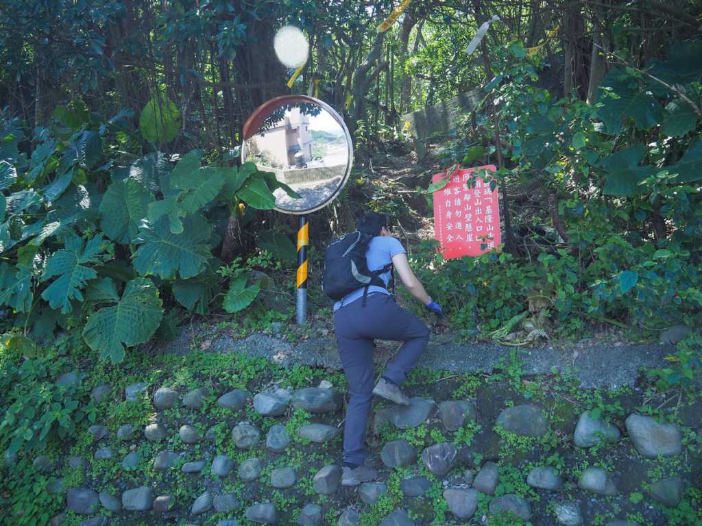
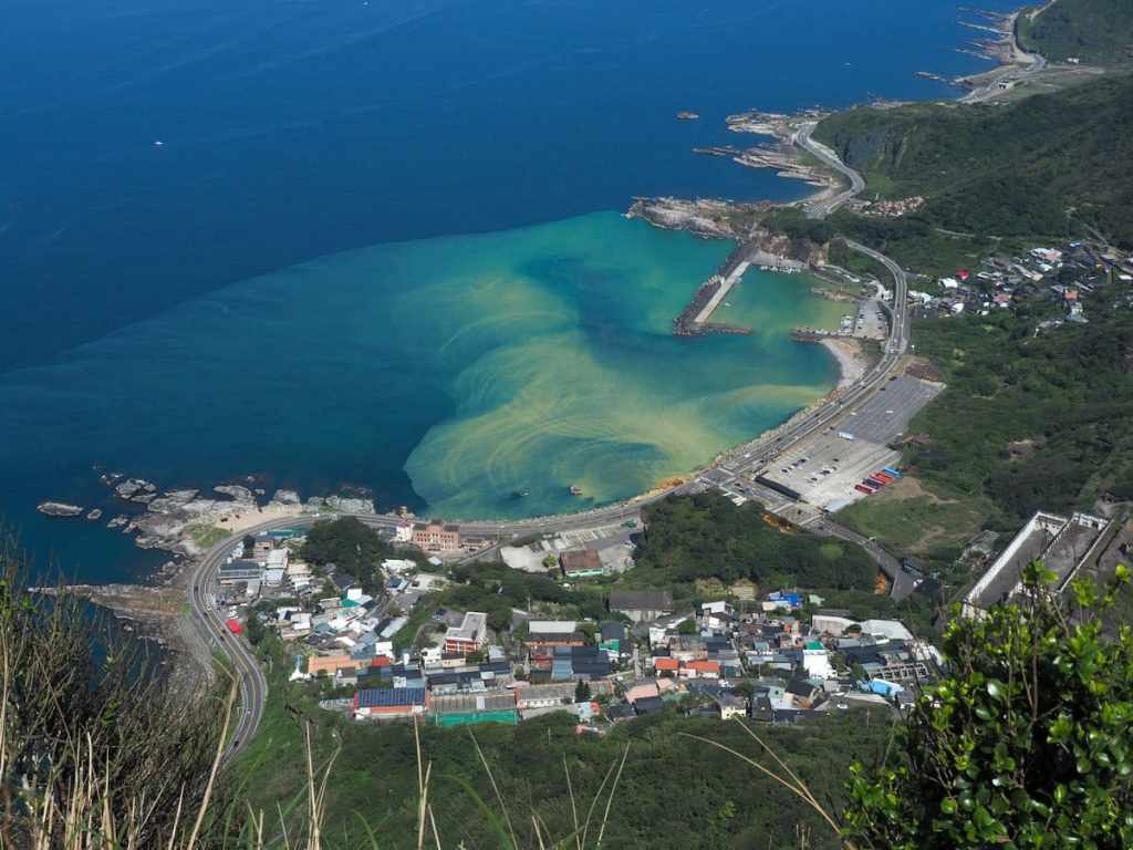
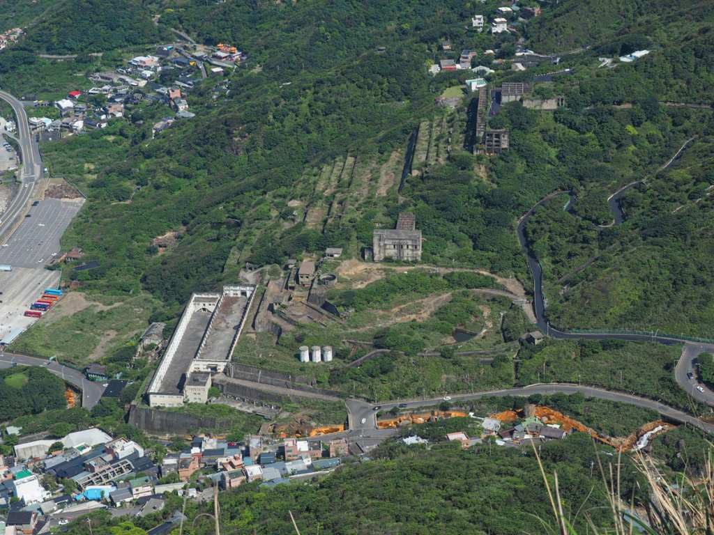
The trailhead for this walk is hidden up a backroad in the slopes just up from the Yin Yang Sea and the ruins of the old Shuinandong Smelter. The red sign urges hikers to keep out on account of the precipitous trailside drops, but as is evident, plenty of people don’t keep out.
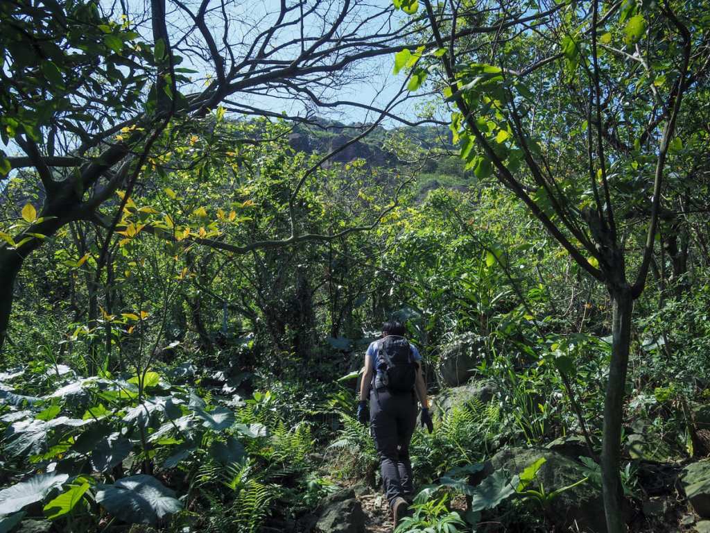
For the first couple of hundred metres, the trail sticks under the tree line and we let the sparse hiking tags guide us, but then very, very quickly things switch up a gear.

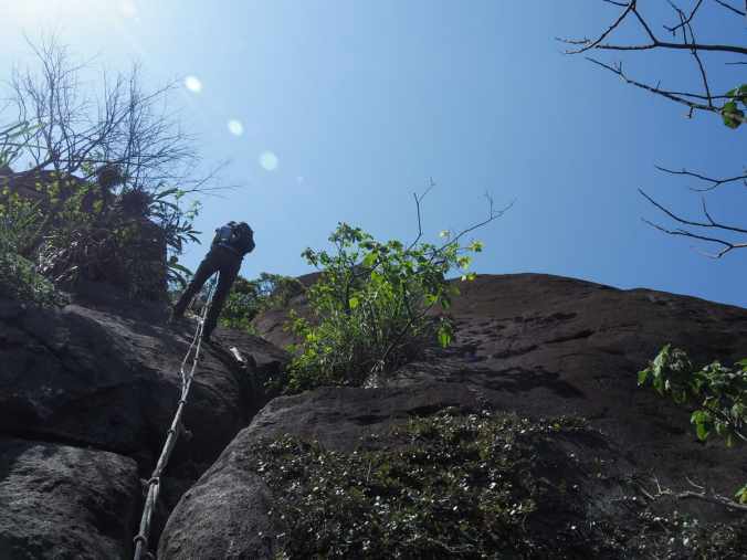
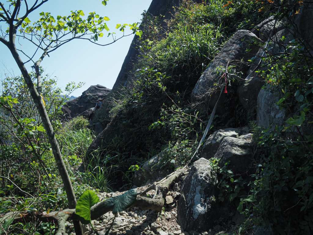
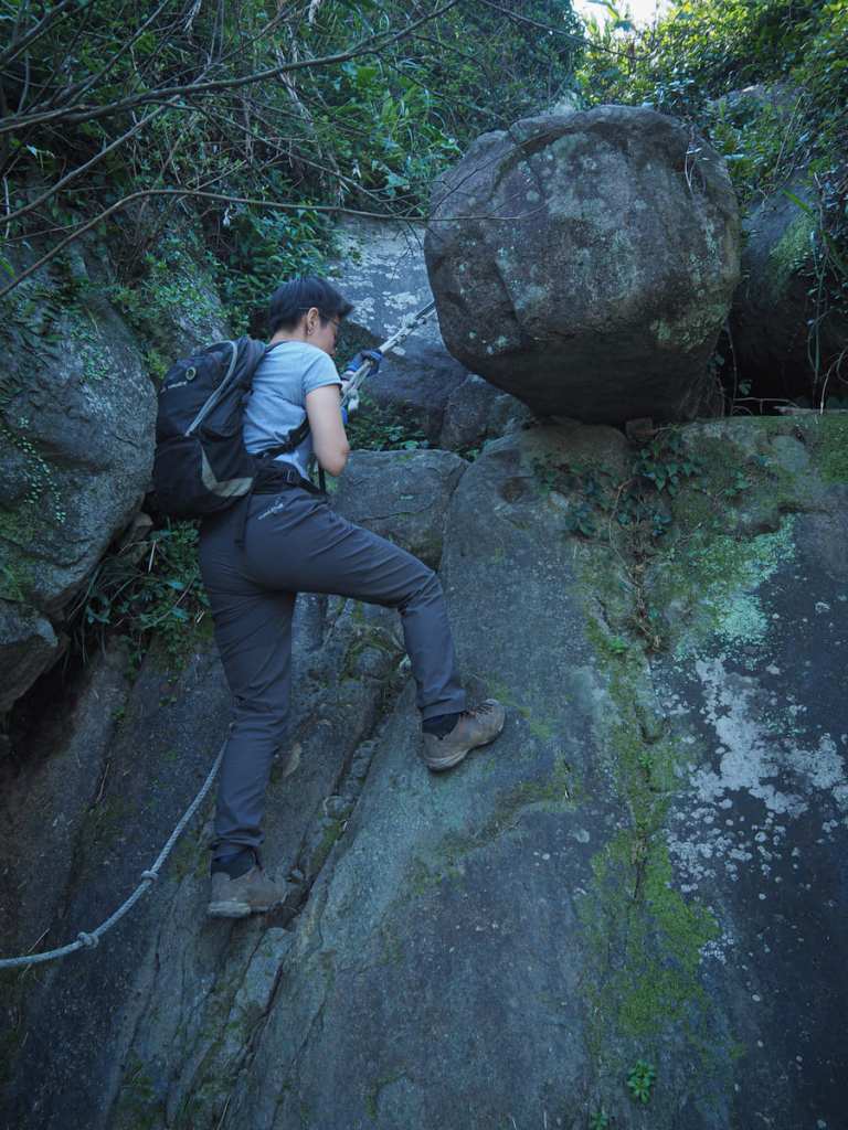
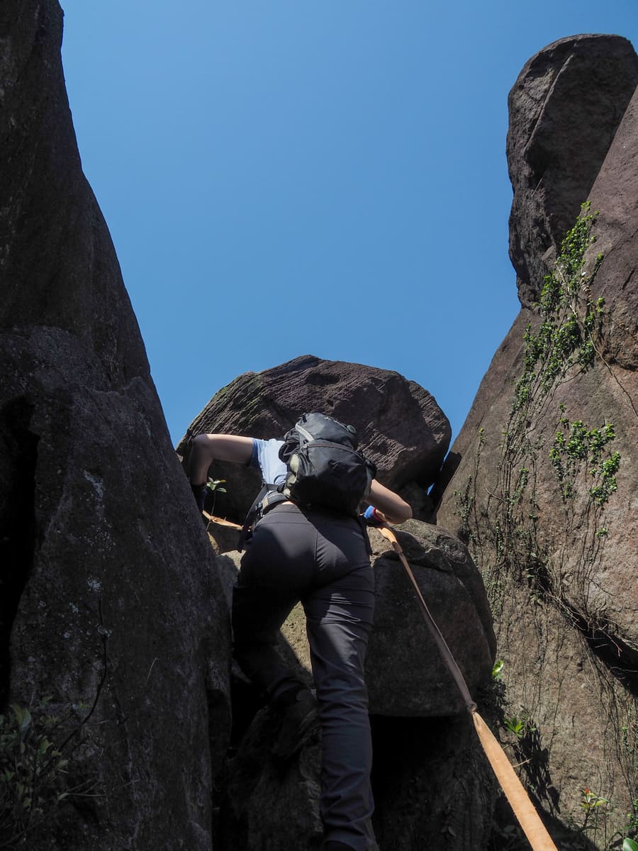
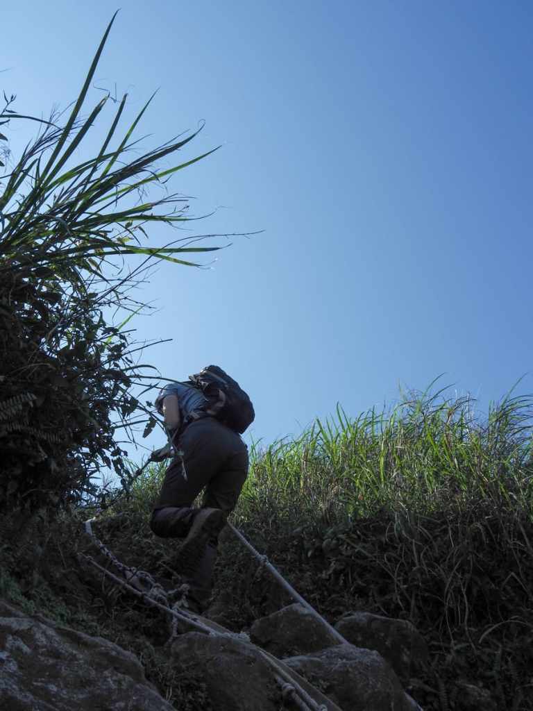
There are a couple of baby scrambles first, then within 15 minutes of leaving the road, we found ourselves scrambling up this ridiculously steep rock face. Generally speaking, where trails require ropes, I tend to grab them with a hand and use them as a secondary aid to support my climb, but here, I had to grab the two ropes at a time and twist them around my arm because there was absolutely no way I would be getting up without their assistance.

There was a minor traffic jam at this point, when we encountered a team coming the other way (I have no idea why they wanted to descend this way, there’s no way I would have walked it that way around).
This stretch is the longest exposed climb of the day but — aside from one challenging scramble — it’s not too tough.
A little way up from the exposed climb, the trail splits in two. The left hand path is the most obvious, and we initially walked that way, but upon reaching a spindly rocky outcropping, the path seemed to taper off, so we retraced our steps and took the trail on the right (the rope you can spot in this photo).
Looking at a map, there are actually two paths that reconnect later, but the presence of many rock climbing anchors on left hand one might indicate more of a bouldering route.
Even the route we picked ended up involving some mentally taxing scrambling.
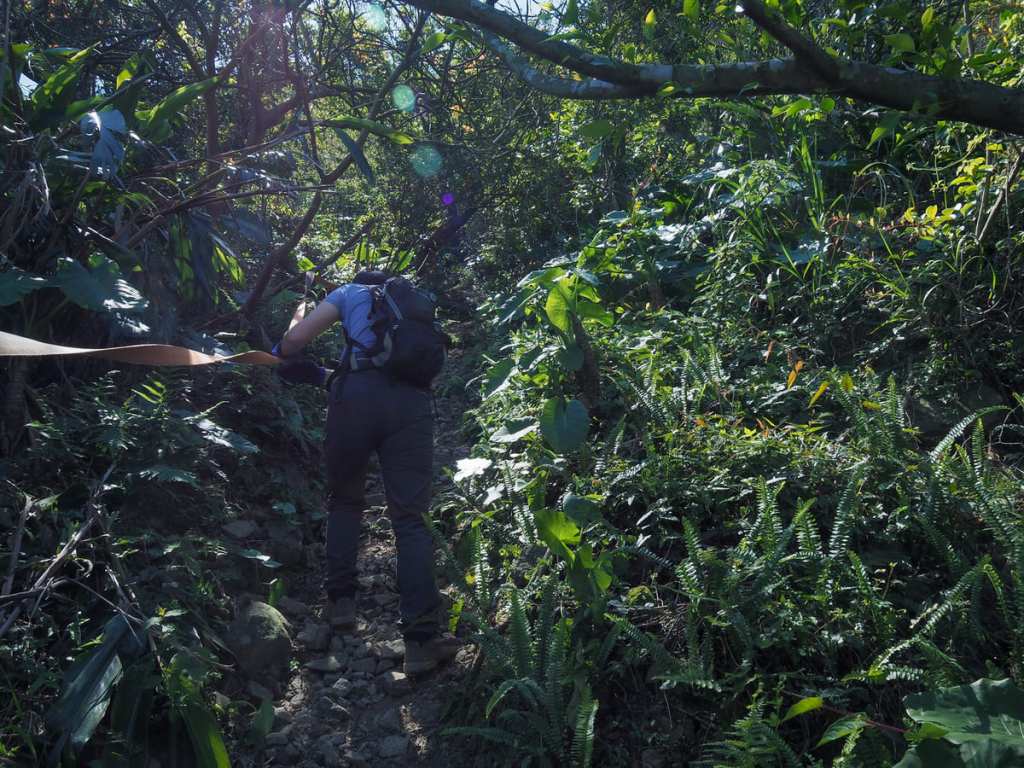
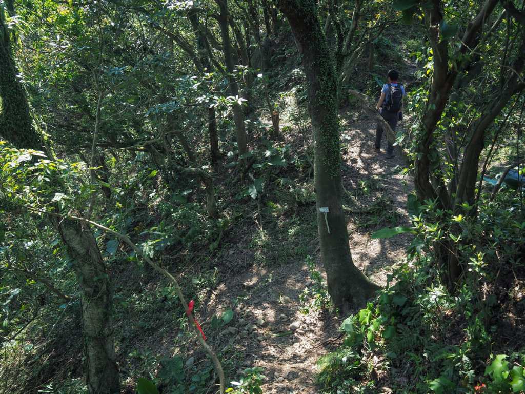
With the majority of the rocky climbs completed, the trail then ducked under the trees for a stretch. The shade was welcome, but what was not at all welcome were the loose ankle-twisting, effort-robbing pissy pebbles covering the ground. This was easily my least favourite part of the walk (perhaps the only part I didn’t like). It was tiring in the same way that running on sand is — for every step we took, the rocks undid at least some of the ground we’d covered.
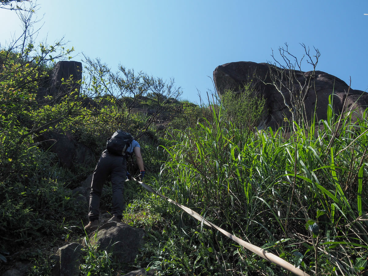
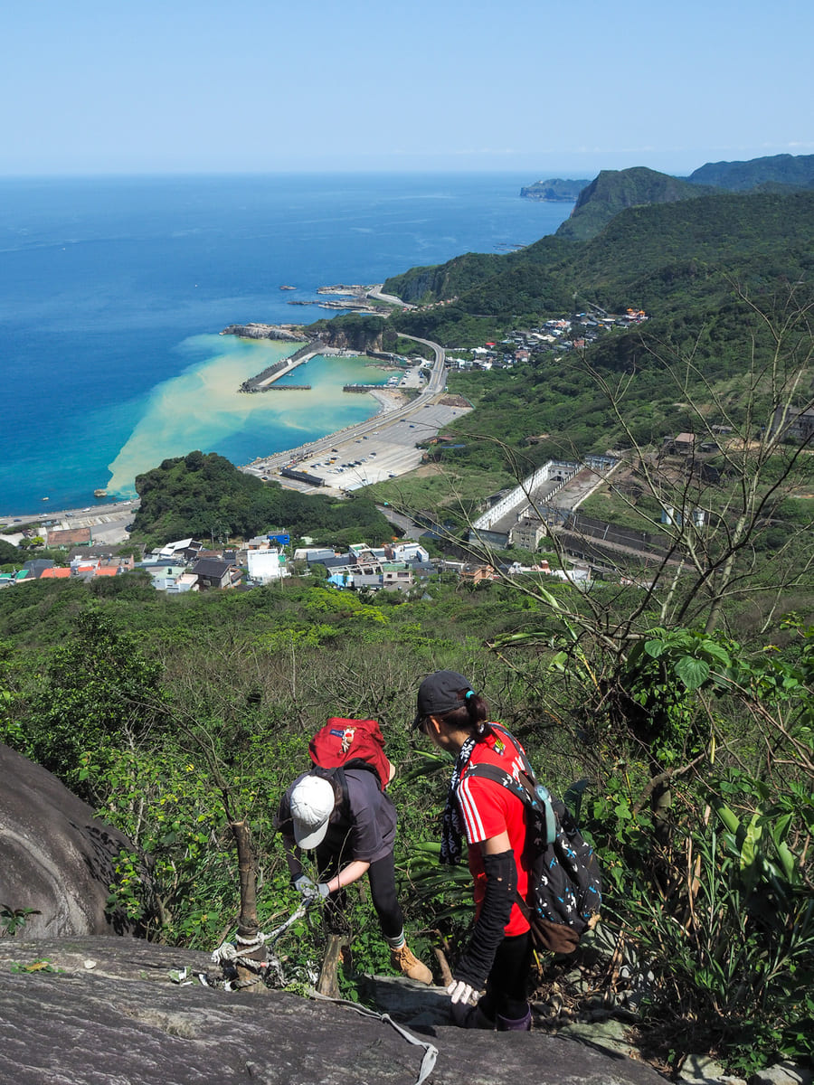
Shortly before arriving at Mount Keelung’s east peak, there is another steep scramble. (This one gave me a rather impressive bruise.)
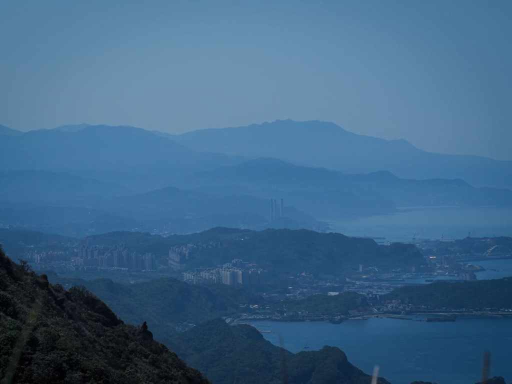
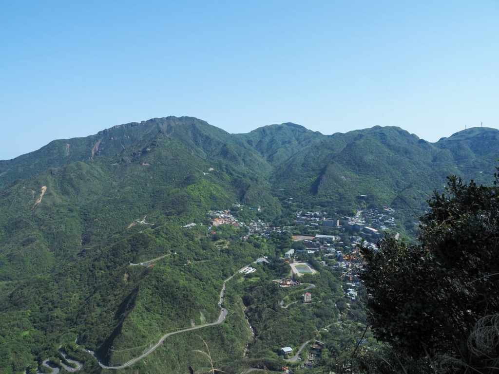
The view from up here is impressive in all directions. Looking north up the coast, you can see snatches of Keelung sandwiched between the layers of mountains.
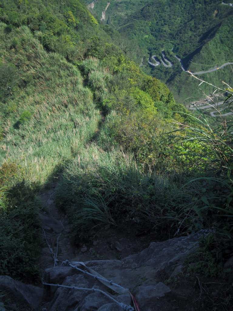
Looking back down to where we’d begun our walk, the angle was almost dizzying. It’s so steep that you almost feel as if you’re getting a bird’s-eye view.
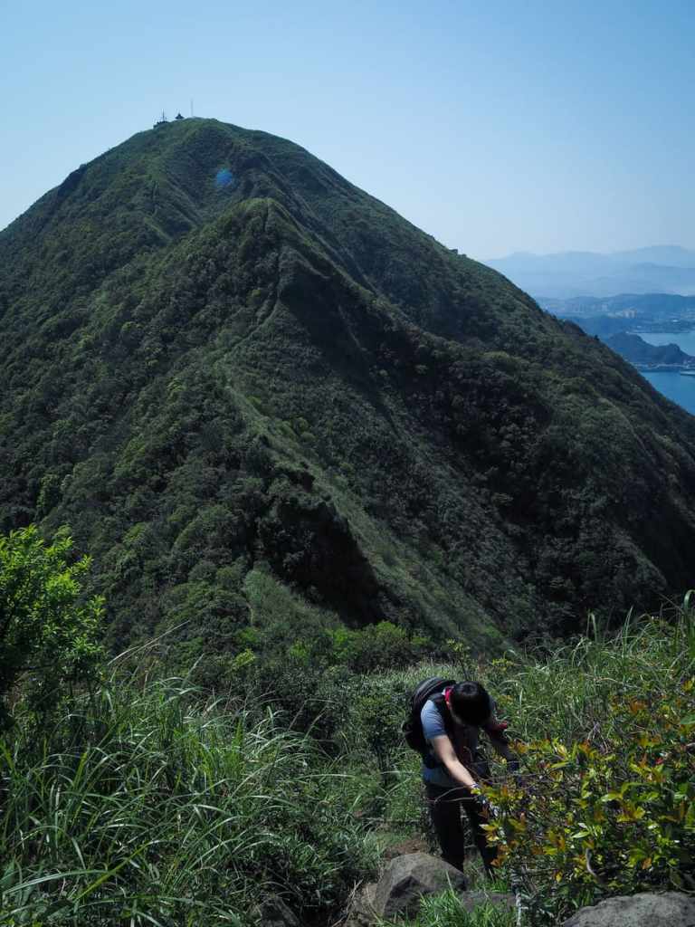
And once you turn towards Mount Keelung, you can just about pick out the line of the trail cutting its way through along the crest of the hill.
According to my map, there are actually three trails that meet at this peak, but the third one is easier to miss than to spot, so there should be no chance of taking the wrong one.
After a five-minute descent, we arrived at a junction. The path on the left heads down to the road, while the one going straight will take you to Mount Keelung.
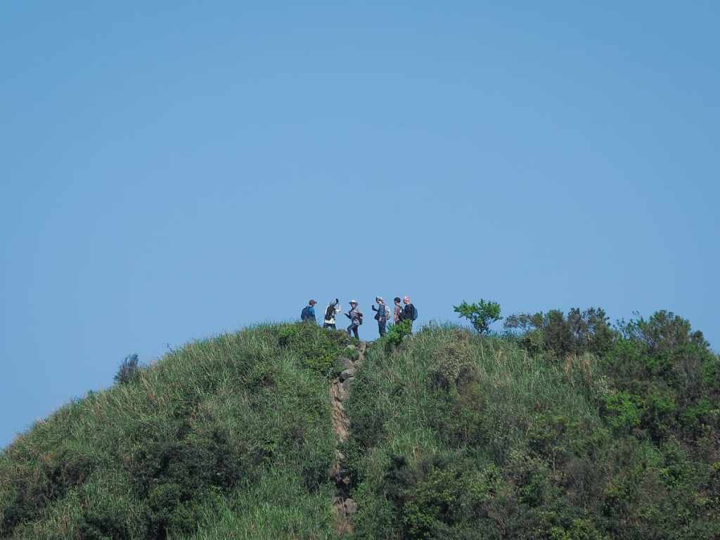
From the junction, the path immediately begins to climb again, and we soon found ourselves level with the east peak, where another group of hikers had arrived.
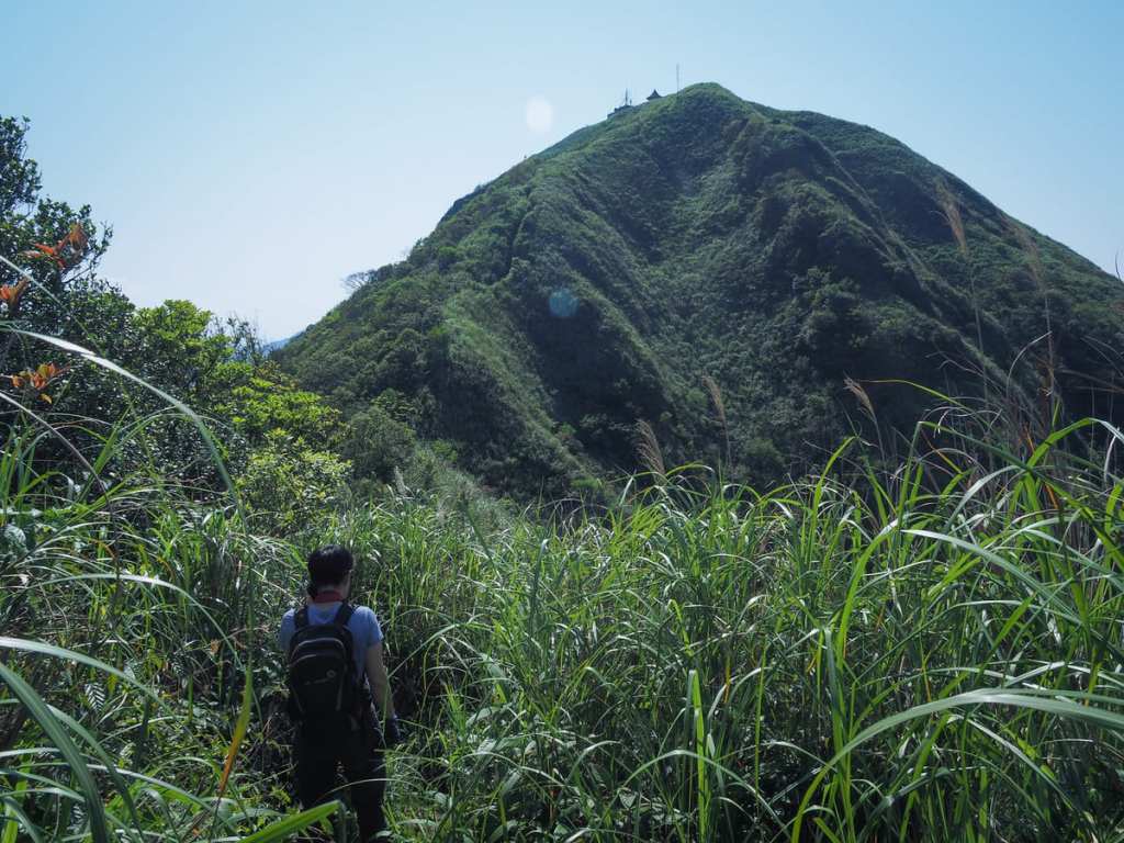
There are no more rocky scrambles, but the unrelenting steepness really does not let up until you’re almost at the summit of Mount Keelung.
Looking over towards Teapot Mountain, Mount Banping and the dramatic crest of Stegosaurus Ridge — all of which present spectacular hiking opportunities.
By this point, the heat was really getting a bit too much, and our destination still seemed dishearteningly distant.
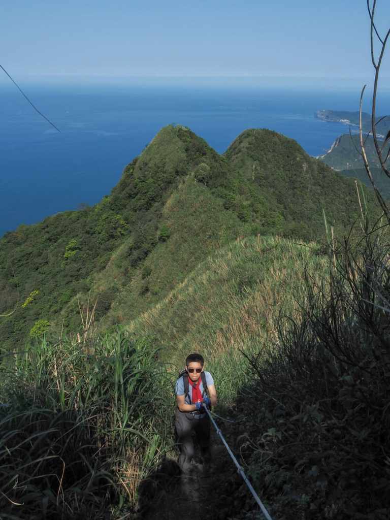
Teresa rocking her shades, hiking towel and gardening gloves. She’s an icon.
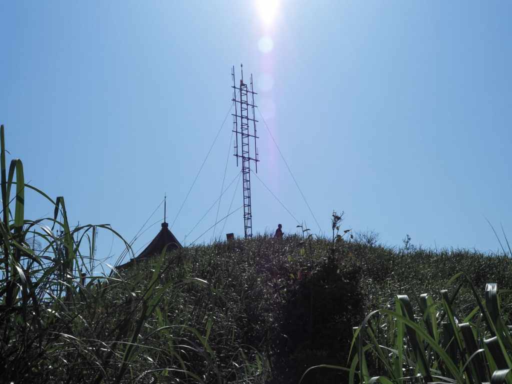
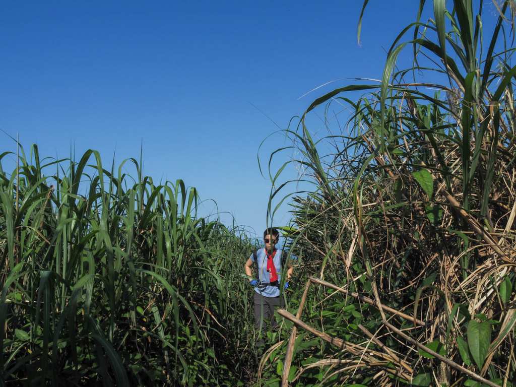
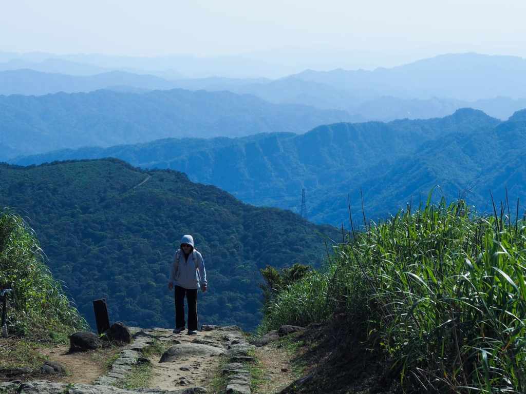
The final 100-200 metres before the top of Mount Keelung was covered in dense grasses that hid the summit from us until we had pretty much arrived.
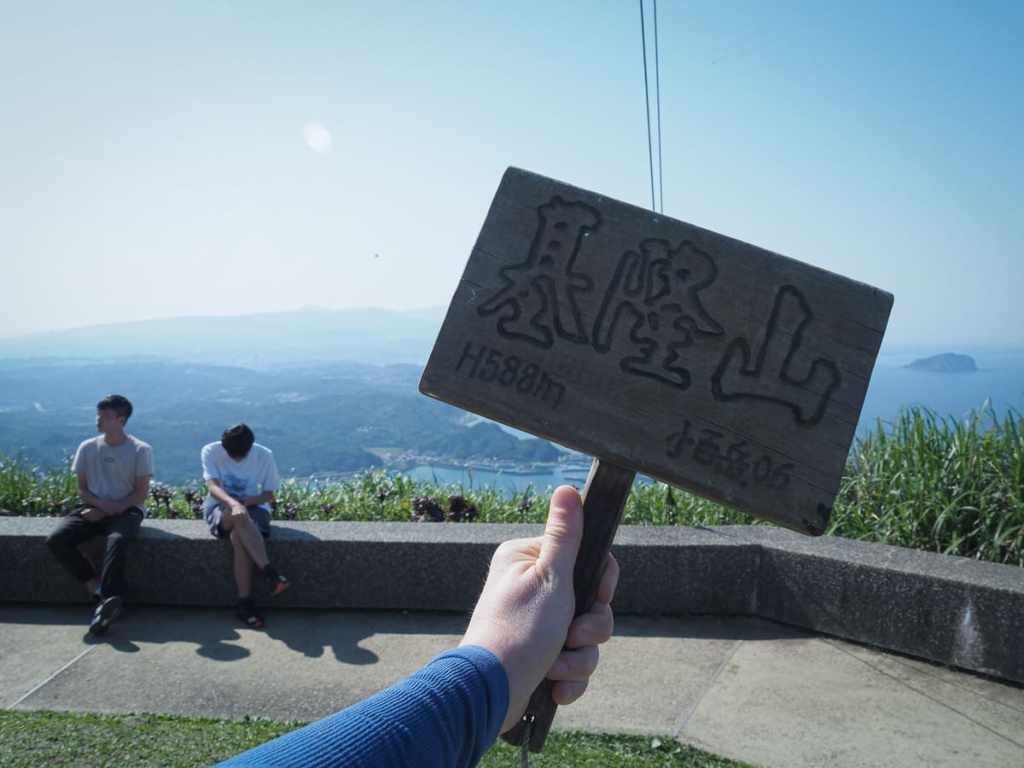
It was slightly funny to watch the reactions of the Jiufen daytrippers to seeing the pair of us emerge sweaty and slightly disheveled from the bushes. A couple of them ambled over to see where we’d come from, but the trail is really very faint from this side.
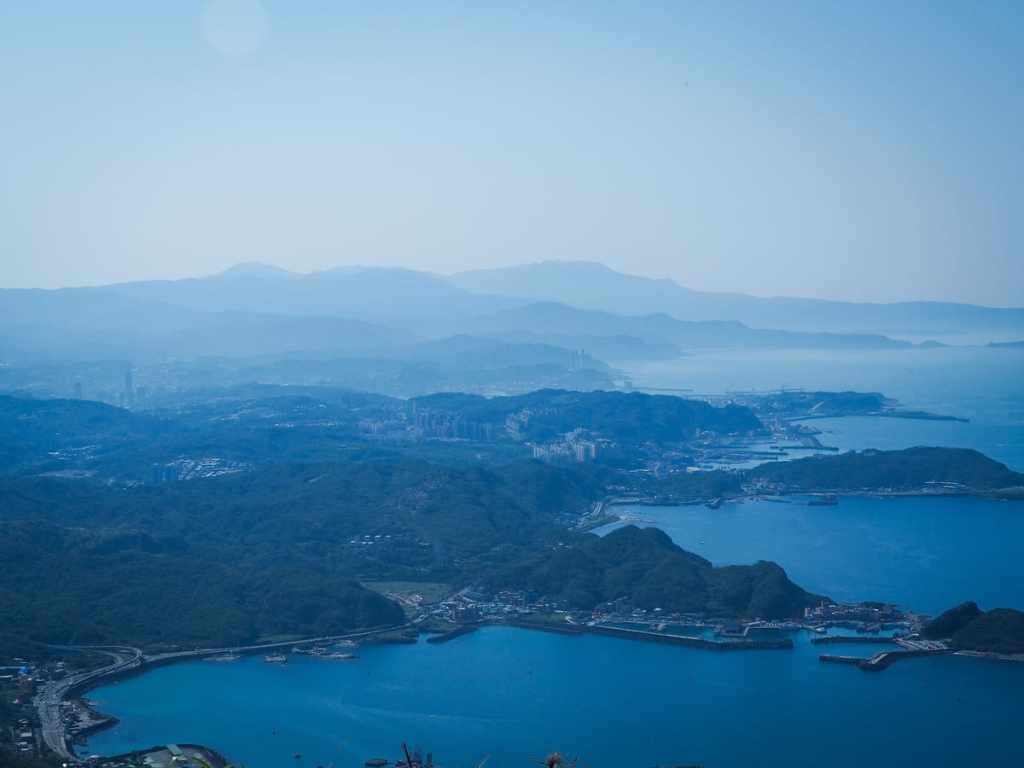
The views up here are pretty similar to those you can enjoy from the east peak, but the quietness and comparative wildness make the east peak’s views somehow seem even prettier.
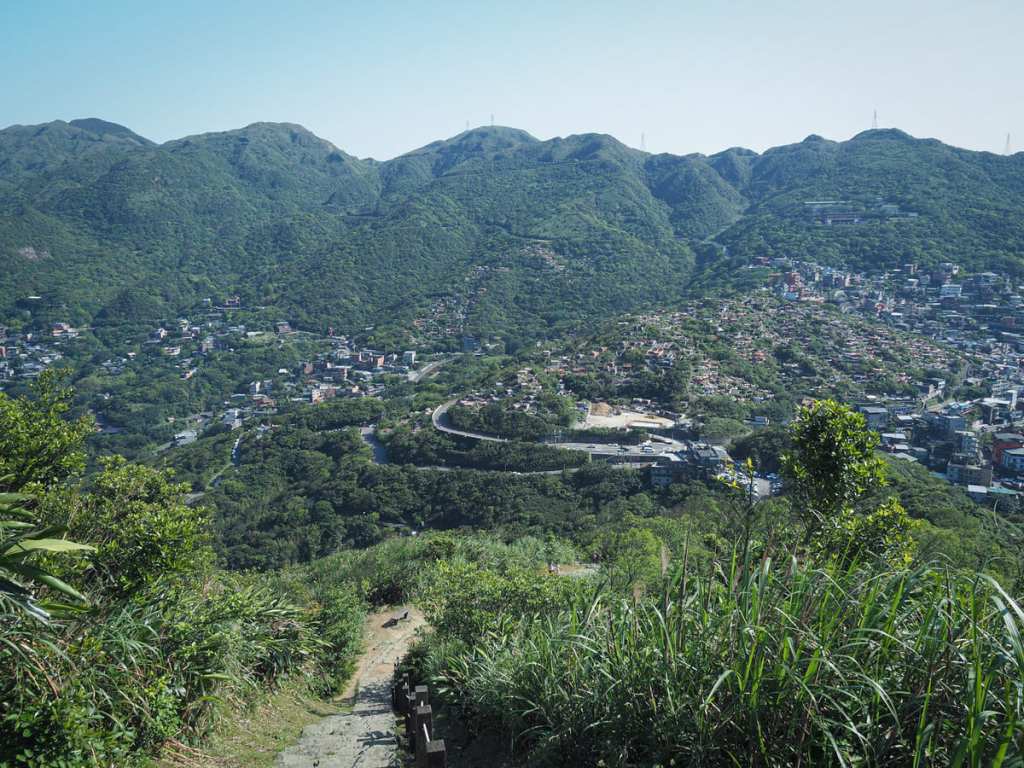
From the summit, we followed the steps of the main trail back down towards Jiufen. Every time I come here, I realise that I’ve forgotten just how pretty the views from this peak are — the steps suck, but it really is a small price to pay for scenery like this.
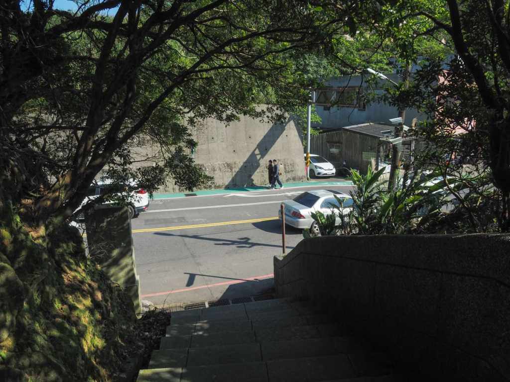
The trail ends on the outskirts of Jiufen, so if you’ve worked up an appetite, there are plenty of snack options ready and waiting. If you’re using public transport, you’ll need to turn right at the trailhead and walk another 100 metres or so to the Jiufen bus stop, but since we’d parked near the trailhead, we had to turn left and take the steps, then a road back down to where we’d started.
How to get there
Google Maps address: The walk starts from an obscure spot on Dongding Road, Lane 101, close to Liandong Elementary School and ends in Jiufen. There is free roadside parking near the bottom trailhead, but you’d have to pay to park near Jiufen.
GPS location: N25 07.225 E121 51.630
Public transport:
Getting to the trailhead — The easiest way to get here is to take the 1062 from Zhongxiao Fuxing Station and alight at Guashan Elementary School (the penultimate stop) and walk down the road to the trailhead. I say this is the easiest because — although the 1062 doesn’t drop you at the trailhead — it is a frequent enough service that you don’t really need to worry about the timing. The alternative would be to take a train to Ruifang then hop on the 866 or 856 services and alight at Shuinandong, but neither of these are especially frequent.
Getting home — From Jiufen, you can catch the 1062 or the 956 Taiwan Tourist Shuttle back into Taipei city centre.
Nearby trails:
- Golden Waterfall and Jiukeng Slope Ropeway
- Jinguashi Aqueduct Trail
- Jinguashi to Benshan Geologial Park
- Mount Banping
- Mount Keelung
- Stegosaurus Ridge
- Tamsui Kavalan Trails — Mudan Loop
- Tamsui Kavalan Trails — Ruifang to Fulong
- Teapot Mountain
Keelung Mountain South Peak Trail Map
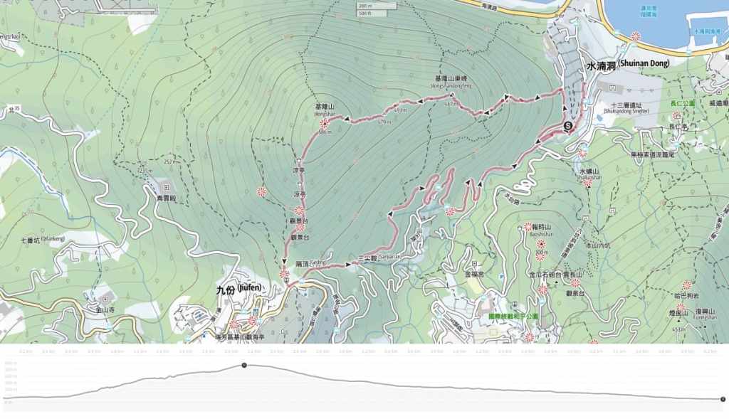
GPX file available here on Outdoor Active. (Account needed, but the free one works just fine.)

I did this hike a year or two ago and loved it! I did it in the opposite way but if I did it again I would start from the same side that you did. Both ways seem fun, though. I think a visit to the Golden Waterfall is a nice warm up for the hike, too. –Taiwan Hiking Journal
LikeLiked by 1 person
We saw some folks coming down as we were going up and I remember thinking how much tougher that must be. Either way, as you say, both directions are a good deal of fun.
LikeLike