
Qingtiangang to Jinshan Old Street
December 2025 — Note: According to a recent poster, parts of this trail are currently inaccessible. Please see their comment at the end of this post for further details and make any necessary changes to the route.
The Fisherman’s Trail, is one of those vexing places in Taiwan that goes by a myriad of names. You might have heard it called the Jinbaoli Trail, Yulu Historic Trail, Fish Road, the Japanese Cannon Trail, the Henan Soldier’s Road, or some variation of the above. With so many monikers, it took me a couple of years to realise that they were all referring to the same route (and it took me even longer to get round to walking of any of it). When most people talk about this trail, they are just referring to a short and pretty section that connects Qingtiangang and Shanghuang Creek carpark (which I’ve covered separately in its own post here), but the trail stretches far beyond that, connecting Jinshan on Taiwan’s northeastern coast with Shilin of Shilin Night Market Fame.
The trail’s roots likely lie with the first inhabitants of the area, the Basai peoples and other indigenous groups within the Ketagalan umbrella. The path’s presence before the 1600s suggests its use as an early trade route for these indigenous communities. Then, with the arrival of Han settlers in the 17th century, the Jinbaoli Trail witnessed a surge in activity. Farmers and traders adopted it as a key route for transporting goods, primarily fish and sulfur mined from the region’s fumaroles. Plenty of terrace farms from this era can still be spotted if you peer carefully into the trees. The Japanese occupation in the late 19th and early 20th centuries also left its mark in the form of more sulpur mining operations and the construction of the “Cannon Trail.” Designed for defense purposes, it meandered up the hills from Bayan to Qingtiangang, crisscrossing the original steeper route on a wider and gentler track to accommodate horses pulling heavy artillery.
At just under 30km, it should be possible for a very fit hiker (or more likely, trail runner) to cover the distance between Jinshan and Shilin in a single day. But for me, the enjoyment lies more in having the time to enjoy the scenery along the way, so I have done the walk over two separate days. Also, since finishing in either Jinshan or Shilin means you have easy access to food and transportation at the end of the walk, I have decided to start both walks at Qingtiangang rather than try to replicate a more historically accurate journey heading entirely in one direction. This post covers the northern part of the journey.
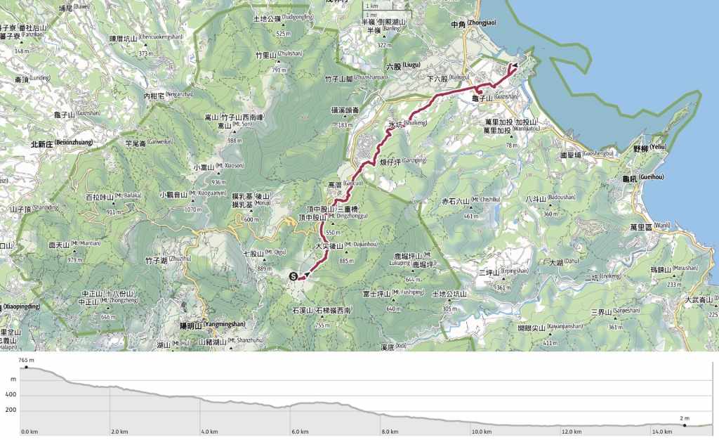
Distance: 15.4 km
Time: I spent about 6 hours on this walk, including an hour-long coffee break.
Difficulty (regular Taiwan hiker): 3/10 – I was surprised just how easy this walk was. Although it was long, I found the distance passed quickly. Also, although this stretch is arguably far more remote than the southern part, the trails were all pretty well-kept and easy to follow.
Difficulty (new Taiwan hiker): 5-6/10 – The length of the walk and the need for basic navigation skills might make this a little harder for anyone new to hiking or Taiwan’s trails.
Total ascent: About 100 metres, but the 830 metres of descent was a lot more significant.
Food and water : I drank about 0.8L on a cool day and needed a little snack to keep up my energy levels. Depending on what time of day you set off, you may or may not be able to get provisions at Qingtiangang Visitor Centre (the shop opens at maybe 9am on weekdays, perhaps a little earlier on weekends). Once you arrive in Jinshan, there are numerous refreshment options.
Shade: This trail is well-covered in some parts and completely exposed in others.
Mobile network: Mostly OK, with a couple of weak spots.
Enjoyment: The first section of this journey is by far the prettiest. Beyond that, mosy of my enjoyment came from the fact that I was completing the route of a historic trail and the fact that I have now covered the ground between the coast and Taipei.
Other: A hiking stick and or gloves might be useful. I visited in early January when the ground was dry and the plants hadn’t become too overgrown, but I would guess that some sections get a bit more plant-covered from March-April onwards.
Bathroom facilities: There are toilets at the start of the walk, at Ming’an Temple on the road down to Jinshan, and close to Jinshan Old Street.
Route type: Point to point
Permit: None needed.
Jump to the bottom of this post for a trail map, GPX file and transportation information.
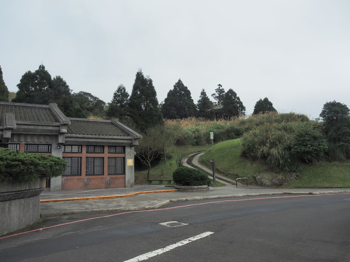
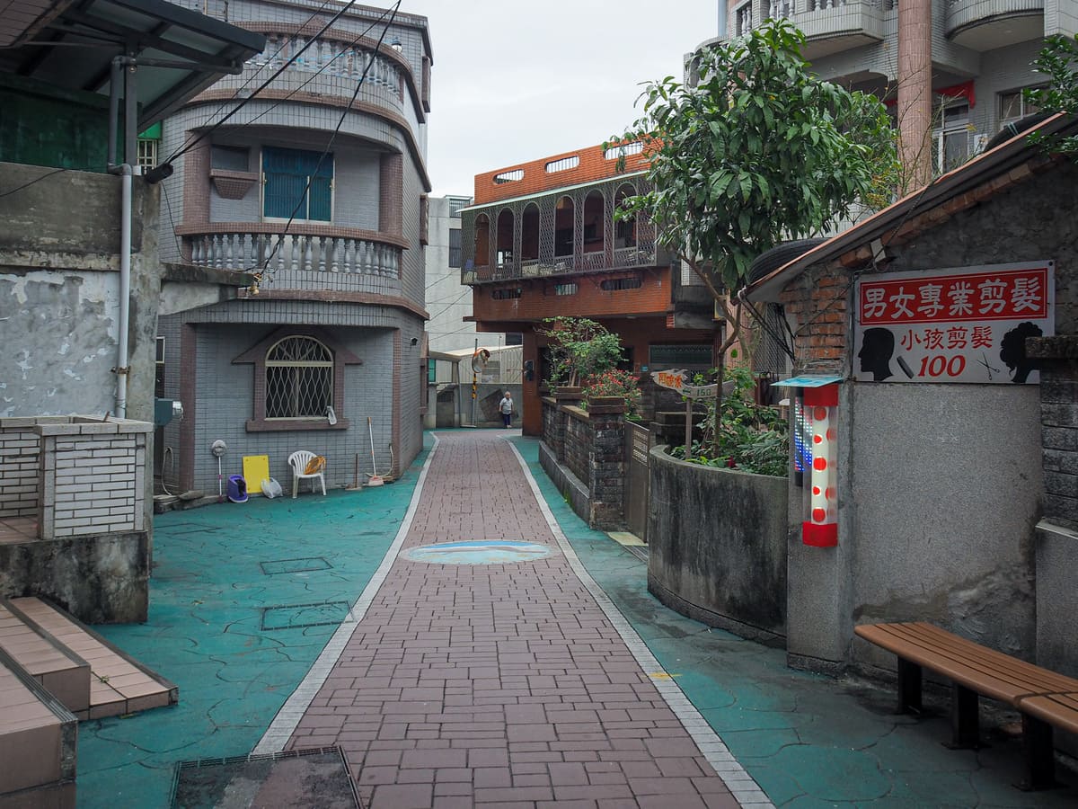
08:37 – From where the bus drops you off at the visitor centre, take the steps and follow the path towards the land god temple.
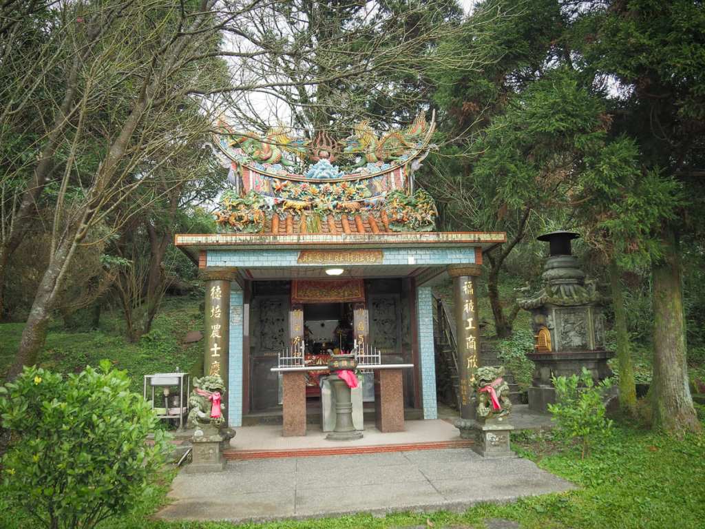
The new temple is small but decorative, but behind that you can find a smaller and older version. An information board in front of both of them says that the smaller of the two was moved here from the foot Mount Zhuzi in the mid-to-late Qing Dynasty, (which, given its range of 1644-1911, doesn’t narrow the time down much).
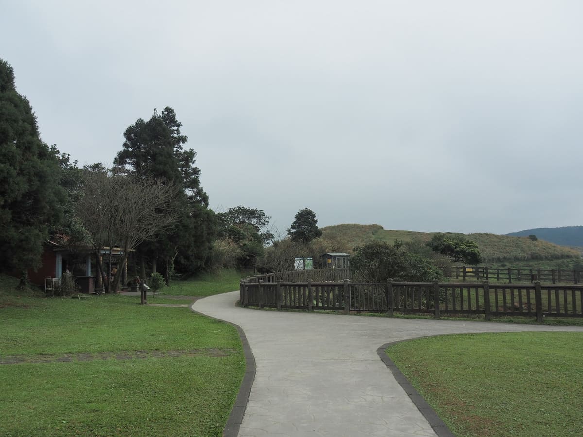
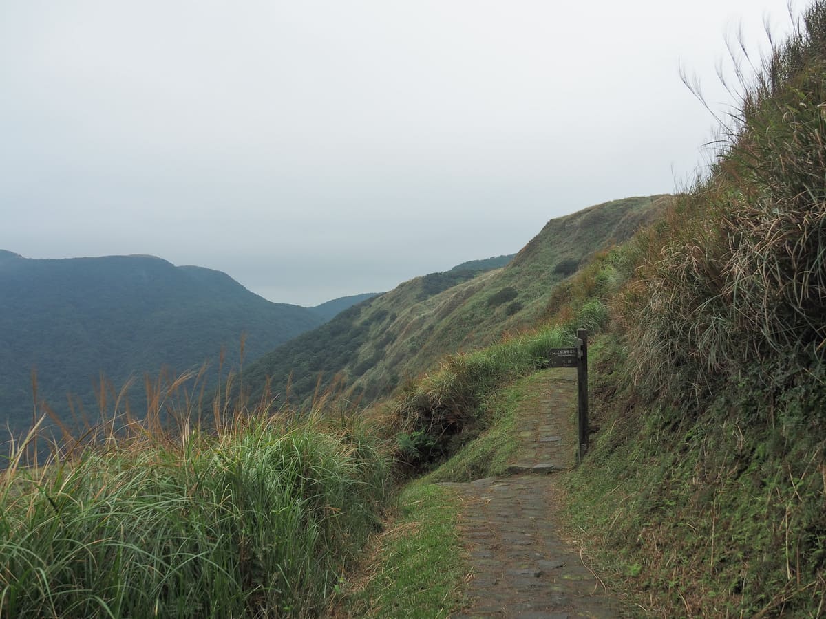
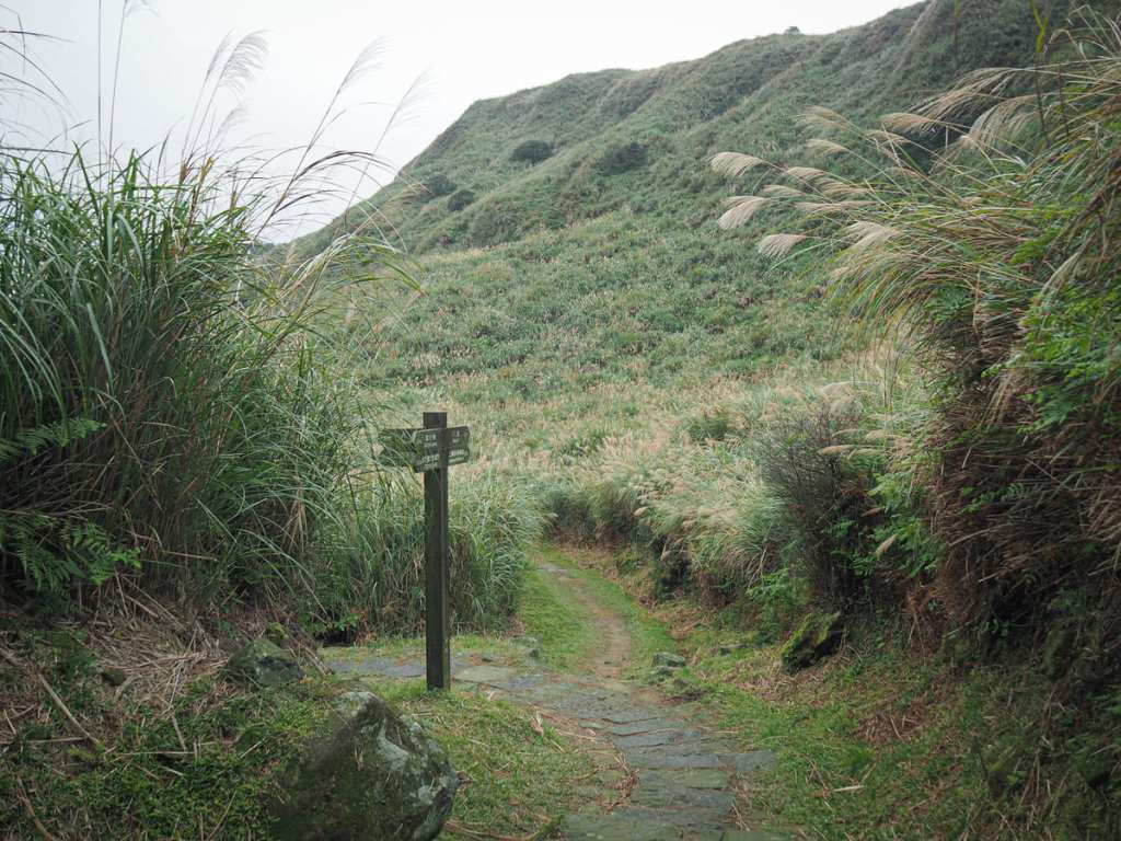
At the start of the Qingtiangang Circular Trail, keep heading straightish (instead of turning right to walk along the fenced walkway).
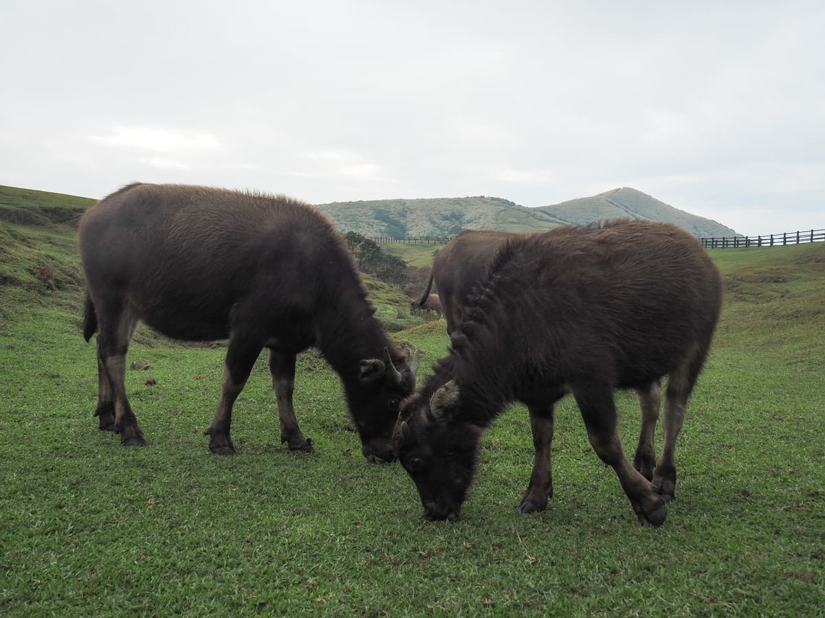
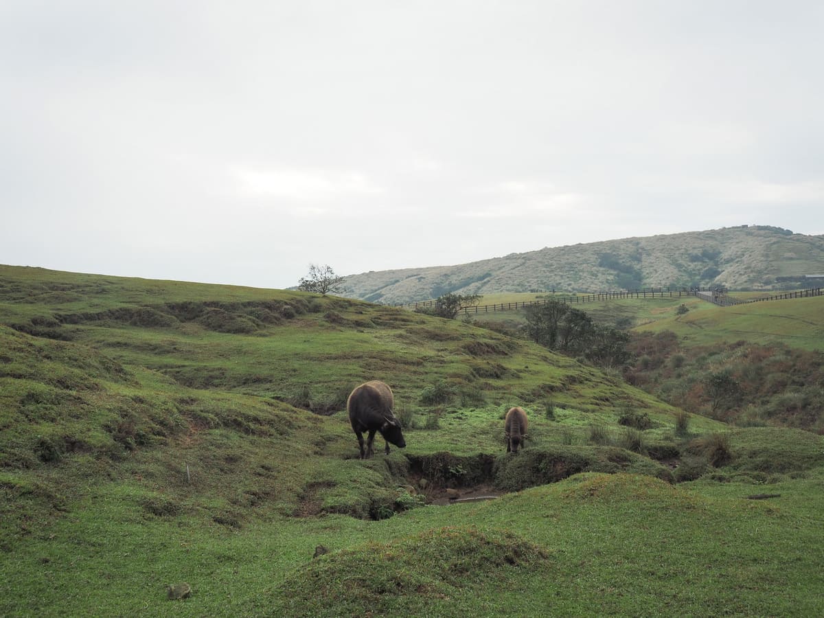
On this occasion, I was lucky enough to see several of the park’s water buffalo up close. So close in fact, that I could clearly hear the sound of their munching.
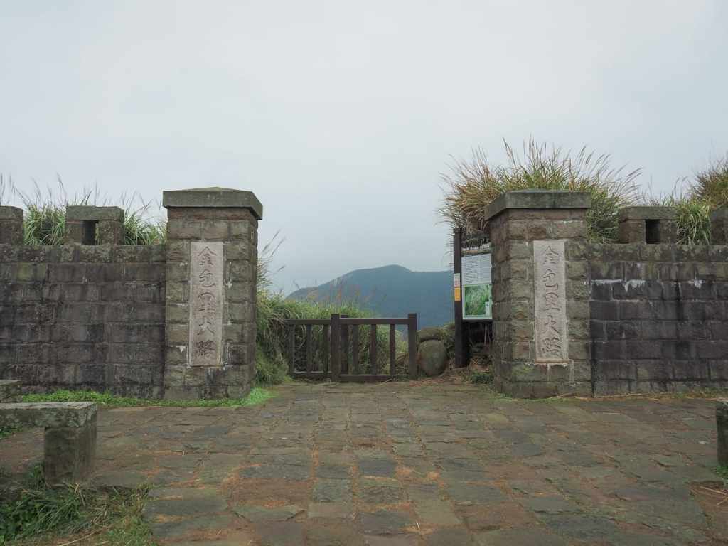
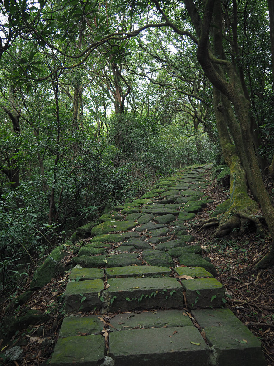
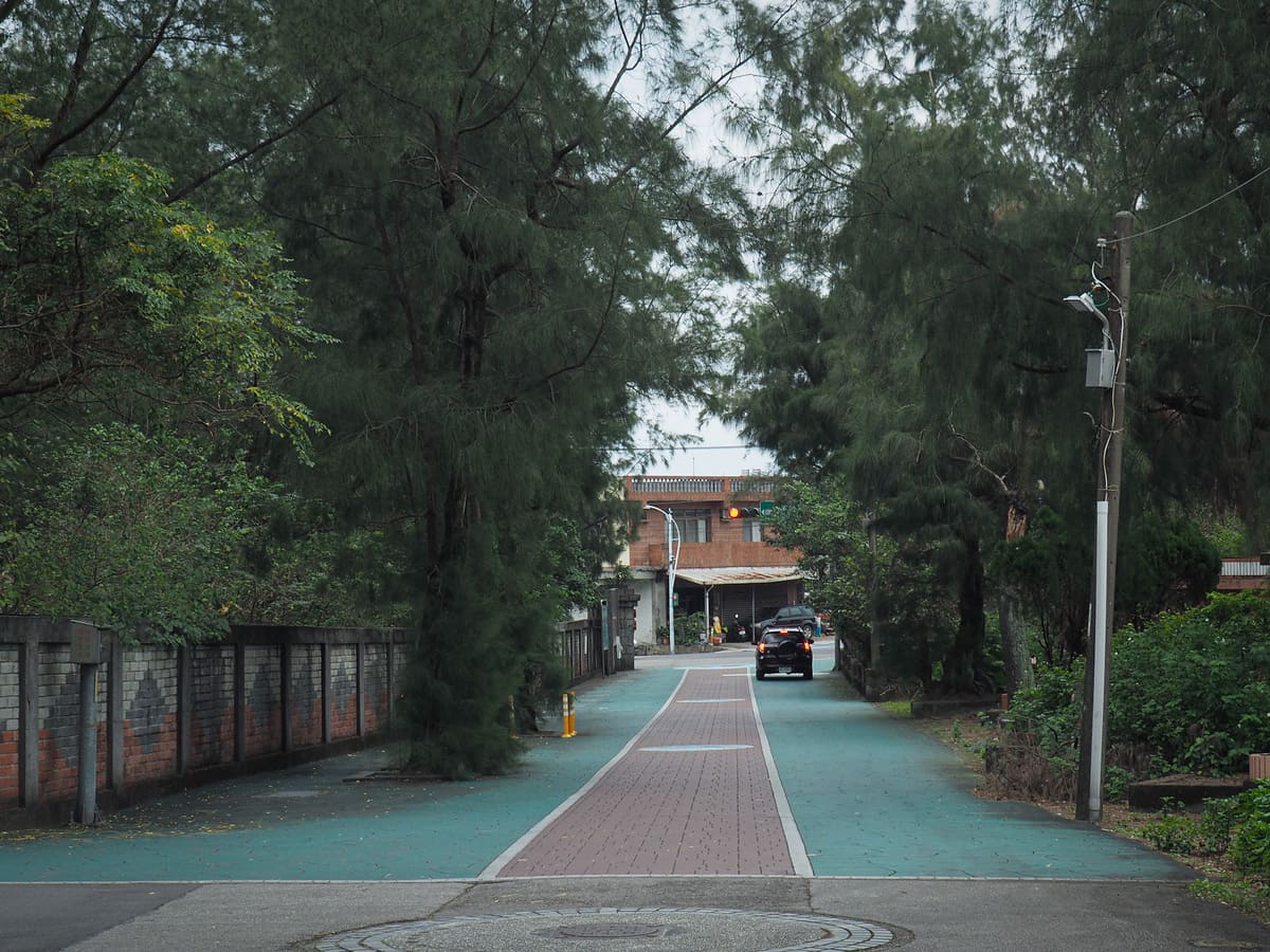
08:46 – After walking for 5-10 minutes, you’ll arrive at Jinbaoli Gate (金包里大路城門). This current gate is a replica, not the original. Head through the gate and start the descent.
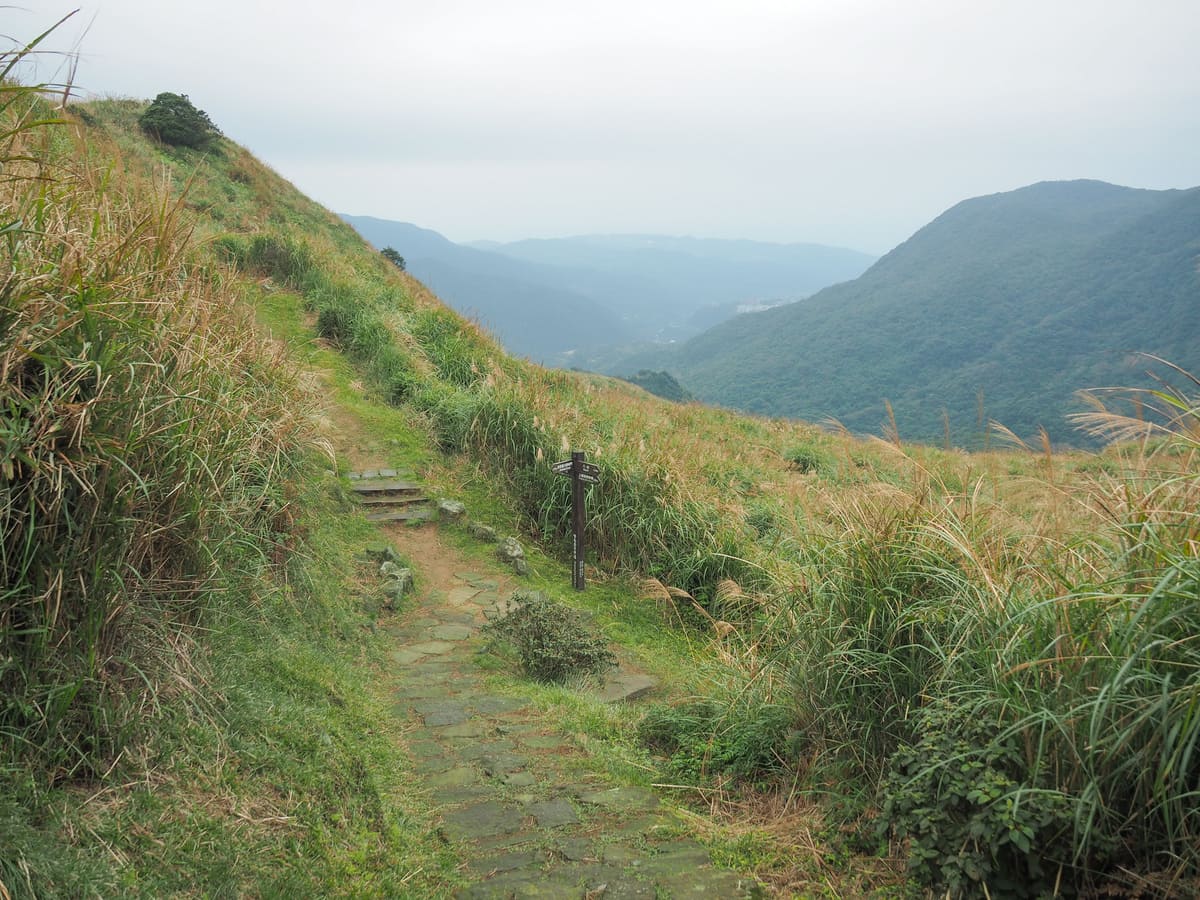
At the bottom of the first flight of steps, veer right, then almost straight away, take a sharp left and head down more steps, then take another right.
There are a lot of junctions to navigate before the trail reaches the cover of the trees. At this one, follow the path left.
Then at the next junction head straight over.
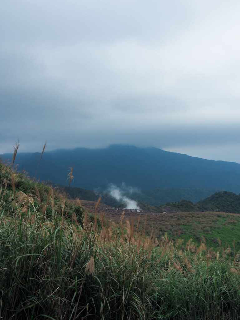
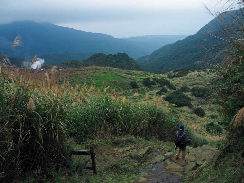
Descending further, the white, sulphurous stream issuing from Dayouleng’s fumeroles briefly became a mysterious companion. I hadn’t noticed it at all on my first visit to the area despite the weather being much clearer that day.
08:55 – At the next junction you’ll need to head straight over too.
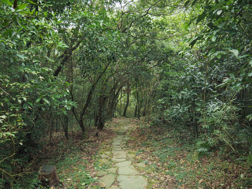
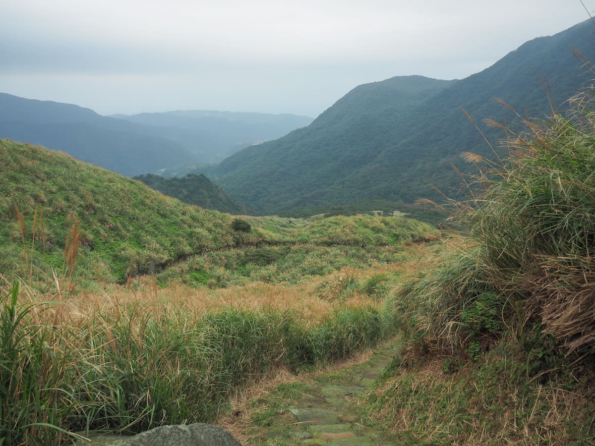
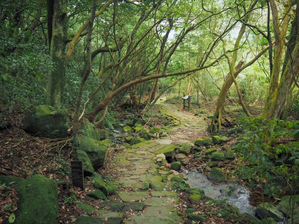
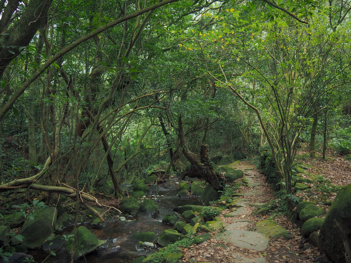
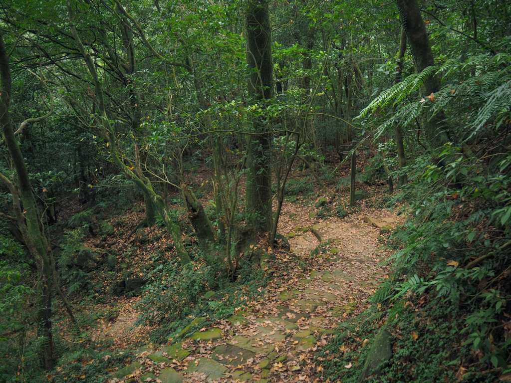
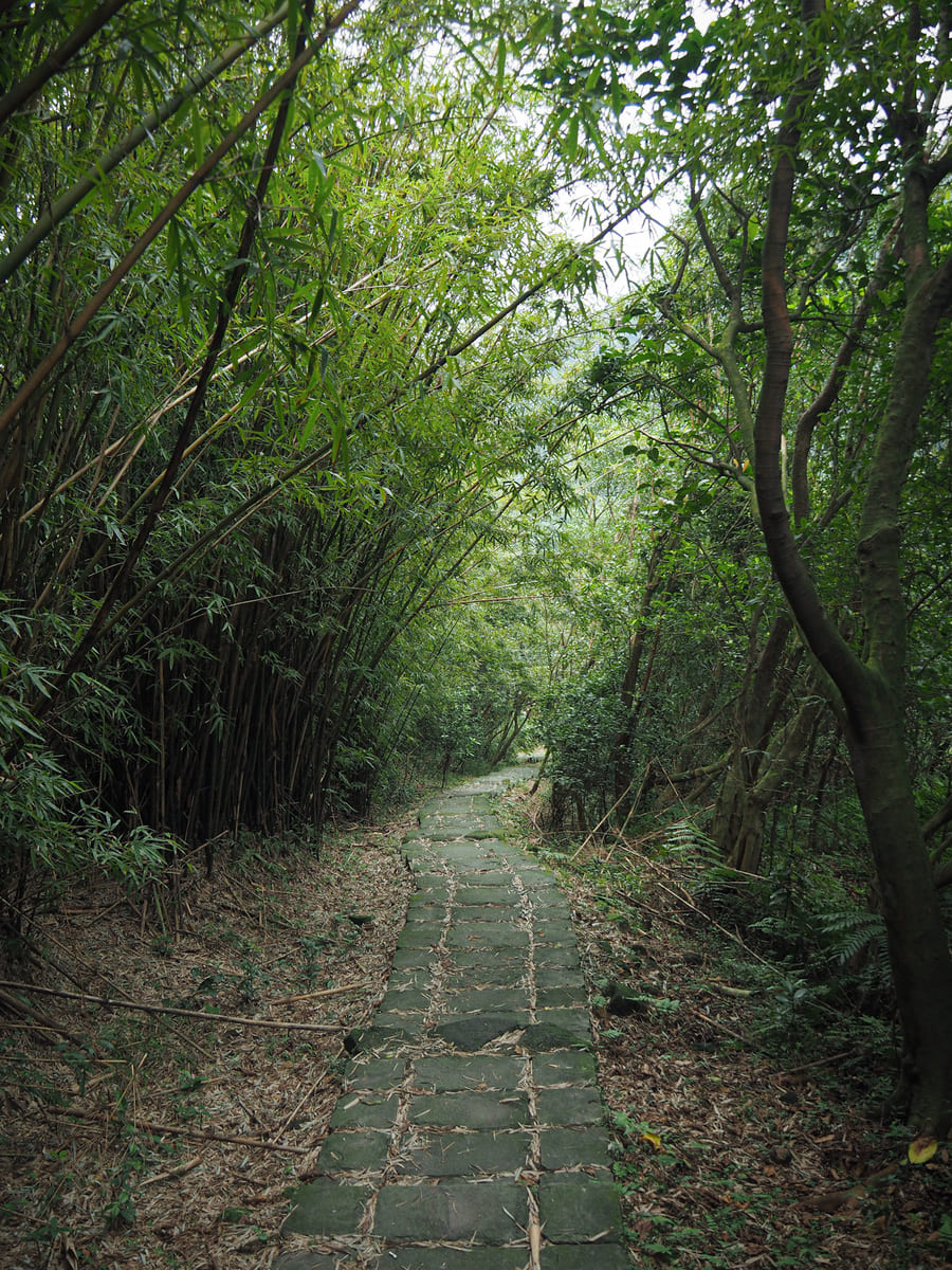
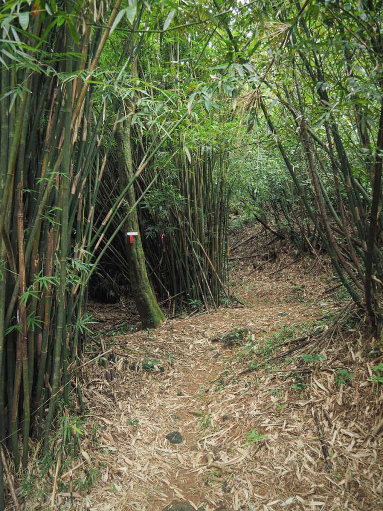
Just a short distance further along the trail, the open skies and swaying grasses are replaced by well-established secondary forest with the occasional clump of bamboo culms.
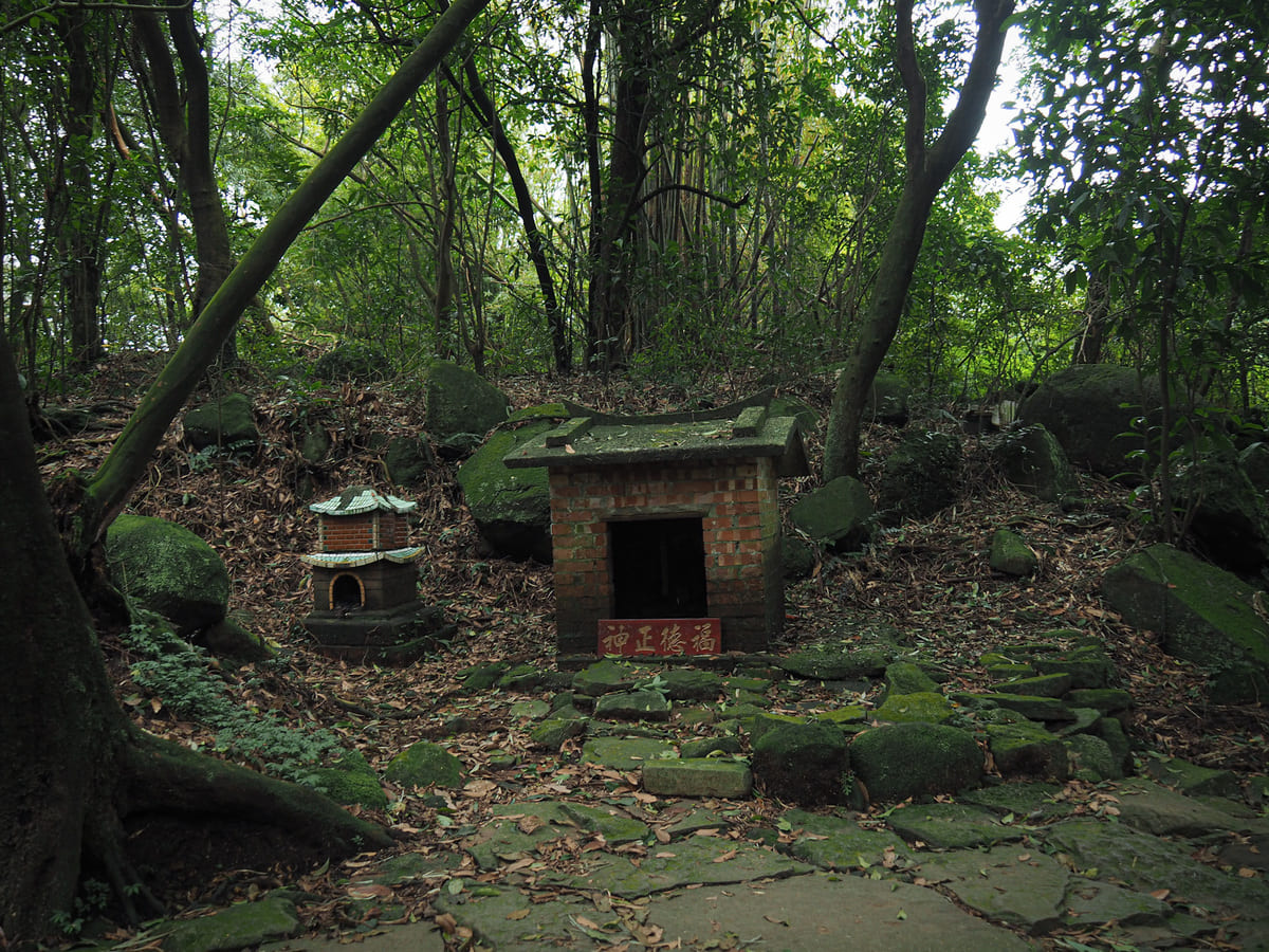
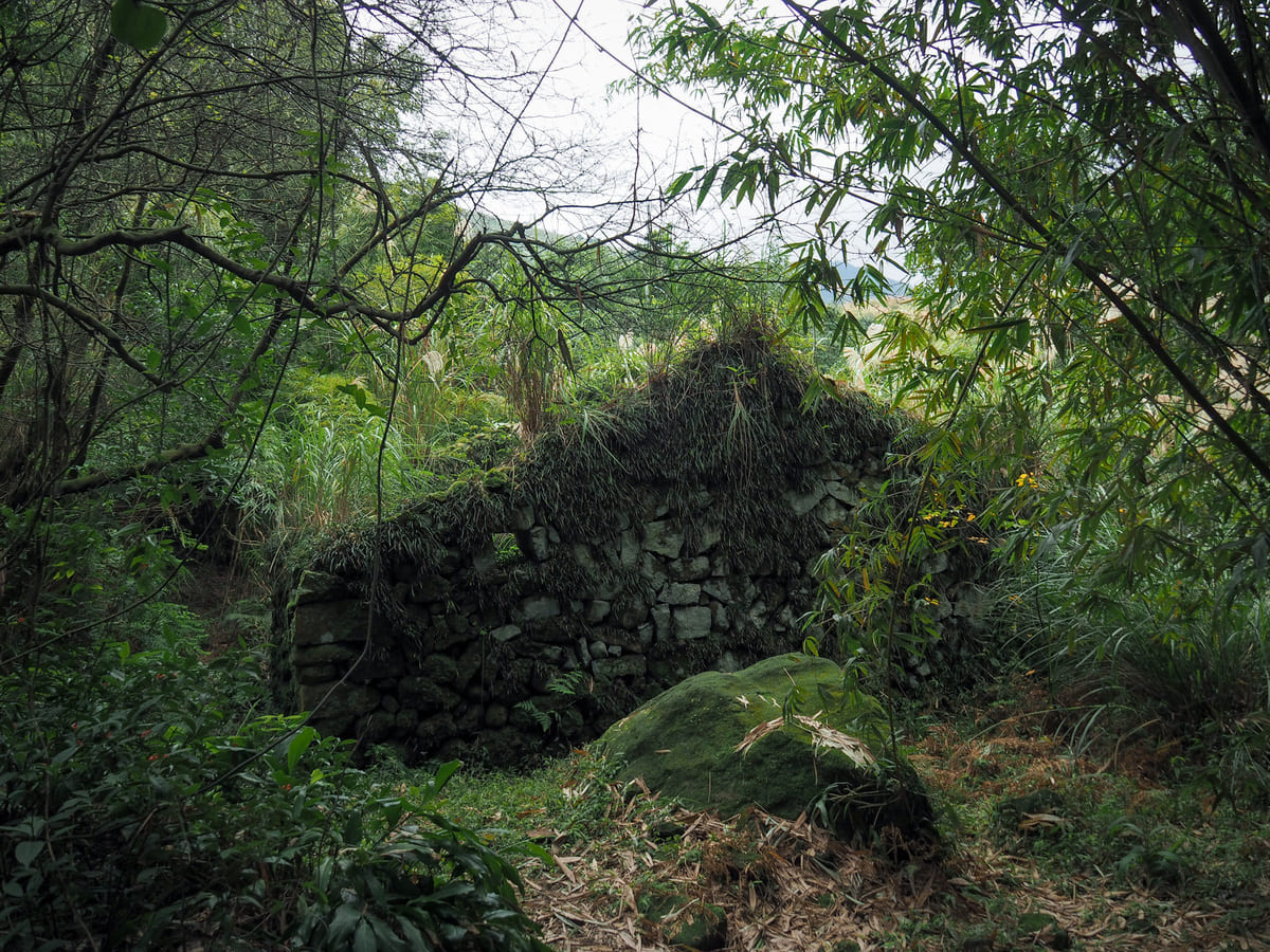
09:02 – In a clearing, a red brick land god temple sits to the left of the trail, and a small stream flows to the right. Inside the temple sits a peaceful-looking deity. There are several old buildings hidden and partially obscured in the bushes to either side of the trail here. This time, I noticed a short side trail leading to this stone wall that I hadn’t spotted on an earlier visit.
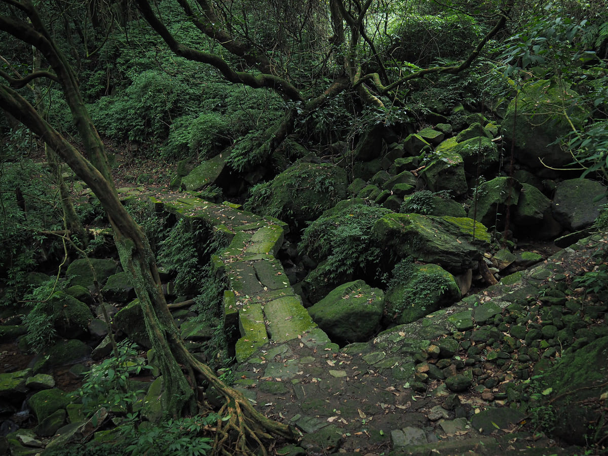
The next couple of hundred metres of path leading down from the shrine are absolutely delightful. The path sticks close to the water as several smaller streams converge into one larger body of water. On the right, there are large areas of flat land—the remains of terrace farming- that would be ideal for camping (well, it would if camping were legal in Yangmingshan National Park, which it isn’t).
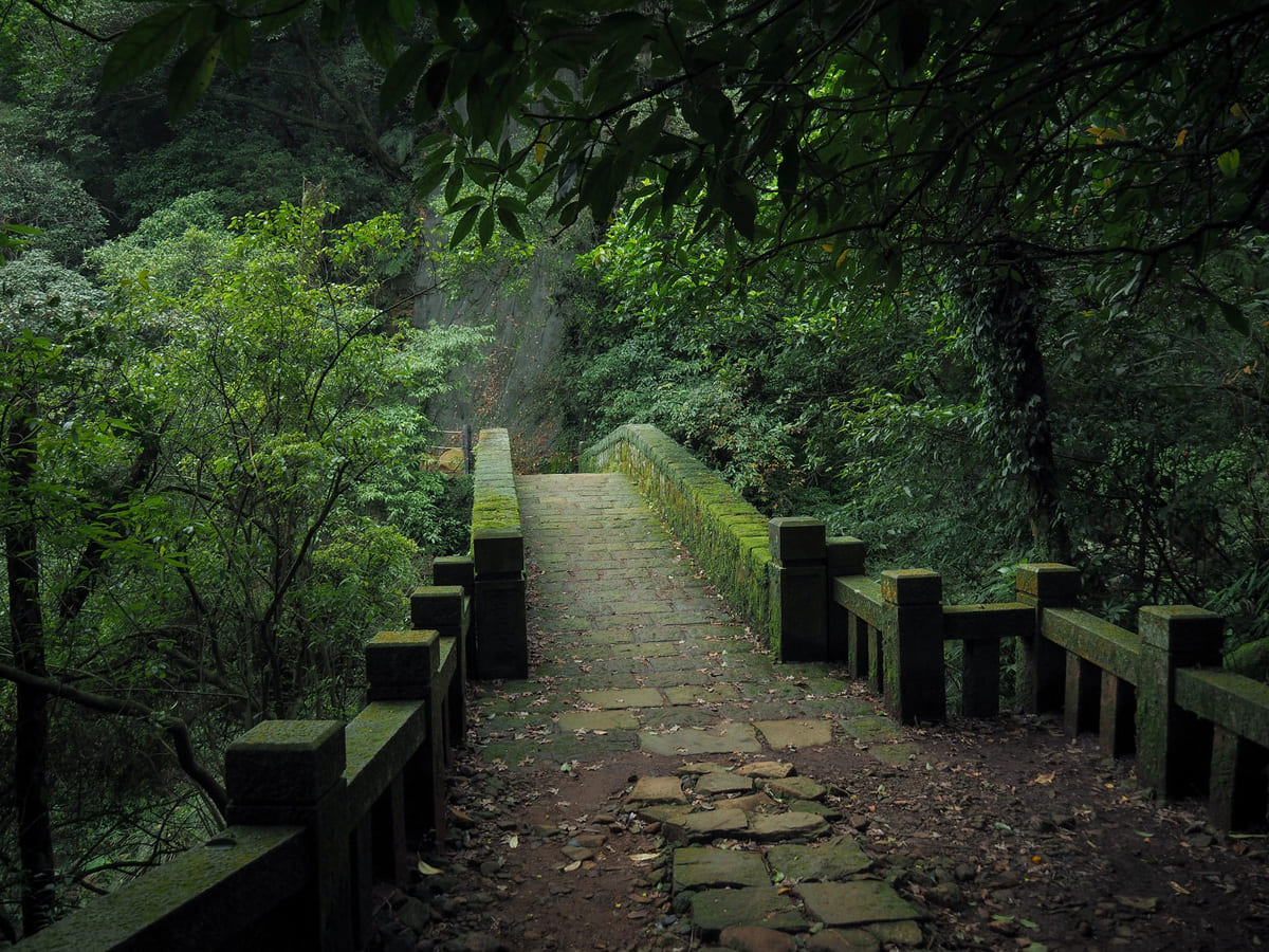
There are a number of small cascades interspersed with shallow pools and I’m sure this place is full of wildlife at night. At the bottom edge of the terrace farm, there’s longer stone bridge crossing another tributary of the stream.
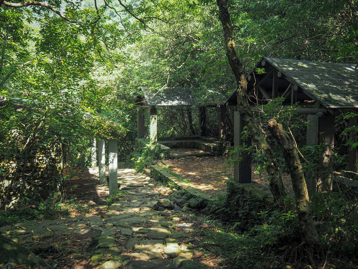
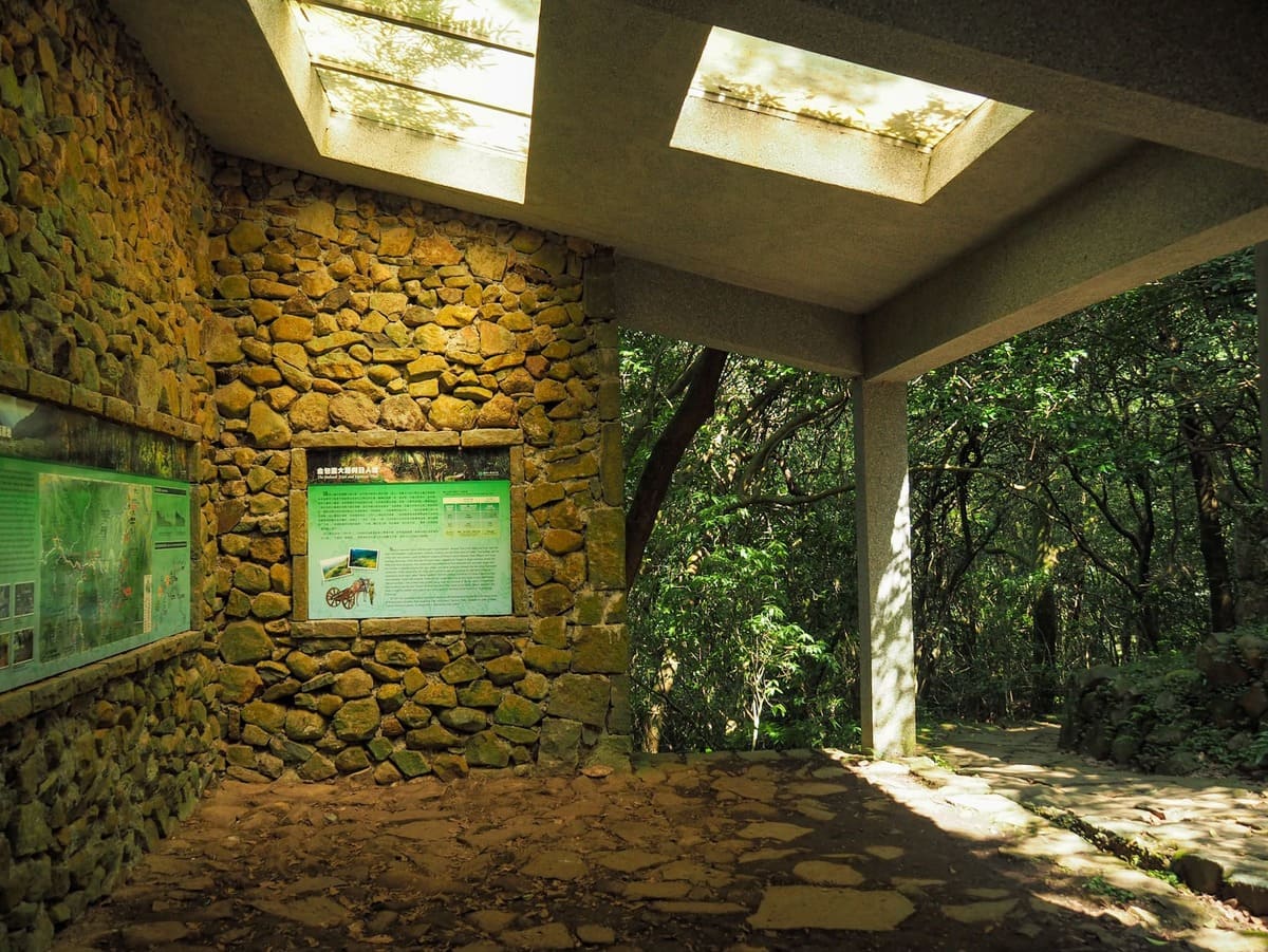
09:07 – The trail descends to a rest area beside the part-rebuilt structure of an old house. The old Hanbing Residence (憨丙厝地) is one of many previously inhabited places along the way. Bilingual information boards describing the history of the area and trail have been hung up on the walls.
At this junction, take a left and continue downhill. (The path joining from the right is the Japanese Trail again.)
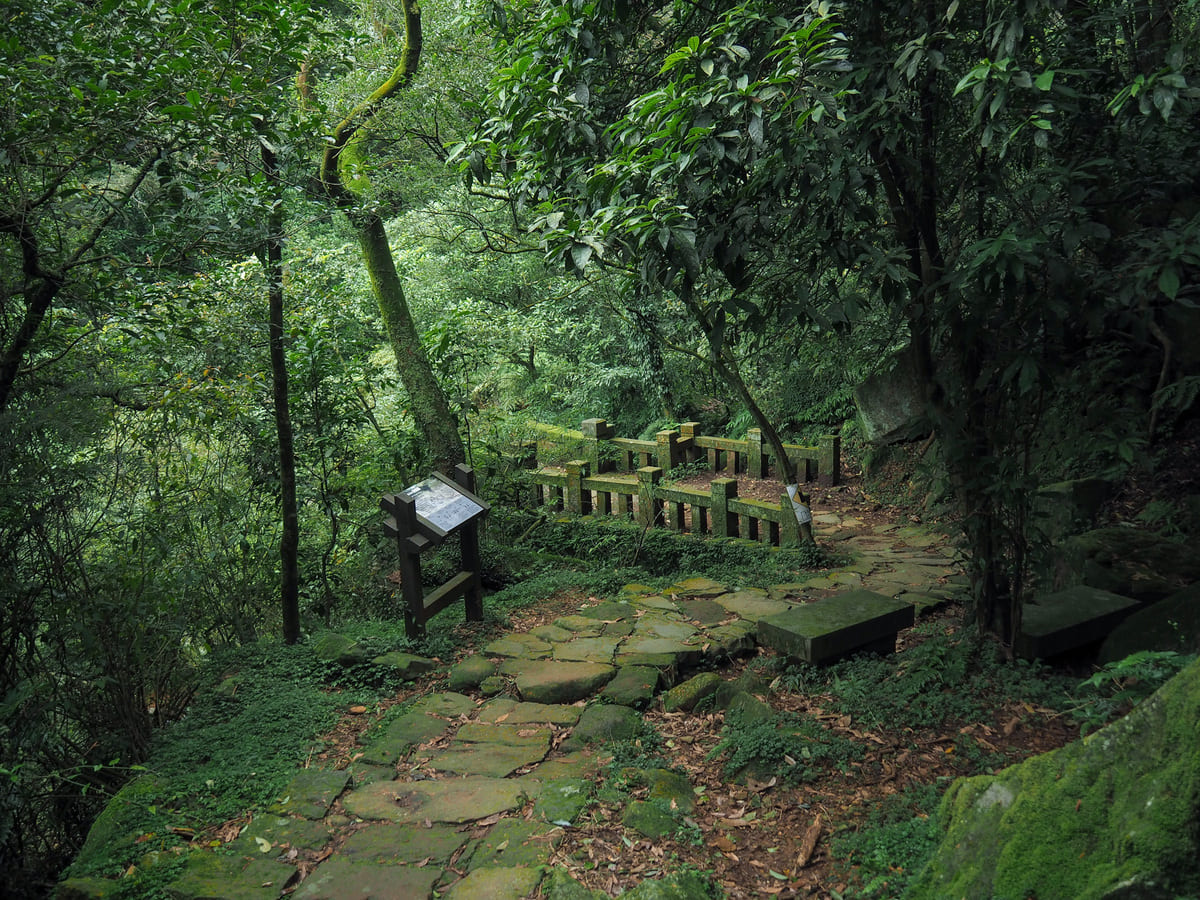
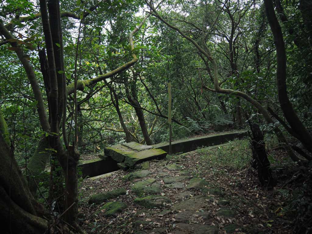
09:10 – The path runs down to cross over Xuyan Bridge (許顏橋). You can’t see it from above, but the bridge has a lovely elegant archway.
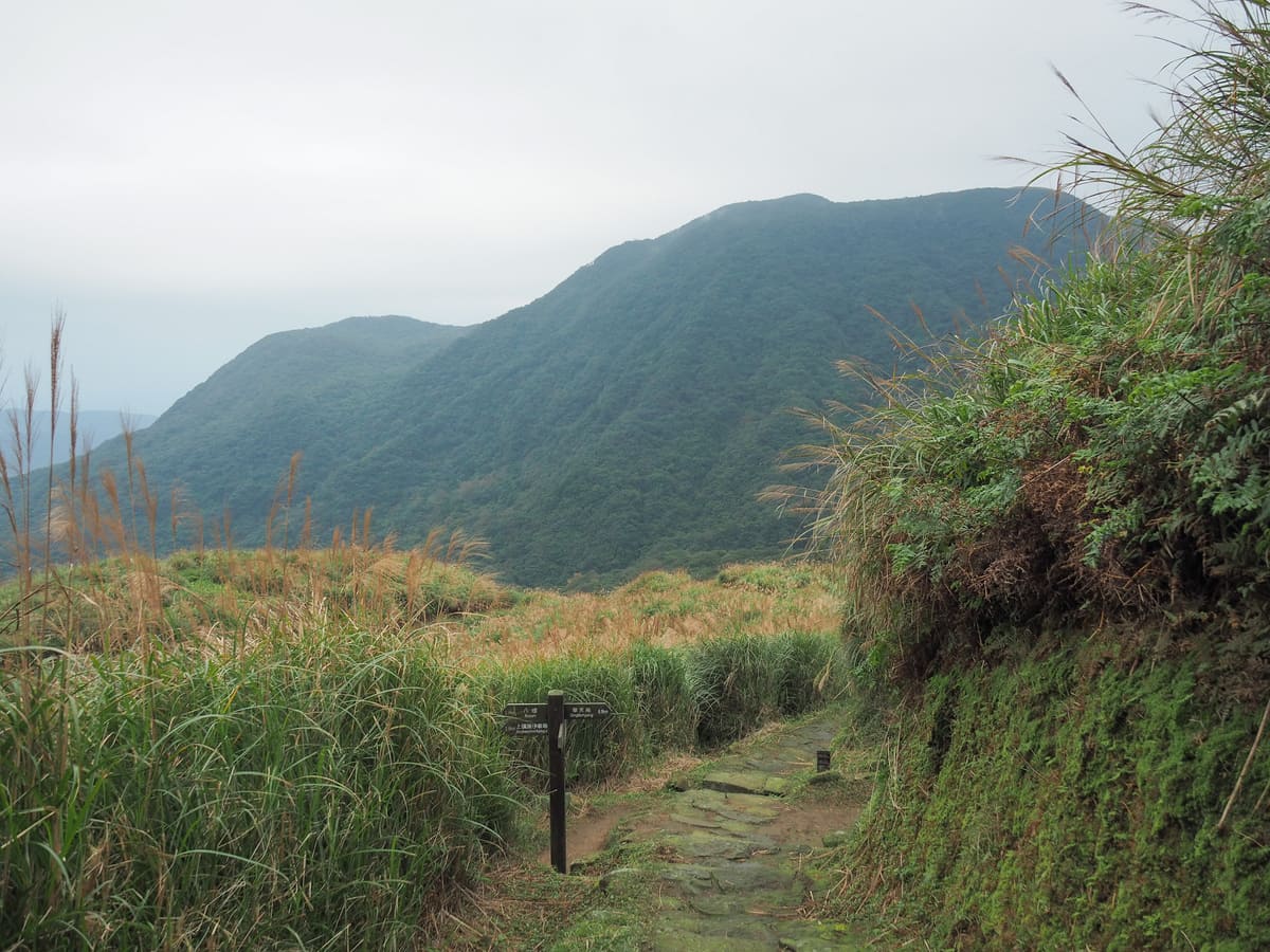
09:12 – At the junction, keep heading straight on, following the sign directing you to Bayan. The next stretch deviates from the official route of the Fisherman’s Trail because parts of it were never repaired after storm damage.
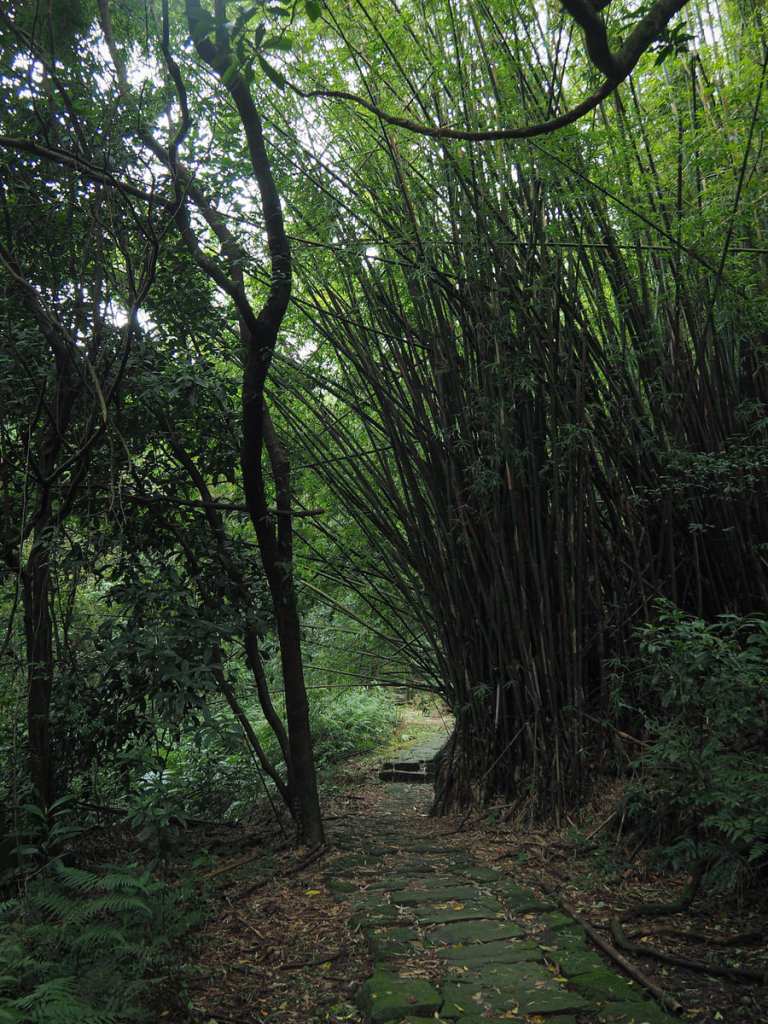
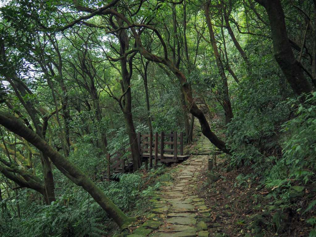
For a while, the path stops descending and instead meanders comfortably on flat trails through bamboo woods and scrubby forest hiding numerous remnants of past farming endeavours.
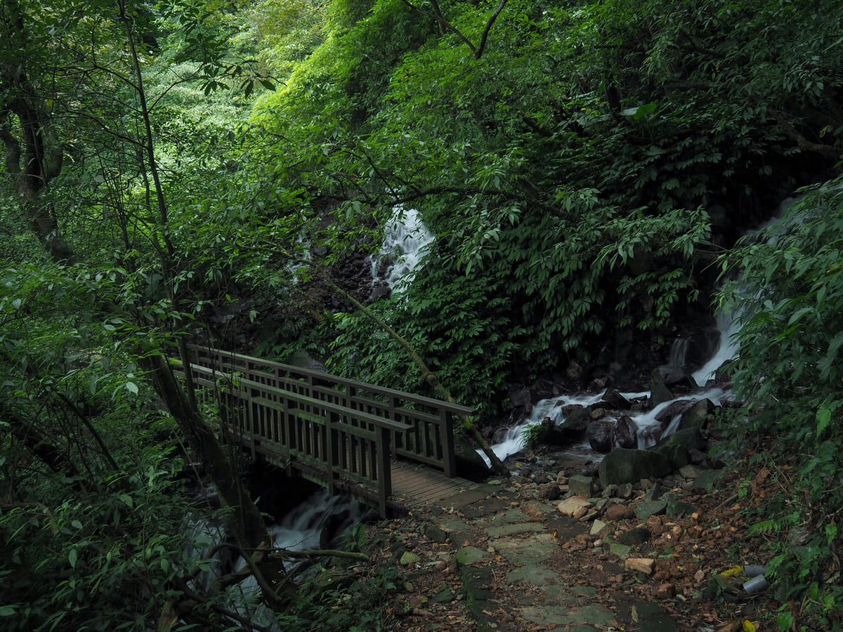
Water is never far away. The trail crosses over the path in a couple of places, and even when you can’t see the streams, you can still hear them. At the first of these two bridges, you can see the remains of the original Fisherman’s Trail a few metres away downhill.
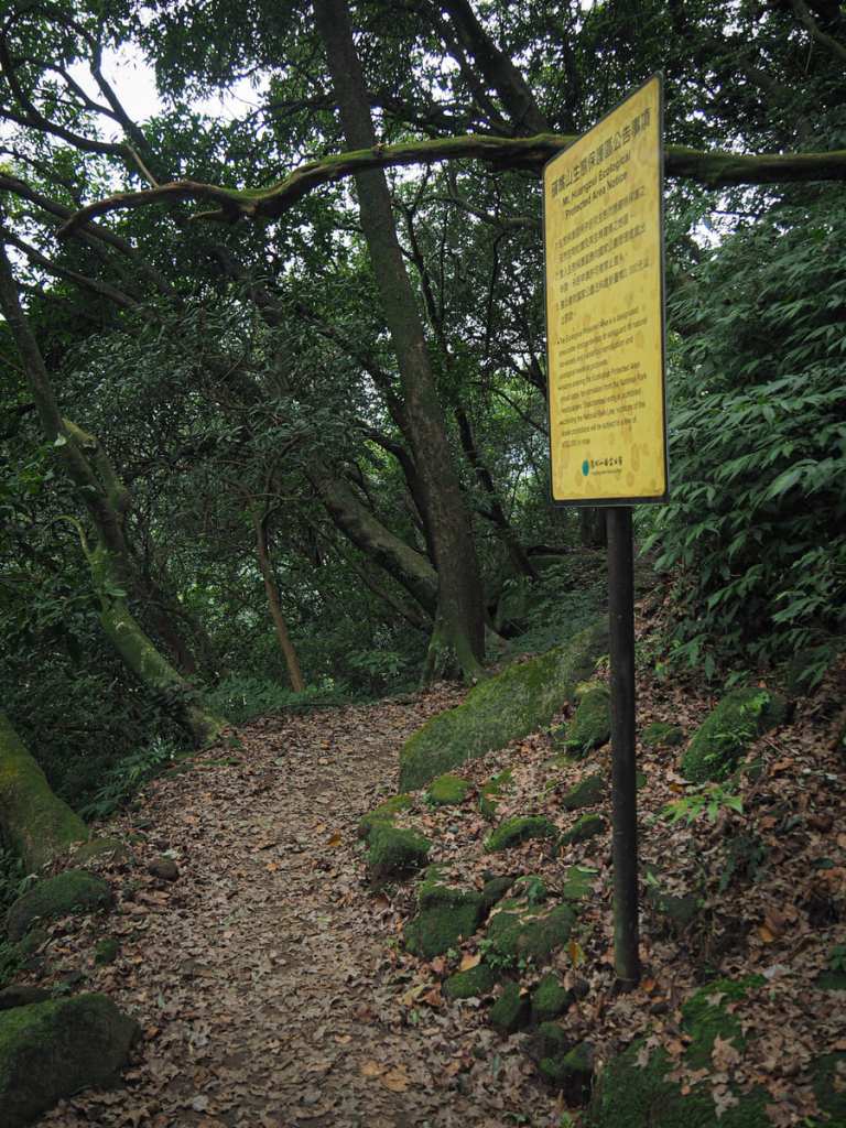
A sign beside the path indicates that you’re walking at the edge of Mount Huangzui Ecological Protected Area. According to the map I was using, this trail sits just inside the perimeter of Huangzui Mountain Ecological Preserve (黃嘴山生態保護區). However, the sign is not intended for people walking the Fisherman’s Trail, instead it’s for those taking an easily missable side trail up from here into the interior of the protected area.
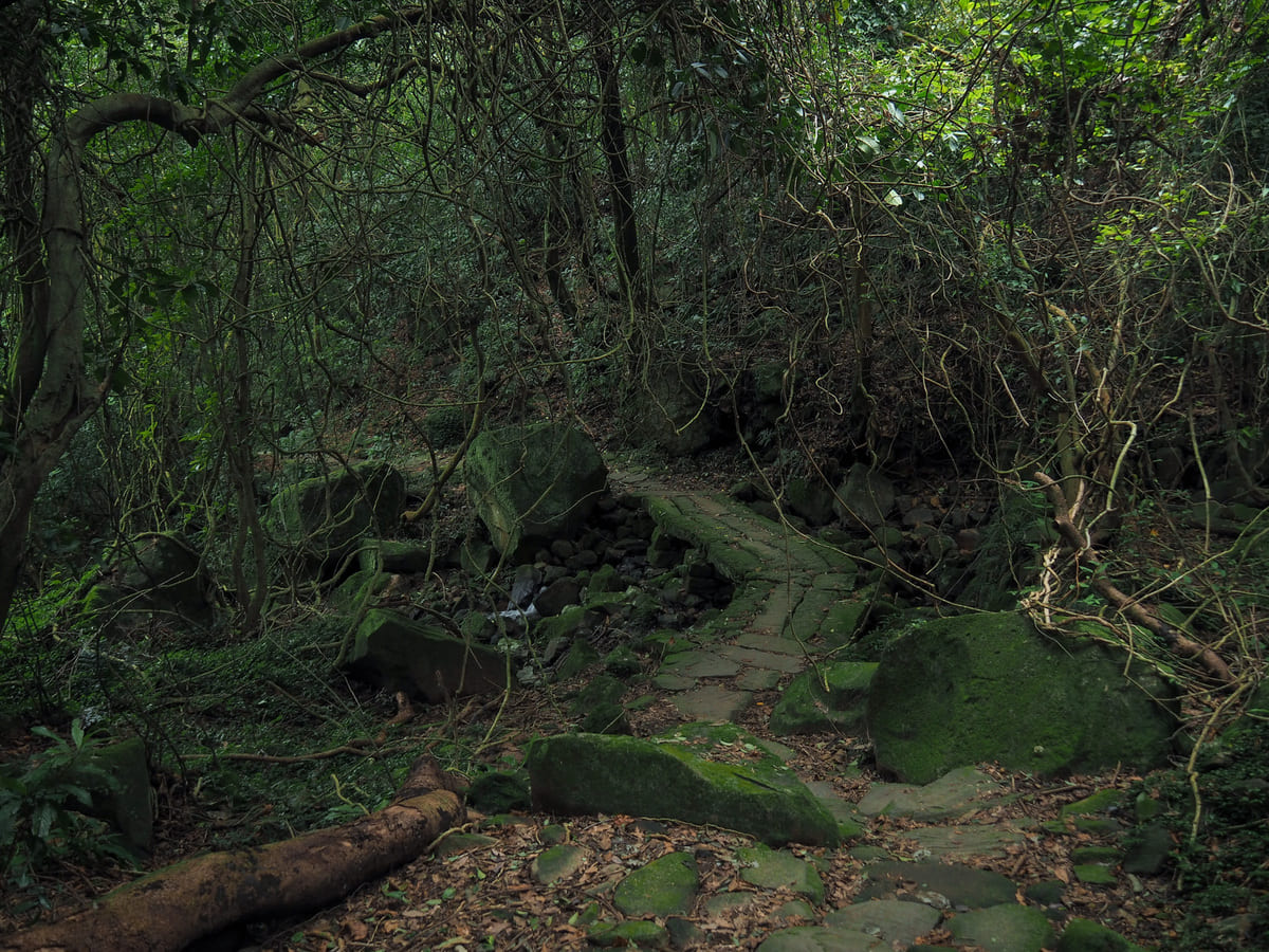
09:47 – I passed a few more spots where you can see or the original Fisherman’s Trail, but I think it isn’t until this junction (or shortly before), that it reconnects with the newer one. Cross straight over the irrigation canal and continue heading downhill.
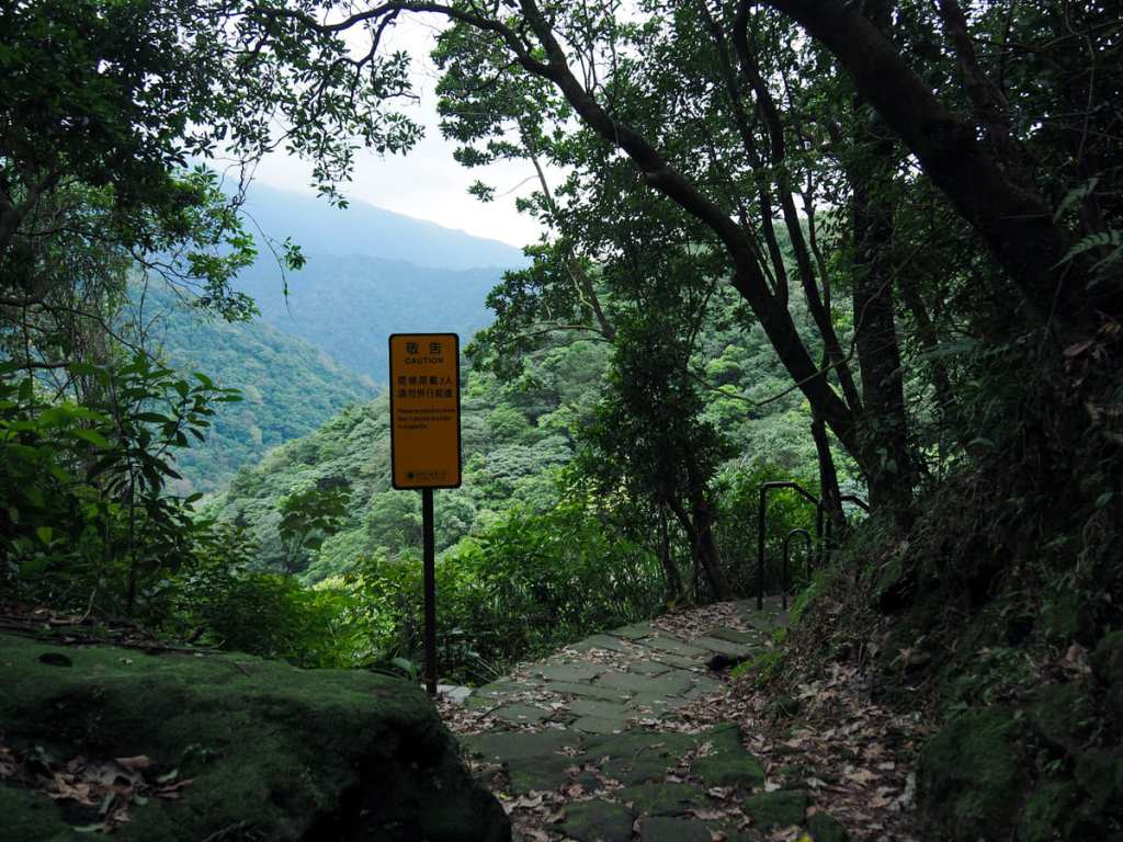
A sign placed at the only spot with a view since leaving that first descent from Qingtiangang warns hikers that only three people at a time can walk on the feature immediately ahead. Normally when you see this sign, it means a narrow bridge is coming up, but in this instance, I was surprised (and childishly delighted) to find a rope mesh ladder.
After the ladder, the remainder of the descent to Bayan was uneventful.
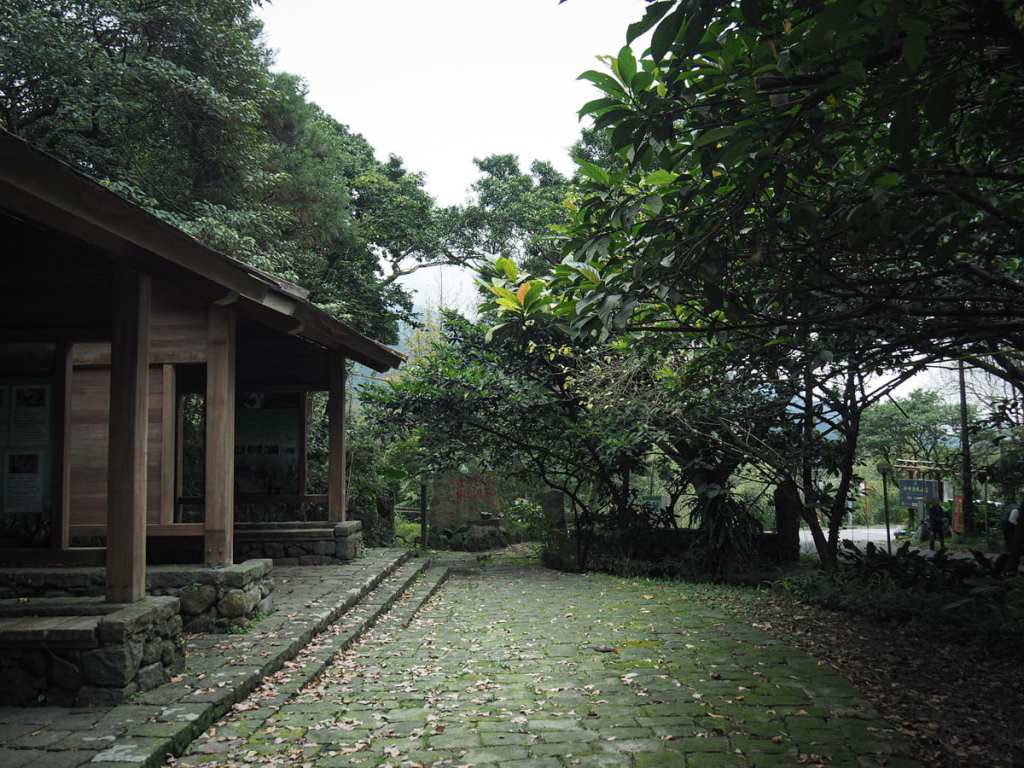
10:15 – Slowly, the sounds of the road and workers trimming the hedgerows began to filter through and soon I was walking past these trailhead shelters. Inside, you’ll find the same historical information that’s displayed on the shelter halfway down the trail.


Turn right onto the road and head past the bus stop and the entrance to Bayan Lufeng Hot Spring Villa. At the second entrance for the same hot spring (just beyond a pretty stone house), a path cuts away from the road and into the trees. I didn’t spot the trail until this opening here in the right-hand picture, so I had to climb up onto the verge and step across the irrigation canal in order to make it onto the path.

This next stretch follows a rickety wooden walkway. One section had completely fallen through, and quite honestly, I would not be surprised if this trail gets closed in the near future. (If you do find it closed, don’t worry, you can walk down the road for another 350m, then pick up the trail again there.)


There are ample signs of this land having been used before. The empty hulk of what looks like an unfinished construction project sits beside the trail to the left, and on the trail you’ll find the rusting remains of a huge pipe (presumably once intended to carry hot spring water downhill).

10:24 – Before long, the path dips down to meet up with the road one more time before swiftly climbing away again.
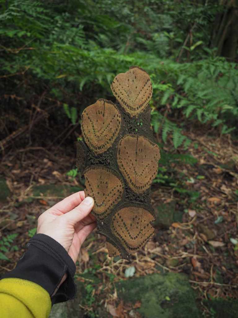
A sliver of beautiful tree fern bark.


10:52 – An old grave sitting at an odd angle to the trail heralds the start of another previously inhabited area. Beyond the grave were several old concrete properties that are in the process of being broken down by time and nature.


Follow the path across another bridge.

11:00 – Then, just beyond the bridge, look out for this easy-to-miss trail leading off to the right. This is the only time on this whole route where you have to take the less-defined path. Turn right up the steps and climb away from the sounds of the road.


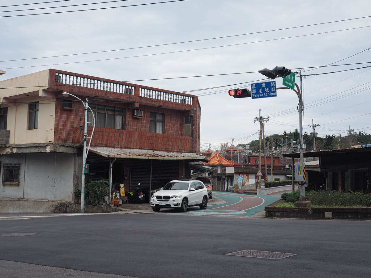
11:07 – The trail leads up through scrubby bamboo until it emerges at the end of a track leading to another hot spring facility. I could hear the sounds of quiet conversation and splashing water emanating from behind the walls. Turn left onto the road and follow it downhill past a temple.

11:12 – Keep following the road as it heads towards this junction with lots of out-of-place-looking apartment blocks. When you hit this T-junction, turn right.


11:15 – The road leads through a desolate neighbourhood where several apartment buildings sit mostly vacant. Then, once you’re through on the far side, look out for this track cutting away from the road on your left.

Maybe 100 metres or so down the track, the path takes an abrupt right turn over a creek.
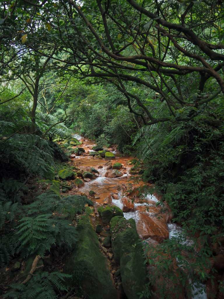
Minerals in the water had stained the rocks a shocking shade of orange.
11:19 – A sign attached to a tree beside some bamboo points you towards a clearing where you can find an old stone structure. I guess it’s probably the remains of a pig pen or something similar because the compartments seem far too small for a house. That said, there was also an assortment of old crockery, so perhaps there’s a house nearby too. After having a look at the structure, you’ll need to come back to the junction and continue onwards.


Just a short distance later, the path veers to the left. It looks like there might previously been another trail heading right, but if there was, it seems to have been lost to time. After a short descent, I found myself passing through a forest clearing.

11:35 – Then, beyond the clearing, the trail seems to fall in step with the stream, which is a ways below and to the left. At times, you can see it, but mostly you can just hear the swish of the water. It was also around here that I caught my first glimpse of Jinshan’s coast.


As is it starts to flatten out, the trail also becomes broader, then when it hits the perimeter wall of Jialuo Shan Dajue Temple (伽羅山大覺寺), it turns left and follows the farm track down to where it rejoins civilisation.

11:50 – The trail emerges onto the lane at a dead end beside some type of factory. Turn right and walk towards the road.


After passing a few houses, the lane merges with a larger road. Bear right and follow the road past the temple’s entryway. Then, continue along the road alongside what looks like some kind of plant nursery. When you reach the little hamlet of Shuikeng, take a left turn onto another road.

12:01 – There isn’t much to Shuikeng except for this fish pond surrounded on one side by buildings.

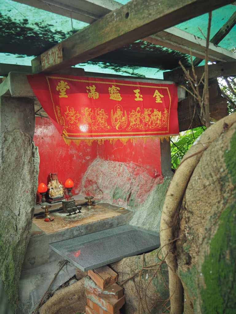
There are a few roads joining to either side, but you just need to follow this same road all the way down until it joins Provincial Highway 2A (省道2甲). I stopped to have a little look at this land god temple.
But it wasn’t until I started to walk past it that I noticed a second smaller shrine tucked into the rocks at the structure’s rear. Here, a small altar offers incense to Mazu. Just beyond the twin altars, a tiny and not very scary dog shot out to bark at me as I peeked at its family’s stream-fed roadside clothes washing pool.


Remnants of old industry can be seen among the tall grasses beside the road.
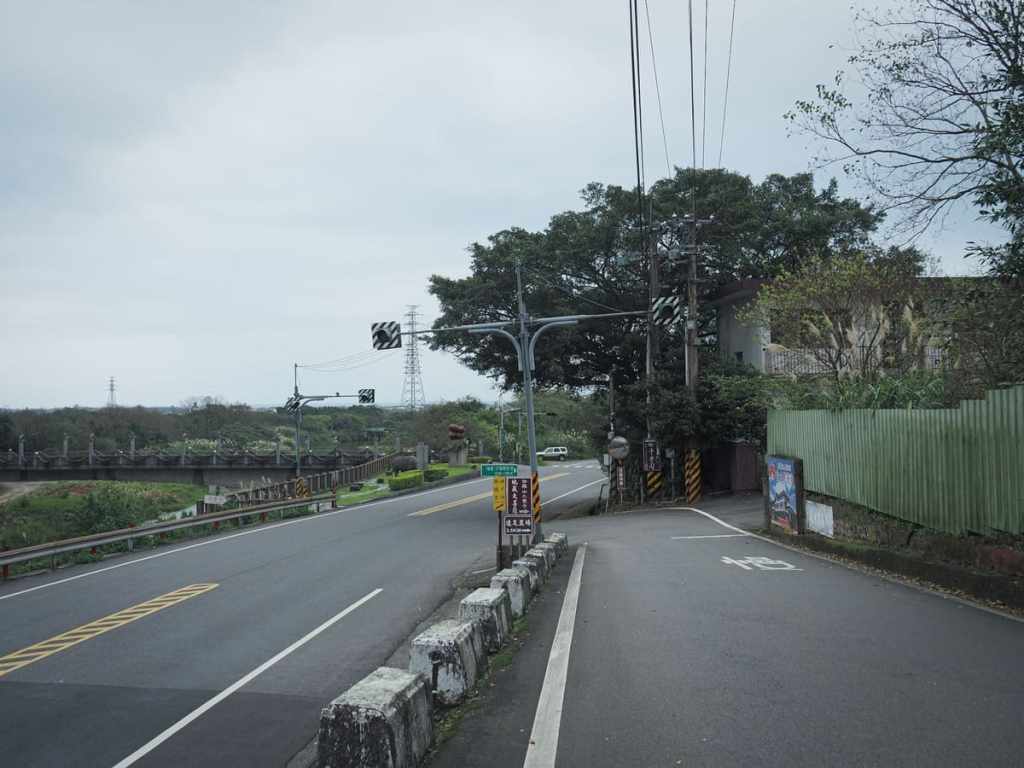
12:25 – As I approached Provincial Highway 2A, I found myself passing a cement factory, then the road merges onto the highway.
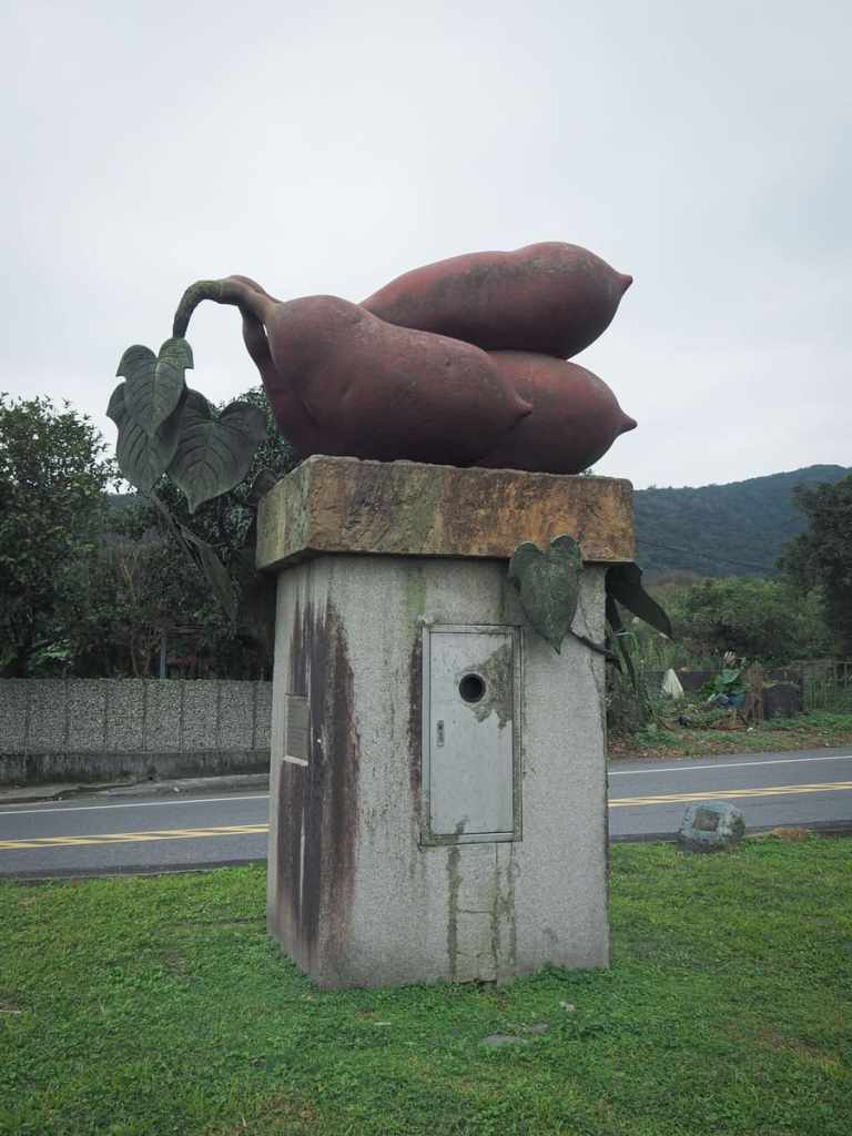
Keep heading straight and you’ll soon find yourself approaching this giant sweet potato statue. Jinshan is famous for the root vegetable, which grows well in the area’s sandy soil.
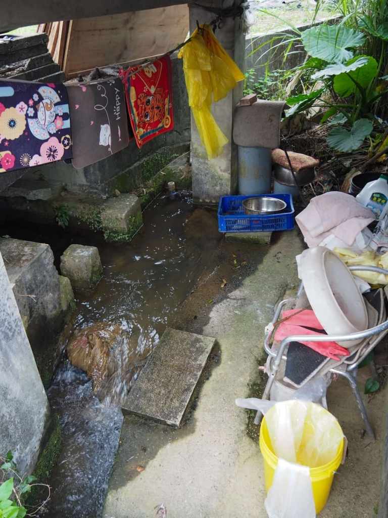
Close to the start of the built-up area, I passed another roadside washing pool.
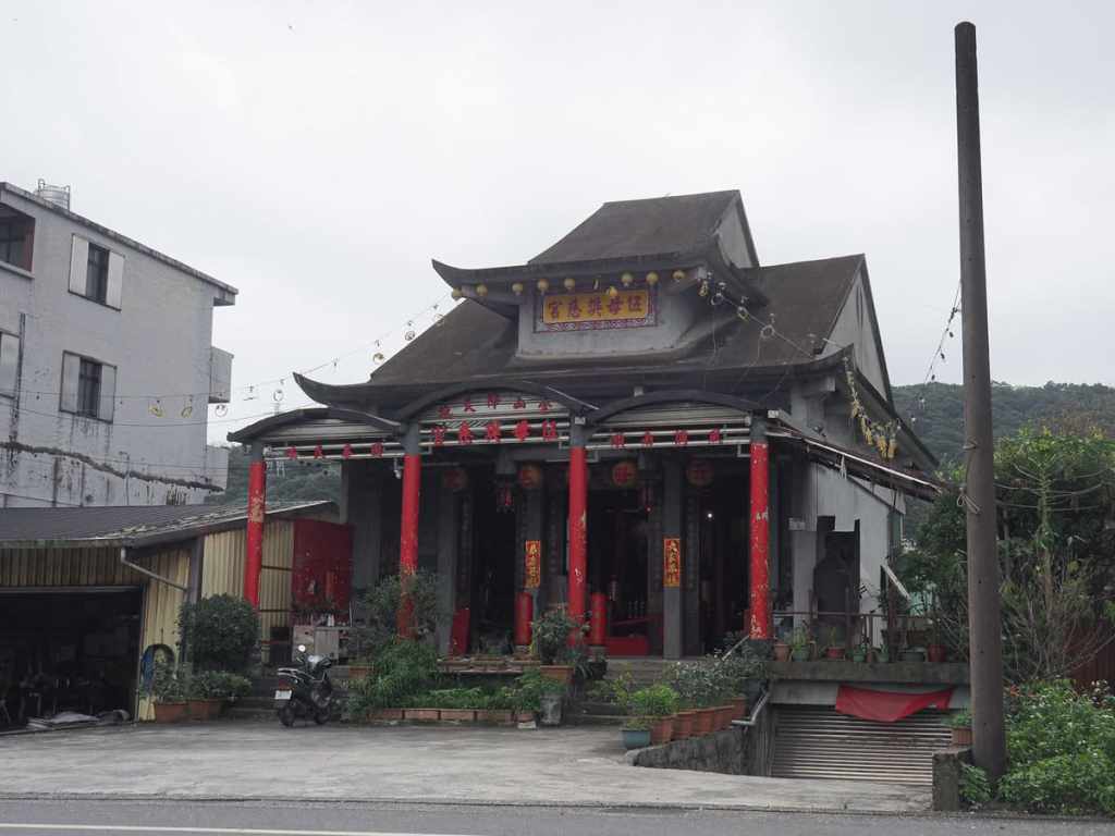
12:30 – Across the street sits the odd form of Wu Mu Fan Ci Temple (伍母樊慈宮). It looks for all the world as if the money just ran out halfway through construction. The roof is unfinished, and inside there are bare concrete surfaces. According to signage, the basement also doubles as a nuclear shelter in case of a malfunction at the (now out-of-action) Kuosheng Nuclear Power Plant.
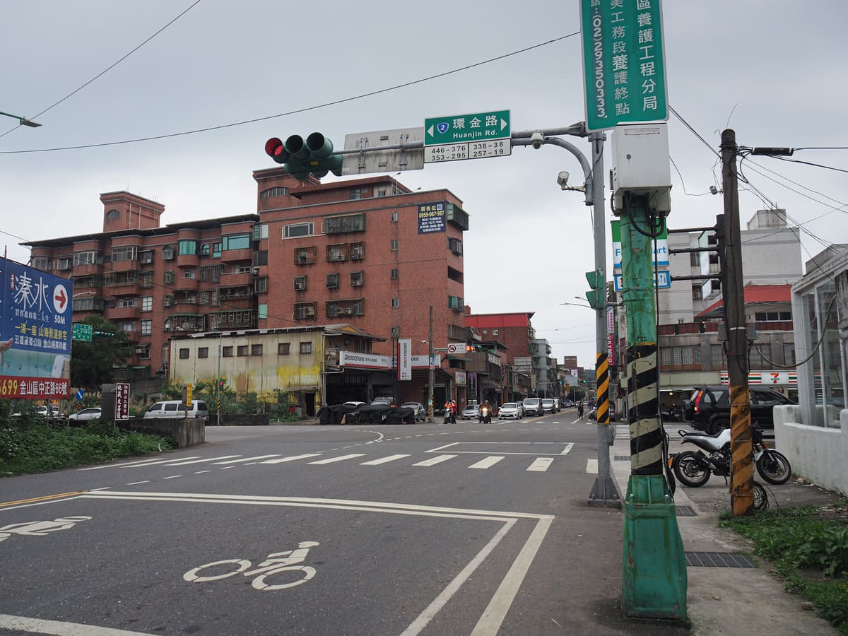
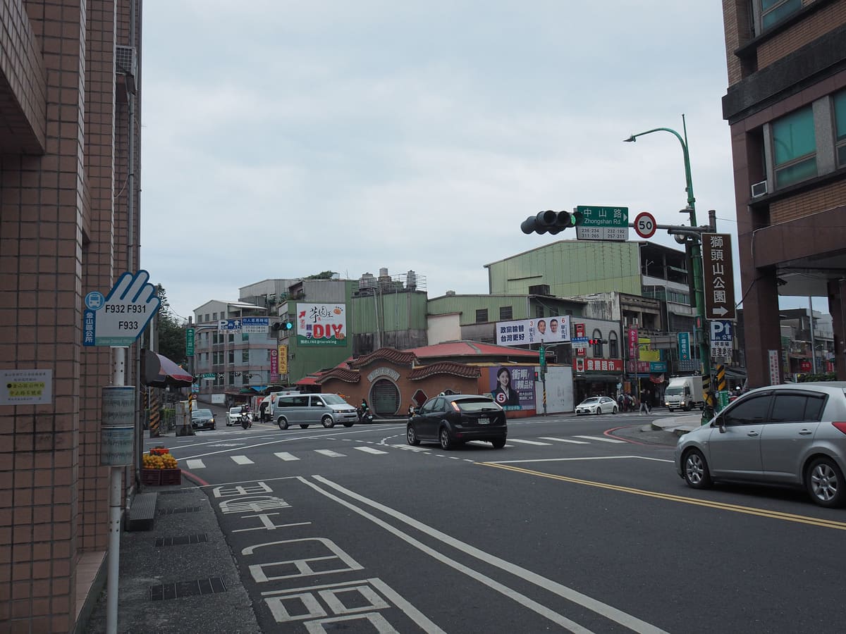
At the first big junction, cross straight over Jijin Road. Then, about 400 metres later, cross over Zhongshan Road. (I detoured to visit a cute little coffee shop that’s slightly hidden away in a residential courtyard before continuing on.)
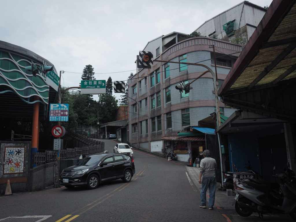
13:58 – Once you’ve crossed Zhongshan Road, let the lights and activity coax you to take a right turn onto Jinbaoli Street.
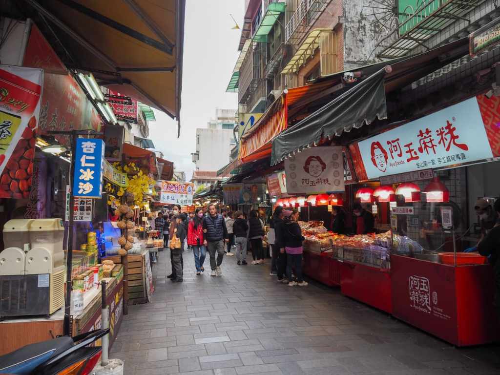
This is Jinshan Old Street (or Jinbaoli Old Street). It would have been an important point on the journey for traders making the journey along the Fisherman’s Trail to Shilin. Here, produce brought from the coastal waters would have started its journey over the hills, and goods from the city, perhaps teas and cloth, would be sold to local residents. The street is crammed with vendors selling mostly various iterations of seafood and sweet potato, as well as a smattering of other stalls selling the usual old street fare.
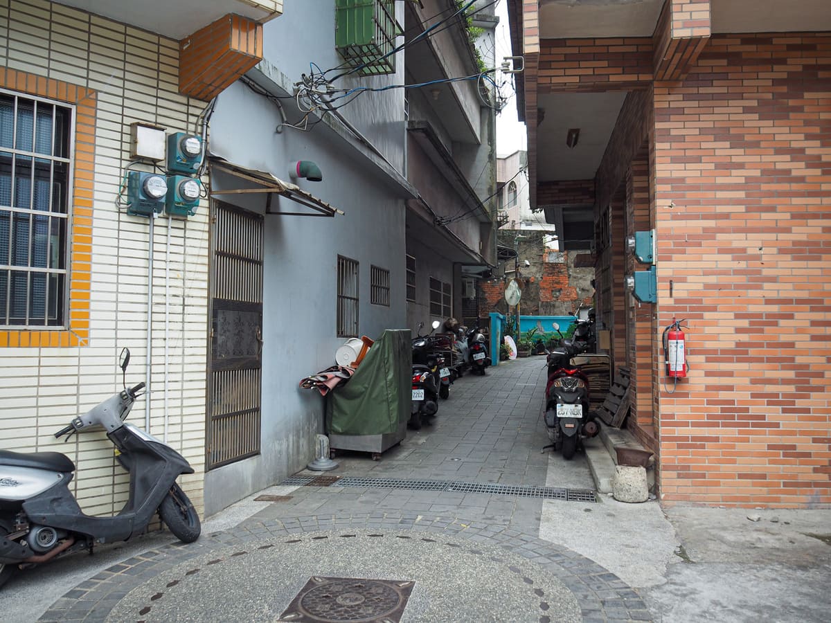
14:01 – Halfway along the crowded length of Jinshan Old Street, turn left onto Fude Street, then almost straight away, take a second left up a narrow alleyway.
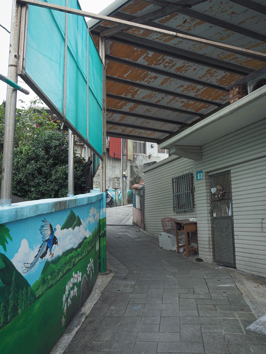
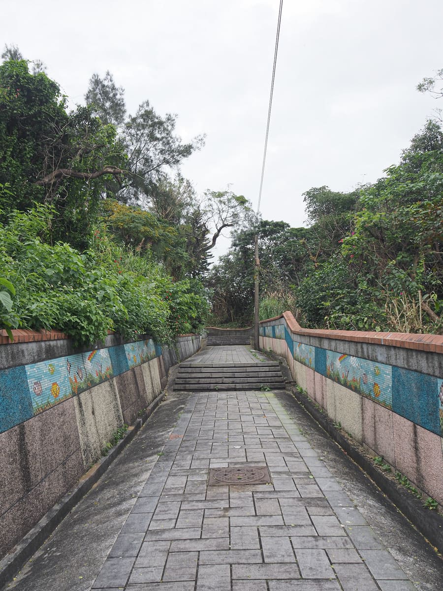
The alley winds between densely packed houses and the walls have been painted with murals that heavily feature birds.
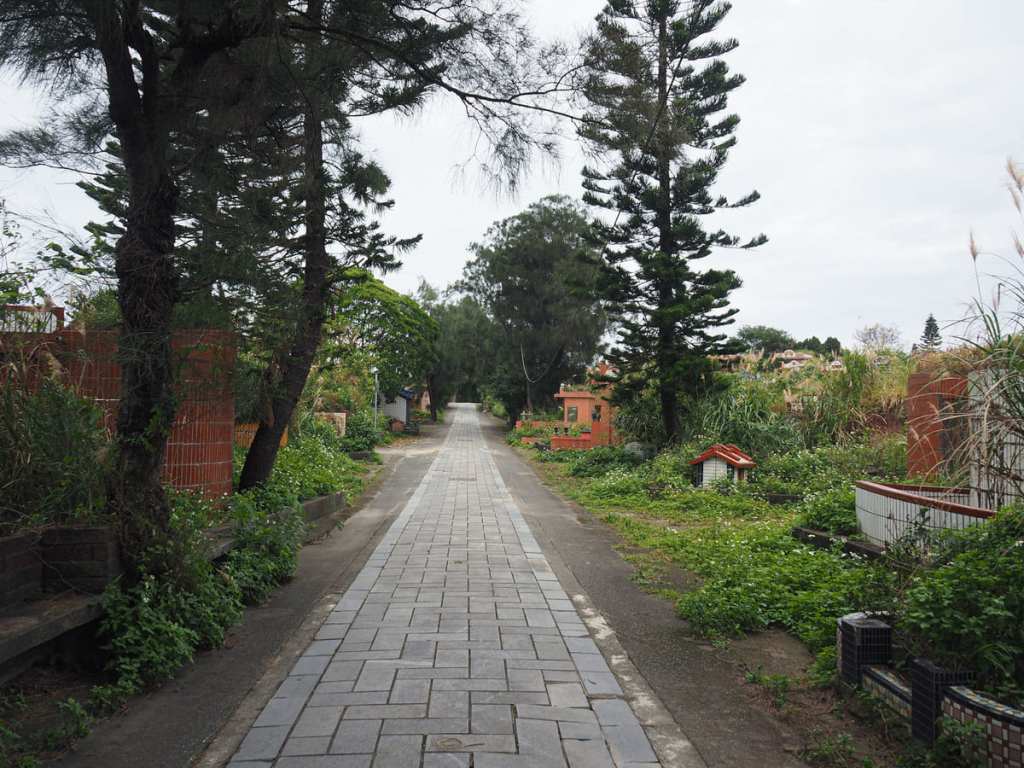
At the top of the steps, I found myself walking through a large cemetery. Since I visited in January, it had been about eight months since anyone had cleared the graves, and they were looking rather overgrown.
14:16 – Where the graves end, the path joins a proper road again. It has been coloured so it doesn’t look much like a road, but it is and you need to look out for the cars that come speeding round the corner. Cross over Huanggang Road and keep following the red and green brickwork.
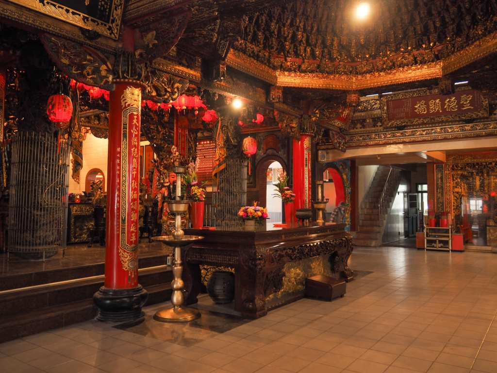
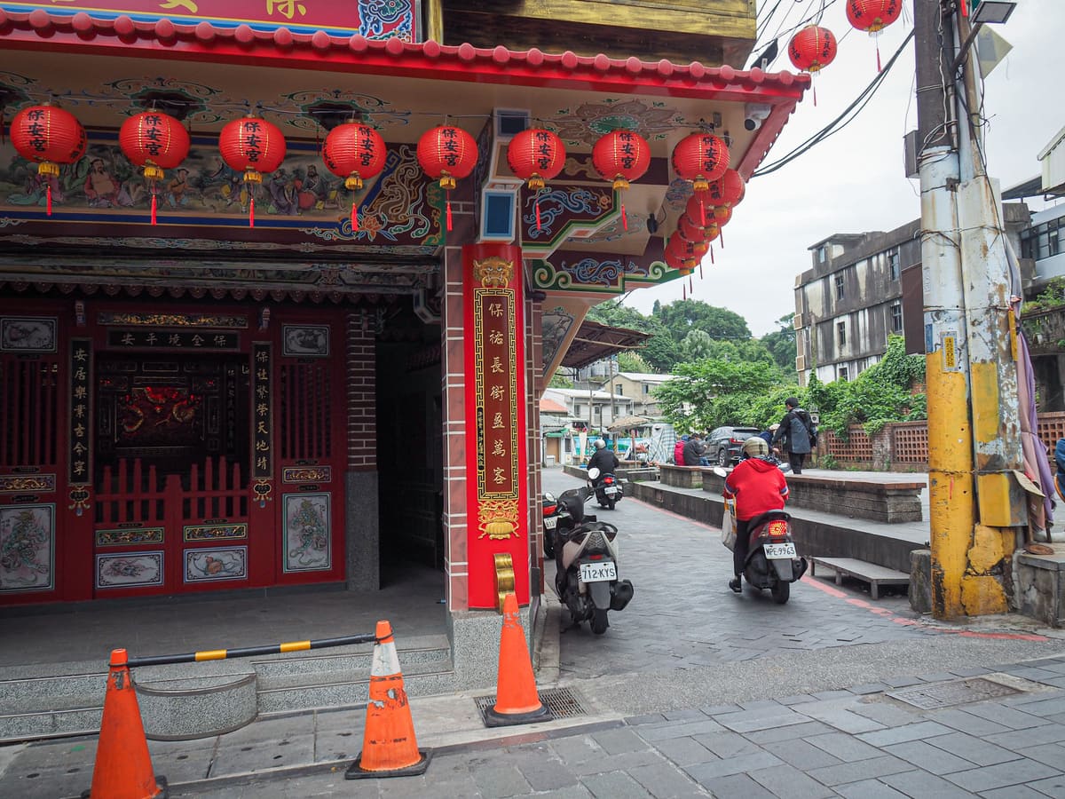
14:20 – The lane takes you past Jinshan Chengtian Temple (金山承天宮). I popped in for a quick visit and found the temple’s sound system blaring out a jazzy Taiwanese tune on repeat. The temple, which has been the focal point of Huanggang Village’s religious life for over half a century, has an interesting origin story. According to interviews with village elders that were carried by students of Jinshan High School (their project and great website is the source for the photo below), the wooden head of an idol was found drifting in nearby waters. Although, at the time, it was mistaken for junk, it was later speculated that the disembodied head was carried here after a storm destroyed a temple in Nan’an (in China’s Fujian Province). The coastal patrol members who found the item tried to break it up for firewood, but (with divine protection), the head survived and instead, the chap who tried to destroy it ended up injuring himself in the process. Evidently, no longer deemed useful, the head was thrown in a junk pile, where local kids picked it up and used it as a toy. When village elder Jiang Deng-Wang learned about the existence of this item, he collected it and enshrined it in a makeshift. A few fishermen came to pray to the head before heading out on their boats, and when they later returned with full nets, the idol’s fame became guaranteed.
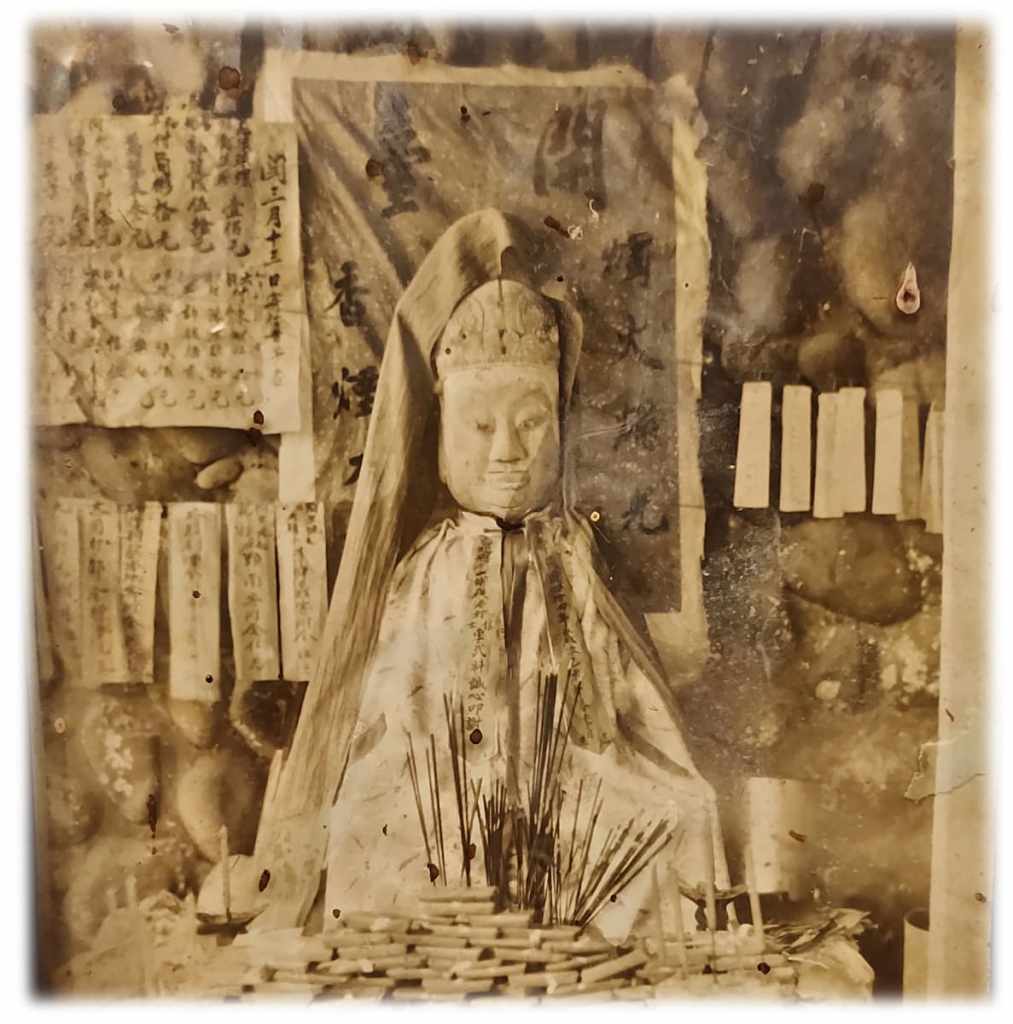
Locals determined that the head belonged to Koxinga (鄭成功). Temporarily, he was given a soy sauce bottle as a stand-in for a body, and later, he was given clothing and finally, a full temple makeover. These days, the temple is a very respectable mid-sized temple with multiple altars dedicated to various deities.
Leaving the temple behind, I set off to complete the final couple of hundred metres. Decorative insets depicting a traditional fishing vessel with and the Chinese name of the Fisherman’s Trail lead you down through the houses to the water.
The lane does a little zig-zagging wiggle as you near the harbour.

14:27 – And then before I knew it, I found myself at the harbour—the origin point for many of the goods that would have historically been carried up and over the hills to arrive at Shilin. I decided to reward myself with a little paddle in the nearby public hot springs, so from the harbour I took a left turn and walked upstream to find Huanggang Community Public Hot Springs.
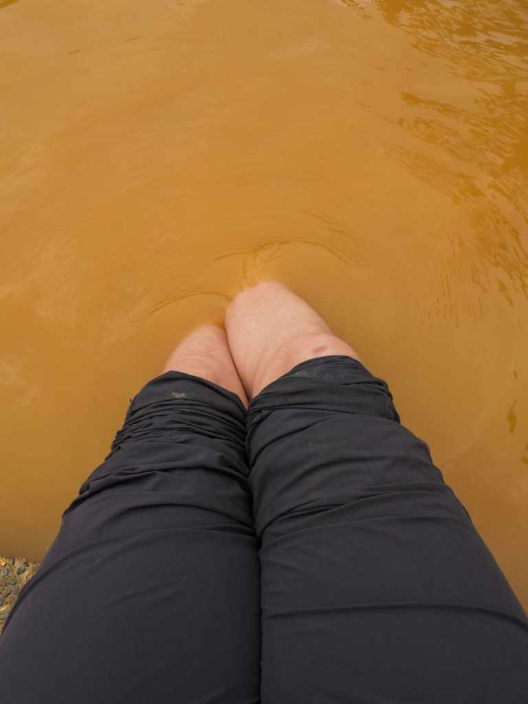
The hot spring waters here are a vivid rust colour and so soupy that you cannot see beneath the surface at all. There are free footbaths and free (single-sex) naked pools — the former is open most of the time, while the latter is only open at set times each day (Google Maps seems to have a pretty accurate handle on when precisely).
Once suitably refreshed, I dried off and walked up the road to Huanggang Road bus stop, where I was soon boarding a bus back to Taipei.
Getting There
Google Maps address: The walk starts from Qingtiangang Visitor Centre and ends at Huanggang Fishing Harbour. There is parking at both ends, but it would be more sensible to use public transport.
GPS location:
- Qingtiangang trailhead – N25 9.955 E121 34.465
Public transport: You could do this walk in either direction, but it’s probably slightly easier to start at Qingtiangang and walk down.
- Getting to Qingtiangang – Take the S15 minibus from outside Jintian Station. The bus also passes Shilin Station, but take it from someone with hard-won experience, you do not want to catch it anywhere except the first stop on the route. Ride the bus all the way to Qingtiangang.
- Getting back from Huanggang Fishing Harbour — The 1815 runs exceptionally frequently (really, there’s a bus every 5-10 minutes) from Huanggang Road back to Taipei. The bus stop wasn’t on the side of the road I was expecting it to be on, so make sure you’re headed in the right direction. Once in Taipei, the bus stops at several points along the blue line.
Further reading: I used this Chinese trail description as the basis of my walk, with a couple of changes as the path neared Shanghuang Creek carpark.
Nearby trails:
- Jinbaoli Trail (a shorter version which just covers the first part of this walk)
- Jinshan Shitoushan Park
- Tea Mountain Trail
- Qingtiangang Circular Trail
- Xia Qigu Hot Springs
Fisherman’s Trail Northern Section Map
GPX file available here on Outdoor Active. (Account needed, but the free one works just fine.)

You always write clearly and thoroughly. Well done!
LikeLiked by 1 person
Thanks, that’s a great compliment!
LikeLike
I recently tried this hike, although I started from Jinshan, not Qingtiangang. I used the GPX files and I would not recommend people try it! The section where you leave Yangjing Road and hike up to Chonghe Village is totally overgrown. The path was barely discernable. I’m not sure why the author would recommend you take that path. Maybe there was a time when the path was clear. Also, there’s been a huge landslide that destroyed part of the Jinbaoli trail, about 3 km away from Qingtiangang. This post needs update.
LikeLike
Thank you for reporting this. I really appreciate it and I have used your information to add a note to the top of this post.
You’re right that some parts of the trail can get overgrown, but they were definitely walkable when I visited, and there was certainly no sign of a landslide. Unfortunately, this is just part of the reality of walking (and writing about walking) in a place with frequent earthquakes and typhoons — trails change and as a one-person (hobbiest) operation with a backlog of nearly ten years’ worth of trail reports, I try, but it can be impossible to keep up to date with all the trail closures. That’s why comments like yours are so invaluable. I hope it wasn’t an entirely wasted trip!
LikeLike