Waterfalls and Tree-Lined Trails in Neidong Forest Recreation Area
Neidong Forest Recreation Area is a small patch of government-maintained parkland in New Taipei’s Wulai District. Situated on the banks of Nanshi Creek and far away from the busy city, it is a peaceful and pretty natural haven. The park has a total of three trails — the Scenic Trail, the Forest Bathing Trail and the Waterfall Trail — which can be woven together into a single loop, allowing you to see all that the park has to offer.
Given the favorable ratio of effort expended to beauty enjoyed, it’s not surprising that local hikers voted this to be one of the 100 top trails in Taiwan. If you’re interested in seeing more of these, you can find the whole list and track your progress using the Hiking Notes (健行筆記) app.
DISTANCE: A little over 4 kilometres.
TIME: 2-3 hours. It took me a little over two hours to complete this route, but you could easily spend longer if you’re good at forest bathing.
TOTAL ASCENT: About 250 metres.
DIFFICULTY (REGULAR TAIWAN HIKERS): 2-3/10 – This is a pretty gentle walk for anyone used to hiking in Taiwan.
DIFFICULTY (NEW HIKERS): 4-5/10 – For anyone new to Taiwan’s hiking trails, this can be considered an easy-to-moderate walk. The ascent and descent will be a little tiring, but that aside, getting to the park will probably be the hardest part of the endeavour.
SIGNAGE: There is clear signage throughout.
FOOD AND WATER: I took bout 1L and drank about three-quarters of that on a warm September day. The park has hot and cold water dispensers but no food, so you’ll want to take some snacks with you.
SHADE: The Scenic Trail and the Forest Bathing Trail are both pretty well-shaded, but I had to crack out my sunhat for the Waterfall Trail.
MOBILE NETWORK: Mostly OK but weak in a couple of spots.
ENJOYMENT: The ratio of effort to enjoyment is high on this one. The walk isn’t too taxing, but the forest scenery and waterfalls are an absolute treat. And if you combine it with a visit to nearby Wulai, you’ve got a lovely little day trip.
SOLO HIKE-ABILITY: This trail is absolutely fine to do solo.
OPENING HOURS: Neidong Forest Recreation Area opens daily, 8am to 5pm on weekdays and 7am to 5pm on weekends and national holidays (with the exception of Chinese New Year’s Eve, when the park usually closes).
ROUTE TYPE: Loop.
PERMIT: None needed, but you need to purchase a ticket to enter. (See below for more information.)
Jump to the bottom of this post for a trail map and GPX file.
DIRECTIONS:
Neidong Forest Recreation Area can be reached by following Taipei District Road 107 southwest out of Wulai as far as the village of Lahaw (Naxiao or 哪哮) then taking a left turn to cross Nanxia River. At the far end of the bridge, you’ll find two carparks. The one on the left leads to XinxianTrail Xinxian (信賢步道), while the one on the right is for Neidong Forest Recreation Area.

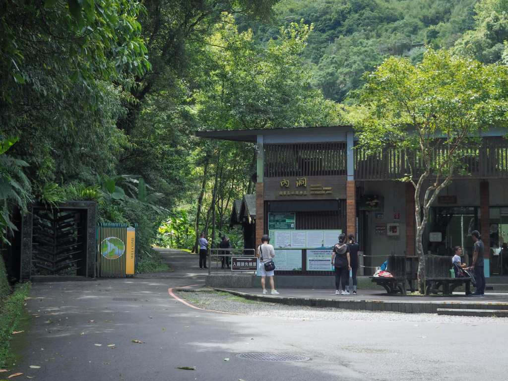
Tickets need to be bought from the ticket book by the park gates. Midweek, a full price ticket costs NT$65, while on the weekends, it’s NT$80. Residents of New Taipei get discounted tickets for NT$40 regardless of which day you visit on so if that’s you, remember to bring your ID card.
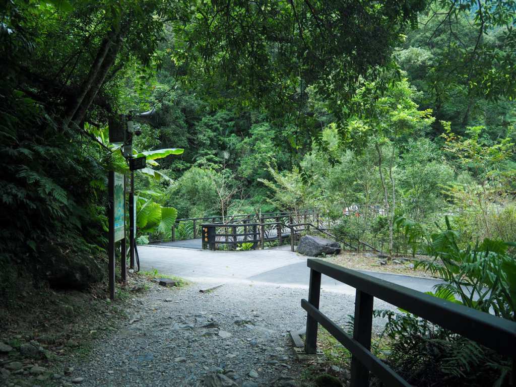
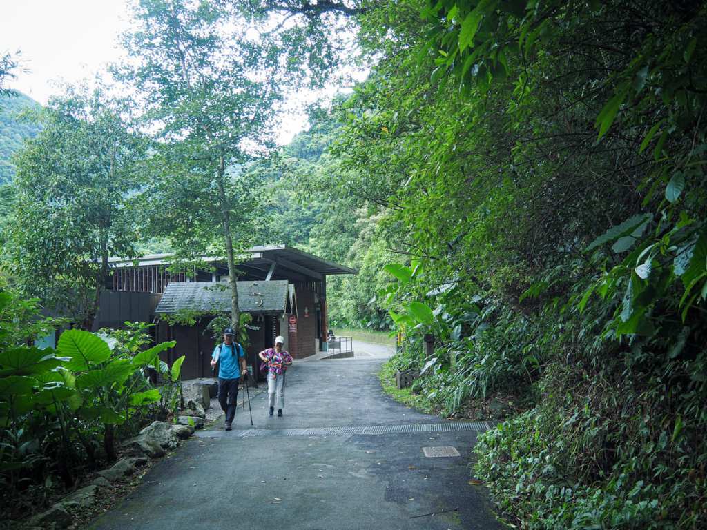
Wandering through the gates and was greeted by a man who checked my tickets and offered me a paper map containing some basic information about the park’s trails and landmarks. Before I set off, I also stamped my travel book with the park’s rubber stamp and filled my bottle from the water dispenser.
Just before I reached a pavilion overlooking Wusha Creek Waterfall, I took a left turn to head up the Scenic Trail.
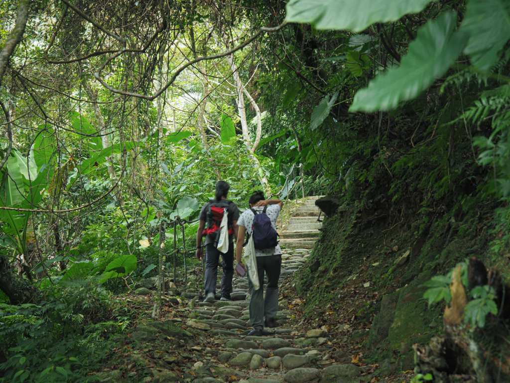
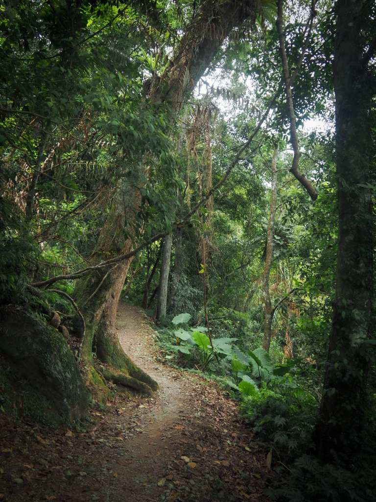
A trail made from a mix of river-smoothed rocks and rough-edged sharp slabs leads up and away from the water — never too steep but a steady and persistant climb.
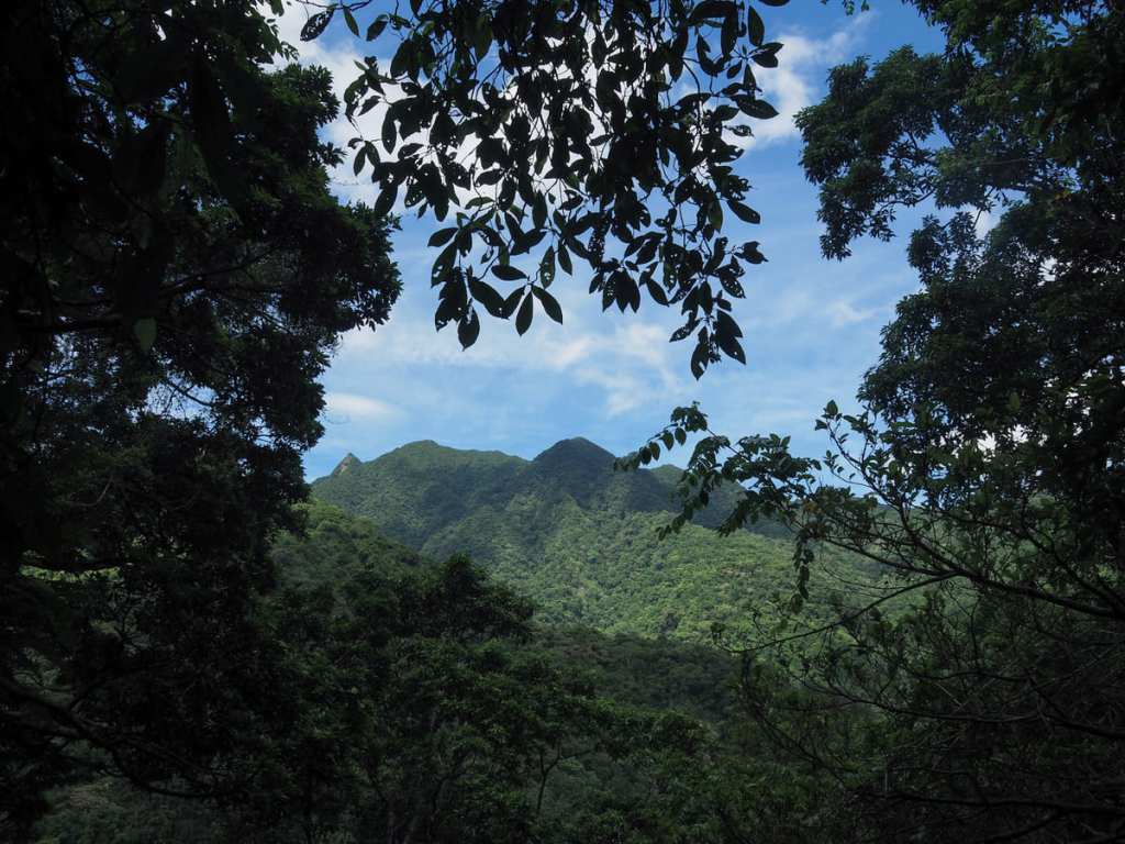
For the most part, it is entirely enclosed within the trees, but in a couple of spots, I caught brief glimpse of the hills beyond.
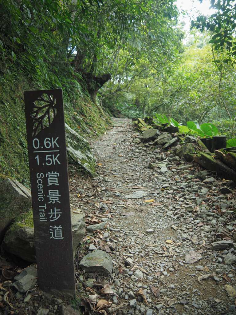
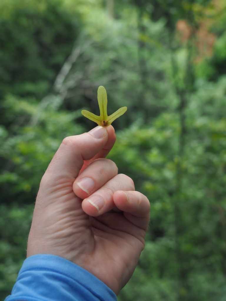
The trail zigzags up in sharp switchbacks to ease the gradient, with every 200 metres marked by a post bearing the cut-out form of a bergonia leaf. There were no pink-hued flowers on display during my September visit, but bergoinas are abundant in the park.
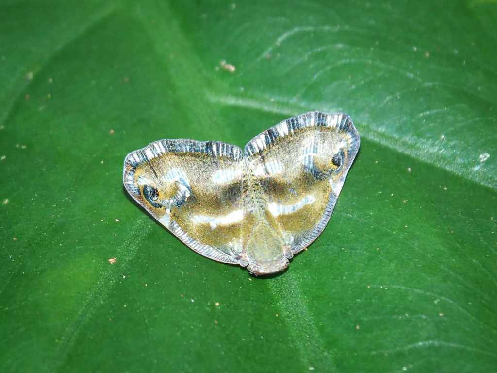
A tiny, shiny moth on a leaf beside the trail. There were also a fair number of grey-chinned minivets flitting around in the canopy, but none of them stayed still for long enough to be photographed.
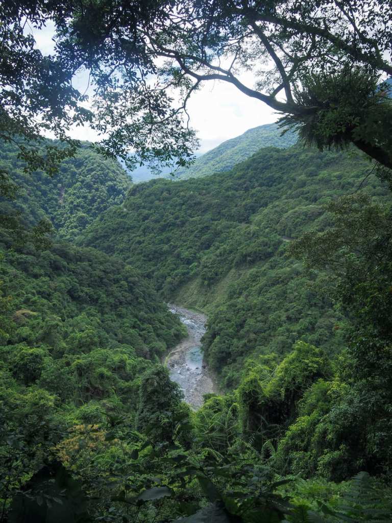
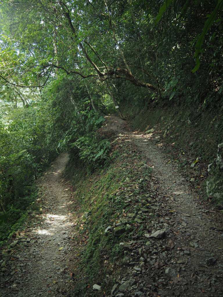
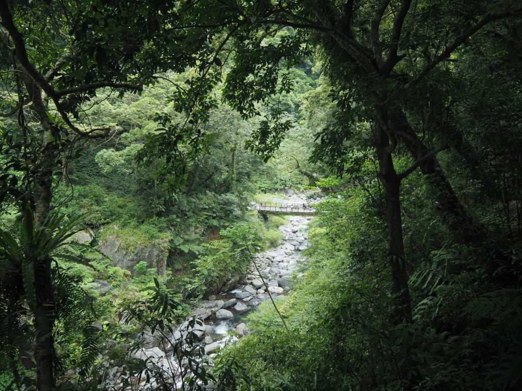
Around the 0.8-kilometre mark, the climb begins to ease off a little and at the 1-kilomtre point, there’s a wooden platform from which you can gaze upstream in the direction of the waterfalls.
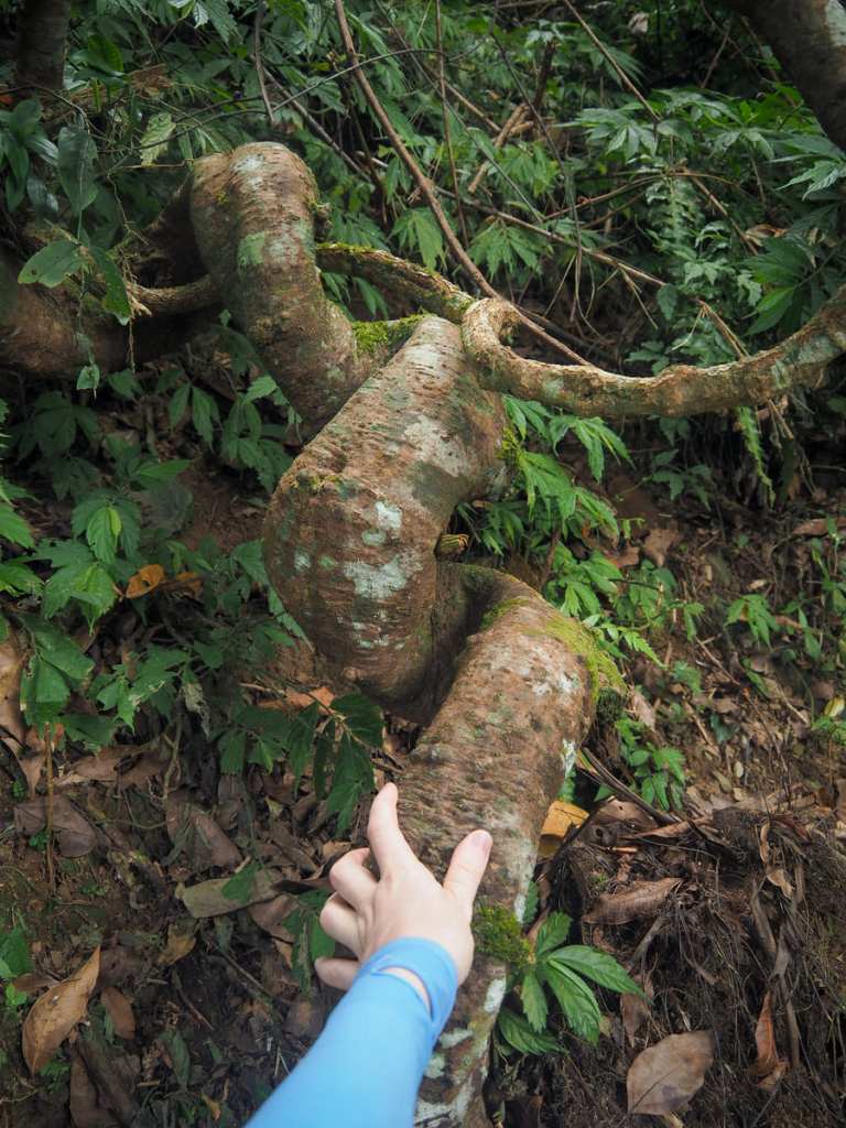
Beyond the lookout platform, the trail curves gently through the forest in waves echoed by this twisting liana root.
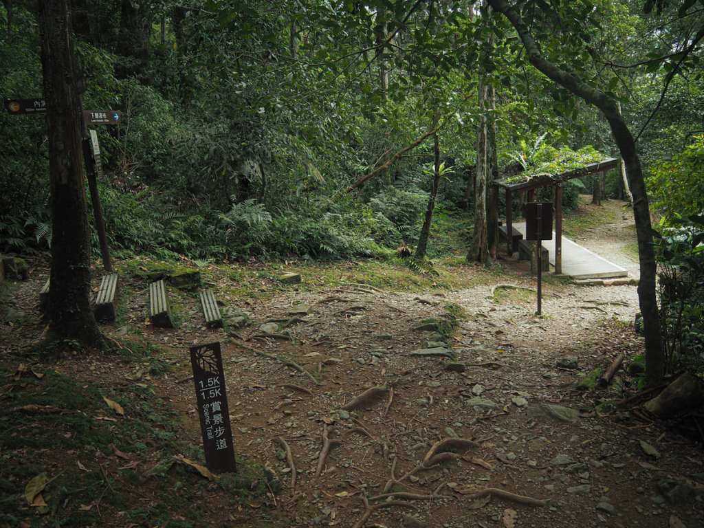
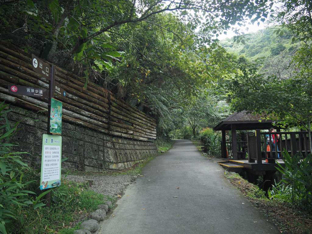
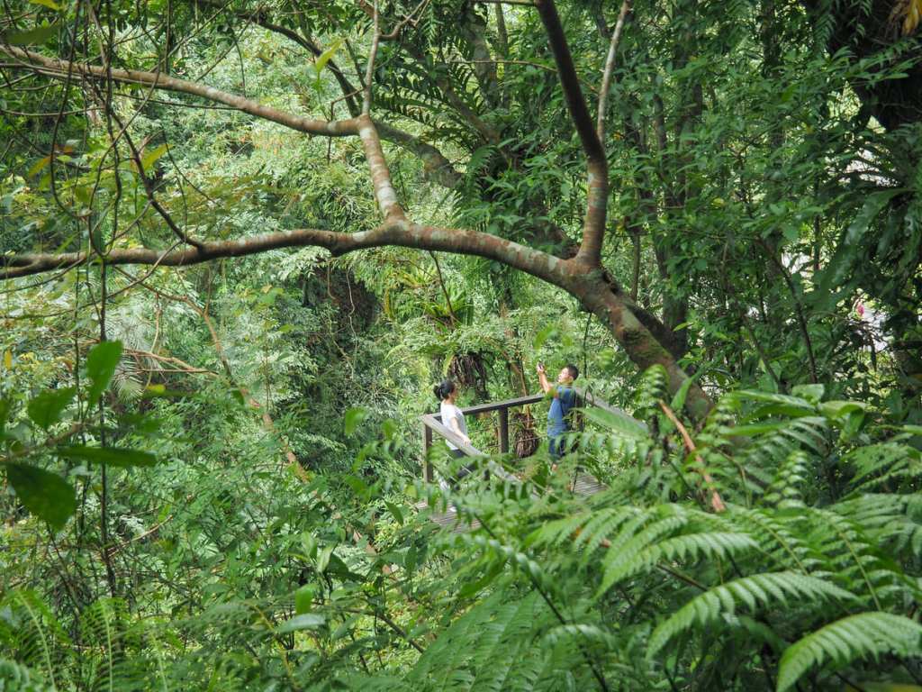
At the 1.5-kilometre marker, the Scenic Trail intersects with the Forest Bathing Trail. Here, I paued in the shelter for a while to listen to the insect hum and then took the righthand fork of the trail leading down to the waterfalls. (The Forest Bathing Trail actually connects up with Neidong Forestry Road if you head left, but that wasn’t my goal.)
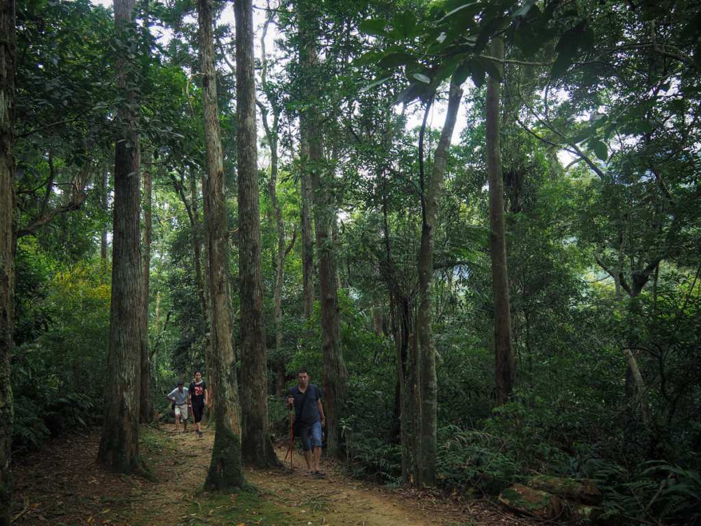
Heading down, the forest scenery changes somewhat — most noteable are the tall cedars that grow in sporadic patches.
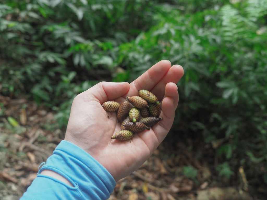
Looking deeper into the undergrowth, I noticed a lot of creeping, draping yellow rattan, instantly recogiseable because of its viciously spiky vines, and in some places, the floor was absolutely carpeted by its pineconeesque fuits.

It felt like the park authorities maybe hadn’t quite made it clear what kind of terrain to expect or how far the walk went on for, because for most of the descent, I was bumping into tired looking people in jeans and nice shoes, many of whom asked me how much further. At least there are benches for them to rest on.
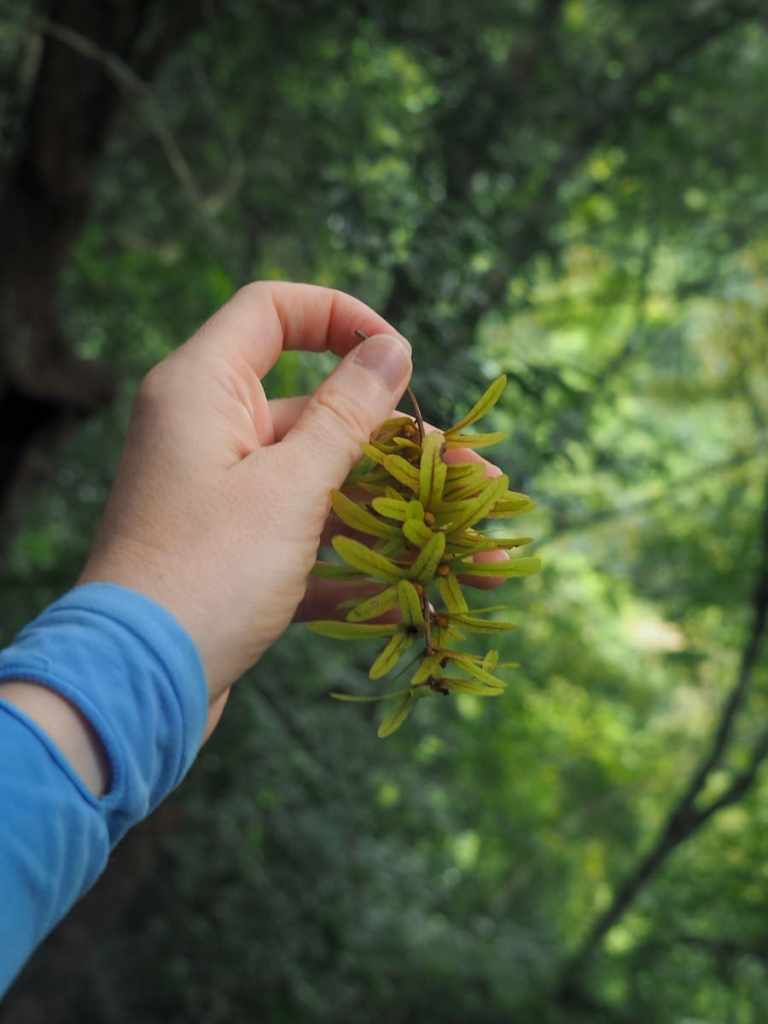
A cluster of winged nutlets (yes, that really is the name for them) from the Engelhardia roxburghiana tree. There were many of them lining the path, and while they don’t helicopter in quite the same pleasing manner as the sycamore seeds I used to play with in my youth, I still had fun throwing them into the air and watching them spiral down.
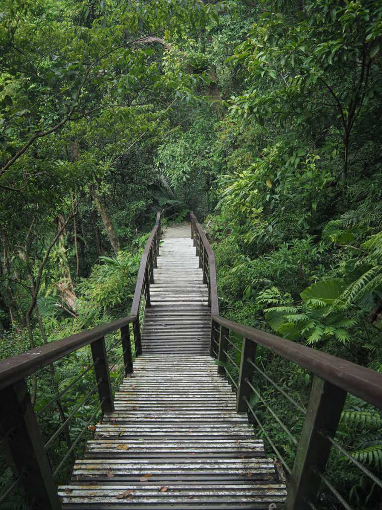
The sound of water became louder as I drew nearer to the Waterfall Trail and for the final couple of hundre metres, the trail becomes a wooden boardwalk as it descends more steeply than before.
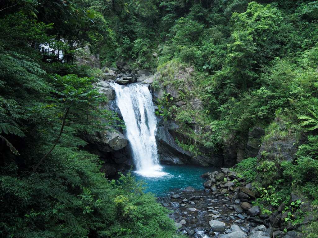
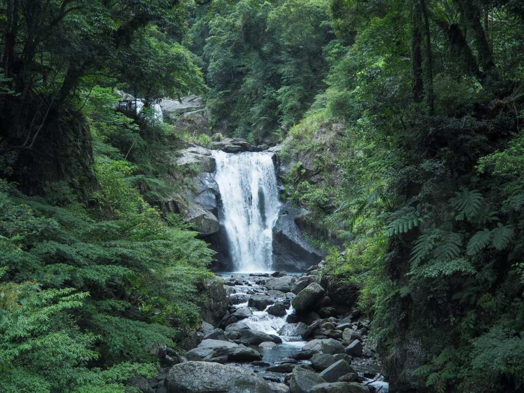
When I joined the Waterfall Trail, I took a left to visit Neidong Upper Waterfall’s observation platform.
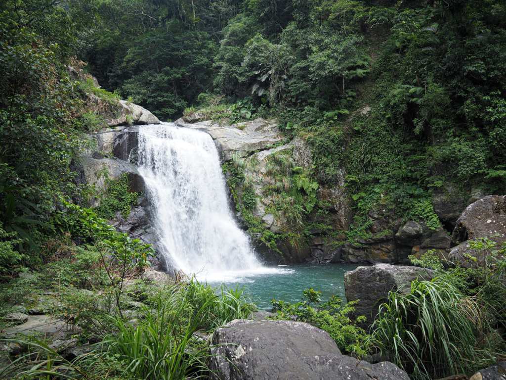
A powerful, broad ribbon of water tumbles over the rocks and into a wide plunge pool. Even without too much rain in the days prior, it was strong enough kick up a fine mist that reached me on the breeze.
Looking downstream from the platform, you can make out Leshui Bridge, and beyond it, the point at which Neidong Creek flows into the larger Nanshi River. This part of the park is called Wawa Valley or Doll Valley (娃娃谷). Why Doll Valley? As far as the internet knows, it’s because the area is home to large numbers of frogs and at one time or another, it was called Frog Valley (蛙蛙谷). Frog (蛙/wā) and doll (娃/wá) are different only in their tone, so it’s thought that somehow the frog became a doll.
Heading back down the path, past the place where I’d joined from the Forest Bathing Trail, I passed a second viewing platofrm.
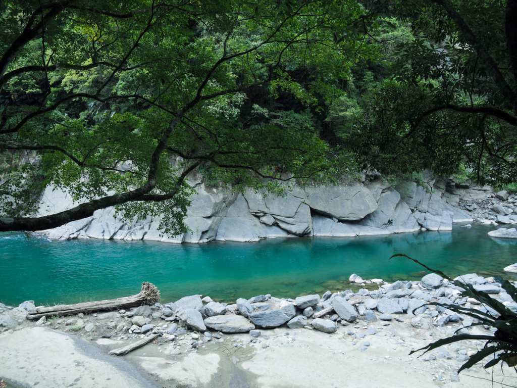
This one overlooks Neidong Lower Waterfall from a vantage point that shows off its deep blue plunge pool.
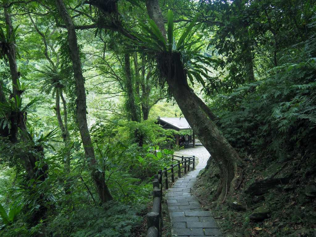
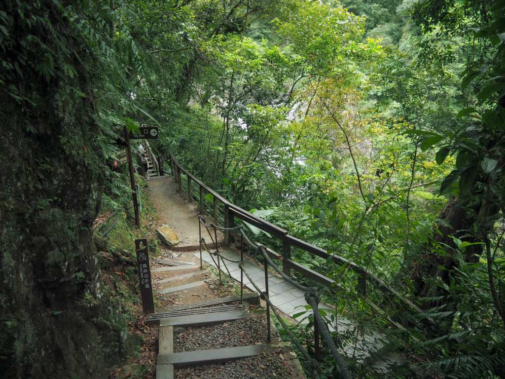
Continuing downwards, I walked through a fern-decked corridor and past a large sheltered pavilion before making it down to join the flat, paved part of the waterfall trail.
To retuen to the park entrance from here, you’ll need to turn right, but before you do, its worth heading onto Leshui Bridge for one parting glance at the lower waterfall.
Although this angle doesn’t show off the water’s blye hue, it does give you the most lovely frame of greenery and dark grey rocks.
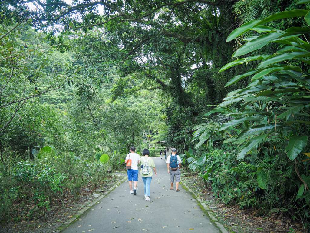
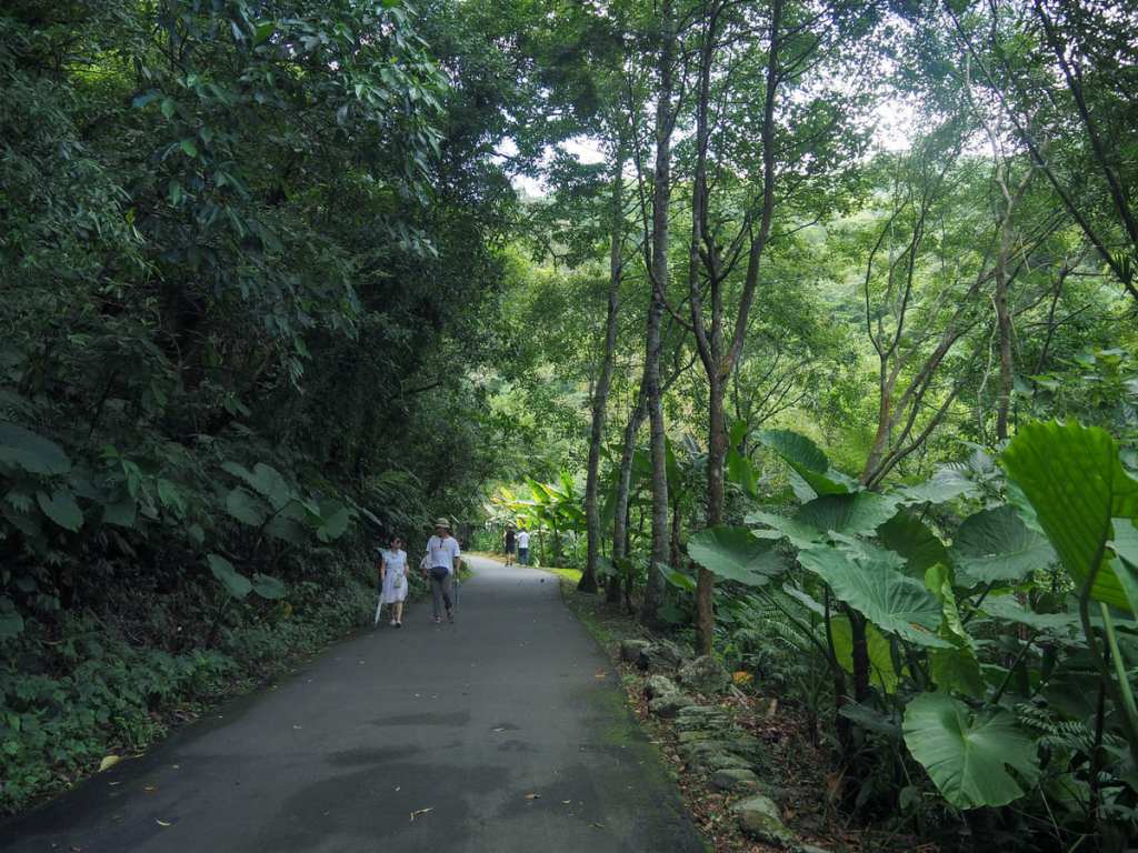
The return journey to the entrance is much, much easier than the outbound leg.
A wide paved track follows Nanshi River as it flows on its way to Wulai. In spots ike this where the water seems placid, deep and inviting, I wished very much that swimming were allowed.
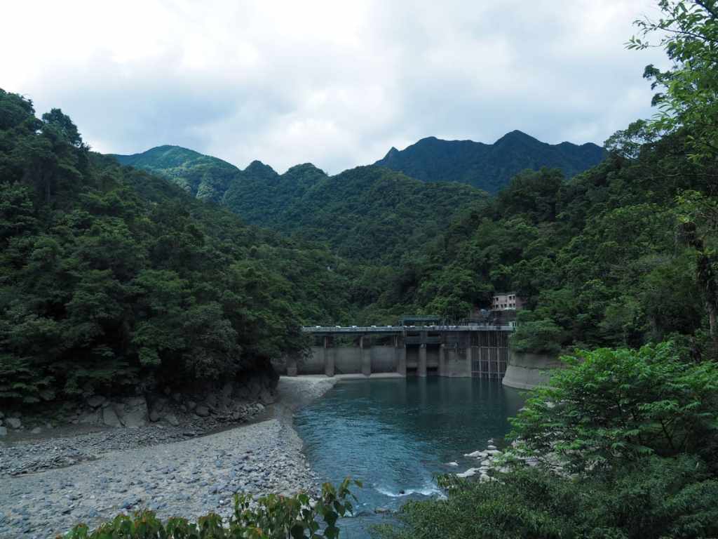
Aside from nature itself, the most impressive feature along the trail is the concrete mass of Luohao Dam. The dam was built in 1947 and added to in 1963 when an inlet was added to funnel water into a 4.7-kilometre-long tunnel leading to Wulai Power Plant. These days, the hydroelectric plant is still used, but only during periods of peak demand.
After making it back to the trailhead, I replenished my water supplies once more and set off on my scooter in search of the river pool below the red span of Jiajiuliao Suspension Bridge, where I enjoyed a nice dip.
HOW TO GET TO NEIDONG FOREST RECREATION AREA
Google Maps address: There’s a free carpark at the entrance to the park.
GPS location: N24 50.070 E121 31.590
Public transport: There isn’t any public transport to Neidong Forest Recreation Area, but that doesn’t mean getting here is impossible without your own transportation. The 849 bus runs between Xindian MRT station and Wulai every 20 minutes or so, then from Wulai it should be easy to get a taxi to take you to Neidong Forest Recreation Area (a 20-minute drive). Getting back, there probably won’t be any taxis waiting at the trailhead, but it’s not actually all that difficult to walk back to Wulai. For the first part, you can follow Xinxian Trail as it cuts alongside the river, and then there’s a short section of walking alongside the road (mostly on a separate path) back to Wulai Falls. This is about 5-6 kilometres of gentle, flattish path. Once you’re back at Wulai Falls, you can either take the mini tourist train down into the town, or follow the path/road leading back to the old street.
Nearby Trails:
- Mount Wulai and Mount Datong
- Xilong Trail and Ma’an Old Canal
- Xinxian Trail
NEIDONG TRAIL MAP
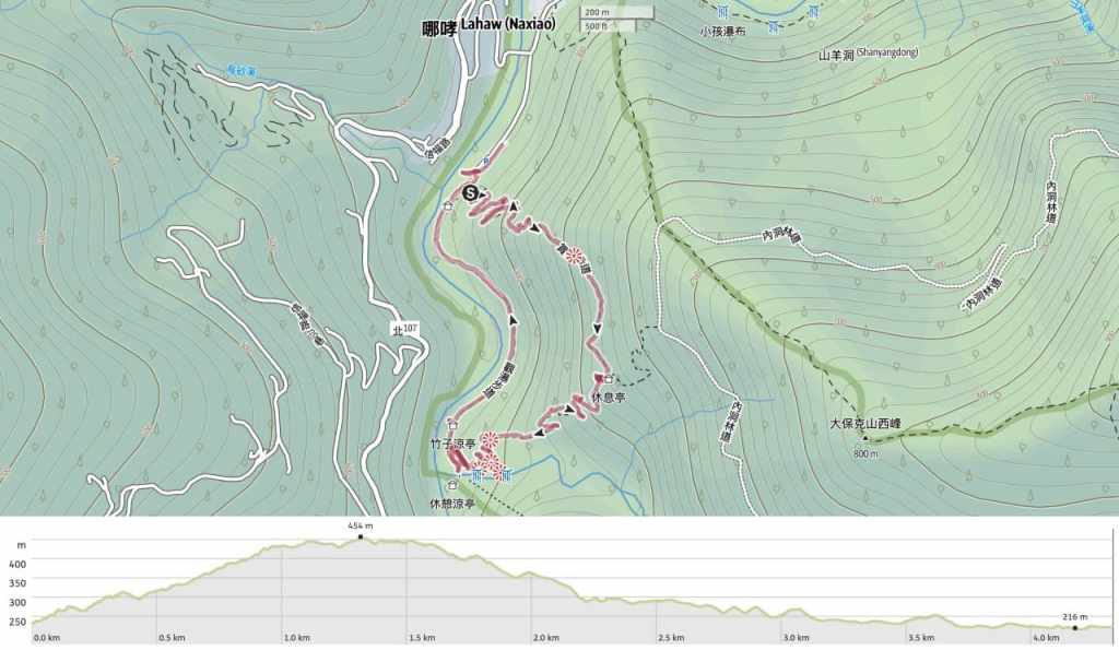
GPX file available here on Outdoor Active. (Account needed, but the free one works just fine.)

very nice, many thanks!
LikeLiked by 1 person
Great Waterfall!
LikeLike