
Tiger Mountain is one of the four beasts that guard the south of Taipei’s Xinyi District. Like its neighbour, Elephant Mountain, it’s a place I have visited many times, but which I neglected to detail properly on this site for nigh on a decade simply because it’s so easily accessible that I thought it was barely worth mentioning. However, the popularity of my write-up featuring the tiger’s elephant neighbor has shown me that my assumption was incorrect and that there are indeed readers out there who are interested in the particulars of these long-time city favourites. Here it is: my guide to Taipei’s Tiger Mountain Trail. (Well, one version of it — I plan to come back to another version at some point. Maybe in another decade.)
Distance: 2.3 kilometres with plenty of options to extend your adventure.
Time: 1-1½ hours.
Total ascent: 120 metres.
Difficulty (regular Taiwan hiker): 2/10 — This is a walk in the park for those used to Taiwan’s trails, albeit a rather steeply stepped park.
Difficulty (new Taiwan hiker): 4/10 — The steps are tiring for those unfamiliar with Taiwan’s trails, and it takes a little bit of navigational effort, but overall, this belongs on the harder end of easy for new Taiwan hikers.
Risks and dangers: This is a pretty safe walk. It’s paved the whole way and is part of a well-trafficked network.
Water: I drank about 0.5L on a hot July day. There are convenience stores by the trailhead.
Shade: Mostly quite shady. I was OK with a sunhat for the on-trail portions of the walk but I still needed an umbrella for the walk from the MRT station to the trailhead and back.
Mobile network: Clear throughout.
Enjoyment: This probably isn’t my favourite walk in the Four Beasts/Nangang Mountain area, but it’s always nice to have options. If you’re looking for a walk like the more famous Elephant Mountain Trail, this is a good dupe.
When to see rhino beetles: The rhino beetle season in Taipei usually runs from the last couple of weeks in June to the end of July. For the specific spot, read through the route description below.
Bathroom facilities: There are toilets at Songshan Fengtian Temple near the start and Yongchunpi Wetland Park at the end.
Route type: Narrow point-to-point hike that could easily be a loop if you want to scooter to the trailhead.
Permit: None needed
Jump to the bottom of this post for a trail map and GPX file.

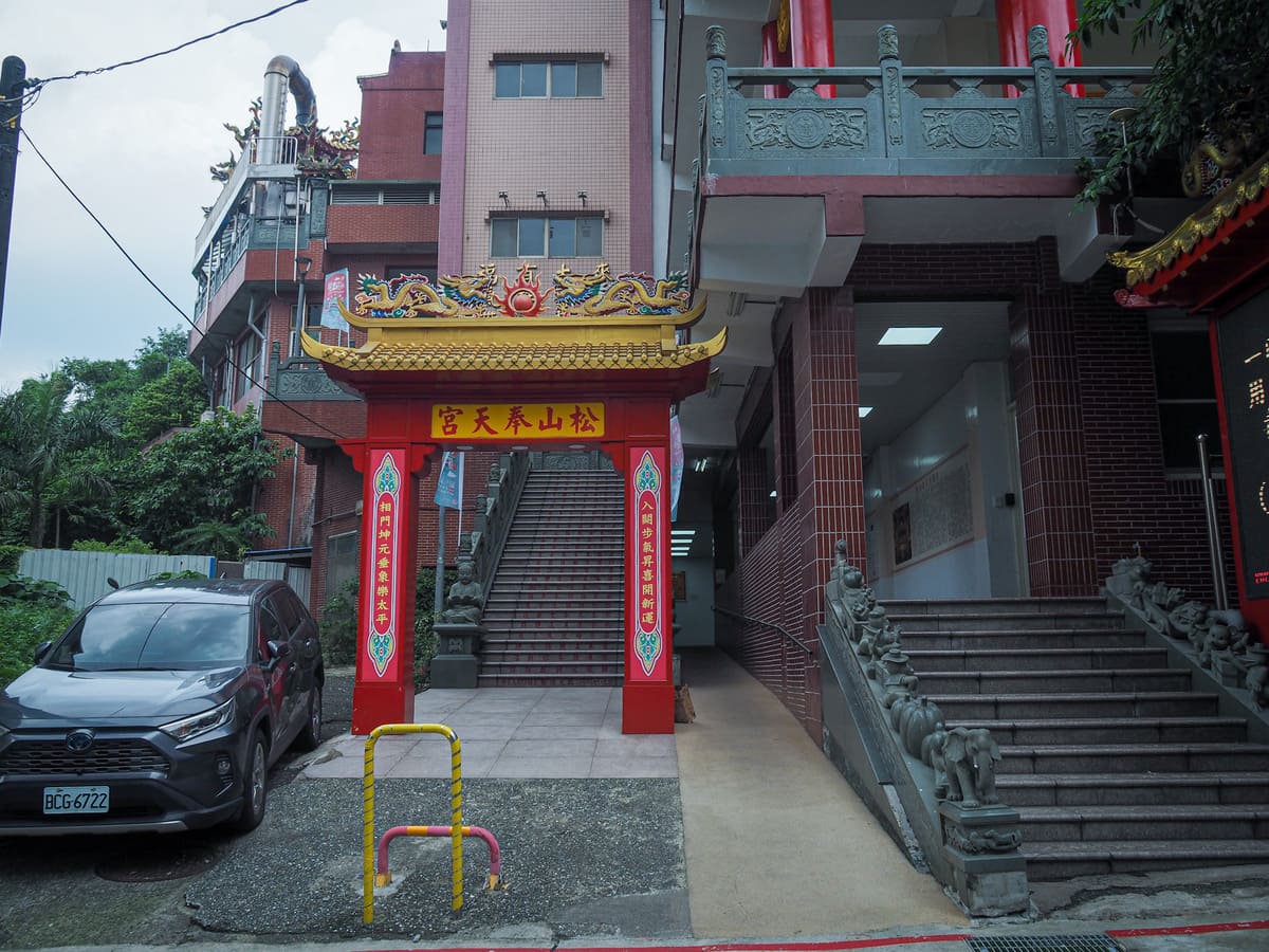
Technically speaking, the walk starts at Houshanpi MRT station, but — aside from a brief, air-conditioned detour via a coffee shop — the walk down Dadao Road to the trailhead is pretty uneventful. Once you cross over Fude Street, look out for the bright red pillars of Songshan Fengtian Temple. Turn right through an archway and follow the steps up and around until you arrive in front of the temple.
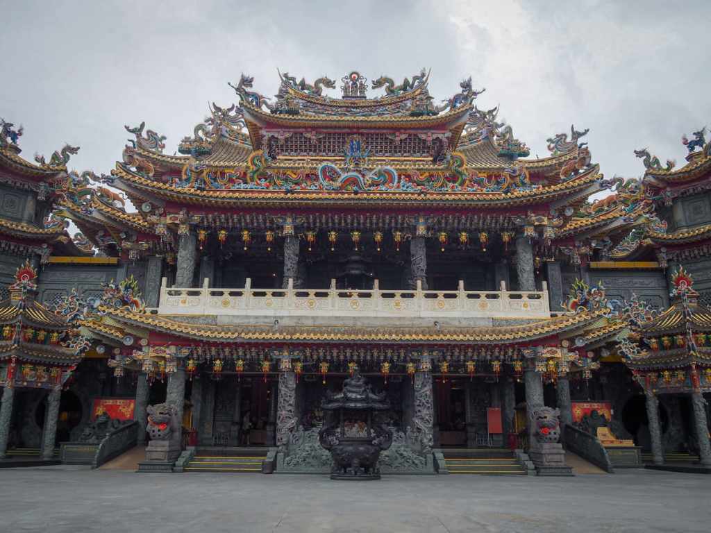
I went on an overcast day, which didn’t do much justice to the vibrant decorations, and the interior was so full of praying visitors that I felt a little uncomfortable taking photos, but it’s definitely worth stopping in to take a quick look at the intricate gold-plated detailing.

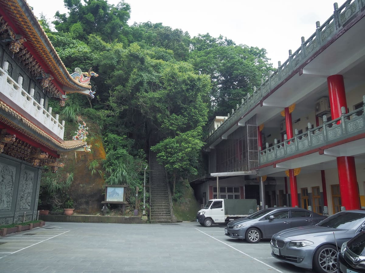
If you stand facing the temple, look for a circular entryway to the right. Just through the other side, you can find the start of the trail and the temple’s accommodation block. This temple, like a fair few temples in Taiwan, offers rooms to visiting tourists and believers, but as is to be expected of a Taipei temple, the prices are pretty steep (especially when considering how basic the facilities in such places tend to be).
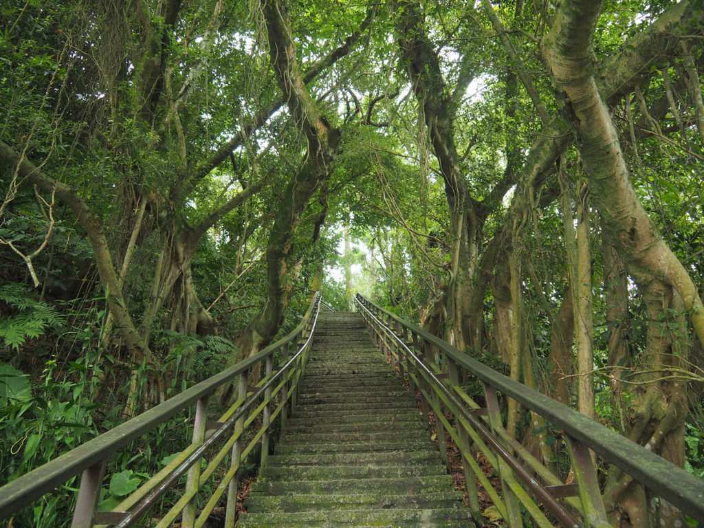
The first flight of steps feels a little intimidating, but it’s not like this the whole way.
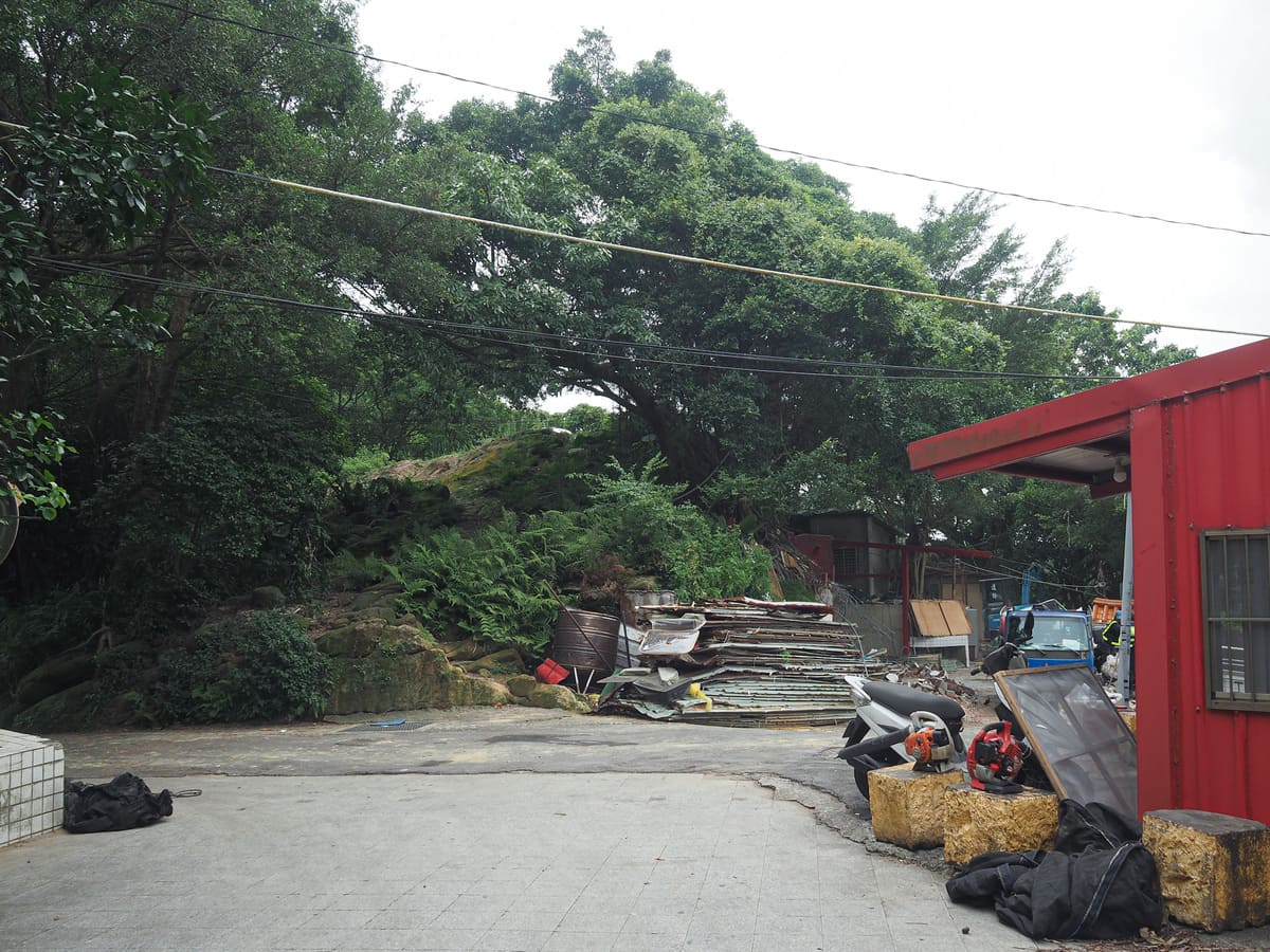
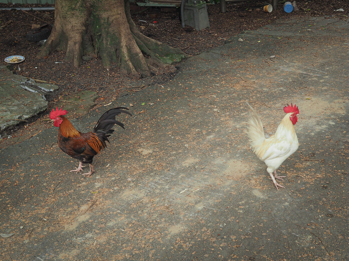
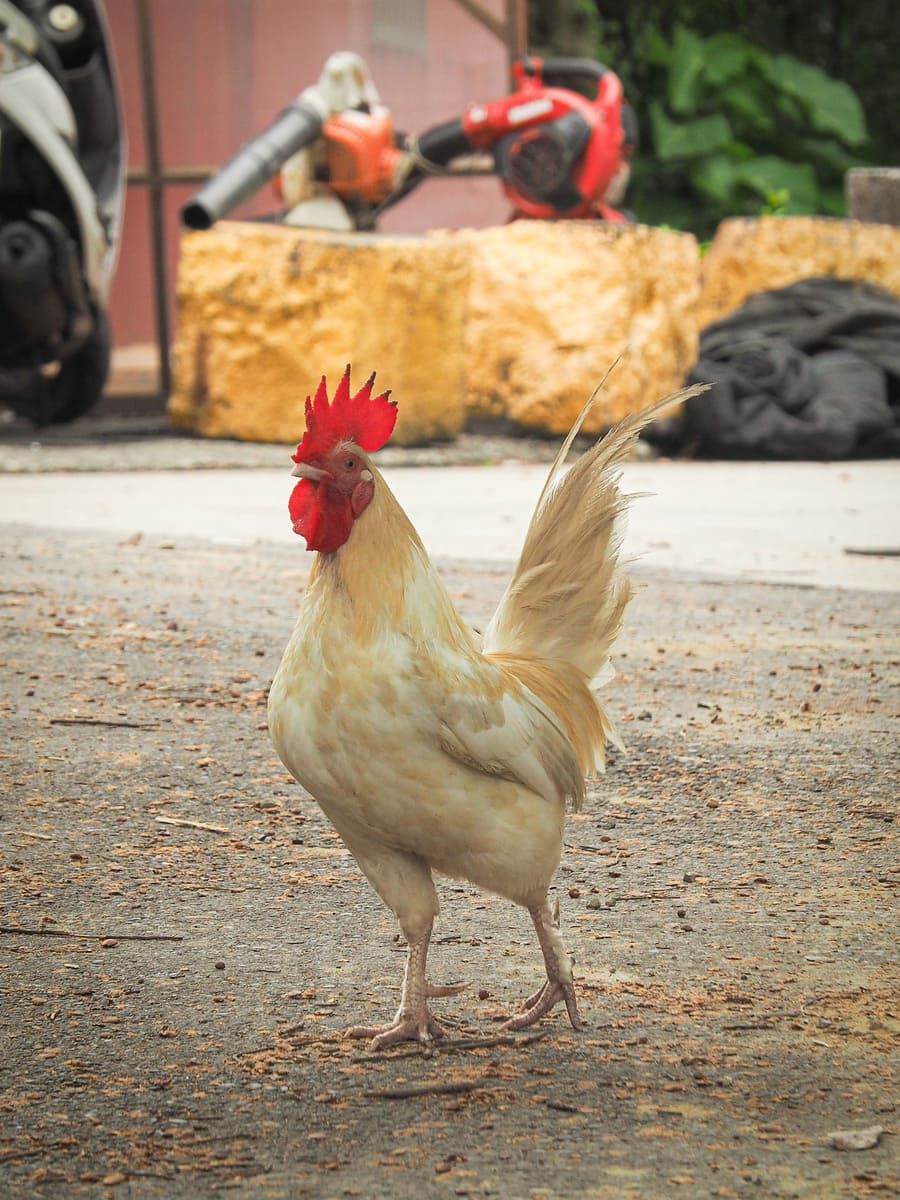
At the top of the steps, I arrived at an odd little car park beside another trail, a temple and a flock of chickens. The temple seemed to be undergoing renovation, so perhaps it doesn’t always look so scruffy, but then again, it absolutely might.
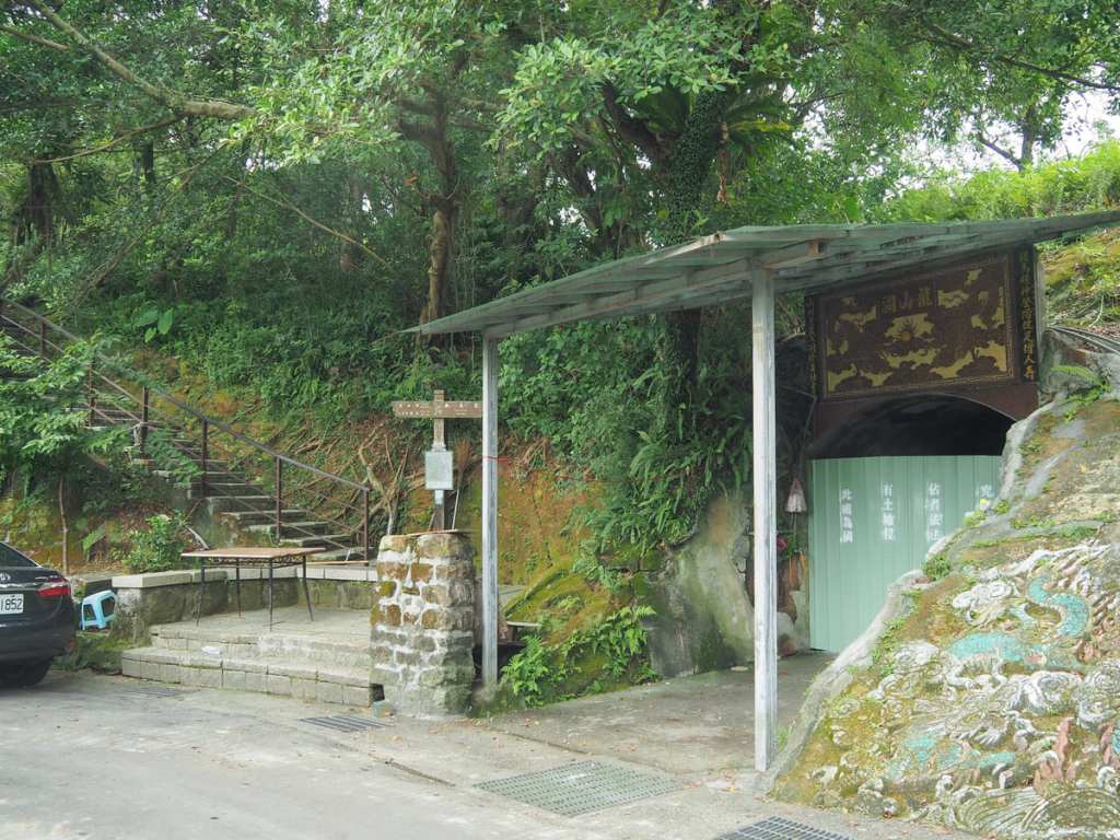
Heading leftish down the track, I passed the sealed entrance to Longshan Cave. Although cavelike in form, this is no natural feature. It was originally an air raid shelter carved out of the rock during the Japanese era, but in more recent years, it has seen use as a mountainside KTV spot. I’m not sure what led to its current sorry, metal-fenced state. Perhaps the neighbourhood chickens lodged a noise complaint.
The Tiger Mountain Trail takes a right up the steps immediately beside the Longshan Cave.
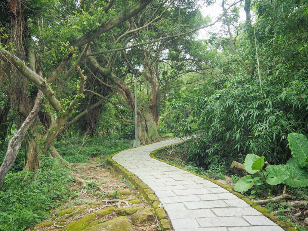
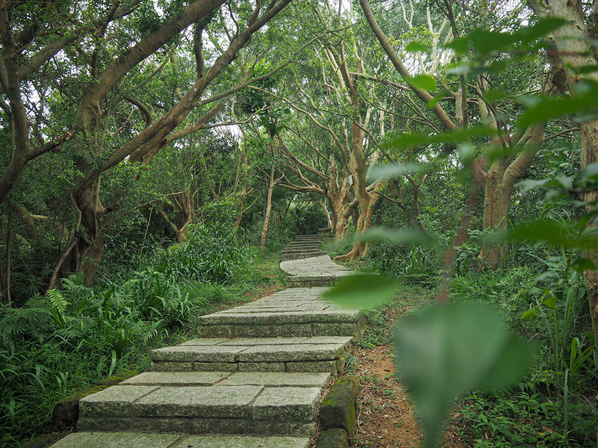
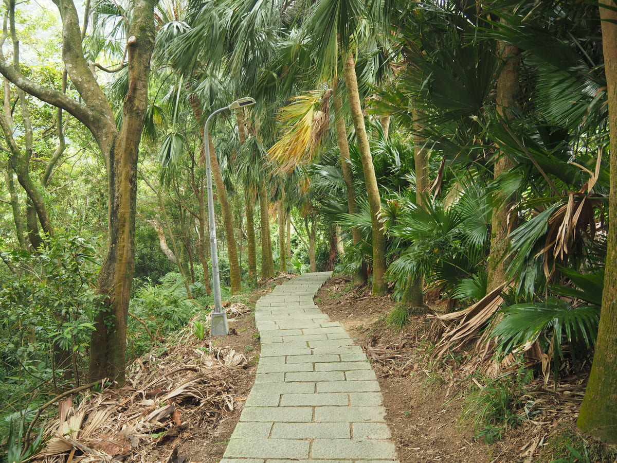
The steps are not as steep as that first flight, and are interspersed with gently sloping sections that meander through scruffy patches of farmland.
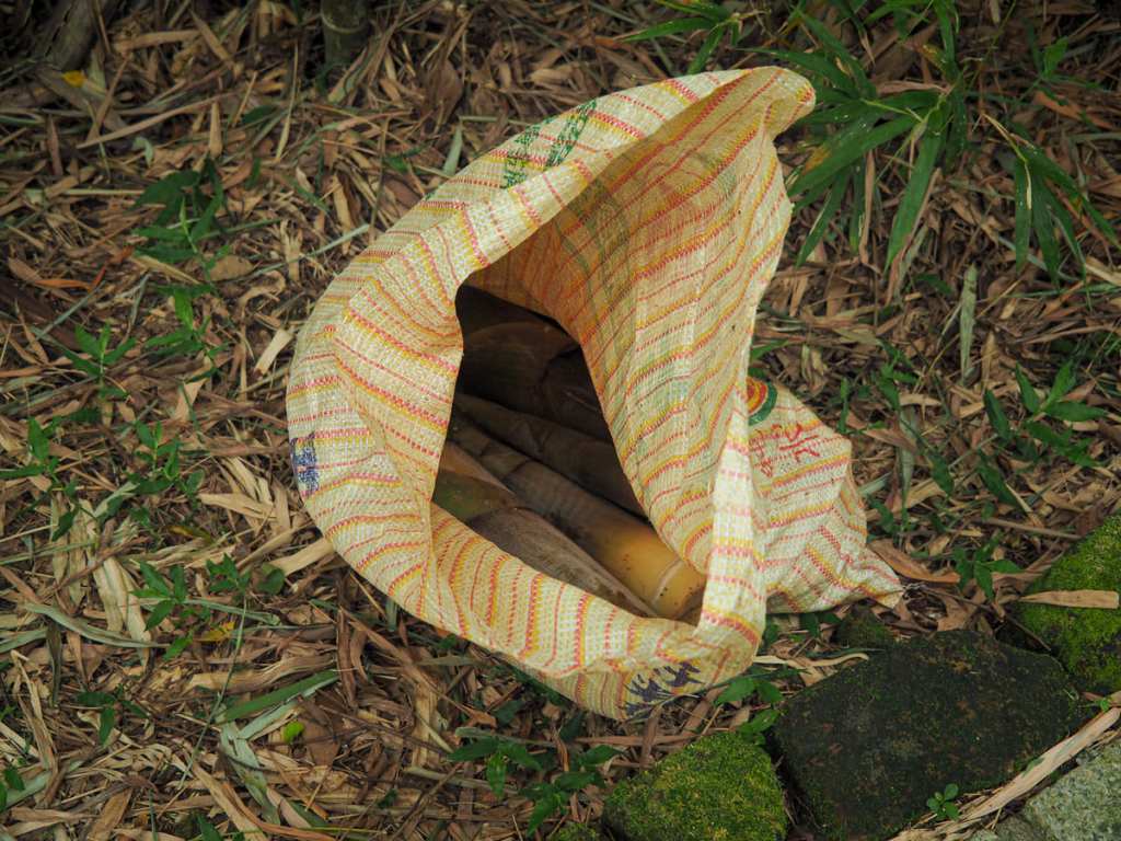
A little way into my journey, I came across this sack of shoots beside the trail and a rhythmic thwack, thwack, thwacking emanating from somewhere behind a messy spray of bamboo culms let me know that their forager was nearby.
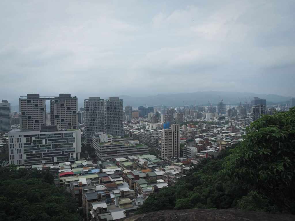
After about 10-15 minutes of climbing, I reached the first vantage point of the walk.

The view was overcast and underwhelming, but as I stood on the rock surveying the city, I met a grass lizard and a black bulbul that was enjoying a cicada lunch.
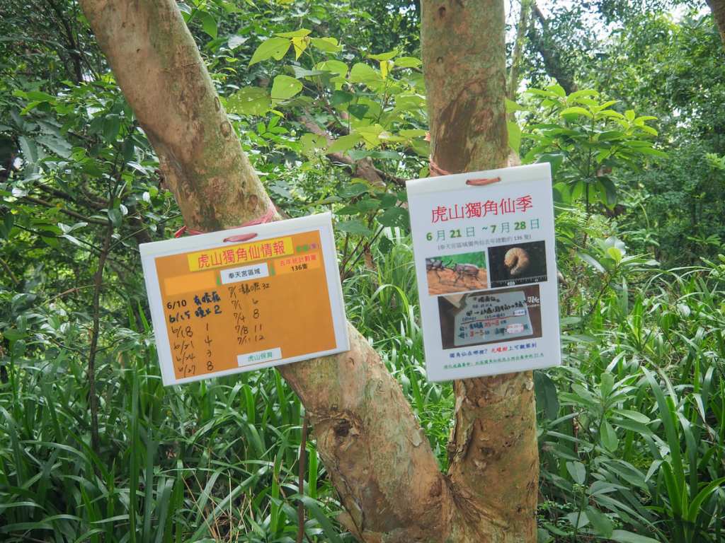
The stand of trees leading away from the viewing point is a popular hang out for rhino beetles in July and August. I didn’t see any on my visit, but the sign indicates that they had been spotted here earlier in the same day. The presence of rhino beetles is pretty easy to predict year to year, since their whole life cycles are played out in the same small patches from generation to generation.
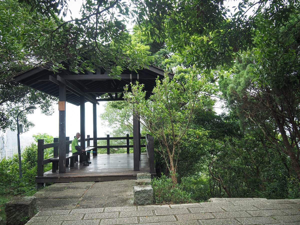
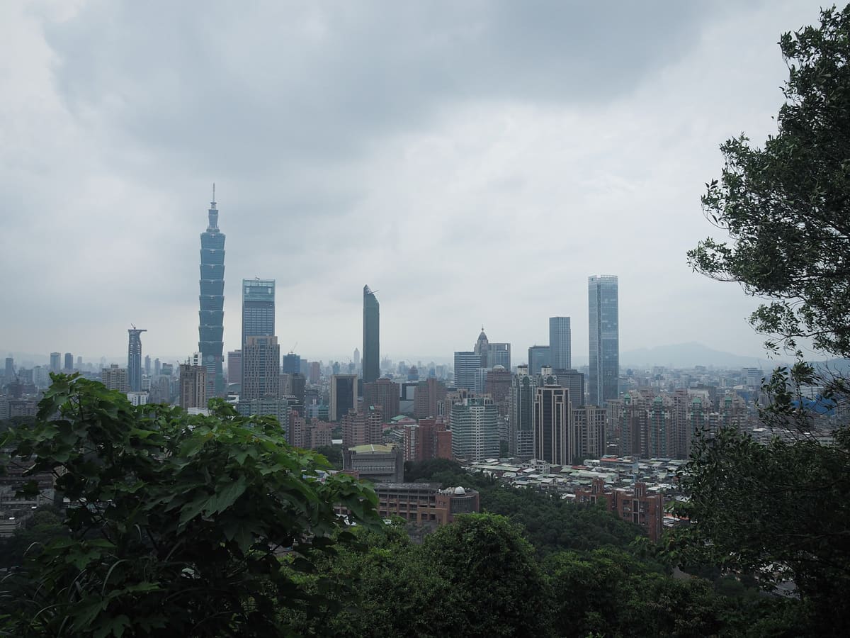
The trail then climbs again to a second overlook, this time marked by a pavilion. The views from up here are better than the views from the lower vantage point, but in cloudy weather, the city never looks that impressive.
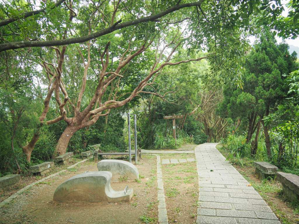
Turning your back on the pavilion, you’ll see a small exercise area in the clearing with two paths leading away at the far end. Take the right-hand trail.

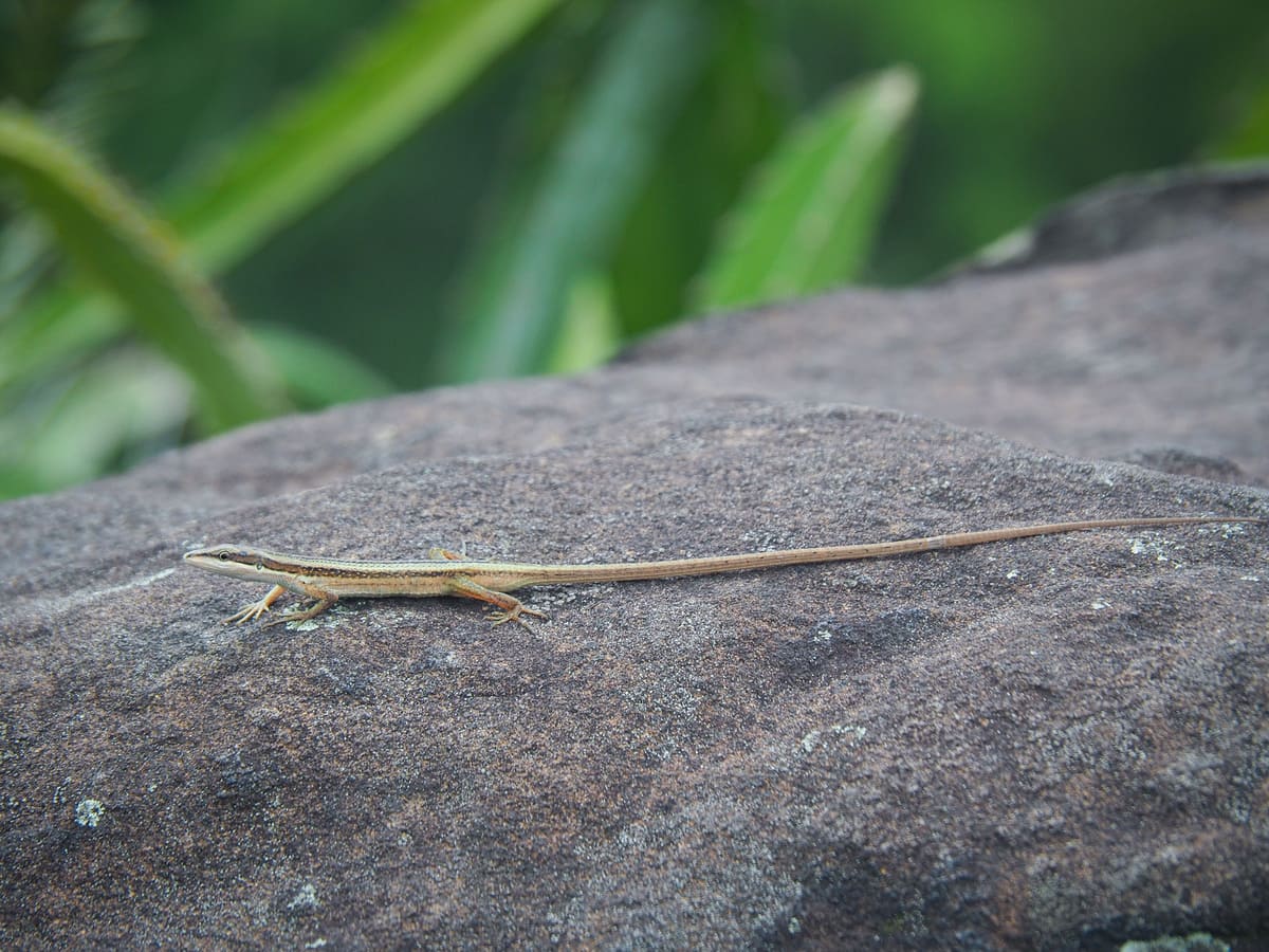
At the next junction (right again), I got distracted by this rather lovely little elegant five-lined skink (“elegant” is actually a part of its name). It was a youngster (the younger ones have brighter tails than the adults), and had caught a mountain cockroach that it was busy devouring. Usually, skinks are very flighty and won’t let you get too close, but this one was so excited about its meal (and maybe just so young and silly) that I was able to creep very close. Watching it for a while, it seemed to be practicing its hunting on the (already dead) cockroach and would approach it again and again with its tail excitedly flicking from side to side in anticipation.
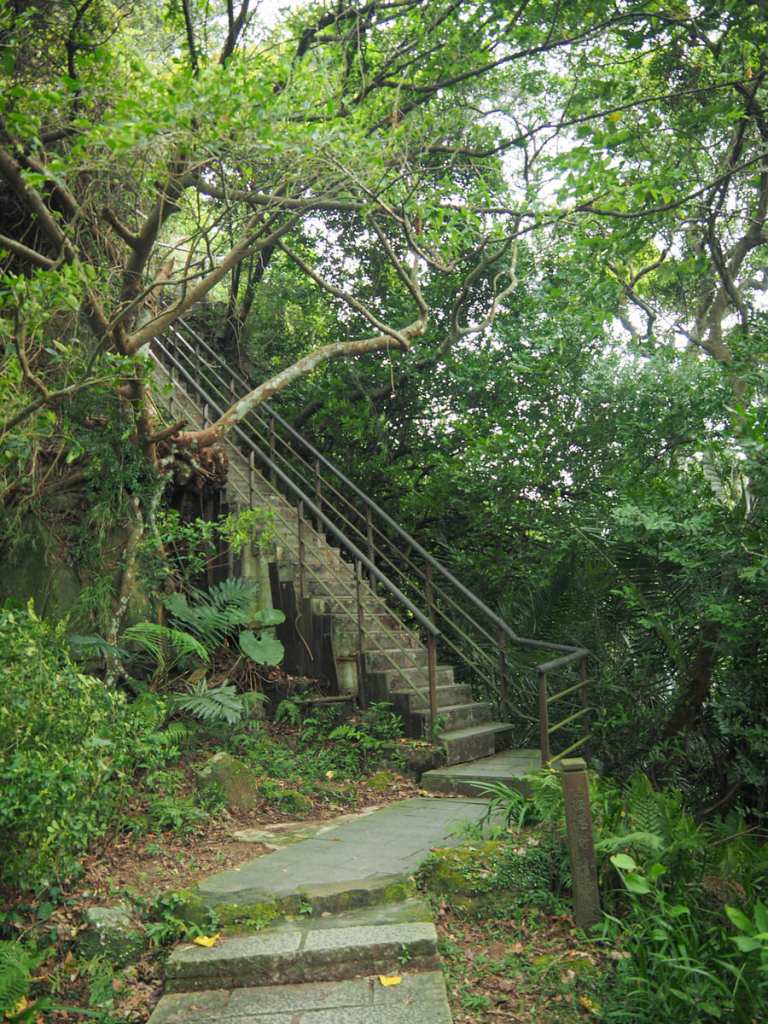
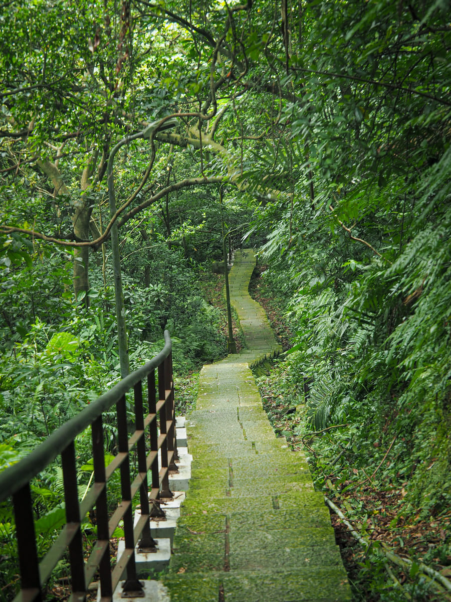
A flight of steep concrete steps marks the final ascent to Tiger Mountain.
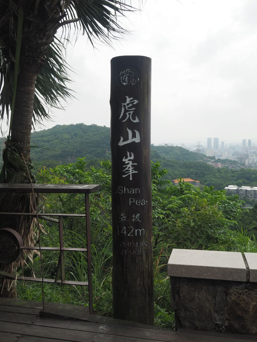
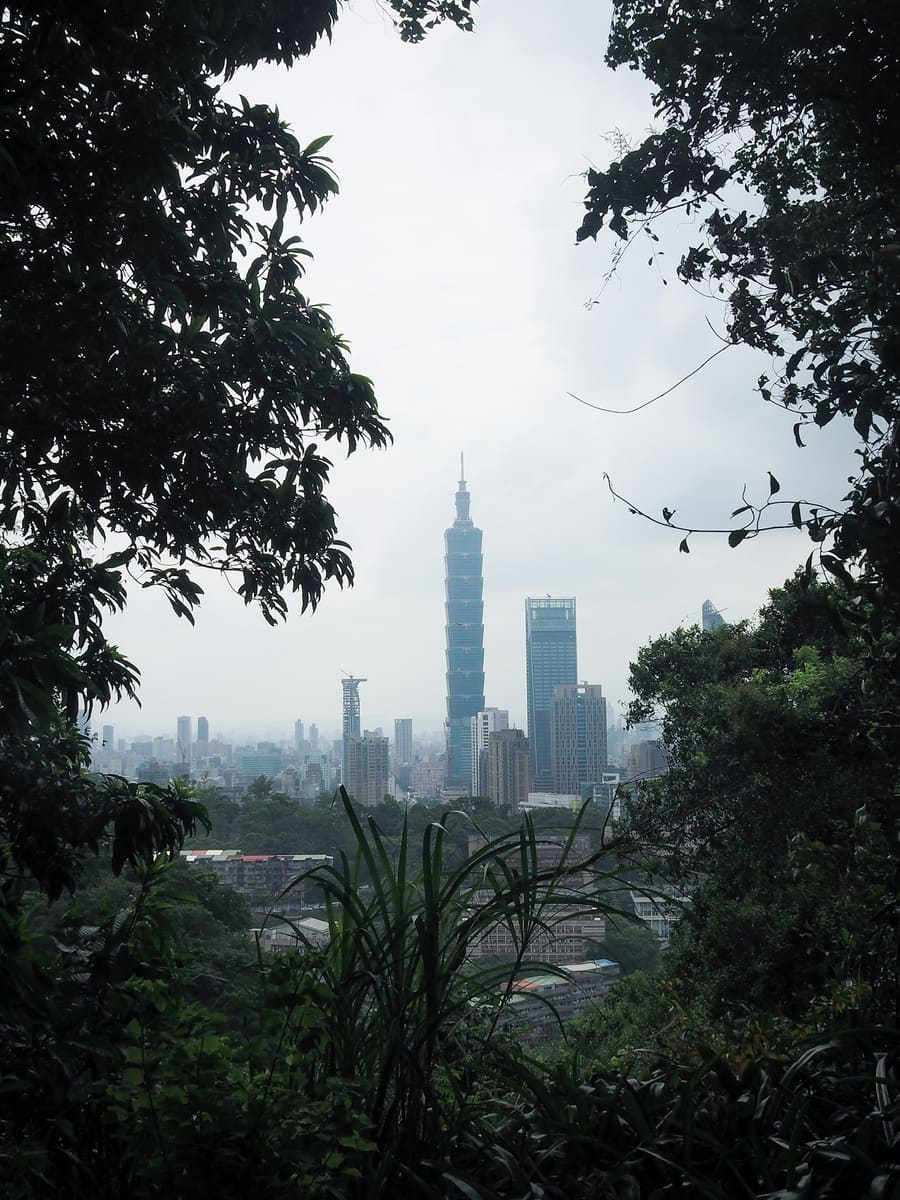
The top of Tiger Mountain is occupied by a lookout platform and a totem-pole-like summit marker (similar markers can be found on the other four beasts). From up here, hikers are afforded expansive views over Taipei 101 and much of the rest of Taipei.
Since the platform is exposed to the elements, I was quickly on my way (it was too hot to dilly dally). Steps track down through an avenue of trees, then up again to an open-sided shelter. Take the trail leading straight through the shelter (not the one on the left).
At the bottom of the steps, take a right onto the road and then another right very quickly down a very straight flight of steps. (Heading straight would take you past Leopard Mountain and eventually on towards Elephant Mountain.)
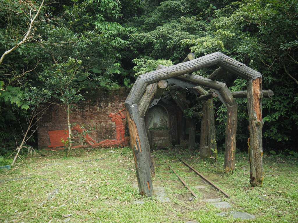
The steps are so straight that I wondered whether they were built along the route of a historic cableway. I didn’t find any information to back up this suspicion, but there’s an old mine that’s been dressed up for hikers to take photos with (and another mine entrance near the top of the steps), so I wouldn’t be surprised if my hunch was correct.
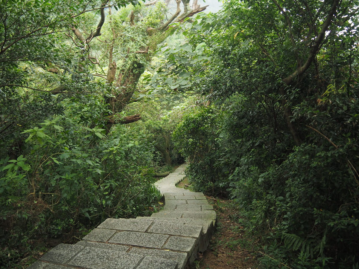
The steps continue down for most of the way back to the road. After a little while, the path falls in step with a small stream. There’s a little waterfall with a viewing platform, too. However, the mess of ugly pipes somewhat detracts from the natural beauty of the scene.
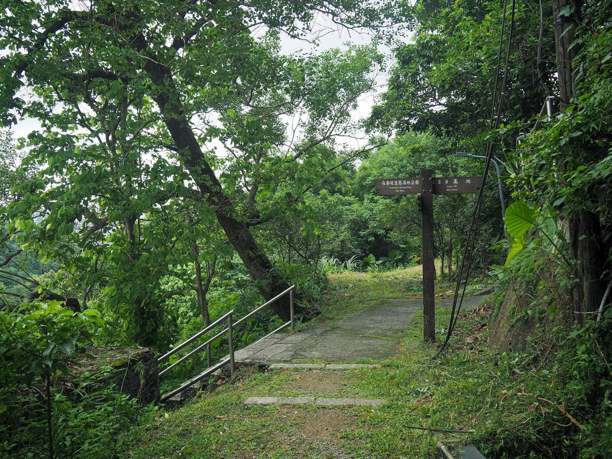
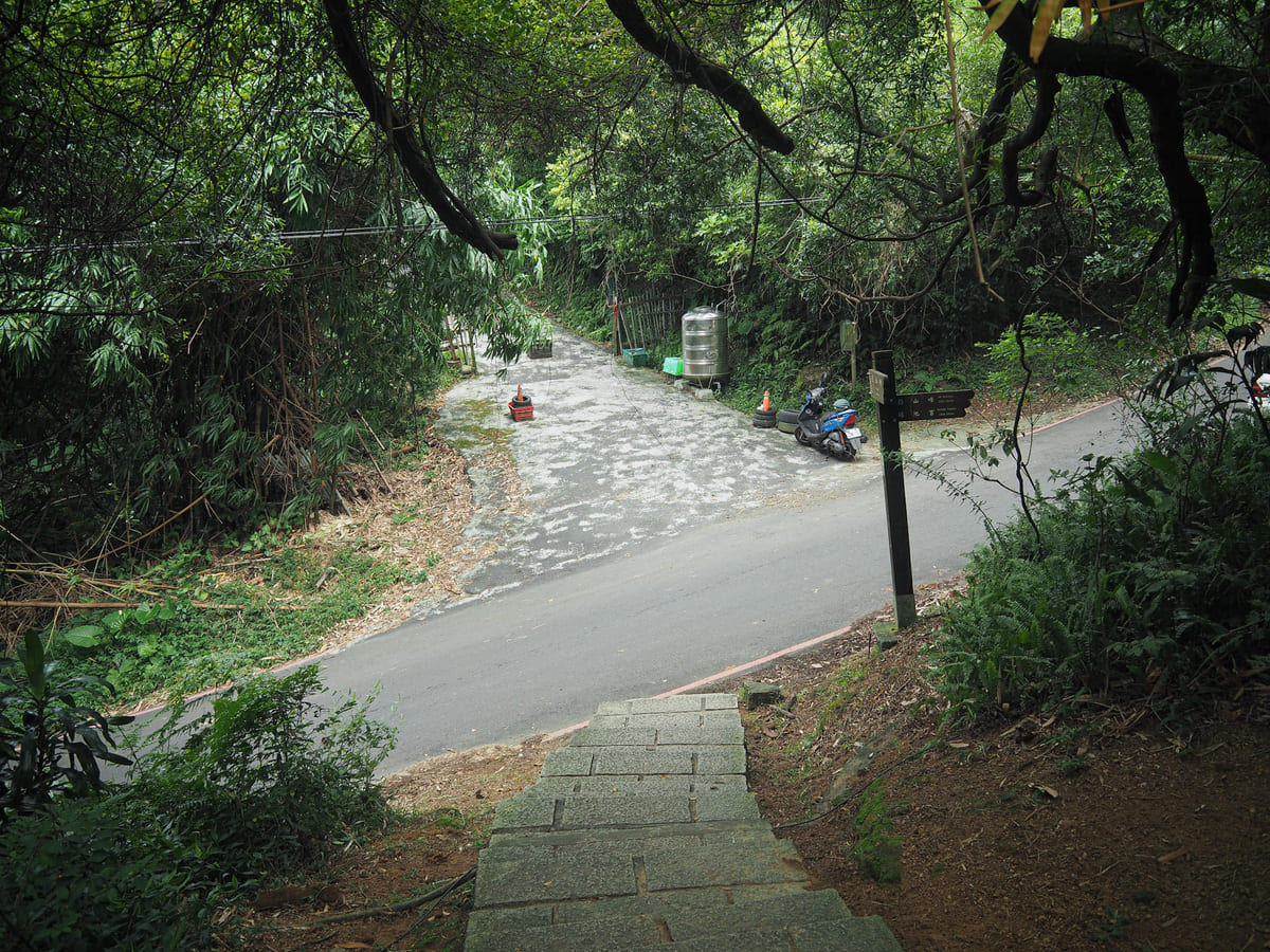
Where the steps level out, the path continues to head straight, then, before long, I took a left turn to head down more steps.
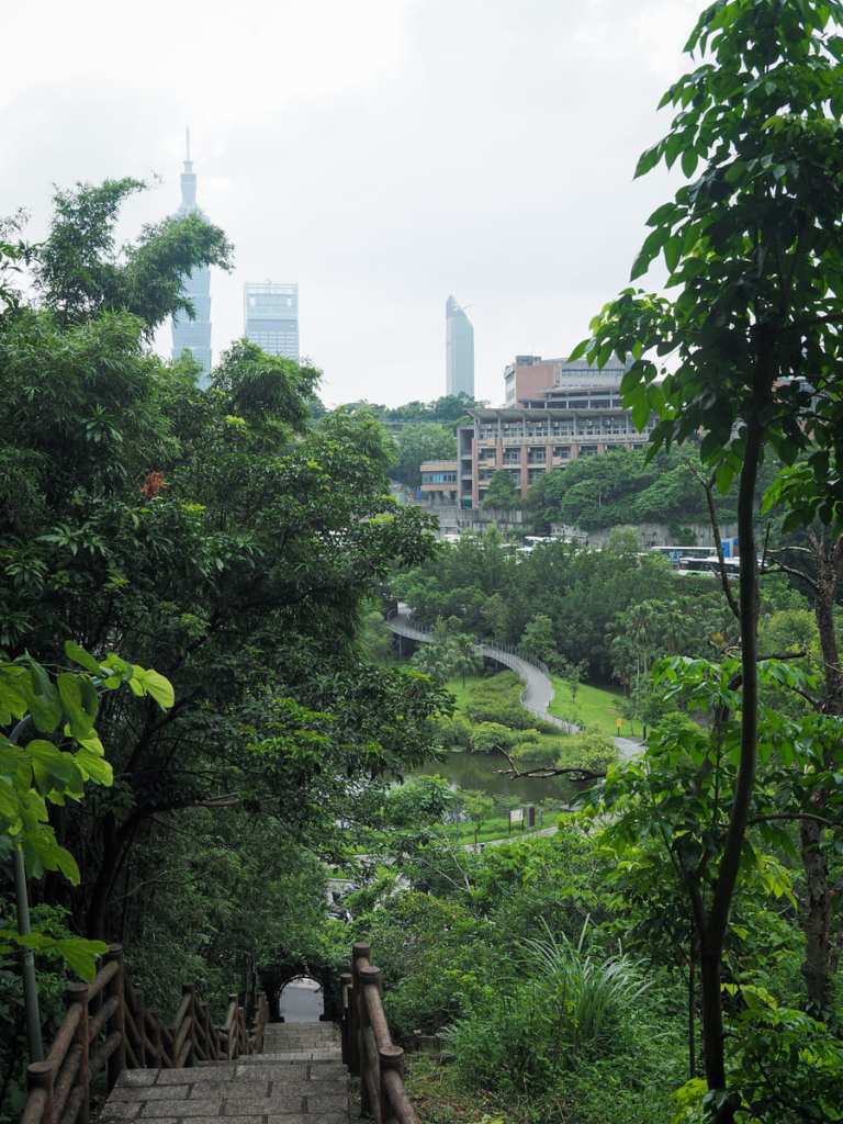
The steps lead down to Yongchunpi Wetland Park — Taipei 101 looming unexpectedly prettily behind the ponds.
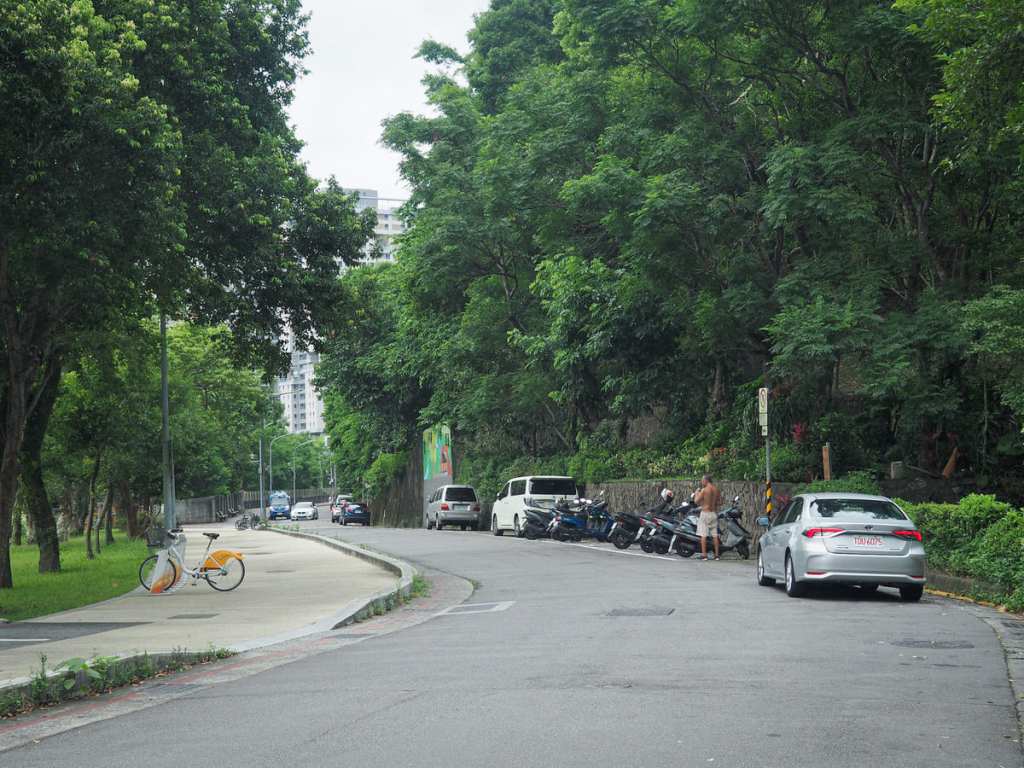
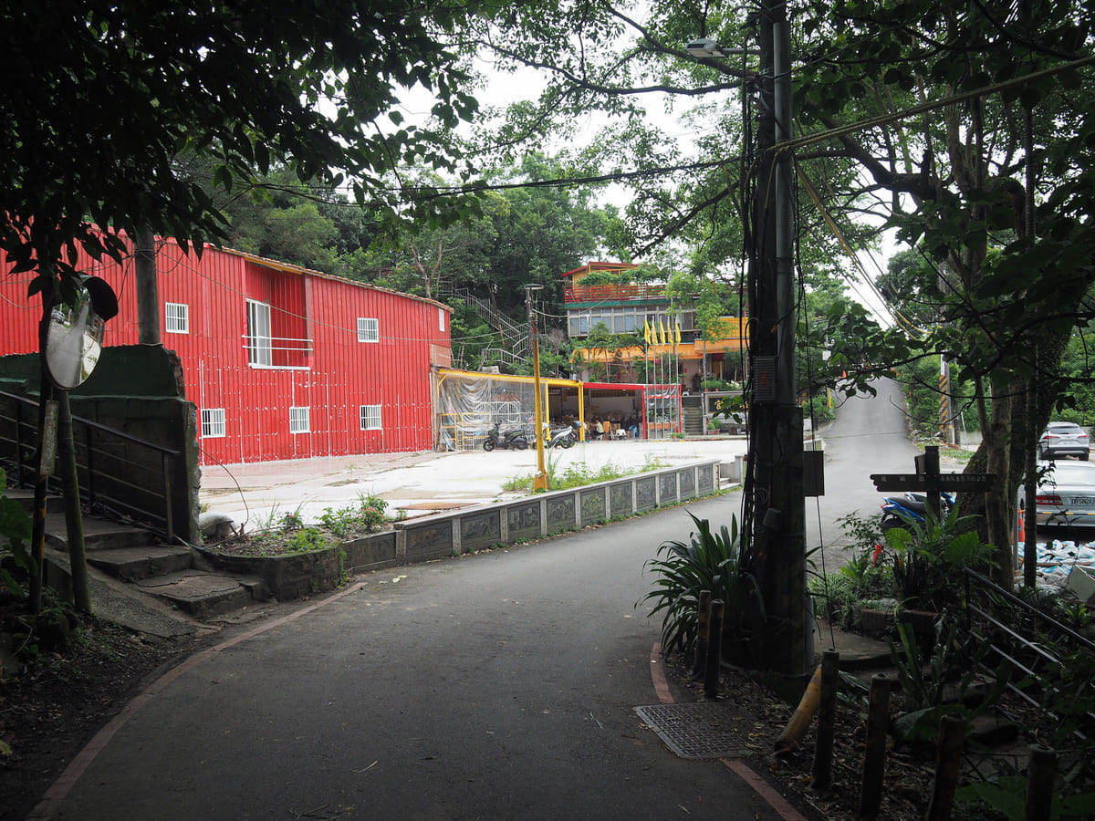
Once on the flat again, I took a right turn onto Songshan Road and slowly made my way back towards the MRT.
How to get to Taipei’s Tiger Mountain Trail
Google Maps address: The walk starts at Songshan Fengtian Temple and ends at Yongchunpi Wetland Park. You should be able to find street-side scooter parking pretty easily, but it would be easier to use public transport than travel by car.
GPS location:
- Songshan Fengtian Temple Trailhead — N25 02.245 E121 35.040
- Yongchunpi Wetland Park — N25 01.990 E121 34.870
Public transport: It’s easy to walk from Houshanpi MRT station. There’s also a YouBike stand near the trailhead, so you could cycle here. The reverse goes for getting back.
Nearby trails:
- Elephant Mountain
- Tiger Mountain Fire Fly Walk
- Lion Mountain Trail
- Taipei Grand Hike – Section 6
- Thumb Mountain Sunrise
Tiger Mountain Trail Map
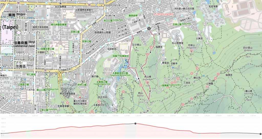
GPX file available here on Outdoor Active. (Account needed, but the free one works just fine.)

Many thanks for your clear description, peter
LikeLiked by 1 person
No problem! I hope you’re able to enjoy walking the trail one day.
LikeLike
Thanks for writing such a helpful and informative post! Loved it. Off to try this walk today!
LikeLiked by 1 person
You’re welcome! Take an umbrella and have fun!
LikeLike