
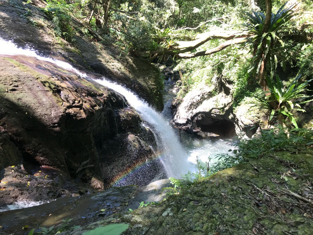
This has definitely been one of my favourite hikes of the year. The walk starts with a reasonable climb through quiet and multi-layered forests to a peak which has multiple names. On my maps, it appears as 熊空南山 (in pinyin Xiongkong Nan Shan), which translates to the wonderfully evocative Bear Hollow South Mountain, (it sounds better without ‘south’ in there). However on the ground, and on most of the written resources about the walk it’s referred to as 組合山, (Zuhe Shan), or ‘Combination Mountain’ – a slightly less obvious naming choice. The trails at the top remain cool and breezy even in the summer heat and they run along the hill’s spine between rhododendron trees. Then the path tracks down again to follow the playful Zhongkeng Stream as it spills and bounces its way through the valley. There are mountain views, grand waterfalls and even swimming holes to be enjoyed along the way. The most spectacular view has to be the cascading curtain of Yunxin Falls (also known as Cloud Heart Falls), a two-layer, 20m waterfall and one of three along this stretch of river. I will be adding this to my list of places to take visiting friends.
Distance: About 10km I think.
Time: 6½ hours – But only a little over half of that time was spent actually walking, the rest was spent enjoying the environment.
Difficulty (regular Taiwan hiker): 4-5/10 – Pathfinding is straightforward if you have basic map-reading skills (and/or Chinese reading abilities), the climb is steep and tiring but not at all technically difficult or dangerous.
Difficulty (new Taiwan hiker): 6.5-7/10 – The two things that will be hard if you’re not experienced with hiking in Taiwan are the steepness of the ascent and descent, and finding your way without directions written in English. However, if you’re physically fit this walk is definitely doable. If you’re worried, you could just do the walk up the river to the waterfalls, we saw plenty of kids doing that.
Total ascent: Around 600m to a high point of 908 metres above sea level.
Water: I used about 2L of the 3L that I took.
Shade: Well-shaded throughout. Even my pasty north-European skin was fine on a sunny day.
Mobile network: A couple of black spot, but if I remember rightly, those are in the more populated areas.
Enjoyment: It’s almost perfect, waterfalls, tiring walking, forests. I think to make it perfect you should go on a weekday.
Other: Gloves were useful, food was essential. And you might want to do as we did and pack dry clothes so you can go for a paddle.
Jump to the bottom of this post for a trail map, GPX file, and transportation information.
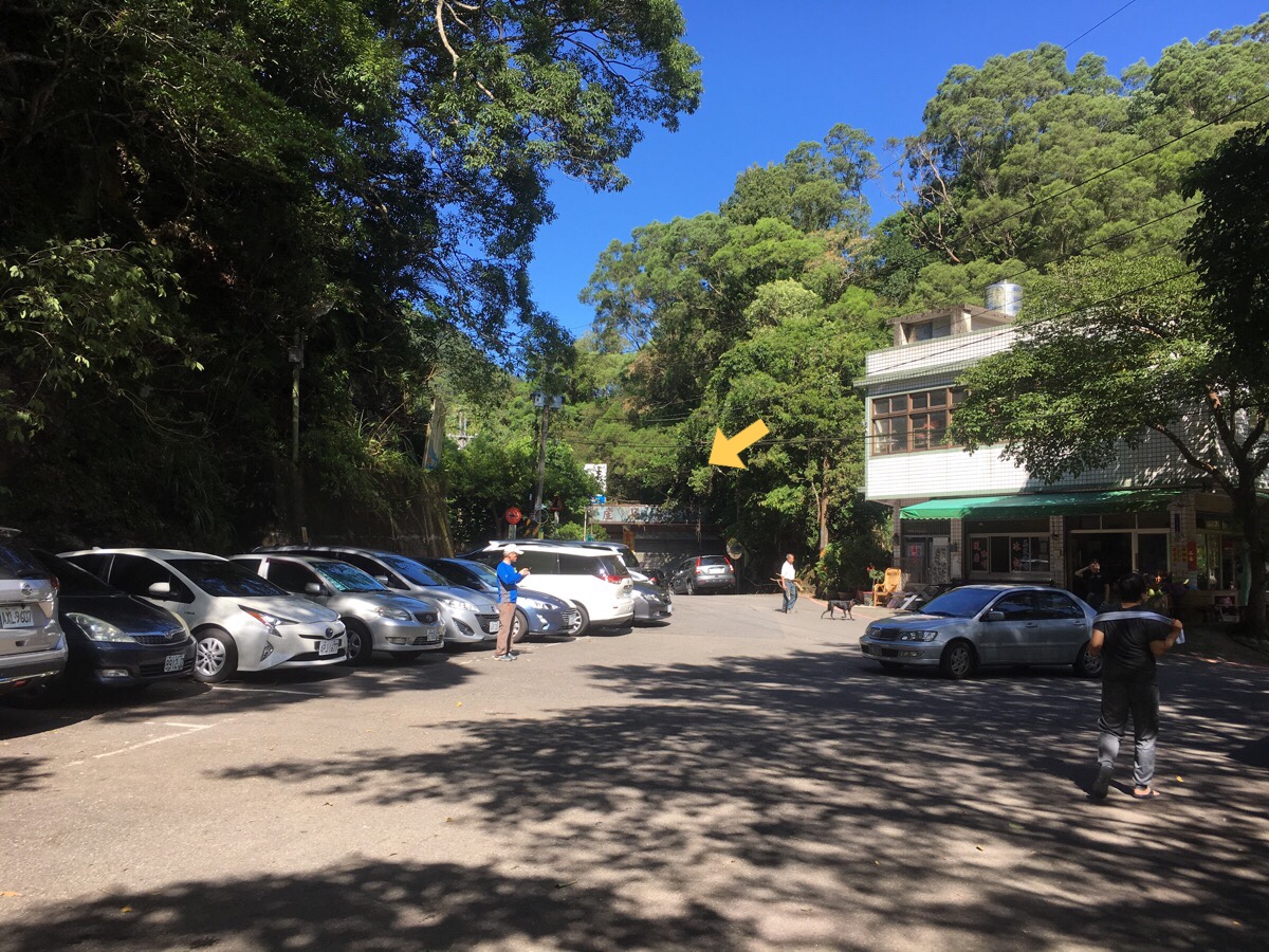
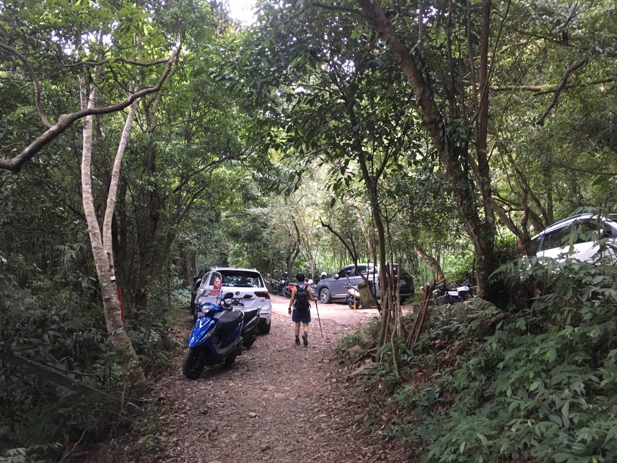
When we arrived at the parking area, (more of a road than a parking lot), we immediately noticed just how busy it was. We parked next to a fish farm, just up the road from the bus stop, and just down from a row of houses. This being a Sunday with reasonable weather at the tail end of summer, I guess we shouldn’t have been surprised to see hoards of greying hikers all dressed in the matching clothing of their respective hiking groups. I don’t think I’ve mentioned it before on this blog, but that is a big thing here. The Taiwanese seem to love doing things en masse to a much greater extent than the Brits do. And not only do they like to do things together, but they also like to wear matching clothing to further emphasise the affiliation. Hiking groups often have their own customised T-shirts, bandanas and/or backpack covers. Some even have jackets. There’s even one troupe of what I (incorrectly) call evening aunty dancers in my neighbourhood (this group actually includes men too), who have matching outfits.
Anyway, hiking uniforms aside, these groups looked like they meant business, so I was imagining that we were going to have a lot of company on our walk. Consequently I was pleasantly surprised when we all set off at the same time and every single last one of them walked in the opposite direction to us. It turned out they were either planning to only walk up to the falls and back down the same way, or else do an clockwise loop, (far less fun). We got a few funny looks, but no one questioned us.
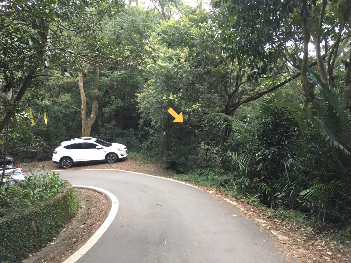
Passing a small store and the bus stop on our right, we took the road that headed down towards a river. (There is another road heading up which goes towards the car park for the waterfall trail.)
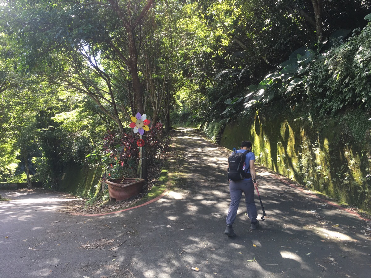
Immediately after crossing the stream, the path heads up the road as it doubles back, and then once more.
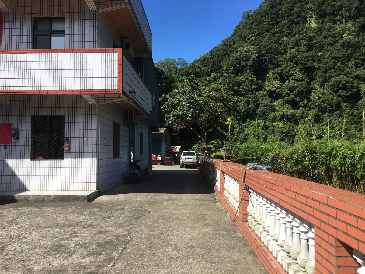
The road terminates at a collection of houses with a duck pond and farmland, (over the wall). There was another group of four or five hikers with their packs off, maybe getting ready to head up too. Teresa being Teresa, she stopped to commune with the animals for long enough to entice the landowner out of his home. He said that originally he had five geese like the one we could see, (台灣土鵝), but that the others had all died. The remaining one was over 20 years old he said. I didn’t realise that geese could live so long.
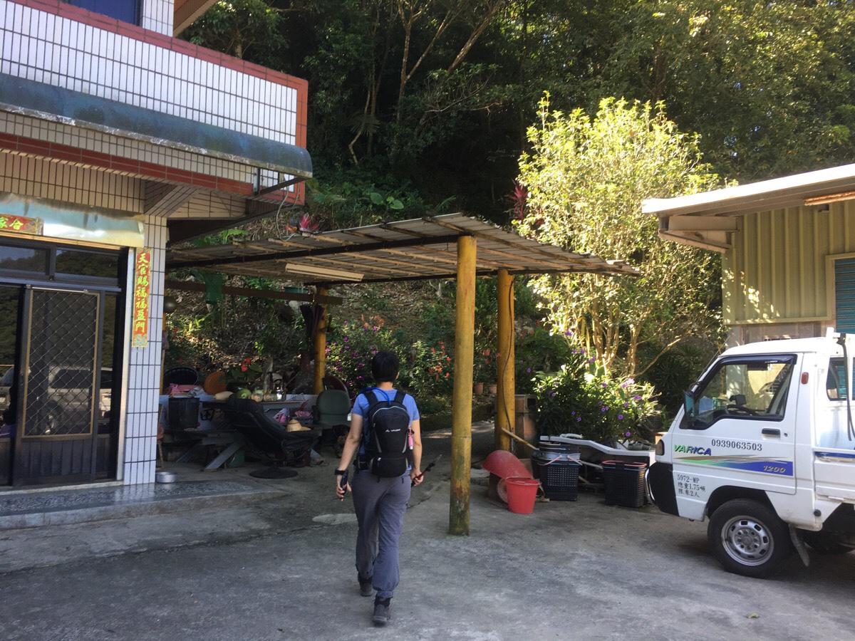
We walked along next to the wall until we passed the final property and saw the trail starting. Here a (maybe partially blind), guard dog put on a good (loud) show of guarding, but just stood there passively as we walked past, and a second, quieter dog with cute droopy ears sat at the trailhead waiting to be petted by anyone passing by.
An old agricultural track leads up through semi-maintained-looking bamboo groves. This farmland looks like it has certainly seen more prosperous times – it must have been busy enough in the past to make it worth surfacing a road. At a number of places, other trails lead off into the trees. In most cases, these seem to be shortcuts to further up sections of the ‘road’. We tried one, but it was so overgrown that I decided I’d rather walk a little further on reasonably easy ground than tire myself out early on by bushwhacking up steep slopes. I was in front as we headed up and twice I saw a huge bird of prey lift off from the trail and fly just out of sight in front of us – maybe we were interrupting it’s meal.
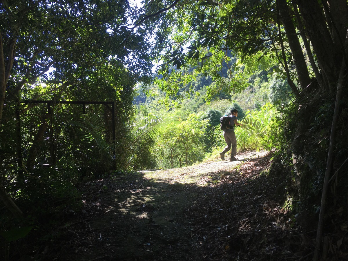
A long-since useful fence marks the point where the track doubles back on itself. The gradient continues to be mostly gently sloping upwards.
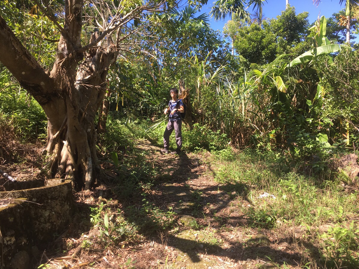
Where the surfaced track ends, the path meets up with the shortcut we had initially tried to take (it joins here on the right). The way up becomes somewhat harder to spot for a way here. There are actually two paths, one heading left directly through more open farmland, and the other heading kind of straight over at first then curving to the left. We took the straight over route and met back up with the left route very quickly. This part is really overgrown – I was crouched low to avoid being smacked across the face by giant leaves.
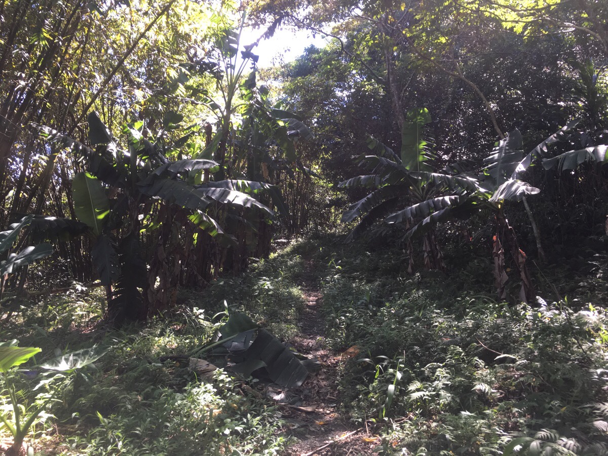
As the trail finally leaves the more cultivated land behind, it passes through one last stand of banana trees. The plants were heavy with green fruit, and since this spot looks like it had now well and truly been handed back to nature, I imagine that some hikers in a couple of weeks might find themselves enjoying an unexpected bounty.
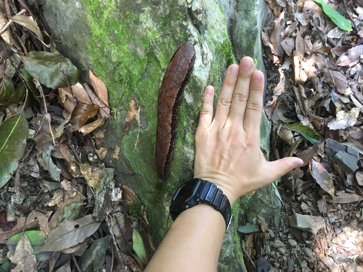
The trail for the next portion of the walk was still somewhat planned-seeming. Stones formed the trail surface, and it zigzagged incrementally up through bamboo and other varied greenery. Just as the trail went to bend to the right, I spotted what I am certain is the biggest, fattest slug that I have ever seen. Judging by Teresa’s hand, it was nearly 18cm long and extremely girthy. It was a monster slug, at least as plump as the quorn sausages you could buy back home several years ago. I later found out that it is a 山蛞蝓, or ‘mountain slug’, and is found in Japan as well as Taiwan. Despite having been vegetarian for well over three quarters of my life, (and not finding insects at all appealing), I couldn’t help but imagine what a great meal that slug would have made if I were a bird, snake or other slug-eating creature.
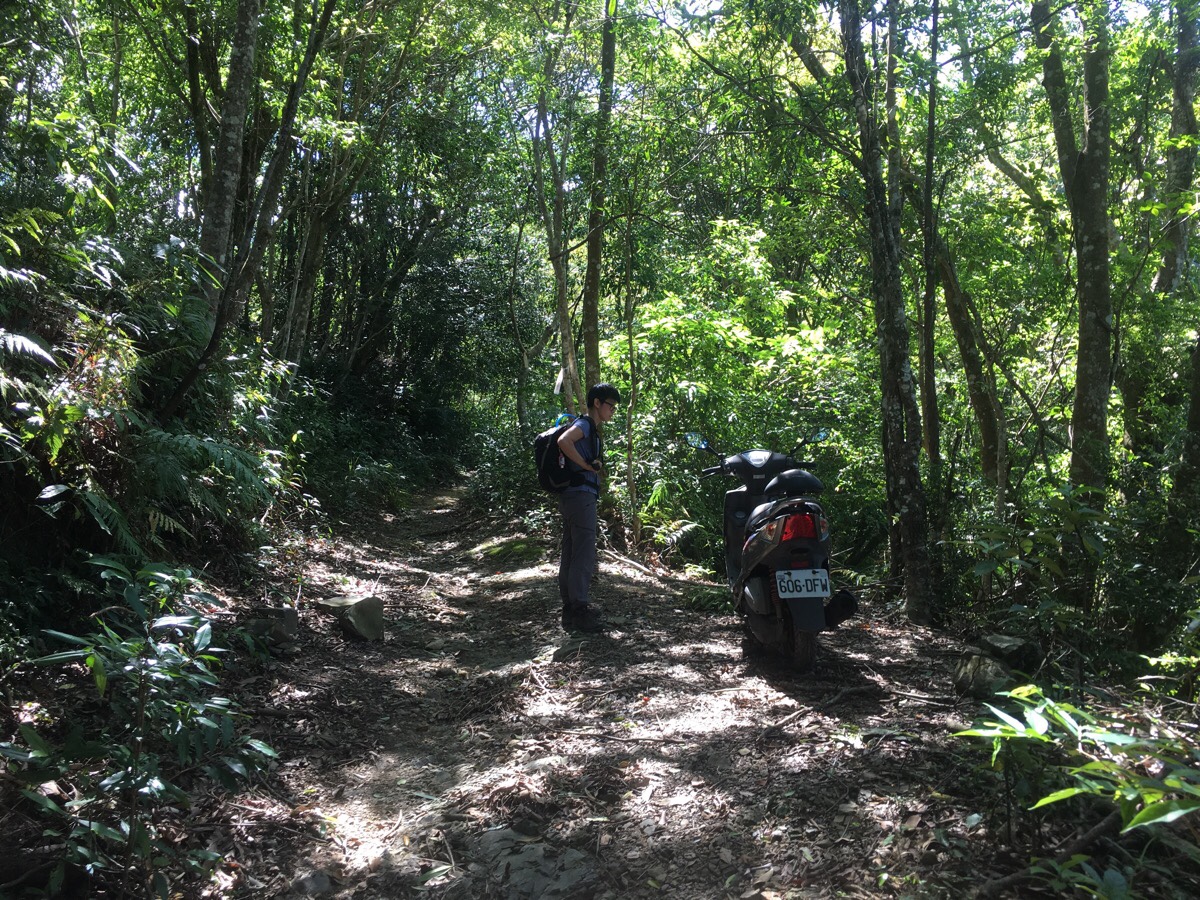
At a flat section in the trail we found a scooter parked next to a path leading downwards. I was stunned to imagine anyone riding a regular scooter up the track we’d just walked up. Sure, most of it was surfaced, but there were big rocks and deep channels cut by the heavy rain that must frequently turn it into a small stream in the summer months. Teresa said she thought it wouldn’t be too unusual for people to do this if they planned on carrying something back down – she pointed to the staples that were working to just about tack the seat cover onto the foam beneath. “Definitely a farmer’s scooter” was her pronouncement. Being nosy, I checked the exhaust pipe – not even slightly warm, perhaps it had been abandoned months ago. But then a later review of the blog we’d kind of used as our guide showed that it definitely wasn’t there a month earlier.
We kept heading up along the left hand track and never did see whoever had parked the scooter.
The trail climbs to another junction, here an indistinct farming route heads straight, but the track that we were on bent back to the left.
Very soon after that, it veered right again and that is where the proper walk started.
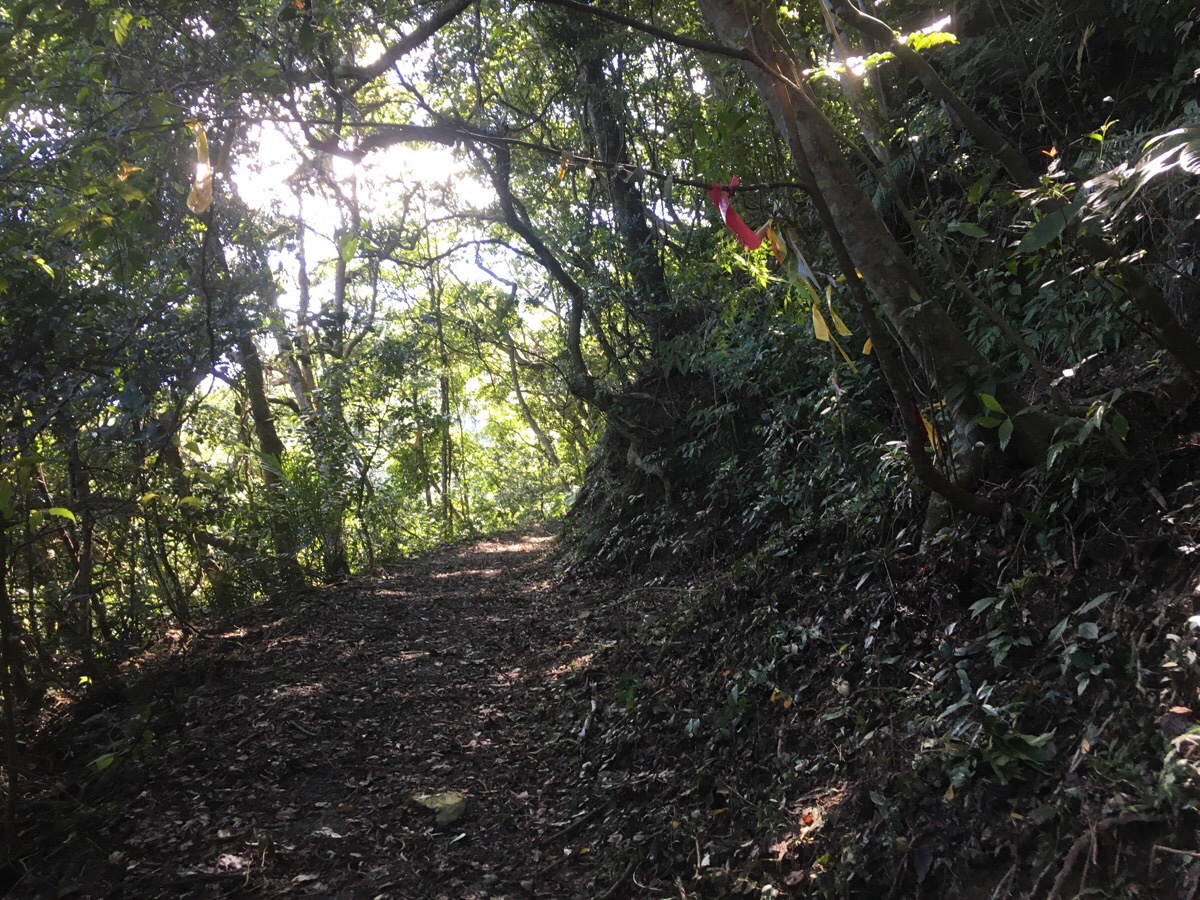
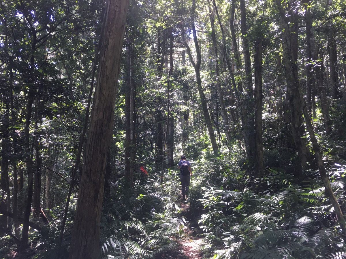
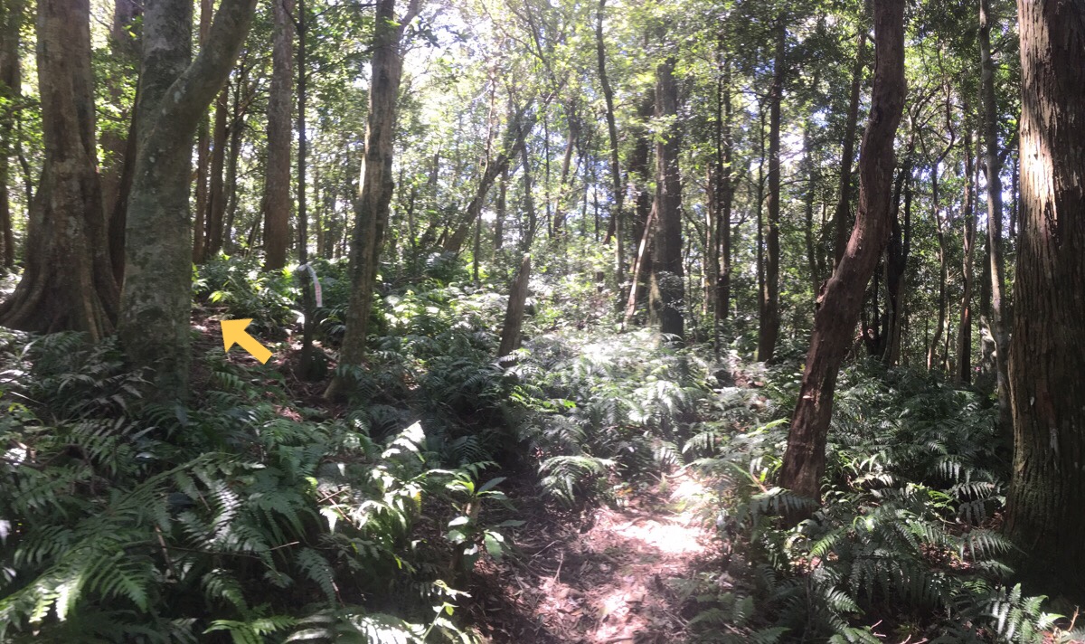
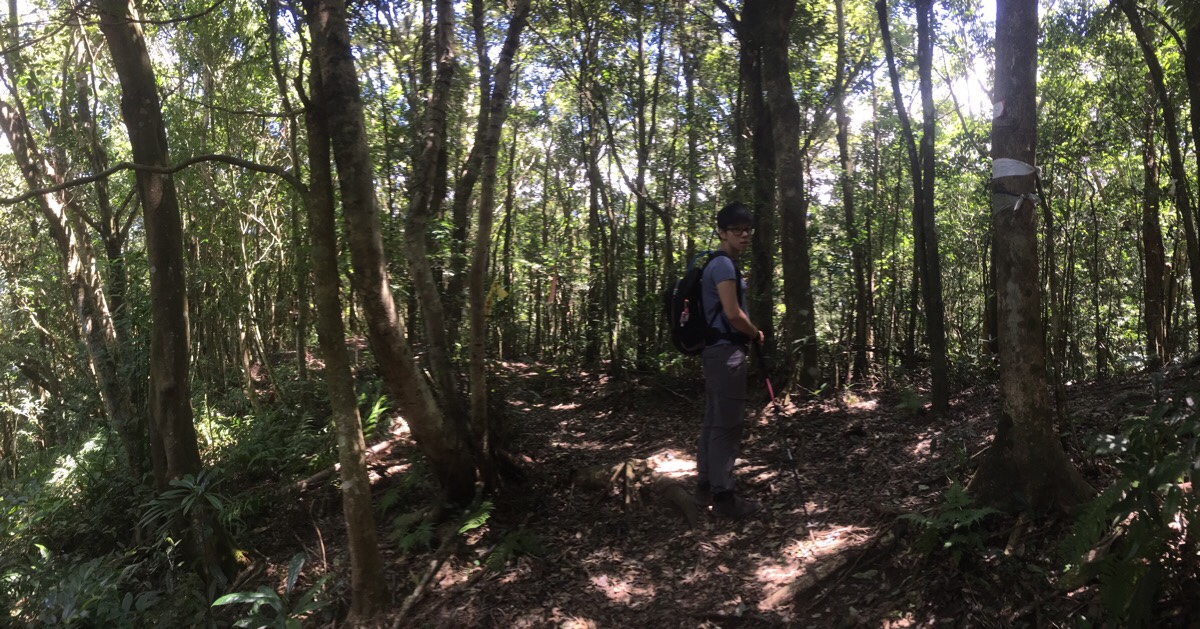
Here any vestiges of a farming track were left behind and replaced with a narrow track through lush forest. Many varieties of ferns carpeted the forest floor, tall trees formed a shady canopy and there was more greenery of different kinds at every level.
Whilst it was clear and easy to follow the path, it was clear from the exuberant plant growth crowding the trail that this isn’t a very heavily trafficked path. We met just one other person heading up in this section, a lone older gentleman who we passed as he was having a quick snack break. But what this trail lacked in human activity, it more than made up for in bird life. We didn’t see so many of the critters, most seemed to be somewhere high up above the lowest level of leaves, but the range of birdsong was near orchestral.
As we climbed, Japanese cedars became the predominant tree, although unlike other trails with replanted forests, (Jiali Shan for example), this place still retained a pretty wide mix of tree and plant life. I also found out a couple of days later, (thanks Todd), that these trees were probably what caused my horribly stuffy nose when I got home later that day. Allergies aside, it is a really beautiful forest, especially with the sunlight playing through the leaves as it was that day.
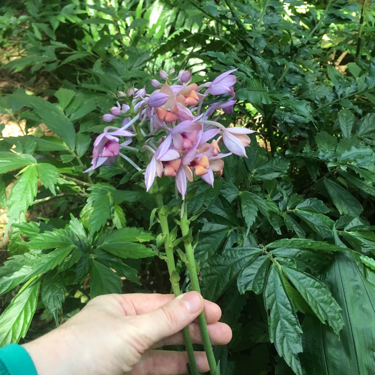
Along the way I spotted a couple of these elegantly shaded orchids. Another visitor to the area called them 長距根節蘭.
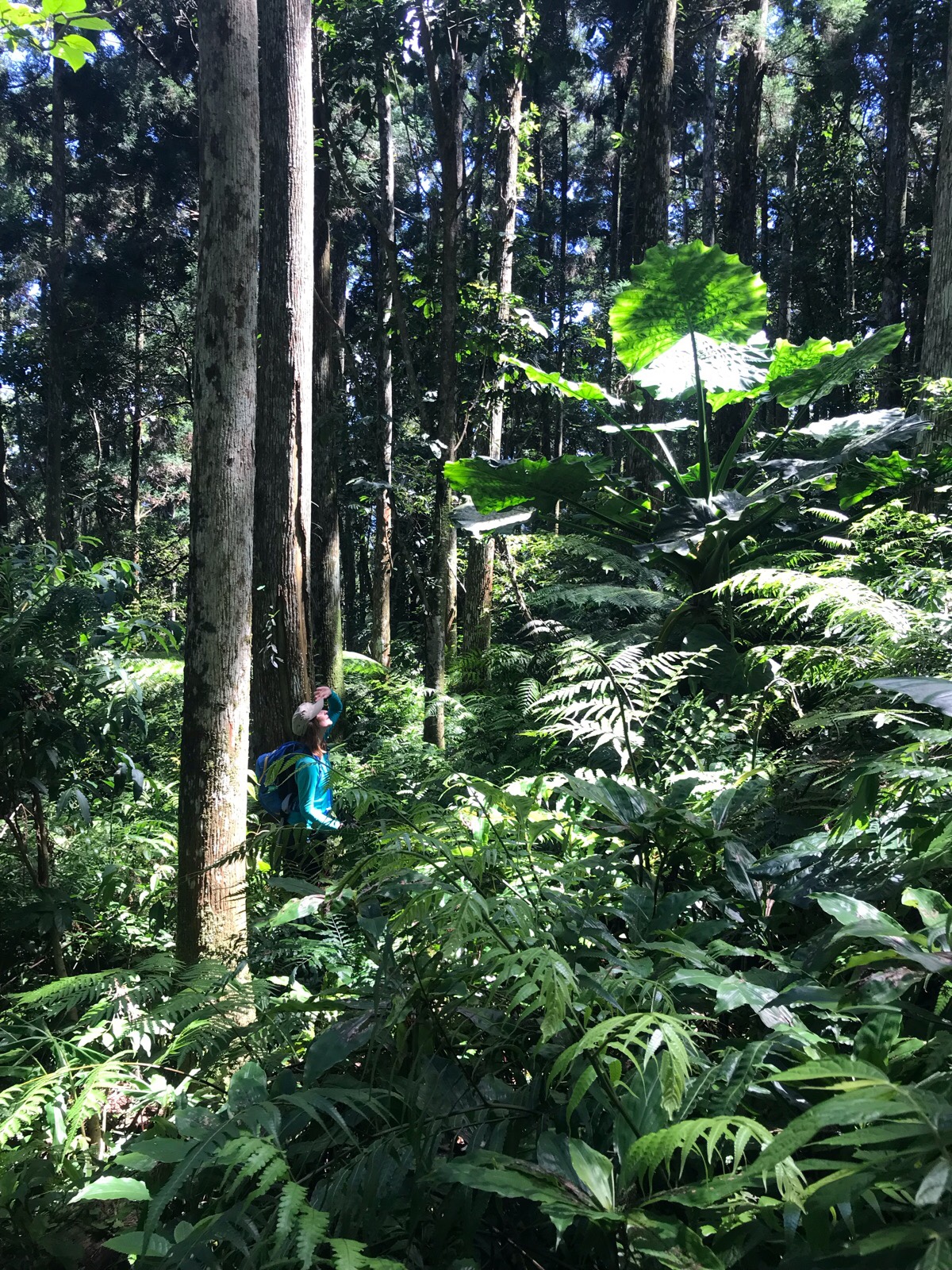
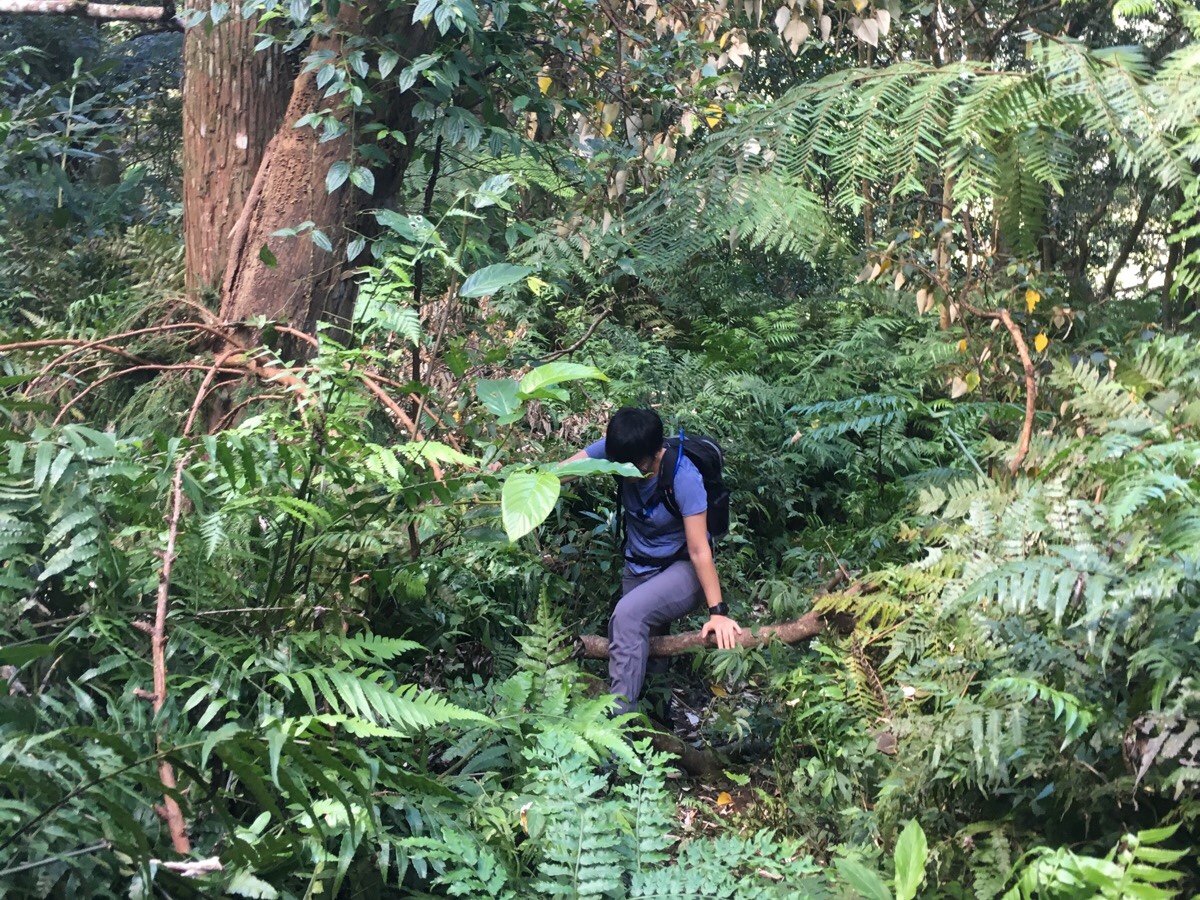
I have to impress upon you just how beautiful the forest is here. I know Taiwan has a lot of beautiful forests, but this was breathtakingly so. When we are walking, Teresa will stop to great every single animal we pass, but what stops me is the amazing plant life. This giant elephant ear plant was nearly three times my height.
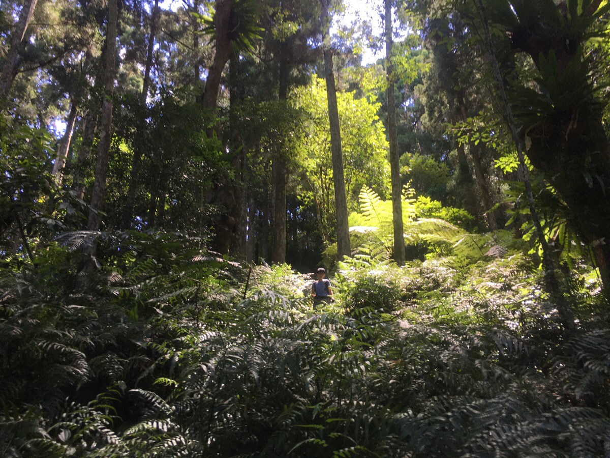
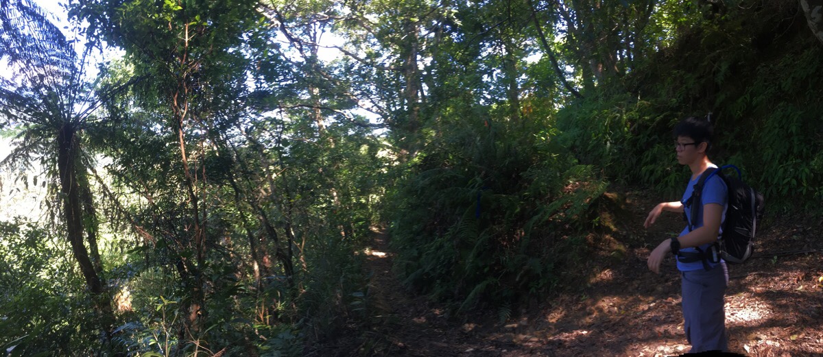
A little further up I turned a bend in the path and saw Teresa dwarfed by a feathery tree fern which was perfectly picked out by the sun as it streamed through a gap in the canopy. And all the way up large birds nest ferns bedecked the trunks and branches of trees.
Not far from where this was taken we met a couple, I guess they were in their late thirties or early forties. They were day in a small clearing having a snack. The conversation started normally enough, where are you going, have you been here before, that kind of thing. But it soon devolved into a slightly uncomfortable monologue by the guy as his female companion sat there silently. How come you know about this trail entrance? (Because we researched it first.) Are you lost? (No, because we researched it first.) Do you have a map? (Yes.) What kind of map? (Pre-downloaded on viewranger.) You’re young, why don’t you use GPS? (We do sometimes, this walk seemed reasonably easy to navigate though, especially since we’d checked several blogs and researched it before coming.) What if the sources you checked are outdated? (The most recent one was from the previous month.) Well it’s still really difficult to navigate, and you might get lost, there are lots of routes going off in other directions. (Yup, we’ve got a map, and by lots, you mean maybe three or four? Which I know because I checked the maps beforehand.) Well let me tell you where to go anyway. And then he went on to give instructions about how to get where we wanted to go.
Now I don’t mind people giving advice. Sometimes I even solicit it. Perhaps there are some particularly difficult sections ahead, in that case, sure, please tell me about it. Maybe a recent storm has made the path unclear, again, thanks for letting me know. Sometimes people are alarmed to see a foreigner deep in the woods and halfway up a big hill, and assume that said foreigner is lost and in need of assistance. (I only tend to get this when I’m alone though.) This doesn’t bother me because it comes from genuine position of care for another human. Ditto the old people who just want to give their opinions just because that is what opinionated old people do – I don’t mind them at all because they normally just seem pleased to have a bit of a chat. But this guy? He just didn’t know when to stop. We must have politely explained that yes, we definitely knew where we were going at least five times but he just wasn’t hearing it. I have to believe that the woman picked up on our exasperation and was silent because she was just enjoying the experience of it not being her who was lectured. Anyway, once we managed to escape, I took this opportunity to teach Teresa the term ‘mansplaining’.
A few minutes later we came across one of the many (not many) trails forking off. The righthand trail leads down to Manyuyuan, (a place that I definitely plan to come back and explore a little in the future). However, since we wanted to loop back to our car via the waterfalls, we took the left route towards 組合山/熊空南山.
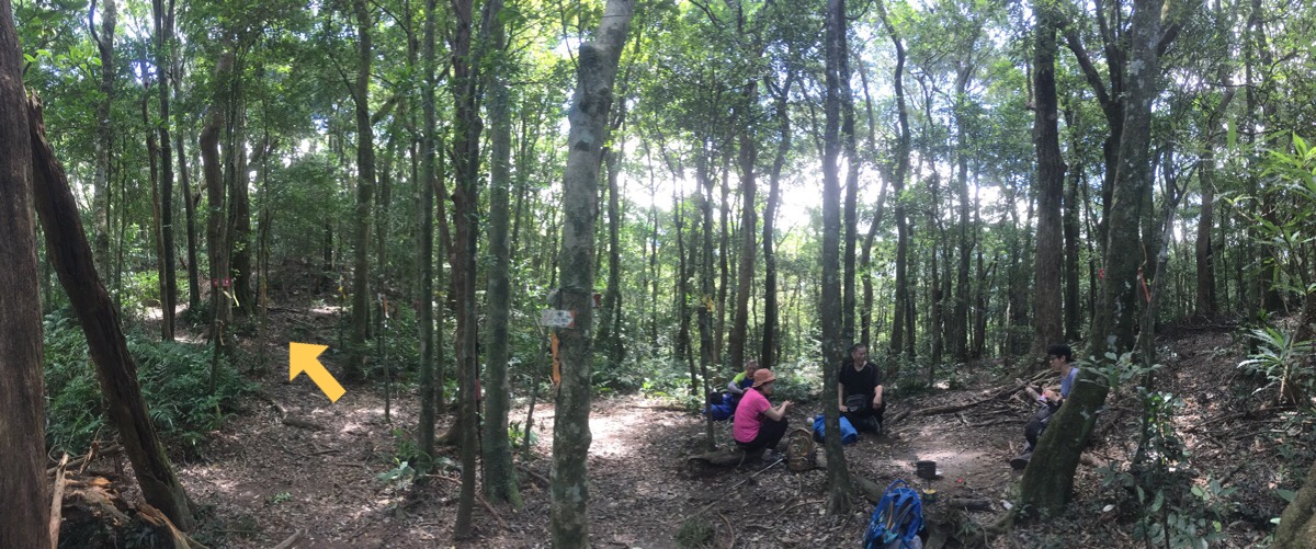
A huge gathering of hiking tags were fluttering in the breeze at the edge of a kind of clearing. There were two people already sat there when we arrived, a woman who – after just a few minutes of conversation – gave away her age by saying she was born in the year of the pig, (like Teresa’s mother), and her husband who told us he was in his sixties too. They were seated on skinny logs that had been pulled up to form a kind of circle and were just enjoying the breeze. It must have been around 22°C up there with a gentle breeze and ample shade – the perfect antidote to summer in the city. The couple said that although they’ve been housebound for a while (providing free childcare for a new grandson), they often hike in the area because it is such a great summer hiking spot. They also said that they only started hiking when they were in their forties – a fact which impressed both Teresa and I.
As I heated up water for a cup of coffee, they gave us a couple of recommendations for other places that we should visit. One was Shitou Shan in Taoyuan, Fuxing District and the other was Da Xue Shan, (I think it’s a no-permit-required high mountain). The lone hiker we’d been leapfrogging with arrived and sat down at the edge of the clearing – when questioned by our new friends, he said he was hoping to push on up to a further more distant peak, (I forget the name), but they cautioned him against it given how late it was in the morning. Then just as we were finishing the coffee, Mr Mansplainer and his mute companion rocked up and doled out further unsolicited advice – the older couple elegantly dismissed it by bringing out their local credentials, and before he could start on Teresa and I again we were waving our goodbyes and continuing along the path. The trail here heads pretty much straight through, keeping the clearing on the right, and is signposted as heading towards the waterfall (往雲森瀑布).
Note: there are one or two other trails leading off from the clearing, one of which joins the trail heading to Manyueyuan.
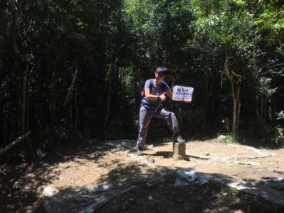
When we arrived at the peak, I felt glad that we’d stopped for coffee a couple of minutes downhill instead. There was some shade, but the clearing we’d just left was far more comfortable. All the blogs we’d seen had hikers striking tough-looking poses with the sign, so Teresa tried her hand at it. I don’t think she did too badly. A funny guy in toe-shoes barrelled up and asked if we could take his photo – all the while grumbling comically about having done the walk the wrong way round because now he’d already seen all the pretty stuff.
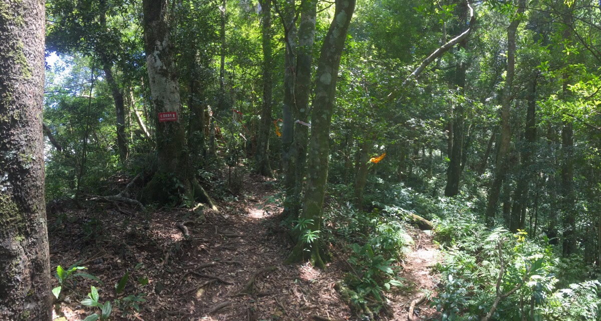
A little way down from the peak there was a splitting of the paths. Again, we followed the red signs directing us towards the waterfall, (往雲森瀑布). Since the walk traces the edge of a valley, you basically just need to make sure that the land to the left of you is always lower than the right.
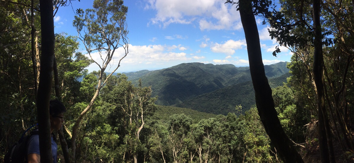
Following a fun but brief climb, we arrived at the walk’s only proper view. A gap in the trees sits just atop a gaping hole in the mountainside – a 30-metre patch of land had been taken out by a landslide. Teresa held a tree and leaned out to look down. A few trees away from the opening, I saw the thin overhang of earth held up by a not-substantial-enough tangle of roots and I pulled her back. (Here in the land of earthquakes, it isn’t wise to blindly trust the ground you stand on.) From a safer distance I enjoyed the play of the clouds on the hills across the far side of the valley and imagined the water that we’d once we got down.
The climb down from the view was through one of my favourite types of Taiwan mountain terrain – maze like rhododendrons that rippled with the breeze causing shadows to dance across the forest floor and make illusions of the tree trunks. I enjoy moving through this type of landscape quickly (although I really should be more careful on the downhills to avoid aggravating my toe problems), there is just something so right and satisfying about how I can get my body to interact with the trees.
At two points on the way down, there were trails signposted to the left and the right. On both occasions we headed left. By this point the roar of the water was loud and clear and ever so inviting. We
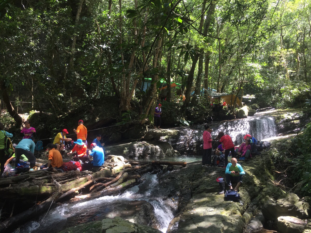
Along with the roar of the water, a whole other kind of clamour became audible – the collective chatterings of many hiking groups. It is clearly a very established rest spot, since outdoor kitchen facilities had been installed to allow for cooking and water filtration. They’d spread out around the stream to eat, rest, and enjoy the 熱鬧 (lively) atmosphere that comes from being squashed together with many other people. We held out hope for a quieter spot to have our lunch, and so we crossed the water and headed left downhill to find some space.
Just as the path leaves the stream rest area, it crosses a semi-bridge structure that has been built to get people around a narrow section of path. The aunties walking towards us were struggling somewhat with it, but it wasn’t anywhere near as scary as they made it look.
Not far downstream of the designated rest area we spotted a smaller path branching off and heading down to a place where you could get a clear view of Yunsen Waterfall as it spilled like a water slide over a lip of protruding rock. Another side trail led to an area directly above the waterfall and we headed down to see if it would make a good lunch spot.
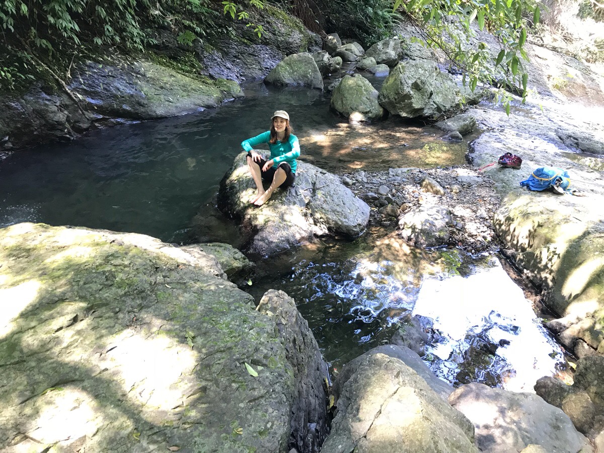
As it turned out, it was the perfect lunch spot. Flat land to cook on, a small pool that was just deep enough to splash around in, and best of all, no one else.
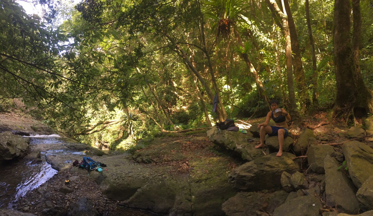
I think I took my shoes and socks off before even taking my pack off – the water worked wonders to cool down my tired feet. Then as we waited for the noodles to heat up, I changed my trousers for swimming trunks and stripped to a sports bra to go for a dip. I believe there is nothing in the engineered world that can recreate the exact, exquisite tingling sensation of the breeze on your skin as you leave the water of a mountain stream. It is an experience that couldn’t possibly be improved in any way.
We spent over an hour and twenty minutes stopped here. (I definitely felt happy for insisting on an early start since that meant we could spend the hottest part of the day in water and didn’t need to worry at all about time.) When we were ready to leave, we climbed up to rejoin the path that we’d been on before breaking for lunch and continued heading downstream. (We walked down in our wet shorts rather than switching back to trousers in the hopes that we could get them dry.)
A brief ten minutes further downhill we found where most of the families on the trail had stopped. This is the dramatic and romantically named Cloud Heart Waterfall (雲心瀑布/Yunxin Waterfall). The falls plunge down in two levels and kick up a constant mist of water. Large boulders sit at the edge of the pool that had formed under the waterfall, and on the boulders people were sitting, transfixed by the gushing water as if they were watching TV.
There are three waterfalls along this stretch of river, Yuxin waterfall (雲心瀑布), Sisters falls (姐妹瀑布), and Senshan waterfall (森山瀑布). According to local expert Tony Huang, people refer to them collectively as Yunsen Three Falls (雲森三瀑), and the whole area is very popular in the summer with shade seekers and those looking for a fun river trace.
(Note, even if you think you can’t do the whole hike, you can definitely walk up from the parking area to this first waterfall, and the walk would be well worth the effort.)
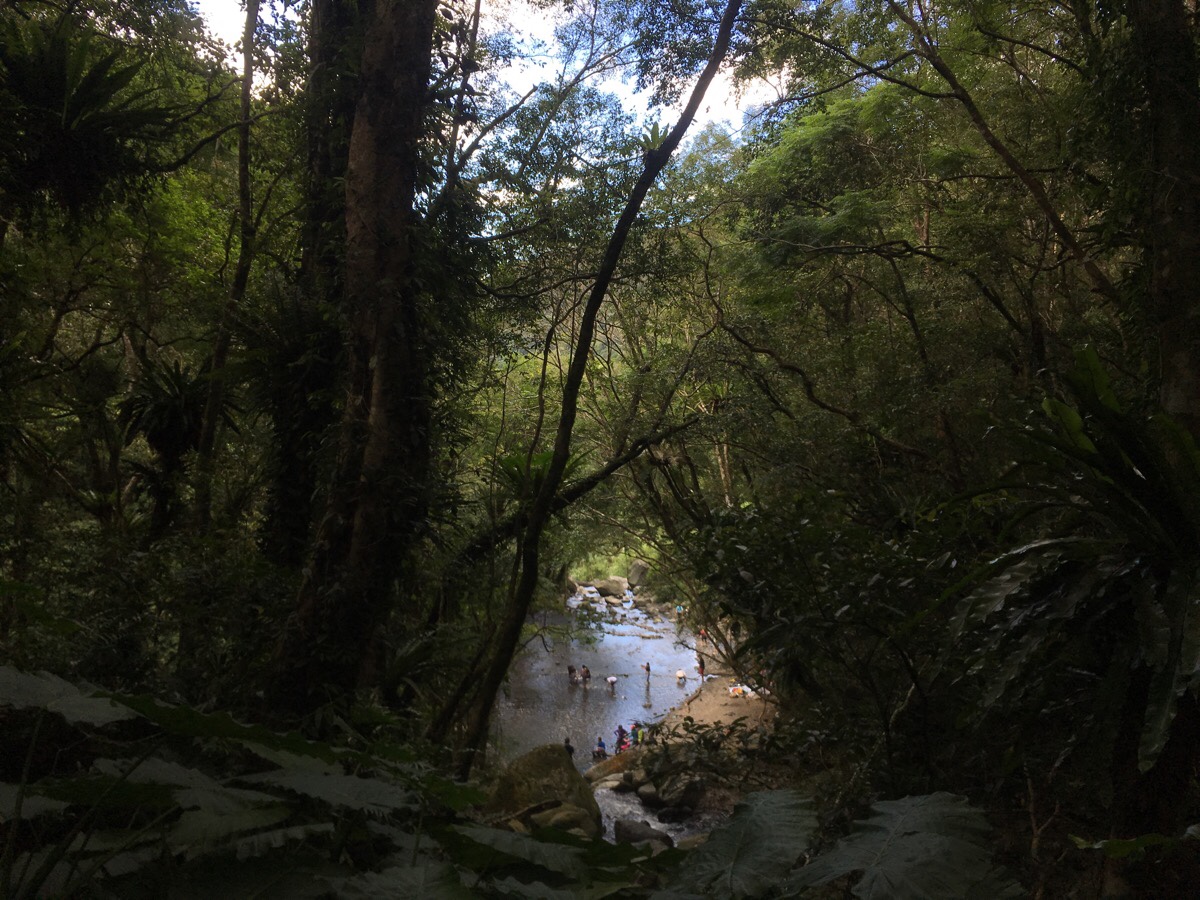
The area just downstream of Cloud Heart Waterfall was awash with families finding ways to enjoy the summer heat. At a point where another tributary joined the stream, the channel widened to create a large shallow area with a kind of beach. We got a view of this area from the trail above and I was both amazed and deeply impressed to see one family with a highly advanced leisure time skill level. They hadn’t just brought a regular picnic to enjoy by the water. No, they were leagues above that in terms of preparation and imagination. They had carried camp chairs and barbecue equipment up the trail, (maybe an hour’s worth of walking), and then set it up in the middle of the river. I have long known that the Taiwanese as a nation love water and water-adjacent shade in the summer months, but this was the first time I’d witnessed anyone go to such efforts to enjoy it.
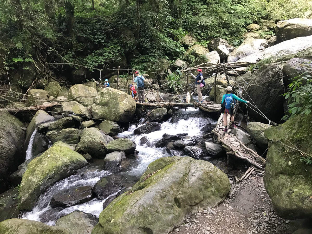
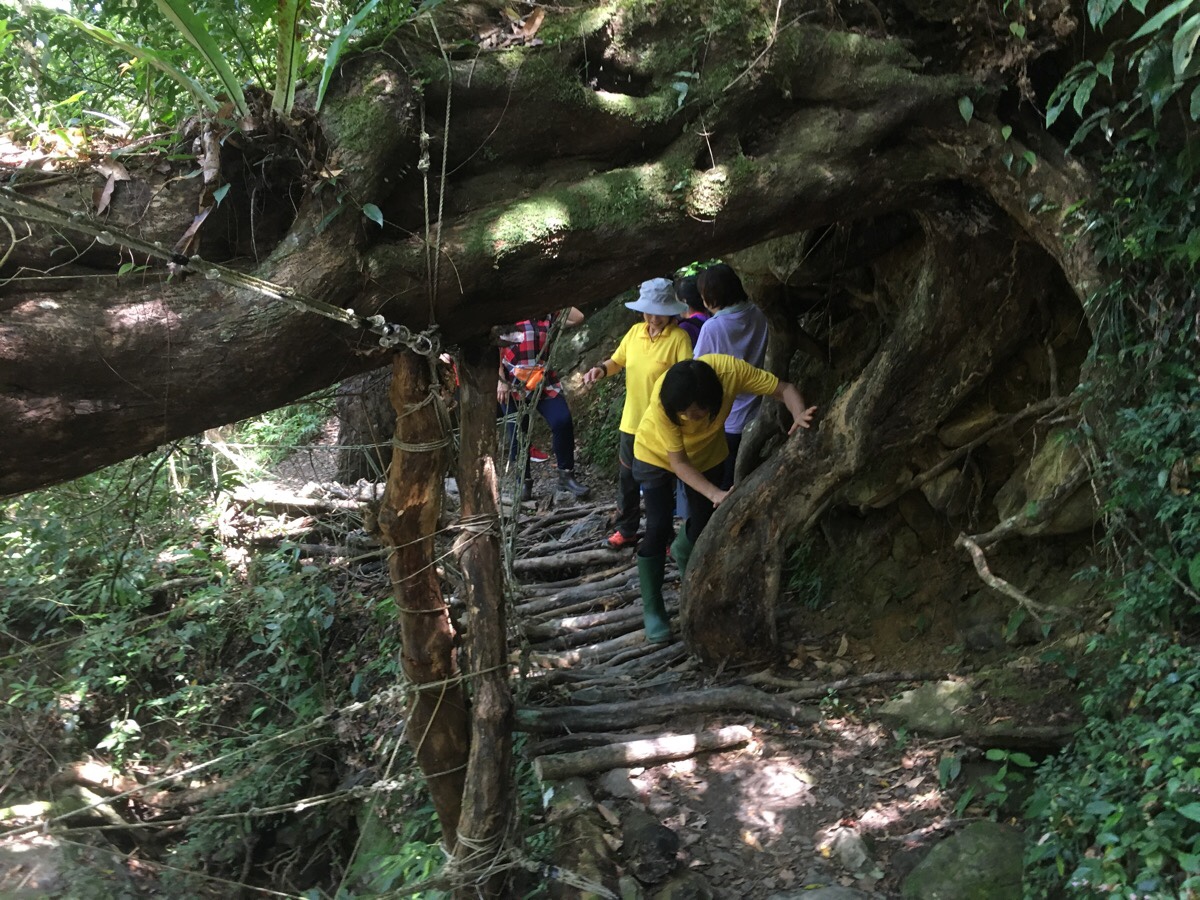
The path crosses three or so smaller streams as it tracks back to the start. This one is by far the biggest, and the only one with any substantial kind of bridge structure. (As far as I can remember, the others just involve crossing over on stones.) Although this wood-and-rope construction doesn’t look all that solid, it was in fact remarkably sturdy. Teresa and I waited for a family with two small children, (about 3 and 6 years old) to cross in front of us, and even the youngest was able to cross mostly unaided.
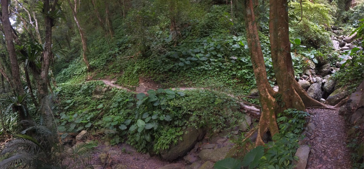
The path here was really, really pretty. It hugged the side of the valley, rising and dipping pleasingly with the contours of the land. It was easy to keep up a good pace here, despite wanting to linger a bit to enjoy it. There were also a lot more people here. Almost constant pairs and groups of people flowed past us upstream.
Too quickly, we arrived at the end of the trail, and headed downhill to find our car. There was actually a very large car park here which is where most of the people visiting the waterfalls seemed to have parked.
Continuing downhill, there is a shortcut trail through the trees back down to where we’d parked. The trail spat us out next to the row of houses just up from where we’d parked. We were pretty much the last car left.
How to get to Yusen Waterfall
Google Maps address: if you’re driving or coming by scooter, there is road parking available near this little shop. (However if you only want to do the waterfall trail, youcan save yourself a bit of road walking if you park at the designatedcar park which is up Zhongkeng Industrial Road.
GPS location:
- Roadside parking near the bus stop – N24 50.721 E121 27.035
- Trailhead behind the farmhouses – N24 50.620 E121 26.985
- Car park for just the river section – N24 50.620 E121 27.435
Public transport: there is a bus which goes here from Sanxia, but it is infrequent and you would need to get one of the two earliest ones in order to be able to complete the walk and get back on time. From Sanxia No.1 Bus Depot you can catch the 807 bus, (weekdays the first two buses to leave Sanxia are at 05:20 and 07:00, whilst the two last buses returning leave at 15:45 and 18:10 – on weekends those times change to 06:00 and 08:30 going out and 15:15 and 18:10 returning).
Further reading: there doesn’t seem to be any other English write ups of the same walk, but there are plenty in Chinese. This one was the one that we used as our guide – they deviated slightly from the route we took in that they took all the shortcuts rather than following the agricultural track up the first section. And this large hiking team did the same route, but in the opposite direction, (personally, I think the direction we did it in is more fun). Also, there are plenty of English write-ups, and even videos about how to get to the waterfall if you only plan to do the shorter route.
Yusen Waterfall Trail Map
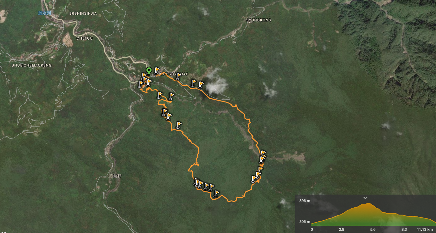
GPX file available here on Outdoor Active. (Account needed, but the free one works just fine.)
My new words learnt on this hike:
- twa tang / blind (Taiwanese)
- xi dwa koh / fatty (Taiwanese – the equivalent of the Mandarin 死胖子)
- 普遍 / pǔpiàn / common, universal (Teresa was using it to describe the extreme prevalence of one specific model of car.)
This is the bit where I come to you cap in hand. If you’ve got all the way down this page, then I can only assume that you’re actually interested in the stuff I write about. If this is the case and you feel inclined to chip in a few dollars for transport and time then I would appreciate it immensely. You can find me on either Ko-fi or Buy Me a Coffee.
