Distance: 6.7km
Time: 8 hours and 40 minutes (including a one-hour break).
Difficulty (regular Taiwan hiker): 4-6/10 – Depending on the weather conditions, it’ll always be quite a long and tiring hike, but wet weather would make it harder.
Difficulty (new Taiwan hiker): 8/10 – This is quite tough in that the whole way is either steep up or steep down, but actually, there is nothing technical about it and there aren’t really any particularly dangerous parts. It would be a 7.5 if it weren’t for the fact that the trail was so much harder to follow than other walks I’ve done.
Total ascent: A little under 1100m to a maximum altitude of 1773m.
Water: I took 3L for drinking and cooking and ended up with about 0.5L left by the time I arrived back at the car.
Shade: almost entirely shaded, this trail should be ok even in summer.
Mobile network: not great, although there were sections with amazing reception given how deep in the mountains this place is.
Enjoyment: I think I enjoyed this more for the challenge and for the fact that I found it scary but got home safely than for any other reason. The peak wasn’t really anything special, and the poor visibility meant that we didn’t get to enjoy the views, but huge bamboo forests, Japanese ruins and the roughness of the path made it a really exciting trail for me.
Other: take enough food, this is high-energy stuff so you’ll need to refuel. You’ll also want to take gloves and long sleeves/trousers – after making it about halfway down, both of us discovered leeches on our trousers around the knees. It’s not the first time I’ve seen leeches whilst hiking, but it’s the first time I’ve gotten personally acquainted with them. If you’re unsure about your ability to get down before nightfall, you should also pack a torch – we took ours, we didn’t have to use them, but would have if we’d taken an extra half and hour.
Jump to the bottom of this post for a trail map, GPX file, and transportation information.
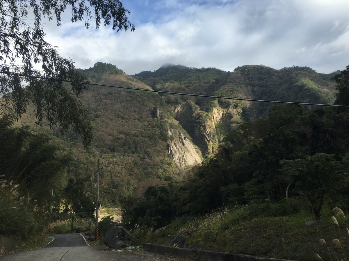
We parked up at the side of the road and watched the light play over the hills as we got our stuff together.
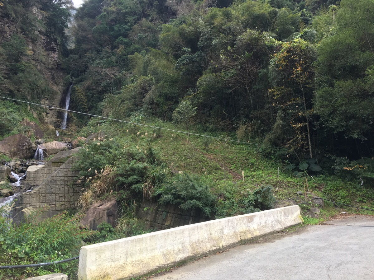
We set off at about 8:35. The path leaves the road by the side of the bridge. Ignore the defined path which runs next to the river, instead bear right and up into the trees. (The lefthand path takes you to 玉峰瀑布/Yufeng Falls – worth a look if you have spare time.)
Quickly, we got a sense of what the walk would be like… a whole lot of up.
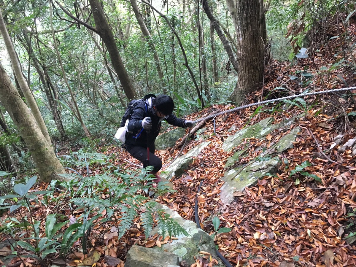
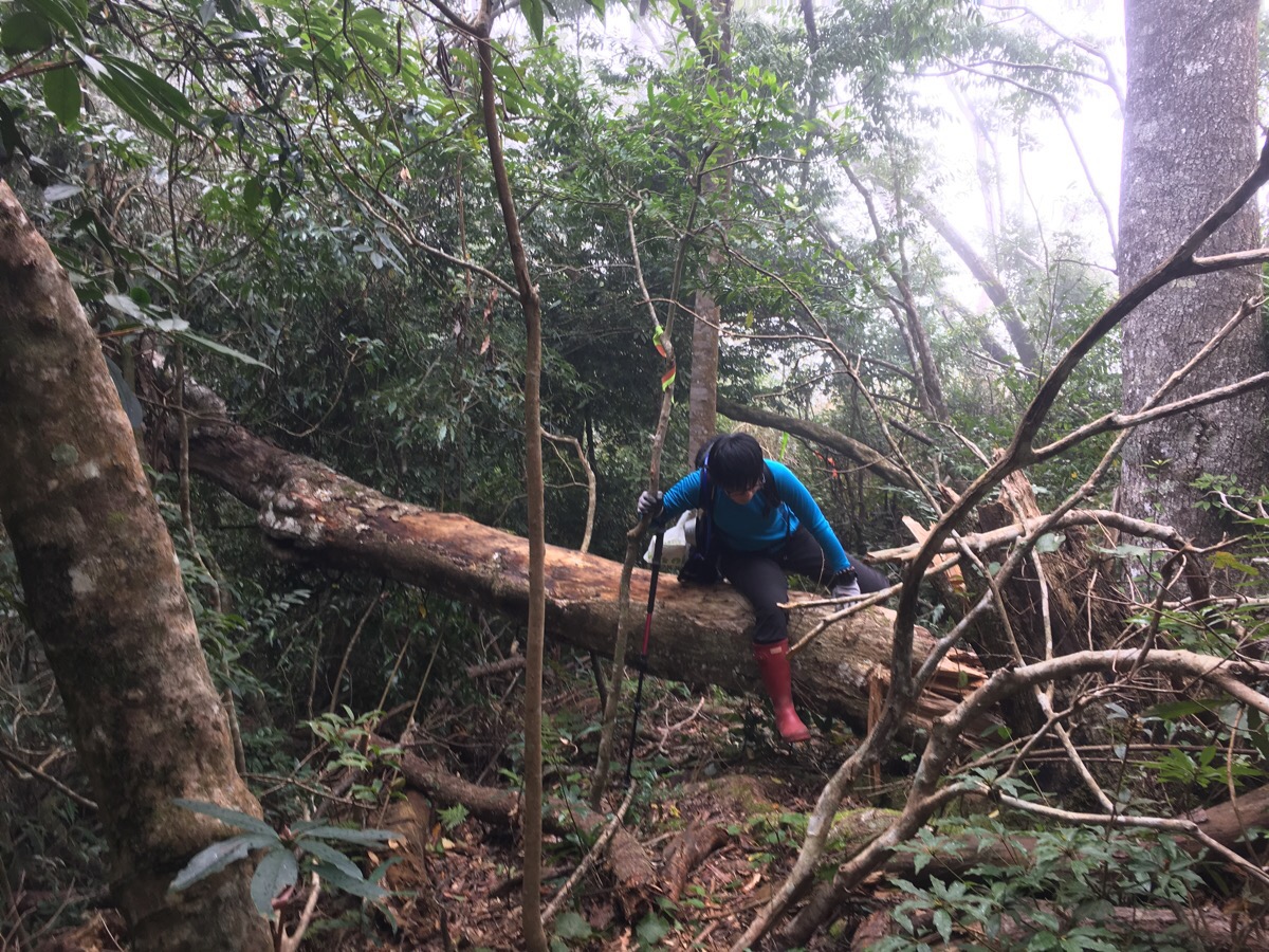
08:50 – There are ropes in a few places, mostly, they were a lot more useful on the way down than on the way up.
An intriguing tree.
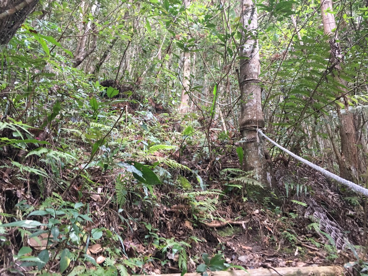
The ropes were useful for determining where to go at times.
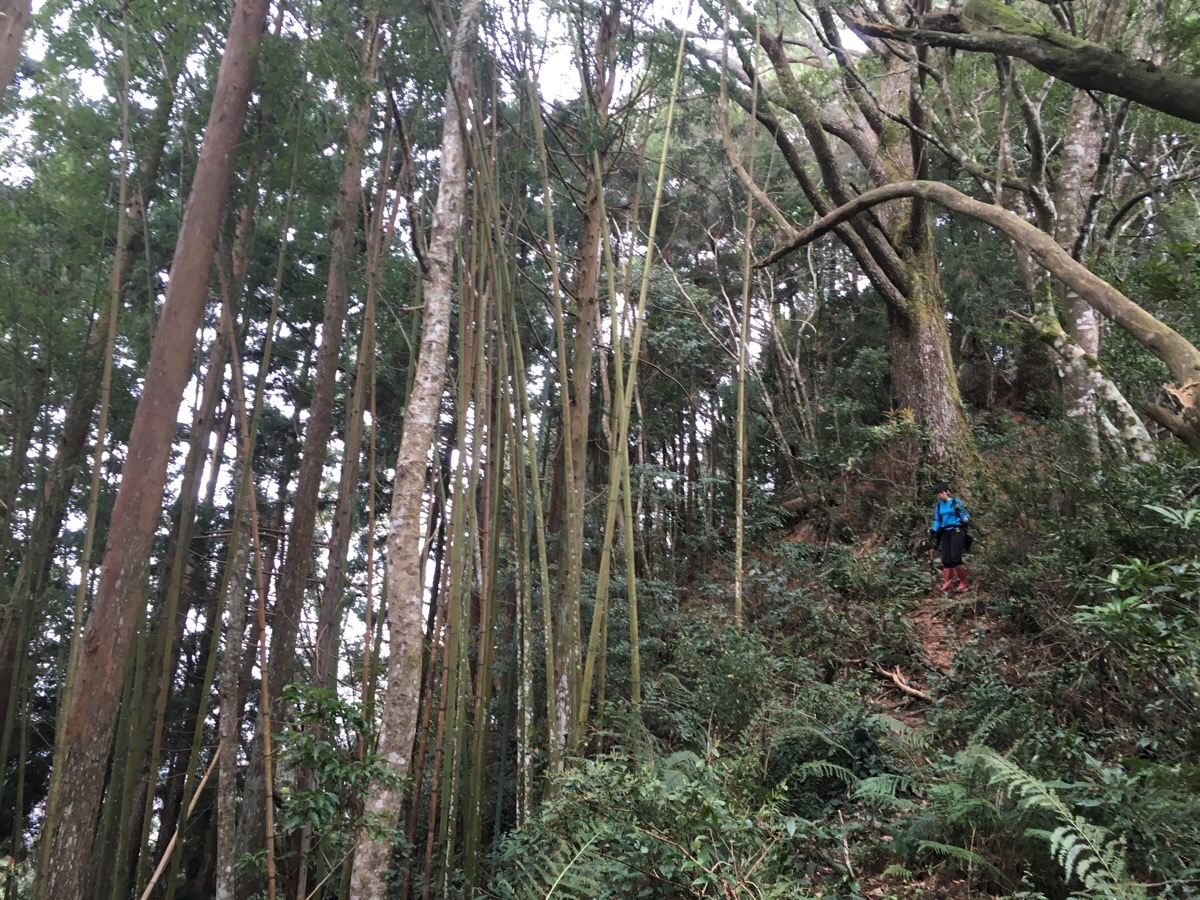
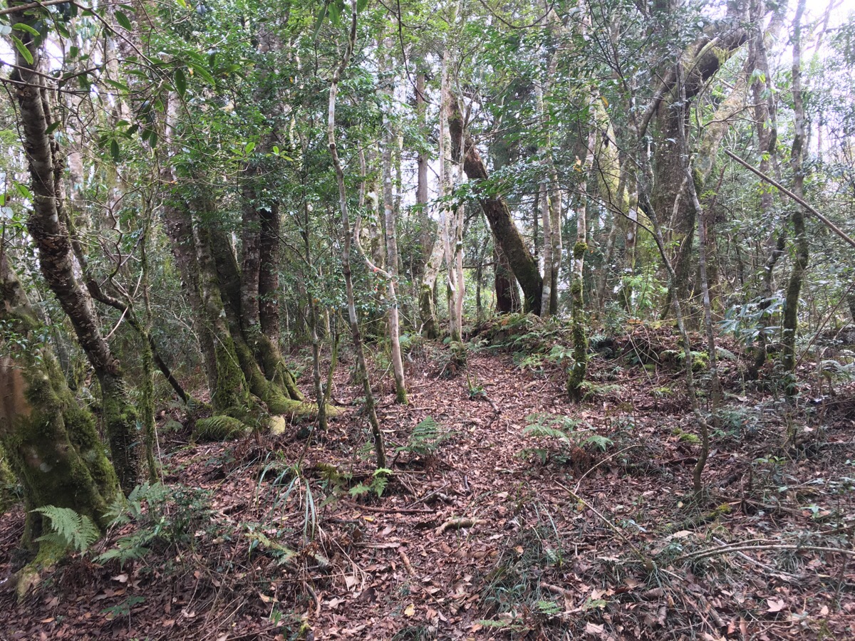
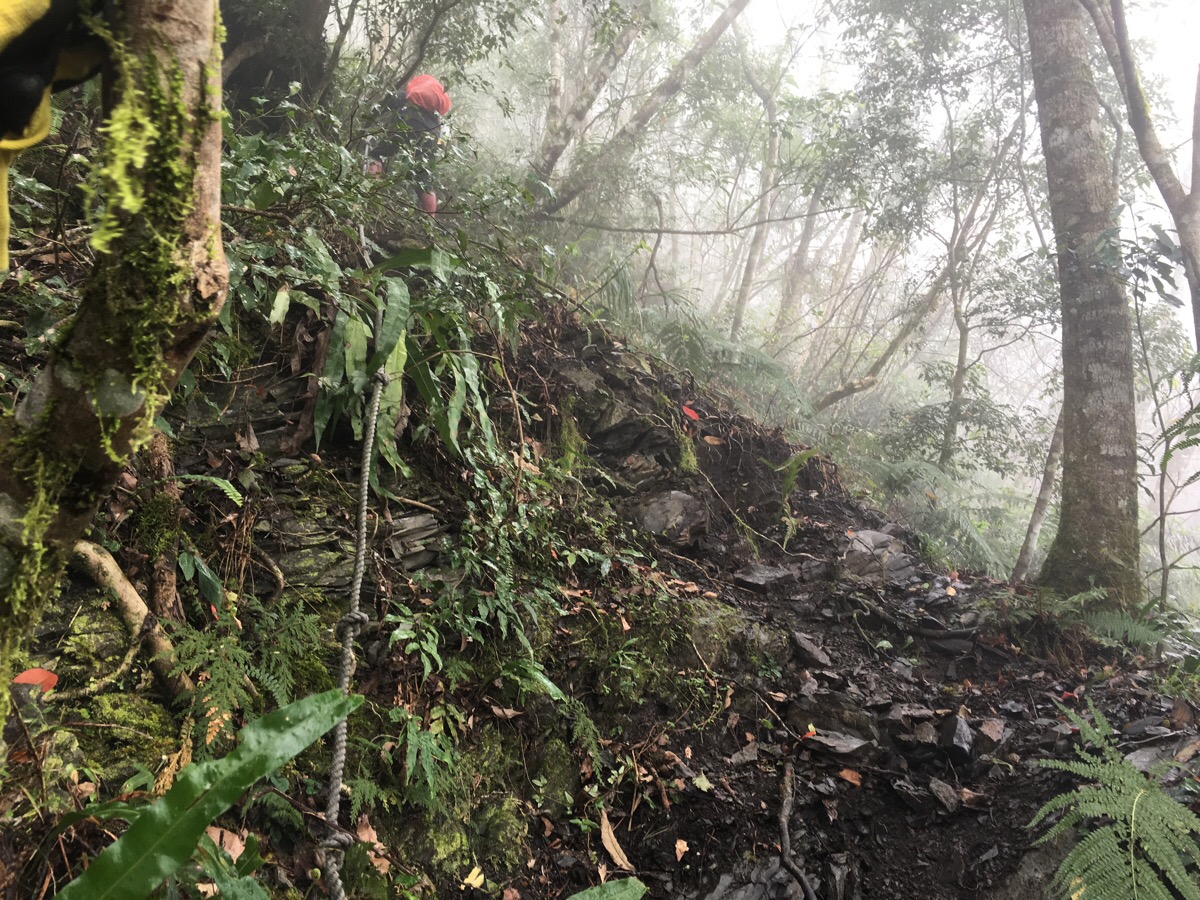
09:03 – Likewise, the hiking tags were a real life-line because the trail was barely visible in some areas. This was the last slightly flat area for a long time.
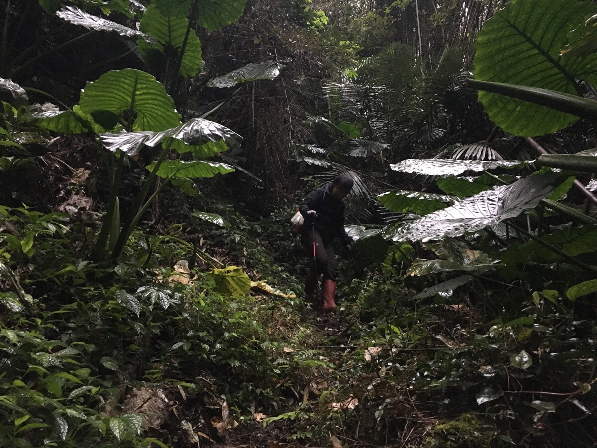
This trail was only opened in the last year or two, and is clearly not yet a well-established route. Most of the time it was possible to see where to go, but not always.
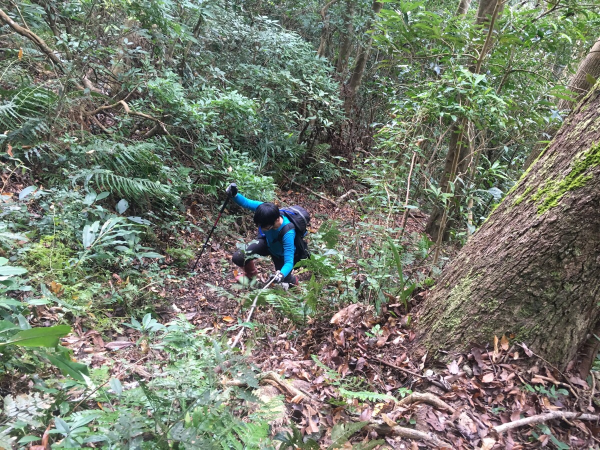
09:33 – The steepness of the route also added to the difficulty. There weren’t really many flat sections of gradual inclines.
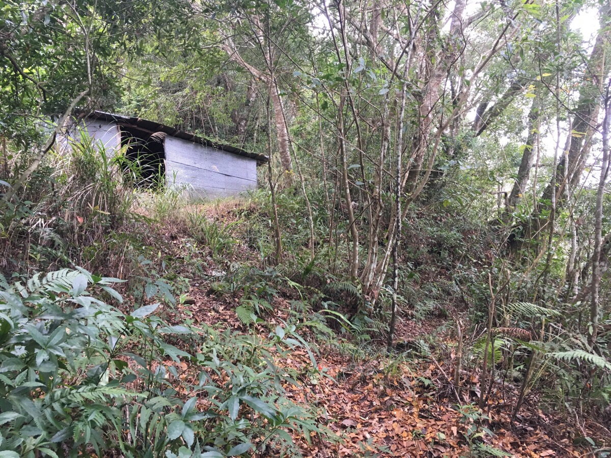
10:05 – About an hour and a half after starting, we came to this shelter. It was actually the third shelter we’d passed, but the other two had collapsed. The hiking group whose guide we were following managed to make it here ten minutes quicker than us, but I was still pretty comfortable with our pace.
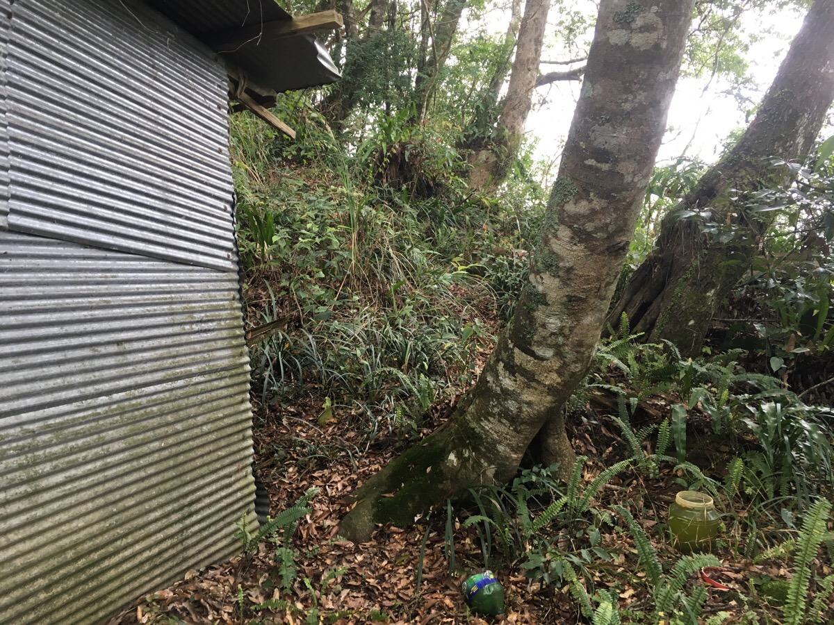
Inside are the remains of a fire as well as a bed-like structure and some shelving. This is one of several aboriginal shelters along the route, I’d imagine they’re used for hunting parties to rest in.
The path skirts around the shelter to the right and keeps on going up.
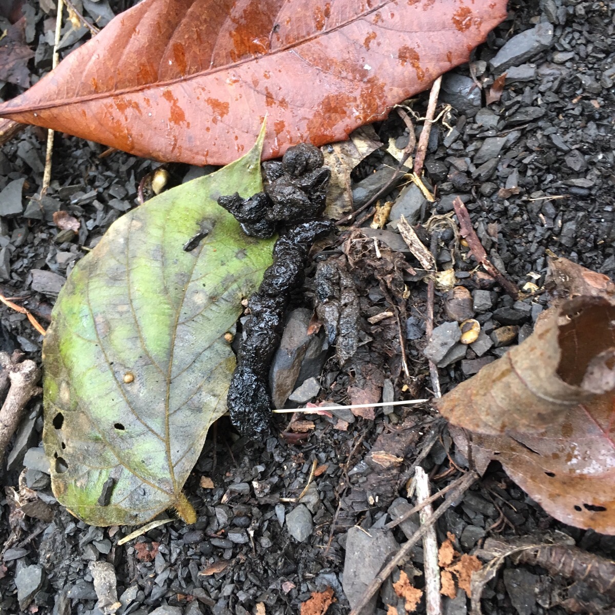
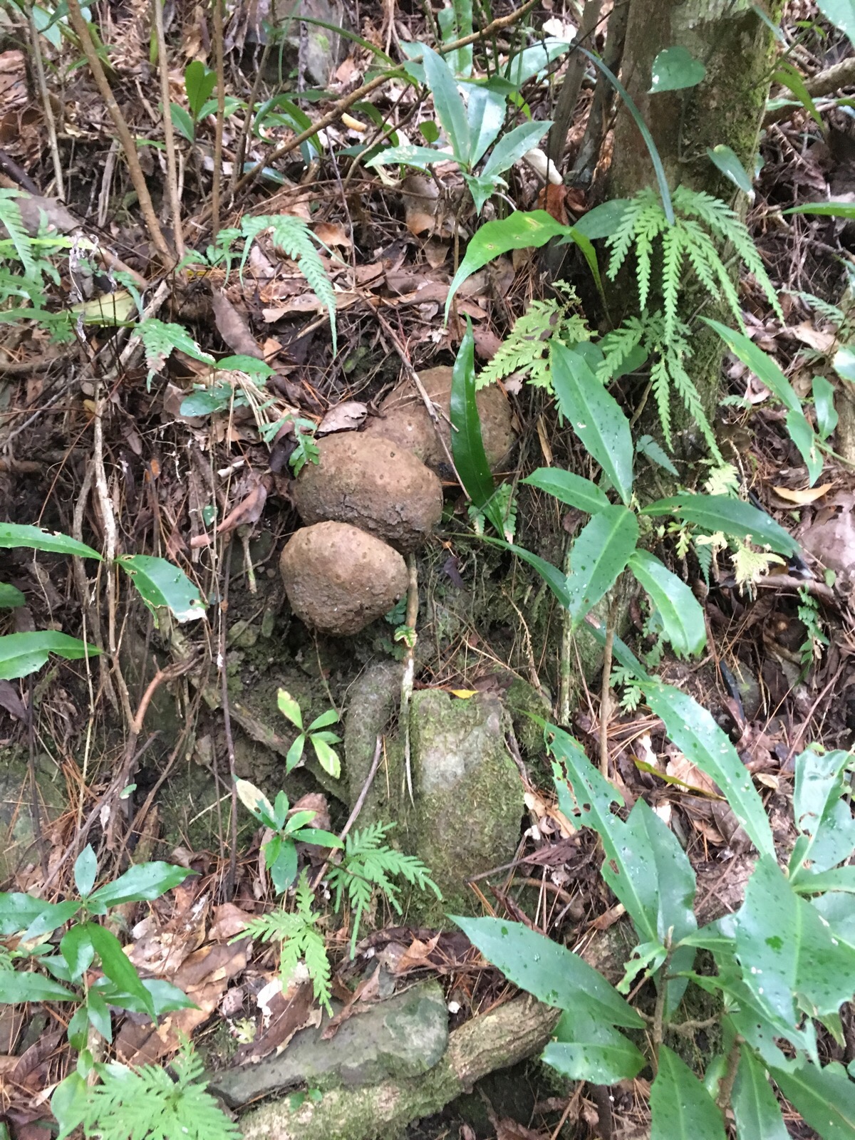
I kept my eyes open for signs of wildlife as we climbed and was rewarded by two kinds of scat. One was rather loose and therefore not so readily identifiable, but this one was almost certainly left by something in the weasel/stoat/marten family. The last time I saw something like this was in a similar location during a nearby hike. We also heard the calls of a muntjac deer for a good half an hour – if you didn’t know what was making the noise it would be a rather horrible sound to hear.
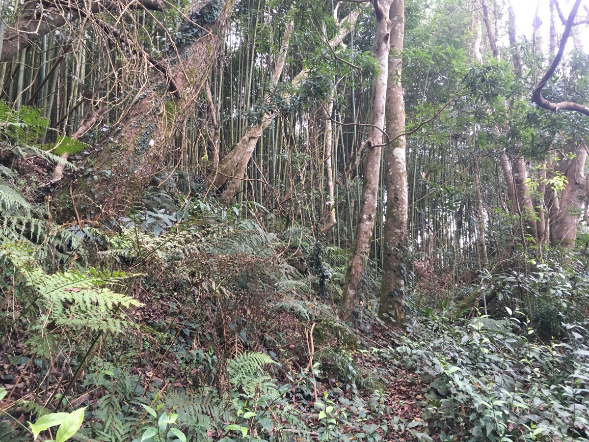
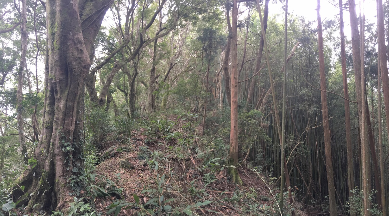
10:53 – After we’d been walking for about two hours and twenty minutes, we reached the spot on the map where there’s a sharp turn and we started climbing along a narrower ridge. As the path turns, it enters another area of bamboo. Just where the path meets the bamboo in this pictures, it veers sharply left and we followed the edge of the bamboo patch for a way.
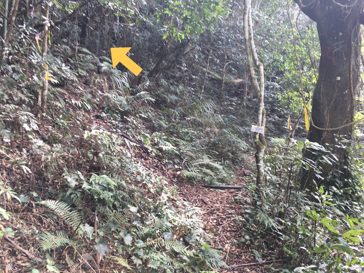
We were slightly unsure of whether we were on the right path here and had to keep checking. I wouldn’t be surprised if some hiking tags have been removed since they were so few and far between that you could get lost quickly between markers. We had to keep referring to the GPX route we’d downloaded and scanning the ground for signs that it had been trodden.
10:59 – Five minutes after entering this patch of bamboo, we emerged into what felt like a clearing, (in fact it was more like a small hollow), where the path totally disappeared. Using the GPX and logic, we worked out that we were meant to be heading up the ridge which is seen just right of centre in the above photo. It’s not an obvious ridge until you’re a metre up it, but by that point the path becomes clearer.
The ridge climbs to a small peak and then there is the only down section of the whole climb.
11:08 – The down is very short though, and soon the path is climbing again, passing some beautiful big trees and heading into another bamboo grove.
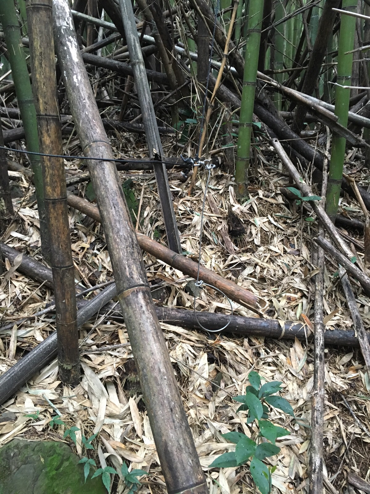
As soon as we were a metre or two into the trees, we heard something mid-sized crashing around just over the horizon maybe 20-30m away. We never saw it, but I can assume it was neither a bird not a deer, since I’m sure we would have heard either wings or barking if it were either of those. From then on I made a point of being a little noisier, because I didn’t particularly feel like startling a group of wild boar – an instinct which was validated less than ten minutes later when we passed a couple of traps which had been set at neck height for boars.
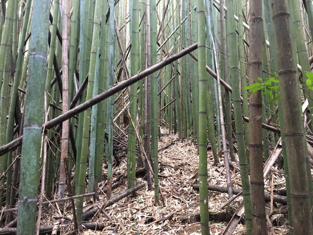
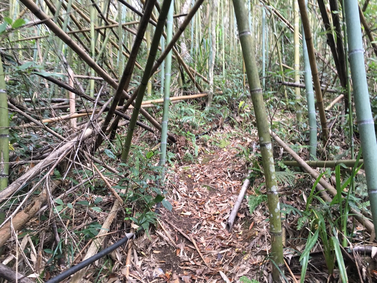
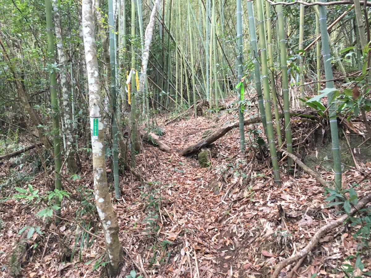
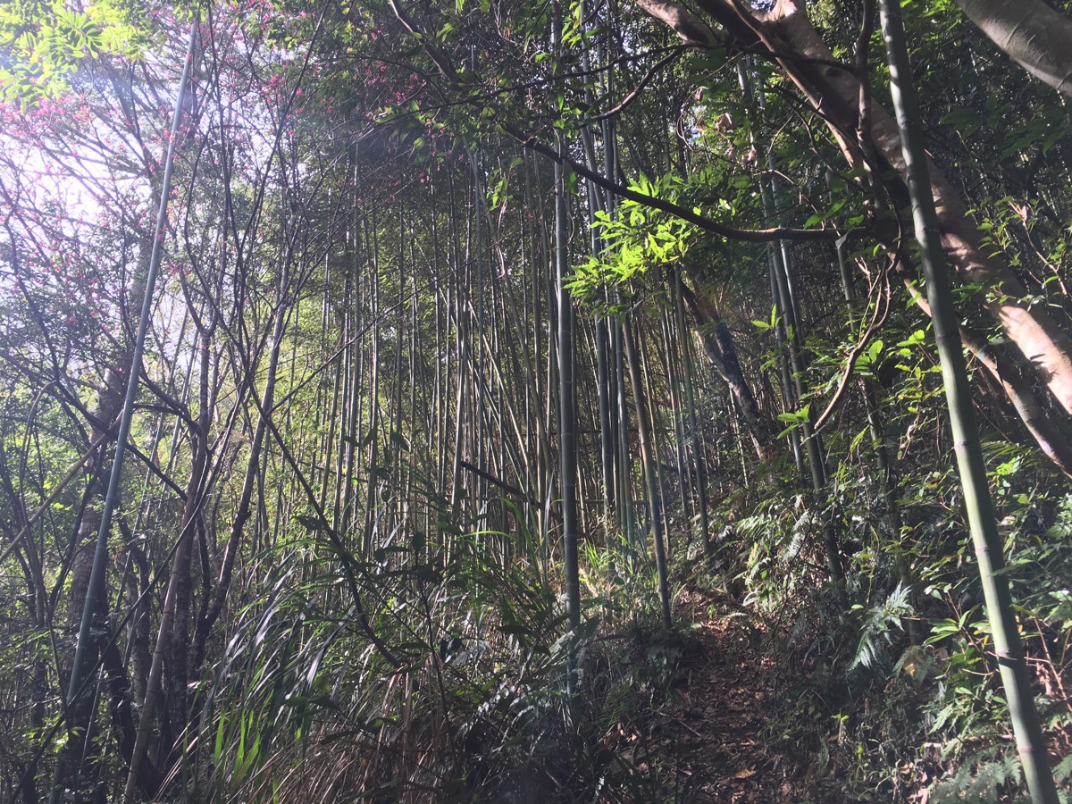
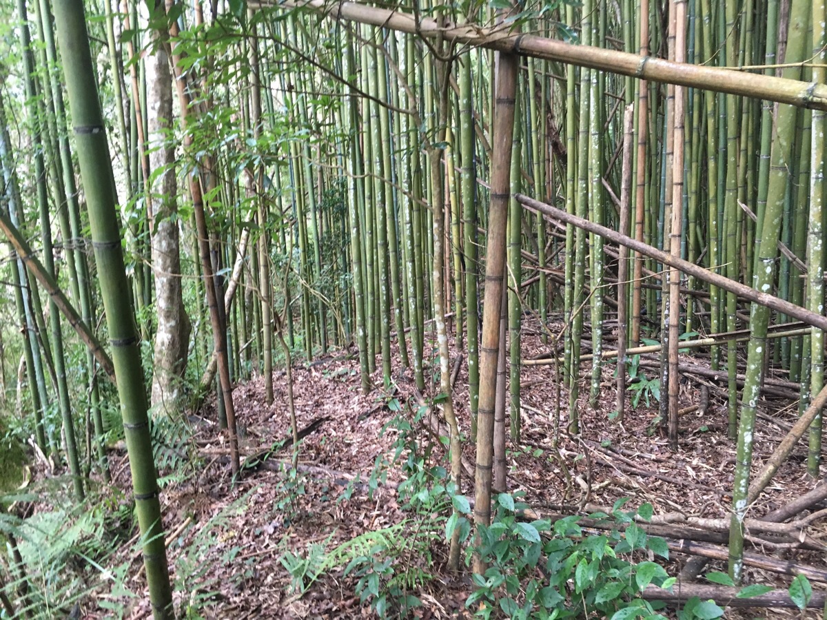
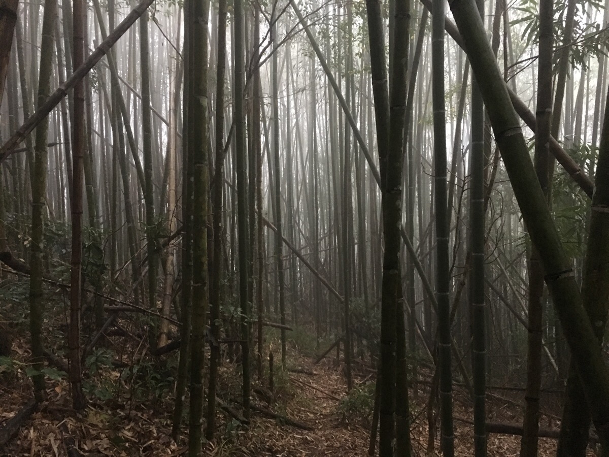
In some places the path through the bamboo was easy enough to follow, you just have to follow the sawn-off stumps and (slightly) wider gaps.
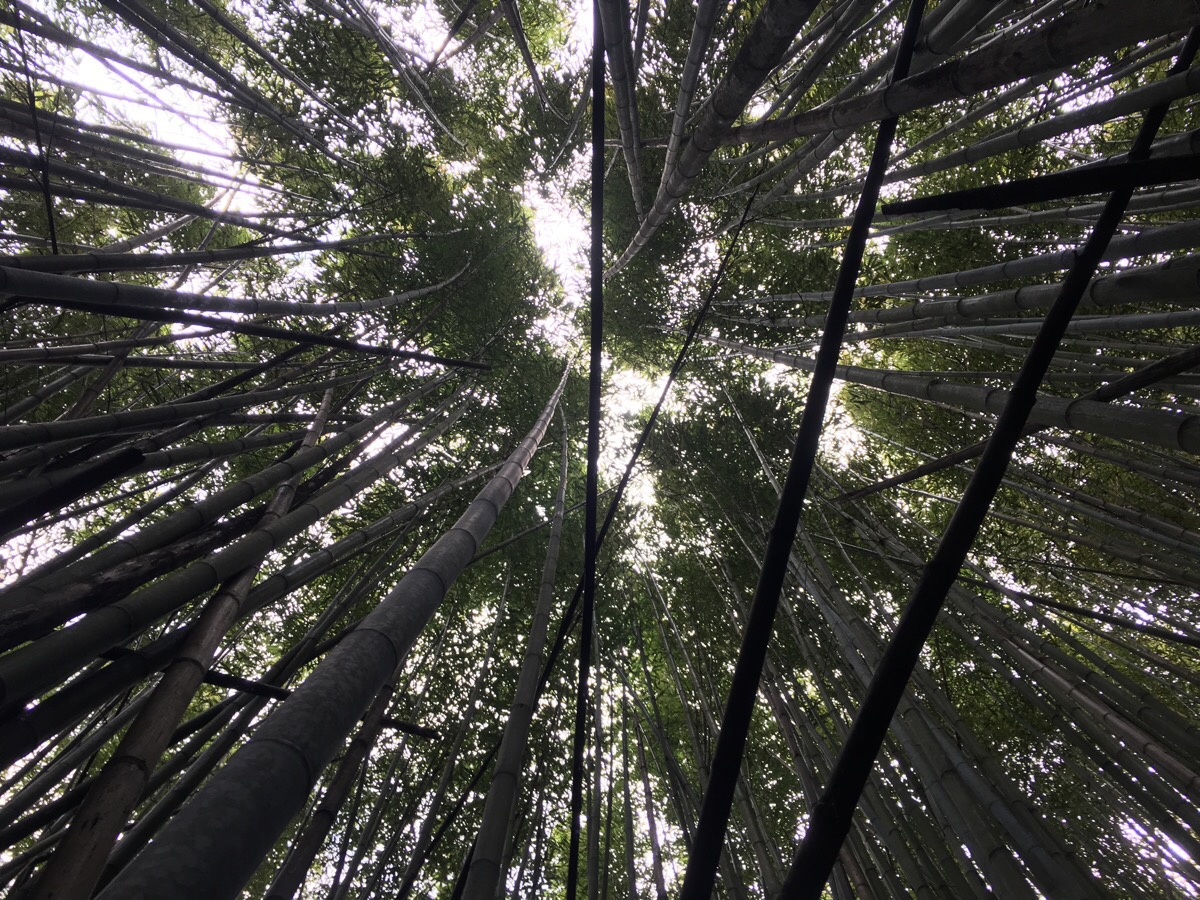
It is amazing just how much light they block out, they really create totally different atmosphere.
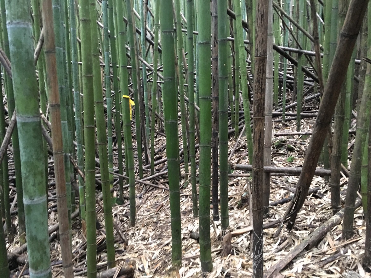
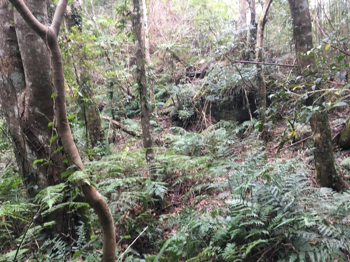
But there were other areas where the path vanished completely. I can only assume the people who are trapping wild boar in the area maybe want to discourage visitors, since every other trail I’ve been on has had greater amounts of and more visible tagging in areas where the path is harder to follow.
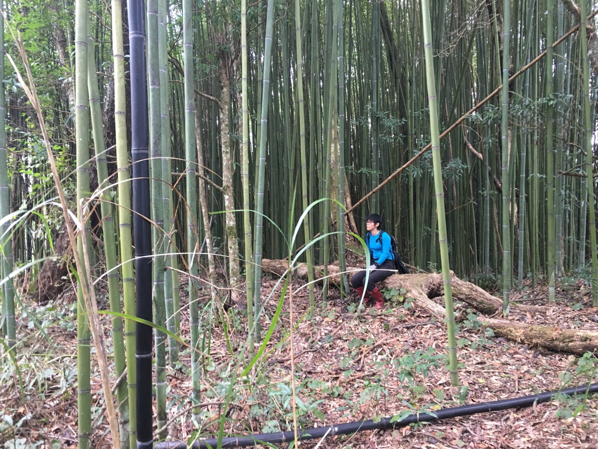
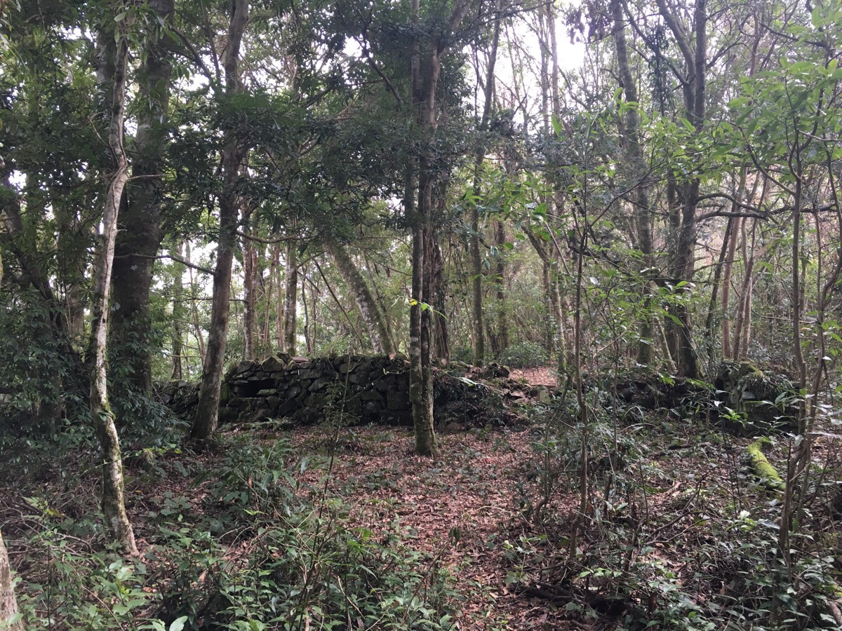
As the path nears the edge of the bamboo, we followed the stone wall of an old Japanese encampment.
11:36 – Teresa stopped to rest for a minute on a fallen tree whilst I had a look at the remaining structures.
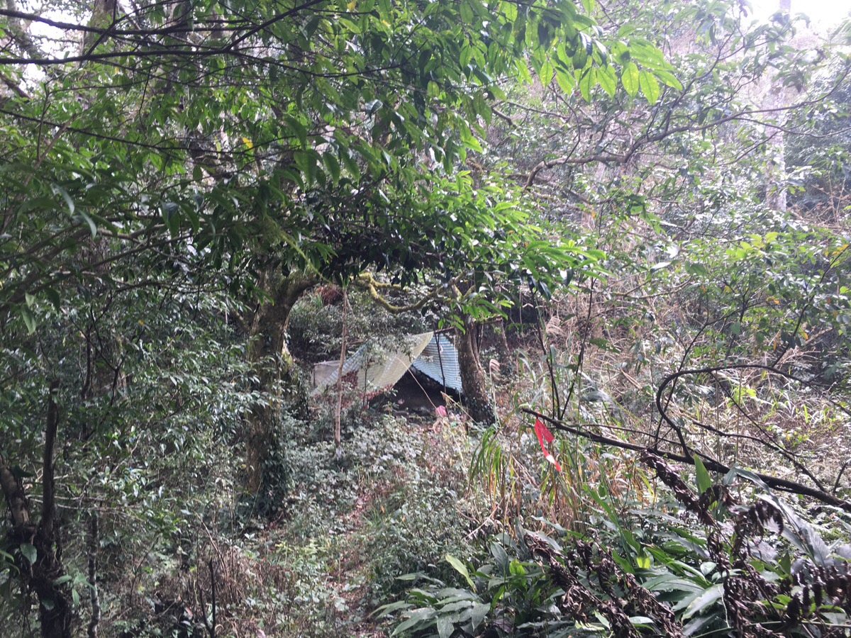
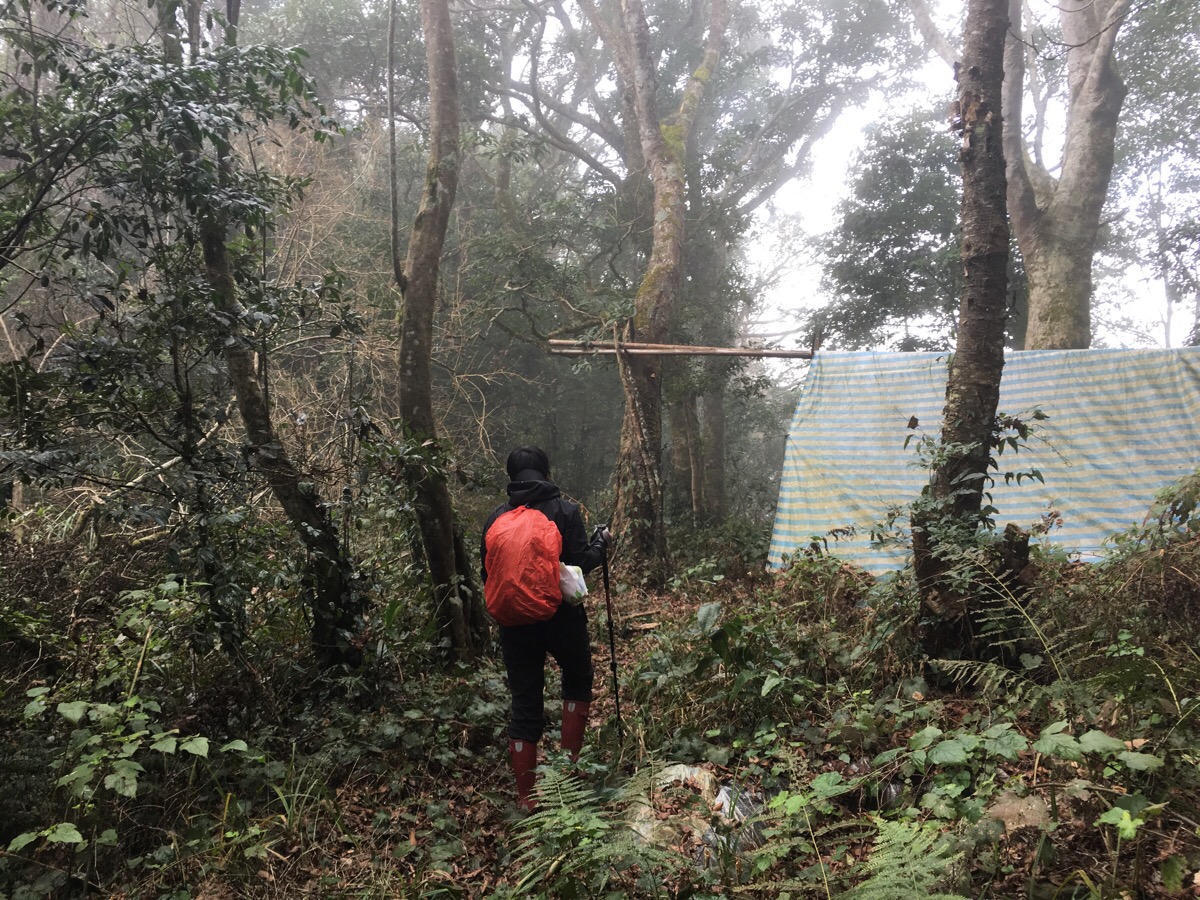
11:39 – Just beyond the old stone walls, we came upon another mountain shelter. This one also had remains of a fire on the floor as well as some blankets or clothing hung in bags from the central support beam. According to the map, there is another trail which goes back to the road near where we parked to the left of this shelter, but it was so poorly marked that we couldn’t see it even though we tried to. However, the path up to the peak gets a bit clearer from here.
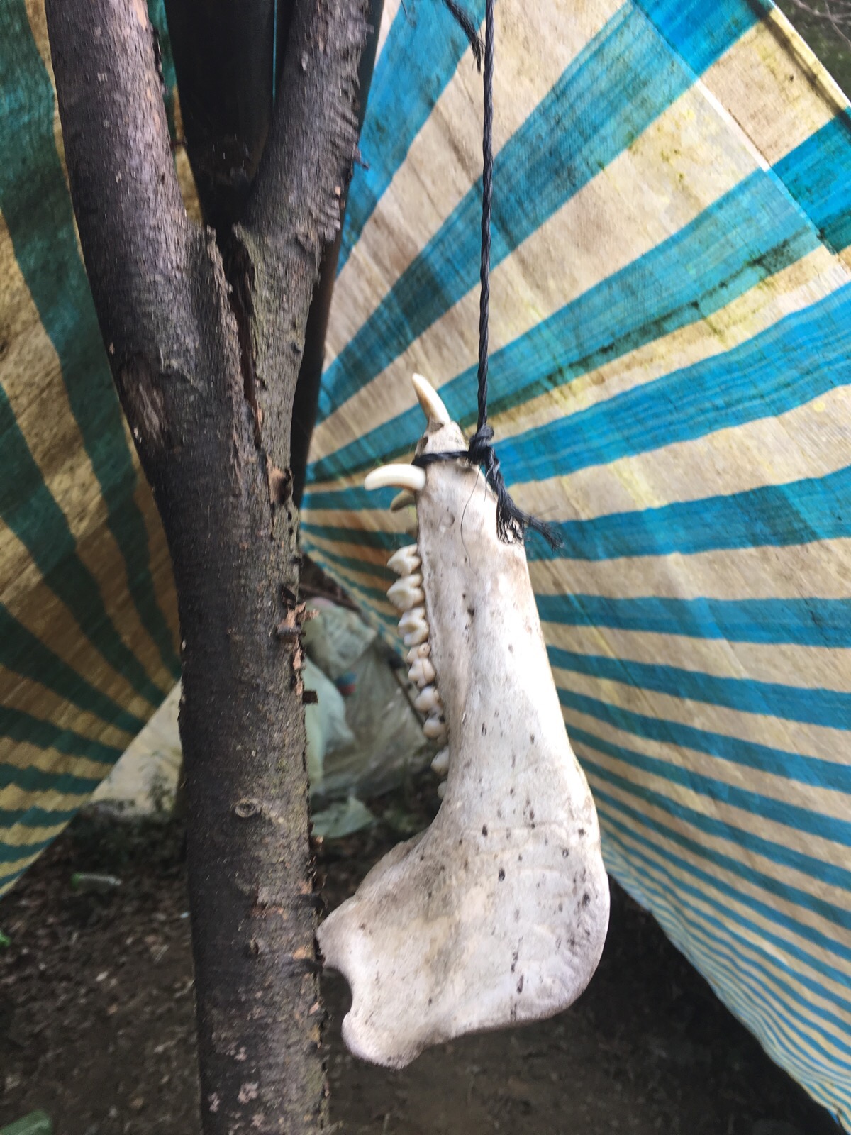
There is a wild boar jawbone hung in front of the trail-facing entrance. It was bigger than I would have imagined and seeing it made me even less keen to encounter the bone’s living relatives close up.
We veered right past the shelter and its guard-pig-bone and suddenly the trail was littered with many colourful hiking tags.
11:43 – The first and only clear junction.
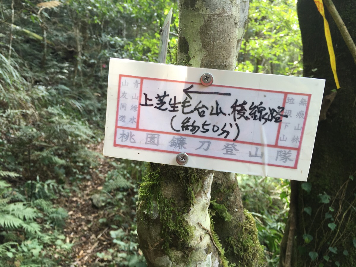
We decided to take the left, more direct route up to 芝生毛台山, (the sign indicated that it was another 50 minutes of climbing), and then reassess to see if we had time to make a loop later.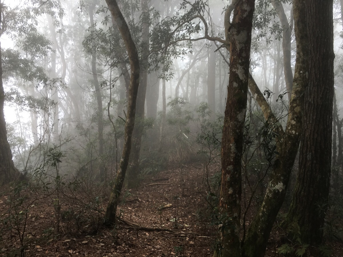
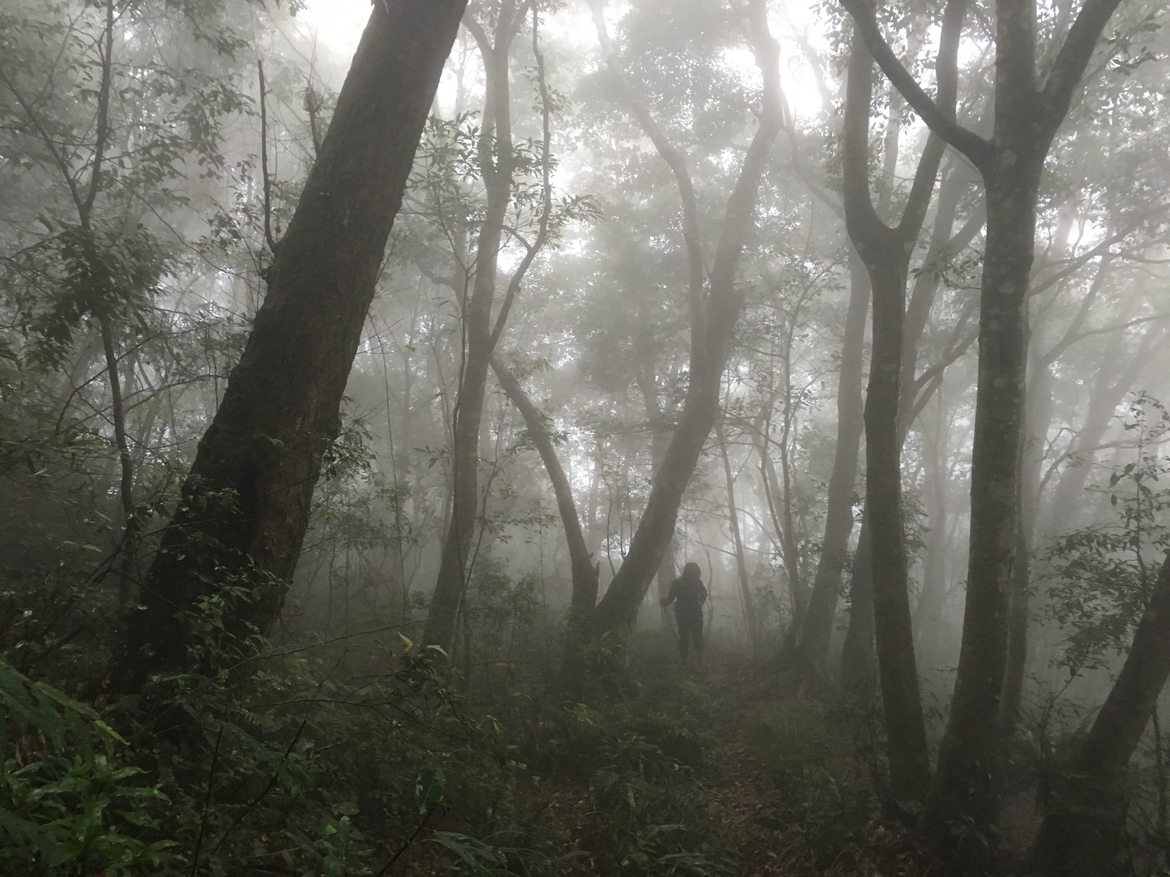
As we made the last push up, either we climbed into the clouds, or the clouds came down to meet us. This section is the only part that would have offered good views on a clear day.
12:13 – The path has a few more gently sloping sections mixed in with some exceedingly steep parts.
12:33 – Exactly 50 minutes after turning left, we saw the barely visible stone walls which signalled that we had arrived at the top.
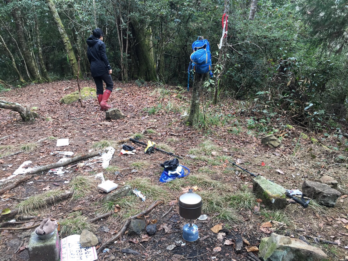
The peak itself is depressingly cluttered with the remains of other visitors travels, and as such is not the nicest peak to relax on but we needed to refuel and rest up a bit.
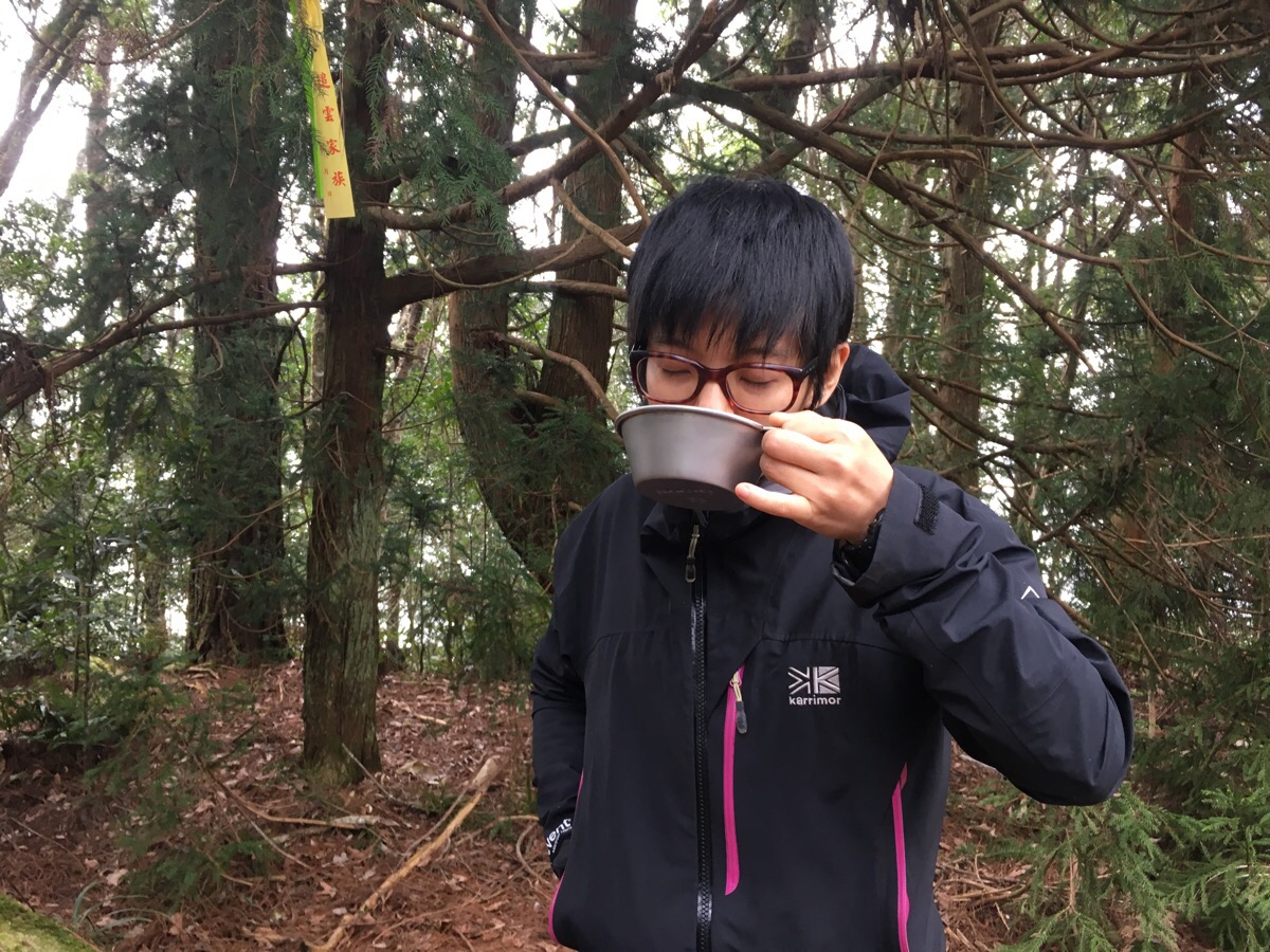
We heated a couple of boil-in-the-bag curries which we ate with spoons fashioned out of a cardboard takeaway box because we had foolishly packed everything except for spoons. We also had a coffee which was mixed with its own sachet. The feeling of having satisfied warm bellies made us unsure as to whether we should be exasperated at our stupidity for forgetting something as basic as a spoon or smug about our inventiveness.
As we were eating, there was a slightly heavier shower than we’d seen all morning (although it’s possible that it only seemed that way because we were sat in a clearing). This prompted us to tidy up quickly and get cracking on the descent. We left an hour after we arrived at 1:33 – somehow time seems to stretch when you’re hiking. I have no idea how one hour passed so quickly with only the simple tasks of preparing food and drink to occupy us. It felt like no more than half an hour.
It had taken almost exactly four hours to climb up, and judging by our previous form on similar walks, it should take us just a little less than that to make the return journey. So, since we had about 3½-4 hours before we started losing the light, we decided that it would be more sensible to head back down the same way that we’d come. Before leaving we made a bet on how many times we would fall down, I guessed that we’d fall down five times between the two of us and Teresa went for the more optimistic three (I was being superstitious and thinking that I could avoid it by betting on a higher number).*
Beginning the steep climb down, we were treated to some utterly magical sights as the sun cut through the clouds – the photos don’t even begin to do justice to it.
14:22 – As we passed this shelter again on the way back, we briefly reconsidered, seeing if we could take the alternative path down, however, it was still all but invisible so we stuck to the original plan.
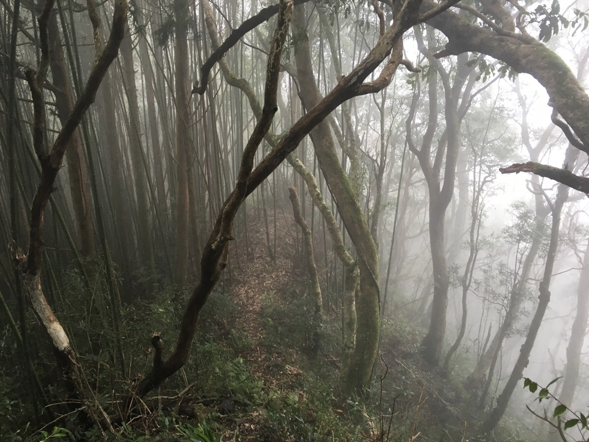
14:52 – There were a couple of sections that we weren’t looking forward to on the way down. For me, it was the (already creepy) bamboo forests which would only have become more gloomy and eerily hushed than they were on the way up after the fog came in. And for Teresa, she was worrying about the area of loose rock which had crumbled beneath our feet on the way up.
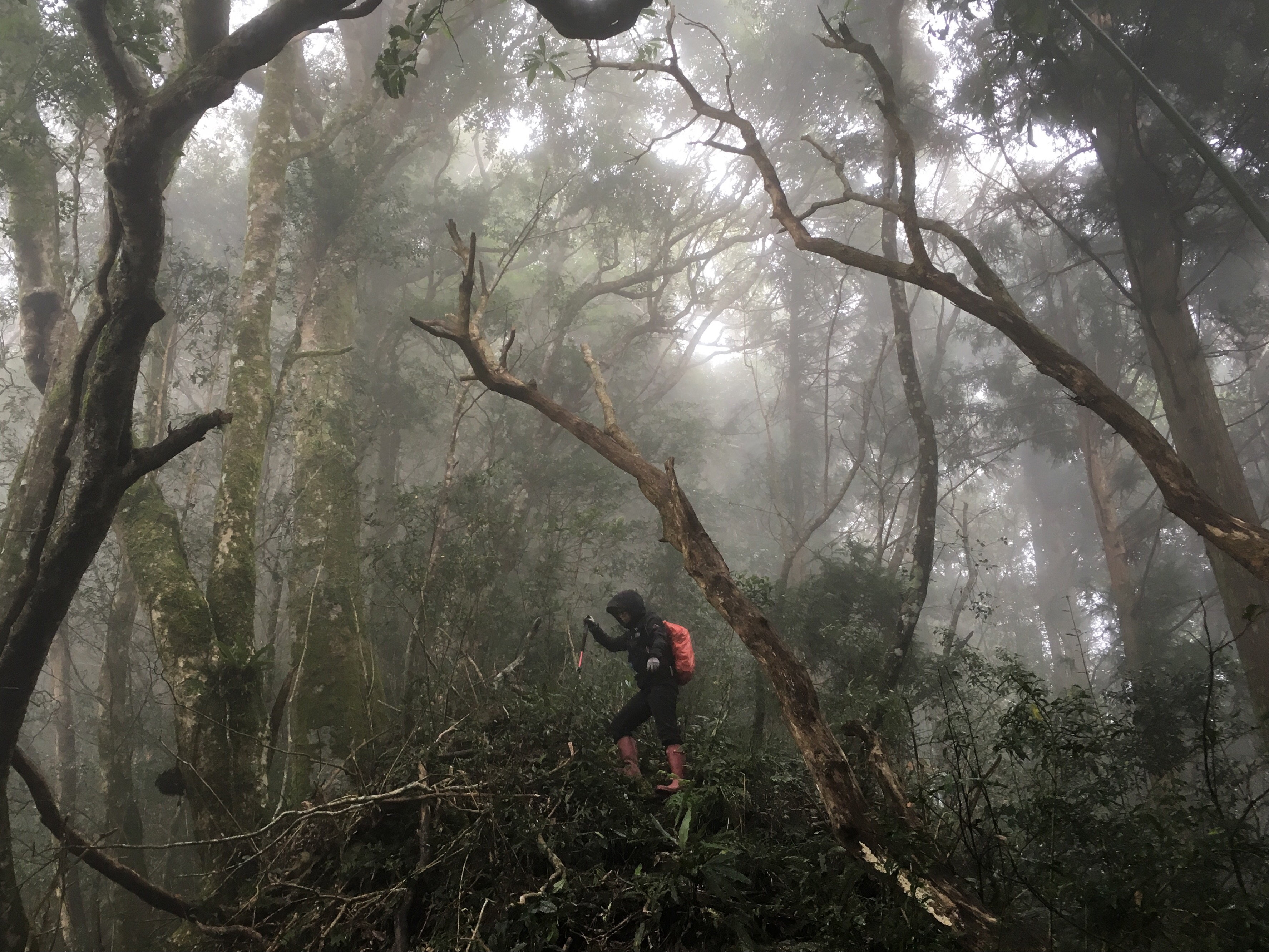
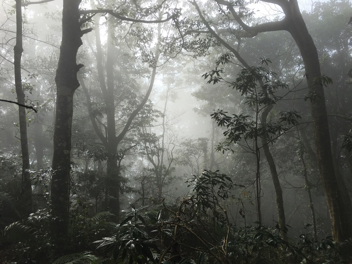
I showed the photos of the foggy rhododendron forest to my family after completing the hike and they said it looked spooky. In reality, the rhodedenrons don’t feel at all creepy, they’re gentle and calming and the fog brings out a whole other beauty of the landscape. I had to keep stopping to take in all the muted shades of green and brown.
15:19 – We were very careful down the scree section and were able to get down without dislodging any rocks or falling over.
15:56 – The bamboo sections presented a bit of a challenge as we made our way back, especially the one by the remains of the Japanese buildings. There was no visible path at all and we found ourselves going extremely slowly so as not to lose the way. Once or twice we struck off in the wrong direction, but thankfully we never strayed by more than a few metres. The more open sections were easier to traverse and there were even some parts where the path was clearer on the way down.
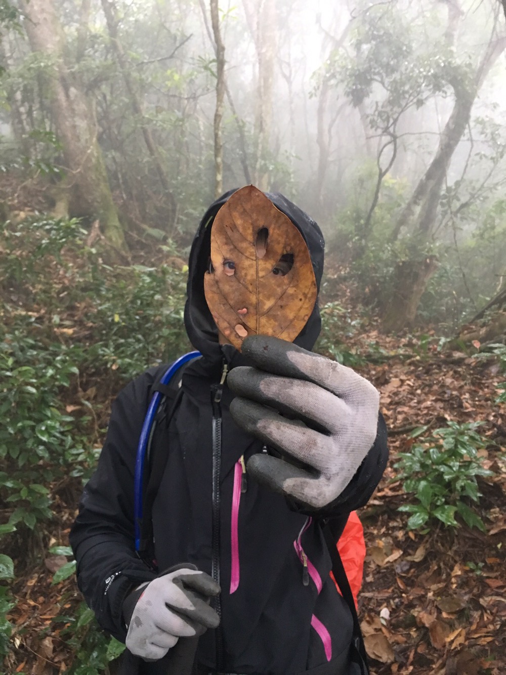
Teresa managed to find time to entertain herself with leaf masks, despite the encroaching tiredness in our legs.
16:41 – Although I didn’t enjoy walking through the bamboo, their strong trunks were very much appreciated. Where the path was clear enough, I was able to use them to do a little backwards walking to ease up the tension in my muscles.
17:15 – This image was taken just a few metres from the trailhead. In my excitement to get started earlier in the day, I had totally missed these giant elephant ear leaves – I have no idea how I missed them though, they are huge. We emerged onto the road and sat on the wall for a bit before heading home, tired but thoroughly satisfied.
*Teresa won the bet about how many times we’d slip. She went down twice and I went down once.
How to get there
Google Maps address: 芝生毛台山步道口, Shilei Road, Jianshi Township, Hsinchu County, 313
GPS location: N24 39.152 E121 18.455
Public transport: You will probably find that it’s not so easy to get here using public transport, you’re better off getting there under your own steam.
Further reading: I couldn’t find any English language resources for this walk, but there are a few in Chinese. This group seemed to start where we did and then veer off in another direction. Likewise, these hikers started at the same place, but took the right turn where we turned left just after the boar jaw bone, and they went down a different way too.
My new words learnt on this hike:
- 邏輯 / luójí / logic
- 這輩子 / zhè bèizi / this life or for the rest of this life
- 有一腿 / yǒuyī tuǐ / (slang), literally these three characters are ‘have one leg‘, but the translation is more accurately something like ‘have an affair‘. 妳跟他有一腿嗎? / Are you having an affair with him?
- 神經質 / shénjīngzhì / nervous
- 名人 / míngrén / celebrity (n.) – I am sure I have learnt this and forgotten it in the past.
- 泥土 / nítǔ / soil – the first character is translated separately as mud or sludge, which explains how 馬鈴薯泥 ends up getting translated as the ever so appetising potato mud on so many restaurant menus.
- 犧牲小我完成大我 / xīshēng xiǎo wǒ wánchéng dà wǒ / (idiom), literally this translates as ‘sacrifice the small self, complete the big self’, with the big self being something beyond yourself, like a family, company, community or country – kind of like the English idiom ‘take one for the team‘. The context I heard it in was more like ‘I am happy to sacrifice something/do something I don’t really want to do to make you happy‘.
- oh bei bu / Taiwanese for 亂弄 or randomly do/use/handle/mess with – I love these phrases in both Taiwanese and Mandarin. There’s really nothing so universally useful for the same range of activities in English.
- 許願 / xǔyuàn / wish or make a wish
- 還願 / huányuàn / pay back the Gods (for a wish which was granted) – these two phrases came up when I was talking about what I’d overheard in the staffroom at work – some colleagues were discussing how they had made a deal to be vegetarian for the mornings for a certain period of time – it seems that this sort of bargain with deities is a not uncommon way of getting things done here.
- 合作 / hézuò / cooperation – I’ve either learnt this or another word for the same thing before, but I’d forgotten.
- 水蛭 / shuǐzhì / leech – another one to add to my collection of mountain microfauna.
- 岳母 / yuèmǔ / mother-in-law
Zhi Sheng Mao Tai Shan Trail Map
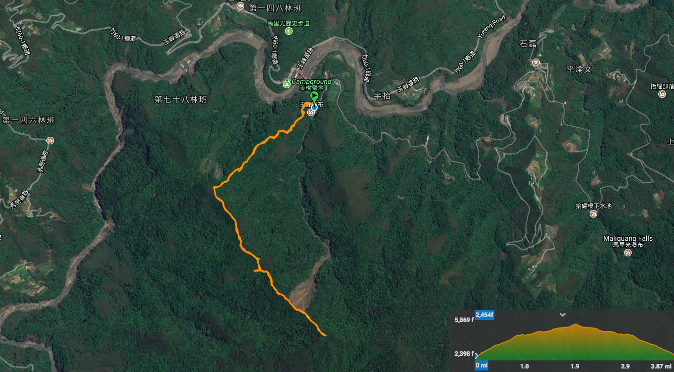
GPX file available here on Outdoor Active. (Account needed, but the free one works just fine.)

This sounds like an eventful hike. Props for sticking to it and finding your way. Looks like it would have been challenging to stay on the path!
LikeLiked by 1 person
It was pretty challenging, I don’t think I would have stuck with it a year or so ago, but I’m glad I did.
LikeLiked by 1 person