Distance: 14.1km
Time: 12¼ hours – the faster walkers had a couple of half an hour breaks but at most we had three ten-minute breaks and a three or four five-minute rest stops.
Difficulty (regular Taiwan hiker): 6-7/10 – actually I’m not sure how difficult I would find this now (several years later), maybe I’d be pleasantly surprised.
Difficulty (new Taiwan hiker): 9/10 – for a combination of length, elevation gain and terrain.
Water: 2L or more – we took 2.5L each and drank 4L total, and take plenty of snacks too.
Shade: pretty well shaded throughout – I didn’t have sun cream on and it wasn’t a problem due to cloud coverage and trees.
Mobile network: patchy, I didn’t stop to check often, but there were definitely areas with no signal.
Enjoyment: This is an awesome challenge of a hike, not too many views but they’re good when they come and the different layers of forest are delightful.
Other: this is a difficult hike and you’ll need to be well prepared. Take plenty of food – we didn’t take enough really, but luckily for us, other members of the group had brought lots, it’d also be sensible to take something to replace all the salt you’ll be losing – the group had all brought salt sweets which they passed around at regular intervals. Wear suitable shoes – the downwards sections are steep and there are lots of roots waiting to snag lose shoes, I’d recommend long trousers and sleeves but several of the group hiked in short sleeves and got away with minor scrapes. Take gloves and/or trekking poles, everyone was using gloves and everyone except for Teresa and I had poles, (they though we were weird for not using poles but I’m still not a fan). It would also be a good idea to take a headlight – we were in the middle lot of people to finish and although we could possibly have got down ok without, the headlights made things a lot easier for the last 15 minutes. The few who came down behind us absolutely needed their lights as the sun had totally gone down about an hour before they arrived. And finally, you’ll want to do this with at least two cars (or a scooter and a car), we had a few cars parked at each end so that once everyone was safely down we could drive back to the staring point, if we didn’t have to work the next day we would have stayed in the area overnight again since the drive back up to Taoyuan was tough after such a long walk.
Mount Baxian Trail Map
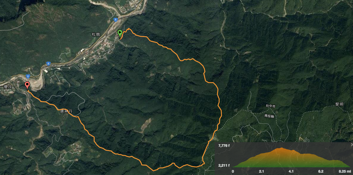
Link to a downloadable map on Outdoor Active here.
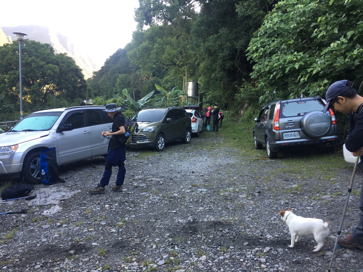
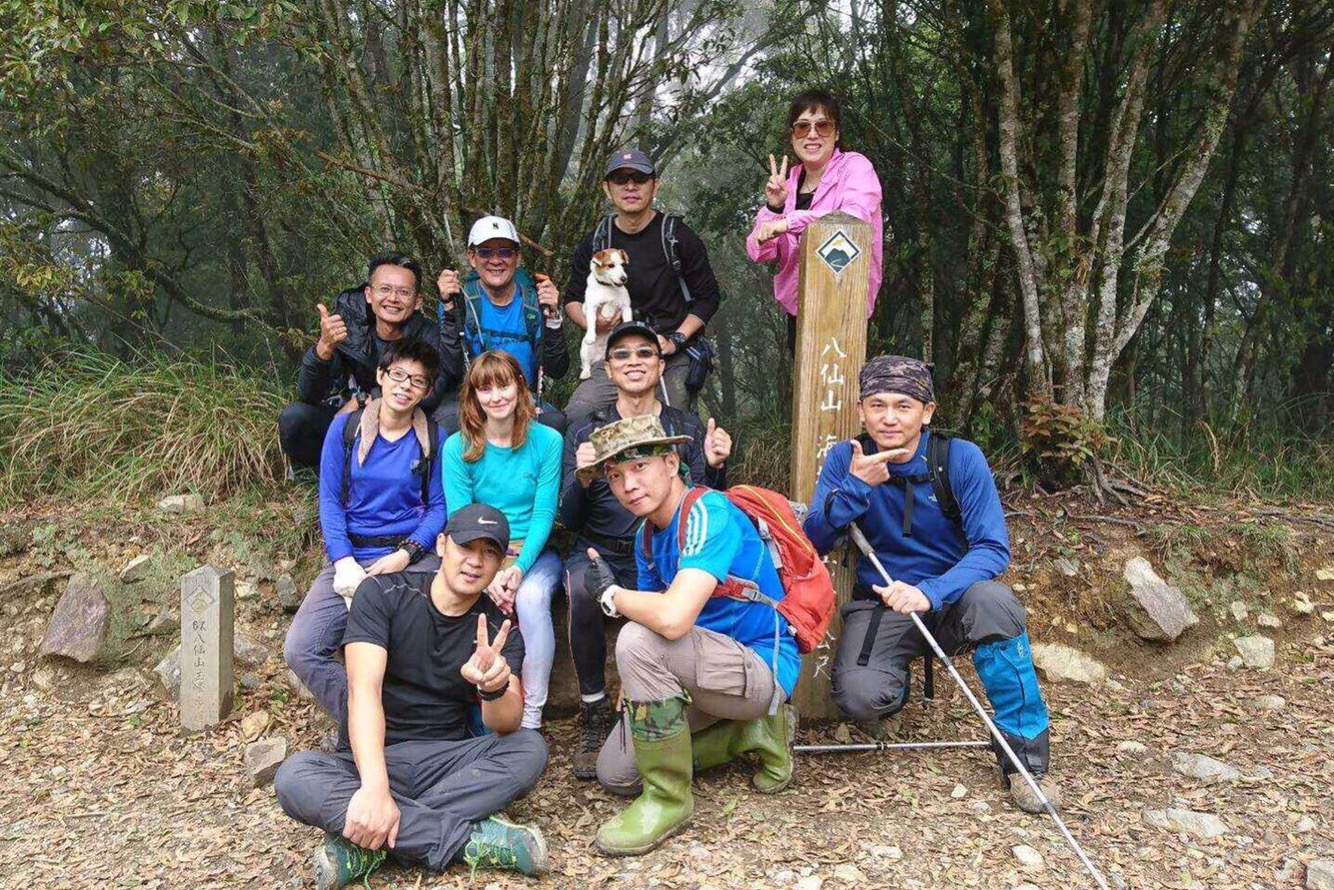
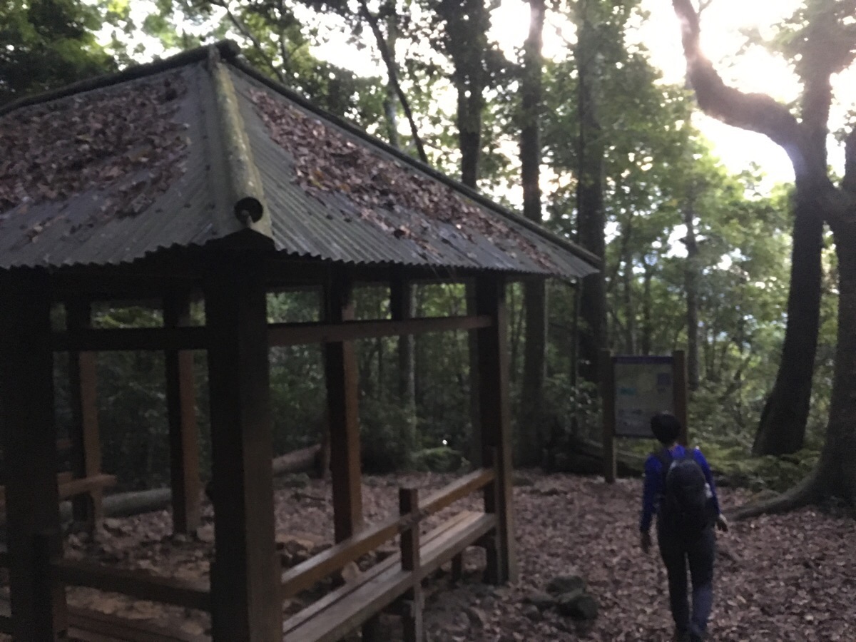
We pulled up in the parking lot at about 6:10 and there was a bit of standing around and waiting whilst the people who were parking at the far end of the trail were ferried back. It was our first time to join a group – we’d accidentally joined this lot when we did Stegosaurus ridge and had kept in touch – they were clearly pros at the whole large scale organisation thing. At 6:50 we were all ready to go so we set off.
The path heads beyond where we parked around the side of a few houses, a dog and her two young pups were guarding the entrance but since we had Funny, a fearless Jack Russell, with us we were able to pass easily.
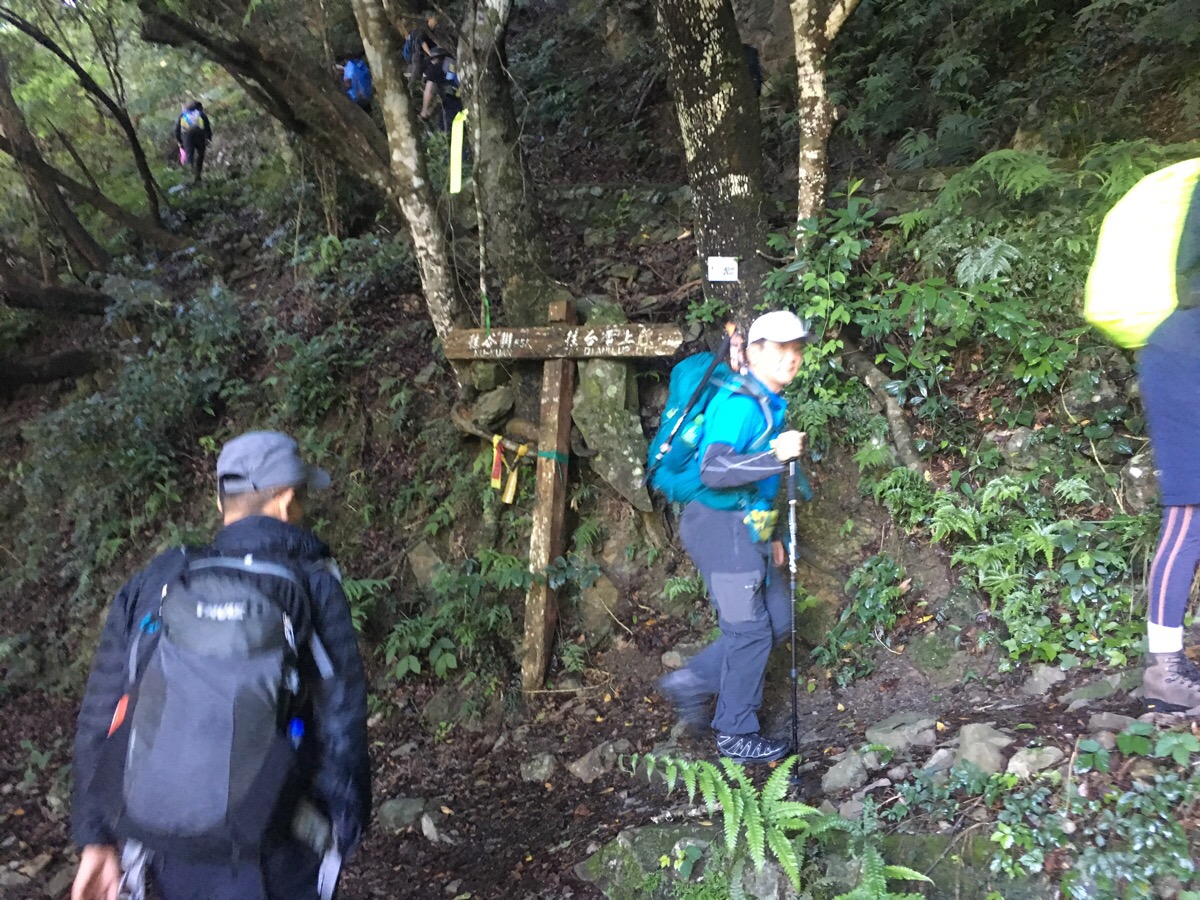
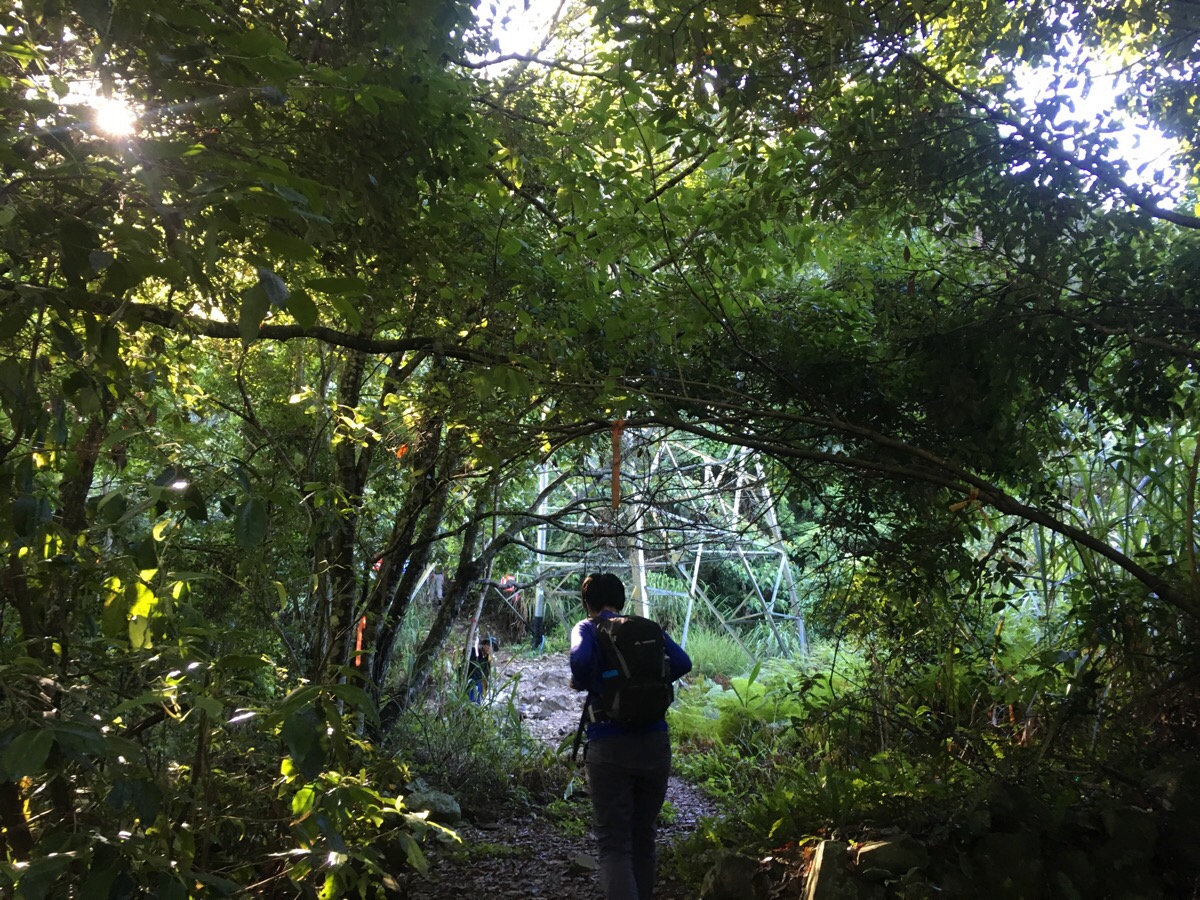
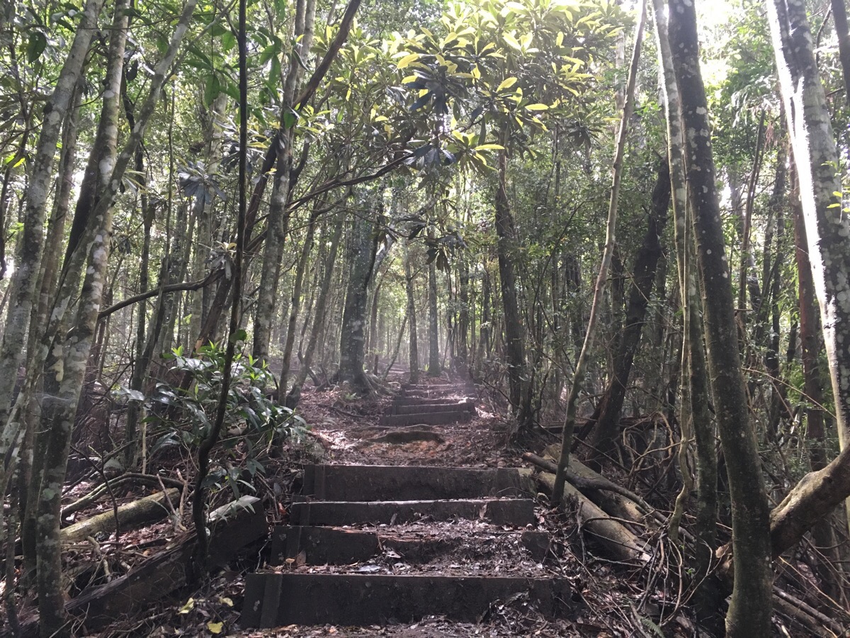
A couple of hundred metres from where we parked the trail proper starts with a signpost pointing left to Ku-Kuan and right following ‘tai dian up line’. It was switchbacks all the way up, climbing constantly. (Look at the elevation profile and you’ll see what I mean – barring a couple of rest stops we climbed for a solid five and a half hours.)
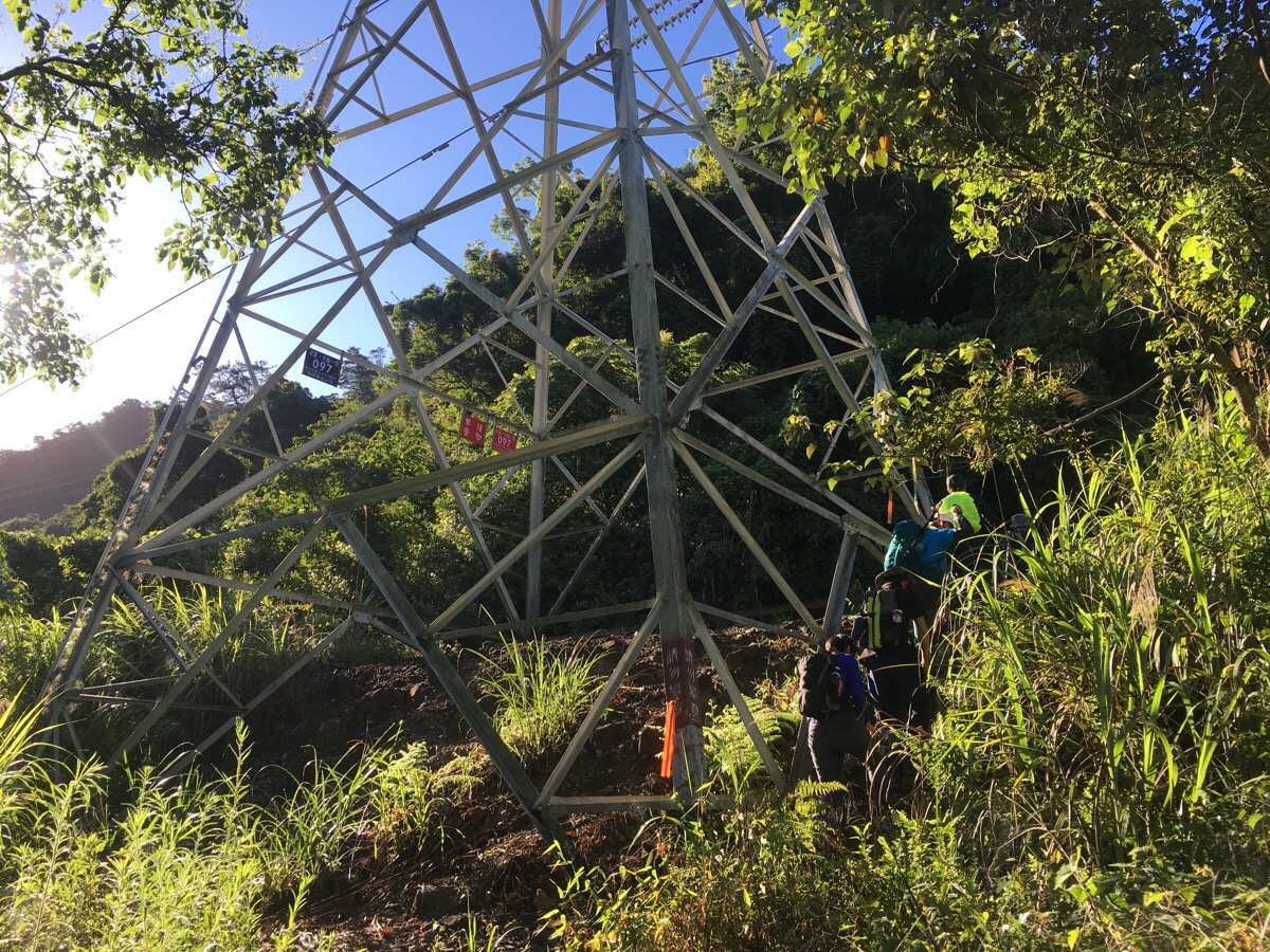
The route passes under two pylons, the first at 0.5km and about 15 minutes.
The second was at 0.9km and 35 minutes. People were already stopping for a rest at this point.
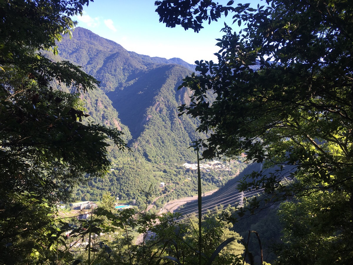
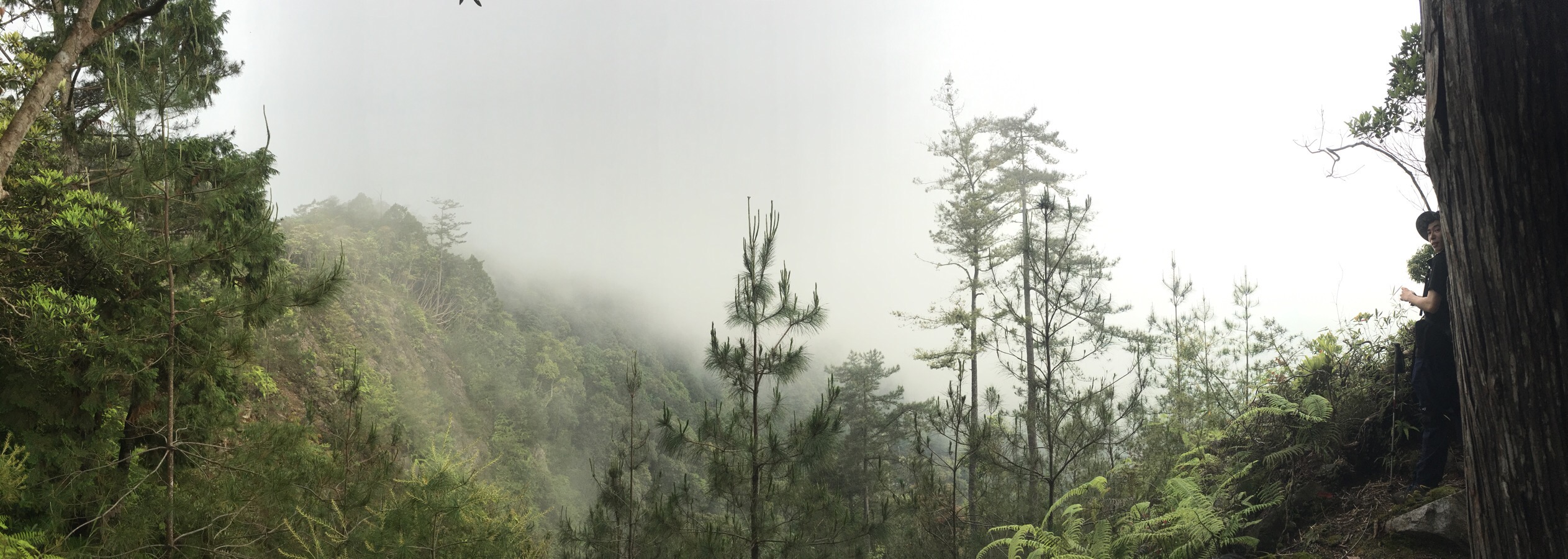
At the hour mark we reached a flatter clearing with views up the valley looking towards Ku-Kuan.
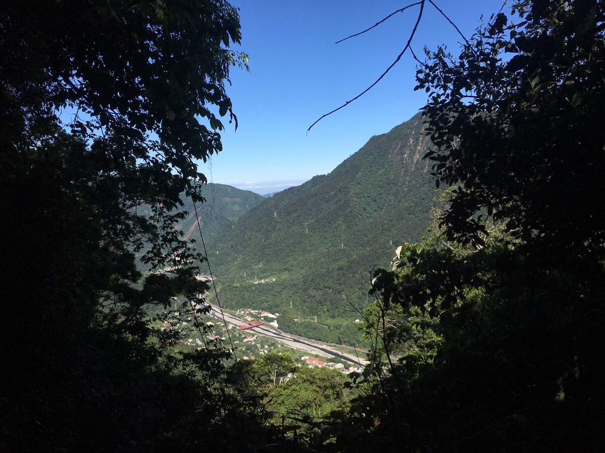
As we climbed there were a few spots where we got glimpses of the valley below – this red bridge was where we drove to get to the trail head. It was just up, up, up, mostly steep but not too hard underfoot. The tougher places had ropes to help pull yourself up.
After three hours of walking we met the first and only junction before ba xian shan – the left hand path goes down towards Ku-Kuan so we ignored that and went up and right. We had fallen behind most of the group by this point, Teresa’s dodgy nose made it tough for her to get enough air in but the group trailer was calm, patient and encouraging. We stopped for M&Ms and then pressed on.
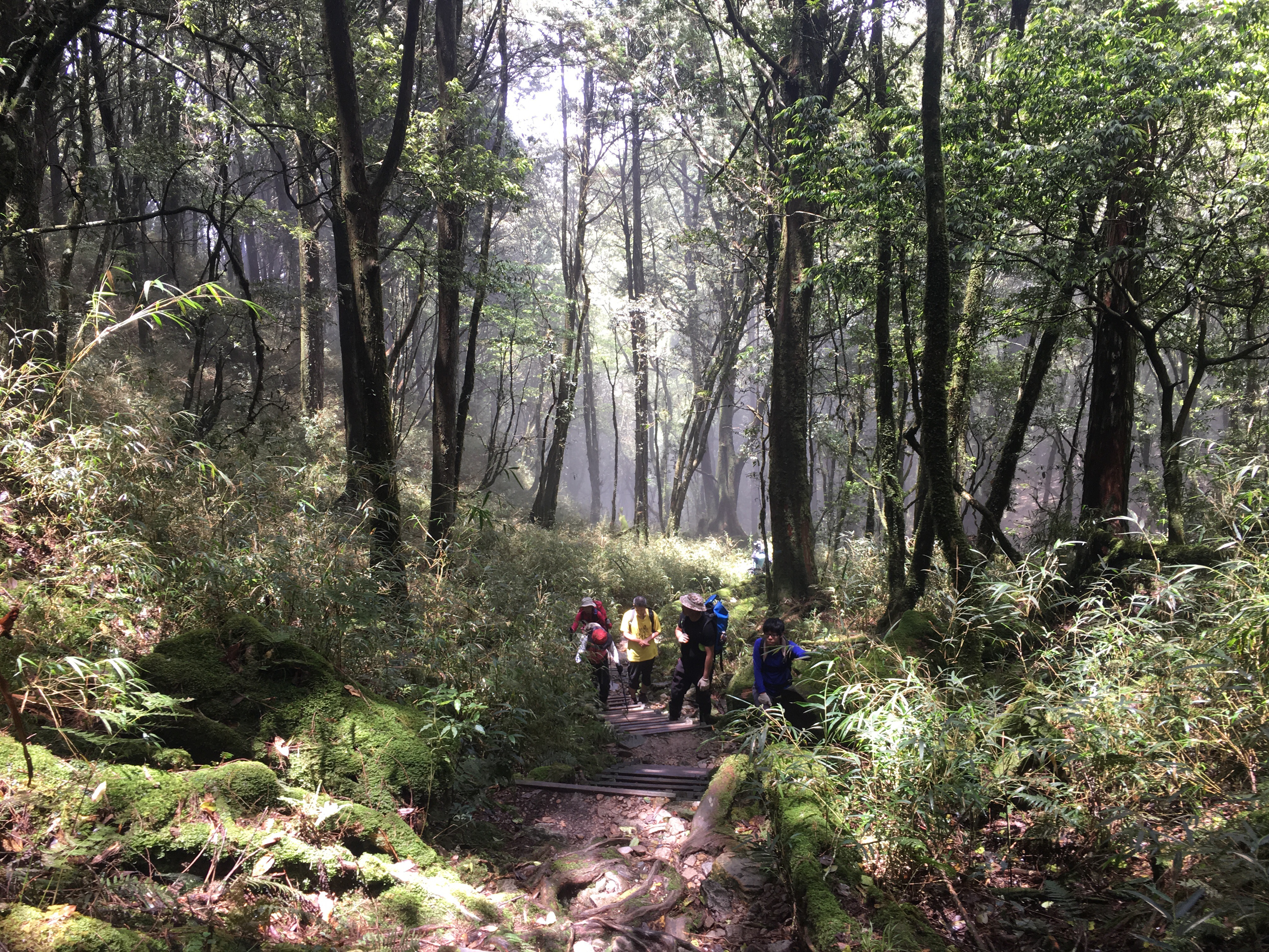
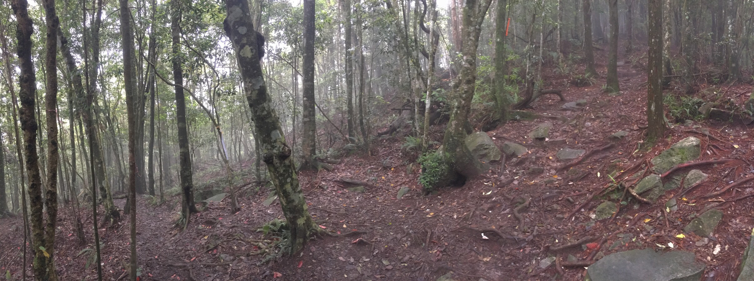
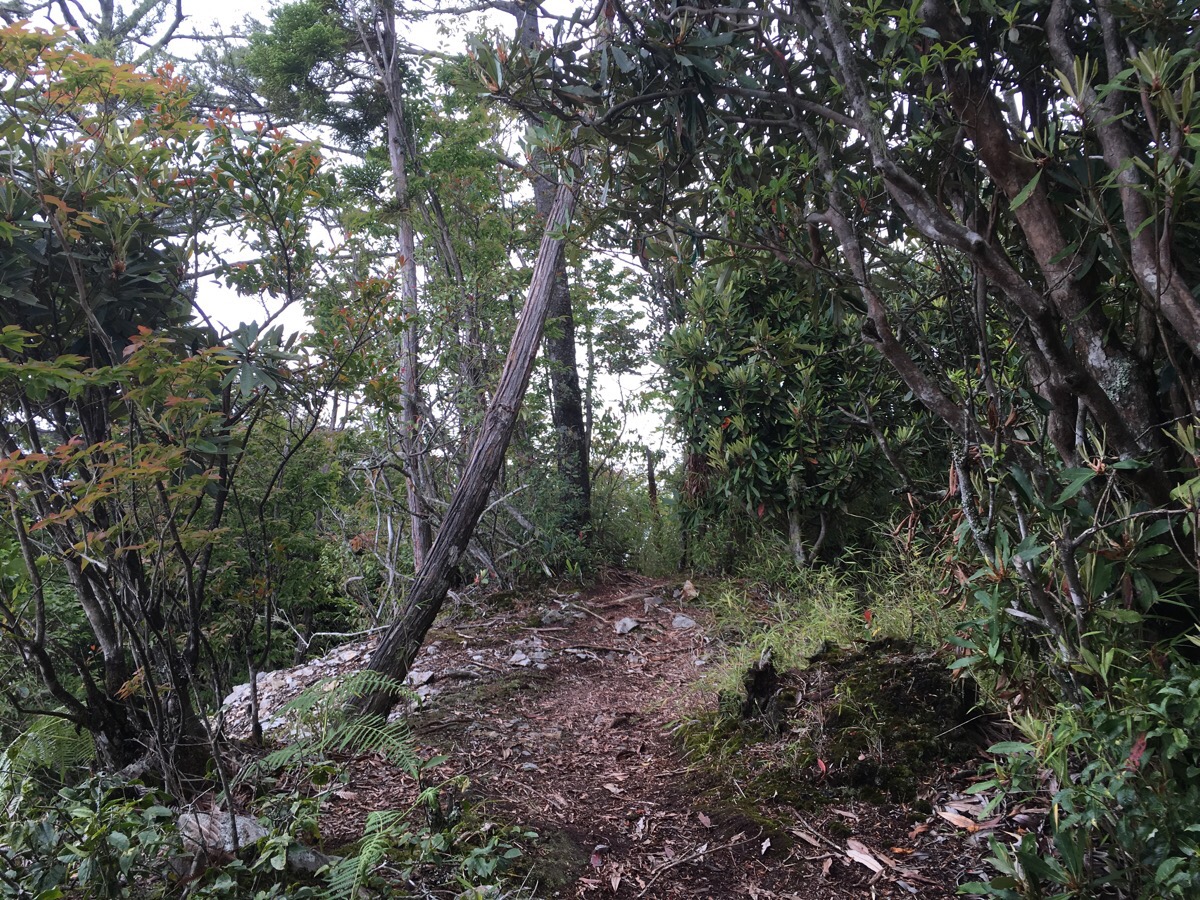
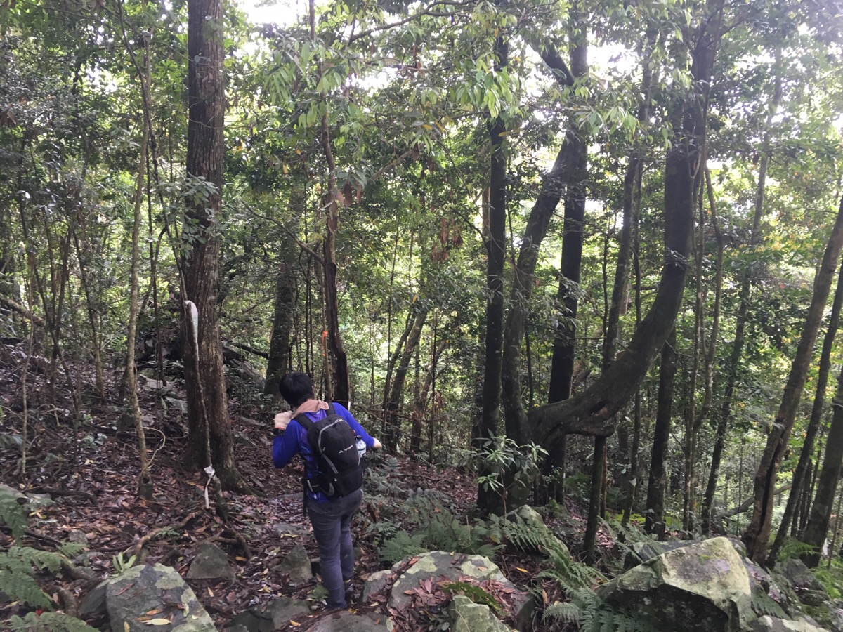
As with most climbs which go up a fair way, we passed different levels of forest, the dense foliage of the lower levels became something else, skinny-limbed trees with higher canopies.
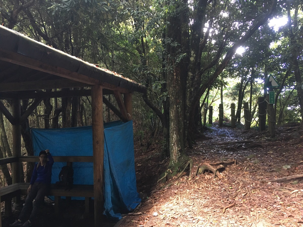
At 3.7km (three and a half hours) we reached a shelter. We found Funny and her dad resting there and were joined by a pair of older gentlemen who had a huge flask of hot tea which they offered to share with us. As we were getting ready to leave, another couple were just arriving, they caught up with us about half an hour later.
At 4.5km (four hours), after a short flat area, the path is signposted up to the right. By this point the trees had mostly become conifers and the place felt more open.
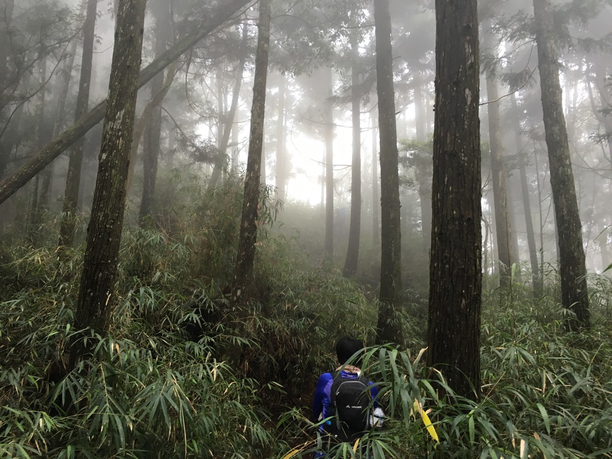
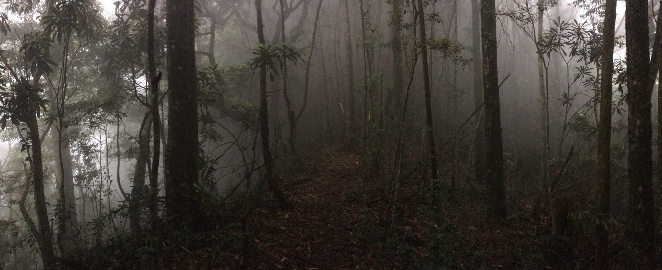
As we climbed we passed a band of small bamboo shrubs and entered the clouds. From here the woods took on that strange other-worldly feeling that you can only really get at high altitude in tall trees, the sound of speech seemed to carry for a long way, we could hear people up and down trail from us clearly and apart from that everything was hushed, muted by the pressing clouds.
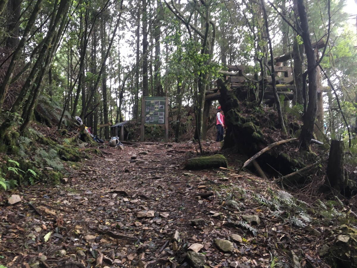
The next kilometre distance was gruelling for Teresa. We hit 5.4km at five and a quarter hours in. There we caught up with the later group who had over taken us and found a large structure which looked like it would have been the top anchor for some type of pulley system for transporting logs down the mountain. There were a couple of signs here, one outlining ‘the operation flow path of timberland’ and the other explaining ‘the histories of Pa-Hsien-shan timberland’ – (because nowhere has just one spelling). I couldn’t read it but as with most things here, it’s worth persevering by asking some people and checking online as the natural places in Taiwan tell the history more plainly, more elegantly than the urban areas where earthquakes and renewal clear away signs of the past.
Prior to 1911, 八仙山 (which translates as the eight immortals), was known by it local name 八千山, (eight thousand mountain), because it is about 8,000ft high. Somewhere around 1914-16 the area was surveyed by the Japanese government to measure the trees in the area with a view to logging – specifically Chinese hemlock, Taiwan fir and cypress trees. They wasted no time in setting up a forest railway connecting the 八仙山 area with Fengyuan and as logging commenced, the area became full of loggers and their families as well as all the services and amenities that such a community needed. Logging operations here were massive, among the largest scale in the country (along with Alishan and Taiping mountain), and logging in the area continued even after the restoration of Taiwan – as we walked up there were signs of these later operations, ceramic things that looked like they might once have had rope running over them, one or two broken on the floor but mostly still on the trees, some half consumed by growth. From the 1980s onwards, the logging finally ceased and the forest was established as a tourist and recreational area. Even after so many years of logging, this landscape is breathtaking, but I can’t help but wish I could stand still with my eyes closed for a minute then open them to find myself transported back to see the forest of 100 years ago, before us insatiable humans swept in an carved up the oldest of trees for our wants.
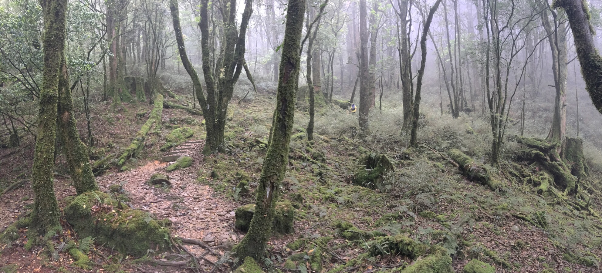
This photo is like one of those trick pictures – at first glance it seems like just a perfectly nice woodland area. But look closer, spot the hiker just right and up of centre wearing a yellow t-shirt. When you see him you’ll get some idea of the scale of this landscape. It is huge and its magnificent. The trees are personalities, one giant, magestic dame stood at the elbow of the path, commandeering a wide patch of ground to shed her leaves on. Moss shrouds the carcasses and stumps of the fallen – catching the clouds and providing water for life on the forest floor. This type of place elicits in me a longing, a pining, a true sense of awe, like I am already missing it when I am still there. I want my eyes to open wider, or my brain to find a better way to remember, as if I need to see it the same way I need to drink water after extreme exhertion.
This stretch between the log transporting system and 八仙 peak was my favourite, the clouds and sun wandered amongst the trees and it had the same sense of hush and splendour as a cathedral.
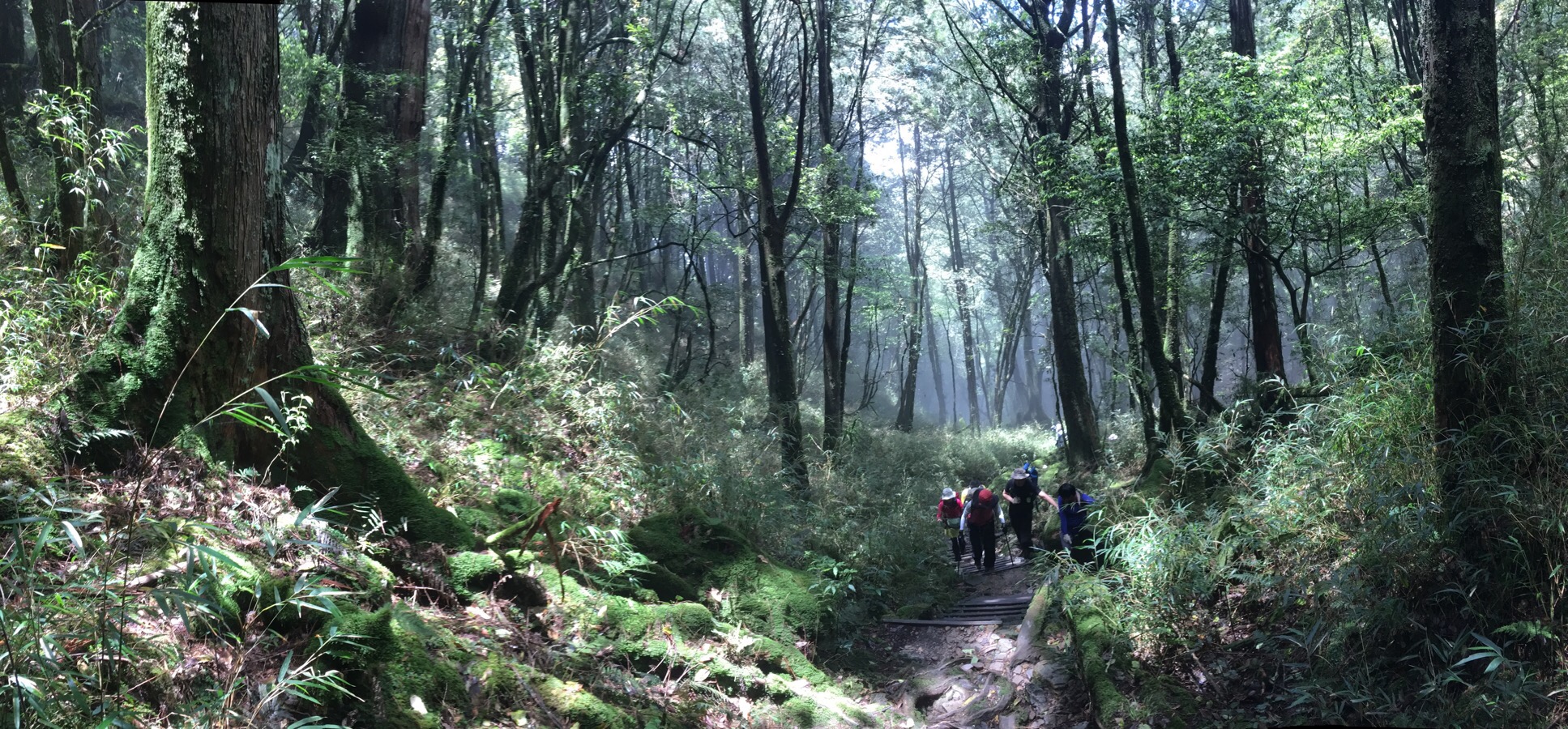
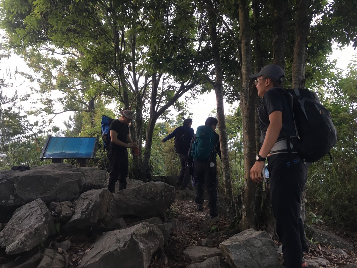
We arrived at the top of 八仙山 at about 12:40 – it had taken nearly five hours to walk 6km. The rest of the group cheered as we broke through the tree line and it really felt lovely to be with other people. They’d already been there at least half an hour and were well rested, fed and ready to go but they hung around to make sure we ate and to work out if we were going to continue or go back the same way. The three slowest members in the group didn’t have headlights so there was a bit of calculating about which way would get us back quickest. In the end it was decided that we’d come so far already that it would be silly to turn back and there were enough people in the group to make sure that we’d have enough light. This decision meant that we only had about ten minutes to refuel, but luckily (as we found out later), it was a good call on behalf of the other, more experienced hikers.
The path heads down to the left of the clearing, next to the sign with the elevation and mountain name on it. Aparently there is another trail that goes down maybe behind the shelter but I didn’t see it. The first hour or so of the downward stretch had a lot more variation in the forna on show.
Although in fact it wasn’t really a downwards stretch as for a while, the path dipped and climbed, occasionally breaking out onto small rocky peaks where we could catch sight of the valley to our left.
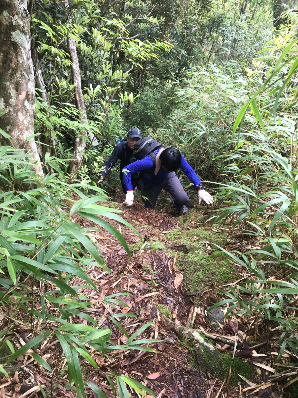
Once the real descent had started, Teresa and I found ourselves gravitating more towards the middle of the group, there were a few member who had knee issues so they had to take it a little slower. When I hiked in Hong Kong, I noticed that all the groups had walkie-talkies, the front and rear members of the group’s would keep in touch this way. In Taiwan they employ a different method: shouting. Being in the middle meant that we were the connection between the front and the rear, the volume and sound quality of the shouts letting us know just how far in front or behind they all were. The downs were steep and about as relentless as the up had been, luckily the change in terrain was accompanied by a change in vegetation and the rhodedendrons came to our recscue, they covered the slope with their skinny-but-strong trunks and we made much use of them.
For a strange 45 minutes we entered a murky twilight zone where the shade of the mountain brought an artificial a dusk down around us, gloomy and hushed. It was only about 2pm but it felt more like 6.
At 2:45pm we crested a small hill to find a cloud-cloaked view of our next peak. Looking at the distances, we guessed that it would take about half an hour to get there, but in the end it was closer to 15 minutes.
Beyond the peak, the downs continued apace – the ground all tangled roots and springy leaf litter treacherously covering holes. There were one or two patches where small jagged boulders replaced the tree roots, but either way we had to keep our concentration firmly on our feet to avoid slipping. Even then we went down a few times – Teresa scored a cracking bruise on her behind – I think almost everyone had a few missteps.
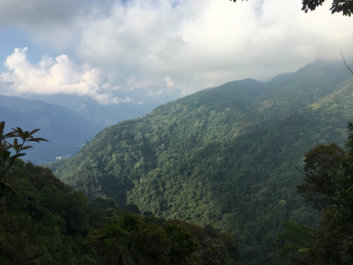
At the last open point before we reached the final peak of 唐麻單山 (tang ma dan shan), we were treated to a partial vote of where we’d come from – the shape of the valley and the down press of the clouds hiding both extremities. It doesn’t look all that tough from here…
At some point we passed a turning on the right which must have gone down to butterfly falls but I didn’t see it and at 5:30pm – only a little later than expected – we made it to 唐麻單山. With the light fading and bodies tiring, we didn’t hang around long and promptly started on the final 2.5km.
It took us about an hour and 20 minutes to get down from 唐麻單山, (the first group to arrive made it in just over an hour), and most of that time was spent in silence, my body exhausted and all remaining mental energy focused on finding a safe place to put my feet in the growing dark. Markers counted down: 2.5km, 2km, 1.5km, the number on the 1km marker had rotted away and by 0.5km it had got too dark to notice. We started being able to hear the sound of the river and see the glow of the streetlights through the trees.
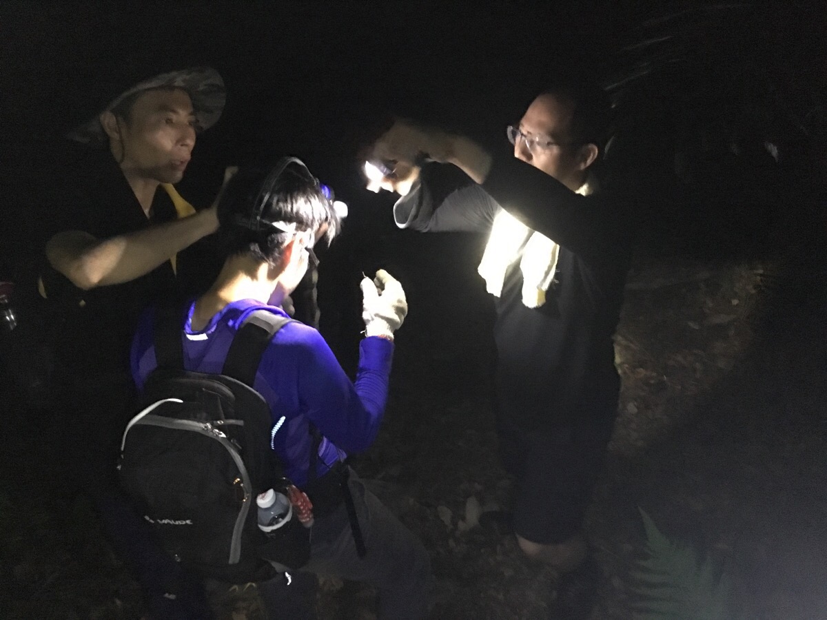
For the last 20 minutes we needed lights to see where we were going, the dark had closed in around us, emphasising the sounds of the forest. We had hand-held torches until one of the early finishers bounded back up the trail with spare head torches. From there it was just another five minutes down, the voices of the others providing a goal. The trail spat us out onto a single-line road and we joined the rest in sprawling across the tarmac with our shoes off. Normally when we hike alone there’s no waiting around at the end for other people, so it took me a while to settle in to the waiting but after stretching out my muscles it was a delight to lay down and look up at the sky framed through trees to see the stars. Everyone had turned their lights off so the only illumination came from phone screens, cigarettes (the majority of the group were smokers – I’ve no idea how their lungs were up to the job of hiking and smoking) and the occasional firefly out on patrol. We waited over an hour for the final team – they were going slow as a result of an injury and that in turn meant that they had more ground to cover in the dark which slowed them further. By the time they arrived, the drivers who had parked nearby had already retrieved their cars ready to ferry everyone back to the start. When we got back to the car, Teresa and I wasted no time in changing our clothes (even if we were still dirty underneath), and setting off to find food and start the journey home.
How to get to Mount Baxian
Google maps address: trailhead parking Taichung City, Heping District, 博愛里, we managed to fit quite a large number of cars here. And trail exit parking near 424, Taichung City, Heping District, 裡冷林道
GPS address: trail head – N24 10.689 E120 59.065 and then trail exit point – N24 09.884 E120 57.446
Public transport: apparently it’s possible to get here using public transport, but only if you’re planning to stay overnight and make a holiday of it since you couldn’t get here early enough using public transport. The 153 bus towards Guguan Station goes from a few places in Taichung City (it seems to depart every 60 minutes from Taichung high speed rail station). This is the website for this bus route which might help in timings and the like.
My new words learnt on this hike were:
- 價值 / jiāzhí / add value – is in I want to add value to my easy card – I think this can also be expressed as 增值 / zēng zhí but for what should be a simple concept I’m finding it quite hard to work this one out.
- 部落 / bùluò / tribe – the area around where we hiked maintains strong connections to Taiwan’s tribal history.
- 真愛 / zhēnài / true love – the joker of the group referred to me as his 真愛, much to my embarrassment and everyone else’s amusement.
- 膽小 / dǎn xiǎo / cowardly – one of the group members sneezed which caused me to jump which in turn caused him to call me cowardly. Cowardly can also be combined with ‘ghost’ to form a mild insult in the same way that greedy and crying can, now I know at least three ghost types: 愛哭鬼, 貪吃鬼, 膽小鬼, I think cry baby, greedy pig and scaredy cat would be close English synonyms.
- 爆走 / bàozǒu / to shoot out or move quickly away from a standing start as if propelled by explosive force, literally ‘explode away’. Although it sounds weird, this is one of those hybrid words that gets a little easier to understand once you have some idea of how new concepts are formed in Chinese by combining words. The first character 爆, means explode whilst the second 走, means go or away, combined this gives you a verb indicating both direction and quality of movement.
- 冷静 / lěngjìng / calm
- 胡說八道 / húshuō bādào / nonsense or rubbish – I can’t really unpick where the meaning of this comes from by understanding the individual characters, but it’s used as an interjection, the same way that the English translations would be and also (maybe) in the sentence you’re talking 胡說八道.
- 螢火蟲 / yínghuǒchóng / firefly
- 封閉 / fēngbì / of a person, closed – (actually I’m not sure if this applies to other things or if it’s only used to describe people), I heard it in the sentence 這個人很封閉 which can be translated as something like this person finds it hard to open up/let others in. More sad than bad.
- 腫起來 / zhǒng qǐlái / swollen or swell up depending on the usage, I love these constructions in Chinese – even if you’ve never heard them before, as long as you have some sense of the first verb you can generally understand them. I also encountered the phrase 拉起來 / lā qǐlái / pull up on this walk because I pulled Teresa up some sections. I think the ones I’ve learnt so far seem much more logical than their English counterparts and there’s just something about them that I find funny.
- 水泡 / shuǐpào / blister – actually I think I may have learnt this before and it slipped from memory.
- ah niao wei / oh my God – this is a Taiwanese phrase which means that it is harder to get the right written representation – this was said many times as we sat at the end of the walk, I was too tired to work out why though.
- 掰咖 / bāi kā / lame or crippled – again this is a Taiwanese phrase so the written version is a bit odd, it translates as breaking the coffee, the Mandarin version would be 跛腳 / bǒjiǎo – technically I didn’t learnt this whilst walking but in the days after as a consequence of the walk. My legs really suffered which caused Teresa much mirth, she repeatedly called me 掰咖 whenever I struggled.

Wow! Those huge trees!
LikeLike
They truly are, the photos really don’t do justice to the scale of it.
LikeLiked by 1 person
Is it possible to get to this hike on public transportation??
LikeLike
It’s definitely doable but it would be impossible as a day hike on public transportation. You could get there and back using local bus routes since it’s very near a popular hotspring destination. If you do, you’d have to find somewhere to stay or camp close to the trailhead, (in fact I’m pretty sure the house right next to the trail head was a B&B – it is I just checked, the name is 松鶴的家 and there are a couple of places in the nearby village). When we came down we also saw some people camping in a lay-by ready to get up and do it early the next day.
LikeLike
Oh thank you so much for the information!! 🙂 I love hiking and live in Fengyuan. Always looking for a good hike!
LikeLike
You’re welcome! Let me know if you manage to get around to it. I’m hoping to get another big hike done next month, it’s been too long!
LikeLike
Okay, is the weather good to go whenever? I was thinking about attempting it in like three weeks!
LikeLike
We went three days after heavy rain and it was no problem but I wouldn’t want to do it when it was raining. Also, we bought headlamps as a consequence of this walk – we walked the last twenty minutes in the dark.
LikeLike
Good to know, thank you!
LikeLike
Did this route as a two day hike over Chinese New Year holiday. First day arrived at SongHe village at about mid-day and spent the first night at the lower hut. Saw a pine marten there at dusk. Next day up to the peak and then hiked down past TangMaDanShan enjoying intermittent views before stopping at the hut. Just a few small groups on both days. Perfect clear skies, so slept on the ground. The hut surface was too rocky! Third day down to the road. So, I’m writing to express my surprise that your team did it in one day! Maybe it’s time for you to up your game and do bigger peaks!
LikeLike
Wow, you saw a pine marten! That is awesome, they are really cute and shy creatures, so you’re very lucky to have had that opportunity. And thanks for telling me about your experience on this hike, it’s lovely to hear about other people who have done the same walks. Aren’t the trees here just amazing? I was so in awe of the hugeness of the forest.
As for us being able to do it in one day, I think it was only because we were in a group, honestly I don’t think the two of us (most of the walks here are just me and my partner), would have been able to do it if there weren’t other people pushing us on. It’s the toughest walk we’ve done so far in terms of distance, elevation gain and time spent on the trip. Personally I think I would have enjoyed it a little more if we’d tackled it as you did split over two days.
LikeLike