Search for Taichung hikes by level of difficulty:
See all hikes in Taichung County. Walks listed with the most recent at the top.
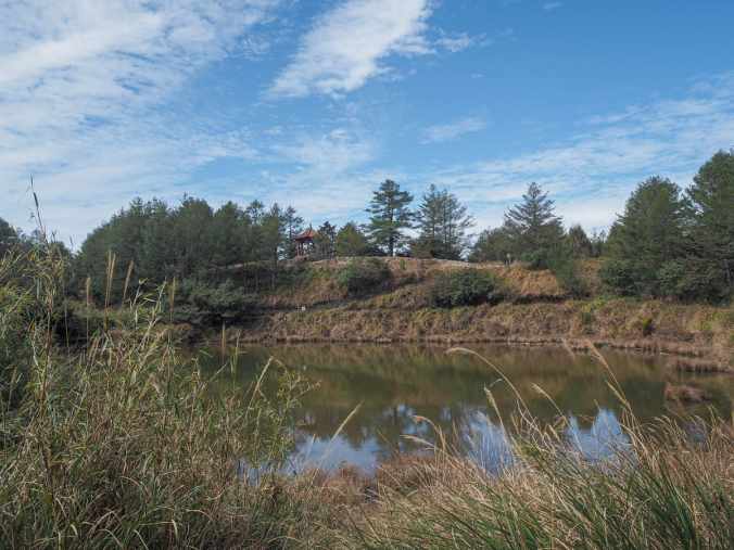
DAKENG TRAIL 4 & MOUNT TOUKE (大坑四號登山步道)
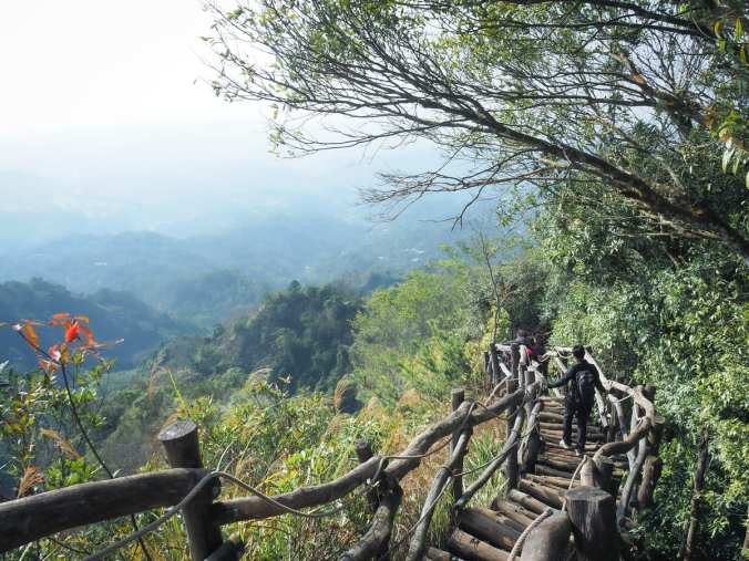 This picturesque trail in Taichung’s Beitun District is a unique Taiwan hiking experience — an undulating log path leads up to some great views.
SHUANGQI AMBUPING TRAIL (雙崎埋伏坪步道)
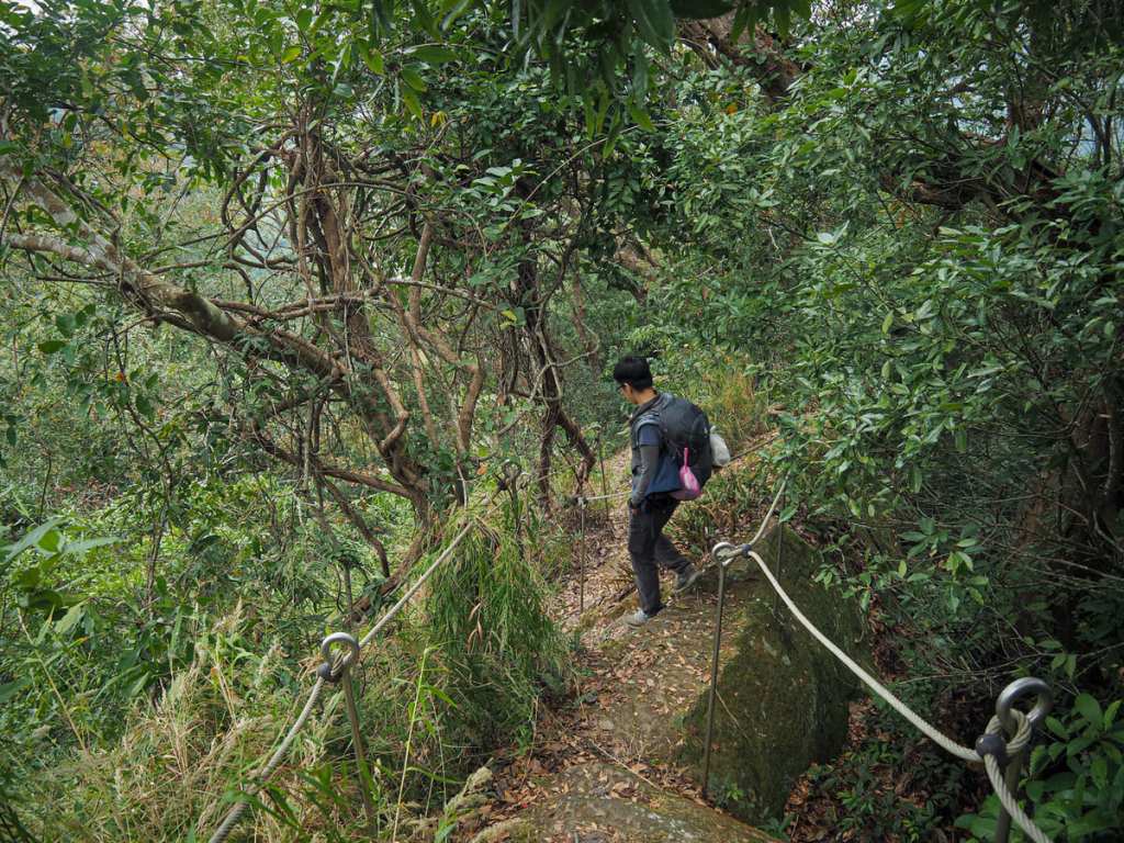 Ambuping Hiking Trail is a short loop in the lower elevation part of Taichung’s Heping District. The trail encircles the Tayal tribal village of Shuangqi and takes in one peak, a section of ridgeline, and the remains of an old irrigation canal.
XUESHAN SACRED TREE TRAIL (雪山神木)
Xueshan sacred tree is a giant tree is a century-old giant Formosan cypress that sits deep within Daxueshan National Park. It stands in a small clearing, accessible via a 1.5-kilometre stroll down an old track, and — thanks to the fact that there used to be a carpark down here — you can stand back and take in the whole tree.
MUMA HISTORIC TRAIL (木馬古道)
 Muma Historic Trail is one of several hiking trails located within the bounds of Daxueshan National Forest Recreation Area. Being neither the longest, nor the shortest, not the easiest, nor the toughest walk in the park it presents a pleasant, middle-of-the-pack hike for anyone hoping to explore the area.
XIAOXUESHAN HEAVENLY POND TRAIL (小雪山天池)
Xiaoxueshan’s Heavenly Pond is a beautiful alpine pool sitting at an elevation of over 2,000 metres within Daxueshan National Forest Recreation Area. It’s accessible via a very easy, mostly flat trail from Xiaoxueshan Visitor Information Station.
YAKOU LOOKOUT TRAIL (埡口觀景台步道)
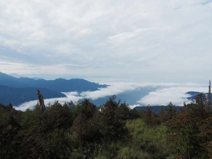 If you’re heading to Daxueshan National Forest Recreation Area and want to do a walk with views, this short hike to a panoramic lookout platform is undoubtedly the walk for you.
RAKNUS SELU TRAIL – DAY 14 (樟之細路D14)
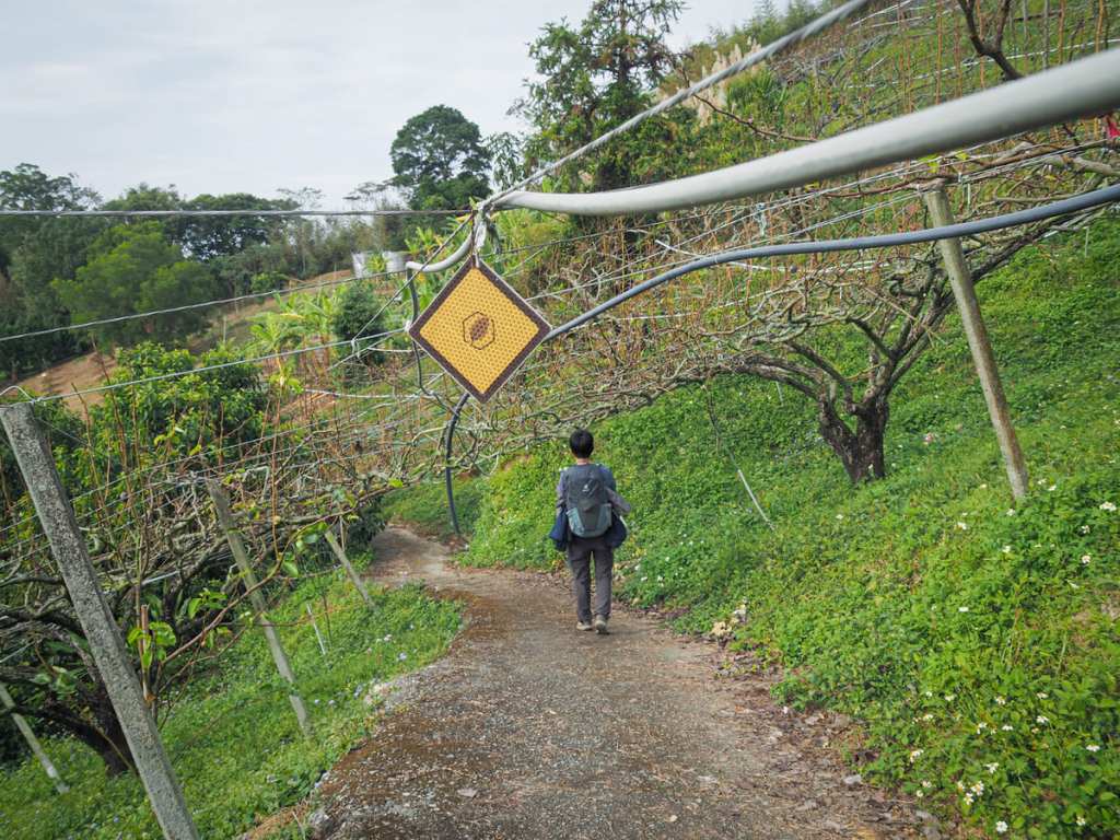 Day 14 was the final day of hiking on the Raknus Selu Trail’s main A route. We passed through many orchards and were rewarded with our first ever sighting of a pangolin.
MOUNT DAHENGPING (大橫屏山)
 This quiet ridge hike straddles the border of Taichung and Nantou Counties. In clear weather, it offers a few views, but even on hazy days, the forest scenery makes for pleasant walking.
DAKENG TRAILS 10 & 9-1
 This easy loop in Taichung’s Beitun District takes in two of Dakeng’s famous hiking trails.
DAKENG TRAILS 6 & 7 (大坑步道6+7)
 Criss-crossing the hills of Beitun District there is a network of paths for hikers to enjoy. This route encompasses two of the Dakeng trails, and takes you past temples, up steep summits and through a mountaintop adventure playground.
MOUNT WUSHIKENG & MOUNT CHUANXING LOOP (烏石坑山/船型山O型)
 This looped route takes you deep into the forests of Daxueshan National Forest Recreation Area. Tread quietly, and you might even be rewarded with a sighting of a Formosan serow.
TIEZHAN SHAN (鐵站山)
 Tiezhan Shan is an easy walk with lots in the way of random art/weirdness to distract you from the fact that it’s not much of a walk. This is one of the Minor 100 Peaks that you could bring your gran to.
SOUTH GUANYIN MOUNTAIN (南觀音山)
 This enjoyable loop trail in Taichung will take you to number 42 of Taiwan’s list of 100 Minor Peaks. It is well-known in Taiwan’s hiking circles for the odd sight of a giant golden hand at the summit.
MOUNT MAWUBUA (馬武霸山)
 Mount Mawuba sits just inside the borders of Shei-pa National Park, deep inside Taichung’s mountainous Heping District. It’s a breathtakingly beautiful walk, and best of all, it doesn’t require any permits.
MOUNT DONGMAO (東卯山)
 The fifth highest of the Guguan Seven Heroes, Mount Dongmao is a thoroughly enjoyable day hike in Taichung’s Heping District. Despite the trail’s relative ease, it doesn’t hold back on the views.
MOUNT SANTING (三汀山)
 Santing Shan is one of Taiwan’s 100 Minor Peaks, and can be reached after a short bus ride from Taichung Station.
TAI’AN HIKING TRAIL (泰安登山步道)
 Tai’an Hiking Trail is a short trail in Taichung’s northeastern Houli District. As well as the walk, you can enjoy a wander around Tai’an Railway Cultural Park, see the stunning red slopes of Huoyan Shan from a distance, and crack out your best model pose on the picturesque Da’an River Iron Bridge.
MOUNT MALUN (馬崙山)
At 2305m high, Mount Malun is the second highest among Guguan’s Seven Heroes, but despite its lofty nature, it’s not a difficult climb. The long trail climbs gently (well almost gently), through different types of forest landscape and past the remains of an old logging village.
MOUNT WU WO WEI (屋我尾山)
 At 1796m above sea level Mount Wu Wo Wei is the third highest of the Guguan Seven Heroes. There are two routes to the peak, and since this post details the harder of the two, you can expect to have the peaceful forest to yourself for most of the walk.
MOUNT POJINJIA (波津加山)
 The fourth highest of the Guguan Seven Heroes, Mount Pojinjia is a steep, but straightforward climb that rewards all of your hard work with the occasional spectacular view over distant cloud-capped peaks.
ZHI GAO ZHEN TRAIL LOOP (知高圳O型縱走)
 Zhi Gao Zhen is a small canal in Wuri that draws water from Fazi River to irrigate farms in Nantun, Wuri and Dadu. The shaded and well-paved trail stretches from Wuri to Dadu District and with the sound of the water playing as backdrop music, it is a gentle trail, perfect for a weekend stroll with the family. If you have a little more energy, you can turn it into a loop by adding a short scramble up to a low overlook with views over Changhua.
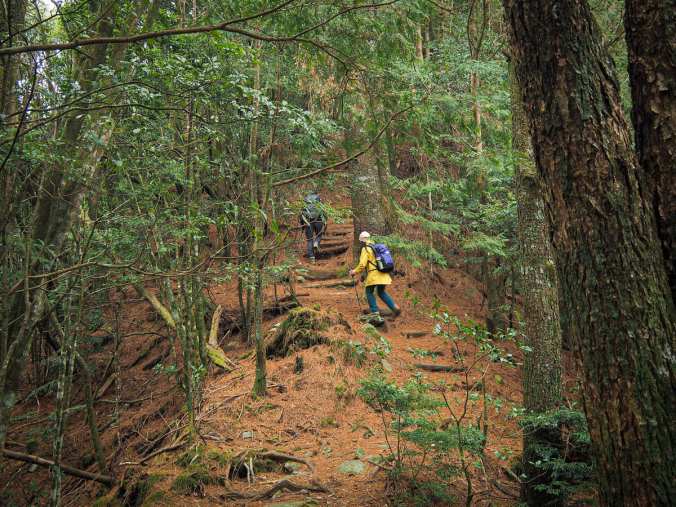
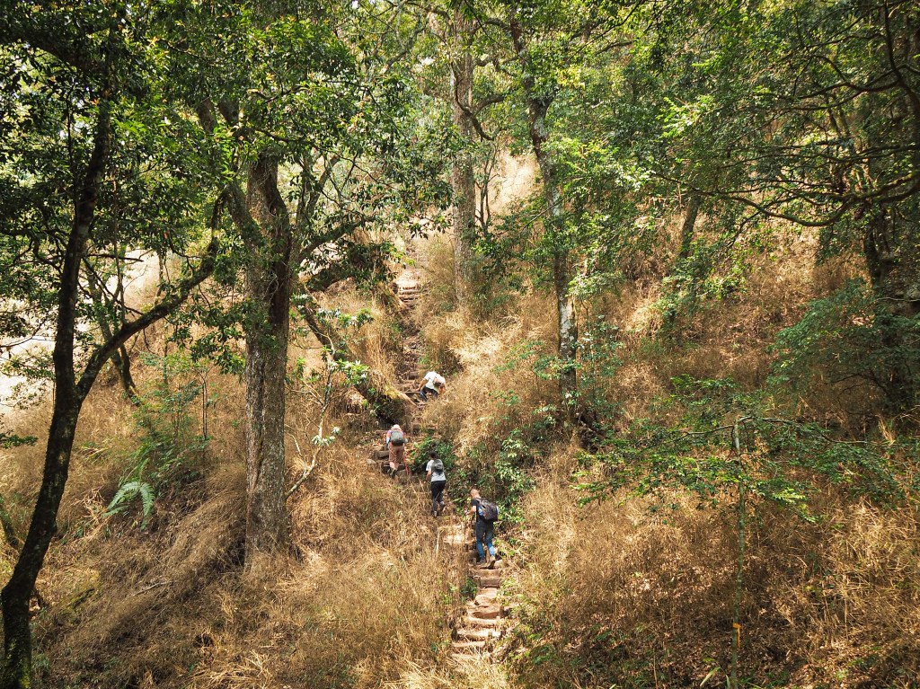
YUANZUI SHAN to SHAOLAI SHAN (鳶嘴稍來山步道)
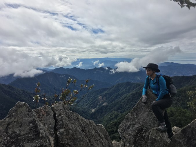
An exhilarating and energising trip up to some stupendous scenery. This walk takes in two peaks over 2000m, with stunning views from exposed ridges as well as the hushed calm of old forests.
BA XIAN SHAN TO TANG MA DA SHAN (八唐縱走)
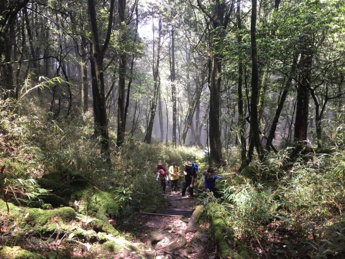
A strenuous all day-er which is guaranteed to leave you with a healthy appetite. The hard work is worth it for anyone who loves big, old forests.
