
A Wild and Watery Hike on the Pingxi Line
NOTE: Between hiking this and publishing the trail, I’ve received information that leads me to believe that the red bridge at the start is no longer crossable. With this in mind, it might be advisable to try a different route that starts by passing up through the Sandialing Waterfall Trail. I have included a link to a GPX file for this suggested route below. However, I must stress that I have not attempted to complete the hike in the configuration shown below, so please go prepared to double back/find an alternative route.
This walk is a bit of a weird one. The whole thing feels a little illicit, from crossing the railway tracks to sneaking into the abandoned Savage Valley pleasure park via a back route—it’s safe to say it’s probably not one to take the kids on (or boast about on the socials). That said, as long as you take careful precautions, this is an enjoyable excursion in a less-often visited corner of Pingxi District.
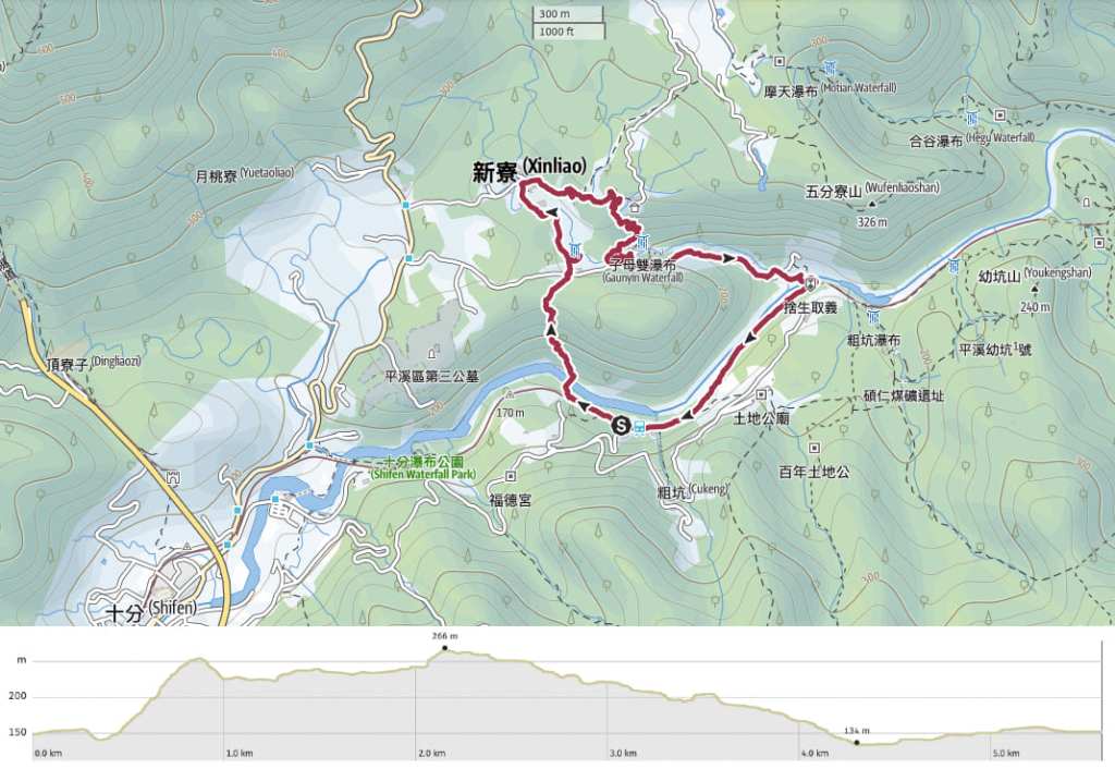
Distance: About 5.6 kilometres.
Time: 2½-3½ hours.
Difficulty (regular Taiwan hiker): 3/10 – Some steep and slippery sections, no English signage, lots of junctions.
Difficulty (new Taiwan hiker): 5/10 – I would not have enjoyed this walk as a new hiker in Taiwan. It’s not that it’s particularly challenging or dangerous, but more that I would have hated the feeling of not knowing whether or not I am actually allowed to be in a place
Total ascent: About 180 metres.
Water: We drank a little under 1L each because it was unbearably hot.
Shade: The on-trail sections were mostly nice and shady, but the road and track portions were very exposed.
Mobile network: Mobile reception was patchy on this trail.
Enjoyment: This walk offers loads of waterfalls and the thrill of being in a weird, half-forgotten place.
Other: It is very important to note that trespassing on the track is illegal and people caught trespassing can be fined (although unlike at the illegal wild hot springs in Yangmingshan, I don’t think fines are frequently handed out). I cannot and will not advise anyone to walk on the tracks. If you would rather avoid this, it is possible to cross over the tracks and take a slightly longer route to and from the station. Generally speaking, people who walk along the tracks will only do so after checking the train timetable to ensure that they won’t meet the train.
Route type: Loop
Permit: None needed
Jump to the bottom of this post for a trail map and GPX file.
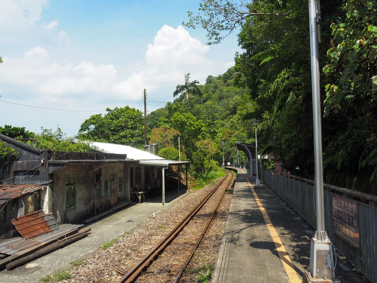
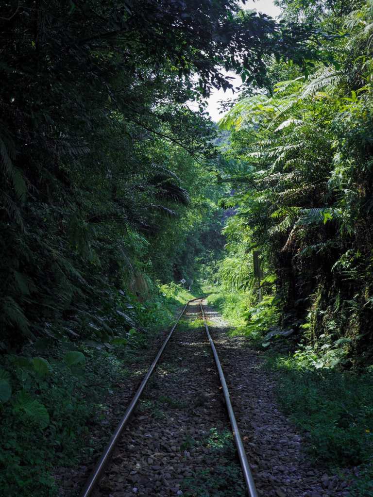
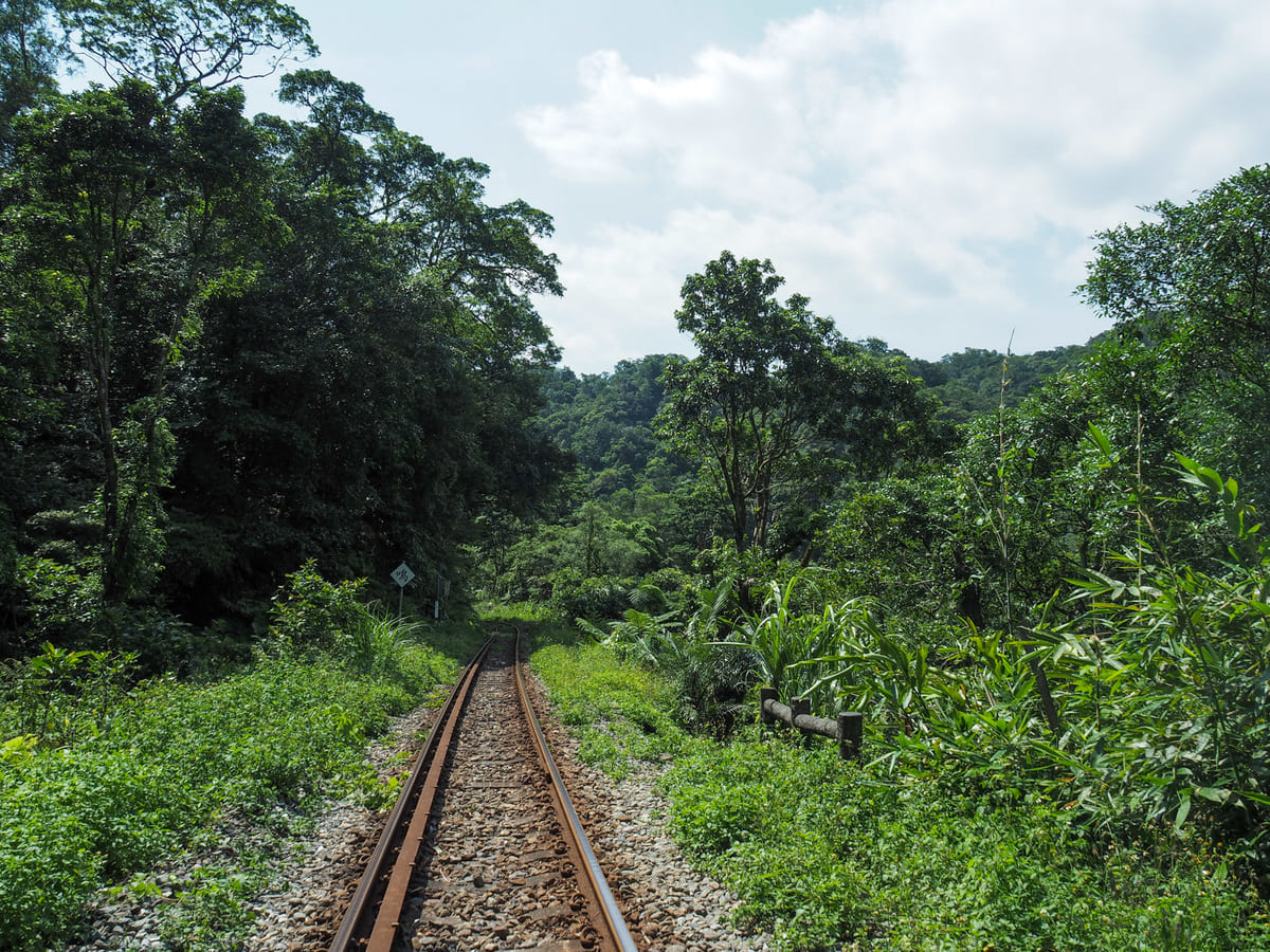
The last time I stopped at tiny, unmanned Dahua Station was many, many moons ago when I did the Sandiaoling Waterfall Trail. On that occasion, I actually ended up visiting the station twice because Teresa left her wallet there and I came back to try and retrieve it, but not before a helpful person found it and took it back to Ruifang Police Station. As we arrived, a whole troupe of orange/clad hikers were just returning from their walk. We set off walking in the direction they had come from, following the tracks in the direction of Shifen. At this point, as well as at the far end, there are longer routes which will allow you to skip most of the train tracks, but most people prefer to carefully time their trespassing to avoid any trains.
Being the generally quiet law-abiding citizen that I am, I felt anxious to be on the rails despite the fact that there was no train due for at least another half an hour. Thankfully though, this first section of track is not long, maybe 500 m or so, and I felt emboldened by the continued stream of orange-T-shirted hikers (there must have been at least eighty of them in total).
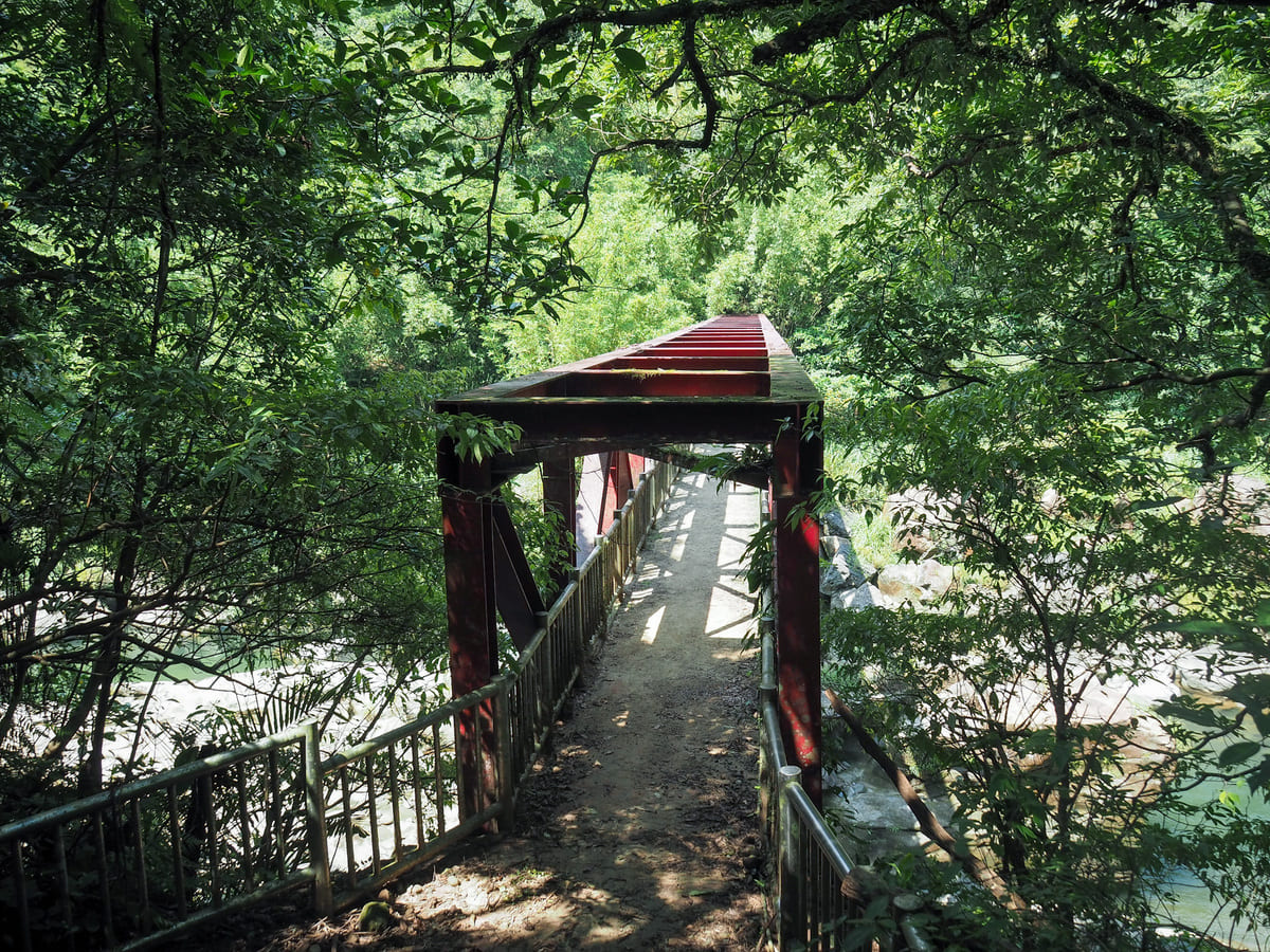
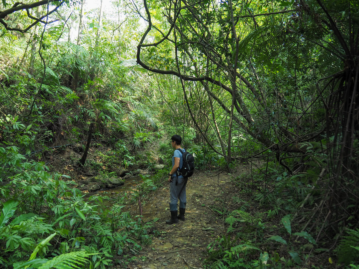
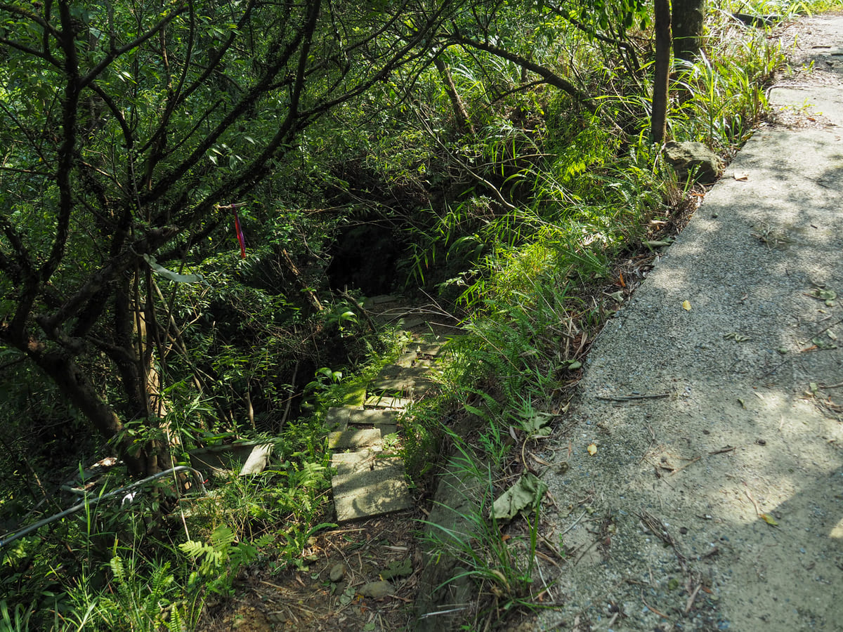
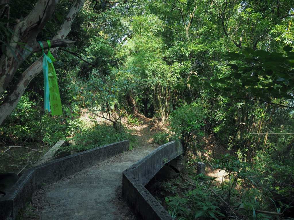
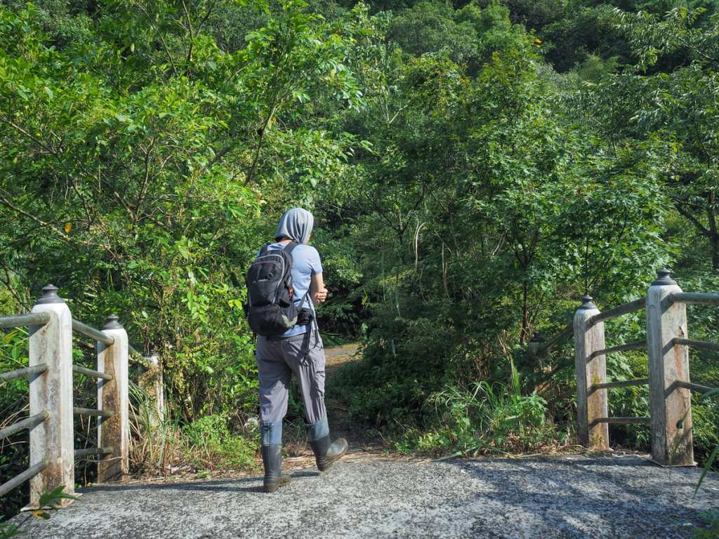
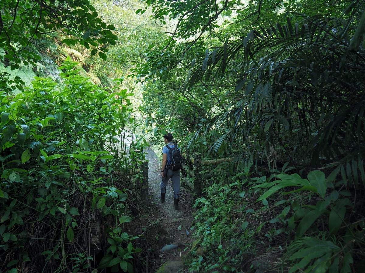
The steps down to Keelung River lead away from the left side of the track. (If you walk the longer route to avoid the rails, that joins from about 50m further up the track.) The steps take you down to an ugly red bridge over the water.
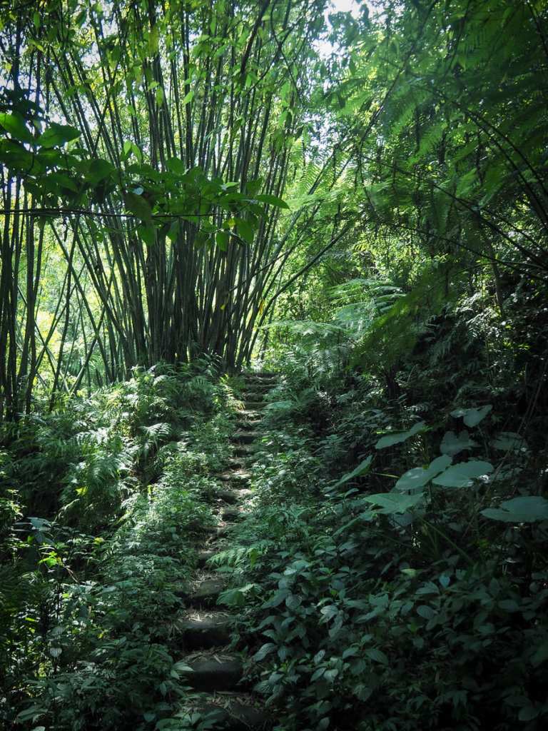
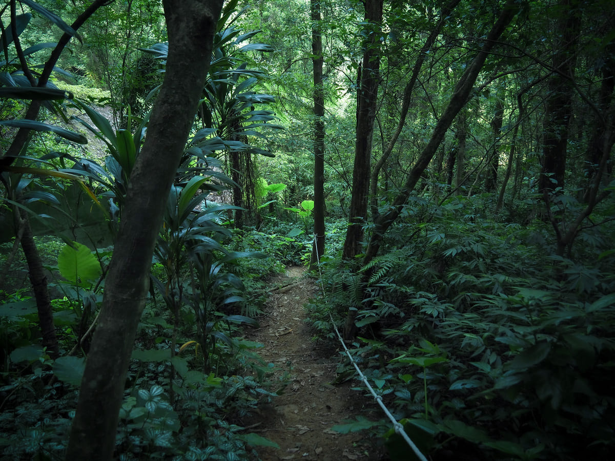
And on the far side of the river, more steps take you up through a swaying forest of tall bamboo. It looks like this whole slope was probably harvested at some point, but only sections of it are maintained now. When we passed through in August, there were many chubby, stubby and tasty-looking shoots poking out of the earth.
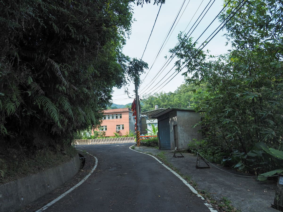
As you reach the top of the climb, you’ll enter a neatly-kept bamboo farm, then the trail starts to descend towards the old Savage Valley carpark.
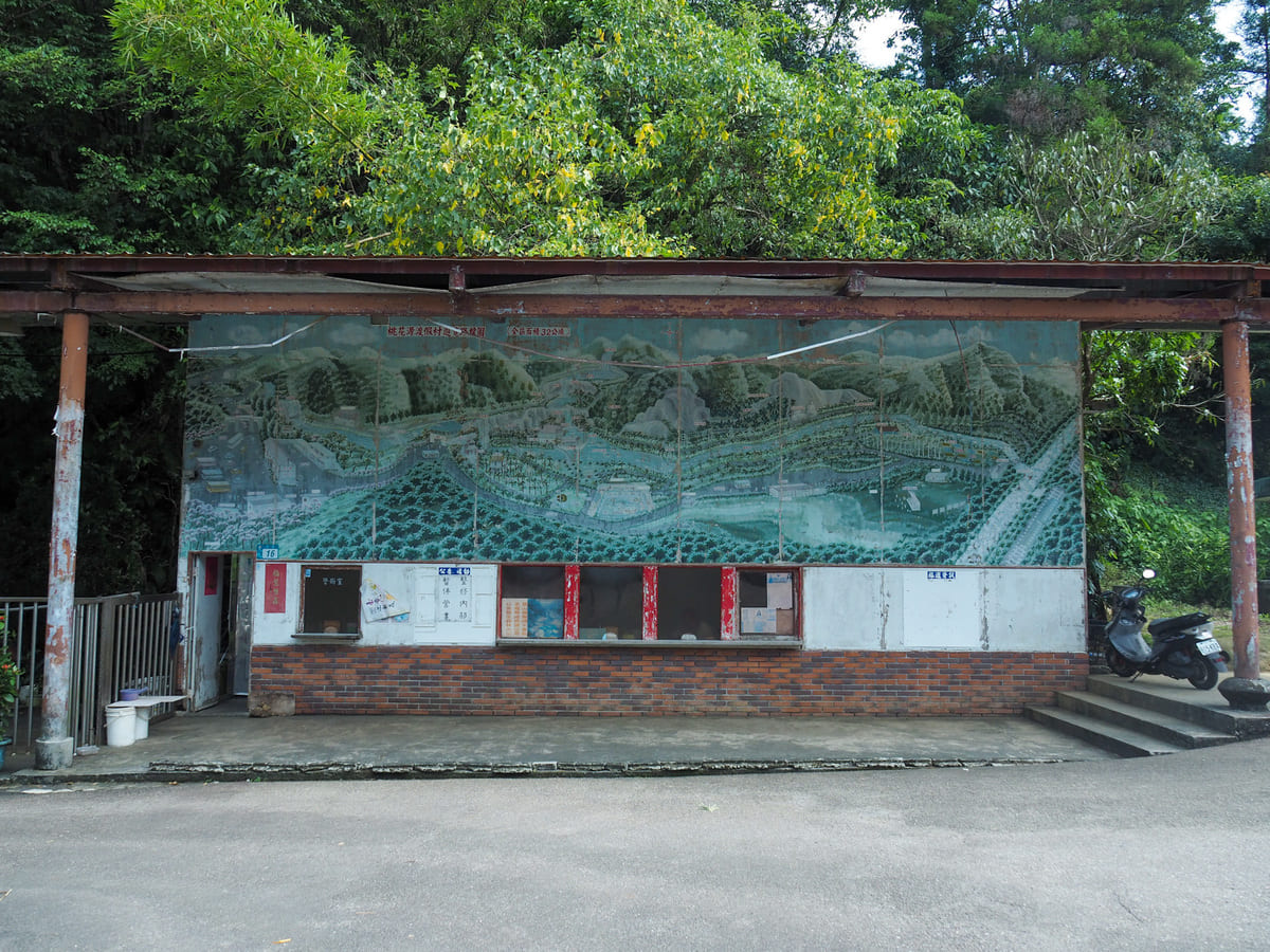
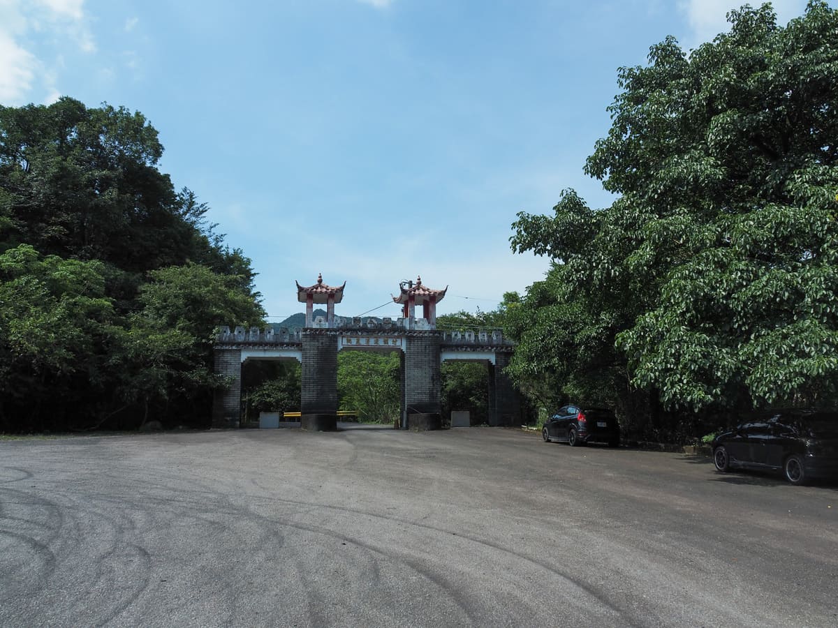
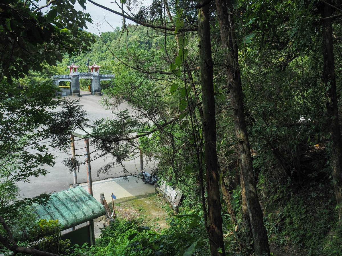
The original entrance and ticket barrier to this former resort is adorned with a large, hand-painted map of the facilities. There is still a guard stationed here to prevent access via this gate. At least, I assume that’s why he’s here. We didn’t inquire though, and since every other online description of this walk goes in and out via alternative routes, that’s what we did too. To get to that back route in, you’ll need to head straight over the carpark and through the be-turreted gates.
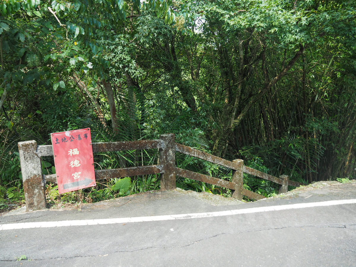
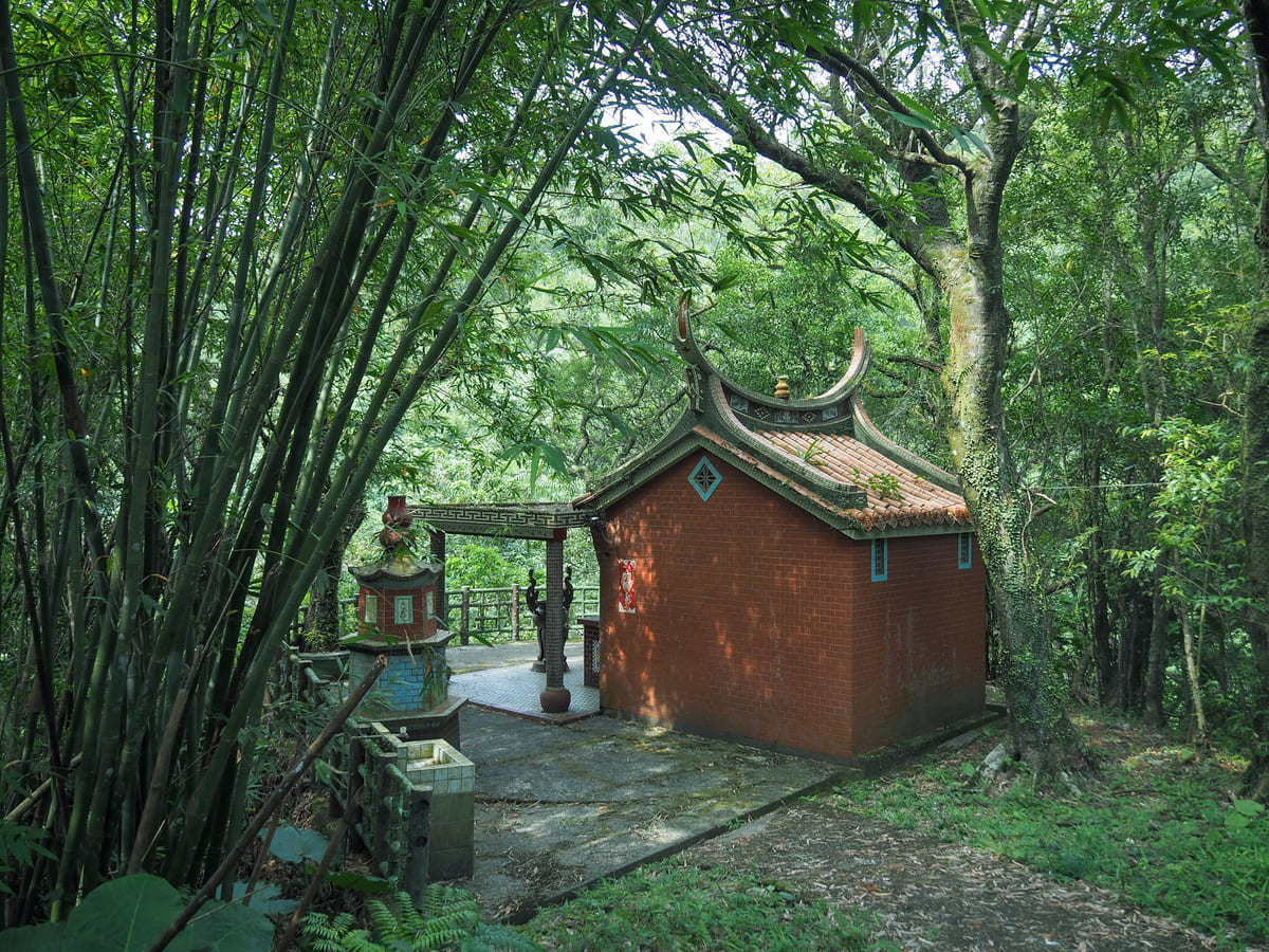
Just on the far side of the gateway, a set of steps on the right lead down a dead-end trail to a land god temple with a partially obscured view of Xinliao Waterfall (新寮瀑布). In actual fact, I think I spotted a very steep trail heading down all the way to the water, but given how hot it was, I was already feeling averse to expending any more energy than was strictly necessary.
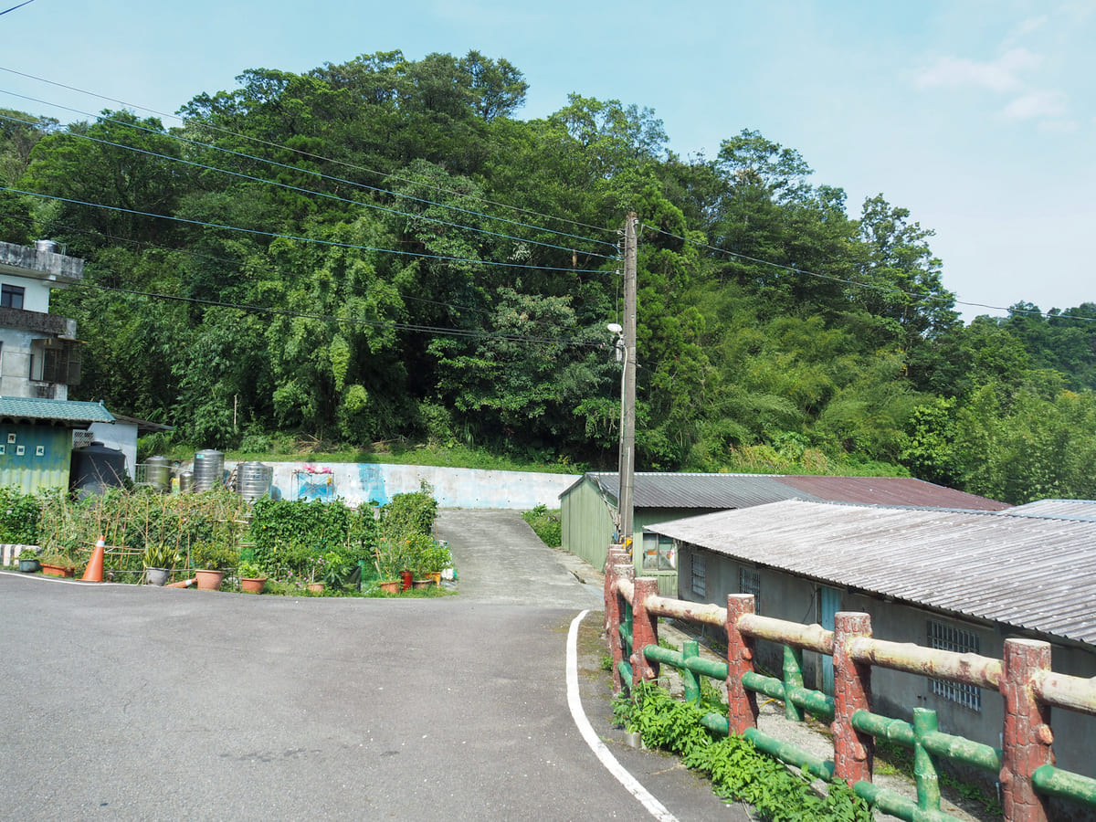
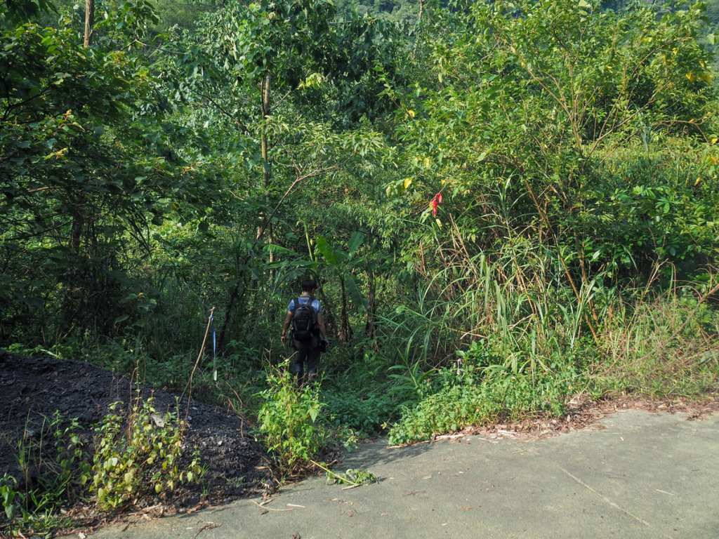
Once back on the road, we headed straight and followed it into the little hamlet of Xinliao. You’ll need to take a right at the first T-junction, then cross the stream and bear straight/right-ish until you’re following a painted wall.
At least one of the buildings is a pretty traditional stone farmhouse, and the whole hamlet makes for a peacefully bucolic scene.
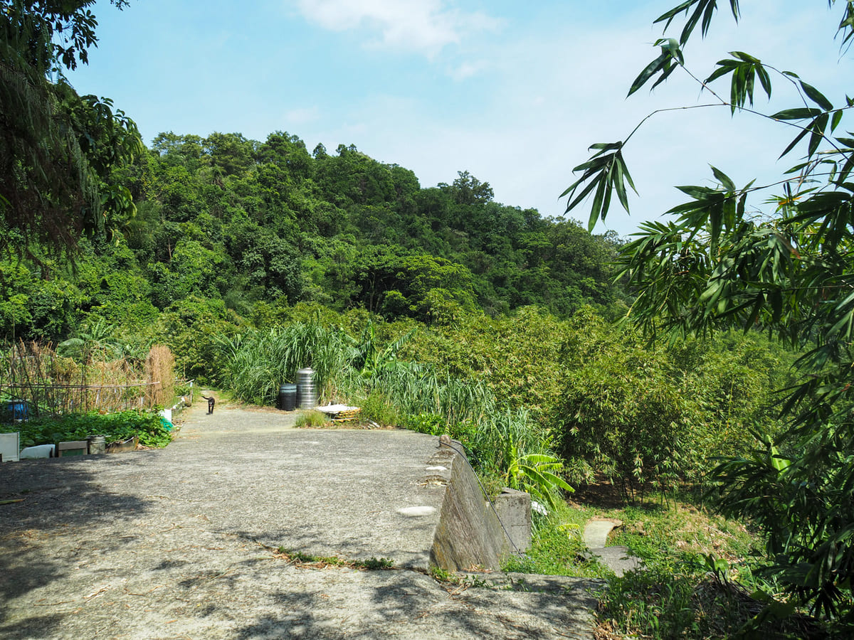
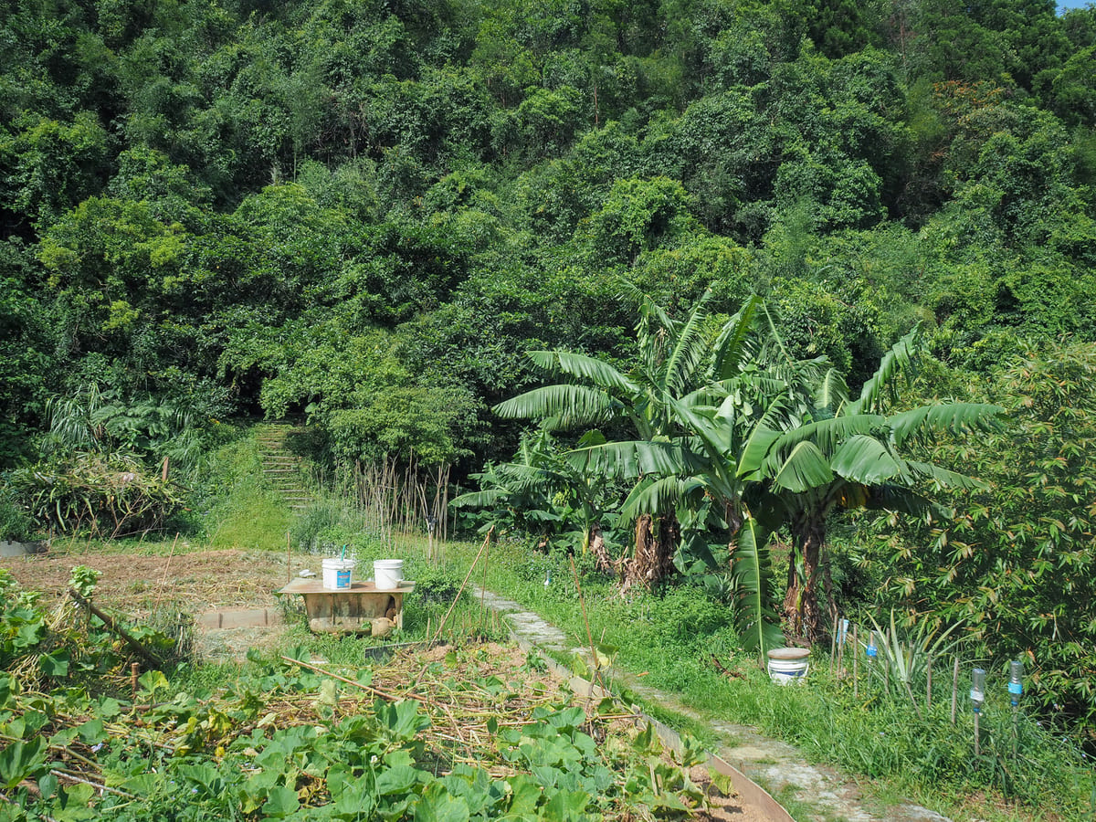
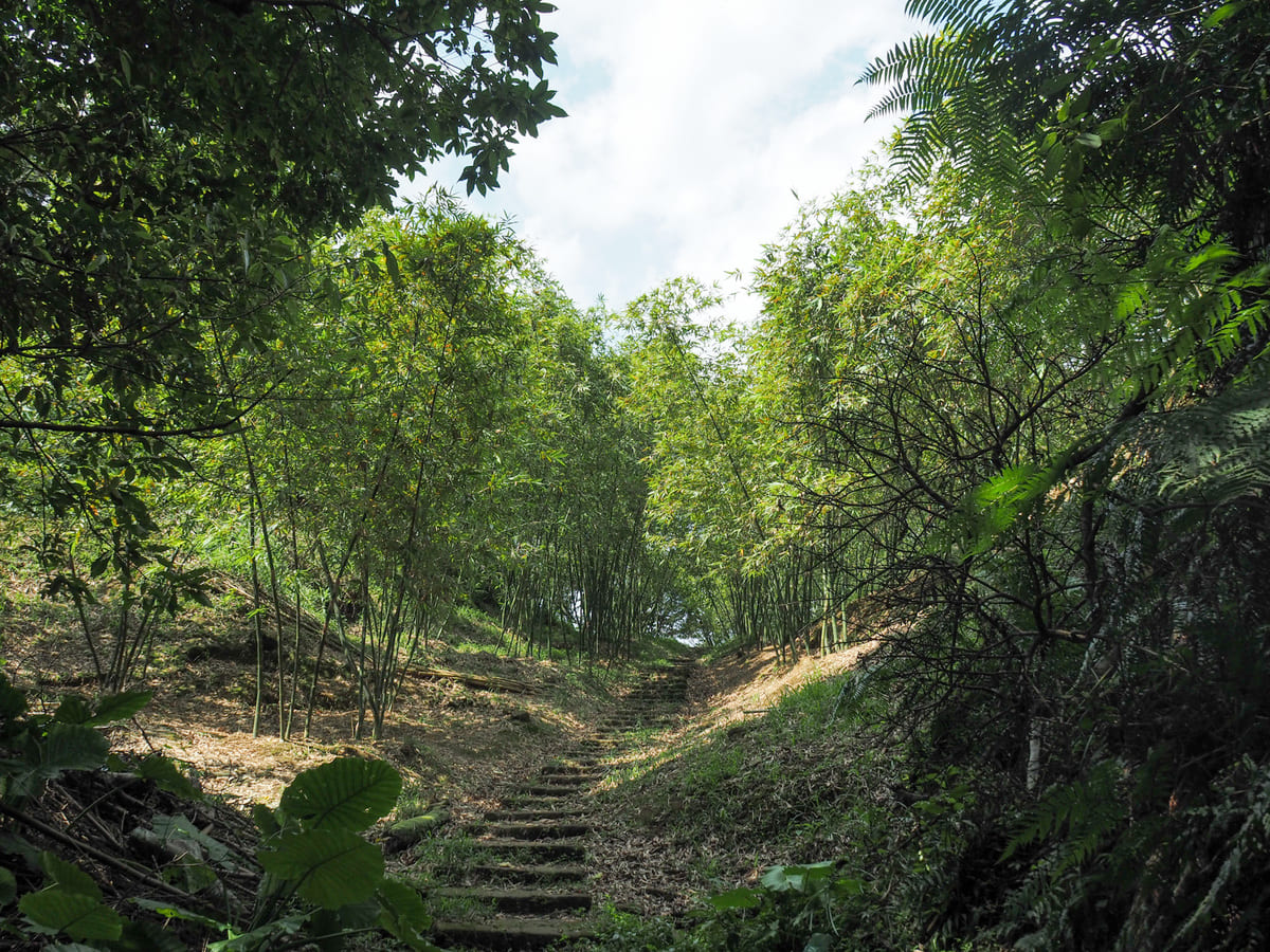
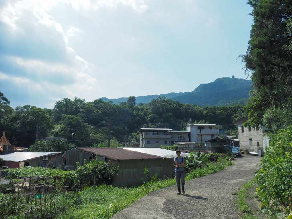
The track ends at a farm and we followed the trail through sprawling squash plants and up the steps at the far end.
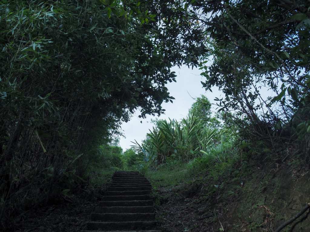
The climb, though short, was exhausting in the summer heat. At the top of the steps, take a right turn off the main trail and head along what looks like a farmer’s trail through some farmed bamboo. The presence of hiking tags should indicate that you’re on the right track.
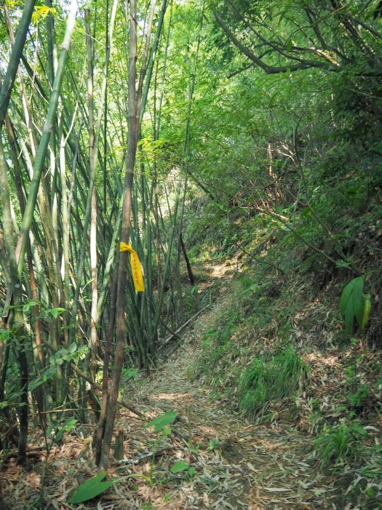
Once you’re through to the far end of the farmed area, the trail becomes clearer and easier to follow.
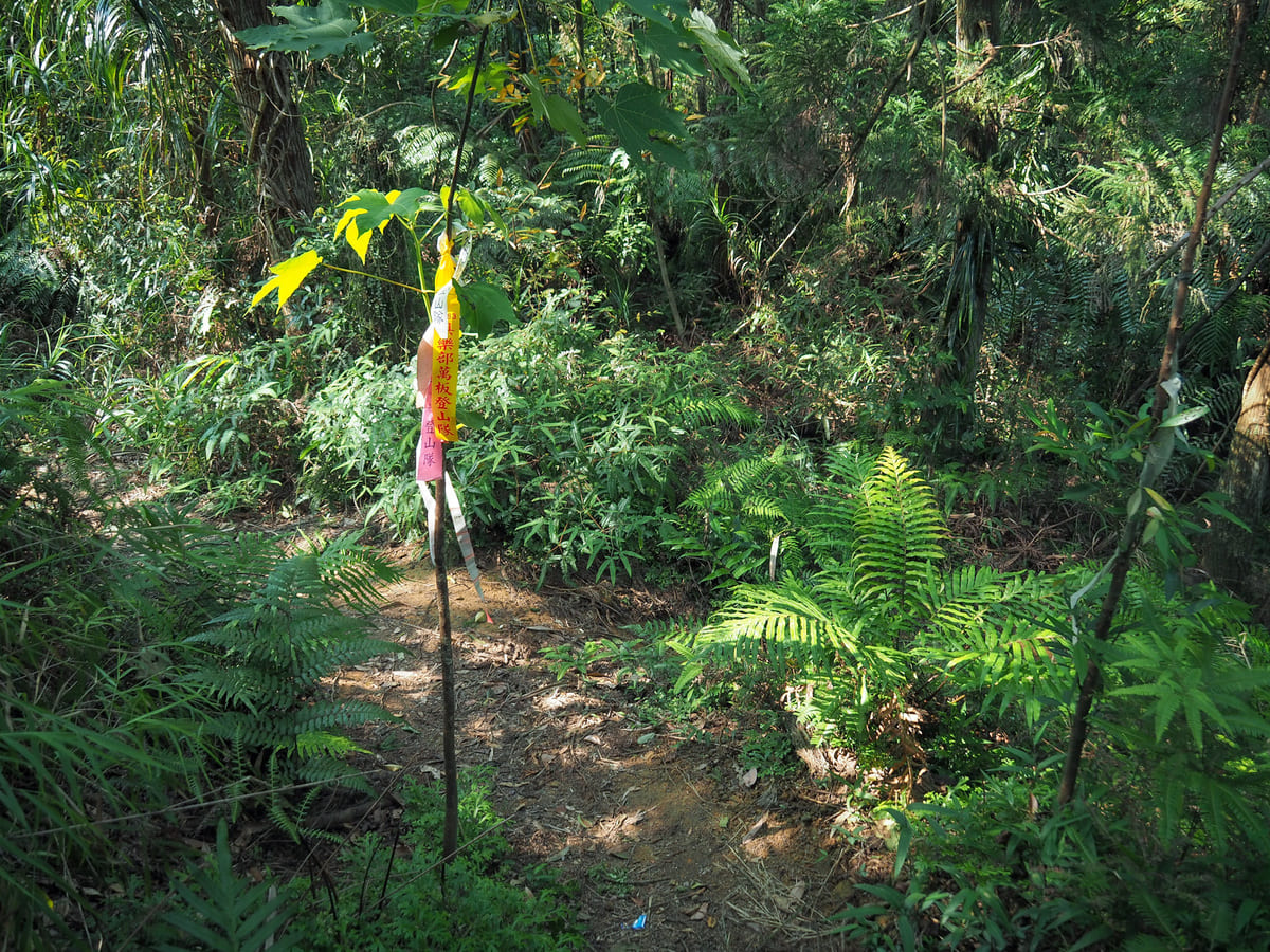
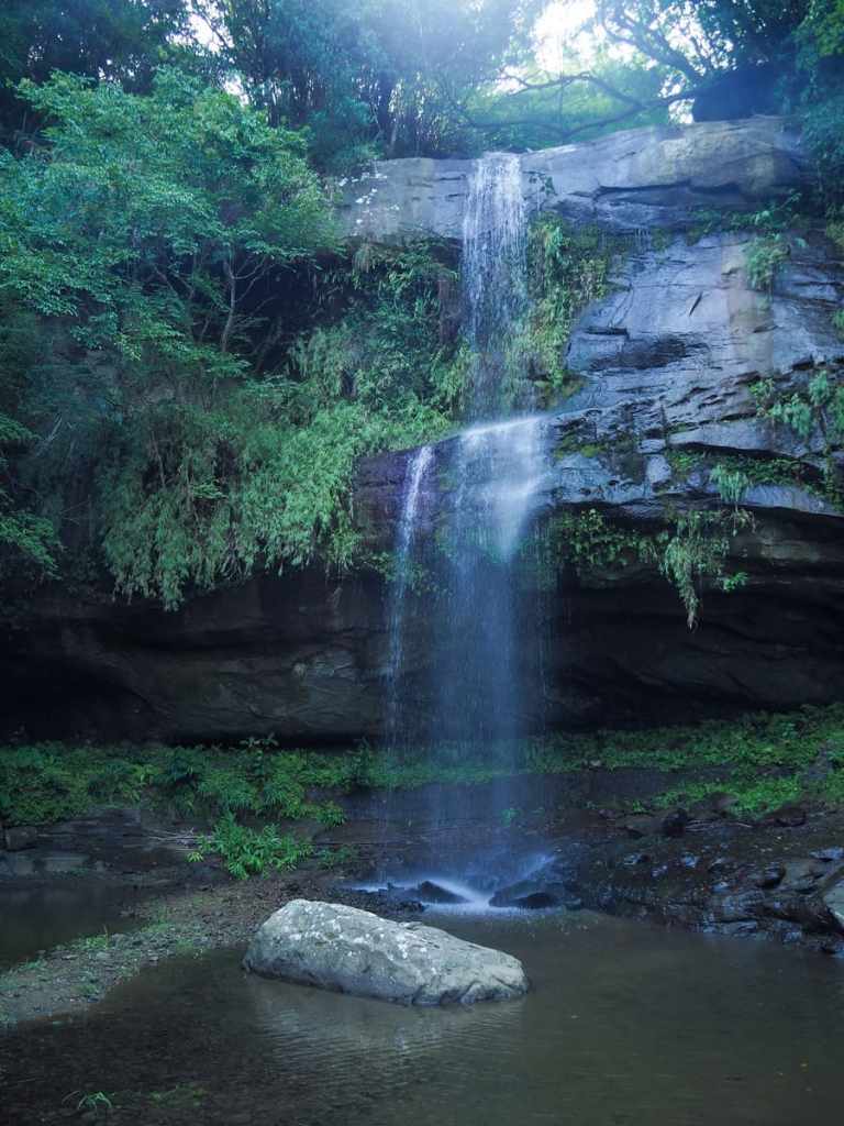
Before long, we reached another junction and turned right following a hand-written sign pointing to Yinmenghu and Tianyun Waterfalls (茵夢湖瀑布 and 天雲瀑布, this latter one could also be translated as “Sky Cloud Waterfall”). When you hit the river stream, you’ll find yourself right almost right at the top of Yingmenghu Waterfall.
There are two ways you can go from here. Both go around the edge of the waterfall and rejoin at its base. We chose to cross over the stream and take the easier of the two paths.
After climbing for a couple of metres, we reached a crumbling track, then almost straight away, headed off down a set of steps heading sharply to the right.
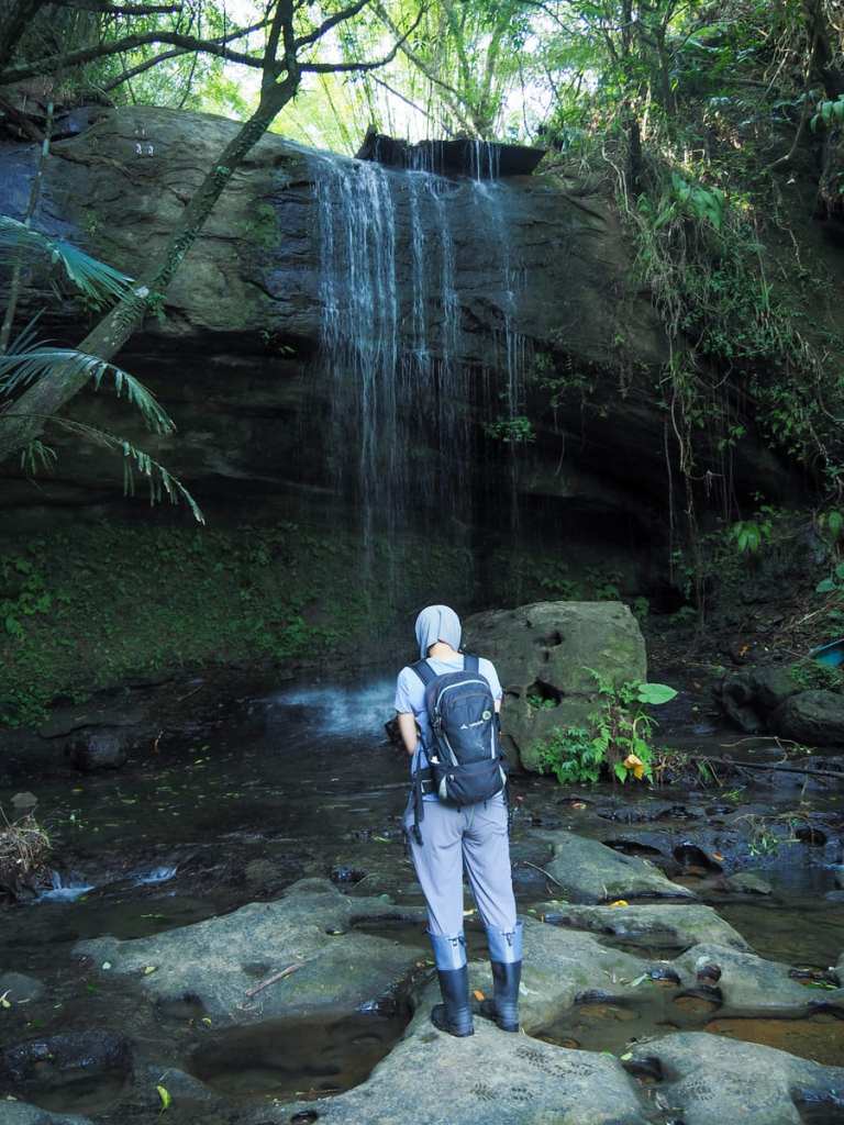
As with pretty much everything you’ll find in this old park, the falls’ natural beauty has been marred by long-since abandoned human attempts to control and manipulate the environment—an ugly and disintegrating concrete spout protrudes over the rock like a tongue lolling out of a mouth. It must have previously been used to funnel the water in a neat and more aesthetically pleasing way, just like the falls at Shifen have been tamed. Despite recent heavy rains brought on by a typhoon, the water flow was not much more than a steady trickle.
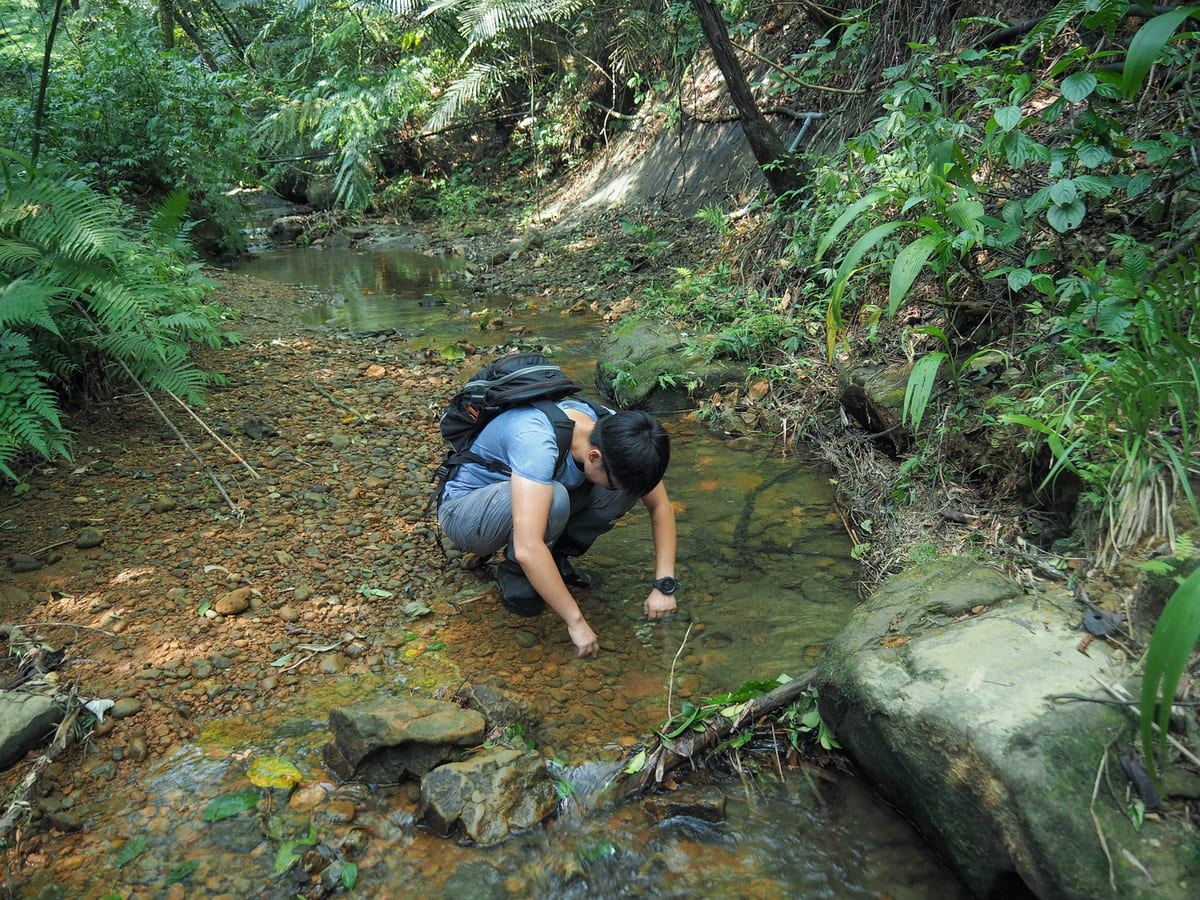
We picked our way carefully over the slippery and potholed rocks and took the left-hand trail away from Yingmenghu Waterfall. (If you look closely at the picture, you’ll see a skinny white rope leading back up to where we’d just come from.)
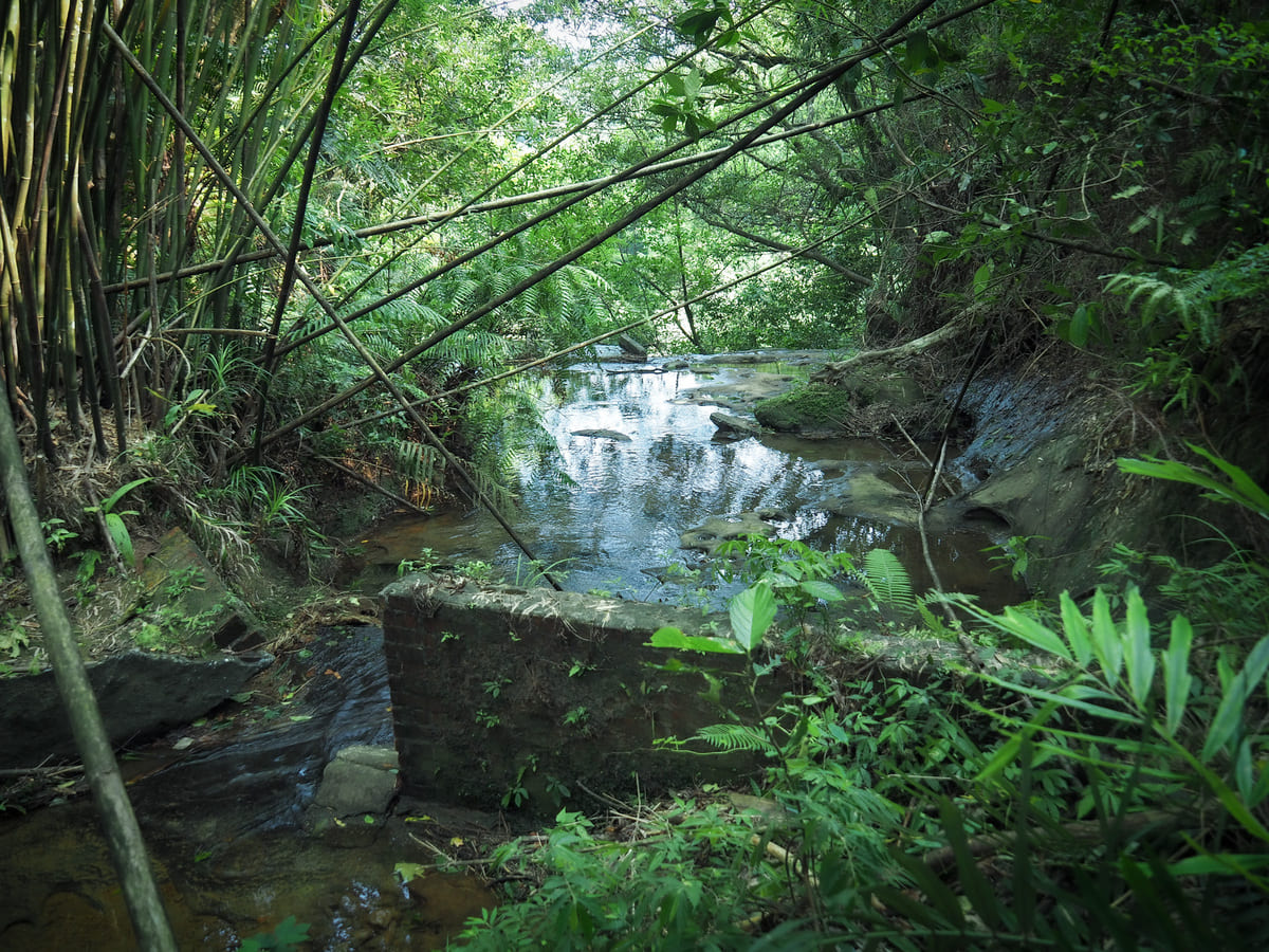
Just downstream from the waterfall, the water spills into a broad and shallow pool, the banks of which are fringed with feathery ferns.
A bridge cuts across the lower edge of the pool, just above Tianyun Waterfall.
I forgot to photograph the next junction, but it’s easy to spot. Beyond the bridge, some steps lead downhill for a short distance, then at the bottom of the steps you can either for straight or turn right to get down to the waterfall. This one seems less interfered with than Yingmenghu Waterfall. There are some signs of old concreting, but they’re not so obvious. From here, you can either cross in front of the waterfall and continue down the far side of the water, or return back up to the previous junction and take the path heading straight.
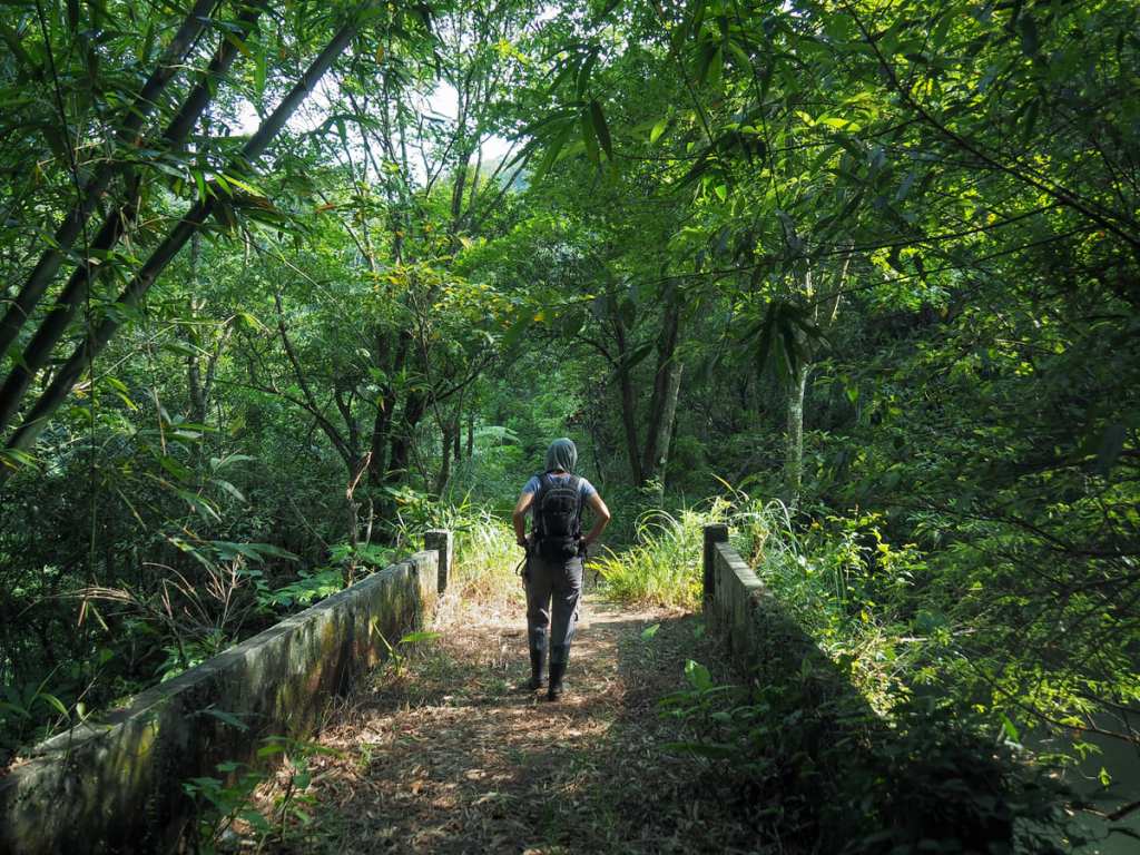
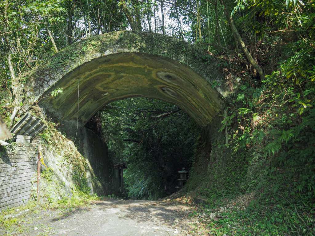
We chose the latter option, which soon led us to another bridge. Just beyond the bridge, the alternative trail joins from the right.
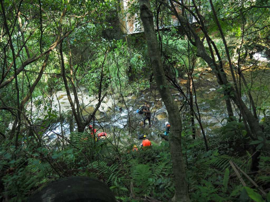
This is where the park starts to look a bit storm-battered. Those Taiwanese staples of trail-building efforts, scooter tyres, have been used to demarcate the edge of the path, but in some cases, they have been wiped out by landslides. One very steep trail seems to lead hikers directly down the slope to meet the stream, but we were not up for that kind of fun in the ridiculous summer heat, so we continued to follow the more level trail going upstream. There was a group of canyoneers in the water gearing up to abseil down the waterfall, and I envied their watery position.
A bridge with encroaching plants leads over the water. If you turn right here, you’ll soon be back at the guard station and big carpark, however, since that exit is blocked, we turned left to seek an alternative means of egress.
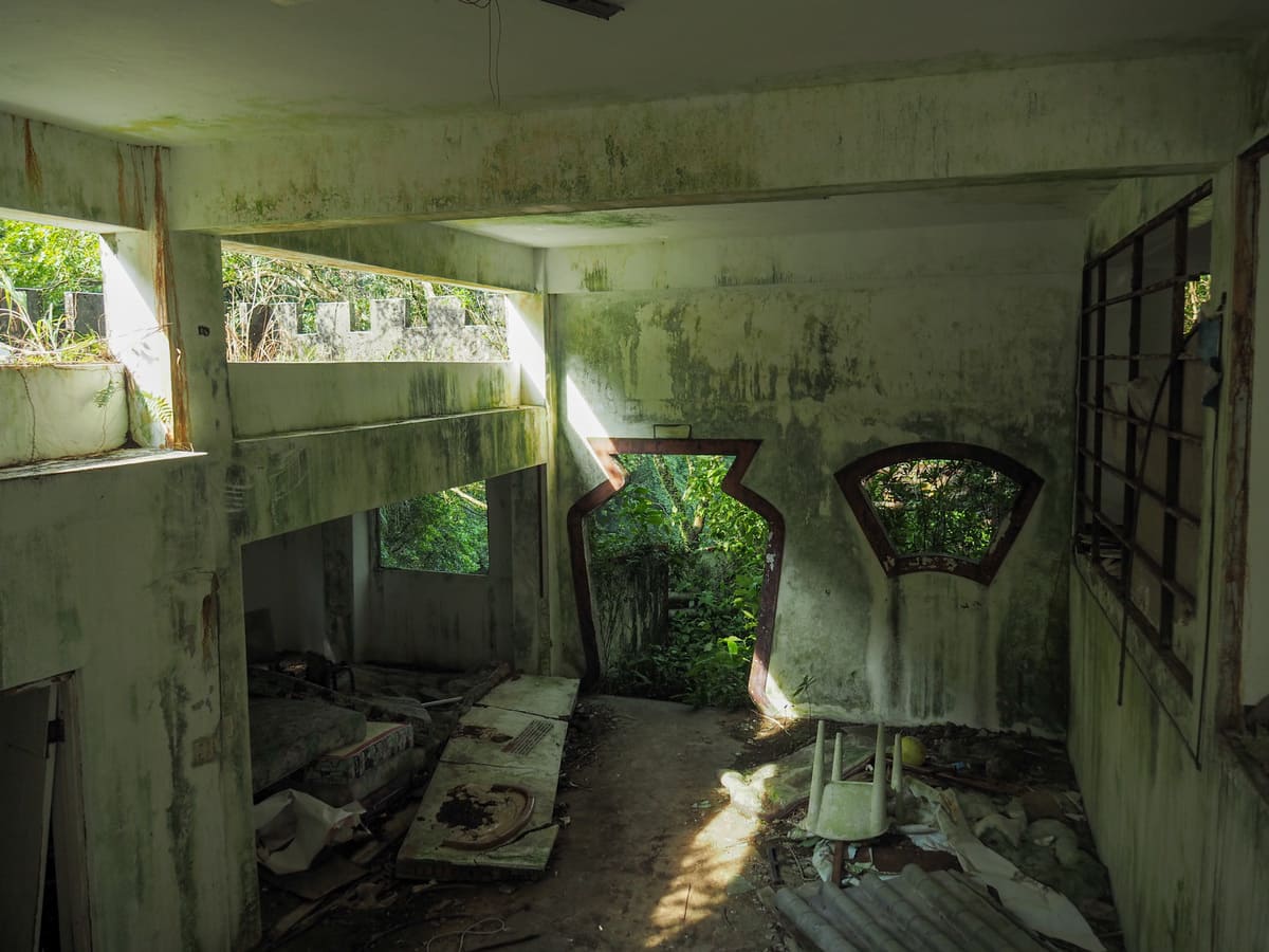
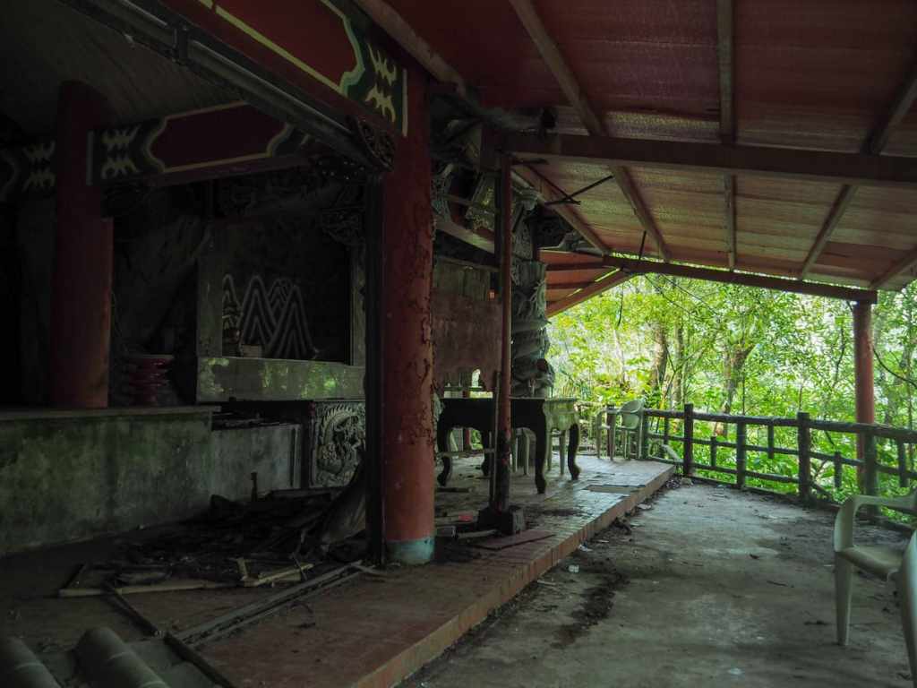
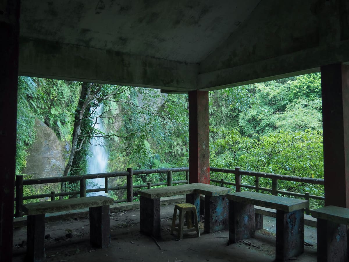
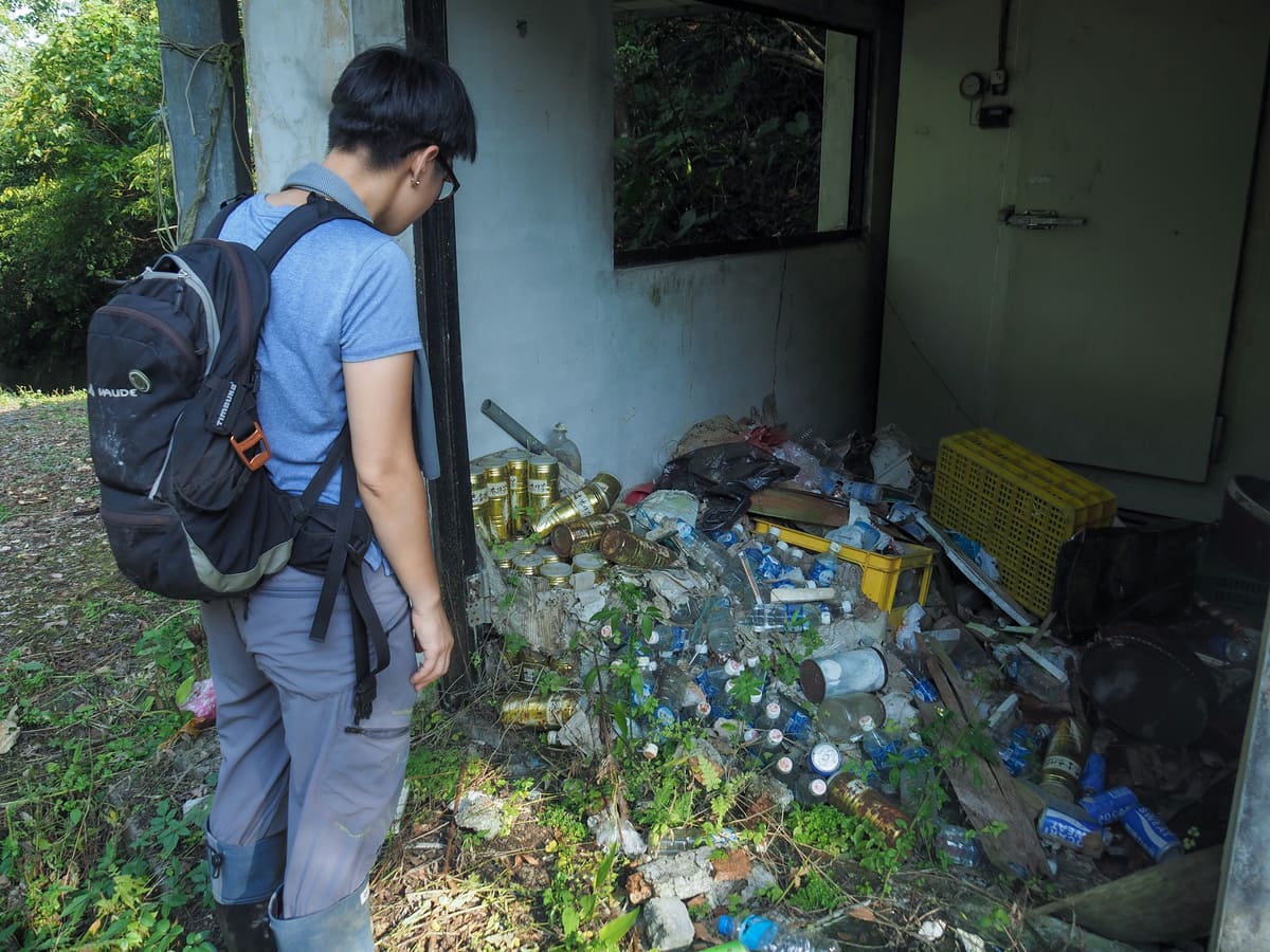
A palace-like building on a bend shows sign of the damage that befell the whole park. Inside, there’s a scattered and messy assortment of old furniture and plant detritus.
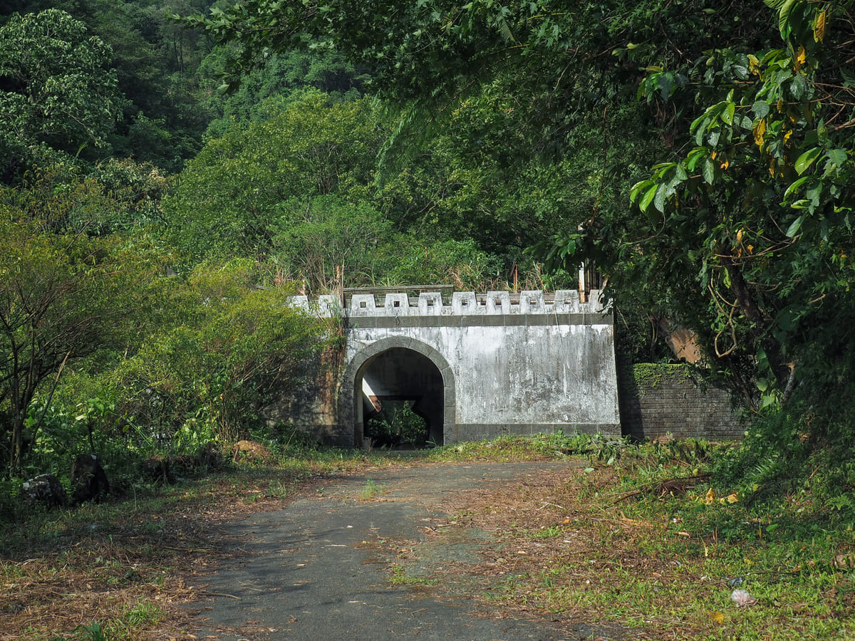
Next to the decaying structure, an arched concrete tunnel funnels the road round a corner and downhill.
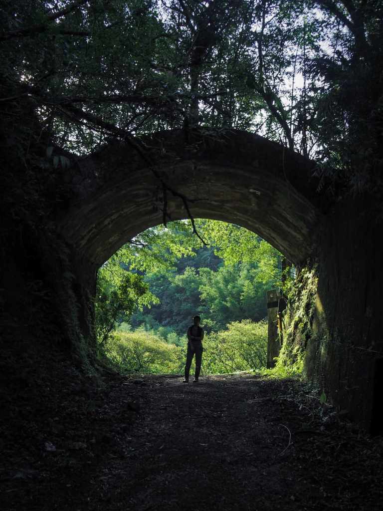
Teresa looking all moody and dramatic with the light behind her.
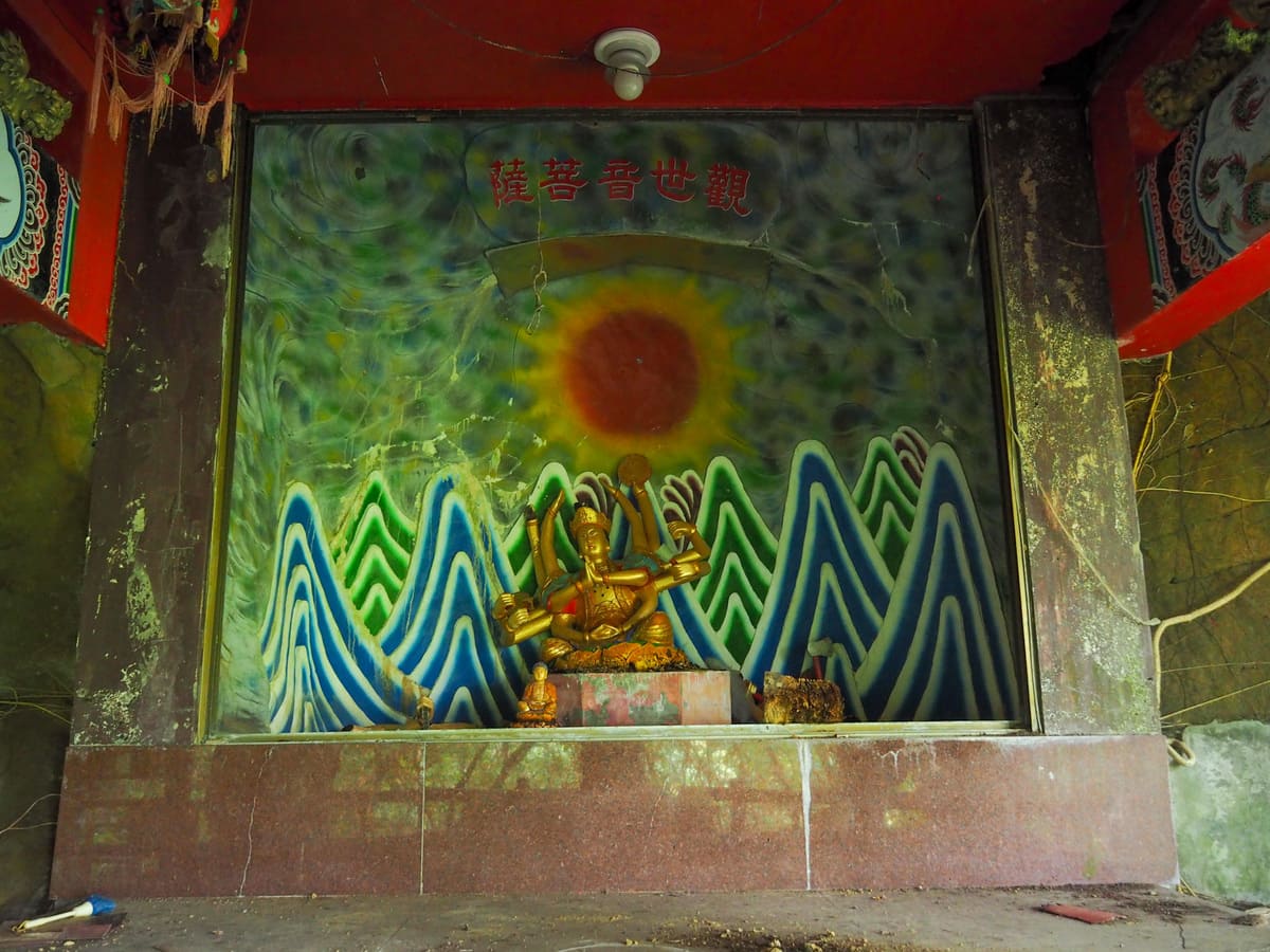
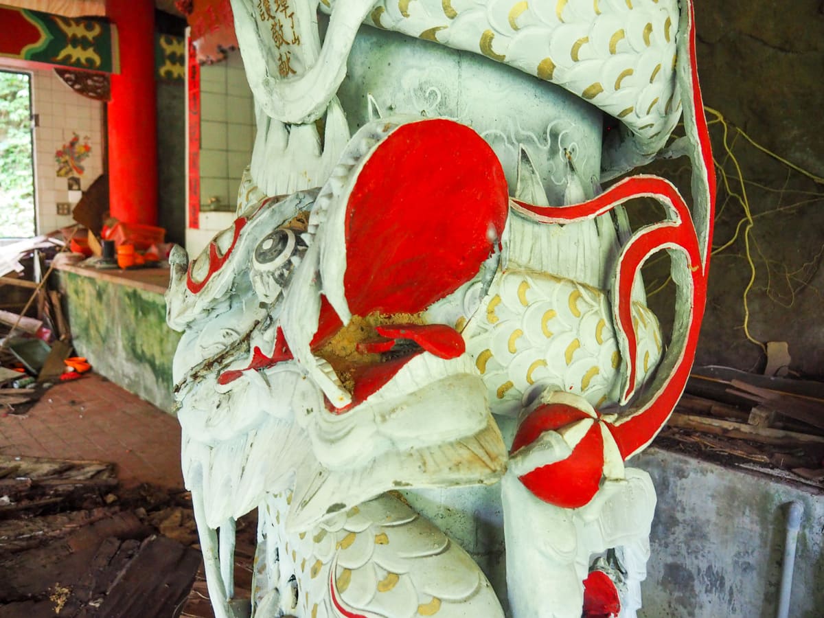
Almost as soon as you’re through the tunnel, you’ll spot the half-collapsed remains of a temple. It feels so strange to see the altars and icons gathering dust.
If you venture a little further in, you’ll see steps heading down to Emerald Valley Waterfall (翠谷瀑布) and the neighbouring Zimushuang Waterfall (子母雙瀑布).
Teresa was pooped from walking in the heat, but I decided to venture down as far as the first of the two falls.
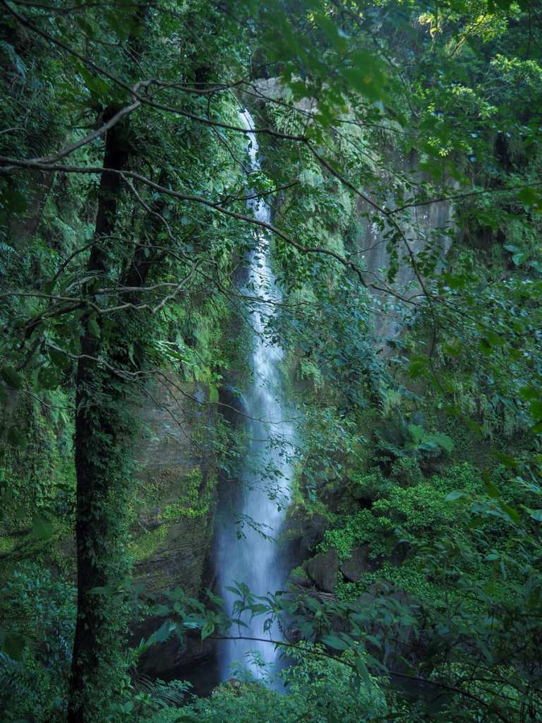
In the end though, even I was defeated by the heat. I got down as far as the old viewing platform and admired the impressive column of water plunging straight down into the river. But after that, I gave up. I just got not bring myself to continue walking down in the knowledge that I would have to go up again soon. This summer has been brutal.
I climbed back up to the temple to find Teresa sensibly enjoying the shade. From there, we continued making our way down the track.
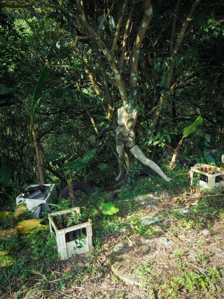
At one point, we were startled by the presence of a tree-mounted mannequin.

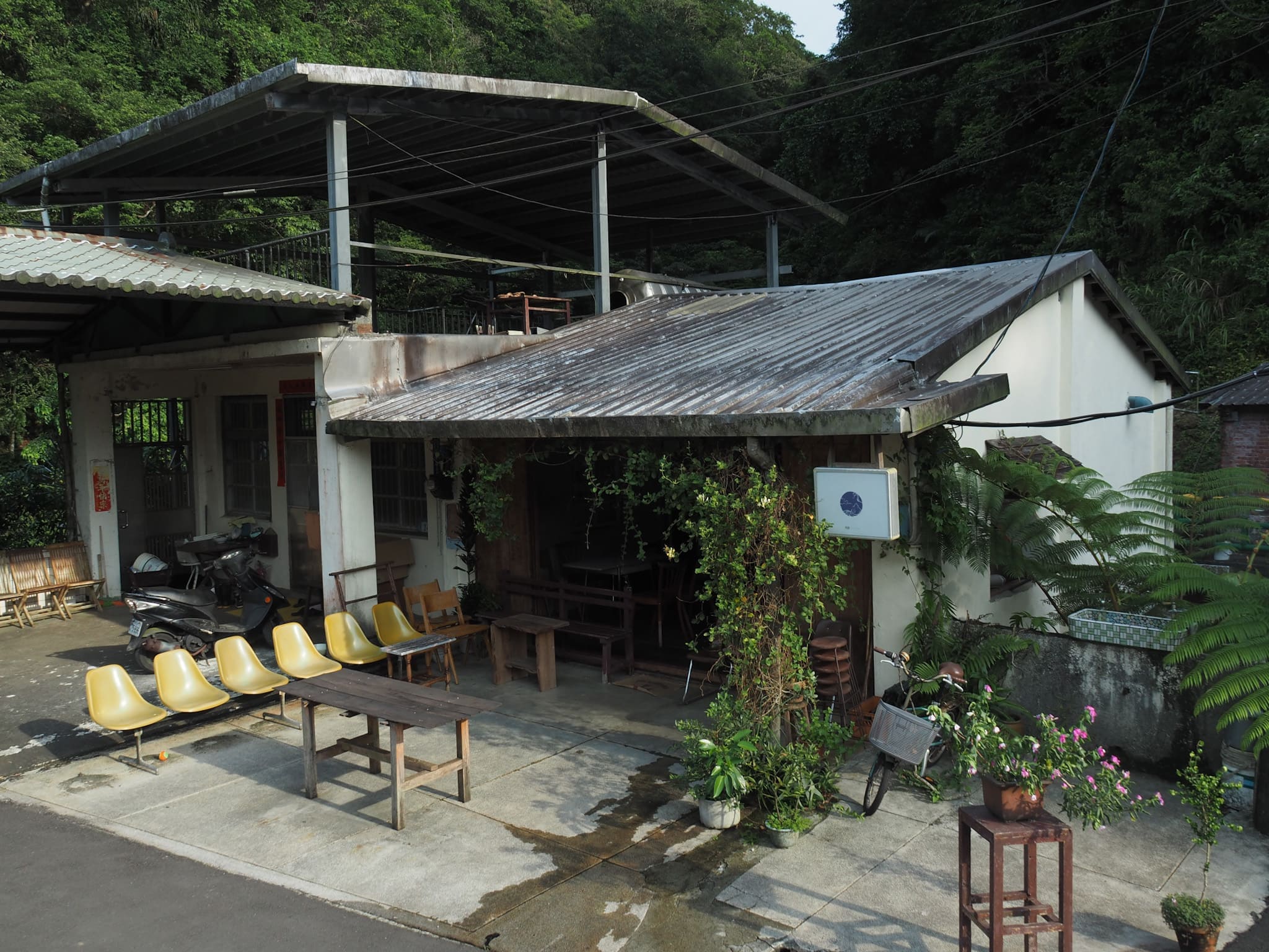
And nearby, what we guessed was previously a KTV place had a stack of these LaserDiscs. Each one was in a cardboard sleeve bearing a track list.
Look out for a hiking-tag-marked trail leading away from the track on your left. If you end up crossing over a bridge, you’ve gone too far.
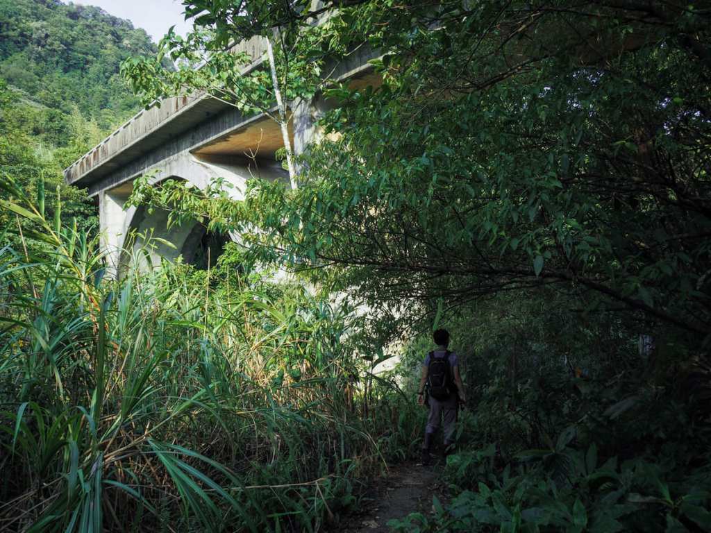
Instead, the trail passes under the bridge, the looming and stained concrete supports lending the path a kind of edge-of-the-worldly feeling. An abandoned building below the bridge only serves to amplify that feeling.
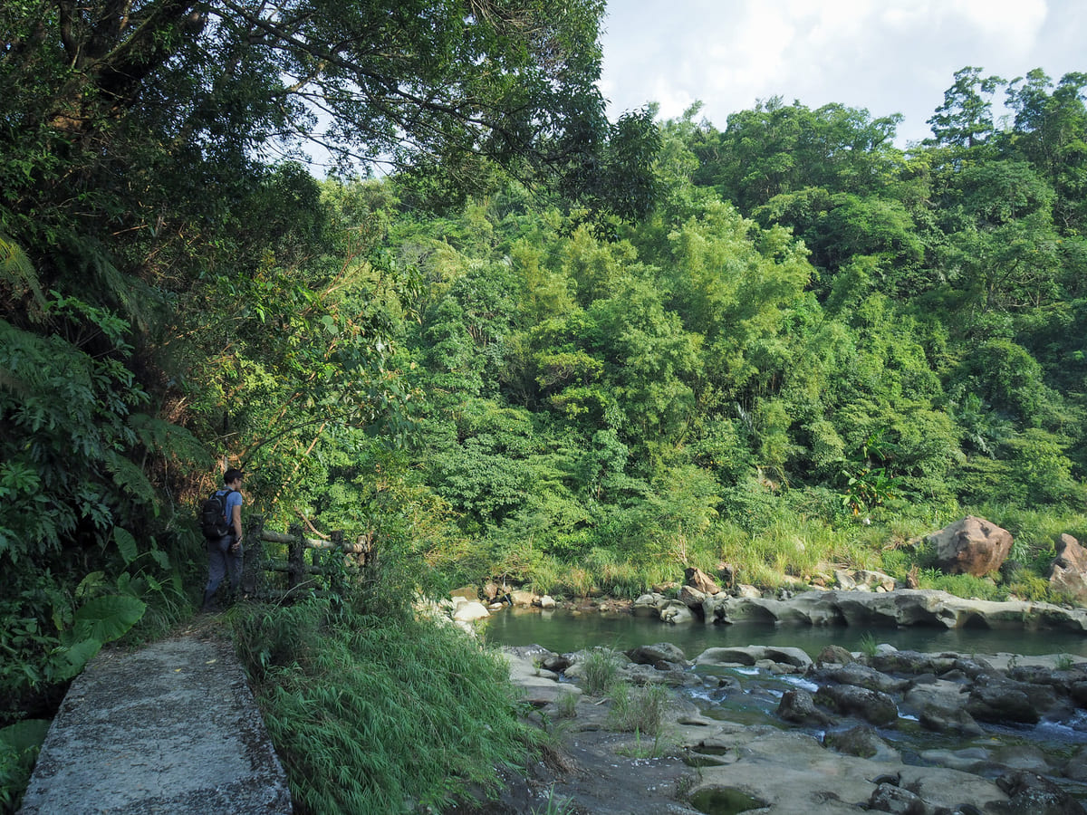
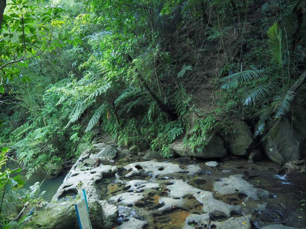
Past the long-since disappeared windows, the trail passes through a gap in the fence to arrive at the Dahua Potholes.
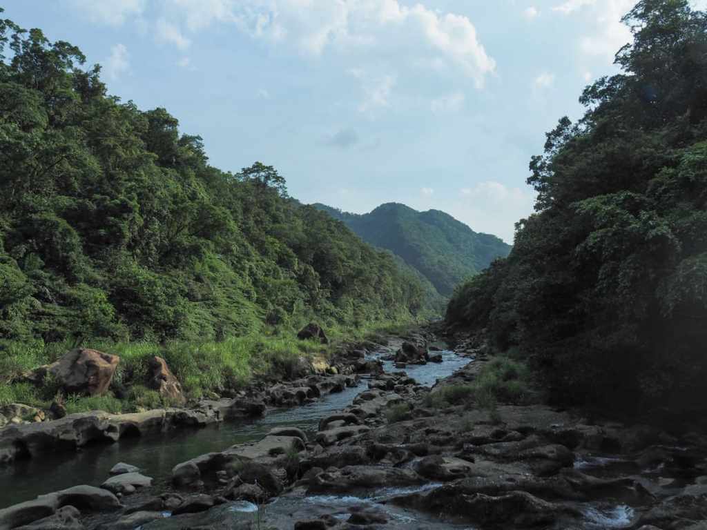
This is probably one of the prettiest stretches of Keelung River, and I certainly don’t think I’ve seen it with less human interference than this.
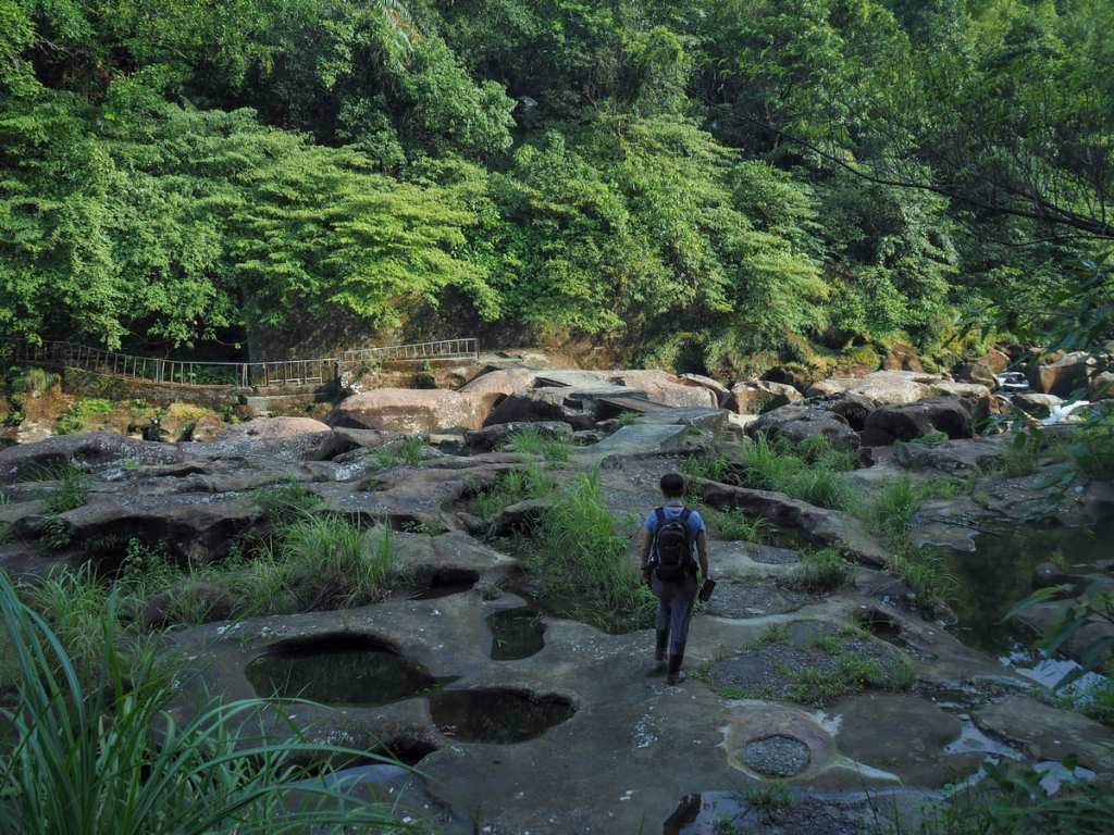
Unfortunately, the lack of human interference does not extend to the whole scene. A trail of concrete-filled potholes (the result of wind and rock erosion over millennia), mars the surface of the rocks. (Presumably, authorities couldn’t trust people to look where they’re going.)
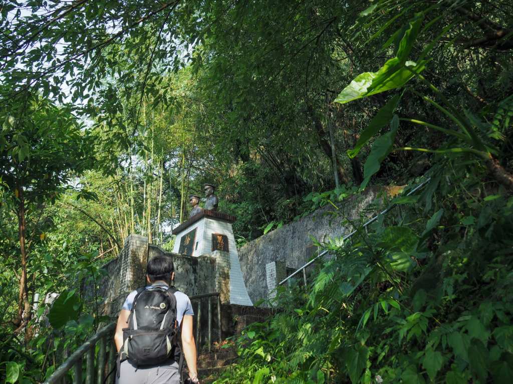
And in case you were feeling tempted to dive in (which we definitely were), these twin busts of Li Xi-Ping and Huang Wen-Zhong are here to deter you. Li and Huang visited this spot with friends (or a friend, accounts vary), in 1986. The friend (or one of the friends) slipped on the algae-slicked rocks and fell in, so Li and Huang jumped in to try and save him. They succeeded, but tragically, their act of heroism led to their own drownings. It is perhaps quite a good window into the general local attitude to such tragedies that, although the time and money were found to erect a memorial, no emergency life-saving equipment has been installed at this spot.
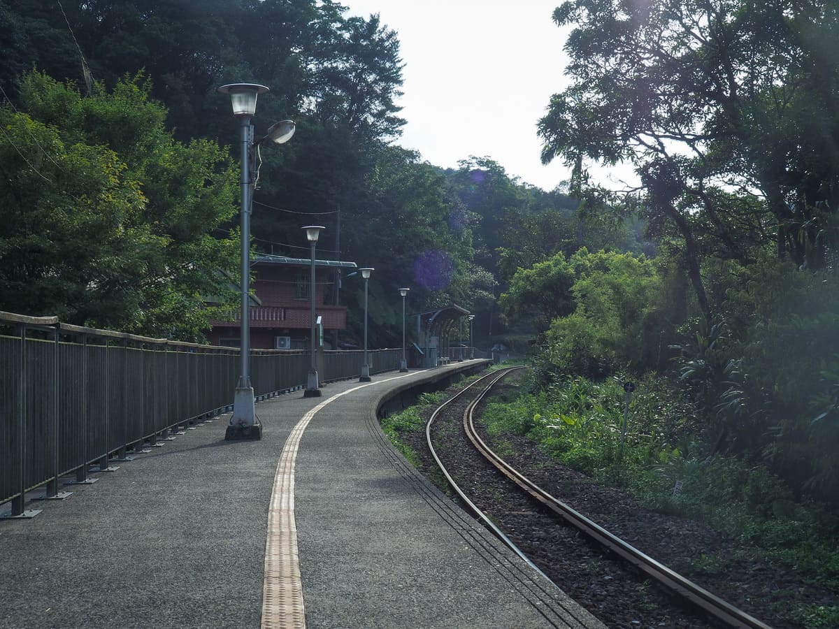
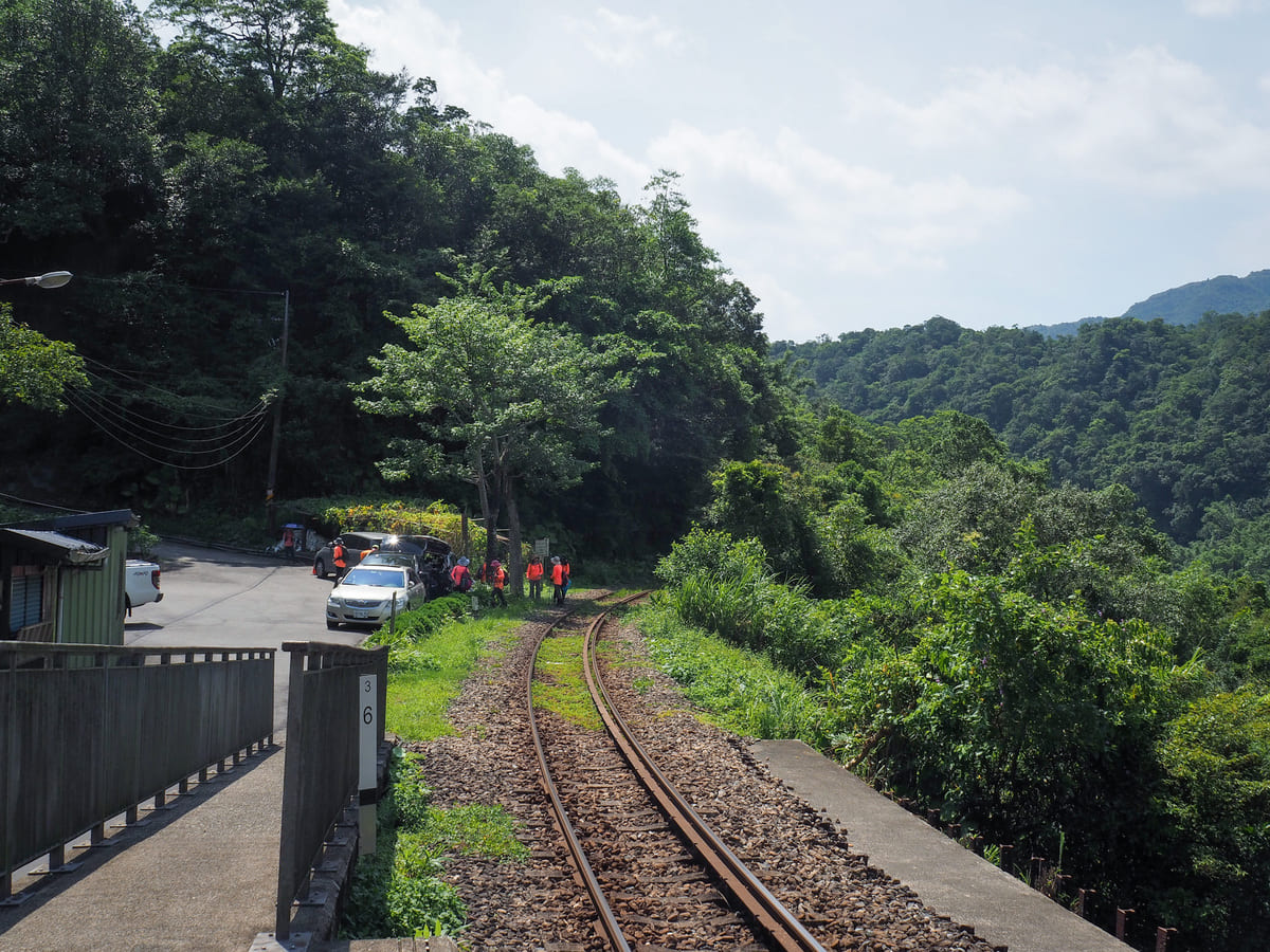
From here, steps lead up to the railway track, but again, I am not going to advise anyone to walk on the tracks. Dahua Station is about 1 km along the tracks to the right and the walk will take about 15 minutes at a brisk pace. You will want to time your walk along this section very carefully. If you check Dahua Station on Google Maps, you’ll be able to see the next scheduled arrivals. We had a solid 25 minutes, so we went for it. Alternatively, if you’re being sensible, you’ll find a flight of steps leading uphill on your left after a short distance. These will take you up to a road that runs parallel to the tracks, then back down to join the rails when you’re pretty much back at the station.
After completing our walk, we rode back to Shifen and I inhaled a bowl of shaved ice and watermelon.
How to get to Savage Valley
Google maps address: The route starts and finished at Dahua Train Station. There is some roadside space for parking both cars and scooters.
GPS location:
- Railside trailhead close to the red bridge – N25 03.065 E121 47.665
- Railside trailhead close to Dahua potholes – N25 03.310 E121 48.265
Public transport: Take any train leaving Taipei and stopping at Ruifang (so all local, fast local and Tze-chiang Express trains for Su’ao or Hualien), and transfer onto the Pingxi Line at Ruifang. You’ll need to swipe out and then back in again if you’re using an EasyCard (the staff here are used to helping confused visitors, so ask if you’re unsure. Then ride the Pingxi Line until you reach tiny, unmanned Dahua Station (remember to swipe out as you leave the platform).
Further reading:
Nearby trails:
- Menghuan Falls
- Sandiaoling Tunnel
- Sandiaoling Waterfall to Dahua Station
- Youkeng Trail and Waterfall
Savage Valley Trail Map
The GPX file for the walk as we originally did it is available here on Outdoor Active. (Account needed, but the free one works just fine.) However, since the starting portion has been reported as no longer passable, this longer version, which includes a pass through the Sandiaoling Waterfall Trail might be a more viable option.
As I mentioned up top, I have not attempted to walk this alternative route, so please use common sense and go prepared to double back if necessary.
