
Coastal Views, Towering Turbines and a Converted Railway Tunnel
This spot has been on my “to visit” list for a couple of years now, but it wasn’t until we found ourselves drifting back northwards at the end of a long weekend that we found ourselves in the area and with nothing better to do. I’m glad we finally made it here. I might even be persuaded to return one day to catch sunset over the rippling meadows of silvergrass.
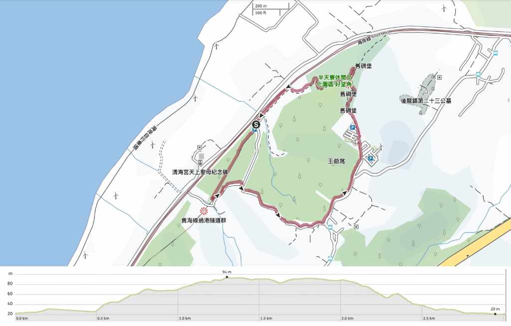
Distance: 3km – I think you could probably walk a little further if you explore the whole length of the tunnel and/or visit the nearby temple.
Time: 1-1½ hours – We spent a little under an hour ambling our way around this short loop.
Difficulty (regular Taiwan hiker): 1/10 – Strong winds or sun would make this walk more tiring (or less pleasant), but otherwise, it’s very easy.
Difficulty (new Taiwan hiker): 2/10 – There are a few steps to navigate, but aside from that, this is an easy walk even for people who don’t often hike.
Total ascent: About 70 metres.
Water: We just took a single water bottle between us and that was plenty. If you visit on holidays or weekends, you’ll find several stalls selling snacks at the top.
Shade: The tunnel offers full shade, but aside from that, it’s quite exposed. However, hat-wearers be warned, only hats with chin straps are suitable on this trail on account of the year-round blustery winds.
Mobile network: Clear mobile reception throughout.
Enjoyment: Some nice coastal views, being so close to the turbines is either exciting or terrifying depending on how much you trust the engineers who constructed them, and the lit up tunnel is a neat little addition that’s bound to appeal to kids.
Other: The platform and steps at the start/end of the walk face west, so it’s a great spot to watch the sunset.
When to see silvergrass: The silvergrass season is usually at its peak in late November or early December. For peak photo-opportunities, make sure to arrive in late afternoon so that you can enjoy the setting sun painting the grass in beautiful honey tones.
Bathroom facilities: There is a toilet block in the carpark at the start of the trail.
Route type: Loop
Permit: None needed
Jump to the bottom of this post for a trail map and GPX file.
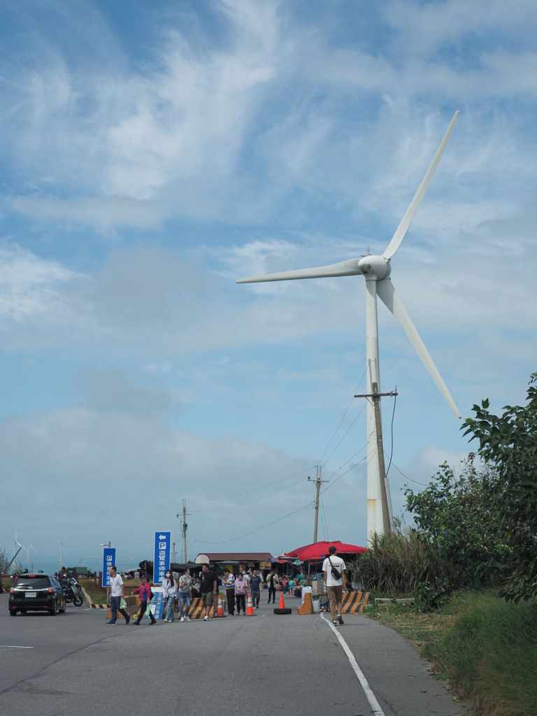
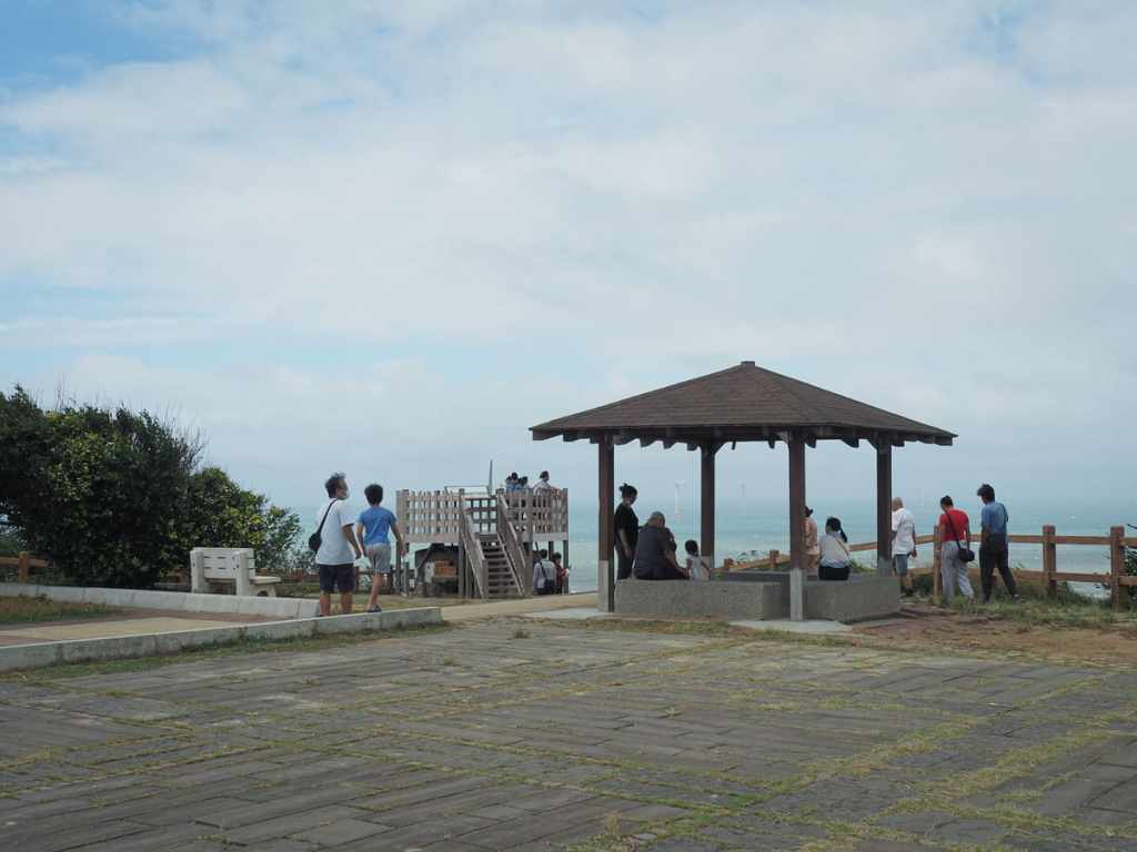
If you start your walk from the large carpark at the top, it is not difficult to find your way to the start of the trail. On holidays and weekends, a smattering of vendors gather around the top of the steps selling things like corn dogs, charcoal-dried longan fruit, and taro fritters.
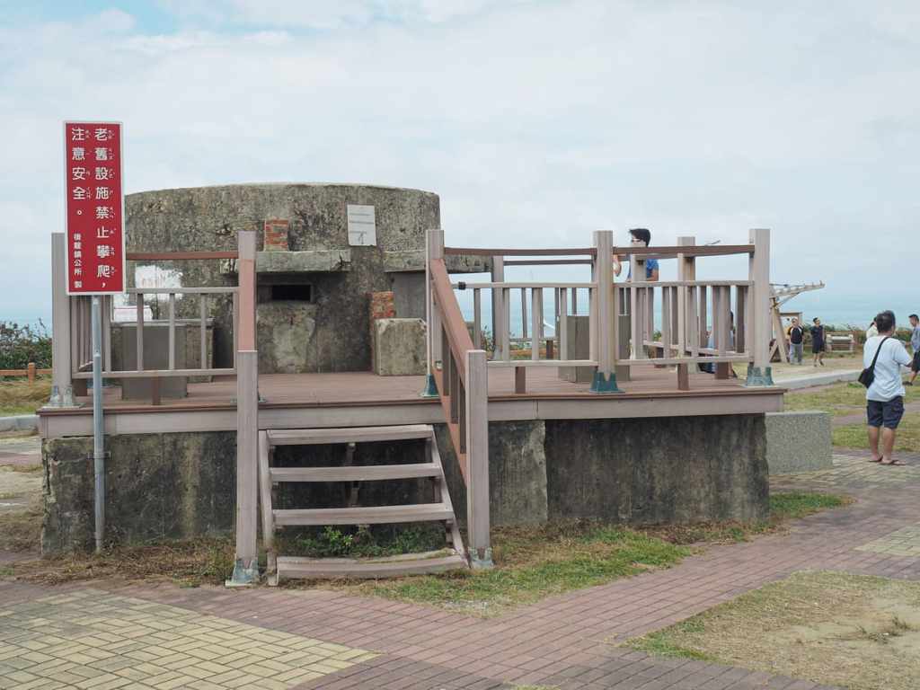
If you walk the gauntlet between the vendors, you’ll come to the first of several old military bunkers.
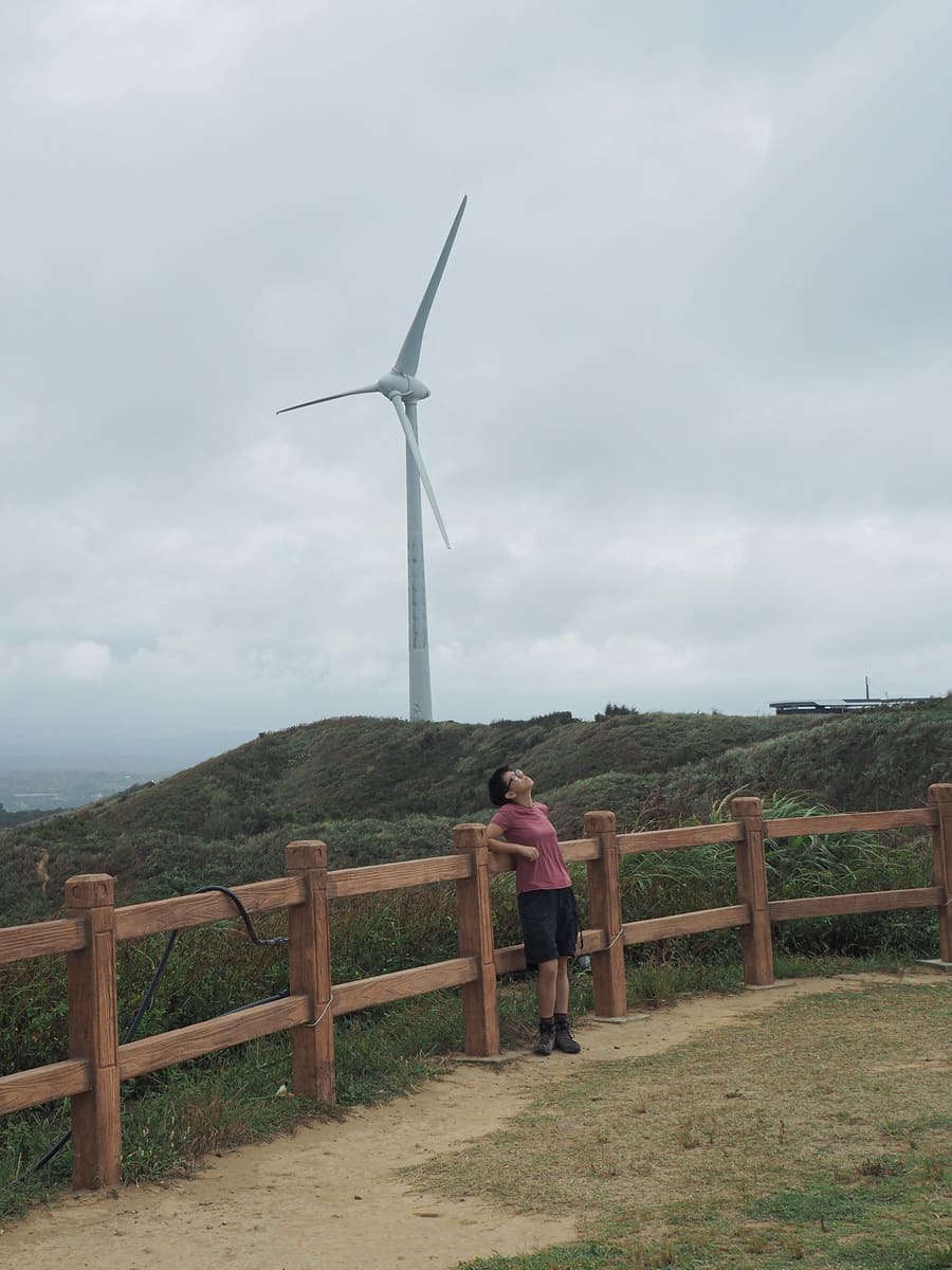
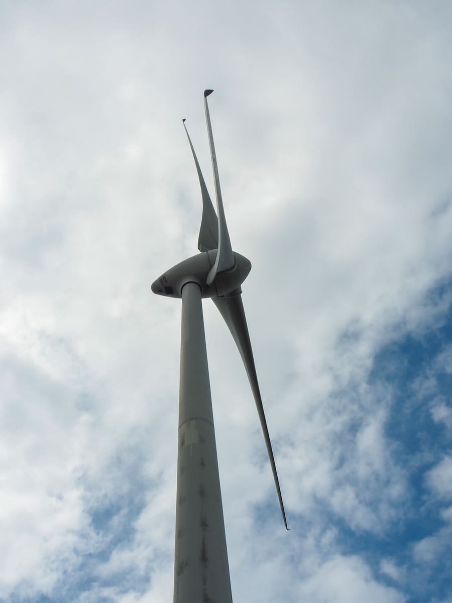
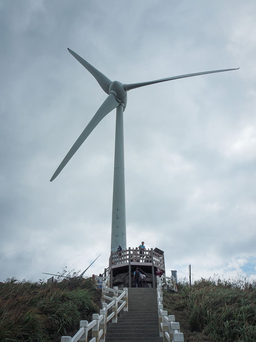
When I walked over to her, I learnt that she had been contemplating what it would feel like to be strapped to once of the blades as it spun. Given the dizzying speed of this closest turbine, I don’t think it’s a question I want to know the answer to.
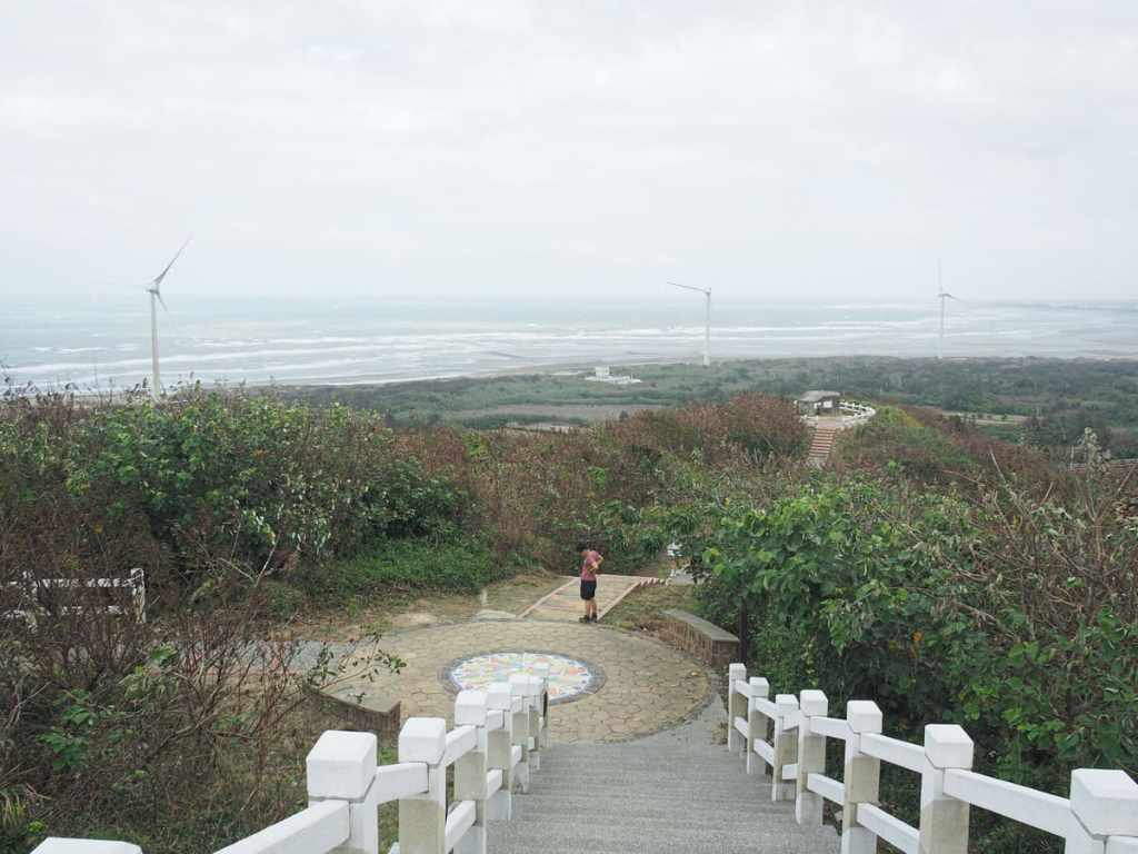
If you head over to the seaward-facing edge of the platform, you’ll find a flight of white-fenced steps leading down towards the flat land close to the shoreline.
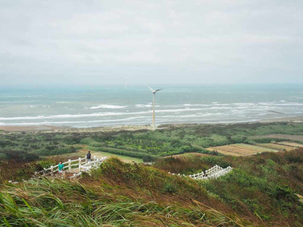
You can’t quite see it from here, but the railway runs parallel to the coast, just at the bottom of the hill.
Many people seemed to get no further than the very top of the steps—there was a small queue of people waiting to take a photo in the perfect spot.
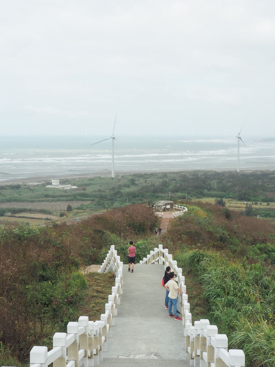
At the junction you can choose to go either straight over to the next bunker, down a bit more, then turn left onto the road, or take this first left. Teresa was already feeling tired at the prospect of continuing the drive back home on a national holiday, so we took this first left (which is a shorter option).
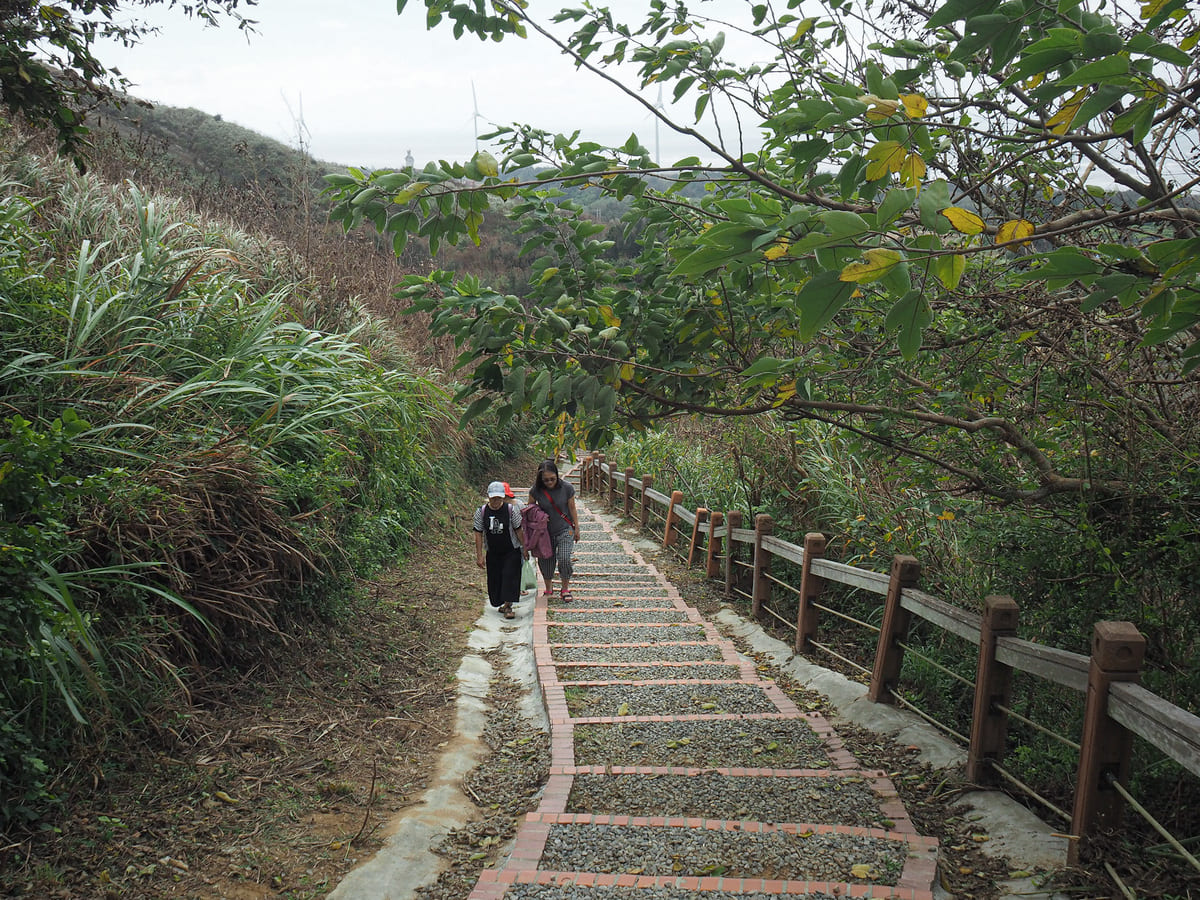
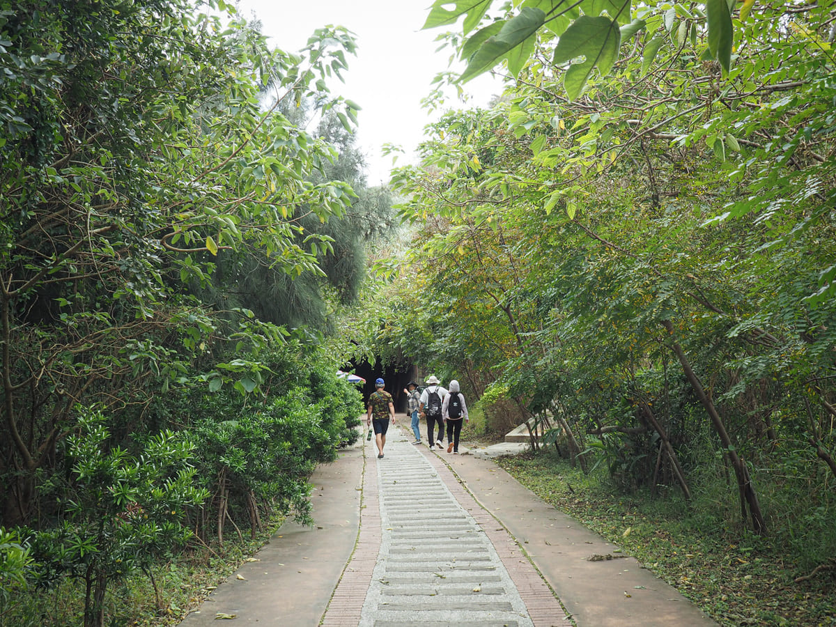
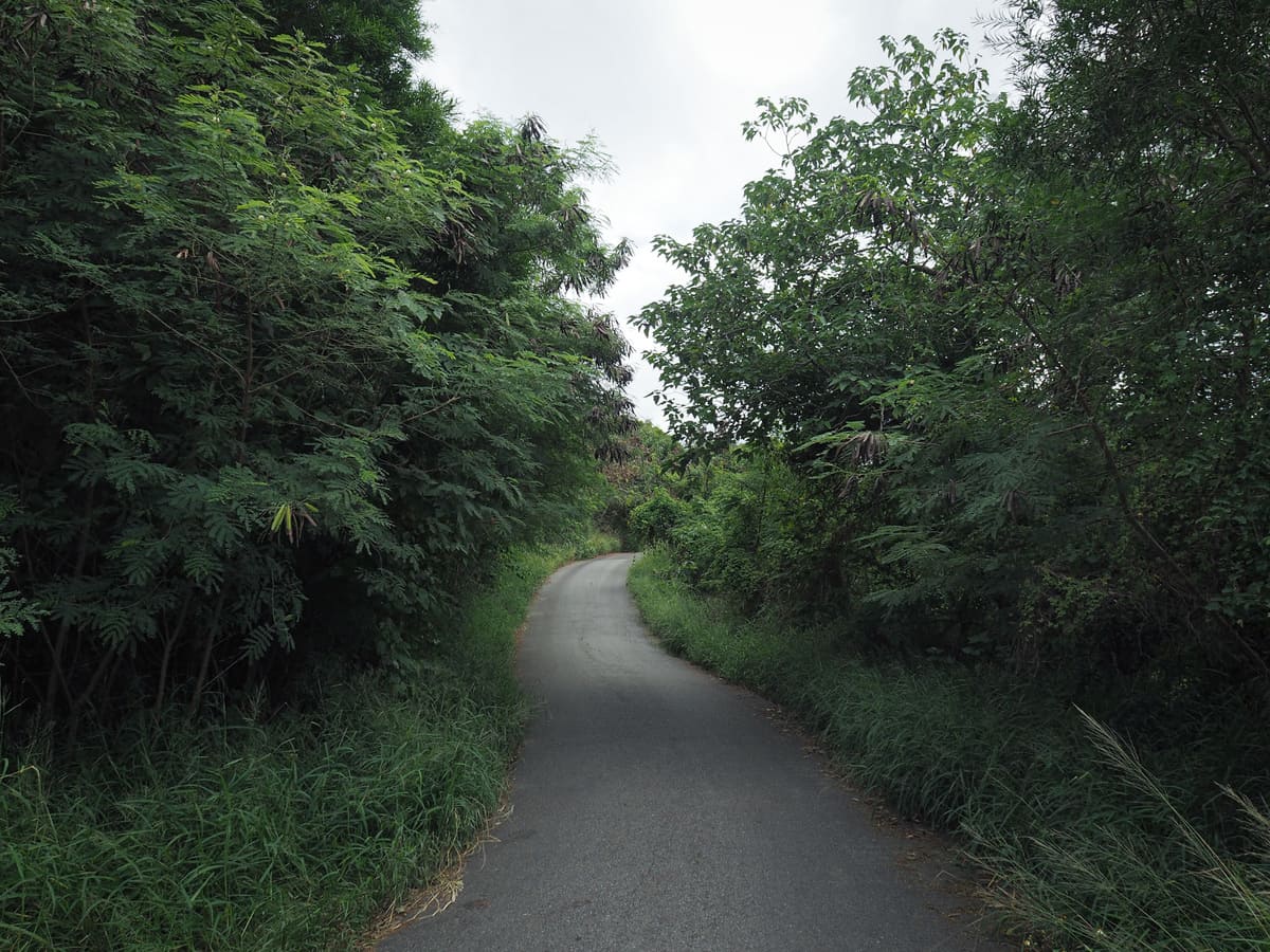
From here, steps lead down for several hundred metres until they morph into a flat path running alongside scrubby-looking farmland.
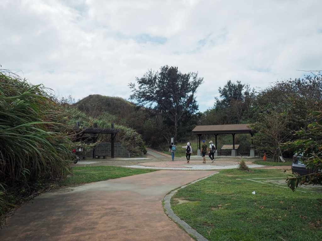
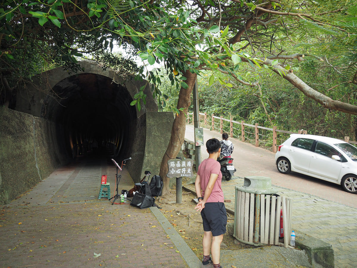
For a brief while, the trail joins a single-lane track leading to another carpark. (If you’re only interested in walking the tunnel, you can park here, but be warned, the road is not easy to maneuver on when there are lots of visitors.)
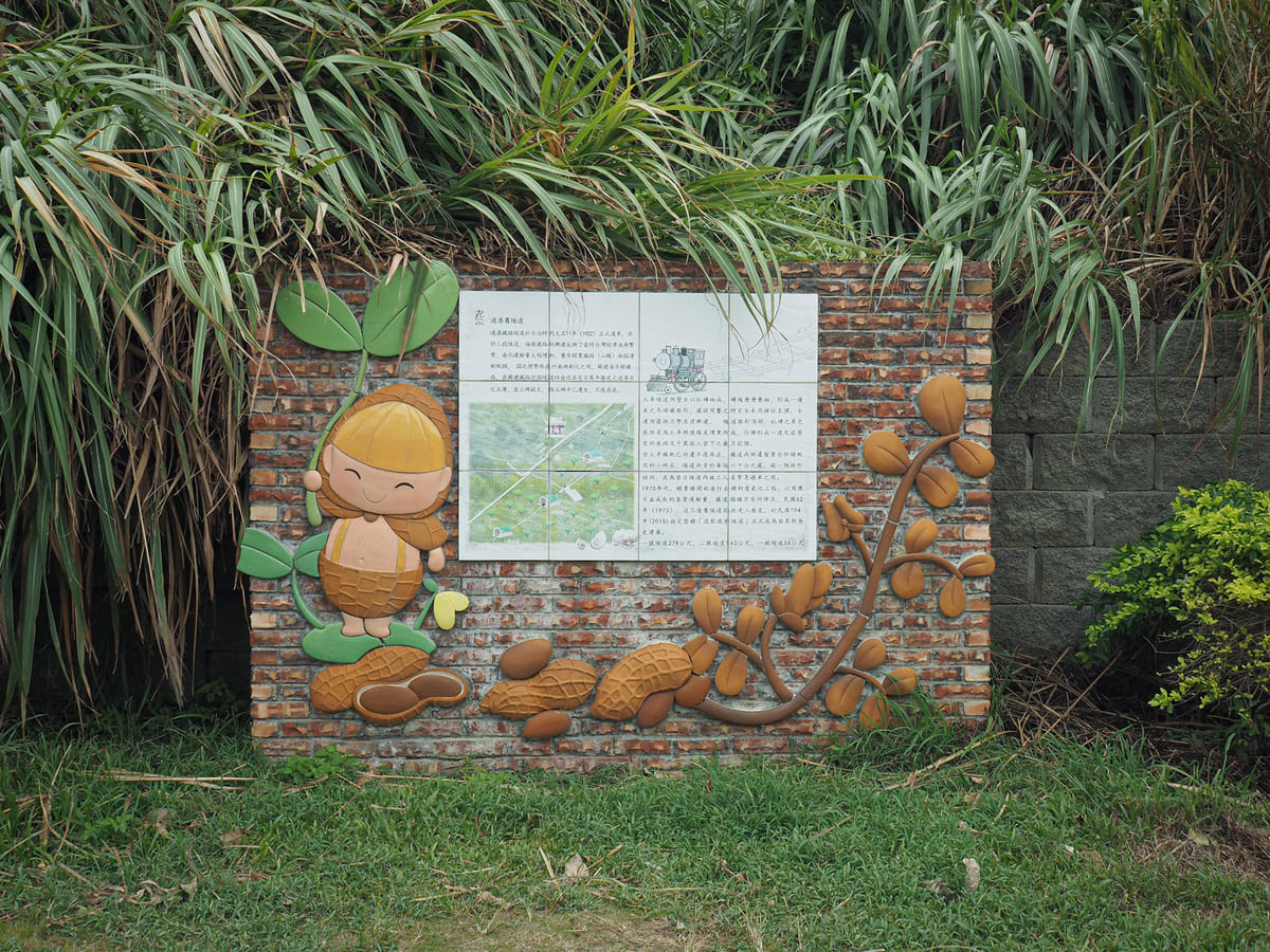
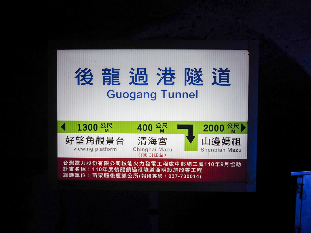
A cute anthropomorphic peanut welcomes visitors to the start of the old Guogang Tunnel path (過港隧道 or sometimes 後龍過港隧道).
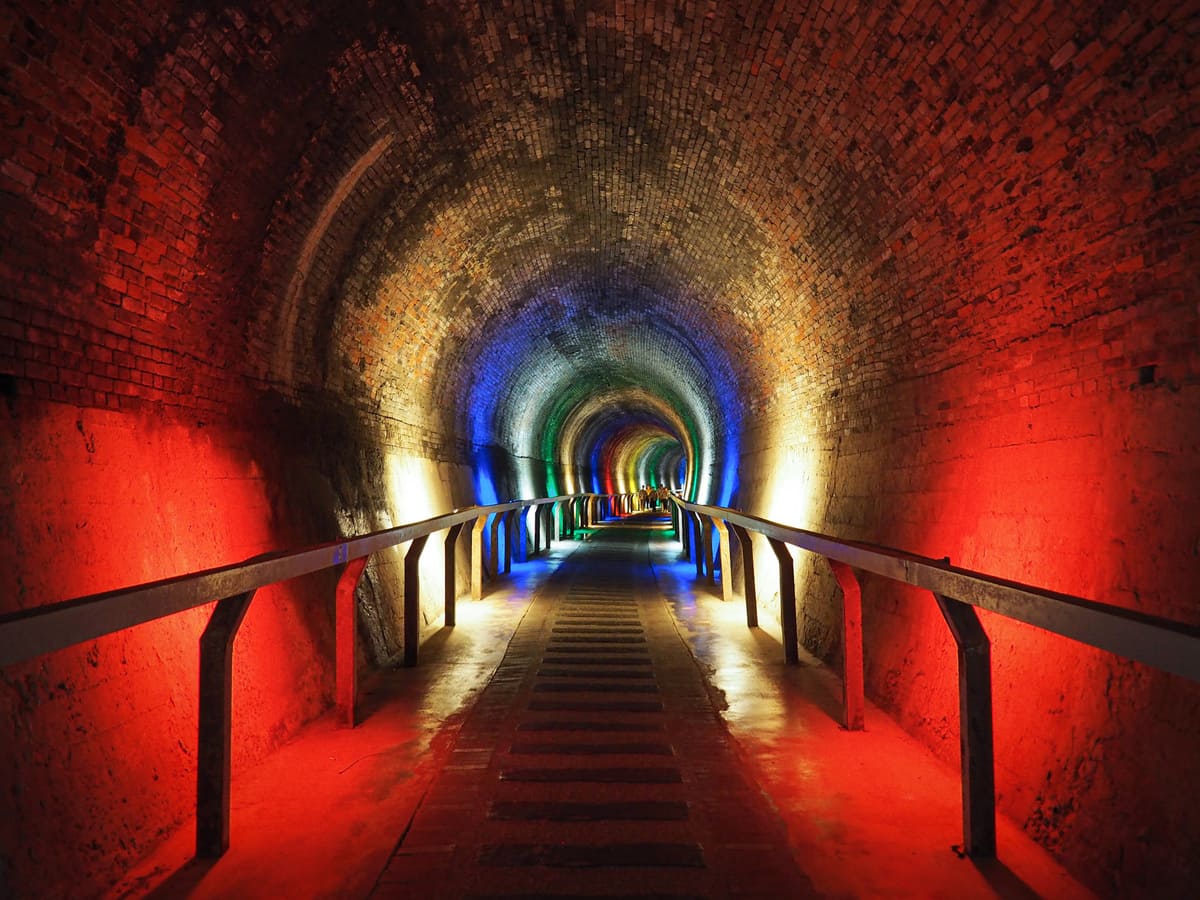
The tunnel was first built by the Japanese in the 1920s during the construction of the Coastal Branch Line (which was intended to ease the strain on the existing Mountain Line). It remained in use until the 1970s, when the line was electrified to cope with increasing passenger volume, and the line was rerouted around the end of the small hill.
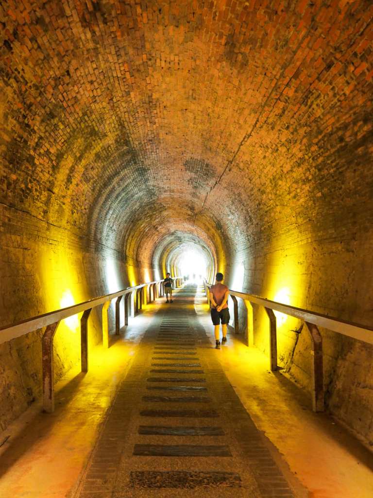
The tunnel has been decorated somewhat artlessly with coloured lights. I prefered the second half, which was just yellow and white, but I guess I’m maybe not the target audience for this type of tourist spot. (For an example of an old railway tunnel that has been excellently done, check out the beautifully treated Sandiaoling Tunnel. And since Taiwan seems to have a lot of tunnels-turned-attractions, you can also enjoy one even more garishly lit than this on the Shen’ao Bikeway. )
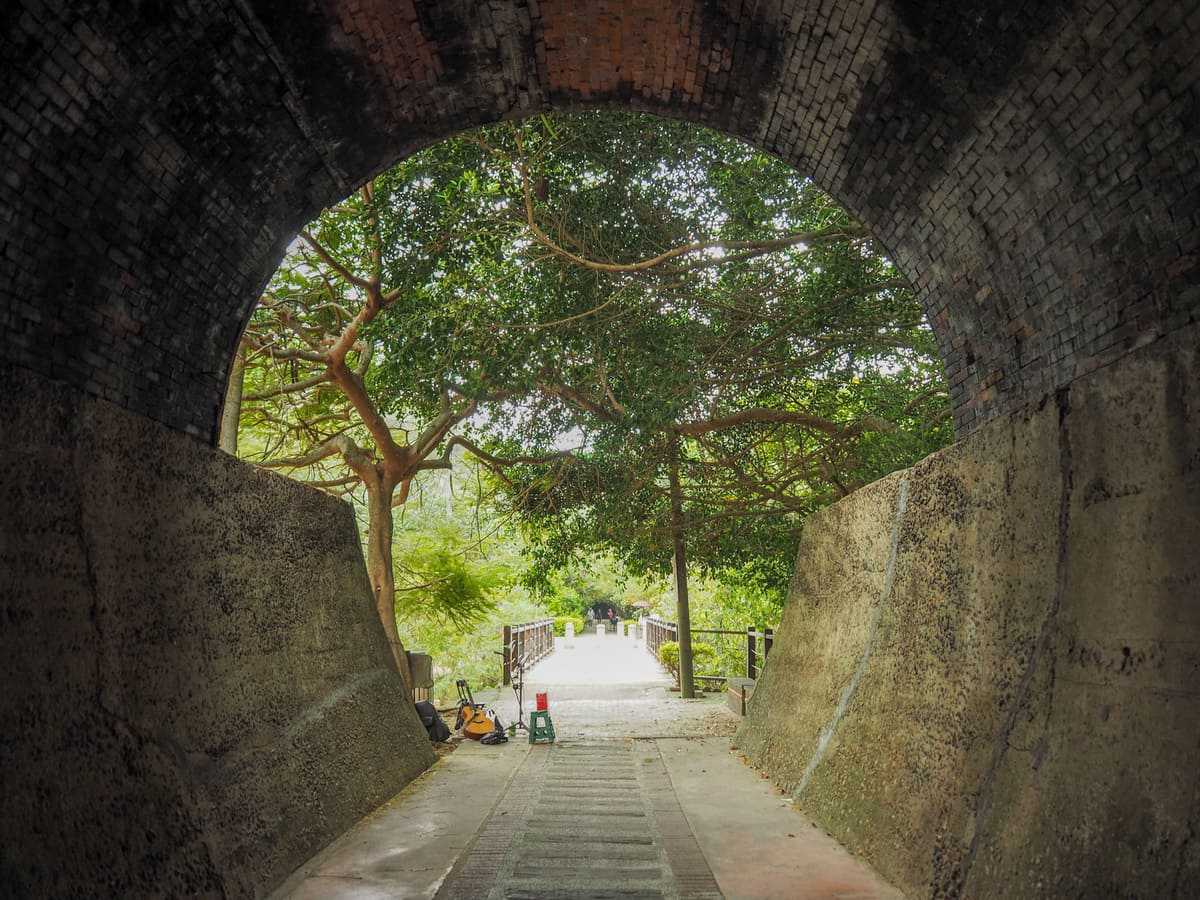
At the end of the first tunnel, we took a left and doubled back on ourselves to climb up the road. (There is a second tunnel of a slightly short length that you can walk through, but you’d have to come back the same way if you need to get back up to the top carpark.)
At the junction, head right and keep following the single-lane track upwards. We had to stand to the side to let cars pass us on a couple of occasions.
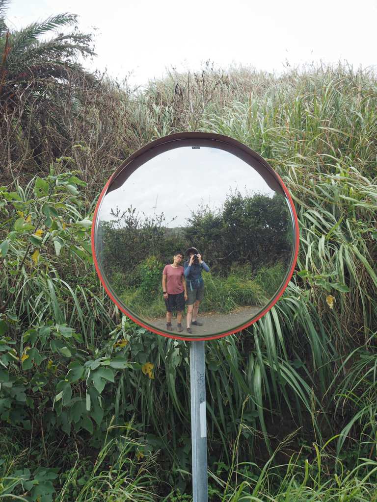
The pair of us in our matching shorts. Of course, she pulls them off better than I do.
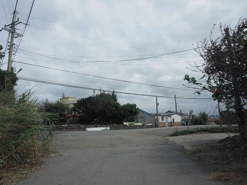
At the second junction, the lane joins a (slightly) larger road. Head left here.
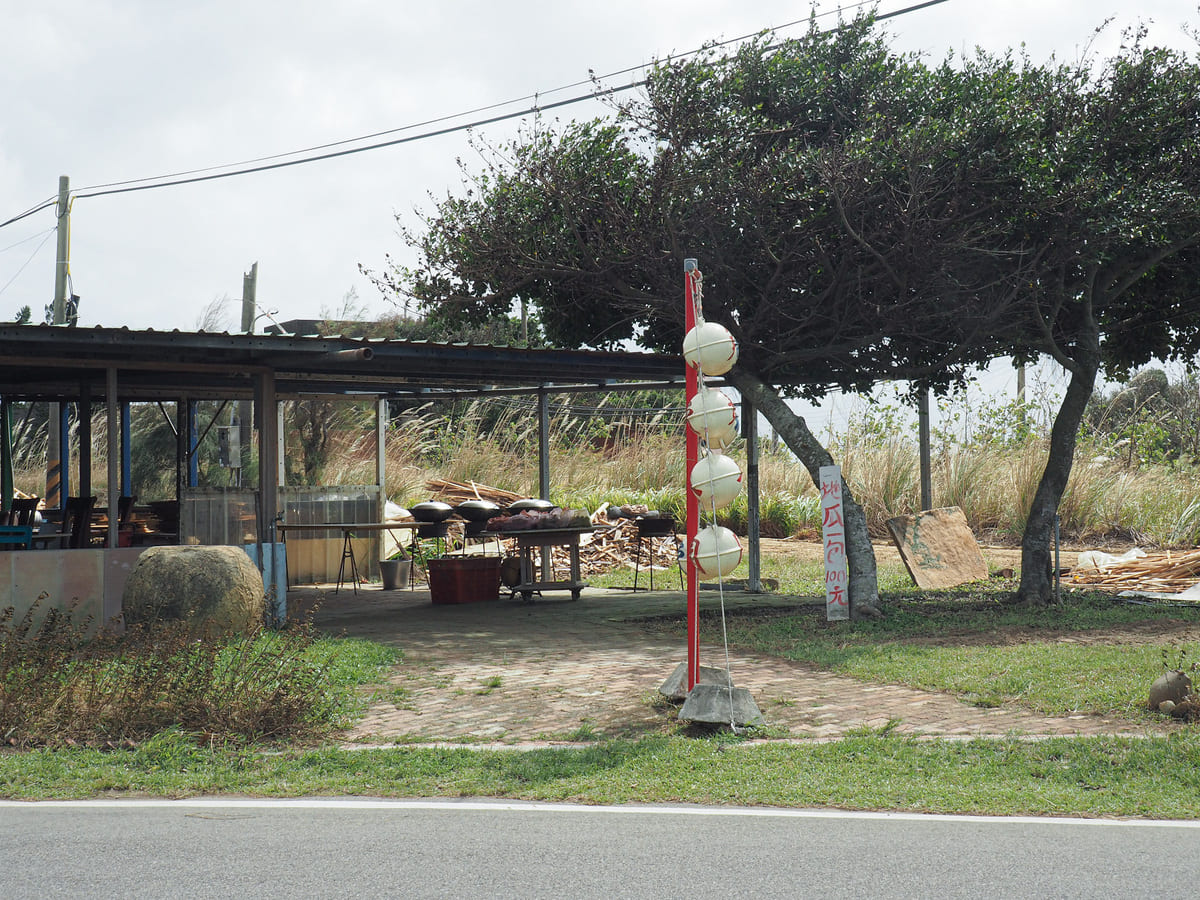
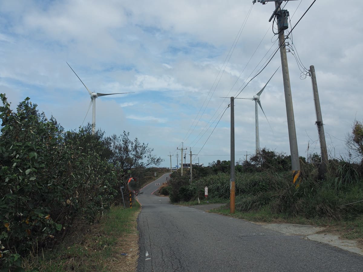
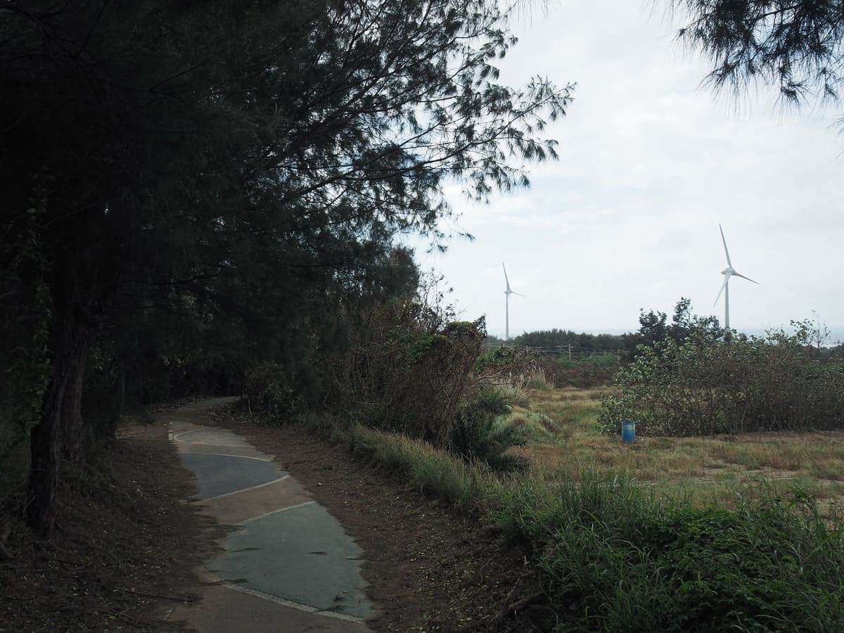
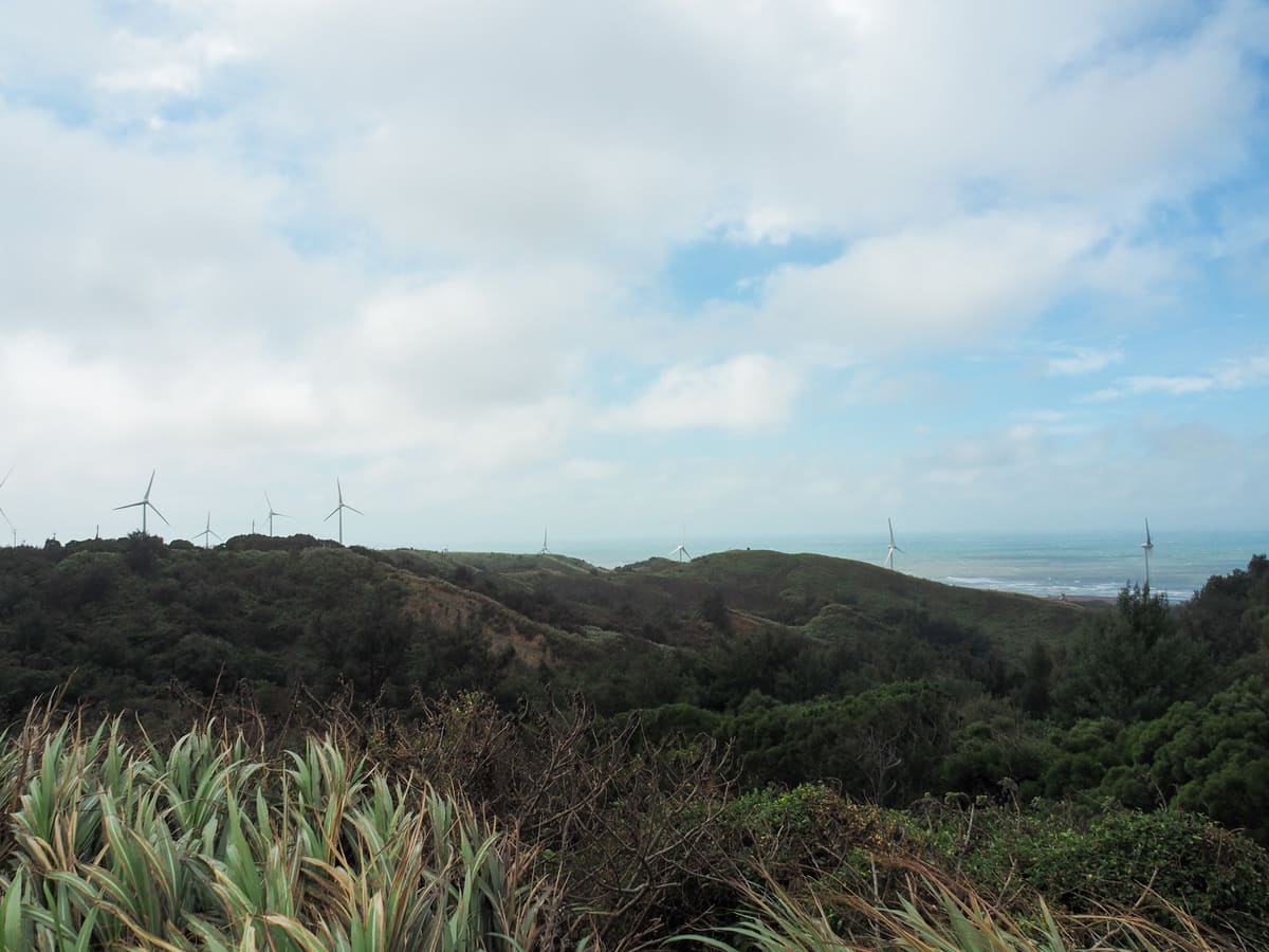
We passed a farm selling large bags of dusty sweet potatoes for $100 a pop, and soon after, we saw the turbines marking the end point of our journey.
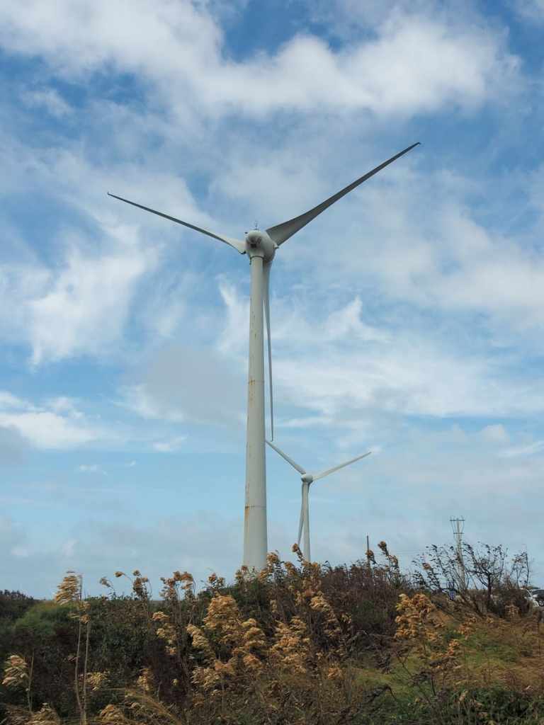
They are so much more impressive to see in person than through a photo. Somehow, photos seem to shrink them.
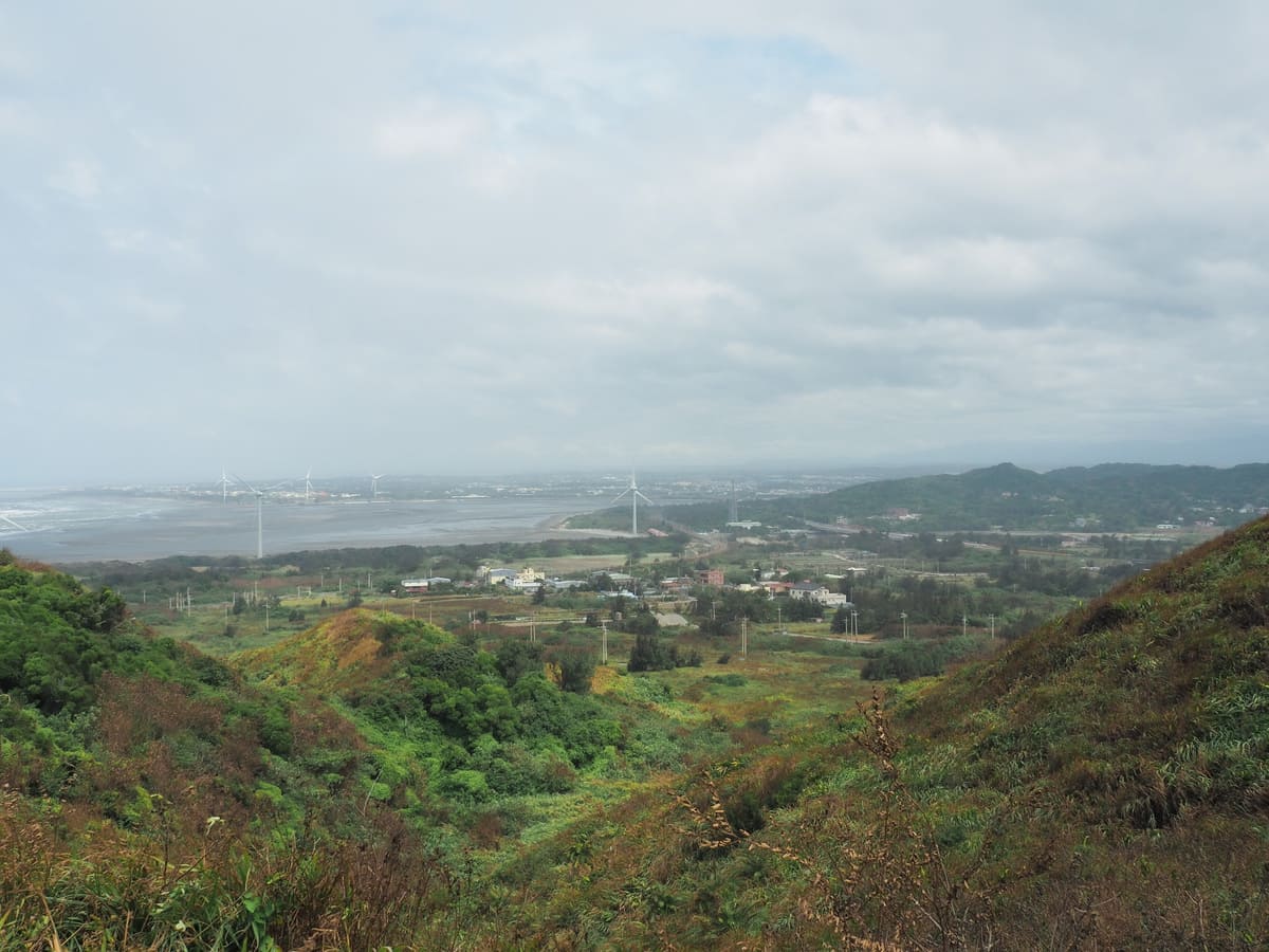
Back at the top, we took a little more time to endure enjoy the wind whipping around us and take in the views before braving the holiday traffic once more.
How to get to the Cape of Good Hope
Google Maps address: If you’re coming by car or scooter, you can park either in the top carpark, or the one close to Guogang Tunnel (although if you’re in a car, the second option involves a drive down a narrow and possibly busy lane).
GPS location: N24 36.000 E120 43.900
Public transport: There are a couple of ways you could get here on public transport.
- By HSR and bus – Take the High Speed Rail to Miaoli HSR Station, then transfer to the 5815 bus service, and alight at Haowangjiao bus stop. Unfortunately, this is quite a slow route and the bus journey alone will likely take longer than the walk.
- By train and YouBike – Take a coastal line train to Baishatun Station and pick up a YouBike from in front of the station. There’re a second YouBike stand where you can deposit your bike just outside of Qinghai Temple, which is close to Guogang Tunnel. The ride should take about 20 minutes, and for part of it, you can even follow the coastal bikeway.
Cape of Good Hope Trail Map
GPX file available here on Outdoor Active. (Account needed, but the free one works just fine.)
