
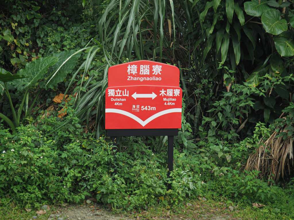
For railway engineering buffs, one of the most fascinating parts of the Alishan Forestry Railway is the Dulishan Squiggle. OK, so that’s not actually a proper name for the spiralling loops that the track takes as it circles around, through, and up the slopes of Mount Duli, but if you look on a map, it really does look like a doodle of overlapping circles. Mount Duli National Trail takes hikers up from Zhangnaoliao Station to Dulishan Station, crossing paths with the tracks at several points along the way. And the train is not the only neat thing about this walk. Fengtiagnyan Temple sits at the highest point of the track, and is known for its extensive free-to-use outdoor kitchen. For uniqueness, this trail is hard to beat.
DISTANCE: About 4 kilometres.
TIME: 2-4 hours. It took me about 2½ hours, but if I came back, I would definitely go all out on the temple cooking.
TOTAL ASCENT: Around 350 metres.
DIFFICULTY (REGULAR TAIWAN HIKERS): 2/10 – Just some steep steps, but otherwise, it’s easy.
DIFFICULTY (NEW HIKERS): 4/10 – The amount of elevation gain put this on the harder end of easy for anyone new to hiking in Taiwan.
SIGNAGE: Pretty good throughout.
FOOD AND WATER: I took a small 0.5L bottle and topped it up from the temple. As for food, it seems almost obligatory to take noodles to cook at the temple.
SHADE: The shade was very patchy on this trail. I definitely needed a sun hat and long sleeves.
MOBILE NETWORK: Mostly pretty clear.
ENJOYMENT: I absolutely loved this walk. It was short, but in that brief distance, it packed in cute mountain train stations, views, and a neat temple with a kitchen. It’s probably not the best walk to do if you’re seeking peace and quiet, but if you’re after an authentic taste of weekend Taiwanese hiking culture, this is a great choice.
SOLO HIKE-ABILITY: This would be a very safe hike to do solo.
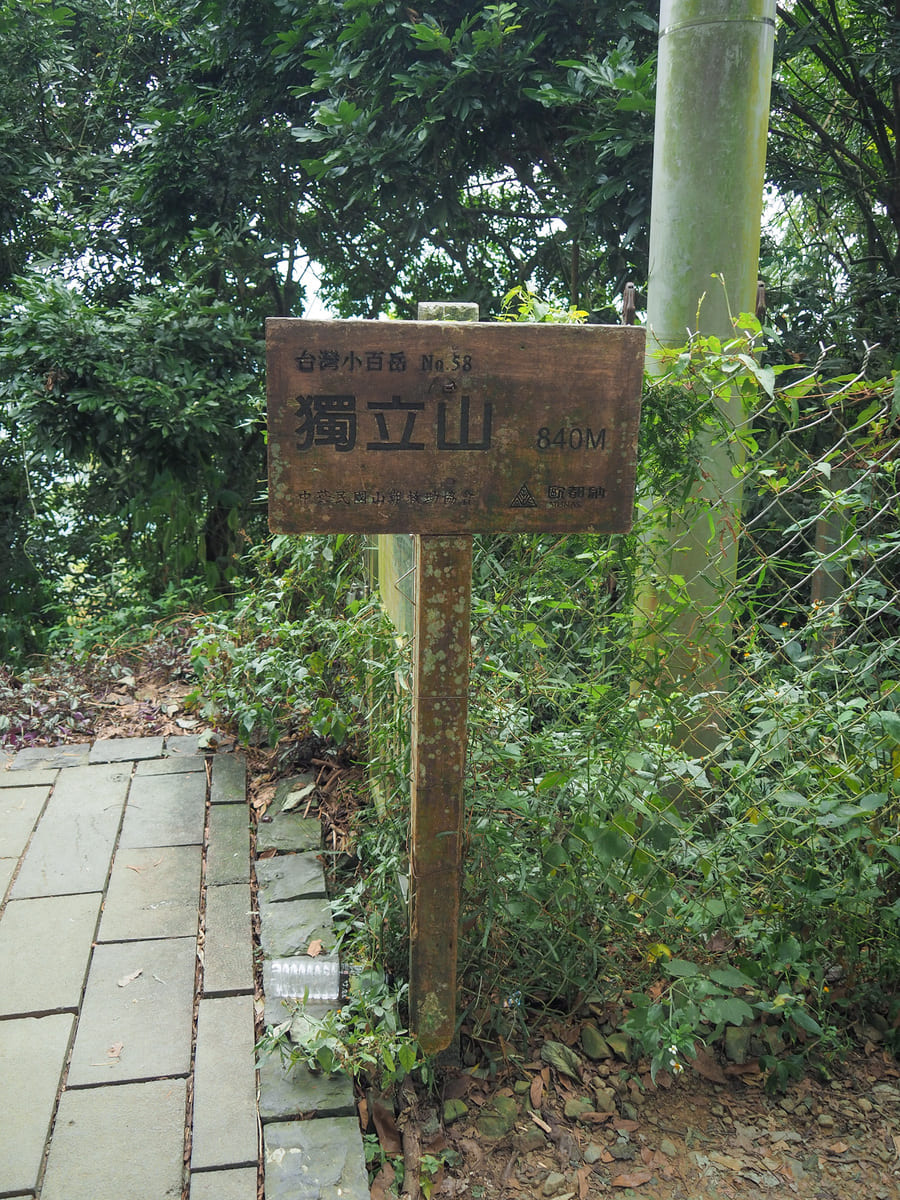
TAIWAN 100 MINOR PEAKS: Number 58, Mount Duli.
ROUTE TYPE: Loop
PERMIT: None needed
Jump to the bottom of this post for a trail map and GPX file.
DIRECTIONS:
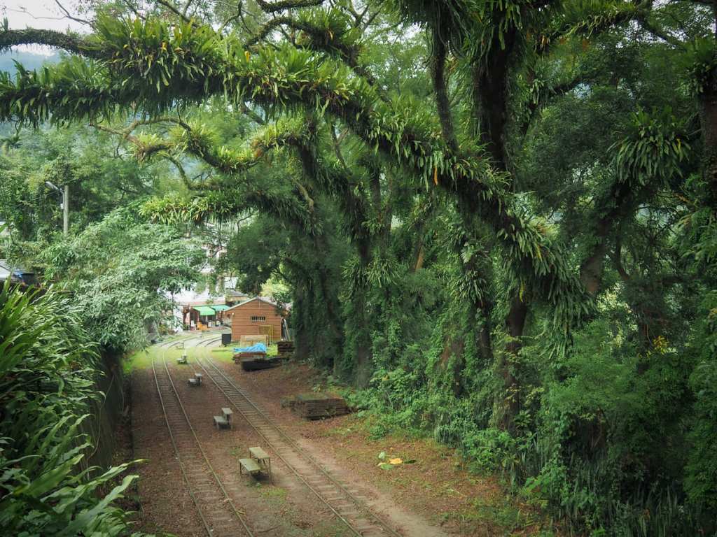
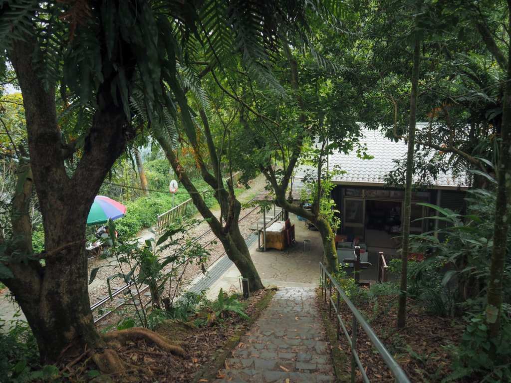
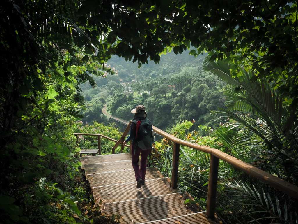
I parked my scooter at the side of the road just before it crosses the tracks, so when I crossed over and began to walk up the road, I got this pretty view of the station framed by fern-cloaked branches.
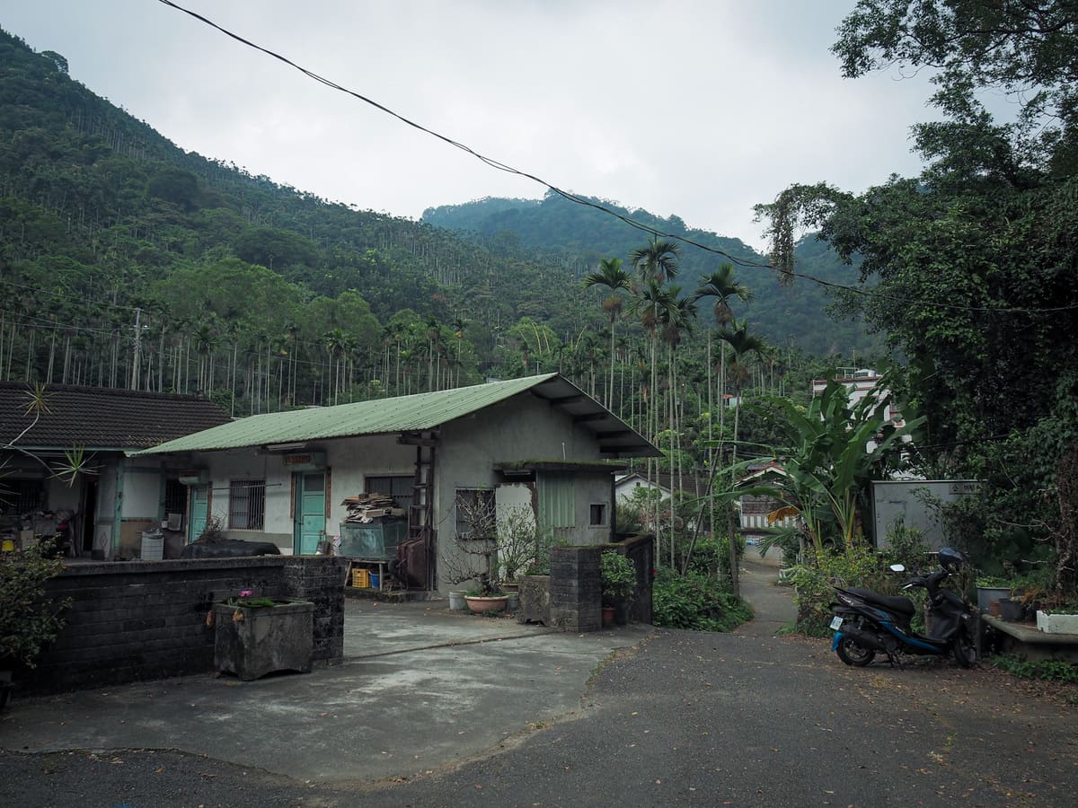
The track I was following on the Hiking Biji app starts from Zhangnaoliao Fude Temple (樟腦寮福興宮). The temple is actually two temples, with the smaller, more rudimentary one housing a plump rock. At the temple, follow the road to the right past a lovely old house and towards the station.
Every single stop along the Alishan Historic Railway has one of these cute little boards bearing the station’s elevation, neighbouring stations, as well as the stop’s name in English and Chinese (and in some cases, the language of the local Tsou tribe).

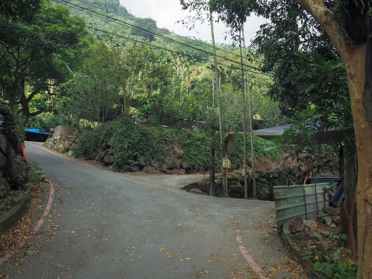
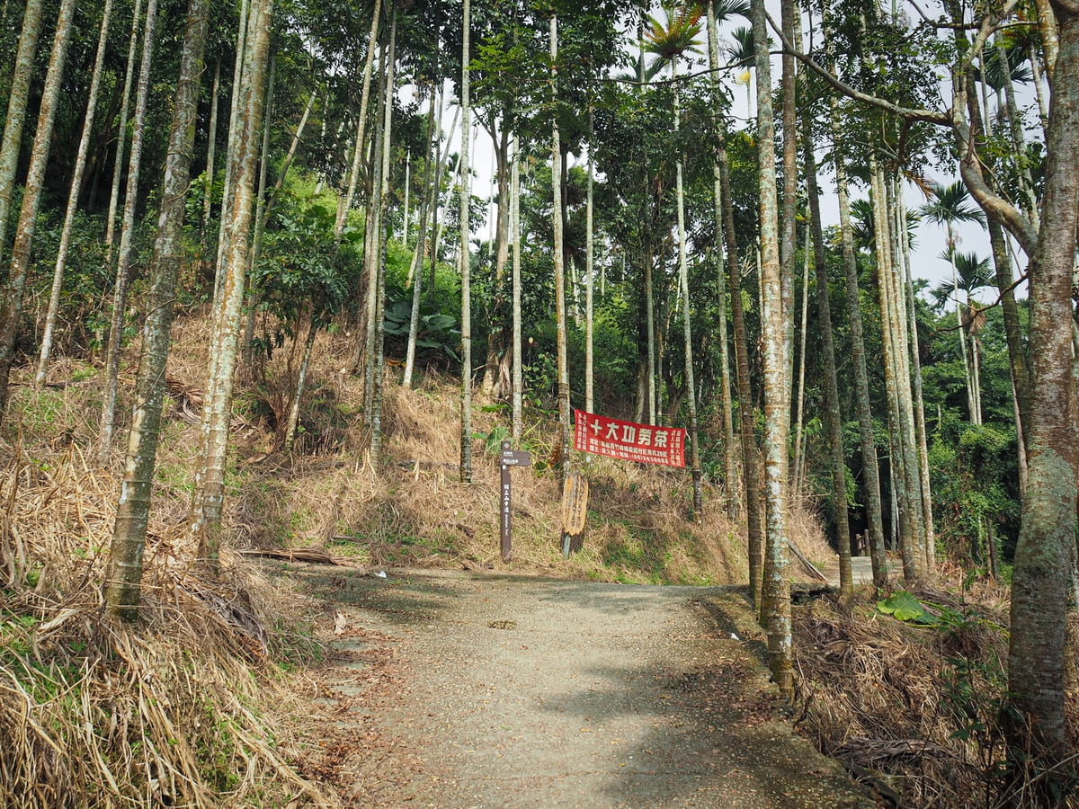
The track I was following indicated that I needed to head straight along the tracks, but a map just beyond the ticket booth suggested it would be better (and less trespassy) to take the steps heading up to the left here and so that’s what I did. (Many people ignore these instructions and just follow the tracks, but obviously I’m not going to advise you to do anything that might result in a fine). At the top of the steps, follow the road around until it comes to this junction, and here you’ll need to head left following the signs towards both Fengtiagnyan and the start of Mount Duli Trail (this is rendered in English on the signs simply as “To Trail Entrance”).
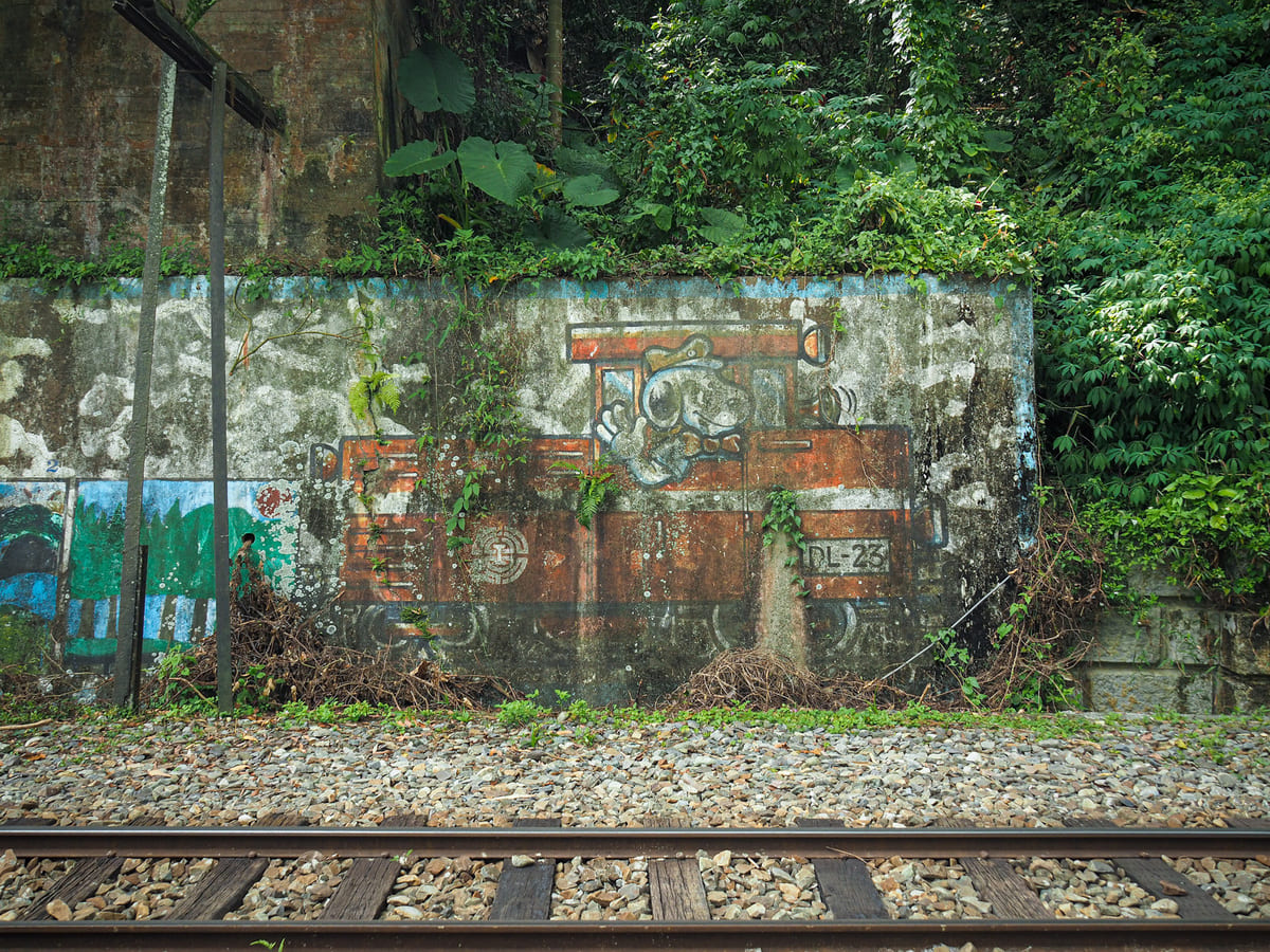
At the next junction, head right again, and soon after that, take yet another right past a big mural depicting the red Alishan train. There were a couple of grandmas selling persimmons and guavas, and an honesty stand selling some type of citrus fruit here, even on a non-holiday Wednesday afternoon. This suggests it must be a very busy trail.
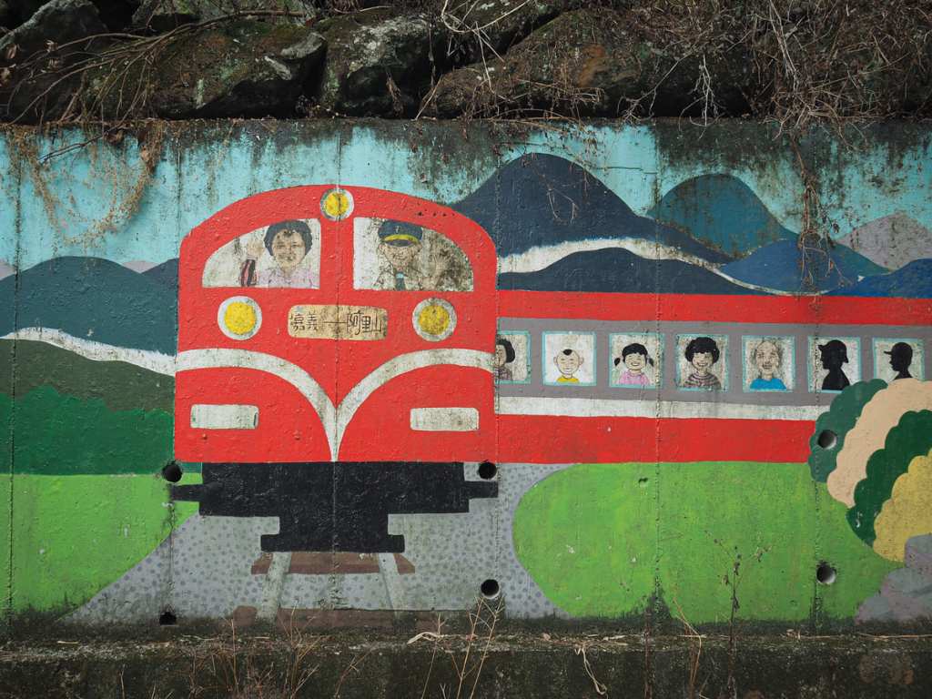
The mural is a little odd. Almost all of the people in the train have been rendered as cute cartoons except for the grandma in the front left window. It may just be an artifact of the algae, but she looks alarmingly real.

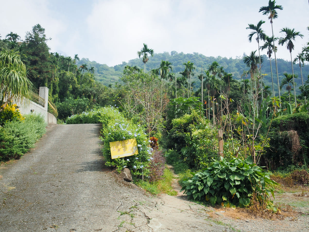
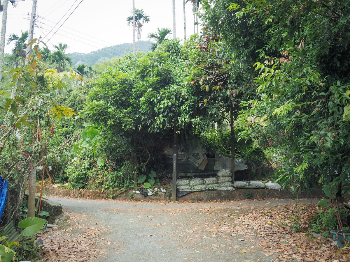
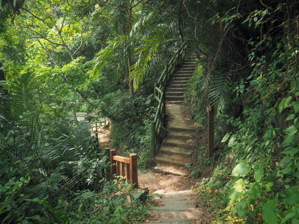
Past the train mural, take a left turn and head up past more painted walls. The trail proper starts here. A narrow path cuts between two strips of private land and past some graves. I actually missed it the first time around and had to double back. (The sign does say, but it’s very faded.)
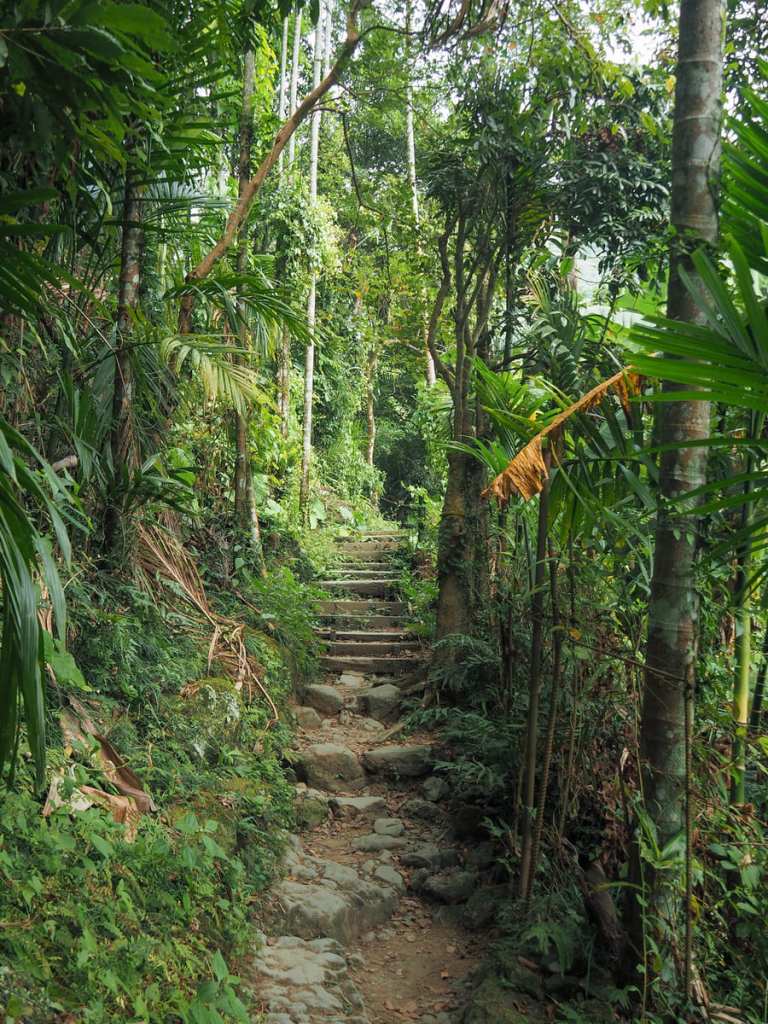
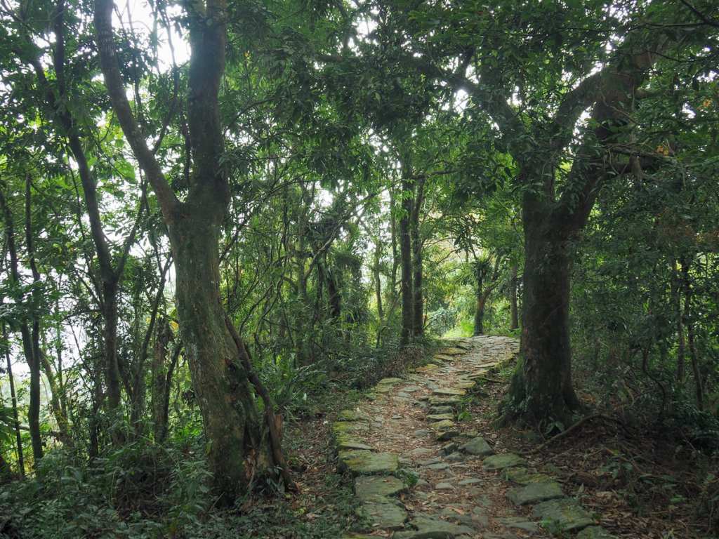
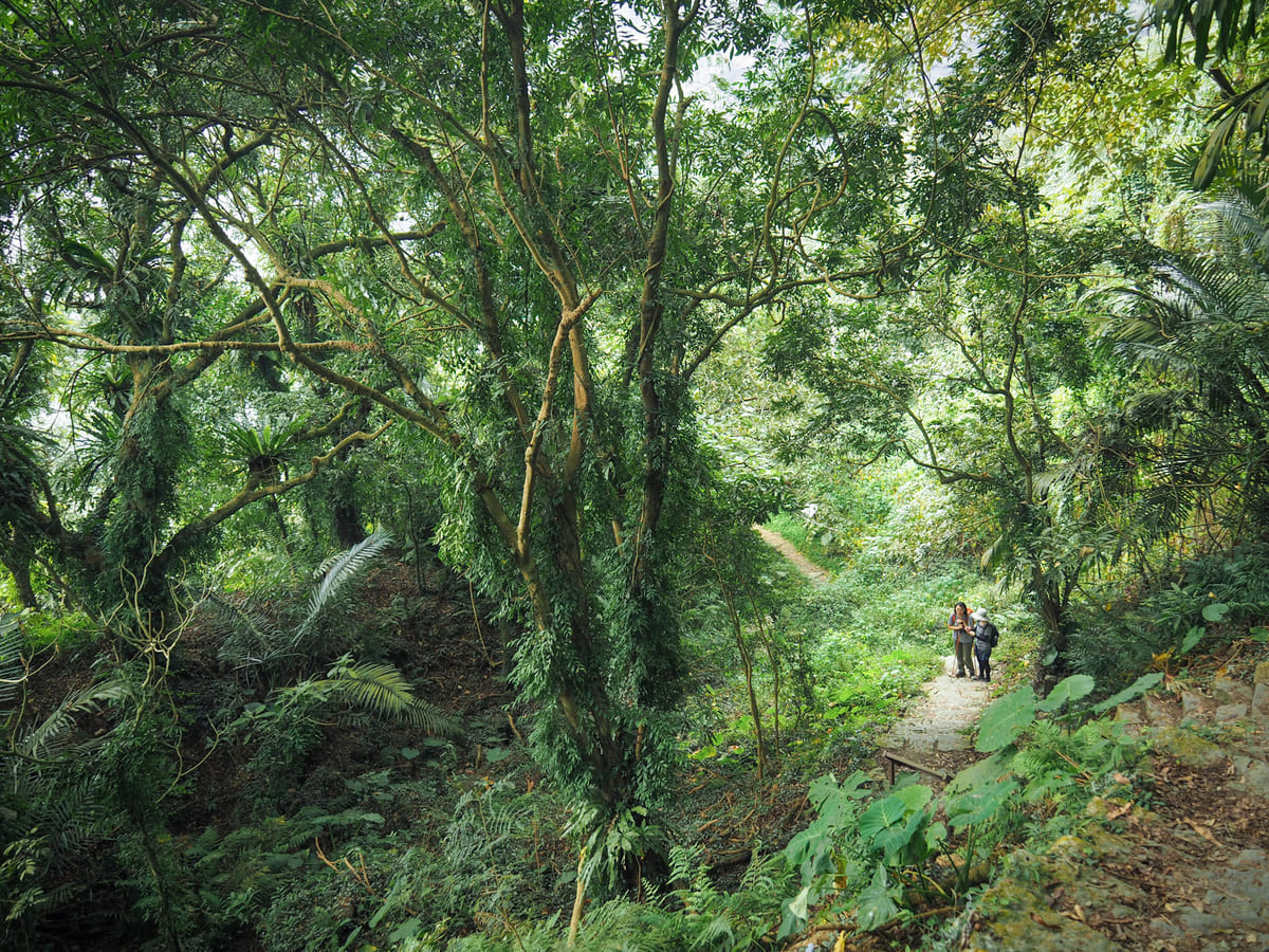
Pretty much straight away, you’re in amongst the jungle.
At the junction, turn left to begin a clockwise loop or right to start an anti-clockwise loop. For no particular reason, I decided to go left. I think this way probably feels slightly easier overall because the climbing is split into two sections.


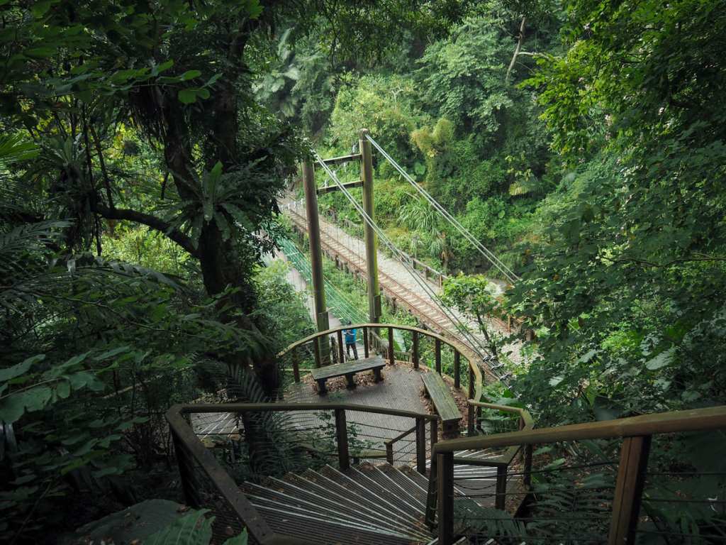
A fence across the path indicates a slight diversion from the original route. High above the stream bed, a decommissioned suspension bridge is slowly gathering moss. According to a news report from April 2023, the 20-year old bridge is showing signs of wear and tear, so it’s scheduled to be closed for renovation work until May of 2024. A temporary wooden bridge has been built at stream-level to help people pass. Somewhere in the vicinity, I picked up one of the trail’s digital gemstones. In addition to Mount Duli being one of Taiwan’s 100 Minor Peaks (小百岳), this trail has also been voted one of the top 100 trails in Taiwan by Hiking Biji users- an honour the app’s makers have celebrated by allowing users to amass a collection of digital gemstones as they walk it.
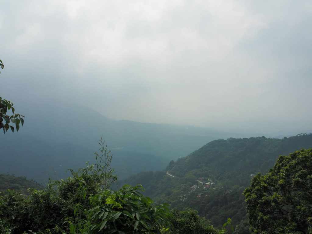
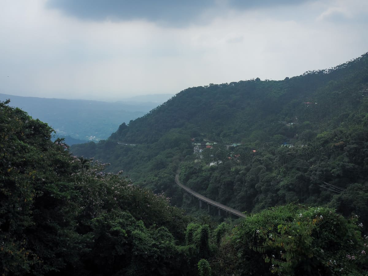
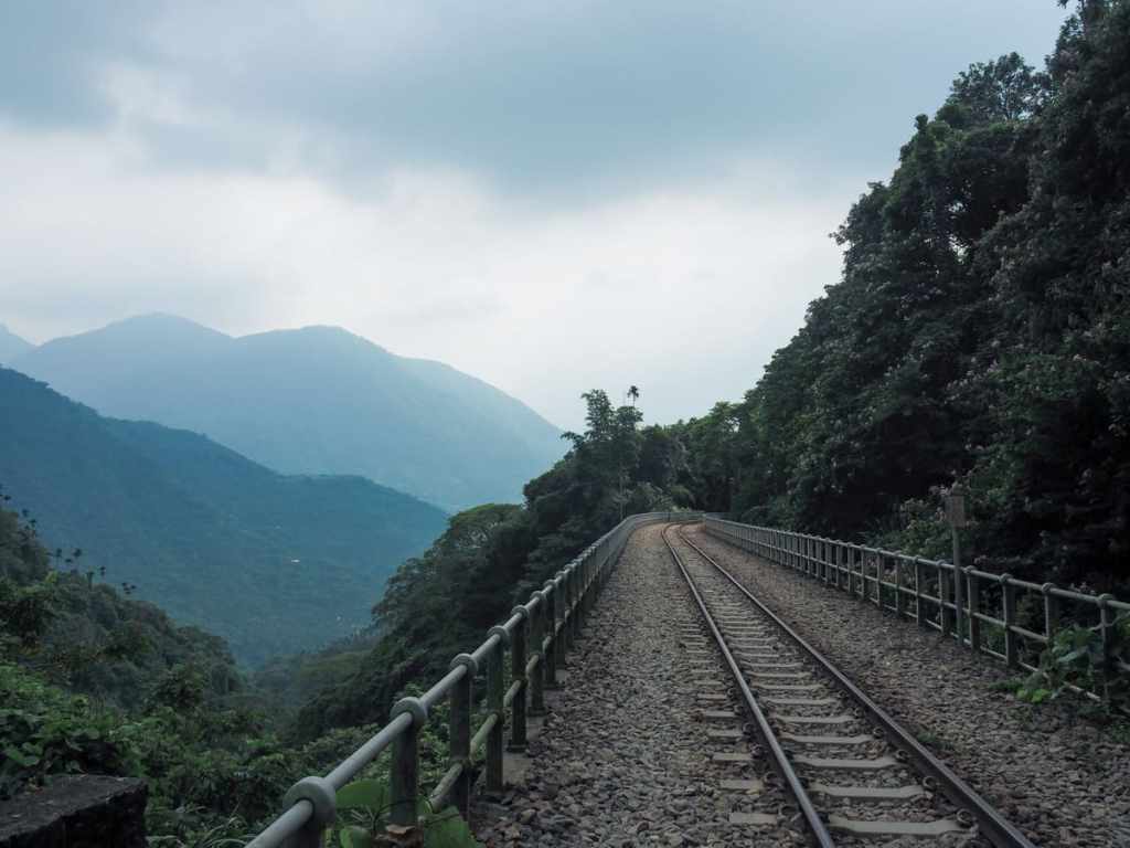
By about 11am, the sky was already full of haze. I could make out the railway village at Zhangnaoliao, but everything beyond that was unclear.

The steps lead up to a patch of farmland planted with betel nut trees, then takes a right turn.
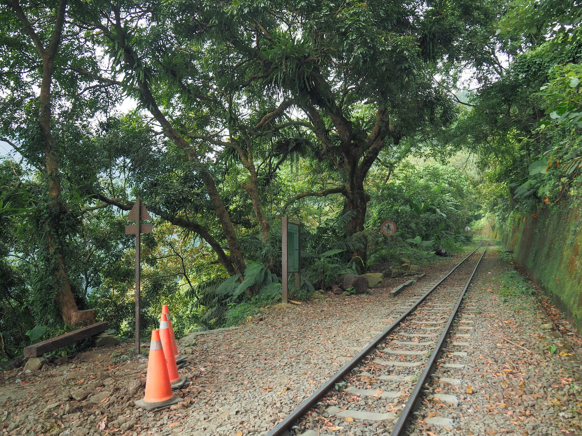
After only another minute or two, I arrived at the train tracks close to Dulishan Station. The trail later tracks back to this spot and crosses over the rails, but first, take a left turn and head up some more steps.


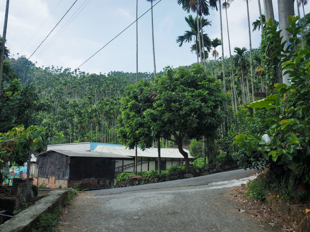
I climbed past a restaurant selling aiyu jelly and roast duck, then climbed some more until reaching this barn. Turn right onto the road, then turn left up some steps almost straight away.


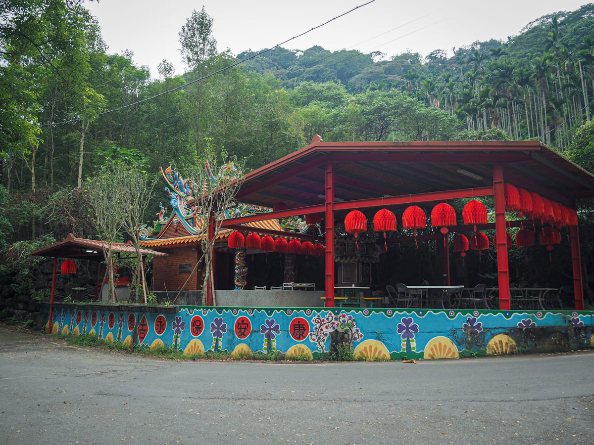
It was around this point that the din from up by the temple became audible. Following the noise, I turned left up the next narrow lane, then kept heading up as the lane became steps and I found myself entering the lower floor of a temple.
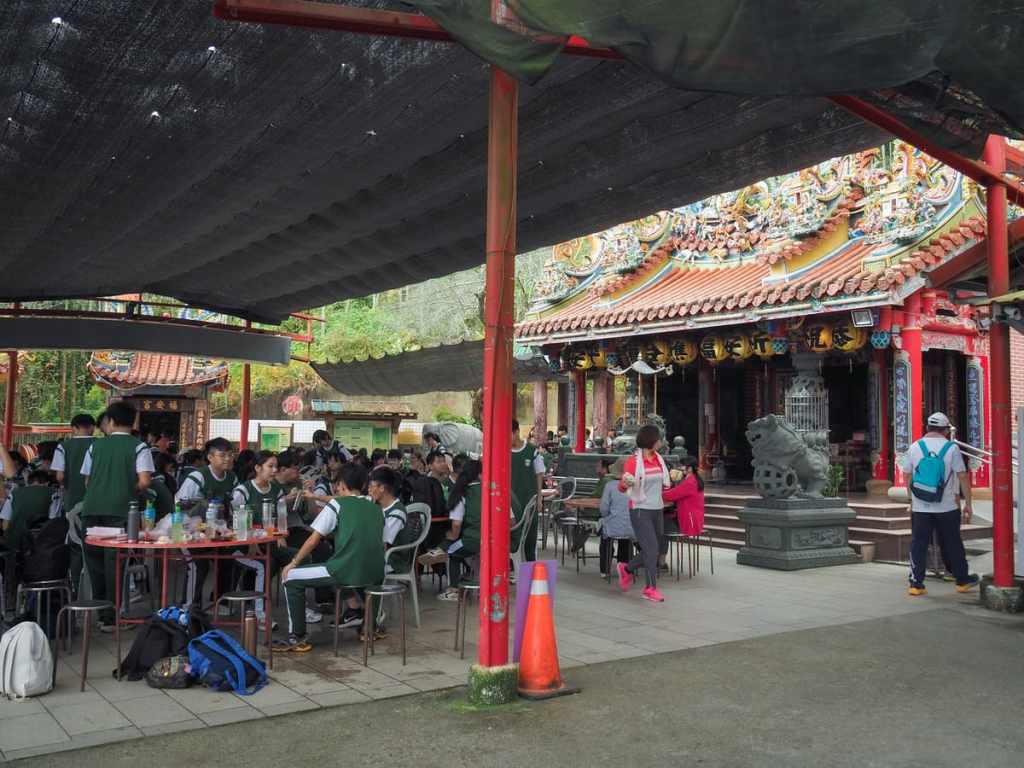
Straight away, it’s very clear that Fengtiagnyan Temple (奉天岩) is no ordinary temple. There is a stall on the lower floor selling lots of trinkets, snacks and drinks, and not just the usual paltry offerings you get at places selling (literal) offerings.
Upon reaching the upper floor, I realised that I’d managed to coincide my arrival with the lunch break of a local senior high school. Scores of teenagers were busily slurping down instant noodles and packed lunches as they sat around large circular tables.


I would say this kind of crowd is a rarity, but if you look at the temple on Google Maps, it seems like this place is perpetually lively. The reason for this seems to be the fact that the temple is famous for providing hikers need to cook their lunch totally free of charge (well, everything except the actual food).
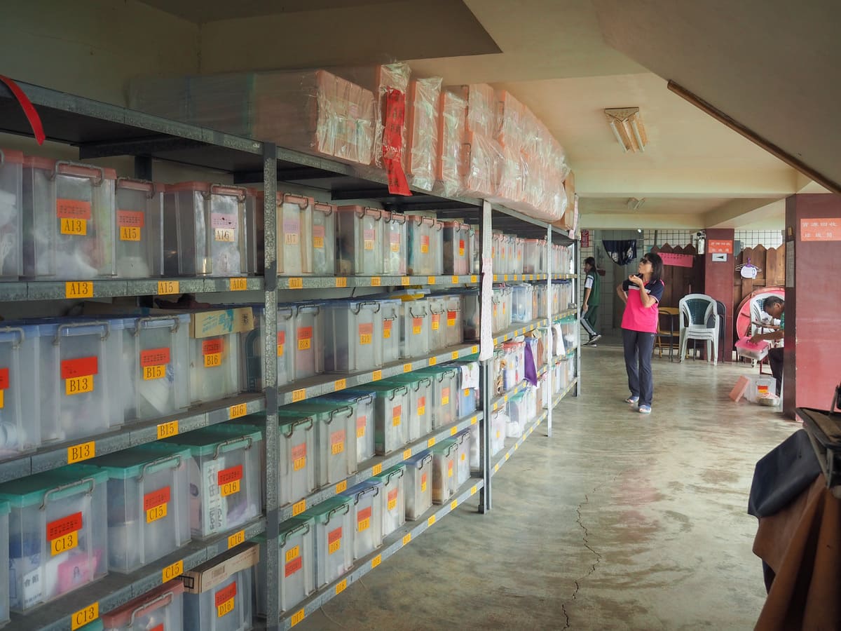
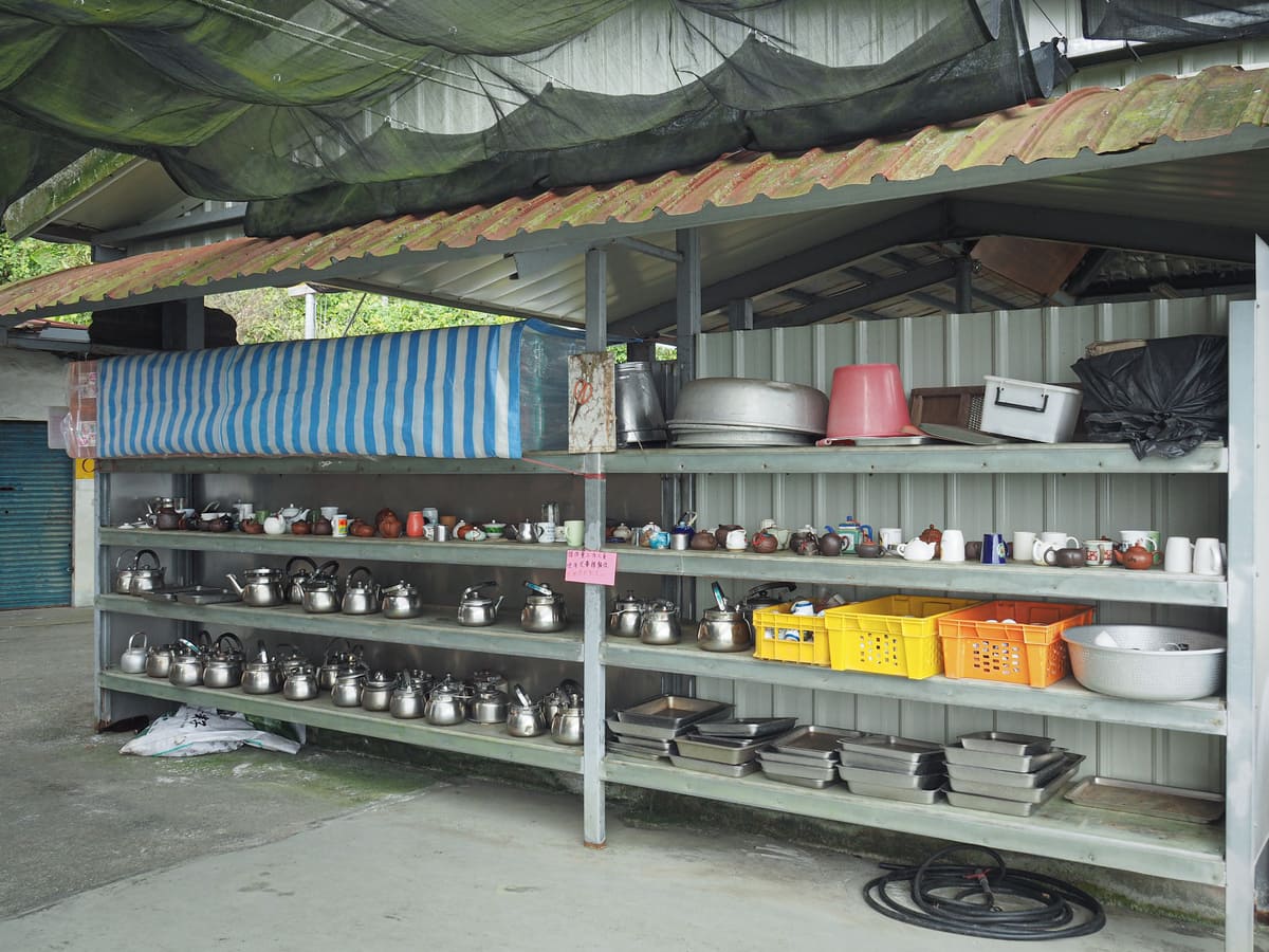

There are bowls, plates, cups, cutlery, gas, sinks, even a few basic ingredients like oil and salt. In my years hiking in Taiwan, I’ve never seen a place like this. From what I can gather, the boxes on the lower floor are rented by frequent hikers so that they can stash their stuff without needing to worry about how diligently other people washed their dishes, while the shelving on the upper level is basically a free for all. Just grab some gas, grab a pot, and get cooking—now it suddenly made sense why there would be so many stalls selling vegetables to hikers climbing uphill.
I was feeling miffed that I hadn’t brought anything to cook with me, when the principal of the school came up to ask me if I was willing to interact with their students (I’d already had a brief chat with an awkward 16-year-old named Ken). Suddenly, not being metaphorically chained to a boiling pot of water seemed like an excellent stroke of fortune and I made up some excuse about having to set off again.
From the temple, I retraced my steps back to the junction beside the railway tracks and turned left to cross over them. (I was tempted by the ice cream vendor here, but knew that if I made it back to Chiayi without succumbing, I would have a nice big bowl of taro and snow ice waiting for me).
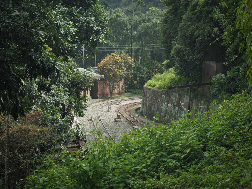
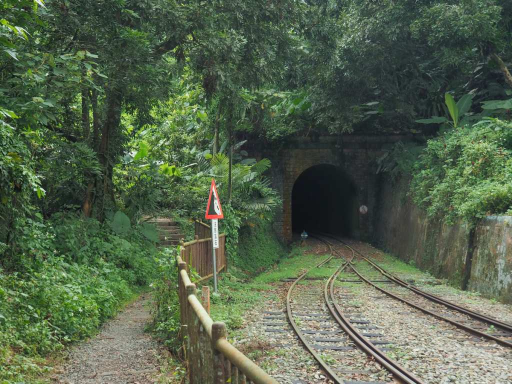
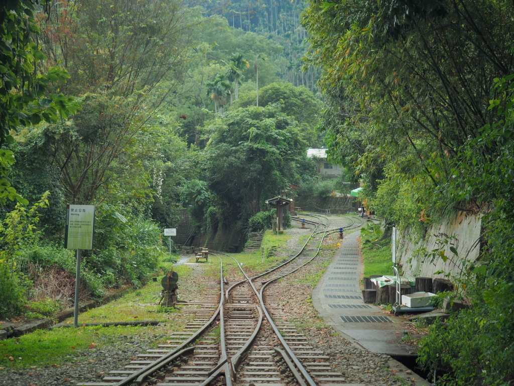
Steps run down to meet the rails again, and while it might seem like this is the same track from earlier, it’s not. Well, it is, but not exactly. Mount Duli presented a tough challenge for the engineers tasked with building the logging railway. In order to deal with its steep, C-shaped profile the rails have to wiggle around in messy loops that look rather like a kid’s scribbles if you look at them on a map. So, while it only takes a minute or two to walk from the spot in the last photo to this, it takes quite a bit longer to do on a train because you have to complete a little loop of the hill before you can get there.
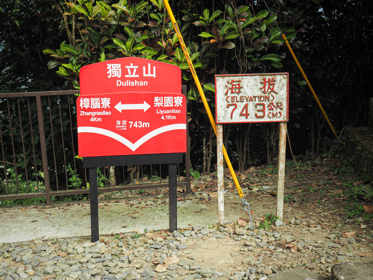
Mount Dulishan Station has only a handful of services a day, and for the rest of the time, the station sits unmanned.
To continue the walk, pass the toilet block and exit the station at the far end.
After a couple of minutes, steps climb up to join the upper level of the track. (It is actually possible to walk from the last junction along this upper track to this point if you’re not interested in visiting the train station.) From here, keep following the steps upwards.
Pretty variegated leaves line the path heading towards the summit.

About five minutes after I left Dulishan Station, I arrived at the top of Mount Duli. There peak is marked with a shelter and a summit sign, and I stopped in the shade to have a snack (away from the threat of having to be photographed talking awkwardly to teenagers).
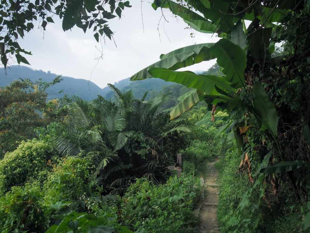
From this point on, the trail is downhill all the way.

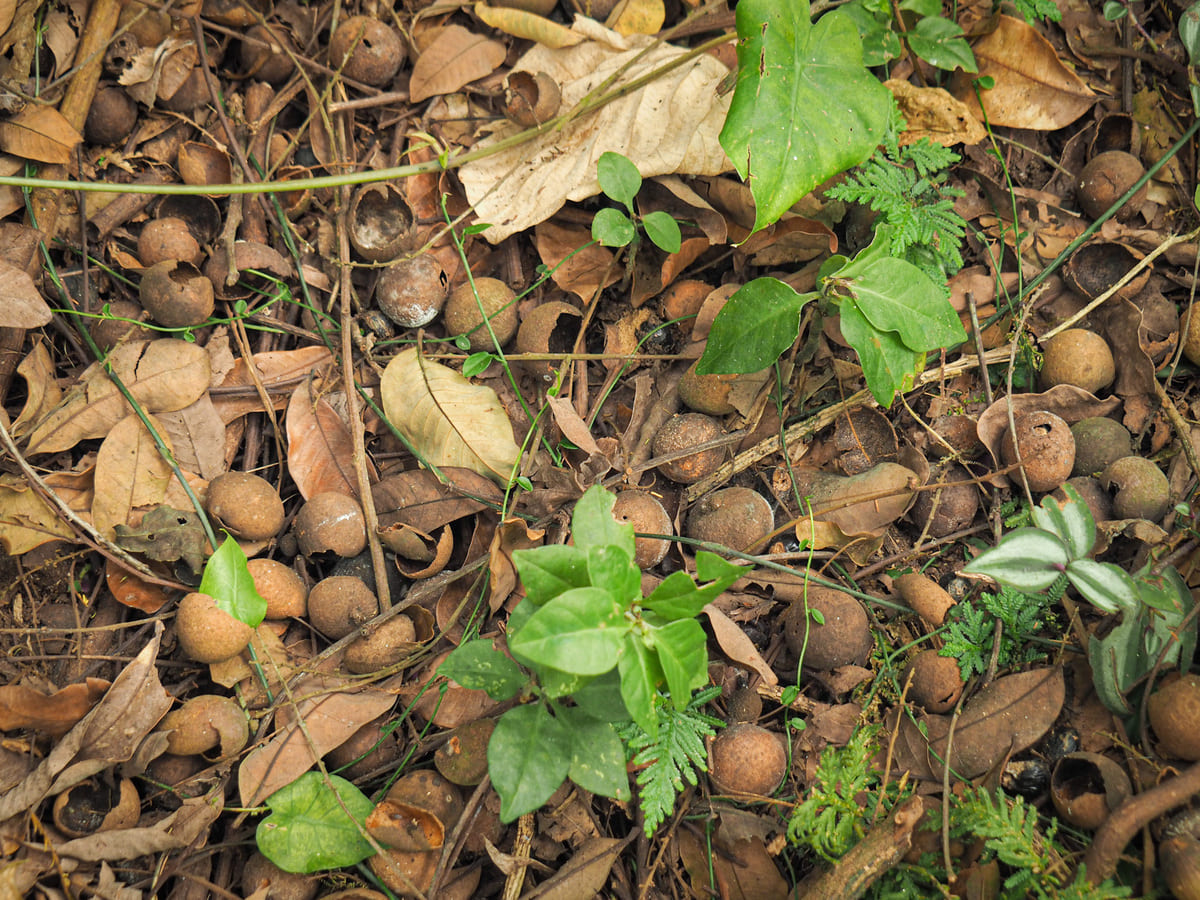
For most of the trail, the floor is absolutely covered with longan husks and seeds. I don’t know precisely when the season is, but I imagine the air is pretty pungent when they’re all ripe.
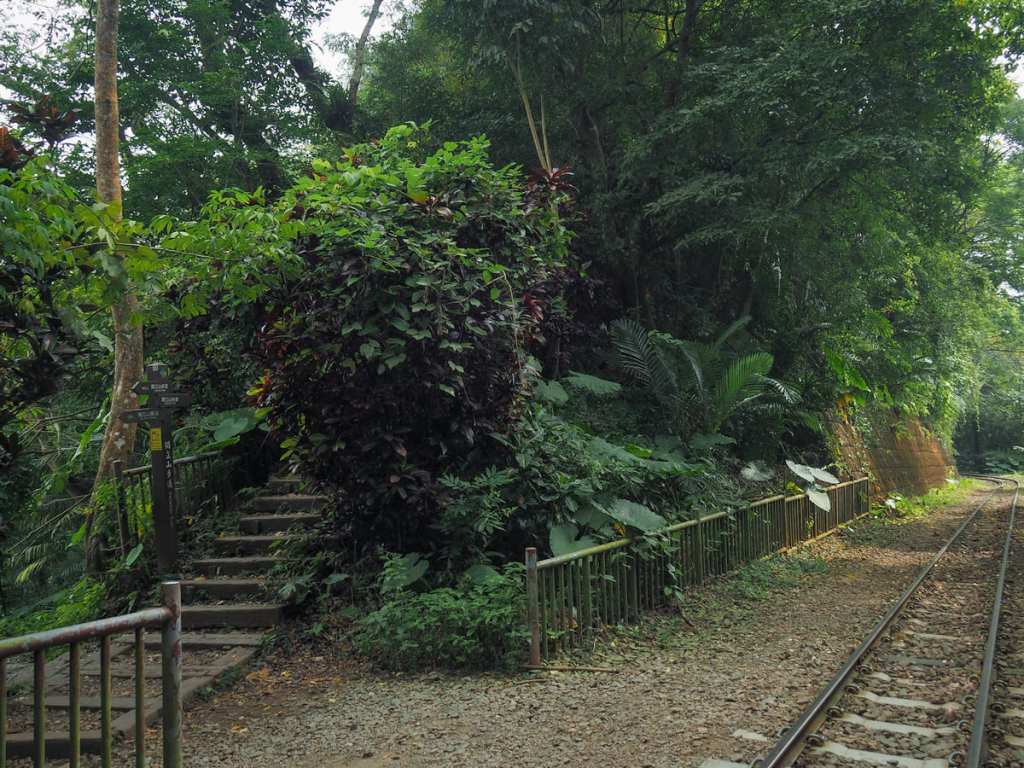
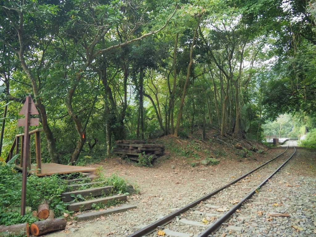
At the next junction, turn left and keep heading downwards (the other trail that joins here is the one that continues following the upper-level track).
The steps head down to cross the track. (Dulishan Station is just around the next bend to right.)
Thn, just a few minutes later, the trail crosses over the tracks again. This time, Zhangnaoliao Station (which is more or less straight ahead of you as you’re walking), can be reached by trains following the tracks to the left and round the back of the mountain one more time.

The steps continue straight over the tracks, but there is a platform of sorts another 50 metres up the rails which offers a nice view down towards Zhangnaoliao.
This next section of the trail follows a wooden boardwalk. In a few places, it opens up to give you more views of the railway. This must be a great spot to photograph the trains coming up.
Another good train spotting location is here, where a second suspension bridge sits alongside a short section of track between two tunnels. The guy standing at the end of the bridge there told me he had stopped because he spotted a Mikado pheasant and was waiting to see if it would reappear.
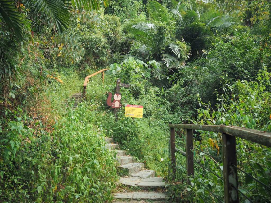
The steps track down to one final junction. If you head straight over and up here for another 50 metres, you’ll find yourself back at that first junction with the squirrel signpost.
Many hikers take a shortcut by crossing over this rail bridge and following it for another 200 metres back to Zhangnaoliao Station, but there are signs at either end of the bridge prohibiting walkers from doing so. (And occasionally people do get fined for doing this.)
Shortly after I arrived back at the station, a train passed through—one of the express services that doesn’t stop at all of the little stations like this one. The aunties sat at the station store laughed at my return, just as they’d laughed at my setting off. It seems the happy people of rural Chiayi can be amused by the mere appearance of a strange-looking foreigner in their midst.
HOW TO GET TO GET TO MOUNT DULI
Google Maps address: The walk starts and ends near to Zhangnaoliao Station, one of the stops on the Alishan Forestry Railway. There are a couple of paid car parks in the village and scooters can probably find a spot to pull up beside the road.
GPS location: N23 32.055 E120 36.150
Public transport: Technically, you should be able to do this hike by riding the Alishan Express, but practically, that might be a little challenging. Two services a day call here, one from departing from Chiayi at 9:00 and arriving at Zhangnaoliao at 10:10, with a return service departing Zhangnaoliao at 3:44. This would give you ample time to walk the route, however, since it’s not possible to book tickets for this shorter section, you’ll just have to turn up on the day and hope that there is space for you to board. I haven’t tried this myself, so I can’t speak to the success rate.
Further reading: Check here for a write-up of this walk in Chinese.
MOUNT DULI TRAIL MAP
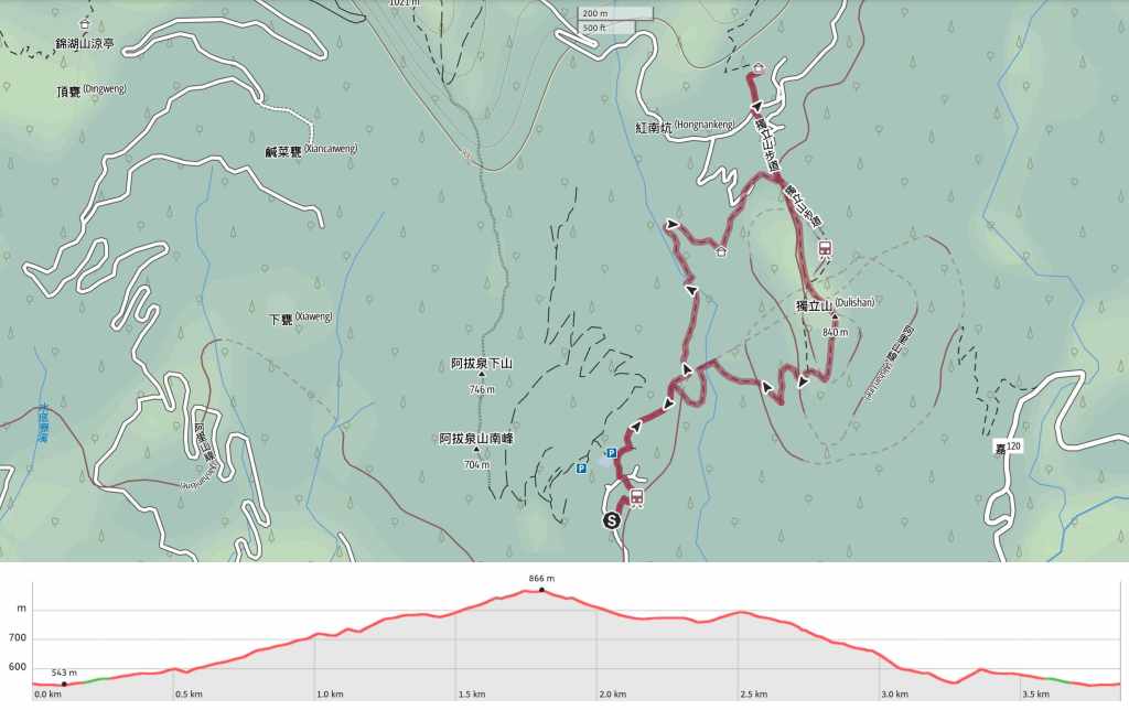
GPX file available here on Outdoor Active. (Account needed, but the free one works just fine.)

How beautiful! I am in the process of planning our trip to Taiwan. We will be limited on hiking time, but if there were one or two hikes you would say we should definitely do as first time visitors, do you have any top recommendations?
LikeLiked by 1 person
Well that’s exciting! Do you know where you’re planning to stay? And how experienced/comfortable are you as hikers?
LikeLiked by 1 person
Well at the moment we have 12 nights, and we are thinking 4 nights Taipei, 4 nights Sun Moon Lake and 4 nights Tainan. We may reduce time at SML and head off in to nature nearby, or reduce time in Tainan and add in Kaohsiung. As hikers we are comfortable and experienced, though prefer to do half day hikes rather than full day hikes 🙂 I am so excited to be visiting Taiwan, there is just so much to see and do. Feel like I need 2 months there!
LikeLiked by 1 person
12 days is a solid amount of time. I always feel a little sorry for people who come for a week or less, it’s really not enough. (9 years and I still haven’t run out of places on my “want to visit” list… in fact, the list keeps growing.)
I’m sure someone else has better advice regarding Tainan/Kaohsiung, but I can definitely offer a few pointers elsewhere.
Your instinct to cut your Sun Moon Lake time is sensible. Two nights is ample, especially if you’ve been to other places with mountain lakes. Instead, if you can find a hotel in the park that meets your budget, I would advise heading down from Sun Moon Lake via Alishan and spending a night or two there. The Mianyue Line Hike is absolutely unforgettable. I think it’s closed at the moment but it should be open again by the end of the month. (My trail guide and permit info can be found here: https://tinyurl.com/4babhb5w) The park itself is also really pretty. If you’re self-driving, you can stop off at Eryanping Tea Trail for a little walk on your way back to the city.
As for Taipei, there are sooooo many good walks to do. I’m assuming you’ll visit Jiufen/Jinguashi, and the Mount Banping and Teapot Mountain hike can be slotted in as a nice little half-day adventure to work up an appetite (https://tinyurl.com/4xsffhu7). You can easily walk or catch a bus between the trail and Jiufen. Another favourite day or half-day trip is a bike ride/walk through Sandiaoling Eco Tunnel. It’s pretty and takes you to some nice rural areas.
Other honourable Taipei mentions go to:
The Pingxi Crags (thrilling/scary)
Qingtian Grassland (easy, water buffalos, gentle hills)
Huangdidian (slightly hardcore, so much fun, past some people’s risk level)
And if you really want my favourite way to enjoy Taipei’s hills, it would be a sunrise hike to Scissors Rock or Thumb Mountain. (I live near the former and love watching the sun come up from up there.)
Finally, this isn’t on your schedule, but if your plans change, I’d look into Lion’s Head Mountain in Miaoli. It has an easy walk with so many cool temples, plus, you can spend a night at one of the temples there and I think that’s a pretty unique Taiwan experience.
(All of the walks mentioned are ones I’ve done and written about, so if any sound interesting, you can find all the particulars on my site.)
LikeLiked by 1 person
Wow this is sooo helpful, thank you so much – I hugely hugely appreciate it and am so excited for my trip. I will definitely take you advice on shortening time at Sun Moon Lake and definitely getting the Mianyue Line Hike in 🙂 Thank you again for all your detailed information – I’ll definitely be going through your posts soon!
LikeLiked by 1 person
Thank you for sharing the information and this place truly looks great for an trip!
LikeLiked by 1 person
It really is a very unique little spot. I still haven’t made it back, but I’d really love to go again so that I can have lunch at the temple.
LikeLike