UPDATED March 2026 to reflect changes to transportation schedules.
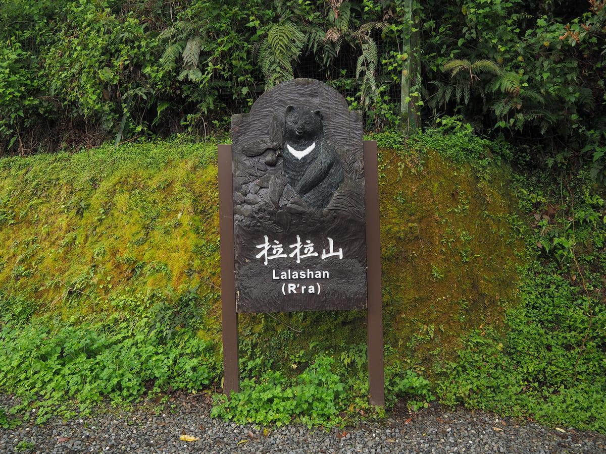
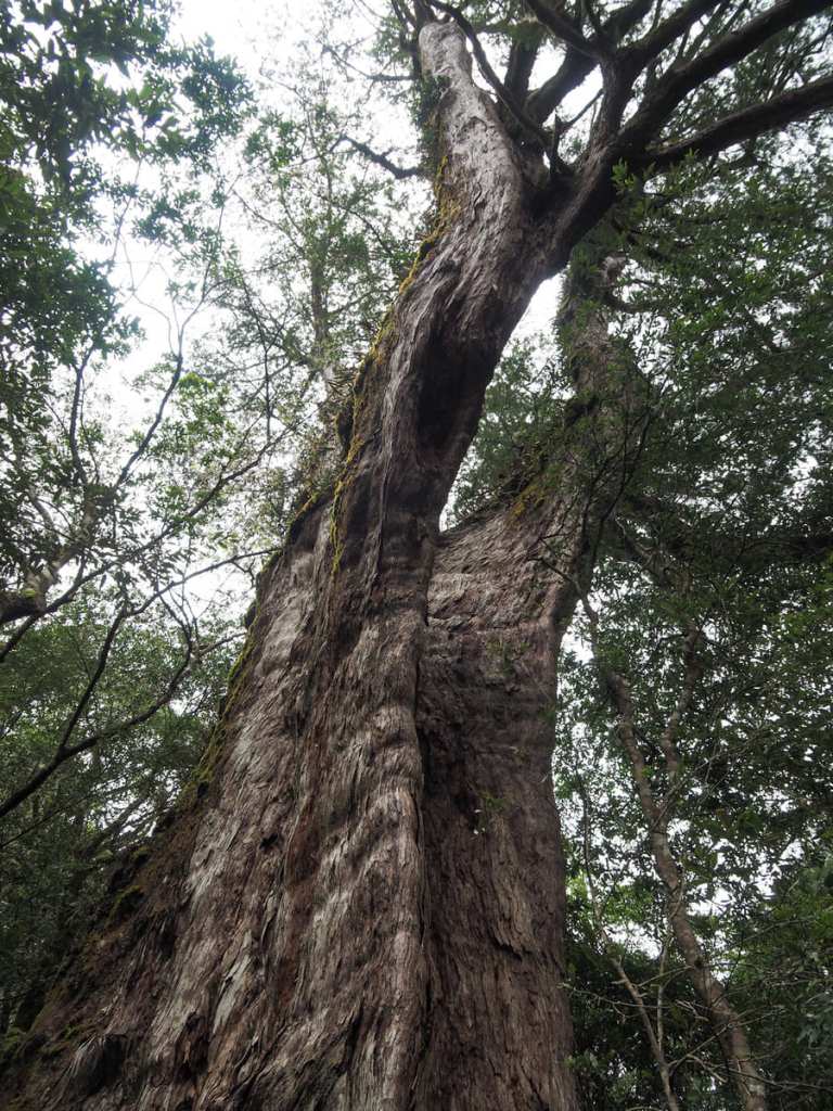
Lalashan (拉拉山森林遊樂區, or R’ra in the local Tayal language), is one of 19 such designated national forest recreation areas in Taiwan. It occupies an area of land that sits 1,500 to 2,130 metres above sea level in Taoyuan’s Fuxing District up a winding road dotted with Tayal villages. The forest is home to many ancient trees, some of them centuries old, and a pleasantly shady trail takes hikers on a meandering loop to greet these sacred giants.
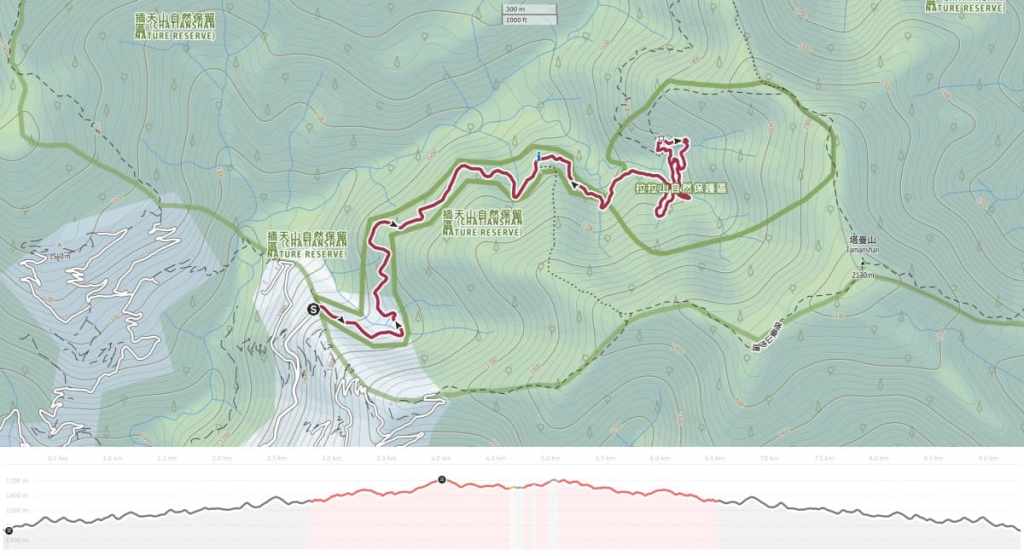
DISTANCE: If you’re coming by public transport, you can expect to hike 9.3 kilometres, but if you’re arriving by private car, it’ll only be about 4 kilometres.
TIME: 4-5 hours — It took me a little over four hours to cover the route shown here, although that could easily have been longer if I didn’t need to keep an eye on the bus times — it’s a lovely place to linger.
TOTAL ASCENT: Around 720 metres, but that is including the gradual but constant slope up from the bus stop to the visitor centre.
DIFFICULTY (REGULAR TAIWAN HIKERS): 3/10 — This is a harder easy walk for anyone used to Taiwan’s hiking trails. The routes are define and easy to follow, but there are steep steps and the ground is often uneven. Added on to that is the fact that Lalashan is pretty remote and therefore the travel logistics require a little more effort than normal.
DIFFICULTY (NEW HIKERS): 5/10 — For those unfamiliar with hiking in Taiwan, this should be considered a moderately difficult hike for the same reasons as above.
SIGNAGE: Bilingual signage is present throughout the park.
FOOD AND WATER: I took some snacks and about 1L, almost all of which was consumed. There is a water dispenser, a café and a small restaurant in the visitor centre.
SHADE: If you’re coming by public transport, the road from the ticket booth to the visitor centre is a little exposed, but the remainder of the walk is pretty shady.
MOBILE NETWORK: Signal is a little weak in spots, but never for too long.
ENJOYMENT: Lalashan’s collection of giant trees is absolutely worth the visit and if you go midweek, you’re likely to have this beautiful forest all to yourself for extended periods. It’s an excellent location for forest bathing, bird spotting, and just generally enjoying being out in nature, and its elevation means it is a great place to escape the summer heat.
SOLO HIKE-ABILITY: This is absolutely a safe place to head off on your own. In fact, it’s probably one of the safest places to enjoy the deep forest feeling as a solo hiker.
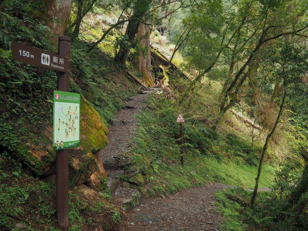
BATHROOM FACILITIES: There are toilets by the visitor centre and two more places deeper into the park. If you come by bus, you’ll also find that the drivers stop once in each direction to allow passengers to get off and use the bathroom.
HIKING BIJI STICKERS TO COLLECT: This trail is one of the Hiking Biji app’s 100 best trails in Taiwan (Taoyuan selection).
ROUTE TYPE: Lollipop loop (or lollipop figure -of-eight loop).
PERMIT: None needed, but you do need to buy a ticket to enter Lalashan National Forest Recreation Area. See below for details.
Jump to the bottom of this post for a trail map and GPX file.
DIRECTIONS:
The bus has the feel of a travelling community. Many of the passengers seem to be regulars and given that the bus is a small one, the driver
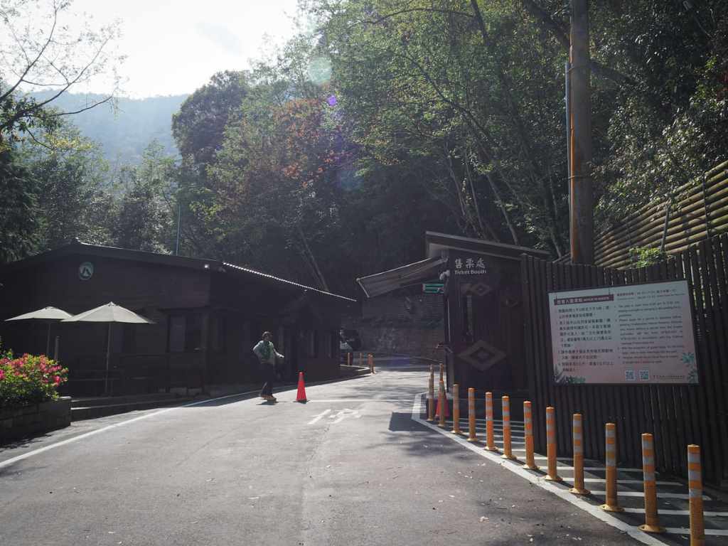
If you walk another 100 metres up the road from where the bus stops, you’ll arrive at the ticket booth. There are toilets here (on the left once you’ve passed through the gates).
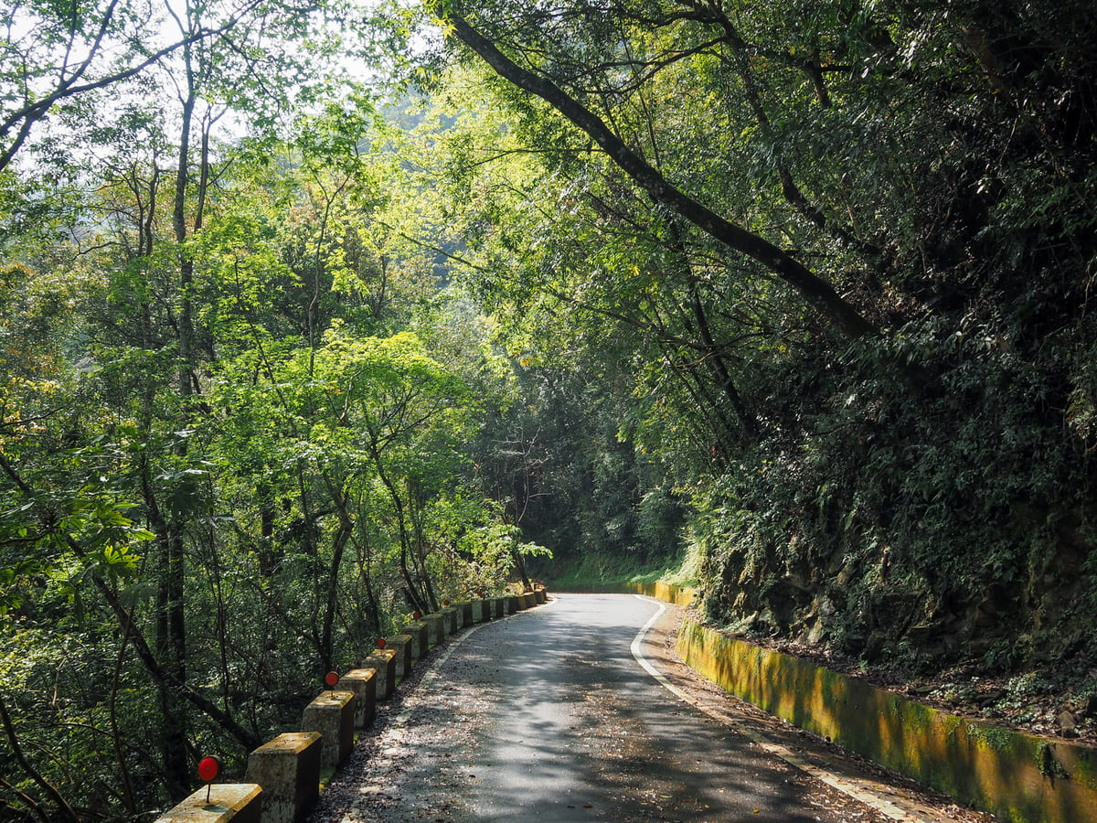
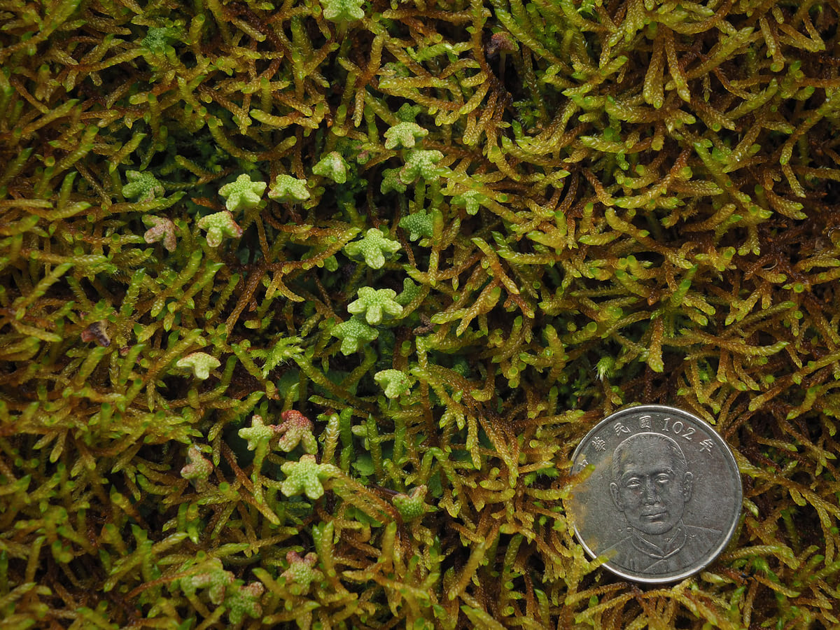
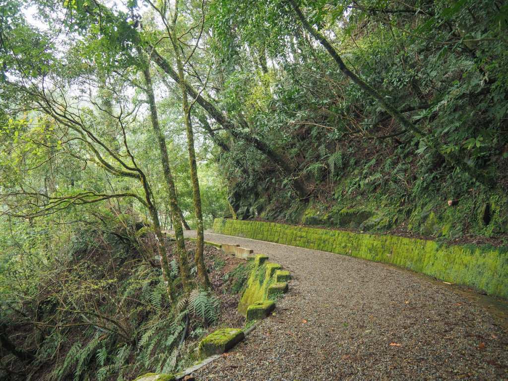
If you’re driving, you can just head on through and drive all the way up to the visitor centre, but if you’re arriving by bus, you’ve got a 2.7-kilometre warm-up walk before the real trail begins. Luckily, the road walk makes a pleasant change after all of that bumping up and down in the bus. There are mosses and lichens and liverworts on the walls and the surrounding forest is full of noisy bird life.

It took me about 35 minutes to make it to the visitor centre.
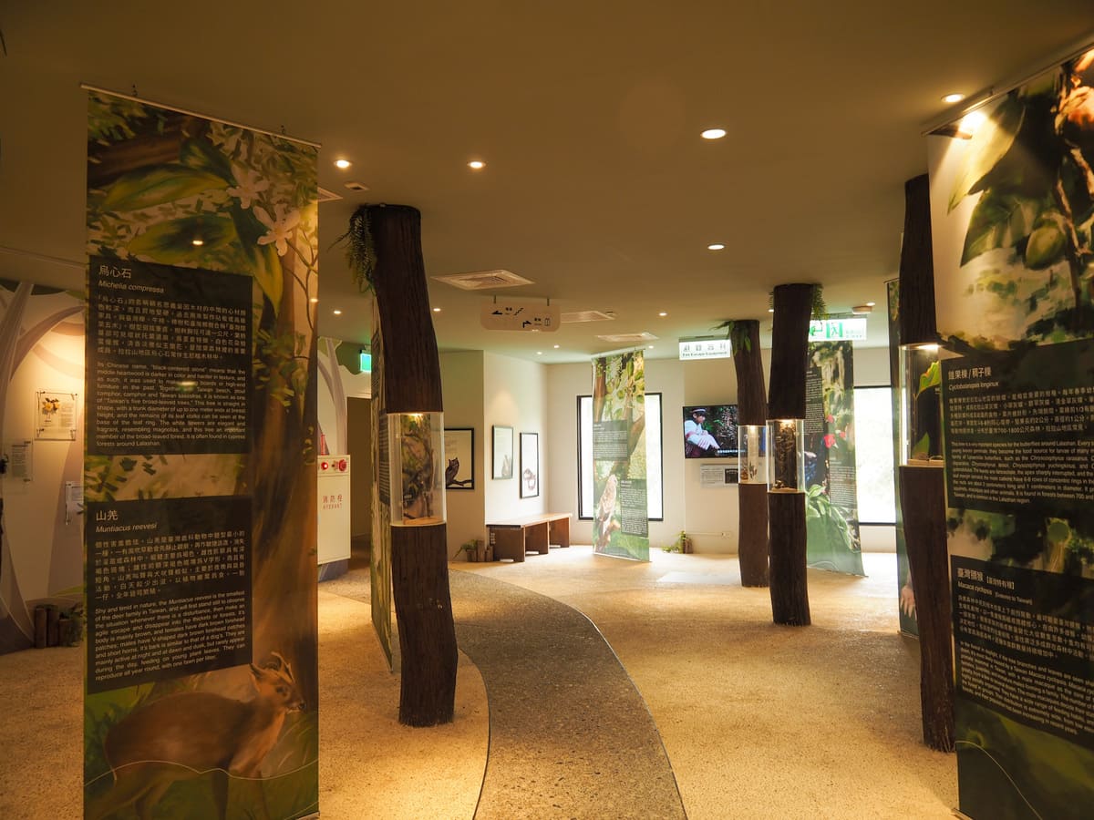

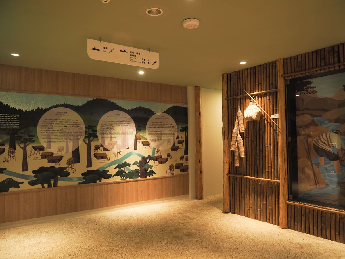
You wouldn’t know it from outside, but the centre is actually 4-floors deep. You enter on the fourth floor, where there’s a small store selling local products (peach jam, magao peppercorns, that kind of thing); the second floor has toilets and a gallery space with exhibits introducing the park’s plants and wildlife, and the local Tayal Indigenous villages; the second floor has a restaurant, and the ground floor has a kids’ play area.

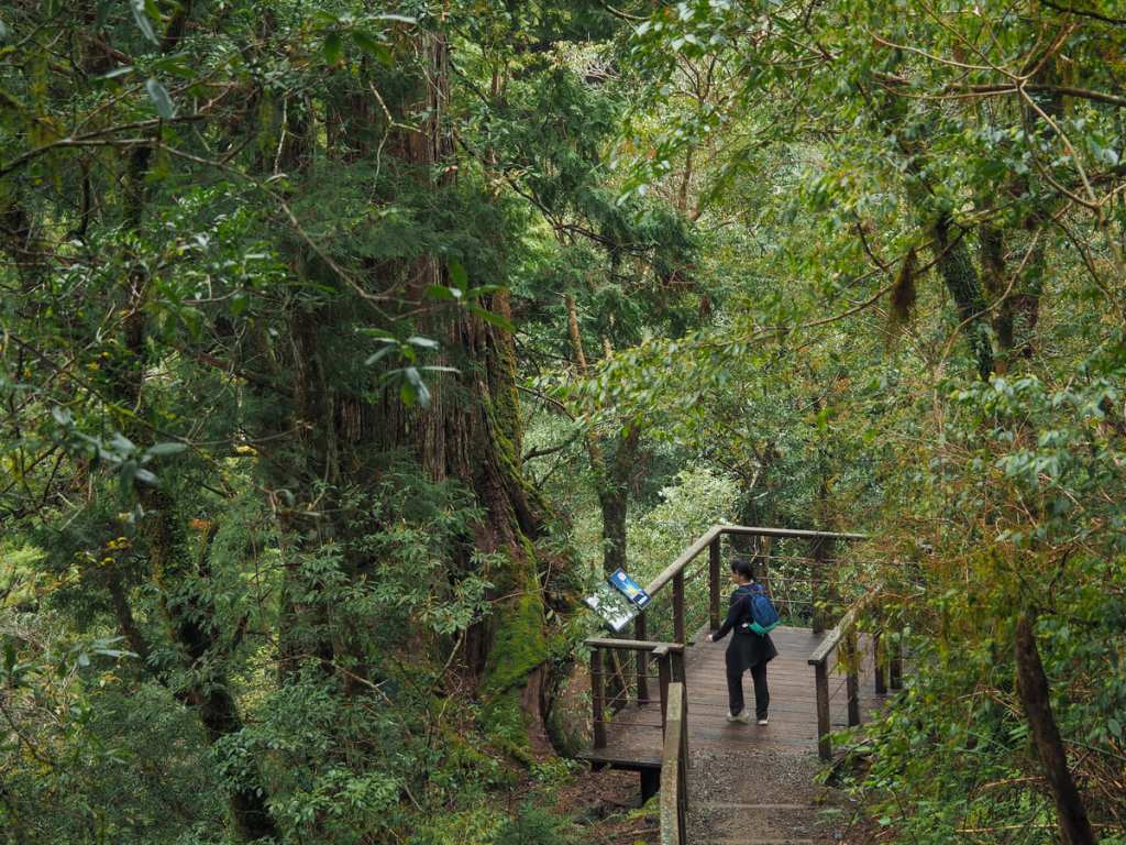
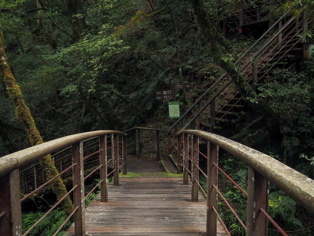
As you are about to start walking along the gravel path towards the giant trees, look out for the shoe-cleaning station on the left. A coir mat and one of those bum gun water jets have been installed and a sign requests that park visitors scrub their shoes before venturing further to avoid tracking alien species into the park.
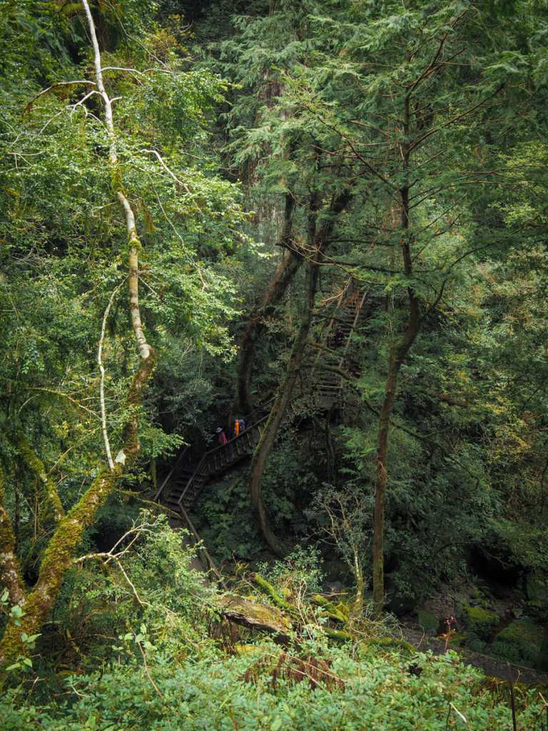
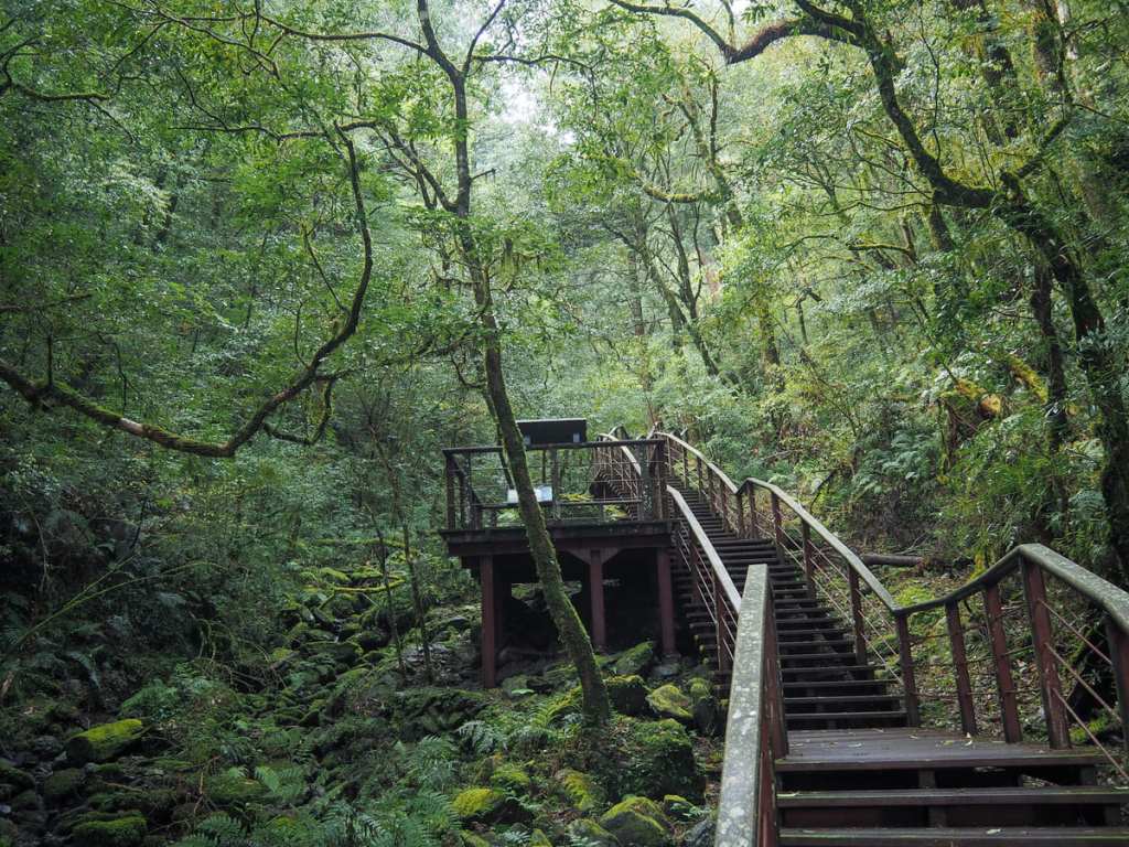
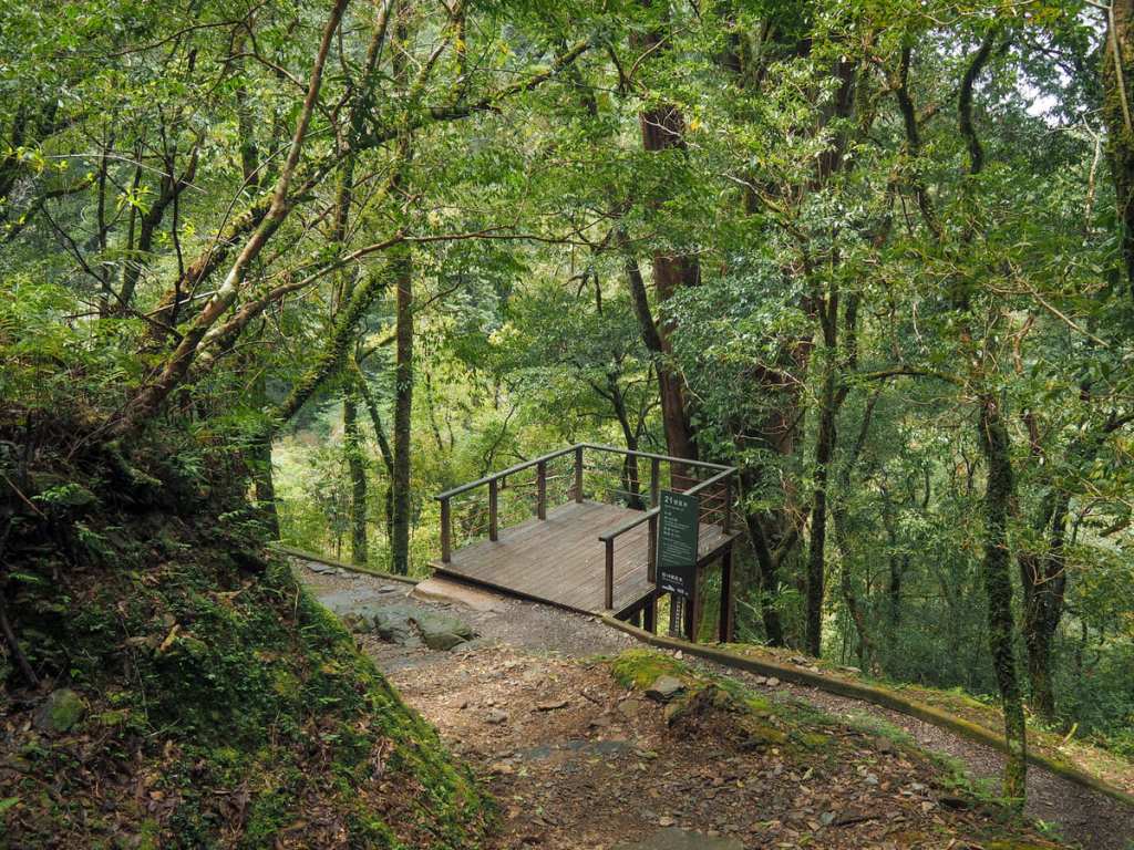
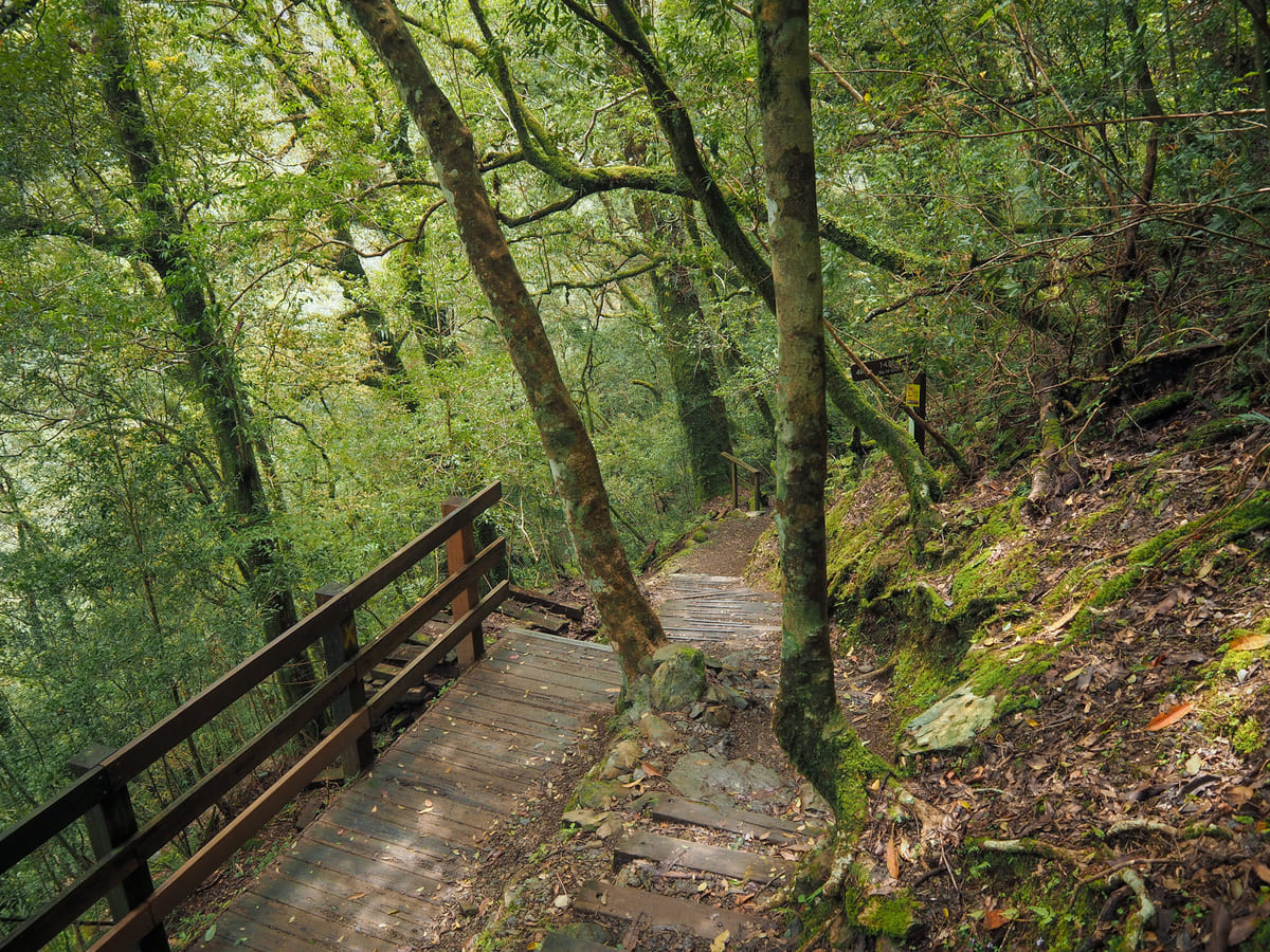
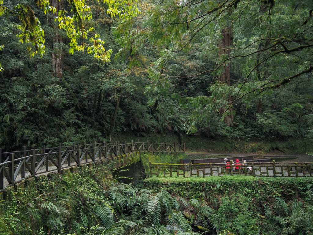
From the visitor centre to giant trees three and four, the trail is a broad and almost flat gravel path or wooden walkway (I say almost flat because there’s a barely perceptible incline). Around the 0.6-kilometre mark, I passed a broken bridge — a new bridge has been built to allow walkers to pass through, but the old one is currently still sitting there as a demonstration of just how destructive Taiwan’s weather can be. News reports say it was damaged by the unseasonably late typhoon in November of 2024.
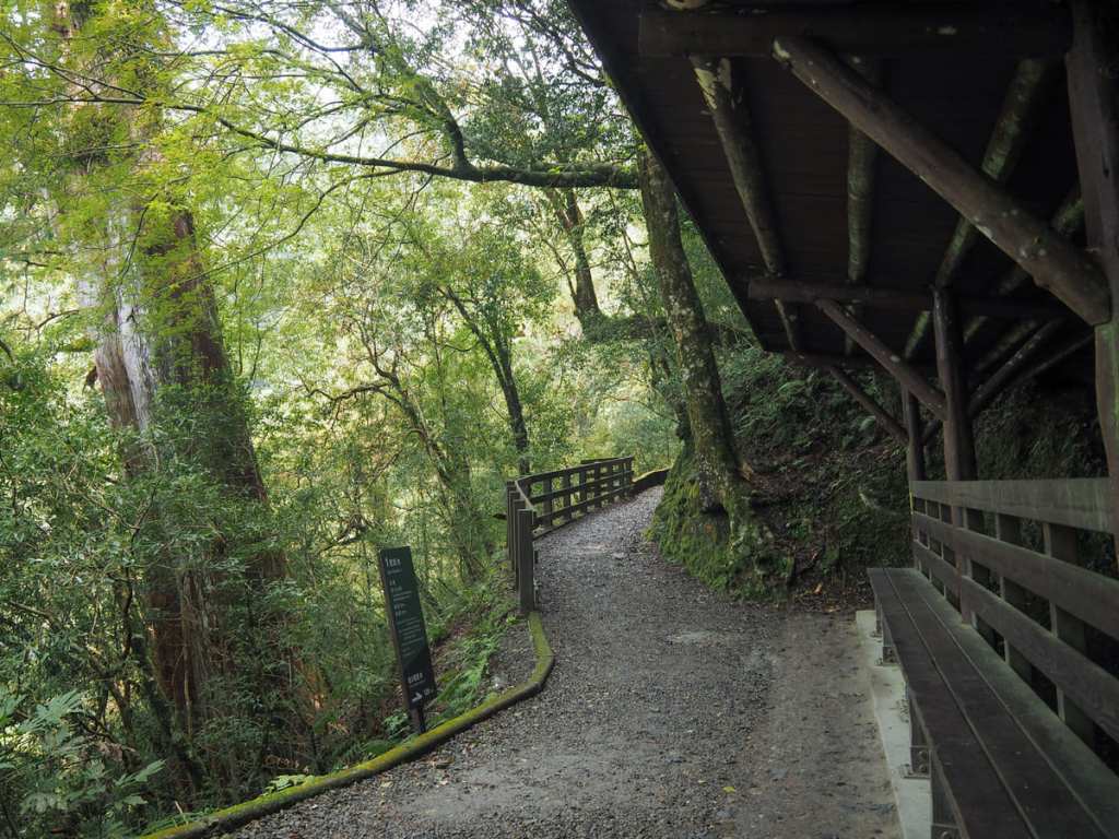
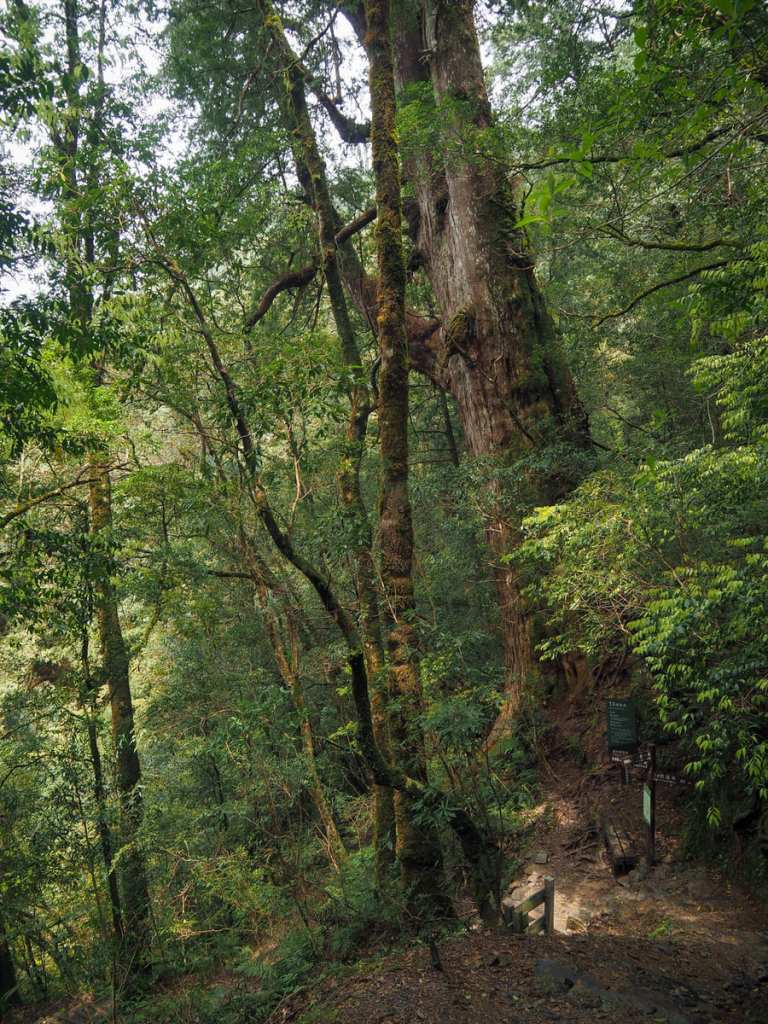
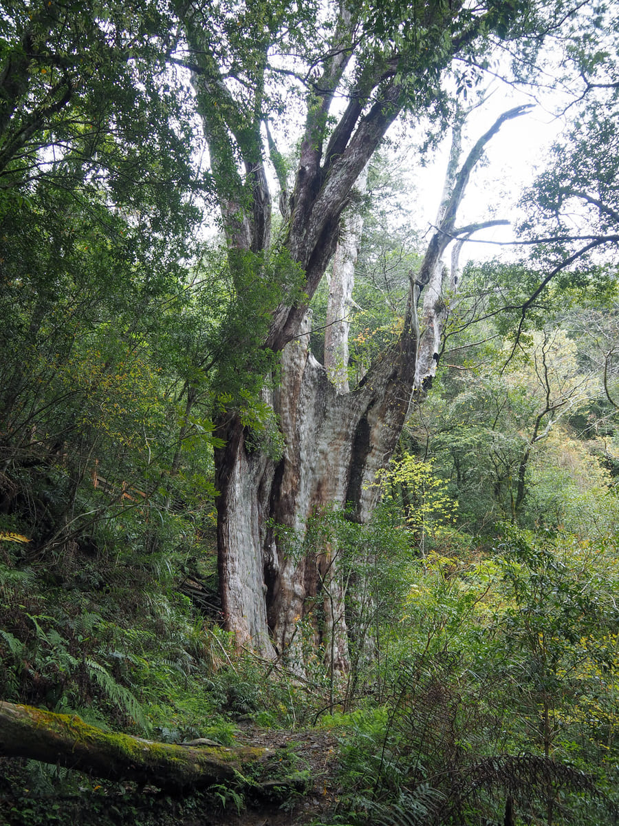
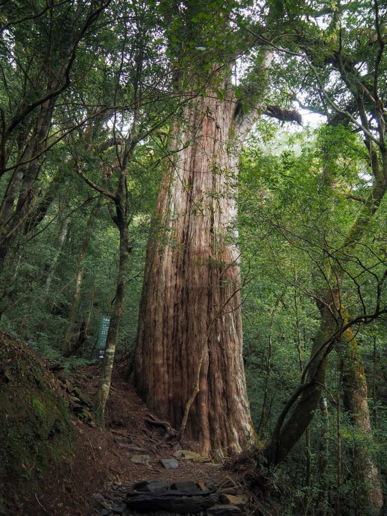
It took about 15 minutes to walk from the visitor centre to the first of the giant trees. This one has its very own seated bench so that people can sit and admire its impressive scale, and — like all of the park’s giant trees — there’s an info board which gives you some basic details such as its age (around 1075 years), height (35 metres), and species (Formosan red cypress).
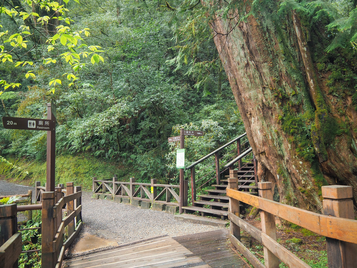
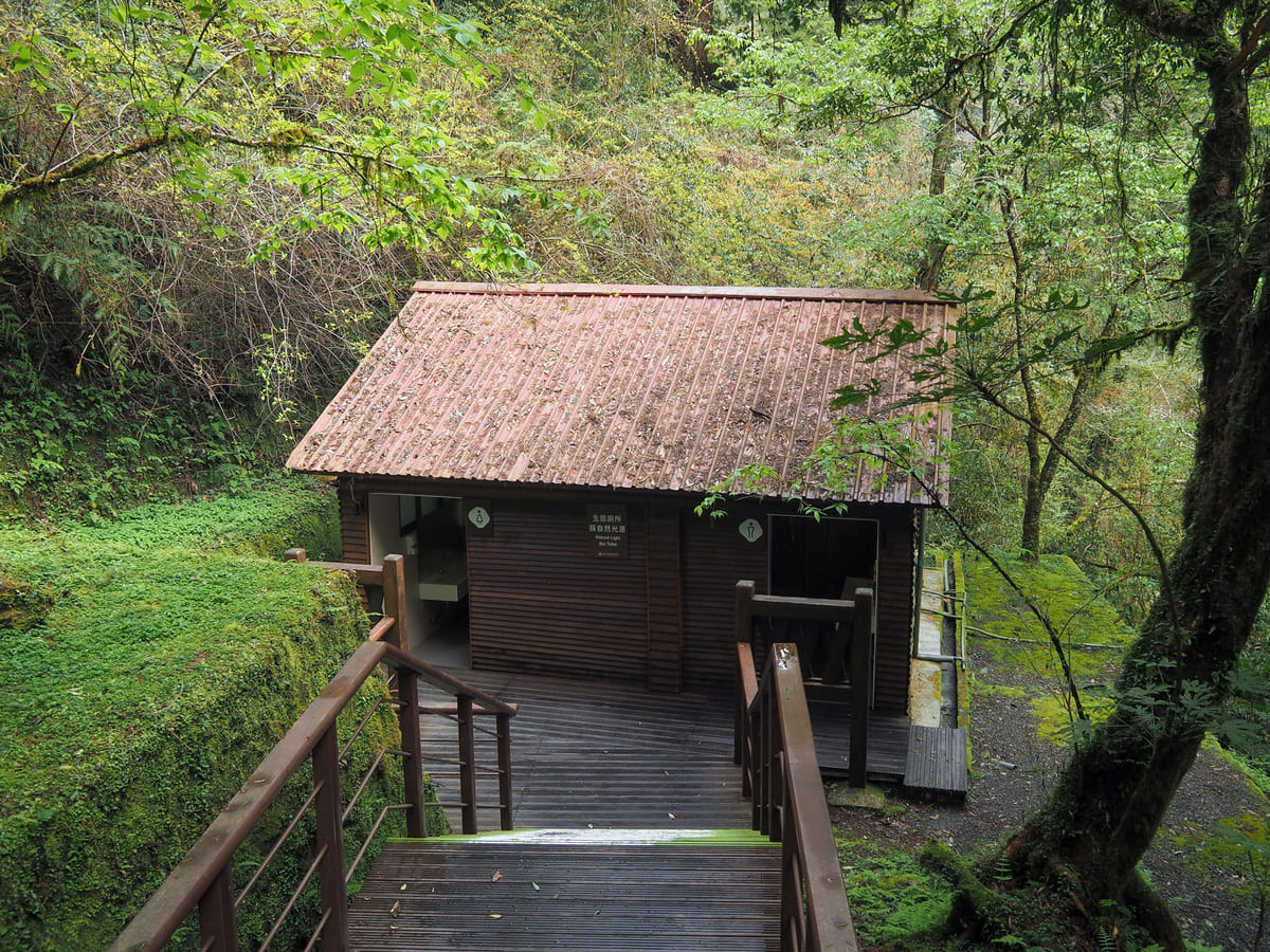
Giant trees three and four mark the beginning of the walk’s loop portion. You’ll also find a toilet block with “eco lighting” (read: “windows at either end but no actual lights”) and a little picnic area beside a creek with a few benches.
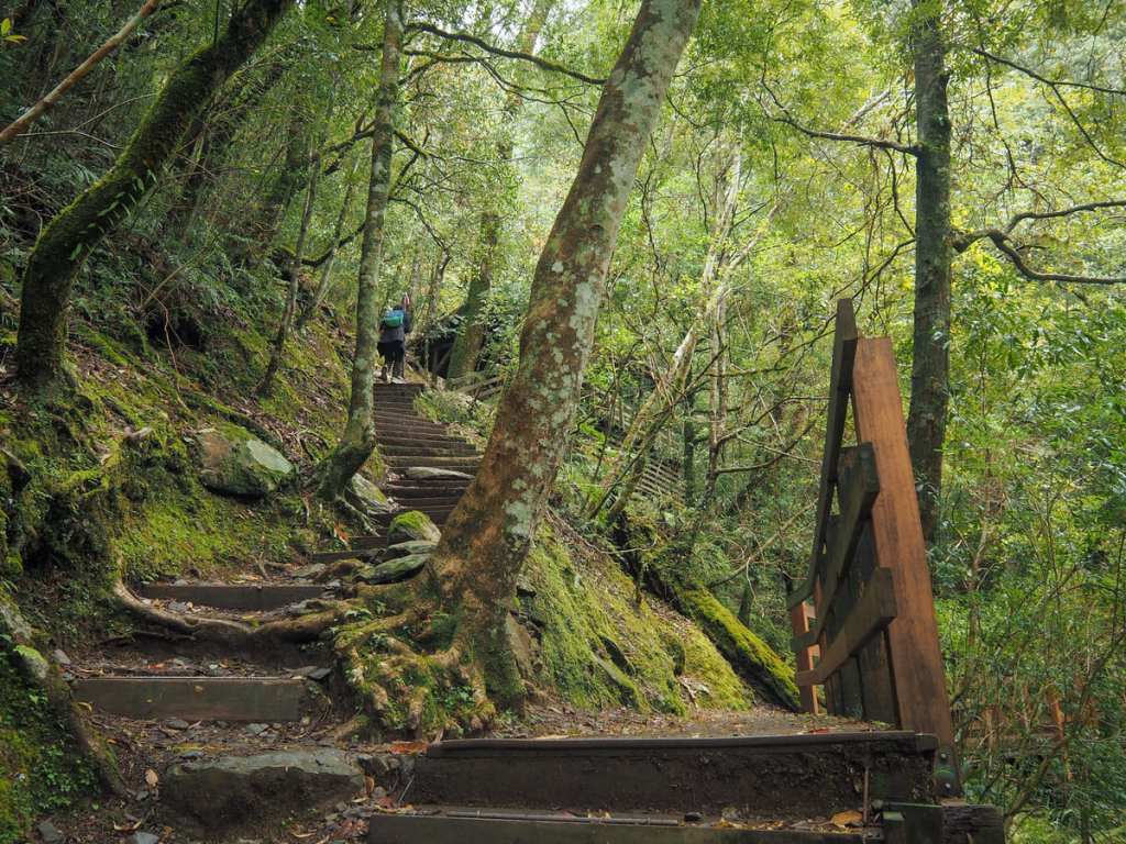
You can go either way, but it seems to make most sense to follow the progression of the giant trees by taking a right turn and heading up wooden steps in search of giant tree number five.
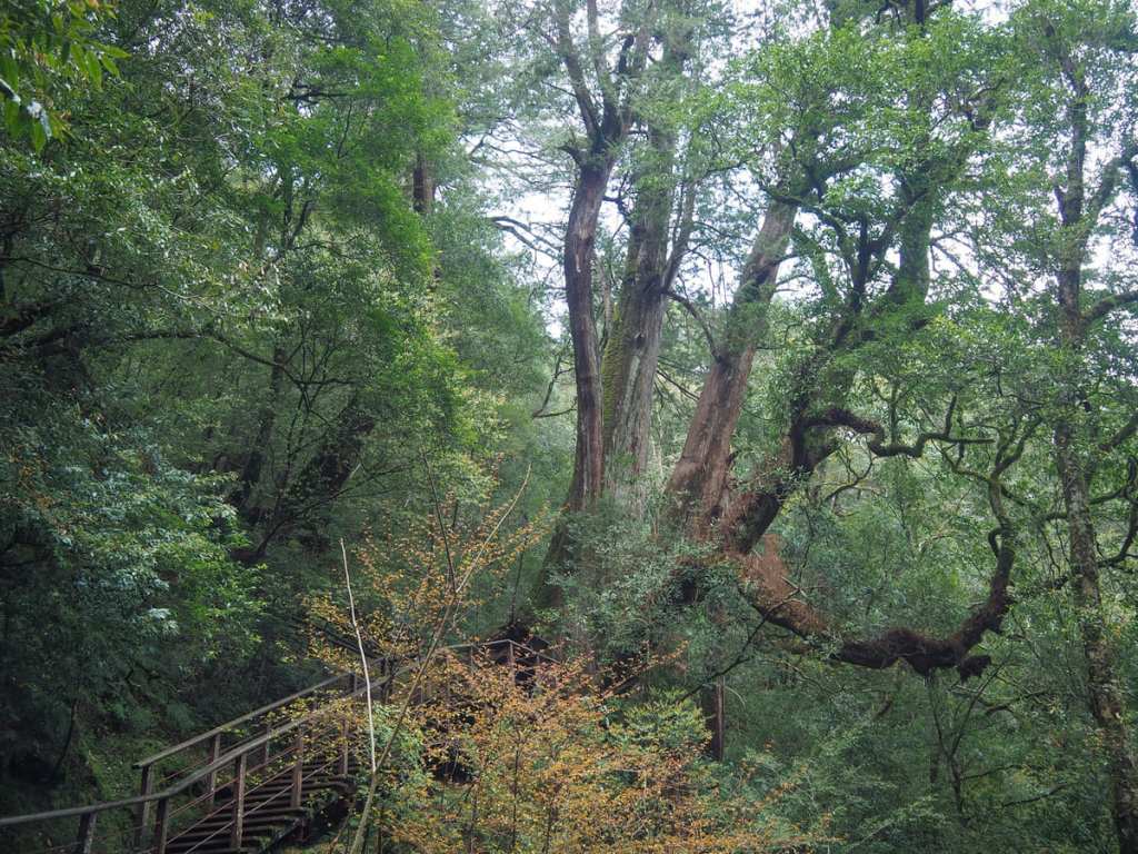
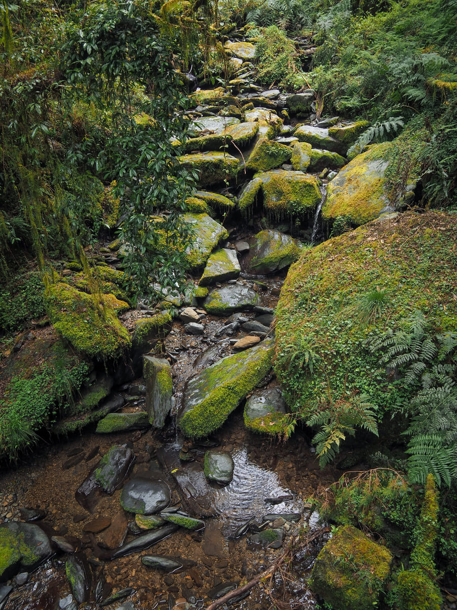
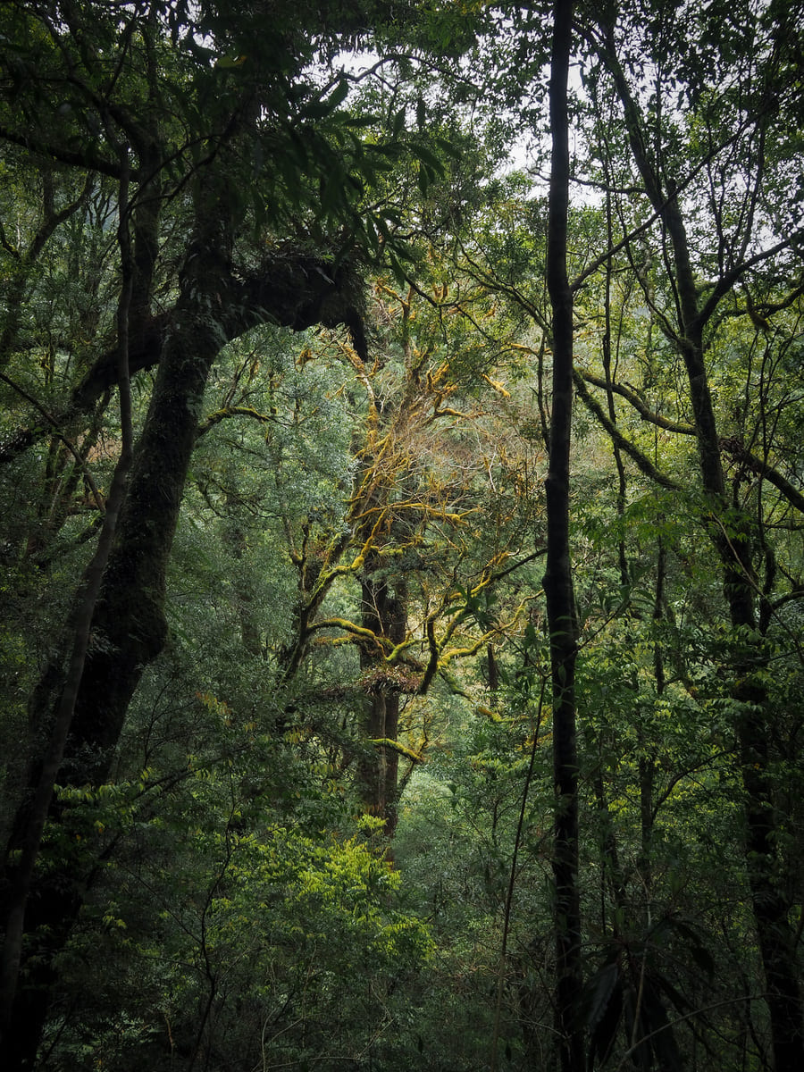
This initial climb is exceptionally pretty. Like many giant tree groves, this one is clustered on a slope that’s riddled with fresh mountain streams, and the trail here is accompanied by one of them as it heads upwards.
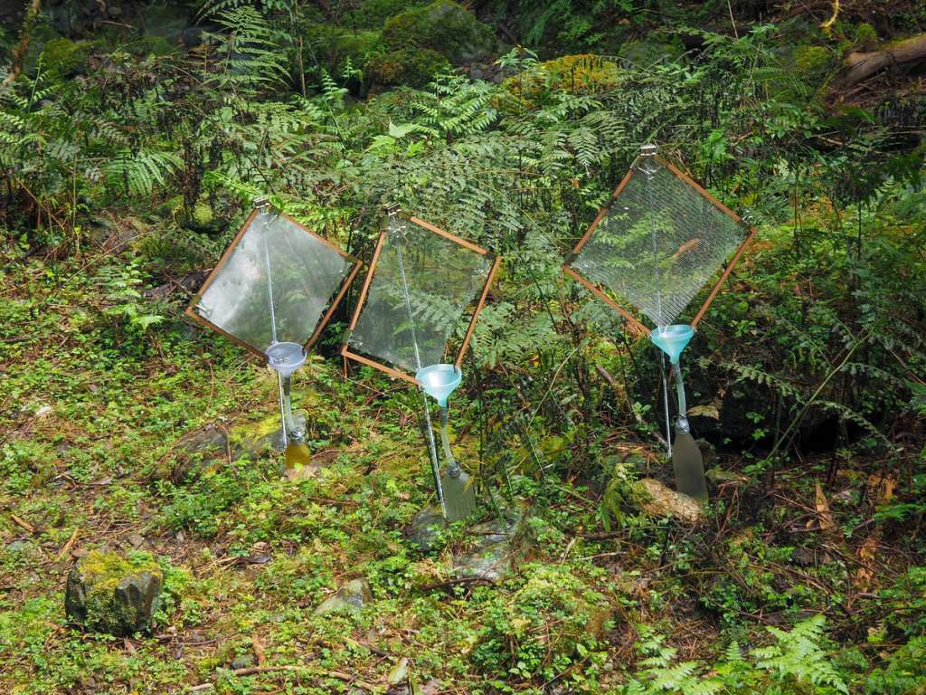
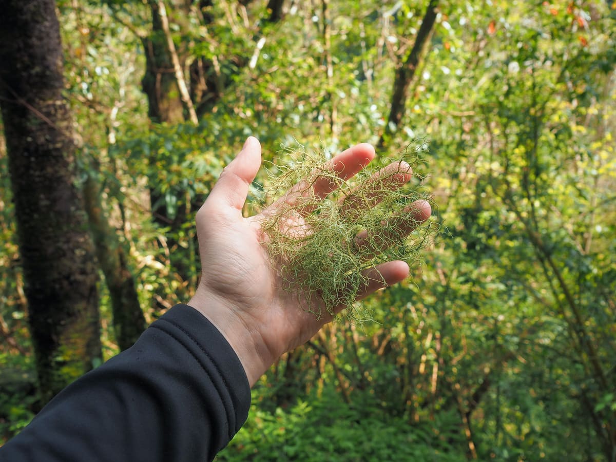
There were several contraptions set up beside the path that I took to be research installations of some kind. These three were positioned on the edge of the stream and looked like they were poised to catch dew and funnel it into bottles or something similar.
Giant tree number six is this gorgeous sprawling number.
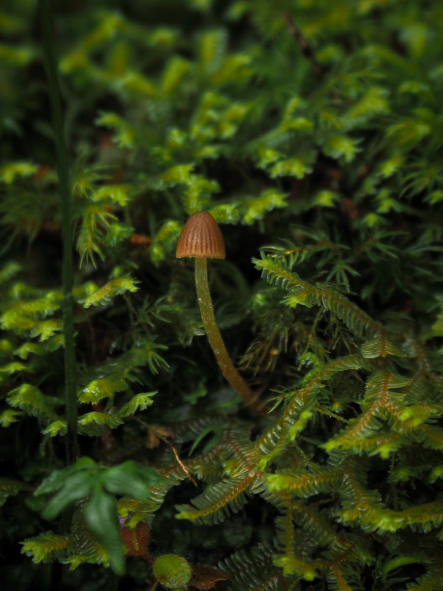
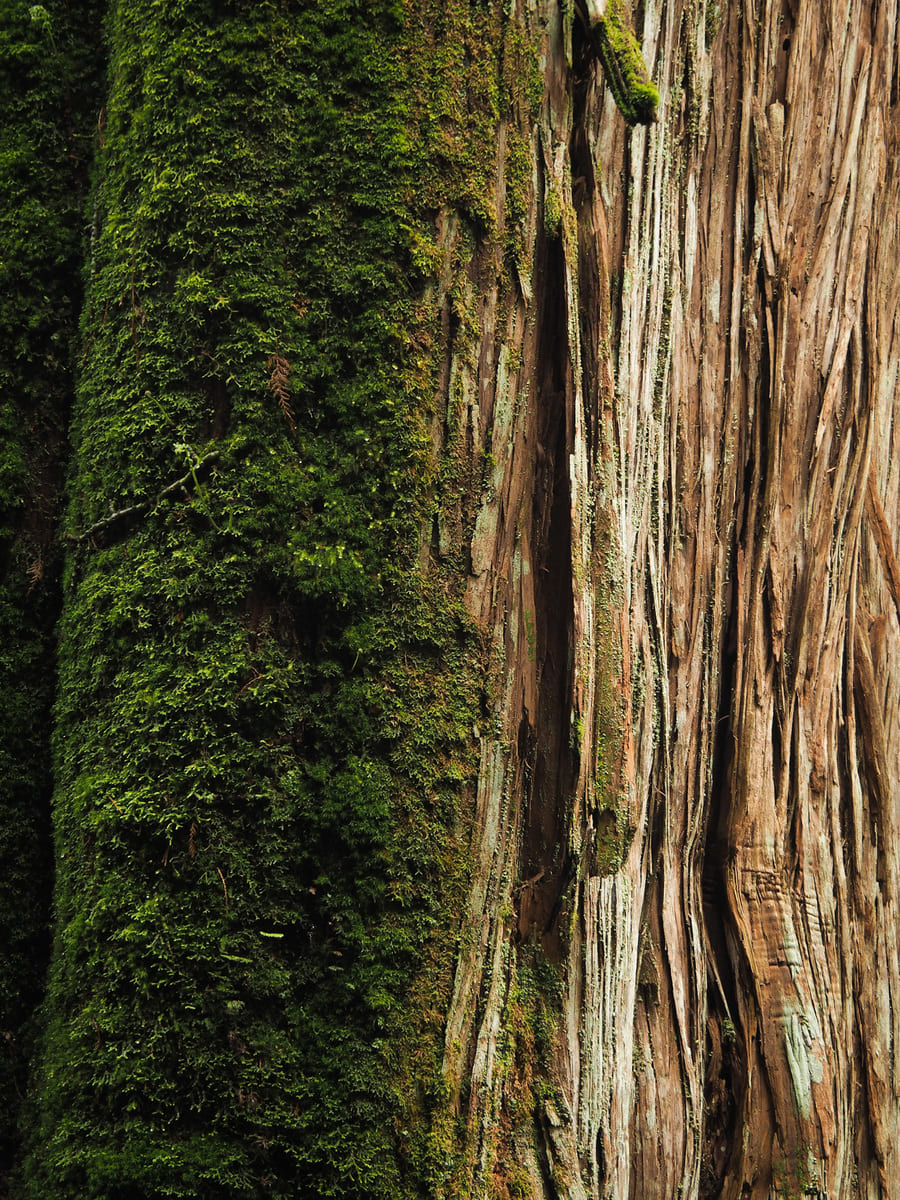
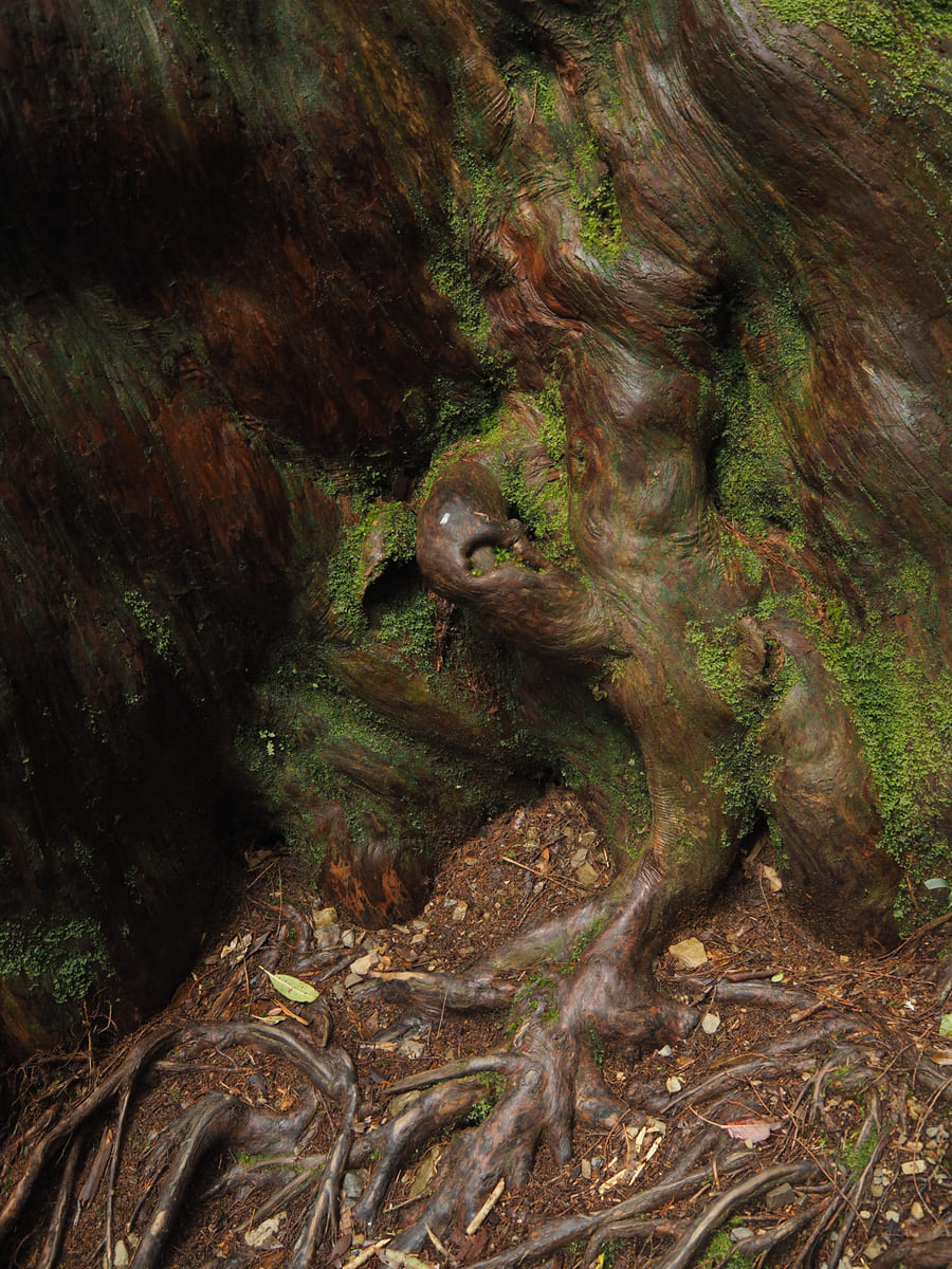
The micro and the macro — this teeny tiny mushroom was growing beside the trail, while this giant tree had a cloak of moss just on one side.
A woman standing beside another giant tree. This woman met me while I was photographing the tiny mushroom and showed me photos of a fabulous blueish fungus that she’d spotted on a previous visit to Lalashan.
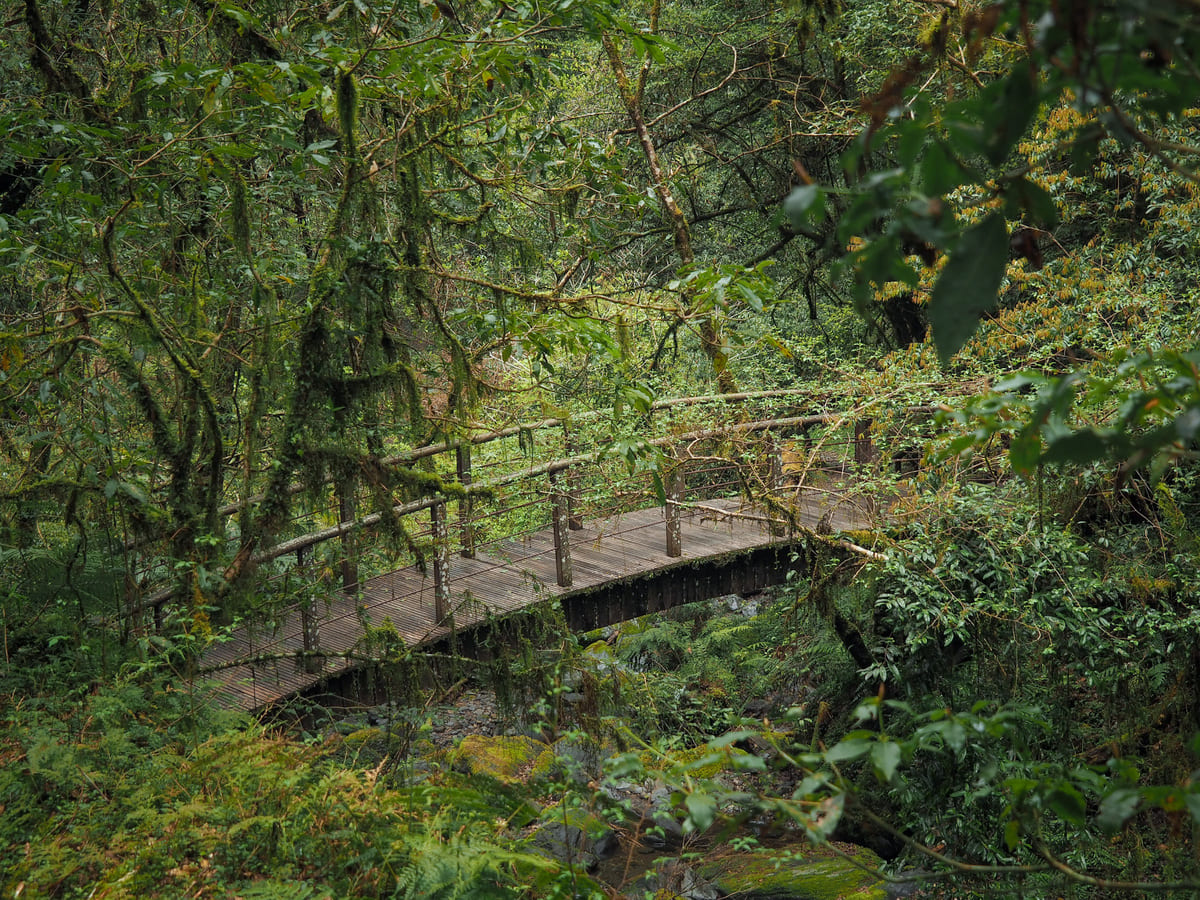
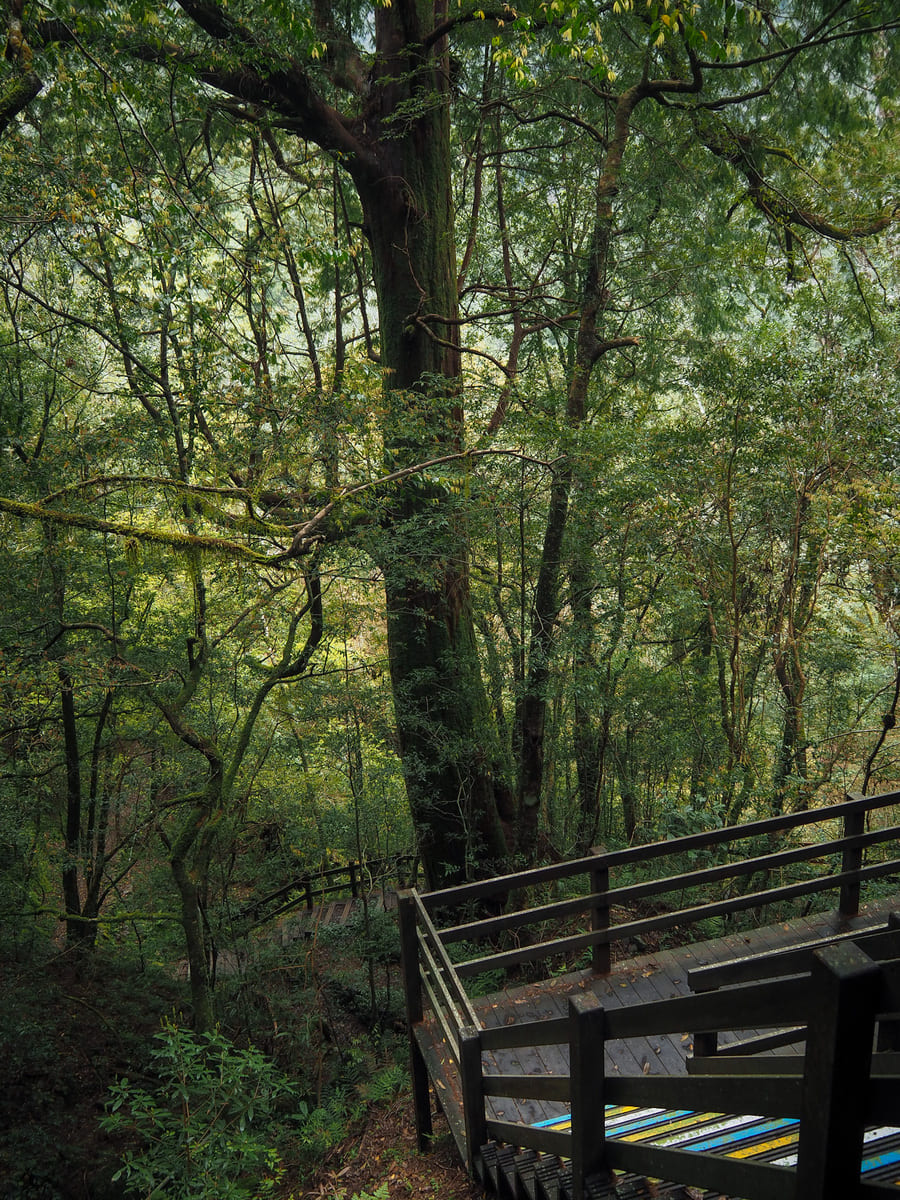
The walkway heads down to meet and cross over another creek — actually, it’s the same creek that runs beside the picnic area but a bit further up.
Crossing over the bridge, I took the steps heading uphill (if you take the left, you’ll be back at the start of the loop straight away.
Pretty quickly, I soon found myself at another junction. Here, the trail on the right heads up towards tree number 14 in a continuation of the loop, but what I was seeing in my map didn’t match what I was seeing on the park’s maps, and I ended up taking the left path, which sent me off on a figure-of-eight loop instead. The did stance and time difference is marginal though, so I’d just go whichever way calls to you.
Mossy branches and moisture-slick roots.
At the bottom of the steps, the trail splits in two. Turn right to continue on the figure-of-eight loop. (Heading left takes you back to the toilet block.)
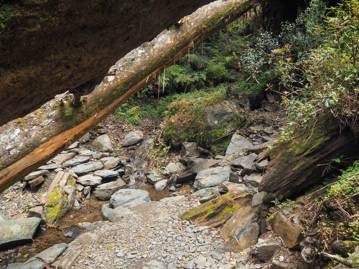
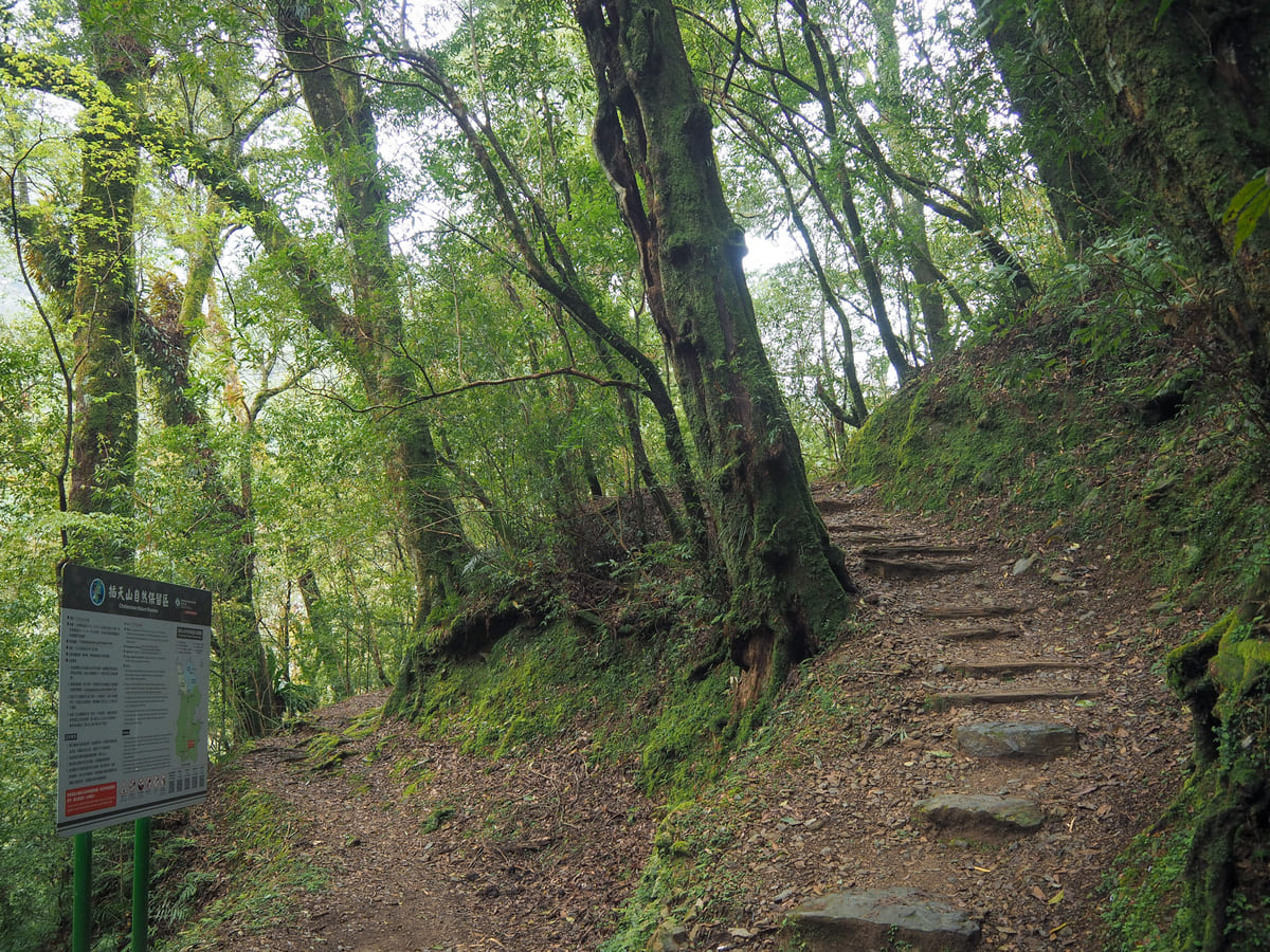
A fallen tree cuts across the trail just before a small creek — ducking under it and then tiptoeing over the stepping stones feels a little bit like an obstacle course. A little distance further, the path comes across the turn-off for Fuba Historic Trail (on the left). This is an old Tayal hunting, trading, and social route that cuts through Beichatian Nature Reserve (北插天山自然保護區) on its way to Wulai, so anyone hoping to attempt it needs to apply in advance.
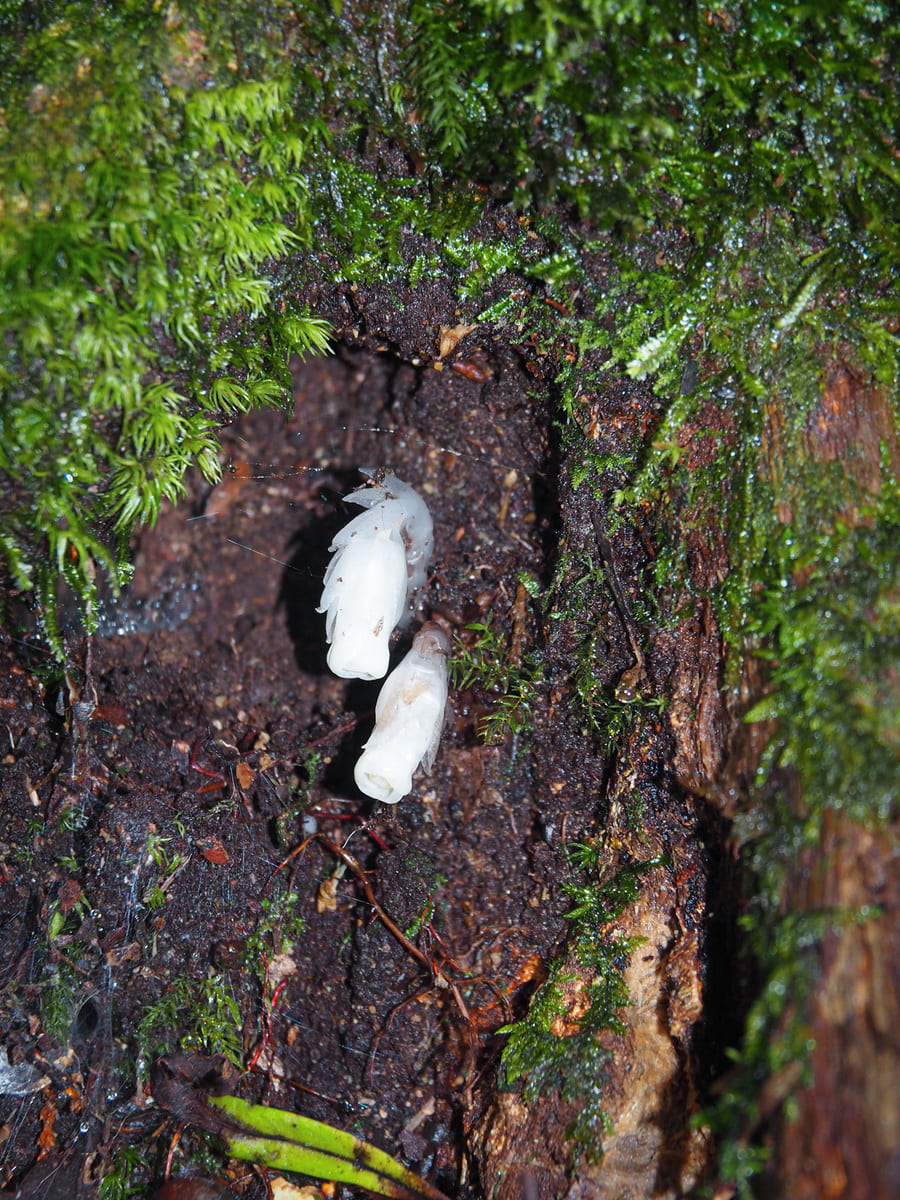
Another micro and macro moment, this time with a couple of Indian ghost pipe flowers (super cool chlorophyll-lacking flowers that draw all of their required nutrients from the roots of their host trees) and another giant Formosan red cypress. This particular tree had ceramic somethings hammered into its trunk going quite a long way up.
The trail climbs to a junction just as it reaches the furthermost extent of the figure-of-eight loop. The path on the left is a short spur heading up to a pavilion and the trail continues on the right.
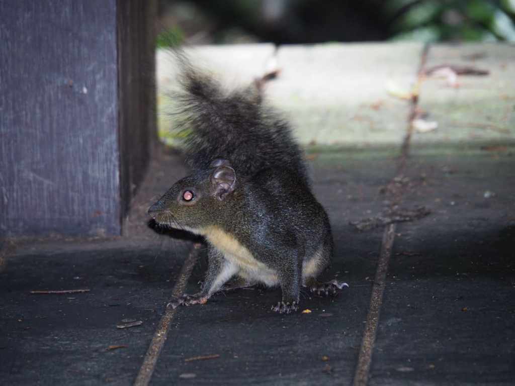
I headed up to visit the pavilion briefly and found it occupied by an overconfident young squirrel that is clearly far too familiar with the insides of hikers’ snack packs.
Then, after a brief rest, I set off again, heading back down to the previous junction and turning left to continue my loop. A short distance further along, there was another toilet block where you can do your business surrounded by the sounds of nature.
Tiny hikers dwarfed by the forest around them. A little further up from here, I met a loud group of hikers who were intrigued and perplexed by my presence, but I was in a more antisocial mood than usual and didn’t really fancy hanging around to satisfy their curiosity.
Another spur trail, this time, the path on the left heads up to visit giant tree number 24.
Number 24 is the last of the numbered giant trees on the trail and it sits on a partially exposed slope overlooking the forest below.
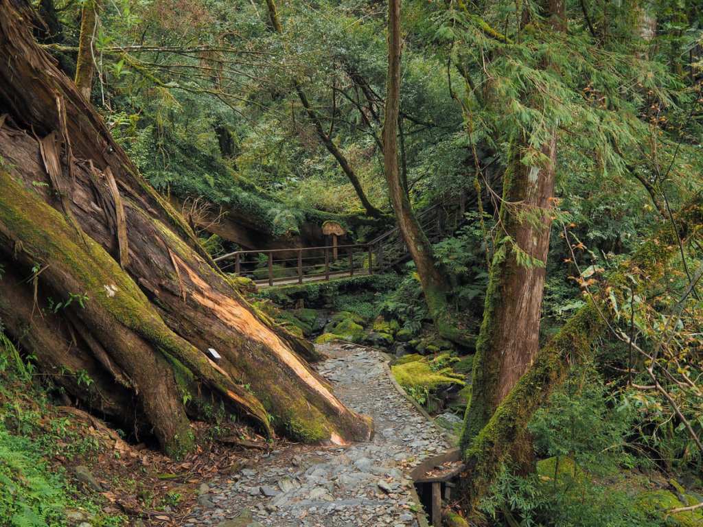
Continuing onwards, the path crossed one of the creeks again beside the skeleton of an impressive fallen giant.
Then, very quickly, I found myself standing in front of giant tree number 14, the one I should have visited had I not accidentally embarked on a figure-of-eight-shaped loop.
I retraced my steps back down to this junction, only this time, I took a left.
It only took me a few minutes to make it back to the clearing with the picnic area, and from there, I made my way slowly back down the track to the visitor centre and then the bus stop. I arrived at the bus stop with about 40 minutes to spare and hung out in the shade with a shy cat until the bus arrived.
HOW TO GET TO LALASHAN
Google Maps address: The park’s ticket booth can be found here and if you’re coming by car or scooter, you can follow the road a little deeper into the park and stop close in the carpark beside the visitor centre.
GPS location:
- The bus drops you off at — N24 42.220 E121 25.300
- The carpark is closer to — N24 42.670 E121 25.980
Public transport: If you are sufficiently determined, it is possible to visit Lalashan by public transport from Taipei, but it requires a seriously early start. If I’m honest, I think it would be preferable to do an overnight trip which involves staying in the area the day before the hike, if only so you can make the most of the long journey. However, if you’re keen to do this as a day trip, you can. The journey is quite long and the bus driver stops roughly half-way in each direction to allow passengers to get off for a bathroom break.
- Getting There — There is a fast local train that departs Taipei Main at 5:24 am that gets you into Taoyuan station early enough to walk over to the bus station and hop onboard the 6:20 am 5301 service to Lalashan.
- Getting Back — Two services depart Lalashan each afternoon. The 5091 leaves at 2:00pm and the 5301 leaves at 3:30pm. This is the starting stop, so they will leave on time, not earlier and not later. The 5091 takes you to Zhongli train station, and the 5301 heads to Taoyuan bus station. If you really want to make the most of your trip out here, it would be smart to catch the early bus back from Lalashan, then get off at either Shangbaling Village for food or drink, or by Baling Historic Trail for a short stroll, then hop on the later bus to take you back down to the city.
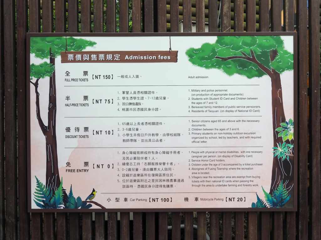
Lalashan National Forest Recreation Area Tickets: Tickets can be purchased at the time of your visit from the ticket booth at the park entrance. At the time of writing, a full price adult ticket costs NT$150.
Further reading: Taiwan Everything have written about several attractions in this area.
LALASHAN TRAIL MAP
GPX file available here on Outdoor Active. (Account needed, but the free one works just fine.)
