This short hike in New Taipei’s Xizhi District combines a Xiao Bai Yue (Mount Dajian, No. 12) with pretty night views. It’s small, too, so it’s a perfect post-dinner or pre-supper walk for anyone planning to grab some grub at Xizhi’s Tourist Night Market.
Distance: About 2 kilometres.
Time: 1-2 hours depending on how slowly you take it and how much time you spend stopped to look at bugs and views.
Total ascent: A little over 200 metres.
Difficulty (regular Taiwan hiker): 2/10 – Some steep steps, but otherwise it’s pretty easy.
Difficulty (new Taiwan hiker): 3/10 – Even someone new to hiking in Taiwan would find this easy.
Risks and dangers: There aren’t many noteworthy hazards on this trail. However, it’s worth saying that there’s a steep drop beside the summit. The last time I visited this peak, someone had slipped off and hit their head here, but as long as you’re paying attention to where you’re stepping, you’ll be fine. That aside, there is always the possibility of encountering snakes on a night hike. If you’re lucky enough to meet one, just be sensible and give them enough space.
Water: I took a small 0.5L bottle and that was ample for a night hike. There’s a water dispenser at the temple, so you can top up if you run out by the time you finish your walk.
Mobile network: Pretty clear throughout.
Enjoyment: There’s only one spot with a good view of the city lights, so it’s perhaps not the best bang for your buck that you can get. But it’s a nice short little loop that can be done without any preparation.
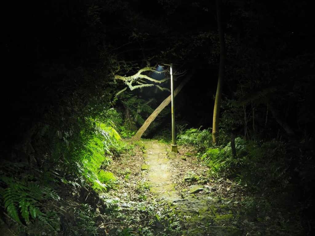
Other: There are sections without any lighting, so if you’re planning on doing this as a night hike, be sure to take your own torch.
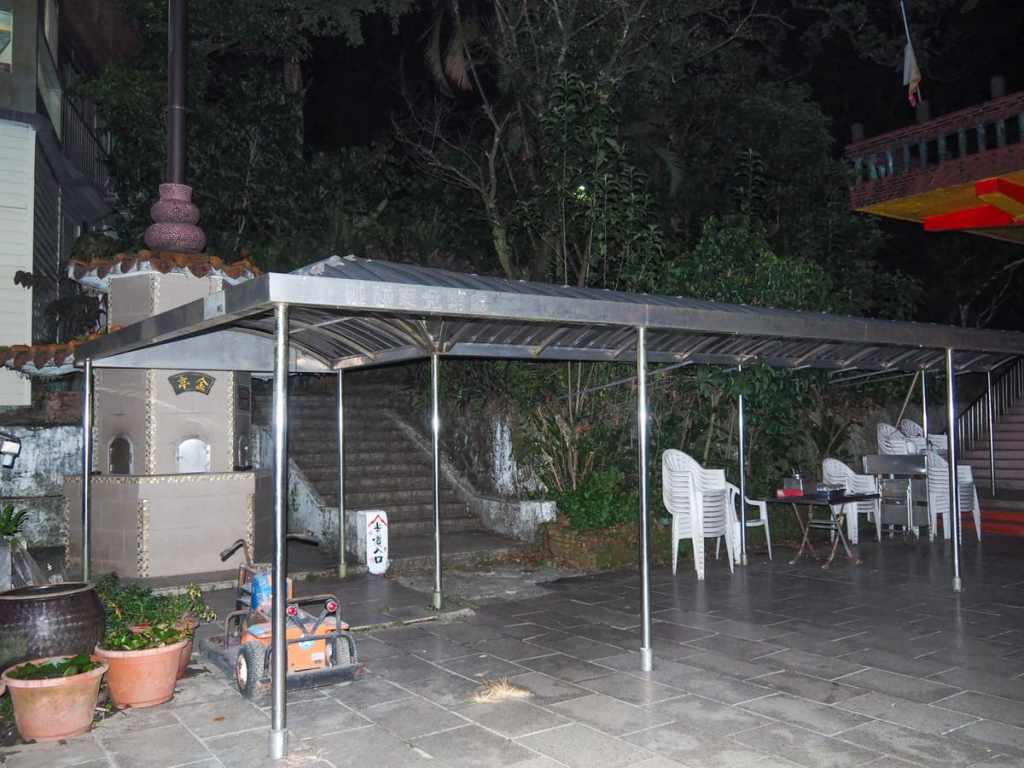
Bathroom facilities: There is a toilet block at the start/end of the trail.
Route type: Loop or there and back.
Permit: None needed.
Jump to the bottom of this post for a trail map and GPX file.
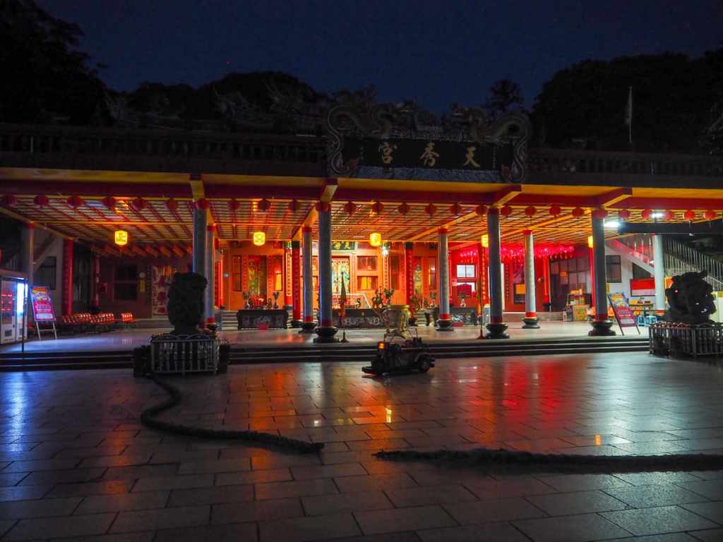
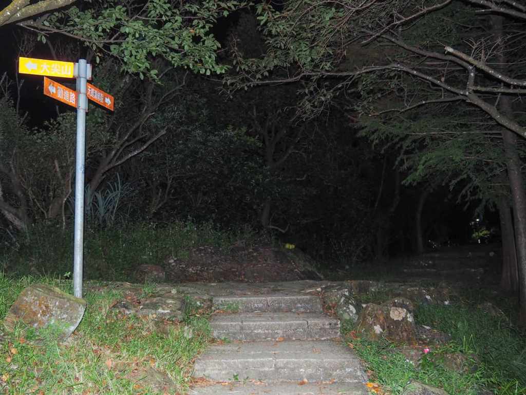
The walk starts in front of Tianxiu Temple (天秀宮). During weekends, this is a popular spot with a café, crappy kids bumper cars, and loads of people hanging out after climbing the peak, and it’s no less full of energy. Locals head up here to sit and watch the sunset painting the sky and the city lights twinkle on. Incongruously, there was also a woman playing a deafeningly loud saxophone against an almost equally loud backing track.
If you’re standing facing the temple, the trail starts up a flight up steps to the left. There was a small knot of frogs hanging out in the water lily beside the steps valiantly trying to compete against the saxophone with their mating croaks.
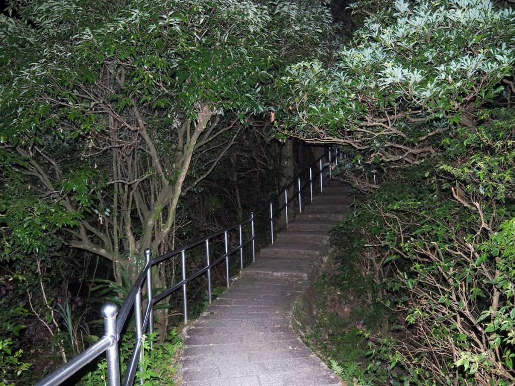
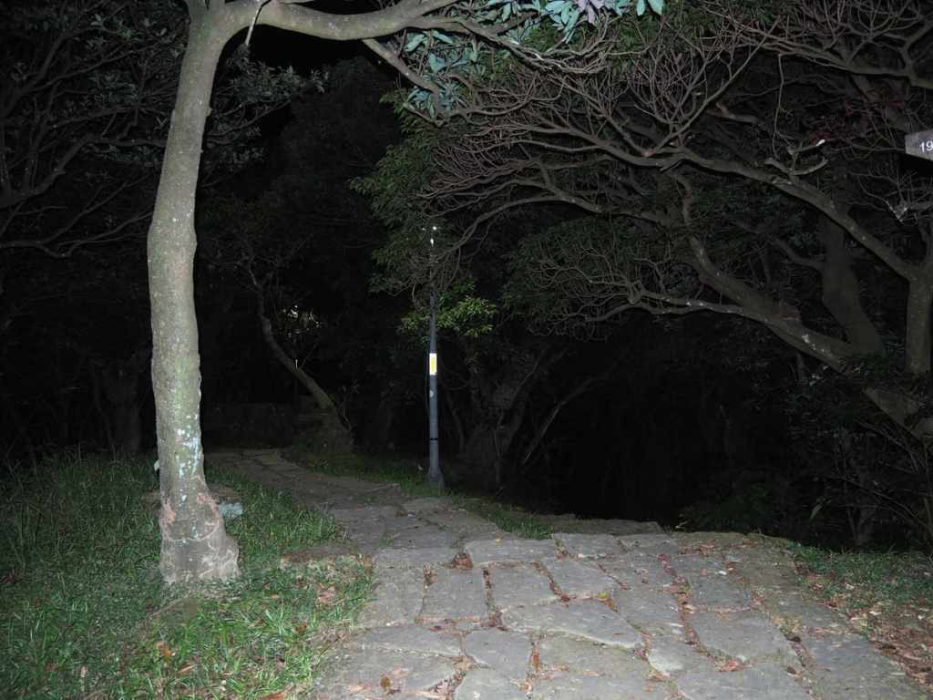
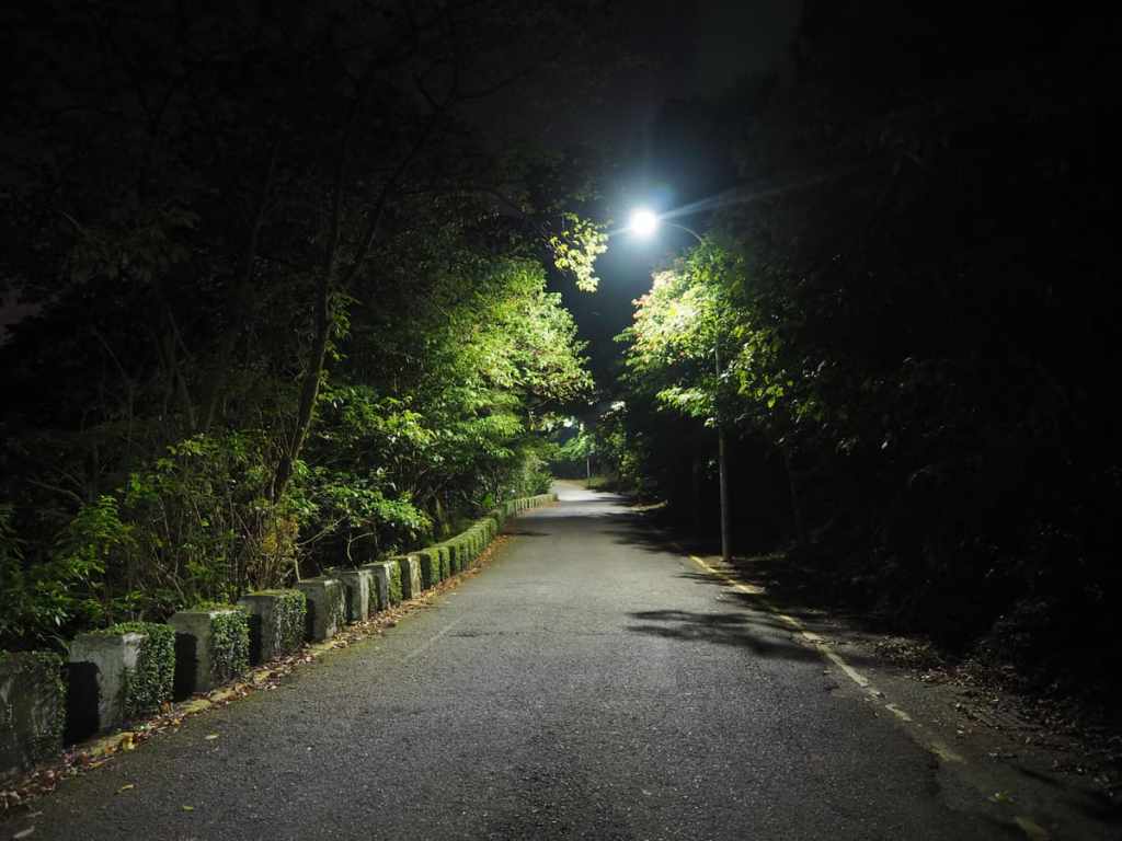
Steps ascend steeply more or less the whole way to the peak, and while there are lights along the first 100-200 metres into the trail, after that, you’re on your own.
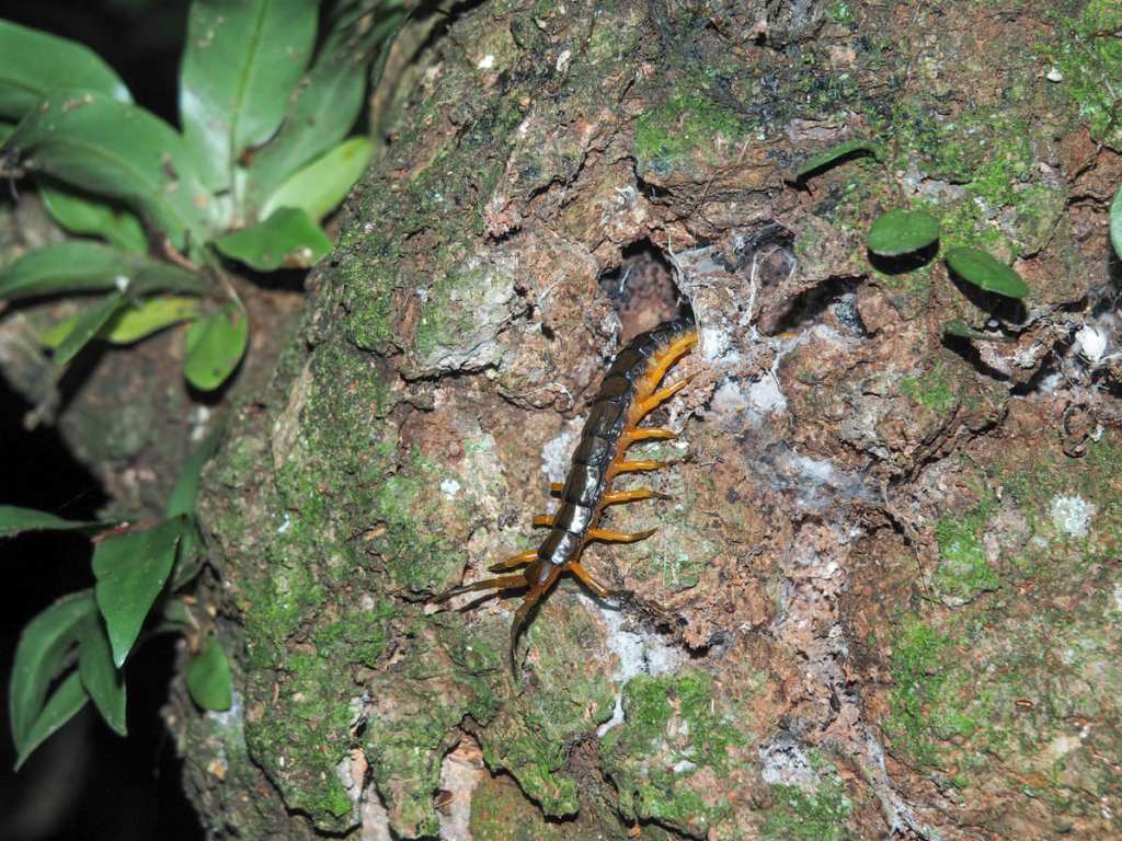
The bug life on this trail was pretty impressive. In addition to summer’s ever-present cicadas, we saw this Chinese red-headed centipede and some type of cricket.
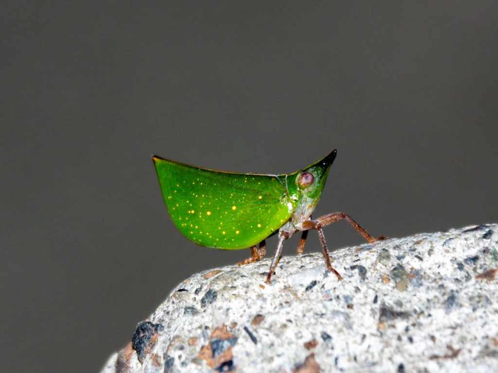
And there were so, so, so many of these planthoppers (and another, more timid species of planthopper). The Latin name for this one is Tonga westwoodi. As far as bugs go, they’re pretty cute. I just love how the little of pattern of dots on them looks like a constellation of stars, and if you get close to them, they’ll kind of shuffle around like an awkward British person trying to maintain their personal space.
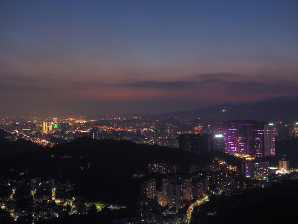
After about 30 minutes, we reached the summit. There’s a hilltop park on the right, but if you turn left, you’ll reach a pavilion with views over most of Taipei.
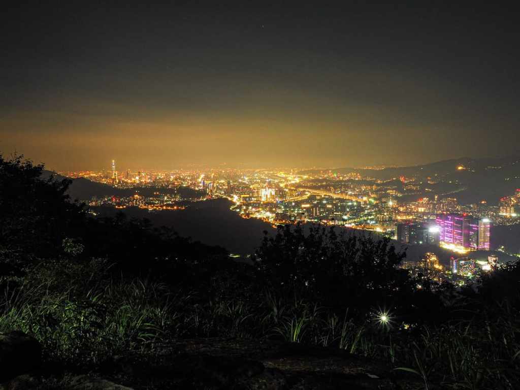
Looking west, the cluster of buildings Taipei 101 stands tall, and the bright lights of Freeway No. 1 snake like a river of lights through the city. That huge structure with the purple lights is the iFG Farglory Square.
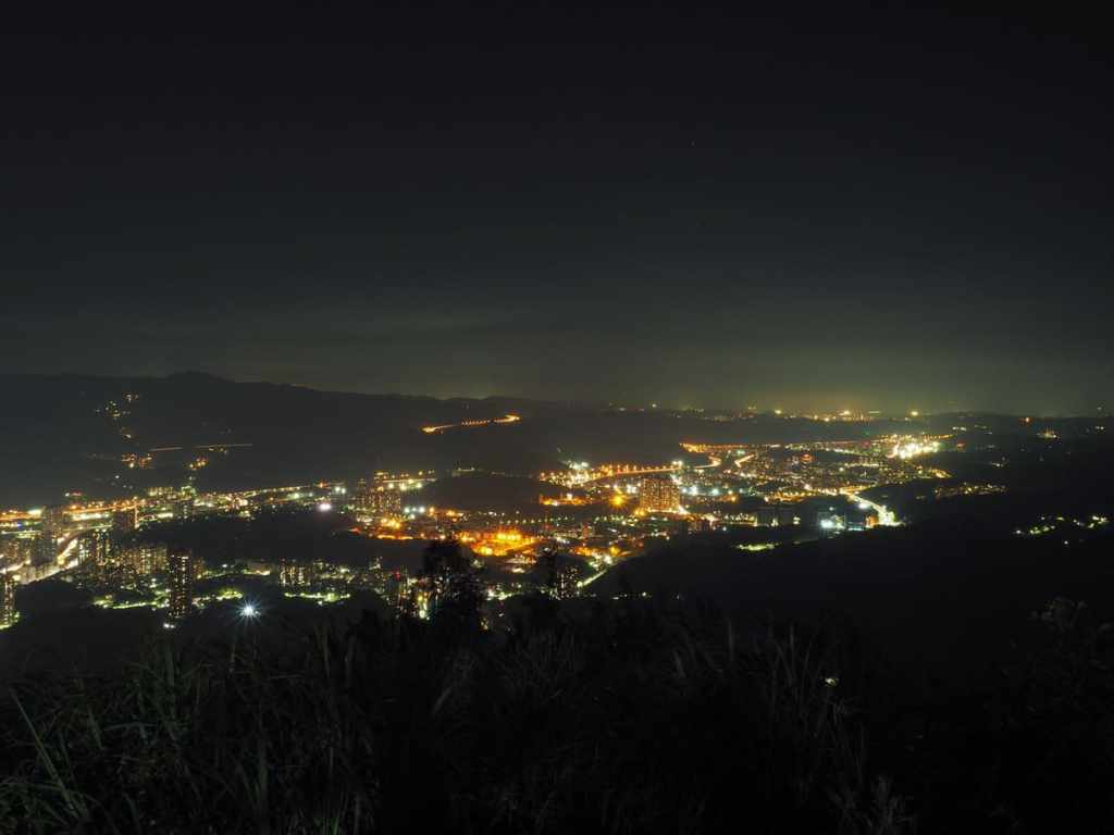
Looking east towards the port city of Keelung, you can see the lights hewing close to the course of the river and the train tracks. We sat there for a while, enjoying the quiet chorus of the evening—nearby, crickets, cicadas, and frogs were joined by an occasional owl, while from further off came the faint rumble of traffic and trains.
It would be possible to just return the same way, but it’s also possible to do either a small or middling size loop. We did a small loop by heading through the hilltop park and taking the first trail leading back down to the right.
Strangely, after the dark ascent, this section is well-lit, with lamps installed almost so close that you wouldn’t need to use a headtorch.
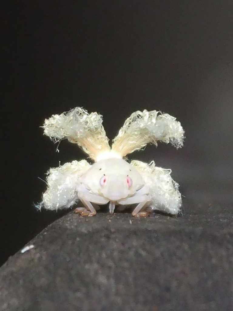
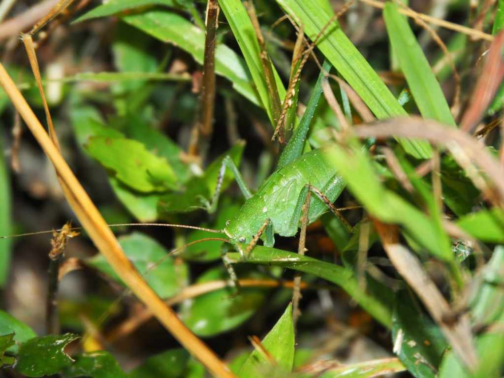
Another of Taiwan’s weird and wonderful bugs.
Once you hit the road, turn right, and follow it all the way back to Tianxiu Temple. We didn’t see any snakes, but given the number of small streams and damp places beside the road, you might well get lucky and spot something if you’re looking.
How to get to Mount Dajian
Google Maps address: The walk starts at Tianxiu Temple. If you come by scooter, you can park in front of the temple, and if you’re driving, there is a carpark nearby.
GPS location: N25 03.170 E121 39.780
Public transport: The F911 bus runs between Xizhi Train Station and Tianxiu Temple. However, in the afternoon, there is only one bus every two hours, and the last one leaves shortly after 7pm, so if you’re planning this as a night hike, you’d be better off arranging your own transport.
Nearby trails:
- Lingbo Temple Trail
- Maling Peak
- Nangang Tea Mountain Trail
- Tamsui-Kavalan Trails: Xizhi to Ruifang
- Xiandonghu Shan and Yuemei Cave Temple
- Xizhi Lion’s Head Mountain
Mount Dajian Trail Map
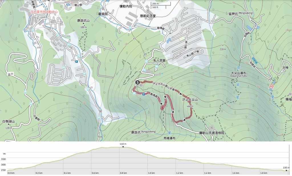
GPX file available here on Outdoor Active. (Account needed, but the free one works just fine.)
