A Nostalgic Trek Along Alishan’s Sleeping Moon Line
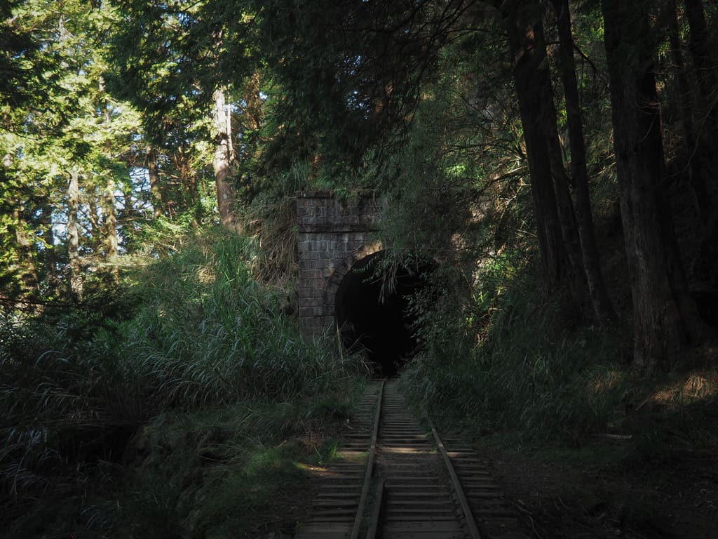
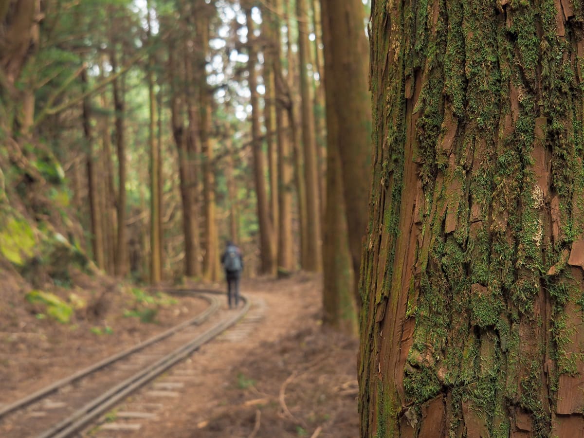
The Mianyue Line hike has to be one of the most photographed hikes in Taiwan. Kilometre after kilometre of trestle bridges, mossy tracks, and abandoned tunnels stretch out through beautiful old forests, high up in the clear air of Chiayi. It is not hard to see why this trail has become one of Alishan’s best-loved hikes.
The line was built by the Japanese, opening in 1913 as part of the extensive network of logging railways used for transporting precious lumber from the forests where it had spent hundreds or thousands of years growing to Chiayi where it was processed and sent onwards to building projects around Taiwan and back in Japan. As the quantity of trees to be cut diminished, the railway gradually lost its function. It lay dormant for a while before being brought back to life as a nostalgic tourist route plied by steam trains in 1983 — it must have been a majestic sight. In 1999, the big 921 earthquake (Taiwan’s most destructive earthquake in modern history) rattled the rails, making it far too unsafe for the trains to run. Repair work was undertaken, but before the work could be completed, Typhoon Morokat smashed into Taiwan, undoing much of what had been done. The decision was left to return the line to nature. It was after the debris settled that hikers “discovered” this forgotten forest, first just the most adventurous, but gradually in greater and greater numbers. With the rise of social media, the route became so popular that authorities had to put a cap on the number of visitors. These days, only 350 people a day are permitted to enter. On weekends, the full capacity is met with ease, but on weekdays — Wednesdays in particular — numbers are generally slightly lower.
“Mianyue” means “Sleeping Moon” — a romantic moniker with a rather sad, Lorax-esque origin story. The name was bestowed by Kawai Shitarō, a Japanese Doctor of Forestry who had been appointed to plan the development of the Alishan region and oversee the construction of the forest railway. During explorations in the Shigupan River area, Dr Kawai was laying down to sleep on a slab of rock when he found himself watching a huge moon rise over towering cypresses that had guarded their forest kingdom for centuries. He was overwhelmed by the might of nature and the scene left a deep impression on him. Years later, Kawai returned to the spot where he had experienced this epiphany and found the landscape to be entirely changed. In response, he penned a sentimental short poem.
斧斤走入翠微岑,伐盡千年古木林;
枕石席苔散無蹤,鳴泉當作舊時音。
I’m no translator, but internet brains can come up with this approximation in English:
The axe enters the verdant hills, felling ancient trees of a thousand years;
Pillowed on stones, the moss scatters without trace,
The murmuring spring should evoke the sounds of old.
Kawai also named the place where he had slept “Sleeping Moon” in remembrance of his experience there and the name stuck.
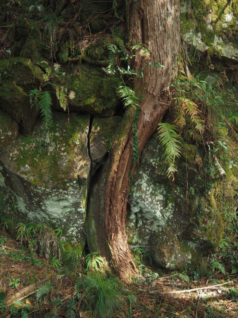
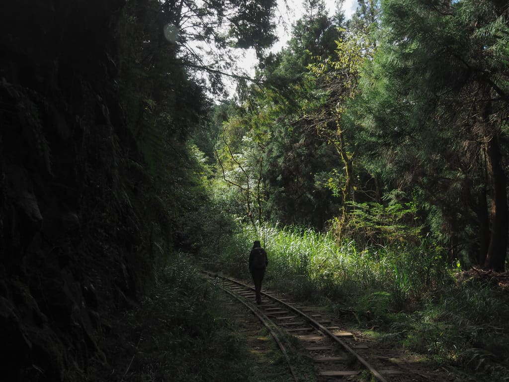
Walking the Mianyue Line today, it feels like it’s possible to get glimpses of the world that was. Moss is creeping in to cover the human-load tracks and the young trees, while certainly no match for their giant fore bearers, have covered the slopes once more. As we were walking, we passed one person talking on the phone to someone far away, “There are mountains all around me, I’m embraced by the hills.” Perhaps not as poetic as Dr Kawai’s musings, but it’s clear that this place continues to inspire awe in visitors.
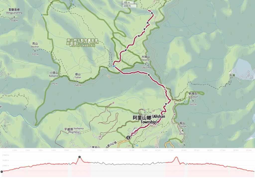
Distance: This is up for debate. We walked from the park entrance, so in total, it was a 9.4-kilometre walk, but if you catch the train from Alishan Station to Chaoping Station, you can shave a little off that. The Mianyue Line itself is a little over 9 kilometres (but since this is a there-and-back walk, that’s at least 18km).
Time: 6-8 hours — We walked it in 8 hours, hit that included a stop for breakfast within the park and the time spent walking between the park entrance and the trailhead. In fact, if you are a fast walker, you could probably complete the walk in 5-6 hours, but personally, I feel this is a walk that should be undertaken slowly.
Total ascent: My tracking app recorded an elevation gain of around 400 metres, but I don’t think that can be accurate. There is some upping and downing at the start of the walk, before you start the Mianyue Line portion, but the section along the railway is exceedingly flat.
Difficulty (regular Taiwan hiker): 4-5/10 – This walk is generally pretty easy, the only challenging elements are the distance, the mentally tiring nature of never being able to not look at where you’re putting each foot, plus the hassle of applying for a permit. Because of the above, this belongs in the moderate camp for people used to hiking in Taiwan.
Difficulty (new Taiwan hiker): 8-9/10 – The logistics alone (permit, figuring out transportation and accommodation) would be quite challenging (but not impossible) for someone unfamiliar with Taiwan hiking trails. The walk itself is not too physically demanding. It’s long and the elevation makes hiking somewhat more tiring than it usually is, but there isn’t a huge amount of elevation change since the majority of the walk follows the old railway. People unfamiliar with Taiwan’s trails may not be quite as comfortable as the locals with the level of risk. (See below.)
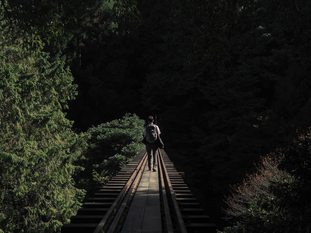
Risks and dangers: This is a walk with some really quite obvious risks. There are 24 wooden trestle bridges with drops of varying heights. Planks have been laid across the sleepers between the rails, so you have a solid path to walk on, but there are no railings to stop you from falling. If you meet someone coming in the opposite direction, you need to wait to let them pass before starting over the bridge yourself. There are a number of tunnels. None have lighting and one has a collapsed section that you’ll need to pass through. There’s also a section that has collapsed due to a landslide. Ropes and metal hand/footholds have been installed to make it passable. There are photos of all of these so you can se how you feel about them before applying.
Food and water: I took a little over 1L and drank most of it. Food-wise, we had bread, bananas, dried fruit and crisps, but ended up taking most of it home because we had a big breakfast from one of the restaurants near the park entrance. Supplies can be sourced from the 7-Eleven inside the park and you can fill up your water bottle inside Chaoping Station.
Shade: There is dappled shade for the whole of this route. I went in late November and got mildly sunburnt cheeks on a pleasant day.
Mobile network: Generally OK with a couple of weak patches.
Enjoyment: This is a hike unlike any other I’ve ever done. The historic railway scenery is really impressive and the forest is delightful. You might even get lucky with a few wildlife sightings.
Other: You will need a torch or head torch for some of the tunnel sections. Some people wear gloves to pass the landslide section, but it’s not necessary. Hiking sticks aren’t particularly useful on this walk.
Bathroom facilities: You’ll find toilets at Chaoping Station, then at two points along Mianyue line. The Chaoping Station toilets are pleasant enough. The ones on the hiking trail are not all that nice.
Route type: There and back.
Permit: Yes. A permit is required for this hike. You can find out how to get one here. The permit itself is free, but since the hike begins within Alishan National Forest Recreation Area, you will need to pay to enter the park. At the time of writing, the entrance ticket fee is NT$300 for foreign tourists, NT$200 for those with Taiwan ID (including ARC/APRC), or NT$150 for anyone arriving on public transport (you’ll need to show your bus ticket to get this discount).
Jump to the bottom of this post for a trail map and GPX file.
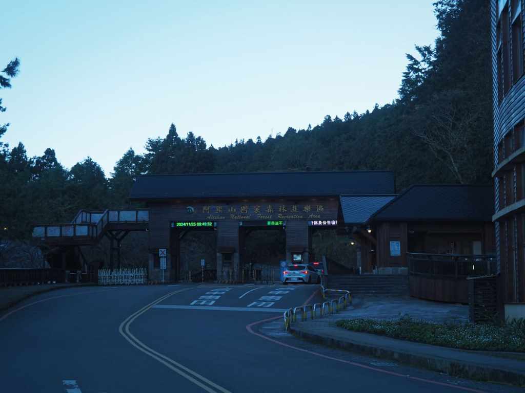
We had spent the night sleeping in our car close to the entrance to Alishan National Scenic Recreation Area and as we were getting up and getting dressed around 6:30, we were passed by a cheerful runner heading downhill. I have no idea where he came from or what time he must have started — the nearest place in that direction is Dongpu Lodge, which is a 20-kilometer slog along the road.
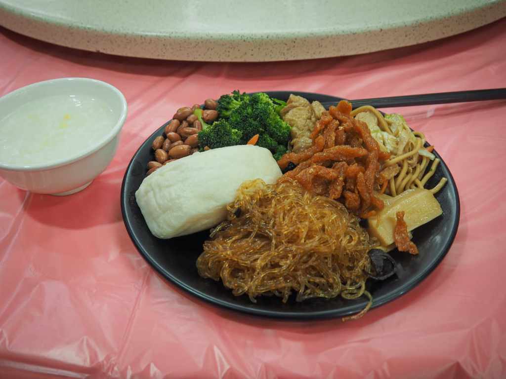
We were ready and on our way shortly before 7am and bought our entry tickets on the way into the park before heading to one of the restaurants to grab breakfast — NT$120 for an all-you-can-eat vegetarian spread that included congee, noodles, vegetables, and piss-poor coffee. There was also toast, but we were both too full to think about that.
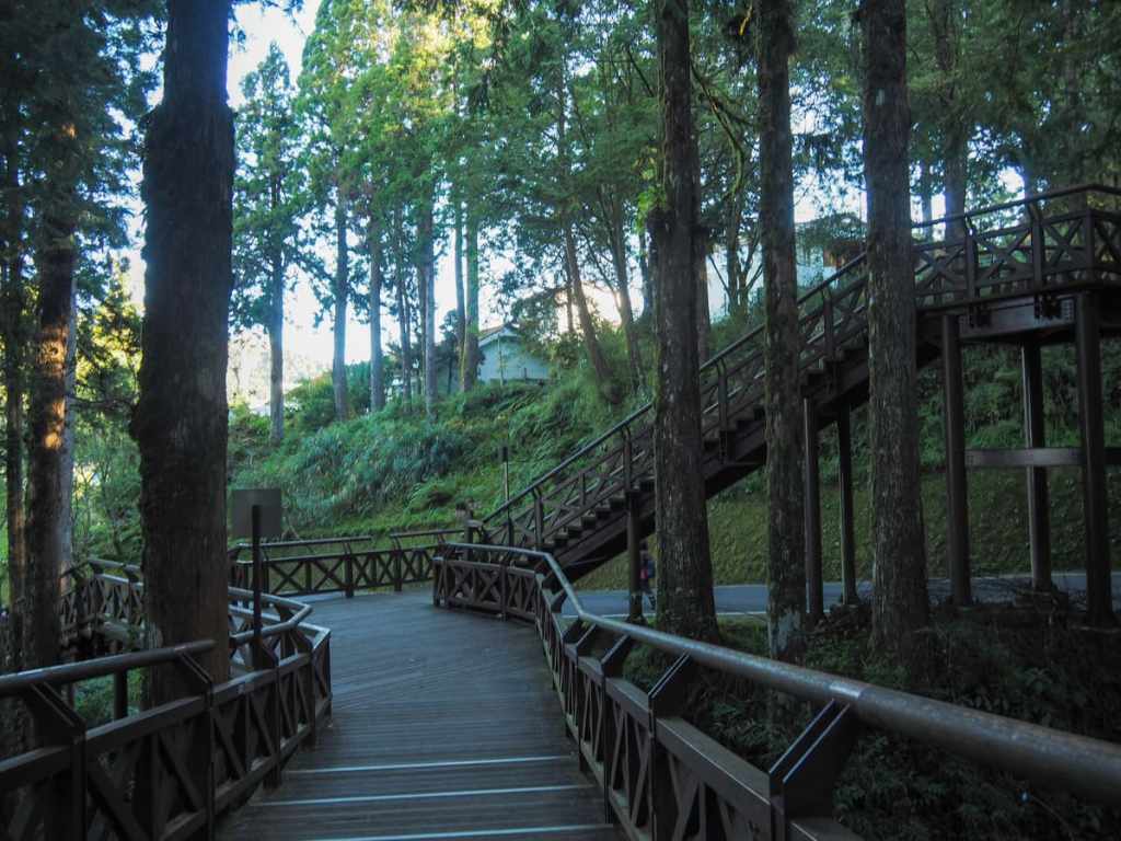
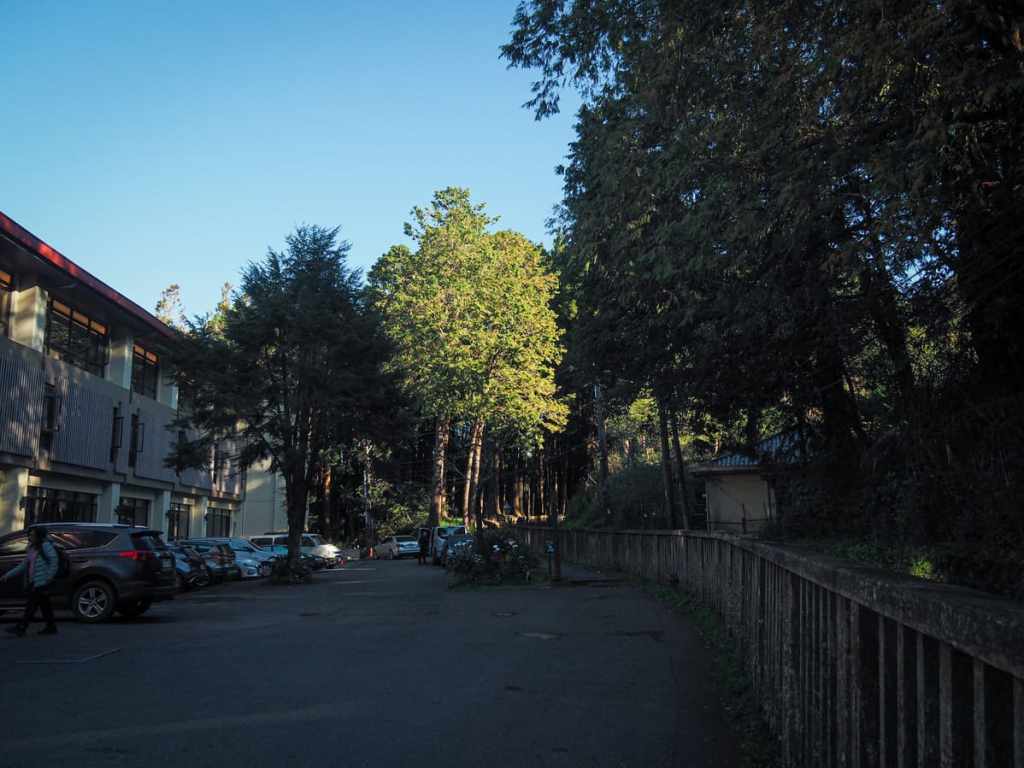
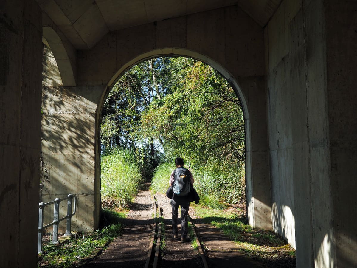
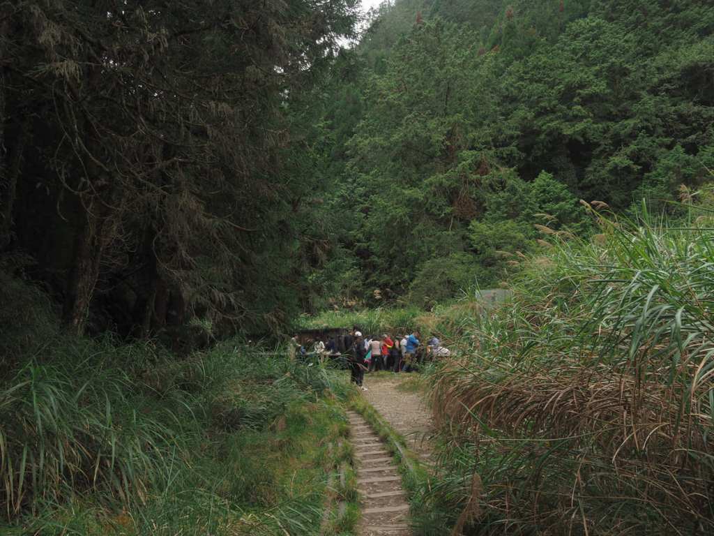
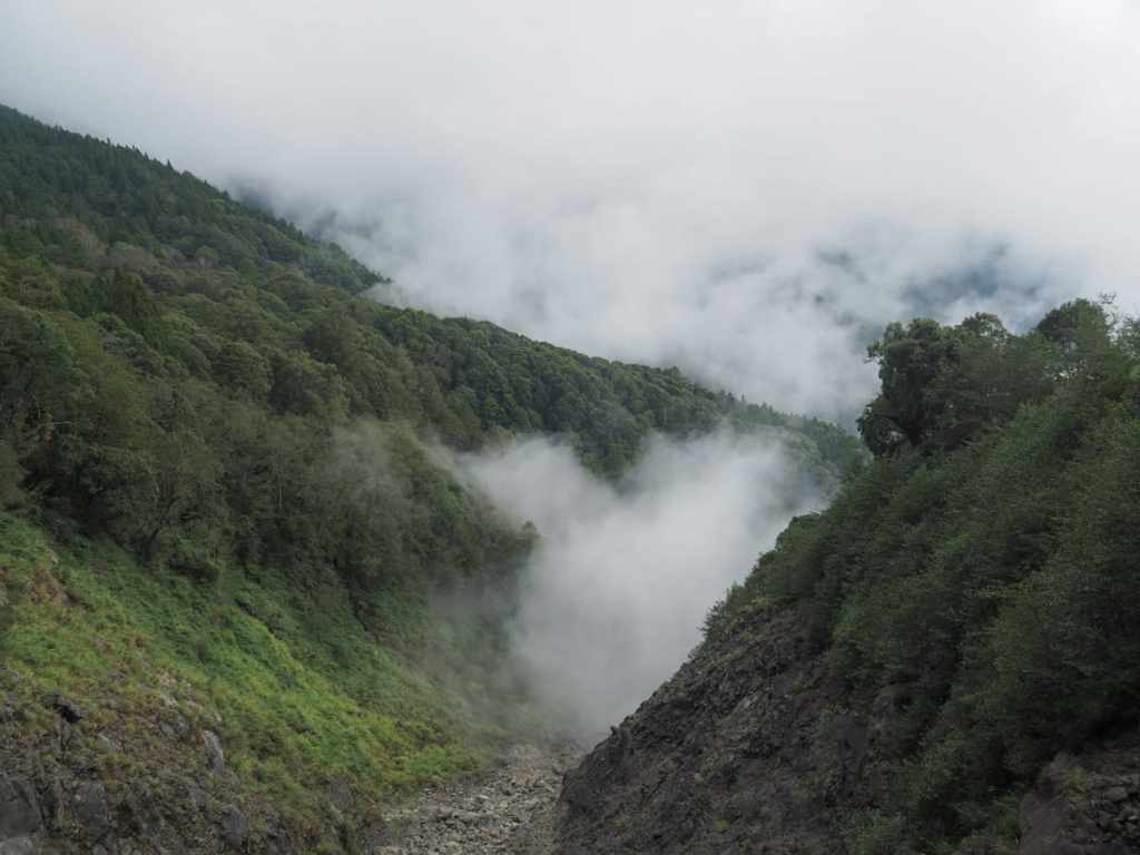
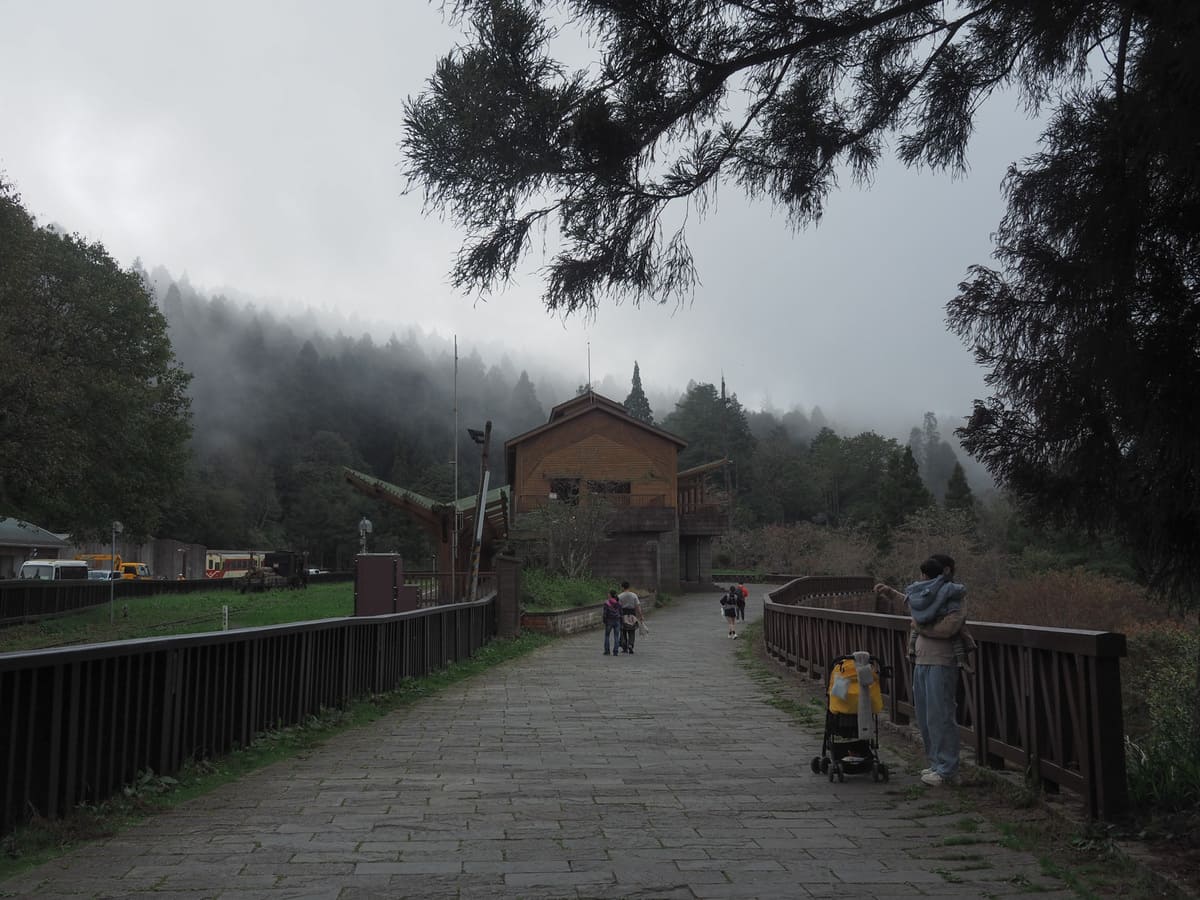
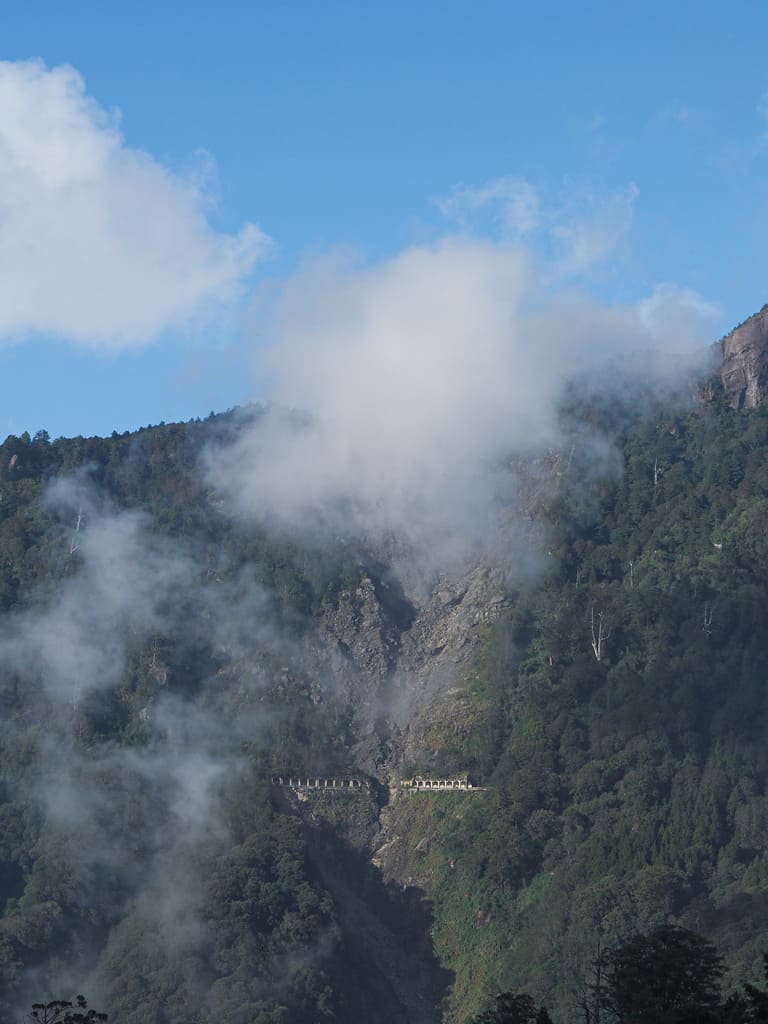
Heading deeper into the park, we passed a lookout point where — peering across the valley — it’s possible to make out the concrete skeleton of the reinforced concrete rock sheds that we’d be passing through later on. We also made stops at the 7-Eleven inside the park to pick up provisions and Chaoping Station to fill up our water bottles before finally making our way past Aligou Hotel and into the woods.
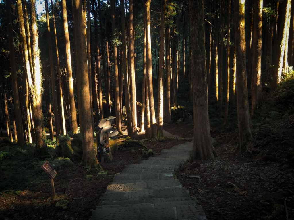
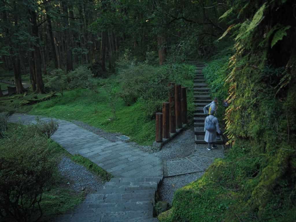
Steps lead down past blocky sculptures and through an archway formed by the long-dead stump of a giant cypress. At the second junction, we turned right passed a pair of monks who were debating whether they were going to climb Mount Data (or Tashan) or just do the Sisters’ Pond Loop.
For the next kilometre or so, we were following the Tashan Trail. The steps climbed up to meet and cross over the railway via a footbridge before following alongside the railway for quite a way. Honestly speaking, this section is the hardest part of the whole walk because the trail dips and climbs numerous times, and unsurprisingly, a fair few hikers take the easy option of walking along the railway. Before rushing to join them, it’s worth pointing out that this section of the railway is still in operation and walking on it is prohibited. This is the route taken daily by the sunrise-viewing train, and even if the sunrise train has already been and gone, the park runs semi-regular morning and afternoon services at special times of year (like cherry blossom season or maple leaf season), so it’s best to stick to the proper hiking trail.
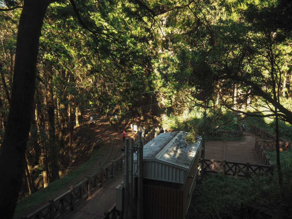
A second bridge crosses the rails at the point where the trains split to trundle onwards and up Duigaoyue and Zhushan Stations, and then a little further on, we reached the point at which out own path would split from those of hikers climbing Mount Data.
The trail descends to meet a small maintenance shed, and from here, anyone hiking the Mianyue Line will need to shimmy through the fence and start following the train tracks. (The Mount Data climb goes from the far right corner of this little staging area.)
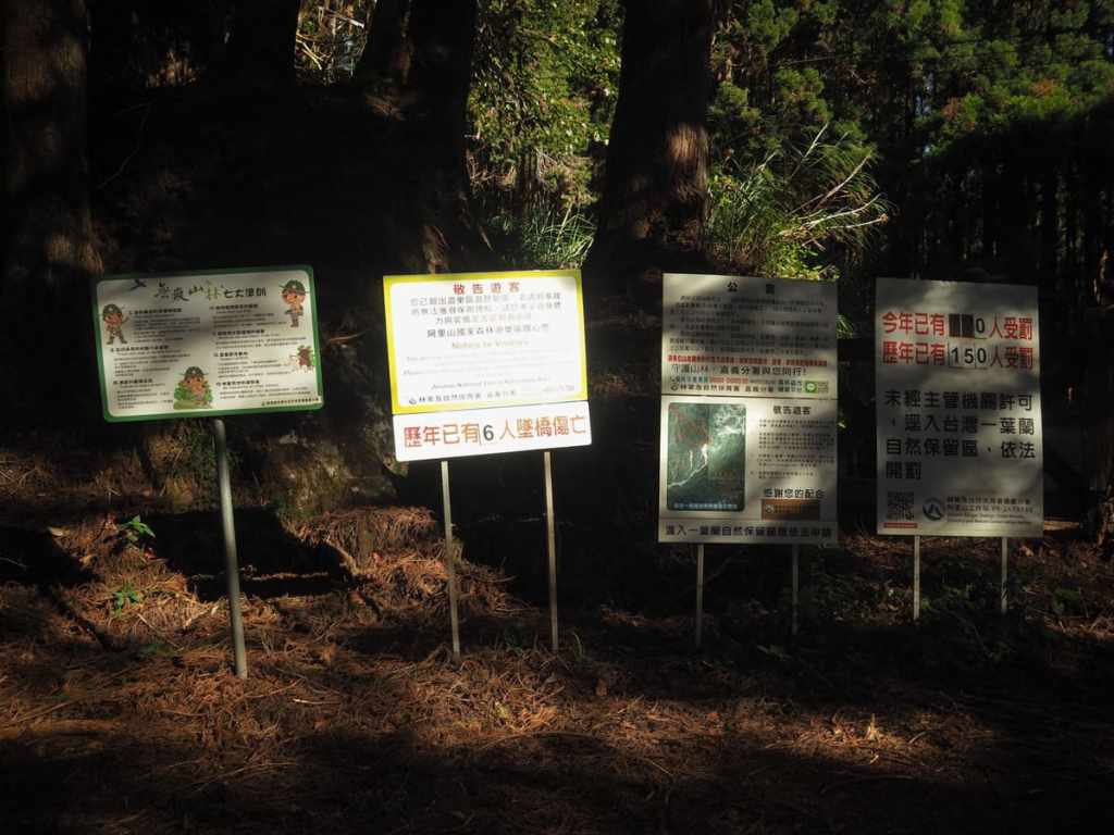
The entrance is defended by a wall of warnings covering the basics of the Leave No Trace principle, warning that there have been at least six instances of people falling from the bridges and at least 150 historic instances of people being fined for not having the correct permits (although none of the fines were levied this year).
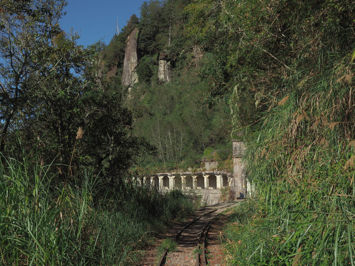
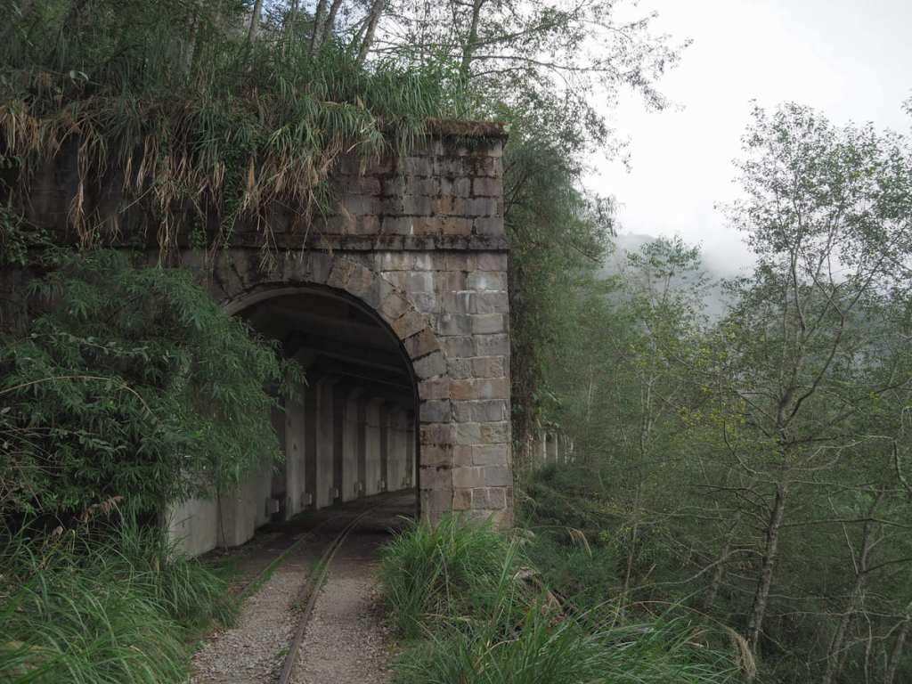
Within a few metres of stepping onto the tracks, we spotted a Mikado’s pheasant (unfortunately no good photos), and far quicker than I would have imagined, we reached the first of the two rock sheds. This early section of the trail is the only part which has some views, and if you look to the left, you can make out all the buildings around the built-up part of Alishan National Forest Recreation Area.
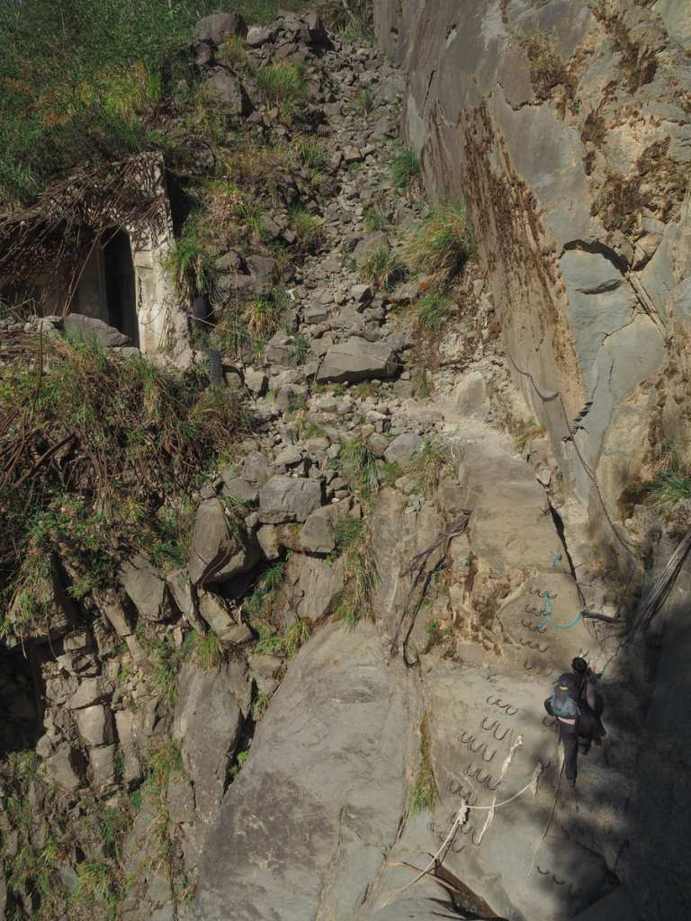
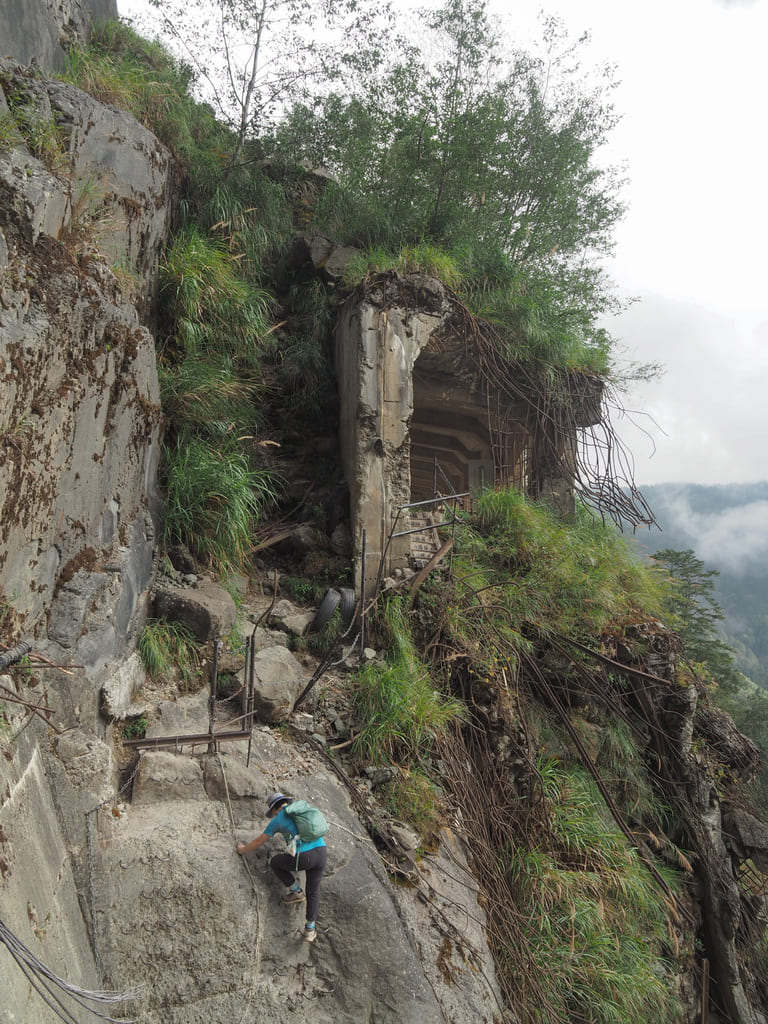
The Mianyue Line has two or three sections that feel somewhat hairy — especially if you’re used to hiking in a country that has stable and steady geology (like my home, the UK). The first of these potentially anxiety-provoking sections is a brief stretch where a landslide has torn away a section of rock shed. Mangled steel rods jut out from the torn concrete and hikers must traverse the gaping chasm between the two severed ends. Ropes and metal hand/footholds have been added to help, and in all honesty, the reality doesn’t feel as bad as it looks in the photos.
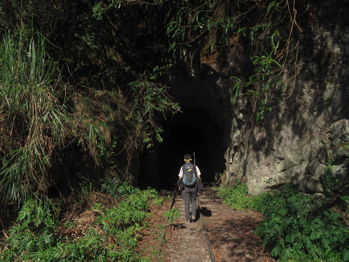
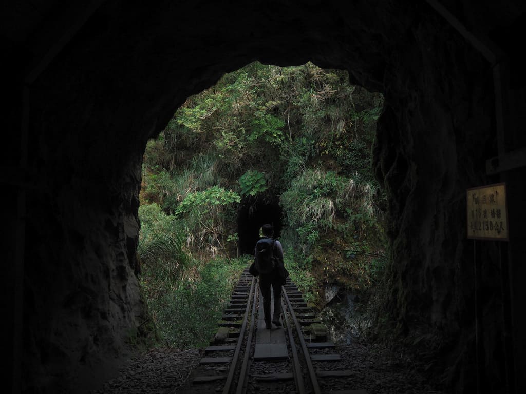
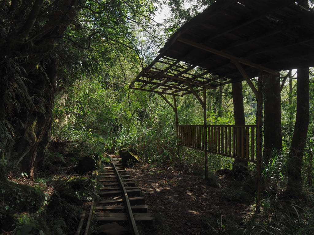
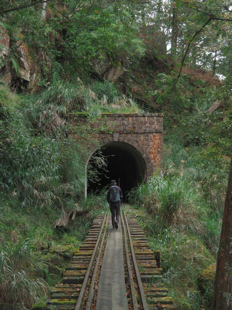
Not far beyond the end of the second rock shed, we came across the entrance to the first of the tunnels. It looked dark from the outside, but stepping into it, we quickly realised that it was pretty short and we could see without turning on our torches.
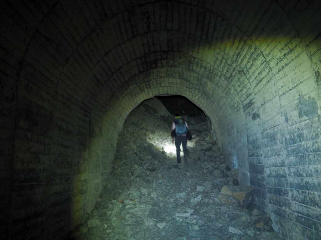
The same could not be said of the second tunnel. Not only is this the longest tunnel (it’s a shade over 400 metres long), but it also has a collapsed section, meaning that torches are essential. This is the second hairy part of the Mianyue Line adventure, and — in my opinion — the scariest. After you scramble up the pile of mud-slicked debris, you’ll find yourself in a hollow rocky chamber where the roof of the tunnel used to be. It’s not so small or tight that it’s claustrophobic, but it makes you unpleasantly aware of how superficial our control over nature really is.
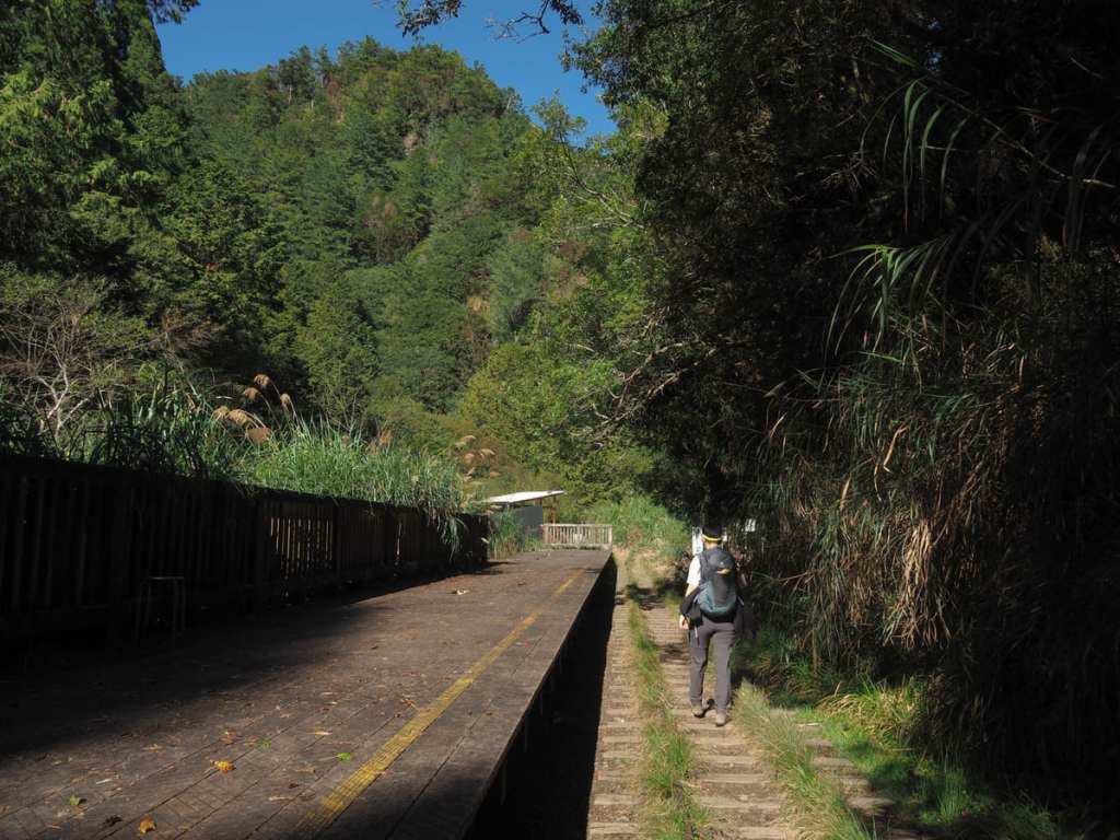
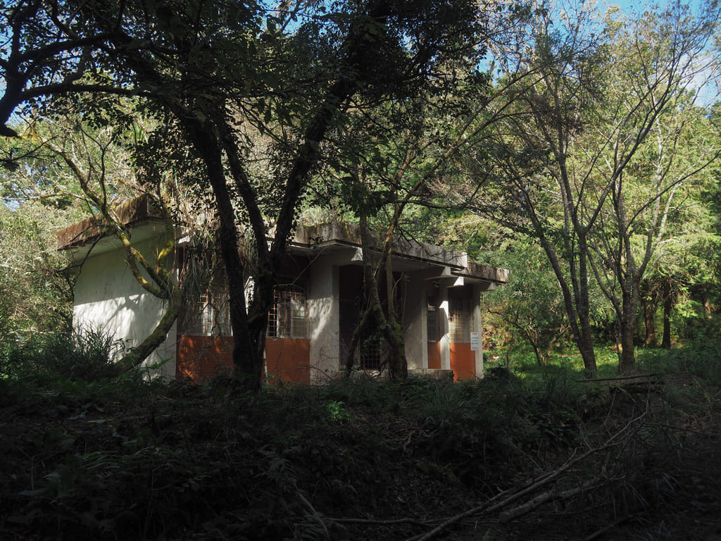
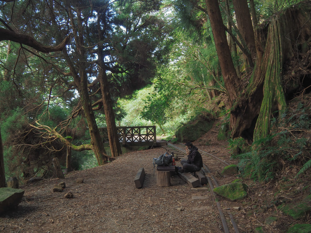
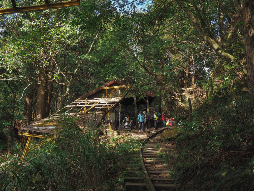
At the far end of tunnel number two, the tracks emerge at Tashan Station. There are toilets at the far end of the wooden decking, and this is one of the two spots where people often set up tents if doing a two-day hike.
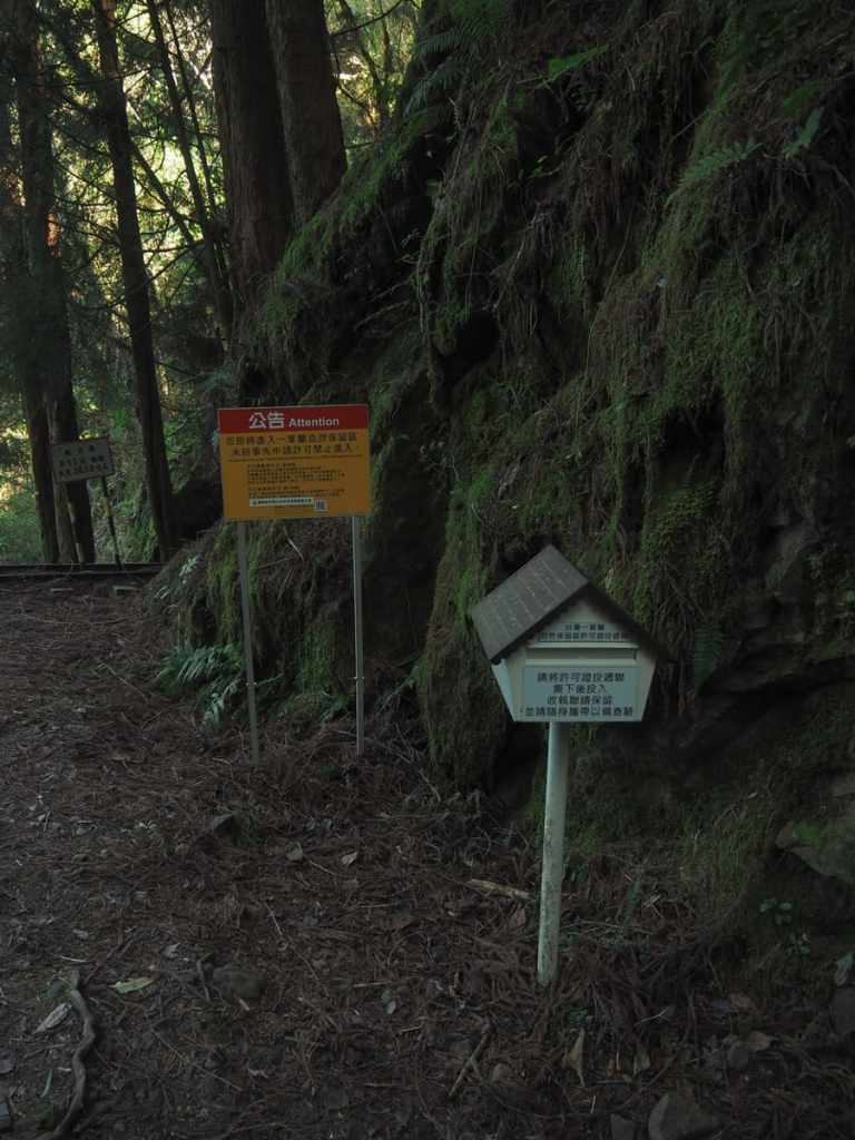
A short way beyond Tahan Station, we came across the box where we were supposed to deposit a print-out of our permits. The box was pretty full — it seemed like it hadn’t been cleared out since the weekend hoards had been through.
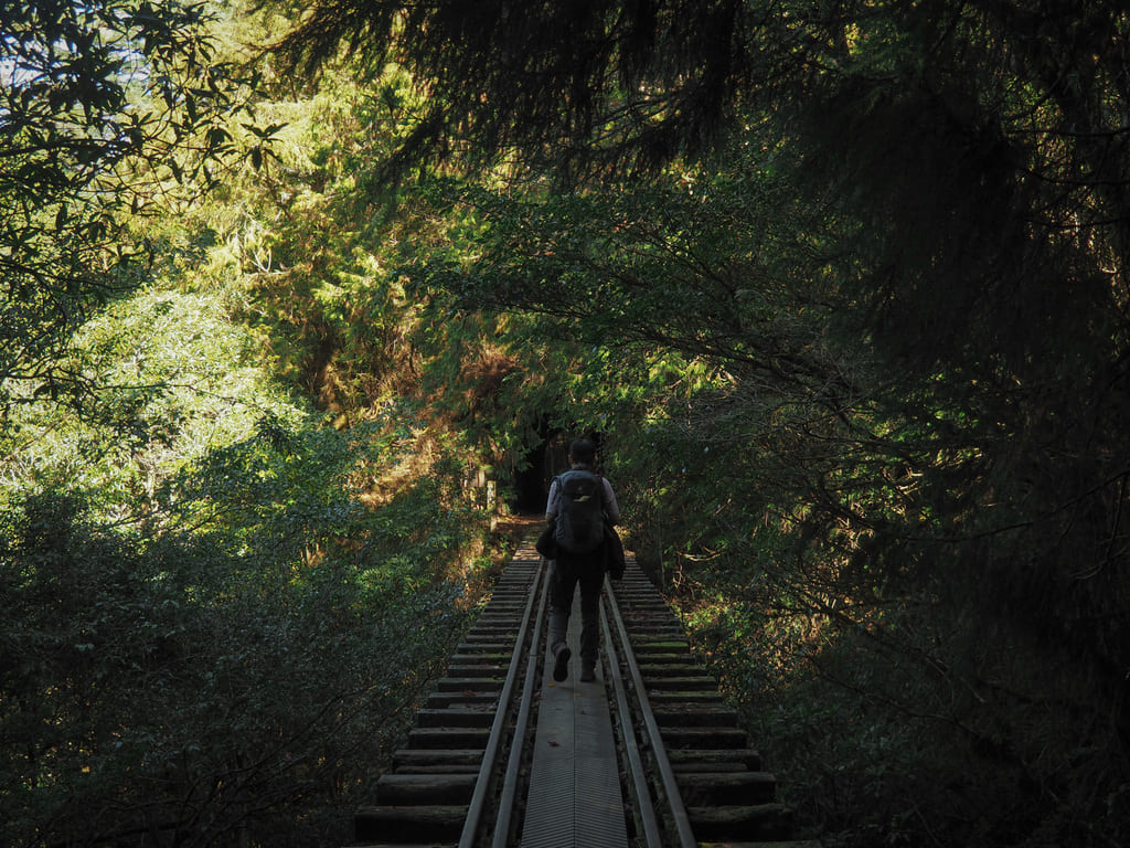
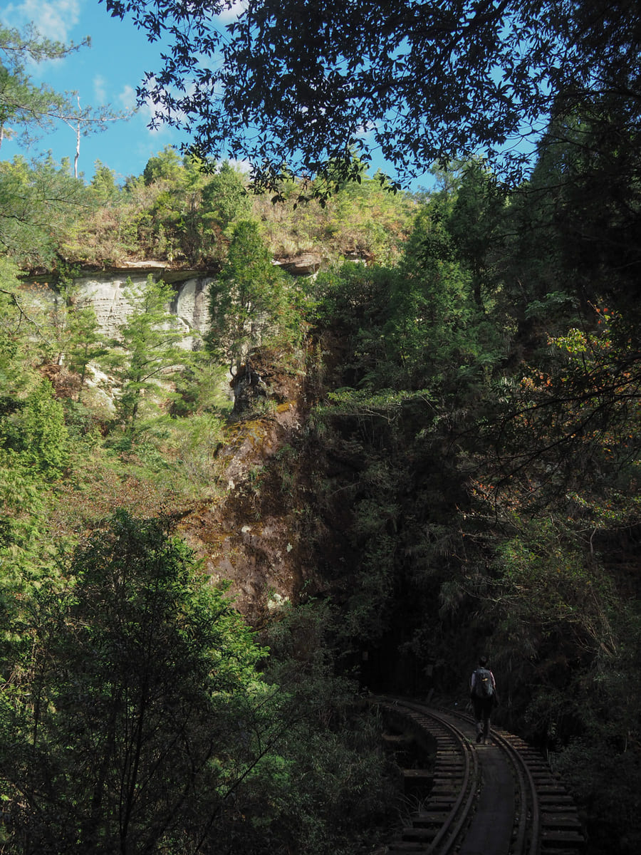
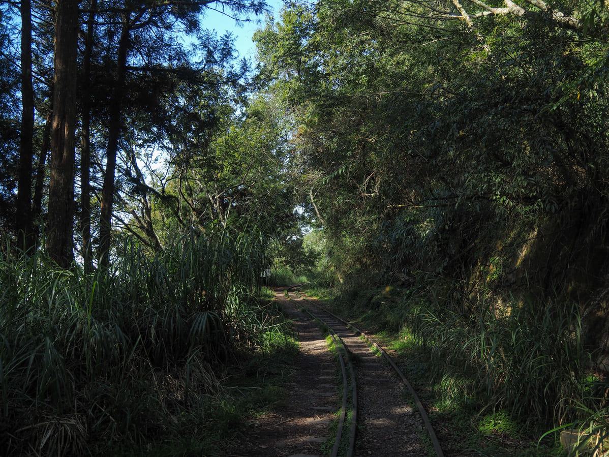
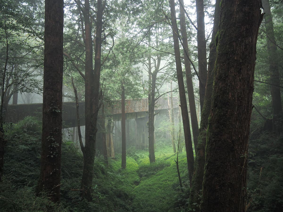
The remaining three-and-a-bit kilometres to the turn-around point was a pleasant and gentle stroll over high trestle bridges, through short tunnels and amid luscious greenery.
We passed three or four people coming back from the opposite direction, but for the most part, we had the trail to ourselves — it pays to get up early sometimes.
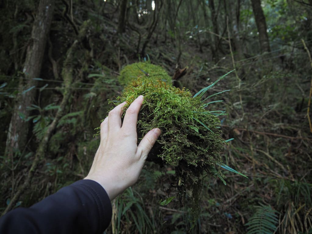
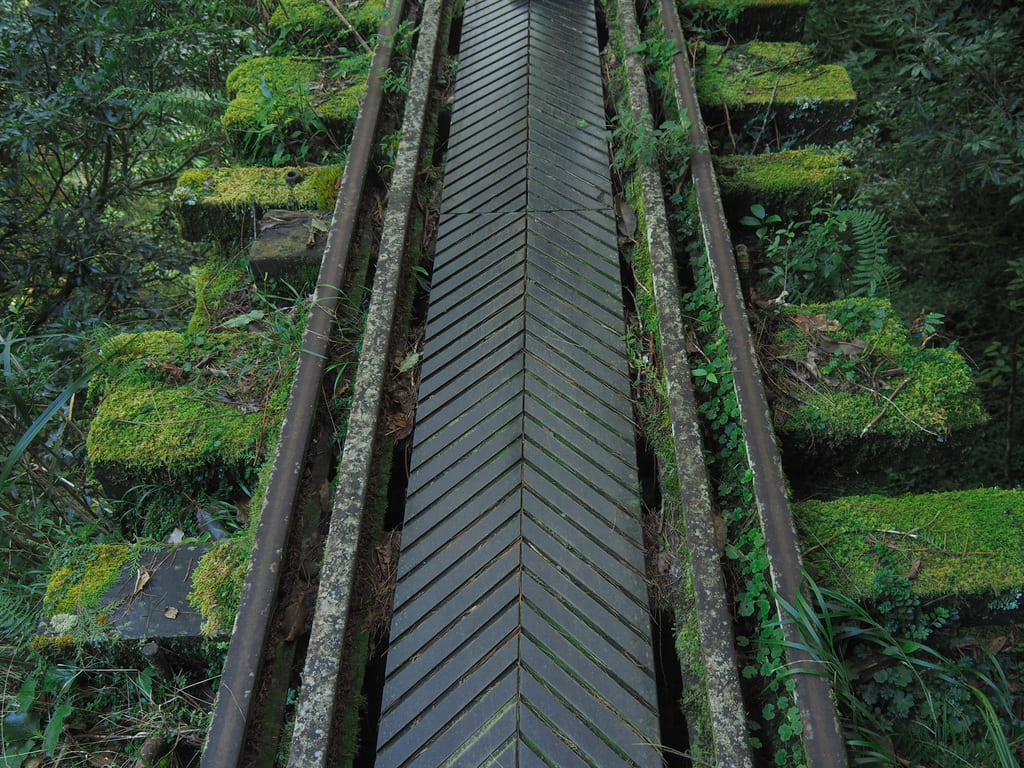
Thick moss carpets the sides of the sleepers and all of the trees and rocks in the valleys below the bridges. As recently as a couple of years ago, there were only the most basic planks thrown between the rails, and in some places, hikers had to step from sleeper to sleeper. After the pandemic caused local interest in hiking to explode, the authorities laid down a proper walkway to reduce the likelihood of accidents — probably a good thing since the drops are not insubstantial.
For the highest and most dramatic of the bridges, the sunlight decided to go into extra-contrast mode, making it look like Teresa was walking across a bridge to oblivion.
A second toilet block sits near the abandoned shell of another old railway building. We scared off a pair of monkeys who had been scavenging nearby — possibly on the hunt for provisions left by campers.
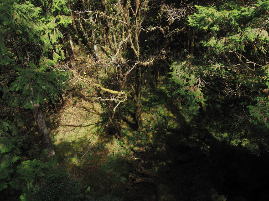
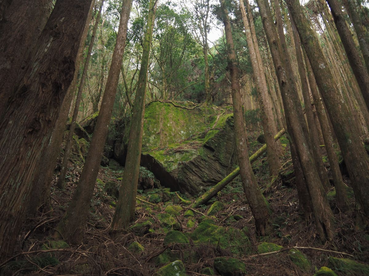
As we drew closer to the end of the line, the trees started to change again, becoming more like the forest right at the start of the walk — lots of younger cedars growing up around the carcasses of felled cypress giants.
The walk ends at the decaying remains of Shihou Station (石猴車站), which is hidden through a more densely forested stretch just beyond a picnic bench and a viewing platform where – in the past, it was possible to see the monkey-like rock formation that gave the station its name. We decided to pause for snacks here before turning round and as we were setting off, we encountered a large number of other hikers just arriving.
If you explore the area around Shihou Station, you will spot signage directing hikers to Shuiyang Forest. This overnight trek usually involves camping on the shore of an earthquake lake filled with ghost trees that died when their roots were suddenly swamped.
Heading back, the light seemed to be somehow even prettier than before. Sunlight picked out each strand of grass and threw shadows over the trees.
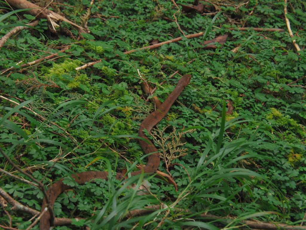
Teresa nearly stepped on this mountain keelback snake that crossed the tracks in front of us.
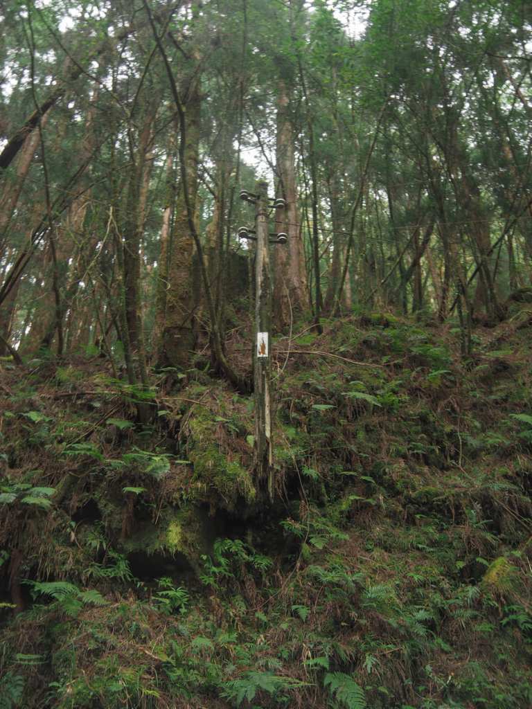
Several of the tunnel entrances near to the old Tashan Station have paths beaten around the sides and hikers like to clamber up to pose on them (not this one though). In the right hand image, there’s an electricity pole, the bottom half of which has rotted away, now suspended aloft by dead wires.
Back at Tashan Station, a huge crowd had gathered. Despite it only being midday, it seemed like a fair few people had already arrived to set up camp for later in the day.
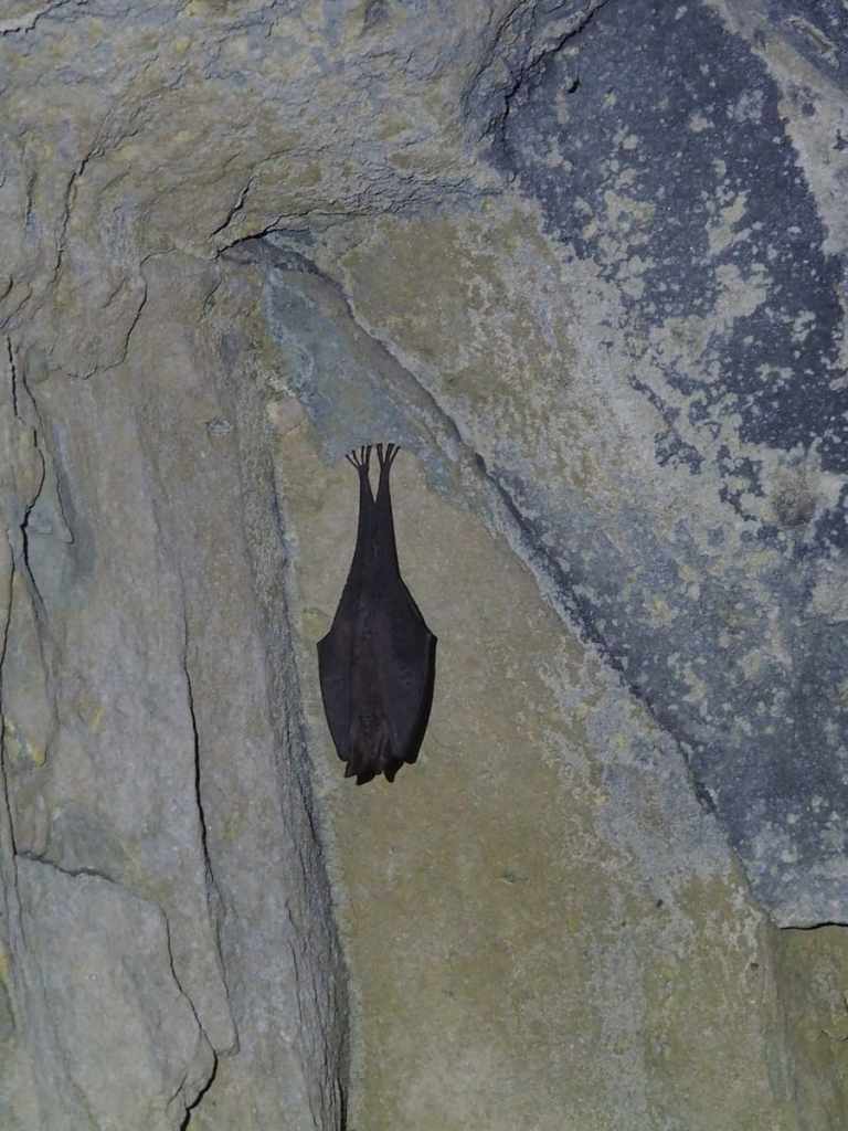
On our way back through tunnel number two, we spotted this Formosan woolly horseshoe bat. I can’t get over how cute its little toes are!
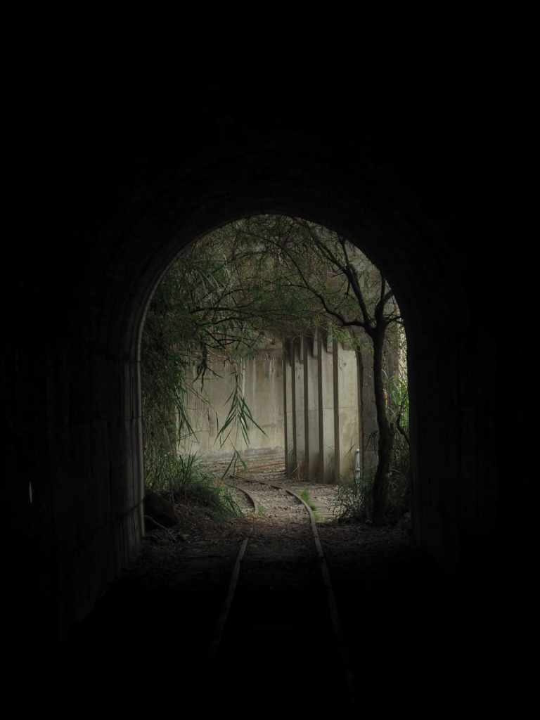
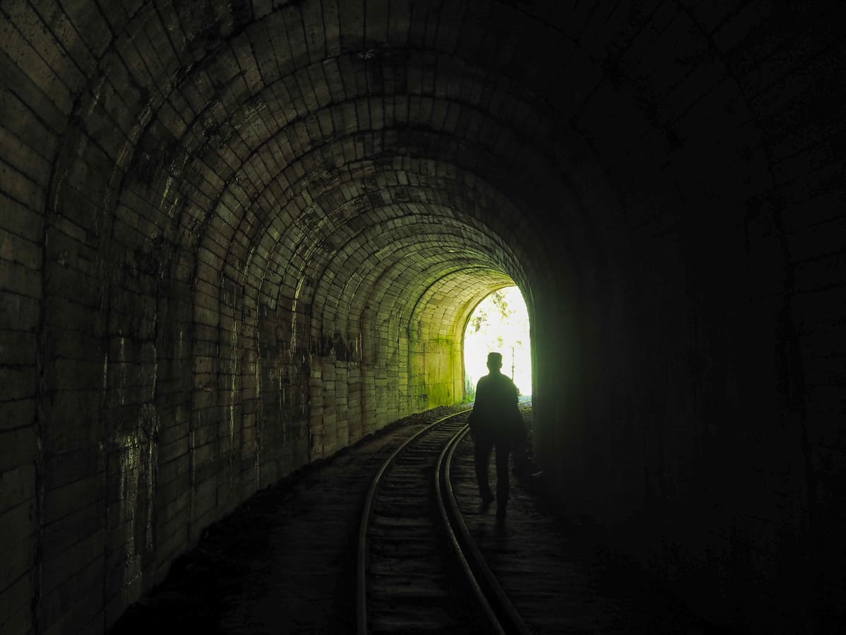
The exit to the final (or first) tunnel looking especially photogenic as the afternoon mists softened the light.
I had hoped that we might get extra lucky and get the perfect combination of sunny morning and misty afternoon, but my wish was only partially granted. There were tendrils of afternoon clouds here and there, just not the full-on atmospheric murk that sometimes descends upon the region.
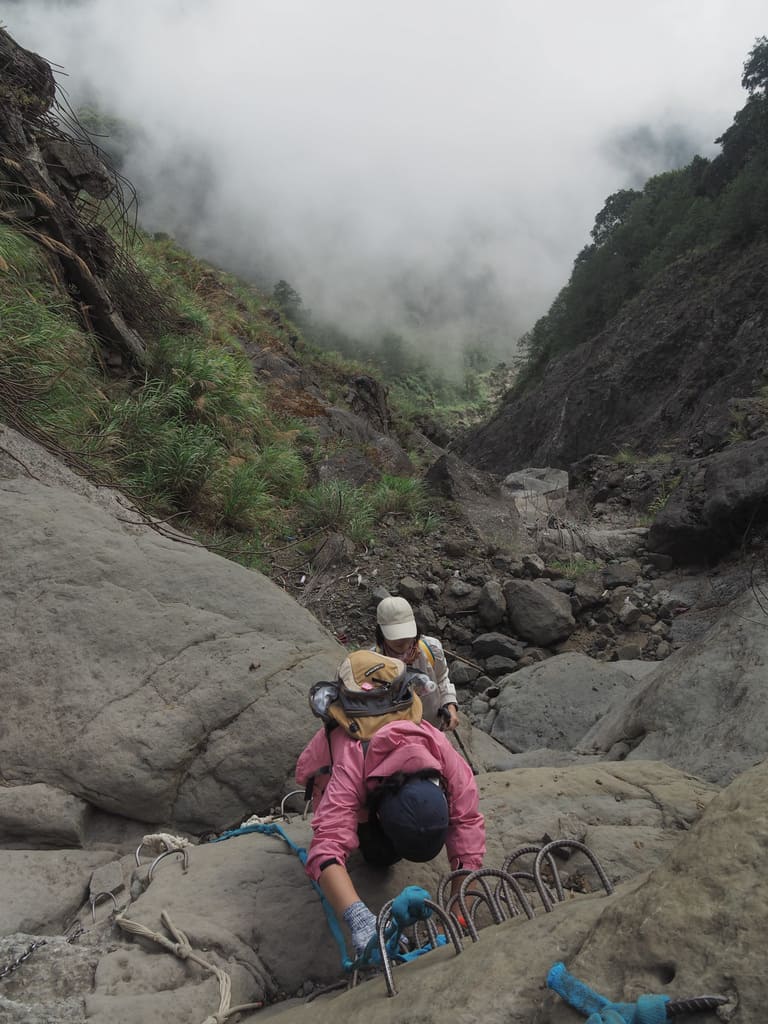
When we arrived back at the landslide, there was a bit of a bottle neck as hikers with ungainly camping packs came one way and a quarter of slightly anxious walkers went in the opposite tree direction. By this time, those who were late starting the hike had begun turning around, so a big queue soon formed.
It must have taken the group behind us quite a long time to clear the landslide, because for the remainder of the walk back to the main park, we were almost entirely by ourselves.
We got back to Chapping station by 2:30pm, write a bit earlier than I’d anticipated, and thanks to the fact that it was a Monday, we enjoyed a comparatively traffic-free drive back to Taipei.
How to get to Mianyue Line
Google Maps address: The walk starts inside Alishan National Forest Recreation Area. If you plan to arrive by car, you’ll probably have to park up along the road and walk or catch the shuttle bus down to the park entrance.
GPS location: This is where the trail leaves the built-up area of the park N23 30.980 E120 48.890
Public Transport to Alishan
Public transport: Given the park’s location, you’ll probably want to spend the night in the area even if you have your own transport. There are a couple of options to get here on public transport.
- Bus from Taipei – the 1835 Kuo-kuang bus departs Taipei Bus Station, although their website is unclear and doesn’t list any timetable, so you’re better off either calling (good luck) or going in to enquire about when that service operates.
- Bus from Chiayi – the 7322 Chiayi County bus leaves Chiayi Station (not the Chiayi HSR Station), whilst the 7329 departs from the HSR Station (not the regular train station). You can buy tickets for both of these from Famiport or iBon machines – again, just make sure you’re prepared in advance and know where you’re going.
- Train and bus from Chiayi – if it’s you’re first (and maybe only) time in the area you might want to consider riding the Alishan Forest Railway as far as Fenqihu and then transferring to bus for the remainder of the journey (hopefully the whole of the route will be repaired soon, but for now you can only go part of the way). This railway is a truly spectacular feat of engineering, and (assuming you don’t get motion sickness), it’s a journey well worth taking at least once in your life.
Alishan Park Entrance Tickets
There’s no need to pre-book Alishan tickets, you pay when you enter the park. When I visited, the cost was NT$300 for a standard ticket for foreigners, NT$200 for a standard ticket for Taiwan ID/APRC/ARC holders and NT$150 for a discount ticket. If you have the yellow ticket issued by bus operators to prove you travelled on public transportation, you can get a discount.
Nearby trails:
- Alishan Sisters Ponds Loop
- Mount Data Trail
- Shuishan Sacred Tree Trail
My new words learnt on this hike:
- 帝雉 / dìzhì – Mikado’s pheasant
- 雙胞胎 / shuāngbāotāi – twin
- 包圍 / bāowéi – surround
Mianyue Line Trail Map
GPX file available here on Outdoor Active. (Account needed, but the free one works just fine.)

very interesting and clear explanation. Well done!
LikeLiked by 1 person
Thanks! Happy to hear you found it interesting.
LikeLike