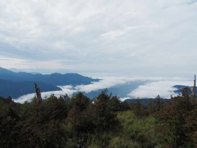
While Daxueshan National Forest Recreation Area offers much in the way of outstanding forested scenery and treescapes, it’s much less of a view destination. Here and there, you can glimpse sight of peaks and valleys in the distance, from the side of the road or from the top of the visitor centre, but if you want a walk with a view, this should be top of your picks.
Distance: About 1.3 kilometres, or a little extra if you venture to the nearby park.
Time: An hour or so. It took us about 20 minutes to reach the summit and a similar amount of time to descend, plus a little extra time for enjoying the view. If you plan to walk from the visitor centre accommodation to catch sunrise, you can expect it to take you 1½-2 hours to arrive depending on your walking speed. (Total distance would be closer to 6 kilometres — five and a bit on the road and about 700 metres on trail.)
Total ascent: Around 80 metres.
Difficulty (regular Taiwan hiker): 1-2/10 — There’s a small amount of elevation gain, but otherwise very easy.
Difficulty (new Taiwan hiker): 2-3/10 — The shortness of this walk means that, despite the steps, it should be pretty easy even for those new to hiking in Taiwan.
Risks and dangers: If you go in the day time, this is a pretty risk-free walk, but during the night time, you ought to be a little more aware of wildlife. It’s highly unlikely that you’ll run into them, and even more unlikely that they will pose a threat, but there are occasional Formosan black bear sightings in the area, so if you go for sunrise or sunset, it would be wise to take company and/or a bear bell.
Water: I left my water bottle in the car and was fine, but if you go on a sunny day, it would be smart to take a small bottle.
Shade: There is patchy shade along this trail. I ended up getting a bit of a sunburn after a day spent exploring similarly shady trails up here because the intensity of the UV rays is that much stronger.
Mobile network: I had clear reception throughout.
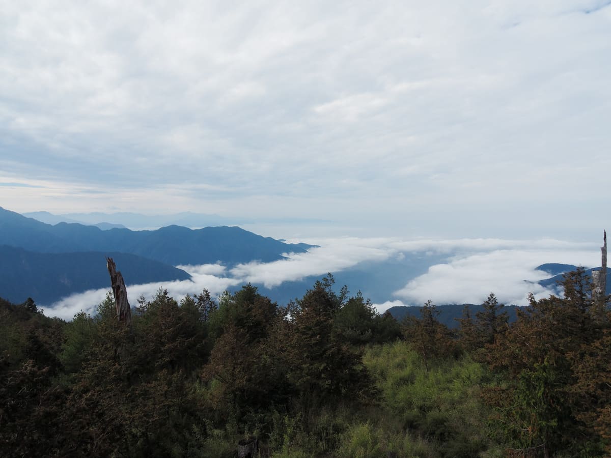
Enjoyment: Most of the trails in Daxueshan National Forest Recreation Area are more forest- than view-focused, so if you want to include a short walk with views to balance out the experience, this is a good choice. Also, if you’re able to make it here for sunrise, all the better.
Sunrise and Sunset: If you’re staying in the park, this makes an excellent spot to see sunrise or sunset. Ideally, you’d want your own transport to get to the trailhead, but if you’re particularly determined, you could walk the 5 kilometres here from the hotels near Daxueshan Visitor Information Centre.
Bathroom facilities: There’s no bathroom at the trailhead. The nearest toilets are at the visitor centre.
Route type: There and back.
Permit: No permit needed, but you need to pay to enter the park.
Jump to the bottom of this post for a trail map and GPX file.
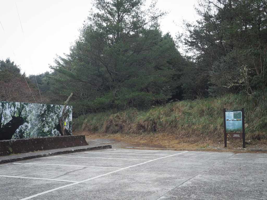
When we arrived at the carpark for the Yakou Lookout Trail we were the only car there (in fact, we remained the only group on the trail the whole time we were there).
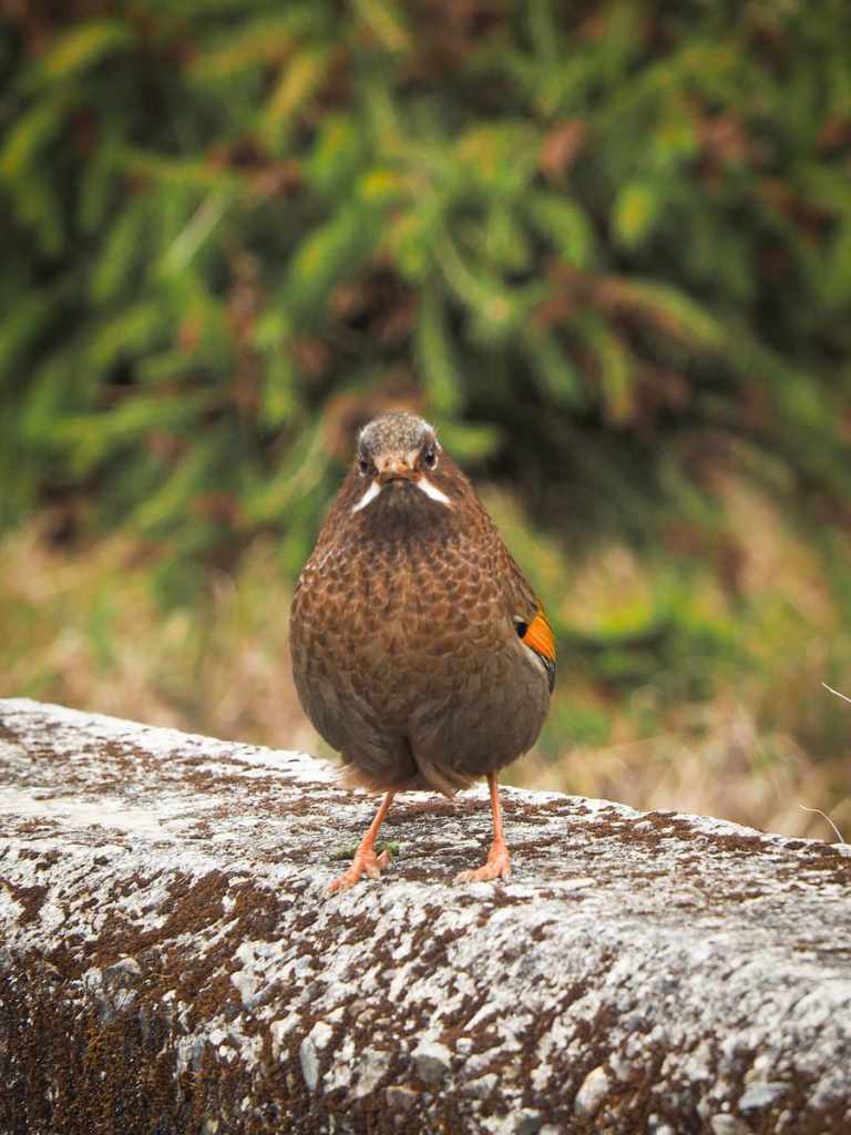
We didn’t need to go very far to meet some of the park’s wildlife — as soon as we stepped out of the car, this impertinent white-whiskered laughingthrush and one of its buddies began hopping around, hopeful for some treats. (Do not feed them, they have more than enough easy pickings in the park.)
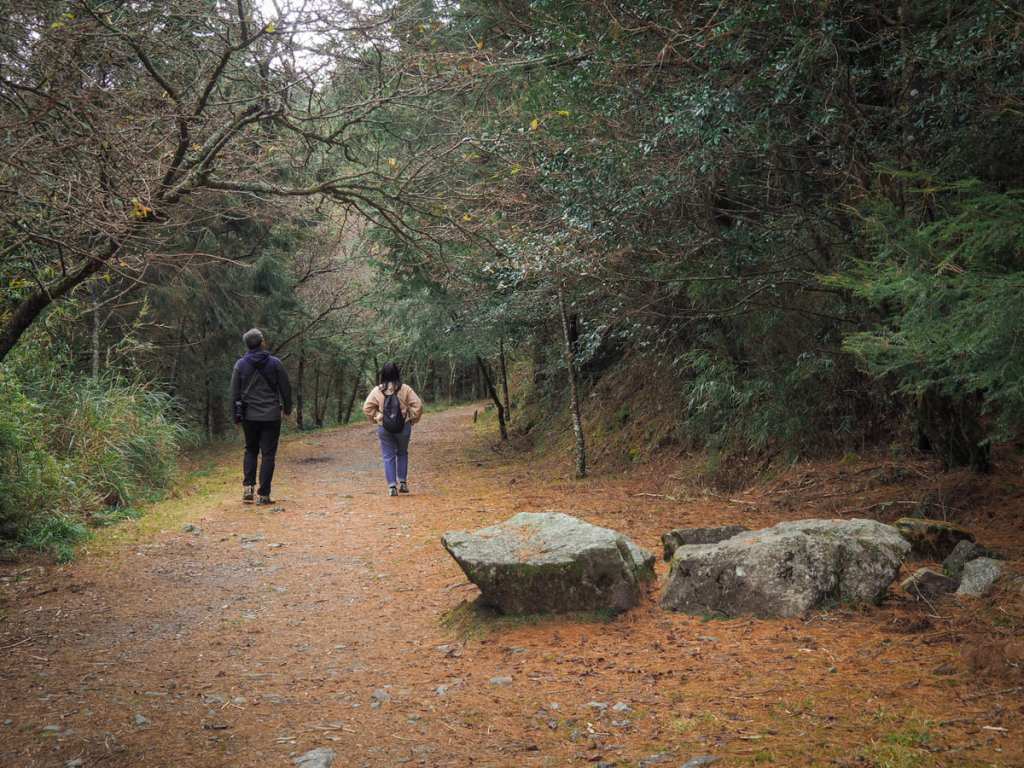
The trail starts from the rear of the carpark and the first little stretch is flat and easy.
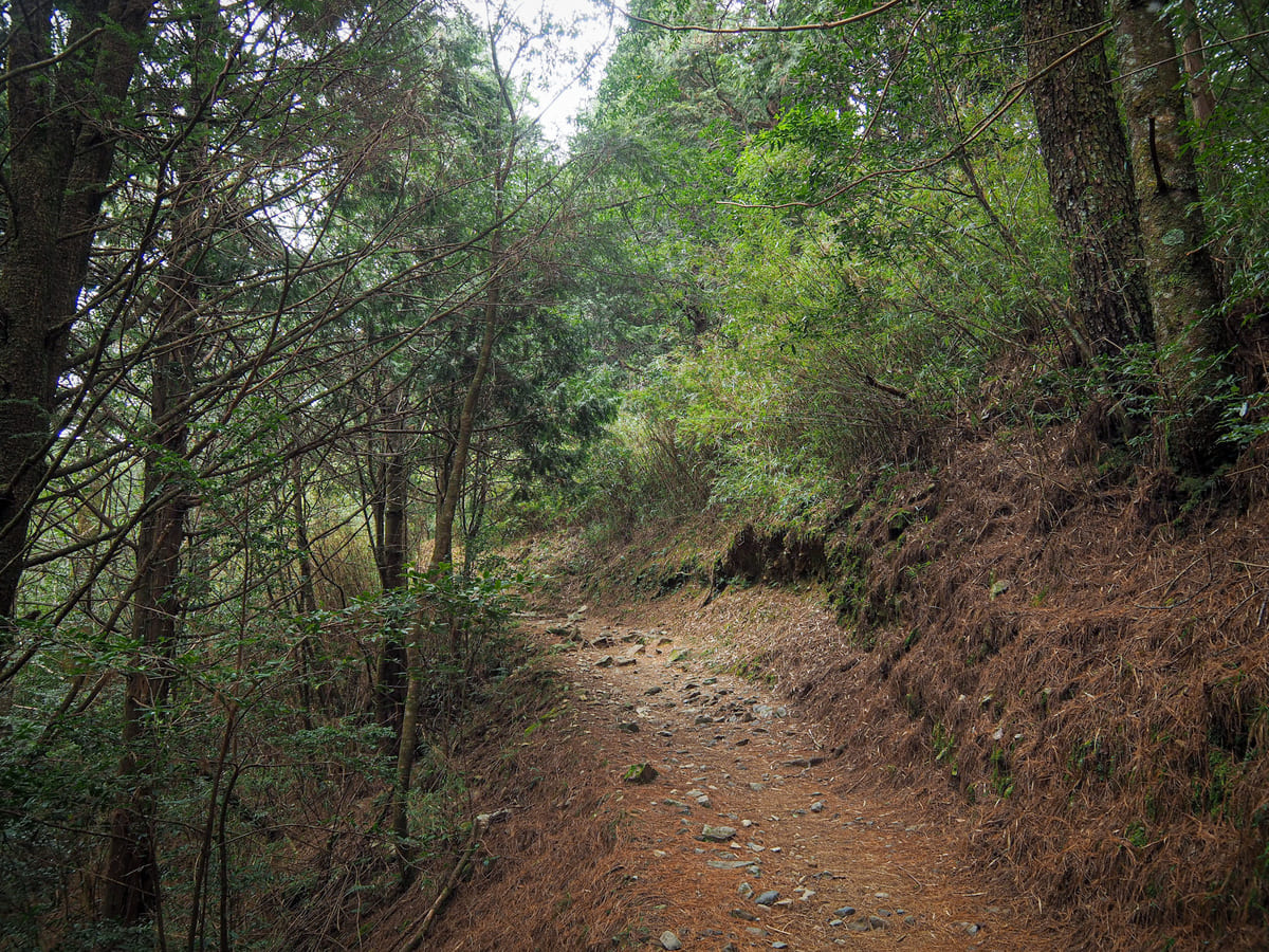
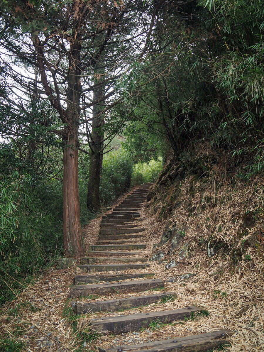
Then, quite quickly, the track morphs into steps and begins a steady, not-too-steep ascent.
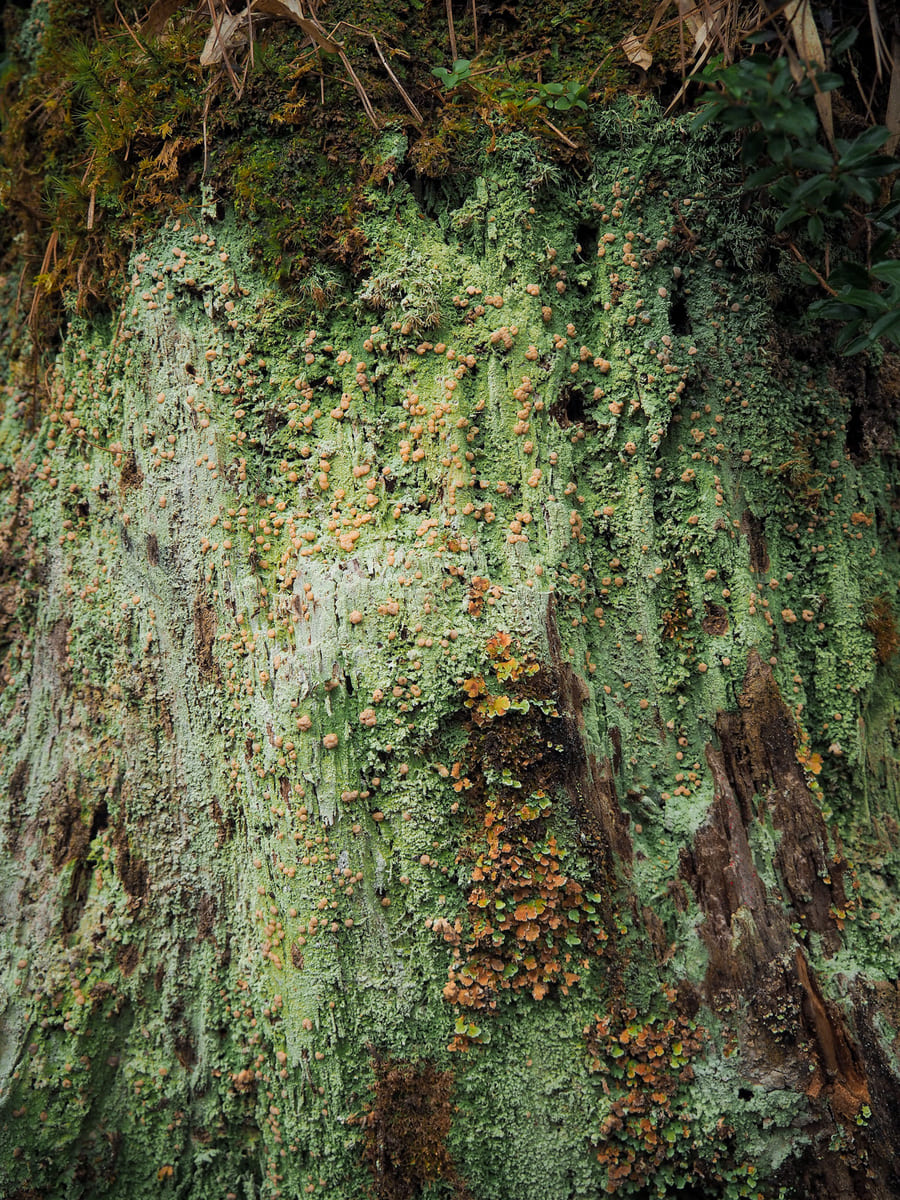
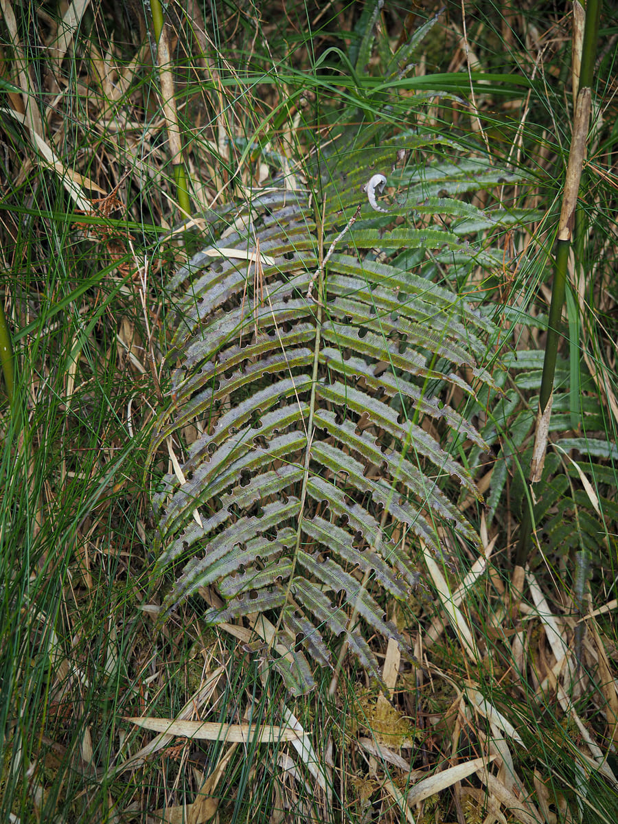
Along the way, keep your eyes out for the little nuances in the flora. I was particularly taken by the lovely pastel shades in this patch of lichen and the neatness in the nibbled holes on this fern.
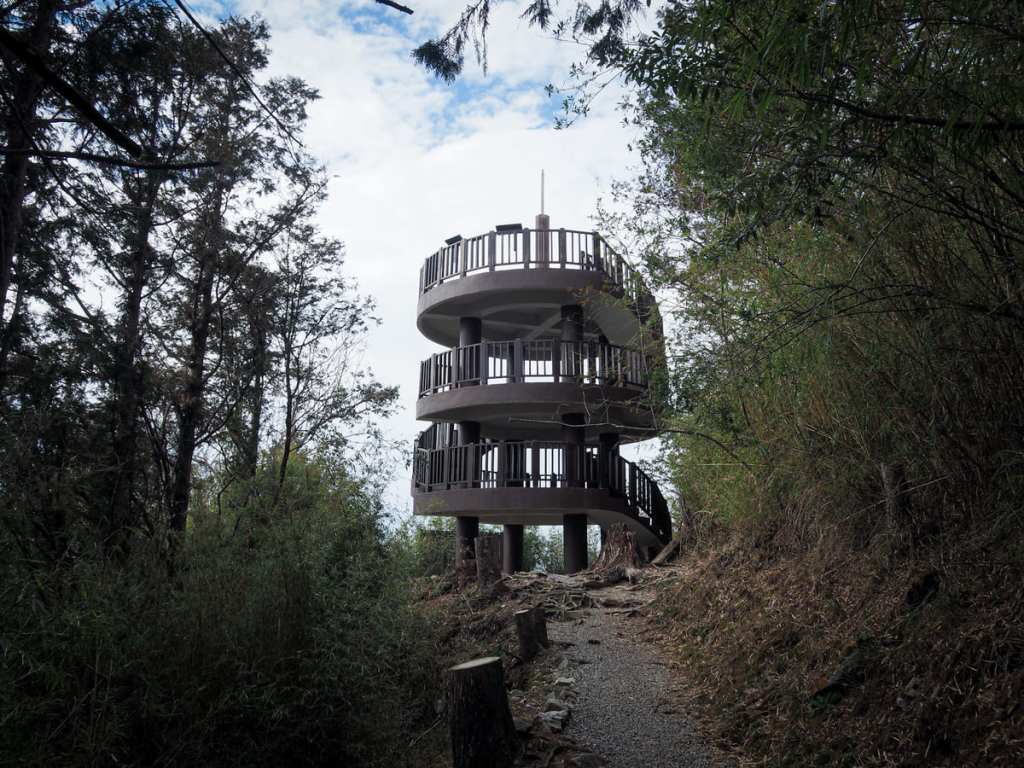
The goal of the walk is this three-storey lookout tower that offers panoramic views over much of the nearby area. (There is also a little side-trail which cuts away into the undergrowth just before reaching the tower that climbs a further hundred metres to the summit of the West Peak of Mount Pingshi, but we didn’t explore that way.)
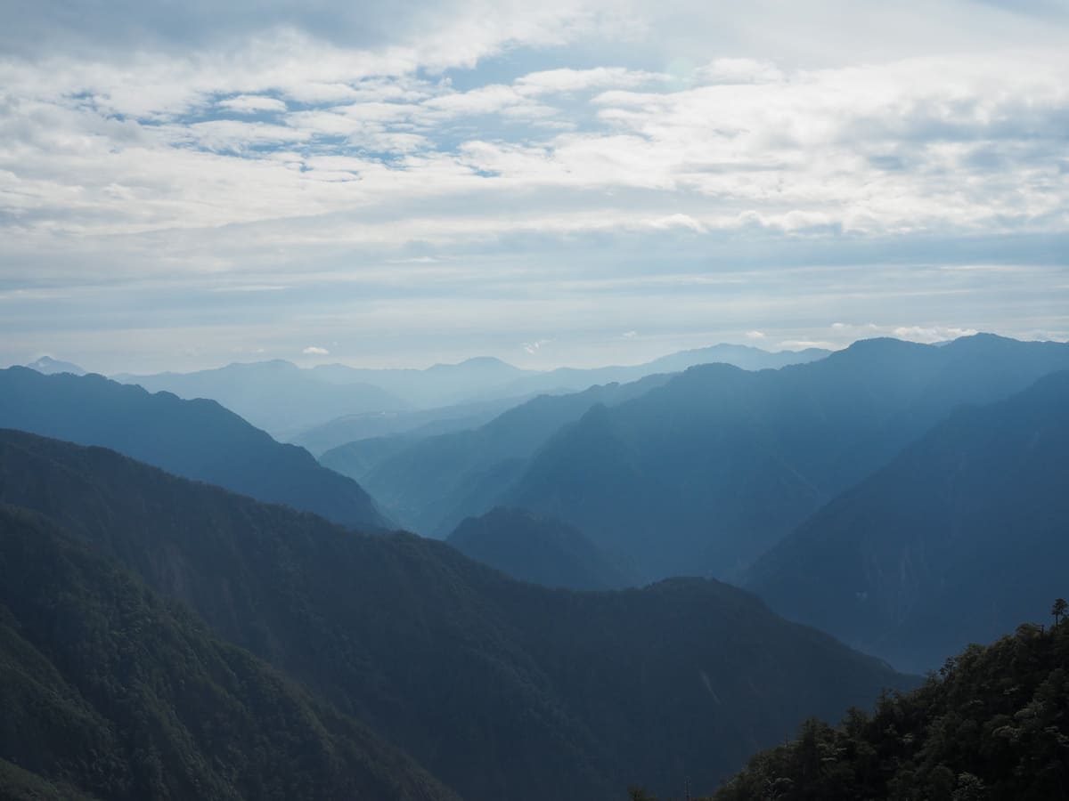
There are signboards outlining the various peaks in each direction and I was happy to see many old friends like Mount Malun, Mount four, Mount Baxian and Mount Wuwowei — three of Guguan’s Seven Heroes, as well as further more distant peaks like Mount Zhongyangjian, Mount Bilu and Mount Hehuan.
When we visited in late February, my peak finder app had the sun rising between Mount Zhongyangjian and Mount at about 6:22 and setting just to the right of Mount Yuanzui at 18:02, but if you’re planning on visiting to catch the show, you’ll need to check to find the precise times for the date you’re visiting since there’s a little variation throughout the year.
How to get to Yakou Lookout Trail
Google Maps address: There is a largish dedicated carpark for the trail part-way along the road between Daxueshan Visitor Centre and Xiaoxueshan Visitor Centre.
GPS location: N24 16.235 E121 01.620
Public transport:
There’s no bus directly to this spot, but you can get the 889 Taiwan Tourist Shuttle from Fengyuan Transfer Station and alight at Xiaoxueshan Travel Info Station and walk down the road to the trailhead.
Nearby trails:
- Heavenly Pond Trail
- Mount Wushikeng and Mount Chuanxing
- Muma Historic Trail
- Xueshan Sacred Tree Trail
Yakou Lookout Trail Map
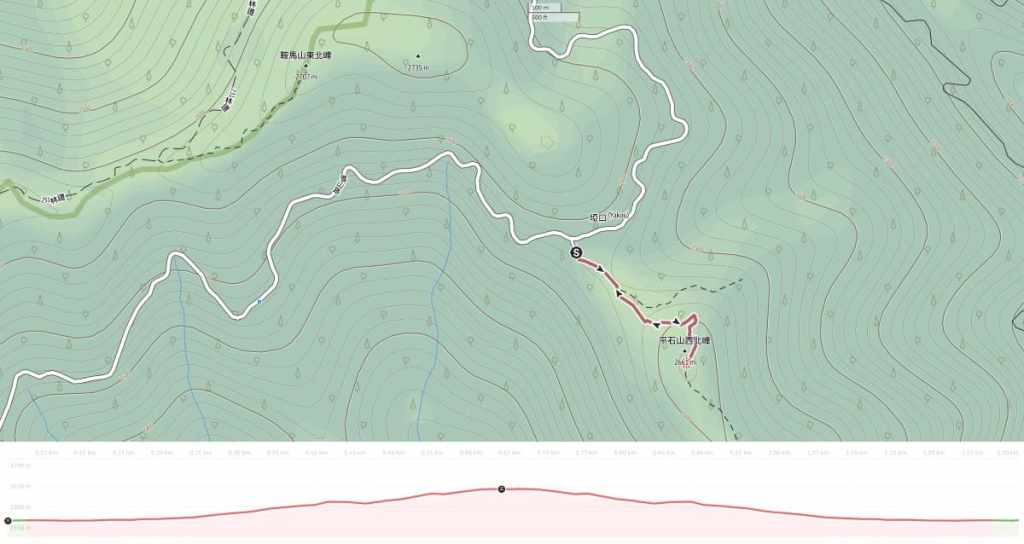
GPX file available here on Outdoor Active. (Account needed, but the free one works just fine.)
