The walk around Bitoujiao (or Bitou Cape) is one that I’ve been aware of pretty much since I first arrived in Taiwan, and yet somehow, it has taken me over seven years to get my butt over there and actually walk it. At first, it was just the fact that I lived all the way over in Taoyuan that meant I didn’t get around to it, but then the most interesting section of the trail got closed off because it was deemed to perilous. On top of that, the first time I actually managed to get myself over to the trailhead, I found the whole thing was temporarily closed. In the end, what pushed me to get back out there was the fact that it has earned itself a spot on the top 100 hiking trails of Taiwan (as voted for by users of the Hiking Notes App), and this was just one of two in the New Taipei region that I hadn’t previously visited.
DISTANCE: About 3 kilometres.
TIME: 1-1½ hours.
TOTAL ASCENT: Not quite 100 metres.
DIFFICULTY (REGULAR TAIWAN HIKERS): 2/10 – This paved trail is an exceptionally easy walk for anyone used to hiking in Taiwan.
DIFFICULTY (NEW HIKERS): 3/10 – This trail has a fair amount of steps to cover, but it’s paved and well-maintained the whole way. Anyone new to hiking in Taiwan might find the steps tiring, but overall, this is still an easy hike.
SIGNAGE: Signage is minimal, but sufficient. There are bilingual maps and finger posts at all the places where you might need them.
FOOD AND WATER: I took 0.5L on a warm summer day and that was ample. The fishing village of Bitoujiao has a 7-Eleven (although it’s a couple of hundred metres from the trailhead bus stop), and lots of little cafés and restaurants, so there are places to replenish if necessary. There’s also a coffee shop located in the remains of an old army outpost near the top of the trail.
SHADE: The trail is mostly quite exposed, but due to its coastal location, it’s also quite windy. If you’re especially sun-shy, I’d save this one for the winter months or for a late-afternoon stroll.
MOBILE NETWORK: Clear throughout.
ENJOYMENT: In terms of the effort-to-prettiness ratio, this walk does very well. There are some stupendous views to be enjoyed, especially if you head up just before sunset (or presumably around dawn).
SOLO HIKE-ABILITY: As long as you stick to the designated trails and don’t veer off it to walk close to the cliffs, this is absolutely a walk that’s safe and enjoyable to do solo.
OTHER: If you want to make a proper day of it, you could head to Bitoujiao Park (close to where the path rejoins the village). The park’s tidal pools and shallow coastal waters are popular with snorkelers. A few of the village’s cafés even offer gear rental for things like fins and water shoes.
ROUTE TYPE: Loop
PERMIT: None needed.
Jump to the bottom of this post for a trail map and GPX file.
DIRECTIONS:
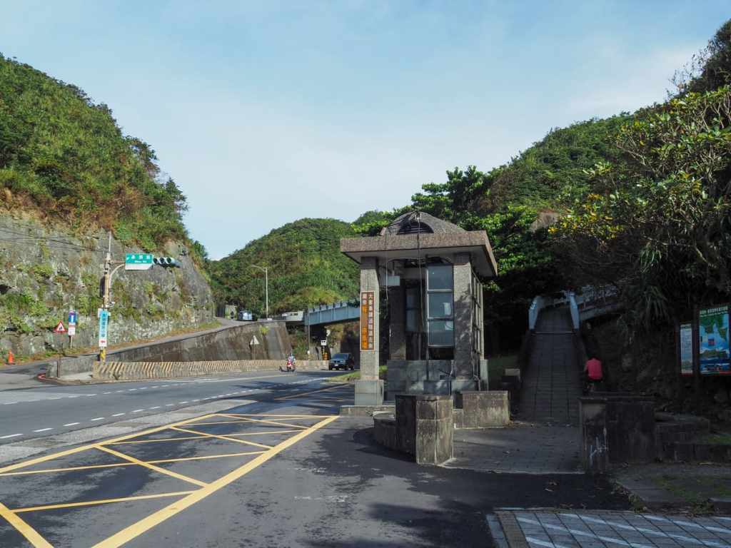
It would be impossible to get any more convenient than this. The walk starts literally right from where the bus stops. You don’t even need to cross the road because a pedestrian bridge has been built to give tourists easy access to the trail.
Looking north from the bridge, you can see the road winding its way along the edge of Bitou Fishing Harbour, while southwards, you can watch thundering trucks getting swallowed up and spat out by the black maw of Bitou Tunnel.
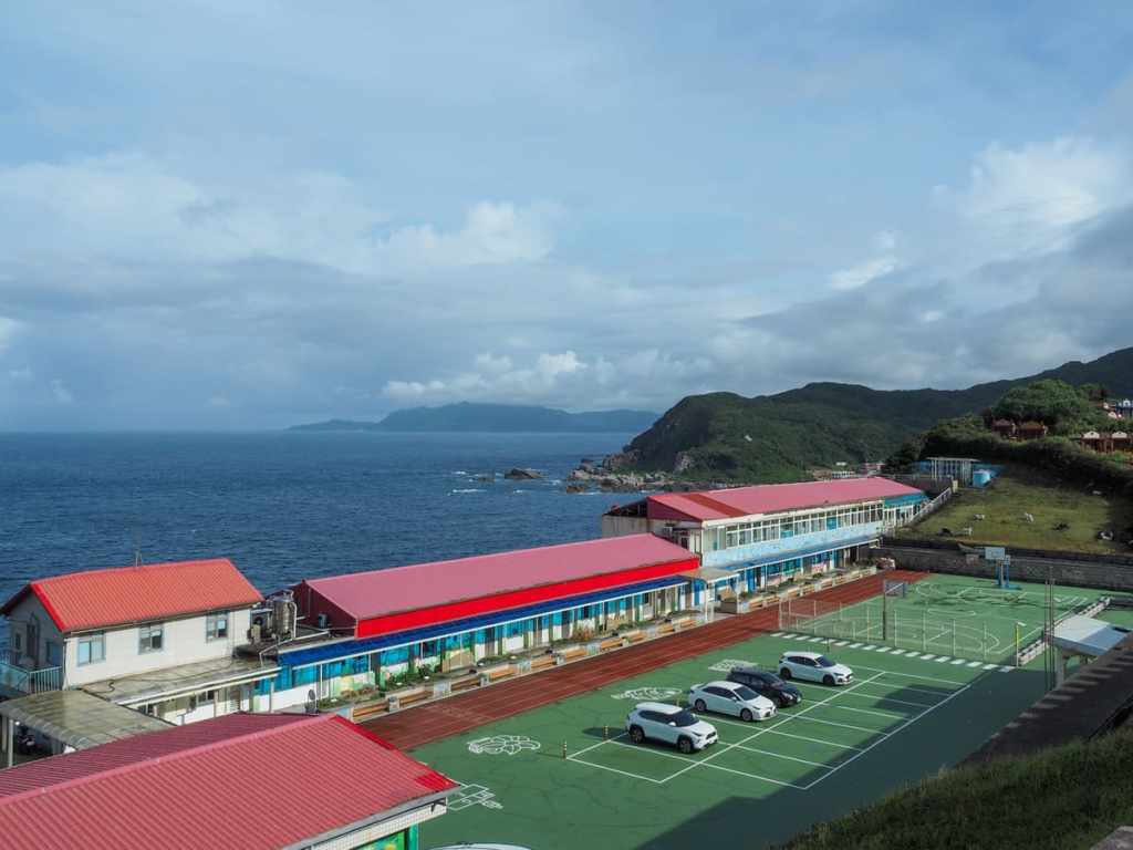
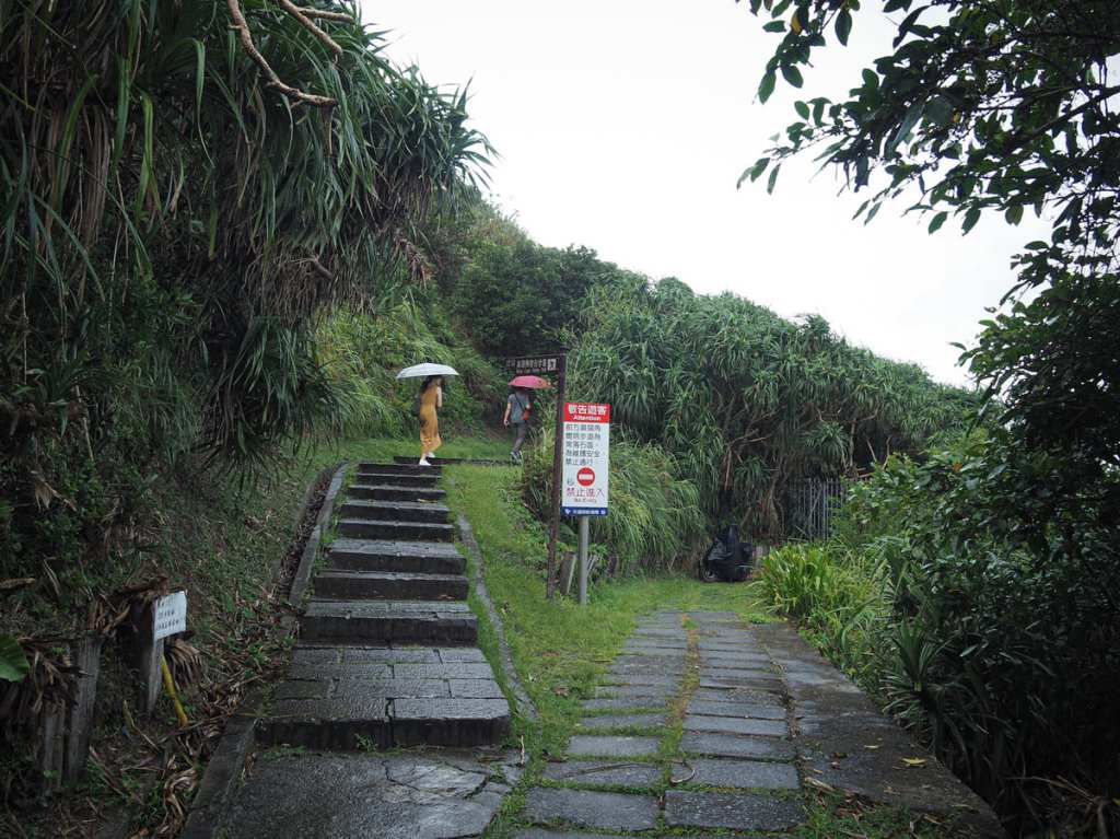
On the far side of the bridge, a single-lane track winds up to the start of the trail, which just so happens to be right beside Bitou Elementary School. Can you imagine going to a school with a view like this? It’s magnificent.
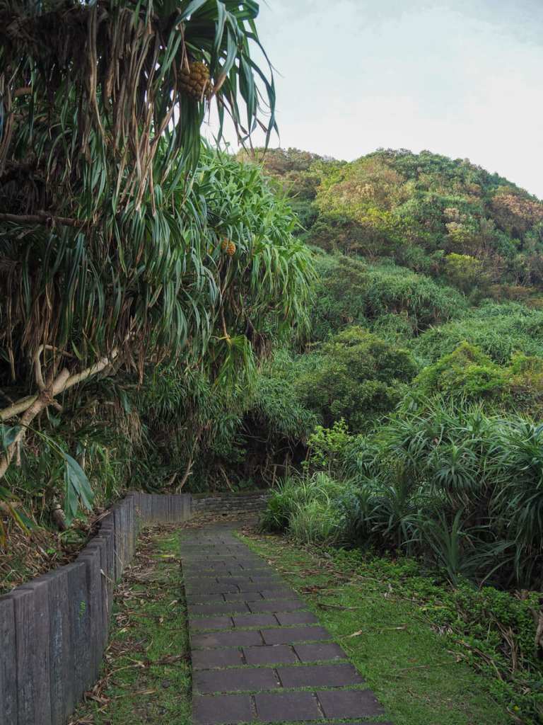
The path leads around the cape through a corridor of hardy coastal plants like screw pine and beach naupaka.

Looking back towards the start of the trail, you can see the elementary school with graves dotting the slopes immediately behind it. Further away, on the far side of the bay, a smattering of buildings are gathered around Longdong Harbour.
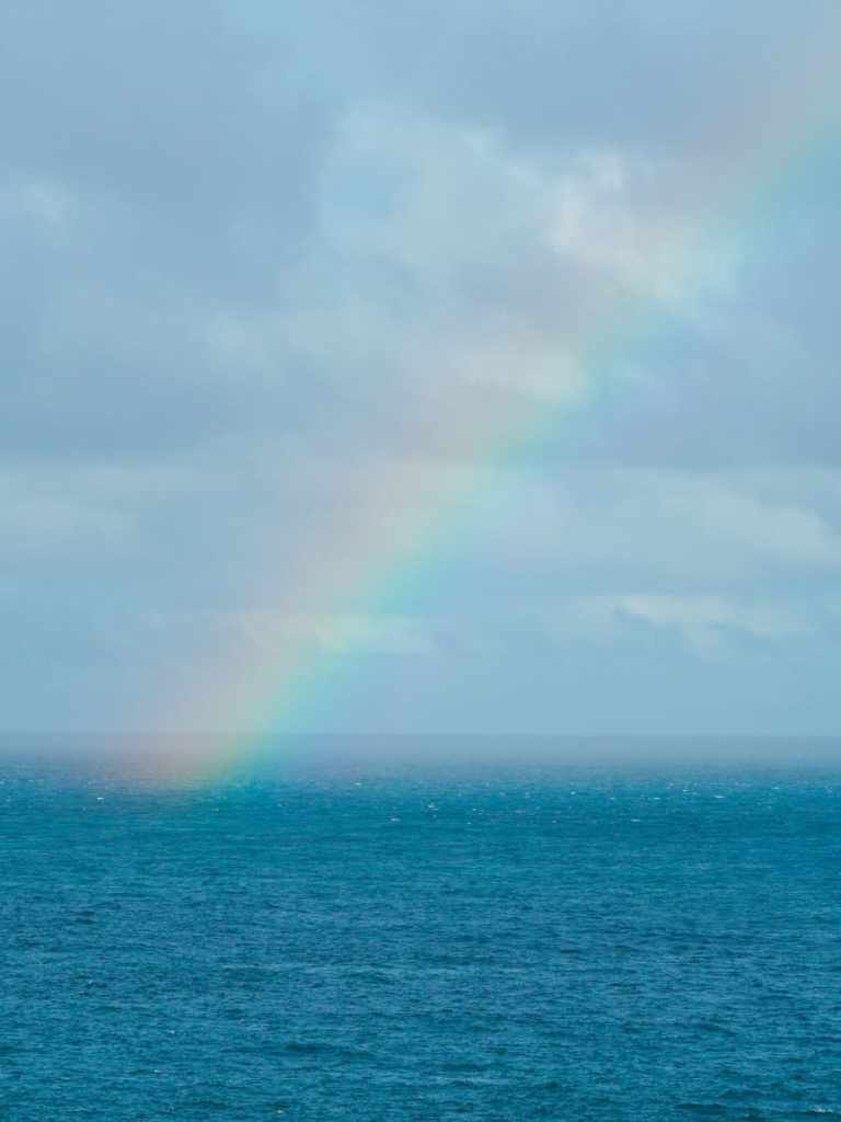
A squally shower hit me just as I made it to the shelter of the first trailside pavilion, and as I waited, sitting it out, I watched a broad rainbow stretch across the waters.
Once the worst of the rain had passed, I continued along the way, passing a toilet block making it almost as far as the next pavilion. Just before I got there, a flight of stairs to the right of the trail piqued my curiosity.
The path leads down through some greenery before opening out onto a small grassland overlooking the rocky foreshore.

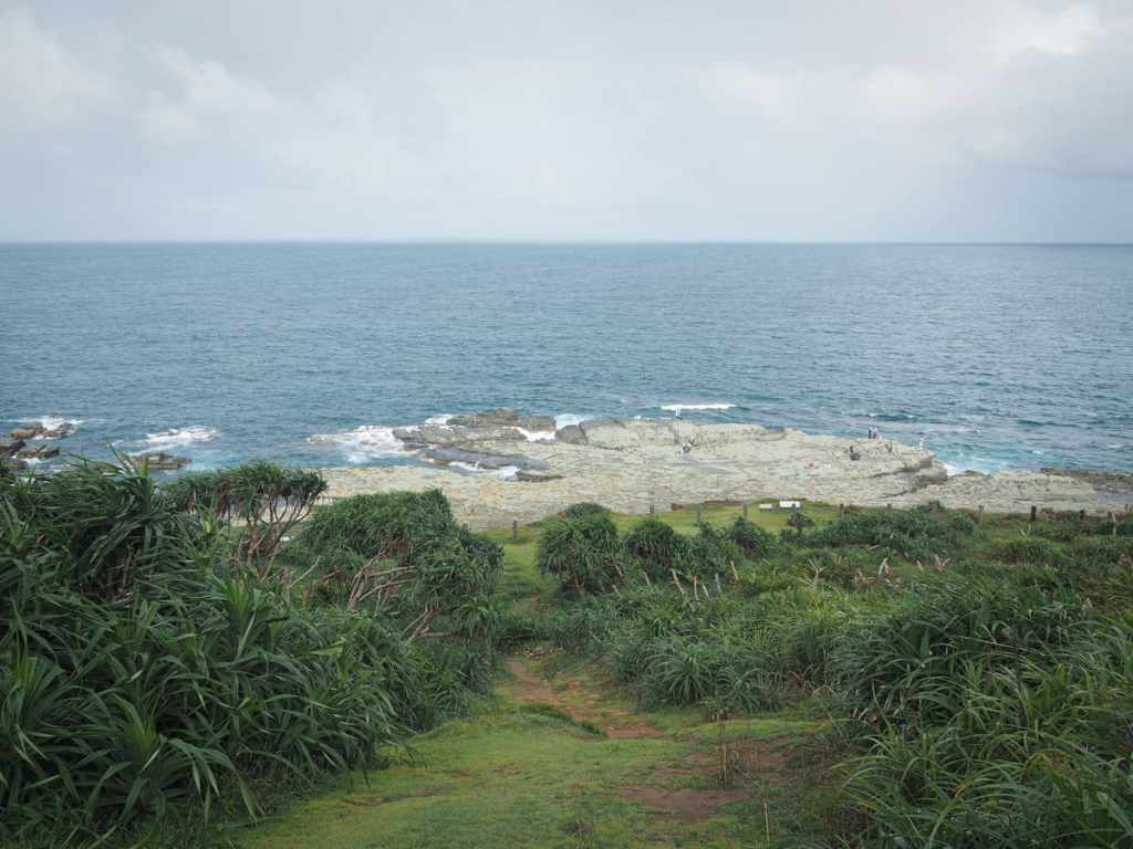
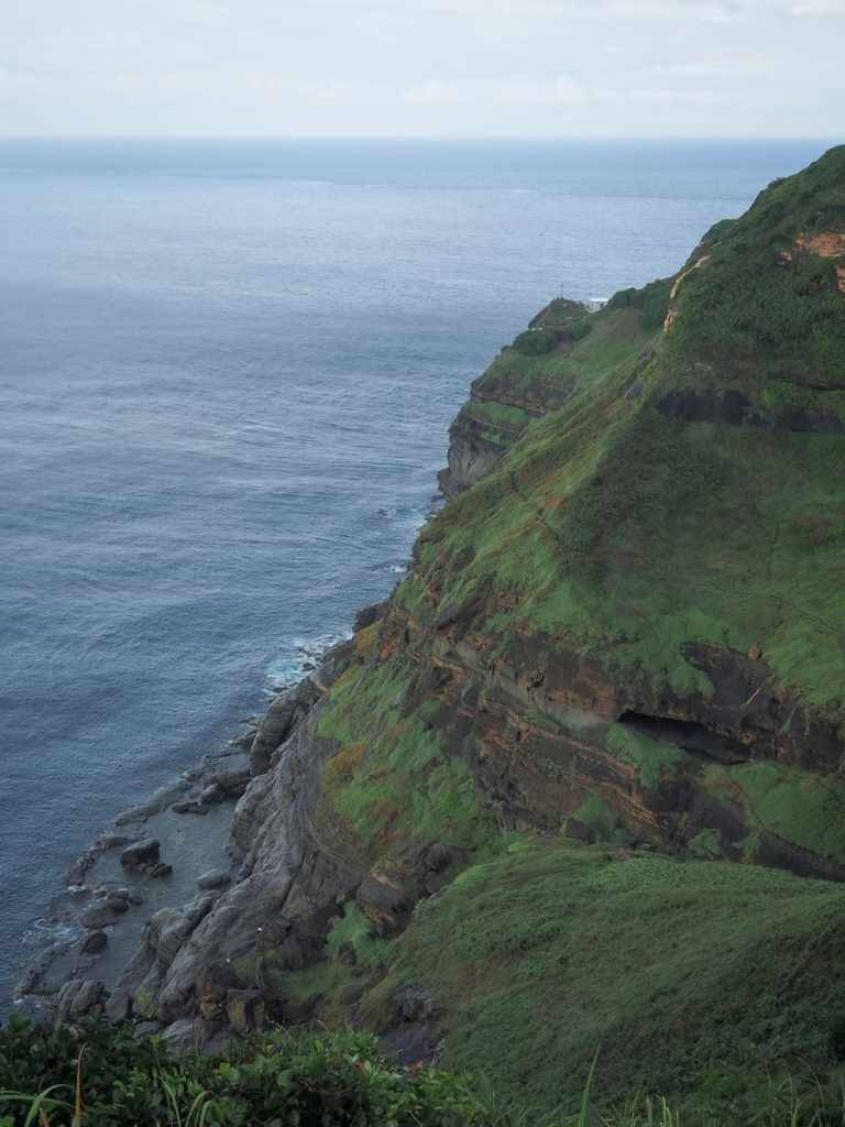
A rope with a warning sign prevents hapless hikers from straying too close to the cliff edge, but there are clearly ways to get down there because the wave-sculpted rocks were dotted with fishermen casting their lines into the churning waters. If you do find yourself among the mushroomesque rocks, be sure to keep an eye open for the trace fossils that can be spotted in the bedrock.
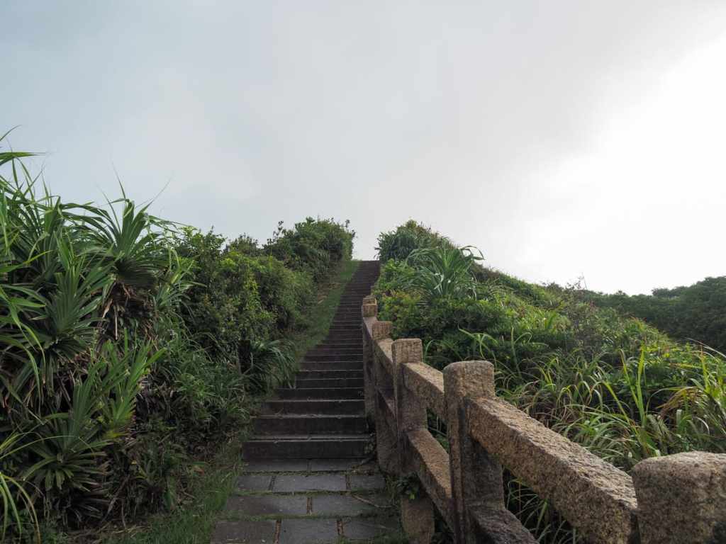
Back on the path, I followed it up to the left at a former junction. (I say former because the one on the right has since closed to foot traffic.)

Part way up, some not-exactly-camoflagued camo-painted sentry boxes mark the entrance to Tingtao Café. The store has taken over a decommissioned military facility and now offers a simple menu of coffees, teas and snacks. On this occasion, I’d already consumed my daily caffeine quota, so I carried on up the trail.
In the past, it used to be possible to climb up from this point to visit the lighthouse on the seaward-facing tip of the cape, but that’s no longer the case.
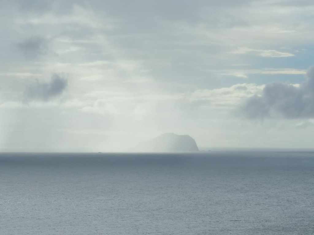
From the top of the climb, a vision of Keelung Islet came into view, half-obscured by another of the squally bursts of rain that were sweeping over the landscape that day.
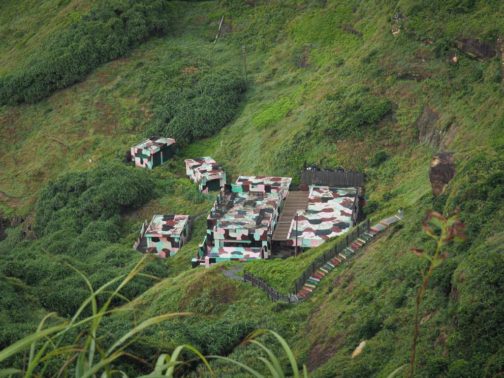
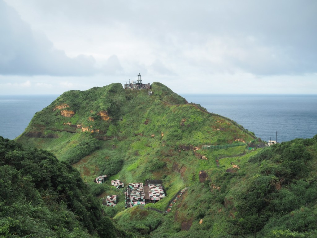
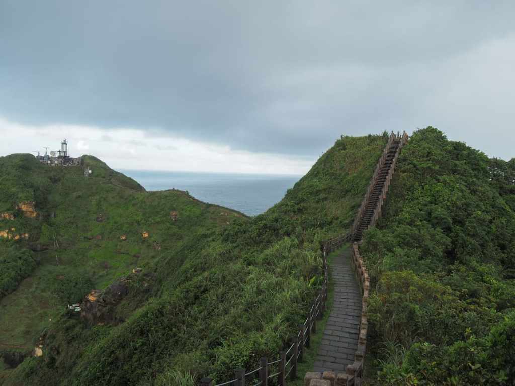
Being higher up also affords you a clear view overlooking the entirety of the repurposed military camp in its Instagram-friendly colour palette.
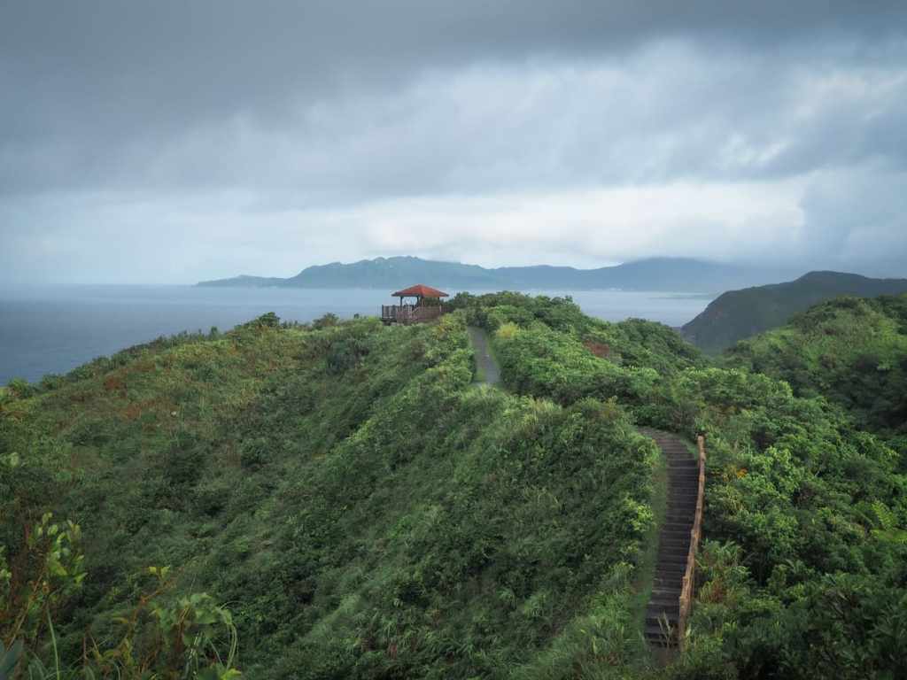
There are views wherever you look once you’re up here at the top. Indeed, if you see any photos promoting this trail online, they’re generally taken from up here of the trail snaking its way over the hills under a big blue sky.
If you look carefully, you can see remnants of the adventurous coastal path that used to take hikers around the cape’s northern slopes. (Sadly, I missed my opportunity to visit since route has been officially closed since 2020.)
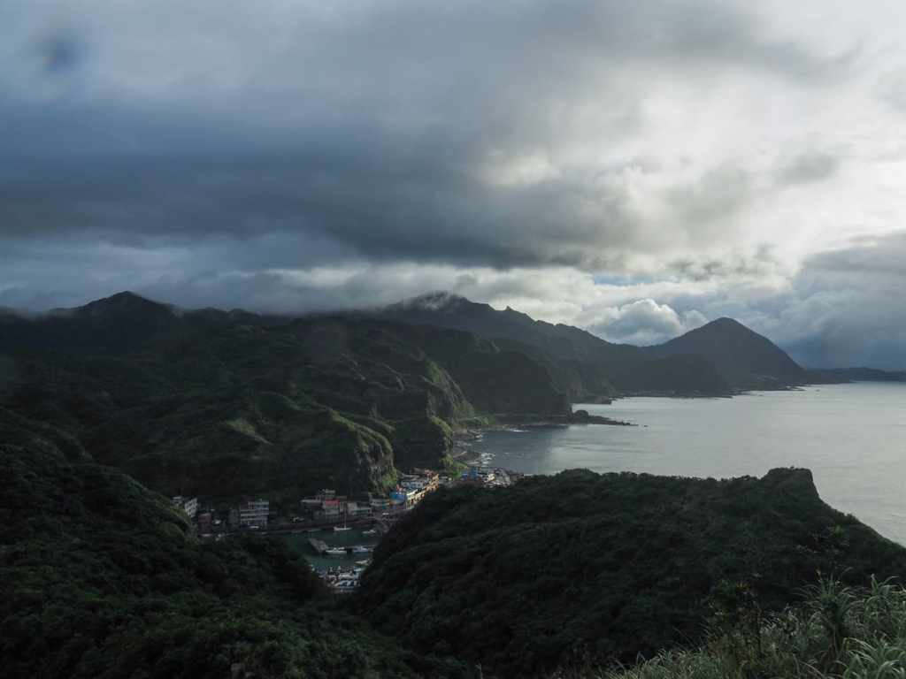
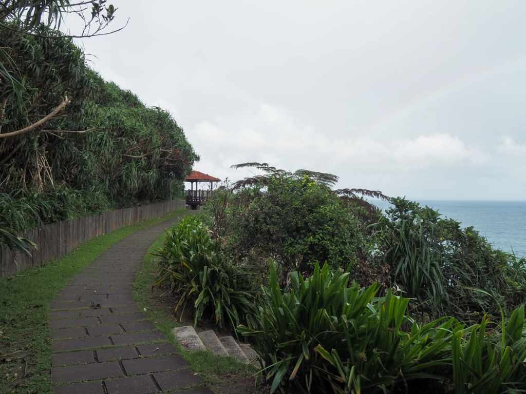
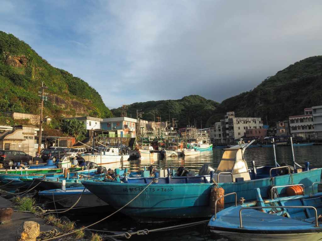
There are two pavilions up here, and just as I made it to the second one, another burst of rain blew over. This one was both heavily and lasted for longer than the first, but given the pleasing scenery, there are many much worse locations I could have been stranded in. The view from this final pavilion is rather lovely. The fishing village of Bitou sits tucked into a small inlet in the near distance, while beyond that, you can see several of Ruifang District’s best-known day hikes. With binoculars or a good zoom lens, you can make out the exposed climb of Stegosaurus Ridge reaching up to Teapot Mountain, and even further back, the perfectly mountain-shaped form of Keelung Mountain rises from the ocean.


Wooden lead down from the pavilion through Taiwan sugar palms and ferns, then when the steps give way to stone paving, the scenery becomes a denser, bamboo-filled forest.
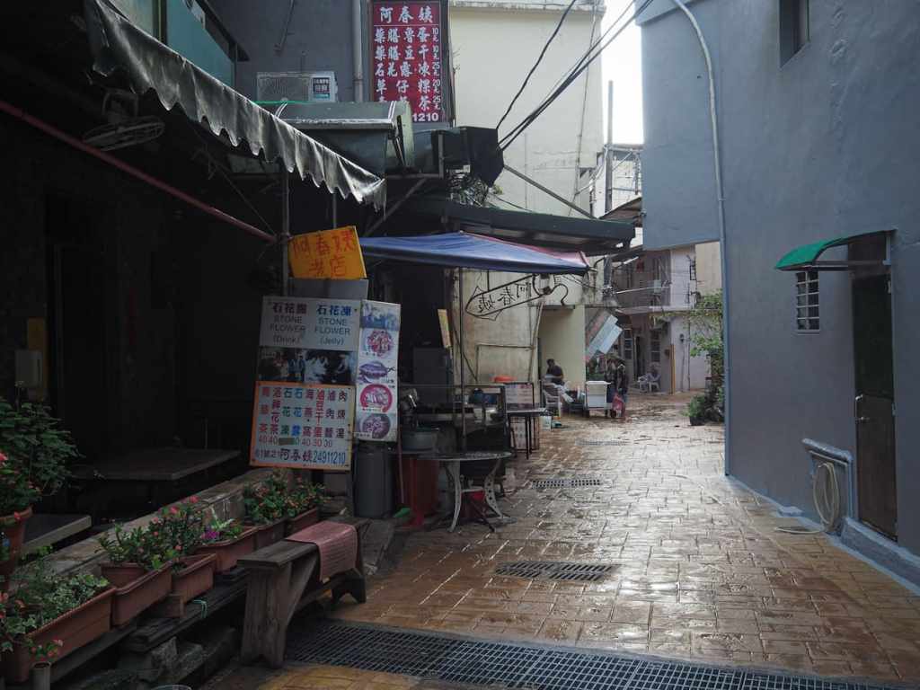
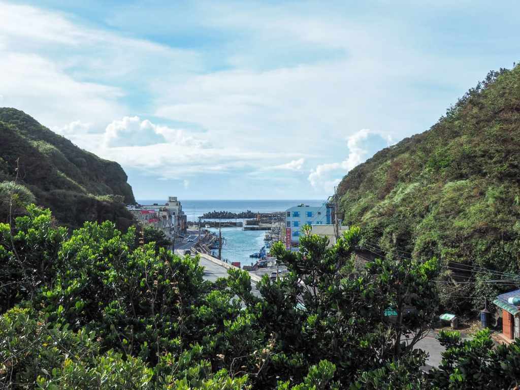
The steps soon deposit you at the end of a short lane close to Bitou Fishing Harbour. As I made my way to towards the port, I passed a couple of small stalls selling stone flower jelly and drinks (石花凍/石花露), which—as far as I can tell—seems to be made from a type of seaweed gathered from the coastal waters here and touted as being a healthy ingredient to chuck in your cooking. Some versions are flavoured with lemon, rock sugar, or passion fruit, so I guess that makes it a sweetened seaweed health drink. Curious as I was about the taste, I didn’t give it a go.
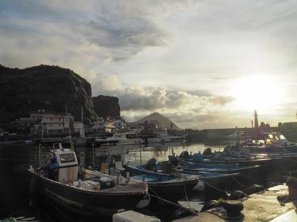
The sun was low in the sky by the time I arrived at the harbour’s edge. If you have time, it’s worth turning right here and enjoying a brief foray along the water at Bitoujiao Park. The rocks hold many tidal pools filled with crabs of all sizes and shy guppies that dart back into their hidey-holes as soon as a shadow darkens their sky.
HOW TO GET TO BITOUJIAO
Google Maps address: The walk starts and ends from the coastal village of Bitou. For anyone coming by car or scooter, there is a small roadside carpark right beside the trailhead and a larger carpark by the western end of the village.
GPS location:
- Bitou Elementary School trailhead – N25 07.260 E121 55.140
- Bitou Village trailhead – N25 07.480 E121 55.030
Public transport: The easiest way to get here is to first get yourself to Keelung, either by train or by bus (there are many buses arriving at Keelung from all over Taipei). Then walk from Keelung Transit Station to Chenghuang Temple bus stop and ride the 791 all the way around the coast to Bitou.
Further reading: Given the popularity of this trail, there is no end of information about it out there in the ether. For some shots of the older and more exciting version of the walk, check out this post on Taiwan Hikes. Josh Ellis also has some info and shots on his site here.
BITOUJIAO TRAIL MAP
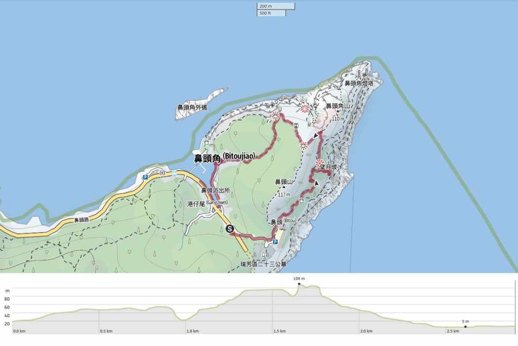
GPX file available here on Outdoor Active. (Account needed, but the free one works just fine.)

Pingback: 12 Absolute Best Things To Do in Taipei, Taiwan - Hand Luggage Only - Travel, Food And Photography Blog
Pingback: 12 Absolute Best Things To Do in Taipei, Taiwan – Hand Luggage Only – journearn.com
Pingback: 12 Absolute Best Things To Do in Taipei, Taiwan – Hand Luggage Only – brazidin.com
Pingback: 12 Absolute Best Things To Do in Taipei, Taiwan – Hand Luggage Only – blog
Very useful information: thanks for sharing!
LikeLiked by 1 person