Distance: 12.3km – There is a possibility to add another 3-4km by visiting the western peak too.
Time: 9 hours – We stopped for an hour’s lunch break, but otherwise it was mostly all spent on the move.
Difficulty: 6/10 – This isn’t a technical hike at all, and save for a couple of places there aren’t really any tricky-to-navigate sections. Having said that, 9 hours was a pretty long walk for us, and given the elevation gains and losses, it is not something that you want to do without any preparation. Additionally, it is really quite remote, (there were only four people out in this part of the forest on the day we went), so you’re a long way from help. If there isn’t someone who can read Chinese in your group, you might find it hard to read the signs, so make sure you’ve got a good map.
Total ascent: About 1400m from a minimum of 1039m up to 2114m.
Water: I found that I drank a little less than normal due to the cooler weather, but I still took my nearly full 3L water bladder with me and using it for coffee and cooking.
Shade: Very well covered. I would imagine that even in the summer this would be ok for me and my pale, pasty skin.
Mobile network: very poor, there were several hours where we had no signal or just the odd bar of 3G here and there.
Enjoyment: 7.5/10 – This is more of a reflection on my own shortcomings rather than the hike itself – it was the first longer-distance, quite remote hike that we’d done since Zhi Sheng Mao Tai Shan around a year ago and I got a bit nervous to be doing something so far away from people and where I knew that we didn’t have much of a time window for making mistakes or being slow. But once we were on the home straight, I realised that it was actually a very beautiful hike through wonderfully quiet forest, that I really am privileged to be able to enjoy this type of place, and that I should learn to use my fears productively (in terms of making sure we are as prepared as we can be – which we almost always are), rather than letting it nag at me.
Other: You’ll need to take the right clothing and footwear on this on. Shoes should be sturdy and supportive, there are very steep slopes and the last thing you want is your toes slipping repeatedly to the front of your shoes. As for clothing, I’d recommend light layers that can easily be taken off and carried – there is a significant difference in temperatures between the top and the bottom (about 10 and 14/15 respectively when we visited in December). You will also need plenty of food. This was the first time that I’d tried using salt sweets to see if it could help me alleviate some of the (normally pretty bad) aching I experience after this type of walk, and they actually seem to have been useful. I normally have at least one very sore day and a couple more stiff days after this amount of effort, but this time I never did, only mild soreness for a couple of days.
Permit: No permit is necessary, but you have to show your ID and sign the log to let the guy at the weather station know who you are and when you get in. We just showed my ARC and he was fine with that.
GPX file available here on Outdoor Active. (Account needed, but the free one works just fine.)
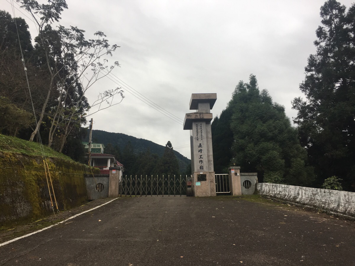
A 5am wake up, a 5:45am start and a nausea-inducing drive up through narrow roads, we arrived at Wufeng Agricultural Research and Extension Station around 7:40. We parked in the wide area outside the gate and wandered up to have a look – there was a guy tending some plants out the front of the building, but he paid us little attention so we went back to put on our shoes and get ready.
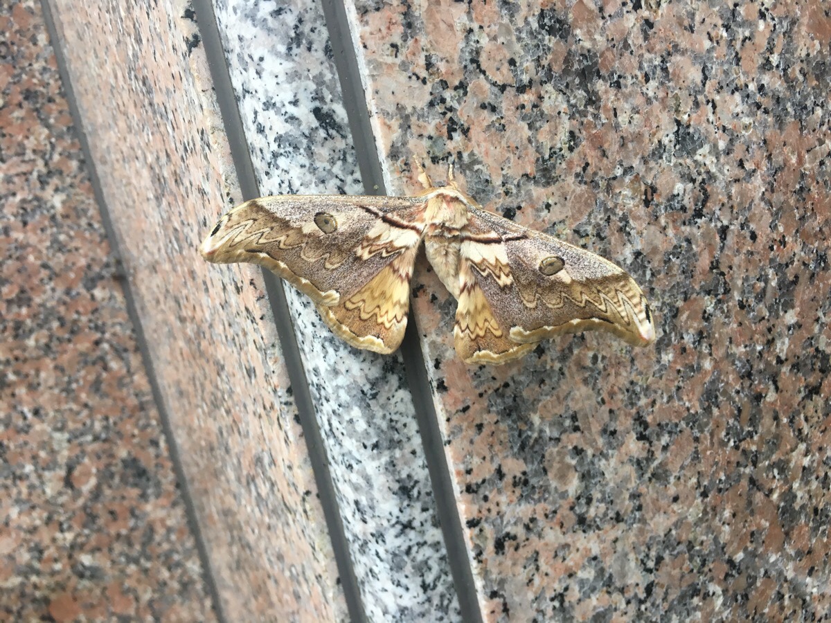
Clinging to the pink granite facade of the gateway we encountered two of these large silkmoths. From what I can gather, they are examples of Saturnia thibeta okurai, which, while it doesn’t seem to have a common name in English, is called big green eye moth (大綠目天蠶蛾) in Chinese. At around 13cm across, they were pretty impressive. Not much is available about them in English – probably because they are a subspecies which is endemic to Taiwan. But if you are interested moths, you might want to check out this amazingly detailed blog about ‘lasiocampidae and all the families of the bombycoidae‘ – it is written by someone who clearly has a great fascination for these creatures – they’ve even posted about raising this species as a caterpillar.
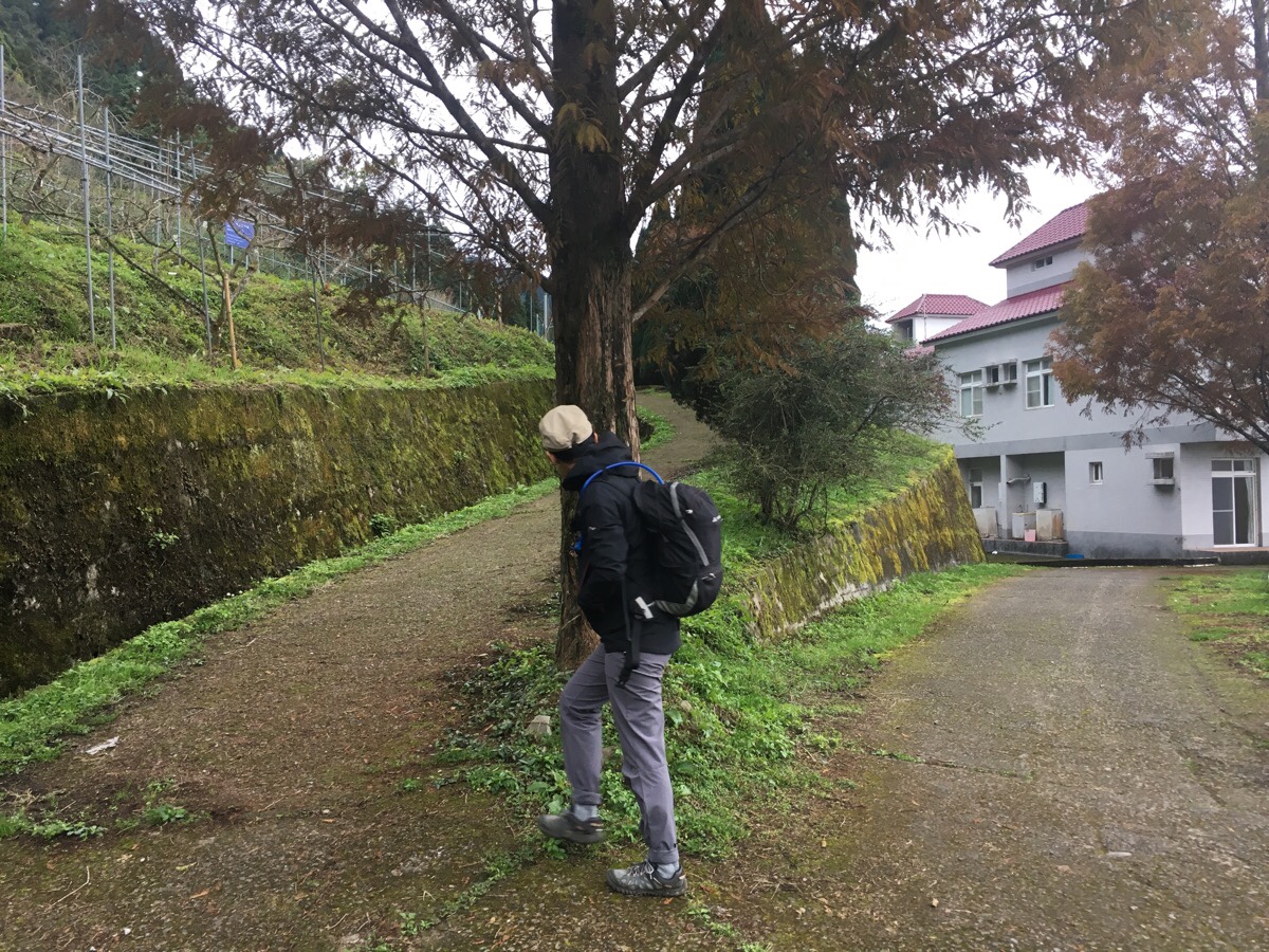
Once we walked up to the gate with our proper shoes on and backpacks loaded, the metal concertinaed back on itself as if by magic, and we walked in.

07:53 – The security guy manning the station came out from a little room at the front and asked us to sign in. We wrote down the time and date, our names, phone numbers and car registration plate. From the record, it was clear that we were the only ones there so early, (I think the place officially opens at 8am, so there shouldn’t have been anyone else there). The man took out a map, (an A4 piece of paper with a rough loop scribbled on it), and gave us a brief overview of the route he thought we were taking – although I’m not sure if it was actually the one we walked or not). We asked about the weather and I was glad to hear that rain wasn’t expected.
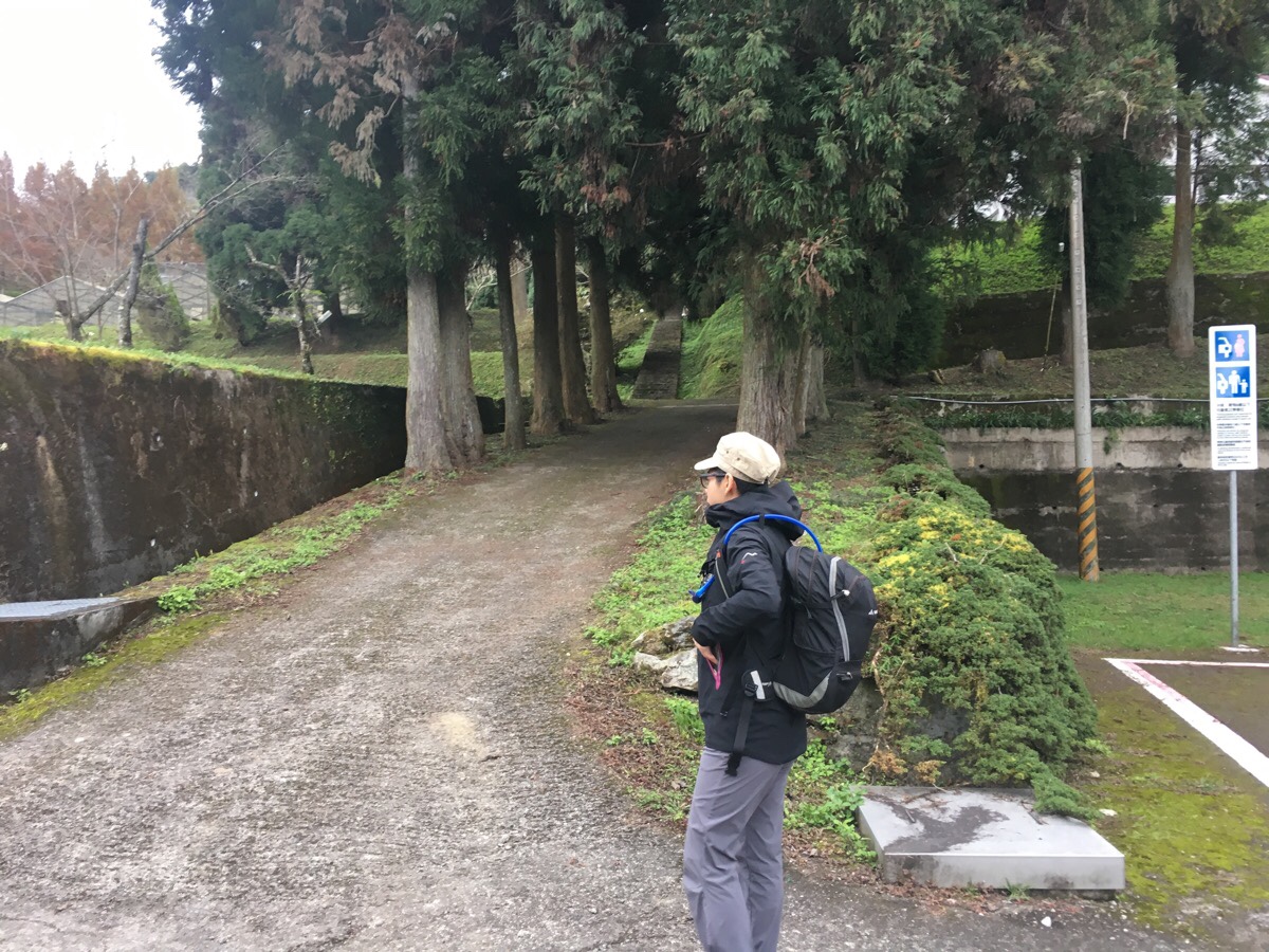
07:55 – To get to the start of the trail, first you have to walk up the steps to the left of the research buildings.
07:58 – At the top of the steps, take the upper road on the right which runs behind the houses, (I’m not sure who they house, it seemed like only the one guy there). The road doubles back on itself after 30 metres or so and continues up.
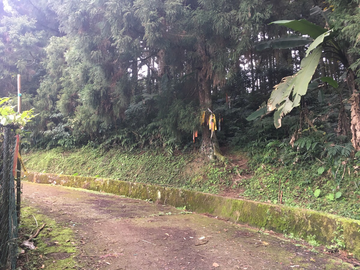
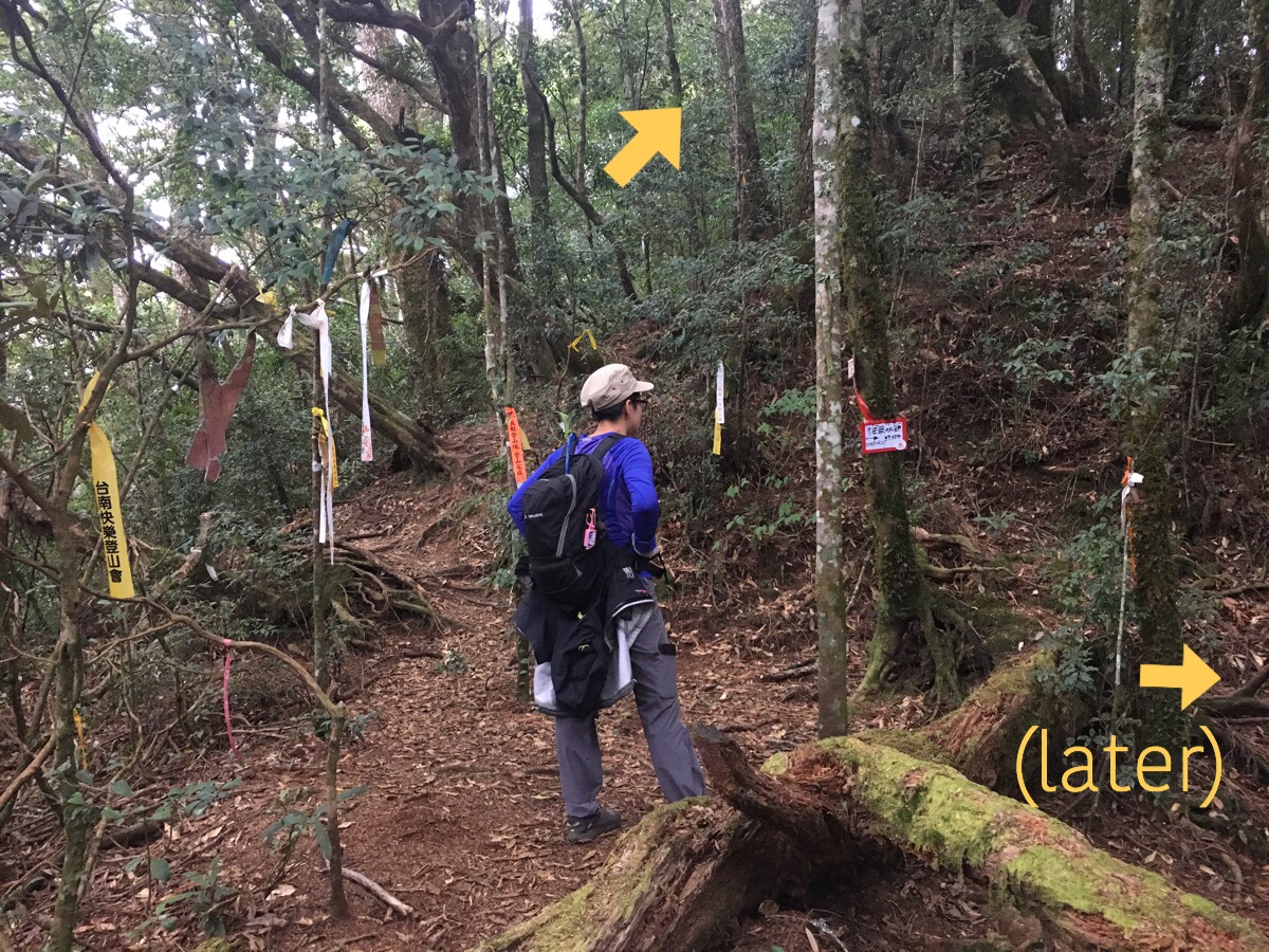
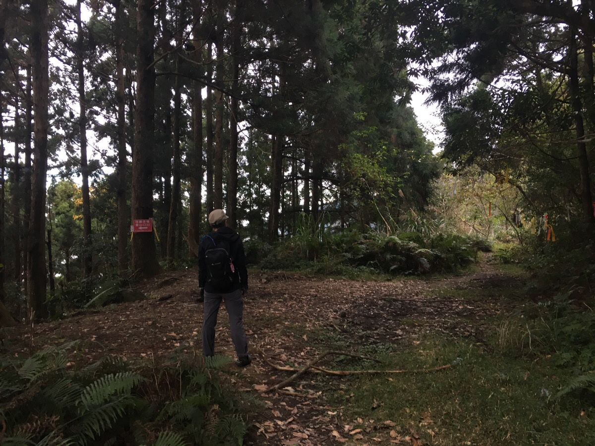
08:06 – The start of the trail is marked with tags, and a trail sign pinned to the trail says that it’s a 30 minute walk up to Mai Ba Lai northwest peak.
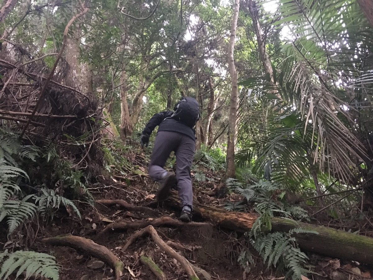
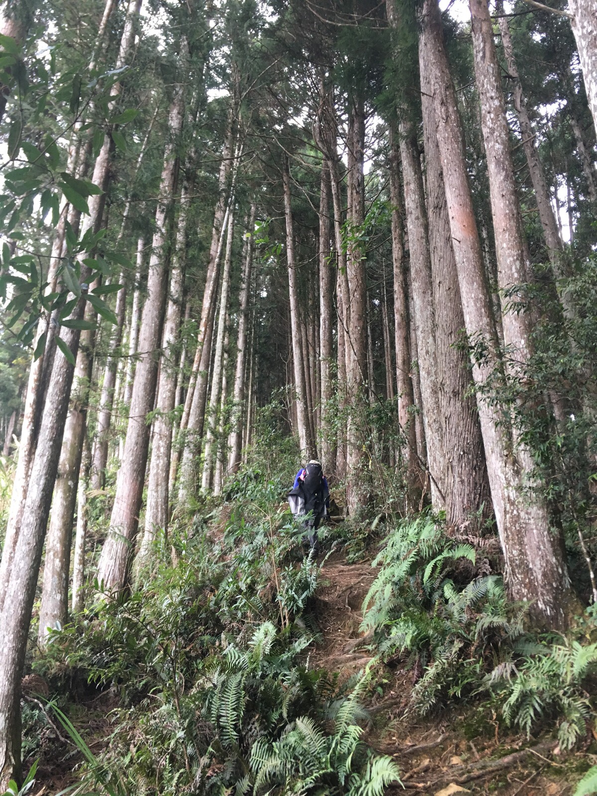
08:19 – Very quickly the path lets you know what to expect. It’s so steep that you’re going to spend a fair amount of time getting acquainted with the rear end of anyone heading up in front of you. There were a lot of loose rocks on this section, so as the one at the back, I had to keep an eye out for stones that started rolling in my direction.
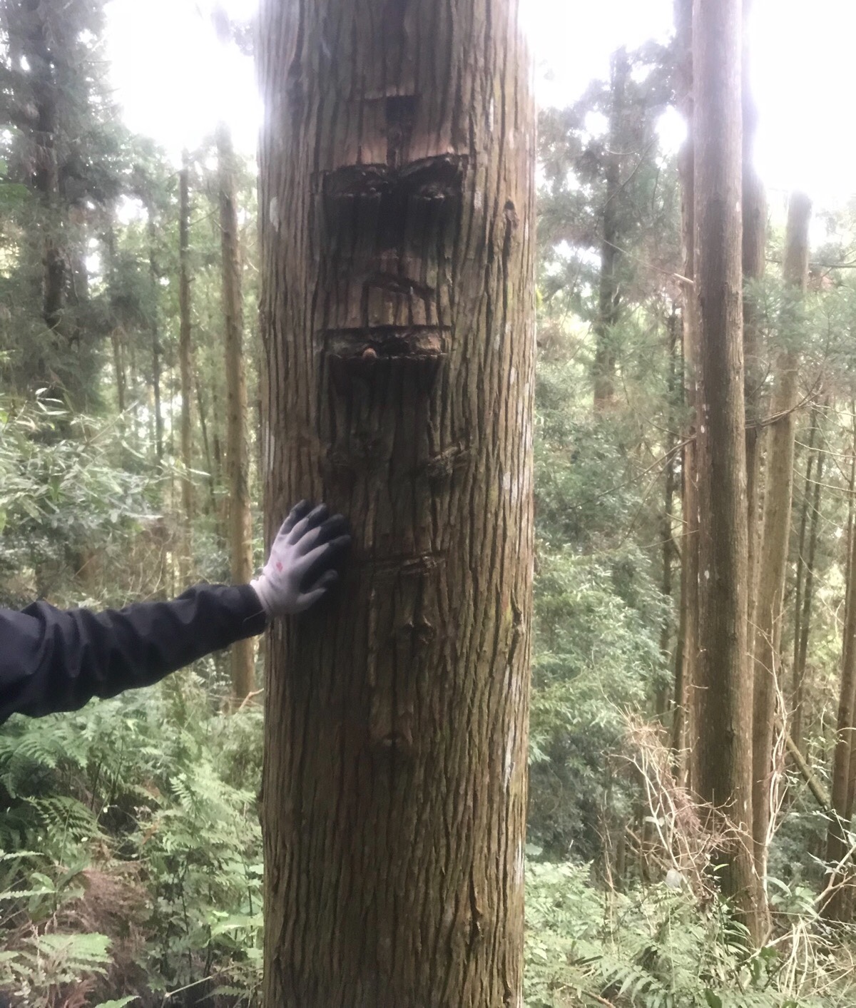
08:26 – The first of many noteworthy trees on the trail; this one genuinely looked like a face smoking a fat cigar.
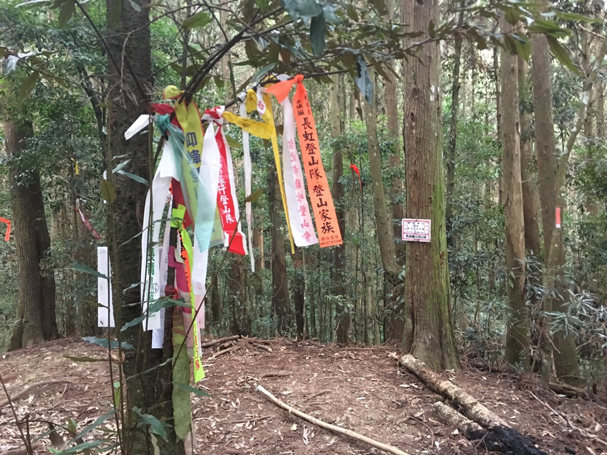
08:40 – A few minutes slower than the sign at the start indicated, we arrived at the northwest peak of Mai Ba Lai Shan. At an altitude of 1265m, there is a little under 1000m of elevation still to gain. We didn’t stop for long, just enough to unwrap a couple of the salt sweets that we’d brought with us.
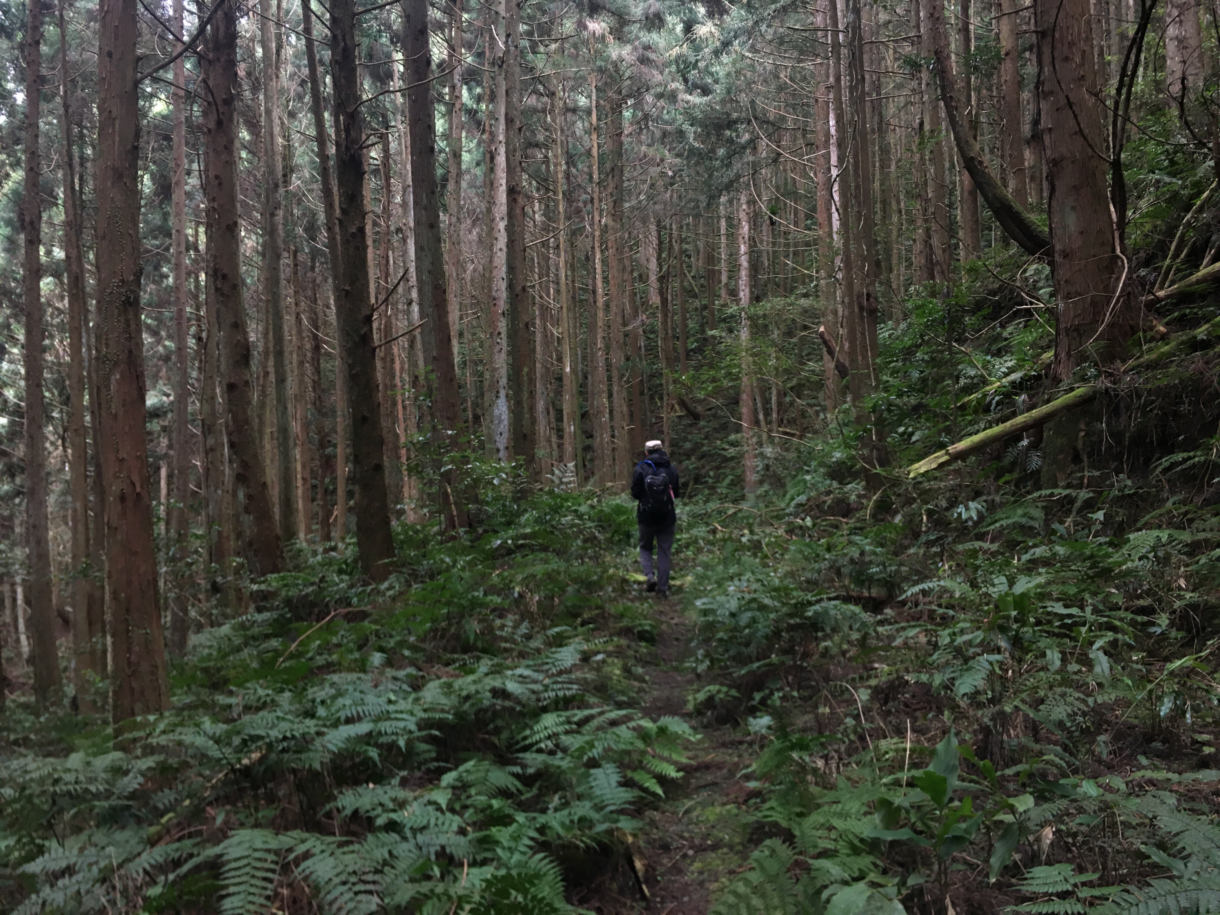
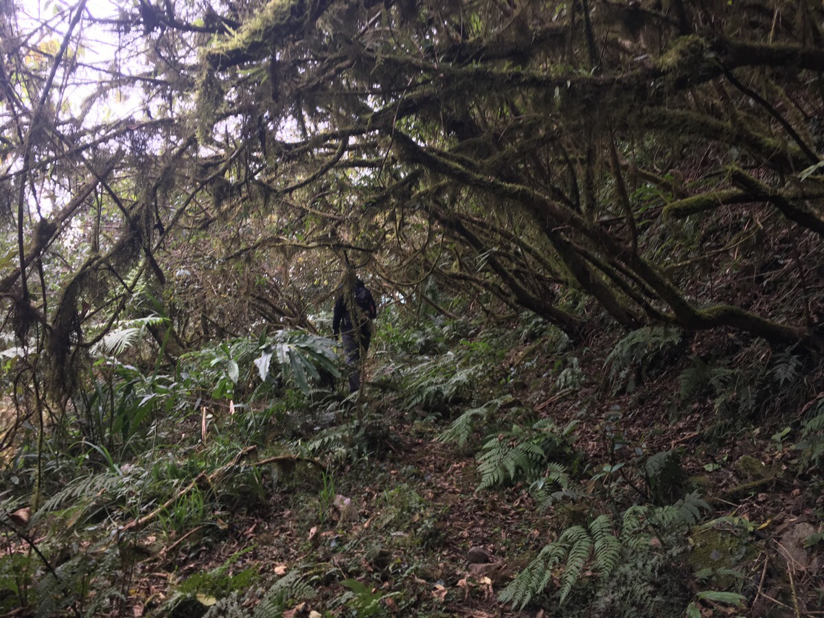
08:52 – This section of the trail (actually the whole trail up to Mai Ba Lai Shan), is very clear and well defined. Trail markers and the occasional sign on a tree make it easy to follow the route. But despite the clear signs of frequent use, the forest was silent, almost eerily so; no people, no animals, no birds, no insects, just the occasional distant sound of a plane overhead. That coupled with the fact that we were in a shaded valley where the light felt like a perpetual dusk made for a vaguely unsettling start. Later on in the walk there were a couple of times when we heard the unmistakeable sounds of a barking deer – and anyone who has heard one of those will know that they do nothing to settle the nerves.
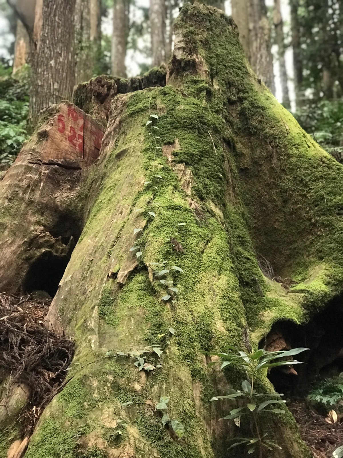
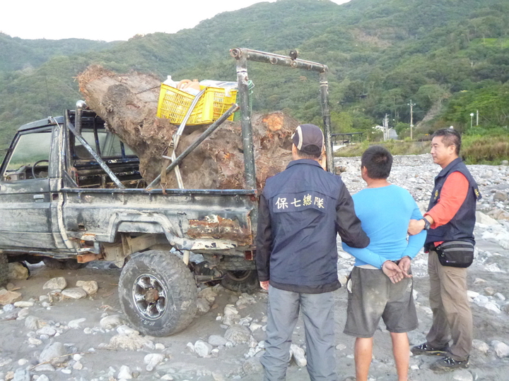
09:05 – The path curves around the cut-down stump of a Formosan cypress tree. The stump is numbered and a tag inside a missing section warns people not to take any away. (Illegal logging is apparently a big problem in Taiwan, and part of the reason why you need to give your ID or get permits before entering areas with old trees.) One of the things that cypress wood is known and used for is the very pleasant smell that it gives off – smell the most recently cut area and you’ll know exactly what I mean.
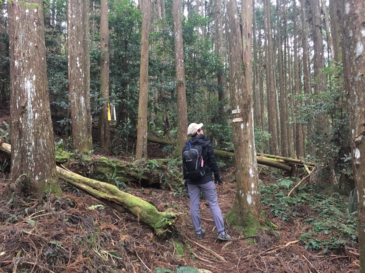
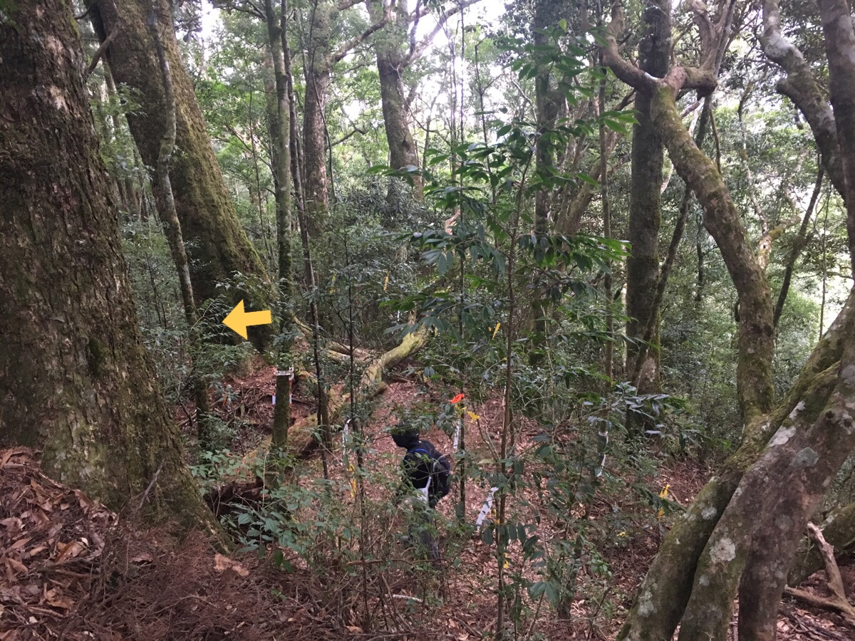
09:13 – After an hour and five minutes of climbing we reached a kind of mountain road, (road only in the sense that it was flat). We bore left towards the larger number of trail tags.
Eventually we would find ourselves back at this same spot having returned from the less easily traversable trail on the right.
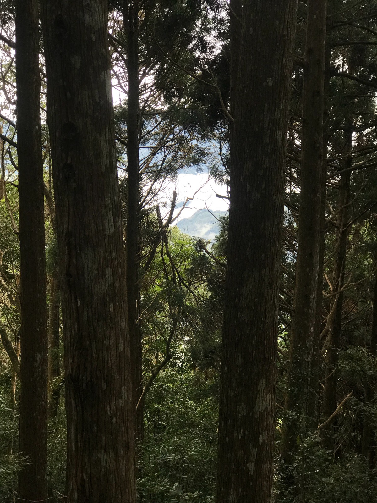
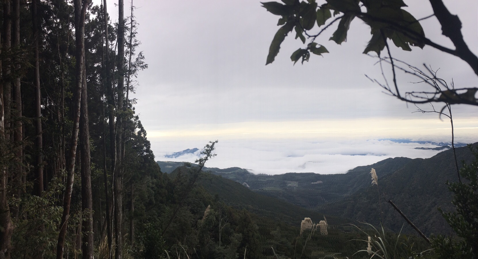
09:14 – A rare glimpse of the mountains and clouds below us through the trees.
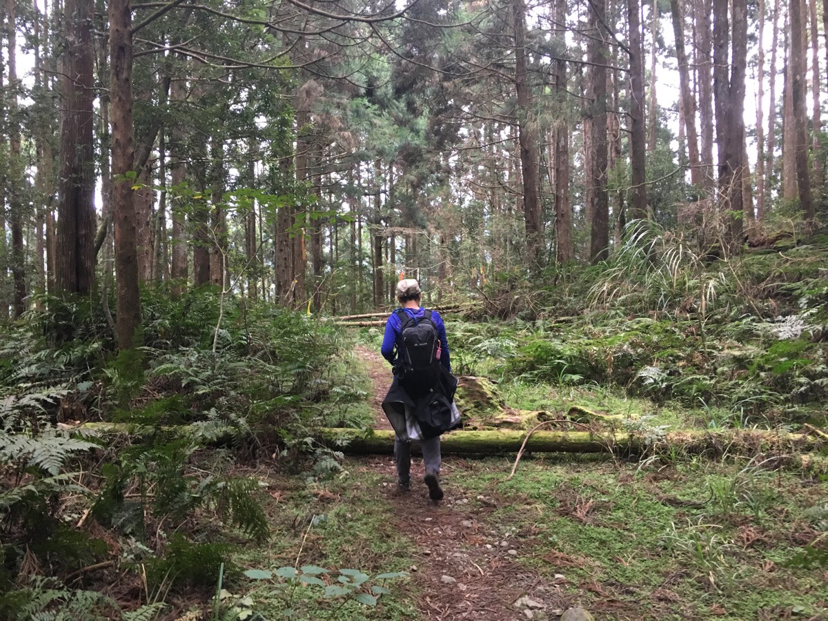
09:17 – The flat portion of the trail is an unfairly short five minutes or so. Just up ahead of Teresa in this photo are the numerous hiking tags which indicate that it’s time to start climbing again.
09:18 – The first portion wasn’t actual so bad, it’s all climbing, but since it wasn’t too steep, we were able to keep up a reasonable pace. But I’d checked the map beforehand, so I knew that all those bunched up little contour lines would be piling up to slow us down soon. And they did just that.
09:49 – Another one of the walk’s arboreal curiosities.
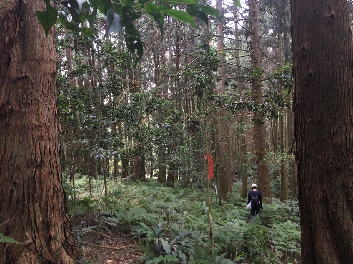
10:11 – Along the most exposed section of the whole hike, two lines of Japanese cedars flank the path, there is only the lefthand stand between you and the sky.
10:17 – There is a lookout point just before the trail snakes back into the trees for good. A sign here advises that you take a break before continuing. This point is about 1700m above sea level which means that there is still over 400m of elevation to be gained – we followed the advise to stop for a bit, but we didn’t wait long.
About 10 minutes further on from here there was a small open area which had been marked on the map we were following as another rest stop. We ate a banana Eurocake (strange kind-of-custard custard filled sponges that Teresa had brought back from a business trip) each to restore a little energy. I think it might have been around this area that we had a close encounter with some kind of wildlife, something about 20 metres away crashed about a bit in the trees, but we never saw it despite the fact that the forest floor was relatively sparse. I think it was probably some large bird since I heard faint chucking sounds, and the movement we heard sounded more like wings than four legs.
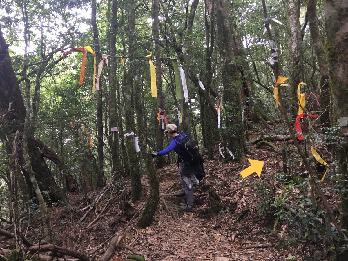
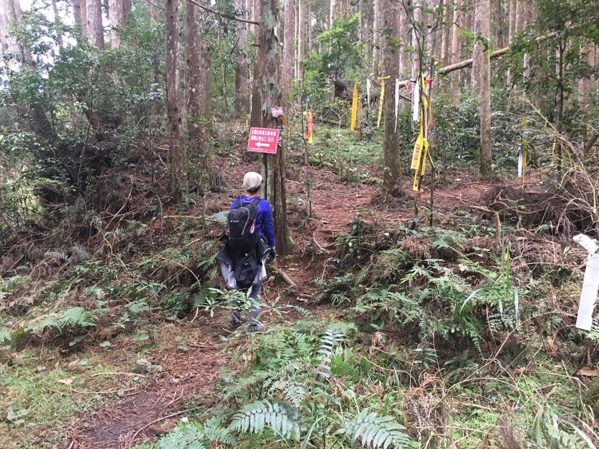
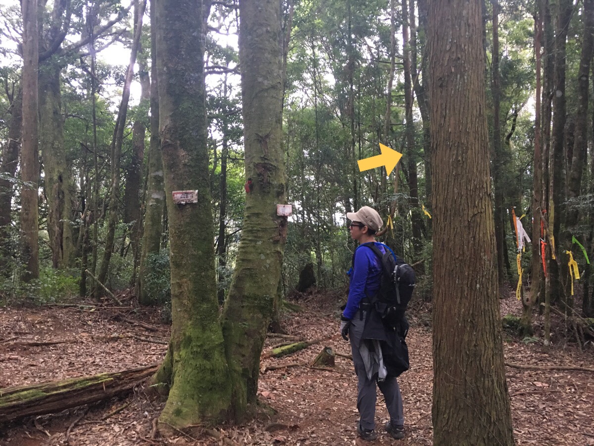
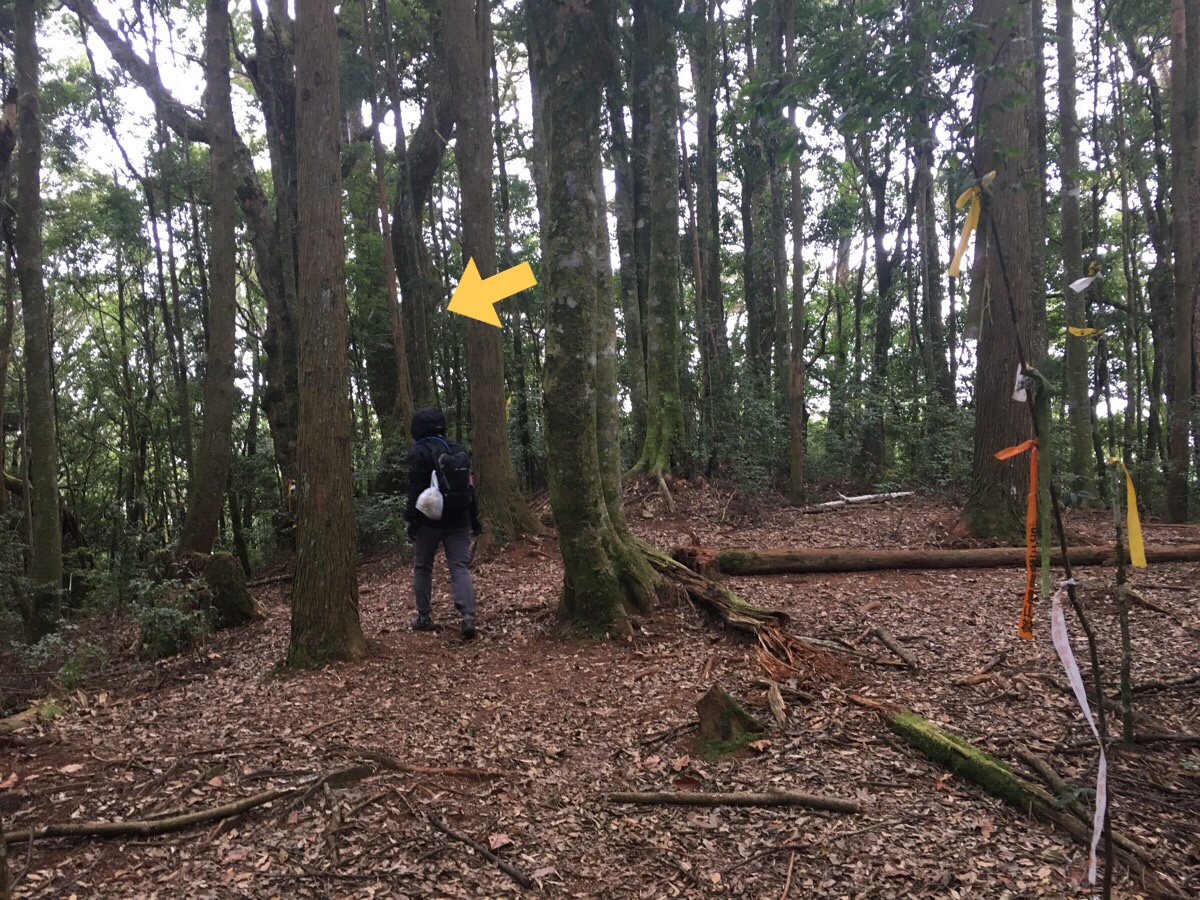
11:17 – The trail reaches a junction. A trail heads off to the left, but we ignored it and kept on going up following signs towards 麥巴來山. (The lefthand path goes down to another exit 11km away.)
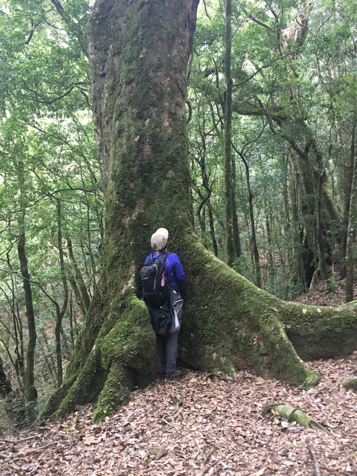
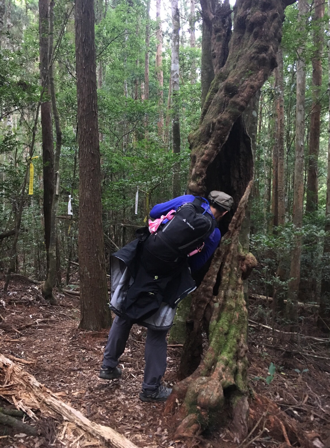
11:23 – Around this point there is a noticeable change in the makeup of the forest, there are still Japanese cedars around, but up this high it is the realm of the forest giants. Along the path there are lots of grand specimens, but look around through the trees and you’ll spot even larger ones dotted around. As well as the many standing trees, there were a fair few stumps and fallen trunks. Somehow it feels impossible to see such a large tree fallen across the forest floor so quietly – it must have been such an event when it fell, scything down anything smaller than itself in its descent.
11:30 – By the next junction we were both getting quite hungry, but felt that it was better to keep going and wait until we arrived at the top before eating.
(Later one we would return down to this junction and then continue along the path on the left.)
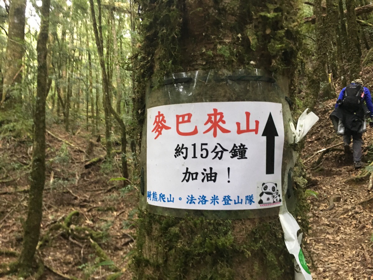
11:37 – An encouraging sign from the 法洛米 (faluomi – I think it is meant to sound like follow me) hiking group. 15 minutes until coffee and food.
11:45 – Another junction, a path to a much longer trail crept off on the left, but we were very definitely heading right towards lunch. Dispiritingly, the path dipped down quite a way immediately after the junction, height which we would later have to gain back again.
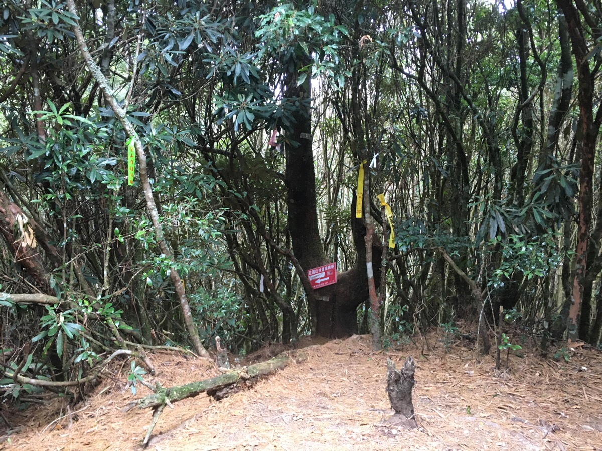
11:51 – The very top of 麥巴來山 is surrounded by the thick and twisted sprawl of rhododendrons, so much so that the three tunnels leading away from the peak seem to emerge from deep, gloomy forest.
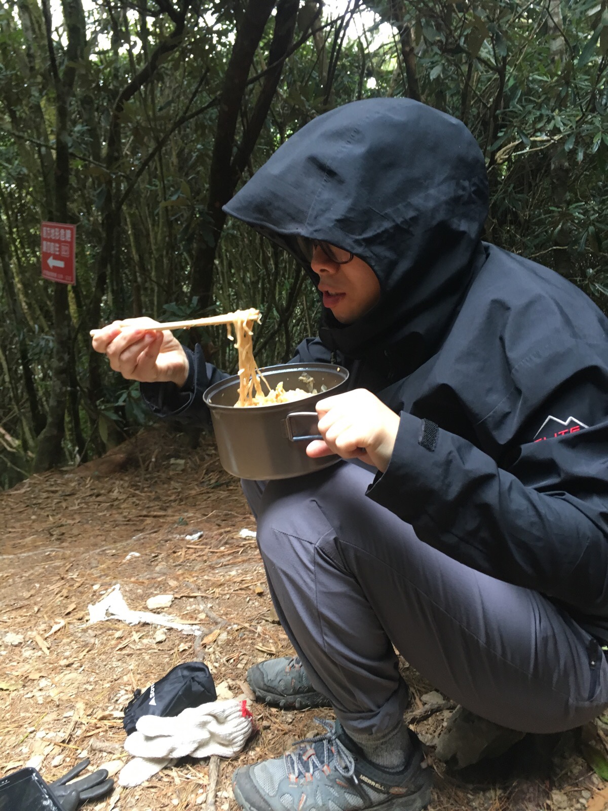
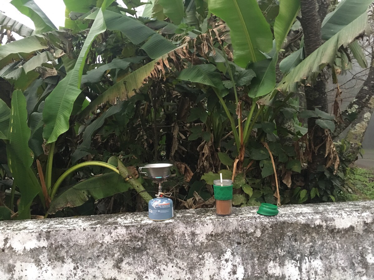
11:53 – We arrived at the peak 16 minutes after passing 法洛米’s sign and immediately set up the cooker to get some coffee and noodles going. Teresa stripped off her base layer to dry it out a bit and I sorted out the vegetables. This time we had Bah Kut Teh instant noodles with vegetables.
At an elevation of 2113m, the air was pretty chilly up there, I’d say maybe 10 degrees. I’d taken off my coat and body warmer whilst climbing, but they went back on again rather promptly to prevent myself from seizing up with the cold.
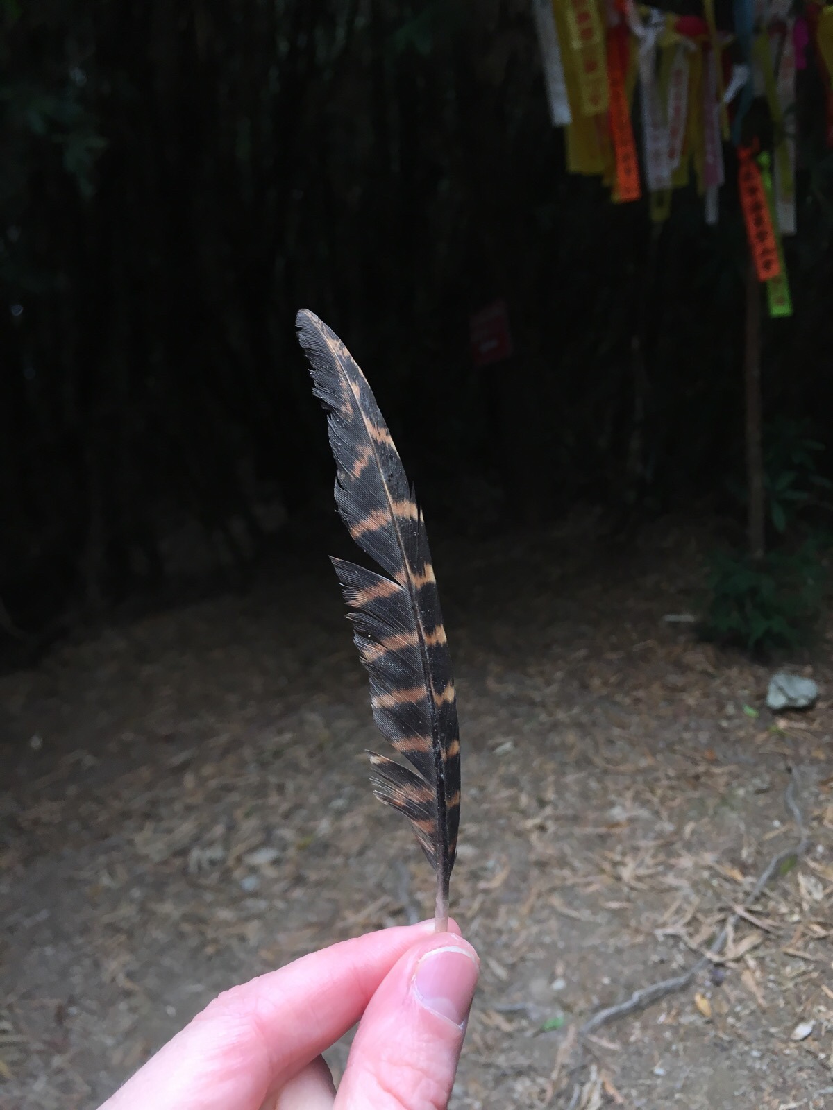
After we’d eaten and mostly cleared away I noticed this feather on the ground next to the trig point. In my inexpert opinion, it looks like a wing feather from a female Swinhoe’s pheasant. (Just look at that gloom in the background of the photo – I found it vaguely menacing…yes, I am a coward.)
12:55 – A little more than an hour after arriving, we set off again – it always takes us about an hour to go through the whole process of cooking and eating, but it never seems like it at the time. At the very most it feels like we stopped for about 40 minutes, going through all the stages of of preparation, eating and cleaning is enough to keep the mind busy. But while my stomach was full of wearing sustenance, my hands were feeling nipped at by the cold air and I was glad to be moving again so that I could get the blood going a bit.
13:10 – Back at the junction we passed at quarter to twelve on the way up. We went left back the same way we’d come. Around this point there is the hollowed stump of a fallen tree which is emitting a very strong animal-ish scent. I’d smelled it both on the way up and on the way back, but Teresa claimed to smell nothing of note.
13:18 – Arriving back at the junction we’d passed earlier, this time we turned left and away from the direction that we’d originally come from.
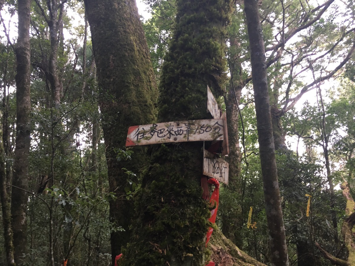
A sign attached to a tree here indicated that it was another 150 minutes to the west peak of Mai Ba Lai. This worried me a little, since it would have us arriving back onto the flatter portion of the trail at around 3:30 or later and even if we decided not to head up to the west peak, it would still likely be cutting it somewhat fine light-wise. (But of course we had our head torches, so we were prepared at the very least.)
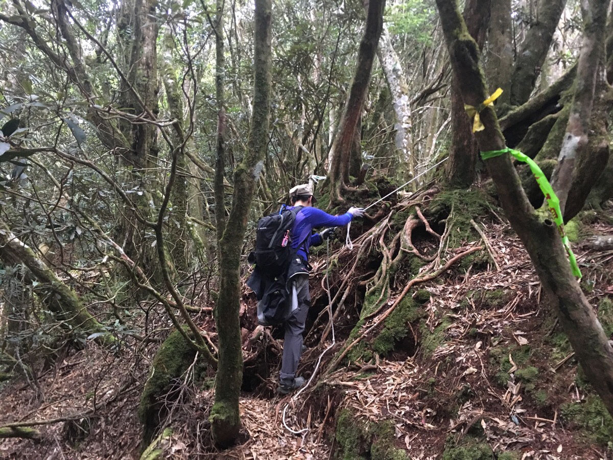
The descent is steep, and even though my new shoes fit nicely, this type of very steep slope is not comfortable. To make it harder, there aren’t quite enough trees to provide handhold – I really would have benefitted from having hiking poles here.
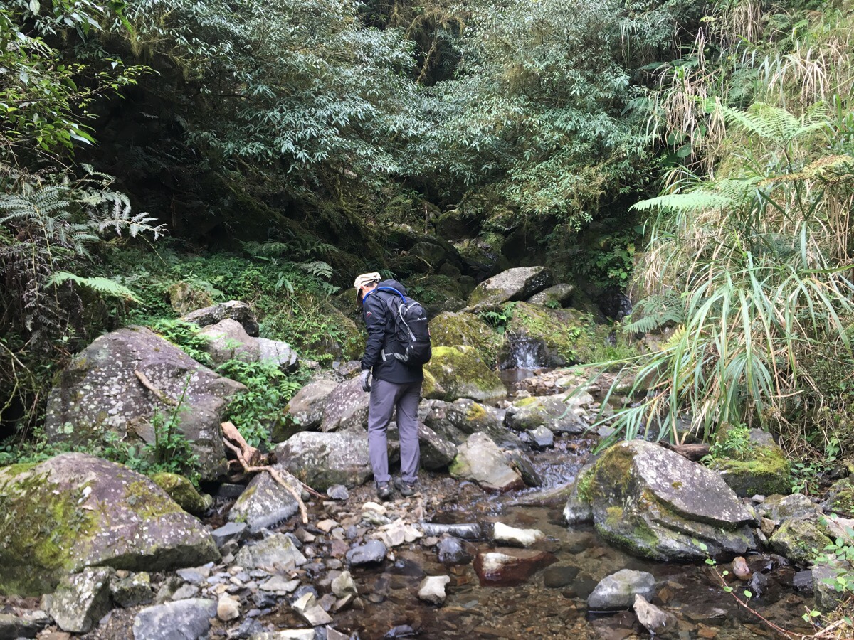
13:30 – A trail on the left heads down towards a small creek and is signposted as 水源小溪谷. We kept going straight along what might have been my favourite small portion of the whole walk.
13:31 – A narrow ridge line made springy by the accumulation of many years of leaves leads you along the spine of the mountain. The drop to the right is particularly steep, it just seems to go down and down and down.
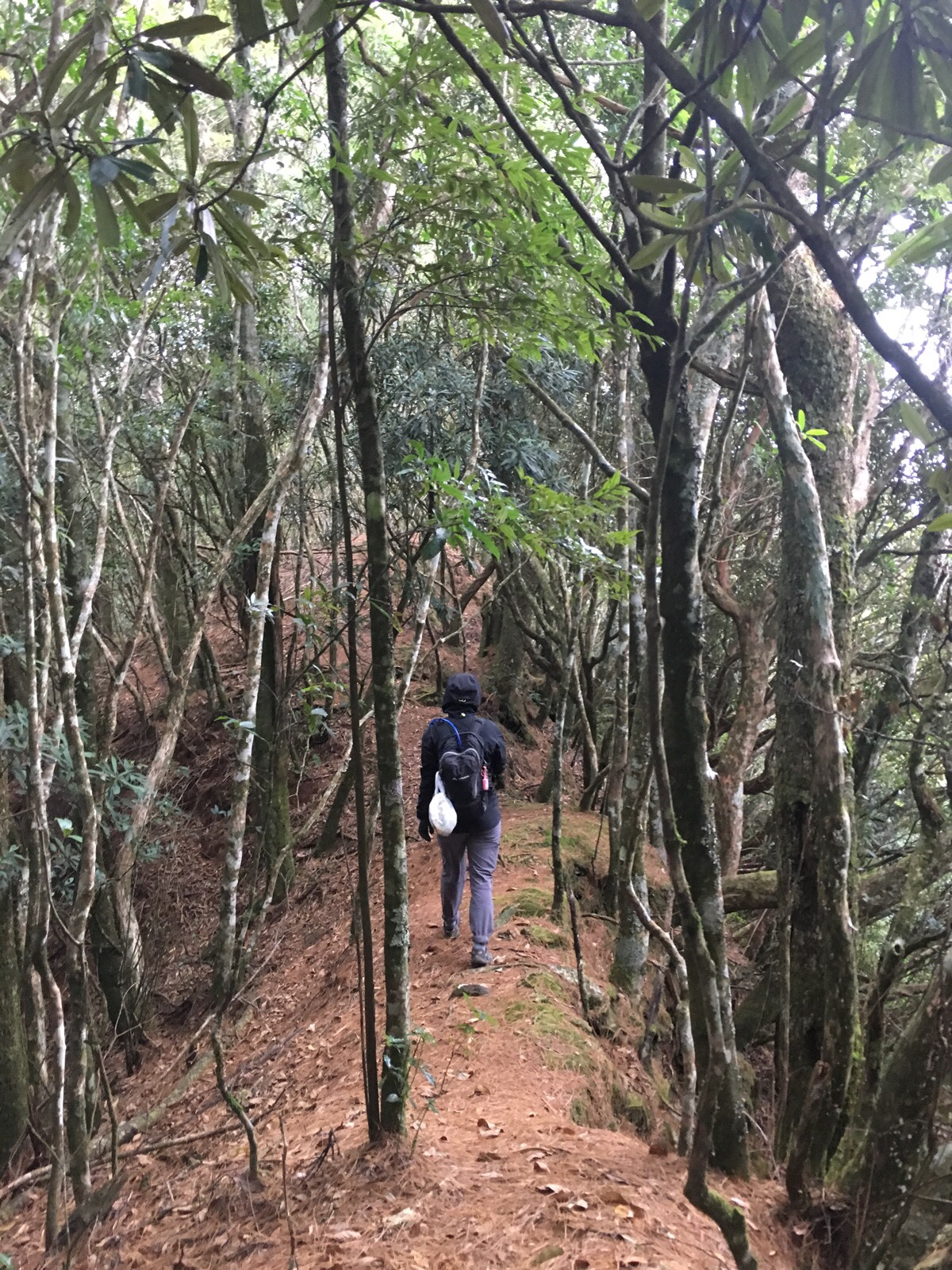
After this brief respite where the downwards trajectory is gradual rather than extreme, the slope begins in earnest again and it was a scramble almost all the way to the next junction.
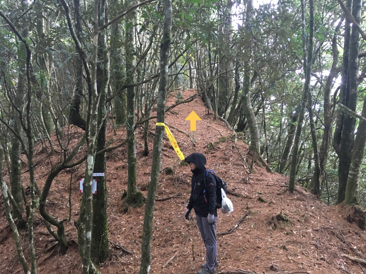
14:47 – Finally, things started levelling off and we realised that most of the big old trees had lingered in the higher reaches, leaving us with only the Japanese cedars for cover again.
14:52 – Making great time on the sign that we’d seen at the top, we reached the junction where we had to decide whether we wanted to continue to the west peak or head directly back. I made the call to skip the extra peak; it was down from the junction which would mean having to climb back up again, and I wasn’t sure that I had that much spare energy in me. Besides, I had 5pm as my mental cut-off time for being back at the car, and I figured that two hours should see us able to get back quite comfortably assuming the terrain was similar to how it had appeared in other people’s posts online and how it appeared on the map.
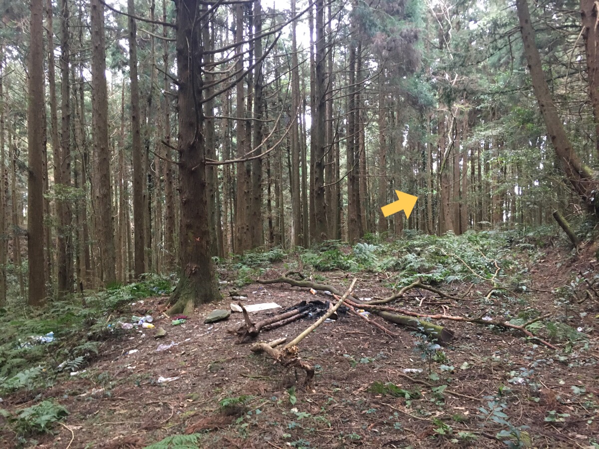
There was a large campfire which had been left here with bottles, bags and packs of cigarettes and food wrappers strewn all about. In fact from here all the way along this flat section to where we headed down again, there was a large amount of rubbish littering the trail. Teresa said it was likely to be left by hunting parties. The path so far had been largely unspoilt by litter, I’d just picked up a couple of sweet wrappers, but as I walked back along this forestry track, I very soon filled both of our rubbish bags.
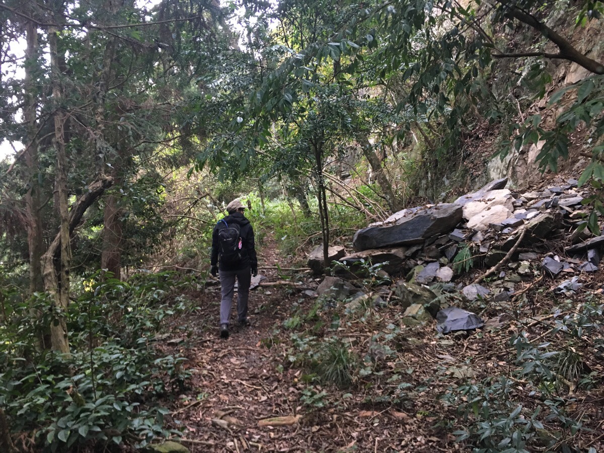
14:54 – Roughly the first third of the forestry track was very easily traversable. There weren’t so many hiking tags, (I think that it isn’t uncommon for hunters to pull down tags), but the path was flat and clear.
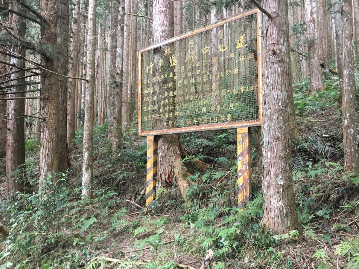
15:02 – A sign which is several years older than me and Teresa. I would say this gives an indication of how old this part of the forest is – the tree on the left has started to consume the leg of the sign.
15:09 – The middle third of the forestry track section is a little harder to pass through. The trail becomes narrower and crosses a number of creek beds where the ground is clearly a little less stable.
15:41 – Only two of the creeks we passed had any water. Immediately after we’d crossed one of the streams and climbed the opposite bank, a crack and flurry of motion upstream let us know that we’d disturbed something. I’m not sure what it was though. At one point I think we might have heard a gun too, but it was way, way off downhill so it could just have easily been any large bang.
15:43 – The moss along this section was luxuriant and extreme, draping over the branches of many trees like an alien invasion.
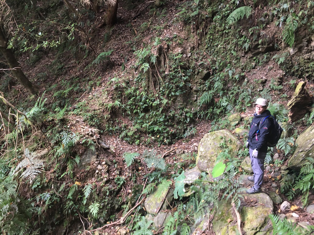
15:54 – There were a couple of places where the slope above or below us appeared to have given way in the not too distant past – at some points it was evident that the path had been rerouted to avoid going too close to a drop off, or otherwise to climb over a chunk of land which hadn’t been there before.
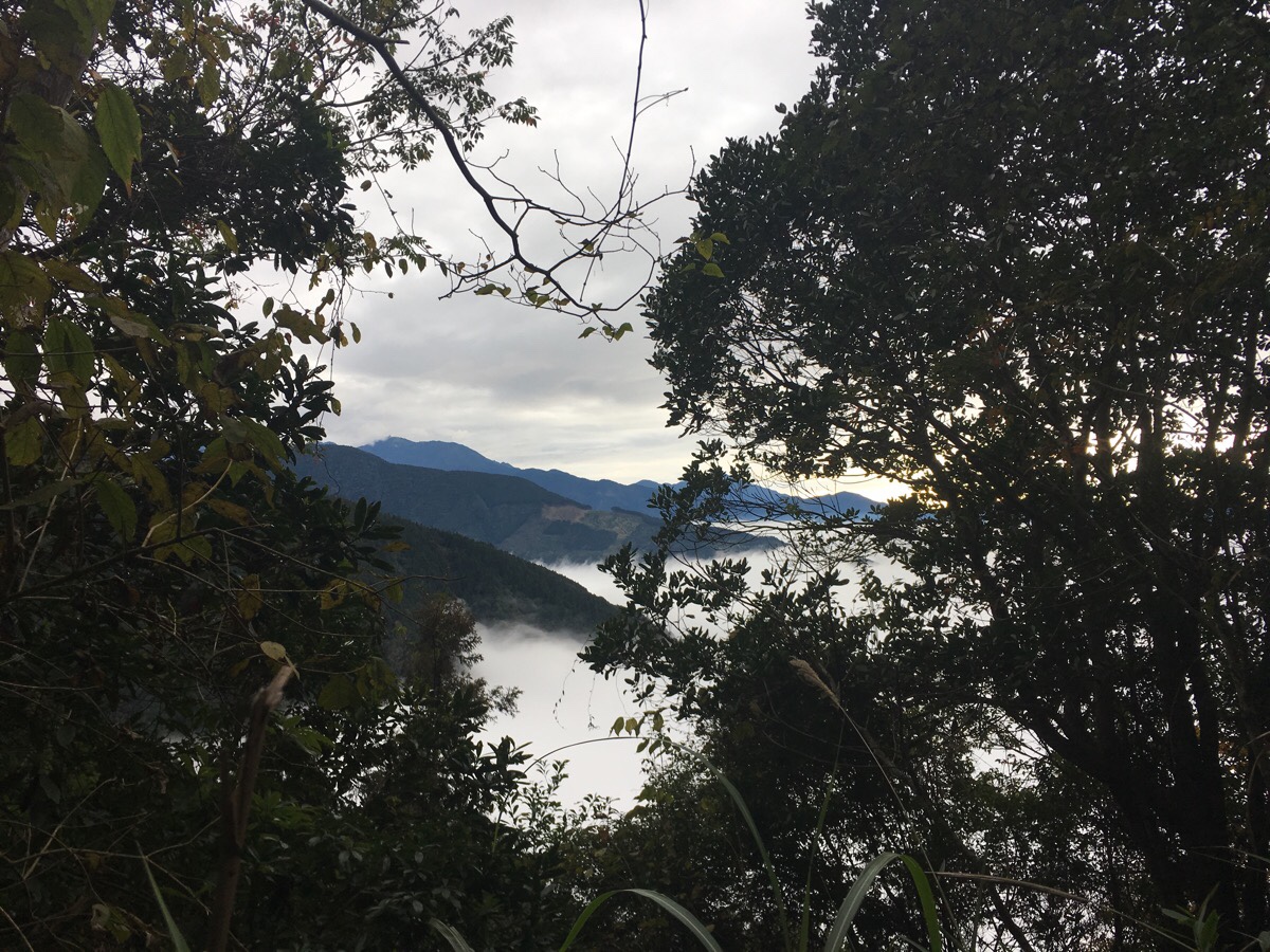
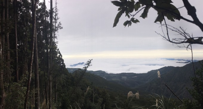
15:59 – We had been between strata of clouds for most of the day, the upper layer blocking out the sun and the lower spread out to cut us off from the world below. This was one of the few windows where the trees let up and we were able to get a glimpse of the land around us.
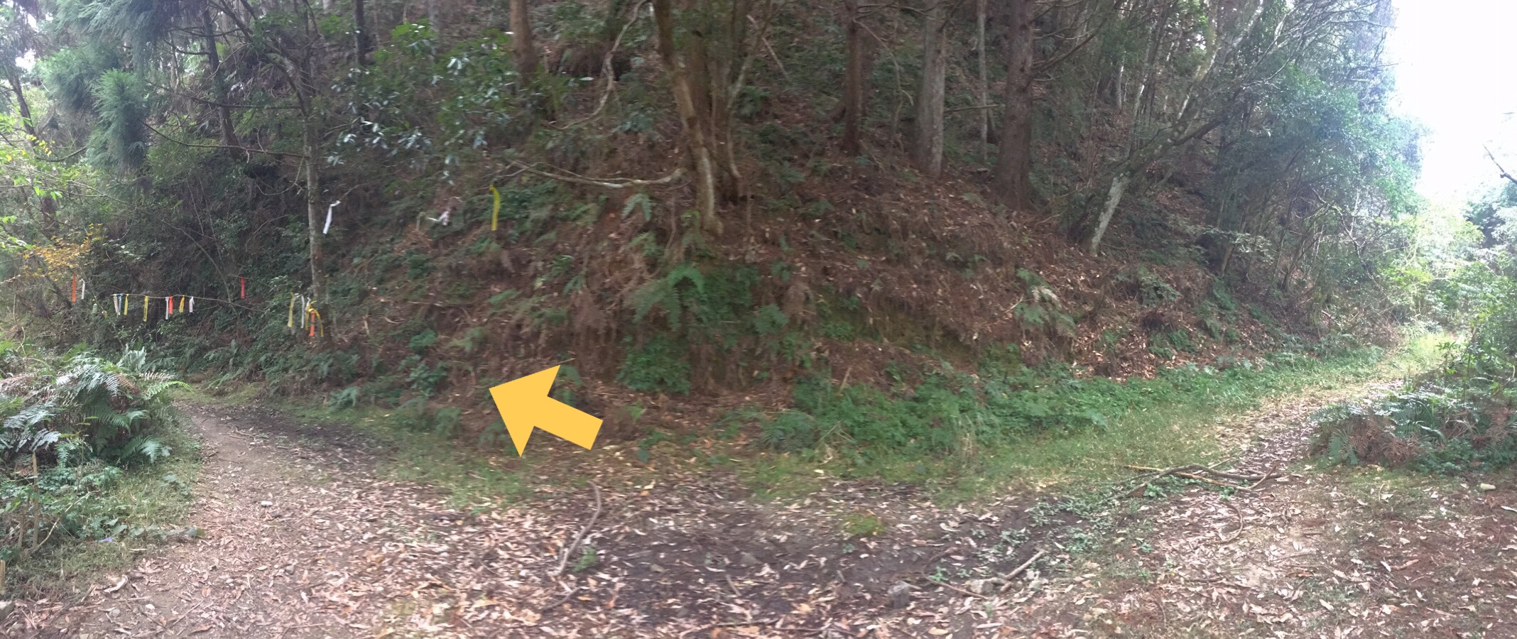
16:02 – Finally after a push through the most overgrown portion of the whole walk, we arrived back at the junction where we had gone left seven hours earlier. In the above picture Teresa is staring towards the route we’d taken earlier because walking towards us on that path were the first two people that we’d seen since setting off. They had set off a bit too late to get to the top, but had made it up as far as the viewpoint that we’d reached at around quarter past ten. They said that they’d waited for us there for a bit since they’d seen our names on the register and knew that we must have been up ahead of them and they assumed that we’d be coming back the same way.
Together we took the left path back down to where we’d started, Teresa and the woman chatting as they went. The couple were from Hsinchu and had hiking the previous day too, (I forget where), but they said that the peak had been so crowded that they couldn’t even find a place to sit – I guess that might have been why they ended up coming somewhere quieter on this day.
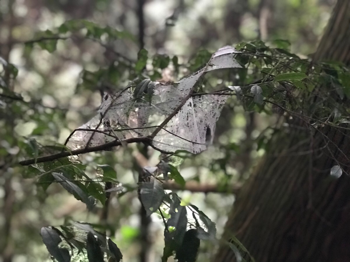
After a while we pulled ahead of them a little, our pace being slightly quicker. As we neared the end of the trail, we descended down into the clouds and a large number of spiders’ webs became visible, the fine mesh picked out by the moisture in the air. Of particular note were these cocoon-like structures which seemed to draw together a small funnel of leaves.
16:45 – We made it back to the road with fifteen minutes to spare before my self-imposed deadline, (and the closing hours of the research station), and a good forty-five minutes before full dark.
The guy manning the station asked us to sign ourselves out and asked if we’d seen the other couple – at this point they appeared from around the corner and Teresa pointed out that she had saved him a job and had brought them back down with her. The man kindly let us use the centre’s toilets to get changed before we got into the car, (as we passed the doors in the hallway the “Pomology Research Laboratory” caught my attention), and we thanked him before headed out to the car.
Knowing that it would be quite a drive and we were both likely to feel tired on the way, I made up another coffee to see us through the drive. That and the fruit that we’d carried up but not consumed were enough to see us back to Taoyuan, and eventually Taipei in time to (not quite) see the 101 New Year fireworks.
How to get there
Google Maps address: the trail starts from Wufeng Agricultural Research and and Extension Station, 311, Hsinchu County, Wufeng Township, 8號. It is quite a long drive up on narrow, windy roads, but the road is relatively well maintained. There is room for several cars to park up out the front of the station.
GPS location: N24 36.690 E121 09.430
Public transport: there doesn’t appear to be any public transportation which will get you near here, you’ll have to travel either by car or scooter.
Further reading: this blog in Chinese takes a there-and-back route, they went up to Mai Ba Lai Shan the same way we did, then back the same way they went, and there are lots of pictures to show you what to expect – this route seems to be the most popular. This post (also Chinese) follows almost exactly the same route that we did, although the did an additional couple of kilometres to the west peak. There doesn’t appear to be any English information on this one yet.
In case you need any reminder for why you need to check the weather before any excursion into the wild, this article (in Chinese) details how a man was separated from his hiking group on this trail during heavy rain. He was able to shelter in a hollow tree for the night and was found the next day.
Maibalai Shan Trail Map
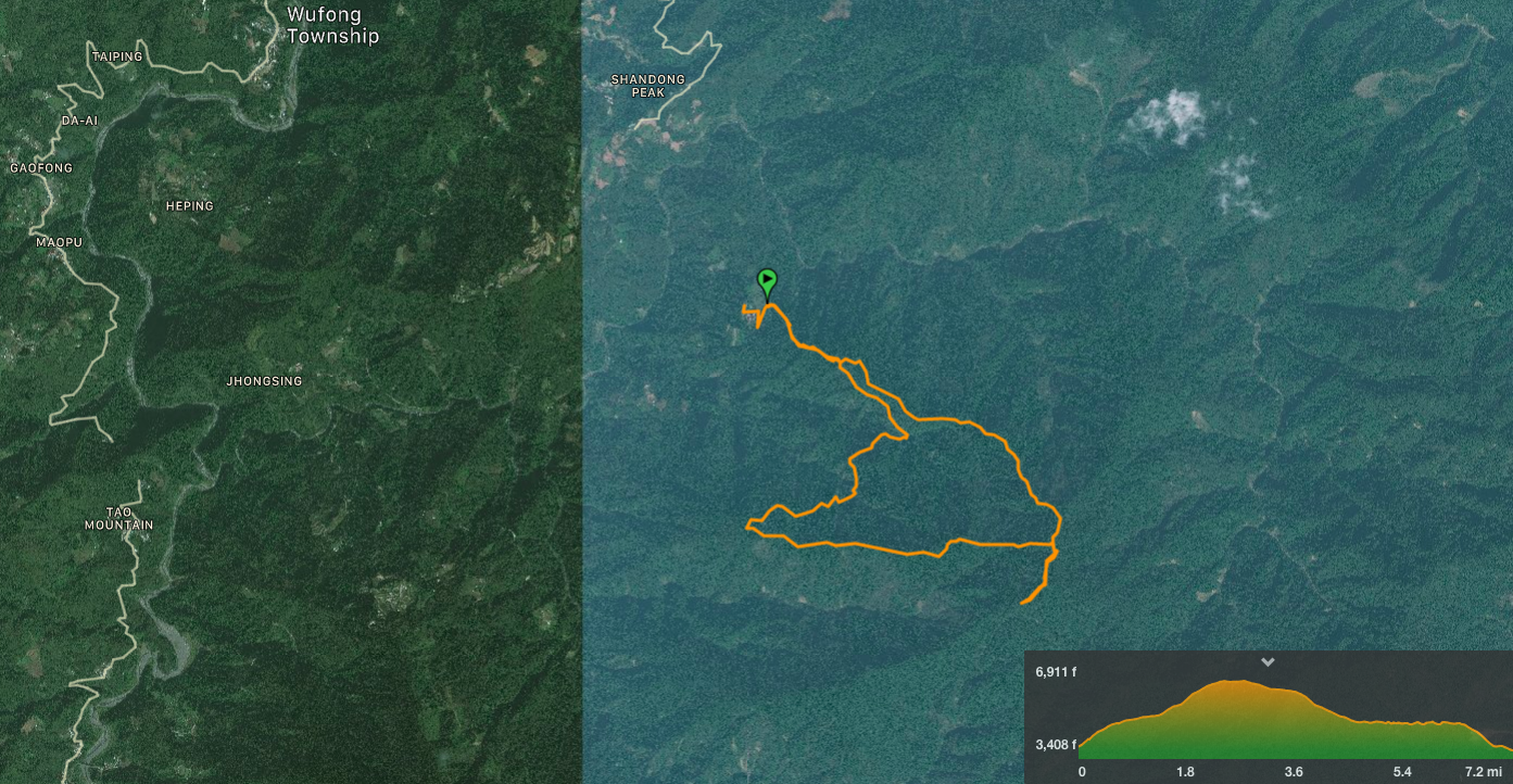
GPX file available here. As you can see from the map above, it’s right in the mountains and quite a long way away from anywhere.
My new words learnt on this hike:
- 嫌棄 / xiánqì / dislike and avoid/feel repulsed by, cold-shoulder someone
- 山老鼠 / shān lǎoshǔ / literally “mountain rat”, actually it is a term which is used to describe people who illegally cut down trees and take them out of the forest to sell. Evidently it is a relatively big problem here since there are tons of news reports about it, loads of photos of police standing next to the people they caught, and reference to their activities even appeared in a local TV show that I’ve watched.
- 不必 / bùbì / no need, unnecessary – I heard someone saying this on the radio and the teenage boy in me found it rather amusing.
- 起雾 / qǐ wù / fog up (as it’s used for glasses or windows), or fog come out, (as in the sudden appearance of fog).
- 翹家 or 翹課 / qiào jiā or qiào kè / run away from home or skip class.
- 性感 / xìnggǎn / sexy – I am sure I have learnt this before, but I’d forgotten so thoroughly that it felt like the first time I was hearing it.
