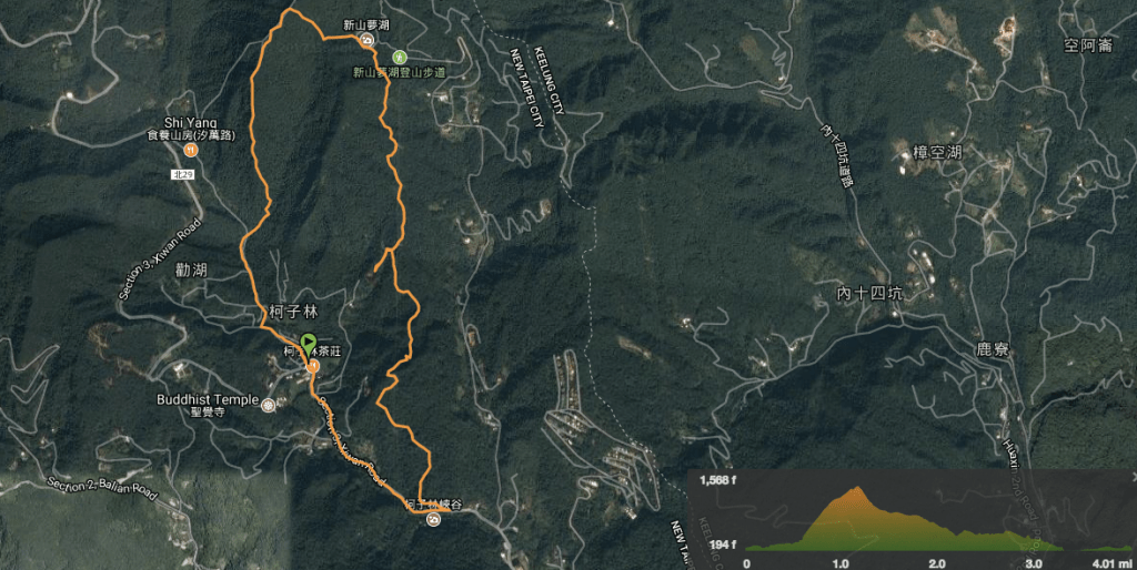
Distance: 6.5km
Time: 3¼ hours – With the downward section at a pretty fast pace. This doesn’t include swimming time or any time to stop at the lake.
Difficulty (new Taiwan hiker): 4/10 – Tiring but fun.
Difficulty (new Taiwan hiker): 7/10 – The upward section is just a little tough to be included in moderate but this is definitely at the very easy end of difficult. The climb is steep with some fixed ropes in sections but really there’s not anything particularly challenging for someone who has completed a few similar hikes in Taiwan. Having said that, this is definitely not a beginner’s hike and if you’re using it to experiment with tougher routes then make sure you give yourself plenty of time to complete the walk.
Total ascent: 540m
Water: 1L or more – We didn’t drink quite as much as we should have in order to conserve time and as a consequence we were thirsty all night.
Shade: Most of the path was shaded enough for me but the weather wasn’t particularly sunny – perhaps if the sun had been stronger I would have needed some hands-free sun protection.
Mobile network: Most of the time I think we had good signal but there were sections where I can’t honestly say I was aware of whether or not I had service.
Enjoyment: Even with the terrifying conditions, it was a great hike. Of course, I would never have chosen to do this hike in the weather that we did it in, but that aside I think this is one of the more enjoyable Taipei-accessible walks I’ve done. The climbing was enough to get the heart racing and keep the mind occupied finding the next foot and hand-hold but it was well within our abilities which made it seem really fun. Added to that, there were some spectacular views, small rock climbing opportunities and lovely geology to enjoy. Almost all the path was unmodified (except for a few steps up near the lake and a few fixed rope sections over the more exposed parts of the ridge), and because there were relatively few alternative routes, most of the route felt free from unnecessary signs to detract from nature. Then the icing on the cake was the outdoor swimming hole as a rewarding end to a hot day.
Other: You’d be better off wearing gloves and long sleeves/trousers for this one. We didn’t take gloves and it was ok because it was dry and not spider season but I would have definitely taken the protection if I’d known what sort of route we’d be doing. Also, I’d avoid doing this in wet weather or just after rain, there are bits that would become pretty dangerous in wet conditions.
Jump to the bottom of this post for a trail map, GPX file, and transportation information.
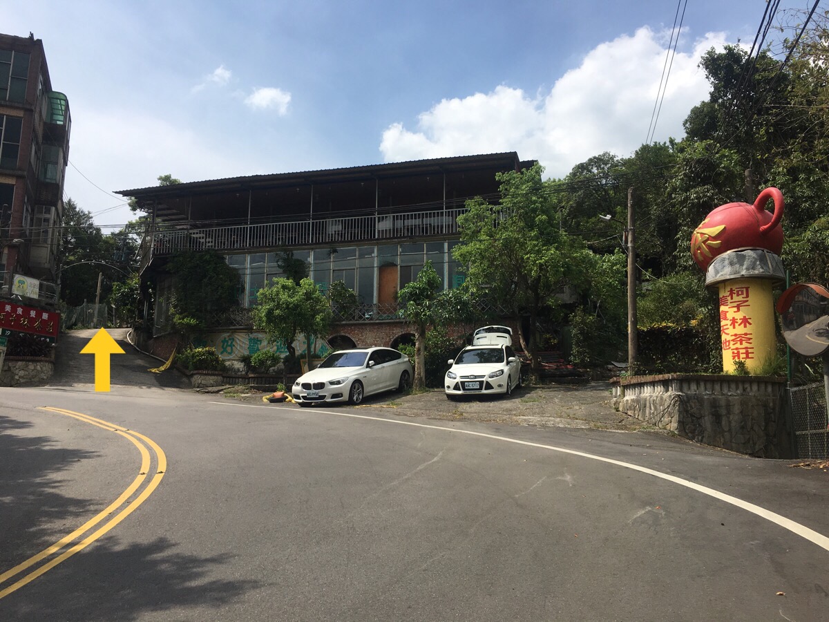
We parked up in front of a restaurant with a big red teapot – there are parking spaces further up the lane but it’s a single-track gravel road so we decided to avoid the pain of meeting other drivers and just walk a little further.
It was quite a busy stretch of road and we had to repeatedly stand to the side so that cars could pass.
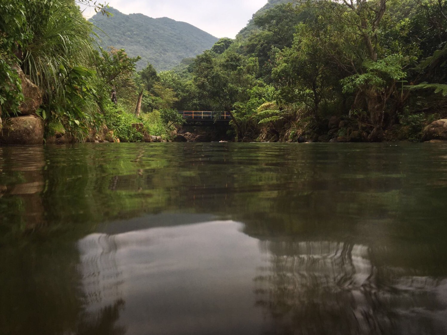
Rounding a bend in the road we heard the sounds of splashing water and came across the shelter/kitchen/changing room that’ve accrued around the swimming areas.
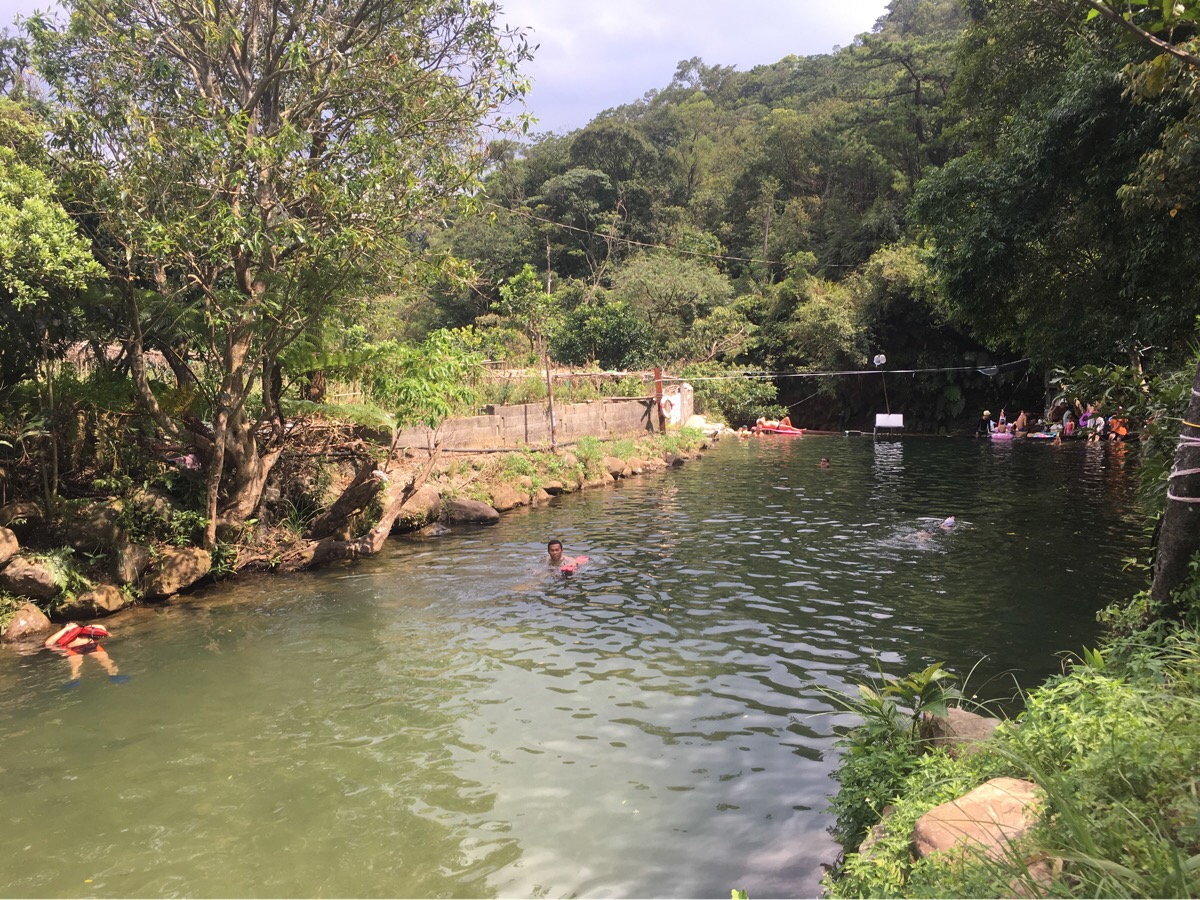
The pool looked incredibly inviting and I could see fish darting around beneath the swimmers. It was busy with families enjoying the summer weather and so we decided to head up for a walk before returning to swim. In hindsight, we should have perhaps been a little more prepared, but from the research I’d done, it seemed like a very doable thing.
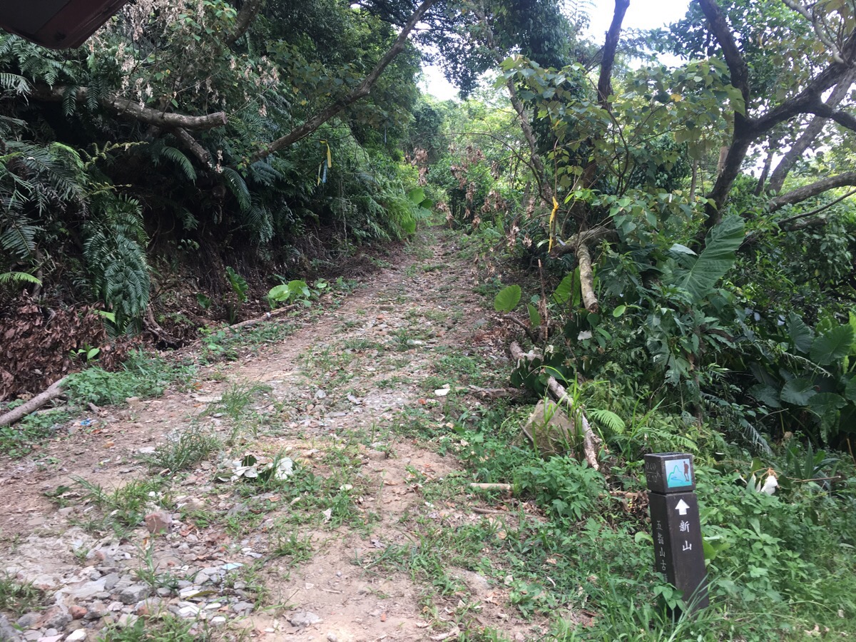
The trail leads away from the back of the pool and a sign suggests it’s about 85 minutes up to Xin Shan and we definitely had enough time to do that both ways. The first couple of hundred metres were gentle, the track was almost wide enough to walk side by side and we met a man coming the other way with an armful of bamboo shoots that he’d gathered from somewhere.
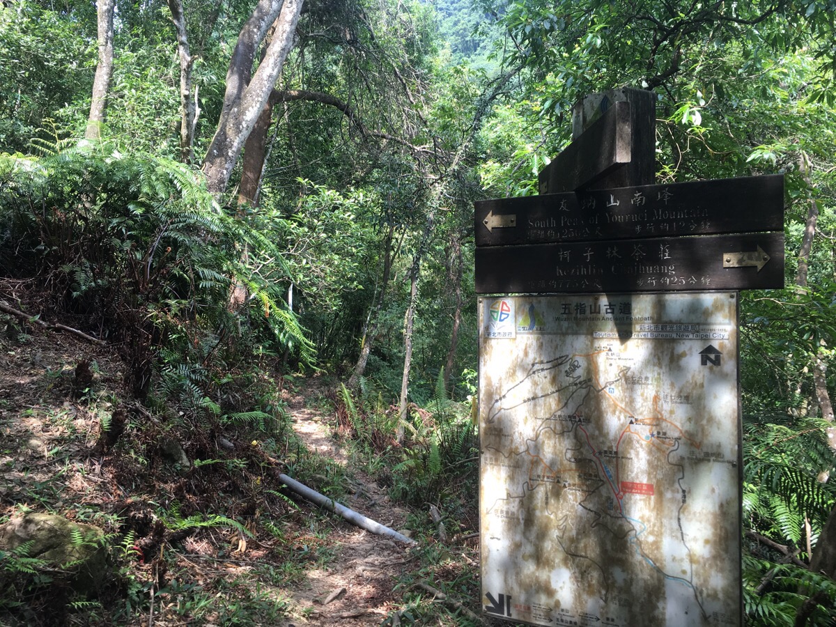
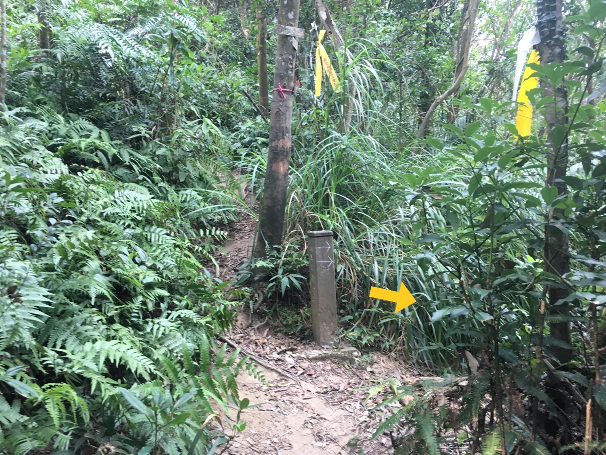
At the first of only a handful of junctions, we went right towards Xin Shan, (the left path goes up to the south peak of Youruci mountain).
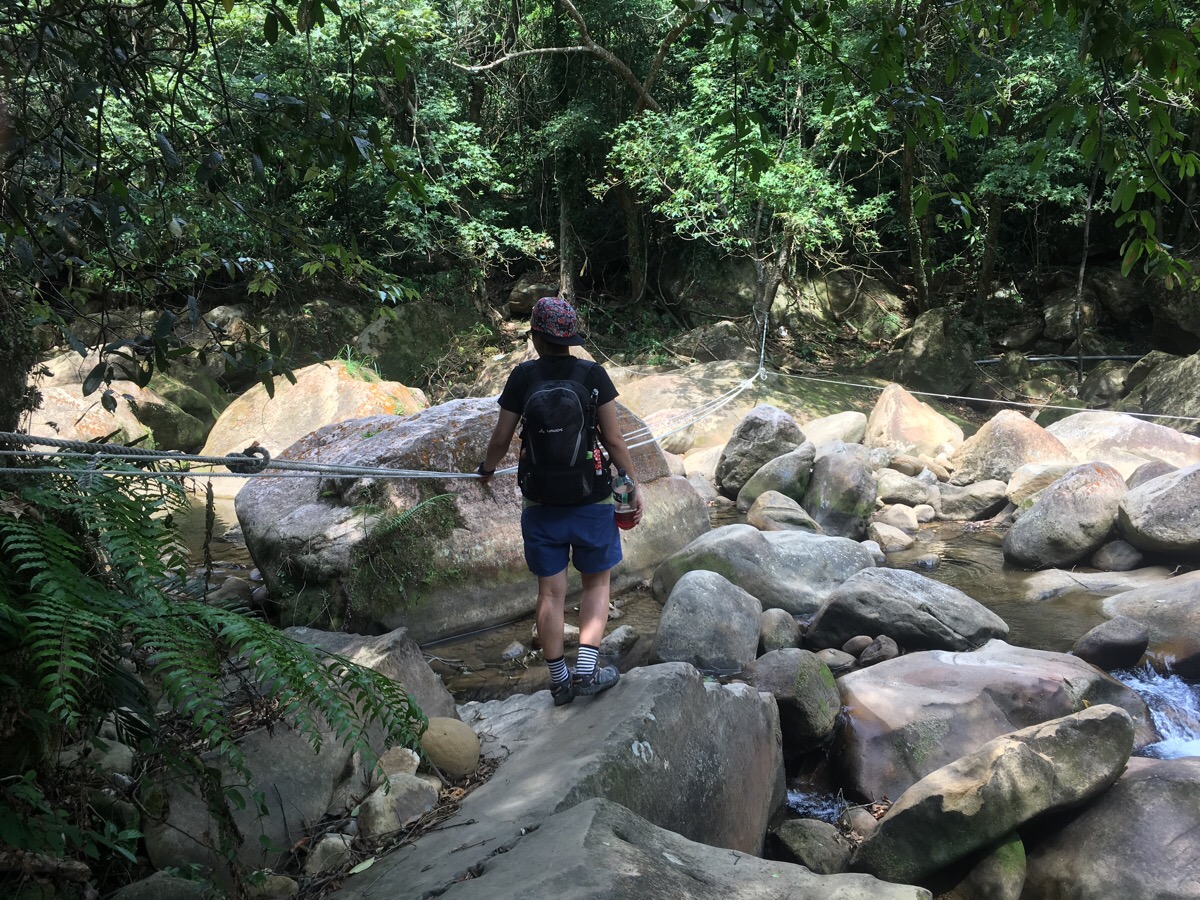
Just beyond the junction, the path crosses a river. The water level was really low so we had no trouble stepping from stone to stone but I’d imagine that it would be a different matter after heavy rain.
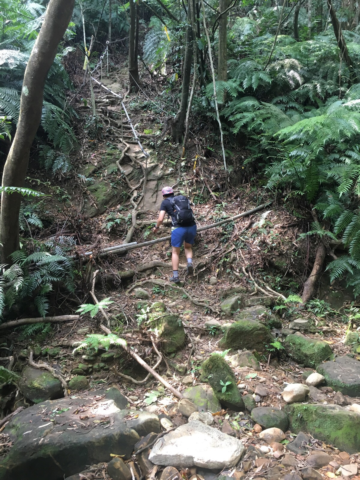
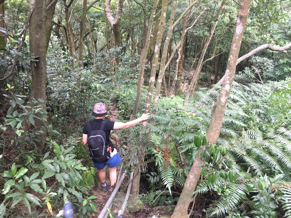
Beyond the riverbed, the path climbs up next to the water for a while and then crosses back over a smaller tributary of the same watercourse. After this second crossing, the climbing starts in earnest.
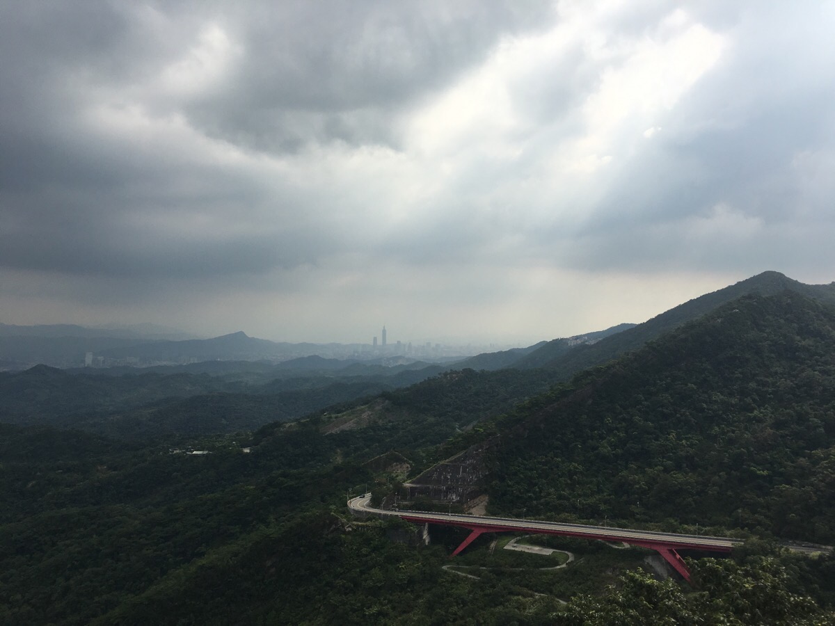
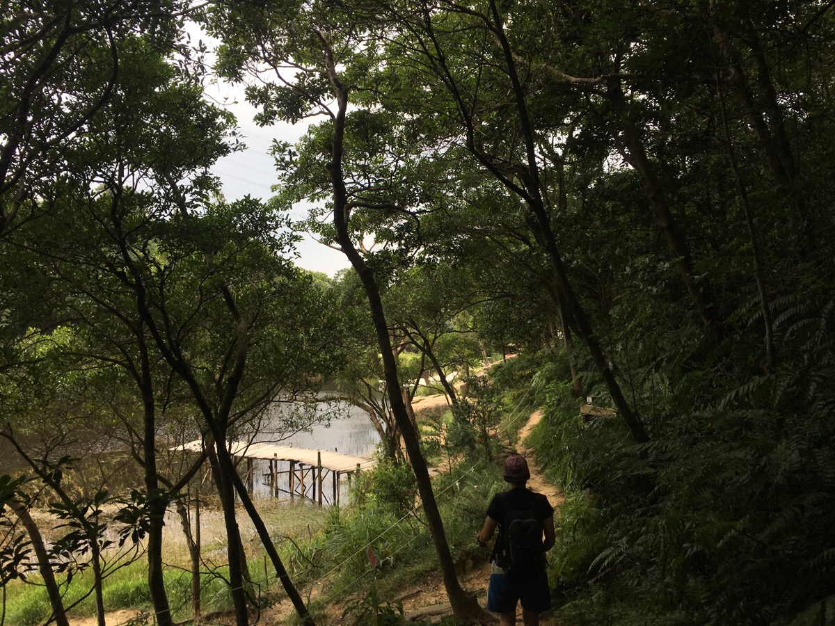
Although there was nothing technically difficult about this hike, the steepness of the slope, the unevenness of the path and the constant attacks from tree limbs made it a good workout. After a short way up, we made it out onto the spine of the hill and kept passing huge boulders and glimpsing promising views. After rounding one such Boulder we found a rope leading up the top side and decided to see what could be seen from the top. The exposed side of the rock had an amazing example of honeycomb weathering, all pockmarks and gritty, sandy texture. The view was fantastic too, we could see down to the pool where we’d started the walk, the splashes of swimmers catching the sun and causing the surface to sparkle. Looking south we could see towards Nangang Shan and Taipei 101, to the west we saw the huge military cemetery that we’d diverted through after spiders forced us to abort a Keelung to Taipei hike a while back.
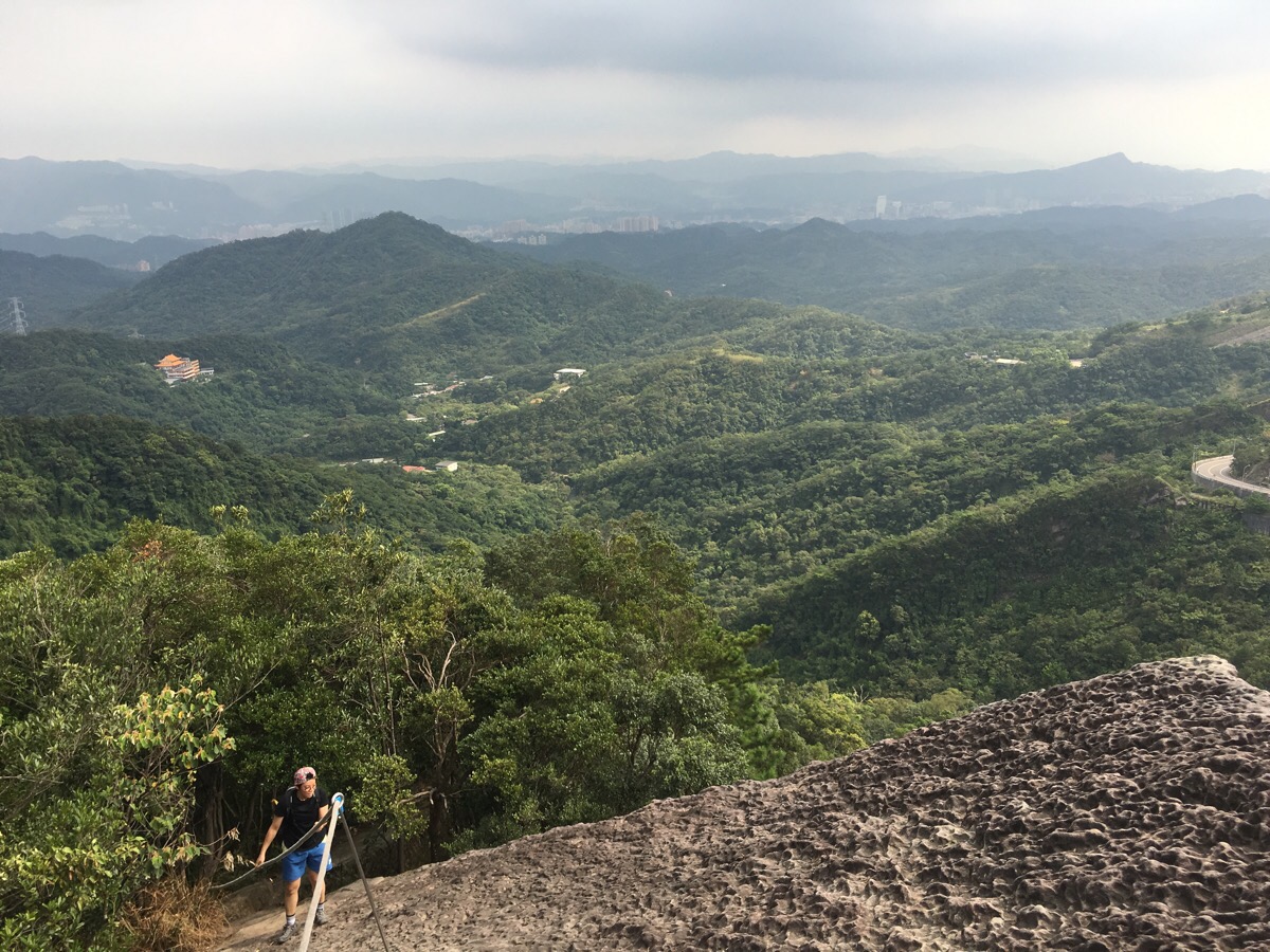
The path dipped in and out of the tree line – in turns either totally hemmed in by trees or totally open to the skies. It was really rather wonderful.
Looking ahead we could see the path snaking in and out of the trees and over the rocks. If you look closely at the picture you can see the fixed rope near the top.
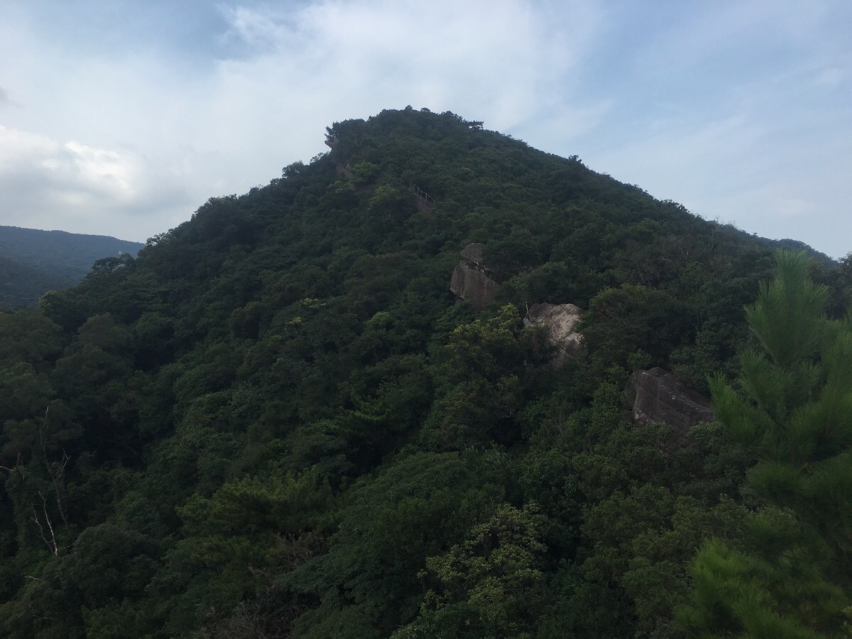
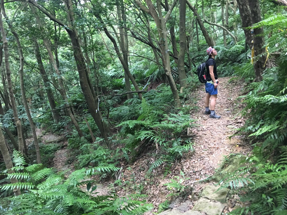
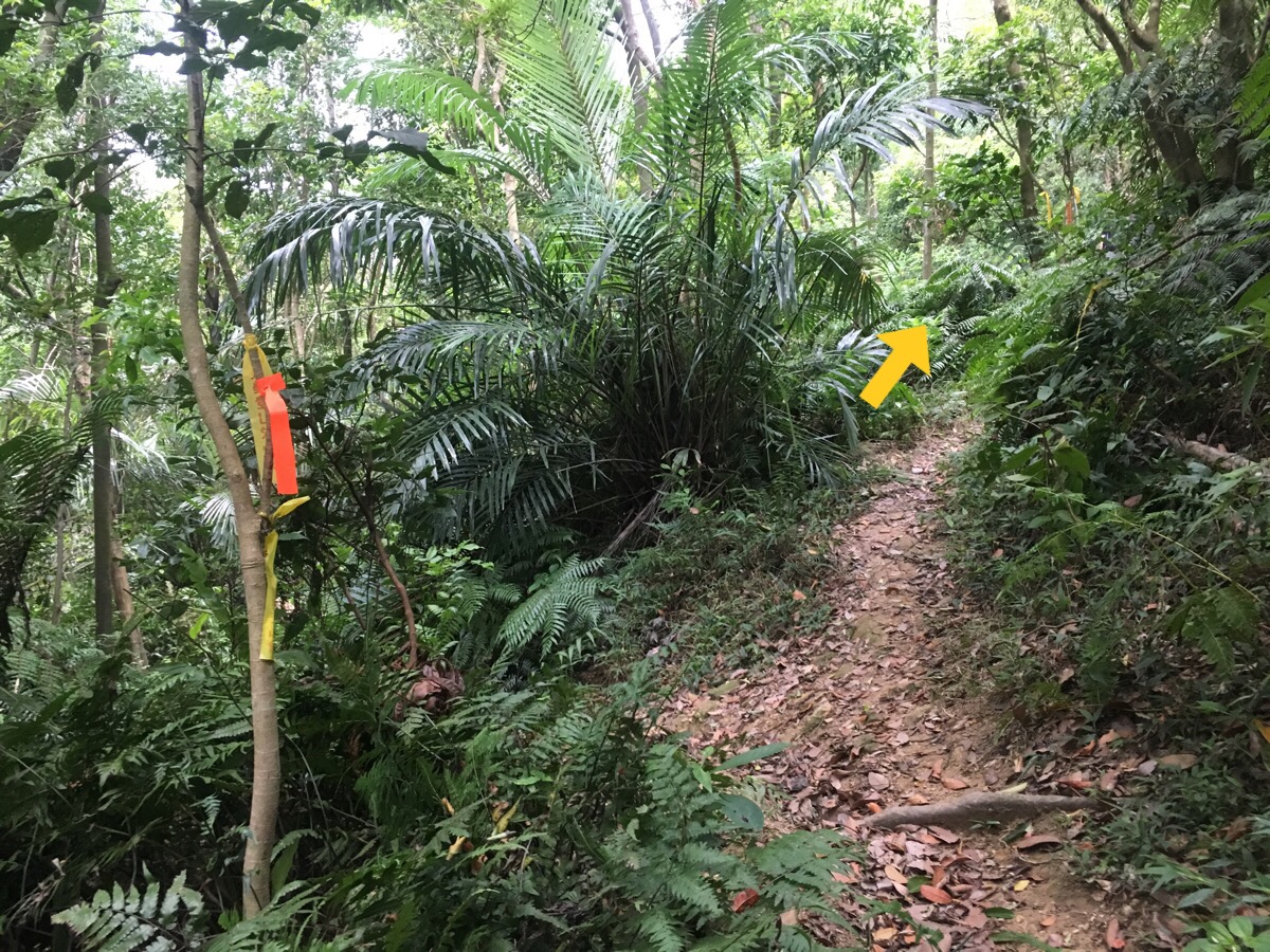
As we were nearing the peak, we started to think that we’d have to pick up the pace a bit if we wanted to get back in time to go swimming so we decided to cut of the very top of Xin Shan, but from looking at the map, it must have been only a matter of metres. Where the path continues up to Xin Shan we went right and downhill, this section was the most overgrown of the whole trail and we walked into several spider webs.
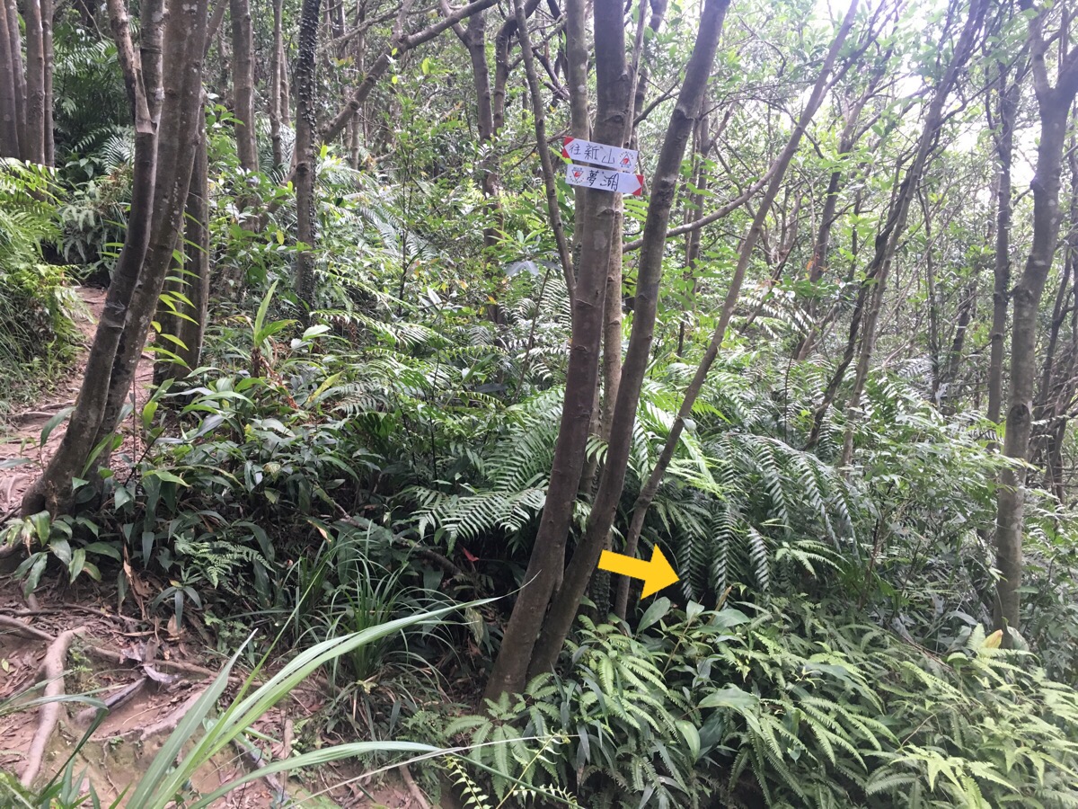
Only five minutes later, we reconnected with the trail that went up to the top. We continued downhill towards 夢湖 (Meng Hu), from here the path opens up a bit and there are even steps in parts.
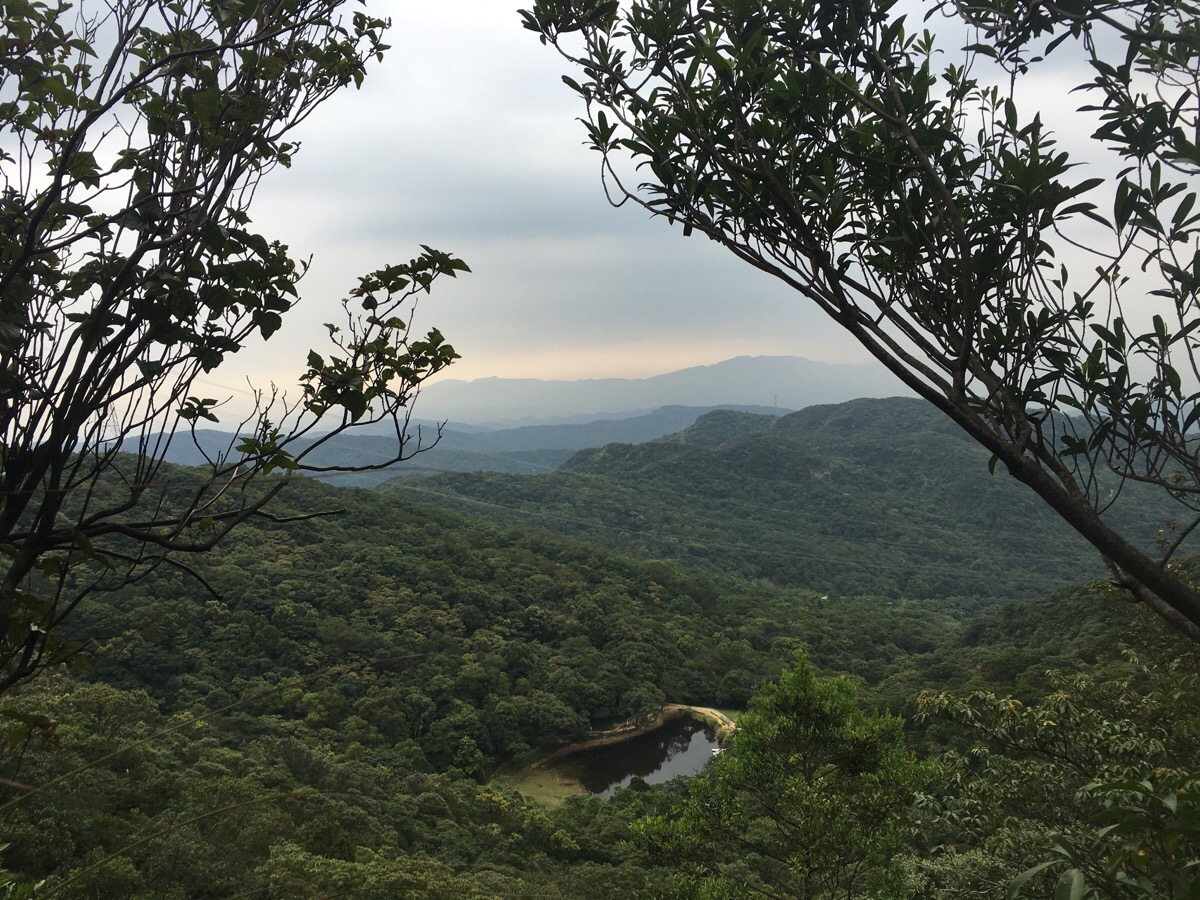
At one point the trees open up enough to give you a view of Meng Hu. The name of this place translates as Dream Lake, from what I can scrape out of translations, it was an artificially constructed lake, made for the enjoyment of one family but eventually opened up for the public to enjoy. Many people seem to use it as a location for wedding photos and as a starting point for climbing Xin Shan or starting other walks.
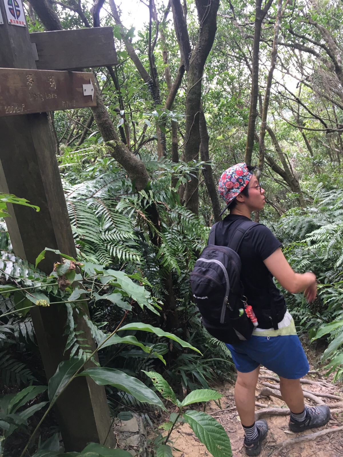
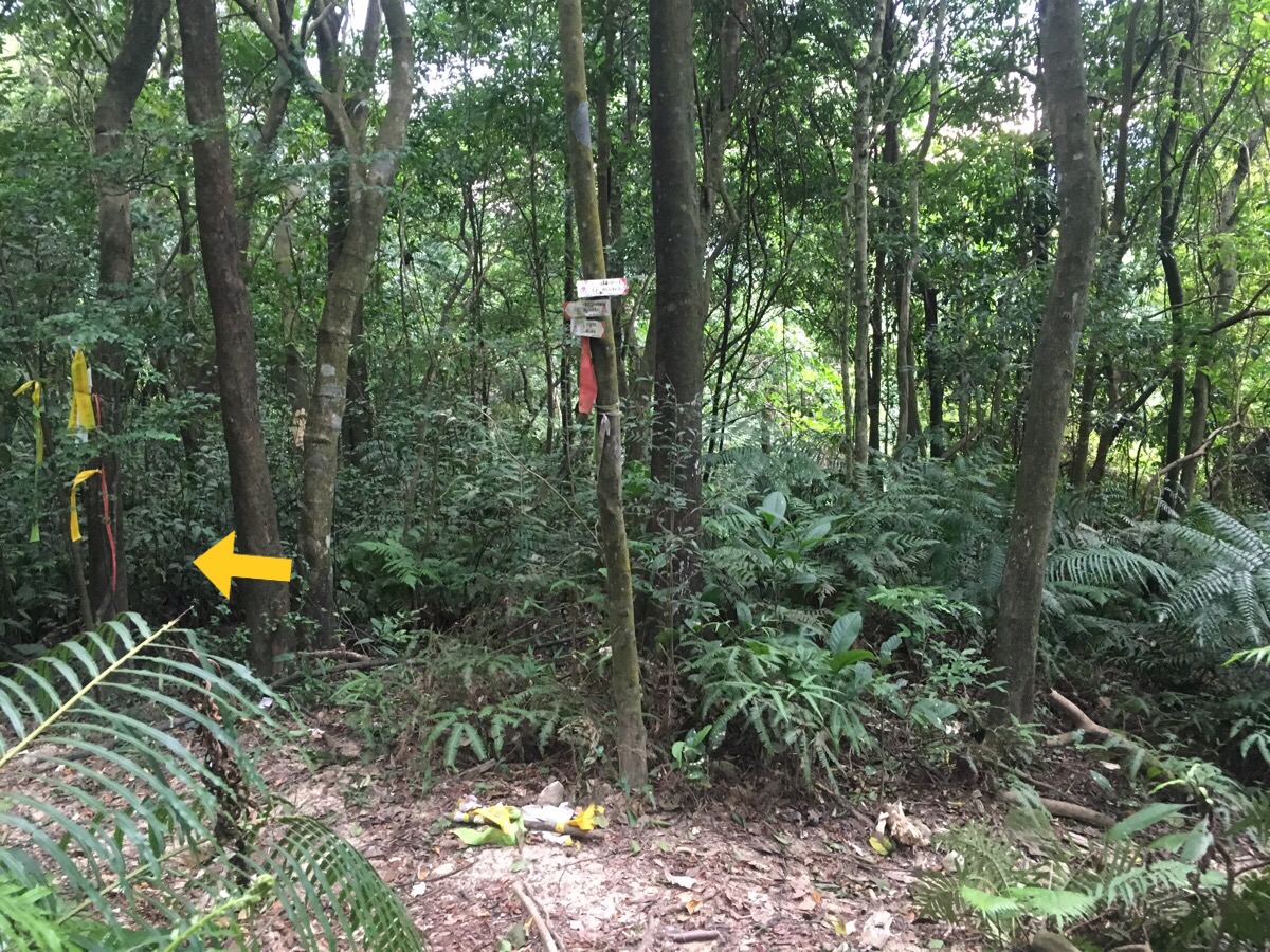
There’s one more junction before the lake and again, we headed down.
The path skirts the lake and passes the small cafe – if we’d started the walk earlier I would have loved to stop and have a drink but at this point, the weather seemed to be turning and we wanted to clear the remaining part of the walk before the rain came.
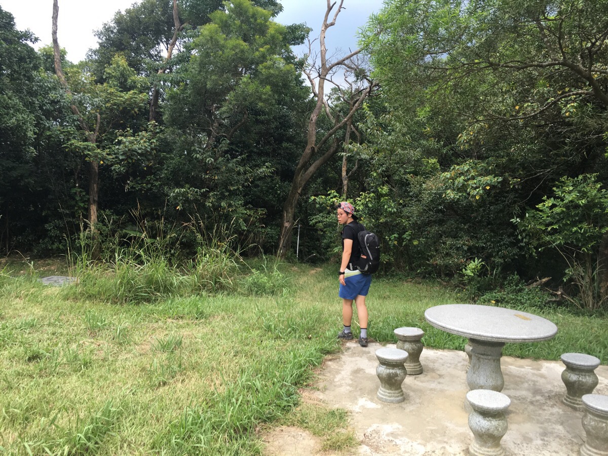
Just beyond the cafe and some stone tables, a small path disappears into the undergrowth.
A few pipes run from Meng Hu to the stream just down the path from it – we crossed the stream and went carefully along the very narrow path.
At the first of two marked junctions, we headed right. The left path leads back to the road which you can travel up to get to Meng Hu. After this the path is pretty easy, the gradient is nowhere near as steep as the way we climbed up and so we ran as and where possible to try and make it back in time for some swimming. It also seemed that there was a storm bearing down on the area so we were increasingly anxious to get back before that arrived.
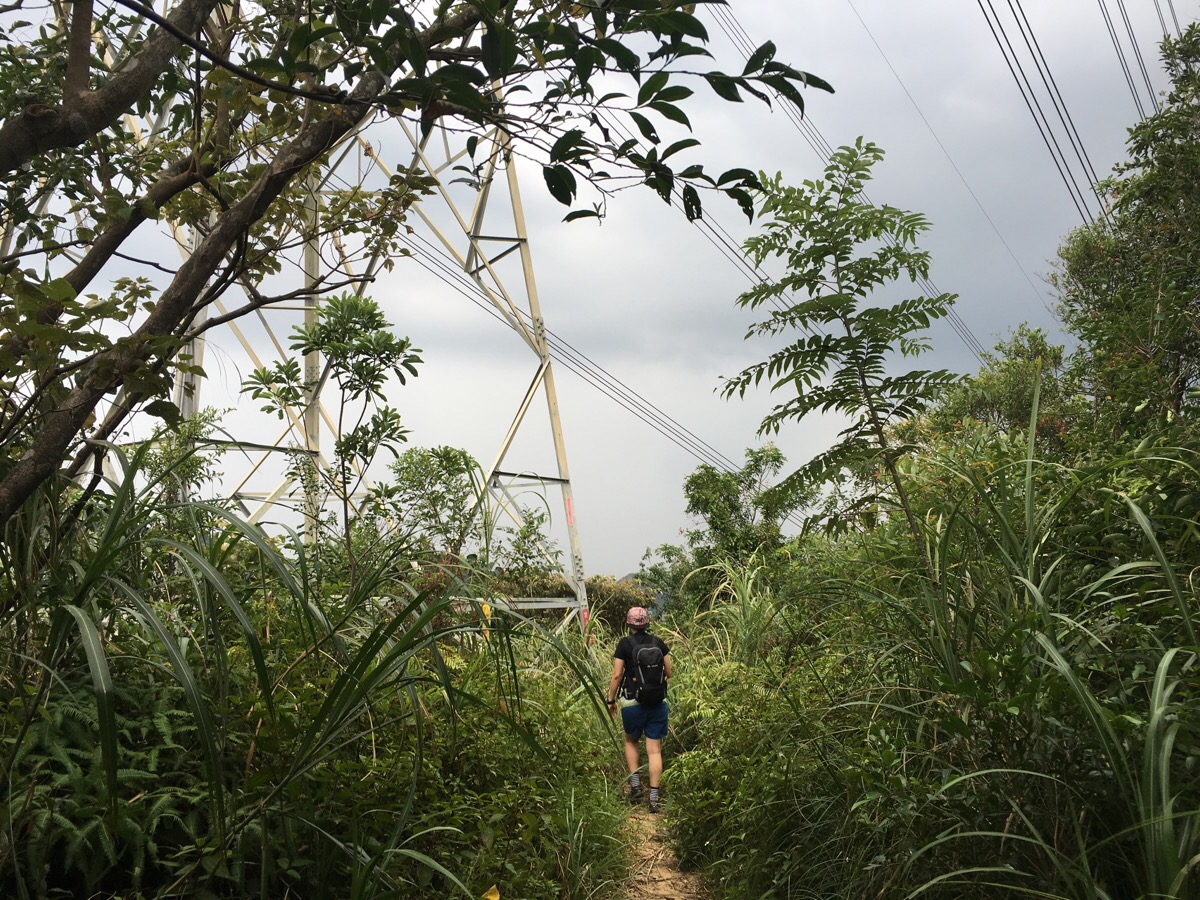
About halfway down we abandoned plans to swim and instead focused on just getting down as quickly and safely as possible – the path continues down weaving under electricity pylons and cables and we really did not want to be there if the weather turned nasty.
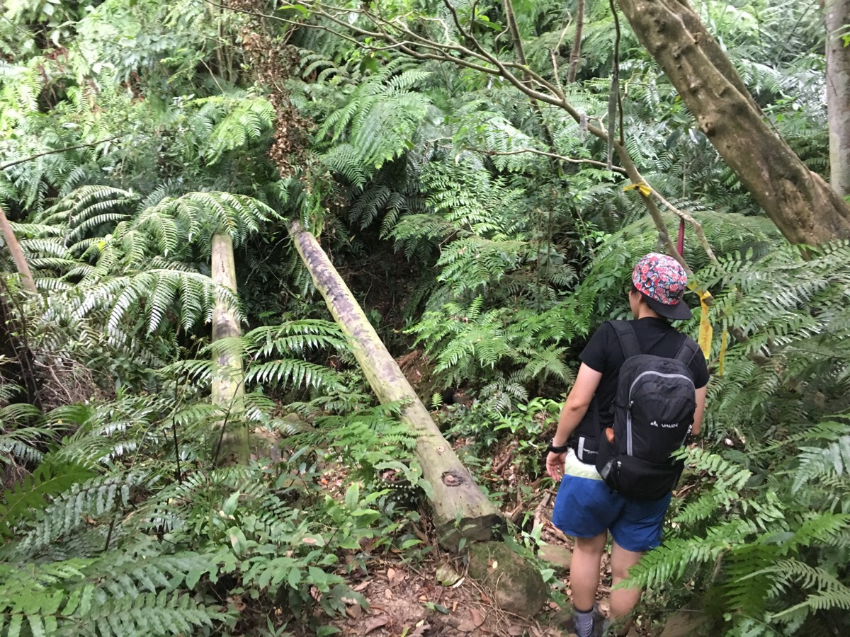
At another stream crossing there is evidence of an old bridge but the cross slats had rotted away so we went down and under.
At an unmarked junction, we kept right, I wasn’t sure if the trail on the left was a dry stream course or a path but if was defined enough to require a choice. By this point, the thunder was getting louder and we’d seen the first signs of lightening we were starting to get quite nervous – we were still more than a kilometre from the road and there really wasn’t any shelter if we needed it, none of the big boulders that we’d seen on the way up, just trees.
At the next junction, we wanted to go right – it was marked on the map as a shorter route and the signpost suggested it was a trail, but after heading down a short way we found that the path actually cut through private land, there were big signs warning people not to trespass and barking dogs seemed agitated by our presence. We turned back and it started to rain but it was just a light drizzle. For the next 400m or so the rain held off, the same can not be said for the thunder and lightning – terrifyingly the storm had moved right above us and we had no choice but to keep moving down towards somewhere where we might find safety or shelter. I’ve seen how changeable weather can be here many times, but I’ve never before experienced it’s fickleness in such a firsthand and panic-inducing way – we’re generally pretty good at being over-prepared, checking the weather, taking more food and water than we think we need and planning ahead, but this time I can honestly say that our safe return was purely down to luck. 600m from the road, the rain started for real. It was super heavy, clothes-soaking rain and before long our clothes were clinging to our skin and our hair plastered to our faces, Teresa’s glasses became more of a hindrance than a help and the path became a small stream. We were so fortunate that we were nearly at the road – it seemed that the path must have been quite frequently traversed, perhaps by a small vehicle because the ground was compacted and hard and because of this we were able to keep up quite a quick pace without too much fear of slipping. Also, with the arrival of the rain, the thunder and lightning seemed to stop and after the terror of seeing forked lightning close by through the trees I welcomed the wet shock of the rain.
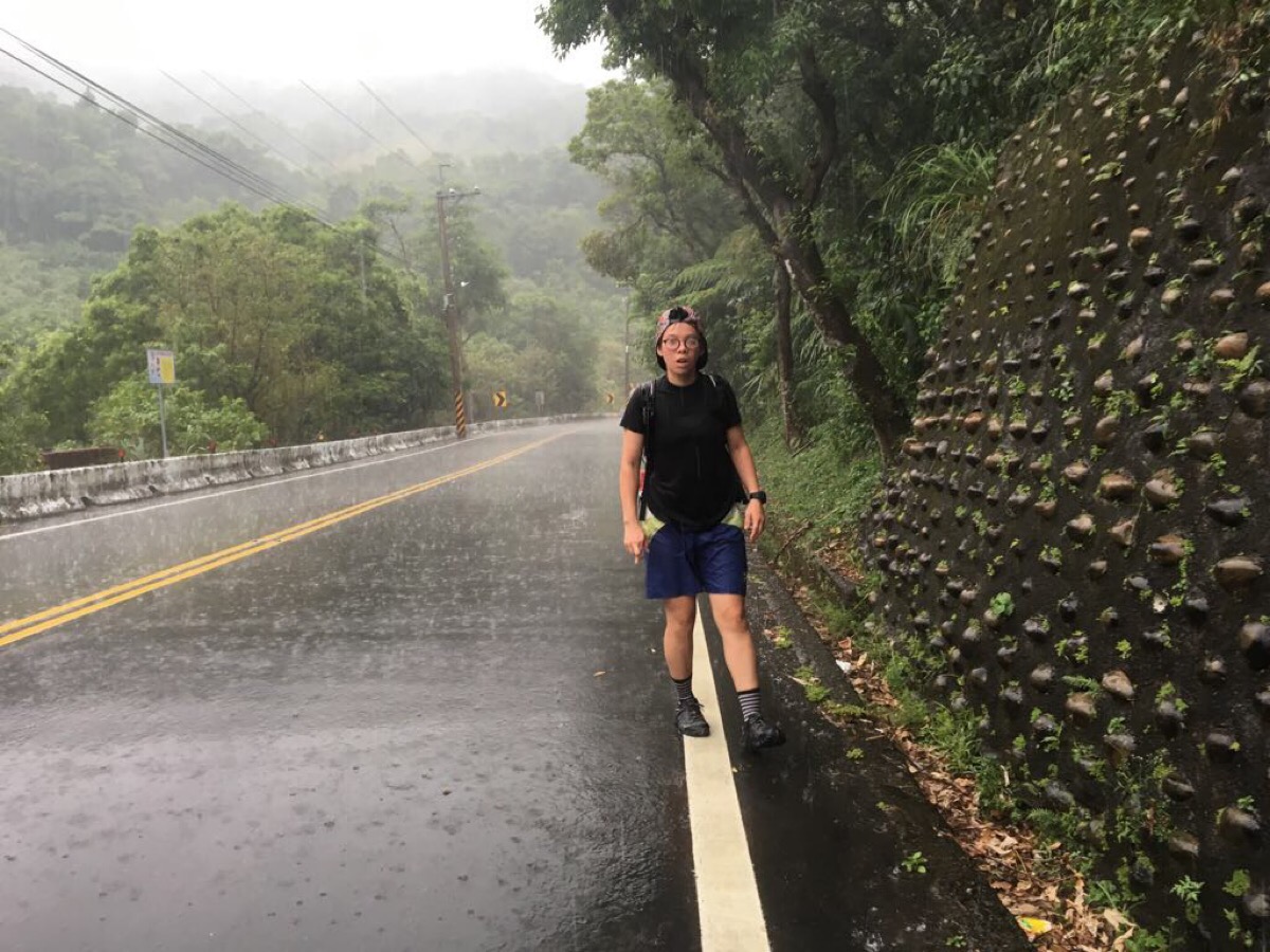
Bursting out onto the road induced a flood of relief. There was a building on the left but given that the worst of the storm had passed and we were already soaked, we decided to just turn right and head back to where we’d parked. It had taken us less than an hour to get down from Meng Hu but it had been an extremely challenging 50 minutes.
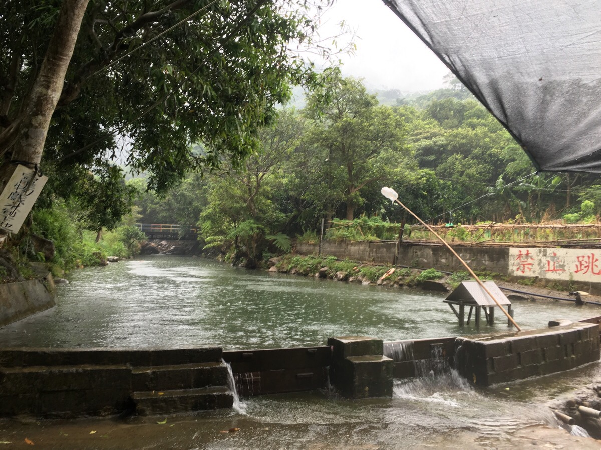
When we arrived back at the car, the rain had all but stopped (what looks like rain in that picture is actually just the water dripping from the tree which overhangs the pool), and there’d been no thunder or lightening for about half an hour and after being reassured by some locals that it was ok, we decided to continue with our plan with take a dip in Kezilin pool. We’d brought clothes to change into but we’d gotten so wet that we both just swam in sports bras and the trousers or shorts we’d walked in.
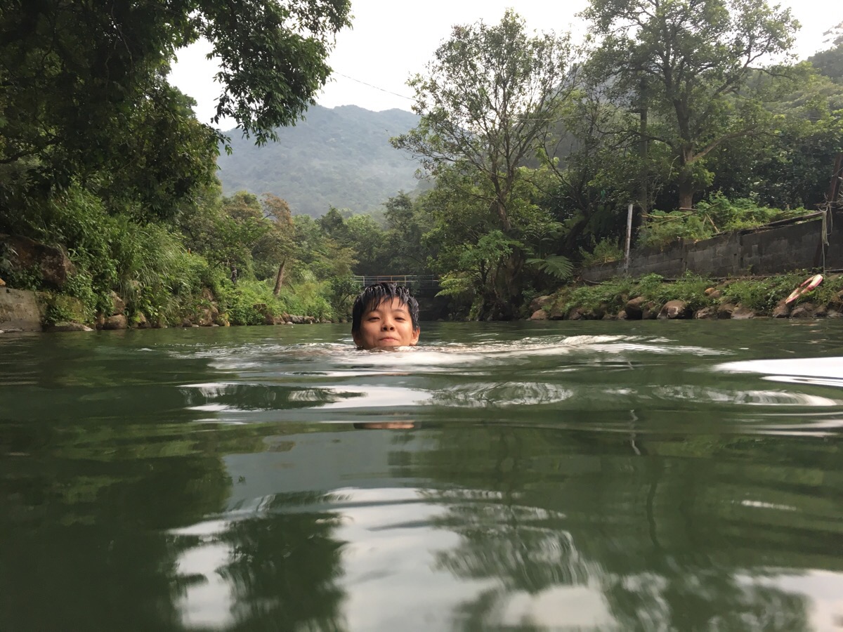
I’m so glad that we did. As we swam with the one local who had returned after the storm, the weather lightened further, the clouds moving away to reveal a blue sky. The water and the feeling of being surrounded by fish, mountains and quiet helped to soak out the adrenalin and fear of the past hour.
To avoid being in a similar situation, the best thing to do is to be familiar with the local weather patterns, (for example, Taiwan often has hot, dry mornings and then big afternoon storms in the summer months), and make a habit of checking the weather before setting out for a walk – just don’t go if rain is forecast. Also, don’t as a general rule it’s a very bad idea to get in a watercourse here after heavy rain – flash floods are a common occurance – so don’t do that either! But if you do get caught out in a storm:
- Find cover as soon as you can – if you’re near civilisation just get inside a large structure. Buildings with plumbing and electricity are better since they will help ground any potential lightning strike. Bigger buildings are also more likely to be constructed with lightning rods. Once you’re inside, avoid windows, phones and using water as these all raise the risk of lightning being conducted into the building.
- If you’re not near a building but you are near your car then get in your car. Since cars tend to have a metal body, the electricity can be conducted by the frame around you and hopefully not into you. Make sure to close all windows and doors and keep yourself away from all the metal parts. Don’t turn on the radio.
- If you can’t find a building or a car then your best bet is to seek shelter in a stone structure like a cave or under a big rock. Avoid standing under trees because they are tall and likely lightening attractors – the same goes for electricity pylons and wires (we were really, really screwed, no shelter, just trees and pylons). If you’re in water then get out right away. If there’s nowhere safe, make your way to lower ground since lightning is more likely to strike higher places. If none of the above works and you’re totally exposed like in a desert or on a beach then your best bet is to crouch down and try to make yourself lower than any surrounding features and simply hope that you don’t get hit.
I know hiking is an activity which comes with many risks, especially in a place with such wild hills and changeable weather as Taiwan, but being caught in a storm is not an experience either of us want to repeat any time soon. Hikers frequently run into difficulties and dangers here in all kinds of weather and situations so it’s important that we do all we can to be knowledgeable and prepared.
How to get to Kezilin Pool and Xin Shan
Google maps address: 柯子林天然游泳池, Section 3, Xiwan Road, Xizhi District, New Taipei City, 221 – this is the pool itself, there’s some parking here but you might not want to drive up here in a car because the road is rough and narrow. We parked out on the road.
GPS location: N25 06.974 E121 37.901
Public transport: this isn’t the easiest place to reach on public transport, but it’s possible if you don’t mind a bit of a walk (you could avoid the walk if you get a taxi to take you there but you’re unlikely to be able to find a taxi to take you back). Pretty much every option requires changing at least once. The most straightforward option is probably to take a train to Xizhi Station, (depending on where you’re based you could get this from Taipei Main Station, Songshan Station, Nangang Station or Xike Station). Once at Xizhi Station, you need to cross over the railway tracks and find the train station bus stop. Here you can catch either the 896 towards Nangang District Admin Center or the F908 towards Rui Shi Mountain resort – the buses are both pretty irregular (around once an hour) and the routes are almost the same.
My new words learnt on this hike:
- 龍蝦 / lóngxiā / lobster – we saw some prawn or crayfish-like things in one of the stream pools, they must have been nearly 10cm long with pincers.
- 摩擦 / mó cā / rub – translate says friction but when it was demonstrated to me it was definitely a rubbing kind of touch.
- 很愛對方 / hěn ài duìfāng / love each other – as in 我們很愛對方 / we really love each other.
- 馬上 / mǎshàng / immediately – I’ve heard this a lot recently but on this occasion, I heard it used in the phrase 馬上就好 – from context this translated to something kind of like we’ll be finished right now.
- 你自己看著辦 / nǐ zìjǐ kànzhe bàn / do it yourself – this is quite a rude phrase – comparable in strength to the same in English so it’s not something you want to go using with people you don’t know well.
- 藥局 / yào jú / pharmacy – the 局 is the same that you find in 警察局 / police station and 郵局 / post office.
Other resources:
- Bikehike Taipei did the walk almost in reverse, from Meng Hu down to the pool and offer a continuation.
- Rich Saunders uses Meng Hu as a jumping off point for a quick scramble up Xin Shan and talks about how the place has changed in his years here.
Kezilin Pool and Xin Shan Trail Map
GPX file available here on Outdoor Active. (Account needed, but the free one works just fine.)
