Distance: 10.1km
Time: 7 hours
Difficulty (regular Taiwan hiker): 4.5/10 – Steep, but not too tough.
Difficulty (new Taiwan hiker): 6.5/10 – It’s kind of long for a steep hike but actually, this wasn’t really all that challenging compared to others we’ve done, there were no ropes, no real scrambling and although the signs were all in Chinese, it would be difficult to get too lost.
Water: I made my way through a little under 1.5L – it’s quite high so it’s a lot cooler than hikes lower down, this meant I had make sure I was drinking enough.
Shade: Mostly shaded but I got a little pink during our stay at the top – I had suncream on but the coolness of the air makes it easy to forget about the sun.
Mobile network: It disappeared in a few patches but mostly ok.
Enjoyment: Interesting history, great flora and fauna, not so much in the way of views though.
Other: This is the long route up. There is a much shorter route which reaches Lidong Shan and the fortress from a different starting point. Information on that other walk can be found here.
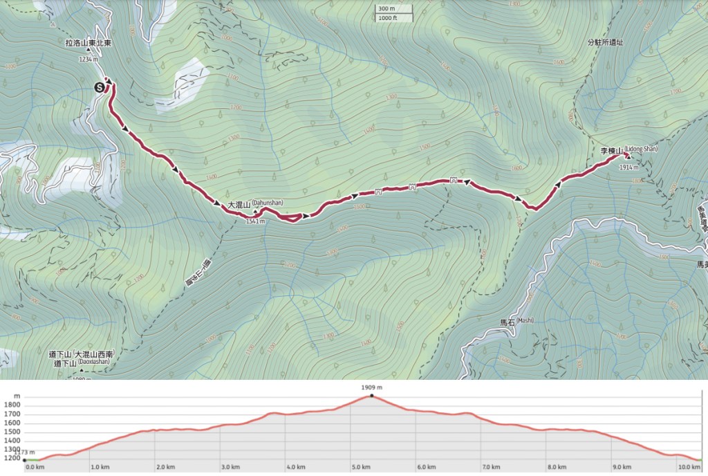
Lidong Shan Trail Map
Link to download to a GPS device can be found here.
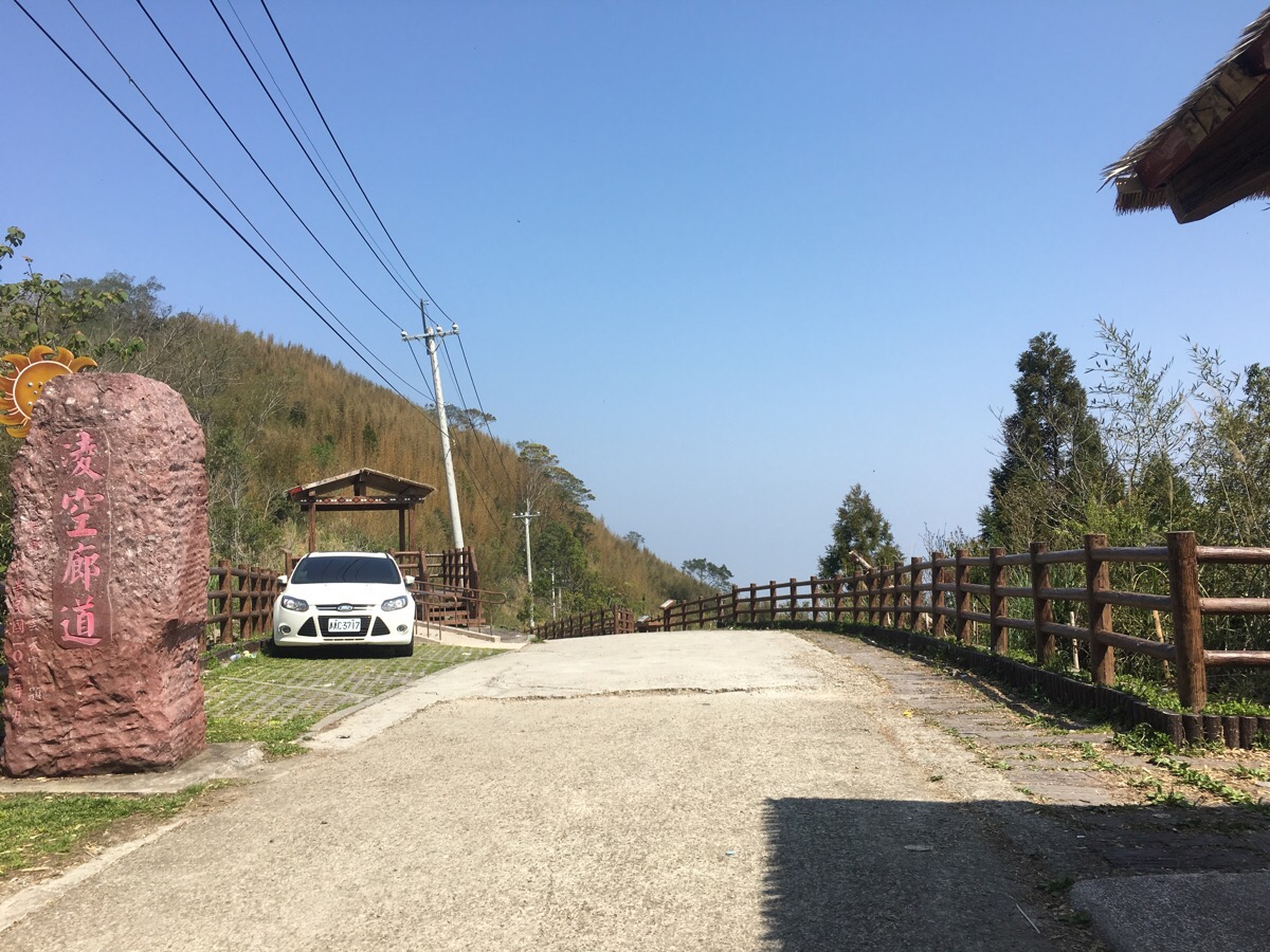
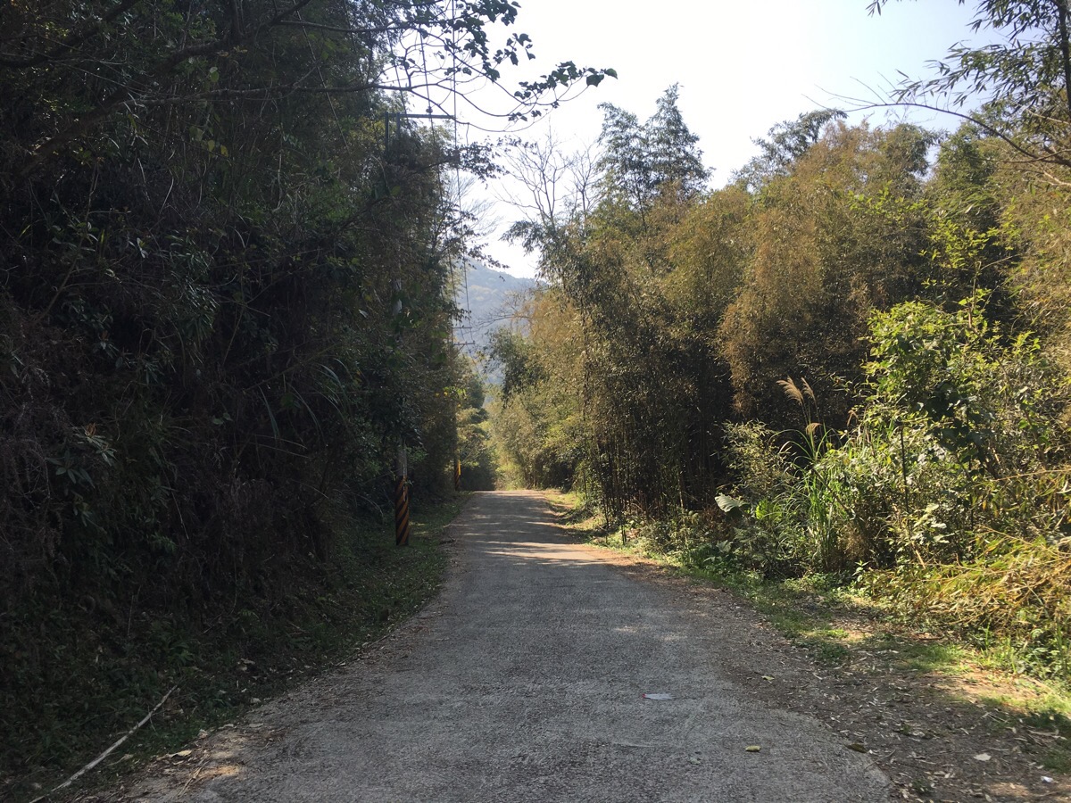
We parked up at about 9.30, it was a little later than we were planning to arrive, (and just about the latest that I’d want to start this hike in order to get back to civilisation with a comfortable window of daylight). We stopped a little way up the road from the trail entrance next to a viewing platform and small shelter.
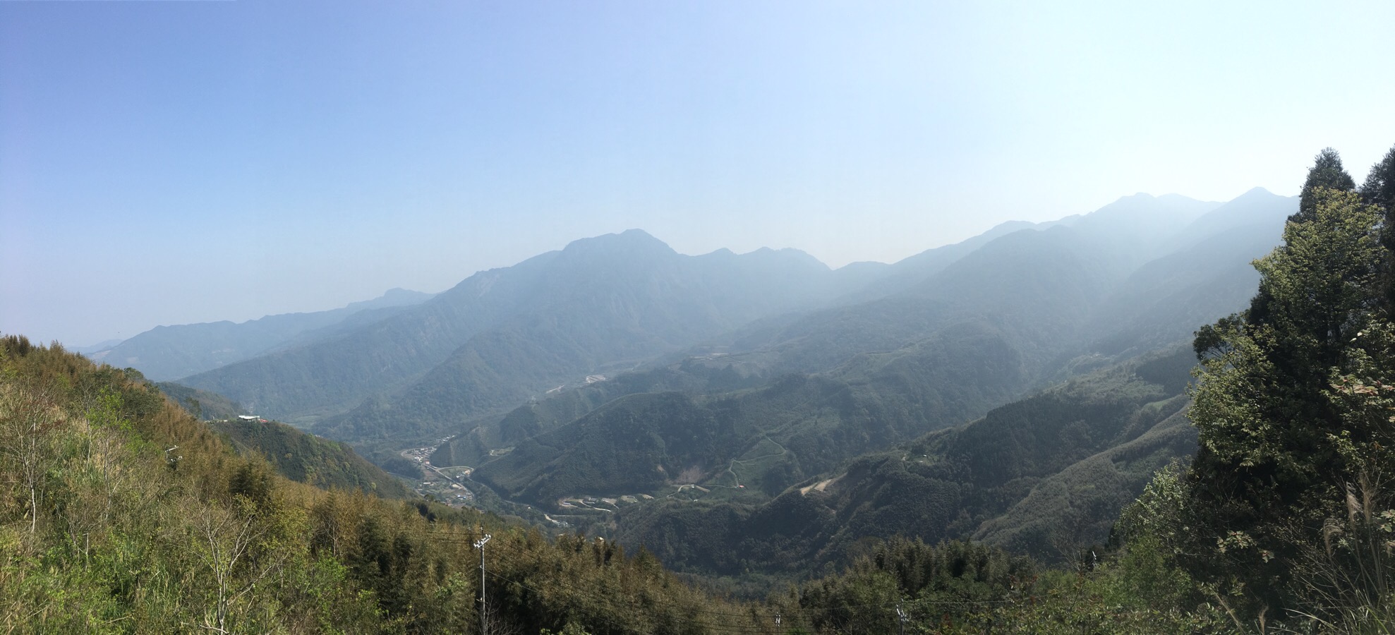
This location is listed as 凌空廊道 on google maps and it really is a lovely view, perhaps the best view of the whole hike.
With a few changes to clothes and bags double checked, we set off southish and downhill.
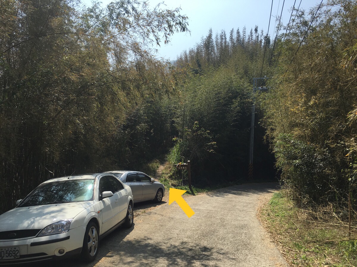
After about 150m we reached the actual trail entrance, it’s marked with a proper signpost which says 往李棟山 (to Lidong Mountain), as well as scores of hiking group tags.
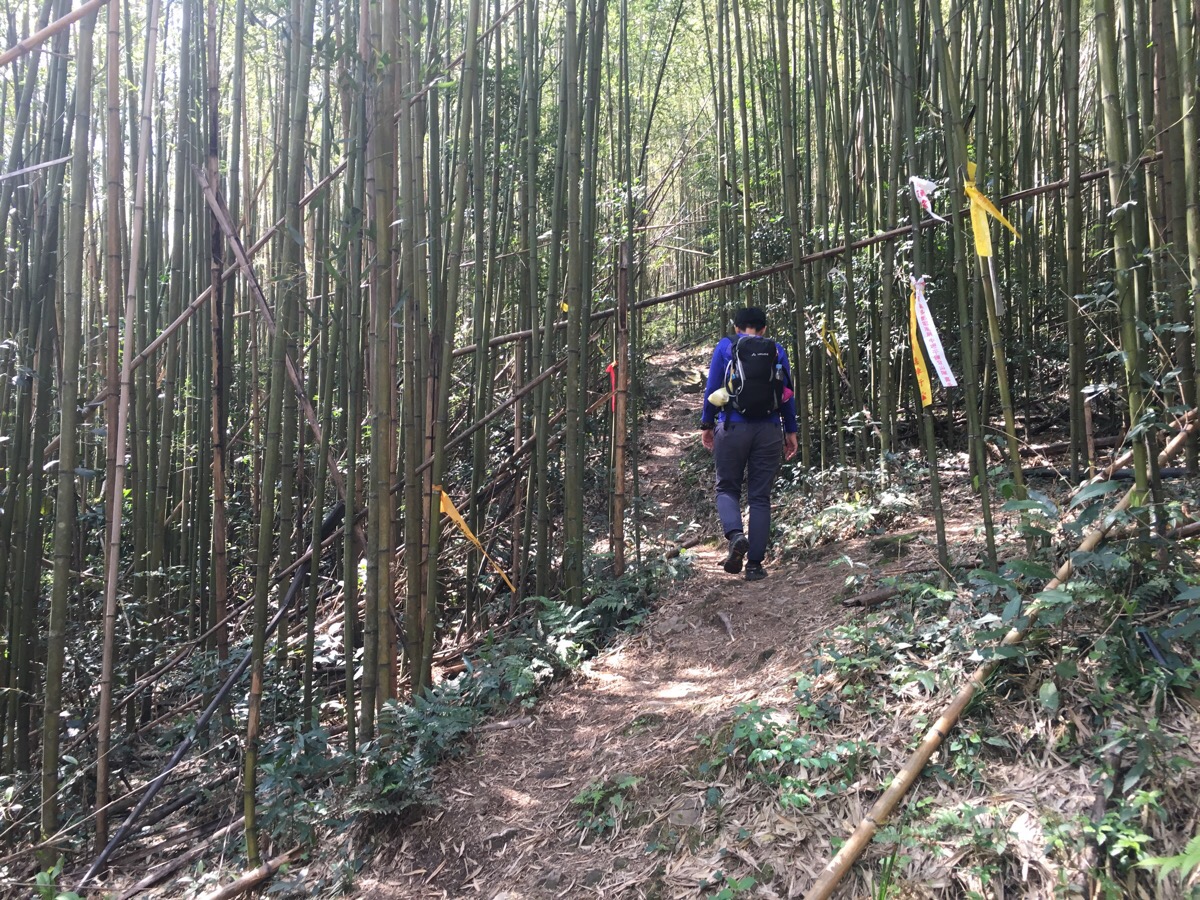
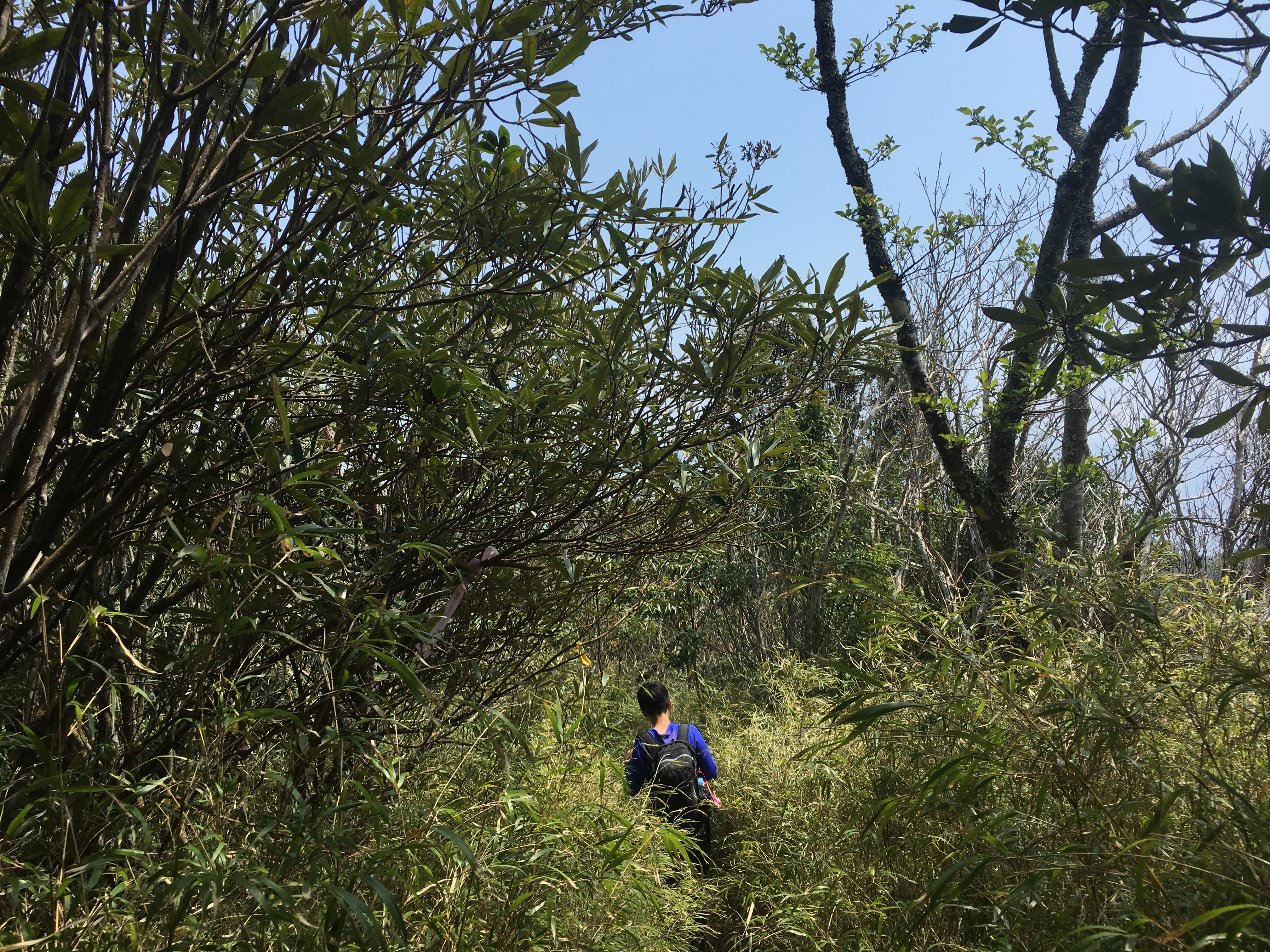
The first couple of hundred metres followed a rough track but that soon ended and we started climbing up into a bamboo forest.
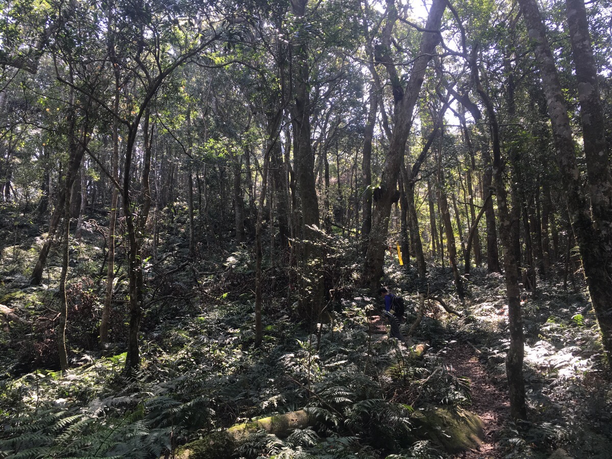
Bamboo quickly gave way to a landscape that looks more what I recognise as forest (being from the UK, bamboo will always look a little strange to me in such large patches). And for almost an hour there were no diversions, just a path up the spine of the hill. We passed a group photographing the flowers (this type of forest is a perfect place for flower spotting), and heard some really noisy birds chattering amongst themselves.
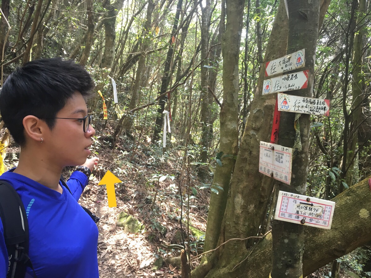
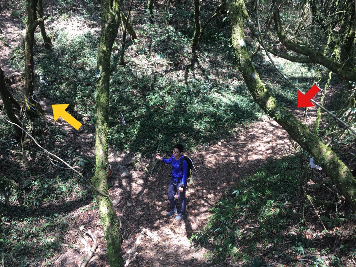
After a little less than an hour we reached the first junction. We followed the sign pointing towards 大混山/dahun shan. The sign pointing to where we’d come says 八五山/ba wu shan and 哈勇農場/hayong nongchang (a farm and campground which seems to have closed down). And the third sign says 西南稜隘勇支線 and 到下山 (大混山西南峯), this is an alternative route down the mountain – I’m not sure where it comes out.
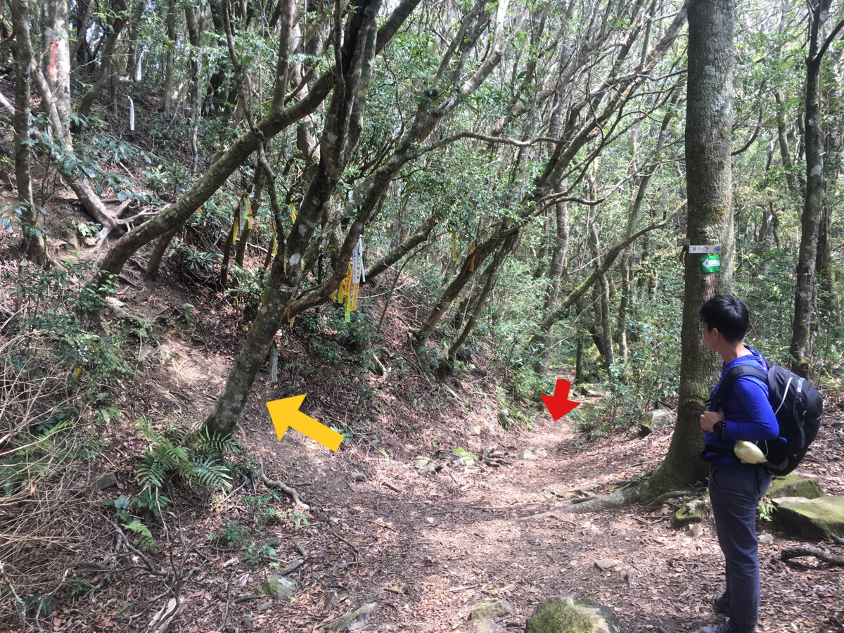
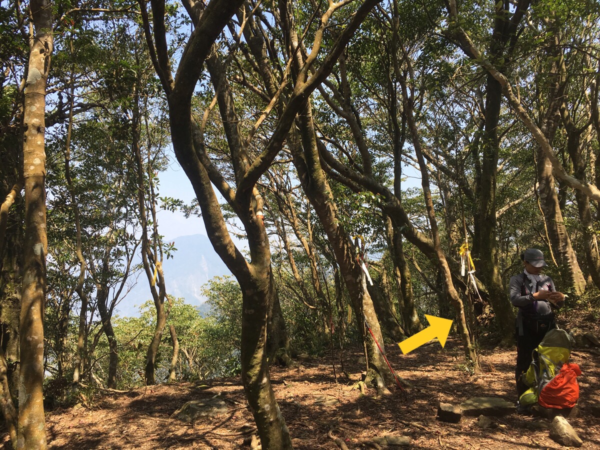
Eight minutes after leaving the junction we reached another junction. This time the signs were clearer. Left up to dahun shan, straight on to lidong shan and right to a gap in the trees with a good view. (You don’t need to go up to dahun shan, you can keep going straight to take a brief shortcut – we came back via this shorter route indicated by the red arrow.)
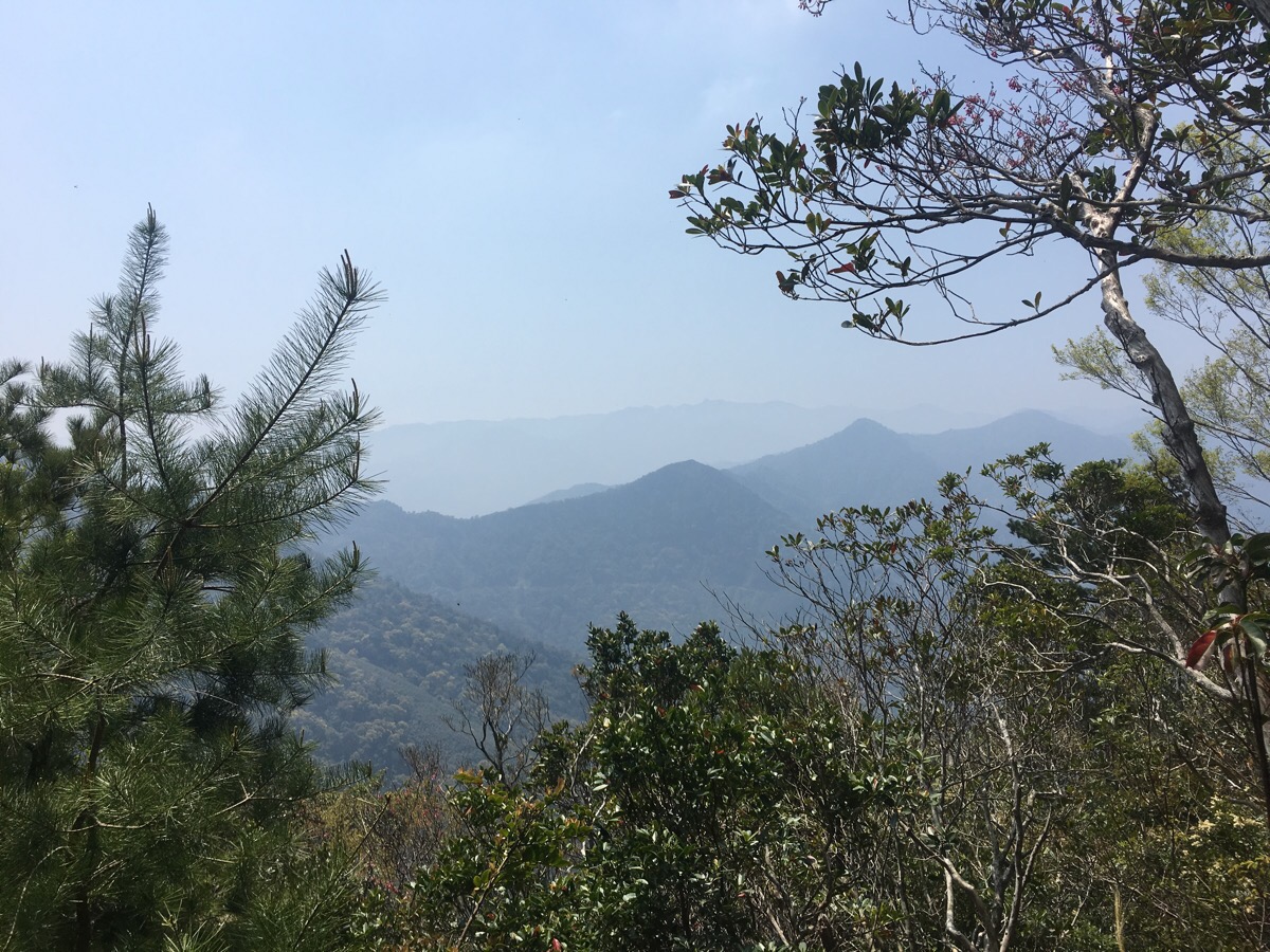
We took a quick look at the view, I’m not sure where these mountains were, they were southwest of us – pretty much everything in that direction is mountain for miles and miles.
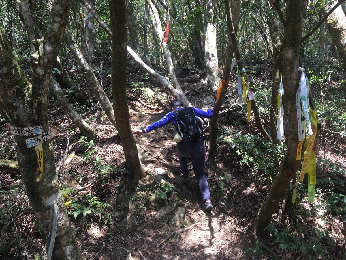
After enjoying the view we took the lefthand path up to dahun shan.
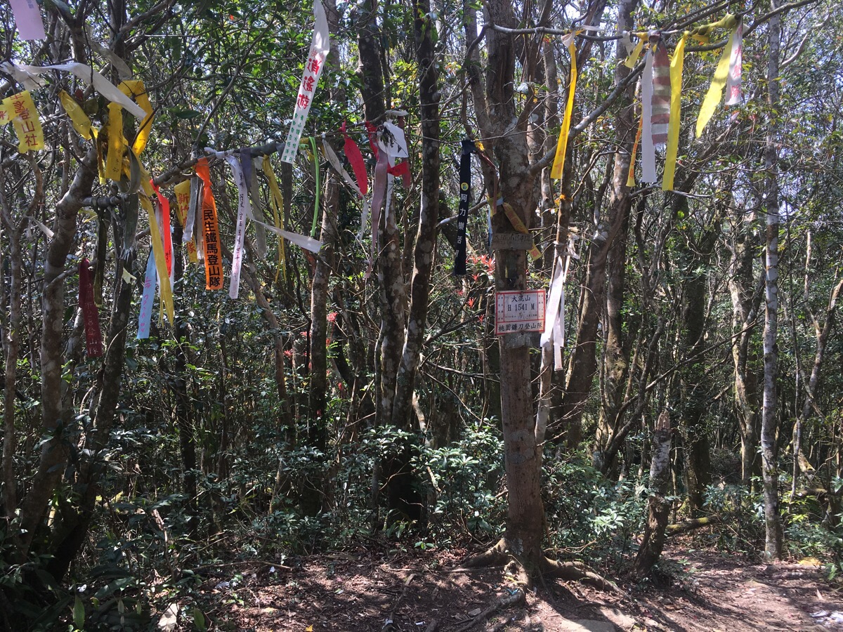
The sign indicated it would take only another four minutes and we did it in three. (By now we were about an hour and 15 minutes into our walk). It wasn’t the most exciting summit that I’ve ever summited, a clearing with a trig point and loads of hiking tags.
We didn’t stay too long, just long enough to catch our breath and then it was off again. The path continues through the opposite side of the clearing.
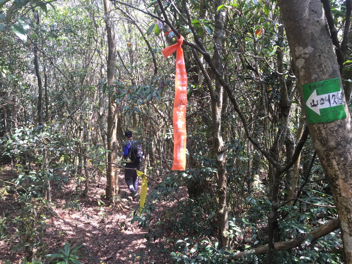
Only a couple of minutes after leaving the top we rejoined the shortcut and continued straight following the sign to 李棟山, this sign said it would take another 80-90 minutes to reach lidong shan but this is way off the mark, another sign about half an hour later also said 90 minutes and that was more accurate.
Five minutes later we met another false junction, again this one is two trails headed in the same direction, one goes alone the ridge, the other goes just along the side of the ridge. We went along the lefthand path (it’s flatter), but they join up after another five minutes or so.
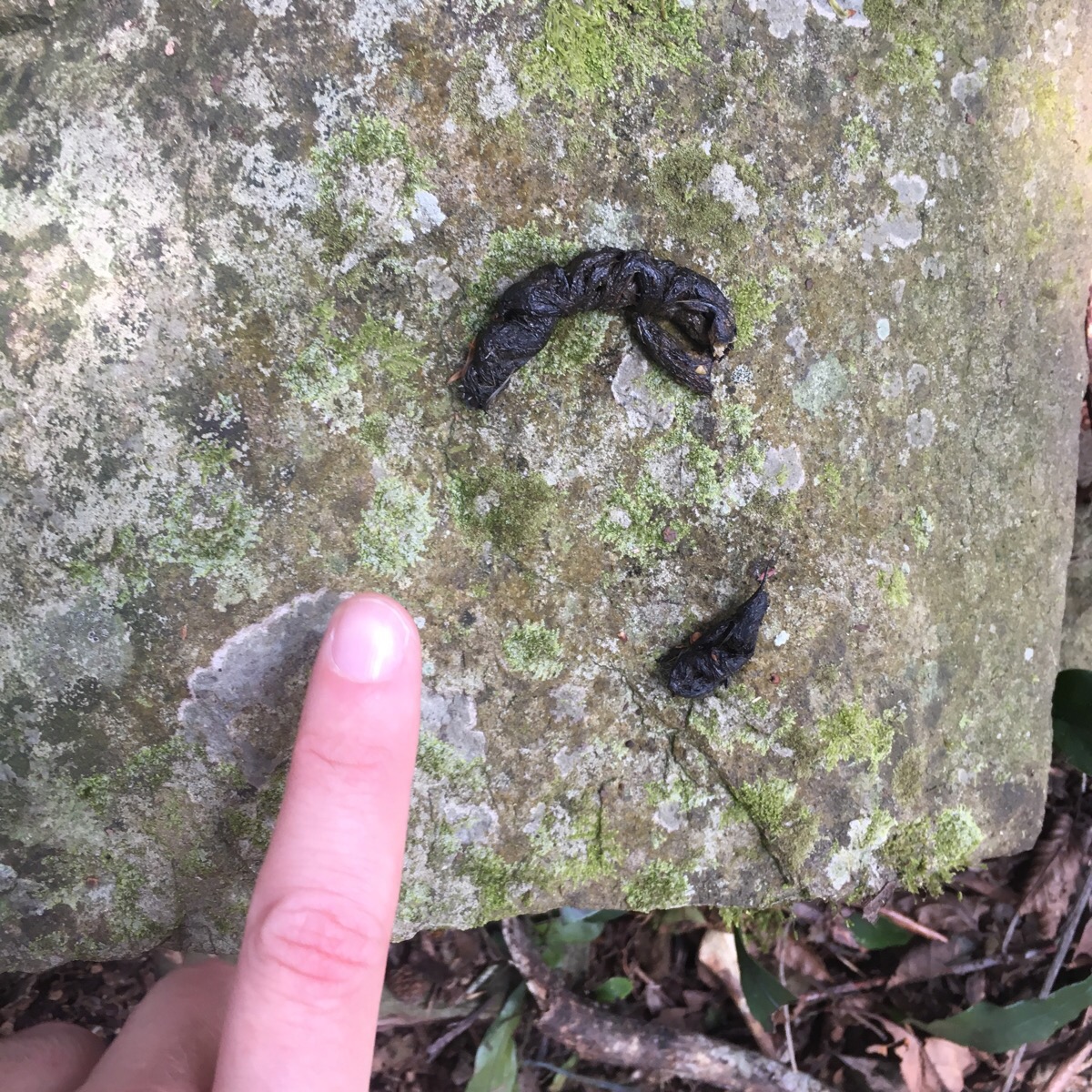
As we climbed up through the forest I saw a few of these, something had clearly been marking territory by doing its business on the rocks. If I saw this in the UK my first guess would be fox, but it’s too small to be a fox and Taiwan doesn’t seem to have foxes so my second guess would be a weasel or stoat or something similar, however after a little research it seems that Taiwan’s two types of weasel are both primarily meat eaters which rules them out since there are seeds in this poo. Of the other animals found in Taiwan which make a habit of leaving territorial scat and are omnivores, I could only really come up with the yellow throated marten (黃喉貂 in Chinese). However, I’m not convinced that’s the right answer either. If anyone is a scat expert I’d like to know what you think.
About 25 minutes after leaving dahun shan (nearly two hours into the hike), we arrived at another small clearing. This seemed to be a staging post for the next upwards burst and we found a woman here taking a rest and having a snack. In Taiwan it is pretty uncommon to find someone hiking alone on these wilder trails and whenever we have encountered them it has always been a wiry, old ah-bei in wellies, skipping his way over rocks and tree roots as if he was a mountain goat in another life. This was the first time we’d encountered a solo woman. In fact on this walk woman outnumbered men on the trail for the first time in my experience. Only seven people walked this route on that day and five of them were women.
We didn’t stop long and headed onwards and upwards.
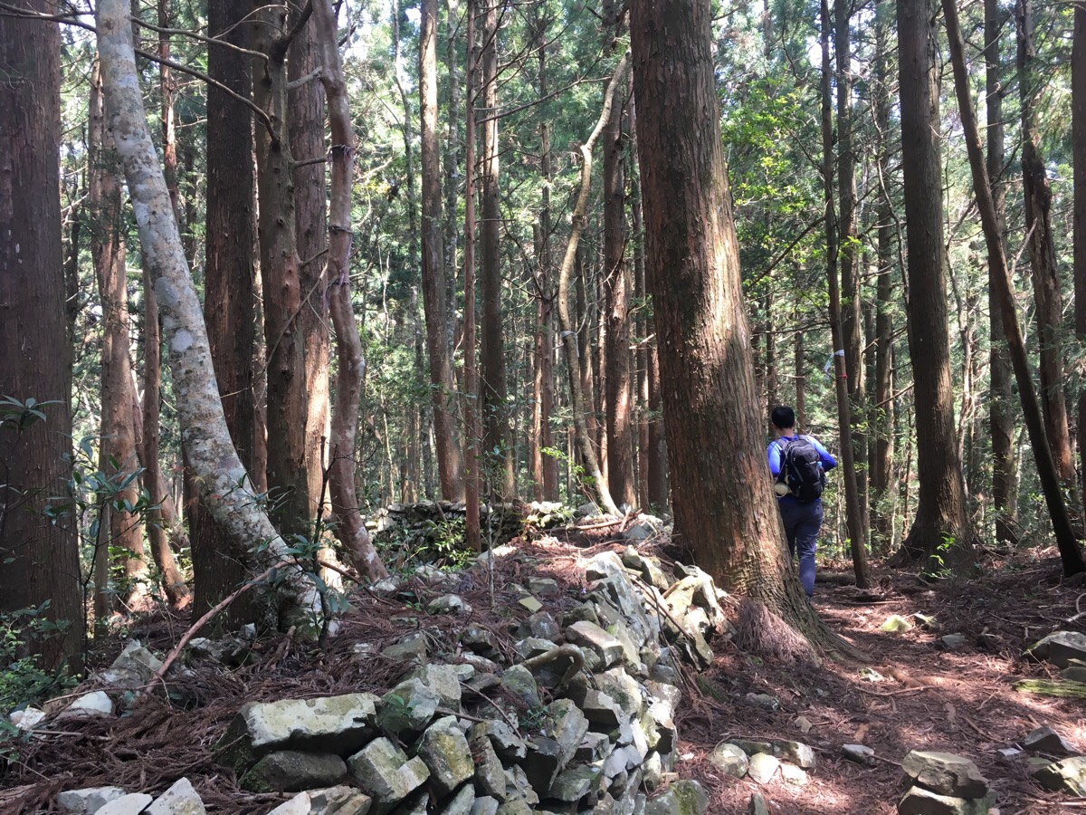
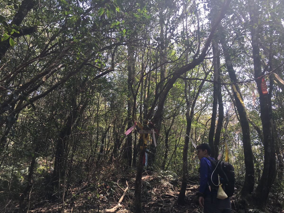
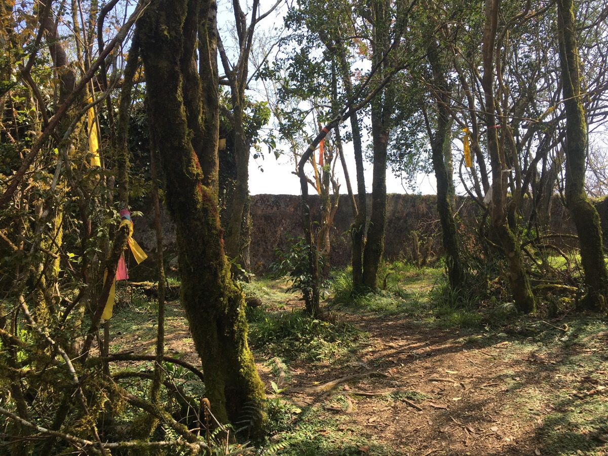
Almost immediately after leaving the clearing we found ourselves surrounded by signs of this place’s history. Dry stone walls snaked through towering Japanese cypress trees, both signs that the area had previously been occupied.
There were two areas with signs of previous habitation, one was just a series of low walls, the other was a kind of platform. It would have made a good place to camp if it didn’t remind me too much of the ghosts that inhabitants. As we made our way up there were even signs of visitors from modern times – a campfire still fresh enough to smell faintly of woodsmoke with all of the outdoor chef’s things just left there, an empty tin of something, disposable chopsticks (and their wrapper), a takeaway bowl of rice which hadn’t been finished. Littering is a real problem on the trails here, we could easily fill a rubbish bag with each hike we do, this time it looked too awful to ignore and we collected it up in our own rubbish bag to take back down.
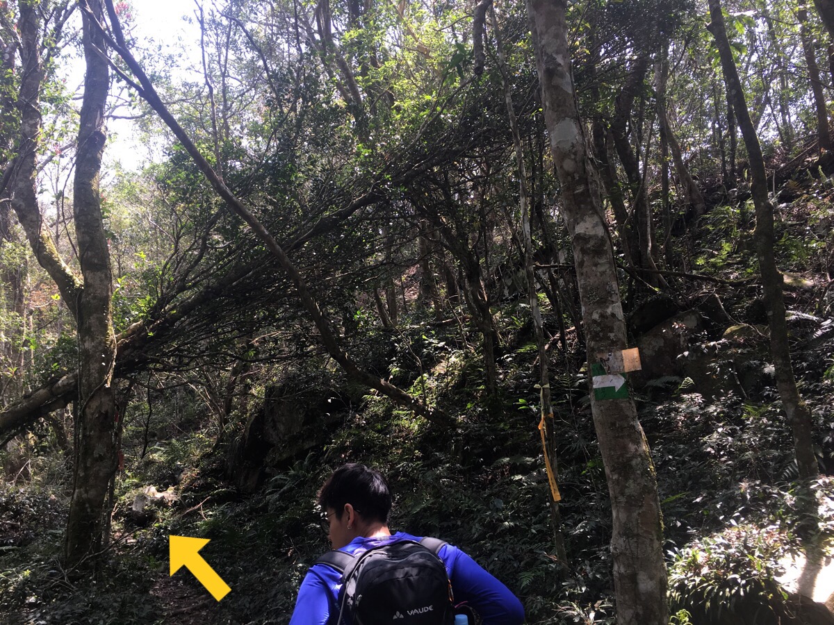
If you look on the map there is what seems to be small peak just before the two ridge lines leading up to Lidong Shan merge. At this point the cypress drops away to be replaced with over-enthusiastically growing bamboo. At times it was easier to duck down to pass through the tunnel to avoid being slapped in the face by lots of leaves.
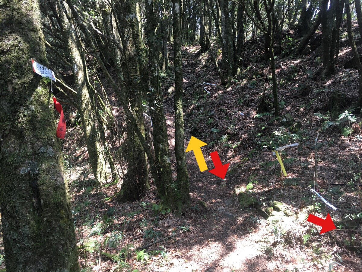
The bamboo was soon replaced by the kind of rhododendron forest that you find all over the mountains at this elevation and there was another junction about 7 minutes down from the peak, (at this point we were 2 hours and 20 minutes into the hike). I think this must have been the junction where the two ridges merge, left went up towards Lidong Shan and right went down, (I forgot to check where to). A few metres up from the junction I heard a noise in the undergrowth and turned to see a couple of coils of striped tan and brown snake disappearing from view.
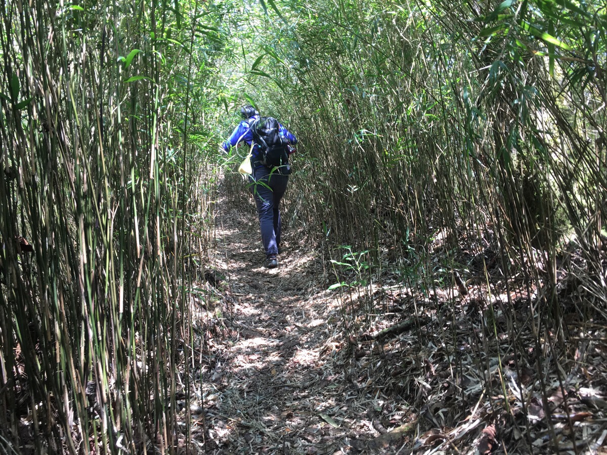
There was more bamboo tunnels to walk through – this time the experience was even less pleasant since I’d recently been reminded of the snakes that must be lurking all around.
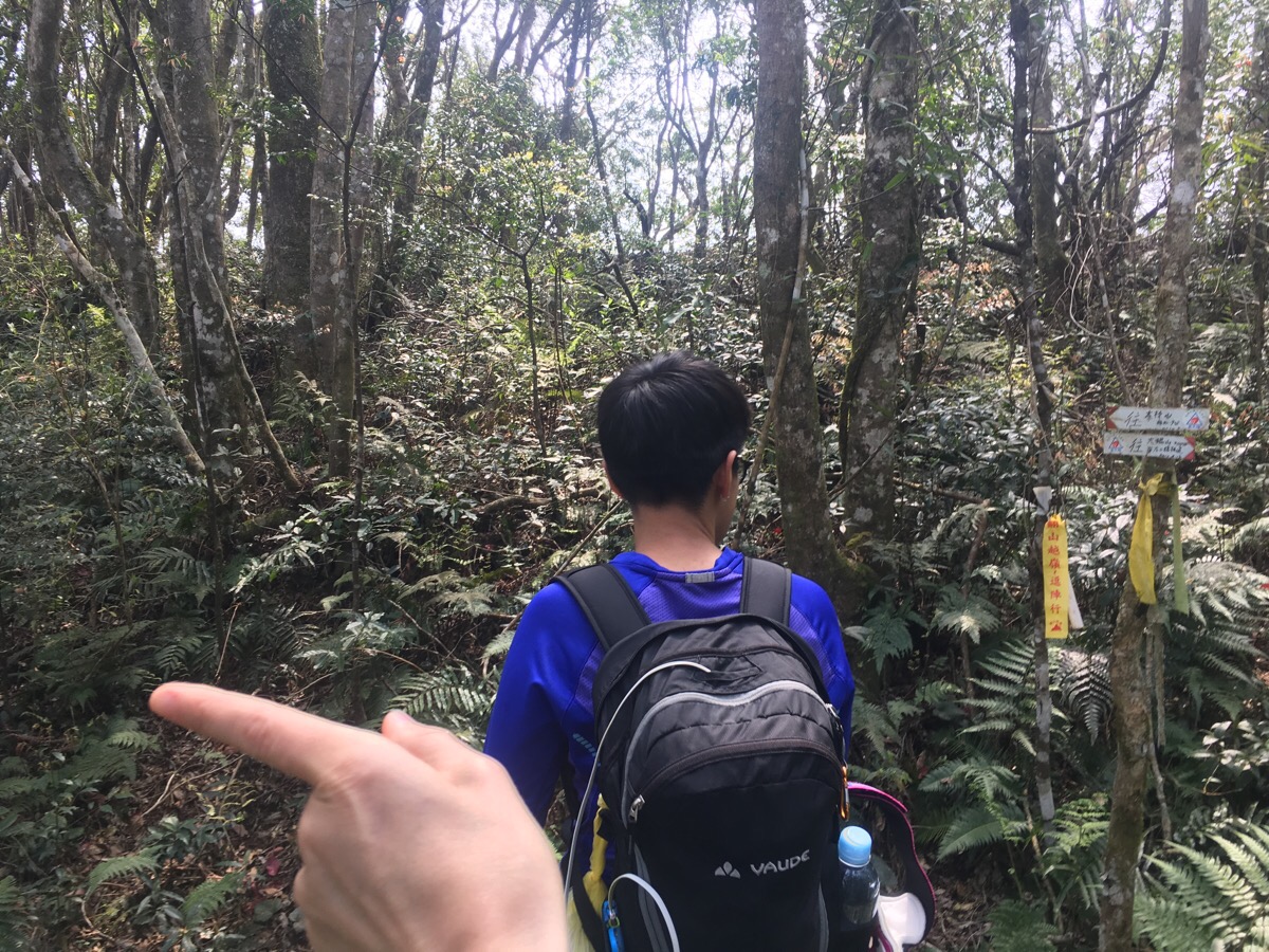
At the next junction we had the choice to go left or right, both headed to the same place. We took the left route which looked to be the steeper of the two – this route passes an old grave marker which I imagine must date back to the Japanese occupation of this place. One of the signs also indicates that this trail goes towards 鳥嘴 which I take to mean the nearby Wainiaozui hike.
The trails merge again after about five minutes and we continued up where the sign directed us to 李東山.
From this last junction it was a little over ten minutes until we reached the fort. In total it took us 3 hours and 40 minutes to get up here.
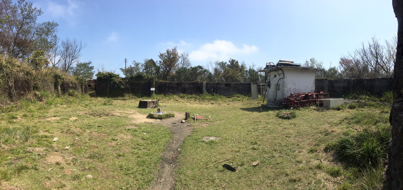
We were quickly joined by the woman we’d passed a while back and another couple who’d come up the short way. Four walls with small windows are all that’s left of the fort as well as a more modern weather station – some information on the location and its history can be found here.
We ended up staying for almost an hour, (it really didn’t feel like that, I thought it was only about half an hour), and once we’d eaten our snacks we packed up and headed back down the same way we’d come. We left the fort at 2:30 and we’re back at the car at about 5pm. On the way down we took a couple of the alternative routes and passed all five of the other people on their way down – we were (for once) the last to start hiking and the first to finish, the group of four didn’t make it up all the way, I think they’d come to photograph the flowers more than they’d come to hike. It felt kind of special to be one of such a small group exploring this corner of the world for a day.
How to get to Lidong Shan
Google maps address: 凌空廊道, 313, Hsinchu County, Jianshi Township, 錦屏村 – this is the scenic spot where we parked, just a short way up from the trailhead.
GPS location: N24 41.988 E121 15.744
Public transport: not really, it’s a little bit out of the way.
My new words learnt on this hike:
- 警察局 / jǐngchá jú / police station
- 適合 / shìhé 你 / suit – as in 那個裙子很適合你 / nàgè qúnzi hěn shìhé nǐ / that skirt really suits you
- 拉 / lā / pull
- 不好意思跟你點嗎?/bù hǎoyìsi gēn nǐ diǎn ma? / excuse me, can I order with you? ( Learnt on the way here when I went to order a rice roll and wasn’t sure who was a customer and who was staff – without anyone to help me I ended up reaching for words that I knew and I asked the guy 你在賣嗎? / nǐ zài mài ma? the words mean are you selling? but apparently this can have the implied meaning of are you selling sex? Thankfully the breakfast shop guy interpreted it the way I had meant and I got my fantuan without any extras.
- 露營車 / lùyíng chē / campervan
- 太陽 / tàiyáng / sun – I have learnt this word several times, somehow it keeps slipping away.
- 纖維 / xiānwéi / fibre – I heard someone in the group we passed talking about fibre in sweet potato
- 混帳 / hùn zhàng / bastard or jerk – the day before this hike I’d found some ‘vegan jerk’ in a shop – it was actually vegan jerky, but the absence of a ‘y’ gave me a few chuckles. Then the mountain we climbed had the same character in it’s same 混, so it got changed to 大混帳, big jerk.
- 混 / hùn / mixed – as in 混種的狗 / hùn zhǒng de gǒu / mixed (breed) dog
- 意外 / yìwài / accident
- 滑倒 / huá dǎo / slip (down) – maybe it can be used like this 竹子害你滑倒了 / zhúzi hài nǐ huá dǎo le / the bamboo made you slip over
- 蟑螂 / zhāngláng / cockroach

I think you are a hardy hiker! Have you visited Canada? Of course, Rocky Mountains and various national parks are recommended.
LikeLiked by 1 person
Thanks for the recommendation, I would love to hike in Canada, it’s definitely on my list of places that I want to get outdoors in. (Although I am not as hardy as you might imagine, both the cold weather and rise of encountering bears are two things I worry greatly about.)
LikeLiked by 1 person
There are certain areas where there are more hikers and you’re all still in great wilderness. That would scare off enough bears. You’re welcome to ask me any questions. Vancouver also offers some trails on the North shore. Am also living city just 120 km. southeast of Banff National Park which includes Lake Louise area. Fall is a great time or early July. You should try snowshoeing one day. You’ll love it.
LikeLike