Jiali Shan – One of Miaoli’s Top Day Hike
Distance: 7km
Time: 6 hours and 45 hours minutes. It took us about 3 hours to go up, we spent half an hour at the top, and then took a very leisurely 3 hours and fifteen minutes to get back, (this included a sweet potato break and about 20 minutes by the stream).
Difficulty (regular Taiwan hiker): 3-4/10 – some climbing, reasonable elevation gain.
Difficulty (new Taiwan hiker): 5-6/10 – it starts off not too difficult but gets progressively harder as you near the peak.
Water: 1.5L – actually I drank a little over a litre but I wanted more when I got back to the car.
Shade: the first part is beautifully dappled but as you break out above the forest the shade disappears.
Mobile network: almost none from the moment you step onto the trail.
Enjoyment: Just walking through a forest this big and this is impressive enough, but then add in the wildness of the trail (the walking surface is almost entirely unconcreted and the signs are far enough apart not to appear intrusive), three types of habitat, some exciting climbing and an amazing view at the top – it definitely deserves full marks.
Other: pack enough food to keep your energy levels up and you’ll probably want to take gloves/hiking poles. I took gloves and found them very helpful but I saw others using poles instead – whatever your preference is.
GPX file available here on Outdoor Active. (Account needed, but the free one works just fine.)
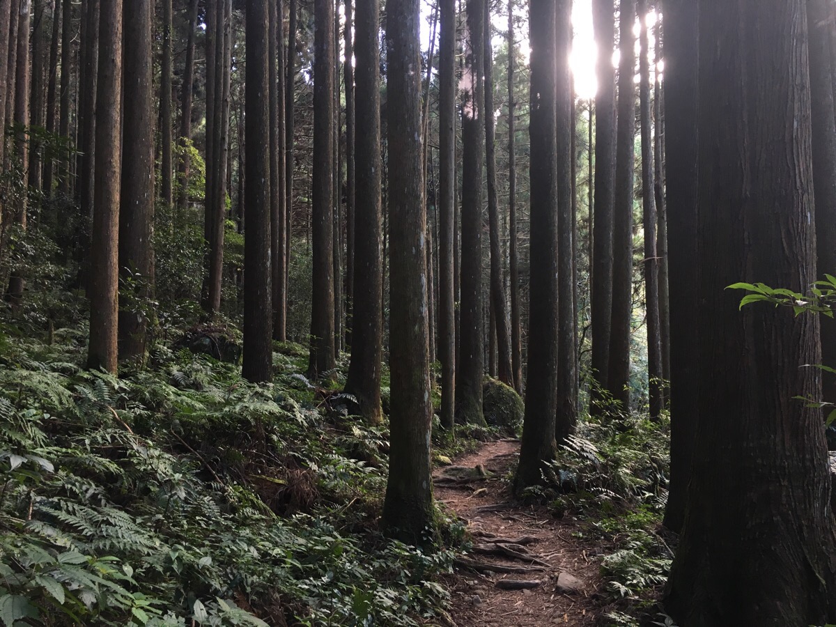
The walk starts at the top of the parking area and immediately you are surrounded by magnificent, tall Japanese cedars.
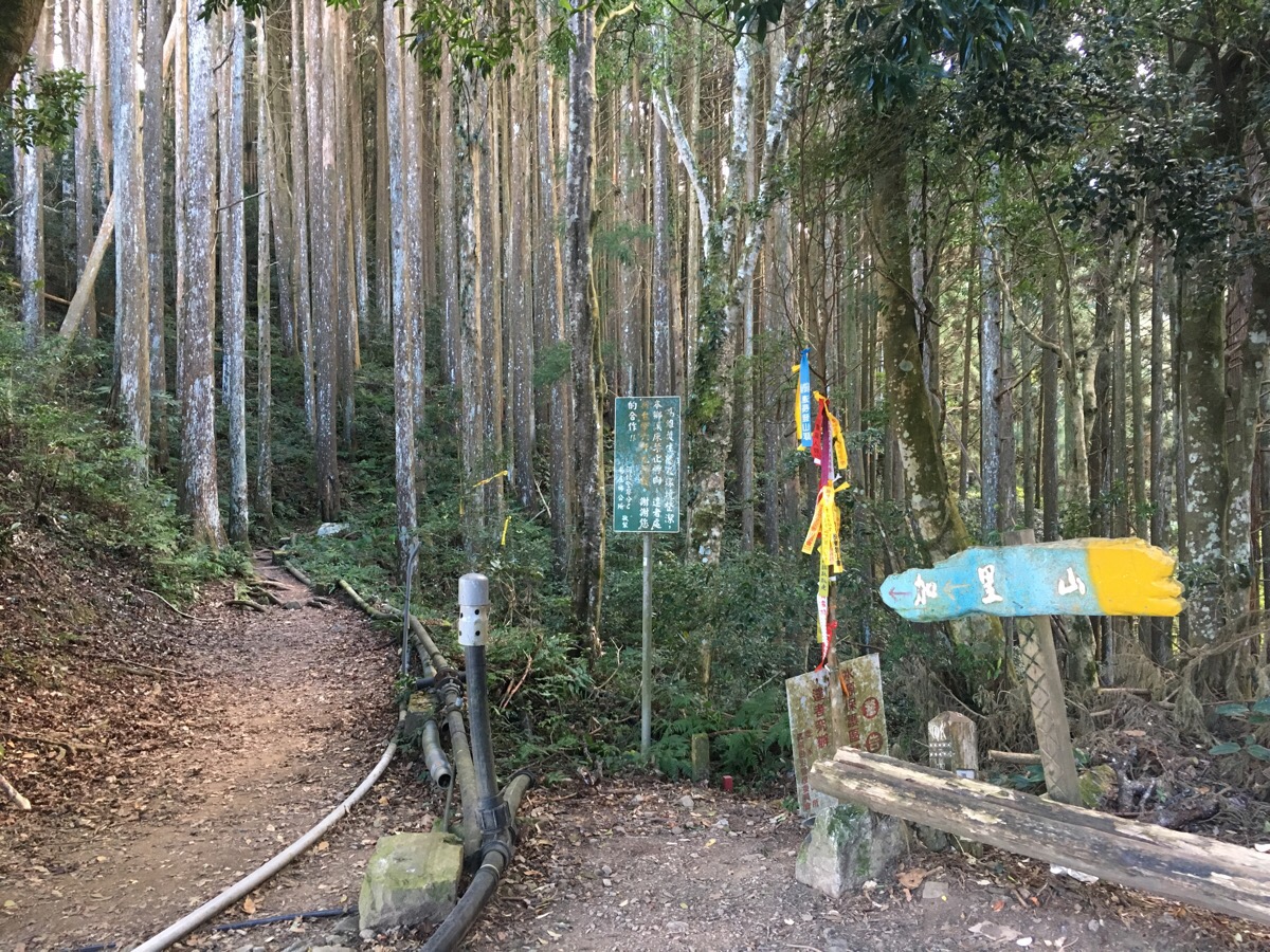
Not far into the walk there’s one of the (very few) junctions, this one goes straight to 哈卡尼山/Hakanni mountain and right towards 加里山/ Jiali mountain. (Actually Jiali is misspelt as Jiail on almost all of the signs.) We went right towards Jiali/Jiail mountain.
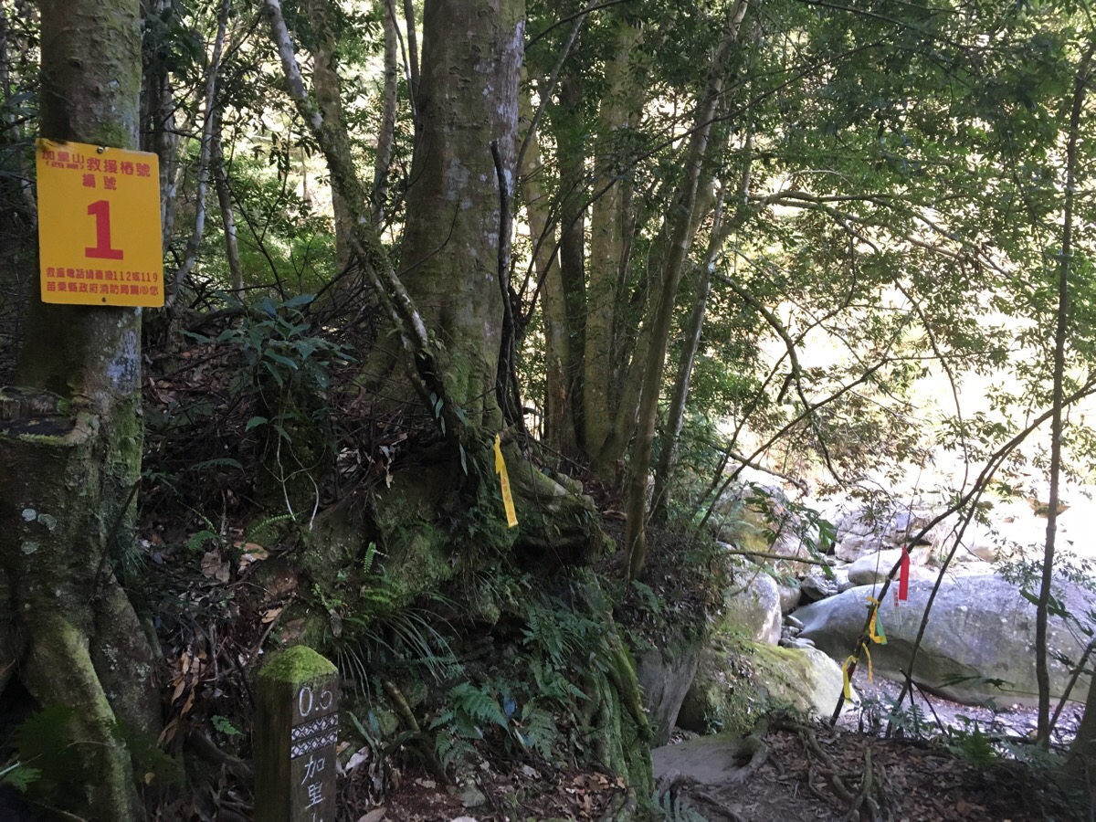
As you walk through the trees the sound of water starts to get louder and just as you can see the creek you reach the first numbered yellow sign – this one is at around 0.6km (a little over 10 minutes) into the trail. There are nine of these signs spaced along the trail and not very much between them, but the path is pretty defined so it’s not too difficult to follow, and in the few places where it seems like there’s more than one path it almost always is an older path and a newer one which meet up after a few metres.
The path briefly breaks out of the forest and crosses the water before going steeply up the other bank. Here is one of the places where there are a couple of possible paths, the older one goes straight up the hill whilst the newer one curves right a little before going up – you just have to pay attention to where you’re going.
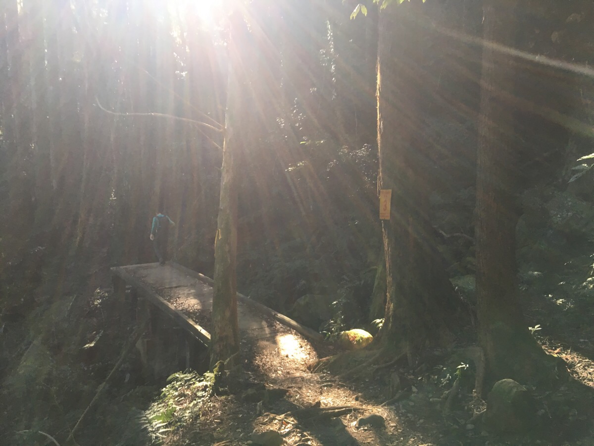
At 1.3km and 43 minutes in we hit sign post number three and one of several wooden bridges crossing minor streams although there hadn’t been enough rain for the streams to have any water. As with the rest of the constructed parts of the path on this trail, natural materials have been used – this has huge positives (less damage to the surrounding environment and maintaining the natural feel of the place), but natural materials are subject to natural processes and they decay. A few planks on the bridge had rotted through so tread carefully when crossing.
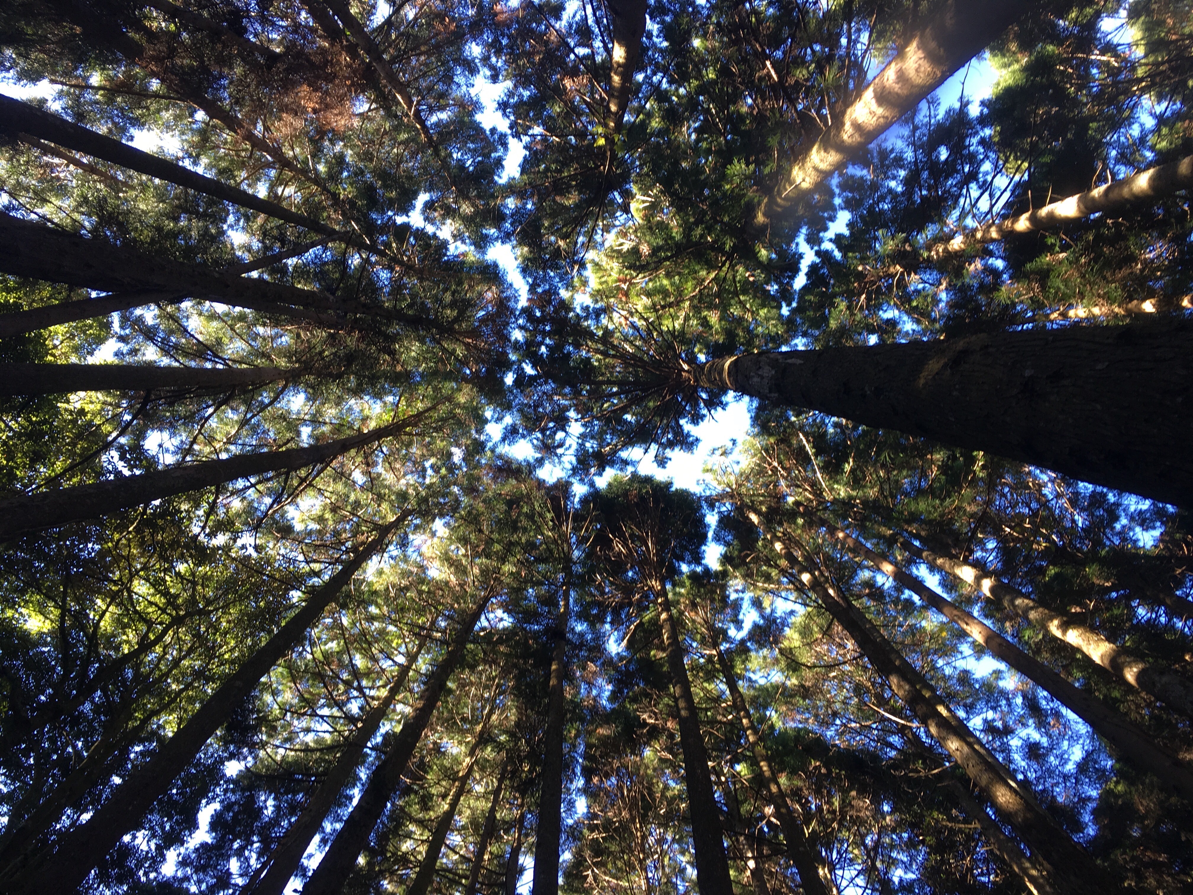
Although the forest here feels ancient, that feeling is mostly an illusion, amongst the tall cedars you can find signs of an older landscape – boulders the size of houses now overgrown with moss and climbing trees, the skeletons of grander giants who once lived here – possibly red cypress going by the sheer scale of them, huge, hulking stumps nearly 2m in diameter, some with the fallen trunk still visible nearby, others where the rest of the carcass has been vanished by time or loggers. But the trees which make up most of the forest are young in comparison, planted in the 1960s or 70s to replace forest lost in large-scale logging and mining of the area’s resources.
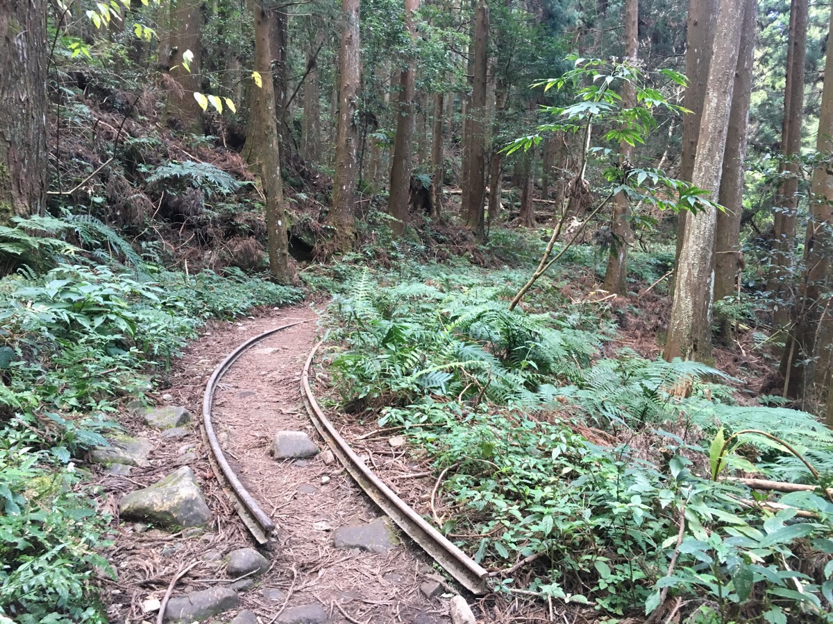
A few remnants of that industrial past are visible under the high canopy of the trees – a narrow railroad joins the path at one point, snaking through the trunks like an invitation to an instagrammer’s dreams. It was once used to transport wood, camphor oil, citronella oil and coal down from the slopes but it’s been a long time since anything rolled down these tracks.
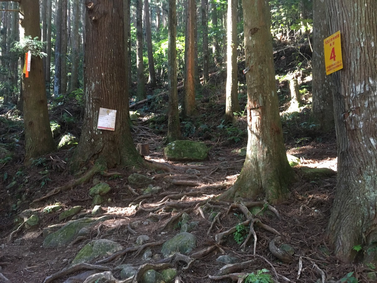
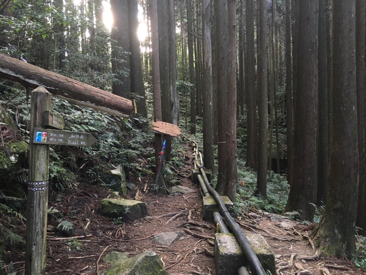
Following the tracks we quickly came upon marker number four (at 1.7km and 1 hour in). Marker four comes at another junction – straight on leads to Daping trail but we didn’t go that way, instead we went left up past a big wooden hikers’ hut, (it was a very basic hut, a box with some benches around the edges but I imagine it would be welcome in an emergency). The sign pointing up is clearly marked to 加里山/Jiali mountain so it’s easy to stay on the right path.
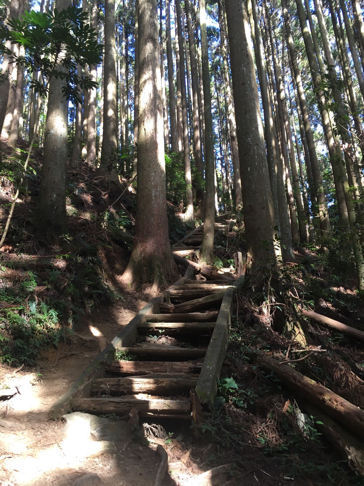
Between markers four and five there is a flight of wooden steps that nature is busily reclaiming – in blog posts from about 8 years ago the steps seem pretty intact but now a lot of the treads have rotted through and a path has been worn along the inner edge instead. Just beyond the steps was marker number five (an hour and 25 minutes in), the path continues in much the same way to marker number six (2.4km, 1 hour and 40 minutes). Just beyond this marker we looked up and were surprised to find a Pepper Pig balloon waving at us from her nest in leaves 30 metres above our heads – I had no idea that pigs could climb trees. At some point between markers six and seven the forest changed from being dominated by a single species of tree to having several different types, smaller and more gnarled than the elegant Japanese cedars. Marker seven was met at 2.7km, (1 hour and fifty minutes), and then a quick 10 minutes later came marker 8. From here on the path amps up the difficulty level and you go from walking to climbing.
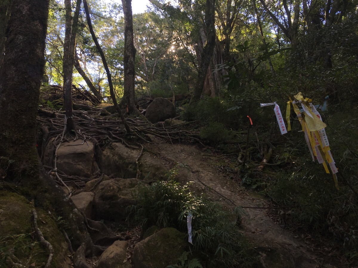
Marker nine was at 3km, (2 hours and 5 minutes), here there’s another split in the path – another path to Daping trail goes off to the left but the route to jiali shan continues up a steep slope covered in roots. From here it’s another 0.5km and 45 minutes to the top.
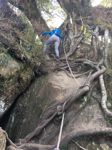
There are ropes, roots and rocks that you’ll need to use to aid you in your climb and I was very glad I was wearing gloves and long sleeves. The rock formations here are really interesting, as is the interplay of geology and plant life – that weird trippy part of the photo above is a gap under a tree where the soil which originally supported the roots has eroded away. The final 20 metres are dominated by short, scrubby bamboo – hardy enough to weather the elements this high up.
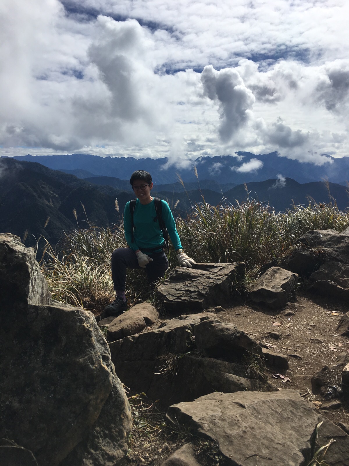
We reached the top just after two small parties and just before the couple of larger parties we’d passed on the way up which meant that the beautiful view was soundtracked by the members of a chatty hiking group from Taoyuan, a family with a large number of older adolescent boys and a very proud older man who was happily telling anyone who would listen just how great his lungs were (and that men are inherently better at climbing mountains). We stayed long enough to eat our lunch and appreciate the view (as much as we could given the number of people generally milling around or queueing to take a selfie with the view and the 2220m sign.)
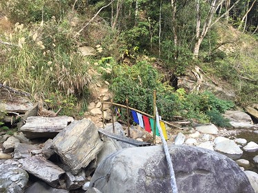
On the way down we considered going via the Daping trail given that we still had about five hours of light left but decided against changing plans mid-hike and instead walked slowly back the way we came. We stopped briefly by the stream right near the start and bothered the tadpoles for a while – there were a couple of different types, really big, fat black ones which populated the deeper waters and smaller ones with yellow-brown tails which had claimed the shallows.
How to get to Mount Jiali
Google maps address: 353, Miaoli County, Nanzhuang Township – this is a private car park for a campsite which allows people to park for $100, (they have a clipboard and everything). The road here is s challenge in itself, the last 20 minutes or so is a narrow road with an alarming amount of visible earthquake/landslide damage.
GPS location: N24 31.631 E121 01.475
Public transport: it’s not really a public transport kind of place.
My new words learnt on this hike were:
- 被 / bèi / kind of like passive in English – used to emphasise the action being done to a thing/person rather than the doer of the action: 我被蚊子吃了 / wǒ bèi wénzi chī le / I was eaten by mosquitos or the reason I learnt it on this hike 我一直被看了 / wǒ yīzhí bèi kàn le / I keep being looked at.
- 讀書 / dúshū / read or study
- 唸書 / niànshū / study – because one of the questions people ask me quite often is 你來台灣讀書嗎 / nǐ lái táiwān dúshū ma / did you come to Taiwan to study?
- 你是交換學生嗎? / nǐ shì jiāohuàn xuéshēng ma? / Are you an exchange student?
- 流血 / liúxuè / bleed
- 撞車 / zhuàngchē / crash (a car)
- 剝 / bō / peel (as in peel a banana)

Loved this hike!
LikeLike
This was my first hike in Taiwan. Which one would you reccommend next?
LikeLike
I’m glad you enjoyed it. I liked that one quite a lot too. One that I think was kind of similar enjoyment-wise was Gao Taishan, it had the different levels of forest and that above-the-clouds quietness. Or if you’re feeling brave, perhaps stegosaurus ridge. Now the weather is getting more comfortable I can’t wait to get back out to do some of these longer, harder walks.
LikeLike
Hi. A buddy and I will be hiking up this trail in 2 weeks’ time and I wonder if we need to apply for any permit in advance.
LikeLike
No, there’s no permit required for this one. In fact, as of now, there’s only one walk on this site that needs a permit, (Yuan Zui Shan). I hope you enjoy it, the forests there are beautiful.
LikeLike
Did you manage to compete the hike?
LikeLike
Oops, apologies as I just checked this page again.
Due to rain, we only got as far as the stream unfortunately. As you have written, the forest felt ancient and the feeling was so peaceful.
And yes, I’ll certainly be attempting to climb in the future.
Many thanks for your informative articles which I’ve been following constantly.
LikeLiked by 1 person
Very glad to hear you enjoyed the part you were able to do, and I hope you’re able to make a return visit in better weather.
LikeLike
Pingback: JiaLi Mountain -加里山 – Parkbus Taiwan
Great hike
My girlfriend and me went up and down in about 3:15hrs ( car to car) with a short stay at the top( there were a lot of flies). Mind you she’s a strong hiker and I can mostly match her pace. It’s a nice hike with a great view from the top.
LikeLiked by 1 person
You guys are speedy! My other half and I are definitely more in the “stop and smell the roses” camp! I’d love to revisit this trail actually, it was one of the first ones I did after moving to Taiwan.
LikeLike