St. Marian’s Hiking Trail, also known more recently as Matcha Mountain is a well known trail in Yilan’s Jiaoxi District. It’s popularity boomed rather dramatically after Japanese photographer Kengo Kobayashi published images of the beautiful, velvety layers of hills and rechristened it Matcha Mountain. Even prior to gaining this charmingly alliterative name the trail was always busy on weekends, but these days you’re much better off choosing a weekday to make your climb. Don’t let the talk of crowds put you off though, it really is a spectacular scene and is worth the effort of getting there.
Distance: 10.7km
Time: 6 hours, 2 hours and 40 minutes going up, 50 minutes at the top, about 2 hours coming back and an extra 30 minutes at the church.
Difficulty (regular Taiwan hiker): 3/10 – just quite a long climb and then the opposite on the way back. No ropes, no danger, no difficulty finding the route.
Difficulty (new Taiwan hiker): 5/10 for the combination of distance and climb. It starts out pretty easily but gets progressively steeper. Finding your way is really easy, once you get above the church there’s basically only one path (actually there are quite a few small paths offering alternative routes up but as long as you stick to the main route it’s easy).
Water: I got through 1.5L on a warm winter day, you can fill up your water bottle at the church at the start of the trail.
Shade: patchy for the first part and none at the top, I had to apply sun cream even in January and I still pinked a little.
Mobile network: on and off, mostly available at the lower levels but it dropped off by the time we reached the top.
Enjoyment: The views are amazing and the walk is a challenging enough to feel like a good work out but simple enough underfoot that you can get up to a good pace, I also enjoyed doing something a bit longer than I have done in recent months. As with other trails in Taiwan, I feel this one could only be improved in parts by being a little less ‘maintained’.
Other: don’t forget to bring refreshments, you’ll want something to snack on at the top.
GPX file available here on Outdoor Active. (Account needed, but the free one works just fine.)
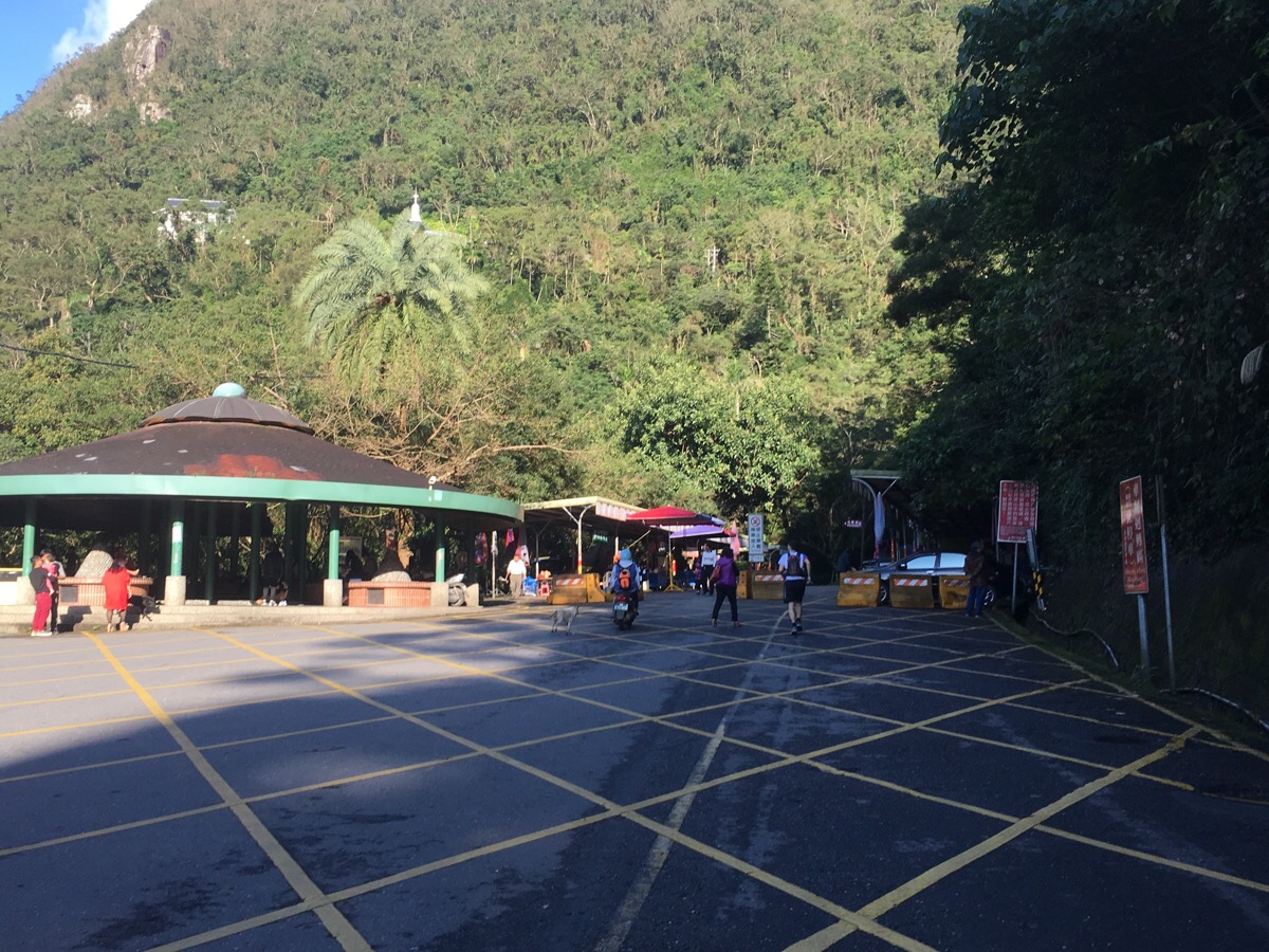
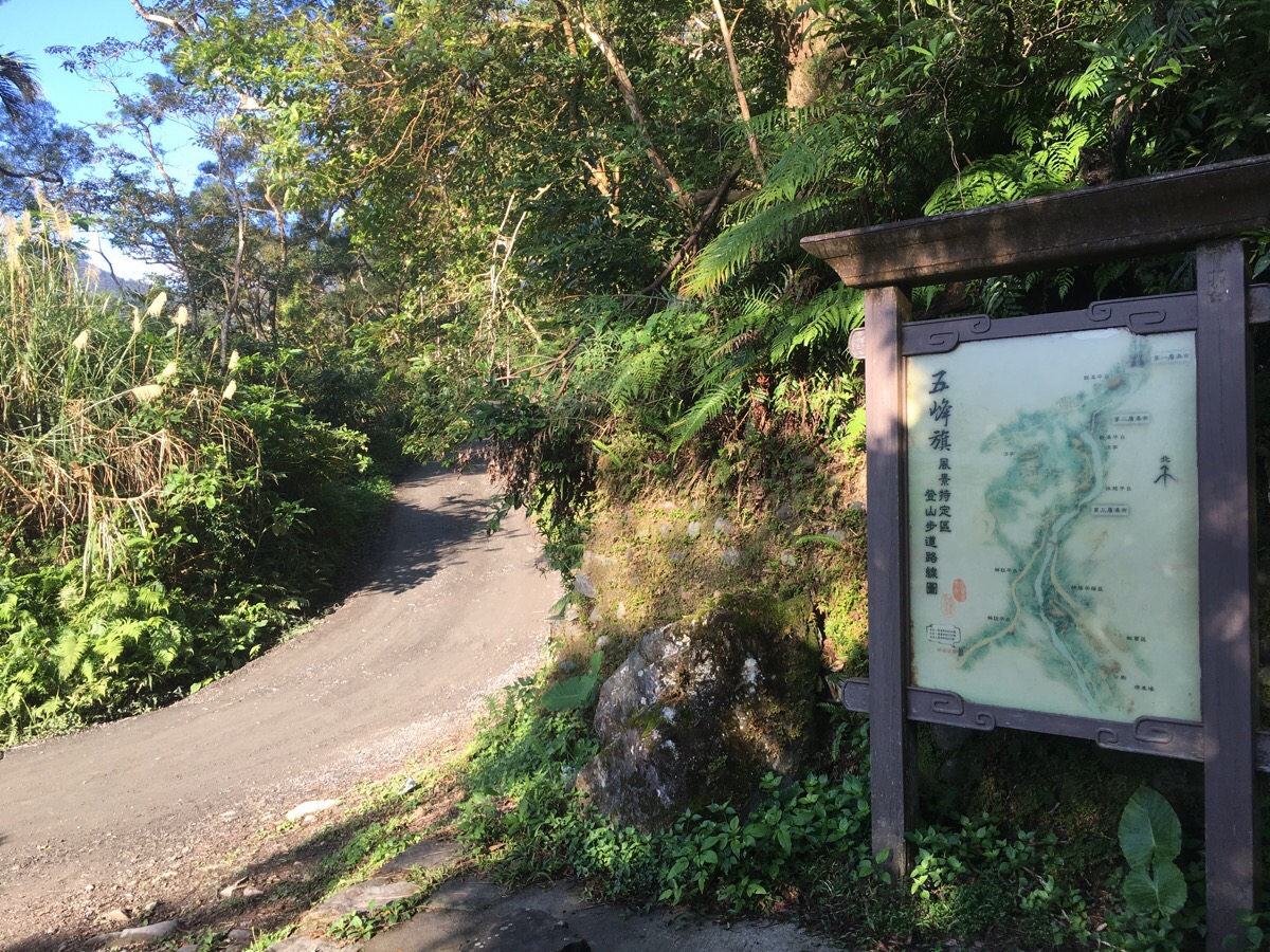
We left the house super early and were at the trail head by 8.30 which is a real achievement for us. We walked through the small collection of vendors setting up stall – someone was selling carved wooden frogs but the food vendors were still preparing their wares so it was good that we’d brought everything we needed with us.
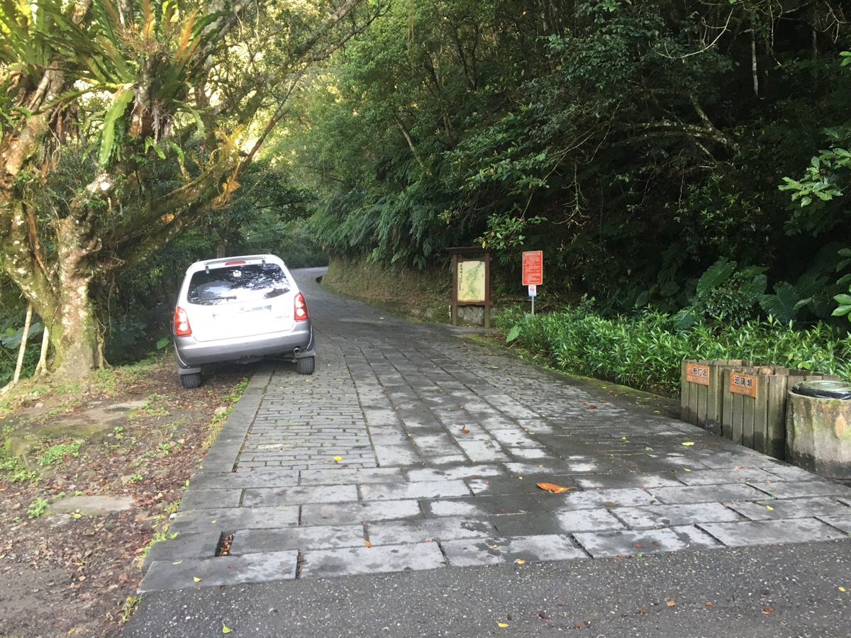
At the back of the stalls a tiled road goes up towards the sound of water.
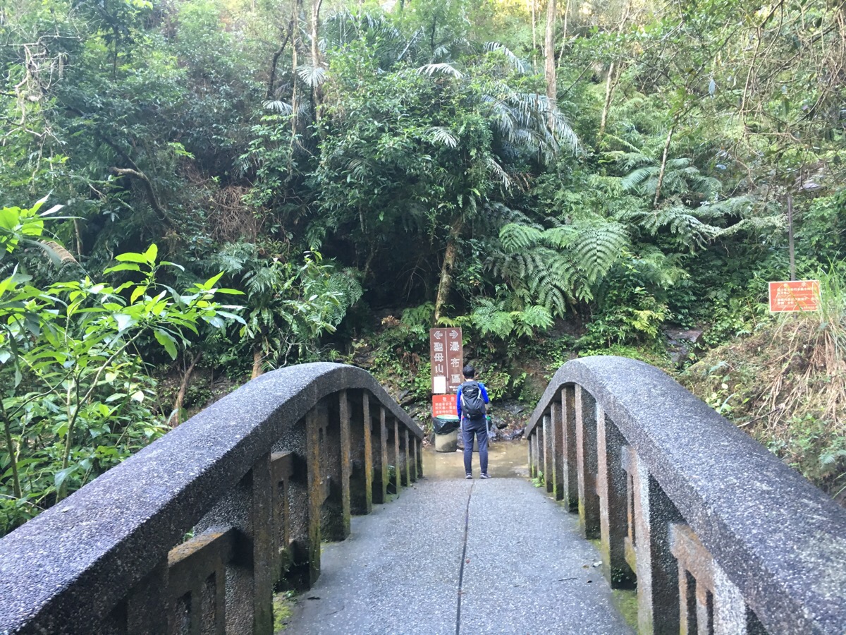
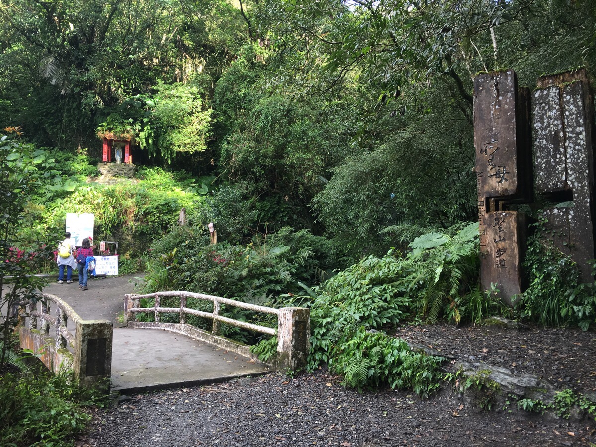
Just beyond the bridge we turned left towards the church. The other direction goes up to the waterfall – it’s definitely worth a look if you’ve not been, we went last year after a typhoon and it was magnificent, (if you decide to check it out you can loop up to the church via a slightly different path).
We followed the road to the right uphill until we came to the round church. I made use of the toilets here and filled up my hot water bottle from a machine next to the information centre.
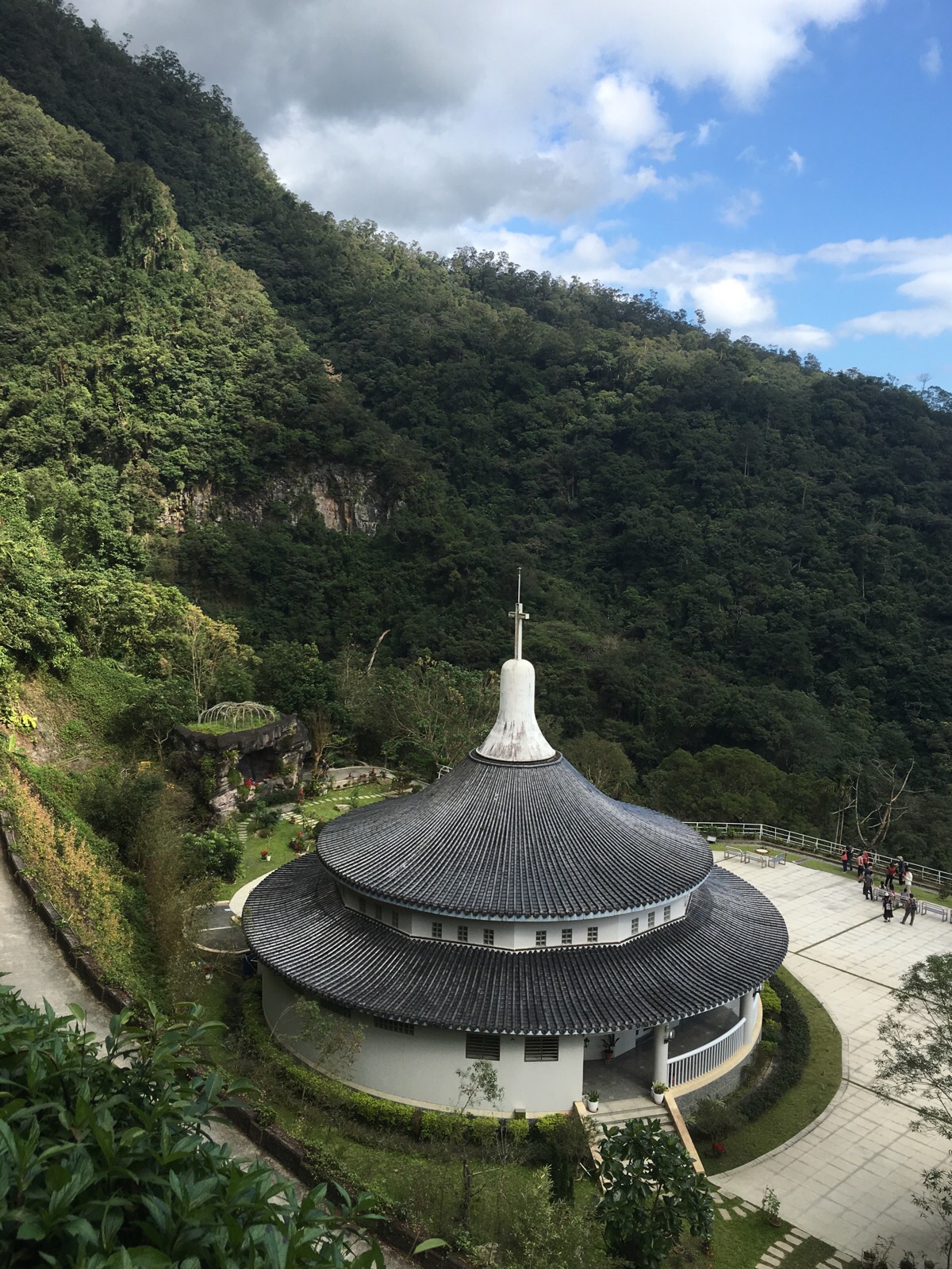
The road curves around the back of the church complex and carries on up giving you a great view of the round building with wufenchi waterfall plummeting down the rock face behind it – from here the casual walkers who came for the waterfall and the church start to drop off and it gets a bit quieter. We thought we’d done well to have our boots on the ground before 9am but despite our early start we were met by a steady trickle of people returning down the trail – one or two looked like they might have stayed the night but mostly it was ‘morning people’ who gave happy and hearty greetings of “xin nian kuai le” as we passed – I’m actually quite envious of this strange subspecies of humans. On the rare day when I wake up early feeling full of energy everything is wonderful and I fit so much in, I wish I was like them.

We were joined on our walk by one such early-bird, a local abei who recommended that we stay in the middle of the road to avoid snakes. He told us that he walked the road most days and he greeted most of the people heading back down as if they knew each other – one of them asked if Teresa was his grandchild. We kept pace with him for a while but he eventually outpaced us and went haring off ahead when we stopped for a drink.
We caught up with him just the other side of this bridge where there was a small shelter and toilet. This was at 4km and a little more than an hour into the walk. Until this point the walking surface had been a gravelly road going steadily but gently up, beyond this point the path becomes steep, slippery steps and rocks. As the sign next to the step says: “Want to test your fitness and endurance? Let’s go!”

I really enjoyed this upper section of the walk, I like walking on a more natural surface and the feeling of being surrounded by old trees is very relaxing.
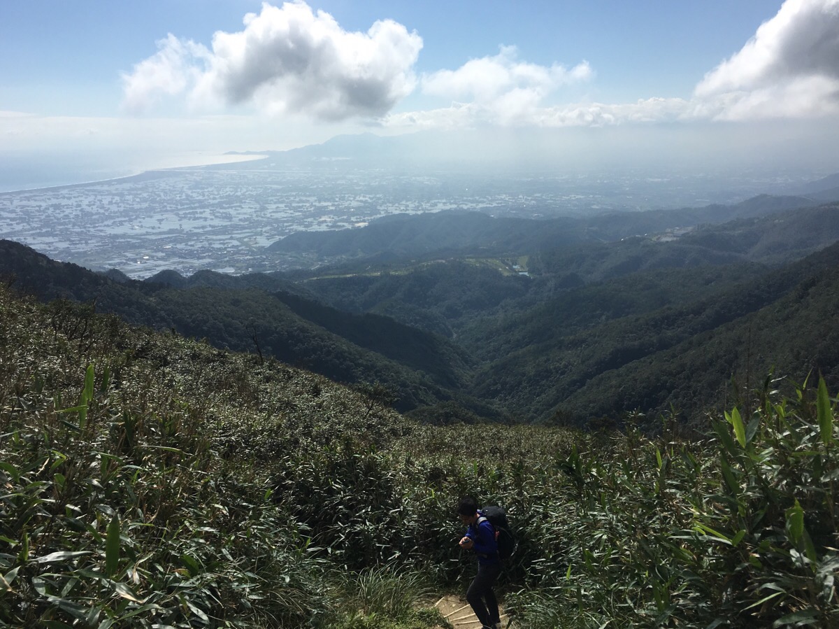
As the path climbs higher the trees gradually thin out and then disappear completely to be replaced with stubby dwarf bamboo, (a sign nearer up helpfully explains that the harsher climate of the higher slopes means that the bamboo has had to stay short in order to thrive. As well as admiring the plants, we saw signs of animal life all the way up this section – both droppings and hoof prints of some type of deer, they seemed pretty small so I would guess it was a muntjac.
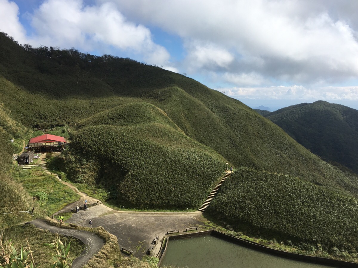
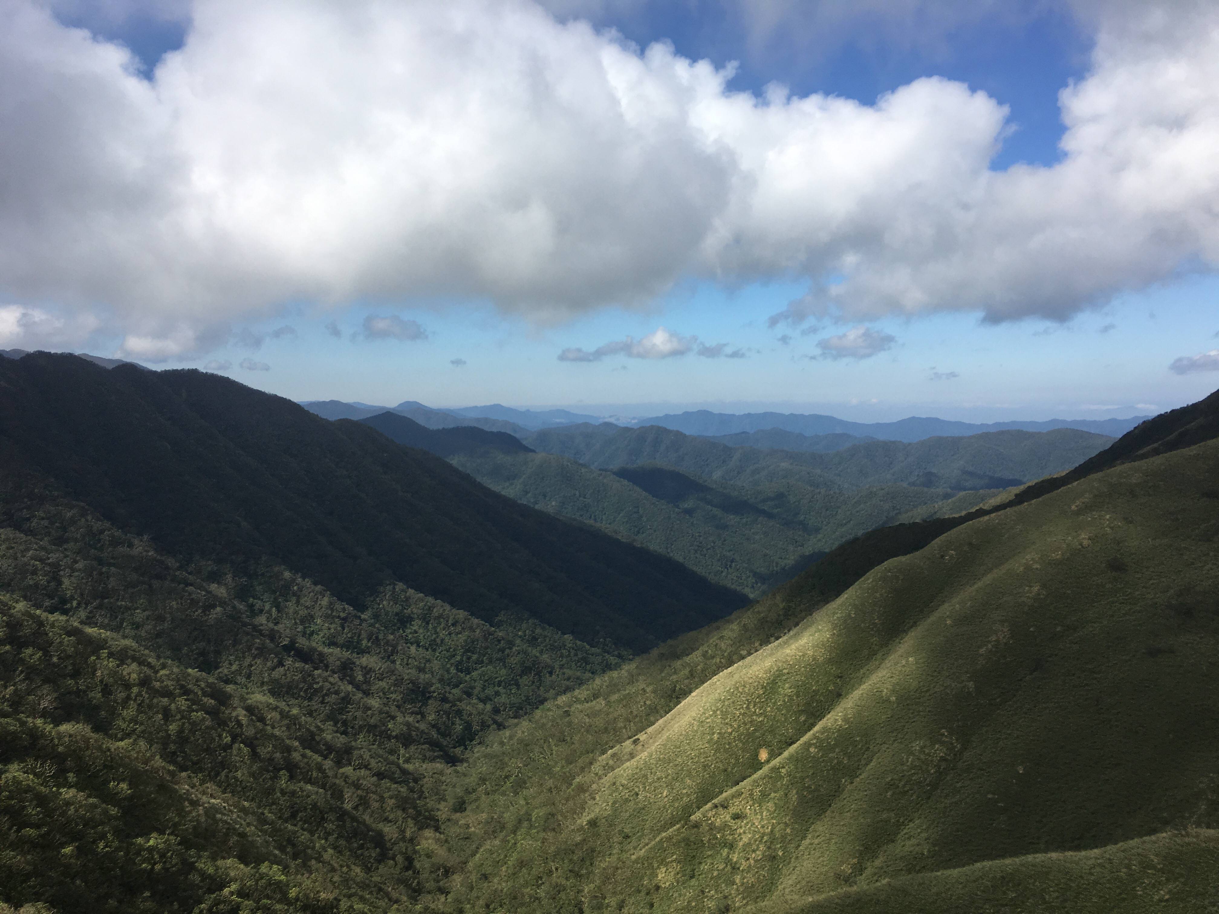
After cresting a final mound we arrived at our destination, a small artificial lake and a mountain hut. The hut was built by the same group of people who built the church, it’s open to people wanting to stay the night and they’ve got toilets for anyone to use. Just beyond the lake is a peak with a statue of Jesus on the cross and a really impressive view of a huge, green, unspoilt valley. Looking north-east you can just about glimpse buildings pushing their way into the greenery, (I couldn’t work out exactly where the buildings are – it seems like there’s nothing in that direction until you reach Taipei but that feels like an awfully long way away), looking south east you can see the ridge which separates Taoyuan and Yilan Counties and then in the south/south west if you look back towards where you came from you can see Jiaoxi and the rest of Yilan beyond that. Once we’d eaten our sandwiches and thoroughly admired the view we headed back the way we came.
How to get to Matcha Mountain
Google maps address: 262, Yilan County, Jiaoxi Township, Wufeng Road, 95號 – this is where we parked but there’s more spaces a little way further down the road.
GPS location: N24 49.890 E121 44.856
Public transport: this is pretty easy if you’re coming from Yilan, you can take a train to Jiaoxi and then catch the 111 bus and get off at Wufengqi Scenic Spot. It would also be possible to walk from the station but you’d have to factor in an extra 50 minutes each way (and it would add another 7km to the round trip).
My new words learnt on this hike were:
- 煙花 / yānhuā / fireworks
- 鞭炮 / biānpào / firecrackers
- 假髮 / jiǎfà / wig
- 逼真 / bīzhēn / realistic or lifelike
- 植物 / zhíwù / plant (n.)
- 有的沒的 / yǒu de méi de / nonsense, rubbish, trivial stuff, can be used to describe actions taken which are distractions from what you’re supposed to to, or or words spoken which don’t answer/deal with the subject you wish to discuss. From what I can understand it can be used to describe both intentional misdirection of attention (like politicians talking around an answer and never really answering the question they were asked), or unintentional, (like when I get sidetracked by lots of more interesting things when I’m cleaning).
- 聲音 / shēngyīn / sound
- 打招呼 / dǎzhāohū / greet, say hello to
- 閱讀困難 / yuèdú kùnnán / dyslexia – the two parts of this break down into reading and difficulty which kind of makes sense

Hi, will it be a good time to go to st marian’s hiking trail (聖母山莊) in the month of February?
Thank you
LikeLike
February should be fine, (in fact winter is my preferred hiking season here), just make sure you take enough layers to keep warm.
LikeLike
Hi! Thanks for this sharing on hiking the St Marian trail. May I ask if the overnight stay in the mountain hut open for all or you need to apply before you can stay there? Thank you!
LikeLike
Apparently you need to apply before you stay there. The shelter is run by volunteers, so process isn’t as formal as the other Taiwan hiking applications. You need to join this Facebook group and message the admins. https://www.facebook.com/groups/185834538788284/
LikeLike
Thank you and appreciate the lead.
LikeLike